

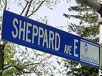
Sheppard Avenue
Encyclopedia
Arterial road
An arterial road, or arterial thoroughfare, is a high-capacity urban road. The primary function of an arterial road is to deliver traffic from collector roads to freeways, and between urban centres at the highest level of service possible. As such, many arteries are limited-access roads, or feature...
in Toronto
Toronto
Toronto is the provincial capital of Ontario and the largest city in Canada. It is located in Southern Ontario on the northwestern shore of Lake Ontario. A relatively modern city, Toronto's history dates back to the late-18th century, when its land was first purchased by the British monarchy from...
, Ontario
Ontario
Ontario is a province of Canada, located in east-central Canada. It is Canada's most populous province and second largest in total area. It is home to the nation's most populous city, Toronto, and the nation's capital, Ottawa....
, Canada
Canada
Canada is a North American country consisting of ten provinces and three territories. Located in the northern part of the continent, it extends from the Atlantic Ocean in the east to the Pacific Ocean in the west, and northward into the Arctic Ocean...
. A small portion of a continuation of the road in Pickering, Ontario
Pickering, Ontario
Pickering is a city located in Southern Ontario, Canada immediately east of Toronto in Durham Region. It is part of the Greater Toronto Area, the largest metropolitan area in Canada.- Early Period :...
is also called Sheppard Avenue.
History
Sheppard is named for Joseph Sheppard I, who acquired 400 acres (161.9 ha) of land at the northwest corner of Sheppard and Yonge StreetYonge Street
Yonge Street is a major arterial route connecting the shores of Lake Ontario in Toronto to Lake Simcoe, a gateway to the Upper Great Lakes. It was formerly listed in the Guinness Book of Records as the longest street in the world at , and the construction of Yonge Street is designated an "Event of...
. His son opened a general store there. The site was occupied in 1860 by the Dempsey Hardware Store, which was later moved and restored as a museum
Museum
A museum is an institution that cares for a collection of artifacts and other objects of scientific, artistic, cultural, or historical importance and makes them available for public viewing through exhibits that may be permanent or temporary. Most large museums are located in major cities...
. The former site is now an empty lot pending developed of a commercial building.
In the former Scarborough
Scarborough, Ontario
Scarborough is a dissolved municipality within the city of Toronto, Ontario, Canada. Geographically, it comprises the eastern part of Toronto. It is bordered on the south by Lake Ontario, on the west by Victoria Park Avenue, on the north by Steeles Avenue East, and on the east by the Rouge River...
municipality, Sheppard was once called the Lansing Sideroad.
Sheppard Avenue East
Victoria Park Avenue
Victoria Park Avenue is a major north-south route in eastern Toronto, Ontario, Canada. It marks the border between the Old City of Toronto and Scarborough.-History:Victoria Park Avenue was originally a pioneer road for settlement of Scarborough...
at the Scarborough border, where travellers then turned south to meet up with the Sheppard section through Scarborough. However, a new section called the Lansing Cutoff was constructed joining the two disconnected pieces. The orphaned section of Sheppard between the 404 and Victoria Park was renamed Old Sheppard Avenue. 43°46′34"N 79°20′13"W
Sheppard continues straight east through Scarborough until just east of Meadowvale Road, where the Rouge River
Rouge River (Ontario)
The Rouge River is a two river system. Little Rouge and Rouge River are in the east and the northeast parts of Toronto and begin in the Oak Ridges Moraine in Richmond Hill and Whitchurch-Stouffville...
valley presents steep grades 43°48′33"N 79°09′58"W, and so Sheppard curves southwards to meet Kingston Road
Kingston Road (Toronto)
Kingston Road is the southernmost major road along the eastern portion of Toronto, specifically in the districts of East York and Scarborough. Until 1998, it formed a significant portion of Highway 2...
just north of Highway 401. At that junction, it also meets Port Union Road, which heads south into the Port Union
Port Union, Ontario
Port Union, also known as Centennial Scarborough is a neighbourhood located in Scarborough, part of Toronto, Ontario, Canada. The neighbourhood is bounded by Kingston Road to the north, Port Union Road to the east, the Lake Ontario shoreline to the south, and Highland Creek to the west.The...
neighbourhood. However, Twyn Rivers Drive continues east into the Rouge valley as a collector road, and becomes Sheppard again at Altona Road just east of the border of Pickering, Durham Region
Regional Municipality of Durham, Ontario
The Regional Municipality of Durham, informally referred to as Durham Region, is a regional municipality located in Southern Ontario east of Toronto, Ontario. It has an area of approximately 2,500 square kilometres. Durham Region is considered part of the Greater Toronto Area, with the communities...
. It continues farther east until it ends at Fairport Road just north of Highway 2 / Kingston Road. 43°49′28"N 79°06′26"W
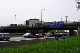
This routing parallels the alignment for Highway 401 and serves as an alternative if the highway is closed or congested.
Sheppard Avenue West
West of Yonge Street, Sheppard travels west across the Sheppard Avenue Bridge over the DonDon River (Toronto)
The Don River is one of two rivers bounding the original settled area of Toronto, Ontario along the shore of Lake Ontario, the other being the Humber River to the west. The Don is formed from two rivers, the East and West Branches, that meet about north of Lake Ontario while flowing southward into...
and past Bathurst Street and Wilson Heights Boulevard. Further west, the road allowance became blocked in 1939 by the appropriation of land for a DeHavilland aircraft plant and, after World War II
World War II
World War II, or the Second World War , was a global conflict lasting from 1939 to 1945, involving most of the world's nations—including all of the great powers—eventually forming two opposing military alliances: the Allies and the Axis...
, Canadian Forces Base Downsview
CFB Downsview
Canadian Forces Base Downsview is a former Canadian Forces base in Toronto, Ontario. The airfield is currently operated as Toronto/Downsview Airport.-RCAF Station Downsview:...
. A crescent-shaped section of road was finally constructed along the northern edge of the now former base in the 1970s, connecting Sheppard at Wilson Heights to Keele Street
Keele Street
Keele Street is a north-south road in Toronto and York Region in Ontario, Canada. It stretches 47km, running from Bloor Street in Toronto to the Holland Marsh. South of Bloor Street, the roadway is today known as Parkside Drive, but was originally part of Keele Street...
. 43°45′17"N 79°28′42"W Today, Sheppard also intersects Allen Road
Allen Road
William R. Allen Road, known more commonly as Allen Road, The Allen Expressway or simply The Allen and formerly as the Spadina Expressway, is a short expressway/freeway in Toronto, Ontario, which runs from Kennard Avenue in the north, to Eglinton Avenue West in the south...
on this section, but the intersecting portion of Allen Road was not constructed until 1982. Sheppard Avenue continues still further west to Weston Road, but cannot be extended because the Humber Sheppard Community Centre (the former site of St. Basil's Catholic High School) is on the west side of the intersection.43°44′01"N 79°32′18"W
Public transportation
The Sheppard Subway runs under Sheppard Avenue East from Yonge Street to Don Mills Road, with proposals to continue the line farther eastwards to the Scarborough Town CentreScarborough Town Centre
The Scarborough Town Centre is an upscale shopping mall in the Scarborough district of Toronto, Ontario, Canada. Central to the Scarborough City Centre, it is adjacent to the Scarborough Centre RT station and Scarborough Centre Bus Terminal. It was constructed by Oxford Properties and opened in...
and westwards to Downsview Station
Downsview (TTC)
Downsview is a station of the Yonge–University–Spadina line of the Toronto subway and RT. It is located at the intersection of William R. Allen Road and Sheppard Avenue West. The station is currently the northern terminus of its western branch, the Spadina line. It is also a ‘Vivastation’ on the...
at Allen Road. There are five stations on the line providing access to Sheppard Avenue, including Bayview
Bayview (TTC)
Bayview is a station on the Sheppard line of the subway system in Toronto, Ontario, Canada. It is located at 550 Sheppard Avenue East, at Bayview Avenue. It opened in 2002.- Architecture and art :Stevens Group Architects designed the station...
, Bessarion
Bessarion (TTC)
Bessarion is a station on the Sheppard line of the subway/RT system in Toronto, Ontario, Canada. It is located at 701 Sheppard Avenue East at Bessarion Road and Burbank Drive, and was opened in 2002. The station is, , the second least-used in the TTC’s subway network...
, and Leslie
Leslie (TTC)
Leslie is a station on the Sheppard line of the Toronto subway and RT. It is located at 1209 Sheppard Avenue East at Old Leslie Street. It was opened in 2002....
, as well as the Sheppard-Yonge
Sheppard-Yonge (TTC)
Sheppard-Yonge is a station on the Yonge-University-Spadina and Sheppard lines of the subway system in Toronto, Ontario, Canada. It is the third busiest subway station in the system, after Bloor-Yonge, and St...
(at the junction with the Yonge section of the Yonge-University-Spadina line line) Don Mills
Don Mills (TTC)
Don Mills is the eastern terminus station of the Sheppard line of the subway system in Toronto, Canada. It is also a "Vivastation" on the Viva Green line of York Region's Viva bus rapid transit system...
termini. Downsview
Downsview (TTC)
Downsview is a station of the Yonge–University–Spadina line of the Toronto subway and RT. It is located at the intersection of William R. Allen Road and Sheppard Avenue West. The station is currently the northern terminus of its western branch, the Spadina line. It is also a ‘Vivastation’ on the...
station is located at the corner of Sheppard and Allen Road
Allen Road
William R. Allen Road, known more commonly as Allen Road, The Allen Expressway or simply The Allen and formerly as the Spadina Expressway, is a short expressway/freeway in Toronto, Ontario, which runs from Kennard Avenue in the north, to Eglinton Avenue West in the south...
at the northern terminus of the Spadina section of the Yonge-University-Spadina line.
Three bus routes runs along Sheppard Avenue in Toronto from Sheppard Subway station:
- 84 Sheppard West (1974–present)
- 85 Sheppard East (85 Sheppard 1963-1968)
- Blue Night Network 385 Sheppard East (2005–present)
GO Transit
GO Transit
GO Transit is an inter-regional public transit system in Southern Ontario, Canada. It primarily serves the Greater Toronto and Hamilton Area conurbation, with operations extending to several communities beyond the GTHA proper in the Greater Golden Horseshoe...
has stations at Agincourt on the Stouffville line, on Sheppard between Kennedy Road and Midland Avenue, and at Oriole on the Richmond Hill line
Richmond Hill Line
The Richmond Hill Line is a surface transit line on Myrtle Avenue in Queens, New York City, United States. Once a streetcar line owned by the Brooklyn–Manhattan Transit Corporation, it is now the Q55 Myrtle Avenue bus route, operated by the New York City Transit Authority....
, south-west of the intersection of Leslie Street and Sheppard.
Communities
- EmeryEmeryEmery may refer to:* Emery ** Emery paper** Emery board, nail filers* Emery , a post-hardcore band from Rock Hill, South Carolina* Emery Theatre, a historic multi-purpose theatre in Cincinnati, Ohio* Emery Worldwide, a cargo airline...
- Dublin Heights
- EliaEliaElia may refer to:* European League of Institutes of the Arts , an organization of art schools* Elia , a prominent public artwork in Denmark* Elia, a historical and alternative name for the Jane and Finch neighbourhood of Toronto, Canada...
- Downsview
- Lansing
- Bayview VillageBayview VillageBayview Village is an affluent neighbourhood in Toronto, Ontario, Canada, formerly in North York before it was amalgamated into Toronto in 1998. It is part of the federal and provincial electoral district Willowdale, and Toronto electoral wards 24: Willowdale and 33: Don Valley North...
- Don Valley VillageDon Valley VillageDon Valley Village is a neighbourhood in the city of Toronto, Ontario, Canada. It is located north of Highway 401, and is bounded by Sheppard Avenue to the south, Leslie Street to the west, Finch Avenue to the north and Highway 404 to the east...
- WillowdaleWillowdale, TorontoWillowdale is an established, affluent community in the city of Toronto, Ontario, Canada, located in the district of North York. It was originally called Lansing, which is now the name of a nearby neighbourhood....
(includes Lansing) - North York CentreNorth York CentreNorth York Centre is a town centre in North York, Toronto, Ontario, Canada. Prior to the Amalgamation of Toronto in 1998, it was considered the central business district of the former city of North York...
- Henry FarmHenry FarmHenry Farm is an officially designated neighbourhood in the City of Toronto, Ontario, Canada. It is located in the north central part of town within the district of North York....
- Parkway ForestParkway ForestParkway Forest is a neighbourhood in Toronto, Ontario, Canada. It is located in the north of the city, in the former City of North York. North York was merged with five other municipalities and a regional government to form the new "City of Toronto" in 1998....
- The Peanut
- AgincourtAgincourt, TorontoAgincourt is a very diverse neighbourhood in the Scarborough district of the city of Toronto, Ontario, Canada. It is centred along Sheppard Avenue between Kennedy and Markham Roads...
- MalvernMalvern, TorontoMalvern is a neighbourhood in Toronto, Ontario, Canada, with a population of 44,315. It is located in the northeast corner of the city, in the district of Scarborough. Scarborough was merged with five other municipalities and a regional government to form the new City of Toronto in 1998...
- L'Amoreaux
Attractions
- Bayview VillageBayview VillageBayview Village is an affluent neighbourhood in Toronto, Ontario, Canada, formerly in North York before it was amalgamated into Toronto in 1998. It is part of the federal and provincial electoral district Willowdale, and Toronto electoral wards 24: Willowdale and 33: Don Valley North...
- retail shopping mall (connecting with Bayview Station) - Sheppard Centre - retail, commercial and residential complex
- Fairview MallFairview MallFairview Mall is a major shopping centre in Toronto, Ontario, Canada of about 80,000 m² , located at the northeast corner of Don Mills Road and Sheppard Avenue in the former borough of North York...
- large retail shopping mall - Agincourt Mall - mid-size retail shopping mall
- Downsview ParkDownsview ParkDownsview Park is a former Canadian Forces Base in the community of Downsview in Toronto, Canada. It contains about 231.5 hectares of land, of which more than 130 hectares are earmarked for traditional parkland, recreational and cultural amenities...
- park and recreational facility owned by federal government and on the former CFB DownsviewCFB DownsviewCanadian Forces Base Downsview is a former Canadian Forces base in Toronto, Ontario. The airfield is currently operated as Toronto/Downsview Airport.-RCAF Station Downsview:...
lands - LCol George Taylor Denison III Armoury
- North York General Hospital - major hospital and teaching unit of the University of TorontoUniversity of TorontoThe University of Toronto is a public research university in Toronto, Ontario, Canada, situated on the grounds that surround Queen's Park. It was founded by royal charter in 1827 as King's College, the first institution of higher learning in Upper Canada...
's Faculty of Medicine - Rouge ParkRouge ParkRouge Park will become an urban national park located along the border of Toronto and Pickering, Ontario, Canada. It will be Canada's first national park within a municipality....
- regional park in the east end of the city - Toronto ZooToronto ZooThe Toronto Zoo is a zoo located in Toronto, Ontario, Canada. It opened August 15, 1974 as the Metropolitan Toronto Zoo and is owned by the City of Toronto; the word "Metropolitan" was dropped from its name when the cities of the Municipality of Metropolitan Toronto were amalgamated to form the...
- zoo located in east end of the city