

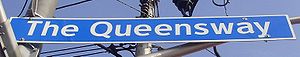
The Queensway
Encyclopedia

Toronto
Toronto is the provincial capital of Ontario and the largest city in Canada. It is located in Southern Ontario on the northwestern shore of Lake Ontario. A relatively modern city, Toronto's history dates back to the late-18th century, when its land was first purchased by the British monarchy from...
and Mississauga, Ontario
Ontario
Ontario is a province of Canada, located in east-central Canada. It is Canada's most populous province and second largest in total area. It is home to the nation's most populous city, Toronto, and the nation's capital, Ottawa....
, Canada
Canada
Canada is a North American country consisting of ten provinces and three territories. Located in the northern part of the continent, it extends from the Atlantic Ocean in the east to the Pacific Ocean in the west, and northward into the Arctic Ocean...
. It is the western extension of Queen Street, after it merges with King Street near Roncesvalles Avenue
Roncesvalles Avenue
Roncesvalles Avenue is a north-south arterial street in Toronto, Canada. It connects Queen Street West, King Street West and runs north to Dundas Street West. Roncesvalles Avenue takes its name from the Battle of Roncesvalles, which took place in the Roncesvalles gorge in Spain in 1813...
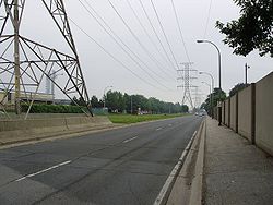
in Toronto. The Queensway is a divided roadway
Dual carriageway
A dual carriageway is a class of highway with two carriageways for traffic travelling in opposite directions separated by a central reservation...
from just east of Parkside Drive westerly to just beyond South Kingsway, with ramps and centre median dedicated to the streetcar service. The road continues undivided west from the Humber River
Humber River (Ontario)
The Humber River is one of two major rivers on either side of Toronto, Ontario, Canada, the other being the Don River to the east. It was designated a Canadian Heritage River on September 24, 1999....
west to Highway 427 as a four or six-lane thoroughfare.
The Toronto section of the road ends at the Etobicoke Creek
Etobicoke Creek
Etobicoke Creek is one of the many creeks running through Toronto, Ontario and the Toronto Area into Lake Ontario, often characterized by their winding paths through deep ravines and distinctive shale banks....
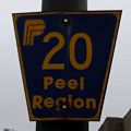
, but continues as Queensway (Peel Regional Road 20) in Mississauga, ending at Glengarry Road just west of Mavis Road
Peel Regional Road 18
Mavis Road is a street in Peel Region, Ontario, Canada, running in the cities of Mississauga and Brampton. The road begins at the Queensway, as a continuation of Stavebank Road , and runs north to Steeles Avenue, where it changes its name and continues north as Chinguacousy Road...
. There is a road allowance with hydro lines, cutting into the Mississauga Golf and Country Club on the shores of the Credit River
Credit River
The Credit River is a river in southern Ontario which flows from headwaters above the Niagara Escarpment to empty into Lake Ontario at Port Credit, Mississauga. It drains an area of approximately 1,000 km²...
. In the 1990s, the name Queensway was eliminated on the roads on this allowance west of the river. The street gives its name to Etobicoke's The Queensway
The Queensway-Humber Bay
The Queensway-Humber Bay, known officially as Stonegate-Queensway, is a neighbourhood in the south-west of Toronto, Ontario, Canada. It is located in the south-east of the former City of Etobicoke.-Neighbourhoods:...
neighbourhood
Naming
History
Humber River (Ontario)
The Humber River is one of two major rivers on either side of Toronto, Ontario, Canada, the other being the Don River to the east. It was designated a Canadian Heritage River on September 24, 1999....
was built in the 1950s, in conjunction with the construction of the Gardiner Expressway
Gardiner Expressway
The Frederick G. Gardiner Expressway, colloquially referred to as "the Gardiner", is a municipal expressway in the Canadian province of Ontario, connecting downtown Toronto with its western suburbs...
. The Queensway was built before the Gardiner to provide an east-west route for traffic while Lake Shore Boulevard was rerouted to accommodate the Gardiner. The project cost $4.9 million.
To build the Parkside Drive to Ellis Drive section, Metro government bought 18 acres (7.3 ha) of High Park
High Park
High Park is a municipal park in Toronto, Ontario, Canada. It spans , and is a mixed recreational and natural park, with sporting facilities, cultural facilities, educational facilities, gardens, playgrounds and a zoo. One third of the park remains in a natural state, with a rare oak savannah ecology...
from the city. This was in contravention of stipulations by original High Park owner John Howard
John Howard
John Winston Howard AC, SSI, was the 25th Prime Minister of Australia, from 11 March 1996 to 3 December 2007. He was the second-longest serving Australian Prime Minister after Sir Robert Menzies....
that the lands be used for parkland only. Metro officials searched for descendants of Howard to obtain their consent.
The Queensway became the new location for the streetcar service along the lake shore in the area and a separate right-of-way was part of the design from Parkside Drive to the Humber. The right-of-way on the Queensway opened to streetcar service on July 21, 1957. It is the route used by the 501 Queen and 508 Lake Shore
508 Lake Shore
The 508 Lake Shore is an east-west streetcar route in Toronto, Ontario, Canada, operated by the Toronto Transit Commission. The route serves the downtown financial district from the western limit of the city, and operates as a rush hour service only...
.
During the post-2000 period, the Queensway has been subject to new condominium
Condominium
A condominium, or condo, is the form of housing tenure and other real property where a specified part of a piece of real estate is individually owned while use of and access to common facilities in the piece such as hallways, heating system, elevators, exterior areas is executed under legal rights...
development, particularly in the vicinity of the Humber River. An attraction to this development is the proximity to downtown streetcar service. The streetcar right-of-way has been proposed as a future subway
Rapid transit
A rapid transit, underground, subway, elevated railway, metro or metropolitan railway system is an electric passenger railway in an urban area with a high capacity and frequency, and grade separation from other traffic. Rapid transit systems are typically located either in underground tunnels or on...
corridor, parallel to the existing Bloor subway line, should transit ridership increase dramatically in the future. More immediately, there has been a move to consider creation of an extended right of way streetcar system on the portion of Queensway west of the Humber Loop transit terminus, offering direct access to downtown.
The right-of-way was rebuilt, starting in the summer of 2005, after a period of prolonged deterioration. The traffic lanes were also rebuilt. The eastbound lanes were finished early in 2006, while completion of the westbound lanes was realized in early 2007.
Nearby landmarks
From east to west:- St. Joseph's Health Centre
- High ParkHigh ParkHigh Park is a municipal park in Toronto, Ontario, Canada. It spans , and is a mixed recreational and natural park, with sporting facilities, cultural facilities, educational facilities, gardens, playgrounds and a zoo. One third of the park remains in a natural state, with a rare oak savannah ecology...
- Ontario Food TerminalOntario Food TerminalThe Ontario Food Terminal is the main produce distribution centre for Toronto, Canada. It is located on The Queensway in Etobicoke just off the Gardiner Expressway. Annually some one million vehicles arrive at the centre delivering produce from across North America or leave to distribute it to...
- Humber Bay Park
- Sherway GardensSherway GardensSherway Garden is a large shopping mall located in Etobicoke with over 200 stores. It is located on the south-east intersection of The Queensway and The West Mall in the west end of the city on the Mississauga border...
- Queensway Cathedral, a Pentecostal mega-church
- Trillium Health CentreTrillium Health CentreThe Trillium Health Centre Bus Terminal is located in Mississauga, Ontario, Canada. It is situated on the northern end of the Mississauga site..The bus terminal only contains a bus shelter.-Bus routes:...
s (both Queensway and Mississauga hospitals) - Huron Park Recreation Centre
See also
- Queen Street (Toronto)
- Queen Street WestQueen Street WestQueen Street West describes both the western branch of Queen Street, a major east-west thoroughfare, and a series of neighbourhoods or commercial districts, situated west of Yonge Street in downtown Toronto, Ontario, Canada. Queen Street begins in the west at the intersection of King Street, The...
- King Street