
Rail transport in South Australia
Encyclopedia
Tram
A tram is a passenger rail vehicle which runs on tracks along public urban streets and also sometimes on separate rights of way. It may also run between cities and/or towns , and/or partially grade separated even in the cities...
from the port of Goolwa
Goolwa, South Australia
Goolwa is a historic river port on the Murray River near the Murray Mouth in South Australia, and joined by a bridge to Hindmarsh Island. The name "Goolwa" means "elbow" in Ngarrindjeri, the local Aboriginal language....
on the Murray River
Murray River
The Murray River is Australia's longest river. At in length, the Murray rises in the Australian Alps, draining the western side of Australia's highest mountains and, for most of its length, meanders across Australia's inland plains, forming the border between New South Wales and Victoria as it...
to an ocean harbour at Port Elliot
Port Elliot, South Australia
Port Elliot is a town in South Australia toward the eastern end of the south coast of the Fleurieu Peninsula. It is situated on the sheltered Horseshoe Bay, a small bay off the much larger Encounter Bay...
in 1854. Today the state has broad gauge
Broad gauge
Broad-gauge railways use a track gauge greater than the standard gauge of .- List :For list see: List of broad gauges, by gauge and country- History :...
suburban railways in Adelaide
Adelaide
Adelaide is the capital city of South Australia and the fifth-largest city in Australia. Adelaide has an estimated population of more than 1.2 million...
, a number of country freight lines, as well as key standard gauge
Standard gauge
The standard gauge is a widely-used track gauge . Approximately 60% of the world's existing railway lines are built to this gauge...
links to other states.
Gauge
The first of the main line railwaysRailways in Adelaide
The rail network in Adelaide, South Australia, consists of five lines and 81 stations, totalling 125.9 km. It is operated by Adelaide Metro, and is part of the city-wide Adelaide Metro]public transport system. Apart from the Glenelg Tram, Adelaide's railway system is serviced entirely by...
in Adelaide
Adelaide
Adelaide is the capital city of South Australia and the fifth-largest city in Australia. Adelaide has an estimated population of more than 1.2 million...
was built in 1856 between the city and the port, in the broad gauge
Broad gauge
Broad-gauge railways use a track gauge greater than the standard gauge of .- List :For list see: List of broad gauges, by gauge and country- History :...
, after a change from to maintain compatibility with New South Wales. The main line to Melbourne was opened after a bridge was built at Murray Bridge
Murray Bridge, South Australia
Murray Bridge is the fourth most populous city in South Australia after Adelaide, Mount Gambier and Whyalla. It is located east-southeast of Adelaide and north of Meningie....
in 1886. It was the first railway line between colony capitals to not have a break-of-gauge
Break-of-gauge
With railways, a break-of-gauge occurs where a line of one gauge meets a line of a different gauge. Trains and rolling stock cannot run through without some form of conversion between gauges, and freight and passengers must otherwise be transloaded...
. It was also the last of these to be converted to standard gauge
Standard gauge
The standard gauge is a widely-used track gauge . Approximately 60% of the world's existing railway lines are built to this gauge...
in 1995.
Because the narrow gauge lines started out as isolated lines from independent ports at Port Wakefield, Port Pirie, Port Augusta, Port Lincoln, Beachport, Kingston SE
Kingston SE, South Australia
Kingston SE is a town approximately 297 km southeast of Adelaide, the capital of South Australia, and 44 km from the town of Robe. It is at the southeastern end of Encounter Bay and the Coorong. At the 2006 census, Kingston SE had a population of 1,443.-History:The town was named after...
and Wallaroo
Wallaroo, South Australia
Wallaroo is a port town on the western side of Yorke Peninsula in South Australia, 160 kilometres north-northwest of Adelaide. It is one of the three Copper Triangle towns famed for their historic shared copper mining industry, and known together as "Little Cornwall", the other two being Kadina ...
, the problem of the nascent break of gauge was not immediately apparent. When the broad and narrow systems finally met at Hamley Bridge, Terowie, Wolseley
Wolseley
-Businesses:* The Wolseley, a restaurant at 160 Piccadilly, London, based in the former head showroom of the Wolseley Motor Company* Wolseley plc, a UK-based multinational building supplies company which was formerly active in other sectors...
and Mount Gambier endless complaints started. There may have been even more breaks of gauge, as the original bridge at Murray Bridge was designed for narrow gauge.
The narrow gauge line at Port Broughton on the Yorke Peninsula
Yorke Peninsula
The Yorke Peninsula is a peninsula located north-west and west of Adelaide in South Australia, Australia, between Spencer Gulf on the west and Gulf St Vincent on the east. It has geographic coordinates of...
was never connected to the main system.
The lines on the Eyre Peninsula
Eyre Peninsula
Eyre Peninsula is a triangular peninsula in South Australia. It is bounded on the east by Spencer Gulf, the west by the Great Australian Bight, and the north by the Gawler Ranges. It is named after explorer Edward John Eyre who explored some of it in 1839-1841. The coastline was first explored by...
and throughout the mid north were built to narrow gauge. Once the standard gauge from Port Pirie
Port Pirie, South Australia
-Transport:Port Pirie is located off National Highway One. It is serviced by an airport five minutes out of the city.- Railways :The first railways in Port Pirie were of the narrow [3' 6"] gauge....
to Broken Hill
Broken Hill, New South Wales
-Geology:Broken Hill's massive orebody, which formed about 1,800 million years ago, has proved to be among the world's largest silver-lead-zinc mineral deposits. The orebody is shaped like a boomerang plunging into the earth at its ends and outcropping in the centre. The protruding tip of the...
was built, broad gauge extended up to this line, and narrow gauge north of it.
The main interstate links from Adelaide
Adelaide
Adelaide is the capital city of South Australia and the fifth-largest city in Australia. Adelaide has an estimated population of more than 1.2 million...
to Perth
Perth, Western Australia
Perth is the capital and largest city of the Australian state of Western Australia and the fourth most populous city in Australia. The Perth metropolitan area has an estimated population of almost 1,700,000....
, Darwin
Darwin, Northern Territory
Darwin is the capital city of the Northern Territory, Australia. Situated on the Timor Sea, Darwin has a population of 127,500, making it by far the largest and most populated city in the sparsely populated Northern Territory, but the least populous of all Australia's capital cities...
, Melbourne
Melbourne
Melbourne is the capital and most populous city in the state of Victoria, and the second most populous city in Australia. The Melbourne City Centre is the hub of the greater metropolitan area and the Census statistical division—of which "Melbourne" is the common name. As of June 2009, the greater...
, and Sydney
Sydney
Sydney is the most populous city in Australia and the state capital of New South Wales. Sydney is located on Australia's south-east coast of the Tasman Sea. As of June 2010, the greater metropolitan area had an approximate population of 4.6 million people...
are all of standard gauge
Standard gauge
The standard gauge is a widely-used track gauge . Approximately 60% of the world's existing railway lines are built to this gauge...
.
Operators
The country railways were initially owned by South Australian RailwaysSouth Australian Railways
South Australian Railways built and operated railways in South Australia from 1854 to the incorporation of its non-urban railways into the Australian National Railways Commission in 1975, together with the former Commonwealth Railways and the former Tasmanian Government Railways...
. The narrow gauge lines north and west of Quorn
Quorn, South Australia
Quorn is a township and railhead in the Flinders Ranges in the north of South Australia, 39 km northeast of Port Augusta. At the 2006 census, Quorn had a population of 1068.Quorn is the home of the Flinders Ranges Council local government area...
were handed over to the Commonwealth Railways
Commonwealth Railways
The Commonwealth Railways were established in 1912, as part of a government department, currently called the Department of Infrastructure, Transport, Regional Development and Local Government, by the Government of Australia to construct the missing link in the east-west transcontinental railway and...
in 1926, though the Commonwealth had had financial responsibility for these lines since 1911. The Commonwealth Railways later merged with the S.A.R. to become the Australian National Railways Commission
Australian National Railways Commission
The Australian National Railways Commission was a government owned railway operator in Australia. ANRC was also known as Australian National Railways in its early years and was later rebranded as Australian National .-History:...
(ANR) in 1978, and was eventually absorbed into the National Rail Corporation
National Rail Corporation
The National Rail Corporation was a rail operator in Australia. The Australian Government, New South Wales and Victoria established the National Rail Corporation in 1992...
.
The metropolitan railway lines are now owned and operated by TransAdelaide
TransAdelaide
TransAdelaide was a publicly owned corporation which provided suburban train and tram services in Adelaide, South Australia, under contract to the Government of South Australia....
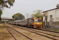
, interstate passenger services by operated by Great Southern Railway
Great Southern Railway (Australia)
Great Southern Railway , owned by Serco Asia Pacific, is a tourism business and rail transport operator in Australia.GSR operates interstate passenger trains aimed at the tourist market:* The Indian Pacific...
, intrastate freight by Australian Railroad Group
Australian Railroad Group
Australian Railroad Group was one of Australia's largest private rail operators, operating across almost 10,000 kilometres of track and began operating in Western Australia on 17 December 2000 following its purchase of the Westrail freight business. It was acquired by QR National...
, and interstate freight by a number of companies including Pacific National
Pacific National
Pacific National is one of Australia's largest private rail freight businesses. Originally a joint venture between Patrick Corporation and Toll Holdings; it is now a wholly owned subsidiary of Asciano Limited following the restructure of Toll Holdings....
, QRNational, FreightLink
FreightLink
FreightLink is a railway freight operator in Australia that operates over the Adelaide–Darwin railway.-History:In 2000, the AustralAsia Rail Corporation awarded the contract to build and operate the Adelaide to Darwin railway as a Build, Own, Operate and Transfer back project to the Asia Pacific...
, and SCT Logistics.
Passenger services
South Australian Railways
South Australian Railways built and operated railways in South Australia from 1854 to the incorporation of its non-urban railways into the Australian National Railways Commission in 1975, together with the former Commonwealth Railways and the former Tasmanian Government Railways...
, today the only services are the TransAdelaide
TransAdelaide
TransAdelaide was a publicly owned corporation which provided suburban train and tram services in Adelaide, South Australia, under contract to the Government of South Australia....
Adelaide suburban services; and the Great Southern Railway
Great Southern Railway (Australia)
Great Southern Railway , owned by Serco Asia Pacific, is a tourism business and rail transport operator in Australia.GSR operates interstate passenger trains aimed at the tourist market:* The Indian Pacific...
operated The Overland between Adelaide and Melbourne, the Indian Pacific between Perth
Perth, Western Australia
Perth is the capital and largest city of the Australian state of Western Australia and the fourth most populous city in Australia. The Perth metropolitan area has an estimated population of almost 1,700,000....
and Sydney
Sydney
Sydney is the most populous city in Australia and the state capital of New South Wales. Sydney is located on Australia's south-east coast of the Tasman Sea. As of June 2010, the greater metropolitan area had an approximate population of 4.6 million people...
via Adelaide, and The Ghan from Adelaide to Darwin
Darwin, Northern Territory
Darwin is the capital city of the Northern Territory, Australia. Situated on the Timor Sea, Darwin has a population of 127,500, making it by far the largest and most populated city in the sparsely populated Northern Territory, but the least populous of all Australia's capital cities...
, via Alice Springs.
Railway preservation
Port AdelaidePort Adelaide
Port Adelaide is a suburb of Adelaide lying about 14 kilometres northwest of the City of Adelaide. It lies within the City of Port Adelaide Enfield and is the main port for the city of Adelaide...
is home to the National Railway Museum
National Railway Museum (Port Adelaide)
thumb|Conference dinner being held in the rollingstock pavilionThe National Railway Museum, Port Adelaide, South Australia, is the current site of the Port Dock Station Railway Museum's vast Australian Railway Collection.- History :...
, the largest undercover railway museum
Railway museum
A railway museum is a museum that explores the history of all aspects of rail related transportation, including: locomotives , railway cars, trams, and railway signalling equipment.See List of railway museums...
in Australia. The SteamRanger
SteamRanger
SteamRanger is an historic train society in South Australia running trains on the Victor Harbor railway line. They are the only group regularly running broad gauge steam locomotives in South Australia...
preservation group in the Adelaide Hills
Adelaide Hills
The Adelaide Hills are part of the Mount Lofty Ranges, east of the city of Adelaide in the state of South Australia. It is unofficially centred on the largest town in the area, Mount Barker, which has a population of around 29,000 and is also one of Australia's fastest growing towns.- History :The...
has restored a number of steam
Steam locomotive
A steam locomotive is a railway locomotive that produces its power through a steam engine. These locomotives are fueled by burning some combustible material, usually coal, wood or oil, to produce steam in a boiler, which drives the steam engine...
and diesel locomotives for tourist services, and the Pichi Richi Railway
Pichi Richi Railway
The Pichi Richi Railway Preservation Society is a non-profit railway preservation society and operating museum formed in 1973. The society, managed and staffed by volunteers, operates heritage steam and diesel trains on the restored 39 km section of track between Quorn and Port Augusta in...
based in Quorn
Quorn, South Australia
Quorn is a township and railhead in the Flinders Ranges in the north of South Australia, 39 km northeast of Port Augusta. At the 2006 census, Quorn had a population of 1068.Quorn is the home of the Flinders Ranges Council local government area...
operates on part of the former Central Australia Railway.
History
The first railway in colonial South Australia was the horse-drawn tramway from Goolwa to Port Elliot opened in 1854, providing a rail link from the port of GoolwaGoolwa, South Australia
Goolwa is a historic river port on the Murray River near the Murray Mouth in South Australia, and joined by a bridge to Hindmarsh Island. The name "Goolwa" means "elbow" in Ngarrindjeri, the local Aboriginal language....
on the Murray River
Murray River
The Murray River is Australia's longest river. At in length, the Murray rises in the Australian Alps, draining the western side of Australia's highest mountains and, for most of its length, meanders across Australia's inland plains, forming the border between New South Wales and Victoria as it...
to an ocean harbour at Port Elliot
Port Elliot, South Australia
Port Elliot is a town in South Australia toward the eastern end of the south coast of the Fleurieu Peninsula. It is situated on the sheltered Horseshoe Bay, a small bay off the much larger Encounter Bay...
. It was later extended to a safer harbour at Victor Harbor
Victor Harbor, South Australia
Victor Harbor is a city located on the coast of the Fleurieu Peninsula, about 80 km south of Adelaide, South Australia. The city is the largest population centre on the peninsula, with an economy based upon agriculture, fisheries and various industries...
. This line was used to move freight between the shallow-draft vessels navigating the Murray, and coastal and ocean-going vessels, without either having to traverse the narrow and shallow mouth of the river with unpredictable current
Current (stream)
A current, in a river or stream, is the flow of water influenced by gravity as the water moves downhill to reduce its potential energy. The current varies spatially as well as temporally within the stream, dependent upon the flow volume of water, stream gradient, and channel geometrics...
s.
The first of the Railways in Adelaide
Railways in Adelaide
The rail network in Adelaide, South Australia, consists of five lines and 81 stations, totalling 125.9 km. It is operated by Adelaide Metro, and is part of the city-wide Adelaide Metro]public transport system. Apart from the Glenelg Tram, Adelaide's railway system is serviced entirely by...
was built in 1856 between the city and the port. The Adelaide railways were all built as broad gauge
Broad gauge
Broad-gauge railways use a track gauge greater than the standard gauge of .- List :For list see: List of broad gauges, by gauge and country- History :...
of . Gradually, a network of lines spread out from Adelaide. These were initially built to carry ore
Ore
An ore is a type of rock that contains minerals with important elements including metals. The ores are extracted through mining; these are then refined to extract the valuable element....
, particularly copper
Copper
Copper is a chemical element with the symbol Cu and atomic number 29. It is a ductile metal with very high thermal and electrical conductivity. Pure copper is soft and malleable; an exposed surface has a reddish-orange tarnish...
, then later freight from the Murray River, and grain
Cereal
Cereals are grasses cultivated for the edible components of their grain , composed of the endosperm, germ, and bran...
from the broadacre lands. In the first half of the 20th century, most of these lines carried passengers as well as freight.
The main line to Melbourne was opened after a bridge was built at Murray Bridge
Murray Bridge, South Australia
Murray Bridge is the fourth most populous city in South Australia after Adelaide, Mount Gambier and Whyalla. It is located east-southeast of Adelaide and north of Meningie....
in 1886. It was the first railway line between colony capitals to not have a break-of-gauge
Break-of-gauge
With railways, a break-of-gauge occurs where a line of one gauge meets a line of a different gauge. Trains and rolling stock cannot run through without some form of conversion between gauges, and freight and passengers must otherwise be transloaded...
. It was also the last of these to be converted to standard gauge
Standard gauge
The standard gauge is a widely-used track gauge . Approximately 60% of the world's existing railway lines are built to this gauge...
in 1995.
Timeline
- 1856 - First broad (1600 mm) gauge line from Adelaide to Port Adelaide opens
- 1870 - First narrow (1067 mm) gauge line opens from Port WakefieldPort Wakefield, South AustraliaPort Wakefield was the first government town to be established north of the capital, Adelaide, in South Australia.Port Wakefield is situated approximately 98.7 kilometres from Adelaide and lies on the Port Wakefield Road section of the A1 National Highway...
to BalaklavaBalaklava, South AustraliaThe town of Balaklava is located in South Australia, 92 kilometres north of Adelaide in the Mid North region. It is on the banks of the Wakefield River, 25 kilometres east of Port Wakefield.-History:...
- isolated from broad gaugeBroad gaugeBroad-gauge railways use a track gauge greater than the standard gauge of .- List :For list see: List of broad gauges, by gauge and country- History :...
system. Originally horse drawn railwayHorse drawn railwayHorse drawn railways were used before the advent of steam locomotive traction, which gradually superseded them in most instances.- Examples :Examples include :...
. - 1880 - Broad gauge line reaches TerowieTerowie, South AustraliaTerowie is a small town in the mid-north of South Australia located north of Adelaide. It is located in the Regional Council of Goyder. Terowie retains a number of authentic and well preserved 1880s buildings, and has been declared a "historic town". It also remains a town of interest to those...
- 1887 - Railways of South Australia and Victoria meet at Serviceton, VictoriaServiceton, VictoriaServiceton is a small town in Victoria, Australia, located near the Victorian-South Australian border, 437 kilometres north-west of Melbourne. The town was named after James Service, Premier of Victoria in 1880 and from 1883-86...
- 1888 - Narrow gauge line built from Port PiriePort Pirie, South Australia-Transport:Port Pirie is located off National Highway One. It is serviced by an airport five minutes out of the city.- Railways :The first railways in Port Pirie were of the narrow [3' 6"] gauge....
to Broken Hill, New South WalesBroken Hill, New South Wales-Geology:Broken Hill's massive orebody, which formed about 1,800 million years ago, has proved to be among the world's largest silver-lead-zinc mineral deposits. The orebody is shaped like a boomerang plunging into the earth at its ends and outcropping in the centre. The protruding tip of the... - 1891 - Narrow gauge line reaches OodnadattaOodnadatta, South AustraliaOodnadatta, South Australia, is a small town surrounded by an area of with cattle stations in arid pastoral rangelands close to the Simpson Desert, north of Adelaide and 112 m above sea level. It can be reached by an unsealed road from Coober Pedy or via the unsealed Oodnadatta Track from...
from Terowie break-of-gaugeBreak-of-gaugeWith railways, a break-of-gauge occurs where a line of one gauge meets a line of a different gauge. Trains and rolling stock cannot run through without some form of conversion between gauges, and freight and passengers must otherwise be transloaded...
station - 1917 - First standard gauge lineTrans-Australian RailwayThe Trans-Australian Railway crosses the Nullarbor Plain of Australia from Port Augusta in South Australia to Kalgoorlie in Western Australia...
completed between Port Augusta, South AustraliaPort Augusta, South Australia-Electricity generation:Electricity is generated at the Playford B and Northern power stations from brown coal mined at Leigh Creek, 250 km to the north...
and Kalgoorlie, Western AustraliaKalgoorlie, Western AustraliaKalgoorlie, known as Kalgoorlie-Boulder, is a town in the Goldfields-Esperance region of Western Australia, and is located east-northeast of state capital Perth at the end of the Great Eastern Highway...
, requiring a break-of-gauge at Terowie, Port Augusta and Kalgoorlie to reach Perth - 1919 - Railways of South Australia and New South Wales meet at Broken Hill, New South WalesBroken Hill, New South Wales-Geology:Broken Hill's massive orebody, which formed about 1,800 million years ago, has proved to be among the world's largest silver-lead-zinc mineral deposits. The orebody is shaped like a boomerang plunging into the earth at its ends and outcropping in the centre. The protruding tip of the...
with a break-of-gauge - 1937 - Trans-Australian RailwayTrans-Australian RailwayThe Trans-Australian Railway crosses the Nullarbor Plain of Australia from Port Augusta in South Australia to Kalgoorlie in Western Australia...
extended to Port Pirie and the broad gauge railway from Adelaide to RedhillRedhill, South Australia- Governance :Redhill is in the Port Pirie Regional Council local government area, the South Australian House of Assembly electoral district of Frome and the Australian House of Representatives Division of Grey.-History:...
extended to Port Pirie - 1970 - Port Pirie to Broken Hill standard gauge line officially opened, completing the Sydney - Perth rail link
- 1980 - Tarcoola, South AustraliaTarcoola, South AustraliaTarcoola is a town in the Far North of South Australia 416 km north-northwest of Port Augusta.Tarcoola is taken from a non-local aboriginal language from an area around Tarcoola Station in NSW; it means river bend.-History:Tarcoola Post Office opened on 18 August 1900 and the town was...
to Alice Springs standard gauge railway opened, first stage of the Adelaide-Darwin railwayAdelaide-Darwin railwayThe Adelaide–Darwin railway is a north-south transcontinental railway in Australia, between the cities of Adelaide, South Australia and Darwin, Northern Territory... - 1982 - Adelaide to Crystal Brook, South AustraliaCrystal Brook, South AustraliaCrystal Brook is a town in South Australia, named after the spring-fed creek next to which it was founded. It is north of Adelaide and in 2006 had a population of 1,185.Crystal Brook is situated on Goyder's Line near the border of two climate systems...
standard gauge railway opened, connecting Adelaide to the standard gauge network - 1995 - Adelaide to Melbourne gauge convertedGauge conversionIn rail transport, gauge conversion is the process of converting a railway from one rail gauge to another, through the alteration of the railway tracks...
from broad gaugeBroad gaugeBroad-gauge railways use a track gauge greater than the standard gauge of .- List :For list see: List of broad gauges, by gauge and country- History :...
to standard gaugeStandard gaugeThe standard gauge is a widely-used track gauge . Approximately 60% of the world's existing railway lines are built to this gauge...
under the Federal Government One Nation Project - 2008 - South Australian Treasurer Kevin Foley announces budget which includes plans to electrify the Noarlunga, Outer Harbor and Gawler rail lines
The first South Australian steam-operated line was built as a broad gauge
Victorian broad gauge
Rail gauge in Australia displays significant variation, which has been an ongoing problem for transportation on the Australian continent, for over a hundred years.-Track gauges and route km:The most used gauges are Main gauges:...
(1600 mm) line in 1856 between the city and Port Adelaide stopping at Bowden, Woodville and Alberton. This line is now part of the Adelaide suburban network
Railways in Adelaide
The rail network in Adelaide, South Australia, consists of five lines and 81 stations, totalling 125.9 km. It is operated by Adelaide Metro, and is part of the city-wide Adelaide Metro]public transport system. Apart from the Glenelg Tram, Adelaide's railway system is serviced entirely by...
and has been proposed for standardisation and conversion to light rail. It was extended as the Outer Harbor line to Outer Harbor in 1908. A branch was built to Grange in 1882. It was extended as the Henley Beach line to Henley Beach
Henley Beach, South Australia
Henley Beach is a seaside suburb of Adelaide in the City of Charles Sturt local government area , South Australia.-External links:*...
in 1894 and closed in 1957.
Southern Lines
The South Line, through the Adelaide Hills, was opened to AldgateAldgate, South Australia
Aldgate is a South Australian town located 21 kilometres south-east of Adelaide, in the Adelaide Hills.The town of Aldgate was supposedly named in 1882 after the local hotel the Aldgate Pump, which was named by Richard D. Hawkins, who had additionally opened the nearby Crafers Inn...
, Nairne
Nairne, South Australia
Nairne is a small township in South Australia and was founded by Matthew Smillie in 1839. Nairne is about 7 km from Mount Barker, in the federal Division of Mayo and in the state electoral district of Kavel...
in 1883, Murray Bridge
Murray Bridge, South Australia
Murray Bridge is the fourth most populous city in South Australia after Adelaide, Mount Gambier and Whyalla. It is located east-southeast of Adelaide and north of Meningie....
in 1884 and Bordertown
Bordertown, South Australia
Bordertown is a small South Australian town near the Victorian border. It is where the Dukes Highway and the railway line, the two main routes between Adelaide and Melbourne, cross Tatiara Creek....
and Serviceton, Victoria
Serviceton, Victoria
Serviceton is a small town in Victoria, Australia, located near the Victorian-South Australian border, 437 kilometres north-west of Melbourne. The town was named after James Service, Premier of Victoria in 1880 and from 1883-86...
, connecting with Victorian Railways
Victorian Railways
The Victorian Railways operated railways in the Australian state of Victoria from 1859 to 1983. The first railways in Victoria were private companies, but when these companies failed or defaulted, the Victorian Railways was established to take over their operations...
in 1887. This line was standardised in 1995.
A branch line was built to Marino
Marino railway station, Adelaide
Marino railway station is a railway station on the Noarlunga railway line, which is located in the southern Adelaide suburb of Marino. It is located 18.3 km by railway from the Adelaide Railway Station. The small station building is similar to the ones at Ascot Park and Seacliff...
in 1913, and extended to Willunga in 1915. The section from Hallett Cove to Willunga was closed in 1969. In the 1970s the line was extended south from Hallett Cove, reaching Christie Downs in 1976, and Noarlunga Centre
Noarlunga Centre Interchange
Noarlunga Centre Interchange is the terminus of the Noarlunga Centre line, a part of the suburban railway system in Adelaide, South Australia....
in 1978, forming the current TransAdelaide Noarlunga Centre line.
The beginnings of the Victor Harbor line was a horse-drawn broad (1600 mm) gauge tram
Tram
A tram is a passenger rail vehicle which runs on tracks along public urban streets and also sometimes on separate rights of way. It may also run between cities and/or towns , and/or partially grade separated even in the cities...
way built from the port of Goolwa
Goolwa, South Australia
Goolwa is a historic river port on the Murray River near the Murray Mouth in South Australia, and joined by a bridge to Hindmarsh Island. The name "Goolwa" means "elbow" in Ngarrindjeri, the local Aboriginal language....
on the Murray River
Murray River
The Murray River is Australia's longest river. At in length, the Murray rises in the Australian Alps, draining the western side of Australia's highest mountains and, for most of its length, meanders across Australia's inland plains, forming the border between New South Wales and Victoria as it...
to an ocean harbour at Port Elliot
Port Elliot, South Australia
Port Elliot is a town in South Australia toward the eastern end of the south coast of the Fleurieu Peninsula. It is situated on the sheltered Horseshoe Bay, a small bay off the much larger Encounter Bay...
in 1854. This line was used to move freight between the shallow-draft vessels navigating the Murray, and coastal and ocean-going vessels, without either having to traverse the narrow and shallow mouth of the river with unpredictable current
Current (stream)
A current, in a river or stream, is the flow of water influenced by gravity as the water moves downhill to reduce its potential energy. The current varies spatially as well as temporally within the stream, dependent upon the flow volume of water, stream gradient, and channel geometrics...
s. It was later extended from Port Elliot to Victor Harbor
Victor Harbor, South Australia
Victor Harbor is a city located on the coast of the Fleurieu Peninsula, about 80 km south of Adelaide, South Australia. The city is the largest population centre on the peninsula, with an economy based upon agriculture, fisheries and various industries...
in 1864 and from Goolwa to Strathalbyn
Strathalbyn, South Australia
Strathalbyn is a town in South Australia, in the Alexandrina Council. The town has a population of 3894 people.-History and Culture:The town was founded in 1839. Strathalbyn was once connected by broad gauge horse tram to Goolwa and Victor Harbor from 1869, and the line was extended to Mount Barker...
in 1869. It was extended to Mount Barker
Mount Barker, South Australia
Mount Barker is an expanding city, home to 10 258 residents that is 33 kilometres up the South Eastern Freeway, east of Adelaide, in South Australia. It is the seat of the District Council of Mount Barker, is the largest town in the Adelaide Hills, and is one of the fastest growing areas in the...
Junction on the South Line in 1884 and strengthened to carry steam trains.
A branch line was built to Monarto
Monarto, South Australia
Monarto is a region and formerly proposed city in South Australia. It is north of the South Eastern Freeway between the Callington and Murray Bridge exits 63 km from Adelaide....
and Cambrai
Cambrai, South Australia
Cambrai is a small town located on the eastern side of the Mount Lofty Ranges, along the River Marne and at the northern end of the former Apamurra to Sedan railway line. Originally named Rhine Villa, it was one of many Australian towns re-named during World War I to remove any connection with...
in 1886. In was shortened to Apamurra near Palmer
Palmer, South Australia
Palmer is a town just east of the Adelaide Hills region of South Australia along the Adelaide-Mannum Road, 70 kilometres east-north-east of the state capital, Adelaide and 15 km west-north-west of Mannum . It is located in the Mid Murray Council local government area...
before being closed due to the standardisation of the Adelaide - Melbourne line in 1995.
A branch line was built from Tailem Bend
Tailem Bend, South Australia
Tailem Bend is a town on the Murray River in South Australia. The town was proclaimed in 1887, the year after the main railway came through. At the 2006 census, Tailem Bend had a population of 1,457....
to Pinnaroo
Pinnaroo, South Australia
Pinnaroo is a town in the Murray Mallee region of South Australia, near the border with Victoria 243 km east of Adelaide. Pinnaroo is on the Mallee Highway, and the railway line between Tailem Bend and Ouyen. The roadhouses on the highway are the first food and leg-stretch stop on the bus route...
in 1906. This was connected with the Victorian Railways
Victorian Railways
The Victorian Railways operated railways in the Australian state of Victoria from 1859 to 1983. The first railways in Victoria were private companies, but when these companies failed or defaulted, the Victorian Railways was established to take over their operations...
at the Victoria
Victoria (Australia)
Victoria is the second most populous state in Australia. Geographically the smallest mainland state, Victoria is bordered by New South Wales, South Australia, and Tasmania on Boundary Islet to the north, west and south respectively....
n border and Ouyen
Ouyen, Victoria
Ouyen is a town in Victoria, Australia, located in the Rural City of Mildura at the junction of the Calder Highway and Mallee Highway, south of Mildura and north-west of Melbourne. At the 2006 census the town had a population of 1,061.-History:...
in 1915. The South Australian part of this line was standardised in 1998 to reconnect it with the Adelaide - Melbourne line. This has created a break-of-gauge
Break-of-gauge
With railways, a break-of-gauge occurs where a line of one gauge meets a line of a different gauge. Trains and rolling stock cannot run through without some form of conversion between gauges, and freight and passengers must otherwise be transloaded...
at Pinnaroo, but there are proposals to standardise the Mildura line from Geelong to Mildura
Mildura, Victoria
Mildura is a regional city in northwestern Victoria, Australia and seat of the Rural City of Mildura local government area. It is located in the Sunraysia region, and is on the banks of the Murray River. The current population is estimated at just over 30,000.Mildura is a major agricultural centre...
and the line between Ouyen
Ouyen, Victoria
Ouyen is a town in Victoria, Australia, located in the Rural City of Mildura at the junction of the Calder Highway and Mallee Highway, south of Mildura and north-west of Melbourne. At the 2006 census the town had a population of 1,061.-History:...
and Pinnaroo.
A branch line was opened from Tailem Bend to Karoonda
Karoonda, South Australia
Karoonda is in the middle of the Murray Mallee region of South Australia at geographic coordinates . Karoonda takes its name from the Aboriginal word for "winter camp"....
and Alawoona
Alawoona, South Australia
Alawoona is a settlement in South Australia. At the 2006 census, Alawoona had a population of 250.-Notes and references:...
in 1913 and extended to Loxton
Loxton, South Australia
Loxton is a town on the south bank of the River Murray in the Riverland region of South Australia. At the 2006 census, Loxton had a population of 3,431....
in February 1914. This was standardised in 1998.
A branch line was opened from Karoonda to Waikerie
Waikerie, South Australia
Waikerie is a rural town in the Riverland region of South Australia on the south bank of the Murray River. At the 2006 census, Waikerie had a population of 1,744. The Sturt Highway passes to the south of the town at the top of the cliffs...
in December 1914; it closed in 1990. Another branch line was opened from Wanbi
Wanbi, South Australia
Wanbi is a settlement in South Australia. At the 2006 census, Wanbi had a population of 154....
to Yinkanie (near Moorook
Moorook, South Australia
Moorook is a settlement in South Australia. It is part of a series of towns surrounding lakes in the Riverland region in Australia. At the 2006 census, Moorook had a population of 289.-References:...
) in September 1925, but closed in 1971. In 1928 a branch line was opened from Alawoona to Renmark
Renmark, South Australia
Renmark is a town in South Australia's rural Riverland area, and is located 254 km northeast of Adelaide, on the banks of the River Murray. The Sturt Highway between Adelaide and Sydney runs through the town; Renmark is the last major town encountered in South Australia when driving this route. It...
and Barmera
Barmera, South Australia
Barmera is a town in the Riverland region of South Australia. It is on the Sturt Highway A20, 220 kilometres north-east of Adelaide, the capital of the state of South Australia. It is primarily an agricultural and viticultural town and is located on Lake Bonney , a freshwater lake...
, crossing the Murray River at Paringa
Paringa, South Australia
Paringa is a small town in the Riverland of South Australia. Paringa is famous for its vineyards, almond, citrus and stone fruit orchards, and the beautiful steel bridge with a span that can be raised to allow houseboats and paddlesteamers to pass underneath. across the Murray River to Renmark....
; it closed in 1990. Another branch was opened from Karoonda to Peebinga in December 1914, but it was closed in 1990.
Southern narrow gauge lines
Kingston SE, South Australia
Kingston SE is a town approximately 297 km southeast of Adelaide, the capital of South Australia, and 44 km from the town of Robe. It is at the southeastern end of Encounter Bay and the Coorong. At the 2006 census, Kingston SE had a population of 1,443.-History:The town was named after...
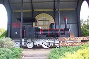
to Naracoorte
Naracoorte, South Australia
Naracoorte is a town in the Limestone Coast region of South Australia, approximately 336 kilometres south east of Adelaide and 100 kilometres north of Mount Gambier on the Riddoch Highway .-History:...
. In 1879, a railway was built between Beachport
Beachport, South Australia
Beachport is a small coastal town 379 kilometres south-east of Adelaide, South Australia, located in the Wattle Range Council. Known for its 772 metre long jetty , Beachport is located on the northern end of Rivoli Bay...
, Millicent
Millicent, South Australia
Millicent is a town in South Australia, south-east of Adelaide, and north of Mount Gambier. At the 2006 Census, the population was 4,771.The town is home to the Millicent National Trust Museum, and is nearby to the Tantanoola Caves Conservation Park and the Canunda National Park.The Millicent...
and Mount Gambier
Mount Gambier, South Australia
Mount Gambier is the largest regional city in South Australia located approximately 450 kilometres south of the capital Adelaide and just 17 kilometres from the Victorian border....
. In 1887 a line was built from Mount Gambier to Naracoorte and Wolseley
Wolseley, South Australia
Wolseley is a small South Australian town near the Victorian border. It is five kilometres south of the Dukes Highway and 13 kilometres east of Bordertown. It was first proclaimed a town in 1884....
, with a branch line from Wandilo to Glencoe, creating a break-of-gauge
Break-of-gauge
With railways, a break-of-gauge occurs where a line of one gauge meets a line of a different gauge. Trains and rolling stock cannot run through without some form of conversion between gauges, and freight and passengers must otherwise be transloaded...
junction with the Adelaide-Melbourne line at Wolseley.
A broad gauge branch was opened from Mount Gambier to Heywood
Heywood, Victoria
Heywood is a town on the Fitzroy River in the Australian state of Victoria. It is situated at an elevation of 27 metres amidst rolling green hills in an agricultural, pastoral and timbercutting district. Heywood is west of Melbourne at the intersection of the Princes and Henty Highways and north...
near Portland
Portland, Victoria
The city of Portland is the oldest European settlement in what is now the state of Victoria, Australia. It is the main urban centre of the Shire of Glenelg. It is located on Portland Bay.-History:...
in 1917. From 1953 to 1956, the southeastern lines were converted to broad gauge, with the exception of the Beachport - Millicent and the Wandilo - Glencoe line, which were closed down. The Kingston - Naracoorte was closed in the 1970s. The other southeastern lines, including the line to Heywood, have been out of use since the standardisation of the Adelaide - Melbourne and Maroona - Portland lines in 1995. There are regular calls for their standardisation.
Broad gauge lines
In 1857 the 42 km Gawler line was built to Gawler station, which was rural at the time, and extended to RoseworthyRoseworthy, South Australia
Roseworthy is a small town in South Australia, about 10 km north of Gawler. At the 2006 census, Roseworthy had a population of 668.Roseworthy has a large grain storage facility consisting of both storage silos and bunkers for grain grown in the surrounding areas, and grain is collected by rail to...
, Kapunda in 1860 and Morgan
Morgan, South Australia
Morgan is a town in South Australia on the right bank of the Murray River, just downstream of where it turns from flowing roughly westwards to roughly southwards. It is about north east of Adelaide, and about upstream of the Murray Mouth. At the 2006 census, Morgan had a population of 426.The...
in 1878 (now closed). The main line left the Kapunda branch at Roseworthy and proceeded to Hamley Bridge, Riverton
Riverton, South Australia
Riverton is a small town of distinctive character and interest to travellers in the Mid North of South Australia, in the Gilbert Valley. It is situated on the Gilbert River, from which the town derives its name...
, Burra
Burra, South Australia
Burra is a pastoral centre and historic tourist town in the mid-north of South Australia. It lies east of the Clare Valley in the Bald Hills range, part of the northern Mount Lofty Ranges, and on Burra Creek. The town began as a single company mining township that, by 1851, was a set of townships ...
in 1870, and Terowie
Terowie, South Australia
Terowie is a small town in the mid-north of South Australia located north of Adelaide. It is located in the Regional Council of Goyder. Terowie retains a number of authentic and well preserved 1880s buildings, and has been declared a "historic town". It also remains a town of interest to those...
in 1880.
A branch line was built from Gawler Junction, north of Gawler station, to Gawler Central Station, Penrice
Penrice, South Australia
Penrice is a small town in the Barossa Valley of South Australia, just north of Angaston. It is the site of a large limestone and marble quarry operated by Penrice Soda Products.Penrice was named by Captain Rodda after Penrice, a town in Glamorganshire, Wales...
and Angaston
Angaston, South Australia
Angaston is a town in the Barossa Valley, South Australia, 77 km north east of Adelaide. Its elevation is 347 m, one of the highest points in the valley, and has an average rainfall of 561 mm...
in the Barossa Valley
Barossa Valley
The Barossa Valley is a major wine-producing region and tourist destination of South Australia, located 60 km northeast of Adelaide. It is the valley formed by the North Para River, and the Barossa Valley Way is the main road through the valley, connecting the main towns on the valley floor of...
in 1911.
A branch line was built from Riverton to Clare
Clare, South Australia
The town of Clare is located in South Australia in the Mid North region, 136 km north of Adelaide. It gives its name to the Clare Valley wine and tourist region.-History:One of the first settlers in the area was John Horrocks, in 1839...
in 1919 and Spalding
Spalding, South Australia
Spalding is a town located north of the Clare Valley in South Australia, Australia at . At the 2006 census, Spalding had a population of 212.It is mainly a farming community and also is home to a slate quarry....
in 1922. This line was lifted in the early 80s and part of it restored as a bicycle/walking trail.
In 1925, a broad gauge line was built from Salisbury to Redhill
Redhill, South Australia
- Governance :Redhill is in the Port Pirie Regional Council local government area, the South Australian House of Assembly electoral district of Frome and the Australian House of Representatives Division of Grey.-History:...
and in 1937, it was extended to Port Pirie to meet the extension of the standard gauge from Port Augusta. This line was converted to standard gauge in 1982, including a deviation at the northern end to move the rail junction from Port Pirie to Crystal Brook
Crystal Brook, South Australia
Crystal Brook is a town in South Australia, named after the spring-fed creek next to which it was founded. It is north of Adelaide and in 2006 had a population of 1,185.Crystal Brook is situated on Goyder's Line near the border of two climate systems...
.
Western Division narrow gauge lines
The lines in the Mid NorthMid North
The Mid North is a region of South Australia, north of the Adelaide Plains, but not as far north as the Far North, or outback. It is generally accepted to extend from Spencer Gulf east to the Barrier Highway, including the coastal plain, the southern part of the Flinders Ranges, and the northern...
(generally north of Goyder's Line
Goyder's Line
Goyder's Line is a boundary line across South Australia corresponding to a rainfall boundary believed to indicate the edge of the area suitable for agriculture. North of Goyder's Line, the rainfall is not reliable enough, and the land is only suitable for grazing and not cropping. The line traces a...
, which is the limit of 10" annual rainfall) were built to narrow gauge (1067 mm).
Upper Yorke Peninsula lines
Port Wakefield, South Australia
Port Wakefield was the first government town to be established north of the capital, Adelaide, in South Australia.Port Wakefield is situated approximately 98.7 kilometres from Adelaide and lies on the Port Wakefield Road section of the A1 National Highway...
to Hoyleton
Hoyleton, South Australia
Hoyleton is a former railway town in South Australia, west of the Clare Valley, halfway between Leasingham and Halbury. At the 2006 census, Hoyleton had a population of 283....
, opened in 1870 and extended to Hamley Bridge
Hamley Bridge, South Australia
Hamley Bridge is a community in South Australia located at the junction of the Gilbert and Light rivers, as well as the site of a former railway junction....
in 1878, creating Australia's first break-of-gauge
Break-of-gauge
With railways, a break-of-gauge occurs where a line of one gauge meets a line of a different gauge. Trains and rolling stock cannot run through without some form of conversion between gauges, and freight and passengers must otherwise be transloaded...
on the government railways.
A horse-drawn tramway was built by the Kadina and Wallaroo Railway and Pier Company between Wallaroo
Wallaroo, South Australia
Wallaroo is a port town on the western side of Yorke Peninsula in South Australia, 160 kilometres north-northwest of Adelaide. It is one of the three Copper Triangle towns famed for their historic shared copper mining industry, and known together as "Little Cornwall", the other two being Kadina ...
and Kadina
Kadina, South Australia
Kadina is a town located on the Yorke Peninsula of South Australia, approximately 144 kilometres north-northwest of the state capital of Adelaide. The largest town of the Peninsula, Kadina is one of the three Copper Triangle towns famous for their shared copper mining history...
in 1862 and extended to Moonta
Moonta, South Australia
Moonta is a town located on the Yorke Peninsula of South Australia, 165 kilometres north-northwest of the state capital of Adelaide. It is one of three towns known as the Copper Coast or "Little Cornwall" for their shared copper mining history....
in 1866. This was acquired by the South Australian Railways
South Australian Railways
South Australian Railways built and operated railways in South Australia from 1854 to the incorporation of its non-urban railways into the Australian National Railways Commission in 1975, together with the former Commonwealth Railways and the former Tasmanian Government Railways...
in 1877 and a new narrow gauge line was built along its route and connected to Port Wakefield
Port Wakefield, South Australia
Port Wakefield was the first government town to be established north of the capital, Adelaide, in South Australia.Port Wakefield is situated approximately 98.7 kilometres from Adelaide and lies on the Port Wakefield Road section of the A1 National Highway...
in about 1878. A line was built from Brinkworth to Snowtown
Snowtown, South Australia
The town of Snowtown is located in the Mid North of South Australia 145 km north of Adelaide and lies on the main route between Adelaide and Perth. The town's elevation is 103 metres and on average the town receives 389 mm of rainfall per annum.-History:...
, Bute
Bute, South Australia
Bute is a town located in the northern Yorke Peninsula, approximately 40 kilometres east of Wallaroo and 24 kilometres west of Snowtown. It was proclaimed as a town in 1884 and named after the Isle of Bute, in the Firth of Clyde, Scotland...
and Kadina in 1879. These lines were converted to broad gauge in 1927.
All the lines west of the Adelaide
Adelaide
Adelaide is the capital city of South Australia and the fifth-largest city in Australia. Adelaide has an estimated population of more than 1.2 million...
-Crystal Brook
Crystal Brook, South Australia
Crystal Brook is a town in South Australia, named after the spring-fed creek next to which it was founded. It is north of Adelaide and in 2006 had a population of 1,185.Crystal Brook is situated on Goyder's Line near the border of two climate systems...
standard gauge line and the line from Snowtown to Brinkworth were closed after the Adelaide - Crystal Brook line was opened in 1982, despite proposals to convert some of them to standard gauge.
There are calls to convert the Wolseley
Wolseley, South Australia
Wolseley is a small South Australian town near the Victorian border. It is five kilometres south of the Dukes Highway and 13 kilometres east of Bordertown. It was first proclaimed a town in 1884....
to Mount Gambier
Mount Gambier, South Australia
Mount Gambier is the largest regional city in South Australia located approximately 450 kilometres south of the capital Adelaide and just 17 kilometres from the Victorian border....
line to standard gauge. This partly reflects the lifting of restriction on the road transportation of grain Australia-wide that followed recommendations of the 1986-88 Royal Commission into grain storage, handling and transport. This particularly affected South Australian railways because of the short distances between the growing areas and its various wheat exporting ports. The Snowtown to Wallaroo Broad Gauge was converted to Dual Gauge
Dual gauge
A dual-gauge or mixed-gauge railway has railway track that allows trains of different gauges to use the same track. Generally, a dual-gauge railway consists of three rails, rather than the standard two rails. The two outer rails give the wider gauge, while one of the outer rails and the inner rail...
(Standard/Broad) during the late 1980s.
North Mount Lofty Ranges lines
A line was built from Balaklava to BrinkworthBrinkworth, South Australia
Brinkworth is a town in the Mid North region of South Australia with a current population of 401. It is 32 km north of the regional centre of Clare.The Brinkworth area was first settled in the 1860s and the town laid out in 1892...
and Gladstone
Gladstone, South Australia
Gladstone is a small rural town in the Mid North of South Australia in the approach to the lower Flinders Ranges. At the 2006 census, Gladstone had a population of 629....
by 1880 and later extended to Wilmington
Wilmington, South Australia
Wilmington is a town in the southern Flinders Ranges region of South Australia. The town is located in the District Council of Mount Remarkable Local Government Area, north of the state capital, Adelaide...
. The Hamley Bridge - Balaklava - Brinkworth - Gladstone line was converted to broad gauge in 1927, making Gladstone a break-of-gauge
Break-of-gauge
With railways, a break-of-gauge occurs where a line of one gauge meets a line of a different gauge. Trains and rolling stock cannot run through without some form of conversion between gauges, and freight and passengers must otherwise be transloaded...
junction. In 1969, when the line from Port Pirie to Broken Hill was converted to standard gauge
Standard gauge
The standard gauge is a widely-used track gauge . Approximately 60% of the world's existing railway lines are built to this gauge...
, Gladstone became a three-gauge break-of-gauge junction (together with Peterborough
Peterborough, South Australia
Peterborough is a town in the mid north of South Australia, in wheat country, just off the Barrier Highway. At the 2006 census, Peterborough had a population of 1,689....
and succeeding Port Pirie
Port Pirie, South Australia
-Transport:Port Pirie is located off National Highway One. It is serviced by an airport five minutes out of the city.- Railways :The first railways in Port Pirie were of the narrow [3' 6"] gauge....
, which had been reduced to two gauges). In the 1980s, the broad gauge line north of Balaklava and the narrow gauge line were closed, leaving Gladstone as a purely standard gauge station.
A narrow gauge line was built from Terowie to Peterborough
Peterborough, South Australia
Peterborough is a town in the mid north of South Australia, in wheat country, just off the Barrier Highway. At the 2006 census, Peterborough had a population of 1,689....
in 1881, creating a break-of-gauge
Break-of-gauge
With railways, a break-of-gauge occurs where a line of one gauge meets a line of a different gauge. Trains and rolling stock cannot run through without some form of conversion between gauges, and freight and passengers must otherwise be transloaded...
at Terowie, although the enforced train change created an opportunity for General Douglas MacArthur
Douglas MacArthur
General of the Army Douglas MacArthur was an American general and field marshal of the Philippine Army. He was a Chief of Staff of the United States Army during the 1930s and played a prominent role in the Pacific theater during World War II. He received the Medal of Honor for his service in the...
to deliver his famous line "I shall return" at Terowie station on 20 March 1942. The break-of-gauge was not overcome until the Terowie - Peterborough line was converted to broad (1600 mm) gauge in 1970, to meet new the standard gauge from Port Pirie
Port Pirie, South Australia
-Transport:Port Pirie is located off National Highway One. It is serviced by an airport five minutes out of the city.- Railways :The first railways in Port Pirie were of the narrow [3' 6"] gauge....
to Broken Hill, but it was abandoned by 1988.
The narrow gauge line was extended to Orroroo
Orroroo, South Australia
Orroroo is a town in the Flinders Ranges region of South Australia. At the 2006 census, Orroroo had a population of 543. The Wilmington-Ucolta Road passes through here, intersecting there with the southern stretch of the Birdsville and Oodnadatta Tracks. The narrow gauge rail line was extended to...
also in 1881 and Quorn
Quorn, South Australia
Quorn is a township and railhead in the Flinders Ranges in the north of South Australia, 39 km northeast of Port Augusta. At the 2006 census, Quorn had a population of 1068.Quorn is the home of the Flinders Ranges Council local government area...
in 1882, connecting with the new line from Port Augusta
Port Augusta, South Australia
-Electricity generation:Electricity is generated at the Playford B and Northern power stations from brown coal mined at Leigh Creek, 250 km to the north...
. This line has now been abandoned.
A narrow gauge railway was built from Port Pirie to Gladstone, Peterborough and Broken Hill
Broken Hill, New South Wales
-Geology:Broken Hill's massive orebody, which formed about 1,800 million years ago, has proved to be among the world's largest silver-lead-zinc mineral deposits. The orebody is shaped like a boomerang plunging into the earth at its ends and outcropping in the centre. The protruding tip of the...
, in 1888 to serve the Broken Hill silver and lead mine, which was becoming the largest and richest of its kind in the world. Since the New South Wales Government would not allow the South Australia railway to cross the border, the last 30 km was built by a private company as a tramway, the Silverton Tramway
Silverton Tramway
The Silverton Tramway was an Australian long narrow gauge railway running from Cockburn on the South Australian state border to Broken Hill in New South Wales. Operating between 1888 and 1970 it served the mines of Broken Hill, and formed the link between the standard gauge New South Wales...
from Cockburn, South Australia
Cockburn, South Australia
Cockburn is a town on the border of South Australia and New South Wales near Broken Hill. The town population consists of roughly 25 people with a greater regional community of 180 as of 2005.-Town history:...
to Silverton, New South Wales
Silverton, New South Wales
Silverton is a small village at the far west of New South Wales, Australia, 25 kilometres north-west of Broken Hill. At the 2006 census, Silverton had a population of 89 people....
and Broken Hill. In 1970 the line was converted to standard gauge, completing the standard transcontinental gauge line from Sydney to Perth.
The Great Northern Railway
The Great Northern Railway was completed from Port AugustaPort Augusta, South Australia
-Electricity generation:Electricity is generated at the Playford B and Northern power stations from brown coal mined at Leigh Creek, 250 km to the north...
across the Pichi Richi Pass
Pichi Richi Railway
The Pichi Richi Railway Preservation Society is a non-profit railway preservation society and operating museum formed in 1973. The society, managed and staffed by volunteers, operates heritage steam and diesel trains on the restored 39 km section of track between Quorn and Port Augusta in...
to Quorn
Quorn, South Australia
Quorn is a township and railhead in the Flinders Ranges in the north of South Australia, 39 km northeast of Port Augusta. At the 2006 census, Quorn had a population of 1068.Quorn is the home of the Flinders Ranges Council local government area...
in 1879, Hergott Springs (now known as Marree
Marree, South Australia
Marree is a small town located in the north of South Australia. It lies North of Adelaide at the junction of the Oodnadatta Track and the Birdsville Track, above sea level. The area is the home of the Dieri people. At the 2006 census, Marree had a population of 70.The town was home to Australia's...
) in 1883 and Oodnadatta
Oodnadatta, South Australia
Oodnadatta, South Australia, is a small town surrounded by an area of with cattle stations in arid pastoral rangelands close to the Simpson Desert, north of Adelaide and 112 m above sea level. It can be reached by an unsealed road from Coober Pedy or via the unsealed Oodnadatta Track from...
in 1891. It was extended to Alice Springs
Alice Springs, Northern Territory
Alice Springs is the second largest town in the Northern Territory of Australia. Popularly known as "the Alice" or simply "Alice", Alice Springs is situated in the geographic centre of Australia near the southern border of the Northern Territory...
by Commonwealth Railways
Commonwealth Railways
The Commonwealth Railways were established in 1912, as part of a government department, currently called the Department of Infrastructure, Transport, Regional Development and Local Government, by the Government of Australia to construct the missing link in the east-west transcontinental railway and...
in 1929, when it was renamed the Central Australia Railway.
In 1957, a new standard gauge line was built from Stirling North
Stirling North, South Australia
Stirling North is a small town located 7 km east of Port Augusta in South Australia. It acts primarily as a satellite town to Port Augusta with the town's railway station lying at a major rail junction linking the Port Augusta power station and the main east-west rail link to the coal rail...
(near Port Augusta) to Marree on a new alignment west of the Flinders Ranges
Flinders Ranges
Flinders Ranges is the largest mountain range in South Australia, which starts approximately north west of Adelaide. The discontinuous ranges stretch for over from Port Pirie to Lake Callabonna...
and the narrow gauge line between Hawker
Hawker, South Australia
Hawker is a town in the Flinders Ranges area of South Australia, 365 km north of Adelaide. It is in the Flinders Ranges Council, the state Electoral district of Stuart and the federal Division of Grey. At the 2006 census, Hawker had a population of 229....
and Marree was abandoned. The remainder of the narrow gauge line between Stirling North, Quorn and Hawker was abandoned in 1972, although the Stirling North - Quorn section has been taken over by the Pichi Richi tourist railway
Pichi Richi Railway
The Pichi Richi Railway Preservation Society is a non-profit railway preservation society and operating museum formed in 1973. The society, managed and staffed by volunteers, operates heritage steam and diesel trains on the restored 39 km section of track between Quorn and Port Augusta in...
. The narrow gauge line from Marree to Alice Springs was abandoned with the opening of the new standard gauge railway from Tarcoola
Tarcoola, South Australia
Tarcoola is a town in the Far North of South Australia 416 km north-northwest of Port Augusta.Tarcoola is taken from a non-local aboriginal language from an area around Tarcoola Station in NSW; it means river bend.-History:Tarcoola Post Office opened on 18 August 1900 and the town was...
to Alice Springs in 1980, which forms port of the Adelaide–Darwin railway. The standard gauge line from Stirling North has since been abandoned north of Leigh Creek
Leigh Creek, South Australia
Leigh Creek is a coal-mining town in the north of South Australia. At the 2006 census, Leigh Creek had a population of 549....
.
Eyre Peninsula lines
The lines on Eyre PeninsulaEyre Peninsula
Eyre Peninsula is a triangular peninsula in South Australia. It is bounded on the east by Spencer Gulf, the west by the Great Australian Bight, and the north by the Gawler Ranges. It is named after explorer Edward John Eyre who explored some of it in 1839-1841. The coastline was first explored by...
were built to narrow gauge (1067 mm) as their primary purpose was to promote the development of the area.
Construction started with a railway between Port Lincoln and Cummins, opened in 1908. Growth of the network continued through until the 1950s. The system covers some 800 route kilometres, of lightly built permanent way.
BHP developed two separate systems.
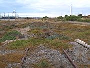
The Tramway at Whyalla (1067mm gauge) for ore haulage, and a standard gauge tramway from Proper Bay to Coffin Bay on Southern Eyre Peninsula for mineral sand haulage. The Proper Bay operation was closed in 1989, and removed in 2000.
Northern Territory railway
Northern Territory
The Northern Territory is a federal territory of Australia, occupying much of the centre of the mainland continent, as well as the central northern regions...
was part of South Australia from 1863 to 1911, when it was transferred to Commonwealth
Government of Australia
The Commonwealth of Australia is a federal constitutional monarchy under a parliamentary democracy. The Commonwealth of Australia was formed in 1901 as a result of an agreement among six self-governing British colonies, which became the six states...
control.
The Palmerston and Pine Creek Railway
Palmerston and Pine Creek Railway
The North Australia Railway , also known as the Palmerston to Pine Creek railway, was a narrow gauge railway which ran from Darwin, once known as Palmerston, to Birdum, just south of Larrimah.-History:...
was a narrow gauge (1067 mm) railway and ran from Darwin
Darwin, Northern Territory
Darwin is the capital city of the Northern Territory, Australia. Situated on the Timor Sea, Darwin has a population of 127,500, making it by far the largest and most populated city in the sparsely populated Northern Territory, but the least populous of all Australia's capital cities...
, once known as Palmerston, to Pine Creek.
The John Cox Bray Government in South Australia
South Australia
South Australia is a state of Australia in the southern central part of the country. It covers some of the most arid parts of the continent; with a total land area of , it is the fourth largest of Australia's six states and two territories.South Australia shares borders with all of the mainland...
introduced the Palmerston and Pine Creek Railway Bill in 1883. The £959,300 contract went to C & E Millar of Melbourne on the proviso that they could use coolie labour. The line reached Pine Creek
Pine Creek, Northern Territory
Pine Creek is a small town in the Katherine region of the Northern Territory, Australia. According to the 2001 Australian census 665 people live in Pine Creek, which is the fourth largest town between Darwin and Alice Springs....
in 1888 and was officially opened on 30 September 1889. Singhalese and Indian gangs did the grubbing and earthwork and 3,000 Chinese labourers laid over 1 km of track per day. A total of 310 bridges and flood opening
Flood opening
A flood opening or flood vent is an orifice in an enclosed structure intended to allow the free passage of water between the interior and exterior.-Flood Openings in the United States:...
s were built.
The Commonwealth Government
Government of Australia
The Commonwealth of Australia is a federal constitutional monarchy under a parliamentary democracy. The Commonwealth of Australia was formed in 1901 as a result of an agreement among six self-governing British colonies, which became the six states...
took over the line in 1911 and renamed it the Northern Territory Railway. The line was extended to Katherine
Katherine, Northern Territory
Katherine is a town situated southeast of Darwin in the "Top End" of Australia in the Northern Territory. It is the fourth largest settlement in the Territory after the capital Darwin, Palmerston and Alice Springs...
in 1917. Further extensions in the 1920s saw it eventually reach Birdum, just south of Larrimah
Larrimah, Northern Territory
Larrimah is a tiny hamlet in the Northern Territory of Australia. It has a population of 18. It is built along the Stuart Highway and offers petrol and supplies to passing motorists. It was the railhead on the North Australia Railway during World War II....
, in 1929, when it was further renamed the North Australia Railway, to distinguish it from the Central Australia Railway, which reached Alice Springs from the south in the same year.
Although a railway line from Alice Springs
Alice Springs, Northern Territory
Alice Springs is the second largest town in the Northern Territory of Australia. Popularly known as "the Alice" or simply "Alice", Alice Springs is situated in the geographic centre of Australia near the southern border of the Northern Territory...
to Darwin
Darwin, Northern Territory
Darwin is the capital city of the Northern Territory, Australia. Situated on the Timor Sea, Darwin has a population of 127,500, making it by far the largest and most populated city in the sparsely populated Northern Territory, but the least populous of all Australia's capital cities...
had been discussed for many years, the North
Australia Railway was closed in 1976. However eventually the standard gauge Adelaide to Darwin Railway was finally completed on 17 September 2003 with the line between Alice Springs and Darwin. The first freight train reached Darwin on 17 January 2004.
Adelaide suburban network
Adelaide's metropolitan rail networkRailways in Adelaide
The rail network in Adelaide, South Australia, consists of five lines and 81 stations, totalling 125.9 km. It is operated by Adelaide Metro, and is part of the city-wide Adelaide Metro]public transport system. Apart from the Glenelg Tram, Adelaide's railway system is serviced entirely by...
is the only one in Australia
Australia
Australia , officially the Commonwealth of Australia, is a country in the Southern Hemisphere comprising the mainland of the Australian continent, the island of Tasmania, and numerous smaller islands in the Indian and Pacific Oceans. It is the world's sixth-largest country by total area...
's five major cities that has not been electrified. Almost $500 million in funding has been provided in the 2008-09 State Budget for electrification and gauge conversion.
In Adelaide, concrete sleepers, installed since the 1990s are of a slightly more expensive gauge convertible
Gauge conversion
In rail transport, gauge conversion is the process of converting a railway from one rail gauge to another, through the alteration of the railway tracks...
type to facilitate the conversion.
Mid north
- Port BroughtonPort Broughton, South AustraliaPort Broughton is a small South Australian town located on the Yorke Peninsula on the east coast of Spencer Gulf. It is situated about 170 km north west of Adelaide, and 56 km south of Port Pirie At the 2006 census, Port Broughton had a population of 908....
- MundooraMundoora, South AustraliaMundoora is a settlement in South Australia. In 1876, Mundoora was connected to Port Broughton by a horse drawn railway. This has since fallen into disuse. At the 2006 census, Mundoora had a population of 248.-References:...
(1876) was horse-drawn uphill, and gravity-powered to carry bagged wheatWheatWheat is a cereal grain, originally from the Levant region of the Near East, but now cultivated worldwide. In 2007 world production of wheat was 607 million tons, making it the third most-produced cereal after maize and rice...
down to the port. - Adelaide - Kapunda, later extended to MorganMorgan, South AustraliaMorgan is a town in South Australia on the right bank of the Murray River, just downstream of where it turns from flowing roughly westwards to roughly southwards. It is about north east of Adelaide, and about upstream of the Murray Mouth. At the 2006 census, Morgan had a population of 426.The...
, with junctionJunction (rail)A junction, in the context of rail transport, is a place at which two or more rail routes converge or diverge.This implies a physical connection between the tracks of the two routes , 'points' and signalling.one or two tracks each meet at a junction, a fairly simple layout of tracks suffices to...
s at GawlerGawler, South AustraliaGawler is the first country town in the state of South Australia, and is named after the second Governor of the colony of South Australia, George Gawler. It is located north of the centre of the state capital, Adelaide, and is close to the major wine producing district of the Barossa Valley...
and RoseworthyRoseworthy, South AustraliaRoseworthy is a small town in South Australia, about 10 km north of Gawler. At the 2006 census, Roseworthy had a population of 668.Roseworthy has a large grain storage facility consisting of both storage silos and bunkers for grain grown in the surrounding areas, and grain is collected by rail to... - Roseworthy - BurraBurra, South AustraliaBurra is a pastoral centre and historic tourist town in the mid-north of South Australia. It lies east of the Clare Valley in the Bald Hills range, part of the northern Mount Lofty Ranges, and on Burra Creek. The town began as a single company mining township that, by 1851, was a set of townships ...
, later extended to TerowieTerowie, South AustraliaTerowie is a small town in the mid-north of South Australia located north of Adelaide. It is located in the Regional Council of Goyder. Terowie retains a number of authentic and well preserved 1880s buildings, and has been declared a "historic town". It also remains a town of interest to those...
, then PeterboroughPeterborough, South AustraliaPeterborough is a town in the mid north of South Australia, in wheat country, just off the Barrier Highway. At the 2006 census, Peterborough had a population of 1,689....
, with junctions at Hamley BridgeHamley Bridge, South AustraliaHamley Bridge is a community in South Australia located at the junction of the Gilbert and Light rivers, as well as the site of a former railway junction....
and RivertonRiverton, South AustraliaRiverton is a small town of distinctive character and interest to travellers in the Mid North of South Australia, in the Gilbert Valley. It is situated on the Gilbert River, from which the town derives its name...
(now closed beyond Burra) - Hamley Bridge - BalaklavaBalaklava, South AustraliaThe town of Balaklava is located in South Australia, 92 kilometres north of Adelaide in the Mid North region. It is on the banks of the Wakefield River, 25 kilometres east of Port Wakefield.-History:...
, continuing through BrinkworthBrinkworth, South AustraliaBrinkworth is a town in the Mid North region of South Australia with a current population of 401. It is 32 km north of the regional centre of Clare.The Brinkworth area was first settled in the 1860s and the town laid out in 1892...
to GladstoneGladstone, South AustraliaGladstone is a small rural town in the Mid North of South Australia in the approach to the lower Flinders Ranges. At the 2006 census, Gladstone had a population of 629.... - Brinkworth - SnowtownSnowtown, South AustraliaThe town of Snowtown is located in the Mid North of South Australia 145 km north of Adelaide and lies on the main route between Adelaide and Perth. The town's elevation is 103 metres and on average the town receives 389 mm of rainfall per annum.-History:...
- KadinaKadina, South AustraliaKadina is a town located on the Yorke Peninsula of South Australia, approximately 144 kilometres north-northwest of the state capital of Adelaide. The largest town of the Peninsula, Kadina is one of the three Copper Triangle towns famous for their shared copper mining history...
- WallarooWallaroo, South AustraliaWallaroo is a port town on the western side of Yorke Peninsula in South Australia, 160 kilometres north-northwest of Adelaide. It is one of the three Copper Triangle towns famed for their historic shared copper mining industry, and known together as "Little Cornwall", the other two being Kadina ...
- MoontaMoonta, South AustraliaMoonta is a town located on the Yorke Peninsula of South Australia, 165 kilometres north-northwest of the state capital of Adelaide. It is one of three towns known as the Copper Coast or "Little Cornwall" for their shared copper mining history.... - Gawler to PenricePenrice, South AustraliaPenrice is a small town in the Barossa Valley of South Australia, just north of Angaston. It is the site of a large limestone and marble quarry operated by Penrice Soda Products.Penrice was named by Captain Rodda after Penrice, a town in Glamorganshire, Wales...
and AngastonAngaston, South AustraliaAngaston is a town in the Barossa Valley, South Australia, 77 km north east of Adelaide. Its elevation is 347 m, one of the highest points in the valley, and has an average rainfall of 561 mm...
in the Barossa ValleyBarossa ValleyThe Barossa Valley is a major wine-producing region and tourist destination of South Australia, located 60 km northeast of Adelaide. It is the valley formed by the North Para River, and the Barossa Valley Way is the main road through the valley, connecting the main towns on the valley floor of...
, carries marbleMarbleMarble is a metamorphic rock composed of recrystallized carbonate minerals, most commonly calcite or dolomite.Geologists use the term "marble" to refer to metamorphosed limestone; however stonemasons use the term more broadly to encompass unmetamorphosed limestone.Marble is commonly used for...
from a quarry at Penrice to sodaSodium carbonateSodium carbonate , Na2CO3 is a sodium salt of carbonic acid. It most commonly occurs as a crystalline heptahydrate, which readily effloresces to form a white powder, the monohydrate. Sodium carbonate is domestically well-known for its everyday use as a water softener. It can be extracted from the...
works at OsborneOsborne, South AustraliaOsborne is a north-western suburb of Adelaide, South Australia, Australia 19 km from the CBD, in the City of Port Adelaide Enfield. It is on the LeFevre Peninsula, adjacent to Outer Harbor, Taperoo and North Haven...
, near Port Adelaide - Riverton to ClareClare, South AustraliaThe town of Clare is located in South Australia in the Mid North region, 136 km north of Adelaide. It gives its name to the Clare Valley wine and tourist region.-History:One of the first settlers in the area was John Horrocks, in 1839...
and SpaldingSpalding, South AustraliaSpalding is a town located north of the Clare Valley in South Australia, Australia at . At the 2006 census, Spalding had a population of 212.It is mainly a farming community and also is home to a slate quarry....
- closed, the easement is now used for the Riesling TrailRiesling TrailThe Riesling Trail is a 35 kilometre walking and cycling track located in the Clare Valley, South Australia. It runs between Auburn and Clare, passing through several towns and villages along the way, including Leasingham, Watervale, Penwortham and Sevenhill. A recent extension now extends 8km...
cycle path through the Clare ValleyClare ValleyThe Clare Valley is one of Australia's oldest wine regions, best known for Riesling wines. It lies in the Mid North of South Australia, approximately 120 km north of Adelaide. The valley runs north-south, with Main North Road as the main thoroughfare.... - Adelaide - Port PiriePort Pirie, South Australia-Transport:Port Pirie is located off National Highway One. It is serviced by an airport five minutes out of the city.- Railways :The first railways in Port Pirie were of the narrow [3' 6"] gauge....
- Port WakefieldPort Wakefield, South AustraliaPort Wakefield was the first government town to be established north of the capital, Adelaide, in South Australia.Port Wakefield is situated approximately 98.7 kilometres from Adelaide and lies on the Port Wakefield Road section of the A1 National Highway...
- Balaklava - Port WakefieldPort Wakefield, South AustraliaPort Wakefield was the first government town to be established north of the capital, Adelaide, in South Australia.Port Wakefield is situated approximately 98.7 kilometres from Adelaide and lies on the Port Wakefield Road section of the A1 National Highway...
- Kadina
Branches from the Melbourne line
- BalhannahBalhannah, South AustraliaBalhannah is a town in the Adelaide Hills about 30 km southeast of Adelaide, the capital of South Australia. It was established in 1839 as a farming community. The fruit cold store built in 1914 was one of the first in Australia and is still in use. It is on the main interstate railway between...
to Mount PleasantMount Pleasant, South AustraliaMount Pleasant is a town situated at the northern end of the Adelaide Hills region of South Australia, 55 kilometres east-north-east of the state capital, Adelaide . It is located in the Barossa Council and Mid Murray Council local government areas, and is at an altitude of 440 metres above sea level...
via OakbankOakbank, South AustraliaOakbank is a town in the Adelaide Hills, east of Adelaide in South Australia. It is in the Adelaide Hills Council area. At the 2006 census, Oakbank had a population of 473.The town was founded in about 1840 by Scottish brothers James and Andrew Johnston...
, WoodsideWoodside, South AustraliaWoodside is a town in the Adelaide Hills region of South Australia. The town is between Balhannah and Lobethal, from the state capital, Adelaide. Amenities include a swimming pool, , second hand store, grocery store, tennis club, bowls club and playing fields. The Johnston family of Oakbank...
, Mount TorrensMount Torrens, South AustraliaMount Torrens is a town in the eastern Adelaide Hills region of South Australia, 46 kilometres east-north-east of the state capital, Adelaide and 8 km east of Lobethal along the Onkaparinga River. It is located in the Adelaide Hills Council local government area...
and BirdwoodBirdwood, South AustraliaBirdwood is a town near Adelaide, South Australia. It is located in the Adelaide Hills Council local government area.- Origin of the name :Formerly known as Blumberg, the German town name was anglicized during World War I, along with many others in the region in 1917...
. Opened 1918, closed 1963 (tracks have since been totally removed) - Mount BarkerMount Barker, South AustraliaMount Barker is an expanding city, home to 10 258 residents that is 33 kilometres up the South Eastern Freeway, east of Adelaide, in South Australia. It is the seat of the District Council of Mount Barker, is the largest town in the Adelaide Hills, and is one of the fastest growing areas in the...
to Goolwa and Victor Harbor- Sandergrove to Milang via Nurragi. A 13 kilometre spur line opened in 1884 and closed in 1970 (line dismantled)
- MonartoMonarto, South AustraliaMonarto is a region and formerly proposed city in South Australia. It is north of the South Eastern Freeway between the Callington and Murray Bridge exits 63 km from Adelaide....
(west of Murray Bridge) north to CambraiCambrai, South AustraliaCambrai is a small town located on the eastern side of the Mount Lofty Ranges, along the River Marne and at the northern end of the former Apamurra to Sedan railway line. Originally named Rhine Villa, it was one of many Australian towns re-named during World War I to remove any connection with...
(shortened to Apamurra near PalmerPalmer, South AustraliaPalmer is a town just east of the Adelaide Hills region of South Australia along the Adelaide-Mannum Road, 70 kilometres east-north-east of the state capital, Adelaide and 15 km west-north-west of Mannum . It is located in the Mid Murray Council local government area...
before being closed). The rails from that section were reused in 2001 by Pichi Richi RailwayPichi Richi RailwayThe Pichi Richi Railway Preservation Society is a non-profit railway preservation society and operating museum formed in 1973. The society, managed and staffed by volunteers, operates heritage steam and diesel trains on the restored 39 km section of track between Quorn and Port Augusta in...
to extend their narrow gauge track from Stirling North to Port AugustaPort Augusta, South Australia-Electricity generation:Electricity is generated at the Playford B and Northern power stations from brown coal mined at Leigh Creek, 250 km to the north... - Tailem BendTailem Bend, South AustraliaTailem Bend is a town on the Murray River in South Australia. The town was proclaimed in 1887, the year after the main railway came through. At the 2006 census, Tailem Bend had a population of 1,457....
(south east of Murray Bridge) to PinnarooPinnaroo, South AustraliaPinnaroo is a town in the Murray Mallee region of South Australia, near the border with Victoria 243 km east of Adelaide. Pinnaroo is on the Mallee Highway, and the railway line between Tailem Bend and Ouyen. The roadhouses on the highway are the first food and leg-stretch stop on the bus route...
continuing into VictoriaVictoria (Australia)Victoria is the second most populous state in Australia. Geographically the smallest mainland state, Victoria is bordered by New South Wales, South Australia, and Tasmania on Boundary Islet to the north, west and south respectively....
to OuyenOuyen, VictoriaOuyen is a town in Victoria, Australia, located in the Rural City of Mildura at the junction of the Calder Highway and Mallee Highway, south of Mildura and north-west of Melbourne. At the 2006 census the town had a population of 1,061.-History:... - Tailem Bend - KaroondaKaroonda, South AustraliaKaroonda is in the middle of the Murray Mallee region of South Australia at geographic coordinates . Karoonda takes its name from the Aboriginal word for "winter camp"....
- AlawoonaAlawoona, South AustraliaAlawoona is a settlement in South Australia. At the 2006 census, Alawoona had a population of 250.-Notes and references:...
- LoxtonLoxton, South AustraliaLoxton is a town on the south bank of the River Murray in the Riverland region of South Australia. At the 2006 census, Loxton had a population of 3,431....
(still in use - the other branches off this line have been removed)- Karoonda to WaikerieWaikerie, South AustraliaWaikerie is a rural town in the Riverland region of South Australia on the south bank of the Murray River. At the 2006 census, Waikerie had a population of 1,744. The Sturt Highway passes to the south of the town at the top of the cliffs...
- WanbiWanbi, South AustraliaWanbi is a settlement in South Australia. At the 2006 census, Wanbi had a population of 154....
- Yinkanie (near MoorookMoorook, South AustraliaMoorook is a settlement in South Australia. It is part of a series of towns surrounding lakes in the Riverland region in Australia. At the 2006 census, Moorook had a population of 289.-References:...
) - Alawoona - RenmarkRenmark, South AustraliaRenmark is a town in South Australia's rural Riverland area, and is located 254 km northeast of Adelaide, on the banks of the River Murray. The Sturt Highway between Adelaide and Sydney runs through the town; Renmark is the last major town encountered in South Australia when driving this route. It...
and BarmeraBarmera, South AustraliaBarmera is a town in the Riverland region of South Australia. It is on the Sturt Highway A20, 220 kilometres north-east of Adelaide, the capital of the state of South Australia. It is primarily an agricultural and viticultural town and is located on Lake Bonney , a freshwater lake...
, crossing the Murray River at ParingaParinga, South AustraliaParinga is a small town in the Riverland of South Australia. Paringa is famous for its vineyards, almond, citrus and stone fruit orchards, and the beautiful steel bridge with a span that can be raised to allow houseboats and paddlesteamers to pass underneath. across the Murray River to Renmark.... - Karoonda - Peebinga
- Karoonda to Waikerie
- WolseleyWolseley, South AustraliaWolseley is a small South Australian town near the Victorian border. It is five kilometres south of the Dukes Highway and 13 kilometres east of Bordertown. It was first proclaimed a town in 1884....
(between BordertownBordertown, South AustraliaBordertown is a small South Australian town near the Victorian border. It is where the Dukes Highway and the railway line, the two main routes between Adelaide and Melbourne, cross Tatiara Creek....
and the state border) through NaracoorteNaracoorte, South AustraliaNaracoorte is a town in the Limestone Coast region of South Australia, approximately 336 kilometres south east of Adelaide and 100 kilometres north of Mount Gambier on the Riddoch Highway .-History:...
to Mount GambierMount Gambier, South AustraliaMount Gambier is the largest regional city in South Australia located approximately 450 kilometres south of the capital Adelaide and just 17 kilometres from the Victorian border....
, branching west to MillicentMillicent, South AustraliaMillicent is a town in South Australia, south-east of Adelaide, and north of Mount Gambier. At the 2006 Census, the population was 4,771.The town is home to the Millicent National Trust Museum, and is nearby to the Tantanoola Caves Conservation Park and the Canunda National Park.The Millicent...
and east to the Victorian network at HeywoodHeywood, VictoriaHeywood is a town on the Fitzroy River in the Australian state of Victoria. It is situated at an elevation of 27 metres amidst rolling green hills in an agricultural, pastoral and timbercutting district. Heywood is west of Melbourne at the intersection of the Princes and Henty Highways and north...
near PortlandPortland, VictoriaThe city of Portland is the oldest European settlement in what is now the state of Victoria, Australia. It is the main urban centre of the Shire of Glenelg. It is located on Portland Bay.-History:...
- Naracoorte - Kingston SEKingston SE, South AustraliaKingston SE is a town approximately 297 km southeast of Adelaide, the capital of South Australia, and 44 km from the town of Robe. It is at the southeastern end of Encounter Bay and the Coorong. At the 2006 census, Kingston SE had a population of 1,443.-History:The town was named after...
opened 1877, closed.
- Naracoorte - Kingston SE
North
- Broken Hill - Port Pirie
- Peterborough - Port AugustaPort Augusta, South Australia-Electricity generation:Electricity is generated at the Playford B and Northern power stations from brown coal mined at Leigh Creek, 250 km to the north...
via OrrorooOrroroo, South AustraliaOrroroo is a town in the Flinders Ranges region of South Australia. At the 2006 census, Orroroo had a population of 543. The Wilmington-Ucolta Road passes through here, intersecting there with the southern stretch of the Birdsville and Oodnadatta Tracks. The narrow gauge rail line was extended to...
and QuornQuorn, South AustraliaQuorn is a township and railhead in the Flinders Ranges in the north of South Australia, 39 km northeast of Port Augusta. At the 2006 census, Quorn had a population of 1068.Quorn is the home of the Flinders Ranges Council local government area... - Port Pirie - Port Augusta
- Central Australia Railway: Quorn - MarreeMarree, South AustraliaMarree is a small town located in the north of South Australia. It lies North of Adelaide at the junction of the Oodnadatta Track and the Birdsville Track, above sea level. The area is the home of the Dieri people. At the 2006 census, Marree had a population of 70.The town was home to Australia's...
(1883) - OodnadattaOodnadatta, South AustraliaOodnadatta, South Australia, is a small town surrounded by an area of with cattle stations in arid pastoral rangelands close to the Simpson Desert, north of Adelaide and 112 m above sea level. It can be reached by an unsealed road from Coober Pedy or via the unsealed Oodnadatta Track from...
(1891) - Alice Springs (1929) (narrow gauge) - closed in 1980 - Port Augusta - Marree (standard gauge) (1957) replaced the narrow gauge line to Marree. Now used to haul coalCoalCoal is a combustible black or brownish-black sedimentary rock usually occurring in rock strata in layers or veins called coal beds or coal seams. The harder forms, such as anthracite coal, can be regarded as metamorphic rock because of later exposure to elevated temperature and pressure...
from Leigh CreekLeigh Creek, South AustraliaLeigh Creek is a coal-mining town in the north of South Australia. At the 2006 census, Leigh Creek had a population of 549....
to the power stationPower stationA power station is an industrial facility for the generation of electric energy....
s at Port Augusta. - Port Augusta - Kalgoorlie, Western AustraliaKalgoorlie, Western AustraliaKalgoorlie, known as Kalgoorlie-Boulder, is a town in the Goldfields-Esperance region of Western Australia, and is located east-northeast of state capital Perth at the end of the Great Eastern Highway...
- the first standard gauge line, built in 1917 - Port Augusta - WhyallaWhyalla, South Australia-Demographics:According to the 2006 Census the population of the Whyalla census area was 21,122 people, making it the second largest urban area in the state outside of Adelaide...
(1972) standard gauge - TarcoolaTarcoola, South AustraliaTarcoola is a town in the Far North of South Australia 416 km north-northwest of Port Augusta.Tarcoola is taken from a non-local aboriginal language from an area around Tarcoola Station in NSW; it means river bend.-History:Tarcoola Post Office opened on 18 August 1900 and the town was...
- Alice Springs (1980)
Eyre Peninsula
Genesee and Wyoming AustraliaGenesee and Wyoming Australia
Genesee and Wyoming Australia is an Australian rail freight operator based in Adelaide, South Australia. It is a 100 percent owned subsidiary of Genesee and Wyoming Inc based in the USA, and was formed in June 2006 to run the South Australian operations of the Australian Railroad Group joint...
(GWA) owned
- Port LincolnPort Lincoln, South Australia- Transport :Port Lincoln is the port for the isolated narrow gauge Eyre Peninsular Railway.There is also a subsidiary port at Proper Bay which may be restored to use for iron ore traffic. The export of iron ore through Port Lincoln has been approved by the South Australian Government. Port...
- ThevenardThevenard, South AustraliaThevenard is a port town 3 km east of Ceduna, South Australia. It is named after nearby Cape Thevenard, which in turn had been named after Antoine-Jean-Marie Thévenard, a French admiral. At the 2006 census, Thevenard had a population of 776.The port at Thevenard, handles bulk grain, gypsum...
(west of CedunaCeduna, South AustraliaCeduna is a small town in the West Coast region of South Australia. It is situated in the northwest corner of Eyre Peninsula, facing the islands of the Nuyts Archipelago. It lies west of the junction of the Flinders and Eyre Highways around 786 km northwest of the capital Adelaide. The port...
) with a junction at CumminsCummins, South AustraliaCummins is a town on Eyre Peninsula in South Australia, 67 km north of Port Lincoln and 68 m above sea level. At the 2006 census, the town had a population of 705....
and Yeelanna. - ThevenardThevenard, South AustraliaThevenard is a port town 3 km east of Ceduna, South Australia. It is named after nearby Cape Thevenard, which in turn had been named after Antoine-Jean-Marie Thévenard, a French admiral. At the 2006 census, Thevenard had a population of 776.The port at Thevenard, handles bulk grain, gypsum...
to Penong (Via Kevin) (Kevin - Penong Closed) - Cummins - BucklebooBuckleboo, South AustraliaBuckleboo is a wheat farming community 35 km northwest of Kimba, on South Australia's Eyre Peninsula.Buckleboo is home to 'Buckleboo Park' which consists of 6 tennis courts and an oval for Australian Rules Football and Cricket...
(north of KimbaKimba, South AustraliaKimba is a rural service town on the Eyre Highway at the top of Eyre Peninsula in South Australia. At the 2006 census, Kimba had a population of 636 and it has an annual rainfall of 339 mm. There is 7 metre tall statue of a big galah beside the highway marking halfway between the east and west...
) (Kimba - Buckleboo Dormant) - Yeelanna - Kapinnie (Dormant)
GWA managed
- Whyalla - Iron KnobIron Knob, South AustraliaIron Knob is a town in South Australia on the Eyre Highway across Eyre Peninsula. At the 2006 census, Iron Knob and the surrounding area had a population of 199....
(private - owned by BHPBHP BillitonBHP Billiton is a global mining, oil and gas company headquartered in Melbourne, Australia and with a major management office in London, United Kingdom...
/OneSteelOneSteelOneSteel is an Australian-based mining, ore processing and steel manufacturing company specialising in steel-long products for the construction, mining, transport and agricultural industries...
) - narrow gauge, opened 1901, carries iron ore - Whyalla (109 km) - Iron BaronIron Baron, South AustraliaIron Baron is a settlement in South Australia....
(private - owned by BHPBHP BillitonBHP Billiton is a global mining, oil and gas company headquartered in Melbourne, Australia and with a major management office in London, United Kingdom...
/OneSteelOneSteelOneSteel is an Australian-based mining, ore processing and steel manufacturing company specialising in steel-long products for the construction, mining, transport and agricultural industries...
) opened 1930, extended to Iron Duke in 1990
BHP Billiton
BHP Billiton
BHP Billiton is a global mining, oil and gas company headquartered in Melbourne, Australia and with a major management office in London, United Kingdom...
owned
- Proper Bay (near Port Lincoln) to Coffin Bay to carry lime sand between 1960 and 1989
External links
- National Rail Museum - history of rail in South Australia
- Peninsula Pioneer - history of the railways of Eyre Peninsula
- Railpage Australia - discussion forums and news
- RailSA - discussion forums and news
- South Australian Railway Page
- SAR Weekly Notices and Annual Report indexes
Maps: