
Pacific Crest Trail
Encyclopedia
The Pacific Crest Trail (commonly referred to as the PCT, and occasionally designated as the Pacific Crest National Scenic Trail) is a long-distance mountain hiking
and equestrian
trail on the Western Seaboard
of the United States
. The southern terminus is at the California
border with Mexico
. The trail continues through the states of California, Oregon
, and Washington
before reaching its northern terminus in British Columbia, Canada.
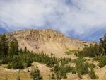
The trail follows the highest portion of the Sierra Nevada and Cascade Range
, which parallel the Pacific Ocean
by 100 to 150 mi (160.9 to 241.4 km). The Pacific Crest Trail is 2663 mi (4,286 km) long and ranges in elevation from just above sea level at the Oregon-Washington border to 13153 feet (4,009 m) at Forester Pass
in the Sierra Nevada. The route passes through 25 national forests and 7 national parks.
It was designated a National Scenic Trail
in 1968, although it was not officially completed until 1993. The PCT was conceived by Clinton C. Clarke in 1932; however it was not given official status until the National Trails System
Act of 1968.
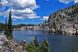
. The trail avoids civilization, and covers scenic and pristine mountainous terrain with few roads. It passes through the Laguna
, San Jacinto
, San Bernardino
, San Gabriel
, Liebre, Tehachapi
, Sierra Nevada, and Klamath
ranges in California
, and the Cascade Range
in California
, Oregon
, and Washington states.
A parallel route for bicycles, the Pacific Crest Bicycle Trail
(PCBT) is a 2,500 mile route designed to closely parallel the PCT on roads. The PCT and PCBT cross in about 27 places along their routes.
, Oregon
, and Washington. The original proposal was to link the John Muir Trail
, the Tahoe-Yosemite Trail (both in California), the Skyline Trail (in Oregon) and the Cascade Crest Trail (in Washington).
The Pacific Crest Trail System Conference was formed by Clarke to both plan the trail and to lobby the federal government to protect the trail. The conference was founded by Clarke, the Boy Scouts, the YMCA
, and Ansel Adams
(amongst others). From 1935 through 1938, YMCA groups explored the 2000 miles of potential trail and planned a route, which has been closely followed by the modern PCT route.
In 1968, President Lyndon Johnson defined the PCT and the Appalachian Trail
with the National Trails System Act. The PCT was then constructed through cooperation between the federal government and volunteers organized by the Pacific Crest Trail Association. In 1993, the PCT was officially declared finished.
, and Continental Divide Trail
are the three long distance trails in the U.S. Successfully thru-hiking all of these three trails is known as the “Triple Crown of hiking". Thru-hiking is a long commitment, usually taking between four and six months, that requires thorough preparation and dedication. Although the actual number is difficult to calculate, it is estimated that around 180 out of approximately 300 people who attempt a thru-hike complete the entire trail each year.
The Pacific Crest Trail Association estimates that it takes most hikers between 6 and 8 months to plan their trip.
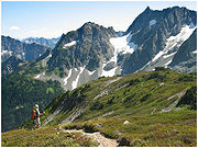
The first thing prospective thru hikers have to do when thinking about attempting a thru hike is planning their trip. The first decision during the trip planning process is to decide the route to take. Most hikers travel from the Southern Terminus at the Mexico Border north to Manning Park, British Columbia, but some hikers travel southbound. In a normal weather year, northbound hikes are most practical. If snowpack in the Sierra Nevada is high in early June and low in the Northern Cascades, some hikers may choose to 'flip-flop.' Flip-flopping can take many forms but is often the term used to describe beginning at one end (on the PCT, usually the southern end) of the trail and then, at some point, like reaching the Sierra, going to the end of the trail (Manning Park in B.C.) and hiking southbound to finish the trail.
Hikers also have to determine their resupply points. Resupply points are towns or post offices where hikers replenish food and other supplies such as cooking fuel. Hikers can ship packages to themselves at the U.S. Post Offices along the trail, resupply at general and grocery stores along the trail, or any combination of the two. The final major logistical step is to create an approximate schedule for completion. Thru hikers have to make sure they complete enough miles every day so they will be able to reach the opposite end of the trail before weather conditions make sections impassable. However, the snow pack in the Sierra Nevada can prevent an early start. The timing is a balance of not getting to the Sierra too soon nor the Northern Cascades too late. Most hikers cover about 20 miles (32 km) per day.
In order to reduce their hiking time to increase their chances of completion many hikers try to substantially reduce their pack weight. Since the creation of the Pacific Crest Trail there has been a large movement by hikers away from large heavy packs with a lot of gear. There are three classifications for hikers: Traditional, Lightweight, and Ultralight
. Very few hikers are traditional hikers anymore. The Pacific Crest Trail Association cites Ray Jardine’s book Beyond Backpacking as a great resource for hikers during the planning process. Beyond Backpacking is a “how-to” book for ultralight hikers. In this book Jardine explains how to trim every extra ounce from one’s pack weight by doing everything from cutting extra straps off your pack to eating only food that does not have to be cooked.
In 1970, Eric Ryback, a 17-year-old student, was popularly credited as the first thru-hiker on the trail. Ryback's 1971 book The High Adventure of Eric Ryback: Canada to Mexico on Foot focused public attention on the PCT. Ryback carried an 80-pound pack on his 1970 thru-hike. He had only five resupply packages on the entire trip, and was loaded with 40 pounds of food at the start of each leg. He often ran out of food and foraged or went hungry. Ryback was not only was the first, he helped the forest service lay out future plans for the PCT. The guide books "The Pacific Crest Trail: Volume One and Volume Two", raised doubts about Ryback's claim and produced evidence that he accepted rides for some of the journey. Ryback and Chronicle Publishers sued Wilderness Press, the publisher of the guide books, but the suits were dropped in 1974.
The first person to hike the PCT from south to north was Richard Watson, who completed the trail on September 1, 1972. Watson was often credited as the first PCT thru-hiker, because Papendick was generally unknown, and Ryback may have accepted rides The first woman to complete the PCT was Mary Carstens, who finished the journey later in 1972 accompanied by Jeff Smukler.
The first person to thru-hike the entire PCT both ways in a single continuous round-trip was Scott Williamson
, who completed the "yo-yo" circuit on his fourth attempt in November 2004. Williamson traveled a total of 5300 miles (8,529.5 km) in 197 days, covering an average of 35 to 40 mi (56.3 to 64.4 km) per day when not in snow—an overall average of 27 miles (43.5 km) per day—wearing an extremely ultra-lightweight pack
, which "without food, weighed about 8.5 pounds (3.9 kg)". Williamson then went on to complete a second round trip on November 28, 2006, cutting two weeks off his 2004 time.
The youngest person to successfully thru-hike the trail is Mary Chambers, who hiked the route from April–October 2004 at the age of 10. She completed the trek with her parents, Barbara Egbert and Gary Chambers. Egbert authored a book about their experiences on the trail, entitled Zero Days. It was published in January 2008 by Wilderness Press
.
The oldest person to successfully thru-hike the trail is not known.
Red Dunning Show. The Mulfords even made a 90-minute movie and showed it around 12 western states for 10 years.
The Murray family—Barry, Bernice, Barry Jr. and Bernadette—completed the trek on horseback on October 7, 1970.
was reached.
Portland, Oregon's 40 Mile Loop
proposes to extend the Springwater Corridor
hiking and bicycling spur trail to connect to the Pacific Crest Trail.
Hiking
Hiking is an outdoor activity which consists of walking in natural environments, often in mountainous or other scenic terrain. People often hike on hiking trails. It is such a popular activity that there are numerous hiking organizations worldwide. The health benefits of different types of hiking...
and equestrian
Equestrianism
Equestrianism more often known as riding, horseback riding or horse riding refers to the skill of riding, driving, or vaulting with horses...
trail on the Western Seaboard
West Coast of the United States
West Coast or Pacific Coast are terms for the westernmost coastal states of the United States. The term most often refers to the states of California, Oregon, and Washington. Although not part of the contiguous United States, Alaska and Hawaii do border the Pacific Ocean but can't be included in...
of the United States
United States
The United States of America is a federal constitutional republic comprising fifty states and a federal district...
. The southern terminus is at the California
California
California is a state located on the West Coast of the United States. It is by far the most populous U.S. state, and the third-largest by land area...
border with Mexico
Mexico
The United Mexican States , commonly known as Mexico , is a federal constitutional republic in North America. It is bordered on the north by the United States; on the south and west by the Pacific Ocean; on the southeast by Guatemala, Belize, and the Caribbean Sea; and on the east by the Gulf of...
. The trail continues through the states of California, Oregon
Oregon
Oregon is a state in the Pacific Northwest region of the United States. It is located on the Pacific coast, with Washington to the north, California to the south, Nevada on the southeast and Idaho to the east. The Columbia and Snake rivers delineate much of Oregon's northern and eastern...
, and Washington
Washington State
Washington State may refer to:* Washington , often referred to as "Washington state" to differentiate it from Washington, D.C., the capital of the United States* Washington State University, a land-grant college in that state- See also :...
before reaching its northern terminus in British Columbia, Canada.
The trail follows the highest portion of the Sierra Nevada and Cascade Range
Cascade Range
The Cascade Range is a major mountain range of western North America, extending from southern British Columbia through Washington and Oregon to Northern California. It includes both non-volcanic mountains, such as the North Cascades, and the notable volcanoes known as the High Cascades...
, which parallel the Pacific Ocean
Pacific Ocean
The Pacific Ocean is the largest of the Earth's oceanic divisions. It extends from the Arctic in the north to the Southern Ocean in the south, bounded by Asia and Australia in the west, and the Americas in the east.At 165.2 million square kilometres in area, this largest division of the World...
by 100 to 150 mi (160.9 to 241.4 km). The Pacific Crest Trail is 2663 mi (4,286 km) long and ranges in elevation from just above sea level at the Oregon-Washington border to 13153 feet (4,009 m) at Forester Pass
Forester Pass
Forester Pass is a mountain pass in the Sierra Nevada. Located on the Kings-Kern Divide on the boundary between Sequoia National Park and Kings Canyon National Park, Forester Pass connects the drainages of Bubbs Creek and the Kern River...
in the Sierra Nevada. The route passes through 25 national forests and 7 national parks.
It was designated a National Scenic Trail
National Scenic Trail
National Scenic Trail is a designation for protected areas in the United States that consist of trails of particular natural beauty.National Scenic Trails were authorized under the National Trails System Act of 1968 along with National Historic Trails and National Recreation Trails...
in 1968, although it was not officially completed until 1993. The PCT was conceived by Clinton C. Clarke in 1932; however it was not given official status until the National Trails System
National Trails System
The National Trails System was created by the National Trails System Act The Act created a series of National trails "to promote the preservation of, public access to, travel within, and enjoyment and appreciation of the open-air, outdoor areas and historic resources of the Nation." Specifically,...
Act of 1968.
Route
The route is mostly through National Forest and—where possible—protected wildernessWilderness
Wilderness or wildland is a natural environment on Earth that has not been significantly modified by human activity. It may also be defined as: "The most intact, undisturbed wild natural areas left on our planet—those last truly wild places that humans do not control and have not developed with...
. The trail avoids civilization, and covers scenic and pristine mountainous terrain with few roads. It passes through the Laguna
Laguna Mountains
The Laguna Mountains are a section of the Peninsular Ranges in eastern San Diego County, California. The mountains run in a northwest/southeast alignment for approximately ....
, San Jacinto
San Jacinto Mountains
The San Jacinto Mountains are a mountain range east of Los Angeles in southern California in the United States. The mountains are named for Saint Hyacinth . The Pacific Crest Trail runs along the spine of the range.The range extends for approximately from the San Bernardino Mountains southeast to...
, San Bernardino
San Bernardino Mountains
The San Bernardino Mountains are a short transverse mountain range north and east of San Bernardino in Southern California in the United States. The mountains run for approximately 60 miles east-west on the southern edge of the Mojave Desert in southwestern San Bernardino County, north of the...
, San Gabriel
San Gabriel Mountains
The San Gabriel Mountains Range is located in northern Los Angeles County and western San Bernardino County, California, United States. The mountain range lies between the Los Angeles Basin and the Mojave Desert, with Interstate 5 to the west and Interstate 15 to the east...
, Liebre, Tehachapi
Tehachapi Mountains
The Tehachapi Mountains , regionally also called The Tehachapis, are a mountain range in the Transverse Ranges system of California in the Western United States...
, Sierra Nevada, and Klamath
Klamath Mountains
The Klamath Mountains, which include the Siskiyou, Marble, Scott, Trinity, Trinity Alps, Salmon, and northern Yolla-Bolly Mountains, are a rugged lightly populated mountain range in northwest California and southwest Oregon in the United States...
ranges in California
California
California is a state located on the West Coast of the United States. It is by far the most populous U.S. state, and the third-largest by land area...
, and the Cascade Range
Cascade Range
The Cascade Range is a major mountain range of western North America, extending from southern British Columbia through Washington and Oregon to Northern California. It includes both non-volcanic mountains, such as the North Cascades, and the notable volcanoes known as the High Cascades...
in California
California
California is a state located on the West Coast of the United States. It is by far the most populous U.S. state, and the third-largest by land area...
, Oregon
Oregon
Oregon is a state in the Pacific Northwest region of the United States. It is located on the Pacific coast, with Washington to the north, California to the south, Nevada on the southeast and Idaho to the east. The Columbia and Snake rivers delineate much of Oregon's northern and eastern...
, and Washington states.
A parallel route for bicycles, the Pacific Crest Bicycle Trail
Pacific Crest Bicycle Trail
The Pacific Crest Bicycle Trail is a 2,500-mile-long, road-based bicycle touring route from Vancouver, British Columbia, Canada to Tijuana, Baja California, Mexico...
(PCBT) is a 2,500 mile route designed to closely parallel the PCT on roads. The PCT and PCBT cross in about 27 places along their routes.
History
The Pacific Crest Trail was first proposed by Clinton C. Clarke, as a trail running from Mexico to Canada along the crest of the mountains in CaliforniaCalifornia
California is a state located on the West Coast of the United States. It is by far the most populous U.S. state, and the third-largest by land area...
, Oregon
Oregon
Oregon is a state in the Pacific Northwest region of the United States. It is located on the Pacific coast, with Washington to the north, California to the south, Nevada on the southeast and Idaho to the east. The Columbia and Snake rivers delineate much of Oregon's northern and eastern...
, and Washington. The original proposal was to link the John Muir Trail
John Muir Trail
The John Muir Trail is a long-distance trail in the Sierra Nevada mountain range of California, running between the northern terminus at Happy Isles in Yosemite Valley and the southern terminus located on the summit of Mount Whitney . For almost all of its length, the trail is in the High Sierra...
, the Tahoe-Yosemite Trail (both in California), the Skyline Trail (in Oregon) and the Cascade Crest Trail (in Washington).
The Pacific Crest Trail System Conference was formed by Clarke to both plan the trail and to lobby the federal government to protect the trail. The conference was founded by Clarke, the Boy Scouts, the YMCA
YMCA
The Young Men's Christian Association is a worldwide organization of more than 45 million members from 125 national federations affiliated through the World Alliance of YMCAs...
, and Ansel Adams
Ansel Adams
Ansel Easton Adams was an American photographer and environmentalist, best known for his black-and-white photographs of the American West, especially in Yosemite National Park....
(amongst others). From 1935 through 1938, YMCA groups explored the 2000 miles of potential trail and planned a route, which has been closely followed by the modern PCT route.
In 1968, President Lyndon Johnson defined the PCT and the Appalachian Trail
Appalachian Trail
The Appalachian National Scenic Trail, generally known as the Appalachian Trail or simply the AT, is a marked hiking trail in the eastern United States extending between Springer Mountain in Georgia and Mount Katahdin in Maine. It is approximately long...
with the National Trails System Act. The PCT was then constructed through cooperation between the federal government and volunteers organized by the Pacific Crest Trail Association. In 1993, the PCT was officially declared finished.
Thru hiking
Thru hiking is a term used in referring to hikers who complete long distance trails from end-to-end in a single trip. The Pacific Crest Trail, Appalachian TrailAppalachian Trail
The Appalachian National Scenic Trail, generally known as the Appalachian Trail or simply the AT, is a marked hiking trail in the eastern United States extending between Springer Mountain in Georgia and Mount Katahdin in Maine. It is approximately long...
, and Continental Divide Trail
Continental Divide Trail
The Continental Divide National Scenic Trail is a United States National Scenic Trail running 3,100 miles between Mexico and Canada. It follows the Continental Divide along the Rocky Mountains and traverses five U.S. states — Montana, Idaho, Wyoming, Colorado, and New Mexico...
are the three long distance trails in the U.S. Successfully thru-hiking all of these three trails is known as the “Triple Crown of hiking". Thru-hiking is a long commitment, usually taking between four and six months, that requires thorough preparation and dedication. Although the actual number is difficult to calculate, it is estimated that around 180 out of approximately 300 people who attempt a thru-hike complete the entire trail each year.
The Pacific Crest Trail Association estimates that it takes most hikers between 6 and 8 months to plan their trip.
The first thing prospective thru hikers have to do when thinking about attempting a thru hike is planning their trip. The first decision during the trip planning process is to decide the route to take. Most hikers travel from the Southern Terminus at the Mexico Border north to Manning Park, British Columbia, but some hikers travel southbound. In a normal weather year, northbound hikes are most practical. If snowpack in the Sierra Nevada is high in early June and low in the Northern Cascades, some hikers may choose to 'flip-flop.' Flip-flopping can take many forms but is often the term used to describe beginning at one end (on the PCT, usually the southern end) of the trail and then, at some point, like reaching the Sierra, going to the end of the trail (Manning Park in B.C.) and hiking southbound to finish the trail.
Hikers also have to determine their resupply points. Resupply points are towns or post offices where hikers replenish food and other supplies such as cooking fuel. Hikers can ship packages to themselves at the U.S. Post Offices along the trail, resupply at general and grocery stores along the trail, or any combination of the two. The final major logistical step is to create an approximate schedule for completion. Thru hikers have to make sure they complete enough miles every day so they will be able to reach the opposite end of the trail before weather conditions make sections impassable. However, the snow pack in the Sierra Nevada can prevent an early start. The timing is a balance of not getting to the Sierra too soon nor the Northern Cascades too late. Most hikers cover about 20 miles (32 km) per day.
In order to reduce their hiking time to increase their chances of completion many hikers try to substantially reduce their pack weight. Since the creation of the Pacific Crest Trail there has been a large movement by hikers away from large heavy packs with a lot of gear. There are three classifications for hikers: Traditional, Lightweight, and Ultralight
Ultralight backpacking
Ultralight backpacking is a style of backpacking that emphasizes carrying the lightest and simplest kit safely possible for a given trip. Base pack weight is reduced as much as safely possible, though reduction of the weight of...
. Very few hikers are traditional hikers anymore. The Pacific Crest Trail Association cites Ray Jardine’s book Beyond Backpacking as a great resource for hikers during the planning process. Beyond Backpacking is a “how-to” book for ultralight hikers. In this book Jardine explains how to trim every extra ounce from one’s pack weight by doing everything from cutting extra straps off your pack to eating only food that does not have to be cooked.
Notable hikers
Before the PCT was created, Martin Papendick was the first known person to hike across the three states of the PCT in 1952.In 1970, Eric Ryback, a 17-year-old student, was popularly credited as the first thru-hiker on the trail. Ryback's 1971 book The High Adventure of Eric Ryback: Canada to Mexico on Foot focused public attention on the PCT. Ryback carried an 80-pound pack on his 1970 thru-hike. He had only five resupply packages on the entire trip, and was loaded with 40 pounds of food at the start of each leg. He often ran out of food and foraged or went hungry. Ryback was not only was the first, he helped the forest service lay out future plans for the PCT. The guide books "The Pacific Crest Trail: Volume One and Volume Two", raised doubts about Ryback's claim and produced evidence that he accepted rides for some of the journey. Ryback and Chronicle Publishers sued Wilderness Press, the publisher of the guide books, but the suits were dropped in 1974.
The first person to hike the PCT from south to north was Richard Watson, who completed the trail on September 1, 1972. Watson was often credited as the first PCT thru-hiker, because Papendick was generally unknown, and Ryback may have accepted rides The first woman to complete the PCT was Mary Carstens, who finished the journey later in 1972 accompanied by Jeff Smukler.
The first person to thru-hike the entire PCT both ways in a single continuous round-trip was Scott Williamson
Scott Williamson (hiker)
Scott Williamson is an accomplished American thru-hiker, most noted for being the first person to complete a continuous one-season round trip of the Pacific Crest Trail . This round trip is known in hiking circles as a “yo-yo”.-Accomplishments:...
, who completed the "yo-yo" circuit on his fourth attempt in November 2004. Williamson traveled a total of 5300 miles (8,529.5 km) in 197 days, covering an average of 35 to 40 mi (56.3 to 64.4 km) per day when not in snow—an overall average of 27 miles (43.5 km) per day—wearing an extremely ultra-lightweight pack
Ultralight backpacking
Ultralight backpacking is a style of backpacking that emphasizes carrying the lightest and simplest kit safely possible for a given trip. Base pack weight is reduced as much as safely possible, though reduction of the weight of...
, which "without food, weighed about 8.5 pounds (3.9 kg)". Williamson then went on to complete a second round trip on November 28, 2006, cutting two weeks off his 2004 time.
The youngest person to successfully thru-hike the trail is Mary Chambers, who hiked the route from April–October 2004 at the age of 10. She completed the trek with her parents, Barbara Egbert and Gary Chambers. Egbert authored a book about their experiences on the trail, entitled Zero Days. It was published in January 2008 by Wilderness Press
Wilderness Press
Wilderness Press is publisher of outdoor guidebooks and maps founded in 1967. Its headquarters are located in Birmingham, Alabama. Its first publication was Sierra North, considered the authoritative guidebook for hikers and backpackers in the Northern Sierra Nevada...
.
The oldest person to successfully thru-hike the trail is not known.
Equestrian use
In 1959, Don and June Mulford made the first verifiable equestrian Thru-Ride of the PCT. The year was 1959, and the Pacific Crest Trail stretched a poorly marked 2,400 miles from Mexico to Canada. More concept than footpath, the trail was an oft-broken, high-ridge track disappearing regularly from map and terrain. On April 19, 1959, on an empty scrub sage plain seven miles east of Tijuana, with four horses, Don and June Mulford began their journey north to the Washington/Canadian border. The Mulfords went to Hollywood for three months immediately after the ride and were featured on network television. June's old press book yields a half-dozen TV-Guide pages, and she recalls, "Art Linkletter was such a nice man. We appeared on his 'House Party' show and he had coffee with us afterward." "High Road to Danger," a syndicated TV show, made an episode on their ride. Even after returning home to the Northwest, there was continued TV coverage. A January 1961 TV Guide records their appearance on Portland's KOINKOIN
KOIN is the CBS affiliate television station serving the Portland metropolitan area. Its transmitter is located in Portland, Oregon, United States; it broadcasts its digital signal on UHF channel 40...
Red Dunning Show. The Mulfords even made a 90-minute movie and showed it around 12 western states for 10 years.
The Murray family—Barry, Bernice, Barry Jr. and Bernadette—completed the trek on horseback on October 7, 1970.
Future
In 2008, an agreement for realignment through Tejon RanchTejon Ranch
The Tejon Ranch Company , based in Lebec, California, is one of the largest private landowners in California. [The federally-gifted lands still held by the Catellus Corporation, a successor to the Southern Pacific Land Company, are much more extensive.] It was incorporated in 1936 to organise the...
was reached.
Portland, Oregon's 40 Mile Loop
40 Mile Loop
The 40-Mile Loop is a partially completed greenway trail around and through Portland in the U.S. State of Oregon. It was proposed in 1903 by the Olmsted Brothers architecture firm as part of the development of Forest Park....
proposes to extend the Springwater Corridor
Springwater Corridor
The Springwater Corridor Trail is a bicycle and pedestrian rail trail in the Portland metropolitan area in Oregon, United States. It follows a former railway line of the same name in its route from Boring, through Gresham, to Portland, where it ends near the Eastbank Esplanade. A large segment...
hiking and bicycling spur trail to connect to the Pacific Crest Trail.
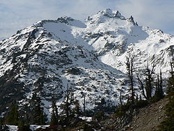
Notable locations
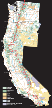
The following notable locations are found along or adjacent to the route of the Pacific Crest Trail. They are listed from south to north to correspond with the itinerary typically followed by thru-hikers to take advantage of the best seasonal weather conditions. The numbers in parentheses correspond to the numbers on the PCT overview map above.California
 |
 |
 |
|
 |
 |
 |
- Campo, CaliforniaCampo, CaliforniaCampo is a census-designated place located in the Mountain Empire area of southeastern San Diego County, California. The population was 2,684 at the 2010 census....
, near the trail's southern terminusTerminal StationTerminal Station is a 1953 film by Italian director Vittorio De Sica. It tells the story of the love affair between an Italian man and an American woman. The film was entered into the 1953 Cannes Film Festival.-Production:...
at the Mexico – United States border - Anza-Borrego Desert State ParkAnza-Borrego Desert State ParkAnza-Borrego Desert State Park is a state park located within the Colorado Desert of Southern California. The park takes its name from 18th century, Spanish explorer Juan Bautista de Anza and borrego, the Spanish word for bighorn sheep...
(41) - Cleveland National ForestCleveland National ForestCleveland National Forest encompasses 460,000 acres , mostly of chaparral, with a few riparian areas. A warm dry mediterranean climate prevails over the Forest. It is the southernmost National forest of California. It is administered by the United States Forest Service, a government agency within...
(40) - Big Bear LakeBig Bear LakeBig Bear Lake is a reservoir in the San Bernardino Mountains, in San Bernardino County, California, United States. At a surface elevation of , it has an east-west length of approximately 7 miles and is approximately 2.5 miles at its widest measurement, though the lake's width mostly averages a...
- Cajon PassCajon PassCajon Pass is a moderate-elevation mountain pass between the San Bernardino Mountains and the San Gabriel Mountains in Southern California in the United States. It was created by the movements of the San Andreas Fault...
- Angeles National ForestAngeles National ForestThe Angeles National Forest of the U.S. National Forest Service is located in the San Gabriel Mountains of Los Angeles County, southern California. It was established on July 1, 1908, incorporating the first San Bernardino National Forest and parts of the former Santa Barbara and San Gabriel...
(35) - Vasquez RocksVasquez RocksVasquez Rocks Natural Area Park is a 905-acre northern Los Angeles County, California, USA park acquired by the Los Angeles County government in the 1970s...
- Agua Dulce, CaliforniaAgua Dulce, CaliforniaAgua Dulce is a census-designated place located in Los Angeles County, California. It lies at an elevation of 2,526 feet . Agua Dulce is located just north of Santa Clarita. The town has a population of about 4,000. It is located at and covers a geographic area of about...
- Walker PassWalker PassWalker Pass is a mountain pass by Lake Isabella in the southern Sierra Nevada mountains. It is located in northeastern Kern County, approximately 53 mi ENE of Bakersfield and 10 mi WNW of Ridgecrest...
- Owens Peak WildernessOwens Peak WildernessThe Owens Peak Wilderness is a wilderness area comprising the rugged eastern face of the Sierra Nevada Mountains. Owens Peak is the high point...
(34) - South Sierra WildernessSouth Sierra WildernessThe South Sierra Wilderness is a federally designated wilderness protected area located northeast of Bakersfield, California.Created with the passage of the California Wilderness Act of 1984 by the U.S. Congress, it is in size, is within both the Sequoia and Inyo national forests and is managed...
(34) - Golden Trout WildernessGolden Trout WildernessThe Golden Trout Wilderness is a federally designated wilderness area in the Sierra Nevada, in Tulare County, California. It is located east of Visalia, California within Inyo National Forest and Sequoia National Forest....
(34) - Kings Canyon National ParkKings Canyon National ParkKings Canyon National Park is a National Park in the southern Sierra Nevada, east of Fresno, California. The park was established in 1940 and covers...
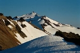
(33)- Forester PassForester PassForester Pass is a mountain pass in the Sierra Nevada. Located on the Kings-Kern Divide on the boundary between Sequoia National Park and Kings Canyon National Park, Forester Pass connects the drainages of Bubbs Creek and the Kern River...
, highest point on the trail
- Forester Pass
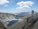
- John Muir WildernessJohn Muir WildernessThe John Muir Wilderness is a wilderness area that extends along the crest of the Sierra Nevada of California, USA for , in the Inyo and Sierra National Forests. Established in 1964 by the Wilderness Act and named for naturalist John Muir, it contains...
(31) - Ansel Adams WildernessAnsel Adams WildernessThe Ansel Adams Wilderness is a wilderness area in the Sierra Nevada of California, USA. The wilderness is part of the Sierra and Inyo National Forests. The wilderness spans...
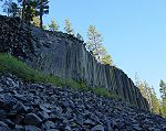
(30)- Devils Postpile National MonumentDevils Postpile National MonumentDevils Postpile National Monument is located near Mammoth Mountain in extreme northeastern Madera County in eastern California. It was established in 1911, and protects Devils Postpile, an unusual formation of columnar basalt.-Geography:...
- Devils Postpile National Monument
- Yosemite National ParkYosemite National ParkYosemite National Park is a United States National Park spanning eastern portions of Tuolumne, Mariposa and Madera counties in east central California, United States. The park covers an area of and reaches across the western slopes of the Sierra Nevada mountain chain...
(29)- Tuolumne MeadowsTuolumne MeadowsTuolumne Meadows is a gentle, dome-studded sub-alpine meadowy section of the Tuolumne River, in the eastern section of Yosemite National Park. Its approximate location is . Its approximate elevation is 8619 feet .-Natural History:...
- Tuolumne Meadows
- Sonora PassSonora PassSonora Pass is the second-highest highway pass in the Sierra Nevada, lower by 321 ft. than Tioga Pass to the south. State Route 108 traverses the pass.-Description:...
, Ebbetts PassEbbetts PassEbbetts Pass, named after John Ebbetts, is a high mountain pass through the Sierra Nevada range in Alpine County, California. Ebbetts is the eastern of two passes in the area traversed by State Route 4. The western pass is the Pacific Grade Summit . The pass is registered as California Historical...
, Carson PassCarson PassCarson Pass is the Sierra Crest mountain pass over which State Route 88 crosses. The historic pass was a point on the Carson Trail during the California Gold Rush and was used for American Civil War shipping to California until the completion of the First Transcontinental Railroad... - Desolation WildernessDesolation WildernessThe Desolation Wilderness is a federally protected wilderness area located along the crest of the Sierra Nevada mountain range, just southwest of Lake Tahoe in El Dorado County, California, United States. It is a popular backpacking destination, with much barren rocky terrain at the edge of the...
- Lassen National ForestLassen National ForestLassen National Forest is a national forest of 1,700 square miles in northeastern California. It is named after pioneer Peter Lassen, who mined, ranched and promoted the area to emigrant parties in the 1850s.- Overview :...
(22)- Lassen Volcanic National ParkLassen Volcanic National ParkLassen Volcanic National Park is a United States National Park in northeastern California. The dominant feature of the park is Lassen Peak; the largest plug dome volcano in the world and the southern-most volcano in the Cascade Range...
(23)
- Lassen Volcanic National Park
- McArthur-Burney Falls Memorial State ParkMcArthur-Burney Falls Memorial State ParkLocated approximately 6 miles north of Burney, California, McArthur-Burney Falls Memorial State Park is the second oldest state park in the California State Parks System. The park offers camping, fishing, watersports, hiking and horseback riding facilities. The park is mainly known for the...
(21) - Shasta-Trinity National ForestShasta-Trinity National ForestThe Shasta-Trinity National Forest is a federally designated forest in northern California, USA. It is the largest National Forest in California and is managed by the United States Forest Service. The 2.2-million acre forest encompasses five wilderness areas, hundreds of mountain lakes and of...
(19)- Castle Crags WildernessCastle CragsCastle Crags is a dramatic and well-known rock formation in Northern California. Although the mountains of Northern California consist largely of rocks of volcanic and sedimentary origin, granite bodies intruded many parts of the area during the Jurassic period...
(20)
- Castle Crags Wilderness
- Klamath MountainsKlamath MountainsThe Klamath Mountains, which include the Siskiyou, Marble, Scott, Trinity, Trinity Alps, Salmon, and northern Yolla-Bolly Mountains, are a rugged lightly populated mountain range in northwest California and southwest Oregon in the United States...
- Trinity Alps WildernessTrinity Alps WildernessThe Trinity Alps Wilderness is a designated wilderness located in northern California, roughly between Eureka and Redding. It is jointly administered by Shasta-Trinity, Klamath, and Six Rivers National Forests. About are administered by the Bureau of Land Management. The wilderness is located in...
- Russian WildernessRussian WildernessThe Russian Wilderness is a wilderness area of located approximately northeast of Eureka in northern California. It is within the Klamath National Forest in Siskiyou County and is managed by the US Forest Service...
- Marble Mountain WildernessMarble Mountain WildernessThe Marble Mountain Wilderness is a wilderness area located northeast of Eureka, California, USA. It is managed by the US Forest Service and is within the Klamath National Forest. The land was first set aside on April 1931 as the Marble Mountain Primitive Area , it was one of four areas to gain...
- Trinity Alps Wilderness
Oregon
 |
|
 |
|
 |
 |
- Cascade–Siskiyou National Monument (17)
- Rogue River National Forest (16) and Winema National ForestWinema National ForestThe Winema National Forest is a United States National Forest in Klamath County on the eastern slopes of the Cascade Range in south-central Oregon, and covers . The forest borders Crater Lake National Park near the crest of the Cascades and stretches eastward into the Klamath Basin...
(14)- Sky Lakes WildernessSky Lakes WildernessThe Sky Lakes Wilderness is a wilderness area located in the Rogue River-Siskiyou and Winema National Forests in the southern Cascade Range of Oregon, U.S.. It comprises . of the area are located in the Rogue River-Siskiyou National Forest, and located in the Winema National Forest...
- Sky Lakes Wilderness
- Crater Lake National ParkCrater Lake National ParkCrater Lake National Park is a United States National Park located in southern Oregon. Established in 1902, Crater Lake National Park is the sixth oldest national park in the United States and the only one in the state of Oregon...
(15)- Crater LakeCrater LakeCrater Lake is a caldera lake located in the south-central region of the U.S. state of Oregon. It is the main feature of Crater Lake National Park and famous for its deep blue color and water clarity. The lake partly fills a nearly deep caldera that was formed around 7,700 years agoby the...
- Crater Lake
- Umpqua National ForestUmpqua National ForestUmpqua National Forest, in southern Oregon's Cascade mountains, covers an area of one-million acres in Douglas, Lane, and Jackson Counties, and borders Crater Lake National Park. The four ranger districts that comprise the Forest are Cottage Grove, Diamond Lake, North Umpqua, and Tiller Ranger...
(13)- Mount ThielsenMount ThielsenMount Thielsen, or Big Cowhorn, is an extinct shield volcano in the Oregon High Cascades, near Mount Bailey. Because Mount Thielsen stopped erupting 250,000 years ago, glaciers have heavily eroded the volcano's structure, creating precipitous slopes and its horn-like peak...
- Mount Thielsen
- Willamette National ForestWillamette National ForestThe Willamette National Forest is a National Forest located in the central portion of the Cascade Range of US state of Oregon.It comprises 1,675,407 acres making it one of the largest national forests. Over 380,000 acres are designated wilderness which include seven major mountain peaks...
(11) and Deschutes National ForestDeschutes National ForestThe Deschutes National Forest is a United States National Forest located in parts of Deschutes, Klamath, Lake, and Jefferson counties in central Oregon. It comprises 1.8 million acres along the east side of the Cascade mountains. In 1908, the Deschutes National Forest was established from parts...
(12)- Diamond Peak WildernessDiamond Peak WildernessThe Diamond Peak Wilderness is a wilderness area straddling the Cascade crest and includes the Diamond Peak Volcano. It is located within two National Forests - the Willamette National Forest on the west and the Deschutes National Forest on the east....
- Waldo LakeWaldo LakeWaldo Lake is a lake in the Cascade Mountains of the U.S. state of Oregon. It is the second largest natural non-alkali lake in Oregon with more than 10 square miles of water and a maximum depth of . The lake is named after Oregon politician, judge, and conservationist John B....
- Three Sisters WildernessThree Sisters WildernessThe Three Sisters Wilderness is a wilderness area in the Cascade Range, within the Willamette and Deschutes National Forests in Oregon. It comprises 286,708 acres , making it the second largest Wilderness area in Oregon...
- McKenzie RiverMcKenzie RiverThe McKenzie River is a tributary of the Willamette River in western Oregon in the United States. It drains part of the Cascade Range east of Eugene and flows into the southernmost end of the Willamette Valley. It is named for Donald MacKenzie, a Scottish Canadian fur trader...
- McKenzie River
- Mount Washington WildernessMount Washington WildernessThe Mount Washington Wilderness is a wilderness area located on and around Mount Washington in the central Cascade Range of Oregon in the United States. The Wilderness Area was established in 1964 and comprises of the Willamette and Deschutes National Forests...
- Mount Jefferson WildernessMount Jefferson WildernessThe Mount Jefferson Wilderness is a wilderness area located on and around Mount Jefferson in the central Cascade Range of Oregon in the United States. It is situated where the Willamette, Deschutes, and Mount Hood National Forests meet...
- Diamond Peak Wilderness
- Mount Hood National ForestMount Hood National ForestThe Mount Hood National Forest is located east of the city of Portland, Oregon, and the northern Willamette River valley. The Forest extends south from the Columbia River Gorge across more than of forested mountains, lakes and streams to the Olallie Scenic Area, a high lake basin under the slopes...
(9)- Olallie Scenic AreaOlallie Scenic AreaOlallie Scenic Area is a United States Forest Service designated scenic area located in Oregon’s Cascade Mountains. It is between Mount Hood on the north and Mount Jefferson to the south and contains Olallie Lake along with several smaller lakes...
- Warm Springs Indian ReservationWarm Springs Indian ReservationThe Warm Springs Indian Reservation consists of 1,019.385 sq mi in north central Oregon, in the United States, and is occupied and governed by the Confederated Tribes of Warm Springs.-Tribes:...
(10) - Timberline Lodge
- Mount Hood WildernessMount Hood WildernessThe Mount Hood Wilderness is a protected wilderness area inside the Mount Hood National Forest which is located in the U.S. state of Oregon. The area, covering , includes the peak of Mount Hood and its upper slopes, and ranges from temperate rain forests at the lower elevations, to glaciers and...
- Lolo PassLolo Pass (Oregon)Lolo Pass is a mountain pass northwest of Mount Hood and northeast of Zigzag, Oregon, on the Clackamas–Hood River county line. It divides the Sandy River watershed on the southwest from the Hood River watershed on the northeast....
- Lolo Pass
- Olallie Scenic Area
- Columbia River GorgeColumbia River GorgeThe Columbia River Gorge is a canyon of the Columbia River in the Pacific Northwest of the United States. Up to deep, the canyon stretches for over as the river winds westward through the Cascade Range forming the boundary between the State of Washington to the north and Oregon to the south...
National Scenic Area (8)- Mark O. Hatfield WildernessMark O. Hatfield WildernessThe Mark O. Hatfield Wilderness is a wilderness area located on the northern side of Mount Hood in the northwestern Cascades of the U.S. state of Oregon, near the Columbia River Gorge and within Mount Hood National Forest...
(formerly the Columbia Wilderness) - Cascade Locks, OregonCascade Locks, OregonCascade Locks is a city in Hood River County, Oregon, United States. The city took its name from a set of locks built to improve navigation past the Cascades Rapids of the Columbia River. The U.S. federal government approved the plan for the locks in 1875, construction began in 1878, and the locks...
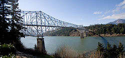
, lowest point on the trail - Bridge of the GodsBridge of the Gods (modern structure)The Bridge of the Gods is a steel truss cantilever bridge that spans the Columbia River between Cascade Locks, Oregon and Washington state near North Bonneville. It is approximately 40 miles east of Portland, Oregon and 4 miles upriver from the Bonneville Dam...
(links Oregon and Washington, crossing the Columbia RiverColumbia RiverThe Columbia River is the largest river in the Pacific Northwest region of North America. The river rises in the Rocky Mountains of British Columbia, Canada, flows northwest and then south into the U.S. state of Washington, then turns west to form most of the border between Washington and the state...
)
- Mark O. Hatfield Wilderness
Washington
 |
||
 |
 |
- Gifford Pinchot National ForestGifford Pinchot National ForestGifford Pinchot National Forest is a U.S. National Forest located in southern Washington, USA. With an area of 1.37 million acres , it extends 116 km along the western slopes of Cascade Range from Mount Rainier National Park to the Columbia River. It includes the 110,000 acre Mount St....
(7)- Indian Heaven WildernessIndian Heaven WildernessIndian Heaven Wilderness is a protected area located inside the Gifford Pinchot National Forest of southwestern Washington state. Originally known to the Indians as "Sahalee Tyee," the area has been and remains culturally important to Native Americans...
- Mount AdamsMount Adams (Washington)Mount Adams is a potentially activestratovolcano in the Cascade Range and the second-highest mountain in the U.S. state of Washington.Adams is a member of the Cascade Volcanic Arc, and is one of the arc's largest volcanoes,...
- Goat Rocks WildernessGoat Rocks WildernessGoat Rocks Wilderness is a U.S. Wilderness Area in Washington, United States. Consisting of portions of Mount Baker-Snoqualmie National Forest and Gifford Pinchot National Forest on the crest of the Cascade Range south of U.S...
- Indian Heaven Wilderness
- Mount Rainier National ParkMount Rainier National ParkMount Rainier National Park is a United States National Park located in southeast Pierce County and northeast Lewis County in Washington state. It was one of the US's earliest National Parks, having been established on March 2, 1899 as the fifth national park in the United States. The park contains...
(6)- Chinook PassChinook PassChinook Pass is a pass through the Cascade Range in the state of Washington.The pass provides the east entrance to Mount Rainier National Park, and carries State Route 410 between the towns of Enumclaw and Naches. Because of the high elevation, Chinook Pass is usually closed in November due to...
- Chinook Pass
- Mount Baker-Snoqualmie National ForestMount Baker-Snoqualmie National ForestThe Mount Baker-Snoqualmie National Forest in Washington extends more than along the western slopes of the Cascade Range from the Canadian border to the northern boundary of Mount Rainier National Park. Forest headquarters are located in the city of Everett....
(5)- Norse Peak WildernessNorse Peak WildernessNorse Peak Wilderness is located in central Washington in the United States. It protects the portion of the Cascade Range north of Chinook Pass , south of Naches Pass , and east of Mt. Rainier National Park. This 50,923 acre wilderness is named for a prominent peak which overlooks Crystal Mountain...
- Alpine Lakes WildernessAlpine Lakes WildernessThe Alpine Lakes Wilderness is a large wilderness area spanning the Cascade Range of Washington state in the United States. The wilderness is located in parts of Wenatchee National Forest and Snoqualmie National Forest, and is approximately bounded by Interstate 90 and Snoqualmie Pass to the south...
- Henry M. Jackson WildernessHenry M. Jackson WildernessThe Henry M. Jackson Wilderness is a U.S. Wilderness Area in the state of Washington, United States.-History:The Henry M. Jackson Wilderness was created by the 1984 Washington Wilderness Act and named after former US Senator Henry M. Jackson of Washington...
- Glacier Peak WildernessGlacier Peak WildernessThe Glacier Peak Wilderness, created by the US Forest Service in 1960 by efforts of the , four years before the 1964 wilderness legislation of the Congress, is located within portions of Chelan County, Snohomish County, and Skagit Counties in the North Cascades of Washington...
- Norse Peak Wilderness
- Snoqualmie PassSnoqualmie Pass (Washington)Snoqualmie Pass is a census-designated place in Kittitas County, Washington, United States. The population was 311 at the 2010 census....
- Stevens PassStevens PassStevens Pass is a mountain pass through the Cascade Mountains located at the border of King County and Chelan County in Washington, United States....
- Lake Chelan National Recreation AreaLake Chelan National Recreation AreaLake Chelan National Recreation Area is a U.S. National Recreation Area located about south of the Canadian border in Chelan County, Washington. It encompasses an area of approximately including the northern end of Lake Chelan and the surrounding area of the Stehekin Valley and the Stehekin...
- Stehekin, WashingtonStehekin, WashingtonStehekin is a small unincorporated community in Chelan County, Washington. It is part of Wenatchee–East Wenatchee Metropolitan Statistical Area. Located at the northwest end of Lake Chelan, it lies just south of the North Cascades National Park at . It is within Lake Chelan National...
, last town along the trail, 10 miles (16 km) from PCT by NPSNational Park ServiceThe National Park Service is the U.S. federal agency that manages all national parks, many national monuments, and other conservation and historical properties with various title designations...
bus
- Stehekin, Washington
- North Cascades National ParkNorth Cascades National ParkNorth Cascades National Park is a U.S. National Park located in the state of Washington. The park is the largest of the three National Park Service units that comprise the North Cascades National Park Service Complex. Several national wilderness areas and British Columbia parkland adjoin the...
(2) - Okanogan National ForestOkanogan National ForestThe Okanogan National Forest is a U.S. National Forest located in northern and western Okanogan County in north-central Washington State, United States...
(3) - Pacific Northwest National Scenic Trail
- Boundary Monument 78, at the Canada – United States border
British Columbia, Canada
- E.C. Manning Provincial Park, the northern terminus of the trail. (1)
Location coordinates
External links
- Pacific Crest Trail Association — Non-profit that maintains and promotes the trail, and provides advice to hikers
- Postholer.Com — An extensive source of PCT information, journals, Google trail maps, printed maps, data book and more.