Glacier Peak Wilderness
Encyclopedia
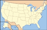
The Glacier Peak Wilderness, created by the US Forest Service in 1960 by efforts of the North Cascades Conservation Council, four years before the 1964 wilderness legislation
of the Congress
, is located within portions of Chelan County, Snohomish County
, and Skagit Counties
in the North Cascades
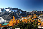
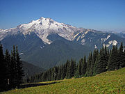
of Washington. The area, 572000 acres (2,314.8 km²) in size, 35 miles (56.3 km) long and 20 miles (32.2 km) wide, lying within parts of Wenatchee National Forest
and Mount Baker National Forest
, is characterized by heavily forest
ed stream
courses, steep sided valley
s, and dramatic glacier
-crowned peaks
.
 Forest vegetation comprises several species of fir
, Douglas-fir
, hemlock
, redcedar
as well as stands of mixed pine
and Douglas-fir
on its eastern slopes. Various species of wildlife inhabit the area and include deer
, elk
, black bear
, mountain goat
, cougar, marten
, and lynx
. Smaller animals, such as field mice
are common. The last confirmed Grizzly Bear sighting in the United States portion of the North Cascade ecosystem occurred in this wilderness. The high mountain lake
s often give good catches of fish during their ice-free months. The primary fishery is cutthroat trout
, however, other species do exist.
 No roads approach Glacier Peak
, and one must hike many miles through extremely rough terrain to reach its base. Normally, hikers can reach the volcano from the west via the White Chuck River
Valley, or the Suiattle River
Valley; from the east, it may be approached from the western tip of Lake Chelan
or the White River
or Chiwawa River
Valleys.
in May. Usually most trails and passes are snow free by mid-August, but this varies from year to year. Snow and cold rain can occur in mid-summer.

event when over 10 inches (254 mm) of rain
fell on the Wilderness. The warm rain melted snow
and ice
driving massive amounts of water, trees and debris into the rivers. Downstream, roads, bridges, campgrounds and trails were damaged and destroyed. The destruction was particularly devastating to the Pacific Crest Trail
(PCT). Eight trail bridges and one stream ford on a 30-mile section of the trail below Glacier Peak were destroyed. Little or no evidence remains that some of these bridges ever existed. The two most notable losses were bridges over the Upper White Chuck River and the Suiattle River. Both crossings are dangerous fords under the best of conditions. Additionally, five major trails that provided access to the PCT in the area sustained varying degrees of damage from fairly light (North Fork Skykomish Trail) to severe (White Chuck Trail). Kennedy Hot Springs was buried in a mudslide and completely destroyed.
Wilderness Act
The Wilderness Act of 1964 was written by Howard Zahniser of The Wilderness Society. It created the legal definition of wilderness in the United States, and protected some 9 million acres of federal land. The result of a long effort to protect federal wilderness, the Wilderness Act was signed...
of the Congress
United States Congress
The United States Congress is the bicameral legislature of the federal government of the United States, consisting of the Senate and the House of Representatives. The Congress meets in the United States Capitol in Washington, D.C....
, is located within portions of Chelan County, Snohomish County
Snohomish County, Washington
Snohomish County is a county located in the U.S. state of Washington. It is named after the Snohomish tribe. Since 2000, the county's population has grown from 606,024 to 713,335 residents , making it one of the fastest-growing in the state, ranking third in overall population after King and...
, and Skagit Counties
Skagit County, Washington
Skagit County is a county in the U.S. state of Washington. It is named after the Skagit Indian tribe. As of 2010, the population was 116,901. It is included in the Mount Vernon-Anacortes, Washington, Metropolitan Statistical Area...
in the North Cascades
North Cascades
The North Cascades are a section of the Cascade Range of western North America. They span the border between the Canadian province of British Columbia and the U.S. state of Washington and are officially named in Canada as the Cascade Mountains...
of Washington. The area, 572000 acres (2,314.8 km²) in size, 35 miles (56.3 km) long and 20 miles (32.2 km) wide, lying within parts of Wenatchee National Forest
Wenatchee National Forest
Wenatchee National Forest is a U.S. National Forest located in Washington. With an area of 1,735,394 acres , it extends about 137 miles along the eastern slopes of the Cascade Range of Washington, USA from Okanogan National Forest to Gifford Pinchot National Forest...
and Mount Baker National Forest
Mount Baker National Forest
Mount Baker National Forest was established in Washington on January 21, 1924 when its name was changed from Washington National Forest. In 1974 it was administratively combined with Snoqualmie National Forest to make Mount Baker-Snoqualmie National Forest. In descending order of land area, Mount...
, is characterized by heavily forest
Forest
A forest, also referred to as a wood or the woods, is an area with a high density of trees. As with cities, depending where you are in the world, what is considered a forest may vary significantly in size and have various classification according to how and what of the forest is composed...
ed stream
Stream
A stream is a body of water with a current, confined within a bed and stream banks. Depending on its locale or certain characteristics, a stream may be referred to as a branch, brook, beck, burn, creek, "crick", gill , kill, lick, rill, river, syke, bayou, rivulet, streamage, wash, run or...
courses, steep sided valley
Valley
In geology, a valley or dale is a depression with predominant extent in one direction. A very deep river valley may be called a canyon or gorge.The terms U-shaped and V-shaped are descriptive terms of geography to characterize the form of valleys...
s, and dramatic glacier
Glacier
A glacier is a large persistent body of ice that forms where the accumulation of snow exceeds its ablation over many years, often centuries. At least 0.1 km² in area and 50 m thick, but often much larger, a glacier slowly deforms and flows due to stresses induced by its weight...
-crowned peaks
Mountain
Image:Himalaya_annotated.jpg|thumb|right|The Himalayan mountain range with Mount Everestrect 58 14 160 49 Chomo Lonzorect 200 28 335 52 Makalurect 378 24 566 45 Mount Everestrect 188 581 920 656 Tibetan Plateaurect 250 406 340 427 Rong River...
.
Ecology

Fir
Firs are a genus of 48–55 species of evergreen conifers in the family Pinaceae. They are found through much of North and Central America, Europe, Asia, and North Africa, occurring in mountains over most of the range...
, Douglas-fir
Douglas-fir
Douglas-fir is one of the English common names for evergreen coniferous trees of the genus Pseudotsuga in the family Pinaceae. Other common names include Douglas tree, and Oregon pine. There are five species, two in western North America, one in Mexico, and two in eastern Asia...
, hemlock
Tsuga
Tsuga is a genus of conifers in the family Pinaceae. The common name hemlock is derived from a perceived similarity in the smell of its crushed foliage to that of the unrelated plant poison hemlock....
, redcedar
Thuja plicata
Thuja plicata, commonly called Western or pacific red cedar, giant or western arborvitae, giant cedar, or shinglewood, is a species of Thuja, an evergreen coniferous tree in the cypress family Cupressaceae native to western North America...
as well as stands of mixed pine
Pine
Pines are trees in the genus Pinus ,in the family Pinaceae. They make up the monotypic subfamily Pinoideae. There are about 115 species of pine, although different authorities accept between 105 and 125 species.-Etymology:...
and Douglas-fir
Douglas-fir
Douglas-fir is one of the English common names for evergreen coniferous trees of the genus Pseudotsuga in the family Pinaceae. Other common names include Douglas tree, and Oregon pine. There are five species, two in western North America, one in Mexico, and two in eastern Asia...
on its eastern slopes. Various species of wildlife inhabit the area and include deer
Deer
Deer are the ruminant mammals forming the family Cervidae. Species in the Cervidae family include white-tailed deer, elk, moose, red deer, reindeer, fallow deer, roe deer and chital. Male deer of all species and female reindeer grow and shed new antlers each year...
, elk
Elk
The Elk is the large deer, also called Cervus canadensis or wapiti, of North America and eastern Asia.Elk may also refer to:Other antlered mammals:...
, black bear
American black bear
The American black bear is a medium-sized bear native to North America. It is the continent's smallest and most common bear species. Black bears are omnivores, with their diets varying greatly depending on season and location. They typically live in largely forested areas, but do leave forests in...
, mountain goat
Mountain goat
The Mountain Goat , also known as the Rocky Mountain Goat, is a large-hoofed mammal found only in North America. Despite its vernacular name, it is not a member of Capra, the genus of true goats...
, cougar, marten
Marten
The martens constitute the genus Martes within the subfamily Mustelinae, in family Mustelidae.-Description:Martens are slender, agile animals, adapted to living in taigas, and are found in coniferous and northern deciduous forests across the northern hemisphere. They have bushy tails, and large...
, and lynx
Lynx
A lynx is any of the four Lynx genus species of medium-sized wildcats. The name "lynx" originated in Middle English via Latin from Greek word "λύγξ", derived from the Indo-European root "*leuk-", meaning "light, brightness", in reference to the luminescence of its reflective eyes...
. Smaller animals, such as field mice
Field mouse
Field mouse may refer to:*in Europe, Asia and north Africa, one of several species of mice in genus Apodemus*in North America, a small vole such as the Meadow Vole*in South America, one of several species of mice in genus Akodon...
are common. The last confirmed Grizzly Bear sighting in the United States portion of the North Cascade ecosystem occurred in this wilderness. The high mountain lake
Lake
A lake is a body of relatively still fresh or salt water of considerable size, localized in a basin, that is surrounded by land. Lakes are inland and not part of the ocean and therefore are distinct from lagoons, and are larger and deeper than ponds. Lakes can be contrasted with rivers or streams,...
s often give good catches of fish during their ice-free months. The primary fishery is cutthroat trout
Cutthroat trout
The cutthroat trout is a species of freshwater fish in the salmon family of order Salmoniformes. It is one of the many fish species colloquially known as trout...
, however, other species do exist.
Access

Glacier Peak
Glacier Peak is the most isolated of the five major stratovolcanoes of the Cascade Volcanic Arc in Washington...
, and one must hike many miles through extremely rough terrain to reach its base. Normally, hikers can reach the volcano from the west via the White Chuck River
White Chuck River
The White Chuck River is a river in the U.S. state of Washington. It is a tributary of the Sauk River.-Course:The White Chuck River originates on the slopes of Glacier Peak in the Cascade Range. It flows generally northwest to join the Sauk River south of Darrington. The Sauk River in turn join the...
Valley, or the Suiattle River
Suiattle River
The Suiattle River is a river in the U.S. state of Washington.-Course:The Suiattle River originates from the Suiattle Glacier on the slopes of Glacier Peak in the Cascade Range. It flows generally northwest to join the Sauk River north of Darrington. The Sauk River in turn joins the Skagit River,...
Valley; from the east, it may be approached from the western tip of Lake Chelan
Lake Chelan
Lake Chelan is a narrow, 55-mile-long lake in Chelan County, northern Washington state, U.S. It is the largest natural lake in Washington state...
or the White River
White River (Washington)
The White River is a white, glacial river in the U.S. state of Washington. It flows about 75 miles from its source, the Emmons Glacier on Mount Rainier, to join the Puyallup River at Sumner...
or Chiwawa River
Chiwawa River
The Chiwawa River is a tributary of the Wenatchee River, in the U.S. state of Washington. It is completely contained within Chelan County.Much of the Chiwawa River's drainage basin is designated national forest and wilderness...
Valleys.
Trail conditions
Most years the Wilderness is still buried under 10 – of snowSnow
Snow is a form of precipitation within the Earth's atmosphere in the form of crystalline water ice, consisting of a multitude of snowflakes that fall from clouds. Since snow is composed of small ice particles, it is a granular material. It has an open and therefore soft structure, unless packed by...
in May. Usually most trails and passes are snow free by mid-August, but this varies from year to year. Snow and cold rain can occur in mid-summer.

Flood damage
On October 20, 2003, there was a record-setting floodFlood
A flood is an overflow of an expanse of water that submerges land. The EU Floods directive defines a flood as a temporary covering by water of land not normally covered by water...
event when over 10 inches (254 mm) of rain
Rain
Rain is liquid precipitation, as opposed to non-liquid kinds of precipitation such as snow, hail and sleet. Rain requires the presence of a thick layer of the atmosphere to have temperatures above the melting point of water near and above the Earth's surface...
fell on the Wilderness. The warm rain melted snow
Snow
Snow is a form of precipitation within the Earth's atmosphere in the form of crystalline water ice, consisting of a multitude of snowflakes that fall from clouds. Since snow is composed of small ice particles, it is a granular material. It has an open and therefore soft structure, unless packed by...
and ice
Ice
Ice is water frozen into the solid state. Usually ice is the phase known as ice Ih, which is the most abundant of the varying solid phases on the Earth's surface. It can appear transparent or opaque bluish-white color, depending on the presence of impurities or air inclusions...
driving massive amounts of water, trees and debris into the rivers. Downstream, roads, bridges, campgrounds and trails were damaged and destroyed. The destruction was particularly devastating to the Pacific Crest Trail
Pacific Crest Trail
The Pacific Crest Trail is a long-distance mountain hiking and equestrian trail on the Western Seaboard of the United States. The southern terminus is at the California border with Mexico...
(PCT). Eight trail bridges and one stream ford on a 30-mile section of the trail below Glacier Peak were destroyed. Little or no evidence remains that some of these bridges ever existed. The two most notable losses were bridges over the Upper White Chuck River and the Suiattle River. Both crossings are dangerous fords under the best of conditions. Additionally, five major trails that provided access to the PCT in the area sustained varying degrees of damage from fairly light (North Fork Skykomish Trail) to severe (White Chuck Trail). Kennedy Hot Springs was buried in a mudslide and completely destroyed.

