
Desbarats, Ontario
Encyclopedia
Johnson is a township
in the Canadian
province of Ontario
, located within the Algoma District. The township had a population of 701 in the Canada 2006 Census
.
.
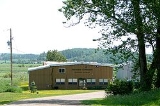
Located in Desbarats is Central Algoma Secondary School, a high school of 450+ students which serves a catchment area extending from Echo Bay to Thessalon
.
 West of Desbarats on Highway 17 is Ripple Rock, a unique rock cut that was uncovered with the blasting of the rock cuts through northern Ontario for the creation of the Trans-Canada Highway
. The ripples in the rock were created two billion years ago by waves in a shallow body of water. It was buried and through pressure it became sandstone.
Puddingstone Road in Johnson Township was named for the geological phenomenon of puddingstone
, found in the area as well as at nearby St. Joseph Island
. Puddingstone is a mixture of different sized grains and pebbles held together by finer sand. The type found in this area is St. Joseph Island Puddingstone, which contains red and brown pieces of jasper
.
Since the early 2000s, about 20 Mennonite
families from Southern Ontario
moved to the Desbarats area. Along with other local farmers, they sell their produce at the Desbarats Farmers' Market on Friday evenings and Saturday mornings.
Township (Canada)
The term township generally means the district or area associated with a town. However in some systems no town needs to be involved. The specific use of the term to describe political subdivisions has varied by country, usually to describe a local rural or semi-rural government within the county...
in the Canadian
Canada
Canada is a North American country consisting of ten provinces and three territories. Located in the northern part of the continent, it extends from the Atlantic Ocean in the east to the Pacific Ocean in the west, and northward into the Arctic Ocean...
province of Ontario
Ontario
Ontario is a province of Canada, located in east-central Canada. It is Canada's most populous province and second largest in total area. It is home to the nation's most populous city, Toronto, and the nation's capital, Ottawa....
, located within the Algoma District. The township had a population of 701 in the Canada 2006 Census
Canada 2006 Census
The Canada 2006 Census was a detailed enumeration of the Canadian population. Census day was May 16, 2006. The next census following will be the 2011 Census. Canada's total population enumerated by the 2006 census was 31,612,897...
.
Communities
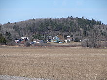
Desbarats, the main community in the township, is located on Highway 17, 54 km east of Sault Ste. MarieSault Ste. Marie, Ontario
Sault Ste. Marie is a city on the St. Marys River in Algoma District, Ontario, Canada. It is the third largest city in Northern Ontario, after Sudbury and Thunder Bay, with a population of 74,948. The community was founded as a French religious mission: Sault either means "jump" or "rapids" in...
.
Located in Desbarats is Central Algoma Secondary School, a high school of 450+ students which serves a catchment area extending from Echo Bay to Thessalon
Thessalon
Thessalon is a town in the Canadian province of Ontario, located at the junction of Highway 17 and Highway 129. It is surrounded by but not part of the municipality of Huron Shores, and is part of the District of Algoma....
.
Trans-Canada Highway
The Trans-Canada Highway is a federal-provincial highway system that joins the ten provinces of Canada. It is, along with the Trans-Siberian Highway and Australia's Highway 1, one of the world's longest national highways, with the main route spanning 8,030 km...
. The ripples in the rock were created two billion years ago by waves in a shallow body of water. It was buried and through pressure it became sandstone.
Puddingstone Road in Johnson Township was named for the geological phenomenon of puddingstone
Puddingstone (rock)
Puddingstone, also known as either Pudding stone or Plum-pudding stone, is a popular name applied to a conglomerate that consists of distinctly rounded pebbles whose colors contrast sharply with the color of the finer-grained, often sandy, matrix or cement surrounding them...
, found in the area as well as at nearby St. Joseph Island
St. Joseph Island
St. Joseph Island is a Canadian island in Lake Huron, near the mouth of the St. Marys River which connects Lake Huron with Lake Superior. It is the second largest island in Lake Huron and the third largest in the Great Lakes overall, trailing Manitoulin and Lake Superior's Isle Royale.St...
. Puddingstone is a mixture of different sized grains and pebbles held together by finer sand. The type found in this area is St. Joseph Island Puddingstone, which contains red and brown pieces of jasper
Jasper
Jasper, a form of chalcedony, is an opaque, impure variety of silica, usually red, yellow, brown or green in color; and rarely blue. This mineral breaks with a smooth surface, and is used for ornamentation or as a gemstone. It can be highly polished and is used for vases, seals, and at one time for...
.
Since the early 2000s, about 20 Mennonite
Mennonite
The Mennonites are a group of Christian Anabaptist denominations named after the Frisian Menno Simons , who, through his writings, articulated and thereby formalized the teachings of earlier Swiss founders...
families from Southern Ontario
Southern Ontario
Southern Ontario is a region of the province of Ontario, Canada that lies south of the French River and Algonquin Park. Depending on the inclusion of the Parry Sound and Muskoka districts, its surface area would cover between 14 to 15% of the province. It is the southernmost region of...
moved to the Desbarats area. Along with other local farmers, they sell their produce at the Desbarats Farmers' Market on Friday evenings and Saturday mornings.
Demographics
Population trend:- Population in 2006: 701
- Population in 2001: 658
- Population in 1996: 729
- Population in 1991: 685