
.gif)
Huehuetenango (department)
Encyclopedia
Huehuetenango is one of the 22 department
s of Guatemala
. It is situated in the western highlands
and shares borders with México
in the north and west; with El Quiché in the east, with Totonicapán
, Quetzaltenango
, and San Marcos
to the south. The capital is the city of Huehuetenango
.
Huehuetenango's ethnic composition is one of the most diverse in Guatemala. While the Mam
are predominant in the department, other Maya groups are the Q'anjob'al
, Chuj
, Jakaltek
, Tektik
, Awakatek
, Chalchitek, Akatek
and K'iche'
. Each of these nine Maya ethnic groups speaks their own language.
language of central Mexico, given by the indigenous allies of the Spanish
conquistador
s during the Spanish Conquest
of Guatemala. It is usually said to mean "place of the elders" but may be a corruption of "place of the ahuehuete
trees".
 Huehuetenango covers an area of 7403 square kilometres (2,858.3 sq mi) in western Guatemala and is bordered on the north and west by Mexico
. On the east side it is bordered by the department of El Quiché and on the south by the departments of Totonicapán, Quetzaltenango and San Marcos. The department encompasses almost the entire length of the Sierra de los Cuchumatanes
mountain range although there is a wide difference in altitude across the department, from heights of 3352 metres (10,997.4 ft) above mean sea level
to as low as 300 metres (984.3 ft) above sea level, encompassing an equally wide variation in local climate, ranging from mountain peaks where the temperature sometimes falls below freezing to tropical lowland rainforest
.
The department possesses various rivers that flow into the Chixoy River
, also known as the Río Negro, which flows into the system of rivers forming the drainage basin
of the Usumacinta River
, which empties into the Gulf of Mexico
. The most important tributaries
of the Chixoy in Huehuetenango are the Hondo and Xecunabaj rivers, which flow into the department from the neighbouring departments of El Quiché and Totonicapán.
The Cuilco River
enters the department from neighbouring San Marcos and crosses into the Mexican state of Chiapas
, where it joins with the Grijalva River
, which empties into the Gulf of Mexico. Its most important tributaries in Huehuetenango are the Apal, Chomá and Coxtón rivers.
The Ixcán River
has its source near Santa Cruz Barillas and flows northwards towards Mexico where it joins the Lacuntún River, a tributary of the Usumacinta.
The Nentón River
is formed in the municipality of San Sebastián Coatán by the joining of the rivers Nupxuptenam and Jajaniguán. It flows westwards across the border into Mexico where it empties into the Presa de la Angostura reservoir
.
The Selegua River
has its source in the Sierra de los Cuchumatanes and flows northwards, crossing the border into Chiapas, where it joins the Cuilco River to form the Grijalva River, to flow onwards to the Gulf of Mexico. Its principal tributaries are the Pino, Sibilá, Ocubilá, Naranjo, Colorado, Torlón, Mapá ahd Chicol rivers.
The largest body of standing water in the department is Laguna Yolnabaj
, in the extreme north, close to the border with Mexico. Smaller lakes include Laguna Maxbal, Laguna Yolhuitz, and Laguna Seca, all in the northeast of the department.
-speaking Ladinos
. The Ladinos tend to be concentrated in towns and villages including Huehuetenango, Chiantla, Malacatancito, La Libertad, San Antonio Huista and La Democracia, which have a relatively low indigenous population. In the rest of the department, the Maya groups make up the majority of the population as much in the towns as the countryside. Huehuetenango has the greatest number of Mam
Maya in Guatemala, although there are also Mam
speakers in the departments of Quetzaltenango and San Marcos, and in the Mexican state of Chiapas.
In 2008, 58% of the population of the department was aged 19 years or under.
since at least the Mesoamerica
n Early Classic Period
. At the time of the Spanish Conquest
, the Maya city of Zaculeu
was the initial focus of Spanish attention in the region that would later become the department of Huehuetenango. The city was defended by the Mam king Kayb'il B'alam
; it was attacked by Gonzalo de Alvarado y Chávez
, cousin of Conquistador
Pedro de Alvarado
, in 1525. After a siege lasting several months the Mam were reduced to starvation and Kayb'il B'alam finally surrendered the city to the Spanish.
Four years after the Spanish conquest of Huehuetenango, in 1529, San Mateo Ixtatán
, Santa Eulalia
and Jacaltenango
were given in encomienda
to the conquistador
Gonzalo de Ovalle, a companion of Pedro de Alvarado
. In 1684, a council led by Enrique Enriquez de Guzmán, the then governor of Guatemala, decided upon the reduction
of San Mateo Ixtatán and nearby Santa Eulalia, both within the colonial administrative district of the Corregimiento
of Huehuetenango.
On 2 February 1838, Huehuetenango joined together with Quetzaltenango, El Quiché, Retalhuleu, San Marcos and Totonicapán to form the short-lived Central American state of Los Altos
. The state was crushed in 1840 by general Rafael Carrera Turcios
, at that time between periods in office as Guatemalan president
.
Huehuetenango includes pre-Columbian
Maya
archaeological sites at Zaculeu, Chalchitán, Mojá
and San Mateo Ixtatán.
on 8 May 1866, although various attempts had been made to declare the district a department from 1826 onwards in order to better administer it.
By 1883, Huehuetenango had 248 coffee plantations and produced 7334 quintal
s (Imperial hundredweight) of coffee.
In 1887, a rebellion in Huehuetenango was put down by president Manuel Lisandro Barillas, who then suspended the constitutional guarantees of the department and rewrote its constitution.
. In modern times agriculture is the most important industry, although mining continues on a small scale and handicraft
production also contributes to the local economy. Maize
is cultivated across the whole department, without being limited by local climatic differences. The primary highland crops are wheat
, potato
es, barley
, alfalfa
and beans
. On the warmer lower slopes the primary crops are coffee
, sugarcane
, tobacco
, chile
, yuca
, achiote
and a wide range of fruits.
Although historically cattle and horse farming was important, the size of production is much reduced in modern times, with the rearing of sheep now more widespread. Mines in Huehuetenango produce silver
, lead
, zinc
and copper
. Gold
was once mined in the department but it is no longer extracted. In 2000, the private mining company Minas de Guatemala S.A. was extracting antimony
from underground mines near San Ildefonso Ixtahuacán.
Local handicraft production mainly consists of weaving traditional Maya textiles, mostly cotton
but also wool
, depending on the local climate.
In 2008 the most important product for exportation was coffee.
:
was born in Huehuetenango city on 16 June 1926.
ruins of Zaculeu. The town of Chiantla is a centre for religious tourism
, with the Catholic Church being a pilgrimage destination due to its image of the Virgin of Candelaria
, known locally as Nuestra Señora de Chiantla ("Our Lady of Chiantla").
Departments of Guatemala
||Guatemala is divided into 22 departments :#Alta Verapaz#Baja Verapaz#Chimaltenango#Chiquimula#Petén#El Progreso#El Quiché#Escuintla#Guatemala#Huehuetenango#Izabal#Jalapa#Jutiapa#Quetzaltenango#Retalhuleu#Sacatepéquez...
s of Guatemala
Guatemala
Guatemala is a country in Central America bordered by Mexico to the north and west, the Pacific Ocean to the southwest, Belize to the northeast, the Caribbean to the east, and Honduras and El Salvador to the southeast...
. It is situated in the western highlands
Guatemalan Highlands
The Guatemalan Highlands is an upland region in southern Guatemala, lying between the Sierra Madre de Chiapas to the south and the Petén lowlands to the north....
and shares borders with México
Mexico
The United Mexican States , commonly known as Mexico , is a federal constitutional republic in North America. It is bordered on the north by the United States; on the south and west by the Pacific Ocean; on the southeast by Guatemala, Belize, and the Caribbean Sea; and on the east by the Gulf of...
in the north and west; with El Quiché in the east, with Totonicapán
Totonicapán (department)
Totonicapán is one of the 22 departments of Guatemala. The capital is the city of Totonicapán.- Municipalities :# Momostenango# San Andrés Xecul# San Bartolo# San Cristóbal Totonicapán# San Francisco El Alto# Santa Lucía La Reforma...
, Quetzaltenango
Quetzaltenango (department)
Quetzaltenango is a department in the western highlands of Guatemala. The capital is the city of Quetzaltenango, the second largest city in Guatemala. The inhabitants include Spanish-speaking Ladinos and the K'iche' and Mam Maya groups, both with their own Maya language...
, and San Marcos
San Marcos (department)
San Marcos is a department in Guatemala. The capital is the city of San Marcos.-Departmental history:The department was created by a governmental decree on 8 May 1866, together with Huehuetenango, Izabal and Petén departments...
to the south. The capital is the city of Huehuetenango
Huehuetenango
Huehuetenango is a city and a municipality in the highlands of western Guatemala. It is also the capital of the department of Huehuetenango. The municipality's population was over 81,000 people in 2002...
.
Huehuetenango's ethnic composition is one of the most diverse in Guatemala. While the Mam
Mam people
The Mam are a Native American people in the western highlands of Guatemala and in south-western Mexico.Most Mam live in Guatemala, in the departments of Huehuetenango, San Marcos, and Quetzaltenango...
are predominant in the department, other Maya groups are the Q'anjob'al
Q'anjob'al people
The Q'anjob'al are a Maya people in Guatemala. Their indigenous language is also called Q'anjob'al....
, Chuj
Chuj people
The Chuj are a Maya people in Guatemala and Mexico. Their indigenous language is also called Chuj and belongs to the Q'anjobalan–Chujean family of Mayan languages. In Guatemala, most Chuj live in the department of Huehuetenango in the municipalities of San Mateo Ixtatán and San Sebastián Coatán....
, Jakaltek
Jakaltek people
The Jakaltek people are a Mayan people of Guatemala. They have lived in the foothills of the Cuchumatanes Mountains in the Department of Huehuetenango in northwestern Guatemala since pre-Columbian times, centered around the town of Jacaltenango...
, Tektik
Tektitek people
The Tektitek are a Maya people in Guatemala. Their indigenous language, which is also called Tektitek, belongs to the Mamean branch of Mayan languages. Most Tektitek live in Tectitán, in the department of Huehuetenango....
, Awakatek
Awakatek people
The Awakatek are a Maya people in Guatemala, primarily located in the municipality of Aguacatán . Their native language is also called Awakatek and is related to the Ixil language.-References:...
, Chalchitek, Akatek
Akatek people
The Akatek are a Maya people in Guatemala. Their indigenous language, which is also called Akatek, belongs to the Q'anjobalan branch of Mayan languages. Most Akatek live in San Miguel Acatán and San Rafael La Independencia, in the department of Huehuetenango....
and K'iche'
K'iche' language
The K’iche’ language is a part of the Mayan language family. It is spoken by many K'iche' people in the central highlands of Guatemala. With close to a million speakers , it is the second-most widely spoken language in the country after Spanish...
. Each of these nine Maya ethnic groups speaks their own language.
Name
The department of Huehuetenango takes its name from the city of the same name, which serves as the departmental capital. The name is derived from the NahuatlNahuatl
Nahuatl is thought to mean "a good, clear sound" This language name has several spellings, among them náhuatl , Naoatl, Nauatl, Nahuatl, Nawatl. In a back formation from the name of the language, the ethnic group of Nahuatl speakers are called Nahua...
language of central Mexico, given by the indigenous allies of the Spanish
Spanish people
The Spanish are citizens of the Kingdom of Spain. Within Spain, there are also a number of vigorous nationalisms and regionalisms, reflecting the country's complex history....
conquistador
Conquistador
Conquistadors were Spanish soldiers, explorers, and adventurers who brought much of the Americas under the control of Spain in the 15th to 16th centuries, following Europe's discovery of the New World by Christopher Columbus in 1492...
s during the Spanish Conquest
Spanish colonization of the Americas
Colonial expansion under the Spanish Empire was initiated by the Spanish conquistadores and developed by the Monarchy of Spain through its administrators and missionaries. The motivations for colonial expansion were trade and the spread of the Christian faith through indigenous conversions...
of Guatemala. It is usually said to mean "place of the elders" but may be a corruption of "place of the ahuehuete
Taxodium mucronatum
Taxodium mucronatum, also known as Montezuma Cypress, Sabino, or Ahuehuete is a species of Taxodium native to much of Mexico , and also the Rio Grande Valley in southernmost Texas, USA as well as Huehuetenango Department in Guatemala...
trees".
Geography
Mexico
The United Mexican States , commonly known as Mexico , is a federal constitutional republic in North America. It is bordered on the north by the United States; on the south and west by the Pacific Ocean; on the southeast by Guatemala, Belize, and the Caribbean Sea; and on the east by the Gulf of...
. On the east side it is bordered by the department of El Quiché and on the south by the departments of Totonicapán, Quetzaltenango and San Marcos. The department encompasses almost the entire length of the Sierra de los Cuchumatanes
Sierra de los Cuchumatanes
The Sierra de los Cuchumatanes is the highest non-volcanic mountain range in Central America. Its elevations range from 500 m to over 3,800 m, and it covers a total area of ±16,350 km². With an area of 1,500 km² situated above 3,000 m, it is also the most extensive highland region in Central...
mountain range although there is a wide difference in altitude across the department, from heights of 3352 metres (10,997.4 ft) above mean sea level
Above mean sea level
The term above mean sea level refers to the elevation or altitude of any object, relative to the average sea level datum. AMSL is used extensively in radio by engineers to determine the coverage area a station will be able to reach...
to as low as 300 metres (984.3 ft) above sea level, encompassing an equally wide variation in local climate, ranging from mountain peaks where the temperature sometimes falls below freezing to tropical lowland rainforest
Rainforest
Rainforests are forests characterized by high rainfall, with definitions based on a minimum normal annual rainfall of 1750-2000 mm...
.
The department possesses various rivers that flow into the Chixoy River
Chixoy River
The Chixoy River or Río Negro is a river in Guatemala. The river is called Río Negro from its sources in the highlands of Huehuetenango and El Quiché until it reaches the Chixoy hydroelectric dam , where the Río Salamá and Rio Carchela converge with the Río Negro...
, also known as the Río Negro, which flows into the system of rivers forming the drainage basin
Drainage basin
A drainage basin is an extent or an area of land where surface water from rain and melting snow or ice converges to a single point, usually the exit of the basin, where the waters join another waterbody, such as a river, lake, reservoir, estuary, wetland, sea, or ocean...
of the Usumacinta River
Usumacinta River
The Usumacinta River is a river in southeastern Mexico and northwestern Guatemala. It is formed by the junction of the Pasión River, which arises in the Sierra de Santa Cruz and the Salinas River, also known as the Chixoy, or the Negro, which descends from the Sierra Madre de Guatemala...
, which empties into the Gulf of Mexico
Gulf of Mexico
The Gulf of Mexico is a partially landlocked ocean basin largely surrounded by the North American continent and the island of Cuba. It is bounded on the northeast, north and northwest by the Gulf Coast of the United States, on the southwest and south by Mexico, and on the southeast by Cuba. In...
. The most important tributaries
Tributary
A tributary or affluent is a stream or river that flows into a main stem river or a lake. A tributary does not flow directly into a sea or ocean...
of the Chixoy in Huehuetenango are the Hondo and Xecunabaj rivers, which flow into the department from the neighbouring departments of El Quiché and Totonicapán.
The Cuilco River
Cuilco River
Río Cuilco is a river in Guatemala. The river's sources are located in the Sierra Madre just north of Cajolá where it is called Río Blanco. The Río Blanco joins the Las Manzanas River which in turn joins the San Isidro River to form the Cuilco river...
enters the department from neighbouring San Marcos and crosses into the Mexican state of Chiapas
Chiapas
Chiapas officially Estado Libre y Soberano de Chiapas is one of the 31 states that, with the Federal District, comprise the 32 Federal Entities of Mexico. It is divided in 118 municipalities and its capital city is Tuxtla Gutierrez. Other important cites in Chiapas include San Cristóbal de las...
, where it joins with the Grijalva River
Grijalva River
Grijalva River, formerly known as Tabasco River. is a 480 km long river in southeastern Mexico. It is named after Juan de Grijalva who visited the area in 1518. The river rises in Chiapas highlands and flows from Chiapas to the state of Tabasco through the Sumidero Canyon into the Bay of...
, which empties into the Gulf of Mexico. Its most important tributaries in Huehuetenango are the Apal, Chomá and Coxtón rivers.
The Ixcán River
Ixcán River
The río Ixcán is a river in Guatemala. The river flows northwards from its sources in the Cuchumatanes mountains in Huehuetenango, marks the border with El Quiché for a number of kilometers, and crosses the border with Mexico at where it flows into the Lacantún River, a tributary of the Usumacinta...
has its source near Santa Cruz Barillas and flows northwards towards Mexico where it joins the Lacuntún River, a tributary of the Usumacinta.
The Nentón River
Nentón River
The Río Nentón is a river in Guatemala. From its sources in the Sierra de los Cuchumatanes of Huehuetenango, the river flows in a north-westerly direction, crosses the border with Mexico at and joins the Río Seleguá which continues northwards to the Presa de La Angostura, one of Mexico's largest...
is formed in the municipality of San Sebastián Coatán by the joining of the rivers Nupxuptenam and Jajaniguán. It flows westwards across the border into Mexico where it empties into the Presa de la Angostura reservoir
Reservoir
A reservoir , artificial lake or dam is used to store water.Reservoirs may be created in river valleys by the construction of a dam or may be built by excavation in the ground or by conventional construction techniques such as brickwork or cast concrete.The term reservoir may also be used to...
.
The Selegua River
Seleguá River
The Selegua is a river in Guatemala. The river flows northwards from its sources in the highlands of Huehuetenango until it crosses the border with Mexico at , and continues northwards into the Presa de La Angostura, one of Mexico's largest artificial lakes. The river's length in Guatemala is 102...
has its source in the Sierra de los Cuchumatanes and flows northwards, crossing the border into Chiapas, where it joins the Cuilco River to form the Grijalva River, to flow onwards to the Gulf of Mexico. Its principal tributaries are the Pino, Sibilá, Ocubilá, Naranjo, Colorado, Torlón, Mapá ahd Chicol rivers.
The largest body of standing water in the department is Laguna Yolnabaj
Laguna Brava
Laguna Brava is a Karstic lake in Guatemala. It is situated in the municipality of Nentón , close to the border with Mexico. The lake is fed by several streams and subterraneous watercourses....
, in the extreme north, close to the border with Mexico. Smaller lakes include Laguna Maxbal, Laguna Yolhuitz, and Laguna Seca, all in the northeast of the department.
Population
In 2004 the department was recorded as having 988,855 inhabitants, by 2008 this had grown to 1,056,566, making the department the second most populated in Guatemala, after the capital. Over 70% of the population are calculated to be living in poverty, with 22% living in extreme poverty and being unable to meet basic necessities. The majority of the population (variously estimated at 64–75%) belong to indigenous Maya groups with the remainder being SpanishSpanish language
Spanish , also known as Castilian , is a Romance language in the Ibero-Romance group that evolved from several languages and dialects in central-northern Iberia around the 9th century and gradually spread with the expansion of the Kingdom of Castile into central and southern Iberia during the...
-speaking Ladinos
Ladino people
Ladino is a Spanish term used to describe various socio-ethnic categories in Latin America, principally in Central America.The term Ladino is derived from "latino" and usually refers to the mestizo or hispanicized population...
. The Ladinos tend to be concentrated in towns and villages including Huehuetenango, Chiantla, Malacatancito, La Libertad, San Antonio Huista and La Democracia, which have a relatively low indigenous population. In the rest of the department, the Maya groups make up the majority of the population as much in the towns as the countryside. Huehuetenango has the greatest number of Mam
Mam people
The Mam are a Native American people in the western highlands of Guatemala and in south-western Mexico.Most Mam live in Guatemala, in the departments of Huehuetenango, San Marcos, and Quetzaltenango...
Maya in Guatemala, although there are also Mam
Mam language
Mam is a Mayan language with almost 480,000 speakers as of 2002, spoken in the Mexican state of Chiapas and the Guatemalan departments of Quetzaltenango, Huehuetenango and San Marcos....
speakers in the departments of Quetzaltenango and San Marcos, and in the Mexican state of Chiapas.
In 2008, 58% of the population of the department was aged 19 years or under.
Early history
The area was occupied by the Maya civilizationMaya civilization
The Maya is a Mesoamerican civilization, noted for the only known fully developed written language of the pre-Columbian Americas, as well as for its art, architecture, and mathematical and astronomical systems. Initially established during the Pre-Classic period The Maya is a Mesoamerican...
since at least the Mesoamerica
Mesoamerica
Mesoamerica is a region and culture area in the Americas, extending approximately from central Mexico to Belize, Guatemala, El Salvador, Honduras, Nicaragua, and Costa Rica, within which a number of pre-Columbian societies flourished before the Spanish colonization of the Americas in the 15th and...
n Early Classic Period
Mesoamerican chronology
Mesoamerican chronology divides the history of pre-Columbian Mesoamerica into several periods: the Paleo-Indian , the Archaic , the Preclassic , the Classic , and the Postclassic...
. At the time of the Spanish Conquest
Spanish colonization of the Americas
Colonial expansion under the Spanish Empire was initiated by the Spanish conquistadores and developed by the Monarchy of Spain through its administrators and missionaries. The motivations for colonial expansion were trade and the spread of the Christian faith through indigenous conversions...
, the Maya city of Zaculeu
Zaculeu
Zaculeu or Saqulew is a pre-Columbian Maya archaeological site in the highlands of western Guatemala, about outside of the modern city of Huehuetenango. Occupation at the site dates back as far as the Early Classic period of Mesoamerican history...
was the initial focus of Spanish attention in the region that would later become the department of Huehuetenango. The city was defended by the Mam king Kayb'il B'alam
Kayb'il B'alam
Kayb'il B'alam was a 16th-century leader of the Mam people Maya kingdom in the western highlands of Guatemala. During the time of the Spanish invasion, the Mam population was mainly situated in Xinabahul...
; it was attacked by Gonzalo de Alvarado y Chávez
Gonzalo de Alvarado
Gonzalo de Alvarado was the name of two Spanish conquistadors, both related to Pedro de Alvarado and participating in the conquest of Mexico and Central America...
, cousin of Conquistador
Conquistador
Conquistadors were Spanish soldiers, explorers, and adventurers who brought much of the Americas under the control of Spain in the 15th to 16th centuries, following Europe's discovery of the New World by Christopher Columbus in 1492...
Pedro de Alvarado
Pedro de Alvarado
Pedro de Alvarado y Contreras was a Spanish conquistador and governor of Guatemala. He participated in the conquest of Cuba, in Juan de Grijalva's exploration of the coasts of Yucatan and the Gulf of Mexico, and in the conquest of Mexico led by Hernan Cortes...
, in 1525. After a siege lasting several months the Mam were reduced to starvation and Kayb'il B'alam finally surrendered the city to the Spanish.
Four years after the Spanish conquest of Huehuetenango, in 1529, San Mateo Ixtatán
San Mateo Ixtatán
San Mateo Ixtatán is a municipality in the Guatemalan department of Huehuetenango. It is situated at above sea level in the Cuchumatanes mountain range and covers of terrain. It has a cold climate and is located in a cloud forest. The temperature fluctuates between . The coldest months are from...
, Santa Eulalia
Santa Eulalia, Huehuetenango
Santa Eulalia also known as Jolom Konob is a municipality located in the north-east of the department of Huehuetenango, Guatemala, Central America. This town is rich in culture and traditions...
and Jacaltenango
Jacaltenango
Jacaltenango is a town situated in the Western Highlands of Guatemala. It is located in a valley surrounded by the Sierra Madre Mountains.Jacaltenango serves as the municipal seat for the surrounding municipality of the same name....
were given in encomienda
Encomienda
The encomienda was a system that was employed mainly by the Spanish crown during the colonization of the Americas to regulate Native American labor....
to the conquistador
Conquistador
Conquistadors were Spanish soldiers, explorers, and adventurers who brought much of the Americas under the control of Spain in the 15th to 16th centuries, following Europe's discovery of the New World by Christopher Columbus in 1492...
Gonzalo de Ovalle, a companion of Pedro de Alvarado
Pedro de Alvarado
Pedro de Alvarado y Contreras was a Spanish conquistador and governor of Guatemala. He participated in the conquest of Cuba, in Juan de Grijalva's exploration of the coasts of Yucatan and the Gulf of Mexico, and in the conquest of Mexico led by Hernan Cortes...
. In 1684, a council led by Enrique Enriquez de Guzmán, the then governor of Guatemala, decided upon the reduction
Indian Reductions
Reductions were settlements founded by the Spanish colonizers of the New World with the purpose of assimilating indigenous populations into European culture and religion.Already since the beginning of the Spanish presence in the Americas, the Crown had been concerned...
of San Mateo Ixtatán and nearby Santa Eulalia, both within the colonial administrative district of the Corregimiento
Corregidor (position)
A corregidor was a local, administrative and judicial position in Spain and its empire. He was the highest authority of a Corregimiento. In the Americas a corregidor was often called an alcalde mayor. They began to be appointed in fourteenth century Castile and the institution was definitively...
of Huehuetenango.
On 2 February 1838, Huehuetenango joined together with Quetzaltenango, El Quiché, Retalhuleu, San Marcos and Totonicapán to form the short-lived Central American state of Los Altos
Los Altos, Central America
Los Altos was an area of Central America, which was added as a sixth state to the Federal Republic of Central America in the 1830s. Its capital was Quetzaltenango...
. The state was crushed in 1840 by general Rafael Carrera Turcios
Rafael Carrera
José Rafael Carrera Turcios was the ruler of Guatemala from 1844 to 1848 and from 1851 until his death in 1865. During his military career and presidency, the new nations in Central America faced numerous problems...
, at that time between periods in office as Guatemalan president
President of Guatemala
The title of President of Guatemala has been the usual title of the leader of Guatemala since 1839, when that title was assumed by Mariano Rivera Paz...
.
Huehuetenango includes pre-Columbian
Pre-Columbian era
The pre-Columbian era incorporates all period subdivisions in the history and prehistory of the Americas before the appearance of significant European influences on the American continents, spanning the time of the original settlement in the Upper Paleolithic period to European colonization during...
Maya
Maya civilization
The Maya is a Mesoamerican civilization, noted for the only known fully developed written language of the pre-Columbian Americas, as well as for its art, architecture, and mathematical and astronomical systems. Initially established during the Pre-Classic period The Maya is a Mesoamerican...
archaeological sites at Zaculeu, Chalchitán, Mojá
Möja
Möja is an island in the Stockholm archipelago in Sweden. Möja is one of the most popular islands in the archipelago for travellers and boaters, and is also significant in size....
and San Mateo Ixtatán.
Departmental history
The department of Huehuetenango was created by the presidential decree of Vicente Cerna SandovalVicente Cerna Sandoval
Vicente Cerna Sandoval was president of Guatemala from 24 May 1865 to 29 June 1871....
on 8 May 1866, although various attempts had been made to declare the district a department from 1826 onwards in order to better administer it.
By 1883, Huehuetenango had 248 coffee plantations and produced 7334 quintal
Quintal
Quintal may refer to:* Quintal , a unit of mass* Quartal and quintal harmony in music* Quintal, Haute-Savoie, a commune of the Haute-Savoie département in France* Stéphane Quintal, NHL ice hockey player...
s (Imperial hundredweight) of coffee.
In 1887, a rebellion in Huehuetenango was put down by president Manuel Lisandro Barillas, who then suspended the constitutional guarantees of the department and rewrote its constitution.
Economy and agriculture
During the 17th and 18th centuries, during the Spanish Colonial period, the main industries were mining and livestock production, run by SpaniardsSpanish people
The Spanish are citizens of the Kingdom of Spain. Within Spain, there are also a number of vigorous nationalisms and regionalisms, reflecting the country's complex history....
. In modern times agriculture is the most important industry, although mining continues on a small scale and handicraft
Handicraft
Handicraft, more precisely expressed as artisanic handicraft, sometimes also called artisanry, is a type of work where useful and decorative devices are made completely by hand or by using only simple tools. It is a traditional main sector of craft. Usually the term is applied to traditional means...
production also contributes to the local economy. Maize
Maize
Maize known in many English-speaking countries as corn or mielie/mealie, is a grain domesticated by indigenous peoples in Mesoamerica in prehistoric times. The leafy stalk produces ears which contain seeds called kernels. Though technically a grain, maize kernels are used in cooking as a vegetable...
is cultivated across the whole department, without being limited by local climatic differences. The primary highland crops are wheat
Wheat
Wheat is a cereal grain, originally from the Levant region of the Near East, but now cultivated worldwide. In 2007 world production of wheat was 607 million tons, making it the third most-produced cereal after maize and rice...
, potato
Potato
The potato is a starchy, tuberous crop from the perennial Solanum tuberosum of the Solanaceae family . The word potato may refer to the plant itself as well as the edible tuber. In the region of the Andes, there are some other closely related cultivated potato species...
es, barley
Barley
Barley is a major cereal grain, a member of the grass family. It serves as a major animal fodder, as a base malt for beer and certain distilled beverages, and as a component of various health foods...
, alfalfa
Alfalfa
Alfalfa is a flowering plant in the pea family Fabaceae cultivated as an important forage crop in the US, Canada, Argentina, France, Australia, the Middle East, South Africa, and many other countries. It is known as lucerne in the UK, France, Australia, South Africa and New Zealand, and known as...
and beans
Common bean
Phaseolus vulgaris, the common bean, is an herbaceous annual plant domesticated independently in ancient Mesoamerica and the Andes, and now grown worldwide for its edible bean, popular both dry and as a green bean. The leaf is occasionally used as a leaf vegetable, and the straw is used for fodder...
. On the warmer lower slopes the primary crops are coffee
Coffee
Coffee is a brewed beverage with a dark,init brooo acidic flavor prepared from the roasted seeds of the coffee plant, colloquially called coffee beans. The beans are found in coffee cherries, which grow on trees cultivated in over 70 countries, primarily in equatorial Latin America, Southeast Asia,...
, sugarcane
Sugarcane
Sugarcane refers to any of six to 37 species of tall perennial grasses of the genus Saccharum . Native to the warm temperate to tropical regions of South Asia, they have stout, jointed, fibrous stalks that are rich in sugar, and measure two to six metres tall...
, tobacco
Tobacco
Tobacco is an agricultural product processed from the leaves of plants in the genus Nicotiana. It can be consumed, used as a pesticide and, in the form of nicotine tartrate, used in some medicines...
, chile
Chile
Chile ,officially the Republic of Chile , is a country in South America occupying a long, narrow coastal strip between the Andes mountains to the east and the Pacific Ocean to the west. It borders Peru to the north, Bolivia to the northeast, Argentina to the east, and the Drake Passage in the far...
, yuca
Cassava
Cassava , also called yuca or manioc, a woody shrub of the Euphorbiaceae native to South America, is extensively cultivated as an annual crop in tropical and subtropical regions for its edible starchy tuberous root, a major source of carbohydrates...
, achiote
Achiote
Achiote is a shrub or small tree from the tropical region of the Americas. The name derives from the Nahuatl word for the shrub, achiotl. It is also known as Aploppas, and its original Tupi name urucu. It is cultivated there and in Southeast Asia, where it was introduced by the Spanish in the...
and a wide range of fruits.
Although historically cattle and horse farming was important, the size of production is much reduced in modern times, with the rearing of sheep now more widespread. Mines in Huehuetenango produce silver
Silver
Silver is a metallic chemical element with the chemical symbol Ag and atomic number 47. A soft, white, lustrous transition metal, it has the highest electrical conductivity of any element and the highest thermal conductivity of any metal...
, lead
Lead
Lead is a main-group element in the carbon group with the symbol Pb and atomic number 82. Lead is a soft, malleable poor metal. It is also counted as one of the heavy metals. Metallic lead has a bluish-white color after being freshly cut, but it soon tarnishes to a dull grayish color when exposed...
, zinc
Zinc
Zinc , or spelter , is a metallic chemical element; it has the symbol Zn and atomic number 30. It is the first element in group 12 of the periodic table. Zinc is, in some respects, chemically similar to magnesium, because its ion is of similar size and its only common oxidation state is +2...
and copper
Copper
Copper is a chemical element with the symbol Cu and atomic number 29. It is a ductile metal with very high thermal and electrical conductivity. Pure copper is soft and malleable; an exposed surface has a reddish-orange tarnish...
. Gold
Gold
Gold is a chemical element with the symbol Au and an atomic number of 79. Gold is a dense, soft, shiny, malleable and ductile metal. Pure gold has a bright yellow color and luster traditionally considered attractive, which it maintains without oxidizing in air or water. Chemically, gold is a...
was once mined in the department but it is no longer extracted. In 2000, the private mining company Minas de Guatemala S.A. was extracting antimony
Antimony
Antimony is a toxic chemical element with the symbol Sb and an atomic number of 51. A lustrous grey metalloid, it is found in nature mainly as the sulfide mineral stibnite...
from underground mines near San Ildefonso Ixtahuacán.
Local handicraft production mainly consists of weaving traditional Maya textiles, mostly cotton
Cotton
Cotton is a soft, fluffy staple fiber that grows in a boll, or protective capsule, around the seeds of cotton plants of the genus Gossypium. The fiber is almost pure cellulose. The botanical purpose of cotton fiber is to aid in seed dispersal....
but also wool
Wool
Wool is the textile fiber obtained from sheep and certain other animals, including cashmere from goats, mohair from goats, qiviut from muskoxen, vicuña, alpaca, camel from animals in the camel family, and angora from rabbits....
, depending on the local climate.
In 2008 the most important product for exportation was coffee.
Municipalities
The department of Huehuetenango includes 31 municipalitiesMunicipalities of Guatemala
The departments of Guatemala are divided into 332 municipalities or municipios. The municipalities are listed below, by department:-Alta Verapaz Department:*Cahabón*Chahal*Chisec*Cobán*Fray Bartolomé de las Casas*Lanquín*Panzós*Raxruha...
:
| Municipality | Ethnicity | Population | Festival | Altitude | Extent |
|---|---|---|---|---|---|
| Aguacatán Aguacatán Aguacatán is a municipality in the Guatemalan department of Huehuetenango. It is situated at 1670m above sea level. It has a population of 41,000. It covers a terrain of 300km2.-Geography:... |
Awakatek/Chalchitek | 45,506 | moveable | 1670 metres (5,479 ft) | 300 square kilometres (115.8 sq mi) |
| Chiantla Chiantla Chiantla is a municipality in the Guatemalan department of Huehuetenango. It is situated at 2,000m above sea level. It covers a terrain of 536km2.The annual festival is on January 28.-External links:**... |
Ladino/Mam | 73,927 | 28 January–2 February | 2000 metres (6,561.7 ft) | 536 square kilometres (207 sq mi) |
| Colotenango Colotenango Colotenango is a municipality in the Guatemalan department of Huehuetenango. It is situated at above sea level. It contains 14,000 people. It covers a terrain of . The annual festival is February 12-15.... |
Mam | 25,091 | 15 August | 1590 metres (5,216.5 ft) | 71 square kilometres (27.4 sq mi) |
| Concepción Huista Concepción Huista Concepción Huista is a municipality in the Guatemalan department of Huehuetenango.... |
Jakaltek | 18,378 | 6–8 December | 2220 metres (7,283.5 ft) | 136 square kilometres (52.5 sq mi) |
| Cuilco Cuilco Cuilco is a municipality in the Guatemalan department of Huehuetenango. It is located in the Cuchumatanes mountains in the Southwestern portion of Huehuetenango. In 2007 it served approximately 50,000 people, most of them of Maya Mam descent, living in over 100 aldeas and caserios, which are... |
Mam | 46,407 | 25 November–1 December | 1150 metres (3,773 ft) | 592 square kilometres (228.6 sq mi) |
| Huehuetenango | Ladino | 102,294 | 16 July | 1901 metres (6,236.9 ft) | 204 square kilometres (78.8 sq mi) |
| Jacaltenango Jacaltenango Jacaltenango is a town situated in the Western Highlands of Guatemala. It is located in a valley surrounded by the Sierra Madre Mountains.Jacaltenango serves as the municipal seat for the surrounding municipality of the same name.... |
Jakaltek | 41,112 | 2 February | 1438 metres (4,717.8 ft) | 212 square kilometres (81.9 sq mi) |
| La Democracia | Ladino | 48,430 | 2nd Friday of Lent Lent In the Christian tradition, Lent is the period of the liturgical year from Ash Wednesday to Easter. The traditional purpose of Lent is the preparation of the believer – through prayer, repentance, almsgiving and self-denial – for the annual commemoration during Holy Week of the Death and... |
920 metres (3,018.4 ft) | 136 square kilometres (52.5 sq mi) |
| La Libertad La Libertad, Huehuetenango La Libertad is a municipality in the Guatemalan department of Huehuetenango. It is situated at 1720m above sea level. It contains 22,000 people. It covers a terrain of 104km2.-External links:*... |
Ladino/Mam | 30,312 | 12–15 January | 1720 metres (5,643 ft) | 104 square kilometres (40.2 sq mi) |
| Malacatancito Malacatancito Malacatancito is a municipality in the Guatemalan department of Huehuetenango.... |
Ladino/K'iche' | 19,177 | 26 July | 1709 metres (5,607 ft) | 68 square kilometres (26.3 sq mi) |
| Nentón Nentón Nentón is a municipality in the Guatemalan department of Huehuetenango. Its territory extends 762.85 km2 and has 9,113 inhabitants. It became a municipality on December 5, 1876 and was formally known as San Benito Nentón... |
Chuj | 38,820 | 15 January | 780 metres (2,559.1 ft) | 787 square kilometres (303.9 sq mi) |
| San Antonio Huista San Antonio Huista San Antonio Huista is a municipality in the Guatemalan department of Huehuetenango. It is located 362 kilometers from Guatemala City. The predominant language is Spanish, while approximately 20% of the population speak indigenous languages, the majority speaking Mam. San Antonio Huista is situated... |
Ladino/Jakaltek | 13,756 | 8–12 December | 1230 metres (4,035.4 ft) | 256 square kilometres (98.8 sq mi) |
| San Gaspar Ixchil San Gaspar Ixchil San Gaspar Ixchil is a municipality in the Guatemalan department of Huehuetenango.... |
Mam | 7,000 | 4–6 January | 1400 metres (4,593.2 ft) | 34.9 square kilometres (13.5 sq mi) |
| San Ildefonso Ixtahuacán San Ildefonso Ixtahuacán Ixtahuacán is a municipality in the Guatemalan department of Huehuetenango. It is situated at 1580m above sea level. It contains 30,500 people. It covers a terrain of 184km2. The annual festival is January 20-25.-External links:*... |
Mam | 30,466 | 20–25 January | 1580 metres (5,183.7 ft) | 184 square kilometres (71 sq mi) |
| San Juan Atitán San Juan Atitán San Juan Atitán is a municipality in the Guatemalan department of Huehuetenango.... |
Mam | 14,860 | 25 June | 2440 metres (8,005.2 ft) | 64 square kilometres (24.7 sq mi) |
| San Juan Ixcoy San Juan Ixcoy San Juan Ixcoy is a municipality in the Guatemalan department of Huehuetenango. The municipality covers an area of 224 km² and is formed by the town of San Juan Ixcoy, 11 villages and 33 caserios... |
Q'anjob'al | 21,805 | 24 June | 2195 metres (7,201.4 ft) | 224 square kilometres (86.5 sq mi) |
| San Mateo Ixtatán San Mateo Ixtatán San Mateo Ixtatán is a municipality in the Guatemalan department of Huehuetenango. It is situated at above sea level in the Cuchumatanes mountain range and covers of terrain. It has a cold climate and is located in a cloud forest. The temperature fluctuates between . The coldest months are from... |
Chuj | 29,823 | 21 September | 2540 metres (8,333.3 ft) | 560 square kilometres (216.2 sq mi) |
| San Miguel Acatán San Miguel Acatán San Miguel Acatán is a municipality in the Guatemalan department of Huehuetenango. The Mayan language of Akateko is spoken here.... |
Akateko | 24,329 | 29 September | 1780 metres (5,839.9 ft) | 152 square kilometres (58.7 sq mi) |
| San Pedro Necta San Pedro Necta San Pedro Necta is a municipality in the Guatemalan department of Huehuetenango.... |
Mam | 31,112 | 5th Friday of Lent | 1520 metres (4,986.9 ft) | 119 square kilometres (45.9 sq mi) |
| San Pedro Soloma San Pedro Soloma San Pedro Soloma or Soloma is a municipality in the Guatemalan department of Huehuetenango. It is situated in the Sierra de los Cuchumatanes at 2,300 m above sea level. The municipality covers a total area of 264 km2 with elevations ranging from 1,900 m to 3,500 m... |
Q'anjob'al | 37,499 | 28 June | 2270 metres (7,447.5 ft) | 140 square kilometres (54.1 sq mi) |
| San Rafael La Independencia San Rafael La Independencia San Rafael La Independencia is a municipality in the Guatemalan department of Huehuetenango.... |
Akateko | 11,638 | 24 October | 2377 metres (7,798.6 ft) | 64 square kilometres (24.7 sq mi) |
| San Rafael Petzal San Rafael Petzal San Rafael Petzal is a municipality in the Guatemalan department of Huehuetenango.... |
Mam | 11,638 | 24 October | 1739 metres (5,705.4 ft) | 38 square kilometres (14.7 sq mi) |
| San Sebastián Coatán San Sebastián Coatán San Sebastián Coatán is a municipality in the Guatemalan department of Huehuetenango. Its territory extends 560 km2, is 2,350m above sea level and has a cooler climate. It has 18,022 inhabitants who speak Spanish and Chuj... |
Chuj | 22,316 | 20 January | 2350 metres (7,710 ft) | 108 square kilometres (41.7 sq mi) |
| San Sebastián Huehuetenango San Sebastián Huehuetenango San Sebastián Huehuetenango is a municipality in the Guatemalan department of Huehuetenango. It is located approximately 27 km. north of the city of Huehuetenango on Inter-American Highway heading toward the Mexican border at La Mesilla. The language spoken is Mayan Mam. The majority of the... |
Mam | 26,397 | 20 January | 1715 metres (5,626.6 ft) | 108 square kilometres (41.7 sq mi) |
| Santa Ana Huista Santa Ana Huista Santa Ana Huista is a municipality in the Guatemalan department of Huehuetenango.... |
Jakaltek | 8,583 | 26 July | 740 metres (2,427.8 ft) | 145 square kilometres (56 sq mi) |
| Santa Bárbara Santa Bárbara, Huehuetenango Santa Bárbara is a municipality in the Guatemalan department of Huehuetenango. Santa Bárbara may be the poorest municipality in the largely impoverished department. Elevations in the municipality range between 1500 meters an 3000 meters. Natural forest in the area has been obliterated by the... |
Mam | 16,665 | 4 December | 2430 metres (7,972.4 ft) | 448 square kilometres (173 sq mi) |
| Santa Cruz Barillas Santa Cruz Barillas Santa Cruz Barillas is a municipality in the Guatemalan department of Huehuetenango. It is situated at 1450m above sea level. It covers a terrain of 1,112km². The annual festival is April 29-May 4.-External links:**... |
Q'anjob'al | 61,139 | 3 May | 1450 metres (4,757.2 ft) | 1112 square kilometres (429.3 sq mi) |
| Santa Eulalia Santa Eulalia, Huehuetenango Santa Eulalia also known as Jolom Konob is a municipality located in the north-east of the department of Huehuetenango, Guatemala, Central America. This town is rich in culture and traditions... |
Q'anjob'al | 36,175 | 12 February | 2580 metres (8,464.6 ft) | 292 square kilometres (112.7 sq mi) |
| Santiago Chimaltenango Santiago Chimaltenango Santiago Chimaltenango is a municipality in the Guatemalan department of Huehuetenango.... |
Mam | 6,769 | 25 July | 2260 metres (7,414.7 ft) | 39 square kilometres (15.1 sq mi) |
| Tectitán Tectitán Tectitán is a municipality in the Guatemalan department of Huehuetenango. It is situated at 2,200m above sea level. It contains 9436 people. It covers a terrain of 74km2.-External links:*... |
Mam | 9436 | 22 July | 2210 metres (7,250.7 ft) | 68 square kilometres (26.3 sq mi) |
| Todos Santos Cuchumatán Todos Santos Cuchumatán Todos Santos Cuchumatán is a municipality in the Guatemalan department of Huehuetenango. It is situated in the Sierra de los Cuchumatanes at an elevation of 2,500 m . The municipality covers an area of approximately 269 km2 and is formed by the town of Todos Santos Cuchumatán, 6 villages, and 69... |
Mam | 32,048 | 1 November | 2470 metres (8,103.7 ft) | 300 square kilometres (115.8 sq mi) |
People of note
Former president of Guatemala Efraín Ríos MonttEfraín Ríos Montt
José Efraín Ríos Montt is a former de facto President of Guatemala, dictator, army general, and former president of Congress. In the 2003 presidential elections, he unsuccessfully ran as the candidate of the ruling Guatemalan Republican Front .Huehuetenango-born Ríos Montt remains one of the most...
was born in Huehuetenango city on 16 June 1926.
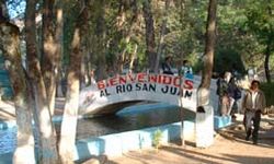
Tourism
The main tourist attractions in the department include the source of the San Juan River and the restored MayaMaya civilization
The Maya is a Mesoamerican civilization, noted for the only known fully developed written language of the pre-Columbian Americas, as well as for its art, architecture, and mathematical and astronomical systems. Initially established during the Pre-Classic period The Maya is a Mesoamerican...
ruins of Zaculeu. The town of Chiantla is a centre for religious tourism
Religious tourism
Religious tourism, also commonly referred to as faith tourism, is a form of tourism, whereby people of faith travel individually or in groups for pilgrimage, missionary, or leisure purposes. The world's largest form of mass religious tourism takes place at the annual Hajj pilgrimage in Mecca,...
, with the Catholic Church being a pilgrimage destination due to its image of the Virgin of Candelaria
Virgin of Candelaria
The cult of the Virgin of Candelaria or Our Lady of Candelaria , popularly called La Morenita, celebrates an apparition of the Virgin Mary on the island of Tenerife, one of the Canary Islands . The center of worship is located in the city of Candelaria in Tenerife. She is depicted as a Black Madonna...
, known locally as Nuestra Señora de Chiantla ("Our Lady of Chiantla").