

Great Lakes Circle Tour
Encyclopedia
The Great Lakes Circle Tour is a designated scenic road system connecting all of the Great Lakes
and the St. Lawrence River
. It consists of routes for circumnavigating the lakes, either individually or collectively.
state highways in the US states of Michigan
, Minnesota
and Wisconsin
and provincial highways in the Canadian province of Ontario
. These highways are usually the closest to the lake.
to Sault Ste. Marie
. In between it follows US 2 to Wakefield
, M-28
to Bergland and M-64
to Ontonagon
. At Ontonagon, the Tour continues east along M-38
to M-26
. It follows M-26 to Houghton
and then follows US 41
north to Copper Harbor
. There is a loop route along M-203
between Hancock
and Calumet
. Travelers following the tour need to backtrack down US 41 to Houghton and then follow US 41 back to M-28 in Covington
. US 41/M-28 carries the tour to Harvey
where M-28 carries it eastward. There is a spur routing along M-77
running north from Seney
to Grand Marais
. The mainline tour departs from M-28 to loop northward along M-123
through Newberry
to Paradise
and back to M-28. Then it follows M-28 for a third time until reaching I-75 where it follows the freeway north to Sault Ste. Marie. It leaves Michigan on the Sault Ste. Marie International Bridge
crossing into Ontario.
. It follows Highway 17 north along the mountainous shoreline through a remote region of Ontario. The highway curves to the west 300 km (186.4 mi) north of Sault Saint Marie, and hugs the northern shore of the lake to Nipigon
. It meets Highway 11, which is concurrent
with Highway 17 thereafter. The tour follows the Thunder Bay Expressway
through Thunder Bay
. At the intersection of the Harbour Expressway
, Highway 11 and Highway 17 turn west; the tour continues south, now on Highway 61
. 60 km (37.3 mi) south of Thunder Bay, the tour crosses the Pigeon River into Minnesota.
between the U.S.
-Canadian
border (near Thunder Bay
) and the city of Duluth
. In Duluth, the tour route follows Interstate 35
southbound to the U.S. Highway 2
exit to Wisconsin.
carrying U.S. Highway 2
between Duluth, Minnesota and Superior, Wisconsin
. In Superior, the tour route follows U.S. 2 / U.S. 53
to Wisconsin Highway 13. Near Ashland
, the tour route returns to U.S. 2 across Northern Wisconsin to Hurley
and the border with Michigan at Ironwood.
following state highways. These highways are usually the closest to the lake. The LMCT follows state highways in the US states of Illinois
, Indiana
and Michigan
and Wisconsin
. A special "spur route" follows the SS Badger
ferry
across the lake between Ludington, Michigan
and Manitowoc, Wisconsin
.
from the state line south on Sheridan Road and joins Lakeshore Drive (U.S. 41)The route then follows U.S. 41 as U.S. Routes 12 and 20 run concurrent but split quickly. The tour then follows U.S. Route 12 into Indiana.
and US 12
in Indiana.
The Indiana portion of the Lake Michigan Circle Tour is the urban stretch of the lake. It begins on the Illinois line in the City of Hammond
. US 12 continues eastward through the 2nd most populous portion of the State of Indiana
. The Gary
-Hammond
PMSA, a portion of the Chicago-Gary-Kenosha, IL-IN-WI Combined Statistical Area (CMSA)
which includes all of Lake
and Porter
Counties. The third county along the shore, LaPorte County
is in the South Bend
CMSA. The only "rural" area is the ten miles (16 km) across northern Porter County, where route passes through Indiana Dunes National Lakeshore
.
Starting from Chicago, US 12 enters Hammond, Indiana
, before Whiting
. Here, US 12, US 20
and US 41
all share Indianapolis Boulevard. Along the lakefront, is Lakefront Park and Wihala Beach County Park. Located here is the Horseshoe Casino. Whiting also provides easy access to Wolf Lake
, which is a remnant of the wetlands and lakes that formed along the shores of Lake Michigan creating a massive wetlands on the Illinois
and Indiana
border.
US 12 turns more southerly as it passes west and south of Indiana Harbor
and industrial complex of mills, refineries, and docks. Entering East Chicago
, US 12 turns east onto Columbus Drive, heading through the Indiana Harbor neighborhood of East Chicago
. From East Chicago
US 12 becomes Industrial Drive in Gary
.
The alternate route for the Circle Tour is along I-94, which is joined with I-80 as the Borman Expressway
. Entering Hammond
the first stop could be the South Shore Welcome Center located on Kennedy Boulevard off the interstate. Hammond developed because of the wetlands and numerous lakes. The area was not considered suitable for farming or development, until the meat packing industry began to thrive in Chicago. With the creation of refrigerated rail cars, a source of ice was needed. The lakes of northern Indiana
were seen as a source of that ice and meat packing moved across the line, creating processing plants and ice house.
Gary
is on both routes of the Circle Tour. I-80/I-94 and US 12 both enter the city. US 12 is closer to the lake, entering from East Chicago on Industrial Drive. Named appropriately for the industries and the Gary Airport that developed along the lakefront. U.S. Steel's Gary Plant
began in 1906, and brought major industries to this area. Located on the southern shore of Lake Michigan
, the city offered direct access to the iron fields of northern Michigan and Minnesota and the coal fields of Ohio and West Virginia.
Following Industrial Drive, US 12 heads southeast, crossing under the Indiana Toll Road
. At 4th Street, it turns east into downtown Gary. Downtown Gary is the home of the Railcats
Minor League Baseball. Continuing east into the Miller
community of Gary, and this is the closest the circle tour comes to the Chicago, South Shore and South Bend Railroad, the last interurban in the United States
. Lake Street to the north will take motorists to Lake Michigan
and over to Marquette Park, the first dune park along the Indiana Shore. Continuing on US 12, which is now called the Dunes Highway, the buildings end and forest and wetlands dominate. At County Line Road are the signs to Indiana Dunes National Lakeshore
's West Beach facility and the east end of the Miller
community. This is also the location for parking for the Marquette Hike/Bike trail.
Crossing County Line Road on US 12 you enter Portage
, in Porter County
. Portage owes its growth as a bedroom community to the creation of the Port of Indiana
complex.
US 12 continues eastward as the Dunes Highway passing quickly through the town of Burns Harbor
Porter
bills itself as the gateway to the Indiana Dunes. Its location with both Indiana Dunes State Park
and the Indiana Dunes National Lakeshore
support their claim.
The Dunes Highway continues east into the town of Chesterton
, which lies mostly south of US 12, US 20 and I-94.
Beverly Shores
was a dune development of the Bartlett Family. Today, it is a residential community with remnants of the various development ideas used to lure home buyers into the dunes. Spanish Eclectic
train depot and town hall, and the Old North Church with the Century of Progress Architectural District
homes from the 1933 Chicago World's Fair
are still present in this diverse architectural community.
Michigan City
is just east of Beverly Shores after US 12/Dunes Highway has passed through the Town of the Pines, turned northward along County Line Road. As the Dunes Highway turns east into the Laporte County
and the Michigan City limits, you come to the east end of Indiana Dunes National Lakeshore
at Mount Baldy
. The road continues as northeast toward Michigan
leaving Indiana
at Michiana Shores.
along US 12
. Near New Buffalo
the tour switches to follow I-94
north to the Benton Harbor
/St. Joseph
area. Here the LMCT follows BL I-94 and M-63
back to the freeway, this time the I-196
/US 31
freeway. At Holland
, the LMCT turns onto BL I-196/US 31. Formerly it also followed BUS US 31 through Holland until that designation was removed. The Circle Tour continues to follow US 31 northward deviating at Muskegon
, Montague
/Whitehall
and Pentwater
for the various business loops
. At Ludington
, the Lake Michigan Circle Tour meets a '"connecting route" over the S.S. Badger
carferry. The tour continues to follow US 31 to Manistee
where it joins M-22 (Michigan highway)
up and around the Leelanau Peninsula
. It rejoins US 31 at Traverse City and follows US 31 to the northern terminus of US 31 south of Mackinaw City
. There it runs along I-75
north to the Upper Peninsula of Michigan
. The Lake Huron Circle Tour joins I-75 at the northern terminus of US 23
and both run together on I-75 over the Mackinac Bridge
. North of the toll plaza in St. Ignace
, The LHCT takes Exit 344A to follow BL I-75 while the LMCT takes Exit 344B to follow US 2
.
In the Upper Peninsula, the circle tour follows US 2 westward to Rapid River
. Here US 41
joins US 2. At Gladstone
M-35
joins to form a three-way concurrency
south to Escanaba
. South of Escanaba, the circle tour follows M-35 to Menominee
. Here M-35 ends and US 41 carries the circle tour south into Wisconsin. There is a "spur route" designated along M-183
and Delta County Road 483 on the Garden Peninsula
.
south to I-43
in the Green Bay
area. From I-43, it runs up into the Door Peninsula
along WIS 57
and WIS 42
and back south to I-43. It continues along I-43 to Port Washington
where it briefly follows WIS 32
for a few miles thru Port Washington
then back onto I-43 to Milwaukee
where it re-joins WIS 32
to the state border.
in Port Huron, Michigan
-Sarnia, Ontario
. The LHCT continues around Lake Huron, touching on locations including the following:
A Michigan spur route utilizes a segment of M-134
to Detour, Michigan.
An Ontario spur route uses the MS Chi-Cheemaun ferry to cross the mouth of Lake Huron's Georgian Bay
from the Bruce Peninsula to Manitoulin Island
and return.
following state and provincial highways. These highways are usually the closest to the lake. The LECT follows state highways in the US states of New York
, Pennsylvania
, Ohio
, and Michigan
and provincial highways in the Canadian province of Ontario
.
, the LECT follows Interstate 75
(I-75) south from the Ambassador Bridge
to exit 43. There it follows M-85
through Lincoln Park
to Trenton
. At exit 28, the LECT rejoins I-75 and runs south through Monroe
to the state line, crossing into Toledo, Ohio
.
to follow I-280
around the east side of Toledo. In Oregon
, the tour exits I-280 and runs along SR 2 to the city of Sandusky
, home of Cedar Point
. There it joins U.S. Route 6 (US 6) to Cleveland
. West of Cleveland, US 6 merges with US 20 and SR 2 in a three-way concurrency
. The LECT will continue to follow SR 2 through downtown Cleveland. On the east side of the city, the tour continues on SR 283 through Euclid
to Painesville
. There it merges onto US 20 until Geneva
. The tour follows SR 531 east along the lake between Geneva and Conneaut
, where it returns along US 20 east to the state line.
through Erie County
. This is also the routing of the Seaway Trail
.
to Buffalo
. There it follows the Peace Bridge
to Ontario.
through the province, running the entire length from the Peace Bridge to the Ambassador Bridge.
(MDOT) was in consultation with its counterparts in Wisconsin (WisDOT
), Minnesota (Mn/DOT
) and Ontario (Ministry of Transportation of Ontario, MTO) in May 1986 to establish a tour route around Lake Superior. The project was started by Paula Blanchard, the First Lady of Michigan at the time. She was an adviser to the Michigan Department of Commerce and called for the formation of the tour in the fall of 1985 at a tourism conference. Representatives from the three states and province agreed to the plan. Michigan drafted the first design for the signs in early 1986, sending the design to the other governments for approval. The Great Lakes Commission approved the formation of a Great Lakes Circle Tour in November 1988.
Great Lakes
The Great Lakes are a collection of freshwater lakes located in northeastern North America, on the Canada – United States border. Consisting of Lakes Superior, Michigan, Huron, Erie, and Ontario, they form the largest group of freshwater lakes on Earth by total surface, coming in second by volume...
and the St. Lawrence River
Saint Lawrence River
The Saint Lawrence is a large river flowing approximately from southwest to northeast in the middle latitudes of North America, connecting the Great Lakes with the Atlantic Ocean. It is the primary drainage conveyor of the Great Lakes Basin...
. It consists of routes for circumnavigating the lakes, either individually or collectively.
Lake Superior Circle Tour
The Lake Superior Circle Tour (LSCT) loops around Lake SuperiorLake Superior
Lake Superior is the largest of the five traditionally-demarcated Great Lakes of North America. It is bounded to the north by the Canadian province of Ontario and the U.S. state of Minnesota, and to the south by the U.S. states of Wisconsin and Michigan. It is the largest freshwater lake in the...
state highways in the US states of Michigan
Michigan
Michigan is a U.S. state located in the Great Lakes Region of the United States of America. The name Michigan is the French form of the Ojibwa word mishigamaa, meaning "large water" or "large lake"....
, Minnesota
Minnesota
Minnesota is a U.S. state located in the Midwestern United States. The twelfth largest state of the U.S., it is the twenty-first most populous, with 5.3 million residents. Minnesota was carved out of the eastern half of the Minnesota Territory and admitted to the Union as the thirty-second state...
and Wisconsin
Wisconsin
Wisconsin is a U.S. state located in the north-central United States and is part of the Midwest. It is bordered by Minnesota to the west, Iowa to the southwest, Illinois to the south, Lake Michigan to the east, Michigan to the northeast, and Lake Superior to the north. Wisconsin's capital is...
and provincial highways in the Canadian province of Ontario
Ontario
Ontario is a province of Canada, located in east-central Canada. It is Canada's most populous province and second largest in total area. It is home to the nation's most populous city, Toronto, and the nation's capital, Ottawa....
. These highways are usually the closest to the lake.
Michigan
In Michigan, it runs from the state line at IronwoodIronwood, Michigan
Ironwood is a city in Gogebic County in the U.S. state of Michigan, about south of Lake Superior. The population was 6,293 at the 2000 census. The city is on US 2 and is situated opposite the Montreal River from Hurley, Wisconsin. It is the westernmost city in Michigan, situated on the same line...
to Sault Ste. Marie
Sault Ste. Marie, Michigan
Sault Ste. Marie is a city in and the county seat of Chippewa County in the U.S. state of Michigan. It is in the north-eastern end of Michigan's Upper Peninsula, on the Canadian border, separated from its twin city of Sault Ste. Marie, Ontario, by the St. Marys River...
. In between it follows US 2 to Wakefield
Wakefield, Michigan
Wakefield is a city in Gogebic County in the US state of Michigan. It is located in the western Upper Peninsula. The population was 1,851 at the 2010 census....
, M-28
M-28 (Michigan highway)
M-28 is an east–west state trunkline highway that almost completely traverses the Upper Peninsula in the U.S. state of Michigan, from Wakefield to near Sault Ste. Marie in Bruce Township...
to Bergland and M-64
M-64 (Michigan highway)
M-64 is a north–south state trunkline highway in the Upper Peninsula of the US state of Michigan. It runs for through the western part of the state in land that is part of the Ottawa National Forest. The highway connects with County Trunk Highway B at the state line near Presque Isle, Wisconsin....
to Ontonagon
Ontonagon, Michigan
Ontonagon is a village in the U.S. state of Michigan. As of the 2000 census, the village had a total population of 1,769. It is the county seat of Ontonagon County....
. At Ontonagon, the Tour continues east along M-38
M-38 (Michigan highway)
M-38 is an east–west state trunkline highway in the Upper Peninsula of the U.S. state of Michigan. Its west end starts in Ontonagon and runs east to Baraga, some apart. The highway crosses streams and rivers in forest lands and provides access to a casino...
to M-26
M-26 (Michigan highway)
M-26 is a state trunkline highway in the U.S. state of Michigan, running from two miles east of Rockland to its junction with US Highway 41 in Copper Harbor. It generally runs southwest-to-northeast in the western half or Michigan's Upper Peninsula...
. It follows M-26 to Houghton
Houghton, Michigan
Houghton is a city in the U.S. state of Michigan's Upper Peninsula and largest city in the Copper Country on the Keweenaw Peninsula. As of the 2010 census, the city population was 7,708. It is the county seat of Houghton County...
and then follows US 41
U.S. Route 41 in Michigan
US Highway 41 is a part of the United States Numbered Highway System that runs from Miami, Florida, to the Upper Peninsula of the US state of Michigan. In Michigan, it is a state trunkline highway that enters the state via the Interstate Bridge between Marinette, Wisconsin, and Menominee,...
north to Copper Harbor
Copper Harbor, Michigan
Copper Harbor is a small unincorporated community in northeastern Keweenaw County in the U.S. state of Michigan. It is within Grant Township on the Keweenaw Peninsula that juts from the Upper Peninsula of Michigan into Lake Superior.-History:...
. There is a loop route along M-203
M-203 (Michigan highway)
M-203 is a north–south state trunkline highway in the Upper Peninsula of the US state of Michigan. It connects McLain State Park with US 41 on each end in Hancock and Calumet...
between Hancock
Hancock, Michigan
Hancock is a city in Houghton County; the northernmost in the U.S. state of Michigan, located on the Keweenaw Peninsula, or, depending on terminology, Copper Island. The population was 4,634 at the 2010 census...
and Calumet
Calumet, Michigan
Calumet is a village in Calumet Township, Houghton County, in the U.S. state of Michigan's Upper Peninsula, that was once at the center of the mining industry of the Upper Peninsula. Also known as Red Jacket, the village includes the Calumet Downtown Historic District, listed on the National...
. Travelers following the tour need to backtrack down US 41 to Houghton and then follow US 41 back to M-28 in Covington
Covington, Michigan
Covington is an unincorporated community in Covington Township of Baraga County in the U.S. state of Michigan, with coordinates of on US 141 near the junction with M-28, which is a few miles west of US 41. Covington uses the ZIP code 49919.-History:...
. US 41/M-28 carries the tour to Harvey
Harvey, Michigan
Harvey is an unincorporated community, known in the early years as "Harvey Location", in Chocolay Township, Marquette County in the U.S. state of Michigan. It is a census-designated place for statistical purposes and has no legal status as an incorporated municipality...
where M-28 carries it eastward. There is a spur routing along M-77
M-77 (Michigan highway)
M-77 is a state trunkline highway in the Upper Peninsula of the US state of Michigan. It runs from US Highway 2 near Blaney Park in the south to Grand Marais in the north. The highway borders the Seney National Wildlife Refuge. The northern half has been designated as a Scenic Spur of the Lake...
running north from Seney
Seney, Michigan
Seney is an unincorporated community in Schoolcraft County in the Upper Peninsula of Michigan in the United States. The town is built on the outskirts of the Seney National Wildlife Refuge, administered by the U.S. Fish and Wildlife Service. It was featured in the Ernest Hemingway short story "Big...
to Grand Marais
Grand Marais, Michigan
Grand Marais is an unincorporated community in Burt Township, Alger County in the U.S. state of Michigan. It is located on Lake Superior at and is the eastern gateway to the Pictured Rocks National Lakeshore via H-58....
. The mainline tour departs from M-28 to loop northward along M-123
M-123 (Michigan highway)
M-123 is a state trunkline highway in the eastern Upper Peninsula of the U.S. state of Michigan. It is one of only a few highways in Michigan that curve around and form a U-shape. In fact, M-123 has three intersections with only two state trunklines. It meets M-28 twice as a result of its U-shaped...
through Newberry
Newberry, Michigan
Newberry is a village in the U.S. state of Michigan and the county seat of Luce County. Located within McMillan Township at its very southern end, it shares some administrative responsibilities with the surrounding township. The population was 2,686 at the 2000 census.The village was named in...
to Paradise
Paradise, Michigan
Paradise is an unincorporated community in Whitefish Township, Chippewa County in the U.S. state of Michigan.Paradise is on the northeastern portion of Michigan's Upper Peninsula, on the western side of Whitefish Bay, Lake Superior, about by road from Sault Ste. Marie and about north of the...
and back to M-28. Then it follows M-28 for a third time until reaching I-75 where it follows the freeway north to Sault Ste. Marie. It leaves Michigan on the Sault Ste. Marie International Bridge
Sault Ste. Marie International Bridge
The Sault Ste. Marie International Bridge, often known just as the International Bridge, spans the St. Marys River between the United States and Canada connecting the twin cities of Sault Ste. Marie, Michigan and Sault Ste. Marie, Ontario. It serves as the northern terminus of Interstate 75...
crossing into Ontario.
Ontario
Once in Ontario, the tour follows city streets through Sault Saint Marie to Highway 17, part of the Trans-Canada HighwayTrans-Canada Highway
The Trans-Canada Highway is a federal-provincial highway system that joins the ten provinces of Canada. It is, along with the Trans-Siberian Highway and Australia's Highway 1, one of the world's longest national highways, with the main route spanning 8,030 km...
. It follows Highway 17 north along the mountainous shoreline through a remote region of Ontario. The highway curves to the west 300 km (186.4 mi) north of Sault Saint Marie, and hugs the northern shore of the lake to Nipigon
Nipigon
Nipigon is a township in Thunder Bay District, Northwestern Ontario, Canada, located along the west side of the Nipigon River and south of the small Lake Helen running between Lake Nipigon and Lake Superior...
. It meets Highway 11, which is concurrent
Concurrency (road)
A concurrency, overlap, or coincidence in a road network is an instance of one physical road bearing two or more different highway, motorway, or other route numbers...
with Highway 17 thereafter. The tour follows the Thunder Bay Expressway
Thunder Bay Expressway
The Thunder Bay Expressway is a four lane highway with signalized intersections running on the western edge of Thunder Bay, Ontario, Canada.- Route description :...
through Thunder Bay
Thunder Bay
-In Canada:Thunder Bay is the name of three places in the province of Ontario, Canada along Lake Superior:*Thunder Bay District, Ontario, a district in Northwestern Ontario*Thunder Bay, a city in Thunder Bay District*Thunder Bay, Unorganized, Ontario...
. At the intersection of the Harbour Expressway
Harbour Expressway
The Harbour Expressway is a four lane highway with signalized intersections running the Intercity business district of Thunder Bay, Ontario, Canada....
, Highway 11 and Highway 17 turn west; the tour continues south, now on Highway 61
Ontario Highway 61
King's Highway 61, commonly referred to as Highway 61 and historically known as the Scott Highway, is a provincially maintained highway in the Canadian province of Ontario. It connects the Pigeon River Bridge, where it crosses into the United States and becomes Minnesota State Highway 61, with a...
. 60 km (37.3 mi) south of Thunder Bay, the tour crosses the Pigeon River into Minnesota.
Minnesota
The Circle Tour follows Minnesota Highway 61Minnesota State Highway 61
Minnesota State Highway 61 is a highway in northeast Minnesota, which runs from the junction of Interstate Highway 35 and Minnesota 61 in Duluth and continues northeast to its northern terminus at the U.S.-Canadian border near Grand Portage...
between the U.S.
United States
The United States of America is a federal constitutional republic comprising fifty states and a federal district...
-Canadian
Canada
Canada is a North American country consisting of ten provinces and three territories. Located in the northern part of the continent, it extends from the Atlantic Ocean in the east to the Pacific Ocean in the west, and northward into the Arctic Ocean...
border (near Thunder Bay
Thunder Bay
-In Canada:Thunder Bay is the name of three places in the province of Ontario, Canada along Lake Superior:*Thunder Bay District, Ontario, a district in Northwestern Ontario*Thunder Bay, a city in Thunder Bay District*Thunder Bay, Unorganized, Ontario...
) and the city of Duluth
Duluth, Minnesota
Duluth is a port city in the U.S. state of Minnesota and is the county seat of Saint Louis County. The fourth largest city in Minnesota, Duluth had a total population of 86,265 in the 2010 census. Duluth is also the second largest city that is located on Lake Superior after Thunder Bay, Ontario,...
. In Duluth, the tour route follows Interstate 35
Interstate 35 in Minnesota
In the U.S. state of Minnesota, Interstate 35 is a highway in southeast, east-central, and northeast Minnesota. The route runs north–south from the Iowa state line through the twin cities of Minneapolis and Saint Paul; where it splits into Interstates 35E and 35W; and ends in the city of...
southbound to the U.S. Highway 2
U.S. Route 2
U.S. Route 2 is an east–west U.S. Highway spanning across the northern continental United States. US 2 consists of two segments connected by various roadways in southern Canada...
exit to Wisconsin.
Wisconsin
The Circle Tour crosses into Wisconsin on the Bong Memorial BridgeRichard I. Bong Memorial Bridge
The Richard I. Bong Memorial Bridge, also known as the Bong Bridge, connects Duluth, Minnesota with Superior, Wisconsin via U.S. Highway 2. Opened on October 25, 1985, it is roughly 11,800 feet long. About 8,300 feet of that length is actually over water. It crosses over the Saint Louis Bay...
carrying U.S. Highway 2
U.S. Route 2
U.S. Route 2 is an east–west U.S. Highway spanning across the northern continental United States. US 2 consists of two segments connected by various roadways in southern Canada...
between Duluth, Minnesota and Superior, Wisconsin
Superior, Wisconsin
Superior is a city in and the county seat of Douglas County, Wisconsin, United States. The population was 26,960 at the 2010 census. Located at the junction of U.S. Highways 2 and 53, it is north of and adjacent to both the Village of Superior and the Town of Superior.Superior is at the western...
. In Superior, the tour route follows U.S. 2 / U.S. 53
U.S. Route 53
U.S. Route 53 is a north–south U.S. highway that runs for 403 miles from La Crosse, Wisconsin to northern Minnesota. It is the primary north–south route in northwestern Wisconsin, serving as a vital link between I-94 at Eau Claire, Wisconsin and the city of Duluth, Minnesota...
to Wisconsin Highway 13. Near Ashland
Ashland, Wisconsin
Ashland is a city in Ashland and Bayfield counties in the U.S. state of Wisconsin. The city is a port on Lake Superior, near the head of Chequamegon Bay. The population was 8,695 at the 2010 census....
, the tour route returns to U.S. 2 across Northern Wisconsin to Hurley
Hurley, Wisconsin
Hurley is a city in and the county seat of Iron County, Wisconsin, United States. The population was 1,818 at the 2000 census. It is directly across the Montreal River from Ironwood, Michigan.-History:...
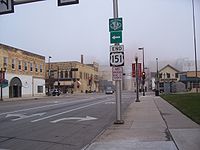
and the border with Michigan at Ironwood.
Lake Michigan Circle Tour
The Lake Michigan Circle Tour (LMCT) loops around Lake MichiganLake Michigan
Lake Michigan is one of the five Great Lakes of North America and the only one located entirely within the United States. It is the second largest of the Great Lakes by volume and the third largest by surface area, after Lake Superior and Lake Huron...
following state highways. These highways are usually the closest to the lake. The LMCT follows state highways in the US states of Illinois
Illinois
Illinois is the fifth-most populous state of the United States of America, and is often noted for being a microcosm of the entire country. With Chicago in the northeast, small industrial cities and great agricultural productivity in central and northern Illinois, and natural resources like coal,...
, Indiana
Indiana
Indiana is a US state, admitted to the United States as the 19th on December 11, 1816. It is located in the Midwestern United States and Great Lakes Region. With 6,483,802 residents, the state is ranked 15th in population and 16th in population density. Indiana is ranked 38th in land area and is...
and Michigan
Michigan
Michigan is a U.S. state located in the Great Lakes Region of the United States of America. The name Michigan is the French form of the Ojibwa word mishigamaa, meaning "large water" or "large lake"....
and Wisconsin
Wisconsin
Wisconsin is a U.S. state located in the north-central United States and is part of the Midwest. It is bordered by Minnesota to the west, Iowa to the southwest, Illinois to the south, Lake Michigan to the east, Michigan to the northeast, and Lake Superior to the north. Wisconsin's capital is...
. A special "spur route" follows the SS Badger
S.S. Badger
The SS Badger is a coal-fired passenger and vehicle ferry in the United States that has been in Lake Michigan service from 1953 until the present. Currently, she shuttles between Ludington, Michigan and Manitowoc, Wisconsin. She is the last coal-fired passenger vessel operating on the Great...
ferry
Ferry
A ferry is a form of transportation, usually a boat, but sometimes a ship, used to carry primarily passengers, and sometimes vehicles and cargo as well, across a body of water. Most ferries operate on regular, frequent, return services...
across the lake between Ludington, Michigan
Ludington, Michigan
Ludington is a city in the U.S. state of Michigan. As of the 2000 census, the city population was 8,357. It is the county seat of Mason County.Ludington is a harbor town located on Lake Michigan at the mouth of the Pere Marquette River...
and Manitowoc, Wisconsin
Manitowoc, Wisconsin
Manitowoc is a city in and the county seat of Manitowoc County, Wisconsin, United States. The city is located on Lake Michigan at the mouth of the Manitowoc River. According to the 2000 census, Manitowoc had a population of 34,053, with over 50,000 residents in the surrounding communities...
.
Illinois
The LMCT follows Illinois Route 137Illinois Route 137
Illinois Route 137 is a state highway in northeast Illinois. It runs from the Wisconsin Border north of Winthrop Harbor south to North Chicago, west to Libertyville, and then back northwest to Grayslake, terminating at Illinois Route 83 just south of Illinois Route 120...
from the state line south on Sheridan Road and joins Lakeshore Drive (U.S. 41)The route then follows U.S. 41 as U.S. Routes 12 and 20 run concurrent but split quickly. The tour then follows U.S. Route 12 into Indiana.
Indiana
The LMCT follows I-94Interstate 94 in Indiana
In the U.S. state of Indiana, Interstate 94 runs east–west through the northwest portion of the state.-Route description:The route between the Illinois border and Lake Station at its junction with the Indiana Toll Road is known as the Borman Expressway and is a heavily traveled route...
and US 12
U.S. Route 12 in Indiana
In the U.S. state of Indiana, U.S. Route 12 is a historical east–west arterial highway that runs along the Lake Michigan shoreline. In the early 1920s, it was the most important route between Chicago, Illinois and Detroit, Michigan. Most of the route has since been supplanted by Interstate 94...
in Indiana.
The Indiana portion of the Lake Michigan Circle Tour is the urban stretch of the lake. It begins on the Illinois line in the City of Hammond
Hammond, Indiana
Hammond is a city in Lake County, Indiana, United States. It is part of the Chicago metropolitan area. The population was 80,830 at the 2010 census.-Geography:Hammond is located at ....
. US 12 continues eastward through the 2nd most populous portion of the State of Indiana
Indiana
Indiana is a US state, admitted to the United States as the 19th on December 11, 1816. It is located in the Midwestern United States and Great Lakes Region. With 6,483,802 residents, the state is ranked 15th in population and 16th in population density. Indiana is ranked 38th in land area and is...
. The Gary
Gary, Indiana
Gary is a city in Lake County, Indiana, United States. The city is in the southeastern portion of the Chicago metropolitan area and is 25 miles from downtown Chicago. The population is 80,294 at the 2010 census, making it the seventh-largest city in the state. It borders Lake Michigan and is known...
-Hammond
Hammond, Indiana
Hammond is a city in Lake County, Indiana, United States. It is part of the Chicago metropolitan area. The population was 80,830 at the 2010 census.-Geography:Hammond is located at ....
PMSA, a portion of the Chicago-Gary-Kenosha, IL-IN-WI Combined Statistical Area (CMSA)
Combined Statistical Area
The United States Office of Management and Budget defines micropolitan and metropolitan statistical areas. Metropolitan and micropolitan statistical areas consist of one or more counties...
which includes all of Lake
Lake County, Indiana
Lake County is a county located in the U.S. state of Indiana. In 2010, its population was 496,005, making it Indiana's second-most populous county. The county seat is Crown Point. This county is part of Northwest Indiana and the Chicago metropolitan area. The county contains a mix of urban,...
and Porter
Porter County, Indiana
Porter County is a county located in the U.S. state of Indiana. As of 2010, the population was 164,343. Much of the population growth has to do with the expansion of the Chicago Metropolitan Area eastward into Indiana. The county seat is Valparaiso...
Counties. The third county along the shore, LaPorte County
LaPorte County, Indiana
LaPorte County is a county located in the U.S. state of Indiana. As of 2010, the population was 111,467. The county seat is the city of La Porte. This county is part of the Chicago metropolitan area, Northwest Indiana and Michiana. The largest city is Michigan City...
is in the South Bend
South Bend, Indiana
The city of South Bend is the county seat of St. Joseph County, Indiana, United States, on the St. Joseph River near its southernmost bend, from which it derives its name. As of the 2010 Census, the city had a total of 101,168 residents; its Metropolitan Statistical Area had a population of 316,663...
CMSA. The only "rural" area is the ten miles (16 km) across northern Porter County, where route passes through Indiana Dunes National Lakeshore
Indiana Dunes National Lakeshore
Indiana Dunes National Lakeshore is a U.S. National Lakeshore located in northwest Indiana and managed by the National Park Service. It was authorized by Congress in 1966. The national lakeshore runs for nearly along the southern shore of Lake Michigan, from Gary, Indiana, on the west to Michigan...
.
Starting from Chicago, US 12 enters Hammond, Indiana
Hammond, Indiana
Hammond is a city in Lake County, Indiana, United States. It is part of the Chicago metropolitan area. The population was 80,830 at the 2010 census.-Geography:Hammond is located at ....
, before Whiting
Whiting, Indiana
Whiting is a city located in the Chicago Metropolitan Area in Lake County, Indiana, which was founded in 1889. The city is located on the southern shore of Lake Michigan. It is roughly 16 miles from the Chicago Loop and just short of two miles from Chicago's South Side. Whiting is home to Whiting...
. Here, US 12, US 20
U.S. Route 20 in Indiana
U.S. Route 20 in Indiana is a main east–west highway that is parallel to the Indiana Toll Road. The western terminus of US 20 is at the Illinois state line and the eastern terminus is at the Ohio state line. US 20 through Whiting, East Chicago, and Gary is concurrent with...
and US 41
U.S. Route 41 in Indiana
In the U.S. state of Indiana, U.S. Route 41 is a north–south highway that is parallel to the Illinois state line. It enters the state south of Evansville. North of Evansville, it becomes a 4-Lane divided highway passing around Vincennes and traveling North to Terre Haute. In Terre Haute, it...
all share Indianapolis Boulevard. Along the lakefront, is Lakefront Park and Wihala Beach County Park. Located here is the Horseshoe Casino. Whiting also provides easy access to Wolf Lake
Wolf Lake
Wolf Lake is an American television series that originally aired on CBS. Wolf Lake follows a pack of werewolves living in a Seattle suburb. The first 5 episodes aired on CBS, but due to low ratings CBS cancelled it. A total of nine aired episodes and a non-aired pilot were made before the show...
, which is a remnant of the wetlands and lakes that formed along the shores of Lake Michigan creating a massive wetlands on the Illinois
Illinois
Illinois is the fifth-most populous state of the United States of America, and is often noted for being a microcosm of the entire country. With Chicago in the northeast, small industrial cities and great agricultural productivity in central and northern Illinois, and natural resources like coal,...
and Indiana
Indiana
Indiana is a US state, admitted to the United States as the 19th on December 11, 1816. It is located in the Midwestern United States and Great Lakes Region. With 6,483,802 residents, the state is ranked 15th in population and 16th in population density. Indiana is ranked 38th in land area and is...
border.
US 12 turns more southerly as it passes west and south of Indiana Harbor
Indiana Harbor and Ship Canal
The Indiana Harbor and Ship Canal is an artificial waterway on the southwest shore of Lake Michigan, in East Chicago, Indiana which connects the Grand Calumet River to Lake Michigan. It consists of two branch canals, the 1.25 mile Lake George Branch and the 2 mile long Grand Calumet River Branch...
and industrial complex of mills, refineries, and docks. Entering East Chicago
East Chicago, Indiana
East Chicago is a city in Lake County, Indiana. The population was 29,698 at the 2010 census.-Geography:East Chicago is located at ....
, US 12 turns east onto Columbus Drive, heading through the Indiana Harbor neighborhood of East Chicago
East Chicago, Indiana
East Chicago is a city in Lake County, Indiana. The population was 29,698 at the 2010 census.-Geography:East Chicago is located at ....
. From East Chicago
East Chicago, Indiana
East Chicago is a city in Lake County, Indiana. The population was 29,698 at the 2010 census.-Geography:East Chicago is located at ....
US 12 becomes Industrial Drive in Gary
Gary, Indiana
Gary is a city in Lake County, Indiana, United States. The city is in the southeastern portion of the Chicago metropolitan area and is 25 miles from downtown Chicago. The population is 80,294 at the 2010 census, making it the seventh-largest city in the state. It borders Lake Michigan and is known...
.
The alternate route for the Circle Tour is along I-94, which is joined with I-80 as the Borman Expressway
Borman Expressway
The Frank Borman Expressway is an east–west highway in the northwest part of the U.S. state of Indiana, named after astronaut and former Eastern Airlines CEO Frank Borman. The expressway consists of parts of Interstate 80 , I-94, and U.S. Highway 6 , as well as a short section of US 41...
. Entering Hammond
Hammond, Indiana
Hammond is a city in Lake County, Indiana, United States. It is part of the Chicago metropolitan area. The population was 80,830 at the 2010 census.-Geography:Hammond is located at ....
the first stop could be the South Shore Welcome Center located on Kennedy Boulevard off the interstate. Hammond developed because of the wetlands and numerous lakes. The area was not considered suitable for farming or development, until the meat packing industry began to thrive in Chicago. With the creation of refrigerated rail cars, a source of ice was needed. The lakes of northern Indiana
Northern Indiana
Northern Indiana is the region of Indiana including 26 counties bordering parts of Illinois, Michigan, and Ohio. The area is generally sub-classified into other regions. The northwest is economically and culturally intertwined with Chicago, and is considered part of the Chicago metropolitan area...
were seen as a source of that ice and meat packing moved across the line, creating processing plants and ice house.
Gary
Gary, Indiana
Gary is a city in Lake County, Indiana, United States. The city is in the southeastern portion of the Chicago metropolitan area and is 25 miles from downtown Chicago. The population is 80,294 at the 2010 census, making it the seventh-largest city in the state. It borders Lake Michigan and is known...
is on both routes of the Circle Tour. I-80/I-94 and US 12 both enter the city. US 12 is closer to the lake, entering from East Chicago on Industrial Drive. Named appropriately for the industries and the Gary Airport that developed along the lakefront. U.S. Steel's Gary Plant
U.S. Steel
The United States Steel Corporation , more commonly known as U.S. Steel, is an integrated steel producer with major production operations in the United States, Canada, and Central Europe. The company is the world's tenth largest steel producer ranked by sales...
began in 1906, and brought major industries to this area. Located on the southern shore of Lake Michigan
Lake Michigan
Lake Michigan is one of the five Great Lakes of North America and the only one located entirely within the United States. It is the second largest of the Great Lakes by volume and the third largest by surface area, after Lake Superior and Lake Huron...
, the city offered direct access to the iron fields of northern Michigan and Minnesota and the coal fields of Ohio and West Virginia.
Following Industrial Drive, US 12 heads southeast, crossing under the Indiana Toll Road
Indiana Toll Road
The Indiana Toll Road, officially the Indiana East–West Toll Road, is a toll road that runs for east–west across northern Indiana from the Illinois state line to the Ohio state line...
. At 4th Street, it turns east into downtown Gary. Downtown Gary is the home of the Railcats
Gary SouthShore RailCats
The Gary SouthShore RailCats are a professional baseball team based in Gary, Indiana, in the United States. The RailCats are a member of the American Association of Independent Professional Baseball, which is not affiliated with Major League Baseball. The RailCats have played their home games at...
Minor League Baseball. Continuing east into the Miller
Miller, Indiana
The name Miller, Indiana can refer to two very different Indiana communities. The unincorporated community of Miller is in Madison Township, Morgan County, Indiana....
community of Gary, and this is the closest the circle tour comes to the Chicago, South Shore and South Bend Railroad, the last interurban in the United States
United States
The United States of America is a federal constitutional republic comprising fifty states and a federal district...
. Lake Street to the north will take motorists to Lake Michigan
Lake Michigan
Lake Michigan is one of the five Great Lakes of North America and the only one located entirely within the United States. It is the second largest of the Great Lakes by volume and the third largest by surface area, after Lake Superior and Lake Huron...
and over to Marquette Park, the first dune park along the Indiana Shore. Continuing on US 12, which is now called the Dunes Highway, the buildings end and forest and wetlands dominate. At County Line Road are the signs to Indiana Dunes National Lakeshore
Indiana Dunes National Lakeshore
Indiana Dunes National Lakeshore is a U.S. National Lakeshore located in northwest Indiana and managed by the National Park Service. It was authorized by Congress in 1966. The national lakeshore runs for nearly along the southern shore of Lake Michigan, from Gary, Indiana, on the west to Michigan...
's West Beach facility and the east end of the Miller
Miller, Indiana
The name Miller, Indiana can refer to two very different Indiana communities. The unincorporated community of Miller is in Madison Township, Morgan County, Indiana....
community. This is also the location for parking for the Marquette Hike/Bike trail.
Crossing County Line Road on US 12 you enter Portage
Portage, Indiana
Portage is a city in Portage Township, Porter County, Indiana, United States. The population was 36,828 as of the 2010 census. It is the largest city in Porter County, and third largest in Northwest Indiana.-Geography:...
, in Porter County
Porter County, Indiana
Porter County is a county located in the U.S. state of Indiana. As of 2010, the population was 164,343. Much of the population growth has to do with the expansion of the Chicago Metropolitan Area eastward into Indiana. The county seat is Valparaiso...
. Portage owes its growth as a bedroom community to the creation of the Port of Indiana
Port of Indiana
The Port of Indiana-Burns Harbor is an industrial area, founded in 1965 and located on the Lake Michigan shore of Indiana at the intersection of U.S. Highway 12 and Indiana 249. The primary work done in the area is the manufacturing of steel, and the port area is dominated by steel mills...
complex.
US 12 continues eastward as the Dunes Highway passing quickly through the town of Burns Harbor
Burns Harbor, Indiana
Burns Harbor is a town in Westchester Township, Porter County, Indiana, United States on the shores of Lake Michigan in Northwest Indiana and is part of the Chicago metropolitan area...
Porter
Porter, Indiana
Porter is a town in Westchester Township, Porter County, Indiana, United States. The population was 4,972 at the 2000 census.Porter is noted for its proximity to the Indiana Dunes State Park and for its railroad heritage...
bills itself as the gateway to the Indiana Dunes. Its location with both Indiana Dunes State Park
Indiana Dunes State Park
Indiana DunesDesignationState Park; National Natural LandmarkLocationPorter County, Indiana, USAAddress1600 N 25 EChesterton, IN 46304Nearest CityPorter, IndianaCoordinatesAreaDate of Establishment1925...
and the Indiana Dunes National Lakeshore
Indiana Dunes National Lakeshore
Indiana Dunes National Lakeshore is a U.S. National Lakeshore located in northwest Indiana and managed by the National Park Service. It was authorized by Congress in 1966. The national lakeshore runs for nearly along the southern shore of Lake Michigan, from Gary, Indiana, on the west to Michigan...
support their claim.
The Dunes Highway continues east into the town of Chesterton
Chesterton, Indiana
Chesterton is a town in Westchester, Jackson and Liberty townships, Porter County, Indiana, United States. The population was 13,068 at the 2010 census. The three towns of Chesterton, Burns Harbor, and Porter are known as the tri-towns or the Duneland area....
, which lies mostly south of US 12, US 20 and I-94.
Beverly Shores
Beverly Shores, Indiana
Beverly Shores is a town in Pine Township, Porter County, Indiana, United States, about east of downtown Chicago. The population was 613 at the 2010 census.-History:...
was a dune development of the Bartlett Family. Today, it is a residential community with remnants of the various development ideas used to lure home buyers into the dunes. Spanish Eclectic
Spanish Colonial Revival Style architecture
The Spanish Colonial Revival Style was a United States architectural stylistic movement that came about in the early 20th century, starting in California and Florida as a regional expression related to history, environment, and nostalgia...
train depot and town hall, and the Old North Church with the Century of Progress Architectural District
Century of Progress Architectural District
The Century of Progress Architectural District is listed on the National Register of Historic Places. The district is in eastern unit of Indiana Dunes National Lakeshore. The homes are also part of the Beverly Shores, Indiana, community...
homes from the 1933 Chicago World's Fair
Century of Progress
A Century of Progress International Exposition was the name of a World's Fair held in Chicago from 1933 to 1934 to celebrate the city's centennial. The theme of the fair was technological innovation...
are still present in this diverse architectural community.
Michigan City
Michigan City, Indiana
Michigan City's origins date to 1830, when the land for the city was first purchased by Isaac C. Elston. Elston Middle School, formerly Elston High School, located at 317 Detroit St., is named after the founder....
is just east of Beverly Shores after US 12/Dunes Highway has passed through the Town of the Pines, turned northward along County Line Road. As the Dunes Highway turns east into the Laporte County
LaPorte County, Indiana
LaPorte County is a county located in the U.S. state of Indiana. As of 2010, the population was 111,467. The county seat is the city of La Porte. This county is part of the Chicago metropolitan area, Northwest Indiana and Michiana. The largest city is Michigan City...
and the Michigan City limits, you come to the east end of Indiana Dunes National Lakeshore
Indiana Dunes National Lakeshore
Indiana Dunes National Lakeshore is a U.S. National Lakeshore located in northwest Indiana and managed by the National Park Service. It was authorized by Congress in 1966. The national lakeshore runs for nearly along the southern shore of Lake Michigan, from Gary, Indiana, on the west to Michigan...
at Mount Baldy
Mount Baldy
Mount Baldy or Baldy Mountain may refer to:* Baldy Mountain * Mount Baldy * Mount Baldy * Mount Baldy * Mount Baldy...
. The road continues as northeast toward Michigan
Michigan
Michigan is a U.S. state located in the Great Lakes Region of the United States of America. The name Michigan is the French form of the Ojibwa word mishigamaa, meaning "large water" or "large lake"....
leaving Indiana
Indiana
Indiana is a US state, admitted to the United States as the 19th on December 11, 1816. It is located in the Midwestern United States and Great Lakes Region. With 6,483,802 residents, the state is ranked 15th in population and 16th in population density. Indiana is ranked 38th in land area and is...
at Michiana Shores.
Michigan
The LMCT enters Michigan in Berrien CountyBerrien County, Michigan
Berrien County is a county located in the extreme southwest of the U.S. state of Michigan. It is included in the Niles-Benton Harbor, Michigan Metropolitan Statistical Area. As of the 2010 census, the population was 156,813. The county seat is St. Joseph....
along US 12
U.S. Route 12 in Michigan
US Highway 12 is a US Highway that runs from Aberdeen, Washington to Detroit, Michigan. In the US state of Michigan it runs for . Previous to the creation of Interstate Highways in Michigan, US 12 ran along Michigan Avenue between Kalamazoo and Detroit, a highway corridor now served by I-94...
. Near New Buffalo
New Buffalo, Michigan
New Buffalo is a city in Berrien County in the U.S. state of Michigan. The population was 2,200 at the 2000 census. This city is within New Buffalo Township, but is politically autonomous.-Geography:...
the tour switches to follow I-94
Interstate 94 in Michigan
Interstate 94 is a part of the Interstate Highway System that runs from Billings, Montana, to the Lower Peninsula of the US state of Michigan. In Michigan, it is a state trunkline highway that enters the state south of New Buffalo...
north to the Benton Harbor
Benton Harbor, Michigan
Benton Harbor is a city in Berrien County in the U.S. state of Michigan which is located west of Kalamazoo. The population was 10,038 at the 2010 census. It is the lesser populated of the two principal cities included in the Niles-Benton Harbor, Michigan Metropolitan Statistical Area, which has a...
/St. Joseph
St. Joseph, Michigan
St. Joseph is a city in the US state of Michigan. It was incorporated as a village in 1834 and as a city in 1891. As of the 2000 census, the city population was 8,789. It lies on the shore of Lake Michigan, at the mouth of the St. Joseph River, about east-northeast of Chicago. It is the county...
area. Here the LMCT follows BL I-94 and M-63
M-63 (Michigan highway)
M-63 is a state trunkline highway in the US state of Michigan that runs from M-139 at Scottdale through the cities of Benton Harbor and St. Joseph to Interstate 196/US Highway 31 at exit 7 just outside Hagar Shores. The trunkline runs through residential areas south of St. Joseph and through...
back to the freeway, this time the I-196
Interstate 196
Interstate 196 is a long freeway spur route in the US state of Michigan linking Grand Rapids, Holland, South Haven, and Benton Harbor. I-196 is known as the Gerald R. Ford Freeway, or simply the Ford Freeway, in Kent, Ottawa, and Allegan Counties, after the 38th President of the United States,...
/US 31
U.S. Route 31 in Michigan
US Highway 31 is a part of the United States Numbered Highway System that runs from Alabama, to the Upper Peninsula of the US state of Michigan. In Michigan, it is a state trunkline highway that runs from the Indiana–Michigan state line at Bertrand Township to its terminus at Interstate 75 south...
freeway. At Holland
Holland, Michigan
Holland is a city in the western region of the Lower Peninsula of the U.S. state of Michigan. It is situated near the eastern shore of Lake Michigan on Lake Macatawa, which is fed by the Macatawa River ....
, the LMCT turns onto BL I-196/US 31. Formerly it also followed BUS US 31 through Holland until that designation was removed. The Circle Tour continues to follow US 31 northward deviating at Muskegon
Muskegon, Michigan
Muskegon is a city in the U.S. state of Michigan. As of the 2010 census, the city population was 38,401. The city is the county seat of Muskegon County...
, Montague
Montague, Michigan
Montague is a city in Muskegon County in the U.S. state of Michigan. As of the 2000 census, the city had a total population of 2,407. The city is located within Montague Township, but is politically independent....
/Whitehall
Whitehall, Michigan
Whitehall is a city in Muskegon County in the U.S. state of Michigan. The population was 2,884 at the 2000 census. The city is located in the southwest corner of Whitehall Township. Montague, Michigan is its neighbor....
and Pentwater
Pentwater, Michigan
Pentwater is a village in Oceana County in the U.S. state of Michigan. The population was 958 at the 2000 census. The village is located within Pentwater Township. Pentwater is home to Mears State Park. The name Pentwater comes from Pent or Penned up waters...
for the various business loops
Bannered routes of U.S. Route 31
Several bannered routes of U.S. Route 31 exist. In order from south to north they are as follows.-Tennessee:U.S. Route 31A exists between Nashville and Pulaski, Tennessee. From Nashville, the road begins at Union St. in downtown Nashville and runs as 4th & 2nd Avenue South and South Nashville as...
. At Ludington
Ludington, Michigan
Ludington is a city in the U.S. state of Michigan. As of the 2000 census, the city population was 8,357. It is the county seat of Mason County.Ludington is a harbor town located on Lake Michigan at the mouth of the Pere Marquette River...
, the Lake Michigan Circle Tour meets a '"connecting route" over the S.S. Badger
S.S. Badger
The SS Badger is a coal-fired passenger and vehicle ferry in the United States that has been in Lake Michigan service from 1953 until the present. Currently, she shuttles between Ludington, Michigan and Manitowoc, Wisconsin. She is the last coal-fired passenger vessel operating on the Great...
carferry. The tour continues to follow US 31 to Manistee
Manistee, Michigan
Manistee is a city in the U.S. state of Michigan. As of the 2000 census, the city population was 6,586. It is the county seat of Manistee County. The name "Manistee" is from an Ojibwe word first applied to the principal river of the county. The derivation is not certain, but it may be from...
where it joins M-22 (Michigan highway)
M-22 (Michigan highway)
M-22 is a state trunkline highway in the US state of Michigan. It is long and follows the Lake Michigan shoreline of the Leelanau Peninsula, making up a portion of the Lake Michigan Circle Tour. It also passes through the Sleeping Bear Dunes National Lakeshore...
up and around the Leelanau Peninsula
Leelanau Peninsula
The Leelanau Peninsula is a peninsula of the U.S. state of Michigan that extends about from the Lower Peninsula of Michigan into Lake Michigan. Leelanau County encompasses the entire peninsula. It is often referred to as the "little finger" of the mitten-shaped lower peninsula.Sleeping Bear Dunes...
. It rejoins US 31 at Traverse City and follows US 31 to the northern terminus of US 31 south of Mackinaw City
Mackinaw City, Michigan
Mackinaw City is a village in Emmet and Cheboygan counties in the U.S. state of Michigan. At the 2000 census the population was 859. The name "Mackinaw City" is a bit of a misnomer as it is actually a village...
. There it runs along I-75
Interstate 75 in Michigan
Interstate 75 is a part of the Interstate Highway System and runs from Miami, Florida to Sault Ste. Marie in the Upper Peninsula of Michigan. I-75 enters the state from Ohio in the south, just to the north of Toledo. It runs generally north through Detroit, Pontiac and Bay City, crossing the...
north to the Upper Peninsula of Michigan
Upper Peninsula of Michigan
The Upper Peninsula of Michigan is the northern of the two major land masses that make up the U.S. state of Michigan. It is commonly referred to as the Upper Peninsula, the U.P., or Upper Michigan. It is also known as the land "above the Bridge" linking the two peninsulas. The peninsula is bounded...
. The Lake Huron Circle Tour joins I-75 at the northern terminus of US 23
U.S. Route 23 in Michigan
US Highway 23 is a United States Numbered Highway that runs from Jacksonville, Florida to Mackinaw City, Michigan. In the US state of Michigan, it is a major north–south state trunkline highway that runs through the Lower Peninsula...
and both run together on I-75 over the Mackinac Bridge
Mackinac Bridge
The Mackinac Bridge is a suspension bridge spanning the Straits of Mackinac to connect the non-contiguous Upper and Lower peninsulas of the U.S. state of Michigan. Opened in 1957, the bridge is the third longest in total suspension in the world and the longest suspension bridge between anchorages...
. North of the toll plaza in St. Ignace
St. Ignace, Michigan
Saint Ignace, usually written as St. Ignace, is a city in the U.S. state of Michigan. As of the 2000 census, the city population was 2,678. It is the county seat of Mackinac County. From the Lower Peninsula, St. Ignace is the gateway to the Upper Peninsula.St...
, The LHCT takes Exit 344A to follow BL I-75 while the LMCT takes Exit 344B to follow US 2
U.S. Route 2 in Michigan
US Highway 2 is a component of the United States Numbered Highway System that connects Everett, Washington, to the Upper Peninsula of the US state of Michigan, with a separate segment that runs from Rouses Point, New York, to Houlton, Maine...
.
In the Upper Peninsula, the circle tour follows US 2 westward to Rapid River
Rapid River, Michigan
Rapid River is an unincorporated community in Masonville Township, Delta County in the U.S. state of Michigan.It is situated on the northern end of the Little Bay de Noc at , between the mouths of the Tacoosh and Rapid rivers with the mouth of the Whitefish River just to the east. U.S. Highway 2...
. Here US 41
U.S. Route 41 in Michigan
US Highway 41 is a part of the United States Numbered Highway System that runs from Miami, Florida, to the Upper Peninsula of the US state of Michigan. In Michigan, it is a state trunkline highway that enters the state via the Interstate Bridge between Marinette, Wisconsin, and Menominee,...
joins US 2. At Gladstone
Gladstone, Michigan
Gladstone is a city in Delta County in the U.S. state of Michigan. First settled in 1877, Gladstone's original name was Saunders Point. The population was 5,032 at the 2000 census....
M-35
M-35 (Michigan highway)
M-35 is a state trunkline highway in the Upper Peninsula of the US state of Michigan. Running for in a general north–south direction, it connects the cities of Menominee, Escanaba and Negaunee. The southern section of M-35 in Menominee and Delta counties carries two additional designations...
joins to form a three-way concurrency
Concurrency (road)
A concurrency, overlap, or coincidence in a road network is an instance of one physical road bearing two or more different highway, motorway, or other route numbers...
south to Escanaba
Escanaba, Michigan
Escanaba is a city in the U.S. state of Michigan, located in the banana belt on the state's Upper Peninsula. As of the 2000 census, the city population was 13,140, making it the third-largest city in the Upper Peninsula after Marquette and Sault Ste. Marie...
. South of Escanaba, the circle tour follows M-35 to Menominee
Menominee, Michigan
Menominee is a city in the Upper Peninsula of the U.S. state of Michigan. As of the 2000 census, the city population was 9,131. It is the county seat of Menominee County. Menominee is the fourth-largest city in the Upper Peninsula, behind Marquette, Sault Ste. Marie, and Escanaba...
. Here M-35 ends and US 41 carries the circle tour south into Wisconsin. There is a "spur route" designated along M-183
M-183 (Michigan highway)
M-183 is a north–south state trunkline highway in the Upper Peninsula of the US state of Michigan. It serves Fayette State Park as an access route from US Highway 2 . The highway runs through rural farmlands of the Garden Peninsula and next to Big Bay de Noc, a bay of Lake Michigan. The community...
and Delta County Road 483 on the Garden Peninsula
Garden Peninsula
The Garden Peninsula is a peninsula of in length that extends southwestward into Lake Michigan from the mainland of Michigan's Upper Peninsula. The peninsula is bordered by Lake Michigan on the east, and by Big Bay de Noc on the west. The base of the peninsula is served by U.S. Highway 2, and...
.
Wisconsin
In Wisconsin, the LMCT follows US 41U.S. Route 41 in Wisconsin
In the U.S. state of Wisconsin, U.S. Highway 41 runs north–south the eastern side of the state. It enters from Illinois at Pleasant Prairie, and runs north to its northern terminus at the Michigan border at Marinette, WI.-Route description:US-41 is a freeway for nearly 70% of its route...
south to I-43
Interstate 43
Interstate 43 is a intrastate Interstate Highway located entirely within the U.S. state of Wisconsin, connecting Interstate 39 and Interstate 90 in Beloit with Milwaukee and U.S. Route 41 and U.S. Route 141 in Green Bay. I-43 is the 5th longest intrastate Interstate Highway of the Interstate...
in the Green Bay
Green Bay, Wisconsin
Green Bay is a city in and the county seat of Brown County in the U.S. state of Wisconsin, located at the head of Green Bay, a sub-basin of Lake Michigan, at the mouth of the Fox River. It has an elevation of above sea level and is located north of Milwaukee. As of the 2010 United States Census,...
area. From I-43, it runs up into the Door Peninsula
Door Peninsula
The Door Peninsula is a peninsula in eastern Wisconsin, separating the southern part of the Green Bay from Lake Michigan. The peninsula begins in northern Brown and Kewaunee counties and proceeds northeast to include all of Door County. It is the western portion of the Niagara Escarpment. Well...
along WIS 57
Highway 57 (Wisconsin)
Wisconsin Highway 57 is a state highway in the U.S. state of Wisconsin. It runs from its southern terminus at Wisconsin Highway 59 in Milwaukee to its northern terminus at Wisconsin Highway 42 in Sister Bay. Much of WIS 57 parallels the Interstate 43 corridor, and the highway is concurrent with...
and WIS 42
Highway 42 (Wisconsin)
State Trunk Highway 42 is a state highway in the U.S. state of Wisconsin. It runs north–south in northeast Wisconsin from Northport's ferry dock to Sheboygan....
and back south to I-43. It continues along I-43 to Port Washington
Port Washington, Wisconsin
Port Washington is the county seat of Ozaukee County in the U.S. state of Wisconsin. The city is about 25 miles north of Milwaukee and 110 miles north of Chicago. In the 2000 census Port Washington had a population of 10,467...
where it briefly follows WIS 32
Highway 32 (Wisconsin)
State Trunk Highway 32 is a state highway in the U.S. state of Wisconsin that runs north–south in eastern Wisconsin. It runs from the Illinois border north to the Michigan border . It is named the 32nd Division Memorial Highway after the U.S...
for a few miles thru Port Washington
Port Washington, Wisconsin
Port Washington is the county seat of Ozaukee County in the U.S. state of Wisconsin. The city is about 25 miles north of Milwaukee and 110 miles north of Chicago. In the 2000 census Port Washington had a population of 10,467...
then back onto I-43 to Milwaukee
Milwaukee, Wisconsin
Milwaukee is the largest city in the U.S. state of Wisconsin, the 28th most populous city in the United States and 39th most populous region in the United States. It is the county seat of Milwaukee County and is located on the southwestern shore of Lake Michigan. According to 2010 census data, the...
where it re-joins WIS 32
Highway 32 (Wisconsin)
State Trunk Highway 32 is a state highway in the U.S. state of Wisconsin that runs north–south in eastern Wisconsin. It runs from the Illinois border north to the Michigan border . It is named the 32nd Division Memorial Highway after the U.S...
to the state border.
Lake Huron Circle Tour
The Lake Huron Circle Tour (LHCT) progresses clockwise from a starting point at the Blue Water BridgeBlue Water Bridge
The Blue Water Bridge is a twin-span international bridge across the St. Clair River that links Port Huron, Michigan, USA and Sarnia, Ontario, Canada...
in Port Huron, Michigan
Port Huron, Michigan
Port Huron is a city in the U.S. state of Michigan and the county seat of St. Clair County. The population was 30,184 at the 2010 census. The city is adjacent to Port Huron Township but is administratively autonomous. It is joined by the Blue Water Bridge over the St. Clair River to Sarnia,...
-Sarnia, Ontario
Sarnia, Ontario
Sarnia is a city in Southern Ontario, Canada . It is the largest city on Lake Huron and is located where the upper Great Lakes empty into the St. Clair River....
. The LHCT continues around Lake Huron, touching on locations including the following:
Michigan
- Bay City, MichiganBay City, MichiganBay City is a city in the U.S. state of Michigan located near the base of the Saginaw Bay on Lake Huron. As of the 2010 census, the city's population was 34,932, and is the principal city of the Bay City Metropolitan Statistical Area, which is included in the Saginaw-Bay City-Saginaw Township North...
- Alpena, MichiganAlpena, MichiganAlpena is a city in the U.S. state of Michigan and the county seat of Alpena County. It is considered to be part of Northern Michigan. The Thunder Bay National Marine Sanctuary is located in the city. The population was 10,483 at the 2010 census...
and the Thunder Bay National Marine SanctuaryThunder Bay National Marine SanctuaryThe Thunder Bay National Marine Sanctuary and Underwater Preserve is a U.S. National Marine Sanctuary on Thunder Bay, part of Lake Huron, within the U.S. state of Michigan. The sanctuary and underwater preserve protects an estimated 116 historically significant shipwrecks ranging from nineteenth... - The Mackinac BridgeMackinac BridgeThe Mackinac Bridge is a suspension bridge spanning the Straits of Mackinac to connect the non-contiguous Upper and Lower peninsulas of the U.S. state of Michigan. Opened in 1957, the bridge is the third longest in total suspension in the world and the longest suspension bridge between anchorages...
- The International BridgeSault Ste. Marie International BridgeThe Sault Ste. Marie International Bridge, often known just as the International Bridge, spans the St. Marys River between the United States and Canada connecting the twin cities of Sault Ste. Marie, Michigan and Sault Ste. Marie, Ontario. It serves as the northern terminus of Interstate 75...
at Sault Ste. Marie, MichiganSault Ste. Marie, MichiganSault Ste. Marie is a city in and the county seat of Chippewa County in the U.S. state of Michigan. It is in the north-eastern end of Michigan's Upper Peninsula, on the Canadian border, separated from its twin city of Sault Ste. Marie, Ontario, by the St. Marys River...
-Sault Ste. Marie, OntarioSault Ste. Marie, OntarioSault Ste. Marie is a city on the St. Marys River in Algoma District, Ontario, Canada. It is the third largest city in Northern Ontario, after Sudbury and Thunder Bay, with a population of 74,948. The community was founded as a French religious mission: Sault either means "jump" or "rapids" in...
A Michigan spur route utilizes a segment of M-134
M-134 (Michigan highway)
M-134 is a state trunkline highway in the Upper Peninsula of the US state of Michigan. It connects Interstate 75 north of St. Ignace with the communities of Cedarville and De Tour Village along Lake Huron. East of De Tour, the highway crosses the De Tour Passage on a ferry to run south of the...
to Detour, Michigan.
Ontario
- Sudbury, Ontario
- Ontario's Bruce PeninsulaBruce PeninsulaThe Bruce Peninsula is a peninsula in Ontario, Canada that lies between Georgian Bay and the main basin of Lake Huron. The peninsula extends roughly northwestwards from the rest of Southern Ontario, pointing towards Manitoulin Island, with which it forms the widest strait joining Georgian Bay to...
and the Bruce Peninsula National ParkBruce Peninsula National ParkBruce Peninsula National Park is a national park on the Bruce Peninsula in Ontario, Canada. Located on a part of the Niagara Escarpment, the park comprises 156 square kilometres and is one of the largest protected areas in southern Ontario, forming the core of UNESCO's Niagara Escarpment World...
An Ontario spur route uses the MS Chi-Cheemaun ferry to cross the mouth of Lake Huron's Georgian Bay
Georgian Bay
Georgian Bay is a large bay of Lake Huron, located entirely within Ontario, Canada...
from the Bruce Peninsula to Manitoulin Island
Manitoulin Island
Manitoulin Island is a Canadian island in Lake Huron, in the province of Ontario. It is the largest island in a freshwater lake in the world. In addition to the historic Anishinaabe and European settlement of the island, archeological discoveries at Sheguiandah have demonstrated Paleo-Indian and...
and return.
Lake Erie Circle Tour
The Lake Erie Circle Tour (LECT) loops around Lake ErieLake Erie
Lake Erie is the fourth largest lake of the five Great Lakes in North America, and the tenth largest globally. It is the southernmost, shallowest, and smallest by volume of the Great Lakes and therefore also has the shortest average water residence time. It is bounded on the north by the...
following state and provincial highways. These highways are usually the closest to the lake. The LECT follows state highways in the US states of New York
New York
New York is a state in the Northeastern region of the United States. It is the nation's third most populous state. New York is bordered by New Jersey and Pennsylvania to the south, and by Connecticut, Massachusetts and Vermont to the east...
, Pennsylvania
Pennsylvania
The Commonwealth of Pennsylvania is a U.S. state that is located in the Northeastern and Mid-Atlantic regions of the United States. The state borders Delaware and Maryland to the south, West Virginia to the southwest, Ohio to the west, New York and Ontario, Canada, to the north, and New Jersey to...
, Ohio
Ohio
Ohio is a Midwestern state in the United States. The 34th largest state by area in the U.S.,it is the 7th‑most populous with over 11.5 million residents, containing several major American cities and seven metropolitan areas with populations of 500,000 or more.The state's capital is Columbus...
, and Michigan
Michigan
Michigan is a U.S. state located in the Great Lakes Region of the United States of America. The name Michigan is the French form of the Ojibwa word mishigamaa, meaning "large water" or "large lake"....
and provincial highways in the Canadian province of Ontario
Ontario
Ontario is a province of Canada, located in east-central Canada. It is Canada's most populous province and second largest in total area. It is home to the nation's most populous city, Toronto, and the nation's capital, Ottawa....
.
Michigan
Starting in DetroitDetroit, Michigan
Detroit is the major city among the primary cultural, financial, and transportation centers in the Metro Detroit area, a region of 5.2 million people. As the seat of Wayne County, the city of Detroit is the largest city in the U.S. state of Michigan and serves as a major port on the Detroit River...
, the LECT follows Interstate 75
Interstate 75 in Michigan
Interstate 75 is a part of the Interstate Highway System and runs from Miami, Florida to Sault Ste. Marie in the Upper Peninsula of Michigan. I-75 enters the state from Ohio in the south, just to the north of Toledo. It runs generally north through Detroit, Pontiac and Bay City, crossing the...
(I-75) south from the Ambassador Bridge
Ambassador Bridge
The Ambassador Bridge is a suspension bridge that connects Detroit, Michigan, in the United States, with Windsor, Ontario, in Canada. It is the busiest international border crossing in North America in terms of trade volume: more than 25 percent of all merchandise trade between the United States...
to exit 43. There it follows M-85
M-85 (Michigan highway)
M-85, also known as Fort Street or Fort Road for its entire length, is a state highway route in the U.S. state of Michigan.In Detroit proper, M-85 consists of West Fort street and South Fort street...
through Lincoln Park
Lincoln Park, Michigan
Lincoln Park is a city in Wayne County in the U.S. state of Michigan. It lies in an area of cities and communities known as Downriver. The population was 38,144 at the 2010 census . The settlement was organized as a village in 1921, and reorganized as a city in 1925. The area was originally home to...
to Trenton
Trenton, Michigan
Trenton is a small city in Wayne County in the southeast portion of the U.S. state of Michigan. As of the 2010 census, the city population was 18,853...
. At exit 28, the LECT rejoins I-75 and runs south through Monroe
Monroe, Michigan
Monroe is a city in the U.S. state of Michigan. The population was 20,733 at the 2010 census. It is the largest city and county seat of Monroe County. The city is bordered on the south by Monroe Charter Township, but both are politically independent. The city is located approximately 14 miles ...
to the state line, crossing into Toledo, Ohio
Toledo, Ohio
Toledo is the fourth most populous city in the U.S. state of Ohio and is the county seat of Lucas County. Toledo is in northwest Ohio, on the western end of Lake Erie, and borders the State of Michigan...
.
Ohio
Crossing into the state of Ohio, the LECT leaves I-75Interstate 75 in Ohio
In the U.S. state of Ohio, Interstate 75 runs from Cincinnati to Toledo by way of Dayton. I-75 enters Ohio concurrent with I-71 from Kentucky on the Brent Spence Bridge over the Ohio River and into the Bluegrass region...
to follow I-280
Interstate 280 (Ohio)
Interstate 280 is a 12.41-mile-long highway that connects I-75 in northeast Toledo, Ohio with I-80/I-90 southeast of the city in northeastern Wood County, Ohio....
around the east side of Toledo. In Oregon
Oregon, Ohio
Oregon is a city in Lucas County, Ohio, United States. It is a suburb of Toledo, located on Lake Erie, just east of the city. The population was 20,291 at the 2010 census.-Geography:Oregon is located at ....
, the tour exits I-280 and runs along SR 2 to the city of Sandusky
Sandusky, Ohio
Sandusky is a city in the U.S. state of Ohio and the county seat of Erie County. It is located in northern Ohio and is situated on the shores of Lake Erie, almost exactly half-way between Toledo to the west and Cleveland to the east....
, home of Cedar Point
Cedar Point
Cedar Point is a 364 acre amusement park located in Sandusky, Ohio, United States on a narrow peninsula jutting into Lake Erie. Cedar Point is the only amusement park with four roller coasters that are taller than...
. There it joins U.S. Route 6 (US 6) to Cleveland
Cleveland, Ohio
Cleveland is a city in the U.S. state of Ohio and is the county seat of Cuyahoga County, the most populous county in the state. The city is located in northeastern Ohio on the southern shore of Lake Erie, approximately west of the Pennsylvania border...
. West of Cleveland, US 6 merges with US 20 and SR 2 in a three-way concurrency
Concurrency (road)
A concurrency, overlap, or coincidence in a road network is an instance of one physical road bearing two or more different highway, motorway, or other route numbers...
. The LECT will continue to follow SR 2 through downtown Cleveland. On the east side of the city, the tour continues on SR 283 through Euclid
Euclid, Ohio
Euclid is a city in Cuyahoga County, Ohio, United States. It is part of the Greater Cleveland Metropolitan Area, and borders Cleveland. As of the 2010 census, the city had a total population of 48,920...
to Painesville
Painesville, Ohio
As of the 2010 Census, there were 19,563 people. As of the census of 2000, there were 17,503 people, 6,525 households, and 4,032 families residing in the city. The population density was 2,928.6 people per square mile . There were 6,933 housing units at an average density of 1,160.0 per square mile...
. There it merges onto US 20 until Geneva
Geneva, Ohio
Geneva is a city in Ashtabula County, Ohio, United States. The area which would become Geneva was originally settled in 1805, and was incorporated as a city in 1958. It is named after Geneva, New York. The city's population was 6,595 at the 2000 census....
. The tour follows SR 531 east along the lake between Geneva and Conneaut
Conneaut, Ohio
As of the census of 2000, there were 12,485 people, 5,038 households, and 3,410 families residing in the city. The population density was 473.4 people per square mile . There were 5,710 housing units at an average density of 216.5 per square mile...
, where it returns along US 20 east to the state line.
Pennsylvania
The LECT follows Pennsylvania Route 5Pennsylvania Route 5
Pennsylvania Route 5 is a westward continuation of New York State Route 5 in Pennsylvania. It runs from North East, Pennsylvania at the New York-Pennsylvania border to near Erie, a total of . The highway is called the Purple Heart Highway and mostly called Lake Road...
through Erie County
Erie County, Pennsylvania
Erie County is a county located in the U.S. state of Pennsylvania. As of 2010, the population was 280,566. Its county seat is the City of Erie.- Geography :...
. This is also the routing of the Seaway Trail
Seaway Trail
The Great Lakes Seaway Trail, formerly named and commonly known as the Seaway Trail, is a National Scenic Byway in the northeastern United States, mostly contained in New York but with a small segment in Pennsylvania...
.
New York
Entering New York, the road becomes New York State Route 5New York State Route 5
New York State Route 5 is a state highway that extends for across the state of New York in the United States. It begins at the Pennsylvania state line in the Chautauqua County town of Ripley and passes through Buffalo, Syracuse, Utica, Schenectady, and several other smaller cities and...
to Buffalo
Buffalo, New York
Buffalo is the second most populous city in the state of New York, after New York City. Located in Western New York on the eastern shores of Lake Erie and at the head of the Niagara River across from Fort Erie, Ontario, Buffalo is the seat of Erie County and the principal city of the...
. There it follows the Peace Bridge
Peace Bridge
The Peace Bridge is an international bridge between Canada and the United States at the east end of Lake Erie at the source of the Niagara River, about upriver of Niagara Falls. It connects the City of Buffalo, New York, in the United States to the Town of Fort Erie, Ontario, in Canada...
to Ontario.
Ontario
The LECT follows Ontario Highway 3Ontario Highway 3
King's Highway 3, commonly referred to as Highway 3 and historically as the Talbot Trail, is a provincially maintained highway in the Canadian province of Ontario which travels parallel to the shore of Lake Erie. It has three segments, the first of which runs from the Ambassador Bridge in Windsor...
through the province, running the entire length from the Peace Bridge to the Ambassador Bridge.
History
Plans for the Great Lakes Circle Tours were started in 1985. The Michigan Department of TransportationMichigan Department of Transportation
The Michigan Department of Transportation is a constitutional government agency in the US state of Michigan. The primary purpose of MDOT is to maintain the Michigan State Trunkline Highway System which includes all Interstate, US and state highways in Michigan with the exception of the Mackinac...
(MDOT) was in consultation with its counterparts in Wisconsin (WisDOT
Wisconsin Department of Transportation
The Wisconsin Department of Transportation, abbreviated as WisDOT, is a governmental agency of the U.S. state of Wisconsin responsible for planning, building and maintaining the state's highways...
), Minnesota (Mn/DOT
Minnesota Department of Transportation
The Minnesota Department of Transportation oversees transportation by land, water, and air in the U.S. state of Minnesota. The cabinet-level agency is responsible for maintaining the state's trunk highway system The Minnesota Department of Transportation (Mn/DOT, pronounced "min-dot") oversees...
) and Ontario (Ministry of Transportation of Ontario, MTO) in May 1986 to establish a tour route around Lake Superior. The project was started by Paula Blanchard, the First Lady of Michigan at the time. She was an adviser to the Michigan Department of Commerce and called for the formation of the tour in the fall of 1985 at a tourism conference. Representatives from the three states and province agreed to the plan. Michigan drafted the first design for the signs in early 1986, sending the design to the other governments for approval. The Great Lakes Commission approved the formation of a Great Lakes Circle Tour in November 1988.