

U.S. Route 12 in Michigan
Encyclopedia
US Highway 12 is a US Highway that runs from Aberdeen, Washington
to Detroit, Michigan
. In the US state of Michigan
it runs for 208.9 miles (336.19 km). Previous to the creation of Interstate Highways
in Michigan, US 12 ran along Michigan Avenue between Kalamazoo
and Detroit
, a highway corridor now served by I-94
. The US 12 designation was moved at that time to replace US 112
between New Buffalo
and Ann Arbor
.
. The Lake Michigan Circle Tour is routed along US 12 until the two meet I-94 in New Buffalo. US 12 continues across the southern portion of Berrien County
running eastward to Niles
. There US 12 meets US 31
/St. Joseph Valley Parkway
. US 12 runs parallel to the state line intersecting US 131
near White Pigeon
and M-66
in Sturgis
in St. Joseph County
. East of Sturgis, US 12 turns northeasterly to Coldwater
and a major intersection with I-69
.
East of Coldwater, US 12 runs northeastward to Jonesville
northwest of Hillsdale
where it meets M-99
. In Jackson County
it passes near the Michigan International Speedway
in Brooklyn
. It runs along the Lenawee
/Washtenaw
county line before turning northeast to Ann Arbor
and Ypsilanti
. Here it forms Michigan Avenue the rest of the way to Detroit
. US 12 and Michigan Avenue part ways briefly in Ypsilanti when US 12 follows I-94
and BUS US 12 follows Michigan Avenue near Willow Run
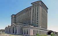
. US 12 runs roughly parallel to I-94 east to Detroit before crossing over to the south side of the freeway and ending downtown Detroit at the corner of Michigan and Cass.
runs from downtown Detroit
to Chicago. It was replaced by Interstate 94
in 1962, and the state of Michigan re-routed the U.S. 12 designation to the former route of U.S. Highway 112.
What is now US 12 was originally Chicago Road, which ran from Detroit, Michigan
, to Chicago, Illinois. It follows the general route of the old Sauk Trail
, an important Native American trail. In 1680, the explorer Robert La Salle was probably the first European to travel along it.
The disasters suffered in the War of 1812
taught the Government that it could not defend the western country without roads over which to move its armies and their supplies. In 1824, the United States Congress
appropriated money for the survey of roads of national importance in the General Survey Act
, and the U.S. President allocated one third of the entire sum to surveying a military highway connecting Detroit with Fort Dearborn
at Chicago. From about 1830 on, an ever-increasing flood of settlers poured into the Old Northwest
and thousands of them traveled the new highway leading to Chicago, which has ever since been called the Chicago Road. In 1833, the Detroit Arsenal was constructed near the eastern end of the road and its water connection to the East Coast. By 1835, daily stagecoaches ran between Detroit and Chicago.
Construction of the Chicago Road began on the eastern end of the Sauk Trail, and the road did not reach the Michigan-Indiana border until 1835.
It was an old highway that ran through the middle of the major towns and cities of Michigan between Detroit and Chicago. In most cases the road is still there, and is named either Michigan Avenue, Old US 12 or the Red Arrow Highway, named after the 32nd Infantry Division. It is still possible to drive the highway from downtown Detroit all the way to The Magnificent Mile
in Chicago, with only a few places in which one is required to navigate around the Interstate Highway. The major break in Old US 12 is in the middle of Michigan in Parma Township
42.262°N 84.69455°W. It is at this point that I-94 cuts south to some degree and bisects the old highway, forcing a motorist to navigate north on smaller roads. Some bypassed portions of the roadway have (although faded) dashed white lines, predating the 1971 Michigan Manual on Uniform Traffic Control Devices
.
Prior to 1956, the Detroit-Ann Arbor segment of US 12 was routed directly through Ann Arbor, through Plymouth Township
, Livonia
, and Redford Township
, into Detroit, along the Plymouth-Ann Arbor Road corridor to Plymouth Road's eastern terminus at US 16, Grand River Avenue
. US 12 continued on Grand River Avenue, co-signed with US 16, into downtown Detroit. Except for the co-signed Grand River Avenue segment, this route was designated as M-14
when US 12 was rerouted to the Detroit Industrial and Willow Run Expressways, most of which became I-94 in 1962.
 Michigan Avenue is one of the major pre-interstate roads of the state of Michigan
. Running through the state east to west, it follows the former course of old US 12
which itself followed the earlier military territorial highway, the Chicago Road. Today the Michigan Avenue name follows a discontinuous route: from downtown Detroit to Hayes State Park
in Lenawee County it follows the current route of US 12. West of this on the current US 12, the Michigan Avenue name is dropped and the road is known as simply "US 12" (west of the junction with US 127 the road is also known as "Chicago Road").
From the eastern Jackson County boundary west to Battle Creek
, it mostly follows the route of old US 12, although it has been routed over newer roads in places where I-94
was built over the former US 12. The Michigan Avenue designation ends on the west side of Kalamazoo
, near US 131
, and reappears only within the village of Paw Paw
.
In Detroit, Michigan Avenue is one of five major avenues (along with Woodward, Grand River
, Gratiot and Jefferson) planned by judge Augustus Woodward in 1805 that extend from downtown Detroit in differing directions. Like the other major avenues, the road extends well beyond the city of Detroit, and historically served as a principal axis of expansion for development beyond Detroit and as the main street of many small towns along its route. The road was a principal settlement and trade route to the west, connecting the water route through the Great Lakes from the east to Chicago and the west without the long passage by water around the unsettled North of Michigan.
Historic Tiger Stadium, the home of the Detroit Tigers
from 1895–1999, was colloquially named "The Corner", referring to its location on the corner of Michigan Avenue and Trumbull Avenue in Detroit. It has since been demolished.
In Westland
, the historic Eloise complex
was on Michigan Avenue.
. On March 15, 2001, US 12 was shortened in Detroit by four city blocks to end along Michigan Avenue at Griswold Street. This would be shortened again on June 8, 2005 to Michigan Avenue and Cass Avenue.
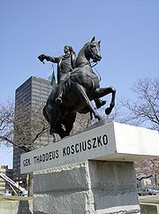
Pulaski Memorial Highway, after Kazimierz Pułaski, is an honorary name given to the current routing. It has also been designated as the Iron Brigade Memorial Highway; a designation which it also has in Indiana, Illinois and Wisconsin.
Aberdeen, Washington
Aberdeen is a city in Grays Harbor County, Washington, United States, founded by Samuel Benn in 1884. Aberdeen was incorporated on May 12, 1890. The city is the economic center of Grays Harbor County, bordering the cities of Hoquiam and Cosmopolis...
to Detroit, Michigan
Michigan
Michigan is a U.S. state located in the Great Lakes Region of the United States of America. The name Michigan is the French form of the Ojibwa word mishigamaa, meaning "large water" or "large lake"....
. In the US state of Michigan
Michigan
Michigan is a U.S. state located in the Great Lakes Region of the United States of America. The name Michigan is the French form of the Ojibwa word mishigamaa, meaning "large water" or "large lake"....
it runs for 208.9 miles (336.19 km). Previous to the creation of Interstate Highways
Interstate Highway System
The Dwight D. Eisenhower National System of Interstate and Defense Highways, , is a network of limited-access roads including freeways, highways, and expressways forming part of the National Highway System of the United States of America...
in Michigan, US 12 ran along Michigan Avenue between Kalamazoo
Kalamazoo, Michigan
The area on which the modern city stands was once home to Native Americans of the Hopewell culture, who migrated into the area sometime before the first millennium. Evidence of their early residency remains in the form of a small mound in downtown's Bronson Park. The Hopewell civilization began to...
and Detroit
Detroit, Michigan
Detroit is the major city among the primary cultural, financial, and transportation centers in the Metro Detroit area, a region of 5.2 million people. As the seat of Wayne County, the city of Detroit is the largest city in the U.S. state of Michigan and serves as a major port on the Detroit River...
, a highway corridor now served by I-94
Interstate 94
Interstate 94 is the northernmost east–west Interstate Highway, connecting the Great Lakes and Intermountain regions of the United States. I-94's western terminus is in Billings, Montana at a junction with Interstate 90; its eastern terminus is the U.S...
. The US 12 designation was moved at that time to replace US 112
U.S. Route 112
U.S. Route 112 was a largely east–west state trunkline highway across the southern portion of the US state of Michigan between New Buffalo and Detroit...
between New Buffalo
New Buffalo, Michigan
New Buffalo is a city in Berrien County in the U.S. state of Michigan. The population was 2,200 at the 2000 census. This city is within New Buffalo Township, but is politically autonomous.-Geography:...
and Ann Arbor
Ann Arbor, Michigan
Ann Arbor is a city in the U.S. state of Michigan and the county seat of Washtenaw County. The 2010 census places the population at 113,934, making it the sixth largest city in Michigan. The Ann Arbor Metropolitan Statistical Area had a population of 344,791 as of 2010...
.
Route description
US 12 enters the state of Michigan west of New Buffalo near the town of MichianaMichiana, Michigan
Michiana is a village in New Buffalo Township, Berrien County in the extreme southwest corner of the U.S. state of Michigan. The population was 200 at the 2000 census.-Geography:...
. The Lake Michigan Circle Tour is routed along US 12 until the two meet I-94 in New Buffalo. US 12 continues across the southern portion of Berrien County
Berrien County, Michigan
Berrien County is a county located in the extreme southwest of the U.S. state of Michigan. It is included in the Niles-Benton Harbor, Michigan Metropolitan Statistical Area. As of the 2010 census, the population was 156,813. The county seat is St. Joseph....
running eastward to Niles
Niles, Michigan
Niles is a city in Berrien and Cass counties in the U.S. state of Michigan, near South Bend, Indiana. The population was 11,600 at the 2010 census. It is the greater populated of two principal cities of and included in the Niles-Benton Harbor, Michigan Metropolitan Statistical Area, which has a...
. There US 12 meets US 31
U.S. Route 31 in Michigan
US Highway 31 is a part of the United States Numbered Highway System that runs from Alabama, to the Upper Peninsula of the US state of Michigan. In Michigan, it is a state trunkline highway that runs from the Indiana–Michigan state line at Bertrand Township to its terminus at Interstate 75 south...
/St. Joseph Valley Parkway
St. Joseph Valley Parkway
The St. Joseph Valley Parkway is a freeway in the U.S. states of Indiana and Michigan, serving as a bypass route around Elkhart, Mishawaka, and South Bend in Indiana and Niles in Michigan. The freeway runs to the south and west of Elkhart and South Bend and Niles and consists of segments of U.S...
. US 12 runs parallel to the state line intersecting US 131
U.S. Route 131
US Highway 131 is a north–south United States Highway, of which all but 0.67 miles of its 266.82 miles are within the state of Michigan. The highway starts in rural Indiana south of the state line as a state road connection to the Indiana Toll Road...
near White Pigeon
White Pigeon, Michigan
White Pigeon is a village in St. Joseph County in the U.S. state of Michigan. The population was 1,627 at the 2000 census. The village is located within White Pigeon Township.-Geography:...
and M-66
M-66 (Michigan highway)
M-66 is a north–south state trunkline highway on the Lower Peninsula of the US state of Michigan. It runs from the Indiana state line in the south to Charlevoix in the north. M-66 is the only state highway to traverse almost the entire north–south distance of the LP. It starts as a...
in Sturgis
Sturgis, Michigan
Sturgis, is a city in St. Joseph County in the U.S. state of Michigan. The population was 10,994 at the 2010 census. The city is located at the northeast corner of Sturgis Township and at the intersection of US 12 and M-66....
in St. Joseph County
St. Joseph County, Michigan
-Demographics:As of the census of 2000, there were 62,422 people, 23,381 households, and 16,600 families residing in the county. The population density was 124 people per square mile . There were 26,503 housing units at an average density of 53 per square mile...
. East of Sturgis, US 12 turns northeasterly to Coldwater
Coldwater, Michigan
Coldwater is a city in the U.S. state of Michigan. As of the 2010 census, the city population was 10,945. It is the county seat of Branch County....
and a major intersection with I-69
Interstate 69 in Michigan
Interstate 69 is a part of the Interstate Highway System that currently runs from Indianapolis, Indiana, to the US–Canadian border at Port Huron, Michigan. In Michigan, it is a state trunkline highway that enters the state south of Coldwater and passes through the cities of Lansing and Flint...
.
East of Coldwater, US 12 runs northeastward to Jonesville
Jonesville, Michigan
Jonesville is a village in Fayette Township, Hillsdale County in the U.S. state of Michigan. The population was 2,337 at the 2000 census.-Geography:...
northwest of Hillsdale
Hillsdale, Michigan
Hillsdale is a city in the state of Michigan. As of the 2010 census, the city population was 8,305. It is the county seat of Hillsdale County, and is run as a council-manager government....
where it meets M-99
M-99 (Michigan highway)
M-99 is a state highway in the Lower Peninsula of the US state of Michigan. It runs from the Ohio state border, where it connects to SR 15, north to Lansing where it terminates at a junction with I-496...
. In Jackson County
Jackson County, Michigan
As of the census of 2000, there were 158,422 people, 58,168 households, and 40,833 families residing in the county. The population density was 224 people per square mile . There were 62,906 housing units at an average density of 89/sq mi...
it passes near the Michigan International Speedway
Michigan International Speedway
Michigan International Speedway is a two-mile moderate-banked D-shaped superspeedway located off U.S. Highway 12 on more than in Brooklyn, in the scenic Irish Hills area of southeastern Michigan. The track is used primarily for NASCAR events. It is sometimes known as a "sister track" to Texas...
in Brooklyn
Brooklyn, Michigan
Brooklyn is a village in Jackson County of the U.S. state of Michigan. As of the 2000 census, the village population was 1,176. It is located just off U.S. Highway 12 Brooklyn (formerly Swainsville) is a village in Jackson County of the U.S. state of Michigan. As of the 2000 census, the village...
. It runs along the Lenawee
Lenawee County, Michigan
-Demographics:As of the census of 2000, there were 98,890 people, 35,930 households, and 26,049 families residing in the county. The population density was 132 people per square mile . There were 39,769 housing units at an average density of 53 per square mile...
/Washtenaw
Washtenaw County, Michigan
Washtenaw County is a county in the U.S. state of Michigan. As of the 2010 census, the population was 344,791. Its county seat is Ann Arbor. The United States Office of Management and Budget defines the county as part of the Detroit–Warren–Flint Combined Statistical Area...
county line before turning northeast to Ann Arbor
Ann Arbor, Michigan
Ann Arbor is a city in the U.S. state of Michigan and the county seat of Washtenaw County. The 2010 census places the population at 113,934, making it the sixth largest city in Michigan. The Ann Arbor Metropolitan Statistical Area had a population of 344,791 as of 2010...
and Ypsilanti
Ypsilanti, Michigan
Ypsilanti is a city in Washtenaw County in the U.S. state of Michigan. As of the 2000 census, the city population was 22,362. The city is bounded to the north by the Charter Township of Superior and on the west, south, and east by the Charter Township of Ypsilanti...
. Here it forms Michigan Avenue the rest of the way to Detroit
Detroit, Michigan
Detroit is the major city among the primary cultural, financial, and transportation centers in the Metro Detroit area, a region of 5.2 million people. As the seat of Wayne County, the city of Detroit is the largest city in the U.S. state of Michigan and serves as a major port on the Detroit River...
. US 12 and Michigan Avenue part ways briefly in Ypsilanti when US 12 follows I-94
Interstate 94
Interstate 94 is the northernmost east–west Interstate Highway, connecting the Great Lakes and Intermountain regions of the United States. I-94's western terminus is in Billings, Montana at a junction with Interstate 90; its eastern terminus is the U.S...
and BUS US 12 follows Michigan Avenue near Willow Run
Willow Run
The Willow Run manufacturing plant, located between Ypsilanti and Belleville, Michigan, was constructed during World War II by Ford Motor Company for the mass production of the B-24 Liberator military aircraft....
. US 12 runs roughly parallel to I-94 east to Detroit before crossing over to the south side of the freeway and ending downtown Detroit at the corner of Michigan and Cass.
History
Old US 12 in MichiganMichigan
Michigan is a U.S. state located in the Great Lakes Region of the United States of America. The name Michigan is the French form of the Ojibwa word mishigamaa, meaning "large water" or "large lake"....
runs from downtown Detroit
Detroit, Michigan
Detroit is the major city among the primary cultural, financial, and transportation centers in the Metro Detroit area, a region of 5.2 million people. As the seat of Wayne County, the city of Detroit is the largest city in the U.S. state of Michigan and serves as a major port on the Detroit River...
to Chicago. It was replaced by Interstate 94
Interstate 94 in Michigan
Interstate 94 is a part of the Interstate Highway System that runs from Billings, Montana, to the Lower Peninsula of the US state of Michigan. In Michigan, it is a state trunkline highway that enters the state south of New Buffalo...
in 1962, and the state of Michigan re-routed the U.S. 12 designation to the former route of U.S. Highway 112.
What is now US 12 was originally Chicago Road, which ran from Detroit, Michigan
Detroit, Michigan
Detroit is the major city among the primary cultural, financial, and transportation centers in the Metro Detroit area, a region of 5.2 million people. As the seat of Wayne County, the city of Detroit is the largest city in the U.S. state of Michigan and serves as a major port on the Detroit River...
, to Chicago, Illinois. It follows the general route of the old Sauk Trail
Sauk Trail
Sauk Trail began as a Native American trail running through Illinois, Indiana and Michigan in the United States. From west to east, the trail ran from Rock Island on the Mississippi River to the Illinois River near modern Peru then along the north bank of that river to Joliet, and on to Valparaiso,...
, an important Native American trail. In 1680, the explorer Robert La Salle was probably the first European to travel along it.
The disasters suffered in the War of 1812
War of 1812
The War of 1812 was a military conflict fought between the forces of the United States of America and those of the British Empire. The Americans declared war in 1812 for several reasons, including trade restrictions because of Britain's ongoing war with France, impressment of American merchant...
taught the Government that it could not defend the western country without roads over which to move its armies and their supplies. In 1824, the United States Congress
United States Congress
The United States Congress is the bicameral legislature of the federal government of the United States, consisting of the Senate and the House of Representatives. The Congress meets in the United States Capitol in Washington, D.C....
appropriated money for the survey of roads of national importance in the General Survey Act
General Survey Act
The General Survey Act was a law passed by the United States Congress in April 1824, which authorized the president to have surveys made of routes for transport roads and canals "of national importance, in a commercial or military point of view, or necessary for the transportation of public mail." ...
, and the U.S. President allocated one third of the entire sum to surveying a military highway connecting Detroit with Fort Dearborn
Fort Dearborn
Fort Dearborn was a United States fort built in 1803 beside the Chicago River in what is now Chicago, Illinois. It was constructed by troops under Captain John Whistler and named in honor of Henry Dearborn, then United States Secretary of War. The original fort was destroyed following the Battle of...
at Chicago. From about 1830 on, an ever-increasing flood of settlers poured into the Old Northwest
Northwest Territory
The Territory Northwest of the River Ohio, more commonly known as the Northwest Territory, was an organized incorporated territory of the United States that existed from July 13, 1787, until March 1, 1803, when the southeastern portion of the territory was admitted to the Union as the state of Ohio...
and thousands of them traveled the new highway leading to Chicago, which has ever since been called the Chicago Road. In 1833, the Detroit Arsenal was constructed near the eastern end of the road and its water connection to the East Coast. By 1835, daily stagecoaches ran between Detroit and Chicago.
Construction of the Chicago Road began on the eastern end of the Sauk Trail, and the road did not reach the Michigan-Indiana border until 1835.
It was an old highway that ran through the middle of the major towns and cities of Michigan between Detroit and Chicago. In most cases the road is still there, and is named either Michigan Avenue, Old US 12 or the Red Arrow Highway, named after the 32nd Infantry Division. It is still possible to drive the highway from downtown Detroit all the way to The Magnificent Mile
Magnificent Mile
The Magnificent Mile, sometimes referred to as The Mag Mile, is a neighborhood in Chicago, Illinois, that runs along a portion of Michigan Avenue extending from the Chicago River to Oak Street in the Near North Side community area. The district is located adjacent to downtown; it is also one block...
in Chicago, with only a few places in which one is required to navigate around the Interstate Highway. The major break in Old US 12 is in the middle of Michigan in Parma Township
Parma Township, Michigan
Parma Township is a civil township of Jackson County in the U.S. state of Michigan. The population was 2,696 at the 2000 census.The Village of Parma is at the southeast corner of the township, partially within Sandstone Charter Township.-Geography:...
42.262°N 84.69455°W. It is at this point that I-94 cuts south to some degree and bisects the old highway, forcing a motorist to navigate north on smaller roads. Some bypassed portions of the roadway have (although faded) dashed white lines, predating the 1971 Michigan Manual on Uniform Traffic Control Devices
Manual on Uniform Traffic Control Devices
The Manual on Uniform Traffic Control Devices is a document issued by the Federal Highway Administration of the United States Department of Transportation to specify the standards by which traffic signs, road surface markings, and signals are designed, installed, and used...
.
Prior to 1956, the Detroit-Ann Arbor segment of US 12 was routed directly through Ann Arbor, through Plymouth Township
Plymouth Township, Michigan
The Charter Township of Plymouth is a charter township of Wayne County in the U.S. state of Michigan. The population was 27,524 at the 2010 census...
, Livonia
Livonia, Michigan
Livonia is a city in the northwest part of Wayne County in the U.S. state of Michigan. Livonia is a very large suburb with an array of traditional neighborhoods connected to the metropolitan area by freeways. The population was 96,942 at the 2010 census, making it Michigan's 9th largest...
, and Redford Township
Redford Township, Michigan
The U.S. Census Bureau also defined Redford Township as a census-designated place in the 2000 Census so that the community would appear on the list of places as well on the list of county subdivisions...
, into Detroit, along the Plymouth-Ann Arbor Road corridor to Plymouth Road's eastern terminus at US 16, Grand River Avenue
Grand River Avenue
US Highway 16 , also called Grand River Avenue for much of its length, is one of the principal pre-Interstate roads in the state of Michigan. Before the creation of the United States Numbered Highway System in 1926, the highway had been designated M-16...
. US 12 continued on Grand River Avenue, co-signed with US 16, into downtown Detroit. Except for the co-signed Grand River Avenue segment, this route was designated as M-14
M-14 (Michigan highway)
M-14 is a east–west state trunkline highway in the southeastern portion of the US state of Michigan. Entirely freeway, it connects Ann Arbor with Detroit by way of connecting with I-96.-Route description:...
when US 12 was rerouted to the Detroit Industrial and Willow Run Expressways, most of which became I-94 in 1962.
Michigan Avenue
Michigan
Michigan is a U.S. state located in the Great Lakes Region of the United States of America. The name Michigan is the French form of the Ojibwa word mishigamaa, meaning "large water" or "large lake"....
. Running through the state east to west, it follows the former course of old US 12
U.S. Route 12
U.S. Route 12 or US 12 is an east–west United States highway, running from Grays Harbor on the Pacific Ocean, in the state of Washington, to downtown Detroit, for almost . As a thoroughfare, it has mostly been supplanted by I-90 and I-94, but remains an important road for local travel.The...
which itself followed the earlier military territorial highway, the Chicago Road. Today the Michigan Avenue name follows a discontinuous route: from downtown Detroit to Hayes State Park
Hayes State Park
Walter J. Hayes State Park is a state park in the U.S. state of Michigan. It is located along US 12 in the Irish Hills region of Lenawee County and extending into small parts of Jackson County and Washtenaw County in the Round Lake area. The park is surrounded by scenic lakes, namely Wamplers...
in Lenawee County it follows the current route of US 12. West of this on the current US 12, the Michigan Avenue name is dropped and the road is known as simply "US 12" (west of the junction with US 127 the road is also known as "Chicago Road").
From the eastern Jackson County boundary west to Battle Creek
Battle Creek, Michigan
Battle Creek is a city in the U.S. state of Michigan, in northwest Calhoun County, at the confluence of the Kalamazoo and Battle Creek Rivers. It is the principal city of the Battle Creek, Michigan Metropolitan Statistical Area , which encompasses all of Calhoun county...
, it mostly follows the route of old US 12, although it has been routed over newer roads in places where I-94
Interstate 94
Interstate 94 is the northernmost east–west Interstate Highway, connecting the Great Lakes and Intermountain regions of the United States. I-94's western terminus is in Billings, Montana at a junction with Interstate 90; its eastern terminus is the U.S...
was built over the former US 12. The Michigan Avenue designation ends on the west side of Kalamazoo
Kalamazoo, Michigan
The area on which the modern city stands was once home to Native Americans of the Hopewell culture, who migrated into the area sometime before the first millennium. Evidence of their early residency remains in the form of a small mound in downtown's Bronson Park. The Hopewell civilization began to...
, near US 131
U.S. Route 131
US Highway 131 is a north–south United States Highway, of which all but 0.67 miles of its 266.82 miles are within the state of Michigan. The highway starts in rural Indiana south of the state line as a state road connection to the Indiana Toll Road...
, and reappears only within the village of Paw Paw
Paw Paw, Michigan
Paw Paw is a village in the U.S. state of Michigan. As of the 2000 census, the village population was 3,363. It is the county seat of Van Buren County.-Overview:...
.
In Detroit, Michigan Avenue is one of five major avenues (along with Woodward, Grand River
Grand River Avenue
US Highway 16 , also called Grand River Avenue for much of its length, is one of the principal pre-Interstate roads in the state of Michigan. Before the creation of the United States Numbered Highway System in 1926, the highway had been designated M-16...
, Gratiot and Jefferson) planned by judge Augustus Woodward in 1805 that extend from downtown Detroit in differing directions. Like the other major avenues, the road extends well beyond the city of Detroit, and historically served as a principal axis of expansion for development beyond Detroit and as the main street of many small towns along its route. The road was a principal settlement and trade route to the west, connecting the water route through the Great Lakes from the east to Chicago and the west without the long passage by water around the unsettled North of Michigan.
Historic Tiger Stadium, the home of the Detroit Tigers
Detroit Tigers
The Detroit Tigers are a Major League Baseball team located in Detroit, Michigan. One of the American League's eight charter franchises, the club was founded in Detroit in as part of the Western League. The Tigers have won four World Series championships and have won the American League pennant...
from 1895–1999, was colloquially named "The Corner", referring to its location on the corner of Michigan Avenue and Trumbull Avenue in Detroit. It has since been demolished.
In Westland
Westland, Michigan
Westland is a city in Wayne County in the U.S. state of Michigan. It is located about west of downtown Detroit. As of the 2010 census, the city had a total population of 84,094.-Politics:...
, the historic Eloise complex
Eloise (psychiatric hospital)
Eloise was a psychiatric hospital located in southeastern Michigan.It operated from 1839 to the early 1980s, and housed not only the mentally ill, but poor and sick people as well. At its prime, Eloise consisted of 78 buildings and 902 acres of land...
was on Michigan Avenue.
Current routing
The US 12 designation was moved to supplant US 112 in Michigan in January 1962. This removed the US 12 designation from the I-94 freeway except for the Ypsilanti bypass, and US 112 was completely removed as a highway designation. BUS US 112 in both Niles and Ypsilanti became BUS US 12Bannered routes of U.S. Route 12
BUS US 12 is a business route running in Ypsilanti. It was first designated in 1962 as a business route of US 12 when US 12 replaced US 112.-Route description:The western terminus of BUS US 12 is at an interchange with I-94/US 12 south of downtown Ypsilanti...
. On March 15, 2001, US 12 was shortened in Detroit by four city blocks to end along Michigan Avenue at Griswold Street. This would be shortened again on June 8, 2005 to Michigan Avenue and Cass Avenue.
Pulaski Memorial Highway, after Kazimierz Pułaski, is an honorary name given to the current routing. It has also been designated as the Iron Brigade Memorial Highway; a designation which it also has in Indiana, Illinois and Wisconsin.