

Hollister, California
Encyclopedia
Hollister is a city in and the county seat
of San Benito County
, California
, United States
. The population was 34,928 at the 2010 census
. Hollister is primarily an agricultural town.
Indians
were the first known inhabitants of the Hollister region.
The town, then located in Monterey County, was founded November 19, 1868 originally as the San Justo Homestead Association
, established by William Welles Hollister
(1818–1886), a group that originally intended to name it San Justo
. An association member, Napa vintner Henry Hagen, objected. Hagen argued that place names in California were dominated by Spanish saint names, and suggested that the state should have a town named after someone less holy. The City was incorporated on August 29, 1872. The western portion of San Benito County, including Hollister, was separated from Monterey County in 1874. The county was expanded eastward in 1887 to include portions taken from Merced and Fresno Counties.
 Hollister is well-known among geologists because it portrays one of the best examples of aseismic creep
anywhere in the world. The Calaveras Fault
(a branch of the San Andreas Fault
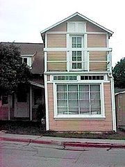
system) bisects the city north and south, roughly along Locust Ave. and Powell St. The streets running east/west across the fault have significant visible offsets. The fault runs directly under several houses. Even though they are visibly contorted the houses are still habitable as the owners have reinforced them to withstand the dislocation of their foundations. Although there was extensive damage in the town after the 1989 Loma Prieta earthquake, and the governor of California came to visit, this was due to a slip of the San Andreas Fault and was not related to the aseismic creep on the Calaveras Fault.
Hollister is one of at least three California towns claiming the title of "Earthquake Capital of the World" as well as the Hay Capitol of the World, the home of the California Gem Benitoite, the most legged centipede in the world, home to Pinnacles National Monument
, and the town based on the "Wild One", two others being Coalinga
and Parkfield
.
was 4,791.4 people per square mile (1,850.0/km²). The racial makeup of Hollister was 10,164 (29.1%) White, 341 (1.0%) African American, 617 (1.8%) Native American, 929 (2.7%) Asian, 63 (0.2%) Pacific Islander, 10,437 (29.9%) from other races
, and 1,780 (5.1%) from two or more races. Hispanic or Latino of any race were 22,965 persons (65.7%).
The Census reported that 34,813 people (99.7% of the population) lived in households, 9 (0%) lived in non-institutionalized group quarters, and 106 (0.3%) were institutionalized.
There were 9,860 households, out of which 5,291 (53.7%) had children under the age of 18 living in them, 5,900 (59.8%) were opposite-sex married couples
living together, 1,511 (15.3%) had a female householder with no husband present, 720 (7.3%) had a male householder with no wife present. There were 744 (7.5%) unmarried opposite-sex partnerships
, and 55 (0.6%) same-sex married couples or partnerships. 1,324 households (13.4%) were made up of individuals and 496 (5.0%) had someone living alone who was 65 years of age or older. The average household size was 3.53. There were 8,131 families
(82.5% of all households); the average family size was 3.82.
The population was spread out with 11,076 people (31.7%) under the age of 18, 3,545 people (10.1%) aged 18 to 24, 9,927 people (28.4%) aged 25 to 44, 7,803 people (22.3%) aged 45 to 64, and 2,577 people (7.4%) who were 65 years of age or older. The median age was 30.8 years. For every 100 females there were 98.7 males. For every 100 females age 18 and over, there were 96.8 males.
There were 10,401 housing units at an average density of 1,426.8 per square mile (550.9/km²), of which 6,030 (61.2%) were owner-occupied, and 3,830 (38.8%) were occupied by renters. The homeowner vacancy rate was 2.3%; the rental vacancy rate was 5.0%. 20,781 people (59.5% of the population) lived in owner-occupied housing units and 14,032 people (40.2%) lived in rental housing units.
of 2000, there were 34,413 people, 9,716 households, and 8,044 families residing in the city. The population density
was 5,237.7 people per square mile (2,022.4/km²). There were 9,924 housing units at an average density of 1,510.5 per square mile (583.2/km²). The racial makeup of the city in 2010 was 29.1% non-Hispanic White, 0.7% non-Hispanic African American, 0.3% Native American, 2.4% Asian, 0.1% Pacific Islander, 0.1% from other races
, and 1.5% from two or more races. 65.7% of the population were Hispanic or Latino of any race.
There were 9,716 households out of which 52.2% had children under the age of 18 living with them, 65.3% were married couples
living together, 12.2% had a female householder with no husband present, and 17.2% were non-families. 12.7% of all households were made up of individuals and 4.7% had someone living alone who was 65 years of age or older. The average household size was 3.52 and the average family size was 3.82.
In the city the population was spread out with 34.6% under the age of 18, 9.5% from 18 to 24, 33.8% from 25 to 44, 15.8% from 45 to 64, and 6.3% who were 65 years of age or older. The median age was 29 years. For every 100 females there were 101.9 males. For every 100 females age 18 and over, there were 98.5 males.
The median income for a household in the city was $56,104, and the median income for a family was $57,494. Males had a median income of $41,971 versus $28,277 for females. The per capita income
for the city was $18,857. About 6.9% of families and 9.5% of the population were below the poverty line, including 10.2% of those under age 18 and 7.0% of those age 65 or over.
Hollister is located in the 12th Senate
District, represented by Republican
Anthony Cannella
, and in the 28th Assembly
District, represented by Democrat
Luis Alejo
. Federally, Hollister is located in California's 17th congressional district
, which has a Cook Partisan Voting Index
of D +17 and is represented by Democrat Sam Farr
.
Print
Hollister has two local newspapers, both published by the Gilroy-based Mainstreet Media Group:
around July Fourth
since 1947. The riot at the 1947 event
was the basis for the 1954 film The Wild One
. The rally took its present incarnation in 1997, and is known as the Hollister Independence Rally. There is no rally planned for 2010, except for a poker run organized by The Top Hatters Motorcycle Club. Hollister, CA is the mother chapter of the Top Hatters MC located throughout the state.
In 2005, the Hollister City Council discontinued their contract with the event organizers, the Hollister Independence Rally Committee, due to financial and public safety concerns. The event was canceled in 2006 due to lack of funding for security, but returned in 2007. The format of the rally in 2007 differed markedly from previous rallies, with vendors on San Benito Street instead of motorcycles. The bikes were forced to park on side streets and a strict downtown curfew was imposed, with the entire area being locked up at 9:00 pm.
According to the event's promoter; Horsepower Promotions, the 2009 Hollister Rally has not been endorsed by the City of Hollister and has been canceled. Despite this, bikers continue to arrive at Hollister every July Fourth, even without vendors and sponsored, organized events.
Because of its long history with motorcyclists, Hollister is considered the "Birthplace of the American Biker".
County seat
A county seat is an administrative center, or seat of government, for a county or civil parish. The term is primarily used in the United States....
of San Benito County
San Benito County, California
San Benito County is a county located in the Coast Range Mountains of the U.S. state of California, south of San Jose. As of 2010 the population was 55,269. The county seat is Hollister, which includes nearly two-thirds of the county's population. El Camino Real passes through the county and...
, California
California
California is a state located on the West Coast of the United States. It is by far the most populous U.S. state, and the third-largest by land area...
, United States
United States
The United States of America is a federal constitutional republic comprising fifty states and a federal district...
. The population was 34,928 at the 2010 census
United States Census, 2010
The Twenty-third United States Census, known as Census 2010 or the 2010 Census, is the current national census of the United States. National Census Day was April 1, 2010 and is the reference date used in enumerating individuals...
. Hollister is primarily an agricultural town.
History
The Mutsun OhloneOhlone
The Ohlone people, also known as the Costanoan, are a Native American people of the central California coast. When Spanish explorers and missionaries arrived in the late 18th century, the Ohlone inhabited the area along the coast from San Francisco Bay through Monterey Bay to the lower Salinas Valley...
Indians
Native Americans in the United States
Native Americans in the United States are the indigenous peoples in North America within the boundaries of the present-day continental United States, parts of Alaska, and the island state of Hawaii. They are composed of numerous, distinct tribes, states, and ethnic groups, many of which survive as...
were the first known inhabitants of the Hollister region.
The town, then located in Monterey County, was founded November 19, 1868 originally as the San Justo Homestead Association
Rancho San Justo
Rancho San Justo was a Mexican land grant in present day San Benito County, California given in 1839 by Governor Juan B. Alvarado to José Antonio Castro. The lands of the rancho include current day Hollister.-History:...
, established by William Welles Hollister
William Welles Hollister
William Welles Hollister was a Californian rancher and entrepreneur.-Ancestors and early life :William Welles Hollister, was born on Jan...
(1818–1886), a group that originally intended to name it San Justo
Rancho San Justo
Rancho San Justo was a Mexican land grant in present day San Benito County, California given in 1839 by Governor Juan B. Alvarado to José Antonio Castro. The lands of the rancho include current day Hollister.-History:...
. An association member, Napa vintner Henry Hagen, objected. Hagen argued that place names in California were dominated by Spanish saint names, and suggested that the state should have a town named after someone less holy. The City was incorporated on August 29, 1872. The western portion of San Benito County, including Hollister, was separated from Monterey County in 1874. The county was expanded eastward in 1887 to include portions taken from Merced and Fresno Counties.
Geology
Aseismic creep
In geology, aseismic creep is measurable surface displacement along a fault in the absence of notable earthquakes.An example is along the Calaveras fault in Hollister, California. Streets crossing the fault in Hollister show significant offset and several houses sitting atop the fault are notably...
anywhere in the world. The Calaveras Fault
Calaveras Fault
The Calaveras Fault is a major branch of the San Andreas Fault located in northern California in the San Francisco Bay Area. To the east of the Hayward-Rodgers Creek fault, the Calaveras fault extends 123 km, splaying from the San Andreas fault near Hollister and terminating at Danville at its...
(a branch of the San Andreas Fault
San Andreas Fault
The San Andreas Fault is a continental strike-slip fault that runs a length of roughly through California in the United States. The fault's motion is right-lateral strike-slip...
system) bisects the city north and south, roughly along Locust Ave. and Powell St. The streets running east/west across the fault have significant visible offsets. The fault runs directly under several houses. Even though they are visibly contorted the houses are still habitable as the owners have reinforced them to withstand the dislocation of their foundations. Although there was extensive damage in the town after the 1989 Loma Prieta earthquake, and the governor of California came to visit, this was due to a slip of the San Andreas Fault and was not related to the aseismic creep on the Calaveras Fault.
Hollister is one of at least three California towns claiming the title of "Earthquake Capital of the World" as well as the Hay Capitol of the World, the home of the California Gem Benitoite, the most legged centipede in the world, home to Pinnacles National Monument
Pinnacles National Monument
Pinnacles National Monument is a protected mountainous area located east of central California's Salinas Valley, just miles from the town of Soledad...
, and the town based on the "Wild One", two others being Coalinga
Coalinga, California
Coalinga is a city in Fresno County, California. The population was 13,380 at the 2010 census, up from 11,668 at the 2000 census. It is the site of both Pleasant Valley State Prison and Coalinga State Hospital. Coalinga is located southwest of Fresno, at an elevation of 673 feet .-Early...
and Parkfield
Parkfield, California
Parkfield is an unincorporated community in Monterey County, California. It is located on Little Cholame Creek east of Bradley, at an elevation of 1529 feet...
.
2010
The 2010 United States Census reported that Hollister had a population of 34,928. The population densityPopulation density
Population density is a measurement of population per unit area or unit volume. It is frequently applied to living organisms, and particularly to humans...
was 4,791.4 people per square mile (1,850.0/km²). The racial makeup of Hollister was 10,164 (29.1%) White, 341 (1.0%) African American, 617 (1.8%) Native American, 929 (2.7%) Asian, 63 (0.2%) Pacific Islander, 10,437 (29.9%) from other races
Race (United States Census)
Race and ethnicity in the United States Census, as defined by the Federal Office of Management and Budget and the United States Census Bureau, are self-identification data items in which residents choose the race or races with which they most closely identify, and indicate whether or not they are...
, and 1,780 (5.1%) from two or more races. Hispanic or Latino of any race were 22,965 persons (65.7%).
The Census reported that 34,813 people (99.7% of the population) lived in households, 9 (0%) lived in non-institutionalized group quarters, and 106 (0.3%) were institutionalized.
There were 9,860 households, out of which 5,291 (53.7%) had children under the age of 18 living in them, 5,900 (59.8%) were opposite-sex married couples
Marriage
Marriage is a social union or legal contract between people that creates kinship. It is an institution in which interpersonal relationships, usually intimate and sexual, are acknowledged in a variety of ways, depending on the culture or subculture in which it is found...
living together, 1,511 (15.3%) had a female householder with no husband present, 720 (7.3%) had a male householder with no wife present. There were 744 (7.5%) unmarried opposite-sex partnerships
POSSLQ
POSSLQ is an abbreviation for "Persons of Opposite Sex Sharing Living Quarters," a term coined in the late 1970s by the United States Census Bureau as part of an effort to more accurately gauge the prevalence of cohabitation in American households....
, and 55 (0.6%) same-sex married couples or partnerships. 1,324 households (13.4%) were made up of individuals and 496 (5.0%) had someone living alone who was 65 years of age or older. The average household size was 3.53. There were 8,131 families
Family (U.S. Census)
A family or family household is defined by the United States Census Bureau for statistical purposes as "a householder and one or more other people related to the householder by birth, marriage, or adoption. They do not include same-sex married couples even if the marriage was performed in a state...
(82.5% of all households); the average family size was 3.82.
The population was spread out with 11,076 people (31.7%) under the age of 18, 3,545 people (10.1%) aged 18 to 24, 9,927 people (28.4%) aged 25 to 44, 7,803 people (22.3%) aged 45 to 64, and 2,577 people (7.4%) who were 65 years of age or older. The median age was 30.8 years. For every 100 females there were 98.7 males. For every 100 females age 18 and over, there were 96.8 males.
There were 10,401 housing units at an average density of 1,426.8 per square mile (550.9/km²), of which 6,030 (61.2%) were owner-occupied, and 3,830 (38.8%) were occupied by renters. The homeowner vacancy rate was 2.3%; the rental vacancy rate was 5.0%. 20,781 people (59.5% of the population) lived in owner-occupied housing units and 14,032 people (40.2%) lived in rental housing units.
2000
As of the censusCensus
A census is the procedure of systematically acquiring and recording information about the members of a given population. It is a regularly occurring and official count of a particular population. The term is used mostly in connection with national population and housing censuses; other common...
of 2000, there were 34,413 people, 9,716 households, and 8,044 families residing in the city. The population density
Population density
Population density is a measurement of population per unit area or unit volume. It is frequently applied to living organisms, and particularly to humans...
was 5,237.7 people per square mile (2,022.4/km²). There were 9,924 housing units at an average density of 1,510.5 per square mile (583.2/km²). The racial makeup of the city in 2010 was 29.1% non-Hispanic White, 0.7% non-Hispanic African American, 0.3% Native American, 2.4% Asian, 0.1% Pacific Islander, 0.1% from other races
Race (United States Census)
Race and ethnicity in the United States Census, as defined by the Federal Office of Management and Budget and the United States Census Bureau, are self-identification data items in which residents choose the race or races with which they most closely identify, and indicate whether or not they are...
, and 1.5% from two or more races. 65.7% of the population were Hispanic or Latino of any race.
There were 9,716 households out of which 52.2% had children under the age of 18 living with them, 65.3% were married couples
Marriage
Marriage is a social union or legal contract between people that creates kinship. It is an institution in which interpersonal relationships, usually intimate and sexual, are acknowledged in a variety of ways, depending on the culture or subculture in which it is found...
living together, 12.2% had a female householder with no husband present, and 17.2% were non-families. 12.7% of all households were made up of individuals and 4.7% had someone living alone who was 65 years of age or older. The average household size was 3.52 and the average family size was 3.82.
In the city the population was spread out with 34.6% under the age of 18, 9.5% from 18 to 24, 33.8% from 25 to 44, 15.8% from 45 to 64, and 6.3% who were 65 years of age or older. The median age was 29 years. For every 100 females there were 101.9 males. For every 100 females age 18 and over, there were 98.5 males.
The median income for a household in the city was $56,104, and the median income for a family was $57,494. Males had a median income of $41,971 versus $28,277 for females. The per capita income
Per capita income
Per capita income or income per person is a measure of mean income within an economic aggregate, such as a country or city. It is calculated by taking a measure of all sources of income in the aggregate and dividing it by the total population...
for the city was $18,857. About 6.9% of families and 9.5% of the population were below the poverty line, including 10.2% of those under age 18 and 7.0% of those age 65 or over.
Politics
In the state legislatureCalifornia State Legislature
The California State Legislature is the state legislature of the U.S. state of California. It is a bicameral body consisting of the lower house, the California State Assembly, with 80 members, and the upper house, the California State Senate, with 40 members...
Hollister is located in the 12th Senate
California State Senate
The California State Senate is the upper house of the California State Legislature. There are 40 state senators. The state legislature meets in the California State Capitol in Sacramento. The Lieutenant Governor is the ex officio President of the Senate and may break a tied vote...
District, represented by Republican
Republican Party (United States)
The Republican Party is one of the two major contemporary political parties in the United States, along with the Democratic Party. Founded by anti-slavery expansion activists in 1854, it is often called the GOP . The party's platform generally reflects American conservatism in the U.S...
Anthony Cannella
Anthony Cannella
Anthony Cannella is an American politician currently serving in the California State Senate. He is a Republican representing the 12th district, encompassing Merced and San Benito counties, as well as parts of Madera, Monterey, and Stanislaus counties...
, and in the 28th Assembly
California State Assembly
The California State Assembly is the lower house of the California State Legislature. There are 80 members in the Assembly, representing an approximately equal number of constituents, with each district having a population of at least 420,000...
District, represented by Democrat
Democratic Party (United States)
The Democratic Party is one of two major contemporary political parties in the United States, along with the Republican Party. The party's socially liberal and progressive platform is largely considered center-left in the U.S. political spectrum. The party has the lengthiest record of continuous...
Luis Alejo
Luis Alejo
Luis Alejo represents the 28th District of the California State Assembly. He was first elected in 2010 with 62% of the vote....
. Federally, Hollister is located in California's 17th congressional district
California's 17th congressional district
California's 17th congressional district is a congressional district in the U.S. state of California that covers all of Monterey and San Benito counties, as well as part of Santa Cruz County...
, which has a Cook Partisan Voting Index
Cook Partisan Voting Index
The Cook Partisan Voting Index , sometimes referred to as simply the Partisan Voting Index , is a measurement of how strongly an American congressional district or state leans toward one political party compared to the nation as a whole...
of D +17 and is represented by Democrat Sam Farr
Sam Farr
Samuel S. "Sam" Farr is the U.S. Representative for , serving since 1993. He is a member of the Democratic Party. He was elected to Congress in a 1993 special election when longtime Democratic Rep...
.
- The Hollister Free Lance is issued Tuesdays and contains a mix of local coverage and mostly AP national stories.
- The Pinnacle is issued Fridays.
- The San Juan Star is a monthly publication, offering local coverage of San Benito County.
Broadcast
The following radio stations are licensed to Hollister:- KMPGKMPGKMPG is a radio station broadcasting a Regional Mexican format. Licensed to Hollister, California, USA, it serves the Gilroy/Hollister area. The station is currently owned by Promo Radio Corp.-External links:...
, at 1520 AM daytime, plays regional Mexican musicRegional MexicanRegional Mexican is a radio format for music radio, typically defined to include Banda, Ranchera, Mariachi and Norteña. It is the most popular radio format targeting Hispanic Americans in the United States....
; - KHRI, at 90.7 FM, is an affiliate of Air 1Air 1Air1 is a Christian music radio network in the United States, operated by the non-profit organization EMF Broadcasting. Air 1 is essentially a Top-40 station with Christian Music - so many of the rules that commercial Top-40 stations use for musical rotation apply.-History:In 1986, KLRD began...
playing contemporary Christian musicContemporary Christian musicContemporary Christian music is a genre of modern popular music which is lyrically focused on matters concerned with the Christian faith...
; - KXSMKXSMKXSM is a radio station broadcasting a Regional Mexican format. Licensed to Hollister, California, USA, it serves the Hollister area. The station is currently owned by Lazer Licenses, LLC.-External links:...
, at 93.5 FM, broadcasts a regional Mexican format. - K206BQ, at 89.1 FM, rebroadcasts KUSPKUSPKUSP is a community supported, National Public Radio affiliated public radio station. Located in Santa Cruz, California, USA, the signal covers most of California's Central Coast area. Station content consists of about 2/3 news and information and 1/3 music content.-Online audio:KUSP offers a...
. - K265DG, at 100.9 FM, rebroadcasts KPRC-FMKPRC-FMKPRC-FM is a radio station broadcasting a Spanish adult hits format. Licensed to Salinas, California, USA, it serves the Santa Cruz area. The station is currently owned by Clear Channel Communications.-External links:...
.
Major highways
- State Route 25California State Route 25State Route 25 is a state highway in the U.S. state of California between Gilroy and State Route 198. This route is part of the California Freeway and Expressway System and is eligible for the State Scenic Highway System.-Route description:...
runs northwestward to GilroyGilroy, CaliforniaGilroy is the southernmost city in Santa Clara County, California, United States. The population was 48,821 at the 2010 census. Gilroy is well-known for its garlic crop and for the annual Gilroy Garlic Festival, featuring various garlicky foods, including garlic ice cream. Gilroy also produces...
and southeastward to Pinnacles National MonumentPinnacles National MonumentPinnacles National Monument is a protected mountainous area located east of central California's Salinas Valley, just miles from the town of Soledad...
and CoalingaCoalinga, CaliforniaCoalinga is a city in Fresno County, California. The population was 13,380 at the 2010 census, up from 11,668 at the 2000 census. It is the site of both Pleasant Valley State Prison and Coalinga State Hospital. Coalinga is located southwest of Fresno, at an elevation of 673 feet .-Early...
(the latter via State Route 198California State Route 198State Route 198 is an east–west state highway that connects the California Central Coast to the mid-Central Valley at Visalia, although the most-traveled portion is in the Central Valley itself....
). Route 25 through Hollister was until 1984 defined under State law as a segment of State Route 180California State Route 180State Route 180 is a state highway in California, United States, which runs through the heart of the San Joaquin Valley from Mendota through Fresno to Kings Canyon National Park, with an unbuilt segment defined west to Paicines....
. - State Route 156California State Route 156State Route 156 is a state highway in California, USA, running from Castroville to State Route 152 near Hollister.This route is eligible for the State Scenic Highway System.-Route description:...
runs westward to Monterey BayMonterey BayMonterey Bay is a bay of the Pacific Ocean, along the central coast of California. The bay is south of San Francisco and San Jose, between the cities of Santa Cruz and Monterey....
and northeastward to Los BanosLos Banos, CaliforniaLos Banos is a city in Merced County, California, near the junction of State Route 152 and Interstate 5. Los Banos is located southwest of Merced, at an elevation of 118 feet . The population was 35,972 at the 2010 census, up from 25,869 at the 2000 census...
in the Central Valley (via State Route 152California State Route 152State Route 152 is a state highway that runs near the latitudinal middle of the U.S. state of California from Watsonville to Route 99 southeast of Merced...
).
Public transportation
- San Benito County Express provides local service within Hollister, regional service to San Juan BautistaSan Juan Bautista, CaliforniaSan Juan Bautista is a city in San Benito County, California, United States. The population was 1,862 at the 2010 census, up from 1,549 at the 2000 census. The city of San Juan Bautista was named after Mission San Juan Bautista...
and GilroyGilroy, CaliforniaGilroy is the southernmost city in Santa Clara County, California, United States. The population was 48,821 at the 2010 census. Gilroy is well-known for its garlic crop and for the annual Gilroy Garlic Festival, featuring various garlicky foods, including garlic ice cream. Gilroy also produces...
, on-request "Dial-a-Ride" service, and paratransitParatransitParatransit is an alternative mode of flexible passenger transportation that does not follow fixed routes or schedules. Typically mini-buses are used to provide paratransit service, but also share taxis and jitneys are important providers....
.
Healthcare
The State of California, Office of Statewide Health Planning and Development defines Hazel Hawkins Memorial Hospital as a General Acute Care Hospital in Hollister with Basic emergency care as of August 22, 2006. The facility is located in California Health Service Area 8 near (NAD83) latitude/longitude of 36°50′02"N 121°23′10"W.Motorcycle rally
The city has been the site of annual motorcycle ralliesMotorcycle rally
A motorcycle rally is a gathering of motorcycle enthusiasts. Rallies can be large or small, and one-time or recurring. Some rallies are ride-in events, whereas some like the Iron Butt Rally involve days of riding and an actual gathering only at the end of the ride.-North America:Notable annual...
around July Fourth
Independence Day (United States)
Independence Day, commonly known as the Fourth of July, is a federal holiday in the United States commemorating the adoption of the Declaration of Independence on July 4, 1776, declaring independence from the Kingdom of Great Britain...
since 1947. The riot at the 1947 event
Hollister riot
The Hollister riot occurred during the Gypsy Tour motorcycle rally in Hollister, California, from July 4 to July 6, 1947. The event was sensationalized by yellow news reports of bikers "taking over the town" and staged photos of public rowdiness....
was the basis for the 1954 film The Wild One
The Wild One
The Wild One is a 1953 outlaw biker film directed by László Benedek and produced by Stanley Kramer. It is famed for Marlon Brando's iconic portrayal of the gang leader Johnny Strabler.-Basis:...
. The rally took its present incarnation in 1997, and is known as the Hollister Independence Rally. There is no rally planned for 2010, except for a poker run organized by The Top Hatters Motorcycle Club. Hollister, CA is the mother chapter of the Top Hatters MC located throughout the state.
In 2005, the Hollister City Council discontinued their contract with the event organizers, the Hollister Independence Rally Committee, due to financial and public safety concerns. The event was canceled in 2006 due to lack of funding for security, but returned in 2007. The format of the rally in 2007 differed markedly from previous rallies, with vendors on San Benito Street instead of motorcycles. The bikes were forced to park on side streets and a strict downtown curfew was imposed, with the entire area being locked up at 9:00 pm.
According to the event's promoter; Horsepower Promotions, the 2009 Hollister Rally has not been endorsed by the City of Hollister and has been canceled. Despite this, bikers continue to arrive at Hollister every July Fourth, even without vendors and sponsored, organized events.
Because of its long history with motorcyclists, Hollister is considered the "Birthplace of the American Biker".