

Chunchucmil
Encyclopedia
Chunchucmil was once a large, sprawling pre-Columbian
Maya city
located in the western part of what is now the state of Yucatán
, Mexico
.
Although the famous explorer and author John Lloyd Stephens
traveled within a few kilometers of Chunchucmil during his historic journey across the Yucatán Peninsula
(he even met with the owner of the nearby Hacienda
s), the archaeological site went relatively unnoticed by Maya scholars
for more than a century because virtually no monuments (stelae) or other grand sculptures have been found there. The lack of royal monuments, combined with other archaeological data (see below), may indicate that Chunchucmil was not a city ruled by a single divine king, as most other Maya
polities
. Instead, it may have been a commercial center, organized by various lineages and focused upon funneling goods between regions—such as the trade between the Gulf of Mexico
and the interior of the Yucatán Peninsula
.
and approximately half-way between the coast and the next largest archaeological site
of Oxkintok
. It was named in the late 1970s after the nearest modern settlement (the Hacienda
and village
of Chunchucmil), however the archaeological site is so large that it extends onto the ejido
lands of at least five modern communities: Chunchucmil, Kochol, San Mateo, Coahuila and Halachó. The majority of the ancient Maya site is located within the municipality of Maxcanú, however a portion of it is situated on land pertaining to the municipality of Halachó.
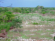
terrain that parallels portions of the western and northern coastlines in Yucatán
and Campeche
. This particular environmental zone is considered the driest in all of the Maya area, with less than 800 mm (31.5 in) of annual rainfall. Compounding these harsh conditions, nearly fifty percent of the surface around Chunchucmil is exposed limestone
bedrock
. Even when soils are encountered, they are rarely more than a few centimeters in depth. Vegetation in this region is generally considered scrub forest dominated by acacia
and other drought-resistant species (similar to the European heathland). One of the mysteries surrounding Chunchucmil is how such a large city could have sustained itself in one of the poorest regions for agriculture.
However, the ancient city was situated at the edge of this semi-arid ecological zone, exactly where the dry Yucatecan plains dip and fracture into vast wetland
s (see map). Immediately to the west of Chunchucmil are found the seasonally inundated savanna
s, fresh water petenes (or ojos de agua), and eventually the brackish mangrove
estuary
where the Yucatán aquifer
empties into the Gulf of Mexico
near the ancient Maya coastal site of Canbalam. It is likely that ancient Chunchucmil was purposefully situated to take advantage of multiple ecological zones
, including coastal resources such as the salt-beds
of the Celestún
peninsula, and to increase accessibility to the vigorous circum-peninsular canoe
trade route
of Pre-Columbian
times, using Canbalam as its port of entry.
hacienda of Chunchucmil. Most wells in this region are named after animals or plants. In this case, the words Ch'en Chun Chukum literally mean "the well at the base of the Chukum tree" (Havardia albicans
). Local Maya speakers still refer to the modern village of Chunchucmil as Chun Chukum when speaking in their native tongue. The ancient Maya archaeological site was given the name Chunchucmil by archaeologists in the 1970s because that was the closest modern community to the site center. Local Maya villagers
today do not have a single term to refer to the ruins, since the ancient city is so large that it encompasses most of their lands.
 The exact size of Chunchucmil is currently being studied using aerial photography
, satellite imagery
, and survey transects by the Pakbeh Regional Economy Project (who have been working at Chunchucmil since the mid 1990s, under the direction of Dr. Bruce H. Dahlin). Estimates range from 25 km² for the more compact urban settlement to around 64 km² for the city and its adjoining suburbs and farmsteads. In either case, this places the site of Chunchucmil among some of the largest and most densely settled ancient Maya polities.
indicate that the Chunchucmil region was occupied from the Middle Preclassic (Middle Formative) through the Postclassic periods of Maya prehistory. However, widespread test excavations within the architectural groups of ancient Chunchucmil indicate that the city reached its apogee during the latter part of the Early Classic and the early part of the Late Classic, attaining its maximum spatial extent, population, and structural density. This period is defined in some areas as the "Middle Classic." Chunchucmil appears to have gone into decline during the latter part of the Late Classic. The Terminal Classic
(or Puuc
) occupation at Chunchucmil is ephemeral at best, and the Postclassic occupation at the site consisted of squatter-like settlement. A few early colonial
homesteads have been found, but the region was largely abandoned between the Maya Postclassic period and the beginnings of the cattle ranches and henequen haciendas of historic and modern times.
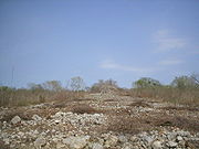
 The Classic Period site center of Chunchucmil is dominated by over a dozen pyramids
ranging in height from 8 to 18 m (26 to 60 ft) tall. Each pyramid is part of a structural arrangement referred to as a “quadrangle group” by members of the Pakbeh Regional Economy Project. Quadrangle groups consist of an enclosed courtyard
flanked by a pyramid on one side (which faces inward towards the courtyard) and a number of ranged and compact structures along the remaining three sides. Within each quadrangle group's courtyard is a small central platform that is interpreted as a focal point of ritualized activities (such as an altar
). Other ceremonies would have taken place within the temple
s atop each pyramid. With the temple pyramids and central platforms acting as loci of lineage-based ritual, quadrangle groups likely housed the upper-echelon elites of ancient Chunchucmil that may have been active in the socio-political, ideological and economic administration of the city. Of particular importance is that fact that each major quadrangle group is connected to the others through a network of sacbe
ob (stone causeways), suggesting an unknown degree of connectedness between the residing lineages and (potentially) cooperation or competition in ruling Chunchucmil. If this was indeed the case, Chunchucmil's political structure may have been roughly analogous to that suggested for the later Maya capital of Chichen Itza
, referred to as a "multepal" system and characterized as rulership through council.
 At Chunchucmil, these clusters of associated structures are encircled by low-lying stone walls (called albarradas), that demarcate domestic space by bounding the group’s residential lot or yard (called a solar). The entire unit, consisting of the architecture and the associated solar, is today referred to as an "albarrada group". Unlike at the vast majority of Maya sites, Chunchucmil’s albarrada groups contain clear boundaries between residential house lots and, as of result of this, researchers are better able to study such issues as settlement patterns, occupational density, population estimates, lineage structure, and social organization.
Many residential groups had a small temple or shrine (similar to the placement of the temple pyramids of their larger counterparts). These buildings served as loci for the performance of household rituals or other types of ideological practices. One such residential shrine that has been excavated and consolidated at the Lool Group revealed its form to be talud-tablero. This style of architecture is most famous at sites in Central Mexico, such as at the contemporaneous city of Teotihuacan
. Beneath the stair of this shrine was a vessel that also replicated the pottery of that Central Mexican city. While this should not be used as evidence of direct Teotihuacan influence, it does suggest Chunchucmil's participation in the greater Mesoamerican communication sphere at the time of Teotihuacan's dominance. It should also be noted that all other structures excavated at Chunchucmil thus far lack demonstrable Teotihuacan influence.
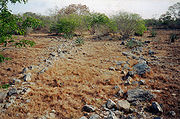
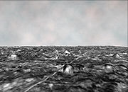
 One of the distinguishing characteristics of Chunchucmil is its network of stone-lined paths. As mentioned above, the majority of residential lots are surrounded by albarradas (stone walls) that, when viewed on a map, give the site a honeycomb appearance. The space between adjacent albarradas form avenues or paths for foot traffic (called callejuelas, see photo) that radiate outward from the site center and into Chunchucmil's dense residential zone. By mapping these formations, researchers have been able to better understand the flow of traffic in and out of the site center as well as the relationship between Chunchucmil's central core, its residential urban sprawl, and its outlying peripheral settlement.
Beyond Chunchucmil, in the seasonally inundated western wetlands, researchers have found a network of rock alignments that connect Chunchucmil's periphery to other outlying settlements. Such rock alignments, called andadores by Maya archaeologists, would have provided sure footing through the wetlands, like stepping stones, leading travelers to various towns and resources in Chunchucmil's hinterland. While not all of these andadores have been followed to their final destinations, the general orientation of the longest alignments suggest that they may have functioned to connect Chunchucmil with the coast near Canbalam.
(an archaeological concept borrowed from the field of geology
), this meant that the large barricade was likely the last feature to be built at the site. Furthermore, the stones used to create the barricade were clearly robbed from nearby structures (rather than freshly quarried). Given this data, it has been hypothesized that the barricade was constructed rapidly at the end of Chunchucmil's history, possibly to protect the remaining inhabitants from an invasion that arrived before the wall could be completed, leading to the ultimate demise of the ancient city.
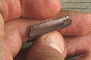 The chipped-stone assemblage of Chunchucmil is dominated by obsidian
prismatic blade
s. The prismatic blade industry
was ubiquitous throughout Mesoamerica
and primarily used in the production
of obsidian tools. Lithic analyses
have determined that the majority of the blades at Chunchucmil were likely imported in finished form, as suggested by the general scarcity of polyhedral cores
, production debitage
, rejuvenation artifacts, and manufacturing errors at the site. Other types of tools made from obsidian, especially formal bifacial tools
, are rare, but present, at Chunchucmil. Bifacial obsidian tools include a small collection of projectile point
s and ambiguous tool fragments. Unifacial
tools are generally absent. Other types of industries, such as expedient flake
production or bipolar reduction, are also absent at Chunchucmil.
The exploitation of non-obsidian stone resources (e.g., chert
, chalcedony
, and quartz
) did occur at Chunchucmil, but these materials are much less common than obsidian. The majority of these resources, especially chert, were obtained locally from nodules in the limestone bedrock, but were very poor in quality. While a number of formal tools were produced from chert and quartz, most non-obsidian tools were informal and produced through expedient flake production.
The fact that obsidian was favored over local resources for utilitarian tools is interesting, especially considering that obsidian had to be imported over long distances. The El Chayal obsidian source (which is the most common at Chunchucmil), is located nearly 1000 km (621 mi) away (as the crow flies
) in Guatemala
. This, once again, indicates Chunchucmil's close ties with external trade routes and the greater Mesoamerican world of the Classic period.
 The site of Chunchucmil is also notable for the likely presence of a marketplace
. Geochemical soil tests combined with careful excavations of an open area in the site center have revealed a possible market for distributing comestibles and other goods. Excavations also revealed ephemeral stone alignments that may have been brace foundations for perishable market stall walls. High levels of phosphorus
correlate with these alignments, suggesting high concentrations of organic decay
. Additionally, the distribution of obsidian within the Chunchucmil region itself, especially among a variety of sociocultural contexts, may also indicate the presence of a market economy
, which is relatively rare among Early Classic Maya economies.
. According to bone isotope
studies conducted by Pakbeh Regional Economy Project member Geni Mansell, the diet of the ancient inhabitants may have been more diversified than in other areas of the Maya region. When compared with skeletal remains from other parts of Yucatán, Belize
and the southern Maya lowlands, human remains from Chunchucmil indicate that their diet
included significantly less corn
(maize, the staple crop for most communities in the Maya area). Access to the more ecologically diverse wetlands and coastal resources, as well as access to inter-regional trade routes and a centralized marketplace, may have been critical to ancient subsistence at Chunchucmil.
Pre-Columbian
The pre-Columbian era incorporates all period subdivisions in the history and prehistory of the Americas before the appearance of significant European influences on the American continents, spanning the time of the original settlement in the Upper Paleolithic period to European colonization during...
Maya city
Maya city
A Maya city was a centre of population of the pre-Columbian Maya civilization of Mesoamerica. It served the specialised roles of administration, commerce, manufacturing and religion that characterised ancient cities worldwide...
located in the western part of what is now the state of Yucatán
Yucatán
Yucatán officially Estado Libre y Soberano de Yucatán is one of the 31 states which, with the Federal District, comprise the 32 Federal Entities of Mexico. It is divided in 106 municipalities and its capital city is Mérida....
, Mexico
Mexico
The United Mexican States , commonly known as Mexico , is a federal constitutional republic in North America. It is bordered on the north by the United States; on the south and west by the Pacific Ocean; on the southeast by Guatemala, Belize, and the Caribbean Sea; and on the east by the Gulf of...
.
Although the famous explorer and author John Lloyd Stephens
John Lloyd Stephens
John Lloyd Stephens was an American explorer, writer, and diplomat. Stephens was a pivotal figure in the rediscovery of Maya civilization throughout Middle America and in the planning of the Panama railroad....
traveled within a few kilometers of Chunchucmil during his historic journey across the Yucatán Peninsula
Yucatán Peninsula
The Yucatán Peninsula, in southeastern Mexico, separates the Caribbean Sea from the Gulf of Mexico, with the northern coastline on the Yucatán Channel...
(he even met with the owner of the nearby Hacienda
Hacienda
Hacienda is a Spanish word for an estate. Some haciendas were plantations, mines, or even business factories. Many haciendas combined these productive activities...
s), the archaeological site went relatively unnoticed by Maya scholars
Mayanist
A Mayanist is a scholar specialising in research and study of the Central American pre-Columbian Maya civilization. This discipline should not be confused with Mayanism, a collection of New Age beliefs about the ancient Maya....
for more than a century because virtually no monuments (stelae) or other grand sculptures have been found there. The lack of royal monuments, combined with other archaeological data (see below), may indicate that Chunchucmil was not a city ruled by a single divine king, as most other Maya
Maya civilization
The Maya is a Mesoamerican civilization, noted for the only known fully developed written language of the pre-Columbian Americas, as well as for its art, architecture, and mathematical and astronomical systems. Initially established during the Pre-Classic period The Maya is a Mesoamerican...
polities
Polity
Polity is a form of government Aristotle developed in his search for a government that could be most easily incorporated and used by the largest amount of people groups, or states...
. Instead, it may have been a commercial center, organized by various lineages and focused upon funneling goods between regions—such as the trade between the Gulf of Mexico
Gulf Coast of Mexico
The Gulf Coast of Mexico stretches along the Gulf of Mexico from the border with the United states at Matamoros, Tamaulipas all the way to the tip of the Yucatán Peninsula at Cancún. It includes the coastal regions along the Bay of Campeche. Major cities include Veracruz, Tampico, and...
and the interior of the Yucatán Peninsula
Yucatán Peninsula
The Yucatán Peninsula, in southeastern Mexico, separates the Caribbean Sea from the Gulf of Mexico, with the northern coastline on the Yucatán Channel...
.
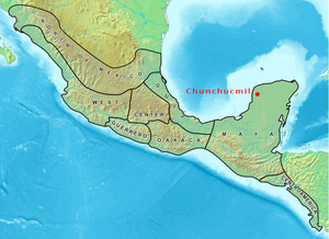 Map of Mesoamerica Mesoamerica Mesoamerica is a region and culture area in the Americas, extending approximately from central Mexico to Belize, Guatemala, El Salvador, Honduras, Nicaragua, and Costa Rica, within which a number of pre-Columbian societies flourished before the Spanish colonization of the Americas in the 15th and... highlighting the location of Chunchucmil |
|
| Country: | Mexico Mexico The United Mexican States , commonly known as Mexico , is a federal constitutional republic in North America. It is bordered on the north by the United States; on the south and west by the Pacific Ocean; on the southeast by Guatemala, Belize, and the Caribbean Sea; and on the east by the Gulf of... |
|---|---|
| State: | Yucatán Yucatán Yucatán officially Estado Libre y Soberano de Yucatán is one of the 31 states which, with the Federal District, comprise the 32 Federal Entities of Mexico. It is divided in 106 municipalities and its capital city is Mérida.... |
| Municipality: | Maxcanú |
| Culture: | Maya Maya civilization The Maya is a Mesoamerican civilization, noted for the only known fully developed written language of the pre-Columbian Americas, as well as for its art, architecture, and mathematical and astronomical systems. Initially established during the Pre-Classic period The Maya is a Mesoamerican... |
| Peak of Occupation: | Early Classic Period Mesoamerican chronology Mesoamerican chronology divides the history of pre-Columbian Mesoamerica into several periods: the Paleo-Indian , the Archaic , the Preclassic , the Classic , and the Postclassic... |
| Chronological Range of Occupation: | Middle Preclassic Mesoamerican chronology Mesoamerican chronology divides the history of pre-Columbian Mesoamerica into several periods: the Paleo-Indian , the Archaic , the Preclassic , the Classic , and the Postclassic... - Terminal Classic Mesoamerican chronology Mesoamerican chronology divides the history of pre-Columbian Mesoamerica into several periods: the Paleo-Indian , the Archaic , the Preclassic , the Classic , and the Postclassic... |
| Estimated Size: | 25 – 65 km² |
| Estimated Peak Population: | 31,000 - 43,000 (within the central 25 km² area) |
Location
The site center is located ca. 27 km (16.8 mi) inland from the Gulf of MexicoGulf of Mexico
The Gulf of Mexico is a partially landlocked ocean basin largely surrounded by the North American continent and the island of Cuba. It is bounded on the northeast, north and northwest by the Gulf Coast of the United States, on the southwest and south by Mexico, and on the southeast by Cuba. In...
and approximately half-way between the coast and the next largest archaeological site
Archaeological site
An archaeological site is a place in which evidence of past activity is preserved , and which has been, or may be, investigated using the discipline of archaeology and represents a part of the archaeological record.Beyond this, the definition and geographical extent of a 'site' can vary widely,...
of Oxkintok
Oxkintok
Oxkintok is a pre-Columbian Maya archaeological site on the Yucatán Peninsula, located at the northern tip of the Puuc hills - a few kilometers to the east of the modern town of Maxcanú, Yucatán, Mexico.-Etymology:...
. It was named in the late 1970s after the nearest modern settlement (the Hacienda
Hacienda
Hacienda is a Spanish word for an estate. Some haciendas were plantations, mines, or even business factories. Many haciendas combined these productive activities...
and village
Village
A village is a clustered human settlement or community, larger than a hamlet with the population ranging from a few hundred to a few thousand , Though often located in rural areas, the term urban village is also applied to certain urban neighbourhoods, such as the West Village in Manhattan, New...
of Chunchucmil), however the archaeological site is so large that it extends onto the ejido
Ejido
The ejido system is a process whereby the government promotes the use of communal land shared by the people of the community. This use of community land was a common practice during the time of Aztec rule in Mexico...
lands of at least five modern communities: Chunchucmil, Kochol, San Mateo, Coahuila and Halachó. The majority of the ancient Maya site is located within the municipality of Maxcanú, however a portion of it is situated on land pertaining to the municipality of Halachó.
Environment and ecology
The site of Chunchucmil is located on a narrow band of semi-aridSemi-arid
A semi-arid climate or steppe climate describes climatic regions that receive precipitation below potential evapotranspiration, but not extremely...
terrain that parallels portions of the western and northern coastlines in Yucatán
Yucatán
Yucatán officially Estado Libre y Soberano de Yucatán is one of the 31 states which, with the Federal District, comprise the 32 Federal Entities of Mexico. It is divided in 106 municipalities and its capital city is Mérida....
and Campeche
Campeche
Campeche is one of the 31 states which, with the Federal District, comprise the 32 Federal Entities of Mexico. Located in Southeast Mexico, it is bordered by the states of Yucatán to the north east, Quintana Roo to the east, and Tabasco to the south west...
. This particular environmental zone is considered the driest in all of the Maya area, with less than 800 mm (31.5 in) of annual rainfall. Compounding these harsh conditions, nearly fifty percent of the surface around Chunchucmil is exposed limestone
Limestone
Limestone is a sedimentary rock composed largely of the minerals calcite and aragonite, which are different crystal forms of calcium carbonate . Many limestones are composed from skeletal fragments of marine organisms such as coral or foraminifera....
bedrock
Bedrock
In stratigraphy, bedrock is the native consolidated rock underlying the surface of a terrestrial planet, usually the Earth. Above the bedrock is usually an area of broken and weathered unconsolidated rock in the basal subsoil...
. Even when soils are encountered, they are rarely more than a few centimeters in depth. Vegetation in this region is generally considered scrub forest dominated by acacia
Acacia
Acacia is a genus of shrubs and trees belonging to the subfamily Mimosoideae of the family Fabaceae, first described in Africa by the Swedish botanist Carl Linnaeus in 1773. Many non-Australian species tend to be thorny, whereas the majority of Australian acacias are not...
and other drought-resistant species (similar to the European heathland). One of the mysteries surrounding Chunchucmil is how such a large city could have sustained itself in one of the poorest regions for agriculture.
However, the ancient city was situated at the edge of this semi-arid ecological zone, exactly where the dry Yucatecan plains dip and fracture into vast wetland
Wetland
A wetland is an area of land whose soil is saturated with water either permanently or seasonally. Wetlands are categorised by their characteristic vegetation, which is adapted to these unique soil conditions....
s (see map). Immediately to the west of Chunchucmil are found the seasonally inundated savanna
Savanna
A savanna, or savannah, is a grassland ecosystem characterized by the trees being sufficiently small or widely spaced so that the canopy does not close. The open canopy allows sufficient light to reach the ground to support an unbroken herbaceous layer consisting primarily of C4 grasses.Some...
s, fresh water petenes (or ojos de agua), and eventually the brackish mangrove
Mangrove
Mangroves are various kinds of trees up to medium height and shrubs that grow in saline coastal sediment habitats in the tropics and subtropics – mainly between latitudes N and S...
estuary
Estuary
An estuary is a partly enclosed coastal body of water with one or more rivers or streams flowing into it, and with a free connection to the open sea....
where the Yucatán aquifer
Aquifer
An aquifer is a wet underground layer of water-bearing permeable rock or unconsolidated materials from which groundwater can be usefully extracted using a water well. The study of water flow in aquifers and the characterization of aquifers is called hydrogeology...
empties into the Gulf of Mexico
Gulf of Mexico
The Gulf of Mexico is a partially landlocked ocean basin largely surrounded by the North American continent and the island of Cuba. It is bounded on the northeast, north and northwest by the Gulf Coast of the United States, on the southwest and south by Mexico, and on the southeast by Cuba. In...
near the ancient Maya coastal site of Canbalam. It is likely that ancient Chunchucmil was purposefully situated to take advantage of multiple ecological zones
Ecoregion
An ecoregion , sometimes called a bioregion, is an ecologically and geographically defined area that is smaller than an ecozone and larger than an ecosystem. Ecoregions cover relatively large areas of land or water, and contain characteristic, geographically distinct assemblages of natural...
, including coastal resources such as the salt-beds
Salt evaporation pond
Salt evaporation ponds, also called salterns or salt pans, are shallow artificial ponds designed to produce salts from sea water or other brines. The seawater or brine is fed into large ponds and water is drawn out through natural evaporation which allows the salt to be subsequently harvested...
of the Celestún
Celestún
Celestún is a town in Yucatán, Mexico. It is located in the northwest corner of the state, just north of the border with the state of Campeche, on the Gulf of Mexico coast at....
peninsula, and to increase accessibility to the vigorous circum-peninsular canoe
Canoe
A canoe or Canadian canoe is a small narrow boat, typically human-powered, though it may also be powered by sails or small electric or gas motors. Canoes are usually pointed at both bow and stern and are normally open on top, but can be decked over A canoe (North American English) or Canadian...
trade route
Trade route
A trade route is a logistical network identified as a series of pathways and stoppages used for the commercial transport of cargo. Allowing goods to reach distant markets, a single trade route contains long distance arteries which may further be connected to several smaller networks of commercial...
of Pre-Columbian
Pre-Columbian
The pre-Columbian era incorporates all period subdivisions in the history and prehistory of the Americas before the appearance of significant European influences on the American continents, spanning the time of the original settlement in the Upper Paleolithic period to European colonization during...
times, using Canbalam as its port of entry.
Etymology
The term "Chunchucmil" was originally used to name a freshwater well (Ch'en Chun Chukum), the central water source for the cattle ranch that eventually grew to become the historic henequenHenequen
Henequen is an agave whose leaves yield a fiber also called henequen which is suitable for rope and twine, but not of as high a quality as sisal. Alternative spellings are Henequin and Heniquen. It is the major plantation fiber agave of eastern Mexico, being grown extensively in Yucatán,...
hacienda of Chunchucmil. Most wells in this region are named after animals or plants. In this case, the words Ch'en Chun Chukum literally mean "the well at the base of the Chukum tree" (Havardia albicans
Havardia albicans
Havardia albicans is a perennial tree which grows to 5 m tall. It is native to Mexico, the Caribbean and Central America, in regions around the Yucatan Peninsula. Common names for it include Chucum and Cuisache...
). Local Maya speakers still refer to the modern village of Chunchucmil as Chun Chukum when speaking in their native tongue. The ancient Maya archaeological site was given the name Chunchucmil by archaeologists in the 1970s because that was the closest modern community to the site center. Local Maya villagers
Maya peoples
The Maya people constitute a diverse range of the Native American people of southern Mexico and northern Central America. The overarching term "Maya" is a collective designation to include the peoples of the region who share some degree of cultural and linguistic heritage; however, the term...
today do not have a single term to refer to the ruins, since the ancient city is so large that it encompasses most of their lands.
Site size
Aerial photography
Aerial photography is the taking of photographs of the ground from an elevated position. The term usually refers to images in which the camera is not supported by a ground-based structure. Cameras may be hand held or mounted, and photographs may be taken by a photographer, triggered remotely or...
, satellite imagery
Satellite imagery
Satellite imagery consists of photographs of Earth or other planets made by means of artificial satellites.- History :The first images from space were taken on sub-orbital flights. The U.S-launched V-2 flight on October 24, 1946 took one image every 1.5 seconds...
, and survey transects by the Pakbeh Regional Economy Project (who have been working at Chunchucmil since the mid 1990s, under the direction of Dr. Bruce H. Dahlin). Estimates range from 25 km² for the more compact urban settlement to around 64 km² for the city and its adjoining suburbs and farmsteads. In either case, this places the site of Chunchucmil among some of the largest and most densely settled ancient Maya polities.
Chronology
Ceramic dataSherd
In archaeology, a sherd is commonly a historic or prehistoric fragment of pottery, although the term is occasionally used to refer to fragments of stone and glass vessels as well....
indicate that the Chunchucmil region was occupied from the Middle Preclassic (Middle Formative) through the Postclassic periods of Maya prehistory. However, widespread test excavations within the architectural groups of ancient Chunchucmil indicate that the city reached its apogee during the latter part of the Early Classic and the early part of the Late Classic, attaining its maximum spatial extent, population, and structural density. This period is defined in some areas as the "Middle Classic." Chunchucmil appears to have gone into decline during the latter part of the Late Classic. The Terminal Classic
Mesoamerican chronology
Mesoamerican chronology divides the history of pre-Columbian Mesoamerica into several periods: the Paleo-Indian , the Archaic , the Preclassic , the Classic , and the Postclassic...
(or Puuc
Puuc
Puuc is the name of either a region in the Mexican state of Yucatán or a Maya architectural style prevalent in that region. The word "puuc" is derived from the Maya term for "hill". Since the Yucatán is relatively flat, this term was extended to encompass the large karstic range of hills in the...
) occupation at Chunchucmil is ephemeral at best, and the Postclassic occupation at the site consisted of squatter-like settlement. A few early colonial
New Spain
New Spain, formally called the Viceroyalty of New Spain , was a viceroyalty of the Spanish colonial empire, comprising primarily territories in what was known then as 'América Septentrional' or North America. Its capital was Mexico City, formerly Tenochtitlan, capital of the Aztec Empire...
homesteads have been found, but the region was largely abandoned between the Maya Postclassic period and the beginnings of the cattle ranches and henequen haciendas of historic and modern times.
Built environment
Monumental architecture
Mesoamerican pyramids
Mesoamerican pyramids, pyramid-shaped structures, are an important part of ancient Mesoamerican architecture. These structures were usually step pyramids with temples on top – more akin to the ziggurats of Mesopotamia than to the pyramids of Ancient Egypt...
ranging in height from 8 to 18 m (26 to 60 ft) tall. Each pyramid is part of a structural arrangement referred to as a “quadrangle group” by members of the Pakbeh Regional Economy Project. Quadrangle groups consist of an enclosed courtyard
Courtyard
A court or courtyard is an enclosed area, often a space enclosed by a building that is open to the sky. These areas in inns and public buildings were often the primary meeting places for some purposes, leading to the other meanings of court....
flanked by a pyramid on one side (which faces inward towards the courtyard) and a number of ranged and compact structures along the remaining three sides. Within each quadrangle group's courtyard is a small central platform that is interpreted as a focal point of ritualized activities (such as an altar
Altar
An altar is any structure upon which offerings such as sacrifices are made for religious purposes. Altars are usually found at shrines, and they can be located in temples, churches and other places of worship...
). Other ceremonies would have taken place within the temple
Temple
A temple is a structure reserved for religious or spiritual activities, such as prayer and sacrifice, or analogous rites. A templum constituted a sacred precinct as defined by a priest, or augur. It has the same root as the word "template," a plan in preparation of the building that was marked out...
s atop each pyramid. With the temple pyramids and central platforms acting as loci of lineage-based ritual, quadrangle groups likely housed the upper-echelon elites of ancient Chunchucmil that may have been active in the socio-political, ideological and economic administration of the city. Of particular importance is that fact that each major quadrangle group is connected to the others through a network of sacbe
Sacbe
right|thumb|Sacbe at Dzibilchaltun in the Yucatánthumb|right|Arch at the end of the sacbé, Kabah, YucatánSacbe, plural Sacbeob, or "white ways" are raised paved roads built by the Maya civilization of pre-Columbian Mesoamerica...
ob (stone causeways), suggesting an unknown degree of connectedness between the residing lineages and (potentially) cooperation or competition in ruling Chunchucmil. If this was indeed the case, Chunchucmil's political structure may have been roughly analogous to that suggested for the later Maya capital of Chichen Itza
Chichen Itza
Chichen Itza is a large pre-Columbian archaeological site built by the Maya civilization located in the northern center of the Yucatán Peninsula, in the Municipality of Tinúm, Yucatán state, present-day Mexico....
, referred to as a "multepal" system and characterized as rulership through council.
Residential architecture
Residential architecture at Chunchucmil often follows the same pattern as the large quadrangle groups, with structures arranged on four sides of a small plaza. This arrangement conforms to the "patio cluster" or "patio group" model for Maya residential organization, where two or more structures, potentially housing multiple family units, face a shared patio or courtyard.Many residential groups had a small temple or shrine (similar to the placement of the temple pyramids of their larger counterparts). These buildings served as loci for the performance of household rituals or other types of ideological practices. One such residential shrine that has been excavated and consolidated at the Lool Group revealed its form to be talud-tablero. This style of architecture is most famous at sites in Central Mexico, such as at the contemporaneous city of Teotihuacan
Teotihuacan
Teotihuacan – also written Teotihuacán, with a Spanish orthographic accent on the last syllable – is an enormous archaeological site in the Basin of Mexico, just 30 miles northeast of Mexico City, containing some of the largest pyramidal structures built in the pre-Columbian Americas...
. Beneath the stair of this shrine was a vessel that also replicated the pottery of that Central Mexican city. While this should not be used as evidence of direct Teotihuacan influence, it does suggest Chunchucmil's participation in the greater Mesoamerican communication sphere at the time of Teotihuacan's dominance. It should also be noted that all other structures excavated at Chunchucmil thus far lack demonstrable Teotihuacan influence.
Transportation arteries
Beyond Chunchucmil, in the seasonally inundated western wetlands, researchers have found a network of rock alignments that connect Chunchucmil's periphery to other outlying settlements. Such rock alignments, called andadores by Maya archaeologists, would have provided sure footing through the wetlands, like stepping stones, leading travelers to various towns and resources in Chunchucmil's hinterland. While not all of these andadores have been followed to their final destinations, the general orientation of the longest alignments suggest that they may have functioned to connect Chunchucmil with the coast near Canbalam.
Barricade and abandonment
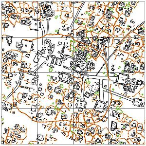
One of the first features of Chunchucmil to gain widespread attention was a stone wall, visible in aerial photos taken by the Atlas project, that roughly encircles 350,000 square metres of the site center (including most of the major Quadrangle Groups). Early reconnaissance by the Pakbeh Regional Economy Project in the late 1990s found that the wall, which stood between 1 and 1.5 m tall and had a perimeter of 1.8 km, was incomplete. It formed a large "C" shape with a 340 m wide gap open to the west (see map). Further mapping and excavation revealed that the wall runs above every major feature at the ancient site (crossing sacbeob', albarradas, and many residential groups). Based upon the law of superpositionLaw of superposition
The law of superposition is a key axiom based on observations of natural history that is a foundational principle of sedimentary stratigraphy and so of other geology dependent natural sciences:...
(an archaeological concept borrowed from the field of geology
Geology
Geology is the science comprising the study of solid Earth, the rocks of which it is composed, and the processes by which it evolves. Geology gives insight into the history of the Earth, as it provides the primary evidence for plate tectonics, the evolutionary history of life, and past climates...
), this meant that the large barricade was likely the last feature to be built at the site. Furthermore, the stones used to create the barricade were clearly robbed from nearby structures (rather than freshly quarried). Given this data, it has been hypothesized that the barricade was constructed rapidly at the end of Chunchucmil's history, possibly to protect the remaining inhabitants from an invasion that arrived before the wall could be completed, leading to the ultimate demise of the ancient city.
Lithic economy
Obsidian
Obsidian is a naturally occurring volcanic glass formed as an extrusive igneous rock.It is produced when felsic lava extruded from a volcano cools rapidly with minimum crystal growth...
prismatic blade
Prismatic blade
In archaeology, a prismatic blade is a long, narrow, specialized lithic flake with parallel margins. Prismatic blades are removed from polyhedral blade cores through pressure reduction. This process results in a very standardized finished tool and waste assemblage...
s. The prismatic blade industry
Obsidian use in Mesoamerica
Obsidian is a naturally formed volcanic glass that was an important part of the material culture of Pre-Columbian Mesoamerica. Obsidian was a highly integrated part of daily and ritual life, and its widespread and varied use may be a significant contributor to Mesoamerica's lack of metallurgy...
was ubiquitous throughout Mesoamerica
Mesoamerica
Mesoamerica is a region and culture area in the Americas, extending approximately from central Mexico to Belize, Guatemala, El Salvador, Honduras, Nicaragua, and Costa Rica, within which a number of pre-Columbian societies flourished before the Spanish colonization of the Americas in the 15th and...
and primarily used in the production
Lithic reduction
Lithic reduction involves the use of a hard hammer precursor, such as a hammerstone, a soft hammer fabricator , or a wood or antler punch to detach lithic flakes from a lump of tool stone called a lithic core . As flakes are detached in sequence, the original mass of stone is reduced; hence the...
of obsidian tools. Lithic analyses
Lithic analysis
In archaeology, lithic analysis is the analysis of stone tools and other chipped stone artifacts using basic scientific techniques. At its most basic level, lithic analyses involve an analysis of the artifact’s morphology, the measurement of various physical attributes, and examining other visible...
have determined that the majority of the blades at Chunchucmil were likely imported in finished form, as suggested by the general scarcity of polyhedral cores
Lithic core
In archaeology, a lithic core is a distinctive artifact that results from the practice of lithic reduction. In this sense, a core is the scarred nucleus resulting from the detachment of one or more flakes from a lump of source material or tool stone, usually by using a hard hammer percussor such...
, production debitage
Debitage
The term debitage refers to all the waste material produced during lithic reduction and the production of chipped stone tools. This assemblage includes, but is not limited to, different kinds of lithic flakes, shatter, and production errors and rejects....
, rejuvenation artifacts, and manufacturing errors at the site. Other types of tools made from obsidian, especially formal bifacial tools
Biface
In archaeology, a biface is a two-sided stone tool and is used as a multi purposes knife, manufactured through a process of lithic reduction, that displays flake scars on both sides. A profile view of the final product tends to exhibit a lenticular shape...
, are rare, but present, at Chunchucmil. Bifacial obsidian tools include a small collection of projectile point
Projectile point
In archaeological terms, a projectile point is an object that was hafted to a projectile, such as a spear, dart, or arrow, or perhaps used as a knife....
s and ambiguous tool fragments. Unifacial
Uniface
In archeology, a uniface is a specific type of stone tool that has been flaked on one surface only. There are two general classes of uniface tools: modified flakes—and formalized tools, which display deliberate, systematic modification of the marginal edges, evidently formed for a specific...
tools are generally absent. Other types of industries, such as expedient flake
Flake
Flake or Flakes may refer to:In food preparation:* Fish flake, a platform for drying cod* Flake , an Australian term for edible flesh of one of several species of shark...
production or bipolar reduction, are also absent at Chunchucmil.
The exploitation of non-obsidian stone resources (e.g., chert
Chert
Chert is a fine-grained silica-rich microcrystalline, cryptocrystalline or microfibrous sedimentary rock that may contain small fossils. It varies greatly in color , but most often manifests as gray, brown, grayish brown and light green to rusty red; its color is an expression of trace elements...
, chalcedony
Chalcedony
Chalcedony is a cryptocrystalline form of silica, composed of very fine intergrowths of the minerals quartz and moganite. These are both silica minerals, but they differ in that quartz has a trigonal crystal structure, while moganite is monoclinic...
, and quartz
Quartz
Quartz is the second-most-abundant mineral in the Earth's continental crust, after feldspar. It is made up of a continuous framework of SiO4 silicon–oxygen tetrahedra, with each oxygen being shared between two tetrahedra, giving an overall formula SiO2. There are many different varieties of quartz,...
) did occur at Chunchucmil, but these materials are much less common than obsidian. The majority of these resources, especially chert, were obtained locally from nodules in the limestone bedrock, but were very poor in quality. While a number of formal tools were produced from chert and quartz, most non-obsidian tools were informal and produced through expedient flake production.
The fact that obsidian was favored over local resources for utilitarian tools is interesting, especially considering that obsidian had to be imported over long distances. The El Chayal obsidian source (which is the most common at Chunchucmil), is located nearly 1000 km (621 mi) away (as the crow flies
As the crow flies
"As the crow flies" or beelining is an idiom for the shortest route between two points; the geodesic distance.An example is the great-circle distance between Key West and Pensacola, at either end of the U.S...
) in Guatemala
Guatemala
Guatemala is a country in Central America bordered by Mexico to the north and west, the Pacific Ocean to the southwest, Belize to the northeast, the Caribbean to the east, and Honduras and El Salvador to the southeast...
. This, once again, indicates Chunchucmil's close ties with external trade routes and the greater Mesoamerican world of the Classic period.
Market system
Marketplace
A marketplace is the space, actual, virtual or metaphorical, in which a market operates. The term is also used in a trademark law context to denote the actual consumer environment, ie. the 'real world' in which products and services are provided and consumed.-Marketplaces and street markets:A...
. Geochemical soil tests combined with careful excavations of an open area in the site center have revealed a possible market for distributing comestibles and other goods. Excavations also revealed ephemeral stone alignments that may have been brace foundations for perishable market stall walls. High levels of phosphorus
Phosphorus
Phosphorus is the chemical element that has the symbol P and atomic number 15. A multivalent nonmetal of the nitrogen group, phosphorus as a mineral is almost always present in its maximally oxidized state, as inorganic phosphate rocks...
correlate with these alignments, suggesting high concentrations of organic decay
Decomposition
Decomposition is the process by which organic material is broken down into simpler forms of matter. The process is essential for recycling the finite matter that occupies physical space in the biome. Bodies of living organisms begin to decompose shortly after death...
. Additionally, the distribution of obsidian within the Chunchucmil region itself, especially among a variety of sociocultural contexts, may also indicate the presence of a market economy
Market economy
A market economy is an economy in which the prices of goods and services are determined in a free price system. This is often contrasted with a state-directed or planned economy. Market economies can range from hypothetically pure laissez-faire variants to an assortment of real-world mixed...
, which is relatively rare among Early Classic Maya economies.
Subsistence
As mentioned above, one important question concerning ancient Chunchucmil is how such a large population could have survived in one of the poorest areas for agricultureAgriculture
Agriculture is the cultivation of animals, plants, fungi and other life forms for food, fiber, and other products used to sustain life. Agriculture was the key implement in the rise of sedentary human civilization, whereby farming of domesticated species created food surpluses that nurtured the...
. According to bone isotope
Isotopic signature
An isotopic signature is a ratio of stable or unstable isotopes of particular elements found in an investigated material...
studies conducted by Pakbeh Regional Economy Project member Geni Mansell, the diet of the ancient inhabitants may have been more diversified than in other areas of the Maya region. When compared with skeletal remains from other parts of Yucatán, Belize
Belize
Belize is a constitutional monarchy and the northernmost country in Central America. Belize has a diverse society, comprising many cultures and languages. Even though Kriol and Spanish are spoken among the population, Belize is the only country in Central America where English is the official...
and the southern Maya lowlands, human remains from Chunchucmil indicate that their diet
Diet (nutrition)
In nutrition, diet is the sum of food consumed by a person or other organism. Dietary habits are the habitual decisions an individual or culture makes when choosing what foods to eat. With the word diet, it is often implied the use of specific intake of nutrition for health or weight-management...
included significantly less corn
Maize
Maize known in many English-speaking countries as corn or mielie/mealie, is a grain domesticated by indigenous peoples in Mesoamerica in prehistoric times. The leafy stalk produces ears which contain seeds called kernels. Though technically a grain, maize kernels are used in cooking as a vegetable...
(maize, the staple crop for most communities in the Maya area). Access to the more ecologically diverse wetlands and coastal resources, as well as access to inter-regional trade routes and a centralized marketplace, may have been critical to ancient subsistence at Chunchucmil.
External links
- Prehistory of Chunchucmil A summary of the prehistory of ancient Chunchucmil, also containing a link to the modern history of Hacienda Chunchucmil. These summaries were created to assist volunteers who provided free medical, dental, and construction services to the modern village in 2002.
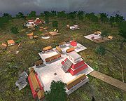
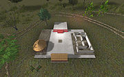
- Digital reconstruction of Chunchucmil Digital reconstructions of one neighborhood within Chunchucmil using the "Unreal Runtime" 3D engine.
- Mayaquest visit Brief notes by the "Mayaquest" team as they visited Chunchucmil in their tour of the Maya region.