
1996 Pacific hurricane season
Encyclopedia
The 1996 Pacific hurricane season was an event in tropical cyclone formation
and the third least active Pacific hurricane season in recorded history, behind 1977
and 2010
. It officially began May 15, 1996 in the eastern north Pacific and on June 1, 1996 in the central north Pacific. It ended on November 30, 1996. These dates conventionally delimit the period of each year when most tropical cyclones form in the northeastern Pacific Ocean. The season begun slightly early, however, when tropical storm One-E formed on May 13.
Few storms formed this season, but it was very eventful. Twelve tropical cyclones formed during this season, of which five made landfall and two other impacted land areas. Two tropical cyclones that formed in other basins
entered the eastern north Pacific Ocean
. Early in the season three tropical cyclones impacted Mexico
in a ten day span, while the first cyclone of the season formed before it officially began. Hurricane Douglas
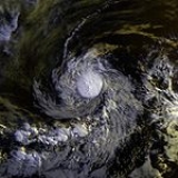
was the strongest storm, reaching Category 4 intensity on the Saffir-Simpson Hurricane Scale
and had its beginnings in the Atlantic
as Hurricane Cesar
.
. In actuality the season exceeded these limits slightly with the formation of Tropical Depression One-E on May 13 and ended on November 11 with the dissipation of Tropical Depression Twelve-E.
This season was below average in activity. In the eastern north Pacific, eleven tropical cyclones formed. Of these, four became hurricanes, one of which were major hurricanes because they reached Category 3 or higher on the Saffir-Simpson Hurricane Scale
. The remainder were tropical storms. In addition, one Atlantic hurricane, Hurricane Cesar
, crossed into this zone from the Atlantic Ocean and was renamed Douglas. None of the systems in the eastern north Pacific crossed 140°W
and entered the central Pacific. The last time that happened was in the 1979 season
.
In the central north Pacific, one tropical depression formed. In addition, a depression crossed the dateline from the western Pacific before dissipating in this basin. None of these two systems reached tropical storm strength.
In terms of the number of storms, the season was below average. Despite this, there were a large number of landfalls. Of note is the fact that three tropical cyclones approached close to, or made landfall on, Mexico during a ten-day span from June 23 to July 3.
steadily weakened the cyclone until it dissipated early on May 17. This system was the only tropical storm to form in May during the period from 1992-99.
Tropical Storm One-E was not assigned a name because it was determined to be a tropical storm after the season was over. The storm was initially forecast to become a tropical storm, but information available at the time did not warrant the upgrade. Subsequently, wind reports relayed from the US Coast Guard
to the National Hurricane Center
suggested that this cyclone was a tropical storm.
This tropical cyclone impacted two ships. The first — called the True Blue - was near the fringes of the storm and escaped. The other — the trimaran Solar Wind - provided wind observations until communications with the vessel were lost after 0600 UTC on May 14. Despite a search by the US Coast Guard, the ship and its two-person crew was never found.
developed into a tropical depression. The disturbance was not readily traceable back to a tropical wave from the Atlantic. On its first day of its existence, Tropical Depression Two-E was a well-organized system with maximum sustained winds of 35 mi/h and a minimum central pressure of 1006 mbar (29.7 inHg). As it slowly moved west, Two-E experienced a few intermittent bursts of convection. However, the depression gradually became less organized during the remainder of its life. On May 18, the cyclone's organization deteriorated markedly until it dissipated the next morning.
Tropical Depression Two-E never threatened land. Consequently, there were no reports of deaths or damage.
in the Atlantic overcame shear to strengthen into Tropical Depression Three-E. It reached tropical storm intensity that same day. When the shear relaxed, Alma strengthened into a hurricane. Weak steering currents sent Alma towards the Mexican coast. It made landfall near Lázaro Cárdenas, Michoacán
on June 23 and almost immediately went back out to sea. Alma slowly paralleled the coast as the topography disrupted the cyclone's circulation. Alma weakened to tropical storm intensity on June 24 and to tropical depression intensity on June 26. It dissipated the next day. Alma's maximum winds were 105 mph (165 km/h) and Alma's minimum pressure was 969 mbar (28.6 inHg).
Hurricane Alma was the first of three consecutive storms to come close to, or make landfall on, the Pacific coast of Mexico
during a ten-day span. At least three, and possibly twenty, people were killed. Three were killed when a house near Lázaro Cárdenas collapsed. There were unconfirmed reports that 17 people were killed by floods in the state of Puebla
caused by Alma's rains. Trees were downed and power was knocked out to many places. Roads were flooded and covered with debris throughout the affected area.
. Boris then moved offshore after turning to the southwest and dissipated on July 1 while south of Puerto Vallarta
.
Hurricane Boris was, in general, a well-forecast storm. Due to the short time when the system was at or above tropical storm intensity, long-range forecasts were not verified. The average errors were 116 mi (186.7 km) at one and a half days in the future. Boris caused at least five deaths. One person was killed in Tecpan. Nearby, three other people drowned and five fishers were missing. In Acapulco, a child was killed when a roof collapsed. Rain was heavy throughout the impacted region, with the highest totals in Guerrero
. The highest total was 14.98 in (380.5 mm) at Paso de San Antonio, to the east of the point of landfall.
. Five-E strengthened into Tropical Storm Cristina on July 2 as it continued its west-northwest track. Cristina was almost a hurricane at the time of its landfall near Puerto Angel
on July 3. It peak strength, which occurred at landfall, was 70 mph (112.7 km/h) and 991 mbar (29.3 inHg). Cristina dissipated over the mountains of Mexico on July 3.
As a whole, both Cristina's intensity and track were well-forecast. However, the tropical cyclone's short life made verification of a small number of forecasts limited. When Cristina was approaching, the Mexican government issued a tropical storm warning for the coast between Tapachula
and Punta Maldonado on July 2.
Tropical Storm Cristina killed one person, a fisherman, who was aboard a boat caught at sea. Another person from that boat was missing, and a third individual was rescued. Eleven other fishing boats, with a total of twenty-two people aboard, were missing. Their fate is unknown. The National Hurricane Center received no reports of damage due to Tropical Storm Cristina; however flooding due to storm surge
and damage from wind. It also produced rain.
This cyclone never came ashore. Consequently, no reports of damage or deaths were received by the National Hurricane Center.
Hurricane Cesar, which crossed Central America
. Continuing Cesar's nearly due-west heading, it was still a tropical storm when it entered the Pacific on July 29, and quickly regained hurricane status.
Douglas's strengthened over the next two days as it turned west-northwest, paralleling the coast of Mexico. It reached its peak intensity on August 1, with winds of 135 mph (215 km/h) and a central pressure of 946 mbar (27.9 inHg), making it the strongest hurricane of the season at a Category 4
strength. It slow weakening began on August 2 as it entered cooler waters, and it officially dissipated on August 6, though like many Pacific hurricanes, a remnant circulation could be tracked westward for several days afterward.
Compared with the long-tern average, Hurricane Douglas was a well-forecast storm. The cyclone passed close enough to Mexico to necessitate a tropical storm warning starting on July 29 for the coast from Salina Cruz
to Acapulco, with a watch along a further section of coast. The watches and warnings were discontinued on July 30.
Hurricane Douglas brought up to 6 in (150 mm) of rain on the south coast of Mexico
and resulted in a 4-ft (1.2-m) storm surge
. No deaths or damages were attributed to the Douglas portion of Hurricane Cesar-Douglas.
area of low pressure area
, crossed the dateline on August 14. It continued to head east, passing close to Midway Island
. It dissipated on August 14, although the remnants of the system hung around the area for a few more days. At its strongest in the central north Pacific, Tropical Depression Seventeen-W had winds of 35 mph (56.3 km/h) and a pressure of 1000 mbar (29.5 inHg).
Seventeen-W brought light winds, with gusts reaching gale
-force, to Midway Island. It also brought about 2.5 in (63.5 mm) of rain. After the cyclone dissipated, showers and gusty winds continued to occur on Midway and Kure
for a few more days.
Seventeen-W was the first tropical cyclone to cross the international dateline in either direction since Typhoon John
in the 1994 season
.
organized into Tropical Depression Eight-E on August 30. The cyclone paralleled the coast of Mexico and also gradually decelerated. Despite some wind shear
, Eight-E strengthened into a tropical storm on September 2 and was named Elida. On September 3 and 4, Elida came close to the southern tip of the Baja California Peninsula
at its peak intensity of 994 mbar (29.4 inHg) and winds of 65 mph (100 km/h). The cyclone then drifted into cooler waters, was devoid of deep convection on September 5, and dissipated the next day.
The storm was forecast slightly better than the long term averages for the eastern North Pacific. Elida posed enough of a threat to the Baja California Peninsula to require a tropical storm warning
for the Baja California Peninsula south of Cabo San Lázaro on September 3. The warning was lifted on September 5 after the threat ended. Moderate to heavy rains fell in association with the tropical cyclone across southwest Mexico and the Baja California peninsula, with the maxima falling at San Marcos/Compostela in southwest mainland Mexico, which measured 6.6 in (167.6 mm), and a maximum for Baja California of 3.88 in (98.6 mm) at La Poza Honda/Comondu. While passing offshore, the tropical storm killed six people and affected 1,200 others, but Elida caused no known damage.
as early as August 31, and may have been related to the tropical wave
that spawned Hurricane Fran
. By September 4 the wave had crossed Central America into the Pacific; it steadily organized until it was upgraded to Tropical Storm Fausto on September 10.
Fausto intensified rapidly after it reached hurricane intensity on the September 12, peaking with sustained winds of 105 knots (205.8 km/h) and a minimum central pressure of 955 mb. The hurricane weakened as an approaching trough
increased shear over the storm; this same trough also turned the storm north on the September 13, where it made landfall as a minimal hurricane on Baja California that day. On September 14, the storm turned northeastward across the Gulf of California
, and dissipated inland over the Sierra Madre
range after its second landfall as a hurricane. Its extratropical
remnants flared up briefly over northern Mexico and the U.S. state
of Texas
, but otherwise soon lost their identity.
Heavy rainfall was accompanied with the passage of this cyclone, with a storm total of 18.50 inches (470 mm) reported at San Vicente de la Sierra. Damage in Mexico was relatively minor, with only a single casualty caused by a downed power line. Damage totaled to around $800,000 (1996 USD).
The tropical cyclone caused no known impact and never came near land.
, an area of disturbed weather containing convection formed on September 23. It moved westward without incident until September 27, when it developed stronger convection and became Tropical Depression Ten-E. Immediately thereafter, it strengthened into a tropical storm and was named Genevieve while it continued its westward track.
Genevieve slowly got better organized, and reached its peak intensity of 999 mbar (29.5 inHg) and 50 mph (85 km/h) on September 29. The tropical storm then turned to the west-southwest
as steering currents collapsed. The cyclone began a time of erratic motion, which included two loops. The erratic motion also exposed Genevieve to wind shear
, and the tropical storm weakened to a tropical depression on October 1. On October 6, the shear temporarily weakened, and Tropical Depression Genevieve restrengthened into a tropical storm. The cyclone's wandering continued, and it entrained dry air. This dry air weakened the system to a depression for a second time on October 8, and Genevieve dissipated the next day. Brief flare-ups of convection could still be seen for a few days thereafter.
Tropical Storm Genevieve was a rather poorly forecast storm. Most tropical cyclone prediction model
s indicated a northwesterly track that never happened, and also over-intensified the system. In addition, advisories on Tropical Depression Genevieve were discontinued on October 3, and only resumed three days later. Later analysis determined that Genevieve had been a tropical depression for this whole time.
Tropical Storm Genevieve never came near land, and consequently no watches or warnings were required for any location. The tropical cyclone had no impact on any land.
The National Hurricane Center
forecasts on the Hurricane were generally forecast slightly worse than the "average" system. Errors by tropical cyclone prediction models were attributed mainly to Hernan's recurvature. In terms of intensity, this system was correctly predicted to become a hurricane although advisories underforecast its eventual intensity.
For the coast from Acapulco
to Manzanillo
, a tropical storm warning
was issued on October 1. A hurricane watch was issued from Zihuatanejo
to Manzanillo on October 2. It was upgraded to a warning later that day. Also on October 2, the coast from Manzanillo
to San Blas
was placed under a tropical storm warning. Meanwhile, the hurricane warning was extended to Cabo Corrientes
. On October 3, the hurricane warning was extended to San Blas
and the tropical storm warning was extended to Mazatlán.
Because it made landfall
in a sparsely populated area, Hernan killed no one. Around 1,000 homes were damaged or destroyed and 100 people were injured. Flooding occurred in Melaque, Jalisco. Flooding also caused washed-out roads along Mexico Route 200 and 80. In many areas, telephone service was interrupted and power outage
s occurred. Along the coasts of Colima
and Jalisco
, waves caused by Hernan reached 13 ft (3.9 m) in height.
Accumulated Cyclone Energy
(ACE) is a measure of how active a season is. It is found by taking a tropical storm or hurricane's windspeed in knots every six hours, squaring it, adding up the results, and dividing the total by 104. The ACE of this season makes it a below-normal season. It is one of the lowest totals ever recorded, indeed only the 2007
and 1977
seasons had lower totals.
. This is the same list used for the 1990 season
.
No central Pacific names were used; the first name used would have been Oliwa.
Tropical cyclogenesis
Tropical cyclogenesis is the term that describes the development and strengthening of a tropical cyclone in the atmosphere. The mechanisms through which tropical cyclogenesis occurs are distinctly different from those through which mid-latitude cyclogenesis occurs...
and the third least active Pacific hurricane season in recorded history, behind 1977
1977 Pacific hurricane season
The 1977 Pacific hurricane season was, at the time, the least active in recorded history. Only eight tropical storms formed, and four hurricanes; they would be tied and surpassed, respectively, by the 2010 Pacific hurricane season. There were no major hurricanes; the next time this happened would...
and 2010
2010 Pacific hurricane season
The 2010 Pacific hurricane season was the least active Pacific hurricane season, in terms of the number of named storms and hurricanes, on record, due to a moderate La Niña, unlike the 2010 Atlantic hurricane season, which was one of the most active on record...
. It officially began May 15, 1996 in the eastern north Pacific and on June 1, 1996 in the central north Pacific. It ended on November 30, 1996. These dates conventionally delimit the period of each year when most tropical cyclones form in the northeastern Pacific Ocean. The season begun slightly early, however, when tropical storm One-E formed on May 13.
Few storms formed this season, but it was very eventful. Twelve tropical cyclones formed during this season, of which five made landfall and two other impacted land areas. Two tropical cyclones that formed in other basins
Tropical cyclone basins
Traditionally, areas of tropical cyclone formation are divided into seven basins. These include the north Atlantic Ocean, the eastern and western parts of the northern Pacific Ocean, the southwestern Pacific, the southwestern and southeastern Indian Oceans, and the northern Indian Ocean. The...
entered the eastern north Pacific Ocean
Pacific Ocean
The Pacific Ocean is the largest of the Earth's oceanic divisions. It extends from the Arctic in the north to the Southern Ocean in the south, bounded by Asia and Australia in the west, and the Americas in the east.At 165.2 million square kilometres in area, this largest division of the World...
. Early in the season three tropical cyclones impacted Mexico
Mexico
The United Mexican States , commonly known as Mexico , is a federal constitutional republic in North America. It is bordered on the north by the United States; on the south and west by the Pacific Ocean; on the southeast by Guatemala, Belize, and the Caribbean Sea; and on the east by the Gulf of...
in a ten day span, while the first cyclone of the season formed before it officially began. Hurricane Douglas
Hurricane Cesar-Douglas
Hurricane Cesar–Douglas was a devastating tropical cyclone that killed 122 people throughout Central and South America in late-July 1996. The Category 1 hurricane formed in late July in the Caribbean Sea and pounded Central America with rain, killing 67 people and causing local governments to deem...
was the strongest storm, reaching Category 4 intensity on the Saffir-Simpson Hurricane Scale
Saffir-Simpson Hurricane Scale
The Saffir–Simpson Hurricane Scale , or the Saffir–Simpson Hurricane Wind Scale , classifies hurricanes — Western Hemisphere tropical cyclones that exceed the intensities of tropical depressions and tropical storms — into five categories distinguished by the intensities of their sustained winds...
and had its beginnings in the Atlantic
Atlantic Ocean
The Atlantic Ocean is the second-largest of the world's oceanic divisions. With a total area of about , it covers approximately 20% of the Earth's surface and about 26% of its water surface area...
as Hurricane Cesar
Hurricane Cesar-Douglas
Hurricane Cesar–Douglas was a devastating tropical cyclone that killed 122 people throughout Central and South America in late-July 1996. The Category 1 hurricane formed in late July in the Caribbean Sea and pounded Central America with rain, killing 67 people and causing local governments to deem...
.
Season summary
This hurricane season officially started on May 15, 1996 in the eastern Pacific, and on June 1, 1996 in the central Pacific, and lasted until November 30, 1996. These dates limit the time period when most tropical cyclones form in the northeastern Pacific OceanPacific Ocean
The Pacific Ocean is the largest of the Earth's oceanic divisions. It extends from the Arctic in the north to the Southern Ocean in the south, bounded by Asia and Australia in the west, and the Americas in the east.At 165.2 million square kilometres in area, this largest division of the World...
. In actuality the season exceeded these limits slightly with the formation of Tropical Depression One-E on May 13 and ended on November 11 with the dissipation of Tropical Depression Twelve-E.
This season was below average in activity. In the eastern north Pacific, eleven tropical cyclones formed. Of these, four became hurricanes, one of which were major hurricanes because they reached Category 3 or higher on the Saffir-Simpson Hurricane Scale
Saffir-Simpson Hurricane Scale
The Saffir–Simpson Hurricane Scale , or the Saffir–Simpson Hurricane Wind Scale , classifies hurricanes — Western Hemisphere tropical cyclones that exceed the intensities of tropical depressions and tropical storms — into five categories distinguished by the intensities of their sustained winds...
. The remainder were tropical storms. In addition, one Atlantic hurricane, Hurricane Cesar
Hurricane Cesar-Douglas
Hurricane Cesar–Douglas was a devastating tropical cyclone that killed 122 people throughout Central and South America in late-July 1996. The Category 1 hurricane formed in late July in the Caribbean Sea and pounded Central America with rain, killing 67 people and causing local governments to deem...
, crossed into this zone from the Atlantic Ocean and was renamed Douglas. None of the systems in the eastern north Pacific crossed 140°W
140th meridian west
The meridian 140° west of Greenwich is a line of longitude that extends from the North Pole across the Arctic Ocean, North America, the Pacific Ocean, the Southern Ocean, and Antarctica to the South Pole....
and entered the central Pacific. The last time that happened was in the 1979 season
1979 Pacific hurricane season
The 1979 Pacific hurricane season officially started May 15, 1979 in the eastern Pacific, and June 1, 1979 in the central Pacific, and lasted until November 30, 1979. These dates conventionally delimit the period of each year when most tropical cyclones form in the northeast Pacific Ocean.With ten...
.
In the central north Pacific, one tropical depression formed. In addition, a depression crossed the dateline from the western Pacific before dissipating in this basin. None of these two systems reached tropical storm strength.
In terms of the number of storms, the season was below average. Despite this, there were a large number of landfalls. Of note is the fact that three tropical cyclones approached close to, or made landfall on, Mexico during a ten-day span from June 23 to July 3.
Tropical Storm One-E
The season had an early start on May 13 when a tropical wave in the open ocean organized into Tropical Depression One-E. The depression moved west-northwest and strengthened into a tropical storm on May 14. On that day, the tropical storm reached its peak intensity, with maximum sustained winds at 50 mi/h and a minimum central pressure of 1000 mbar (29.5 inHg). Wind shearWind shear
Wind shear, sometimes referred to as windshear or wind gradient, is a difference in wind speed and direction over a relatively short distance in the atmosphere...
steadily weakened the cyclone until it dissipated early on May 17. This system was the only tropical storm to form in May during the period from 1992-99.
Tropical Storm One-E was not assigned a name because it was determined to be a tropical storm after the season was over. The storm was initially forecast to become a tropical storm, but information available at the time did not warrant the upgrade. Subsequently, wind reports relayed from the US Coast Guard
United States Coast Guard
The United States Coast Guard is a branch of the United States Armed Forces and one of the seven U.S. uniformed services. The Coast Guard is a maritime, military, multi-mission service unique among the military branches for having a maritime law enforcement mission and a federal regulatory agency...
to the National Hurricane Center
National Hurricane Center
The National Hurricane Center , located at Florida International University in Miami, Florida, is the division of the National Weather Service responsible for tracking and predicting weather systems within the tropics between the Prime Meridian and the 140th meridian west poleward to the 30th...
suggested that this cyclone was a tropical storm.
This tropical cyclone impacted two ships. The first — called the True Blue - was near the fringes of the storm and escaped. The other — the trimaran Solar Wind - provided wind observations until communications with the vessel were lost after 0600 UTC on May 14. Despite a search by the US Coast Guard, the ship and its two-person crew was never found.
Tropical Depression Two-E
On May 15 an area of disturbed weather in the Intertropical Convergence ZoneIntertropical Convergence Zone
The Intertropical Convergence Zone , known by sailors as The Doldrums, is the area encircling the earth near the equator where winds originating in the northern and southern hemispheres come together....
developed into a tropical depression. The disturbance was not readily traceable back to a tropical wave from the Atlantic. On its first day of its existence, Tropical Depression Two-E was a well-organized system with maximum sustained winds of 35 mi/h and a minimum central pressure of 1006 mbar (29.7 inHg). As it slowly moved west, Two-E experienced a few intermittent bursts of convection. However, the depression gradually became less organized during the remainder of its life. On May 18, the cyclone's organization deteriorated markedly until it dissipated the next morning.
Tropical Depression Two-E never threatened land. Consequently, there were no reports of deaths or damage.
Hurricane Alma
On June 20, the southern part of the same tropical wave that spawned Tropical Storm ArthurTropical Storm Arthur (1996)
Tropical Storm Arthur caused minimal flooding in the Carolinas in mid-June 1996. The first tropical cyclone and named storm of the annual Atlantic hurricane season, Arthur originated from an area of increased convection east of the Bahamas on June 16. Gradually, the system increased in...
in the Atlantic overcame shear to strengthen into Tropical Depression Three-E. It reached tropical storm intensity that same day. When the shear relaxed, Alma strengthened into a hurricane. Weak steering currents sent Alma towards the Mexican coast. It made landfall near Lázaro Cárdenas, Michoacán
Lázaro Cárdenas, Michoacán
Lázaro Cárdenas is a port city that with its surrounding municipality is located in the southern part of the Mexican state of Michoacán. It was formerly known as Los Llanitos, but changed its name as a tribute to Lázaro Cárdenas del Río, a Michoacán-born politician who was president of Mexico from...
on June 23 and almost immediately went back out to sea. Alma slowly paralleled the coast as the topography disrupted the cyclone's circulation. Alma weakened to tropical storm intensity on June 24 and to tropical depression intensity on June 26. It dissipated the next day. Alma's maximum winds were 105 mph (165 km/h) and Alma's minimum pressure was 969 mbar (28.6 inHg).
Hurricane Alma was the first of three consecutive storms to come close to, or make landfall on, the Pacific coast of Mexico
Mexico
The United Mexican States , commonly known as Mexico , is a federal constitutional republic in North America. It is bordered on the north by the United States; on the south and west by the Pacific Ocean; on the southeast by Guatemala, Belize, and the Caribbean Sea; and on the east by the Gulf of...
during a ten-day span. At least three, and possibly twenty, people were killed. Three were killed when a house near Lázaro Cárdenas collapsed. There were unconfirmed reports that 17 people were killed by floods in the state of Puebla
Puebla
Puebla officially Estado Libre y Soberano de Puebla is one of the 31 states which, with the Federal District, comprise the 32 Federal Entities of Mexico. It is divided in 217 municipalities and its capital city is Puebla....
caused by Alma's rains. Trees were downed and power was knocked out to many places. Roads were flooded and covered with debris throughout the affected area.
Hurricane Boris
On June 27, a tropical wave developed convection and became Tropical Depression Four. It moved north and slowly intensified. The rate of intensification increased and the depression became a tropical storm on June 28. Boris reached hurricane intensity on June 28 and peaked with winds of 90 mph (150 km/h) and a central pressure of 979 mbar (28.9 inHg). Boris then made landfall on June 29 about midway between Lázaro Cárdenas and AcapulcoAcapulco
Acapulco is a city, municipality and major sea port in the state of Guerrero on the Pacific coast of Mexico, southwest from Mexico City. Acapulco is located on a deep, semi-circular bay and has been a port since the early colonial period of Mexico’s history...
. Boris then moved offshore after turning to the southwest and dissipated on July 1 while south of Puerto Vallarta
Puerto Vallarta
Puerto Vallarta is a Mexican balneario resort city situated on the Pacific Ocean's Bahía de Banderas.The 2010 census reported Puerto Vallarta's population as 255,725 making it the sixth-largest city in the state of Jalisco...
.
Hurricane Boris was, in general, a well-forecast storm. Due to the short time when the system was at or above tropical storm intensity, long-range forecasts were not verified. The average errors were 116 mi (186.7 km) at one and a half days in the future. Boris caused at least five deaths. One person was killed in Tecpan. Nearby, three other people drowned and five fishers were missing. In Acapulco, a child was killed when a roof collapsed. Rain was heavy throughout the impacted region, with the highest totals in Guerrero
Guerrero
Guerrero officially Estado Libre y Soberano de Guerrero is one of the 31 states which, with the Federal District, comprise the 32 Federal Entities of Mexico. It is divided in 81 municipalities and its capital city is Chilpancingo....
. The highest total was 14.98 in (380.5 mm) at Paso de San Antonio, to the east of the point of landfall.
Tropical Storm Cristina
On July 1, a tropical wave organized into Tropical Depression Five-E. The location of the depression was the easternmost since the depression that eventually became Hurricane Paul in the 1982 season1982 Pacific hurricane season
The 1982 Pacific hurricane season officially started May 15, 1982 in the eastern Pacific, and June 1, 1982 in the central Pacific, and lasted until November 30, 1982. These dates conventionally delimit the period of each year when most tropical cyclones form in the northeastern Pacific Ocean.The...
. Five-E strengthened into Tropical Storm Cristina on July 2 as it continued its west-northwest track. Cristina was almost a hurricane at the time of its landfall near Puerto Angel
Puerto Ángel
Puerto Ángel is a small coastal town in the Mexican state of Oaxaca located in the municipality of San Pedro Pochutla. It, along with San Agustinillo and Playa Zipolite are known as the "Riviera Oaxaqueña. It is located 9 km south of city of Pochutla fifty km west of Huatulco and eighty km...
on July 3. It peak strength, which occurred at landfall, was 70 mph (112.7 km/h) and 991 mbar (29.3 inHg). Cristina dissipated over the mountains of Mexico on July 3.
As a whole, both Cristina's intensity and track were well-forecast. However, the tropical cyclone's short life made verification of a small number of forecasts limited. When Cristina was approaching, the Mexican government issued a tropical storm warning for the coast between Tapachula
Tapachula
Tapachula is a town and with a hot, humid climate in the Mexican state of Chiapas. It is located in southern part of the state on the Soconusco coastal plain, near the border with Guatemala, at 14.91° N 92.27° W...
and Punta Maldonado on July 2.
Tropical Storm Cristina killed one person, a fisherman, who was aboard a boat caught at sea. Another person from that boat was missing, and a third individual was rescued. Eleven other fishing boats, with a total of twenty-two people aboard, were missing. Their fate is unknown. The National Hurricane Center received no reports of damage due to Tropical Storm Cristina; however flooding due to storm surge
Storm surge
A storm surge is an offshore rise of water associated with a low pressure weather system, typically tropical cyclones and strong extratropical cyclones. Storm surges are caused primarily by high winds pushing on the ocean's surface. The wind causes the water to pile up higher than the ordinary sea...
and damage from wind. It also produced rain.
Tropical Depression Six-E
On July 4, a persistent area of thunderstorms organized into a tropical depression. Weak steering currents slowly moved it northwest. Easterly wind shear inhibited the development of the system. Despite the wind shear, Six-E was forecast to strengthen into a tropical storm, but it instead weakened to a swirl of clouds and advisories were ended on July 5. Tropical Depression Six-E dissipated on July 6. At its peak strength, Six-E had winds of 35 mph (56.3 km/h) and a central pressure of 1003 mbar (29.6 inHg).This cyclone never came ashore. Consequently, no reports of damage or deaths were received by the National Hurricane Center.
Hurricane Douglas
Hurricane Douglas was a continuation of AtlanticAtlantic Ocean
The Atlantic Ocean is the second-largest of the world's oceanic divisions. With a total area of about , it covers approximately 20% of the Earth's surface and about 26% of its water surface area...
Hurricane Cesar, which crossed Central America
Central America
Central America is the central geographic region of the Americas. It is the southernmost, isthmian portion of the North American continent, which connects with South America on the southeast. When considered part of the unified continental model, it is considered a subcontinent...
. Continuing Cesar's nearly due-west heading, it was still a tropical storm when it entered the Pacific on July 29, and quickly regained hurricane status.
Douglas's strengthened over the next two days as it turned west-northwest, paralleling the coast of Mexico. It reached its peak intensity on August 1, with winds of 135 mph (215 km/h) and a central pressure of 946 mbar (27.9 inHg), making it the strongest hurricane of the season at a Category 4
Saffir-Simpson Hurricane Scale
The Saffir–Simpson Hurricane Scale , or the Saffir–Simpson Hurricane Wind Scale , classifies hurricanes — Western Hemisphere tropical cyclones that exceed the intensities of tropical depressions and tropical storms — into five categories distinguished by the intensities of their sustained winds...
strength. It slow weakening began on August 2 as it entered cooler waters, and it officially dissipated on August 6, though like many Pacific hurricanes, a remnant circulation could be tracked westward for several days afterward.
Compared with the long-tern average, Hurricane Douglas was a well-forecast storm. The cyclone passed close enough to Mexico to necessitate a tropical storm warning starting on July 29 for the coast from Salina Cruz
Salina Cruz
Salina Cruz is a major seaport on the Pacific coast of the Mexican state of Oaxaca. It is the state's third-largest city and is municipal seat of the municipality of the same name.It is part of the Tehuantepec District in the west of the Istmo Region....
to Acapulco, with a watch along a further section of coast. The watches and warnings were discontinued on July 30.
Hurricane Douglas brought up to 6 in (150 mm) of rain on the south coast of Mexico
Mexico
The United Mexican States , commonly known as Mexico , is a federal constitutional republic in North America. It is bordered on the north by the United States; on the south and west by the Pacific Ocean; on the southeast by Guatemala, Belize, and the Caribbean Sea; and on the east by the Gulf of...
and resulted in a 4-ft (1.2-m) storm surge
Storm surge
A storm surge is an offshore rise of water associated with a low pressure weather system, typically tropical cyclones and strong extratropical cyclones. Storm surges are caused primarily by high winds pushing on the ocean's surface. The wind causes the water to pile up higher than the ordinary sea...
. No deaths or damages were attributed to the Douglas portion of Hurricane Cesar-Douglas.
Tropical Depression Seventeen-W
A tropical depression, which formed August 13 from a cutoffCutoff
In theoretical physics, cutoff is an arbitrary maximal or minimal value of energy, momentum, or length, used in order that objects with larger or smaller values than these physical quantities are ignored in some calculation...
area of low pressure area
Low pressure area
A low-pressure area, or "low", is a region where the atmospheric pressure at sea level is below that of surrounding locations. Low-pressure systems form under areas of wind divergence which occur in upper levels of the troposphere. The formation process of a low-pressure area is known as...
, crossed the dateline on August 14. It continued to head east, passing close to Midway Island
Midway Atoll
Midway Atoll is a atoll in the North Pacific Ocean, near the northwestern end of the Hawaiian archipelago, about one-third of the way between Honolulu, Hawaii, and Tokyo, Japan. Unique among the Hawaiian islands, Midway observes UTC-11 , eleven hours behind Coordinated Universal Time and one hour...
. It dissipated on August 14, although the remnants of the system hung around the area for a few more days. At its strongest in the central north Pacific, Tropical Depression Seventeen-W had winds of 35 mph (56.3 km/h) and a pressure of 1000 mbar (29.5 inHg).
Seventeen-W brought light winds, with gusts reaching gale
Gale
A gale is a very strong wind. There are conflicting definitions of how strong a wind must be to be considered a gale. The U.S. government's National Weather Service defines a gale as 34–47 knots of sustained surface winds. Forecasters typically issue gale warnings when winds of this strength are...
-force, to Midway Island. It also brought about 2.5 in (63.5 mm) of rain. After the cyclone dissipated, showers and gusty winds continued to occur on Midway and Kure
Kure Atoll
Kure Atoll or Ocean Island is an atoll in the Pacific Ocean beyond Midway Atoll in the Northwestern Hawaiian Islands at . The only land of significant size is called Green Island and is habitat for hundreds of thousands of seabirds...
for a few more days.
Seventeen-W was the first tropical cyclone to cross the international dateline in either direction since Typhoon John
Hurricane John (1994)
Hurricane John formed during the 1994 Pacific hurricane season and became both the longest-lasting and the farthest-traveling tropical cyclone ever observed...
in the 1994 season
1994 Pacific hurricane season
The 1994 Pacific hurricane season officially started on May 15, 1994 in the eastern Pacific, and on June 1, 1994 in the central Pacific, and lasted until November 30, 1994. These dates conventionally delimit the period of each year when most tropical cyclones form in the northeastern Pacific Ocean...
.
Tropical Storm Elida
A tropical waveTropical wave
Tropical waves, easterly waves, or tropical easterly waves, also known as African easterly waves in the Atlantic region, are a type of atmospheric trough, an elongated area of relatively low air pressure, oriented north to south, which move from east to west across the tropics causing areas of...
organized into Tropical Depression Eight-E on August 30. The cyclone paralleled the coast of Mexico and also gradually decelerated. Despite some wind shear
Wind shear
Wind shear, sometimes referred to as windshear or wind gradient, is a difference in wind speed and direction over a relatively short distance in the atmosphere...
, Eight-E strengthened into a tropical storm on September 2 and was named Elida. On September 3 and 4, Elida came close to the southern tip of the Baja California Peninsula
Baja California Peninsula
The Baja California peninsula , is a peninsula in northwestern Mexico. Its land mass separates the Pacific Ocean from the Gulf of California. The Peninsula extends from Mexicali, Baja California in the north to Cabo San Lucas, Baja California Sur in the south.The total area of the Baja California...
at its peak intensity of 994 mbar (29.4 inHg) and winds of 65 mph (100 km/h). The cyclone then drifted into cooler waters, was devoid of deep convection on September 5, and dissipated the next day.
The storm was forecast slightly better than the long term averages for the eastern North Pacific. Elida posed enough of a threat to the Baja California Peninsula to require a tropical storm warning
Tropical cyclone warnings and watches
Warnings and watches are two levels of alert issued by national weather forecasting bodies to coastal areas threatened by the imminent approach of a tropical cyclone of tropical storm or hurricane intensity. They are notices to the local population and civil authorities to make appropriate...
for the Baja California Peninsula south of Cabo San Lázaro on September 3. The warning was lifted on September 5 after the threat ended. Moderate to heavy rains fell in association with the tropical cyclone across southwest Mexico and the Baja California peninsula, with the maxima falling at San Marcos/Compostela in southwest mainland Mexico, which measured 6.6 in (167.6 mm), and a maximum for Baja California of 3.88 in (98.6 mm) at La Poza Honda/Comondu. While passing offshore, the tropical storm killed six people and affected 1,200 others, but Elida caused no known damage.
Hurricane Fausto
The precursor disturbance to Fausto was first noticed over VenezuelaVenezuela
Venezuela , officially called the Bolivarian Republic of Venezuela , is a tropical country on the northern coast of South America. It borders Colombia to the west, Guyana to the east, and Brazil to the south...
as early as August 31, and may have been related to the tropical wave
Tropical wave
Tropical waves, easterly waves, or tropical easterly waves, also known as African easterly waves in the Atlantic region, are a type of atmospheric trough, an elongated area of relatively low air pressure, oriented north to south, which move from east to west across the tropics causing areas of...
that spawned Hurricane Fran
Hurricane Fran
Hurricane Fran was a powerful Cape Verde-type hurricane of the 1996 Atlantic hurricane season that made landfall near Cape Fear in North Carolina at Category 3 strength. Throughout the eastern United States, early statistics on Fran reported 27 deaths and $3.2 billion in damage...
. By September 4 the wave had crossed Central America into the Pacific; it steadily organized until it was upgraded to Tropical Storm Fausto on September 10.
Fausto intensified rapidly after it reached hurricane intensity on the September 12, peaking with sustained winds of 105 knots (205.8 km/h) and a minimum central pressure of 955 mb. The hurricane weakened as an approaching trough
Trough (meteorology)
A trough is an elongated region of relatively low atmospheric pressure, often associated with fronts.Unlike fronts, there is not a universal symbol for a trough on a weather chart. The weather charts in some countries or regions mark troughs by a line. In the United States, a trough may be marked...
increased shear over the storm; this same trough also turned the storm north on the September 13, where it made landfall as a minimal hurricane on Baja California that day. On September 14, the storm turned northeastward across the Gulf of California
Gulf of California
The Gulf of California is a body of water that separates the Baja California Peninsula from the Mexican mainland...
, and dissipated inland over the Sierra Madre
Sierra Madre Occidental
The Sierra Madre Occidental is a mountain range in western Mexico.-Setting:The range runs north to south, from just south of the Sonora–Arizona border southeast through eastern Sonora, western Chihuahua, Sinaloa, Durango, Zacatecas, Nayarit, Jalisco, Aguascalientes to Guanajuato, where it joins...
range after its second landfall as a hurricane. Its extratropical
Extratropical cyclone
Extratropical cyclones, sometimes called mid-latitude cyclones or wave cyclones, are a group of cyclones defined as synoptic scale low pressure weather systems that occur in the middle latitudes of the Earth having neither tropical nor polar characteristics, and are connected with fronts and...
remnants flared up briefly over northern Mexico and the U.S. state
U.S. state
A U.S. state is any one of the 50 federated states of the United States of America that share sovereignty with the federal government. Because of this shared sovereignty, an American is a citizen both of the federal entity and of his or her state of domicile. Four states use the official title of...
of Texas
Texas
Texas is the second largest U.S. state by both area and population, and the largest state by area in the contiguous United States.The name, based on the Caddo word "Tejas" meaning "friends" or "allies", was applied by the Spanish to the Caddo themselves and to the region of their settlement in...
, but otherwise soon lost their identity.
Heavy rainfall was accompanied with the passage of this cyclone, with a storm total of 18.50 inches (470 mm) reported at San Vicente de la Sierra. Damage in Mexico was relatively minor, with only a single casualty caused by a downed power line. Damage totaled to around $800,000 (1996 USD).
Tropical Depression One-C
A tropical disturbance organized into a tropical depression on September 15. It headed west until September 17. That day, it turned to the west for two days before heading back west-northwest on September 19. It soon began to weaken and dissipated the next day. At its most intense, Tropical Depression One-C had winds of 35 mph (55 km/h) and unknown pressure.The tropical cyclone caused no known impact and never came near land.
Tropical Storm Genevieve
In the Gulf of TehuantepecGulf of Tehuantepec
Gulf of Tehuantepec is a large body of water on the Pacific coast of the Isthmus of Tehuantepec, southeastern Mexico, at . Most of the hurricanes that form in the Eastern Pacific organize in or near this body of water...
, an area of disturbed weather containing convection formed on September 23. It moved westward without incident until September 27, when it developed stronger convection and became Tropical Depression Ten-E. Immediately thereafter, it strengthened into a tropical storm and was named Genevieve while it continued its westward track.
Genevieve slowly got better organized, and reached its peak intensity of 999 mbar (29.5 inHg) and 50 mph (85 km/h) on September 29. The tropical storm then turned to the west-southwest
Boxing the compass
Boxing the compass is the action of naming all thirty-two points of the compass in clockwise order. Such names are formed by the initials of the cardinal directions and their intermediate ordinal directions, and are very handy to refer to a heading in a general or colloquial fashion, without...
as steering currents collapsed. The cyclone began a time of erratic motion, which included two loops. The erratic motion also exposed Genevieve to wind shear
Wind shear
Wind shear, sometimes referred to as windshear or wind gradient, is a difference in wind speed and direction over a relatively short distance in the atmosphere...
, and the tropical storm weakened to a tropical depression on October 1. On October 6, the shear temporarily weakened, and Tropical Depression Genevieve restrengthened into a tropical storm. The cyclone's wandering continued, and it entrained dry air. This dry air weakened the system to a depression for a second time on October 8, and Genevieve dissipated the next day. Brief flare-ups of convection could still be seen for a few days thereafter.
Tropical Storm Genevieve was a rather poorly forecast storm. Most tropical cyclone prediction model
Tropical cyclone prediction model
A tropical cyclone forecast model is a computer program that uses meteorological data to forecast aspects of the future state of tropical cyclones. There are three types of models: statistical, dynamical, or combined statistical-dynamic...
s indicated a northwesterly track that never happened, and also over-intensified the system. In addition, advisories on Tropical Depression Genevieve were discontinued on October 3, and only resumed three days later. Later analysis determined that Genevieve had been a tropical depression for this whole time.
Tropical Storm Genevieve never came near land, and consequently no watches or warnings were required for any location. The tropical cyclone had no impact on any land.
Hurricane Hernan
On September 30, a tropical wave organized into Tropical Depression Eleven-E. Gradual strengthening ensued, and the depression strengthened into a tropical storm twelve hours later and was named Hernan. Hernan's initial track was to the west, but the system gradually started to recurve. Its center of circulation reformed, and Hernan briefly turned to the northwest again. By October 2, and Hernan was close to the coast. It strengthened into a hurricane that day. Late on October 2 and early on October 3 Hernan closely paralleled the coast. Interaction with land weakened the cyclone, and when Hernan made landfall on October 3 near Barra de Navidad, Jalisco, it was only a minimal hurricane. Land weakened the cyclone, and by the time it emerged into the ocean north of Puerto Vallarta, it was so disorganized that it dissipated on October 5. At its strongest, Hurricane Hernan had winds of 85 mph (140 km/h) and a central pressure of 980 mbar (28.9 inHg).The National Hurricane Center
National Hurricane Center
The National Hurricane Center , located at Florida International University in Miami, Florida, is the division of the National Weather Service responsible for tracking and predicting weather systems within the tropics between the Prime Meridian and the 140th meridian west poleward to the 30th...
forecasts on the Hurricane were generally forecast slightly worse than the "average" system. Errors by tropical cyclone prediction models were attributed mainly to Hernan's recurvature. In terms of intensity, this system was correctly predicted to become a hurricane although advisories underforecast its eventual intensity.
For the coast from Acapulco
Acapulco
Acapulco is a city, municipality and major sea port in the state of Guerrero on the Pacific coast of Mexico, southwest from Mexico City. Acapulco is located on a deep, semi-circular bay and has been a port since the early colonial period of Mexico’s history...
to Manzanillo
Manzanillo, Colima
The name Manzanillo refers to the city as well as its surrounding municipality in the Mexican state of Colima. The city, located on the Pacific Ocean, contains Mexico's busiest port. Manzanillo was the third port created by the Spanish in the Pacific during the New Spain period...
, a tropical storm warning
Tropical cyclone warnings and watches
Warnings and watches are two levels of alert issued by national weather forecasting bodies to coastal areas threatened by the imminent approach of a tropical cyclone of tropical storm or hurricane intensity. They are notices to the local population and civil authorities to make appropriate...
was issued on October 1. A hurricane watch was issued from Zihuatanejo
Zihuatanejo
Zihuatanejo or Ixtapa-Zihuatanejo, is the fourth-largest city in the Mexican state of Guerrero. Politically the city belongs to the municipality of Zihuatanejo de Azueta in the western part of Guerrero, but both are commonly referred to as Zihuatanejo...
to Manzanillo on October 2. It was upgraded to a warning later that day. Also on October 2, the coast from Manzanillo
Manzanillo, Colima
The name Manzanillo refers to the city as well as its surrounding municipality in the Mexican state of Colima. The city, located on the Pacific Ocean, contains Mexico's busiest port. Manzanillo was the third port created by the Spanish in the Pacific during the New Spain period...
to San Blas
San Blas, Baja California Sur
San Blas is a small rural community located in the municipality of La Paz in the Mexican state of Baja California Sur .Every year, the community has a celebration to hail the return of gray whales to its waters on 24 and 25 February. Another community that celebrates the whales' arrival yearly is...
was placed under a tropical storm warning. Meanwhile, the hurricane warning was extended to Cabo Corrientes
Cabo Corrientes
Cabo Corrientes is a cape on the Pacific coast of the Mexican state of Jalisco. It marks the southernmost point of the Bahía de Banderas, upon which the port and resort city of Puerto Vallarta stands. The municipality in which the cape lies is also called Cabo Corrientes.Cabo Corrientes is a...
. On October 3, the hurricane warning was extended to San Blas
San Blas, Baja California Sur
San Blas is a small rural community located in the municipality of La Paz in the Mexican state of Baja California Sur .Every year, the community has a celebration to hail the return of gray whales to its waters on 24 and 25 February. Another community that celebrates the whales' arrival yearly is...
and the tropical storm warning was extended to Mazatlán.
Because it made landfall
Landfall (meteorology)
Landfall is the event of a tropical cyclone or a waterspout coming onto land after being over water. When a waterspout makes landfall it is reclassified as a tornado, which can then cause damage inland...
in a sparsely populated area, Hernan killed no one. Around 1,000 homes were damaged or destroyed and 100 people were injured. Flooding occurred in Melaque, Jalisco. Flooding also caused washed-out roads along Mexico Route 200 and 80. In many areas, telephone service was interrupted and power outage
Power outage
A power outage is a short- or long-term loss of the electric power to an area.There are many causes of power failures in an electricity network...
s occurred. Along the coasts of Colima
Colima
Colima is one of the 31 states which, with the Federal District, make up the 32 Federal Entities of Mexico. It shares its name with its capital and main city, Colima....
and Jalisco
Jalisco
Jalisco officially Estado Libre y Soberano de Jalisco is one of the 31 states which, with the Federal District, comprise the 32 Federal Entities of Mexico. It is located in Western Mexico and divided in 125 municipalities and its capital city is Guadalajara.It is one of the more important states...
, waves caused by Hernan reached 13 ft (3.9 m) in height.
Tropical Depression Twelve-E
A system acquired enough convection and became organized enough to be considered a tropical depression on November 7. Although the environment was initially favourable and the system was almost upgraded into a tropical storm as was forecast, wind shear kept the cyclone weak. Its convection was eventually destroyed and advisories were ended on November 10. Twelve-E dissipated on November 11 and no deaths or damages were reported.Season effects
Accumulated Cyclone Energy (ACE)
| ACE (104kt²) (Source) — Storm: | |||||
|---|---|---|---|---|---|
| 1 | 19.96 | Douglas Hurricane Cesar-Douglas Hurricane Cesar–Douglas was a devastating tropical cyclone that killed 122 people throughout Central and South America in late-July 1996. The Category 1 hurricane formed in late July in the Caribbean Sea and pounded Central America with rain, killing 67 people and causing local governments to deem... |
6 | 2.400 | Elida |
| 2 | 9.648 | Fausto Hurricane Fausto (1996) Hurricane Fausto was a Pacific hurricane that caused light damage to Baja California Sur in September 1996. On September 10, a tropical depression developed a short distance south-southeast of the Mexican Riviera. Slowly intensifying, Fuasto paralleled the coastline... |
7 | 2.063 | Genevieve |
| 3 | 9.393 | Alma Hurricane Alma (1996) Hurricane Alma was the first of three consecutively named storms to make landfall on the Pacific coast of Mexico during a ten-day span. Alma was the third tropical cyclone, first named storm and first hurricane of the 1996 Pacific hurricane season. It is believed that the storm originated out of an... |
8 | 1.473 | Cristina |
| 4 | 3.963 | Hernan | 9 | 0.645 | Unnamed |
| 5 | 2.913 | Boris Hurricane Boris (1996) Hurricane Boris was the second of three storms to impact the Pacific coast of Mexico in June and July 1996. The fourth tropical cyclone and second hurricane of the 1996 Pacific hurricane season, Boris formed out of a tropical wave roughly south of the Gulf of Tehuantepec on June 27... |
|||
| Total: 52.46 | |||||
Accumulated Cyclone Energy
Accumulated cyclone energy
Accumulated cyclone energy is a measure used by the National Oceanic and Atmospheric Administration to express the activity of individual tropical cyclones and entire tropical cyclone seasons, particularly the North Atlantic hurricane season. It uses an approximation of the energy used by a...
(ACE) is a measure of how active a season is. It is found by taking a tropical storm or hurricane's windspeed in knots every six hours, squaring it, adding up the results, and dividing the total by 104. The ACE of this season makes it a below-normal season. It is one of the lowest totals ever recorded, indeed only the 2007
2007 Pacific hurricane season
The 2007 Pacific hurricane season was an event in the annual cycle of tropical cyclone formation. It officially started on May 15, 2007 in the eastern Pacific, designated as the area east of 140°W, and on June 1, 2007 in the central Pacific, which is between the International Date Line and 140°W,...
and 1977
1977 Pacific hurricane season
The 1977 Pacific hurricane season was, at the time, the least active in recorded history. Only eight tropical storms formed, and four hurricanes; they would be tied and surpassed, respectively, by the 2010 Pacific hurricane season. There were no major hurricanes; the next time this happened would...
seasons had lower totals.
Storm names
The following names were used for named storms that formed in the eastern Pacific in 1996. Names that were not assigned are marked in gray. No names were retired, so it was used again in the 2002 season2002 Pacific hurricane season
The 2002 Pacific hurricane season was an event in tropical cyclone meteorology. The most notable storm that year was Hurricane Kenna, which reached Category 5 on the Saffir-Simpson Hurricane Scale. It made landfall near Puerto Vallarta, in the Mexican state of Jalisco, on October 25...
. This is the same list used for the 1990 season
1990 Pacific hurricane season
The 1990 Pacific hurricane season is the fifth most active season on record. The 1990 season officially started on May 15 in the eastern Pacific, and on June 1 in the central Pacific, and lasted until November 30. These dates conventionally delimit the period of each year when most tropical...
.
|
|
|
No central Pacific names were used; the first name used would have been Oliwa.
See also
- List of Pacific hurricanes
- List of Pacific hurricane seasons
- 1996 Atlantic hurricane season1996 Atlantic hurricane seasonThe 1996 Atlantic hurricane season was the first season since 1965 in which all tropical cyclones reached tropical storm status. It officially began on June 1, 1996, and lasted until November 30, 1996...
- 1996 Pacific typhoon season1996 Pacific typhoon seasonThe 1996 Pacific typhoon season has no official bounds; it ran year-round in 1996, but most tropical cyclones tend to form in the northwestern Pacific Ocean between May and November...
- 1996 North Indian Ocean cyclone season1996 North Indian Ocean cyclone seasonThe 1995 North Indian Ocean cyclone season had no bounds, but cyclones tend to form between April and December, with peaks in May and November. These dates conventionally delimit the period of each year when most tropical cyclones form in the northern Indian Ocean.-Season summary:Eight tropical...
- South-West Indian Ocean cyclone seasons: 1995–96, 1996–97
- Australian region cyclone seasons: 1995–961995–96 Australian region cyclone season-Tropical Cyclone Dennis:*Dennis, 13 to 18 February 1996, around Cape York, Queensland-Severe Tropical Cyclone Kirsty:A strong cyclone, Kirsty crossed the coast at Pardoo Station near Port Hedland on 12 March 1996. The cyclone did considerable damage to tourist cabins and other structures...
, 1996–97 - South Pacific cyclone seasons: 1995–961995–96 South Pacific cyclone seasonThe 1995–96 South Pacific cyclone season was one of the least active tropical cyclone seasons on record, with only four tropical cyclones occurring within the South Pacific Ocean to the east of 160°E. The season officially ran from November 1, 1995 until April 30, 1996. The first storm developed on...
, 1996–971996–97 South Pacific cyclone seasonThe 1996–97 South Pacific cyclone season was one of the most active tropical cyclone seasons on record, with 12 tropical cyclones officially occurring within the South Pacific Ocean basin between 160°E and 120°W...