
Waterways forming and crossings of the Atlantic Intracoastal Waterway
Encyclopedia
This is a list of waterway
s that form the Atlantic Intracoastal Waterway and crossings (bridge
s, tunnel
s and ferries) across it.

Waterway
A waterway is any navigable body of water. Waterways can include rivers, lakes, seas, oceans, and canals. In order for a waterway to be navigable, it must meet several criteria:...
s that form the Atlantic Intracoastal Waterway and crossings (bridge
Bridge
A bridge is a structure built to span physical obstacles such as a body of water, valley, or road, for the purpose of providing passage over the obstacle...
s, tunnel
Tunnel
A tunnel is an underground passageway, completely enclosed except for openings for egress, commonly at each end.A tunnel may be for foot or vehicular road traffic, for rail traffic, or for a canal. Some tunnels are aqueducts to supply water for consumption or for hydroelectric stations or are sewers...
s and ferries) across it.
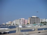
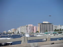
Florida
- Florida BayFlorida BayFlorida Bay is the bay located between the southern end of the Florida mainland and the Florida Keys. Its area is variously stated to be , or , or . Nearly all of Florida Bay is included in Everglades National Park. The southern edge, along the Florida Keys is in the Florida Keys National Marine...
- Baker Cut (manmade)
- Buttonwood Sound
- Grouper Creek
- Tarpon Basin
- Dusenberg Creek
- Blackwater Sound
- Jewfish Creek
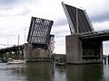
- Jewfish Creek BridgeJewfish Creek BridgeThe Jewfish Creek Bridge is a bridge in the Florida Keys. Spanning both Jewfish Creek and Lake Surprise, it carries the Overseas Highway between the Florida Keys and the Florida mainland....
(U.S. 1U.S. Route 1 in FloridaU.S. Route 1 in Florida runs along the state's east coast from Key West to its crossing of the St. Marys River into Georgia north of Boulogne, and south of Folkston. US 1 was designated through Florida when the U.S. Highway System was established in 1926.US 1 runs in the state of Florida, and...
(SR 5))
- Jewfish Creek Bridge
- Barnes Sound
- Little Card Sound
- Card Sound BridgeCard Sound BridgeCard Sound Bridge is a high-rise toll causeway connecting southern Miami-Dade County and northern Monroe County. It is one of only two ways that motorists can leave or enter the Florida Keys . Toll for two-axle automobiles is USD $1.00 , and SunPass is not accepted at this toll plaza...
- Card Sound Bridge
- Card Sound
- Biscayne BayBiscayne BayBiscayne Bay is a lagoon that is approximately 35 miles long and up to 8 miles wide located on the Atlantic coast of South Florida, United States. It is usually divided for purposes of discussion and analysis into three parts: North Bay, Central Bay, and South Bay. Its area is...
- Rickenbacker CausewayRickenbacker CausewayThe Rickenbacker Causeway connects Miami, Florida, United States to the barrier islands of Virginia Key and Key Biscayne across Biscayne Bay.-Background:...
(north approach is SR 913) - Dodge Island Bridge (SR 886)
- MacArthur CausewayMacArthur CausewayThe General Douglas MacArthur Causeway is a six-lane causeway which connects Downtown, Miami, Florida and South Beach, Miami Beach via Biscayne Bay....
(SR A1AFlorida State Road A1AState Road A1A is a Florida State Road that runs mostly along the Atlantic Ocean, with sections from Key West at the southern tip of Florida, to Callahan, just south of Georgia. It is the main road through most oceanfront towns. SR A1A is designated the A1A Scenic and Historic Coastal Highway, a...
) - Venetian CausewayVenetian CausewayThe Venetian Causeway crosses Biscayne Bay between Miami on the mainland and Miami Beach on a barrier island in south Florida. The man-made Venetian Islands and non-bridge portions of the causeway were created by materials which came from the dredging of the bay. The Venetian Causeway follows the...
- Julia Tuttle Causeway (I-195 (SR 112))
- John F. Kennedy Causeway (SR 934)
- Broad Causeway (SR 922)
- Rickenbacker Causeway
- Biscayne Creek
- Sunny Isles Causeway (SR 826)
- Dumfoundling Bay
- manmade canal
- William Lehman Causeway (SR 856)
- Hallandale Beach Bridge (SR 858)
- SR 820
- SR 822
- SR A1AFlorida State Road A1AState Road A1A is a Florida State Road that runs mostly along the Atlantic Ocean, with sections from Key West at the southern tip of Florida, to Callahan, just south of Georgia. It is the main road through most oceanfront towns. SR A1A is designated the A1A Scenic and Historic Coastal Highway, a...
- Stranahan River
- 17th Street Causeway (SR A1AFlorida State Road A1AState Road A1A is a Florida State Road that runs mostly along the Atlantic Ocean, with sections from Key West at the southern tip of Florida, to Callahan, just south of Georgia. It is the main road through most oceanfront towns. SR A1A is designated the A1A Scenic and Historic Coastal Highway, a...
)
- 17th Street Causeway (SR A1A
- New River
- New River Sound
- SR 842
- Middle River
- manmade canal
- SR 838
- SR 816
- SR 870
- SR 814
- SR 844
- Hillsboro River
- SR 810 (Hillsboro Blvd.)
- manmade canal (Hillsboro CanalHillsboro CanalThe Hillsboro Canal is located in the southeastern portion of Florida within the South Florida Water Management District, and for much of its length forms the border between Broward and Palm Beach counties; however, its western end is entirely in Palm Beach County. It begins at Lake Okeechobee at...
branches off it)- El Camino Real
- Lake Boca Raton
- Palmetto Park Road (CR 798)
- manmade canal?
- Lake Wyman
- Lake Rogers
- SR 800
- manmade canal
- Linton Boulevard (CR 782)
- SR 806
- George Bush Boulevard (CR 806A)
- Southeast 15th Avenue (CR 792)
- SR 804
- Lake Worth
- Lantana Bridge (Ocean Avenue)
- Harris Bridge (Florida) (SR 802)
- Southern Boulevard Bridge (US 98 (SR 80Florida State Road 80Florida State Road 80 is a route linking US 41 in Fort Myers and Florida State Road A1A in Palm Beach. The road is the northernmost of three linking Southwest Florida to South Florida via the Everglades...
-SR 700)) - Royal Palm Bridge (SR 704)
- Flagler Memorial Bridge (SR A1AFlorida State Road A1AState Road A1A is a Florida State Road that runs mostly along the Atlantic Ocean, with sections from Key West at the southern tip of Florida, to Callahan, just south of Georgia. It is the main road through most oceanfront towns. SR A1A is designated the A1A Scenic and Historic Coastal Highway, a...
) - Riviera Beach Bridge (SR A1AFlorida State Road A1AState Road A1A is a Florida State Road that runs mostly along the Atlantic Ocean, with sections from Key West at the southern tip of Florida, to Callahan, just south of Georgia. It is the main road through most oceanfront towns. SR A1A is designated the A1A Scenic and Historic Coastal Highway, a...
)
- Lake Worth Creek
- U.S. 1U.S. Route 1 in FloridaU.S. Route 1 in Florida runs along the state's east coast from Key West to its crossing of the St. Marys River into Georgia north of Boulogne, and south of Folkston. US 1 was designated through Florida when the U.S. Highway System was established in 1926.US 1 runs in the state of Florida, and...
(SR 5) - SR 786
- Donald Ross Road
- SR 706
- U.S. 1
- Loxahatchee RiverLoxahatchee RiverThe Loxahatchee River The Loxahatchee River The Loxahatchee River (Seminole for river of turtles is a 7.6 mile river near the southeast coast of Florida. It is a National Wild and Scenic River, one of only two in the state, and received its federal designation on May 17, 1985. The 1930s pioneer...
- U.S. 1U.S. Route 1 in FloridaU.S. Route 1 in Florida runs along the state's east coast from Key West to its crossing of the St. Marys River into Georgia north of Boulogne, and south of Folkston. US 1 was designated through Florida when the U.S. Highway System was established in 1926.US 1 runs in the state of Florida, and...
(SR 5)
- U.S. 1
- Jupiter Sound
- CR 707
- Hobe Sound
- Jupiter Narrows
- CR 707
- Peck Lake
- manmade canal
- Great Pocket
- Indian RiverIndian River (Florida)The Indian River is a waterway in Florida, a part of the Indian River Lagoon system which forms the Atlantic Intracoastal Waterway. It extends southward from the Ponce de Leon inlet in New Smyrna Beach, Florida [Volusia County] southward and across the "Haulover Canal" and along the western shore...
- SR A1AFlorida State Road A1AState Road A1A is a Florida State Road that runs mostly along the Atlantic Ocean, with sections from Key West at the southern tip of Florida, to Callahan, just south of Georgia. It is the main road through most oceanfront towns. SR A1A is designated the A1A Scenic and Historic Coastal Highway, a...
- Frank A. Wacha Bridge (SR 732)
- South Causeway Bridge (SR A1AFlorida State Road A1AState Road A1A is a Florida State Road that runs mostly along the Atlantic Ocean, with sections from Key West at the southern tip of Florida, to Callahan, just south of Georgia. It is the main road through most oceanfront towns. SR A1A is designated the A1A Scenic and Historic Coastal Highway, a...
) - North Causeway Bridge (SR A1AFlorida State Road A1AState Road A1A is a Florida State Road that runs mostly along the Atlantic Ocean, with sections from Key West at the southern tip of Florida, to Callahan, just south of Georgia. It is the main road through most oceanfront towns. SR A1A is designated the A1A Scenic and Historic Coastal Highway, a...
) - 17th Street Causeway (SR 656)
- Merrill P. Barber BridgeMerrill P. Barber BridgeThe Merrill P. Barber Bridge is a concrete arch bridge that spans the Indian River intercostals waterway in Indian River County, Florida. The bridge was built by Odebrecht Contractors of Florida, Inc. and was completed in 1995. A fishing pier is constructed below the bridge on the east side.The...
(SR 60) - Wabasso Causeway (CR 510)
- Ernest Kouwen-Hoven Bridge (Melbourne Causeway)Melbourne CausewayThe Melbourne Causeway is located entirely within Brevard County, Florida in the United States. It is composed of three bridges and connects the municipalities of Melbourne, Florida and Indialantic, Florida across the Indian River Lagoon in Brevard County. The causeway is part of U.S...
(US 192 (SR 500Florida State Road 500State Road 500 is a major state highway running through Florida as a mostly unsigned route under several US Highways. From Chiefland to Williston it is U.S. Highway 27 Alternate. From Williston to Ocala, it is U.S. Highway 27. From Ocala to Kissimmee, it is U.S. Highway 441. From Kissimmee to...
)) - Eau Gallie Bridge (Eau Gallie Causeway) (SR 518)
- Pineda Bridge (Pineda Causeway) (SR 404)
- Hubert H. Humphrey Bridge (Merritt Island Causeway)Merritt Island CausewayThe Merritt Island Causeway, which connects Cocoa, Florida, Merritt Island, Florida and Cocoa Beach, Florida, is the second route over the Indian River Lagoon and Banana River. The causeway divides Merritt Island into eastern and western sections. The western section is the location of the...
(SR 520) - Emory L. Bennett Causeway (SR 528)
- NASA Parkway (SR 405)
- A. Maxwell Brewer Memorial Causeway (CR 402)
- U.S. Government Railroad
- SR A1A
- Haulover Canal (manmade)
- Former SR 3
- Indian River North
- Mosquito LagoonMosquito LagoonMosquito Lagoon is located in the northern part of the Indian River Lagoon system and the Atlantic Intracoastal Waterway. It extends from Ponce de León Inlet in Volusia County, Florida, to the north end of Merritt Island. It connects to the Indian River via the Haulover Canal. The Lagoon divides...
- South Causeway (New Smyrna Beach) (SR A1AFlorida State Road A1AState Road A1A is a Florida State Road that runs mostly along the Atlantic Ocean, with sections from Key West at the southern tip of Florida, to Callahan, just south of Georgia. It is the main road through most oceanfront towns. SR A1A is designated the A1A Scenic and Historic Coastal Highway, a...
) - North Causeway (New Smyrna Beach) (SR 44)
- South Causeway (New Smyrna Beach) (SR A1A
- Ponce de Leon Cut (manmade)
- Halifax RiverHalifax RiverThe Halifax River is part of the Atlantic Intracoastal Waterway, located in northeast Volusia County, Florida. The waterway was originally known as the North Mosquito River, but was renamed after George Montagu-Dunk, 2nd Earl of Halifax, during the British occupation of Florida .-Geography:The...
- Port Orange CausewayPort Orange CausewayThe Port Orange Causeway, commonly called the Port Orange Bridge or the Dunlawton Bridge, spans the Halifax River and Intracoastal Waterway in Port Orange, Volusia County, Florida...
(William V. Chappell Jr. Memorial Bridge or Dunlawton Bridge) (SR A1AFlorida State Road A1AState Road A1A is a Florida State Road that runs mostly along the Atlantic Ocean, with sections from Key West at the southern tip of Florida, to Callahan, just south of Georgia. It is the main road through most oceanfront towns. SR A1A is designated the A1A Scenic and Historic Coastal Highway, a...
) - Veterans Memorial Bridge (CR 4050County Road 4050 (Volusia County, Florida)Volusia County Road 4050 is a county road located entirely within Daytona Beach, Florida. It is long, from SR 5A to SR A1A...
) - Broadway BridgeBroadway Bridge (Daytona Beach)The Broadway Bridge is a segmental bridge that spans the Halifax River and Intracoastal Waterway in downtown Daytona Beach, Florida, carrying U.S. Route 92....
(US 92 and SR 600) - Main Street Bridge (CR 4040County Road 4040 (Volusia County, Florida)Volusia County Road 4040 is a county road located entirely within Daytona Beach, Florida. It is long, from SR 5A to SR A1A...
) - Seabreeze Bridge (SR 430)
- Granada BridgeGranada Bridge (Ormond Beach)The Granada Bridge is a high-clearance bridge that spans the Halifax River and Intracoastal Waterway, linking the mainland and beach peninsula parts of Ormond Beach, Volusia County, Florida. Granada Bridge carries four lanes of Florida State Road 40 and Granada Blvd...
(SR 40)
- Port Orange Causeway
- Halifax Creek
- Smith Creek
- Knox Memorial BridgeKnox Memorial BridgeThe Knox Memorial Bridge crosses the Intracoastal Waterway north of Ormond Beach, Florida. Highbridge Road passes over the bridge.-History:...
- SR 100
- Knox Memorial Bridge
- manmade canal
- Fox Cut (manmade)
- manmade canal
- Palm Coast Parkway
- Matanzas RiverMatanzas RiverMatanzas River is a body of water located in St. Johns and Flagler counties in Florida. It is a narrow saltwater bar-bounded estuary sheltered from the Atlantic Ocean by Anastasia Island....
- SR 206Florida State Road 206State Road 206 is a 2 lane wide, long Florida State Road in St. Johns County. It extends from SR 207 near Spuds to SR A1A in Crescent Beach, two blocks west of the Atlantic Ocean. Portions of the state road exceeds .-Route description:...
- SR 312
- Bridge of LionsBridge of LionsThe Bridge of Lions is a bascule bridge that spans the Intracoastal Waterway in St. Augustine, Florida. A part of State Road A1A, it connects downtown St. Augustine to Anastasia Island. A pair of Medici lions made of marble guard the bridge, begun in 1925 and completed in 1927 across Matanzas Bay...
(SR A1AFlorida State Road A1AState Road A1A is a Florida State Road that runs mostly along the Atlantic Ocean, with sections from Key West at the southern tip of Florida, to Callahan, just south of Georgia. It is the main road through most oceanfront towns. SR A1A is designated the A1A Scenic and Historic Coastal Highway, a...
)
- SR 206
- Tolomato River
- Vilano Beach Bridge (SR A1AFlorida State Road A1AState Road A1A is a Florida State Road that runs mostly along the Atlantic Ocean, with sections from Key West at the southern tip of Florida, to Callahan, just south of Georgia. It is the main road through most oceanfront towns. SR A1A is designated the A1A Scenic and Historic Coastal Highway, a...
)
- Vilano Beach Bridge (SR A1A
- manmade canal
- Tolomato River
- manmade canal
- Palm Valley BridgePalm Valley BridgeThe Palm Valley Bridge spans the Intracoastal Waterway in the Palm Valley area near Ponte Vedra Beach, Florida. It is located on County Road 210 is St. Johns County. In 2002, the old two lane drawbridge was replaced with a fixed, clear span, four-lane bridge. Ground-breaking was in December 2000...
(CR 210)
- Palm Valley Bridge
- Pablo Creek
- I-295 bypass
- SR 202
- McCormick Bridge (US 90 (SR 212))
- SR 10
- SR 116Florida State Road 116State Road 116 is a state highway in Florida, which runs almost due east–west entirely within Jacksonville's city limits. At its west terminus, SR 116 is signed as Merrill Road beginning at the intersection with SR 9A and SR 113 near the St. Johns River...
- Sisters Creek
- SR 105
- Gunnison Cut (manmade)
- Sawpit Creek
- manmade canal
- South Amelia River
- manmade canal
- Kingsley Creek
- SR A1AFlorida State Road A1AState Road A1A is a Florida State Road that runs mostly along the Atlantic Ocean, with sections from Key West at the southern tip of Florida, to Callahan, just south of Georgia. It is the main road through most oceanfront towns. SR A1A is designated the A1A Scenic and Historic Coastal Highway, a...
/SR 200
- SR A1A
- Amelia River
- Cumberland Sound FloridaFloridaFlorida is a state in the southeastern United States, located on the nation's Atlantic and Gulf coasts. It is bordered to the west by the Gulf of Mexico, to the north by Alabama and Georgia and to the east by the Atlantic Ocean. With a population of 18,801,310 as measured by the 2010 census, it...
/GeorgiaGeorgia (U.S. state)Georgia is a state located in the southeastern United States. It was established in 1732, the last of the original Thirteen Colonies. The state is named after King George II of Great Britain. Georgia was the fourth state to ratify the United States Constitution, on January 2, 1788...
state line
Georgia
- Cumberland Sound - USGS Feature Detail Report
- Passenger ferryFerryA ferry is a form of transportation, usually a boat, but sometimes a ship, used to carry primarily passengers, and sometimes vehicles and cargo as well, across a body of water. Most ferries operate on regular, frequent, return services...
between St Marys and Cumberland Island
- Passenger ferry
- Cumberland Dividings - USGS Feature Detail Report
- Cumberland River - USGS Feature Detail Report
- St. Andrews Sound - USGS Feature Detail Report
- Jekyll Sound - USGS Feature Detail Report
- Jekyll Creek (Jekyll River) - USGS Feature Detail Report
- Jekyll Island Causeway, M. E. Thompson Bridge
- Brunswick River - USGS Feature Detail Report
- Saint Simons Sound - USGS Feature Detail Report
- Manhead Sound - USGS Feature Detail Report
- Mackay RiverMackay RiverThe Mackay River is a tidal river in Glynn County, Georgia. It flows between Saint Simons Island to the east and the mainland, including the city of Brunswick, to the west, and connects to Buttermilk Sound at its north end and St. Simons Sound and the Brunswick River at its south end. It runs...
- USGS Feature Detail Report- F. J. Torras Causeway
- Buttermilk Sound - USGS Feature Detail Report
- Altamaha Sound - USGS Feature Detail Report
- Little Mud River - USGS Feature Detail Report
- Back River - USGS Feature Detail Report
- North River - USGS Feature Detail Report
- Doboy Sound - USGS Feature Detail Report
- Old Teakettle Creek - USGS Feature Detail Report
- Crescent River - USGS Feature Detail Report
- Creighton Narrows - USGS Feature Detail Report
- Front River - USGS Feature Detail Report
- Sapelo RiverSapelo RiverThe Sapelo River is a primarily tidal river in McIntosh County in the U.S. state of Georgia. It forms between Interstate 95 and U.S. Route 17 near the community of Eulonia and winds generally east through salt marshes into Sapelo Sound, an arm of the Atlantic Ocean that separates St...
- USGS Feature Detail Report - Sapelo Sound - USGS Feature Detail Report
- South Newport RiverSouth Newport RiverThe South Newport River is a river on the Atlantic coastal plain in the U.S. state of Georgia. It rises in Long County south of Walthourville and flows east-southeast, becoming the boundary between Liberty and McIntosh counties. It flows into Sapelo Sound, an arm of the Atlantic Ocean, south of St...
- USGS Feature Detail Report - Johnson Creek
- North Newport RiverNorth Newport RiverThe North Newport River is a tidal river in Liberty County in the U.S. state of Georgia. It rises just west of Interstate 95, south of Richmond Hill, and flows generally east-southeast to its mouth at the Medway River and St. Catherines Sound on the Atlantic Ocean....
- USGS Feature Detail Report - Saint Catherines Sound - USGS Feature Detail Report
- Bear RiverBear River (Georgia)The Bear River is a tidal river in the U.S. state of Georgia. It forms the channel that separates Ossabaw Island from the Georgia mainland, connecting with the Ogeechee River at its north end and the Medway River at its south.- References :...
- Florida Passage - USGS Feature Detail Report
- Ogeechee RiverOgeechee RiverOgeechee River is a river in the U.S. state of Georgia. It heads at the confluence of its North and South Forks, about south-southwest of Crawfordville and flowing generally southeast to Ossabaw Sound about south of Savannah. Its largest tributary is the Canoochee River...
- Hell Gate - USGS Feature Detail Report
- Ossabaw Sound - USGS Feature Detail Report
- Green Island Sound - USGS Feature Detail Report
- Vernon River - USGS Feature Detail Report
- Moon RiverMoon River"Moon River" is a song composed by Johnny Mercer and Henry Mancini in 1961, for whom it won that year's Academy Award for Best Original Song. It was originally sung in the movie Breakfast at Tiffany's by Audrey Hepburn, although it has been covered by many other artists...
- Skidaway Narrows - USGS Feature Detail Report
- Skidaway RiverSkidaway RiverThe Skidaway River is an tidal river in the U.S. state of Georgia. It is located in Chatham County southeast of Savannah. Its north end is at the Wilmington River, and it flows southwest from there through Skidaway Narrows to end at the Burnside River, which connects via the Vernon and Little...
- USGS Feature Detail Report - Wilmington River - USGS Feature Detail Report
- Saint Augustine Creek - USGS Feature Detail Report
- Elba Island Cut - USGS Feature Detail Report
- South Channel Savannah RiverSavannah RiverThe Savannah River is a major river in the southeastern United States, forming most of the border between the states of South Carolina and Georgia. Two tributaries of the Savannah, the Tugaloo River and the Chattooga River, form the northernmost part of the border...
- USGS Feature Detail Report - Savannah RiverSavannah RiverThe Savannah River is a major river in the southeastern United States, forming most of the border between the states of South Carolina and Georgia. Two tributaries of the Savannah, the Tugaloo River and the Chattooga River, form the northernmost part of the border...
South Carolina
In South Carolina, the waterway is made of numerous natural and manmade waterways that wind among the sea islands. The Pine Island cut is the longest manmade section of the entire waterway. It was the last section of the waterway to be completed and was dedicated on April 11, 1936.- Savannah RiverSavannah RiverThe Savannah River is a major river in the southeastern United States, forming most of the border between the states of South Carolina and Georgia. Two tributaries of the Savannah, the Tugaloo River and the Chattooga River, form the northernmost part of the border...
- Fields Cut
- Wright River
- Watts Cut
- New River
- Ramshorn Creek
- Cooper River (Beaufort County, South Carolina)
- Calibogue Sound
- Skull Creek
- Fixed span to Hilton Head Island
- Port Royal SoundPort Royal SoundPort Royal Sound is a coastal sound, or inlet of the Atlantic Ocean, located in the Sea Islands region, in Beaufort County in the U.S. state of South Carolina...
- Beaufort River
- Ladies Island Swing Bridge
- Brickyard Creek
- Coosaw River
- Ashepoo Coosaw Cutoff
- Rock Creek
- Ashepoo Coosaw Cutoff
- Ashepoo RiverAshepoo RiverAshepoo River is a short blackwater river in South Carolina. It rises in a confluence of swamps south of Walterboro, flows in southeast direction and then empties into Saint Helena Sound at . The entire course of the river lies within the boundaries of Colleton County...
- Fenwick Cut
- South Edisto RiverEdisto RiverThe Edisto River is the longest completely undammed / unleveed blackwater river in North America, flowing 206 meandering miles from its sources in Saluda and Edgefield counties, to its Atlantic Ocean mouth at Edisto Beach, SC...
- Watts Cut
- North Creek
- Dawhoo River
- McKinley Washington, Jr. BridgeMcKinley Washington, Jr. BridgeThe McKinley Washington, Jr. Bridge, or the Dawhoo River Bridge, connects Edisto Island on the coast of South Carolina to the mainland. The bridge is named for McKinley Washington, Jr...
(fixed span)
- McKinley Washington, Jr. Bridge
- Wadmalaw River
- Church Flats
- Stono RiverStono RiverThe Stono River is a tidal channel in southeast South Carolina, located southwest of Charleston. The channel runs southwest to northeast between the mainland and Wadmalaw Island and Johns Island, from north Edisto River between Johns and James Island. The Intracoastal Waterway runs through...
- John F. Limehouse Memorial BridgeJohn F. Limehouse Memorial BridgeThe John F. Limehouse Memorial Bridge, located about 15 miles west of downtown Charleston, South Carolina, replaced an obsolete low-level swing bridge over the Stono River...
(fixed span)
- John F. Limehouse Memorial Bridge
- Elliott Cut
- Wappoo Creek
- Wappoo Creek drawbridge
- Wappoo Creek drawbridge
- Charleston HarborCharleston HarborThe Charleston Harbor is an inlet of the Atlantic Ocean at Charleston, South Carolina. The inlet is formed by the junction of Ashley and Cooper rivers at . Morris and Sullivan's Island, shelter the entrance...
- Jeanette Creek
- Sullivans Narrows
- Ben Sawyer BridgeBen Sawyer BridgeThe Ben Sawyer Bridge is a swing bridge that connects the town of Mount Pleasant with Sullivan's Island in South Carolina. The bridge swings on its central axis to open for boat traffic which is too tall to clear the bridge, and has an operator's station in the center of the span from which an...
(swing span)
- Ben Sawyer Bridge
- Meeting Reach
- Isle of Palms Connector BridgeIsle of Palms Connector BridgeThe Isle of Palms Connector Bridge connects the town of Mount Pleasant with the Isle of Palms in South Carolina. The bridge is part of, and comprises most of the length of, SC-517, which is commonly known as the "Isle of Palms Connector", and bears the official name of "Clyde Moultrie Dangerfield...
(fixed span)
- Isle of Palms Connector Bridge
- Seven Reaches
- Copahee Sound
- Capers Creek
- Price Creek
- Seewee Bay
- manmade canal
- Graham Creek
- Awendaw Creek
- Harbor River
- Mathews Cut
- Casino Creek
- Fourmile Creek Canal (crosses South Santee River)
- North Santee River
- Estherville Minim Creek Canal
- South Island Ferry
- Winyah BayWinyah BayWinyah Bay is a coastal estuary that is the confluence of the Waccamaw River, the Pee Dee River, the Black River and the Sampit River in Georgetown County in eastern South Carolina...
- Waccamaw RiverWaccamaw RiverThe Waccamaw River is a river, approximately 140 miles long, in southeastern North Carolina and eastern South Carolina in the United States. It drains an area of approximately 1110 square miles in the coastal plain along the eastern border between the two states into the Atlantic Ocean...
- L. W. Stau Bridge (fixed span)
- Socastee Creek
- Benjamin Thrailkill Bridge (fixed span)
- Socastee Swing Bridge (Dick Pond Road)
- Pine Island cut (manmade canal, approximately 24 miles long)
- US 501U.S. Route 501-North Carolina business loops:-Virginia business loop:-External links:*...
, Black Skimmer Trail (fixed span) - Pine Island bascule bridgeBascule bridgeA bascule bridge is a moveable bridge with a counterweight that continuously balances the span, or "leaf," throughout the entire upward swing in providing clearance for boat traffic....
, originally built as a combination rail and vehicle span - Robert M. Grissom ParkwayRobert Grissom ParkwayRobert M. Grissom Parkway, locally known as Grissom Parkway, is a major four-lane connector highway in Myrtle Beach, South Carolina. The road begins at Harrelson Boulevard near Myrtle Beach International Airport and terminates in Carolina Forest, South Carolina at SC Highway 31 and International...
(fixed span) - Grande Dunes Boulevard (fixed span)
- S.C. 22 (fixed spans)
- Barefoot Resort Bridge (swing bridge)
- US 501
- Little River
- Little River swing bridge
- (fixed span)
North Carolina
- manmade canal
- Sunset Boulevard (Sunset Beach)
- Causeway (NC 904) {Ocean Isle Beach}
- Shallotte RiverShallotte RiverThe Shallotte River is a tidal river in Brunswick County, North Carolina, USA. Waters drain from the tributaries of the Green Swamp near the town of Shallotte and flow south down the river to empty into the Atlantic Intracoastal Waterway....
- manmade canal
- NC 130 {Holden Beach}
- Lockwoods Folly River
- manmade canal
- (Future Second Oak IslandOak Island (North Carolina)Oak Island is a barrier island on the Atlantic coast of southeastern North Carolina in Brunswick County. The island contains the towns of Oak Island and Caswell Beach as well as the North Carolina Baptist Assembly and a United States Coast Guard station, which is home to the Oak Island Lighthouse...
crossing) - NC 133
- NC 211
- NC 87
- (Future Second Oak Island
- Cape Fear RiverCape Fear RiverThe Cape Fear River is a long blackwater river in east central North Carolina in the United States. It flows into the Atlantic Ocean near Cape Fear, from which it takes its name. The overall water quality of the river is continuously measured and monitored by and conducted by the , , and the...
- manmade canal
- US 421
- Masonboro Sound
- US 74/US 76
- Middle Sound
- Topsail Sound
- NC 50/NC 210
- Stump Sound
- NC 210
- New RiverNew River (North Carolina)The New River is a 50-mile long river in southeastern North Carolina in the United States. It empties into the Atlantic Ocean.It rises in northwestern Onslow County and flows east-southeast past Jacksonville, where it widens into a tidal estuary approximately two miles wide...
- White Oak River
- Bogue SoundBogue SoundBogue Sound is a medium-sized geographic sound in the state of North Carolina. It separates the Bogue Banks from mainland Carteret County. Morehead City's port is accessed via the Bogue Sound. Two bridges cross the sound: NC 58 on the B...
- NC 58
- Bay View Road
- Newport RiverNewport RiverThe Newport River is a small river in North Carolina that runs approximately twenty kilometers southeast through the town of Newport with its mouth opening into Bogue Sound, between Morehead City and Beaufort. It is popular for flatwater paddling and canoeing....
- US 70
- manmade canal
- NC 101
- Adams Creek
- Neuse RiverNeuse RiverThe Neuse River is a river rising in the Piedmont of North Carolina and emptying into Pamlico Sound below New Bern. Its total length is approximately , making it the longest river entirely contained in North Carolina. The Trent River joins it at New Bern. Its drainage basin, measuring in area,...
- Pamlico SoundPamlico SoundPamlico Sound in North Carolina, is the largest lagoon along the U.S. East Coast, being long and 24 to 48 km wide. It is a body of water separated from the Atlantic Ocean by the Outer Banks, a row of low, sandy barrier islands, including Cape Hatteras. The Neuse and Pamlico rivers flow in...
- manmade canal
- NC 33/NC 301
- Goose Creek
- Pamlico RiverPamlico RiverThe Pamlico River is a tidal river that flows into Pamlico Sound, in North Carolina in the United States of America. It is formed by the confluence of the Tar River and Tranters Creek....
- Pungo River
- manmade canal
- US 264/NC 45
- NC 94
- Alligator RiverAlligator River (North Carolina)The Alligator River is a small river in eastern North Carolina, USA, separating Dare County with Tyrrell County. It is a tributary of the Albemarle Sound and is part of the Alligator River National Wildlife Refuge. The Lindsey C. Warren Bridge of U.S. Route 64 crosses the river.A 21-mile canal...
- US 64
- Albemarle SoundAlbemarle SoundAlbemarle Sound is a large estuary on the coast of North Carolina in the United States located at the confluence of a group of rivers, including the Chowan and Roanoke. It is separated from the Atlantic Ocean by the Outer Banks, a long barrier peninsula upon which the town of Kitty Hawk is located,...
- North RiverNorth River (North Carolina)The North River is a tidal river, approximately 18 miles long, in eastern North Carolina, the United States. It forms the boundary between Currituck and Camden counties....
- Great Swamp
- manmade canal
- US 158
- Currituck SoundCurrituck SoundCurrituck Sound is a protected inlet of the Atlantic Ocean in northeastern part of North Carolina. Thirty miles N-S and 3–8 miles wide, this shallow, island-filled sound is separated from the ocean by Bodie Island, part of the Outer Banks...
- North Landing River
Virginia
- North Landing RiverNorth Landing RiverThe North Landing River is a river in the United States state of Virginia.-References:**USGS Hydrologic Unit Map - State of Virginia...
- Pungo Ferry Road
- VA 165Virginia State Route 165Virginia State Route 165 is a primary state highway in the U.S. state of Virginia. The state highway runs from U.S. Route 17 Business in Chesapeake north to SR 337 in Norfolk. SR 165 is a C-shaped route that connects Chesapeake and Norfolk in the Hampton Roads metropolitan area indirectly via...
- manmade canal
- Centerville Turnpike
- VA 168Virginia State Route 168State Route 168 is a primary state highway in the South Hampton Roads region of the U.S. state of Virginia. It runs from the border with North Carolina through the independent cities of Chesapeake and Norfolk where it ends in the Ocean View area near the Hampton Roads Bridge-Tunnel.SR 168 consists...
/Chesapeake Expressway
- South Branch Elizabeth RiverElizabeth River (Virginia)The Elizabeth River is a tidal estuary forming an arm of Hampton Roads harbor at the southern end of Chesapeake Bay in southeast Virginia in the United States. It is located along the southern side of the mouth of the James River, between the cities of Portsmouth and Norfolk...
- VA 168Virginia State Route 168State Route 168 is a primary state highway in the South Hampton Roads region of the U.S. state of Virginia. It runs from the border with North Carolina through the independent cities of Chesapeake and Norfolk where it ends in the Ocean View area near the Hampton Roads Bridge-Tunnel.SR 168 consists...
Business/ Battlefield Boulevard - US 17U.S. Route 17 in VirginiaU.S. Route 17 is a part of the U.S. Highway System that runs from Punta Gorda, Florida to Winchester, Virginia. In Virginia, the U.S. Highway runs from the North Carolina state line in Chesapeake north to its northern terminus at US 11, US 50, and US 522 in Winchester. US 17 is a major highway...
/Dominion Boulevard - I-64/Hampton Roads Beltway
- US 13/US 460/Military Highway
- VA 337Virginia State Route 337State Route 337 is a primary state highway in the South Hampton Roads area of the U.S. state of Virginia. It runs east from Suffolk to Portsmouth, where it dead-ends at the decommissioned Jordan Bridge...
- I-264Interstate 264 (Virginia)Interstate 264 is an Interstate Highway in the U.S. state of Virginia. It runs from a junction with Interstate 64 and Interstate 664 near Bowers Hill in Chesapeake east into Portsmouth and through the Downtown Tunnel under the South Branch of the Elizabeth River into Norfolk...
/US 460 Alternate/Downtown Tunnel
- VA 168
- Elizabeth RiverElizabeth River (Virginia)The Elizabeth River is a tidal estuary forming an arm of Hampton Roads harbor at the southern end of Chesapeake Bay in southeast Virginia in the United States. It is located along the southern side of the mouth of the James River, between the cities of Portsmouth and Norfolk...
- US 58/Midtown Tunnel
- Hampton RoadsHampton RoadsHampton Roads is the name for both a body of water and the Norfolk–Virginia Beach metropolitan area which surrounds it in southeastern Virginia, United States...
- James RiverJames River (Virginia)The James River is a river in the U.S. state of Virginia. It is long, extending to if one includes the Jackson River, the longer of its two source tributaries. The James River drains a catchment comprising . The watershed includes about 4% open water and an area with a population of 2.5 million...
- I-664/Hampton Roads Beltway/Monitor-Merrimac Memorial Bridge-Tunnel
Maryland
- Chesapeake BayChesapeake BayThe Chesapeake Bay is the largest estuary in the United States. It lies off the Atlantic Ocean, surrounded by Maryland and Virginia. The Chesapeake Bay's drainage basin covers in the District of Columbia and parts of six states: New York, Pennsylvania, Delaware, Maryland, Virginia, and West...
- Chesapeake Bay BridgeChesapeake Bay BridgeThe Chesapeake Bay Bridge is a major dual-span bridge in the U.S. state of Maryland. Spanning the Chesapeake Bay, it connects the state's rural Eastern Shore region with the more urban Western Shore. The original span opened in 1952 and, at the time, with a length of , it was the world's longest...
(US 50U.S. Route 50 in MarylandU.S. Route 50 is a major east–west route of the U.S. Highway system, stretching just over from Ocean City, Maryland on the Atlantic Ocean to West Sacramento, California. In the U.S. state of Maryland, US 50 exists in two sections. The longer of these serves as a major route connecting...
/ US 301U.S. Route 301 in MarylandU.S. Route 301 in Maryland is a major highway that runs from Delaware to the Governor Harry W. Nice Memorial Bridge into Virginia. It passes through three of Maryland's four main regions: the Eastern Shore, the Baltimore-Washington Metropolitan Area, and Southern Maryland...
)
- Chesapeake Bay Bridge
- Chesapeake and Delaware CanalChesapeake and Delaware CanalThe Chesapeake and Delaware Canal is a 14-mile long, 450-foot wide and 40-foot deep ship canal that cuts across the states of Maryland and Delaware, in the United States. It connects the waters of the Delaware River with those of the Chesapeake Bay and the Port of Baltimore...
- Chesapeake City BridgeChesapeake City BridgeThe Chesapeake City Bridge carries Maryland Route 213 across the Chesapeake & Delaware Canal in Chesapeake City, Maryland. There are two undivided traffic lanes and one sidewalk on the east side of the bridge. It was built in 1949 by the U.S. Army Corps of Engineers to provide a high-level canal...
(MD 213Maryland Route 213Maryland Route 213 is a state highway located on the Eastern Shore of Maryland in the United States. The route runs from Maryland Route 662 in Wye Mills, Queen Anne's County north to the Pennsylvania border in Cecil County, where it continues into that state as Pennsylvania Route 841...
)
- Chesapeake City Bridge
Delaware
- Chesapeake and Delaware CanalChesapeake and Delaware CanalThe Chesapeake and Delaware Canal is a 14-mile long, 450-foot wide and 40-foot deep ship canal that cuts across the states of Maryland and Delaware, in the United States. It connects the waters of the Delaware River with those of the Chesapeake Bay and the Port of Baltimore...
- Summit BridgeSummit BridgeThe Summit Bridge carries U.S. Route 301 and Delaware Routes 71 and 896 across the Chesapeake & Delaware Canal, connecting Newark, Delaware with Dover, Delaware and the Chesapeake Bay Bridge . The bridge also carries Delaware Bicycle Route 1, a bicycle route that spans the length of the state of...
(US 301U.S. Route 301 in DelawareIn the U.S. state of Delaware, U.S. Route 301 runs from U.S. Route 40 in Glasgow to the Maryland state line where it continues as the Blue Star Memorial Highway...
/ DE 71Delaware Route 71Delaware Route 71 is a state highway in New Castle County, Delaware. The route loops off U.S. Route 13 from south of Townsend to Tybouts Corner, traveling to the west of US 13 by way of Townsend, Middletown, and the Summit Bridge...
/ DE 896) - Chesapeake & Delaware Canal Lift BridgeChesapeake & Delaware Canal Lift BridgeThe Chesapeake & Delaware Canal Lift Bridge carries Norfolk Southern rail lines across the Chesapeake & Delaware Canal. Built by the U.S. Army Corps of Engineers as part of a canal expansion project and opened in 1966, the Canal Lift Bridge, the only drawbridge on the C & D Canal was...
(Norfolk Southern RailwayNorfolk Southern RailwayThe Norfolk Southern Railway is a Class I railroad in the United States, owned by the Norfolk Southern Corporation. With headquarters in Norfolk, Virginia, the company operates 21,500 route miles in 22 eastern states, the District of Columbia and the province of Ontario, Canada...
) - Chesapeake and Delaware Canal Bridge (DE 1)
- St. Georges BridgeSt. Georges Bridge (Delaware)The St. Georges Bridge is a steel truss bridge with a tied arch span that carries U.S. Route 13 across the Chesapeake & Delaware Canal in St. Georges, Delaware. Built by the U.S. Army Corps of Engineers and opened in 1942 as a high-level crossing, the bridge was the first four-lane, high-level...
(US 13U.S. Route 13 in DelawareU.S. Route 13 is the main north–south highway in the U.S. state of Delaware. It traverses the entire length of the state from the Maryland border in Delmar, Sussex County to the Pennsylvania border in Claymont, New Castle County. U.S. Route 13 connects many important cities and towns in...
) - Reedy Point BridgeReedy Point BridgeThe Reedy Point Bridge carries Delaware Route 9 across the Chesapeake & Delaware Canal in Delaware City, Delaware, USA. A two-lane cantilever bridge similar in appearance to the Platt Bridge in Southwest Philadelphia , the Reedy Point Bridge was built by the U.S...
(DE 9Delaware Route 9Delaware Route 9 is a state highway that connects with Delaware Route 1 at the Dover Air Force Base to Interstate 95 in the City of Wilmington. Much like their U.S...
)
- Summit Bridge
- Delaware BayDelaware BayDelaware Bay is a major estuary outlet of the Delaware River on the Northeast seaboard of the United States whose fresh water mixes for many miles with the waters of the Atlantic Ocean. It is in area. The bay is bordered by the State of New Jersey and the State of Delaware...
New Jersey
- Cape May CanalCape May CanalThe Cape May Canal is a waterway that stretches nearly three miles from Cape May Harbor to the Delaware Bay, at the southern tip of Cape May County, New Jersey. The canal was constructed by the United States Army Corps of Engineers during World War II to provide a protected route to avoid German...
- NJ 162New Jersey Route 162Route 162 is an unsigned long state highway in Lower Township, New Jersey, United States. The highway's designation consists entirely of a bridge on Seashore Road , which is known as Relocated Seashore Road. The southern terminus of the highway is an intersection with County Routes 641 and 626 in...
- NJ 109
- Middle Thorofare Bridge
- NJ 162
- Jarvis Sound
- NJ 47
- Grassy Sound
- NJ 147New Jersey Route 147Route 147 is a state highway located in Cape May County in New Jersey, United States. It is a short connector between U.S. Route 9 in Middle Township and North Wildwood at New York Avenue. West of U.S. Route 9, the road continues to Route 47 as County Route 618 ; this route along with Route 147...
- Grassy Sound Bridge
- NJ 147
- Great Channel
- Stone Harbor Bridge
- CR 657 (Stone Harbor Blvd)
- Great Sound
- CR 601 (Avalon Blvd)
- Ingrams Thorofare
- Townsend Channel
- Ludlam Thoroughfare
- CR 625 (Sea Isle Blvd)
- Ludlam Bay
- Great Egg Harbor
- NJ 52New Jersey Route 52Route 52 is a state highway in the southern part of the U.S. state of New Jersey. The highway runs from Palen Avenue in Ocean City, Cape May County north to U.S. Route 9 in Somers Point, Atlantic County. It is composed mostly of a series of four-lane undivided bridges over Great Egg Harbor Bay...
- NJ 52
- Risley Channel
- John F. Kennedy Memorial Bridge (New Jersey)
- Margate Bridge (CR 563)County Route 563 (New Jersey)County Route 563, abbreviated CR 563, is a county highway in the U.S. state of New Jersey. The highway extends from CR 629/Ocean Drive in Margate City, Atlantic County north to Route 72 in Woodland Township, Burlington County...
- Lake's Bay
- West Canal
- Inside Thorofare
- US 40U.S. Route 40 in New JerseyU.S. Route 40 is a U.S. highway running from Park City, Utah east to Atlantic City, New Jersey. The easternmost segment of the route runs through the southern part of New Jersey between the Delaware Memorial Bridge over the Delaware River in Pennsville Township, Salem County, where it continues...
- Atlantic City ExpresswayAtlantic City ExpresswayThe Atlantic City Expressway is a , controlled-access toll road in New Jersey, managed and operated by the South Jersey Transportation Authority...
- US 30U.S. Route 30 in New JerseyU.S. Route 30 is a U.S. highway running from Astoria, Oregon east to Atlantic City, New Jersey. In the U.S. state of New Jersey, US 30 runs from the Benjamin Franklin Bridge at the Delaware River in Camden, Camden County while concurrent with Interstate 676 southeast to Virginia...
- US 40
- Clam Thorofare
- Reed's Bay
- Little Bay
- Great BayGreat Bay (New Jersey)Great Bay is located in southern New Jersey's Atlantic Coastal Plain in Ocean and Atlantic Counties, about ten miles north of Atlantic City and 87 mi south of New York City. The Mullica River flows into the bay, and together they form the Mullica River - Great Bay estuary habitat. The bay is...
- Little Egg HarborLittle Egg HarborLittle Egg Harbor is a brackish bay along the coast of southeast New Jersey. It was originally called Egg Harbor by the Dutch sailors because of the eggs found in nearby gull nests.The bay is part of the Intracoastal Waterway.-External links:...
- NJ 72
- Manahawkin BayManahawkin BayManahawkin Bay is a bay in the U.S. state of New Jersey in Ocean County, located between Long Beach Island and Manahawkin, on the mainland. It is a part of the Intracoastal Waterway.-Sources:*...
- Barnegat BayBarnegat BayBarnegat Bay is a small brackish arm of the Atlantic Ocean, approximately 30 miles long, along the coast of Ocean County, New Jersey in the United States. It is a long barrier peninsula, as well as by the north end of Long Beach Island...
- NJ 37
- CR 528 (Mantoloking Rd)County Route 528 (New Jersey)County Route 528 is a county highway in the U.S. state of New Jersey. The highway extends from Farnsworth Avenue in Bordentown to Ocean Avenue in Mantoloking.-Burlington County:...
- Point Pleasant CanalPoint Pleasant CanalThe Point Pleasant Canal is a canal in Point Pleasant, New Jersey. It was completed in late 1925 to connect the Manasquan Inlet and Manasquan River with Bay Head Harbor on the northern end of the Barnegat Bay...
- Lovelandtown Bridge
- NJ 88
- Manasquan RiverManasquan RiverThe Manasquan River is a waterway in central New Jersey. It flows from central Monmouth County, beginning in Freehold Township, to the Atlantic Ocean, where it empties between the communities of Manasquan and Point Pleasant via the Manasquan Inlet. It widens greatly as it nears the ocean, making...
New York
- The New York State Canal SystemNew York State Canal SystemThe New York State Canal System is a successor to the Erie Canal and other canals within New York...
is part of the Intracoastal WaterwayIntracoastal WaterwayThe Intracoastal Waterway is a 3,000-mile waterway along the Atlantic and Gulf coasts of the United States. Some lengths consist of natural inlets, salt-water rivers, bays, and sounds; others are artificial canals... - East RiverEast RiverThe East River is a tidal strait in New York City. It connects Upper New York Bay on its south end to Long Island Sound on its north end. It separates Long Island from the island of Manhattan and the Bronx on the North American mainland...
- Long Island SoundLong Island SoundLong Island Sound is an estuary of the Atlantic Ocean, located in the United States between Connecticut to the north and Long Island, New York to the south. The mouth of the Connecticut River at Old Saybrook, Connecticut, empties into the sound. On its western end the sound is bounded by the Bronx...
- Bronx-Whitestone Bridge
- Throgs Neck BridgeThrogs Neck BridgeThe Throgs Neck Bridge is a suspension bridge opened on January 11, 1961, which carries Interstate 295 over the East River where it meets the Long Island Sound. The bridge connects the Throggs Neck section of the Bronx with the Bay Terrace section of Queens...
Connecticut
- Long Island SoundLong Island SoundLong Island Sound is an estuary of the Atlantic Ocean, located in the United States between Connecticut to the north and Long Island, New York to the south. The mouth of the Connecticut River at Old Saybrook, Connecticut, empties into the sound. On its western end the sound is bounded by the Bronx...
- Bridgeport-Port Jefferson Ferry
- Cross Sound FerryCross Sound FerryCross Sound Ferry is a passenger and road vehicle ferry service operating between New London, Connecticut and Orient, Long Island, New York. The service is privately owned and operated by Cross Sound Ferry Services, Inc., headquartered in New London...
Massachusetts
- Buzzards BayBuzzards BayBuzzards Bay is a bay along the southern edge of Massachusetts in the United States. The name may also refer to:*Buzzards Bay, Massachusetts, a village in Bourne, Massachusetts*Buzzards Bay , the name of the horse that won the 2005 Santa Anita Derby...
- Cape Cod CanalCape Cod CanalThe Cape Cod Canal is an artificial waterway traversing the narrow neck of land that joins Cape Cod to mainland Massachusetts.Part of the Atlantic Intracoastal Waterway, the canal is roughly 17.4 miles long and connects Cape Cod Bay in the north to Buzzards Bay in the south...
- Cape Cod Canal Railroad BridgeCape Cod Canal Railroad Bridge- External links :*...
- Bourne Bridge - MA-28
- Sagamore BridgeSagamore BridgeThe Sagamore Bridge in Sagamore, Massachusetts carries U.S. Route 6 across the Cape Cod Canal, connecting Cape Cod with the rest of Massachusetts, USA....
- U.S. Route 6U.S. Route 6U.S. Route 6 , also called the Grand Army of the Republic Highway, a name that honors an American Civil War veterans association, is a main route of the U.S. Highway system, running east-northeast from Bishop, California to Provincetown, Massachusetts. Until 1964, it continued south from Bishop to...
- Cape Cod Canal Railroad Bridge
- Cape Cod BayCape Cod BayCape Cod Bay is a large bay of the Atlantic Ocean adjacent to the U.S. state of Massachusetts. Measuring below a line drawn from Brant Rock in Marshfield to Race Point in Provincetown, Massachusetts, it is enclosed by Cape Cod to the south and east, and Plymouth County, Massachusetts, to the west....
- Massachusetts BayMassachusetts BayThe Massachusetts Bay, also called Mass Bay, is one of the largest bays of the Atlantic Ocean which forms the distinctive shape of the coastline of the U.S. state of Massachusetts. Its waters extend 65 miles into the Atlantic Ocean. Massachusetts Bay includes the Boston Harbor, Dorchester Bay,...
- Annisquam RiverAnnisquam RiverThe Annisquam River is a tidal, salt-water estuary in Annisquam and Gloucester, Massachusetts, connecting Annisquam Harbor on the north to Gloucester Harbor on the south. The segment between Gloucester Harbor and the Boston and Maine railroad bridge is also known as the Blynman Canal.The estuary is...
- Blynman Canal Bridge
- Gloucester Railroad Bridge
- MA-128