
Wabash River
Encyclopedia
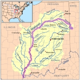
The Wabash River (ˈwɔːbæʃ) is a 503 miles (809.5 km) river
in the Midwestern United States
that flows southwest from northwest Ohio
near Fort Recovery
across northern Indiana
to southern Illinois, where it forms the Illinois
-Indiana border before draining into the Ohio River
, of which it is the largest northern tributary. From the dam near Huntington, Indiana
to its terminus at the Ohio River, the Wabash flows freely for 411 miles (661.4 km).
The Wabash is the state river of Indiana, and subject of the state song "On the Banks of the Wabash, Far Away
" by Paul Dresser
.
Lake Maumee
, the ancestor to Lake Erie
. Eventually the meltwaters overtopped a glacial moraine
located near Fort Wayne, Indiana
, and catastrophically drained southwestward in the Maumee Torrent
. The torrent carved the wide alluvial valley that the Wabash flows through today.
The name "Wabash" is an English
spelling of the French
name for the river, "Ouabache." French traders named the river after the Miami Indian word for the river, waapaahšiiki, meaning "it shines white", "pure white", or "water over white stones". The Miami name reflected the clarity of the river in Huntington County, Indiana
where the river bottom is limestone
.
The Wabash was first mapped by French explorers to the Mississippi
, including the sections now known as the Ohio River
. Although the Wabash is today considered a tributary of the Ohio, the Ohio was considered a tributary of the Wabash until the mid-18th century. This is because the French traders traveled north and south from Canada to the Gulf of Mexico via the Wabash; it served as a vital trade route for North American-French trade.
The United States has fought five battles on or near the river; the Battle of Vincennes
(1779), St. Clair's Defeat
(1791), the Attack on Fort Recovery (1794), the Battle of Tippecanoe
(1811), and the Siege of Fort Harrison (1812). Different conflicts have been referred to as the "Battle of the Wabash". A 329 acres (133.1 ha) remnant of the old-growth forests that once bordered the Wabash can be found at Beall Woods State Park
, near Mount Carmel, Illinois
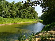
. In the 19th century, the Wabash and Erie Canal
, one of the longest canal
s in the world, was built along the entire length of the river. Portions are still accessible in modern times, but most of the abandoned canal no longer exists.
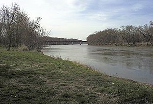
The Wabash River between Terre Haute and the Ohio River was navigable by large ships during the nineteenth century, and was a regular stop for steam ships. Erosion due to farming and runoff rendered it impassible to such ships during the late nineteenth century. Dredging could have resolved the problem, but the availability of railroad transportation did not require such intervention. There are several swing bridges over the river on the two-hundred mile stretch, but none remain in operation.
The river has shifted course several times in the stretch along the Indiana and Illinois border creating cutoffs where parts of the river are entirely in either Indiana or Illinois. However, both states still generally regard the middle of the river as the state border.
In the 1920s there existed a famous hotel and resort that existed in Wabash County nearby the Grand Rapids Dam on the Wabash River. The hotel was named the Grand Rapids Hotel
and was owned by Frederick Hinde Zimmerman. During the hotel's nine year existence it catered to individuals from all over the United States.
, the current is swift and the water remains very shallow and follows a poorly defined channel. The depth and low bridge clearances make the section nearly impassible by boat except in the most ideal conditions. At mile five, the river is dammed, creating Lake Wabash. At mile seven and mile nine, two tributaries give the river a significant boost in volume and at mile eleven the river flows past Fort Recovery. Two more tributaries add to the river's volume between Fort Recovery and Macedon at mile eighteen, making the river navigable for the remainder of its course. To aid in the navigation, this section of the river is regularly dredged by the state. The river continues to flow northward passing the town of Wabash at mile twenty-three and then cutting sharply west, crossing into Indiana at mile twenty-eight.
Upon entering Indiana, there are many sharp turns in the river that frequently lead to log jams that can block the river. Because of the many turns in the river, the state created several separate canal channels to shorten the journey between the state line and Fort Wayne as part of the Wabash and Erie Canal
project during the 1830s. The subsequent abandonment of the canals allowed the river to shift courses several times resulting in the formation of many cut-offs and coves with no outlet, giving the river a maze-like quality in the first seventeen mile (27 km) stretch as it enters Indiana.
At mile forty-five, the river becomes straighter with few sharp bends. An additional seventeen tributaries raise the depth of the river considerably making it navigable for larger vessels. At mile fifty-nine, the river passes through Ouabache State Park
where it begins to widen and become more shallow. The white limestone
river bottom can sometimes be seen in the area, whereas it is not visible due to pollution elsewhere downstream. As the river exits the park and flows towards the town of Bluffton
near mile sixty-six, it widens further, becoming more shallow; only a narrow channel is navigable by larger vessels. The river remains shallow and somewhat rocky with minor rapids until mile seventy-one near the town of Murray
. There the river becomes calm and deeper until mile eighty-one due to the dam and levy at the town of Markle
. The lock that was formerly at the site is abandoned and a narrow washout is the over means to bypass the dam. In the rocky washout the river level drops four feet, making it one of the most dangerous points on the river. Boaters are advised exit the river and reembark on the other side of the dam rather than traverse the washout.
At mile eighty-nine, the large Huntington Dam blocks the river. Built by the Army Corps of Engineers to make a reservoir, the dam creates the J. Edward Roush Lake
. The lake is surrounded by park land and recreation areas and is about five miles (8 km) in length and a mile wide at its widest point. The mile-long stretch after the Huntington Dam is rarely navigable. No lock connects the two sections of the river, and the water is often very shallow. A second smaller dam at mile ninety-one presents a dangerous hazard, leading the section between it and the Huntingon Dam to be closed to boaters.
At mile ninety-three the river is joined by its first major tributary, the Little River
. The town of Huntington
sits at the confluence of the two rivers. The tributary dramatically increases the volume of water in the Wabash at this point, and because of the dams on the Wabash, it often carries more water than the Wabash. Additional minor tributaries raise the water level between Huntington and the town of Wabash
. As the river passes Wabash and moved towards Peru
, it splits creating a series of islands; sandbars are common in the stretch. The river joins back into a single channel at Peru, and flows through one of its most gentle stretches until reaching Logansport
where the river again splits into multiple channels with islands dividing them. Some of the channels are narrow and rocky, while the larger channels are navigable. Between Logansport and Delphi
, at mile 176, is one of the only remaining stretches of the Wabash and Erie canal. It can be accessed at Delphi. Just past Delphi, the Wabash's second major tributary, the Tippecanoe River
, joins the river. The confluence of the two rivers is part of Prophetstown State Park
, the site of the 1811 Battle of Tippecanoe
. The joining of the Tippecanoe raises the level of the Wabash dramatically. At this point, most large power boats can easily navigate the river at cruising speed.
The river passes the town of Lafayette
at mile 210 and gradually begins to end its westward flow, beginning a wide turn to the south. At mile 241, at the town of Covington
, the river begins flowing due south. The river is deep at this point, but there are several gravel bars between Covington and the Terre Haute. Terre Haute, beginning at mile 300, is among the largest cities in Indiana, and the largest along the Wabash. Although navigable by large ships in the past, the remainder of the river becomes shallow in places due to erosion
and silt
. The river gradually widens moving south. It borders Illinois
beginning at mile 316, and serves as a state boundary line with Indiana for the remainder of its course.
At Darwin
, a farmer's cooperative operates the Wabash's only ferry service. It is used to take heavy farm equipment across the river. South of Darwin, beginning at mile 410 a large bluff gradually rise, eventually towering two-hundred feet over the river. The area is one of the most remote through with the river, and it generally open land. The area becomes populous again as it nears the city of Vincennes
at mile 441; founded by the French about 1720, it is the oldest European settlement in Indiana, and amongst the oldest in the American Midwest. The city is sited on a strategic bend in the river which allowed it to control river traffic.
Past Vincennes, the Wabash is joined by its largest tributary, the White River
, again dramatically increasing its size. During low water, there are rapids at the confluence, caused by an old canal lock that was abandoned after flooding. From the confluence to the Ohio, the river zig-zags. The largest cut-off from the river is at Grayville
. A 1985 flood caused the river to change course, disconnecting a two mile (3 km) long stretch of the river and creating a lake. A short distance farther is the historic town of New Harmony
, a settlement created by utopians during 1810s.
At mile 460, the river again splits into several channels and passes through the Grand Chain of Rocks. The area features sandy beaches and the largest islands in the river, some a mile in length. At mile 491 the Wabash drains into the Ohio River
.
 The major tributaries of the Wabash River include:
 The Wabash River supports an abundant and diverse wildlife population. At least 150 species of birds have been sighted around the river. The waterfowl
are most dependent on the river. Three large fishing species frequent the river; the Black-crowned
and Yellow-crowned Night Heron
, and the Merlin
. Several species of shorebirds build nest on or near the banks of the river. The river is home to many species of fish including species of bass
, trout
, sunfish
, crappie
, catfish
, carp
, and others. Aquatic reptiles, including Alligator Snapping Turtle
s and box turtles are common. Less commonly, water moccasin can be found in the southern parts of the river. Dozens of species of frogs and amphibians are common throughout the river system including the American Bullfrog and the Eastern Newt
. Crayfish
are also common throughout the river.
River
A river is a natural watercourse, usually freshwater, flowing towards an ocean, a lake, a sea, or another river. In a few cases, a river simply flows into the ground or dries up completely before reaching another body of water. Small rivers may also be called by several other names, including...
in the Midwestern United States
United States
The United States of America is a federal constitutional republic comprising fifty states and a federal district...
that flows southwest from northwest Ohio
Ohio
Ohio is a Midwestern state in the United States. The 34th largest state by area in the U.S.,it is the 7th‑most populous with over 11.5 million residents, containing several major American cities and seven metropolitan areas with populations of 500,000 or more.The state's capital is Columbus...
near Fort Recovery
Fort Recovery, Ohio
Fort Recovery is a village in Mercer County, Ohio, United States. The population was 1,273 at the 2000 census. The village is near the location of Fort Recovery, first established in 1793 under orders from General Anthony Wayne....
across northern Indiana
Indiana
Indiana is a US state, admitted to the United States as the 19th on December 11, 1816. It is located in the Midwestern United States and Great Lakes Region. With 6,483,802 residents, the state is ranked 15th in population and 16th in population density. Indiana is ranked 38th in land area and is...
to southern Illinois, where it forms the Illinois
Illinois
Illinois is the fifth-most populous state of the United States of America, and is often noted for being a microcosm of the entire country. With Chicago in the northeast, small industrial cities and great agricultural productivity in central and northern Illinois, and natural resources like coal,...
-Indiana border before draining into the Ohio River
Ohio River
The Ohio River is the largest tributary, by volume, of the Mississippi River. At the confluence, the Ohio is even bigger than the Mississippi and, thus, is hydrologically the main stream of the whole river system, including the Allegheny River further upstream...
, of which it is the largest northern tributary. From the dam near Huntington, Indiana
Huntington, Indiana
Huntington, known as the "Lime City", is a small city in and the county seat of Huntington County, Indiana, United States. It is in Huntington Township and Union Township...
to its terminus at the Ohio River, the Wabash flows freely for 411 miles (661.4 km).
The Wabash is the state river of Indiana, and subject of the state song "On the Banks of the Wabash, Far Away
On the Banks of the Wabash, Far Away
"On the Banks of the Wabash, Far Away" was among the best-selling songs of the 19th century in terms of sheet music sold. Written and composed by American songwriter Paul Dresser, it was published by the Tin Pan Alley firm of Howley, Haviland & Co. in October 1897. The lyrics of the ballad...
" by Paul Dresser
Paul Dresser
Johann Paul Dresser, Jr. was a popular American songwriter of the late 19th century and early 20th century. As a child and adolescent he was frequently in trouble and spent several months in jail before joining a band of traveling minstrels...
.
History
When the Wisconsin Glacier melted 14,000 years ago, part of the meltwaters formed the proglacialProglacial lake
In geology, a proglacial lake is a lake formed either by the damming action of a moraine or ice dam during the retreat of a melting glacier, or by meltwater trapped against an ice sheet due to isostatic depression of the crust around the ice...
Lake Maumee
Glacial Lake Maumee
Glacial Lake Maumee was a proglacial lake that was an ancestor of present-day Lake Erie. It formed about 14,000 years ago. As the Erie Lobe of the Wisconsin Glacier retreated at the end of the last ice age, it left meltwater in a previously-existing depressional area that was the valley of an...
, the ancestor to Lake Erie
Lake Erie
Lake Erie is the fourth largest lake of the five Great Lakes in North America, and the tenth largest globally. It is the southernmost, shallowest, and smallest by volume of the Great Lakes and therefore also has the shortest average water residence time. It is bounded on the north by the...
. Eventually the meltwaters overtopped a glacial moraine
Moraine
A moraine is any glacially formed accumulation of unconsolidated glacial debris which can occur in currently glaciated and formerly glaciated regions, such as those areas acted upon by a past glacial maximum. This debris may have been plucked off a valley floor as a glacier advanced or it may have...
located near Fort Wayne, Indiana
Fort Wayne, Indiana
Fort Wayne is a city in the US state of Indiana and the county seat of Allen County. The population was 253,691 at the 2010 Census making it the 74th largest city in the United States and the second largest in Indiana...
, and catastrophically drained southwestward in the Maumee Torrent
Maumee Torrent
The Maumee Torrent was a catastrophic draining of Glacial Lake Maumee, the ancestor of present-day Lake Erie, that occurred during the late Wisconsin glaciation...
. The torrent carved the wide alluvial valley that the Wabash flows through today.
The name "Wabash" is an English
English language
English is a West Germanic language that arose in the Anglo-Saxon kingdoms of England and spread into what was to become south-east Scotland under the influence of the Anglian medieval kingdom of Northumbria...
spelling of the French
French language
French is a Romance language spoken as a first language in France, the Romandy region in Switzerland, Wallonia and Brussels in Belgium, Monaco, the regions of Quebec and Acadia in Canada, and by various communities elsewhere. Second-language speakers of French are distributed throughout many parts...
name for the river, "Ouabache." French traders named the river after the Miami Indian word for the river, waapaahšiiki, meaning "it shines white", "pure white", or "water over white stones". The Miami name reflected the clarity of the river in Huntington County, Indiana
Huntington County, Indiana
Huntington County is a county located in the U.S. state of Indiana. The county seat and lone city is Huntington. According to Census 2010, the population was 37,124.-Geography:...
where the river bottom is limestone
Limestone
Limestone is a sedimentary rock composed largely of the minerals calcite and aragonite, which are different crystal forms of calcium carbonate . Many limestones are composed from skeletal fragments of marine organisms such as coral or foraminifera....
.
The Wabash was first mapped by French explorers to the Mississippi
Mississippi River
The Mississippi River is the largest river system in North America. Flowing entirely in the United States, this river rises in western Minnesota and meanders slowly southwards for to the Mississippi River Delta at the Gulf of Mexico. With its many tributaries, the Mississippi's watershed drains...
, including the sections now known as the Ohio River
Ohio River
The Ohio River is the largest tributary, by volume, of the Mississippi River. At the confluence, the Ohio is even bigger than the Mississippi and, thus, is hydrologically the main stream of the whole river system, including the Allegheny River further upstream...
. Although the Wabash is today considered a tributary of the Ohio, the Ohio was considered a tributary of the Wabash until the mid-18th century. This is because the French traders traveled north and south from Canada to the Gulf of Mexico via the Wabash; it served as a vital trade route for North American-French trade.
The United States has fought five battles on or near the river; the Battle of Vincennes
Battle of Vincennes
The Illinois campaign was a series of events in the American Revolutionary War in which a small force of Virginia militiamen led by George Rogers Clark seized control of several British posts in the Illinois country, in what is now the Midwestern United States...
(1779), St. Clair's Defeat
St. Clair's Defeat
St. Clair's Defeat also known as the Battle of the Wabash, the Battle of Wabash River or the Battle of a Thousand Slain, was fought on November 4, 1791 in the Northwest Territory between the United States and the Western Confederacy of American Indians, as part of the Northwest Indian War...
(1791), the Attack on Fort Recovery (1794), the Battle of Tippecanoe
Battle of Tippecanoe
The Battle of Tippecanoe was fought on November 7, 1811, between United States forces led by Governor William Henry Harrison of the Indiana Territory and Native American warriors associated with the Shawnee leader Tecumseh. Tecumseh and his brother Tenskwatawa were leaders of a confederacy of...
(1811), and the Siege of Fort Harrison (1812). Different conflicts have been referred to as the "Battle of the Wabash". A 329 acres (133.1 ha) remnant of the old-growth forests that once bordered the Wabash can be found at Beall Woods State Park
Beall Woods State Park
Beall Woods State Park is Illinois state park on bordering the Wabash River and Keensburg in Wabash County, Illinois in the United States. of the state park is an old-growth forest designated as an Natural Area by the state of Illinois. The trees within the forest consist overwhelmingly of...
, near Mount Carmel, Illinois
Mount Carmel, Illinois
Mount Carmel is a city in and the county seat of Wabash County, Illinois, United States. At the time of the 2000 census, the population was 7,982, while the next largest town in Wabash County is Allendale, population 528. Located at the confluence of the Wabash, Patoka, and White Rivers, Mount...
. In the 19th century, the Wabash and Erie Canal
Wabash and Erie Canal
The Wabash and Erie Canal was a shipping canal that linked the Great Lakes to the Ohio River via an artificial waterway. The canal provided traders with access from the Great Lakes all the way to the Gulf of Mexico...
, one of the longest canal
Canal
Canals are man-made channels for water. There are two types of canal:#Waterways: navigable transportation canals used for carrying ships and boats shipping goods and conveying people, further subdivided into two kinds:...
s in the world, was built along the entire length of the river. Portions are still accessible in modern times, but most of the abandoned canal no longer exists.
The Wabash River between Terre Haute and the Ohio River was navigable by large ships during the nineteenth century, and was a regular stop for steam ships. Erosion due to farming and runoff rendered it impassible to such ships during the late nineteenth century. Dredging could have resolved the problem, but the availability of railroad transportation did not require such intervention. There are several swing bridges over the river on the two-hundred mile stretch, but none remain in operation.
The river has shifted course several times in the stretch along the Indiana and Illinois border creating cutoffs where parts of the river are entirely in either Indiana or Illinois. However, both states still generally regard the middle of the river as the state border.
In the 1920s there existed a famous hotel and resort that existed in Wabash County nearby the Grand Rapids Dam on the Wabash River. The hotel was named the Grand Rapids Hotel
Grand Rapids Hotel
The Grand Rapids Hotel was a hotel that existed outside of Mount Carmel, Illinois in Wabash County, Illinois, United States in Southern Illinois in the 1920s during a timeperiod that is commonly referred to as the Roaring Twenties, the Jazz Age, and the Golden Twenties. The hotel was located on...
and was owned by Frederick Hinde Zimmerman. During the hotel's nine year existence it catered to individuals from all over the United States.
Course
The river begins as a small spring that comes up from the ground among large stones. The exact source of the water is unknown, but naturalists theorize it could be either the nearby Beaver Creek or Grand Lake. Between the start of the river and Fort RecoveryFort Recovery, Ohio
Fort Recovery is a village in Mercer County, Ohio, United States. The population was 1,273 at the 2000 census. The village is near the location of Fort Recovery, first established in 1793 under orders from General Anthony Wayne....
, the current is swift and the water remains very shallow and follows a poorly defined channel. The depth and low bridge clearances make the section nearly impassible by boat except in the most ideal conditions. At mile five, the river is dammed, creating Lake Wabash. At mile seven and mile nine, two tributaries give the river a significant boost in volume and at mile eleven the river flows past Fort Recovery. Two more tributaries add to the river's volume between Fort Recovery and Macedon at mile eighteen, making the river navigable for the remainder of its course. To aid in the navigation, this section of the river is regularly dredged by the state. The river continues to flow northward passing the town of Wabash at mile twenty-three and then cutting sharply west, crossing into Indiana at mile twenty-eight.
Upon entering Indiana, there are many sharp turns in the river that frequently lead to log jams that can block the river. Because of the many turns in the river, the state created several separate canal channels to shorten the journey between the state line and Fort Wayne as part of the Wabash and Erie Canal
Wabash and Erie Canal
The Wabash and Erie Canal was a shipping canal that linked the Great Lakes to the Ohio River via an artificial waterway. The canal provided traders with access from the Great Lakes all the way to the Gulf of Mexico...
project during the 1830s. The subsequent abandonment of the canals allowed the river to shift courses several times resulting in the formation of many cut-offs and coves with no outlet, giving the river a maze-like quality in the first seventeen mile (27 km) stretch as it enters Indiana.
At mile forty-five, the river becomes straighter with few sharp bends. An additional seventeen tributaries raise the depth of the river considerably making it navigable for larger vessels. At mile fifty-nine, the river passes through Ouabache State Park
Ouabache State Park
Ouabache is a state park in Indiana. It is located south of Fort Wayne, Indiana. It was originally the Wells County State Forest and Game Preserve, formed in the early 1930s. In 1962 it became the Ouabache State Recreation Area, before finally achieving state park status in 1983.The name comes...
where it begins to widen and become more shallow. The white limestone
Limestone
Limestone is a sedimentary rock composed largely of the minerals calcite and aragonite, which are different crystal forms of calcium carbonate . Many limestones are composed from skeletal fragments of marine organisms such as coral or foraminifera....
river bottom can sometimes be seen in the area, whereas it is not visible due to pollution elsewhere downstream. As the river exits the park and flows towards the town of Bluffton
Bluffton, Indiana
Bluffton is a city in Harrison and Lancaster Townships, Wells County, Indiana, United States. The population was 9,897 at the 2010 census. The city is the county seat of Wells County.-Geography:Bluffton is located at ....
near mile sixty-six, it widens further, becoming more shallow; only a narrow channel is navigable by larger vessels. The river remains shallow and somewhat rocky with minor rapids until mile seventy-one near the town of Murray
Murray, Indiana
Murray is an unincorporated town in Lancaster Township, Wells County, Indiana.- History :In 1996, Murray was subject to an unintentional strafing by a military aircraft without any injuries.-Geography:Murray is located at ....
. There the river becomes calm and deeper until mile eighty-one due to the dam and levy at the town of Markle
Markle, Indiana
Markle is a town in Huntington and Wells Counties in the U.S. state of Indiana. The population was 1,095 at the 2010 census. It lies along Interstate 69, U.S. Route 224, Indiana State Road 116 and Indiana State Road 3 .-Geography:...
. The lock that was formerly at the site is abandoned and a narrow washout is the over means to bypass the dam. In the rocky washout the river level drops four feet, making it one of the most dangerous points on the river. Boaters are advised exit the river and reembark on the other side of the dam rather than traverse the washout.
At mile eighty-nine, the large Huntington Dam blocks the river. Built by the Army Corps of Engineers to make a reservoir, the dam creates the J. Edward Roush Lake
J. Edward Roush Lake
J. Edward Roush Lake is a reservoir in Huntington, Indiana.The Huntington Reservoir was renamed J. Edward Roush Lake to honor the impact to the local area of J. Edward Roush, who served as a State Representative and State Senator in Indiana and a representative in the U.S. House of...
. The lake is surrounded by park land and recreation areas and is about five miles (8 km) in length and a mile wide at its widest point. The mile-long stretch after the Huntington Dam is rarely navigable. No lock connects the two sections of the river, and the water is often very shallow. A second smaller dam at mile ninety-one presents a dangerous hazard, leading the section between it and the Huntingon Dam to be closed to boaters.
At mile ninety-three the river is joined by its first major tributary, the Little River
Little River (Indiana)
The Little River is a stream in Allen and Huntington counties in northeastern Indiana. A tributary of the Wabash River, it is sometimes called the "Little Wabash", which may cause it to be confused with the Little Wabash River of Illinois....
. The town of Huntington
Huntington, Indiana
Huntington, known as the "Lime City", is a small city in and the county seat of Huntington County, Indiana, United States. It is in Huntington Township and Union Township...
sits at the confluence of the two rivers. The tributary dramatically increases the volume of water in the Wabash at this point, and because of the dams on the Wabash, it often carries more water than the Wabash. Additional minor tributaries raise the water level between Huntington and the town of Wabash
Wabash, Indiana
Wabash is a city in Noble Township, Wabash County, Indiana, United States. The population was 10,666 at the 2010 census. The city is the county seat of Wabash County....
. As the river passes Wabash and moved towards Peru
Peru, Indiana
-Demographics:As of the census of 2000, there were 12,994 people, 5,410 households, and 3,397 families residing in the city. The population density was 2,815.5 people per square mile . There were 5,943 housing units at an average density of 1,287.7 per square mile...
, it splits creating a series of islands; sandbars are common in the stretch. The river joins back into a single channel at Peru, and flows through one of its most gentle stretches until reaching Logansport
Logansport, Indiana
Logansport is a city in and the county seat of Cass County, Indiana, United States. The population was 18,396 at the 2010 census. Logansport is located in northern Indiana, at the junction of the Wabash and Eel rivers, northeast of Lafayette.-History:...
where the river again splits into multiple channels with islands dividing them. Some of the channels are narrow and rocky, while the larger channels are navigable. Between Logansport and Delphi
Delphi, Indiana
Delphi is a city in and the county seat of Carroll County, Indiana, United States. Located twenty minutes northeast of Lafayette, it is part of the Lafayette, Indiana Metropolitan Statistical Area...
, at mile 176, is one of the only remaining stretches of the Wabash and Erie canal. It can be accessed at Delphi. Just past Delphi, the Wabash's second major tributary, the Tippecanoe River
Tippecanoe River
The Tippecanoe River is a gentle, river in northern Indiana that flows from Big Lake in Noble County to the Wabash River near Battle Ground, about northeast of Lafayette. The name "Tippecanoe" comes from a Miami-Illinois word for buffalo fish, reconstructed as */kiteepihkwana/.The Tippecanoe...
, joins the river. The confluence of the two rivers is part of Prophetstown State Park
Prophetstown State Park
Prophetstown State Park, named after Tenskwatawa , a religious leader and younger brother of Shawnee leader Tecumseh, is located near the town of Battle Ground, Indiana, about a mile east of the site of the Battle of Tippecanoe. Established in 2004, it is Indiana’s newest state park...
, the site of the 1811 Battle of Tippecanoe
Battle of Tippecanoe
The Battle of Tippecanoe was fought on November 7, 1811, between United States forces led by Governor William Henry Harrison of the Indiana Territory and Native American warriors associated with the Shawnee leader Tecumseh. Tecumseh and his brother Tenskwatawa were leaders of a confederacy of...
. The joining of the Tippecanoe raises the level of the Wabash dramatically. At this point, most large power boats can easily navigate the river at cruising speed.
The river passes the town of Lafayette
Lafayette, Indiana
Lafayette is a city in and the county seat of Tippecanoe County, Indiana, United States, northwest of Indianapolis. As of the 2010 census, the city had a total population of 67,140. West Lafayette, on the other side of the Wabash River, is home to Purdue University, which has a large impact on...
at mile 210 and gradually begins to end its westward flow, beginning a wide turn to the south. At mile 241, at the town of Covington
Covington, Indiana
Covington is a city located on the western edge of Fountain County, Indiana. The population was 2,645 at the 2010 census. The city is the county seat of Fountain County.-Geography:Covington is located at ....
, the river begins flowing due south. The river is deep at this point, but there are several gravel bars between Covington and the Terre Haute. Terre Haute, beginning at mile 300, is among the largest cities in Indiana, and the largest along the Wabash. Although navigable by large ships in the past, the remainder of the river becomes shallow in places due to erosion
Erosion
Erosion is when materials are removed from the surface and changed into something else. It only works by hydraulic actions and transport of solids in the natural environment, and leads to the deposition of these materials elsewhere...
and silt
Silt
Silt is granular material of a size somewhere between sand and clay whose mineral origin is quartz and feldspar. Silt may occur as a soil or as suspended sediment in a surface water body...
. The river gradually widens moving south. It borders Illinois
Illinois
Illinois is the fifth-most populous state of the United States of America, and is often noted for being a microcosm of the entire country. With Chicago in the northeast, small industrial cities and great agricultural productivity in central and northern Illinois, and natural resources like coal,...
beginning at mile 316, and serves as a state boundary line with Indiana for the remainder of its course.
At Darwin
Darwin, Illinois
Darwin is an unincorporated community in Clark County, Illinois, United States. Darwin is located along the Wabash River across from the state of Indiana....
, a farmer's cooperative operates the Wabash's only ferry service. It is used to take heavy farm equipment across the river. South of Darwin, beginning at mile 410 a large bluff gradually rise, eventually towering two-hundred feet over the river. The area is one of the most remote through with the river, and it generally open land. The area becomes populous again as it nears the city of Vincennes
Vincennes, Indiana
Vincennes is a city in and the county seat of Knox County, Indiana, United States. It is located on the Wabash River in the southwestern part of the state. The population was 18,701 at the 2000 census...
at mile 441; founded by the French about 1720, it is the oldest European settlement in Indiana, and amongst the oldest in the American Midwest. The city is sited on a strategic bend in the river which allowed it to control river traffic.
Past Vincennes, the Wabash is joined by its largest tributary, the White River
White River (Indiana)
The White River is a two-forked river that flows through central and southern Indiana and is the main tributary to the Wabash River. Via the west fork, considered to be the main stem of the river by the U.S. Board on Geographic Names, the White River is long.-West Fork:The West Fork, long, is...
, again dramatically increasing its size. During low water, there are rapids at the confluence, caused by an old canal lock that was abandoned after flooding. From the confluence to the Ohio, the river zig-zags. The largest cut-off from the river is at Grayville
Grayville, Illinois
Grayville is a city in Edwards and White counties in Illinois. The population was 1,725 at the 2000 census. Grayville is the birthplace of naval hero James Meredith Helm.-Geography:Grayville is located at ....
. A 1985 flood caused the river to change course, disconnecting a two mile (3 km) long stretch of the river and creating a lake. A short distance farther is the historic town of New Harmony
New Harmony, Indiana
New Harmony is a historic town on the Wabash River in Harmony Township, Posey County, Indiana, United States. It lies north of Mount Vernon, the county seat. The population was 916 at the 2000 census. It is part of the Evansville metropolitan area. Many of the old Harmonist buildings still stand...
, a settlement created by utopians during 1810s.
At mile 460, the river again splits into several channels and passes through the Grand Chain of Rocks. The area features sandy beaches and the largest islands in the river, some a mile in length. At mile 491 the Wabash drains into the Ohio River
Ohio River
The Ohio River is the largest tributary, by volume, of the Mississippi River. At the confluence, the Ohio is even bigger than the Mississippi and, thus, is hydrologically the main stream of the whole river system, including the Allegheny River further upstream...
.
Major tributaries
- Salamonie RiverSalamonie RiverThe Salamonie River is a tributary of the Wabash River, long, in eastern Indiana in the United States. Via the Wabash and Ohio rivers, it is part of the watershed of the Mississippi River...
(Indiana) - Little RiverLittle River (Indiana)The Little River is a stream in Allen and Huntington counties in northeastern Indiana. A tributary of the Wabash River, it is sometimes called the "Little Wabash", which may cause it to be confused with the Little Wabash River of Illinois....
(Indiana) - Mississinewa RiverMississinewa RiverThe Mississinewa River is a tributary of the Wabash River in eastern Indiana and a small portion of western Ohio in the United States. It is long. Via the Wabash and Ohio rivers, it is part of the Mississippi River watershed. During the War of 1812, the river was the site of the Battle of the...
(Indiana) - Eel River (Indiana)
- Tippecanoe RiverTippecanoe RiverThe Tippecanoe River is a gentle, river in northern Indiana that flows from Big Lake in Noble County to the Wabash River near Battle Ground, about northeast of Lafayette. The name "Tippecanoe" comes from a Miami-Illinois word for buffalo fish, reconstructed as */kiteepihkwana/.The Tippecanoe...
(Indiana) - White RiverWhite River (Indiana)The White River is a two-forked river that flows through central and southern Indiana and is the main tributary to the Wabash River. Via the west fork, considered to be the main stem of the river by the U.S. Board on Geographic Names, the White River is long.-West Fork:The West Fork, long, is...
(Indiana) - Patoka RiverPatoka RiverThe Patoka River is a tributary of the Wabash River in southwestern Indiana in the United States. It drains a largely rural area of forested bottomland and agricultural lands among the hills north of Evansville.-Description:...
(Indiana) - Vermilion RiverVermilion River (Wabash River tributary)The Vermilion River is a tributary of the Wabash River in the states of Illinois and Indiana, United States.There are two "Vermilion Rivers" in Illinois. The Wabash tributary flows south, while the other Vermilion River flows north to the Illinois River...
(Illinois and Indiana) - Embarras RiverEmbarras RiverThe Embarras River is a tributary of the Wabash River in southeastern Illinois in the United States. The waters of the Embarras reach the Gulf of Mexico via the Wabash, Ohio, and Mississippi rivers. The river drains a watershed of approximately in an agricultural region...
(Illinois) - Little Wabash RiverLittle Wabash RiverThe Little Wabash River is a tributary of the Wabash River in east-central and southeastern Illinois in the United States. Via the Wabash and Ohio rivers, it is part of the watershed of the Mississippi River.-Course:...
(Illinois) - Wildcat Creek (Indiana)Wildcat Creek (Indiana)The Wildcat Creek is an creek in north-central Indiana that is a major tributary of the Wabash River. Wildcat Creek consists of three main forks-North, South, and Middle...
Illinois
- GrayvilleGrayville, IllinoisGrayville is a city in Edwards and White counties in Illinois. The population was 1,725 at the 2000 census. Grayville is the birthplace of naval hero James Meredith Helm.-Geography:Grayville is located at ....
- HutsonvilleHutsonville, IllinoisHutsonville is a village in Crawford County, Illinois, United States. The population was 568 at the 2000 census.-Geography:Hutsonville is located at ....
- MaunieMaunie, IllinoisMaunie is a village in White County, Illinois, United States. The population was 177 at the 2000 census.-Geography:Maunie is located at ....
- Mount CarmelMount Carmel, IllinoisMount Carmel is a city in and the county seat of Wabash County, Illinois, United States. At the time of the 2000 census, the population was 7,982, while the next largest town in Wabash County is Allendale, population 528. Located at the confluence of the Wabash, Patoka, and White Rivers, Mount...
- St. FrancisvilleSt. Francisville, IllinoisSt. Francisville is a city in Lawrence County, Illinois, United States. The population was 759 at the 2000 census.-Geography:St. Francisville is located at ....
Indiana
- AndrewsAndrews, IndianaAndrews is a town in Dallas Township, Huntington County, Indiana, United States. The population was 1,149 at the 2010 census.-Geography:Andrews is located at ....
- AtticaAttica, IndianaAttica is a city in Logan Township, Fountain County, Indiana, United States. The population was 3,245 at the 2010 census.-History:Attica was laid out by George Hollingsworth and platted by David Stump on March 19, 1825...
- BlufftonBluffton, IndianaBluffton is a city in Harrison and Lancaster Townships, Wells County, Indiana, United States. The population was 9,897 at the 2010 census. The city is the county seat of Wells County.-Geography:Bluffton is located at ....
- ClintonClinton, IndianaClinton is a city in Vermillion County, Indiana, United States. The population was 4,893 at the 2010 census. The city was established in 1829 and is named after DeWitt Clinton, who served as governor of New York from 1817 to 1823. Many of Clinton's original settlers were immigrants working in coal...
- CovingtonCovington, IndianaCovington is a city located on the western edge of Fountain County, Indiana. The population was 2,645 at the 2010 census. The city is the county seat of Fountain County.-Geography:Covington is located at ....
- DelphiDelphi, IndianaDelphi is a city in and the county seat of Carroll County, Indiana, United States. Located twenty minutes northeast of Lafayette, it is part of the Lafayette, Indiana Metropolitan Statistical Area...
- HuntingtonHuntington, IndianaHuntington, known as the "Lime City", is a small city in and the county seat of Huntington County, Indiana, United States. It is in Huntington Township and Union Township...
- LafayetteLafayette, IndianaLafayette is a city in and the county seat of Tippecanoe County, Indiana, United States, northwest of Indianapolis. As of the 2010 census, the city had a total population of 67,140. West Lafayette, on the other side of the Wabash River, is home to Purdue University, which has a large impact on...
- LagroLagro, IndianaLagro is a town in Lagro Township, Wabash County, Indiana, United States. Lagro was established by a group of explorers looking for the treasure of Chief Le Gris of the great Miami tribe...

- LogansportLogansport, IndianaLogansport is a city in and the county seat of Cass County, Indiana, United States. The population was 18,396 at the 2010 census. Logansport is located in northern Indiana, at the junction of the Wabash and Eel rivers, northeast of Lafayette.-History:...
- MarkleMarkle, IndianaMarkle is a town in Huntington and Wells Counties in the U.S. state of Indiana. The population was 1,095 at the 2010 census. It lies along Interstate 69, U.S. Route 224, Indiana State Road 116 and Indiana State Road 3 .-Geography:...
- MeromMerom, IndianaMerom is a town in Gill Township, Sullivan County, Indiana, United States. The population was 294 at the 2000 census. It is part of the Terre Haute Metropolitan Statistical Area....
- MontezumaMontezuma, IndianaMontezuma is a town in Reserve and Wabash townships, Parke County, Indiana, United States. The population was 1,022 at the 2010 census.-Geography:Montezuma is located at ....
- NewportNewport, IndianaNewport is a town in Vermillion Township, Vermillion County, Indiana, United States. The population was 515 at the 2010 census. The town is the county seat of Vermillion County.-Geography:Newport is located at ....
- New HarmonyNew Harmony, IndianaNew Harmony is a historic town on the Wabash River in Harmony Township, Posey County, Indiana, United States. It lies north of Mount Vernon, the county seat. The population was 916 at the 2000 census. It is part of the Evansville metropolitan area. Many of the old Harmonist buildings still stand...
- PerrysvillePerrysville, IndianaPerrysville is a town in Highland Township, Vermillion County, Indiana, United States. The population was 456 at the 2010 census.-History:Perrysville was platted and surveyed in 1825 by James Blair on a bluff on the west side of the Wabash River...
- PeruPeru, Indiana-Demographics:As of the census of 2000, there were 12,994 people, 5,410 households, and 3,397 families residing in the city. The population density was 2,815.5 people per square mile . There were 5,943 housing units at an average density of 1,287.7 per square mile...
- Terre HauteTerre Haute, IndianaTerre Haute is a city and the county seat of Vigo County, Indiana, United States, near the state's western border with Illinois. As of the 2010 census, the city had a total population of 60,785 and its metropolitan area had a population of 170,943. The city is the county seat of Vigo County and...
- VincennesVincennes, IndianaVincennes is a city in and the county seat of Knox County, Indiana, United States. It is located on the Wabash River in the southwestern part of the state. The population was 18,701 at the 2000 census...
- WabashWabash, IndianaWabash is a city in Noble Township, Wabash County, Indiana, United States. The population was 10,666 at the 2010 census. The city is the county seat of Wabash County....
- West LafayetteWest Lafayette, IndianaAs of the census of 2010, there were 29,596 people, 12,591 households, and 3,588 families residing in the city. The population density was 5,381.1 people per square mile . The racial makeup of the city was 74.3% White, 17.3% Asian, 2.7% African American, 0.16% Native American, 0.03% Pacific...
- WilliamsportWilliamsport, IndianaWilliamsport is a town in Washington Township, Warren County, Indiana, United States. The population was 1,898 at the 2010 census. It is the county seat of Warren County and is the largest of the four incorporated towns in the county...
Fauna
Waterfowl
Waterfowl are certain wildfowl of the order Anseriformes, especially members of the family Anatidae, which includes ducks, geese, and swans....
are most dependent on the river. Three large fishing species frequent the river; the Black-crowned
Black-crowned Night Heron
The Black-crowned Night Heron commonly abbreviated to just Night Heron in Eurasia, is a medium-sized heron found throughout a large part of the world, except in the coldest regions and Australasia .-Description:Adults are...
and Yellow-crowned Night Heron
Yellow-crowned Night Heron
The Yellow-crowned Night Heron , also called the American Night Heron or squawk, is a fairly small heron, similar in appearance to the Black-crowned Night Heron...
, and the Merlin
Merlin (bird)
The Merlin is a small species of falcon from the Northern Hemisphere. A bird of prey once known colloquially as a pigeon hawk in North America, the Merlin breeds in the northern Holarctic; some migrate to subtropical and northern tropical regions in winter.-European and North American...
. Several species of shorebirds build nest on or near the banks of the river. The river is home to many species of fish including species of bass
Bass (fish)
Bass is a name shared by many different species of popular gamefish. The term encompasses both freshwater and marine species. All belong to the large order Perciformes, or perch-like fishes, and in fact the word bass comes from Middle English bars, meaning "perch."-Types of basses:*The temperate...
, trout
Trout
Trout is the name for a number of species of freshwater and saltwater fish belonging to the Salmoninae subfamily of the family Salmonidae. Salmon belong to the same family as trout. Most salmon species spend almost all their lives in salt water...
, sunfish
Centrarchidae
The sunfishes are a family of freshwater ray-finned fish belonging to the order Perciformes. The type genus is Centrarchus . The family's 27 species includes many fishes familiar to North Americans, including the rock bass, largemouth bass, bluegill, pumpkinseed, and crappies...
, crappie
Crappie
Crappie is a genus of freshwater fish in the sunfish family of order Perciformes. The type species is P. annularis, the white crappie...
, catfish
Catfish
Catfishes are a diverse group of ray-finned fish. Named for their prominent barbels, which resemble a cat's whiskers, catfish range in size and behavior from the heaviest and longest, the Mekong giant catfish from Southeast Asia and the second longest, the wels catfish of Eurasia, to detritivores...
, carp
Carp
Carp are various species of oily freshwater fish of the family Cyprinidae, a very large group of fish native to Europe and Asia. The cypriniformes are traditionally grouped with the Characiformes, Siluriformes and Gymnotiformes to create the superorder Ostariophysi, since these groups have certain...
, and others. Aquatic reptiles, including Alligator Snapping Turtle
Alligator Snapping Turtle
The alligator snapping turtle is one of the largest freshwater turtles in the world. It is not closely related to, but is often associated with the common snapping turtle. They are the sole living member of the genus Macrochelys--while common snappers are in the genus Chelydra...
s and box turtles are common. Less commonly, water moccasin can be found in the southern parts of the river. Dozens of species of frogs and amphibians are common throughout the river system including the American Bullfrog and the Eastern Newt
Eastern Newt
The Eastern Newt or Red-spotted Newt is a common salamander of eastern North America. Eastern newts dwell in wet forests with small lakes or ponds. They can coexist in an aquatic environment with fish, however, their skin secretes a poisonous substance when the newt is threatened or injured...
. Crayfish
Crayfish
Crayfish, crawfish, or crawdads – members of the superfamilies Astacoidea and Parastacoidea – are freshwater crustaceans resembling small lobsters, to which they are related...
are also common throughout the river.
See also
- List of longest rivers of the United States (by main stem)
- Islands of the MidwestIslands of the MidwestThis is a partial list of islands of the Midwestern United States. -Illinois:*Bardwell Island*Campbell's Island*Chouteau Island*Dillon Island*Gabaret Island*Goose Island...
- List of Illinois rivers
- List of Indiana rivers
- List of Ohio rivers
- Wabash and Erie CanalWabash and Erie CanalThe Wabash and Erie Canal was a shipping canal that linked the Great Lakes to the Ohio River via an artificial waterway. The canal provided traders with access from the Great Lakes all the way to the Gulf of Mexico...
- Wabash Valley Seismic ZoneWabash Valley Seismic ZoneThe Wabash Valley Seismic Zone is a tectonic region located in the Midwest of the United States, centered on the valley of the Lower Wabash River, along the state line between southeastern Illinois and southwestern Indiana.-Geology:The Wabash Valley Seismic Zone consists largely of...
- Watersheds of IllinoisWatersheds of IllinoisWatersheds of Illinois is a list of basins or catchment areas into which the State of Illinois can be divided based on the place to which water flows....
Further reading
- Arthur Benke & Colbert Cushing, "Rivers of North America". Elsevier Academic Press, 2005 ISBN 0-12-088253-1
- Rhodes, Captain Rick, "The Ohio River --In American History and Voyaging on Today's River" has a section on the Wabash River, 2007, ISBN 978-09665866-33
- Hay, Jerry M, "Wabash River Guidebook" 2010, ISBN 978-1-60585-215-7
- Nolan, John Matthew, "2,543 Days: A History of the Hotel at Grand Rapids Dam on the Wabash River" 2011, ISBN 978-1-257-04152-7