
The Amazing Race: A Corrida Milionária
Encyclopedia
The Amazing Race: A Corrida Milionária (Portuguese
for The Million Dollar Race) is a Brazil
ian version of the popular franchised reality television show The Amazing Race
. Hosted by Rony Curvelo, it is independently produced and aired in a purchased time slot in the Brazilian television network RedeTV!. The show premiered on October 13, 2007 and ended on January 5, 2008.
Friends Patricia & Sane are the winner of this season's race, and becaming the 2nd all-woman team to win the international version of the race.
for final two legs, becoming the fewest countries to be visited in the Amazing Race franchise until The Amazing Race: China Rush
.
The season follows the rules from the American version's tenth
and eleventh
seasons. With the exception of the Intersection, all clue types are retained in the Brazilian version, as well as the non-elimination penalty. This race also differs from the original format in that while teams leave the pit stops in the same order they arrived, the time differences are not always respected. The penalty for not completing a Roadblock is also shorter. Route markers are colored yellow and green, reflecting the Brazilian national colours
, as opposed to yellow and red in most other versions. Also, contrary to other Amazing Race versions, the eliminated teams did not make an appearance at the finish line. Additionally, this is the first route whereby the race did not end in the same country as it started.
Notably, in Leg 6, while driving to the pit stop, Andréa & Luciana were held up at gunpoint by three men at a stoplight in Fortaleza
. The team did not lose anything, but the criminals took the camera and all personal documents from the crew, and ran off as gunshots were fired by the police. Two of the men were later caught and identified, and the camera was recovered. This incident dropped the team from 4th to last place, and no time credit was given for the situation. Part of the robbery was filmed and shown in the sixth episode. In Leg 13, Perri & Maristela became the first team to quit the race in a final leg, after refusing to perform the first task.
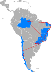
This race started in Brazil
and ended in Chile
, this made the first Amazing Race franchise to start and end in two different countries. In some versions, the race started and ended in same country.
during August and September. Narciso & Marcelo are the first openly gay couple to participate in a Brazilian reality show. While Eduardo previously participated in the Brazilian reality game show "Sem Saída", in which he won R$50,000.
The Detour for this leg was Aventurar ou Procurar ("Adventure or Search"). In Aventurar, teams rappeled down Morro da Urca. In Procurar, teams had to ride a tram to the historical district of Santa Teresa , find Laurinda Santos Lobo Cultural Center and retrieve the clue from a man outside that building. The Roadblock was to correctly identify with signs five specific vegetables patches amongst dozens in the garden.
Additional task
The Roadblock was to climb down deep into the mine and use the tools provided to dig a gold nugget
. The Detour for this leg was Atar ou Desviar ("Tie or Dodge"). In Atar, teams had to tie six kinds of knot
s following a demonstration. In Desviar, both team members had to run through a paintball
field and retrieve a flag from the other side without being hit by the shots fired.
Additional task
 Belo Horizonte
(Tancredo Neves International Airport
) to Salvador
, Bahia
 (Deputado Luís Eduardo Magalhães International Airport
)
The Roadblock was to find out what were the four food items mentioned in Ary Barroso
's song "No Tabuleiro da Baiana": vatapá
, carurú, munguzá
, and umbú. The team member had to purchase these items and present them to the baiana standing in the Praça da Sé. The Detour for this leg was Vestir ou Andar ("Dress or Walk"). In Vestir, teams had to find the Filhos de Ghandy Cultural Center and dress a mannequin in an orisha
costume, using a photograph for reference. In Andar, teams had to walk to the faraway Largo de Santo Antônio and find a capoeira
circle. In the first Fast Forward of the race, the team had to go to the Terreiro de Candomblé
Tira-Teima and both members had to shave their heads and make a hair offering to the orishas.
 Salvador (Deputado Luís Eduardo Magalhães International Airport) to Maceió
, Alagoas
 (Zumbi dos Palmares International Airport
)
The Roadblock was to retrieve a clue and ten mangrove crab
s from a tank. The Detour was Decifrar ou Quebrar ("Decipher or Break"). In Decifrar, teams had to translate a phrase from archaic Portuguese and find the monument described. In Quebrar, teams had to break clay pot lids and find a small clue baked inside one of them.
Additional tasks
The Roadblock was to assemble a small rocket
, transport it and position it in a launch pad. The Detour was Com Emoção ou Sem Emoção ("With Thrills or Without Thrills"). In Com Emoção, teams had to take a thrill ride in a dune buggy
. In Sem Emoção, teams had to conduct a dromedary camel across a dune.
Additional tasks
The Detour for this leg was Nadar ou Remar ("Swim or Row"). In Nadar, teams had to swim with a bodyboard to a raft a short distance away. In Remar, teams had to kayak
a longer distance to a marked sailboat. The Roadblock was to climb the mast of the ship and retrieve a clue.
Additional tasks
 Fortaleza (Pinto Martins International Airport
) to Manaus
, Amazonas (Eduardo Gomes International Airport
)
The Detour for this leg was Aventurar ou Sobreviver ("Adventure or Survival"). In Aventurar, teams had to complete a rope course in the trees, which included a rope bridge and ziplines. In Sobreviver, teams had to assemble an arapuca, an indigenous trap for catching small birds and mammals, with the materials provided. The Roadblock was to carry a 10 kg tambaqui
fish to the free market.
Additional tasks
 Manaus (Eduardo Gomes International Airport) to Brasília
, Distrito Federal
(Brasília International Airport
)
The Roadblock required a racer to whisper a code phrase ("The sky is blue") to people in the bus terminal, until they found a someone who would reply with another phrase ("The sea is green"). Once the racer had found one of the secret agents, they would receive their next clue. The Detour was a choice between Compor ou Compositor ("Compose or Composer"). In Compor, teams had to go to the Espaço Galleria dance club and perform a rap incorporating the names of all of the pit stops visited so far on the Race. They would only receive the clue if the crowd approved of the song. In Compositor, the teams had to go to the Espaço Cultural Renato Russo
, find a copy of the sheet music of the Brazilian national anthem
, and then listen to a pianist performing the song for them. In the second Fast Forward of the race, the team had to make their way to the Academia de Tênis and each team member had to score five points against a professional tennis
coach.
 Brasília (Brasília International Airport) to São Paulo, São Paulo
  (São Paulo-Guarulhos International Airport)
The Detour in this leg was Terra ou Água ("Dirt or Water"). In Terra, teams had to complete an off-road track driving a 4x4 vehicle. In Água, teams had to assemble a raft using bamboo and banana tree trunks, and cross a small lake. The Roadblock was for the team member to complete ten laps in a go-kart race.
Additional tasks
The Detour in this leg was Subir ou Pular ("Climb or Jump"). In Subir, each team member had to climb a medium difficulty rock wall. In Pular, each team member had to climb a 15 meter pole and jump to grab a trapeze bar while blindfolded. The Roadblock had one team member eating 2 kilograms of various meat. The Fast Forward required the team to go to Macuco Safari and climb 288 steps, rappel down 55 meters, then complete a medium difficulty rafting course.
Additional task
The Detour in this leg was Skate ou Sebo ("Skate or Second-Hand Bookstore"). In Skate, teams had to go to Drop Dead Skate Park to assemble a skateboard and perform a medium difficulty skateboarding maneuver. In Sebo, teams had to find Figaro Used Book Store and find three items among the thousands of books, records and magazines sold there. The Roadblock was to dig to find one of four barreados (boiled pieces of meat) in sixty holes.
Additional task
 Curitiba (Afonso Pena International Airport
) to Santiago
, Metropolitan Region
 , Chile
 (Comodoro Arturo Merino Benítez International Airport
)
The Detour in this leg was Limpar Botas ou Limpar Peixes ("Clean Boots or Clean Fish"). In Limpar Botas, teams had to go to the Plaza de Armas
and shine 6 pairs of shoes, charging 300 pesos
for each. In Limpar Peixes, teams had to transport ten fish in the Mercado Central, gut, skin and fillet four of them, and eat one sea urchin each. The Roadblock required the team member to get a book autographed at a nearby bar, then cart 150 books to Chile's Library of Congress.
 Santiago (Comodoro Arturo Merino Benítez International Airport) to Puerto Montt
, Los Lagos Region
 (El Tepual Airport
)
The Final Roadblock required the team member to carry crates filled with apples and crush 1000 apples using farm equipment. The Final Detour in this leg was Casa ou Concha ("House or Shell"). In Casa, teams had to haul a mobile home out of the lake with the help of two bulls. In Concha, teams had to pull four clam cages out of the water and retrieve 100 clams.
Additional tasks
Portuguese language
Portuguese is a Romance language that arose in the medieval Kingdom of Galicia, nowadays Galicia and Northern Portugal. The southern part of the Kingdom of Galicia became independent as the County of Portugal in 1095...
for The Million Dollar Race) is a Brazil
Brazil
Brazil , officially the Federative Republic of Brazil , is the largest country in South America. It is the world's fifth largest country, both by geographical area and by population with over 192 million people...
ian version of the popular franchised reality television show The Amazing Race
The Amazing Race
The Amazing Race is a reality television game show in which teams of two people, who have some form of a preexisting personal relationship, race around the world in competition with other teams...
. Hosted by Rony Curvelo, it is independently produced and aired in a purchased time slot in the Brazilian television network RedeTV!. The show premiered on October 13, 2007 and ended on January 5, 2008.
Friends Patricia & Sane are the winner of this season's race, and becaming the 2nd all-woman team to win the international version of the race.
Development and filming
The Amazing Race: A Corrida Milionária is covered 15,000 km in 33 days. The race spent most of the time in Brazil while traveled outside to ChileChile
Chile ,officially the Republic of Chile , is a country in South America occupying a long, narrow coastal strip between the Andes mountains to the east and the Pacific Ocean to the west. It borders Peru to the north, Bolivia to the northeast, Argentina to the east, and the Drake Passage in the far...
for final two legs, becoming the fewest countries to be visited in the Amazing Race franchise until The Amazing Race: China Rush
The Amazing Race: China Rush
The Amazing Race: China Rush is a Chinese reality television series. Based on the American reality TV series, The Amazing Race, it features 10 teams of two, each with a pre-existing relationship, in a race across 11 cities in China to win a world tour provided by Travelzen...
.
The season follows the rules from the American version's tenth
The Amazing Race 10
The Amazing Race 10 is the tenth installment of the reality television show The Amazing Race. The Amazing Race 10 features twelve teams of two with a pre-existing relationship in a race around the world....
and eleventh
The Amazing Race 11
The Amazing Race 11 is the 11th installment of the reality television show The Amazing Race...
seasons. With the exception of the Intersection, all clue types are retained in the Brazilian version, as well as the non-elimination penalty. This race also differs from the original format in that while teams leave the pit stops in the same order they arrived, the time differences are not always respected. The penalty for not completing a Roadblock is also shorter. Route markers are colored yellow and green, reflecting the Brazilian national colours
National colours
National colours are frequently part of a country's set of national symbols.Many states and nations have formally adopted a set of colours as their official "national colours" while others have de facto national colours that have become well-known through popular use...
, as opposed to yellow and red in most other versions. Also, contrary to other Amazing Race versions, the eliminated teams did not make an appearance at the finish line. Additionally, this is the first route whereby the race did not end in the same country as it started.
Notably, in Leg 6, while driving to the pit stop, Andréa & Luciana were held up at gunpoint by three men at a stoplight in Fortaleza
Fortaleza
Fortaleza is the state capital of Ceará, located in Northeastern Brazil. With a population close to 2.5 million , Fortaleza is the 5th largest city in Brazil. It has an area of and one of the highest demographic densities in the country...
. The team did not lose anything, but the criminals took the camera and all personal documents from the crew, and ran off as gunshots were fired by the police. Two of the men were later caught and identified, and the camera was recovered. This incident dropped the team from 4th to last place, and no time credit was given for the situation. Part of the robbery was filmed and shown in the sixth episode. In Leg 13, Perri & Maristela became the first team to quit the race in a final leg, after refusing to perform the first task.
This race started in Brazil
Brazil
Brazil , officially the Federative Republic of Brazil , is the largest country in South America. It is the world's fifth largest country, both by geographical area and by population with over 192 million people...
and ended in Chile
Chile
Chile ,officially the Republic of Chile , is a country in South America occupying a long, narrow coastal strip between the Andes mountains to the east and the Pacific Ocean to the west. It borders Peru to the north, Bolivia to the northeast, Argentina to the east, and the Drake Passage in the far...
, this made the first Amazing Race franchise to start and end in two different countries. In some versions, the race started and ended in same country.
Cast
Applications for the first season were open from January until July 2007, and filming occurred in South AmericaSouth America
South America is a continent situated in the Western Hemisphere, mostly in the Southern Hemisphere, with a relatively small portion in the Northern Hemisphere. The continent is also considered a subcontinent of the Americas. It is bordered on the west by the Pacific Ocean and on the north and east...
during August and September. Narciso & Marcelo are the first openly gay couple to participate in a Brazilian reality show. While Eduardo previously participated in the Brazilian reality game show "Sem Saída", in which he won R$50,000.
Results
The following teams participated in the Race, with their relationships at the time of filming. Placements are listed in finishing order:| Team | Relationship | Position (by leg) | Roadblocks performed |
||||||||||||
|---|---|---|---|---|---|---|---|---|---|---|---|---|---|---|---|
| 1 | 2 | 3 | 4 | 5 | 6 | 7 | 8 | 9 | 10 | 11 | 12 | 13 | |||
| Patrícia & Sane | Friends | 3rd | 4th | 2nd | 5th | 6th | 3rd | 5th | 3rd | 4th | 3rd | 1st | 2nd | 1st | Patrícia 6, Sane 6 |
| Jonatas & Rafael | Friends | 2nd | 1st | 1st | 2nd | 2nd | 4th | 2nd | 3rd | 4th | 3rd | 3rd | 2nd | Jonatas 5, Rafael 6 | |
| Perri & Maristela | Married | 1st | 3rd | 4th | 4th | 3rd | 1st | 1st | 4th | 1st | 2nd | 2nd | 1st | Perri 6, Maristela 5 | |
| Jorge & Sílvia | Married | 4th | 7th | 5th | 7th | 4th | 5th | 3rd | 5th | 2nd | 1st | Jorge 6, Sílvia 4 | |||
| Débora & Daniela | Sisters | 8th | 5th | 7th | 3rd | 7th | 4th | 2nd | 1st | , | Débora 6, Daniela 3 | ||||
| Andréa & Luciana | Sisters | 9th | 8th | 6th | 6th | 1st | 6th | Andréa 5, Luciana 2 | |||||||
| Milene & Jaqueline | Friends | 5th | 2nd | 8th | 8th | 5th | 6th | Milene 4, Jaqueline 2 | |||||||
| Mari Lice & Tâmisa | Mother & Daughter | 6th | 6th | 3rd | 2nd | Mari Lice 2, Tâmisa 2 | |||||||||
| Carlos & Eduardo | Father & Son | 7th | 9th | 1st | Carlos 2, Eduardo 1 | ||||||||||
| Narciso & Marcelo | Life Partners | 10th | Narciso 1, Marcelo 1 | ||||||||||||
| Sandro & Daniel | Cousins | Sandro 0, Daniel 1 | |||||||||||||
- A team placement indicates that the team was eliminated, and A team placement indicates that the team was disqualified under different circumtances (see below).
- An team placement indicates that the team came in last on a non-elimination leg of the race and was "Marked for Elimination"; if the team did not finish 1st on the next leg, they would receive a 30-minute penalty.
- A indicates that the team won a Fast Forward clue.
- A indicates that the team chose to use the Yield; indicates the team who received it; around the leg number indicates that the Yield for that leg was available but not used.
- In Leg 3, all teams except Carlos & Eduardo (who took the Fast Forward) completed the Roadblock together and were assessed a 30 minute penalty. Therefore, that Roadblock is not counted towards this tally.
- ^ Jorge & Sílvia and Milene & Jaqueline arrived at the Pit Stop 4th and 5th respectively, but both teams took an illegal shortcut by driving in the wrong direction on a one-way street. They left in 5th and 6th place respectively at the beginning of Leg 6 after they were assessed a 25-minute penalty.
- Andréa & Luciana initially checked in 4th, but they and their film crew were robbed at gunpoint. By the time the film crew recovered their belongings and they were allowed to continue racing, it dropped them to last place but was not eliminated.
- Andréa & Luciana initially arrived 5th, but were issued a 30 minute penalty because they were being "marked for elimination" and not arriving 1st. Patrícia & Sane checked in during their penalty time, dropping them to 6th.
- ^ Patrícia, Jonatas, Maristela and Débora were unable to complete the roadblock task at leg 10; their teams were all issued 3-hour penalties at the Roadblock site.
- Débora & Daniela had been "marked for elimination". however, since they arrived last, they were eliminated without being assessed the 30-minute penalty.
- Jorge & Sílvia arrived 3rd, but were issued a 30 minute penalty for being "marked for elimination" and not arriving 1st. During this time, Jonatas & Rafael - the only team trailing Jorge & Silvia at that point - checked in during their penalty time and were eliminated before the 30 minutes elapsed.
- Halfway through the race in the final leg, Perri & Maristela were disqualified due to quitting the task.
Prizes
- Leg 1 – A holiday to Buenos AiresBuenos AiresBuenos Aires is the capital and largest city of Argentina, and the second-largest metropolitan area in South America, after São Paulo. It is located on the western shore of the estuary of the Río de la Plata, on the southeastern coast of the South American continent...
, ArgentinaArgentinaArgentina , officially the Argentine Republic , is the second largest country in South America by land area, after Brazil. It is constituted as a federation of 23 provinces and an autonomous city, Buenos Aires...
. - Leg 2 – A holiday to SalvadorSalvador, BahiaSalvador is the largest city on the northeast coast of Brazil and the capital of the Northeastern Brazilian state of Bahia. Salvador is also known as Brazil's capital of happiness due to its easygoing population and countless popular outdoor parties, including its street carnival. The first...
, BahiaBahiaBahia is one of the 26 states of Brazil, and is located in the northeastern part of the country on the Atlantic coast. It is the fourth most populous Brazilian state after São Paulo, Minas Gerais and Rio de Janeiro, and the fifth-largest in size...
. - Leg 3 – A holiday to NatalNatal, Rio Grande do Norte-History:The northeastern tip of South America, Cabo São Roque, to the north of Natal and the closest point to Europe from Latin America, was first visited by European navigators in 1501, in the 1501–1502 Portuguese expedition led by Amerigo Vespucci, who named the spot after the saint of the day...
, Rio Grande do NorteRio Grande do NorteRio Grande do Norte is one of the states of Brazil, located in the northeastern region of the country, occupying the northeasternmost tip of the South American continent. Because of its geographic position, Rio Grande do Norte has a strategic importance. The capital and largest city is Natal...
. - Leg 4 – A holiday to Rio de JaneiroRio de JaneiroRio de Janeiro , commonly referred to simply as Rio, is the capital city of the State of Rio de Janeiro, the second largest city of Brazil, and the third largest metropolitan area and agglomeration in South America, boasting approximately 6.3 million people within the city proper, making it the 6th...
. - Leg 5 – A holiday to Angra dos ReisAngra dos ReisAngra dos Reis is a Brazilian municipality located in the southern part of Rio de Janeiro state. It is located at an altitude of 6 meters and includes in its territory 365 offshore islands. It was discovered on January 6, 1502, but has been under continual settlement since 1556. Its population...
, Rio de JaneiroRio de Janeiro (state)Rio de Janeiro is one of the 27 states of Brazil.Rio de Janeiro has the second largest economy of Brazil behind only São Paulo state.The state of Rio de Janeiro is located within the Brazilian geopolitical region classified as the Southeast...
. - Leg 6 – A holiday to Salvador, Bahia.
- Leg 7 – A holiday to CuritibaCuritibaCuritiba is the capital of the Brazilian state of Paraná. It is the largest city with the biggest economy of both Paraná and southern Brazil. The population of Curitiba numbers approximately 1.75 million people and the latest GDP figures for the city surpass US$61 billion according to...
, ParanáParaná (state)Paraná is one of the states of Brazil, located in the South of the country, bordered on the north by São Paulo state, on the east by the Atlantic Ocean, on the south by Santa Catarina state and the Misiones Province of Argentina, and on the west by Mato Grosso do Sul and the republic of Paraguay,...
. - Leg 8 – A holiday to Curitiba, Paraná.
- Leg 9 – A holiday to RecifeRecifeRecife is the fifth-largest metropolitan area in Brazil with 4,136,506 inhabitants, the largest metropolitan area of the North/Northeast Regions, the 5th-largest metropolitan influence area in Brazil, and the capital and largest city of the state of Pernambuco. The population of the city proper...
, PernambucoPernambucoPernambuco is a state of Brazil, located in the Northeast region of the country. To the north are the states of Paraíba and Ceará, to the west is Piauí, to the south are Alagoas and Bahia, and to the east is the Atlantic Ocean. There are about of beaches, some of the most beautiful in the...
. - Leg 10 – A holiday to Buenos Aires, Argentina.
- Leg 11 – A holiday to Rio de Janeiro.
- Leg 12 – A holiday to Machu PicchuMachu PicchuMachu Picchu is a pre-Columbian 15th-century Inca site located above sea level. It is situated on a mountain ridge above the Urubamba Valley in Peru, which is northwest of Cusco and through which the Urubamba River flows. Most archaeologists believe that Machu Picchu was built as an estate for...
, PeruPeruPeru , officially the Republic of Peru , is a country in western South America. It is bordered on the north by Ecuador and Colombia, on the east by Brazil, on the southeast by Bolivia, on the south by Chile, and on the west by the Pacific Ocean....
. - Leg 13 – R$500,000 BRLBrazilian realThe real is the present-day currency of Brazil. Its sign is R$ and its ISO code is BRL. It is subdivided into 100 centavos ....
.
Race summary
Leg 1 (São Paulo → Rio de Janeiro)
- São PauloSão PauloSão Paulo is the largest city in Brazil, the largest city in the southern hemisphere and South America, and the world's seventh largest city by population. The metropolis is anchor to the São Paulo metropolitan area, ranked as the second-most populous metropolitan area in the Americas and among...
, São PauloSão Paulo (state)São Paulo is a state in Brazil. It is the major industrial and economic powerhouse of the Brazilian economy. Named after Saint Paul, São Paulo has the largest population, industrial complex, and economic production in the country. It is the richest state in Brazil...
, BrazilBrazilBrazil , officially the Federative Republic of Brazil , is the largest country in South America. It is the world's fifth largest country, both by geographical area and by population with over 192 million people...
 (Ibirapuera Park) (Starting Line) São Paulo (Congonhas-São Paulo International Airport) to Rio de JaneiroRio de JaneiroRio de Janeiro , commonly referred to simply as Rio, is the capital city of the State of Rio de Janeiro, the second largest city of Brazil, and the third largest metropolitan area and agglomeration in South America, boasting approximately 6.3 million people within the city proper, making it the 6th...
, Rio de JaneiroRio de Janeiro (state)Rio de Janeiro is one of the 27 states of Brazil.Rio de Janeiro has the second largest economy of Brazil behind only São Paulo state.The state of Rio de Janeiro is located within the Brazilian geopolitical region classified as the Southeast...
 (Santos Dumont Airport)
 - Rio de Janeiro (Morro da UrcaUrcaUrca is a traditional and wealthy residential neighborhood with nearly 7,000 inhabitants in Rio de Janeiro, Brazil. Although most of the neighborhood dates from the 1920s, parts of it are much older...
) - Rio de Janeiro (CorcovadoCorcovadoCorcovado, meaning "hunchback" in Portuguese, is a mountain in central Rio de Janeiro, Brazil. The granite peak is located in the Tijuca Forest, a national park. It is sometimes confused with nearby Sugarloaf Mountain...
) - Rio de Janeiro (Praça XVPaço ImperialThe Paço Imperial , or Imperial Palace, is a historic building in the center of the city of Rio de Janeiro, Brazil. The Paço Imperial was built in the 18th century to serve as residence for the governors of colonial Brazil. From 1808, it was used as a royal residence by King John VI of Portugal as...
) - Baía da GuanabaraGuanabara BayGuanabara Bay is an oceanic bay located in southeastern Brazil in the state of Rio de Janeiro. On its western shore lies the city of Rio de Janeiro, and on its eastern shore the cities of Niterói and São Gonçalo. Four other municipalities surround the bay's shores...
(Rio de Janeiro - NiteróiNiteróiNiterói is a municipality in the state of Rio de Janeiro, southeast region of Brazil. It has an estimated population of 487,327 inhabitants and an area of ², being the sixth most populous city in the state and the highest Human Development Index. Integrates the Metropolitan Region of Rio de...
ferry) - PetrópolisPetrópolisPetrópolis , also known as The Imperial City of Brazil, is a town in the state of Rio de Janeiro, about 65 km from the city of Rio de Janeiro....
(Palácio Quitandinha ) - Petrópolis (Palácio de Cristal)
- Petrópolis (Pousada da Alcobaça)
The Detour for this leg was Aventurar ou Procurar ("Adventure or Search"). In Aventurar, teams rappeled down Morro da Urca. In Procurar, teams had to ride a tram to the historical district of Santa Teresa , find Laurinda Santos Lobo Cultural Center and retrieve the clue from a man outside that building. The Roadblock was to correctly identify with signs five specific vegetables patches amongst dozens in the garden.
Additional task
- In the ferry, Teams had to search among hundreds of passengers for someone named Shimiko, without knowing their gender, ethnicity or age. This person would hand them their next clue.
Leg 2 (Rio de Janeiro → Minas Gerais)
- Petrópolis (Shopping Plaza)
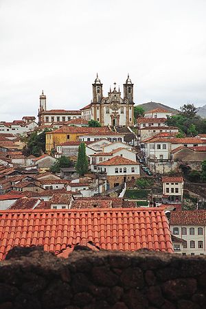
- Ouro PretoOuro Preto-History:Founded at the end of the 17th century, Ouro Preto was originally called Vila Rica, or "rich village," the focal point of the gold rush and Brazil's golden age in the 18th century under Portuguese rule....
, Minas GeraisMinas GeraisMinas Gerais is one of the 26 states of Brazil, of which it is the second most populous, the third richest, and the fourth largest in area. Minas Gerais is the Brazilian state with the largest number of Presidents of Brazil, the current one, Dilma Rousseff, being one of them. The capital is the...
 (Praça Tiradentes )
 - Ouro Preto (Museu da Inconfidência )
- Ouro Preto (Mina de Santa Rita)
- MarianaMariana, Minas GeraisMariana is the oldest city in the state of Minas Gerais, Brazil. It is a touristic city, founded on July 16, 1696, and retains the characteristics of a baroque city, with its churches, buildings and museums.-Further reading:...
(Train station) - Mariana (Mina da Passagem)
- Santa BárbaraSanta Bárbara, Minas GeraisSanta Bárbara is a Brazilian city founded in the year of 1704 and located in the state of Minas Gerais — 100 kilometers away from the capital Belo Horizonte. The main industry of Santa Bárbara is tourism. The city belongs to the mesoregion Metropolitana de Belo Horizonte and to the microregion of...
(Santuário do Caraça )
The Roadblock was to climb down deep into the mine and use the tools provided to dig a gold nugget
Gold nugget
A gold nugget is a naturally occurring piece of native gold. Watercourses often concentrate and grow the nuggets. Nuggets are recovered by placer mining, but they are also found in residual deposits where the gold-bearing veins or lodes are weathered...
. The Detour for this leg was Atar ou Desviar ("Tie or Dodge"). In Atar, teams had to tie six kinds of knot
Knot
A knot is a method of fastening or securing linear material such as rope by tying or interweaving. It may consist of a length of one or several segments of rope, string, webbing, twine, strap, or even chain interwoven such that the line can bind to itself or to some other object—the "load"...
s following a demonstration. In Desviar, both team members had to run through a paintball
Paintball
Paintball is a sport in which players compete, in teams or individually, to eliminate opponents by tagging them with capsules containing water soluble dye and gelatin shell outside propelled from a device called a paintball marker . Paintballs have a non-toxic, biodegradable, water soluble...
field and retrieve a flag from the other side without being hit by the shots fired.
Additional task
- Teams had to acquire 14 flowers in the city to lay one for each martyr of the Inconfidência MineiraInconfidência MineiraThe Inconfidência Mineira of 1789 was an unsuccessful Brazilian independence movement.It was a result of the confluence of external and internal causes...
buried in the Museum.
Leg 3 (Minas Gerais → Bahia)
Belo Horizonte
Belo Horizonte is the capital of and largest city in the state of Minas Gerais, located in the southeastern region of Brazil. It is the third largest metropolitan area in the country...
(Tancredo Neves International Airport
Tancredo Neves International Airport
Tancredo Neves International Airport , formerly called Confins International Airport, is the main airport serving Belo Horizonte, Brazil, located in the adjoining municipality of Confins...
) to Salvador
Salvador, Bahia
Salvador is the largest city on the northeast coast of Brazil and the capital of the Northeastern Brazilian state of Bahia. Salvador is also known as Brazil's capital of happiness due to its easygoing population and countless popular outdoor parties, including its street carnival. The first...
, Bahia
Bahia
Bahia is one of the 26 states of Brazil, and is located in the northeastern part of the country on the Atlantic coast. It is the fourth most populous Brazilian state after São Paulo, Minas Gerais and Rio de Janeiro, and the fifth-largest in size...
(Deputado Luís Eduardo Magalhães International AirportDeputado Luís Eduardo Magalhães International Airport
Salvador-Deputado Luís Eduardo Magalhães International Airport , formerly called Dois de Julho International Airport is the airport serving Salvador da Bahia, Brazil...
)
- Salvador (Largo do Pelourinho )
- Salvador (Terreiro de CandombléCandombléCandomblé is an African-originated or Afro-Brazilian religion, practised chiefly in Brazil by the "povo de santo" . It originated in the cities of Salvador, the capital of Bahia and Cachoeira, at the time one of the main commercial crossroads for the distribution of products and slave trade to...
Tira-Teima)
- Salvador (Terreiro de Candomblé
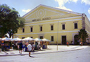
- Salvador (Mercado Modelo)
- Salvador (Farol da Barra )
- Salvador (Praça 15 de Novembro)
- Salvador (Convento do Carmo )
The Roadblock was to find out what were the four food items mentioned in Ary Barroso
Ary Barroso
Ary Barroso was a Brazilian composer, pianist, soccer commentator, and talent-show host on radio and TV...
's song "No Tabuleiro da Baiana": vatapá
Vatapá
Vatapá is a Brazilian dish made from bread, shrimp, coconut milk, finely ground peanuts and palm oil mashed into a creamy paste. This food is very popular in the North and Northeast, but it is more typical in the northeastern state of Bahia where it is commonly eaten with acarajé, although Vatapá...
, carurú, munguzá
Canjica baiana
Canjica or mugunzá is a Brazilian sweet dish, associated with the winter festivals, which in Brazil is in June ....
, and umbú. The team member had to purchase these items and present them to the baiana standing in the Praça da Sé. The Detour for this leg was Vestir ou Andar ("Dress or Walk"). In Vestir, teams had to find the Filhos de Ghandy Cultural Center and dress a mannequin in an orisha
Orisha
An Orisha is a spirit or deity that reflects one of the manifestations of Olodumare in the Yoruba spiritual or religious system....
costume, using a photograph for reference. In Andar, teams had to walk to the faraway Largo de Santo Antônio and find a capoeira
Capoeira
Capoeira is a Brazilian art form that combines elements of martial arts, sports, and music. It was created in Brazil mainly by descendants of African slaves with Brazilian native influences, probably beginning in the 16th century...
circle. In the first Fast Forward of the race, the team had to go to the Terreiro de Candomblé
Candomblé
Candomblé is an African-originated or Afro-Brazilian religion, practised chiefly in Brazil by the "povo de santo" . It originated in the cities of Salvador, the capital of Bahia and Cachoeira, at the time one of the main commercial crossroads for the distribution of products and slave trade to...
Tira-Teima and both members had to shave their heads and make a hair offering to the orishas.
Leg 4 (Bahia → Alagoas)
Maceió
Maceió is the capital and the largest city of the coastal state Alagoas, Brazil. The name "maceió" is of Indian origin, and designates the natural spontaneously courses of water which flow out of the soil...
, Alagoas
Alagoas
Alagoas is one of the 27 federative units of Brazil and is situated in the eastern part of the Northeast Region. It borders: Pernambuco ; Sergipe ; Bahia ; and the Atlantic Ocean . It occupies an area of 27,767 km², being slightly larger than Haiti...
(Zumbi dos Palmares International AirportZumbi dos Palmares International Airport
Maceió-Zumbi dos Palmares International Airport , formerly called Campo dos Palmares Airport, is the airport serving Maceió, Brazil. Since December 16, 1999 the airport is named after Zumbi dos Palmares a leader and hero who fought for the freedom of slaves.It is operated by Infraero.-History:The...
)
- Maceió (PajuçaraPajuçaraPajuçara is a beach and a neighborhood in Maceió,capital of Alagoas, in Brazil. The Estádio Severiano Gomes Filho is located in the neighborhood. This beach is approximately 2 km from downtown. It is a calm water beach thanks to the reefs, which make it safe for swimming, especially for...
) - Maceió (Monumento aos Marechais)
- Marechal DeodoroMarechal DeodoroMarechal Deodoro is a municipality and an important tourist center of Alagoas, Brazil. Its population is 42,793 and its area is 334 km².- History :...
(Recanto do Paraíso) - PiaçabuçuPiaçabuçuPiaçabuçu is a municipality located in the Brazilian state of Alagoas. It is the easternmost municipality in Alagoas, and lies near both São Francisco River and the Atlantic Ocean. Its population was 17,980 and its area is 240 km²....
(São Francisco RiverSão Francisco RiverThe São Francisco is a river in Brazil. With a length of , it is the longest river that runs entirely in Brazilian territory, and the fourth longest in South America and overall in Brazil...
estuary) - PenedoPenedoPenedo is a municipality in the state of Alagoas in Brazil. Its population was 59,968 and its area is 689 km².Founded in 1614, Penedo lies 173 km from the state capital of Maceió. Penedo has many important examples of Portuguese and Dutch colonial architectures, as well as beautiful landscapes...
(Igreja de Nossa Senhora da Corrente) - Jequiá da PraiaJequiá da PraiaJequiá da Praia is a municipality located in the coast of the Brazilian state of Alagoas. Its area is 339 km², and in 2005 it had a population of 12,926....
(Dunas de Marapé )
The Roadblock was to retrieve a clue and ten mangrove crab
Mangrove crab
Mangrove crabs are crabs that live among mangroves, and may belong to many different species and even families. They have been shown to be ecologically significant in many ways. They keep much of the energy within the forest by burying and consuming leaf litter. Along with burrowing in the ground,...
s from a tank. The Detour was Decifrar ou Quebrar ("Decipher or Break"). In Decifrar, teams had to translate a phrase from archaic Portuguese and find the monument described. In Quebrar, teams had to break clay pot lids and find a small clue baked inside one of them.
Additional tasks
- At Pajuçara beach, teams had to dig sand piles to find the next clue.
- Before the detour, teams had to search the entire church for a secret passageway used to hide slaves in the past. The clue would be hidden inside.
Leg 5 (Alagoas → Rio Grande do Norte)
- NatalNatal, Rio Grande do Norte-History:The northeastern tip of South America, Cabo São Roque, to the north of Natal and the closest point to Europe from Latin America, was first visited by European navigators in 1501, in the 1501–1502 Portuguese expedition led by Amerigo Vespucci, who named the spot after the saint of the day...
, Rio Grande do NorteRio Grande do NorteRio Grande do Norte is one of the states of Brazil, located in the northeastern region of the country, occupying the northeasternmost tip of the South American continent. Because of its geographic position, Rio Grande do Norte has a strategic importance. The capital and largest city is Natal...
 (Bus Terminal)
 - Natal (Farol de Mãe Luiza )
- Maxaranguape (Ma-Noa Park )
- ParnamirimParnamirimParnamirim is a city in Rio Grande do Norte, Brazil. It is located at around . Augusto Severo International Airport, the airport serving the city of Natal, is located there....
(Centro de Lançamento da Barreira do Inferno) - Extremoz (Genipabu dunesGenipabuGenipabu is a beach with a complex of dunes, a lagoon and an environmental protection area located in Natal, one of the most famous post-cards of the Rio Grande do Norte Brazilian state....
) - Natal (Forte dos Reis MagosForte dos Reis MagosThe Fortaleza da Barra do Rio Grande, popularly known as the Forte dos Reis Magos or Fortaleza dos Reis Magos , is a fortress located in the city of Natal in the Brazilian state of Rio Grande do Norte....
)
The Roadblock was to assemble a small rocket
Rocket
A rocket is a missile, spacecraft, aircraft or other vehicle which obtains thrust from a rocket engine. In all rockets, the exhaust is formed entirely from propellants carried within the rocket before use. Rocket engines work by action and reaction...
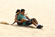
, transport it and position it in a launch pad. The Detour was Com Emoção ou Sem Emoção ("With Thrills or Without Thrills"). In Com Emoção, teams had to take a thrill ride in a dune buggy
Dune buggy
A dune buggy is a recreational vehicle with large wheels, and wide tires, designed for use on sand dunes or beaches. The design is usually a modified vehicle and engine mounted on an open chassis. The modifications usually attempt to increase the power-to-weight ratio by either lightening the...
. In Sem Emoção, teams had to conduct a dromedary camel across a dune.
Additional tasks
- At the park, teams had to swim among the coral reefCoral reefCoral reefs are underwater structures made from calcium carbonate secreted by corals. Coral reefs are colonies of tiny living animals found in marine waters that contain few nutrients. Most coral reefs are built from stony corals, which in turn consist of polyps that cluster in groups. The polyps...
s and find clues attached to three buoys. - Before the roadblock, teams had to learn the proper way to address a high-ranking military official, and ask him for the clue.
- After the Detour, teams had to sled down a steep dune.
Leg 6 (Rio Grande do Norte → Ceará)
- BeberibeBeberibeBeberibe is a municipality in the state of Ceará in Brazil. Its estimated population in 2006 is 46,439.The current mayor of Beberibe is Marcos de Queiroz Ferreira. His term ends in 2008. The municipality was created on June 5, 1892, and incorporated July 18, 1892...
, CearáCearáCeará is one of the 27 states of Brazil, located in the northeastern part of the country, on the Atlantic coast. It is currently the 8th largest Brazilian State by population and the 17th by area. It is also one of the main touristic destinations in Brazil. The state capital is the city of...
 (Praia de Uruaú)
 - Beberibe (Falésias de Morro Branco)
- Beberibe (Capela de São Pedro)
- FortalezaFortalezaFortaleza is the state capital of Ceará, located in Northeastern Brazil. With a population close to 2.5 million , Fortaleza is the 5th largest city in Brazil. It has an area of and one of the highest demographic densities in the country...
(Praia de Mucuripe) - Fortaleza (Pirata Bar, Pier Inglês )
- Fortaleza (Centro Dragão do Mar de Arte e CulturaDragão do Mar Center of Art and CultureThe Dragão do Mar Center of Art And Culture is a government funded cultural center in Fortaleza, Ceará in Brazil. The center contains facilities for exhibitions, a theatre, a library, a cinema and a planetarium. The center was inaugurated in April 1999, and has an overall area of 33 000 m²...
) - Fortaleza (Praça do Ferreira )
- Fortaleza (Mercado Encetur)
- AquirazAquirazAquiraz is the thirteenth largest city in the state of Ceará, located on the nation's northeast coast, a popular vacation destination.- History :...
(Wind PowerWind powerWind power is the conversion of wind energy into a useful form of energy, such as using wind turbines to make electricity, windmills for mechanical power, windpumps for water pumping or drainage, or sails to propel ships....
Plant)
The Detour for this leg was Nadar ou Remar ("Swim or Row"). In Nadar, teams had to swim with a bodyboard to a raft a short distance away. In Remar, teams had to kayak
Kayaking
Kayaking is the use of a kayak for moving across water. Kayaking and canoeing are also known as paddling. Kayaking is distinguished from canoeing by the sitting position of the paddler and the number of blades on the paddle...
a longer distance to a marked sailboat. The Roadblock was to climb the mast of the ship and retrieve a clue.
Additional tasks
- On their dune buggy ride to Morro Branco, teams had to collect three flags. If they missed any, they had to go back and find them.
- At the Falésias de Morro Branco, teams had to search among the labyrinth of sand cliffs for their next clue.
Leg 7 (Ceará → Amazonas)
Pinto Martins International Airport
Pinto Martins International Airport is the airport serving Fortaleza, Brazil. It is named after Euclides Pinto Martins a Ceará-born aviator, who in 1922 was one of the pioneers of the air-link between New York and Rio de Janeiro....
) to Manaus
Manaus
Manaus is a city in Brazil, the capital of the state of Amazonas. It is situated at the confluence of the Negro and Solimões rivers. It is the most populous city of Amazonas, according to the statistics of Brazilian Institute of Geography and Statistics, and is a popular ecotourist destination....
, Amazonas
(Eduardo Gomes International AirportEduardo Gomes International Airport
Brigadeiro Eduardo Gomes-Manaus International Airport , is the main airport serving Manaus, Brazil. It is named after the Brazilian politician and military figure Air Marshall Eduardo Gomes ....
)
- Presidente FigueiredoPresidente FigueiredoPresidente Figueiredo is a municipality located in the Brazilian state of Amazonas. Its population was 23,636 and its area is 25,422 km²....
(Fazenda Marupiara ) - Manaus (Teatro Amazonas)
- Manaus (Porto Ceasa)
- Manaus (Meeting of the WatersMeeting of WatersThe Meeting of Waters is the confluence between the Rio Negro, a river with dark water, and the sandy-coloured Amazon River or Rio Solimões, as it is known the upper section of the Amazon in Brazil. For 6 km the river's waters run side by side without mixing...
) - Manaus (Porto de ManausPort of ManausThe Port of Manaus is a riverport located on the Rio Negro in Manaus, Amazonas, Brazil. The Port of Manaus is an important commercial center for ocean-going vessels traveling the Amazon. In fact, it is the main transport hub for the entire upper Amazon Basin. It imports beef from the hinterlands...
) - Novo AirãoNovo AirãoNovo Airão is a municipality located in the Brazilian state of Amazonas. Its population was 15,915 and its area is 37,771 km².- Sights and attractions :...
(Restaurante Boto-Cor-de-Rosa) - IrandubaIrandubaIranduba is a municipality located in the Brazilian state of Amazonas. Its population was 40,436 and its area is 2,215 km², making it one of the smallest municipalities in terms of size. It is located directly south of Manaus....
(Pousada Amazônia archway) - Iranduba (Sateré-MawéSatere-MaweThe Satere-Mawe is an indigenous tribe located in the Brazilian Amazon, with an estimated population of about 7,000. The Satere are most famous for the cultivating and extracting process of guarana....
tribe)
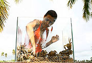
The Detour for this leg was Aventurar ou Sobreviver ("Adventure or Survival"). In Aventurar, teams had to complete a rope course in the trees, which included a rope bridge and ziplines. In Sobreviver, teams had to assemble an arapuca, an indigenous trap for catching small birds and mammals, with the materials provided. The Roadblock was to carry a 10 kg tambaqui
Tambaqui
The tambaqui is a freshwater fish of the subfamily Serrasalminae, family Characidae. It is also known by the names pacu, black pacu, black-finned pacu, giant pacu, cachama and gamitana....
fish to the free market.
Additional tasks
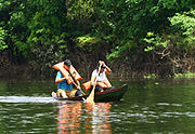
- At the restaurant, teams had to feed six fish to pink river dolphins to receive their next clue.
- At the archway, teams had to row across the Rio Ariaú in a canoe.
Leg 8 (Amazonas → Distrito Federal)
Brasília
Brasília is the capital city of Brazil. The name is commonly spelled Brasilia in English. The city and its District are located in the Central-West region of the country, along a plateau known as Planalto Central. It has a population of about 2,557,000 as of the 2008 IBGE estimate, making it the...
, Distrito Federal
Brazilian Federal District
The Federal District is set apart for Brasília, the capital of Brazil. Located in a region called Planalto Central, or Central Plateau, the Federal District is divided in 29 administrative regions. Brasilia - place where the three branches of the Federal Government are located - is the main...
(Brasília International Airport
Brasília International Airport
Brasília-Presidente Juscelino Kubitschek International Airport is the airport serving Brasília, Brazil. Since April 22, 1999 the airport is named after Juscelino Kubitschek de Oliveira , the 21st President of Brazil....
)
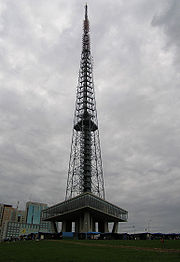
- Brasília (Torre de TVBrasilia TV TowerThe Brasília TV Tower was completed in 1967 at a height of 218 meters, but in 1987 another 6 meter was added by the TV channel Bandeirantes. Now the TV Tower is 224 m height....
)- Brasília (Academia de Tênis )
- Brasília (Memorial Juscelino Kubitschek )
- Brasília (Bus Terminal)
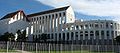
- Brasília (Gardens outside the Congresso NacionalNational Congress of BrazilThe National Congress of Brazil is the legislative body of Brazil's federal government.Unlike regional legislative bodies – Legislative Assemblies and City Councils -, the Congress is bicameral, composed of the Federal Senate and the Chamber of Deputies .The Senate represents the 26 states and...
) - PlanaltinaPlanaltinaPlanaltina is one of the administrative districts of the Federal District of Brazil, with an area of 1,534 kmª and a population of 147,114 in 2000, of whom 134,663 were classified as urban and 12,451 as rural...
(Vale do AmanhecerVale do AmanhecerVale do Amanhecer is a religious community located in the Federal District of Brazil six kilometres from the satellite city of Planaltina and 50 kilometres from Brasília....
community)
The Roadblock required a racer to whisper a code phrase ("The sky is blue") to people in the bus terminal, until they found a someone who would reply with another phrase ("The sea is green"). Once the racer had found one of the secret agents, they would receive their next clue. The Detour was a choice between Compor ou Compositor ("Compose or Composer"). In Compor, teams had to go to the Espaço Galleria dance club and perform a rap incorporating the names of all of the pit stops visited so far on the Race. They would only receive the clue if the crowd approved of the song. In Compositor, the teams had to go to the Espaço Cultural Renato Russo
Renato Russo
Renato Russo was a Brazilian singer and songwriter. His first band was a punk rock band called "Aborto Elétrico" . The band then broke up and split in two different ones: "Capital Inicial" and "Legião Urbana"...
, find a copy of the sheet music of the Brazilian national anthem
Brazilian national anthem
The Brazilian national anthem was composed by Francisco Manuel da Silva in 1831 and had been given at least two sets of unofficial lyrics before a 1922 decree by President Epitácio Pessoa gave the anthem its definitive, official lyrics, by Osório Duque-Estrada, after several changes were made to...
, and then listen to a pianist performing the song for them. In the second Fast Forward of the race, the team had to make their way to the Academia de Tênis and each team member had to score five points against a professional tennis
Tennis
Tennis is a sport usually played between two players or between two teams of two players each . Each player uses a racket that is strung to strike a hollow rubber ball covered with felt over a net into the opponent's court. Tennis is an Olympic sport and is played at all levels of society at all...
coach.
Leg 9 (Distrito Federal → São Paulo)
(São Paulo-Guarulhos International Airport)
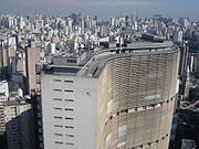
- São Paulo (Edifício CopanEdifício CopanThe Edifício Copan is a 140-metre, 38-story residential building in São Paulo, Brazil. Construction began in 1957 and, following some interruptions, was completed in 1966...
rooftop) - São Paulo (Viaduto do Chá )
- BarueriBarueriBarueri is a Brazilian city in the state of São Paulo located in the northwestern part of the Greater São Paulo metropolitan area. The population in 2006 is estimated to be 265,549, the population density is 4,149.2 per km² and the area of 64 km²....
(RedeTV! studios) - ItuItuItu is an old and historic municipality in the state of São Paulo in Brazil. The population in 2009 was 157,384 and the area is 641.68 km². The elevation is 583 m. This place name comes from the Tupi language, meaning big waterfall. Itu is linked with the highway numbered the SP-75 and are flowed...
(Base 84 ) - Itu (Kartódromo Schincariol)
- IndaiatubaIndaiatubaIndaiatuba is a municipality in the state of São Paulo in Brazil. The population in 2006 is 181,124 and has an area is 311.34 km². The elevation is 624 m. The city's name comes from the Tupi language. One of the most important city of the area....
(Colônia Helvétia )
The Detour in this leg was Terra ou Água ("Dirt or Water"). In Terra, teams had to complete an off-road track driving a 4x4 vehicle. In Água, teams had to assemble a raft using bamboo and banana tree trunks, and cross a small lake. The Roadblock was for the team member to complete ten laps in a go-kart race.
Additional tasks
- At the RedeTV! studios, the first team to arrive had to retrieve their clue during a live broadcast of a morning talk show. The remaining teams received their clues outside the set, off camera.
- After the detour, teams had to pitch tents to receive their next clue.
Leg 10 (São Paulo → Paraná)
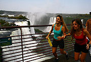
- Foz do IguaçuFoz do IguaçuFoz do Iguaçu is the 7th largest city in Paraná state, Brazil, with a population of 255,900 inhabitants. It is located approximately 650 km west of Curitiba, Parana's capital city, being the westernmost city in that state...
, ParanáParaná (state)Paraná is one of the states of Brazil, located in the South of the country, bordered on the north by São Paulo state, on the east by the Atlantic Ocean, on the south by Santa Catarina state and the Misiones Province of Argentina, and on the west by Mato Grosso do Sul and the republic of Paraguay,...
 (Bus Terminal)
- Foz do Iguaçu (Macuco Safari)
- Foz do Iguaçu (Parque Nacional do Iguaçu – Poço Preto trail)
- Foz do Iguaçu (Parque Nacional do Iguaçu – Cânion Iguaçu)
- Foz do Iguaçu (Parque Nacional do Iguaçu – Mirante Garganta do Diabo )
- Foz do Iguaçu (Paudimar Youth Hostel)
- Foz do Iguaçu (Triple Frontier landmarkTriple FrontierThe Triple Frontier is a tri-border area along the junction of Paraguay, Argentina, and Brazil, where the Iguazú and Paraná rivers converge. Near the convergence are the cities of Ciudad del Este, Alto Paraná; Puerto Iguazú, Misiones and Foz do Iguaçu, Paraná...
)
The Detour in this leg was Subir ou Pular ("Climb or Jump"). In Subir, each team member had to climb a medium difficulty rock wall. In Pular, each team member had to climb a 15 meter pole and jump to grab a trapeze bar while blindfolded. The Roadblock had one team member eating 2 kilograms of various meat. The Fast Forward required the team to go to Macuco Safari and climb 288 steps, rappel down 55 meters, then complete a medium difficulty rafting course.
Additional task
- At the Poço Preto trail, teams were given three bird names at random, and had to find and identify them amongst pictures posted in trees throughout the trail.
Leg 11 (Paraná)
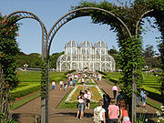
- CuritibaCuritibaCuritiba is the capital of the Brazilian state of Paraná. It is the largest city with the biggest economy of both Paraná and southern Brazil. The population of Curitiba numbers approximately 1.75 million people and the latest GDP figures for the city surpass US$61 billion according to...
(Jardim BotânicoBotanical Garden of CuritibaThe Jardim Botânico de Curitiba, in Portuguese, or the Botanical Garden of Curitiba, in English, is also known as the "Jardim Botânico Fanchette Rischbieter". This is a park located in the city of Curitiba, the capital of the state of Paraná, and the biggest city in southern Brazil...
) - Curitiba (Opera de ArameWire Opera HouseThe Ópera de Arame, in Portuguese, or the Wire Opera House, in English, is a theatre house located in the city of Curitiba, the capital of the state of Paraná, in southern Brazil. It is one of the major tourist attractions of the city...
) - Curitiba (Parque Tingui )
- MorretesMorretesMorretes is a small historic city on the coast of the Brazilian state of Paraná. Its population is of around 15,000 people.Morretes can be reached either by road or by taking the historical Serra Verde Express train from Curitiba, on one of the few railways in Brazil....
(Railway Station) - Morretes (Santuário Nhundiaquara )
- Morretes (Metal bridge over the Nhundiaquara River)
- ParanaguáParanaguáParanaguá is a city in the state of Paraná in Brazil. Founded in 1648, it is Paraná's oldest city.It is known for its excellent port facilities, being the sea port for Curitiba, the capital of Paraná....
(Porto de Paranaguá ) - Ilha do Mel (Praia Encantada)
The Detour in this leg was Skate ou Sebo ("Skate or Second-Hand Bookstore"). In Skate, teams had to go to Drop Dead Skate Park to assemble a skateboard and perform a medium difficulty skateboarding maneuver. In Sebo, teams had to find Figaro Used Book Store and find three items among the thousands of books, records and magazines sold there. The Roadblock was to dig to find one of four barreados (boiled pieces of meat) in sixty holes.
Additional task
- Before the detour, teams had to learn and participate in a traditional UkrainianUkraineUkraine is a country in Eastern Europe. It has an area of 603,628 km², making it the second largest contiguous country on the European continent, after Russia...
folk dance.
Leg 12 (Paraná → Chile)
Afonso Pena International Airport
Afonso Pena International Airport is the main airport serving Curitiba, Brazil, located in the adjoining municipality of São José dos Pinhais. It is named after Afonso Augusto Moreira Pena , the 6th President of Brazil....
) to Santiago
Santiago, Chile
Santiago , also known as Santiago de Chile, is the capital and largest city of Chile, and the center of its largest conurbation . It is located in the country's central valley, at an elevation of above mean sea level...
, Metropolitan Region
Santiago Metropolitan Region
Santiago Metropolitan Region or simply Metropolitan Region is one of Chile's 15 first order administrative divisions. It is the country's only landlocked administrative region and contains the nation's capital, Santiago...
Chile
Chile ,officially the Republic of Chile , is a country in South America occupying a long, narrow coastal strip between the Andes mountains to the east and the Pacific Ocean to the west. It borders Peru to the north, Bolivia to the northeast, Argentina to the east, and the Drake Passage in the far...
(Comodoro Arturo Merino Benítez International AirportComodoro Arturo Merino Benítez International Airport
Comodoro Arturo Merino Benítez International Airport , also known as Pudahuel Airport and Santiago International Airport, located in Pudahuel, north-west of downtown Santiago, is Chile's largest aviation facility and the busiest international air passenger gateway to the country...
)
- Santiago (Chile.com office)
- Santiago (Mall del Centro)
- Santiago (Cerro San CristóbalCerro San CristóbalCerro San Cristóbal is a hill in northern Santiago, Chile. It rises 880 m AMSL and about 300 m above the rest of Santiago; the peak is the second highest point in the city, after Cerro Renca. Its original indigenous name was Tupahue...
-Virgin Mary statue) - Santiago (Home of Pablo NerudaPablo NerudaPablo Neruda was the pen name and, later, legal name of the Chilean poet, diplomat and politician Neftalí Ricardo Reyes Basoalto. He chose his pen name after Czech poet Jan Neruda....
) - Valle NevadoValle NevadoValle Nevado is a popular ski resort located 46 kilometers east of Santiago, Chile.Valle Nevado is one of South America's most modern ski resorts...
The Detour in this leg was Limpar Botas ou Limpar Peixes ("Clean Boots or Clean Fish"). In Limpar Botas, teams had to go to the Plaza de Armas
Plaza de Armas
The Plaza de Armas is the name for the main square in many Latin American cities. In Mexico this space is known as El Zócalo, and in Central America as Parque Central...
and shine 6 pairs of shoes, charging 300 pesos
Chilean peso
The peso is the currency of Chile. The current peso has circulated since 1975, with a previous version circulating between 1817 and 1960. The symbol used locally for it is $. The ISO 4217 code for the present peso is CLP. It is subdivided into 100 centavos, although no centavo denominated coins...
for each. In Limpar Peixes, teams had to transport ten fish in the Mercado Central, gut, skin and fillet four of them, and eat one sea urchin each. The Roadblock required the team member to get a book autographed at a nearby bar, then cart 150 books to Chile's Library of Congress.
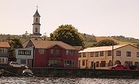
Leg 13 (Chile, Metropolitan Region → Chile, Los Lagos Region)
Puerto Montt
Puerto Montt is a port city and commune in southern Chile, located at the northern end of the Reloncaví Sound in the Llanquihue Province, Los Lagos Region. The commune spans an area of and had a population of 175,938 in 2002. It is located 1,055 km to the south of the capital, Santiago...
, Los Lagos Region
Los Lagos Region
Los Lagos Region is one of Chile's 15 regions, which are first order administrative divisions, and comprises four provinces: Chiloé, Llanquihue, Osorno and Palena. The region contains the country's second largest island, Chiloé, and the second largest lake, Llanquihue.Its capital is Puerto Montt;...
El Tepual Airport
El Tepual International Airport is a commercial and private aviation facility which serves the touristic area of Puerto Montt, Chile.-History:...
)
- Puerto Montt (Angelmó Market)
- AncudAncudAncud is a city in southern Chile located in the northernmost part of the island and province of Chiloé, in Los Lagos Region .-Geography:...
, Chiloé IslandChiloé IslandChiloé Island , also known as Greater Island of Chiloé , is the largest island of the Chiloé Archipelago off the coast of Chile, in the Pacific Ocean...
(Cabañas Gaviotas) - DalcahueDalcahueDalcahue is a port town and a commune on Chiloé Island, Los Lagos Region, Chile.-Demographics:According to the 2002 census by the National Statistics Institute, the Dalcachue commune spans an area of and had 10,693 inhabitants; of these, 4,933 lived in urban areas and 5,760 in rural areas. At...
, Chiloé Island (farm near San Juan) - Dalcahue (San Juan fishing village)
- Dalcahue (San Juan central plaza)
- Dalcahue (San Juan overlook)
The Final Roadblock required the team member to carry crates filled with apples and crush 1000 apples using farm equipment. The Final Detour in this leg was Casa ou Concha ("House or Shell"). In Casa, teams had to haul a mobile home out of the lake with the help of two bulls. In Concha, teams had to pull four clam cages out of the water and retrieve 100 clams.
Additional tasks
- At the market, teams had to each eat 2 kg of smoked clams. Failure to complete this task would be disqualified. After that, Teams then had to carry a small wooden house from the market to Calle Las Queimas to receive their next clue.
- At the fishing village, teams had to paint a boat frame and carry a canoe to their next destination, central plaza.