

Thai highway network
Encyclopedia

Department of Rural Roads
Department of Rural Roads is a department of the Thai government, under the Ministry of Transport...
(DORR, , Krom Thang Luang Chonnabot), under the oversight of the Transportation ministry
Transportation ministry
A Ministry of Transport is a ministry or other government agency charged with transport. It may be headed by a Minister for Transport.Specific duties may be overseeing transportation safety, developing government transportation policy, organizing public transport, and the maintenance and...
of Thailand
Thailand
Thailand , officially the Kingdom of Thailand , formerly known as Siam , is a country located at the centre of the Indochina peninsula and Southeast Asia. It is bordered to the north by Burma and Laos, to the east by Laos and Cambodia, to the south by the Gulf of Thailand and Malaysia, and to the...
. Public highway
Highway
A highway is any public road. In American English, the term is common and almost always designates major roads. In British English, the term designates any road open to the public. Any interconnected set of highways can be variously referred to as a "highway system", a "highway network", or a...
s are also called public road
Road
A road is a thoroughfare, route, or way on land between two places, which typically has been paved or otherwise improved to allow travel by some conveyance, including a horse, cart, or motor vehicle. Roads consist of one, or sometimes two, roadways each with one or more lanes and also any...
s , especially when part of urban streets. The network spans over 70,000 kilometers across all regions of Thailand.
Most are single carriageway
Single carriageway
A single carriageway is a road with 1, 2 or more lanes arranged within a single carriageway with no central reservation to separate opposing flows of traffic. Two-lane road or two-lane highway are single carriageway with one lane for each direction...
s. Dual carriageway
Dual carriageway
A dual carriageway is a class of highway with two carriageways for traffic travelling in opposite directions separated by a central reservation...
s have frequent u-turn lanes and intersections slowing down traffic. Coupled with the increase in the number of vehicles and the demand for a limited-access motorway, the Thai Government issued a Cabinet resolution in 1997 detailing the motorway construction master plan. Some upgraded sections of highway are being turned into a "motorway", while other motorways are not being built from highway sections. See Thai motorway network
Thai motorway network
The Thai motorway network is an intercity motorway network that currently spans 145 kilometers. It is to be greatly extended to 4154.7 kilometers according to the master plan....
.
Types of highways
The 1992 Highway Act , revised as the 2006 Highway Act , defines the following five highway types:A special highway or motorway is a high capacity highway designed for high speed traffic, for which the Department of Highways carries out construction, expansion, upkeep and repairs, and is registered as such. Motorway entrances and exits have controlled access, and controlled by the DOH. Registration of motorways is overseen by the Director General of the DOH.
A national highway is a primary highway, part of the network connecting regions, provinces, districts, and other important destinations, for which the DOH carries out construction, expansion, upkeep and repairs. Registration of national highways is overseen by the Director General of the DOH.
A rural highway or rural road is a highway for which the Department of Rural Roads carries out construction, expansion, upkeep and repairs. Registration of rural highways is overseen by the Director General of the DORR.
A local highway or local route is a highway for which the local administrative organization carries out construction, expansion, upkeep and repairs. Registration of rural highways is overseen by the provincial governor.
A concession highway is a highway for which a legal government concession has been granted. Registration of concession highways is overseen by the Director General of the DOH.
Highway numbering
The first digit of a highway number indicates the region of Thailand it primarily services:- Highways beginning with 1 are in northern ThailandNorthern ThailandThailand's northern region is geographically characterised by multiple mountain ranges which continue from the Shan Hills in bordering Myanmar and Laos, and the river valleys which cut through them...
. - Highways beginning with 2 are in northeastern ThailandIsanIsan is the northeastern region of Thailand. It is located on the Khorat Plateau, bordered by the Mekong River to the north and east, by Cambodia to the southeast and the Prachinburi mountains south of Nakhon Ratchasima...
. - Highways beginning with 3 are in centralCentral ThailandCentral Thailand is a region of Thailand, covering the broad alluvial plain of the Chao Phraya River. It is separated from North-East Thailand by the Phetchabun mountain range, and another mountain range separates it from Myanmar to the west. In the north it gently changes into the more hilly...
and easternEastern ThailandEastern Thailand is a region of Thailand bordering Cambodia on the east and Central Thailand on the west.-Geography:Eastern Thailand lies between the Sankamphaeng Range, which forms the border of the Northeastern plateau to the north and the Gulf of Thailand to the south...
, as well as the upper southSouthern ThailandSouthern Thailand is a distinct region of Thailand, connected with the Central region by the narrow Kra Isthmus.-Geography:Southern Thailand is located on the Malay Peninsula, with an area around 70,713 km², bounded to the north by Kra Isthmus as the narrowest part of the peninsula. The...
. - Highways beginning with 4 are in southern ThailandSouthern ThailandSouthern Thailand is a distinct region of Thailand, connected with the Central region by the narrow Kra Isthmus.-Geography:Southern Thailand is located on the Malay Peninsula, with an area around 70,713 km², bounded to the north by Kra Isthmus as the narrowest part of the peninsula. The...
.
The number of digits in a highway number indicates the classification of the highway.
A single digit number indicates a principal highway connecting between regions. There are four of these:
- Route 1 (Phahonyothin Road), Northern ThailandNorthern ThailandThailand's northern region is geographically characterised by multiple mountain ranges which continue from the Shan Hills in bordering Myanmar and Laos, and the river valleys which cut through them...
- Route 2 (Mittraphap Road), Northeastern Thailand
- Route 3 (Sukhumvit RoadSukhumvit RoadSukhumvit Road , or Thailand Route 3 , is a major road in Thailand, and a major surface road of Bangkok and other cities it winds through. It follows a coastal route from Bangkok to Trat and is just over in length....
), Eastern ThailandEastern ThailandEastern Thailand is a region of Thailand bordering Cambodia on the east and Central Thailand on the west.-Geography:Eastern Thailand lies between the Sankamphaeng Range, which forms the border of the Northeastern plateau to the north and the Gulf of Thailand to the south... - Route 4 (Phetkasem Road), Southern ThailandSouthern ThailandSouthern Thailand is a distinct region of Thailand, connected with the Central region by the narrow Kra Isthmus.-Geography:Southern Thailand is located on the Malay Peninsula, with an area around 70,713 km², bounded to the north by Kra Isthmus as the narrowest part of the peninsula. The...
A two-digit number indicates a principal highway within a region. For example, Route 22 is a main highway in the northeast that runs between Udon Thani
Udon Thani Province
Udon Thani is one of the north-eastern provinces of Thailand. Neighboring provinces are Nong Khai, Sakon Nakhon, Kalasin, Khon Kaen, Nong Bua Lamphu and Loei.- Geography :...
and Nakhon Phanom
Nakhon Phanom Province
Nakhon Phanom is one of the north-eastern provinces of Thailand. Neighboring provinces are Mukdahan, Sakon Nakhon and Bueng Kan. To the north-east it borders Khammouan of Laos.-Geography:...
.
A three-digit number indicates a secondary highway. For example, Route 202 is a secondary highway in the northeast that runs between Chaiyaphum and Khemarat; Route 314 is a secondary highway in the central region, between Bang Pakong and Cha Choeng Sao.
A four-digit number indicates an intra-province highway connecting the provincial capital to the districts, or to important sites in the province. For example, Route 1001 is a northern highway that runs between Route 11 Intersection and Amphoe Phrao; Route 4006 is a southern highway that runs between Route 4 Intersection (Ratchakrut) and Lang Suan.
Northern ThailandNorthern ThailandThailand's northern region is geographically characterised by multiple mountain ranges which continue from the Shan Hills in bordering Myanmar and Laos, and the river valleys which cut through them...
- Route 1 (Phahon Yothin Road) : BangkokBangkokBangkok is the capital and largest urban area city in Thailand. It is known in Thai as Krung Thep Maha Nakhon or simply Krung Thep , meaning "city of angels." The full name of Bangkok is Krung Thep Mahanakhon Amon Rattanakosin Mahintharayutthaya Mahadilok Phop Noppharat Ratchathani Burirom...
– Chiang RaiChiang Rai-Demographics:Official Population count: According to the Thailand National Statistical Office, as of September 2010, Chiang Rai municipal district has a population of 199,699...
and continuing to Tachilek, Burma as -
 Route 11 : In BuriAmphoe In BuriIn Buri is the northernmost district of Singburi Province in central Thailand.-History:In Buri is an ancient city, one of the major Mueang or city states. It was built in the reign of King Ramesuan in 1369. In the Ayutthaya era, the governor of In Buri always was a royal family member because In...
, Sing BuriSing Buri ProvinceSing Buri is one of the central provinces of Thailand. Neighboring provinces are Nakhon Sawan, Lop Buri, Ang Thong, Suphan Buri and Chai Nat....
– Chiang MaiChiang MaiChiang Mai sometimes written as "Chiengmai" or "Chiangmai", is the largest and most culturally significant city in northern Thailand. It is the capital of Chiang Mai Province , a former capital of the Kingdom of Lanna and was the tributary Kingdom of Chiang Mai from 1774 until 1939. It is... -
 Route 12 : TakTak ProvinceTak is one of the northern provinces of Thailand. Neighboring provinces are Mae Hong Son, Chiang Mai, Lamphun, Lampang, Sukhothai, Kamphaeng Phet, Nakhon Sawan, Uthai Thani and Kanchanaburi...
– Khon KaenKhon KaenKhon Kaen is a city in Isan, Thailand. It is also the capital of Khon Kaen province and the Khon Kaen district.-Geography and demography:Khon Kaen is located in the Khorat Plateau, in the central-northwestern area of Isaan...
as and continues into northeastern Thailand superseding Route 2042 : SomdetAmphoe SomdetSomdet is a district in the northeastern part of Kalasin Province, northeastern Thailand.-Geography:Neighboring districts are Huai Phueng, Na Mon, Mueang Kalasin, Sahatsakhan, Kham Muang of Kalasin Province and Phu Phan of Sakon Nakhon Province.-History:The minor district Somdet was created on...
, KalasinKalasin ProvinceKalasin is one of the provinces of Thailand, located in the North-East of Thailand. Neighboring provinces are Sakon Nakhon, Mukdahan, Roi Et, Maha Sarakham, Khon Kaen and Udon Thani.-Geography:...
-MukdahanMukdahan ProvinceMukdahan is one of the north-eastern provinces of Thailand. Neighboring provinces are Amnat Charoen, Yasothon, Roi Et, Kalasin, Sakon Nakhon and Nakhon Phanom. To the east it borders the Mekong River, across which lies Savannakhet Province of Laos.-Geography:The province is located in the... -
 Route 101 : Kamphaeng PhetKamphaeng PhetKamphaeng Phet is a town in northern Thailand, capital of the Kamphaeng Phet Province. It covers the complete tambon Nai Mueang of the Mueang Kamphaeng Phet district. As of 2005 it has a population of 30,114.-External links:...
– NanNan, ThailandNan is a town in Northern Thailand. It is located some 668 km north of Bangkok. Its population exceeds 24.000. It is situated in the centre of the province which bears its name, and of which it is the administrative capital. It covers the whole tambon Nai Wiang of Mueang Nan district, an area... -
 Route 102 : Si SatchanalaiAmphoe Si SatchanalaiSi Satchanalai is the northernmost district of Sukhothai Province, northern Thailand. Si may also be transliterated as Sri.-Geography:...
, SukhothaiSukhothai ProvinceSukhothai is one of the northern provinces of Thailand. Neighboring provinces are Phrae, Uttaradit, Phitsanulok, Kamphaeng Phet, Tak, and Lampang...
– UttaraditUttaraditUttaradit is a town in Thailand, capital of the Uttaradit province. The town covers the whole tambon Tha It of Mueang Uttaradit district... -
 Route 103 : Rong KwangAmphoe Rong KwangRong Kwang is a district in the northeastern part of Phrae Province, northern Thailand.-Geography:Neighboring districts are Mueang Phrae, Nong Muang Khai, Song of Phrae Province, Wiang Sa, Na Noi and Na Muen of Nan Province.-History:The minor district Rong Kwang was upgraded to a full district in...
, PhraePhrae ProvincePhrae is one of the northern provinces of Thailand. Neighboring provinces are Phayao, Nan, Uttaradit, Sukhothai and Lampang.-Geography:Phrae is located in the valley of the river Yom.-History:...
– NgaoAmphoe Ngao-Geography:Neighboring districts are : Mae Mo, Chae Hom and Wang Nuea of Lampang Province, Mueang Phayao and Dok Khamtai of Phayao Province, and Song of Phrae Province.-History:...
, LampangLampang ProvinceLampang is one of the northern provinces of Thailand. Neighboring provinces are Chiang Rai, Phayao, Phrae, Sukhothai, Tak, Lamphun and Chiang Mai. The old name of Lampang is Khelang Nakhon.-Geography:... -
 Route 104 : Kosamphi NakhonAmphoe Kosamphi NakhonKosamphi Nakhon is a district in the northwestern part of Kamphaeng Phet Province, northern Thailand.-History:In Sukhothai Kingdom era, Mueang Kosamphi was a satellite city of the frontier city Mueang Chakangrao , at same level as Mueang Nakhon Chum, Trai Trueng, Phan and Phangkha...
, Kamphaeng PhetKamphaeng Phet ProvinceKamphaeng Phet is one of the provinces of Thailand, located in the north of the country. Neighboring provinces are Sukhothai, Phitsanulok, Phichit, Nakhon Sawan and Tak.- Etymology :...
– TakTak (town)Tak is a town in northwest of Thailand, capital of the Tak Province and the Tak district. As of 2005 the town has a population of 19,900 and an area of 7.27 km². It covers the tambon Rahaeng, Nong Luang, Chiang Ngoen and Hua Diat, and is located on the Ping River.-External links:*... -
 Route 105 : TakTak (town)Tak is a town in northwest of Thailand, capital of the Tak Province and the Tak district. As of 2005 the town has a population of 19,900 and an area of 7.27 km². It covers the tambon Rahaeng, Nong Luang, Chiang Ngoen and Hua Diat, and is located on the Ping River.-External links:*...
– Mae Sariang, Mae Hong SonMae Hong Son ProvinceMost of the areas of Mae Hong Son Province are complex mountain ranges and likely still pristine virgin forest. Of the approximately 6,976,650 rai of national forest reserves, 88.02% is thought to be pristine virgin forest... -
 Route 106 : ThoenAmphoe ThoenThoen is a district in the southern part of Lampang Province, northern Thailand.-Geography:Neighboring districts are : Soem Ngam, Sop Prap of Lampang Province, Wang Chin of Phrae Province, Si Satchanalai, Thung Saliam, Ban Dan Lan Hoi of Sukhothai Province, Ban Tak, Sam Ngao of Tak Province, Mae...
, LampangLampang ProvinceLampang is one of the northern provinces of Thailand. Neighboring provinces are Chiang Rai, Phayao, Phrae, Sukhothai, Tak, Lamphun and Chiang Mai. The old name of Lampang is Khelang Nakhon.-Geography:...
– Chiang MaiChiang MaiChiang Mai sometimes written as "Chiengmai" or "Chiangmai", is the largest and most culturally significant city in northern Thailand. It is the capital of Chiang Mai Province , a former capital of the Kingdom of Lanna and was the tributary Kingdom of Chiang Mai from 1774 until 1939. It is... -
 Route 107 : Chiang MaiChiang MaiChiang Mai sometimes written as "Chiengmai" or "Chiangmai", is the largest and most culturally significant city in northern Thailand. It is the capital of Chiang Mai Province , a former capital of the Kingdom of Lanna and was the tributary Kingdom of Chiang Mai from 1774 until 1939. It is...
– Mae AiAmphoe Mae AiMae Ai is the northernmost district of Chiang Mai Province, northern Thailand.-History:The minor district Mae Ai was created on August 15, 1967, when the three tambon Mae Ai, Mae Sao and Mae Na Wang were separated from Fang district...
, Chiang MaiChiang Mai ProvinceChiang Mai is the second-largest province of Thailand, located in the north of the country. Neighboring provinces are Chiang Rai, Lampang, Lamphun, Tak, and Mae Hong Son. In the north it borders Shan State of Burma... -
 Route 108 : Chiang MaiChiang MaiChiang Mai sometimes written as "Chiengmai" or "Chiangmai", is the largest and most culturally significant city in northern Thailand. It is the capital of Chiang Mai Province , a former capital of the Kingdom of Lanna and was the tributary Kingdom of Chiang Mai from 1774 until 1939. It is...
– Mae Hong SonMae Hong SonMae Hong Son ) is a town in north west Thailand, capital of the Mae Hong Son Province. It is located in the Shan Hills, near the border with Burma along the banks of the river Pai... -
 Route 109 : FangAmphoe FangFang is a district in the northern part of Chiang Mai Province, northern Thailand.-History:According to the Yonok chronicle, Mueang Fang was built in 641 by King Lawa Changkarat. Later King Mengrai the Great reigned Fang before building Wiang Kumkam and Chiang Mai of Lanna Kingdom for one year...
, Chiang MaiChiang Mai ProvinceChiang Mai is the second-largest province of Thailand, located in the north of the country. Neighboring provinces are Chiang Rai, Lampang, Lamphun, Tak, and Mae Hong Son. In the north it borders Shan State of Burma...
– Mae SuaiAmphoe Mae SuaiMae Suai is a district in the western part of Chiang Rai Province, northern Thailand.-Geography:Neighboring districts are Mueang Chiang Rai, Mae Lao, Phan, Wiang Pa Pao, Phrao, Chai Prakan, Fang, Mae Ai of Chiang Mai Province.-History:The district was created in 1905, when the districts Mueang...
, Chiang RaiChiang Rai ProvinceChiang Rai is the northernmost province of Thailand. Neighbouring provinces are Phayao, Lampang and Chiang Mai. In the north it borders Shan State of Myanmar and Bokeo of Laos.-Geography:... -
 Route 110 : Chiang RaiChiang Rai-Demographics:Official Population count: According to the Thailand National Statistical Office, as of September 2010, Chiang Rai municipal district has a population of 199,699...
– Mae Sai, Chiang RaiChiang Rai ProvinceChiang Rai is the northernmost province of Thailand. Neighbouring provinces are Phayao, Lampang and Chiang Mai. In the north it borders Shan State of Myanmar and Bokeo of Laos.-Geography:...
(now superseded by Route 1) -
 Route 111 : PhichitPhichitPhichit is a town in northern Thailand, capital of the Phichit Province. It covers the whole tambon Nai Mueang of Mueang Phichit district, an area of 12.017 km²...
– Sak LekAmphoe Sak LekSak Lek is a district in the northeastern part of Phichit Province, northern Thailand.-Geography:Neighboring districts are Wang Sai Phun and Mueang Phichit of Phichit Province, Bang Krathum, Wang Thong and Noen Maprang of Phitsanulok Province.-History:The minor district was established on April...
, Phichit -
 Route 112 (now superseded by Route 11)
 -
 Route 113 : PhichitPhichitPhichit is a town in northern Thailand, capital of the Phichit Province. It covers the whole tambon Nai Mueang of Mueang Phichit district, an area of 12.017 km²...
– PhetchabunPhetchabunPhetchabun is a town in Thailand, capital of the Phetchabun Province. It covers the tambon Nai Mueang of the Phetchabun district, along the Pa Sak River... -
 Route 114 : LamphunLamphunLamphun is a town in northern Thailand, capital of Lamphun Province. It covers the whole tambon Nai Mueang of Mueang Lamphun district...
town route -
 Route 115 : Kamphaeng PhetKamphaeng PhetKamphaeng Phet is a town in northern Thailand, capital of the Kamphaeng Phet Province. It covers the complete tambon Nai Mueang of the Mueang Kamphaeng Phet district. As of 2005 it has a population of 30,114.-External links:...
- PhichitPhichitPhichit is a town in northern Thailand, capital of the Phichit Province. It covers the whole tambon Nai Mueang of Mueang Phichit district, an area of 12.017 km²... -
 Route 116
 -
 Route 117 : Nakhon SawanNakhon SawanNakhon Sawan is a city in Thailand, the name literally means "Heavenly City". The city is the capital of Nakhon Sawan Province, and covers the complete subdistrict Pak Nam Pho and parts of Khwae Yai, Nakhon Sawan Tok, Nakhon Sawan Ok and Wat Sai, all of Mueang Nakhon Sawan district...
– PhitsanulokPhitsanulokPhitsanulok is an important and historic city in lower northern Thailand and is the capital of Phitsanulok Province, which stretches all the way to the Laotian border. Phitsanulok is one of the oldest cities in Thailand, founded over 600 years ago... -
 Route 118 : Chiang MaiChiang MaiChiang Mai sometimes written as "Chiengmai" or "Chiangmai", is the largest and most culturally significant city in northern Thailand. It is the capital of Chiang Mai Province , a former capital of the Kingdom of Lanna and was the tributary Kingdom of Chiang Mai from 1774 until 1939. It is...
– Chiang RaiChiang Rai-Demographics:Official Population count: According to the Thailand National Statistical Office, as of September 2010, Chiang Rai municipal district has a population of 199,699... -
 Route 119 : UttaraditUttaraditUttaradit is a town in Thailand, capital of the Uttaradit province. The town covers the whole tambon Tha It of Mueang Uttaradit district...
town route -
 Route 120
 -
 Route 121 : Chiang MaiChiang MaiChiang Mai sometimes written as "Chiengmai" or "Chiangmai", is the largest and most culturally significant city in northern Thailand. It is the capital of Chiang Mai Province , a former capital of the Kingdom of Lanna and was the tributary Kingdom of Chiang Mai from 1774 until 1939. It is...
Outer Ring Road -
 Route 122 : Nakhon SawanNakhon SawanNakhon Sawan is a city in Thailand, the name literally means "Heavenly City". The city is the capital of Nakhon Sawan Province, and covers the complete subdistrict Pak Nam Pho and parts of Khwae Yai, Nakhon Sawan Tok, Nakhon Sawan Ok and Wat Sai, all of Mueang Nakhon Sawan district...
Bypass Road -
 Route 123
 - Route 125 : SukhothaiSukhothai ProvinceSukhothai is one of the northern provinces of Thailand. Neighboring provinces are Phrae, Uttaradit, Phitsanulok, Kamphaeng Phet, Tak, and Lampang...
Bypass Road - Route 126 : PhitsanulokPhitsanulokPhitsanulok is an important and historic city in lower northern Thailand and is the capital of Phitsanulok Province, which stretches all the way to the Laotian border. Phitsanulok is one of the oldest cities in Thailand, founded over 600 years ago...
Bypass Road
Northeastern Thailand
-
 Route 2 (Mittraphap Road) : SaraburiSaraburi ProvinceSaraburi is one of the central provinces of Thailand. Neighboring provinces are Lopburi, Nakhon Ratchasima, Nakhon Nayok, Pathum Thani and Ayutthaya. Saraburi has been an important town since ancient times...
–Nong KhaiNong Khai ProvinceNong Khai is the northernmost of the north-eastern provinces of Thailand. Neighboring provinces are Bueng Kan, Sakon Nakhon, Udon Thani and Loei...
as . -
 Route 21 (Khotchaseni Road) : SaraburiSaraburi ProvinceSaraburi is one of the central provinces of Thailand. Neighboring provinces are Lopburi, Nakhon Ratchasima, Nakhon Nayok, Pathum Thani and Ayutthaya. Saraburi has been an important town since ancient times...
–PhetchabunPhetchabun ProvincePhetchabun is one of the northern provinces of Thailand. Neighboring provinces are Loei, Khon Kaen, Chaiyaphum, Lopburi, Nakhon Sawan, Phichit and Phitsanulok.- Geography :...
. -
 Route 22 (Nittayo Road) : Udon ThaniUdon Thani ProvinceUdon Thani is one of the north-eastern provinces of Thailand. Neighboring provinces are Nong Khai, Sakon Nakhon, Kalasin, Khon Kaen, Nong Bua Lamphu and Loei.- Geography :...
–Nakhon PhanomNakhon Phanom ProvinceNakhon Phanom is one of the north-eastern provinces of Thailand. Neighboring provinces are Mukdahan, Sakon Nakhon and Bueng Kan. To the north-east it borders Khammouan of Laos.-Geography:...
as . -
 Route 23 (Chaeng Sanit Road, ถนนแจ้งสนิท) : Ban PhaiAmphoe Ban PhaiBan Phai is a district of Khon Kaen Province, northeastern Thailand.-Geography:Neighboring districts are Pueai Noi, Nong Song Hong, Non Sila, Chonnabot, Mancha Khiri and Ban Haet of Khon Kaen Province, Kosum Phisai and Kut Rang of Maha Sarakham Province.-History:Originally named Ban Keng , the...
, Khon KaenKhon Kaen Province-History:The first city of the area was established in 1783 when Rajakruluang settled there with 330 people. King Rama I made Rajakruluang the first governor of the area when establishing tighter connections with the Isan area. The main city was moved six times until in 1879 it reached its modern...
–Ubon RatchathaniUbon Ratchathani Province-History:The area was part of the Khmer Empire. Before the late eighteenth century, this area evidently was outside Siamese or Thai Ayutthaya Kingdom....
. -
 Route 24 (Sathonlamak Road) : Nakhon RatchasimaNakhon Ratchasima ProvinceNakhon Ratchasima or , often shortened to Korat or Khorat , is one of the north-eastern provinces of Thailand...
–Ubon RatchathaniUbon Ratchathani Province-History:The area was part of the Khmer Empire. Before the late eighteenth century, this area evidently was outside Siamese or Thai Ayutthaya Kingdom....
.
-
 Route 201 : SikhioAmphoe SikhioSikhio is a district in the western part of Nakhon Ratchasima Province, Thailand.-History:Originally known as Mueang Nakhon Chantuek, Sikhio is an ancient frontier city between the Thai dominated Chao Phraya valley and the Lao dominated Khorat Plateau. There is not record of the time of its...
, Nakhon RatchasimaNakhon Ratchasima ProvinceNakhon Ratchasima or , often shortened to Korat or Khorat , is one of the north-eastern provinces of Thailand...
–Chiang KhanAmphoe Chiang KhanChiang Khan is a district in the northern part of Loei Province, northeastern Thailand.-Geography:Neighboring districts are Pak Chom, Mueang Loei and Tha Li of Loei Province...
, LoeiLoei ProvinceLoei is one of the most sparsely populated provinces of Thailand, located in the North-East. Neighboring provinces are Nong Khai, Udon Thani, Nongbua Lamphu, Khon Kaen, Phetchabun, Phitsanulok... -
 Route 202 (Arunprasert Road) : ChaiyaphumChaiyaphum ProvinceChaiyaphum is one of the north-eastern provinces of Thailand. Neighboring provinces are Khon Kaen, Nakhon Ratchasima, Lopburi and Phetchabun.- Etymology :...
–KhemaratAmphoe KhemaratKhemarat is the northernmost district of Ubon Ratchathani Province, northeastern Thailand.-History:Mueang Khemarat is an ancient city. It was a first class city during Rattanakosin era and reported directly to Bangkok...
, Ubon RatchathaniUbon Ratchathani Province-History:The area was part of the Khmer Empire. Before the late eighteenth century, this area evidently was outside Siamese or Thai Ayutthaya Kingdom.... -
 Route 203 : Lom SakAmphoe Lom SakLom Sak is a district in the northern part of Phetchabun Province, northern Thailand.-History:The history of Lom Sak area dates back to the founding time of the Sukhothai kingdom in the 13th century. The governor of Mueang Rat , Pho Khun Pha Mueang , was one of Thai warlords who defeated the...
, PhetchabunPhetchabun ProvincePhetchabun is one of the northern provinces of Thailand. Neighboring provinces are Loei, Khon Kaen, Chaiyaphum, Lopburi, Nakhon Sawan, Phichit and Phitsanulok.- Geography :...
–LoeiLoei ProvinceLoei is one of the most sparsely populated provinces of Thailand, located in the North-East. Neighboring provinces are Nong Khai, Udon Thani, Nongbua Lamphu, Khon Kaen, Phetchabun, Phitsanulok... -
 Route 205 (Suranarai Road) : LopburiLopburi ProvinceLop Buri is one of the central provinces of Thailand. Neighboring provinces are Phetchabun, Chaiyaphum, Nakhon Ratchasima, Saraburi, Phra Nakhon Si Ayutthaya, Ang Thong, Sing Buri and Nakhon Sawan.-Geography:...
–Nakhon RatchasimaNakhon Ratchasima ProvinceNakhon Ratchasima or , often shortened to Korat or Khorat , is one of the north-eastern provinces of Thailand... - Route 207 : PhonAmphoe PhonPhon is a district in the southern part of Khon Kaen Province, northeastern Thailand.-Geography:Neighboring districts are Waeng Noi, Waeng Yai, Chonnabot, Non Sila and Nong Song Hong of Khon Kaen Province, Bua Lai and Prathai of Nakhon Ratchasima Province.-Administration:The district is...
, Khon KaenKhon Kaen Province-History:The first city of the area was established in 1783 when Rajakruluang settled there with 330 people. King Rama I made Rajakruluang the first governor of the area when establishing tighter connections with the Isan area. The main city was moved six times until in 1879 it reached its modern...
-Non DaengAmphoe Non DaengNon Daeng is a district in the northeastern part of Nakhon Ratchasima Province, northeastern Thailand.-Etymology:The name of the district comes from Daeng trees -History:...
, Nakhon RatchasimaNakhon Ratchasima ProvinceNakhon Ratchasima or , often shortened to Korat or Khorat , is one of the north-eastern provinces of Thailand...
via Ban Mai ChaiyaphotAmphoe Ban Mai ChaiyaphotBan Mai Chaiyaphot is a district of Buriram Province, north-eastern Thailand.-History:The minor district Ban Mai Chaiyapho was created on April 1 1992 by splitting off five tambon from Phutthaisong district...
, BuriramBuriram ProvinceBuri Ram or is one of the north-eastern provinces of Thailand. Neighboring provinces are Sa Kaeo, Nakhon Ratchasima, Khon Kaen, Maha Sarakham and Surin. To the south-east it borders Oddar Meancheay of Cambodia... - Route 208 : Maha SarakhamMaha Sarakham ProvinceMaha Sarakham is one of the provinces of Thailand, located in the northeastern region of Thailand. Neighboring provinces are Kalasin, Roi Et, Surin, Buriram and Khon Kaen....
-Khon KaenKhon Kaen Province-History:The first city of the area was established in 1783 when Rajakruluang settled there with 330 people. King Rama I made Rajakruluang the first governor of the area when establishing tighter connections with the Isan area. The main city was moved six times until in 1879 it reached its modern...
(Tambon Tha Phra) - Route 209 : Khon KaenKhon Kaen Province-History:The first city of the area was established in 1783 when Rajakruluang settled there with 330 people. King Rama I made Rajakruluang the first governor of the area when establishing tighter connections with the Isan area. The main city was moved six times until in 1879 it reached its modern...
-Yang TalatAmphoe Yang TalatYang Talat is a district in the western part of Kalasin Province, northeastern Thailand.-Geography:Neighboring districts are Huai Mek, Nong Kung Si, Mueang Kalasin, Khong Chai of Kalasin Province, Kantharawichai and Chiang Yuen of Maha Sarakham Province.-History:Originally named Pachim Kalasin ,...
, KalasinKalasin ProvinceKalasin is one of the provinces of Thailand, located in the North-East of Thailand. Neighboring provinces are Sakon Nakhon, Mukdahan, Roi Et, Maha Sarakham, Khon Kaen and Udon Thani.-Geography:...
(now superseded by Route 12) - Route 210 : Wang SaphungAmphoe Wang SaphungWang Saphung is a district in the central part of Loei Province, northeastern Thailand.-History:Khwaeng Wang Saphung was a satellite city of Mueang Lom Sak...
, LoeiLoei ProvinceLoei is one of the most sparsely populated provinces of Thailand, located in the North-East. Neighboring provinces are Nong Khai, Udon Thani, Nongbua Lamphu, Khon Kaen, Phetchabun, Phitsanulok...
–Udon ThaniUdon Thani ProvinceUdon Thani is one of the north-eastern provinces of Thailand. Neighboring provinces are Nong Khai, Sakon Nakhon, Kalasin, Khon Kaen, Nong Bua Lamphu and Loei.- Geography :... - Route 211 : Chiang KhanAmphoe Chiang KhanChiang Khan is a district in the northern part of Loei Province, northeastern Thailand.-Geography:Neighboring districts are Pak Chom, Mueang Loei and Tha Li of Loei Province...
, LoeiLoei ProvinceLoei is one of the most sparsely populated provinces of Thailand, located in the North-East. Neighboring provinces are Nong Khai, Udon Thani, Nongbua Lamphu, Khon Kaen, Phetchabun, Phitsanulok...
–Nong KhaiNong Khai ProvinceNong Khai is the northernmost of the north-eastern provinces of Thailand. Neighboring provinces are Bueng Kan, Sakon Nakhon, Udon Thani and Loei... - Route 212 (Chayanggoon) : Nong KhaiNong Khai ProvinceNong Khai is the northernmost of the north-eastern provinces of Thailand. Neighboring provinces are Bueng Kan, Sakon Nakhon, Udon Thani and Loei...
–Ubon RatchathaniUbon Ratchathani Province-History:The area was part of the Khmer Empire. Before the late eighteenth century, this area evidently was outside Siamese or Thai Ayutthaya Kingdom.... - Route 213 (Thinanon Road) : Maha SarakhamMaha Sarakham ProvinceMaha Sarakham is one of the provinces of Thailand, located in the northeastern region of Thailand. Neighboring provinces are Kalasin, Roi Et, Surin, Buriram and Khon Kaen....
–Sakon NakhonSakon Nakhon ProvinceSakon Nakhon is one of the north-eastern provinces of Thailand. Neighboring provinces are Nong Khai, Nakhon Phanom, Mukdahan, Kalasin and Udon Thani...
(now superseded by Route 12 only Yang TalatAmphoe Yang TalatYang Talat is a district in the western part of Kalasin Province, northeastern Thailand.-Geography:Neighboring districts are Huai Mek, Nong Kung Si, Mueang Kalasin, Khong Chai of Kalasin Province, Kantharawichai and Chiang Yuen of Maha Sarakham Province.-History:Originally named Pachim Kalasin ,...
-SomdetAmphoe SomdetSomdet is a district in the northeastern part of Kalasin Province, northeastern Thailand.-Geography:Neighboring districts are Huai Phueng, Na Mon, Mueang Kalasin, Sahatsakhan, Kham Muang of Kalasin Province and Phu Phan of Sakon Nakhon Province.-History:The minor district Somdet was created on...
) - Route 214 : KalasinKalasin ProvinceKalasin is one of the provinces of Thailand, located in the North-East of Thailand. Neighboring provinces are Sakon Nakhon, Mukdahan, Roi Et, Maha Sarakham, Khon Kaen and Udon Thani.-Geography:...
–Chong Chom, Kap ChoengAmphoe Kap ChoengKap Choeng is a district in the southern part of Surin Province, northeastern Thailand.-History:The village of Ban Kap Choeng is about 200 years old. It was originally under subdistrict Dan of Sangkha district, but 1937 was moved to Tambon Nong Yai, Prasat district...
, SurinSurin ProvinceSurin is one of the north-eastern provinces of Thailand. Neighboring provinces are Buriram, Maha Sarakham, Roi Et and Sisaket... - Route 215 : Roi EtRoi Et ProvinceRoi Et is one of the provinces of Thailand, located in the North-East of Thailand. Neighboring Provinces are Kalasin, Mukdahan, Yasothon, Sisaket, Surin and Maha Sarakham....
–Tha TumAmphoe Tha TumTha Tum is a district in the northern part of Surin Province, northeastern Thailand.-Geography:Neighboring districts are Rattanaburi, Sanom and Chom Phra of Surin Province, Satuek of Buriram Province, Chumphon Buri of Surin again, and Kaset Wisai and Suwannaphum of Roi Et...
, SurinSurin ProvinceSurin is one of the north-eastern provinces of Thailand. Neighboring provinces are Buriram, Maha Sarakham, Roi Et and Sisaket... - Route 217 : Warin ChamrapAmphoe Warin ChamrapWarin Chamrap is a district in the western part of Ubon Ratchathani Province, northeastern Thailand.-Geography:Neighboring districts are Mueang Ubon Ratchathani, Sawang Wirawong, Na Yia, Det Udom, Samrong of Ubon Ratchathani Province and Kanthararom of Sisaket Province.The important water...
-SirindhornAmphoe SirindhornSirindhorn is a district of Ubon Ratchathani Province, Thailand. It is named in honor of HRH Princess Sirindhorn at her 36th birthday.-History:...
(Ubon RatchataniUbon Ratchathani Province-History:The area was part of the Khmer Empire. Before the late eighteenth century, this area evidently was outside Siamese or Thai Ayutthaya Kingdom....
) - Route 218 : Mueang BuriramAmphoe Mueang BuriramMueang Buriram is the capital district of Buriram Province, northeastern Thailand.-Geography:Neighboring districts are Prakhon Chai, Nang Rong, Chamni, Lam Plai Mat, Khu Mueang, Ban Dan, Huai Rat and Krasang of Buriram Province.-Administration:The district is subdivided into 19 subdistricts ,...
-Nang RongAmphoe Nang RongNang Rong is a district of Buriram Province, northeastern Thailand.-Geography:Neighboring districts are Chamni, Mueang Buriram, Prakhon Chai, Chaloem Phra Kiat, Lahan Sai, Pakham, Non Suwan and Nong Ki of Buriram Province.It is the closest major town to the Phanom Rung Historical Park, and 11th...
(BuriramBuriram ProvinceBuri Ram or is one of the north-eastern provinces of Thailand. Neighboring provinces are Sa Kaeo, Nakhon Ratchasima, Khon Kaen, Maha Sarakham and Surin. To the south-east it borders Oddar Meancheay of Cambodia...
) - Route 219 : BorabueAmphoe BorabueBorabue is a district in the central part of Maha Sarakham Province, northeastern Thailand.- Geography :Neighboring districts are Kosum Phisai, Mueang Maha Sarakham, Wapi Pathum, Na Chueak and Kut Rang.- History :...
, Maha SarakhamMaha Sarakham ProvinceMaha Sarakham is one of the provinces of Thailand, located in the northeastern region of Thailand. Neighboring provinces are Kalasin, Roi Et, Surin, Buriram and Khon Kaen....
-Ban KruatAmphoe Ban KruatBan Kruat is a district of Buriram Province, north-eastern Thailand.-History:The district was created in 1938 by splitting the single tambon Ban Kruat from Prakhon Chai district. It was, at first, a minor district...
, BuriramBuriram ProvinceBuri Ram or is one of the north-eastern provinces of Thailand. Neighboring provinces are Sa Kaeo, Nakhon Ratchasima, Khon Kaen, Maha Sarakham and Surin. To the south-east it borders Oddar Meancheay of Cambodia... - Route 221, Sisaket (town) - Khao Phra Wihan National ParkKhao Phra Wihan National ParkKhao Phra Wihan National Park is a protected natural area in Sisaket Province, Thailand, that contains numerous ruins of the 11th century Khmer Empire. The park lies south of the town of Sisaket, at the end of Thai highway 221...
- Route 222 : Phang KhonAmphoe Phang Khon-Geography:Neighboring districts are Wanon Niwat, Phanna Nikhom, Waritchaphum and Sawang Daen Din.The Nam Un dam is located in the district.-History:...
, Sakon NakhonSakon Nakhon ProvinceSakon Nakhon is one of the north-eastern provinces of Thailand. Neighboring provinces are Nong Khai, Nakhon Phanom, Mukdahan, Kalasin and Udon Thani...
-Bueng KanAmphoe Bueng KanMueang Bueng Kan is a capital district of Bueng Kan province, northeastern Thailand.-History:The district was originally named Chaiburi and was a part of Nakhon Phanom Province... - Route 223 : Sakon NakhonSakon Nakhon ProvinceSakon Nakhon is one of the north-eastern provinces of Thailand. Neighboring provinces are Nong Khai, Nakhon Phanom, Mukdahan, Kalasin and Udon Thani...
-That PhanomAmphoe That PhanomThat Phanom is a district in the southern part of Nakhon Phanom Province, northeastern Thailand.The district is named after Wat Phra That Phanom, the most important Buddhist temple in the region.-Geography:...
, Nakhon PhanomNakhon Phanom ProvinceNakhon Phanom is one of the north-eastern provinces of Thailand. Neighboring provinces are Mukdahan, Sakon Nakhon and Bueng Kan. To the north-east it borders Khammouan of Laos.-Geography:... -
 Route 224 : Nakhon RatchasimaNakhon Ratchasima ProvinceNakhon Ratchasima or , often shortened to Korat or Khorat , is one of the north-eastern provinces of Thailand...
–Kap ChoengAmphoe Kap ChoengKap Choeng is a district in the southern part of Surin Province, northeastern Thailand.-History:The village of Ban Kap Choeng is about 200 years old. It was originally under subdistrict Dan of Sangkha district, but 1937 was moved to Tambon Nong Yai, Prasat district...
, SurinSurin ProvinceSurin is one of the north-eastern provinces of Thailand. Neighboring provinces are Buriram, Maha Sarakham, Roi Et and Sisaket... - Route 225 : ChaiyaphumChaiyaphumChaiyaphum ) is a town in Northeastern Thailand, capital of Chaiyaphum province. As of 2006 it has a population of 37,490, and covers the full tambon Nai Mueang of Mueang Chaiyaphum district.-External links:...
-PhetchabunPhetchabunPhetchabun is a town in Thailand, capital of the Phetchabun Province. It covers the tambon Nai Mueang of the Phetchabun district, along the Pa Sak River...
-Nakhon SawanNakhon SawanNakhon Sawan is a city in Thailand, the name literally means "Heavenly City". The city is the capital of Nakhon Sawan Province, and covers the complete subdistrict Pak Nam Pho and parts of Khwae Yai, Nakhon Sawan Tok, Nakhon Sawan Ok and Wat Sai, all of Mueang Nakhon Sawan district... - Route 226 : Nakhon RatchasimaNakhon Ratchasima ProvinceNakhon Ratchasima or , often shortened to Korat or Khorat , is one of the north-eastern provinces of Thailand...
–Ubon RatchathaniUbon Ratchathani Province-History:The area was part of the Khmer Empire. Before the late eighteenth century, this area evidently was outside Siamese or Thai Ayutthaya Kingdom.... - Route 227 : KalasinKalasin ProvinceKalasin is one of the provinces of Thailand, located in the North-East of Thailand. Neighboring provinces are Sakon Nakhon, Mukdahan, Roi Et, Maha Sarakham, Khon Kaen and Udon Thani.-Geography:...
-Phang KhonAmphoe Phang Khon-Geography:Neighboring districts are Wanon Niwat, Phanna Nikhom, Waritchaphum and Sawang Daen Din.The Nam Un dam is located in the district.-History:...
, Sakon NakhonSakon Nakhon ProvinceSakon Nakhon is one of the north-eastern provinces of Thailand. Neighboring provinces are Nong Khai, Nakhon Phanom, Mukdahan, Kalasin and Udon Thani... - Route 228 : Chum PhaeAmphoe Chum PhaeChum Phae is a district of Khon Kaen Province, northeastern Thailand.-History:The area was occupied since prehistoric times. The ruins of the town Non Mueang date from the Dvaravati times....
, Khon KaenKhon Kaen Province-History:The first city of the area was established in 1783 when Rajakruluang settled there with 330 people. King Rama I made Rajakruluang the first governor of the area when establishing tighter connections with the Isan area. The main city was moved six times until in 1879 it reached its modern...
–Mueang Nong Bua Lamphu - Route 229 : Kaeng KhroAmphoe Kaeng KhroKaeng Khro is a district in the eastern part of Chaiyaphum Province, northeastern Thailand.-History:The area was originally part of Phu Khiao district. It became a separate district on August 13, 1959....
, ChaiyaphumChaiyaphum ProvinceChaiyaphum is one of the north-eastern provinces of Thailand. Neighboring provinces are Khon Kaen, Nakhon Ratchasima, Lopburi and Phetchabun.- Etymology :...
–Mancha KhiriAmphoe Mancha KhiriMancha Khiri is a district in the southern part of Khon Kaen Province, northeastern Thailand.-Geography:Neighboring districts are Nong Ruea, Ban Fang, Phra Yuen, Ban Haet, Ban Phai, Chonnabot, Khok Pho Chai of Khon Kaen Province, Kaeng Khro and Ban Thaen of Chaiyaphum...
, Khon KaenKhon Kaen Province-History:The first city of the area was established in 1783 when Rajakruluang settled there with 330 people. King Rama I made Rajakruluang the first governor of the area when establishing tighter connections with the Isan area. The main city was moved six times until in 1879 it reached its modern... - Route 230 (Mueang Khon KaenAmphoe Mueang Khon KaenMueang Khon Kaen is the capital district of Khon Kaen Province, northeastern Thailand.-Geography:Neighboring districts are Ban Haet, Phra Yuen, Ban Fang, Ubolratana, Nam Phong, Sam Sung of Khon Kaen Province, Kosum Phisai and Chiang Yuen of Maha Sarakham Province.-History:In 1917, the district...
Ring Road) - Route 231 (Mueang Ubon RatchathaniAmphoe Mueang Ubon RatchathaniMueang Ubon Ratchathani is the capital district of Ubon Ratchathani Province, northeastern Thailand.-History:The district was originally named Buphapala Nikhom...
Ring Road) - Route 232 (Mueang Roi EtAmphoe Mueang Roi EtMueang Roi Et is the capital district in the western part of Roi Et Province, northeastern Thailand.- History :Mueang Roi Et is an ancient city. The area around the city was made into a district in 1908...
Ring Road) - Route 288 (Mueang BuriramAmphoe Mueang BuriramMueang Buriram is the capital district of Buriram Province, northeastern Thailand.-Geography:Neighboring districts are Prakhon Chai, Nang Rong, Chamni, Lam Plai Mat, Khu Mueang, Ban Dan, Huai Rat and Krasang of Buriram Province.-Administration:The district is subdivided into 19 subdistricts ,...
Ring Road) - Route 290 (Mueang Nakhon RatchasimaAmphoe Mueang Nakhon RatchasimaMueang Nakhon Ratchasima is one of 32 districts of Nakhon Ratchasima Province, Northeastern Thailand. Including the center city of district is City of Nakhon Ratchasima.-Introduction:...
Ring Road) - Route 2042 : SomdetAmphoe SomdetSomdet is a district in the northeastern part of Kalasin Province, northeastern Thailand.-Geography:Neighboring districts are Huai Phueng, Na Mon, Mueang Kalasin, Sahatsakhan, Kham Muang of Kalasin Province and Phu Phan of Sakon Nakhon Province.-History:The minor district Somdet was created on...
, KalasinKalasin ProvinceKalasin is one of the provinces of Thailand, located in the North-East of Thailand. Neighboring provinces are Sakon Nakhon, Mukdahan, Roi Et, Maha Sarakham, Khon Kaen and Udon Thani.-Geography:...
-MukdahanMukdahan ProvinceMukdahan is one of the north-eastern provinces of Thailand. Neighboring provinces are Amnat Charoen, Yasothon, Roi Et, Kalasin, Sakon Nakhon and Nakhon Phanom. To the east it borders the Mekong River, across which lies Savannakhet Province of Laos.-Geography:The province is located in the...
(now superseded by Route 12) - Route 2169 ( ): YasothonYasothonYasothon is a town on the Chi River in the northeastern region of Thailand. It is the capital and administrative center of Yasothon Province and seat of its City District. Within this district, subdistrict Nai Mueang comprises the bounds of the town proper, which had a population of 21,134 in 2005...
Route 23-Bypass north to Amphoe Sai MunAmphoe Sai Mun-History:Sai Mun village was formerly a village of Amphoe Yasothon, when it was still part of Ubon Ratchathani Province. The village changed locations around the time of King Rama V when an epidemic caused villagers to abandon their homes and start a new village two kilometers away...
–Kut ChumAmphoe Kut ChumKut Chum is a district of Yasothon Province in northeastern Thailand.-History:The village of Kut Chum was established in 1912. A minor district Kut Chum was established on August 1, 1961...
–Thai CharoenAmphoe Thai Charoen-History:Thai Charoen, formerly a subdistrict of Loeng Nok Tha, was established as a minor district on April 1, 1992, comprising 5 subdistricts formerly of Loeng Nok Tha....
–Loeng Nok ThaAmphoe Loeng Nok ThaLoeng Nok Tha is a district of Yasothon Province in northeastern Thailand. Loeng Nok Tha town, the administrative center of the district, lies 69 km from Mueang Yasothon, and approximately 600 km from Bangkok.-History:...
–Route 2047, thence east 5 km to NS Route 212.
Central ThailandCentral ThailandCentral Thailand is a region of Thailand, covering the broad alluvial plain of the Chao Phraya River. It is separated from North-East Thailand by the Phetchabun mountain range, and another mountain range separates it from Myanmar to the west. In the north it gently changes into the more hilly...
including eastern region
-
 Route 3Sukhumvit RoadSukhumvit Road , or Thailand Route 3 , is a major road in Thailand, and a major surface road of Bangkok and other cities it winds through. It follows a coastal route from Bangkok to Trat and is just over in length....
(Sukhumvit Road) : Bangkok–TratTrat ProvinceTrat is a province of Thailand. It is located in the east of Thailand, and has borders with Chanthaburi Province to the northwest, Cambodia to the east, and the Gulf of Thailand to the south.Trat is most famous for gemstone mining and trading....
as . -
 Route 31Vibhavadi Rangsit RoadVibhavadi Rangsit Road or Thailand Route 31, often informally called Vibhavadi Road , is a highway in Thailand. It is part of Thailand Route 301....
(Vibhavadi Rangsit Road) : Bangkok–Pathum Thani. -
 Route 32 Ayutthaya–Nakhon SawanNakhon Sawan ProvinceNakhon Sawan is one of the provinces of Thailand. Neighboring provinces are Kamphaeng Phet, Phichit, Phetchabun, Lop Buri, Sing Buri, Chai Nat, Uthai Thani and Tak.- Etymology :...
as . -
 Route 33 (Suwannason Road) : SaraburiSaraburi ProvinceSaraburi is one of the central provinces of Thailand. Neighboring provinces are Lopburi, Nakhon Ratchasima, Nakhon Nayok, Pathum Thani and Ayutthaya. Saraburi has been an important town since ancient times...
–Sa KaeoSa Kaeo ProvinceSa Kaeo is a province of Thailand.It is located in the east of Thailand. Neighboring provinces are Chanthaburi, Chachoengsao, Prachin Buri, Nakhon Ratchasima and Buri Ram...
as . -
 Route 34Bang Na ExpresswayThe Bang Na Expressway , officially Burapha Withi Expressway , is a 54 km long six-lane elevated highway in Bangkok, Thailand...
(Bang Na Expressway) : part of the Bang Na-Trat highway, Bangkok–ChachoengsaoChachoengsao ProvinceChachoengsao is a province of Thailand. Neighboring provinces are Prachin Buri, Sa Kaeo, Chanthaburi, Chon Buri, Samut Prakan, Bangkok, Pathum Thani and Nakhon Nayok. It also has a short coast to the Gulf of Thailand.-History:Chachoengsao or Paet Rio is a province in the Central region...
as . -
 Route 35 (Rama II Road) : Bangkok–PhetchaburiPhetchaburi ProvincePhetchaburi is one of the central provinces of Thailand. Neighboring provinces are Ratchaburi, Samut Songkhram and Prachuap Khiri Khan...
as . -
 Route 304 : Pak KretAmphoe Pak KretPak Kret is a district in the northeastern part of Nonthaburi province, central Thailand.-Geography:The district is located in the northeast of the province...
, NonthaburiNonthaburi ProvinceNonthaburi is one of the central provinces of Thailand. Neighboring provinces are Phra Nakhon Si Ayutthaya, Pathum Thani, Bangkok and Nakhon Pathom....
–Nakhon RatchasimaNakhon Ratchasima ProvinceNakhon Ratchasima or , often shortened to Korat or Khorat , is one of the north-eastern provinces of Thailand...
as . -
 Route 305 : RangsitRangsitRangsit may refer to:*Rangsit, Prince of Chainat , Thai prince*Khlong Rangsit, a canal north of Bangkok*Rangsit, a city in Pathum Thani Province, Thailand*Rangsit University, a university in Pathum Thani Province, Thailand...
–Nakhon NayokNakhon Nayok ProvinceNakhon Nayok is one of the central provinces of Thailand. Neighboring provinces are Saraburi, Nakhon Ratchasima, Prachinburi, Chachoengsao and Pathum Thani....
. - Route 306
- Route 307
- Route 308
- Route 309
- Route 310
- Route 311
- Route 314
- Route 315
- Route 316
- Route 317
- Route 318
- Route 319
- Route 320
- Route 321
- Route 322
- Route 323
- Route 324
- Route 325
- Route 326
- Route 327
- Route 329
- Route 330
- Route 331
- Route 332
- Route 333
- Route 334
- Route 335
- Route 336
- Route 338
- Route 340
- Route 341
- Route 343
- Route 344
- Route 345
- Route 346
- Route 347
- Route 348
- Route 349
- Route 350
- Route 351Thailand Route 351Prasoet Manukit Road or Thailand Route 351, commonly known as Kaset-Nawamin Road , is a highway in Bangkok, Thailand. It begins at Kasetsart Intersection on Phahonyothin Road, Chatuchak district, as a continuation after the end of Ngamwongwan Road, and runs east until its end at a three-way...
- Route 352
- Route 356
- Route 357
- Route 359
- Route 361
- Route 362
- Route 364
-
 Route 3278 (Seri Thai Road) : Min BuriMin BuriMin Buri is one of the 50 districts of Bangkok, Thailand. It is bounded by other Bangkok districts : Khlong Sam Wa, Nong Chok, Lat Krabang, Saphan Sung, and Khan Na Yao.-History:...
-Bang KapiBang KapiBang Kapi is one of the 50 districts of Bangkok, Thailand. It is bounded by other Bangkok districts : Bueng Kum, Saphan Sung, Prawet, Suan Luang, Huai Khwang, Wang Thonglang, and Lat Phrao.-History:...
(Bangkok). -
 Route 3312 (Lam Luk Ka Road) : RangsitRangsitRangsit may refer to:*Rangsit, Prince of Chainat , Thai prince*Khlong Rangsit, a canal north of Bangkok*Rangsit, a city in Pathum Thani Province, Thailand*Rangsit University, a university in Pathum Thani Province, Thailand...
-Lam Luk KaAmphoe Lam Luk KaLam Luk Ka is a district of Pathum Thani Province, central Thailand.-History:The name Lam Luk Ka originates from a fertile pond in the district named Bueng Lam Luk Ka. When the government created the district Lam Luk Ka in 1904, they cut the word Bueng off.-Geography:The district is located in a...
(Pathum Thani).
Southern ThailandSouthern ThailandSouthern Thailand is a distinct region of Thailand, connected with the Central region by the narrow Kra Isthmus.-Geography:Southern Thailand is located on the Malay Peninsula, with an area around 70,713 km², bounded to the north by Kra Isthmus as the narrowest part of the peninsula. The...
-
 Route 4 (Phetkasem Road) : Bangkok–SadaoSadao-Places:* Sadao, Sadao - Sadao District - Songkhla Province, Southern Thailand* Sadao, Buachet - Buachet District - Surin Province North-Eastern Thailand* Sadao, Nang Rong - Nang Rong District - Buriram Province North-Eastern Thailand...
via Hat YaiHat YaiHat Yai is a city in southern Thailand near the Malaysian border. Located at , it has a population of 157,359 in the city itself and about 800,000 in the greater Hat Yai area. Hat Yai is the largest city of Songkhla Province, the largest metropolitan area in Southern, and third largest...
. -
 Route 41Thailand Route 41Route 41 starts at intersection with Route 4 in Chumphon Province. It goes southward passing through Surat Thani Province and Nakhon Si Thammarat Province. It ends at Phatthalung Province joining Route 4 again.-Route Details:...
: ChumphonChumphon ProvinceChumphon ) is one of the southern provinces of Thailand, at the shore of the Gulf of Thailand. Neighboring provinces are Prachuap Khiri Khan, Surat Thani and Ranong...
–Phattalung. -
 Route 42 : SongkhlaSongkhla ProvinceSongkhla is one of the southern provinces of Thailand. Neighboring provinces are Satun, Phatthalung, Nakhon Si Thammarat, Pattani and Yala. To the south it borders Kedah and Perlis of Malaysia....
–NarathiwatNarathiwat ProvinceNarathiwat is one of the southern provinces of Thailand. Neighboring provinces are Yala and Pattani. To the south it borders the Malaysian state of Kelantan. The southern railway line ends in this province that is one of the nation’s five provinces that borders Malaysia. The name of this...
. -
 Route 43 : SongkhlaSongkhla ProvinceSongkhla is one of the southern provinces of Thailand. Neighboring provinces are Satun, Phatthalung, Nakhon Si Thammarat, Pattani and Yala. To the south it borders Kedah and Perlis of Malaysia....
–PattaniPattani ProvincePattani is one of the southern provinces of Thailand. Neighboring provinces are Narathiwat, Yala and Songkhla.-Geography:...
. -
 Route 44Thailand Route 44Route 44 is part of land bridge project. It starts at intersection with Route 4 in Krabi Province, running northeast, and ends at intersection with Route 401 in Surat Thani Province.-Route Details:...
: KrabiKrabi ProvinceKrabi is one of the southern provinces of Thailand, at the shore of the Andaman Sea. Neighbouring provinces are Phang Nga, Surat Thani, Nakhon Si Thammarat and Trang. The Phuket province to the west is also neighbouring, but without any land boundary...
–Surat ThaniSurat Thani ProvinceSurat Thani is the largest of the southern provinces of Thailand, on the eastern shore of the Gulf of Thailand. Surat Thani means City of Good People, the title given to the city by King Vajiravudh ....
. -
 Route 401Thailand Route 401Thailand Route 401 is a highway in southern Thailand. It starts from the west coast of the Thai-Malay Peninsula at an intersection with Route 4 near Amphoe Takua Pa, Phang Nga Province....
: Phang NgaPhang Nga ProvincePhang Nga is one of the southern provinces of Thailand, on the shore to the Andaman Sea. Neighboring provinces are Ranong, Surat Thani and Krabi. To the south is the Phuket province, but without land boundary to Phang Nga....
–Nakhon Si ThammaratNakhon Si Thammarat ProvinceNakhon Si Thammarat is one of the southern provinces of Thailand, at the eastern shore of the Gulf of Thailand...
. - Route 402
- Route 403Thailand Route 403Route 403 is a road in Thailand that is divided into 3 sections. The first section starts at Amphoe Mueang Nakhon Si Thammarat. It goes south-westward and join Route 41 at Suan Pak junction. The 2nd section starts at Chong Khao junction. It goes westward to Amphoe Thung Song, then goes southward...
- Route 404
- Route 406
- Route 407
- Route 408
- Route 409
- Route 410
- Route 411
- Route 412
- Route 414
- Route 415
- Route 417
- Route 418
- Route 4012Thailand Route 4012Route 4012 is a short route between Ban Tha Pae and Nakhon Si Thammarat Town. Its length is about 8 km.-Route Details:Route 4012 start at Ban Tha Pae, exactly the point Route 401 ends. It run southward to Nakhon Si Thammarat Town. It is 4-lane asphalt, 2 in each direction separated by a...
: a short route between Ban Tha Pae and Nakhon Si Thammarat TownAmphoe Mueang Nakhon Si ThammaratNakhon Si Thammarat is the capital district of Nakhon Si Thammarat Province in southern Thailand.-Geography:Neighboring districts are Pak Phanang, Chaloem Phra Kiat, Phra Phrom, Lan Saka, Phrom Khiri and Tha Sala...
. - Route 4054 (Padang Besar-Sadao HighwayPadang Besar-Sadao HighwayPadang Besar-Sadao Highway is a major highway in Songkhla Province of Thailand.- List of Junctions and Towns :...
) : Padang BesarPadang Besar (Thailand)Padang Besar is a border town of the Malaysia-Thailand border in the Sadao district, Songkhla province, Thailand. Since 2004 the municipality has had town status and covers parts of the subdistrict Padang Besar. In 2007 it had a population of 13,748.There is a road and rail border crossing into...
–SongkhlaSongkhla ProvinceSongkhla is one of the southern provinces of Thailand. Neighboring provinces are Satun, Phatthalung, Nakhon Si Thammarat, Pattani and Yala. To the south it borders Kedah and Perlis of Malaysia....
. - Route 4106 (Pattani-Betong HighwayPattani-Betong HighwayThe Pattani-Betong Highway or National highway 410 is a major highway in Yala Province and Pattani Province of Thailand.- List of Junctions and Towns :...
) : PattaniPattani ProvincePattani is one of the southern provinces of Thailand. Neighboring provinces are Narathiwat, Yala and Songkhla.-Geography:...
–BetongBetong, ThailandBetong is a town in southern Thailand, near the boundary to Malaysia. It is the capital of Betong district, the southernmost district of Yala Province. As of 2005, the town has a population of 24,688....
. - Route 4184 (Wang Prachan RoadWang Prachan RoadWang Prachan Road or National highway 4184 is a major road in Satun Province of Thailand.- List of Junctions and Towns :...
) (SadaoSadao-Places:* Sadao, Sadao - Sadao District - Songkhla Province, Southern Thailand* Sadao, Buachet - Buachet District - Surin Province North-Eastern Thailand* Sadao, Nang Rong - Nang Rong District - Buriram Province North-Eastern Thailand...
).
(Please expand)
Route number signs
DOH signs for public highways (ทางหลวง, thang luang) are white squares with a black garudaGaruda
The Garuda is a large mythical bird or bird-like creature that appears in both Hindu and Buddhist mythology.From an Indian perspective, Garuda is the Hindu name for the constellation Aquila and...
(ครุฑ khrut) centered above the route number.
Signs near the beginning of a route may display the highway's name on a white rectangle above or below the square.

Department of Rural Roads
DORR rural roads do not follow the regional numbering scheme, above.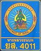
Yasothon Province
Yasothon is one of the provinces of Thailand, located in the North-East of Thailand on the Chi River. Neighboring provinces are Mukdahan, Amnat Charoen, Ubon Ratchathani, Sisaket and Roi Et.-Geography:...
. The rural road network measures some 35,000 km, about 82 percent of which is paved. The Department of Rural Roads of the Ministry of Transport takes care of the maintenance of all the rural roads in Thailand.
Milestones
- Milestone as goalGoalA goal is an objective, or a projected computation of affairs, that a person or a system plans or intends to achieve.Goal, GOAL or G.O.A.L may also refer to:Sport...
is lakh chai (หลักชัย); also see Lak MueangLak MueangLak Mueang are City pillars found in most cities of Thailand. Usually housed in a shrine which is also believed to house Chao Pho Lak Mueang , the city spirit deity; it is held in high esteem by citizens....
, LakhLakhA lakh is a unit in the Indian numbering system equal to one hundred thousand . It is widely used both in official and other contexts in Pakistan, Bangladesh, India, Maldives, Nepal, Sri Lanka, Myanmar and is often used in Indian English.-Usage:...
.

Single carriageway
A single carriageway is a road with 1, 2 or more lanes arranged within a single carriageway with no central reservation to separate opposing flows of traffic. Two-lane road or two-lane highway are single carriageway with one lane for each direction...
milestone facings display the route number on the outline of a garuda; some milestones also display the route number on top. Those located to the left of the carriageway count kilometers left to the road's beginning at KM 0; as seen on the right from the counter lane, the milestones go right on counting. On edges facing traffic, DOH milestones usually show distances remaining to the next two towns
Thesaban
Thesaban are the municipalities in Thailand. There are three levels of municipalities - city, town and subdistrict municipality. Both Bangkok and Pattaya are special municipal entities outside the thesaban system....
(amphoe
Amphoe
An amphoe is the second level administrative subdivision of Thailand. Usually translated as district, amphoe make up the provinces, and are analogous to a county seat...
seats or provincial
Provinces of Thailand
Thailand is divided into 76 provinces , which are geographically grouped into 6 regions. The capital Bangkok is not a province but a special administrative area and is included as the 77th province since it is administered at the same level as the other 76 provinces. The name of the provinces are...
capitals.) Some edges, such as the one depicted to the left, have retroreflector
Retroreflector
A retroreflector is a device or surface that reflects light back to its source with a minimum scattering of light. An electromagnetic wave front is reflected back along a vector that is parallel to but opposite in direction from the wave's source. The device or surface's angle of incidence is...
panels. Dual carriageway
Dual carriageway
A dual carriageway is a class of highway with two carriageways for traffic travelling in opposite directions separated by a central reservation...
milestones or posts located in the median show only the kilometer number.


See also
- Thai motorway networkThai motorway networkThe Thai motorway network is an intercity motorway network that currently spans 145 kilometers. It is to be greatly extended to 4154.7 kilometers according to the master plan....
- Road signs in ThailandRoad signs in ThailandRoad signs in Thailand generally use warning signs as used in the United States, featuring the same black silhouette shapes.-Warning Signs:Warning signs warn of possible dangers or unusual conditions ahead and alert motorists on the hazards to expect...
- List of motor vehicle deaths in Thailand by year
- List of names of Thai highways (in Thai)
External links
- Asian / ASEAN Highway Route Marker (21MB) Department of Highways Thai-language 18-page file, with 1 index and 8 regional maps of AH system overlaid on existing Thai national highways, plus diagrams of AH route markers. Retrieved 2008-10-14.