
Kalasin Province
Encyclopedia
Kalasin is one of the provinces
(changwat) of Thailand
, located in the North-East
of Thailand. Neighboring provinces are (from north clockwise) Sakon Nakhon
, Mukdahan
, Roi Et
, Maha Sarakham
, Khon Kaen
and Udon Thani
.
in the east with the district Nong Kung Si
in the west, saving up to one hour off the journey by road. On the northwestern creek of the reservoir a road bridge now connects the village of Ban Dong Bang in the west with the district town of Wang Sam Mo
in the east. Although the bridge was constructed several years ago (pre 2000) it is not featured (2006) on any commercially available road maps.
Making the border with Sakhon Nakhon Province is the Phu Phan mountain range
, which is preserved as a national park.
Kalasin is famous for the dinosaur
fossils found at Phu Kum Khao (Sahatsakhan district), the largest dinosaur site of Thailand. Most of the fossils are from Sauropods of 120 million years ago.
tribe already lived in the area in prehistoric times 1600 years ago. However, the first town was founded in 1793.
During the thesaphiban reforms at the beginning of the 20th century the town (Mueang
) was converted into a province. In 1932 the province was abolished and included into Maha Sarakham, and was recreated in 1947.
shows a pond in front of the mountains which form the boundary of the province. The water in the pond is black, as the name Kalasin means "black water". The big clouds as well as the water symbolize the fertility
of the province.
The provincial flower is Payorm or Sweet shorea (Shorea roxburghii
), and the provincial tree is Sa-mae-san (Cassia garrettiana).
The provincial slogan is Fa Daet Song Yang Ancient City, Pong Lang Folk Music, Phu Thai Culture, Phrae Wa Silk, Pha Saweoi Phu Phan, Lam Pao River, and Million-year Dinosaurs.
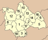
 The province is subdivided into 18 districts (amphoe
). The districts are further subdivided into 134 subdistricts (tambon
) and 1509 villages (muban
).
Wat Klang (วัดกลาง) - Within the temple’s compound, there is an Ubosot building, which was an extension from the old building. Inside a pavilion or Sala near the Ubosot building is a black Buddha image, made from bronze. In any drought season, the local people would take the Buddha image in a procession to beg for rain.
Wat Si Bun Rueang (วัดศรีบุญเรือง) or Wat Nuea (วัดเหนือ) - The temple stores a number of crafted boundary stones from Fa Daet Song Yang Ancient City. One of the most beautiful boundary stones, which are of the Dvaravati
art, is the one that depicts flying angels over a Prasat or palace represented by double arches, with the king, queen and their sons at the bottom.
Kalasin Museum (พิพิธภัณฑ์ของดีจังหวัดกาฬสินธุ์) - The museum was established by Mr. Chairat Mapraneet, Governor of Kalasin province, with an aim to show the collections of good things in Kalasin.
Phutthasathan Phu Po (พุทธสถานภูปอ) - The site is where two ancient reclining Buddha images of the Dvaravati period carved on the cliff can be seen. They are the sacred images highly revered by the people of Kalasin and nearby provinces.
Ban Phokhru Plueang Chairatsami (บ้านพ่อครูเปลื้อง ฉายรัศมี) - Khru Plueang Chairatsami was declared a National Artist in 1986 in the field of folk music. He built a farmer’s hut to be used as a traditional music school. The hut also displays traditional musical instruments such as Phin (lute), Khaen (reed organ), So (bowed stringed instrument) and Pong Lang (northeastern style xylophone).
Mueang Fa Daet Song Yang (เมืองฟ้าแดดสงยาง) - It is an ancient town surrounded by earthen mounds with a length of about 5 kilometres. Evidence for its civilization are religious ruins in and around the city such as a large number of sandstone boundary markers with bas-reliefs.
Wat Pho Chai Semaram (วัดโพธิ์ชัยเสมาราม) or Wat Ban Kom (วัดบ้านก้อม) - It is an old temple with a huge collection of old boundary stones of gigantic sizes. The boundary stones found in Fa Daet Song Yang are different from those discovered in other regions, as they were usually carved telling Jataka stories and the life of the Lord Buddha.
Lam Pao Dam (เขื่อนลำปาว) - The dam was built to block Lam Pao - the Pao River - and Huai Yang – Yang Creek. The dam was constructed particularly for relieving flood problems and for agriculture.
Lam Pao Wildlife Conservation Development and Promotion Station (สถานีพัฒนาและส่งเสริมการอนุรักษ์สัตว์ป่าลำปาว) or Suan Sa-on (สวนสะออน) - It is quite an abundant deciduous dipterocarp forest. Inside is an open zoo in which there are indigenous wild animals and also other fauna like gibbons, monkeys, various kinds of domestic and migratory birds, along with nature trails.
Phu Phra Forest Park (วนอุทยานภูพระ) - It features an outstanding mountain located near the villages. The plain on the backside of the mountain houses an ancient stone Buddha image. Some of the sites in the forest park include:
Sirindhorn Museum and Phu Kum Khao Dinosaur Excavation Site (พิพิธภัณฑ์สิรินธร และแหล่งขุดค้นไดโนเสาร์ภูกุ้มข้าว) - More than 700 fossilized bones were found in this excavation site and they were assumed to belong to seven dinosaurs. As such, Phu Kum Khao is considered to be the largest and most perfect concentration of dinosaur fossils in Thailand.
Phutthasathan Phu Sing (พุทธสถานภูสิงห์) - It is a large image in the subduing Mara posture that is 10.5 metres wide and is clearly visible from below. The surrounding area is shady and offers a lovely panoramic view.
Wat Phutthanimit (วัดพุทธนิมิต) and Phu Khao (ภูค่าว) houses a rock relief of an ancient reclining Buddha image leaning on his left side, which is about 2 metres long and 25 centimetres wide. Every year in April, there will be a bathing ceremony to celebrate the Buddha image.
Laem Non Wiset (แหลมโนนวิเศษ) - It is the land that stretches into Lam Pao Dam’s reservoir. Laem Non Wiset is a good sunset watching spot.
Ban Phon Phrae Wa Silk Weaving Group (กลุ่มทอผ้าไหมแพรวาบ้านโพน) - Phrae Wa silk is a unique style of the Phu Thai ethnic group of Ban Phon. It is divided into two patterns: Lai Lak (principal pattern) and Lai Thaep (stripe pattern). It can be considered that Phrae Wa silk is a rare handcrafted textile product in Thailand.
Pha Sawoei (ผาเสวย) - Their Majesties the King and the Queen visited the cliff and had lunch here, so the place’s name was changed to 'Pha Sawoei' (Sawoei is a royal term for eating). As it is located in the deep valley with a high cliff, the locals also called it 'Heo Ham Hot'.
Namtok Pha Nang Khoi (น้ำตกผานางคอย) - It is a huge waterfall, beautifully cascading down from the Phu Phan mountain range. It is surrounded with abundant thick forest. There is water all year round, even in the dry season.
Namtok Tat Thong (น้ำตกตาดทอง) - It is a huge and beautiful waterfall with complex stone cliffs.
Phu Thai Nong Hang Handicraft Centre (ศูนย์หัตถกรรมผู้ไทยหนองห้าง) - Some of the beautiful basketry products include 'Krato' – a vegetable container, 'Kratip' – a sticky rice container, handbags and other containers.
Phu Thai Khok Kong Cultural Village (หมู่บ้านวัฒนธรรมผู้ไทยโคกโก่ง) - is a small village situated at the hillside and inhabited by a large number of Phu Thai ethnic group.
Phu Faek Forest Park (วนอุทยานภูแฝก) and Dinosaur Footprints (แหล่งรอยเท้าไดโนเสาร์) - It is located in Tambon Phu Laen Chang, with alternate mountainous and hilly topography covered with a deciduous dipterocarp forest featuring various kinds of flora and it is easy to spot some wild animals such as squirrels, tree shrews, civets and hares. At present, there are 4 Dinosaur footprints that can be seen clearly.
silk, Khit
textile, basketry products, pounded pork and beef.
Wichit Phrae Wa Silk Festival (งานมหกรรมวิจิตรแพรวาราชินีแห่งไหม) - It is held annually on August 12, at Rim Pao Hotel to honour H.M. Queen Sirikit who has kindly supported the Phrae Wa silk under her royal patronage and promoted it to wider public awareness. The Queen’s support also helps to create employment for local Phu Thai people.
Provinces of Thailand
Thailand is divided into 76 provinces , which are geographically grouped into 6 regions. The capital Bangkok is not a province but a special administrative area and is included as the 77th province since it is administered at the same level as the other 76 provinces. The name of the provinces are...
(changwat) of Thailand
Thailand
Thailand , officially the Kingdom of Thailand , formerly known as Siam , is a country located at the centre of the Indochina peninsula and Southeast Asia. It is bordered to the north by Burma and Laos, to the east by Laos and Cambodia, to the south by the Gulf of Thailand and Malaysia, and to the...
, located in the North-East
Isan
Isan is the northeastern region of Thailand. It is located on the Khorat Plateau, bordered by the Mekong River to the north and east, by Cambodia to the southeast and the Prachinburi mountains south of Nakhon Ratchasima...
of Thailand. Neighboring provinces are (from north clockwise) Sakon Nakhon
Sakon Nakhon Province
Sakon Nakhon is one of the north-eastern provinces of Thailand. Neighboring provinces are Nong Khai, Nakhon Phanom, Mukdahan, Kalasin and Udon Thani...
, Mukdahan
Mukdahan Province
Mukdahan is one of the north-eastern provinces of Thailand. Neighboring provinces are Amnat Charoen, Yasothon, Roi Et, Kalasin, Sakon Nakhon and Nakhon Phanom. To the east it borders the Mekong River, across which lies Savannakhet Province of Laos.-Geography:The province is located in the...
, Roi Et
Roi Et Province
Roi Et is one of the provinces of Thailand, located in the North-East of Thailand. Neighboring Provinces are Kalasin, Mukdahan, Yasothon, Sisaket, Surin and Maha Sarakham....
, Maha Sarakham
Maha Sarakham Province
Maha Sarakham is one of the provinces of Thailand, located in the northeastern region of Thailand. Neighboring provinces are Kalasin, Roi Et, Surin, Buriram and Khon Kaen....
, Khon Kaen
Khon Kaen Province
-History:The first city of the area was established in 1783 when Rajakruluang settled there with 330 people. King Rama I made Rajakruluang the first governor of the area when establishing tighter connections with the Isan area. The main city was moved six times until in 1879 it reached its modern...
and Udon Thani
Udon Thani Province
Udon Thani is one of the north-eastern provinces of Thailand. Neighboring provinces are Nong Khai, Sakon Nakhon, Kalasin, Khon Kaen, Nong Bua Lamphu and Loei.- Geography :...
.
Geography
Most of the province is covered by hilly landscape. In the north is the Lam Pao dam built 1963-68, storing 1,430 million m³ of water for flood prevention and agriculture. The Lam Pao reservoir effectively cuts the northern part of the province in half but there are car ferries connecting the district of SahatsakhanAmphoe Sahatsakhan
Sahatsakhan is a district in the central part of Kalasin Province, northeastern Thailand.-Geography:Neighboring districts are Somdet, Mueang Kalasin, Nong Kung Si, Sam Chai and Kham Muang of Kalasin Province....
in the east with the district Nong Kung Si
Amphoe Nong Kung Si
Nong Kung Si is a district in the western part of Kalasin Province, northeastern Thailand.-History:The government separated Tambon Nong Kung Si and Khok Khruea from Tha Khantho district and created Nong Kung Si minor district on September 14, 1973. Later Tambon Nong Bua of Sahatsakhan district...
in the west, saving up to one hour off the journey by road. On the northwestern creek of the reservoir a road bridge now connects the village of Ban Dong Bang in the west with the district town of Wang Sam Mo
Amphoe Wang Sam Mo
Wang Sam Mo is a district in the southeastern part of Udon Thani Province, northeastern Thailand.-Geography:Neighboring districts are Si That and Chai Wan of Udon Thani Province, Waritchaphum, Nikhom Nam Un and Kut Bak of Sakon Nakhon Province and Kham Muang, Sam Chai and Nong Kung Si and Tha...
in the east. Although the bridge was constructed several years ago (pre 2000) it is not featured (2006) on any commercially available road maps.
Making the border with Sakhon Nakhon Province is the Phu Phan mountain range
Phu Phan Mountains
The Phu Phan mountains are a range of hills dividing the Khorat Plateau of the Isan region of Thailand into two basins: the northern Sakhon Nakhon Basin, and the southern Khorat Basin.-Etymology:...
, which is preserved as a national park.
Kalasin is famous for the dinosaur
Dinosaur
Dinosaurs are a diverse group of animals of the clade and superorder Dinosauria. They were the dominant terrestrial vertebrates for over 160 million years, from the late Triassic period until the end of the Cretaceous , when the Cretaceous–Paleogene extinction event led to the extinction of...
fossils found at Phu Kum Khao (Sahatsakhan district), the largest dinosaur site of Thailand. Most of the fossils are from Sauropods of 120 million years ago.
Economy
Kalasin is an agricultural province producing sticky rice and other cash crops such as manioc (Cassava) and sugar cane. The families are generally poor in this essentially rural area and make ends meet by producing the silk for which the region is also renowned and basketry.History
Archeological excavations showed that the LawaLawa people
Lawa are an ethnic group in Laos and northern Thailand. They lived there before Thai people arrived. Today they live often in their traditional way of life, often professing animism. As the other mountain ethnic groups of Thailand, they are known for extraordinary craft skills...
tribe already lived in the area in prehistoric times 1600 years ago. However, the first town was founded in 1793.
During the thesaphiban reforms at the beginning of the 20th century the town (Mueang
Mueang
Mueang were historical semi-independent city-states or principalities in present-day Thailand, Laos, parts of northern Vietnam and the Shan State of Myanmar. Smaller Mueang were subordinate to more powerful neighboring Mueang, which in turn were subordinate to the central king, as described in...
) was converted into a province. In 1932 the province was abolished and included into Maha Sarakham, and was recreated in 1947.
Symbols
The seal of the provinceSeals of The Provinces of Thailand
-Present-day provinces of Thailand:This list includes all the seals of the Provinces of Thailand. It also includes the special administrative area of the capital, Bangkok.-Former Provinces:-External links:*...
shows a pond in front of the mountains which form the boundary of the province. The water in the pond is black, as the name Kalasin means "black water". The big clouds as well as the water symbolize the fertility
Fertility
Fertility is the natural capability of producing offsprings. As a measure, "fertility rate" is the number of children born per couple, person or population. Fertility differs from fecundity, which is defined as the potential for reproduction...
of the province.
The provincial flower is Payorm or Sweet shorea (Shorea roxburghii
Shorea roxburghii
Shorea roxburghii is a species of plant in the Dipterocarpaceae family. It is a tree found in Cambodia, India, Laos, Malaysia, Burma, Thailand, and Vietnam.-References in Place Names:...
), and the provincial tree is Sa-mae-san (Cassia garrettiana).
The provincial slogan is Fa Daet Song Yang Ancient City, Pong Lang Folk Music, Phu Thai Culture, Phrae Wa Silk, Pha Saweoi Phu Phan, Lam Pao River, and Million-year Dinosaurs.
Administrative divisions
Amphoe
An amphoe is the second level administrative subdivision of Thailand. Usually translated as district, amphoe make up the provinces, and are analogous to a county seat...
). The districts are further subdivided into 134 subdistricts (tambon
Tambon
Tambon is a local government unit in Thailand. Below district and province , they form the third administrative subdivision level. As of the 2009 there are 7255 tambon, not including the 169 khwaeng of Bangkok, which are set at the same administrative level, thus every district contains 8-10 tambon...
) and 1509 villages (muban
Muban
Muban is the lowest administrative subdivision of Thailand. Usually translated as village, they are the subdivision of tambon. As of 2008, there are 74944 administrative villages in Thailand. As of the 1990 census, the average village consisted of 144 households or 746 persons.A muban does not...
).
|
|
Sights
Phraya Chaisunthon Monument (Chao Somphamit) (อนุสาวรีย์พระยาชัยสุนทร) - The life-sized monument is made from bronze in a standing position with the right hand holding a teapot, and left hand holding a magic sword.Wat Klang (วัดกลาง) - Within the temple’s compound, there is an Ubosot building, which was an extension from the old building. Inside a pavilion or Sala near the Ubosot building is a black Buddha image, made from bronze. In any drought season, the local people would take the Buddha image in a procession to beg for rain.
Wat Si Bun Rueang (วัดศรีบุญเรือง) or Wat Nuea (วัดเหนือ) - The temple stores a number of crafted boundary stones from Fa Daet Song Yang Ancient City. One of the most beautiful boundary stones, which are of the Dvaravati
Dvaravati
The Dvaravati period lasted from the 6th to the 13th centuries. Dvaravati refers to both a culture and a disparate conglomerate of principalities.- History :...
art, is the one that depicts flying angels over a Prasat or palace represented by double arches, with the king, queen and their sons at the bottom.
Kalasin Museum (พิพิธภัณฑ์ของดีจังหวัดกาฬสินธุ์) - The museum was established by Mr. Chairat Mapraneet, Governor of Kalasin province, with an aim to show the collections of good things in Kalasin.
Phutthasathan Phu Po (พุทธสถานภูปอ) - The site is where two ancient reclining Buddha images of the Dvaravati period carved on the cliff can be seen. They are the sacred images highly revered by the people of Kalasin and nearby provinces.
Ban Phokhru Plueang Chairatsami (บ้านพ่อครูเปลื้อง ฉายรัศมี) - Khru Plueang Chairatsami was declared a National Artist in 1986 in the field of folk music. He built a farmer’s hut to be used as a traditional music school. The hut also displays traditional musical instruments such as Phin (lute), Khaen (reed organ), So (bowed stringed instrument) and Pong Lang (northeastern style xylophone).
Mueang Fa Daet Song Yang (เมืองฟ้าแดดสงยาง) - It is an ancient town surrounded by earthen mounds with a length of about 5 kilometres. Evidence for its civilization are religious ruins in and around the city such as a large number of sandstone boundary markers with bas-reliefs.
Wat Pho Chai Semaram (วัดโพธิ์ชัยเสมาราม) or Wat Ban Kom (วัดบ้านก้อม) - It is an old temple with a huge collection of old boundary stones of gigantic sizes. The boundary stones found in Fa Daet Song Yang are different from those discovered in other regions, as they were usually carved telling Jataka stories and the life of the Lord Buddha.
Lam Pao Dam (เขื่อนลำปาว) - The dam was built to block Lam Pao - the Pao River - and Huai Yang – Yang Creek. The dam was constructed particularly for relieving flood problems and for agriculture.
Lam Pao Wildlife Conservation Development and Promotion Station (สถานีพัฒนาและส่งเสริมการอนุรักษ์สัตว์ป่าลำปาว) or Suan Sa-on (สวนสะออน) - It is quite an abundant deciduous dipterocarp forest. Inside is an open zoo in which there are indigenous wild animals and also other fauna like gibbons, monkeys, various kinds of domestic and migratory birds, along with nature trails.
Phu Phra Forest Park (วนอุทยานภูพระ) - It features an outstanding mountain located near the villages. The plain on the backside of the mountain houses an ancient stone Buddha image. Some of the sites in the forest park include:
- Pha Sawoei (ผาเสวย) - It is an expansive stone cliff, about 150-200 metres wide. It is a breathtaking sightseeing spot.
- Tham Siam Sap (ถ้ำเสียมสับ) - It is a cliff cave that looks like somebody had dug the cave with a spade or 'Siam'.
- Tham Phra Rot (ถ้ำพระรอด) - It is a cave that occurred due to the separation of a stone cliff. Inside the cave, there is a walkway of about 2 metres wide and 30 metres long.
- Pha Hin Yaek (ผาหินแยก) - It is a separating cliff of 20 metres long and 6 metres deep. The leaning cliff is also a good sightseeing spot.
- Tham Phra (ถ้ำพระ) - It is a cave 30 metres in depth. There is a Buddha image that is highly revered by locals. Every year during the Songkran Festival, people would ascend to the cave to pour lustral water on the Buddha image to pay respect.
Sirindhorn Museum and Phu Kum Khao Dinosaur Excavation Site (พิพิธภัณฑ์สิรินธร และแหล่งขุดค้นไดโนเสาร์ภูกุ้มข้าว) - More than 700 fossilized bones were found in this excavation site and they were assumed to belong to seven dinosaurs. As such, Phu Kum Khao is considered to be the largest and most perfect concentration of dinosaur fossils in Thailand.
Phutthasathan Phu Sing (พุทธสถานภูสิงห์) - It is a large image in the subduing Mara posture that is 10.5 metres wide and is clearly visible from below. The surrounding area is shady and offers a lovely panoramic view.
Wat Phutthanimit (วัดพุทธนิมิต) and Phu Khao (ภูค่าว) houses a rock relief of an ancient reclining Buddha image leaning on his left side, which is about 2 metres long and 25 centimetres wide. Every year in April, there will be a bathing ceremony to celebrate the Buddha image.
Laem Non Wiset (แหลมโนนวิเศษ) - It is the land that stretches into Lam Pao Dam’s reservoir. Laem Non Wiset is a good sunset watching spot.
Ban Phon Phrae Wa Silk Weaving Group (กลุ่มทอผ้าไหมแพรวาบ้านโพน) - Phrae Wa silk is a unique style of the Phu Thai ethnic group of Ban Phon. It is divided into two patterns: Lai Lak (principal pattern) and Lai Thaep (stripe pattern). It can be considered that Phrae Wa silk is a rare handcrafted textile product in Thailand.
Pha Sawoei (ผาเสวย) - Their Majesties the King and the Queen visited the cliff and had lunch here, so the place’s name was changed to 'Pha Sawoei' (Sawoei is a royal term for eating). As it is located in the deep valley with a high cliff, the locals also called it 'Heo Ham Hot'.
Namtok Pha Nang Khoi (น้ำตกผานางคอย) - It is a huge waterfall, beautifully cascading down from the Phu Phan mountain range. It is surrounded with abundant thick forest. There is water all year round, even in the dry season.
Namtok Tat Thong (น้ำตกตาดทอง) - It is a huge and beautiful waterfall with complex stone cliffs.
Phu Thai Nong Hang Handicraft Centre (ศูนย์หัตถกรรมผู้ไทยหนองห้าง) - Some of the beautiful basketry products include 'Krato' – a vegetable container, 'Kratip' – a sticky rice container, handbags and other containers.
Phu Thai Khok Kong Cultural Village (หมู่บ้านวัฒนธรรมผู้ไทยโคกโก่ง) - is a small village situated at the hillside and inhabited by a large number of Phu Thai ethnic group.
Phu Faek Forest Park (วนอุทยานภูแฝก) and Dinosaur Footprints (แหล่งรอยเท้าไดโนเสาร์) - It is located in Tambon Phu Laen Chang, with alternate mountainous and hilly topography covered with a deciduous dipterocarp forest featuring various kinds of flora and it is easy to spot some wild animals such as squirrels, tree shrews, civets and hares. At present, there are 4 Dinosaur footprints that can be seen clearly.
Local products
Kalasin has various kinds of local products such as Phrae Wa silk, MudmeeIkat
Ikat, or Ikkat, is a dyeing technique used to pattern textiles that employs a resist dyeing process similar to tie-dye on either the warp or weft fibres....
silk, Khit
Khit
Khit, or Khid, is an ancient type of woven cloth produced in certain areas of Isaan, the northeastern region of Thailand.-Tradition:Khit weaving is done by hand in traditional looms. It favours certain basic colors, like red, purple and dark green, although other colors are also used...
textile, basketry products, pounded pork and beef.
Festivals
Kalasin Pong Lang, Phrae Wa and Red Cross Fair (งานมหกรรมโปงลาง แพรวา และกาชาด จังหวัดกาฬสินธุ์) - It is held annually in February in front of the city hall. The festival features a colourful parade of each district decorated with a gigantic-sized Pong Lang – folk vertical xylophone, people dressed in traditional clothes, cultural competition, beauty pageant.Wichit Phrae Wa Silk Festival (งานมหกรรมวิจิตรแพรวาราชินีแห่งไหม) - It is held annually on August 12, at Rim Pao Hotel to honour H.M. Queen Sirikit who has kindly supported the Phrae Wa silk under her royal patronage and promoted it to wider public awareness. The Queen’s support also helps to create employment for local Phu Thai people.
Climate
External links
- http://www.kalasin.go.th Website of province (Thai)
- Province page from the Tourist Authority of Thailand