
Waterfall, New South Wales
Encyclopedia
Suburb
The word suburb mostly refers to a residential area, either existing as part of a city or as a separate residential community within commuting distance of a city . Some suburbs have a degree of administrative autonomy, and most have lower population density than inner city neighborhoods...
in southern
Southern Sydney
This article refers to an area the same as a combination of St George and SutherlandSouthern Sydney is a general term which is used to describe the southern metropolitan area of Sydney, in the state of New South Wales, Australia....
Sydney
Sydney
Sydney is the most populous city in Australia and the state capital of New South Wales. Sydney is located on Australia's south-east coast of the Tasman Sea. As of June 2010, the greater metropolitan area had an approximate population of 4.6 million people...
, in the state of New South Wales
New South Wales
New South Wales is a state of :Australia, located in the east of the country. It is bordered by Queensland, Victoria and South Australia to the north, south and west respectively. To the east, the state is bordered by the Tasman Sea, which forms part of the Pacific Ocean. New South Wales...
, Australia
Australia
Australia , officially the Commonwealth of Australia, is a country in the Southern Hemisphere comprising the mainland of the Australian continent, the island of Tasmania, and numerous smaller islands in the Indian and Pacific Oceans. It is the world's sixth-largest country by total area...
. Waterfall is located 38 kilometers south of the Sydney central business district
Sydney central business district
The Sydney central business district is the main commercial centre of Sydney, New South Wales, Australia. It extends southwards for about 3 kilometres from Sydney Cove, the point of first European settlement. Its north–south axis runs from Circular Quay in the north to Central railway station in...
in the Sutherland Shire
Sutherland Shire
The Sutherland Shire is a Local Government Area in the Southern Sydney region of Sydney, Australia. Geographically, it is the area to the south of Botany Bay and the Georges River...
.
Waterfall is bordered to the north by the suburb of Heathcote
Heathcote, New South Wales
Heathcote is a suburb, in southern Sydney, in the state of New South Wales, Australia. Heathcote is located 36 km south of the Sydney central business district in the Sutherland Shire....
and Engadine
Engadine, New South Wales
Engadine is a suburb in southern Sydney, in the state of New South Wales, Australia. Engadine is located south of the Sydney central business district, in the local government area of the Sutherland Shire...
is further north. It is bounded by The Royal National Park to the east, and Heathcote National Park
Heathcote National Park
Heathcote is a national park in New South Wales , 34 km southwest of Sydney. It lies west of the South Coast Line and the suburbs of Heathcote and Waterfall.-Description:...
to the west. Helensburgh
Helensburgh, New South Wales
Helensburgh is a small town in New South Wales, Australia. Helensburgh is located 45 kilometres south of the Sydney central business district and north of Wollongong. Helensburgh is in the local government area of Wollongong City Council and marks the northern end of the Illawarra region...
is the next town, travelling south. Waterfall marks the southern border of the Sutherland Shire
Sutherland Shire
The Sutherland Shire is a Local Government Area in the Southern Sydney region of Sydney, Australia. Geographically, it is the area to the south of Botany Bay and the Georges River...
. It is approximately 200 metres above sea level.
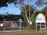
Waterfall has only six streets. Its local school has only two rooms which have kindergarten to 2nd class in one room, and 3rd class to 6th class in another. The bushland gives the small suburb a natural surrounding and walking tracks lead from it into the neighbouring national parks. To the west is a dammed lake and behind it is Mount Westmacott.
History
Waterfall was a town created by rail workers, who built the line from SydneySydney
Sydney is the most populous city in Australia and the state capital of New South Wales. Sydney is located on Australia's south-east coast of the Tasman Sea. As of June 2010, the greater metropolitan area had an approximate population of 4.6 million people...
to Wollongong
Wollongong, New South Wales
Wollongong is a seaside city located in the Illawarra region of New South Wales, Australia. It lies on the narrow coastal strip between the Illawarra Escarpment and the Pacific Ocean, 82 kilometres south of Sydney...
in the late 19th century. Waterfall is the highest point on the line, with a steep rising gradient one end, and a falling gradient the other ends, and sidings were provided in both directions to allow freight wagons to be stowed and shunted. Waterfall derived its name from the waterfall
Waterfall
A waterfall is a place where flowing water rapidly drops in elevation as it flows over a steep region or a cliff.-Formation:Waterfalls are commonly formed when a river is young. At these times the channel is often narrow and deep. When the river courses over resistant bedrock, erosion happens...
s close to the railway station. McKell Avenue, the southern border of the Royal National Park, was originally called Waterfall Road.
The Waterfall State Sanitorium was established in 1909 for the treatment of tuberculosis patients. The Waterfall train disaster
Waterfall train disaster
The Waterfall rail accident was a train accident that occurred on 31 January 2003 near Waterfall, New South Wales, Australia. The train derailed, killing seven people aboard, including the train driver.-Incident:...
on January 31, 2003, involved an interurban train service operated by unit G7 which crashed just past Waterfall. The cause of G7's crash was determined to be the heart attack of the driver and a failure of the safety equipment and the guard to stop the train.
Transport
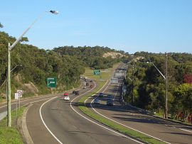
Waterfall is the last suburb heading south on the Princes HighwayPrinces Highway
The Princes Highway extends from Sydney to Port Augusta via the coast through the states of New South Wales, Victoria and South Australia, a distance of 1941 km or 1898 km via the former alignments of the highway ....
before it leads into the Southern Freeway
Southern Freeway
Southern Freeway is a freeway linking Sydney to Wollongong. It currently is designated as part of National Route 1, however was formerly signposted as F6 under a former route numbering system, and is commonly known by this latter name...
(also known as the F6 freeway) to the city of Wollongong
Wollongong, New South Wales
Wollongong is a seaside city located in the Illawarra region of New South Wales, Australia. It lies on the narrow coastal strip between the Illawarra Escarpment and the Pacific Ocean, 82 kilometres south of Sydney...
.
Waterfall railway station
Waterfall railway station, Sydney
Waterfall railway station is a Sydney railway station serving the suburb of Waterfall, New South Wales and is the last stop of the suburban section of the Illawarra line. Waterfall station also provides access to Camp Coutts, a large Scout campsite. The station opened in 1886, moving to its present...
is the terminus for the CityRail
CityRail
CityRail is an operating brand of RailCorp, a corporation owned by the state government of New South Wales, Australia. It is responsible for providing commuter rail services, and some coach services, in and around Sydney, Newcastle and Wollongong, the three largest cities of New South Wales. It is...
suburban Illawarra line. However some trains do terminate one stop further on at Helensburgh. Waterfall is also a stop on the south coast railway. Platform 1 to Sydney terminal, platform 2 to Port Kembla, Dapto and Kiama.