
Scottish place names in Canada
Encyclopedia
This is a list of placenames in Scotland
which have subsequently been applied to parts of Canada
by Scottish emigrants or explorers.
For Nova Scotian names in Scottish Gaelic (not necessarily the same as the English versions) see Canadian communities with Scottish Gaelic speakers and Scottish Gaelic placenames in Canada
Note that, unless otherwise stated, province names are not Scottish.

Alberta
British Columbia
Manitoba
Rural municipalities -
New Brunswick
Glenlevit
Glencoe
Dundee
Newfoundland and Labrador
Nova Scotia
 "Nova Scotia" is the Latin
for New Scotland
Dunmaglas
Lochaber
Loch Lomond
McArra's Brook
North Grant
Northwest Territories
The Northwest Territories
also contain three places with Scottish surnames: Fort Simpson, Fort McPherson
and Rae (Although now collectively known with Edzo as Behchoko).
Nunavut

Ontario
Prince Edward Island
Quebec
Saskatchewan
The town of Coronach
was originally named after a horse; however, the original meaning of coronach
is a Gaelic lament.
Yukon
Scotland
Scotland is a country that is part of the United Kingdom. Occupying the northern third of the island of Great Britain, it shares a border with England to the south and is bounded by the North Sea to the east, the Atlantic Ocean to the north and west, and the North Channel and Irish Sea to the...
which have subsequently been applied to parts of Canada
Canada
Canada is a North American country consisting of ten provinces and three territories. Located in the northern part of the continent, it extends from the Atlantic Ocean in the east to the Pacific Ocean in the west, and northward into the Arctic Ocean...
by Scottish emigrants or explorers.
For Nova Scotian names in Scottish Gaelic (not necessarily the same as the English versions) see Canadian communities with Scottish Gaelic speakers and Scottish Gaelic placenames in Canada
Note that, unless otherwise stated, province names are not Scottish.
AlbertaAlbertaAlberta is a province of Canada. It had an estimated population of 3.7 million in 2010 making it the most populous of Canada's three prairie provinces...
- AirdrieAirdrie, AlbertaAirdrie is a city in Alberta, Canada, located just north of Calgary within the Calgary–Edmonton Corridor. The City of Airdrie is part of Calgary's Census Metropolitan Area and a member community of the Calgary Regional Partnership . Due to its proximity to Calgary, Airdrie's population has been...
- ArdmoreArdmore, AlbertaArdmore, Alberta is a hamlet in northern Alberta, Canada within the Municipal District of Bonnyville No. 87. It is located approximately east of Bonnyville along Highway 28 and has an elevation is .- Demographics :...
- ArdrossanArdrossan, AlbertaArdrossan is a hamlet in Alberta, Canada within Strathcona County. It is located on Highway 824, approximately east of Sherwood Park.Ardrossan has been identified as a growth hamlet and a concept plan has been approved that will see another of land developed for residential purposes.The...
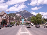
- BanffBanff, AlbertaBanff is a town within Banff National Park in Alberta, Canada. It is located in Alberta's Rockies along the Trans-Canada Highway, approximately west of Calgary and east of Lake Louise....
- named after town in north east Scotland - BankheadBankhead, AlbertaBankhead, Alberta was a small coal mining town that existed in the early twentieth century, in Banff National Park, near the town of Banff, Alberta. The mine was located at Cascade Mountain, which contains high grade anthracite coal deposits...
(ghost town) - BarrheadBarrhead, AlbertaBarrhead is a town in central Alberta, Canada, within the County of Barrhead No. 11. It is located along the Paddle River and at the intersection of Highway 33 and Highway 18, approximately northwest of the City of Edmonton...
- BlairmoreBlairmore, AlbertaBlairmore is an urban community in the Rocky Mountains within the Municipality of Crowsnest Pass in southwest Alberta, Canada. It was formerly incorporated as a town prior to 1979 when it amalgamated with four other municipalities to form Crowsnest Pass...
- Bon AccordBon Accord, AlbertaBon Accord is a town in central Alberta, Canada. It is located north of downtown Edmonton on highway 28.-Demographics:In 2006, Bon Accord had a population of 1,534 living in 500 dwellings, a 0.1% increase from 2001. The town has a land area of and a population density of .-External links:*...
(Bon AccordHeraldry of AberdeenThe Heraldry of Aberdeen, Scotland represents the long history of the city and its people.-Arms:The image of three castles is often present, particularly in the flag and coat of arms of the city...
is the motto of AberdeenAberdeenAberdeen is Scotland's third most populous city, one of Scotland's 32 local government council areas and the United Kingdom's 25th most populous city, with an official population estimate of ....
) - Bonnie Doon (Edmonton)
- Bonnie Lake (Alberta)Bonnie Lake (Alberta)Bonnie Lake is a small lake in Alberta, Canada. It is located outside of Vilna, Alberta, north of Highway 28, and is part of the North Saskatchewan River basin....
- Butedale FallsButedale FallsButedale Falls is a high-volume waterfall located just north of the old ghost town of Butedale, British Columbia. The entire section of stream between the outlet of Butedale Lake & the Inside Passage is one long series of cascades collectively known as Butedale Falls...
- Caldwell (ghost town)
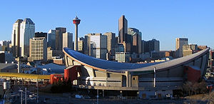
- Calgary - named after place in MullIsle of MullThe Isle of Mull or simply Mull is the second largest island of the Inner Hebrides, off the west coast of Scotland in the council area of Argyll and Bute....
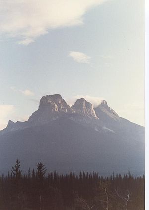
- CanmoreCanmore, AlbertaCanmore is a town in Alberta, Canada, located approximately west of the City of Calgary near the southeast boundary of Banff National Park. It is located in the Bow Valley within Alberta's Rockies. The town shares a border with Kananaskis Country to the west and south and the Municipal District of...
(named for King Malcolm Canmore) - CarstairsCarstairs, AlbertaCarstairs is a town in central Alberta, Canada. It is located on Highway 2A, south of the provincial capital, Edmonton, and north of Calgary, the nearest major city. The closest neighbouring communities are the towns of Didsbury and Crossfield...
- ChisholmChisholm, AlbertaChisholm, also known as Chisholm Mills, is a hamlet in Alberta, Canada within the Municipal District of Lesser Slave River No. 124. It is located east of the Athabasca River, approximately southeast of the Town of Slave Lake...
- ClydeClyde, AlbertaClyde is a village in northern Alberta, Canada. It is located north of Edmonton and east of Westlock, near the junction of Highway 18 and Highway 2.It was incorporated in 1914 and named after the River and Firth of Clyde in Scotland.- Demographics :...
- CouttsCoutts, AlbertaCoutts is a village in Alberta and the location of one of the busiest Canada – US border crossings in western Canada. It connects Highway 4 to Interstate 15, an important trade route between Alberta, American states along I-15, and Mexico.In 2004, a joint border facility opened in Coutts-Sweet...
- CraigmyleCraigmyle, AlbertaCraigmyle is a hamlet in Alberta, Canada within Starland County. It is located between the towns of Delia and Hanna.- References :...
- Cromdale (Edmonton)
- DunmoreDunmore, AlbertaDunmore is a hamlet in Alberta, Canada within Cypress County, located southeast of Medicine Hat's city limits on Highway 1 and the Canadian Pacific Railway mainline. It is also recognized as a designated place by Statistics Canada....
- ErskineErskine, AlbertaErskine is a hamlet in Alberta, Canada within the County of Stettler No. 6. It is located approximately west of Stettler, south of Rochon Sands and east of Red Deer...
- FerintoshFerintosh, AlbertaFerintosh is a small village in central Alberta, Canada located about south of Camrose, and southeast of Edmonton. The town itself is situated on Little Beaver Lake....
- Fort MacleodFort Macleod, AlbertaFort Macleod is a town in the southwest corner of the province of Alberta, Canada. It was founded as a North-West Mounted Police barracks, and is named in honour of the North-West Mounted Police Colonel James Macleod. The town's current mayor is Shawn Patience.- History and heritage preservation...
- Fort McMurrayFort McMurray, AlbertaFort McMurray is an urban service area in the Regional Municipality of Wood Buffalo in Alberta, Canada. It was previously incorporated as a city on September 1, 1980. It became an urban service area when it amalgamated with Improvement District No. 143 on April 1, 1995 to create the Municipality...
- HalkirkHalkirk, AlbertaHalkirk is a village in central Alberta, Canada within the County of Paintearth No. 18. It is located east of Red Deer at the intersection of Highway 12 and Highway 855. Founded in 1912, Halkirk was named after Halkirk, Scotland.- Demographics :...
(HalkirkHalkirkHalkirk is a village on the River Thurso in Caithness, in the Highland council area of Scotland. From Halkirk the B874 road runs towards Thurso in the north and towards Georgemas in the east...
) - Hazeldean (Edmonton)
- Holyrood (Edmonton) (HolyroodHolyrood, EdinburghHolyrood is an area in Edinburgh, the capital of Scotland. Lying east of the city centre, at the end of the Royal Mile, Holyrood was once in the separate burgh of Canongate before the expansion of Edinburgh in 1856...
) - InnisfailInnisfail, AlbertaInnisfail is a town in central Alberta, Canada. It is located in the Calgary-Edmonton Corridor, south of Red Deer at the junction of Highway 2 and Highway 54....
- IrvineIrvine, AlbertaIrvine is a hamlet in Alberta, Canada within Cypress County. It is located approximately east of Medicine Hat on Highway 1 and has an elevation of .The hamlet is located in census division No. 1 and in the federal riding of Medicine Hat....
- Lomond (Loch LomondLoch LomondLoch Lomond is a freshwater Scottish loch, lying on the Highland Boundary Fault. It is the largest lake in Great Britain by surface area. The lake contains many islands, including Inchmurrin, the largest fresh-water island in the British Isles, although the lake itself is smaller than many Irish...
) - Mackenzie County
- MallaigMallaig, AlbertaMallaig is a settlement in Alberta, Canada within the County of St. Paul No. 19. It is located approximately northeast of Edmonton. Its primary industry is agriculture....
- Mintlaw (ghost town)
- Mount HectorMount Hector (Alberta)Mount Hector is a mountain in Banff National Park, Canada. The mountain was named in 1884 by George M. Dawson after James Hector, a geologist on the Palliser Expedition. The mountain is located beside the Icefields Parkway, north of Lake Louise....
(after James HectorJames HectorSir James Hector was a Scottish geologist, naturalist, and surgeon who accompanied the Palliser Expedition as a surgeon and geologist...
) - Mount Lady MacdonaldMount Lady MacdonaldMount Lady Macdonald is a mountain located in the Bow River valley of Banff National Park, Alberta, Canada.The mountain was named in 1886 after Susan Agnes Macdonald, wife of Sir John A. Macdonald, the first Prime Minister of Canada...
(after wife of John A. MacdonaldJohn A. MacdonaldSir John Alexander Macdonald, GCB, KCMG, PC, PC , QC was the first Prime Minister of Canada. The dominant figure of Canadian Confederation, his political career spanned almost half a century...
) - ScotfieldScotfield, AlbertaScotfield is an unincorporated community in east-central Alberta, Canada within Special Area No. 2. It is located on Highway 9 between the Town of Hanna and the Village of Youngstown....
- StirlingStirling, AlbertaStirling is a village in the County of Warner No. 5, Alberta, Canada. The village is located on Highway 4, approximately southeast of Lethbridge and northwest of the United States-Canada border....
- Strathcona CountyStrathcona County, AlbertaStrathcona County is a specialized municipality in central Alberta, Canada between Edmonton and Elk Island National Park.It is located in Division No. 11 and is also part of the Edmonton Census Metropolitan Area. More than half of the population lives in Sherwood Park, a large community east of...
- [Strathcona (Edmonton)]]
British ColumbiaBritish ColumbiaBritish Columbia is the westernmost of Canada's provinces and is known for its natural beauty, as reflected in its Latin motto, Splendor sine occasu . Its name was chosen by Queen Victoria in 1858...
- AbbotsfordAbbotsford, British ColumbiaAbbotsford is a Canadian city located in the Lower Mainland of British Columbia, adjacent to Greater Vancouver. It is the fifth largest municipality in British Columbia, home to 123,864 people . Its Census Metropolitan Area, which includes the District of Mission, is the 23rd largest in Canada,...
(location of Sir Walter Scott's house). Suburbs include Aberdeen and Glen Mountain. - BalfourBalfour, British ColumbiaBalfour, also known as Balfour Bay, is an unincorporated community in British Columbia, located about northeast of the city of Nelson and located at the juncture of Kootenay Lake with its West Arm....
(also known as "Balfour Bay") - ButedaleButedale, British ColumbiaButedale is a ghost town that was founded on Princess Royal Island, British Columbia in 1918 as a fishing, mining and logging camp. Initially the salmon cannery was established by Western Packers which was purchased and operated by the Canadian Fishing Company until it ceased operating in the 1950s...
(ghost town) - Cameron Bar 13Cameron Bar 13, British ColumbiaCameron Bar Indian Reserve No. 13, referred to as Cameron Bar 13 for census purposes, is an Indian Reserve in the Fraser Canyon region of the Canadian province of British Columbia. , the population was 0 . The area of the reserve was .35 square kilometres...
- Cape Scott Provincial ParkCape Scott Provincial ParkCape Scott Provincial Park is a provincial park located at the cape of the same name, which is the northwestern tip of Vancouver Island, British Columbia, Canada. First established in 1973 with c. of area, later boundary revisions form an area of 22,290 ha...
- CraigellachieCraigellachie, British ColumbiaCraigellachie is a locality in British Columbia, located several kilometres to the west of the Eagle Pass summit between Sicamous and Revelstoke...
- ColdstreamColdstream, British ColumbiaColdstream is a district municipality in British Columbia, Canada, located at the northern end of Kalamalka Lake in the Okanagan Valley. Incorporated on December 21, 1906, Coldstream celebrated its centennial in 2006. The municipality is directly southeast of Vernon and is considered part of...
- Cunningham LakeCunningham LakeCunningham Lake is situated approximately 91 km from Fort St. James, British Columbia via Lind Pit Lake road. Nankut Creek connects Cunningham to Stuart Lake....
- Davidson, a settlement west of Prince Rupert, British ColumbiaPrince Rupert, British ColumbiaPrince Rupert is a port city in the province of British Columbia, Canada. It is the land, air, and water transportation hub of British Columbia's North Coast, and home to some 12,815 people .-History:...
- DuncanDuncan, British ColumbiaDuncan is a city on southern Vancouver Island in British Columbia, Canada.-History:The community is named after William Chalmers Duncan . He arrived in Victoria in May 1862, then in August of that year he was one of the party of a hundred settlers which Governor Douglas took to Cowichan Bay...
- Fintry Delta
- InvermereInvermere, British ColumbiaInvermere is a community in eastern British Columbia, Canada, near the border of Alberta. With its growing permanent population of almost 4,000 , swelling to near 40,000 on summer weekends, it is the hub of the Columbia Valley between Golden, and Cranbrook...
(inbhir + mereMere (lake)Mere in English refers to a lake that is broad in relation to its depth, e.g. Martin Mere. A significant effect of its shallow depth is that for all or most of the time, it has no thermocline.- Etymology :...
) - Logan LakeLogan Lake, British ColumbiaLogan Lake is a district municipality in the Southern Interior of British Columbia, Canada.It was founded in the 1960s and 70s to support copper, molybdenum and other mineral mining operations located south of the town. The Village of Logan Lake was incorporated in November 1970, and was...
- MontroseMontrose, British ColumbiaMontrose is a village located in south-eastern British Columbia in the West Kootenay region.It is located 7 km east of the city of Trail along Highway 3B.-Geography:The village of Montrose is built on a mountain ledge leading to Beaver Valley...
- Mount BrownMount Brown (British Columbia)Mount Brown is a massif in the Canadian Rockies, located to the west of the Athabasca Pass. It was first ascended in 1827 by the naturalist David Douglas, who then wrote that its "height does not seem to be less than 16,000 or 17,000 feet above the level of the sea"...
(named after the Scottish botanist Robert BrownRobert Brown (botanist)Robert Brown was a Scottish botanist and palaeobotanist who made important contributions to botany largely through his pioneering use of the microscope...
) - Mount LyellMount Lyell (Canada)Mount Lyell is a mountain on the Alberta-British Columbia border, in western Canada. It is located on the Continental Divide, which forms the BC-Alberta boundary in this area, in Banff National Park.The peak has a height of ....
(named by James HectorJames HectorSir James Hector was a Scottish geologist, naturalist, and surgeon who accompanied the Palliser Expedition as a surgeon and geologist...
in 1858 for the Scottish geologist Sir Charles LyellCharles LyellSir Charles Lyell, 1st Baronet, Kt FRS was a British lawyer and the foremost geologist of his day. He is best known as the author of Principles of Geology, which popularised James Hutton's concepts of uniformitarianism – the idea that the earth was shaped by slow-moving forces still in operation...
) - Mount MacdonaldMount MacdonaldMount Macdonald is a mountain peak located in the Selkirk mountains of British Columbia, Canada, immediately to the east of Rogers Pass in Glacier National Park. It is notable as the location of the Canadian Pacific Railway's Connaught and Mount Macdonald Tunnels. At 14.7 km, the Mount...
(after John A. MacdonaldJohn A. MacdonaldSir John Alexander Macdonald, GCB, KCMG, PC, PC , QC was the first Prime Minister of Canada. The dominant figure of Canadian Confederation, his political career spanned almost half a century...
) - StewartStewart, British ColumbiaStewart is a small town, incorporated as a district municipality at the head of the Portland Canal in northwestern British Columbia, Canada. In 2006, its population was about 496.-History:...
- YarrowYarrow, British ColumbiaYarrow is a small community located 90 kilometres east of Vancouver and 12 km southwest of downtown Chilliwack, in British Columbia, Canada. It is in the Fraser Valley at the foot of Vedder Mountain. The village was first settled by Mennonites in the late 1920s, following the draining of...
(River in Scottish BordersScottish BordersThe Scottish Borders is one of 32 local government council areas of Scotland. It is bordered by Dumfries and Galloway in the west, South Lanarkshire and West Lothian in the north west, City of Edinburgh, East Lothian, Midlothian to the north; and the non-metropolitan counties of Northumberland...
)
ManitobaManitobaManitoba is a Canadian prairie province with an area of . The province has over 110,000 lakes and has a largely continental climate because of its flat topography. Agriculture, mostly concentrated in the fertile southern and western parts of the province, is vital to the province's economy; other...
- AngusvilleAngusville, ManitobaAngusville is a small community in the Canadian province of Manitoba,located in the Rural Municipality of Silver Creek. It was named after a pioneer family with the surname Angus.- Heritage :Angusville has a rich history in prairie settlement...
- CarberryCarberry, ManitobaCarberry is the largest town in the Rural Municipality of North Cypress in southwestern Manitoba, Canada. It is home to 1,502 people and is located 50 kilometres east of Brandon, Manitoba.-Economy:...
(named for Carberry Tower) - East KildonanEast Kildonan, ManitobaEast Kildonan is a primarily residential community in Winnipeg, Manitoba, Canada, located in the northeast part of the city. Commonly known simply by its initials "E.K.", its population is about 30,000...
- ElginElgin, ManitobaElgin is a community in the Rural Municipality of Whitewater in the Canadian province of Manitoba. It is located in southwestern Manitoba.-Major attractions:...
- ElphinstoneElphinstone, ManitobaElphinstone is a community in the rural municipality of Strathclair in the Canadian province of Manitoba. It is located northwest of Brandon, Manitoba and is on Highway 45.It is on the west bank of the Little Saskatchewan River....
- GretnaGretna, ManitobaGretna is a town in south-central Manitoba, Canada. It is located just north of the Canada - United States border on PTH 30. As of 2006, the population of Gretna was 574. It is bordered on the west, north, and east by the Rural Municipality of Rhineland. On the south it is bordered by Pembina...
- MacGregor
- Old KildonanOld KildonanOld Kildonan is a city ward of Winnipeg, Manitoba, represented by a member of Winnipeg City Council. Before the City of Winnipeg Act of 1972, it was an independent rural municipality...
- RossburnRossburn, ManitobaRossburn is a town in Manitoba, located near Waywayseecappo First Nation. The town is surrounded by the Rural Municipality of Rossburn.-External links:*...
- SelkirkSelkirk, ManitobaSelkirk is a city in the western Canadian province of Manitoba, located about 22 km northeast of the provincial capital Winnipeg on the Red River, near . As of the 2006 census, Selkirk had a population of 9,515....
and East SelkirkEast Selkirk, ManitobaEast Selkirk is a community in the Rural Municipality of St. Clements in the Canadian province of Manitoba. It is directly across the Red River from Selkirk, Manitoba.... - St Andrews
Rural municipalities -
- ArgyleArgyle, Manitoba (rural municipality)-External links:*...
- ArmstrongArmstrong, Manitoba-External links:*...
- CameronCameron, ManitobaCameron is a rural municipality in Manitoba, Canada. It is located southwest of Brandon and is home to about 500 people. The separately administered town of Hartney lies just northeast of its centre.-External links:**...
- ClanwilliamRural Municipality of ClanwilliamFor the small community located in the Rural Municipality of Minto, see Clanwilliam, Manitoba.The Rural Municipality of Clanwilliam is an area of mixed farming positioned on the south side of Riding Mountain National Park in Manitoba, Canada. The southern part of the municipality is flatter...
- GlenwoodGlenwood, ManitobaThe Rural Municipality of Glenwood is located in the southwestern corner of Manitoba, Canada and is 47 kilometres southwest of Manitoba's second largest city, Brandon. The municipality's largest town, Souris, located at its geographical centre, provides the advantage of great shops, services and...
- GrahamdaleGrahamdale, ManitobaGrahamdale is a rural municipality in the province of Manitoba in Western Canada. The municipality exists in two disjoint sections that are separated by a part of the Fairford 50 Indian reserve.-External links:*...
- LorneLorne, ManitobaLorne is a rural municipality in the province of Manitoba in Western Canada. The separately administered village of Somerset is enclaved within the municipality, while the village of Notre Dame de Lourdes lies between it and the Rural Municipality of South Norfolk.-External links:*...
- MacdonaldMacdonald, ManitobaMacdonald is a rural municipality lying adjacent to the southwest side of Winnipeg, Manitoba, Canada. It is part of the Winnipeg Capital Region, but is not part of the smaller Winnipeg census metropolitan area. Macdonald's population as of the 2006 census was 5,653.-External links:**...
- MintoMinto, ManitobaThe Rural Municipality of Minto is located north of Brandon, Manitoba and was named after Sir Gilbert Elliot-Murray-Kynynmound, 4th Earl of Minto in 1902.The R.M. is in area and primarily agricultural as its economic base. Minnedosa...
- MortonMorton, ManitobaMorton is a rural municipality in the province of Manitoba in Western Canada. It is located in the southwestern part of the province, on the border with the state of North Dakota in the United States. The population as of the 2006 Census was 718 persons, a decrease from 760 persons in 2001...
- RossburnRossburn, ManitobaRossburn is a town in Manitoba, located near Waywayseecappo First Nation. The town is surrounded by the Rural Municipality of Rossburn.-External links:*...
- St AndrewsSt. Andrews, ManitobaSt. Andrews is a rural municipality in Manitoba, Canada. It is located to the north-east of Winnipeg and the Red River demarcates the eastern boundary of the municipality. St. Andrews contains the communities of Clandeboye, Petersfield, and Lockport . It is part of Manitoba census division 13....
- StrathconaStrathcona, ManitobaStrathcona is a rural municipality in the province of Manitoba in Western Canada.-External links:*...
- StrathclairStrathclair, ManitobaStrathclair is a rural municipality in the province of Manitoba in Western Canada.According to the 2006 Statistics Canada Census, Strathclair Municipality has a population of 840 persons.It is located northwest of Brandon, Manitoba and is on Highway 16....
- StuartburnStuartburn, Manitoba (rural municipality)Stuartburn is a rural municipality located in the Eastman Region of Manitoba, Canada. It had a population of 1,629 according to the Canada 2006 Census. It is home to the Ukrainian-Canadian village of Stuartburn...
New BrunswickNew BrunswickNew Brunswick is one of Canada's three Maritime provinces and is the only province in the federation that is constitutionally bilingual . The provincial capital is Fredericton and Saint John is the most populous city. Greater Moncton is the largest Census Metropolitan Area...
GlenlevitGlencoe
Dundee
- AberdeenAberdeen, New BrunswickAberdeen is a Canadian parish in Carleton County, New Brunswick.Its population in the 2006 Census was 959.-Delineation:Aberdeen Parish is defined in the Territorial Division Act as:-Communities:*Argyle*Glassville*Juniper*Juniper Station...
- AtholvilleAtholville, New BrunswickAtholville is a Canadian village in Restigouche County A4L, New Brunswick.It is located on the south bank of the Restigouche River upstream and west of the city of Campbellton....
(AthollAthollAtholl or Athole is a large historical division in the Scottish Highlands. Today it forms the northern part of Perth and Kinross, Scotland bordering Marr, Badenoch, Breadalbane, Strathearn, Perth and Lochaber....
) - BalmoralBalmoral, New BrunswickBalmoral is a Canadian village in Restigouche County, New Brunswick. It is located approximately 10 kilometres south of Dalhousie. Although Balmoral's population presently meets the requirements for "town" status under the Municipalities Act of the Province of New Brunswick, the community has not...
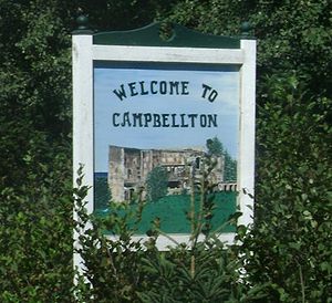
- CampbelltonCampbellton, New BrunswickCampbellton is a Canadian city in Restigouche County, New Brunswick.Situated on the south bank of the Restigouche River opposite Pointe-à-la-Croix, Quebec, Campbellton was officially incorporated in 1889 and achieved city status in 1958.Forestry and tourism are major industries in the regional...
- DalhousieDalhousie, New BrunswickDalhousie is a Canadian town located in Restigouche County, New Brunswick.- History :Dalhousie is the shire town of Restigouche County and dates European settlement to 1800. The Town of Dalhousie has been through some very distinct periods between its founding in 1825 and today...
- DrummondDrummond, New BrunswickDrummond is a Canadian village in Victoria County, New Brunswick. Its population as of the Canada 2006 Census is 839, with roughly 95% of its residents being FrancophoneIt is located in rolling farmland approximately 5 kilometres southeast of Grand Falls...
- Dundas ParishDundas Parish, New BrunswickDundas is a Canadian parish in Kent County, New Brunswick.Its population in the 2006 Census was 6,356.-Delineation:Dundas Parish is defined in the Territorial Division Act as:-Communities:*Cormierville*Caissie Cape*Grande-Digue*Guguen...
- ElginElgin, New BrunswickElgin is a Canadian rural community in Albert County, New Brunswick.It is situated in the western part of the county, approximately 14 kilometres south of Petitcodiac on Highway 905....
- Lower KintoreLower Kintore, New BrunswickLower Kintore is a Canadian rural community in Victoria County, New Brunswick.It received its name from migrants on the ship Castella who named it after Kintore, Scotland.----...
and Upper Kintore, New BrunswickUpper Kintore, New BrunswickUpper Kintore is a Canadian rural community in Victoria County, New Brunswick.It received its name from migrants on the ship Castella who named it after Kintore, Scotland.----...
(KintoreKintore, AberdeenshireKintore is a town and former royal burgh near Inverurie in Aberdeenshire, Scotland, now bypassed by the A96 road between Aberdeen and Inverness. The name Kintore comes from the Gaelic, Ceann Tòrr. Ceann means the head, or the end, and Tòrr means a round hill. So the name signifies that the town...
) - MintoMinto, New BrunswickMinto is a Canadian village straddling the border of Sunbury County and Queens County, New Brunswick. Located on the north shore of Grand Lake, approximately 50 kilometres northeast of Fredericton, its population meets the requirements for "town" status under the Municipalities Act of the...
- New Scotland
- Perth-Andover
- Port ElginPort Elgin, New BrunswickPort Elgin is a Canadian village in Westmorland County, New Brunswick.Port Elgin is situated near the Nova Scotia border at the mouth of the Gaspareaux River where it empties into Baie Verte.-History:...
(ElginElgin, MorayElgin is a former cathedral city and Royal Burgh in Moray, Scotland. It is the administrative and commercial centre for Moray. The town originated to the south of the River Lossie on the higher ground above the flood plain. Elgin is first documented in the Cartulary of Moray in 1190...
) - RothesayRothesay, New BrunswickRothesay is a Canadian town located in Kings County, New Brunswick. It is a bedroom community of Saint John along the Kennebecasis River.Located along the lower Kennebecasis River valley, Rothesay borders the city of Saint John to the southwest, and the neighbouring town of Quispamsis to the...
- St AndrewsSt. Andrews, New BrunswickSt. Andrews is a Canadian town in Charlotte County, New Brunswick.It is sometimes referred to in tourism marketing by its unofficial nickname "St. Andrews-by-the-sea".-Geography:St...
Newfoundland and LabradorNewfoundland and LabradorNewfoundland and Labrador is the easternmost province of Canada. Situated in the country's Atlantic region, it incorporates the island of Newfoundland and mainland Labrador with a combined area of . As of April 2011, the province's estimated population is 508,400...
- Anderson's CoveAnderson's Cove, Newfoundland and LabradorAnderson's Cove is a Canadian settlement in the province of Newfoundland and Labrador.Its primary industry was fishing. It had one church. The first Postmaster was Joshiah Thornhill in 1891. The population was 50 in 1911, 11 in 1940, 106 in 1951, and 94 in 1956.-See also:*List of communities in...
- BuchansBuchans, Newfoundland and LabradorBuchans is a Canadian town located in the central part of the island of Newfoundland in the province of Newfoundland and Labrador. It is situated on the northwest shore of Red Indian Lake on the Buchans River....
and Lake Buchans - Campbell's CreekCampbell's Creek, Newfoundland and LabradorCampbell's Creek is a settlement in Newfoundland and Labrador....
- CampbelltonCampbellton, Newfoundland and LabradorCampbellton is a small lumbering and fishing community located on the island of Newfoundland at Indian Arm, Notre Dame Bay. The community was originally named Indian Arm due to a Beothuk village located on the nearby Indian Arm River. It was renamed to Campbellton in honor of the sawmill manager...
- Hamilton RiverHamilton River, Newfoundland and LabradorHamilton River is located in the Grand Falls area of Labrador. The post office was established here on July 31, 1952. The first Postmistress was Mrs Una Saunders. The mail arrived four times a week from Goose Bay. In 1954 the Postmaster was Robert H. Davis and in 1956, Gordon Bloomfield and 1957,...
- Highlands
- HolyroodHolyrood, Newfoundland and LabradorHolyrood is a town on the Avalon Peninsula in Newfoundland and Labrador, Canada. It is in Division No. 1, on Conception Bay. During King William's War, the village was destroyed in the Avalon Peninsula Campaign....
(HolyroodHolyrood, EdinburghHolyrood is an area in Edinburgh, the capital of Scotland. Lying east of the city centre, at the end of the Royal Mile, Holyrood was once in the separate burgh of Canongate before the expansion of Edinburgh in 1856...
is the site of the current Scottish ParliamentScottish ParliamentThe Scottish Parliament is the devolved national, unicameral legislature of Scotland, located in the Holyrood area of the capital, Edinburgh. The Parliament, informally referred to as "Holyrood", is a democratically elected body comprising 129 members known as Members of the Scottish Parliament...
) - IonaIona, Newfoundland and LabradorIona is a group of small islands in Placentia Bay that used to be inhabited. The islands were once called Ram's or Ram's Island. The population was 100 in 1921 and 67 in 1940. The depression of the 1930's severely impacted the Island's people, causing many people to leave and find work...
- Loch LevenLoch Leven, Newfoundland and Labrador-See also:* List of communities in Newfoundland and Labrador...
- Loch LomondLoch Lomond, Newfoundland and LabradorLoch Lomond was a community in Newfoundland and Labrador near St. Andrews. It had a population of 67 in 1956.-See also:* List of communities in Newfoundland and Labrador...
- LomondLomond, Newfoundland and LabradorLomond was a settlement located southeast of Woody Point. It had a population of 141 in 1940 and 125 in 1956.-See also:* List of communities in Newfoundland and Labrador...
- McKay'sMcKay's, Newfoundland and LabradorMcKay's is a settlement in Newfoundland and Labrador....
- MelroseMelrose, Newfoundland and LabradorMelrose is a settlement in Newfoundland and Labrador.In 2005 Melrose was amalgamated with Catalina and Port Union to form the town of Trinity Bay North....
- St. Andrew'sSt. Andrew's, Newfoundland and LabradorSt. Andrew's is a settlement in the southwestern corner of the island of Newfoundland, in the Canadian province of Newfoundland and Labrador....
Nova ScotiaNova ScotiaNova Scotia is one of Canada's three Maritime provinces and is the most populous province in Atlantic Canada. The name of the province is Latin for "New Scotland," but "Nova Scotia" is the recognized, English-language name of the province. The provincial capital is Halifax. Nova Scotia is the...
Latin
Latin is an Italic language originally spoken in Latium and Ancient Rome. It, along with most European languages, is a descendant of the ancient Proto-Indo-European language. Although it is considered a dead language, a number of scholars and members of the Christian clergy speak it fluently, and...
for New Scotland
- ArgyleArgyle, Nova ScotiaArgyle is a municipal district in Yarmouth County, Nova Scotia.The district occupies the eastern portion of the county and is one of three municipal units - the other two being the town of Yarmouth and the Yarmouth municipal district.-History:...
- Arisaig
- Ben EoinBen Eoin, Nova ScotiaBen Eoin is a community in the Canadian province of Nova Scotia, located in the Cape Breton Regional Municipality.-References:*...
(from the Scottish Gaelic for "mountain of the birds") - Beinn BhreaghBeinn Bhreagh, Nova ScotiaBeinn Bhreagh, generally pronounced "ban vreeagh", is the name of the estate founded by Dr. Alexander Graham Bell, which has become an unincorporated rural community located in Victoria County, Nova Scotia, Canada...
- Beinn ScalpieBeinn Scalpie, Nova ScotiaBeinn Scalpie is a small community in the Canadian province of Nova Scotia, located in Victoria County on Cape Breton Island.- References :*...
- BerwickBerwick, Nova ScotiaBerwick is a Canadian town in Kings County, Nova Scotia. The town is located in the eastern part of the Annapolis Valley on the Cornwallis River. The town site stretches south from the river and Exit 15 of Highway 101 to Highway 1...
- BroughtonBroughton, Nova ScotiaBroughton is a community in the Cape Breton Regional Municipality about 12 miles from the former city of Sydney, Nova Scotia. Expected to be a boomtown when first settled, it was mostly abandoned when mining operations failed....
(ghost town) - CaledoniaCaledonia, Nova ScotiaCaledonia, Nova Scotia is a village located in northern Region of Queens Municipality, Nova Scotia along Trunk 8 . It is about 30 miles north of Liverpool. 11 miles north of Caledonia, in Maitland Bridge,is the main entrance to Kejimkujik National Park...
- ClydesdaleClydesdale, Nova ScotiaClydesdale is a community in the Canadian province of Nova Scotia, located in Antigonish County.Originally founded by Dylan Brophy in 1814, Clydesdale has since become a historical landmark and has been named after Dylan Brophy himself...
Dunmaglas
- DunveganDunvegan, Nova ScotiaDunvegan is a small community in the Canadian province of Nova Scotia, located in Inverness County on Cape Breton Island.The name is derived from Dunvegan on the Isle of Skye in Scotland.-References:*...
- Inverness County
- GlendaleGlendale, Nova ScotiaGlendale is a small community in the Canadian province of Nova Scotia, located in Inverness County on Cape Breton Island. It is named after Glendale in Scotland.-References:*...
- InvernessInverness, Nova ScotiaInverness is a Canadian rural community in Inverness County, Nova Scotia. In 2001 its population was 2,496.Located on the west coast of Cape Breton Island fronting the Gulf of St...
- Glendale
- Glencoe
- KnoydartKnoydart, Nova ScotiaKnoydart is a community in the Canadian province of Nova Scotia, located in Pictou County. It is most notable for the Culloden Cairn, commemorating those who fought on the side of Bonnie Prince Charlie at the Battle of Culloden. It is named after Knoydart in Scotland.-References:**...
- LismoreLismore, Nova ScotiaLismore is a community in the Canadian province of Nova Scotia, located in Pictou County.The name Lismore comes from Irish Lios Mór or Scottish Gaelic Lios Mòr, both meaning "great ringfort".-References:*...
Lochaber
- Loch BroomLoch Broom, Nova ScotiaLoch Broom is a community in the Canadian province of Nova Scotia, located in Pictou County. It is named after Loch Broom in Scotland.-References:*...
Loch Lomond
McArra's Brook
- New GlasgowNew Glasgow, Nova ScotiaNew Glasgow is a town in Pictou County, in the province of Nova Scotia, Canada. It is situated on the banks of the East River of Pictou, which flows into Pictou Harbour, a sub-basin of the Northumberland Strait....
- New RossNew Ross, Nova ScotiaNew Ross is a community in the Canadian province of Nova Scotia, located in the Chester Municipal District. Home of the Ross Farm Museum.New Ross was the end-point for construction of the Western segment of the Annapolis Road which was intended to eventually reach Halifax...
North Grant
- Scotch VillageScotch Village, Nova ScotiaScotch Village is a community in the Canadian province of Nova Scotia, located in the Municipality of West Hants .-References:**...
- Victoria CountyVictoria County, Nova ScotiaVictoria County is a county in the Canadian province of Nova Scotia.The shire town and largest municipality is the village of Baddeck.-History:Named after Queen Victoria, it was established by statute in 1851...
- IonaIona, Nova ScotiaIona is a small community in the Canadian province of Nova Scotia, located in Victoria County on Cape Breton Island. It is named after Iona in Scotland. Perched above the Barra Strait between the Great Bras d'Or and Piper's Cove portions of Bras d'Or Lake, Iona is the western terminus of the...
- Iona
Northwest TerritoriesNorthwest TerritoriesThe Northwest Territories is a federal territory of Canada.Located in northern Canada, the territory borders Canada's two other territories, Yukon to the west and Nunavut to the east, and three provinces: British Columbia to the southwest, and Alberta and Saskatchewan to the south...
The Northwest TerritoriesNorthwest Territories
The Northwest Territories is a federal territory of Canada.Located in northern Canada, the territory borders Canada's two other territories, Yukon to the west and Nunavut to the east, and three provinces: British Columbia to the southwest, and Alberta and Saskatchewan to the south...
also contain three places with Scottish surnames: Fort Simpson, Fort McPherson
Fort McPherson
Fort McPherson was a U.S. Army military base located in East Point, Georgia, on the southwest edge of the City of Atlanta, Ga. It was the headquarters for the U.S. Army Installation Management Command, Southeast Region; the U.S. Army Forces Command; the U.S. Army Reserve Command; the U.S...
and Rae (Although now collectively known with Edzo as Behchoko).
- Cameron River Volcanic BeltCameron River Volcanic BeltThe Cameron River Volcanic Belt is a Neoarchean volcanic belt near the Cameron River in the Northwest Territories, Canada. It contains pillow lavas about 2600 million years old, indicating that great oceanic volcanoes existed during the early stages of the formation of the Earth's crust.-See...
- District of MackenzieDistrict of MackenzieThe District of Mackenzie was a regional administrative district of Canada's Northwest Territories. The district consisted of the portion of the Northwest Territories directly north of British Columbia, Alberta, and Saskatchewan on Canada's mainland....
- Ferguson Lake (Kitikmeot Region)Ferguson Lake (Kitikmeot Region)Ferguson Lake is located on southern Victoria Island in the Kitikmeot Region of Nunavut, in northern Canada...
- Finlayson IslandsFinlayson IslandsThe Finlayson Islands are a string of Canadian arctic islands in Nunavut, Canada. The group lies in Dease Strait, approximately from Cape Alexander, south of Victoria Island and north of the mainland's Kent Peninsula...
- Fort McPhersonFort McPherson, Northwest TerritoriesFort McPherson is a hamlet located in the Inuvik Region of the Northwest Territories, Canada. It is located on the east bank of the Peel River and is south of Inuvik on the Dempster Highway....
(Murdoch McPherson) - Fort Simpson (George SimpsonGeorge Simpson (administrator)Sir George Simpson was a Scots-Quebecer and employee of the Hudson's Bay Company . His title was Governor-in-Chief of Rupert's Land and administrator over the Northwest Territories and Columbia Department in British North America from 1821 to 1860.-Early years:George Simpson was born in Dingwall,...
)] - Mackenzie HighwayMackenzie HighwayThe Mackenzie Highway is a Canadian highway in northern Alberta and the Northwest Territories. It begins as Alberta Highway 2 at Mile Zero in Grimshaw, Alberta...
- Mackenzie MountainsMackenzie MountainsThe Mackenzie Mountains are a mountain range forming part of the Yukon-Northwest Territories boundary between the Liard and Peel rivers. The range is named in honour of Canada's second Prime Minister Alexander Mackenzie. Nahanni National Park Reserve is in the Mackenzie Mountains.The Mackenzie...
and Mackenzie RiverMackenzie RiverThe Mackenzie River is the largest river system in Canada. It flows through a vast, isolated region of forest and tundra entirely within the country's Northwest Territories, although its many tributaries reach into four other Canadian provinces and territories... - Macmillan Pass
- Melville Island (named for Robert Dundas, 2nd Viscount MelvilleRobert Dundas, 2nd Viscount MelvilleRobert Dundas, 2nd Viscount Melville KT, PC, FRS was a British statesman, the son of Henry Dundas, the 1st Viscount. Dundas was the Member of Parliament for Hastings in 1794, Rye in 1796 and Midlothian in 1801. He was also Keeper of the Signet for Scotland from 1800...
NunavutNunavutNunavut is the largest and newest federal territory of Canada; it was separated officially from the Northwest Territories on April 1, 1999, via the Nunavut Act and the Nunavut Land Claims Agreement Act, though the actual boundaries had been established in 1993...
- Baillie-Hamilton IslandBaillie-Hamilton IslandBaillie-Hamilton Island is one of the Canadian arctic islands in Nunavut, Canada. The island is rectangular in shape, , and has an area of .Baillie-Hamilton Island is surrounded by larger islands. Devon Island is to the north and the east, across Wellington Channel. Cornwallis Island is to the...
- Cameron IslandCameron IslandCameron Island is one of the Canadian arctic islands in Nunavut, Canada. Located in the Arctic Ocean, close to Bathurst Island, it has an area of . Île Vanier lies immediately to the south, across the Arnott Strait.- Commercial oil production :...
- Clyde Inlet and Clyde RiverClyde River, NunavutClyde River is an Inuit hamlet located on the shore of Baffin Island's Patricia Bay, off Clyde Inlet, an arm of Davis Strait in the Qikiqtaaluk Region, of Nunavut Canada. It lies in the Baffin Mountains which in turn form part of the Arctic Cordillera mountain range...
- Craig Harbour (on Ellesmere IslandEllesmere IslandEllesmere Island is part of the Qikiqtaaluk Region of the Canadian territory of Nunavut. Lying within the Canadian Arctic Archipelago, it is considered part of the Queen Elizabeth Islands, with Cape Columbia being the most northerly point of land in Canada...
) - Dundas HarbourDundas Harbour, NunavutDundas Harbour is an abandoned settlement in Qikiqtaaluk, Nunavut, Canada. It is located on Devon Island at the eastern shore of the waterway also named Dundas Harbour...
- Edinburgh Island (PIN-DA)
- Eglinton IslandEglinton IslandEglinton Island an uninhabited island of the Canadian Arctic Archipelago in the Northwest Territories, Canada. Eglinton is one of the Queen Elizabeth Islands. Located at 75°48'N 118°30'W, it measures in size...
- Graham Island
- Houston Stewart IslandHouston Stewart IslandHouston Stewart Island is one of the Canadian arctic islands in Nunavut, Canada. Located in the Queens Channel, it is surrounded by larger islands: Devon Island to the north; Dundas Island and Margaret Island to the northeast; Baillie-Hamilton Island to the east; Cornwallis Island to the south;...
- McConnell River Migratory Bird SanctuaryMcConnell River Migratory Bird SanctuaryThe McConnell River Migratory Bird Sanctuary is located in the Kivalliq Region of Nunavut, Canada. The 32,800 hectar sanctuary, at , is on Hudson Bay's west coast, 27 km south of Arviat, and 50 km north of the Manitoba border. Its namesake is the McConnell River which flows to the Hudson...
and McConnell RiverMcConnell RiverThe McConnell River is located in the Kivalliq Region of northern Canada's territory of Nunavut. It drains into Hudson Bay and is the namesake for the McConnell River Migratory Bird Sanctuary.It is home to Snow and Canada geese.-References:... - Mackar Inlet (CAM-5)
- Mackenzie hotspotMackenzie hotspotThe Mackenzie hotspot was a volcanic hotspot that existed about 1,267 million years ago across Canada from the Northwest Territories and Nunavut. It is responsible for the creation of the Mackenzie Large Igneous Province, which contains the largest dike swarm on Earth...
and Mackenzie dike swarmMackenzie dike swarmThe Mackenzie dike swarm, also called the Mackenzie dikes, form a large igneous province in the western Canadian Shield of Canada. It is part of the larger Mackenzie Large Igneous Province and is one of more than three dozen dike swarms in various parts of the Canadian Shield... - Melville Island (named for Robert Dundas, 2nd Viscount MelvilleRobert Dundas, 2nd Viscount MelvilleRobert Dundas, 2nd Viscount Melville KT, PC, FRS was a British statesman, the son of Henry Dundas, the 1st Viscount. Dundas was the Member of Parliament for Hastings in 1794, Rye in 1796 and Midlothian in 1801. He was also Keeper of the Signet for Scotland from 1800...
)- Dundas Peninsula (part of Melville Island)
- Melville PeninsulaMelville PeninsulaMelville Peninsula is a large peninsula in the Canadian Arctic. Since 1999, it has been part of Nunavut. Before that, it was part of the District of Franklin. It's separated from Southampton Island by Frozen Strait. The narrow isthmus connecting the peninsula to the mainland is styled the “Rae...
- Rankin Inlet
- Simpson Lake (CAM-D)
OntarioOntarioOntario is a province of Canada, located in east-central Canada. It is Canada's most populous province and second largest in total area. It is home to the nation's most populous city, Toronto, and the nation's capital, Ottawa....
- Aberdeen, Grey CountyAberdeen, Grey County, OntarioAberdeen is a community in Grey County, Ontario, Canada. Aberdeen consists of a series of houses in a historical Canadian village site. The village is located north of both the Durham Interforest factory and the stretch of Grey Road 4 between Durham and Hanover.The first settlers came to Aberdeen...
- Aberdeen, Prescott and Russell County
- Aberfeldy
- Aberfoyle
- AchrayAchray, OntarioAchray is an unincorporated place and former railway point in geographic Stratton Township in the Unorganized South Part of Nipissing District in northeastern Ontario, Canada...
- Ailsa Craig
- Alloa
- Angus
- Angus GlenAngus Glen, OntarioAngus Glen is a community in the north part of Markham, Ontario, Canada, and is part of Unionville...
- Ardbeg
- Ardoch
- ArmadaleArmadale, OntarioArmadale is the name of a community that overlaps into the Town of Markham and the former city of Scarborough in Toronto, Ontario, Canada. The historical community is situated in the south-east of Markham and north-east of Scarborough.-History:...
- Armstrong, Thunder Bay DistrictArmstrong, Thunder Bay District, OntarioArmstrong is a community and divisional point on the Canadian National Railway in the unorganized portion of Thunder Bay District, Ontario. The Whitesand First Nation's Armstrong Settlement is coterminous to this community....
- Armstrong TownshipArmstrong, OntarioArmstrong is a township in the Timiskaming District of Ontario. The community of Earlton is part of Armstrong Township.-References :**...
, Armstrong Corners and Armstrong Mills - ArnpriorArnprior, OntarioArnprior is a town in Renfrew County, in the eastern portion of Southern Ontario, Canada. It is located at the mouth of the Madawaska River, as it enters the Ottawa River in the Ottawa Valley...
- Arranvale (Isle of ArranIsle of ArranArran or the Isle of Arran is the largest island in the Firth of Clyde, Scotland, and with an area of is the seventh largest Scottish island. It is in the unitary council area of North Ayrshire and the 2001 census had a resident population of 5,058...
) - Athol, Prince Edward County
- Athol, Stormont, Dundas and Glengarry United Counties
- Avonmore
- AyrAyr, OntarioThe village of Ayr, Ontario, Canada is a settlement located within the Township of North Dumfries in the Regional Municipality of Waterloo in Southwestern Ontario...
- AytonAyton, OntarioAyton is a community in the municipality of West Grey, Grey County, Ontario, Canada.Formerly the seat of local government for the disbanded Normanby Township, it is best described as a rural village nestled on the banks of the South Saugeen River and the centre of a prosperous farming area.Although...
- Badenoch
- Bainsville
- Bairds
- BallantraeBallantrae, OntarioBallantrae, Ontario is a hamlet in the Town of Whitchurch–Stouffville. Named for the village of Ballantrae in South Ayrshire, Scotland, the community is centred around the intersection of Aurora Road and Highway 48...
- Ballinafad
- Bannockburn
- Baxter
- Bell Ewart
- Berriedale (Berriedale, Sutherland)
- Berwick
- Bisset Creek
- Bothwell
- Boyds (Surname, derived from ButeBute- People :* John Stuart, 3rd Earl of Bute , British Prime Minister in office between 1762 and 1763* Marquess of Bute, a peerage title in the Peerage of Great Britain* Lucian Bute , Romanian boxer...
) - Brechin
- Brucedale
- Bruce MinesBruce Mines, OntarioBruce Mines is a town in the Canadian province of Ontario, located on the north shore of Lake Huron in the Algoma District along Highway 17. The town of Bruce Mines has a population of 584 residents. The current mayor of Bruce Mines is Gordon Post.- History :...
- Bruce PeninsulaBruce PeninsulaThe Bruce Peninsula is a peninsula in Ontario, Canada that lies between Georgian Bay and the main basin of Lake Huron. The peninsula extends roughly northwestwards from the rest of Southern Ontario, pointing towards Manitoulin Island, with which it forms the widest strait joining Georgian Bay to...
- Bruce Station
- Cairngorm
- CaledonCaledon, OntarioCaledon is a town in the Regional Municipality of Peel in the Greater Toronto Area of Ontario, Canada. In terms of land use, Caledon is somewhat urban, though it is primarily rural in nature...
- Caledon East
- CaledoniaCaledonia, OntarioCaledonia is a small riverside community and former town located on the Grand River in Haldimand County, Ontario, Canada. Haldimand County is in the western part of the Niagara Peninsula, and had a population of 43,280 in 2001. The current mayor of Haldimand County is Ken Hewitt; Caledonia is...
- Caledonia SpringsCaledonia Springs, OntarioCaledonia Springs is a community in the northwest of the municipality of The Nation, Prescott and Russell United Counties in eastern Ontario, Canada. It is part of the National Capital Region and is in the geographic county of Caledonia....
- CallanderCallander, OntarioThe Municipality of Callander is a township in central Ontario, Canada, located at the southeast end of Lake Nipissing in the District of Parry Sound...
- CampbellcroftCampbellcroft, OntarioCampbellcroft is a rural hamlet located 15 kilometres north of Lake Ontario in the Municipality of Port Hope, Ontario in Northumberland County....
- CampbellfordCampbellford, OntarioCampbellford is a small town in Northumberland County, Ontario, Canada, in the municipality of Trent Hills.Located at , Campbellford lies approximately midway between Toronto and Ottawa. It is situated on both the Trent-Severn Waterway and the Trans Canada Trail. It can be reached from Highway...
- CampbellvilleCampbellville, OntarioCampbellville, Ontario, Canada is a community in the geographic township of Nassagaweya in the Town of Milton, Halton Region on the Niagara Escarpment and is a tourist destination for residents of the Greater Toronto Area...
- Cargill
- Cockburn Island
- Coldstream
- Colgan
- Craigleith
- CraigmontCraigmont, OntarioCraigmont is a ghost town in the Canadian province of Ontario. It straddles the municipal boundary of Carlow/Mayo in Hastings County and Brudenell, Lyndoch and Raglan in Renfrew County. It was a former mining town that produced corundum from deposits in Mount Robillard, directly north of the...
- CromartyCromarty, OntarioCromarty is a community in the Canadian province of Ontario. It is located in West Perth, in Perth County, approximately 2 km south of Staffa, Ontario.Cromarty only recently acquired the ability to light homes in the community using electricity...
- Crombie
- Cruikshank
- Dalhousie Lake
- Dalhousie Mills
- Dalkeith
- DalmenyDalmeny, OntarioDalmeny is a community in the Canadian province of Ontario, located within the Osgoode area of Ottawa....
- DalrympleDalrymple, Ontario-See also:*List of communities in Ontario...
- DrummondDrummond/North Elmsley, OntarioDrummond/North Elmsley is a township in eastern Ontario, Canada in the County of Lanark. It is situated on the north shore of the Rideau River between the town of Perth and the town of Smiths Falls. The township covers 364.78 km²...
- DundasDundas, OntarioDundas is a formerly independent town and now constituent community in the city of Hamilton in Ontario, Canada. It's nickname is the Valley Town. The population has been stable for decades at about twenty thousand, largely because it has not annexed rural land from the protected Dundas Valley...
- Dundonald
- Dunedin (Dunedin, poetic name for EdinburghEdinburghEdinburgh is the capital city of Scotland, the second largest city in Scotland, and the eighth most populous in the United Kingdom. The City of Edinburgh Council governs one of Scotland's 32 local government council areas. The council area includes urban Edinburgh and a rural area...
/Dun Eideann) - Dunkeld
- Dunvegan
- Dysart et al. (DysartDysartDysart is a former town and royal burgh located on the south-east coast between Kirkcaldy and West Wemyss in Fife. The town is now considered to be a suburb of Kirkcaldy. Dysart was once part of a wider estate owned by the St Clair or Sinclair family...
) - East Tay Point (TayRiver TayThe River Tay is the longest river in Scotland and the seventh-longest in the United Kingdom. The Tay originates in western Scotland on the slopes of Ben Lui , then flows easterly across the Highlands, through Loch Dochhart, Loch Lubhair and Loch Tay, then continues east through Strathtay , in...
) - Elgin
- Elgin County, OntarioElgin County, OntarioElgin County is a county and census division of the Canadian province of Ontario with a current population of approximately 46,000. The county seat is St. Thomas.It consists of:*Town of Aylmer*Municipality of Bayham*Municipality of Central Elgin...
- FarquharFarquhar, OntarioFarquhar is a community in the Canadian province of Ontario, in the municipality of South Huron....
- FergusFergus, OntarioFergus is the largest community in Centre Wellington, a township within Wellington County in Ontario, Canada. It lies on the Grand River about 25 km north of Guelph.-History:...
- Ferguslea
- Ferguson Corners, Ferguson Falls and Fergusons Beach
- Galbraith
- Gillies Hill
- Gilmour
- GlasgowGlasgow, OntarioGlasgow is a community in the Canadian province of Ontario, located in the Regional Municipality of Durham. It is located on the edge of lands designated for a future international airport , immediately east of the community of Stouffville and north of the ghost-town of Altona. There was a...
- Glen
- Glen Buell
- Glenburn
- GlenburnieGlenburnie, OntarioGlenburnie is a community in the region of Frontenac, Ontario....
- Glen Cross
- Glenfield
- Glen Huron
- Glencairn
- Glencoe
- Glenelg Centre
- Glen Major
- Glen Nevis
- GlenoraGlenora, OntarioGlenora is a community in the Canadian province of Ontario, on the north shore of the Bay of Quinte.The Bay of Quinte is a long narrow inlet on the north shore of Lake Ontario.A ferry connects the two shores between Glenora and Adolphustown....
- Glen Robertson
- Glenview
- Glenville
- Glen WilliamsGlen Williams, OntarioGlen Williams is a hamlet in the Credit River valley in the province of Ontario, Canada. It is part of Halton Hills in the Halton Regional Municipality. The Credit River extends over 1500 km from the Niagara Escarpment, emptying into Lake Ontario at Port Credit, Mississauga...
- Gorrie
- Greenock
- Haliburton
- HamiltonHamilton, OntarioHamilton is a port city in the Canadian province of Ontario. Conceived by George Hamilton when he purchased the Durand farm shortly after the War of 1812, Hamilton has become the centre of a densely populated and industrialized region at the west end of Lake Ontario known as the Golden Horseshoe...
- Hampden
- Henderson
- Innerkip
- InveraryInverary, OntarioInverary is a community in South Frontenac, Ontario, Canada.-Education:Perth Road Public School, an elementary school near Inverary, is operated by the Limestone District School Board.-Postal services:...
- InverhuronInverhuron, OntarioInverhuron is a community located within the Municipality of Kincardine in the Canadian province of Ontario. The community includes approximately 200 permanent residents and 400 seasonal cottagers....
(inbhir, meaning river mouth + Huron) - Invermay
- Iona and Iona StationIona Station, OntarioIona Station is a hamlet located on the border of Dutton-Dunwich and Southwold Townships, in Elgin County, Ontario, Canada.The "station" in the name was on the Canada Southern Railroad owned by the Michigan Central Railroad, later by the New York Central Railroad.The Canadian-American economist...
- Jura, Ontario
- Katrine (Loch KatrineLoch KatrineLoch Katrine is a freshwater loch in the district of Stirling, Scotland. It is roughly 8 miles long by 2/3 of a mile wide and runs the length of Strath Gartney...
) - KilsythKilsyth, OntarioKilsyth is an unincorporated community in rural Georgian Bluffs Township, Ontario, Canada with an approximate population of 100 people. The village is a quiet rural place set in pleasant rolling farmland...
- Kinburn
- KincardineKincardine, OntarioThe Municipality of Kincardine is located on the shores of Lake Huron in the County of Bruce in the province of Ontario, Canada. It has a population of 12,000, and covers an area of 580 square kilometres...
- Kinghorn
- KinmountKinmount, OntarioKinmount is a village with a population of approximately 500, located on the Burnt River in Ontario, Canada. The village is now part of the City of Kawartha Lakes. The village's hinterland covers large sections of both Haliburton and Peterborough counties for which it is a shopping and cultural...
- Kintail
- KirkfieldKirkfield, OntarioKirkfield is a village located in the city of Kawartha Lakes, in the Canadian province of Ontario. The unincorporated village was named in 1864 after the initial name, Novar, was rejected by the government. A list of 8 possible choices was then offered. The village, being predominantly Scottish at...
- Laggan
- LairdLaird, OntarioLaird is a township and village in the Algoma District in Northern Ontario, Canada. The township had a population of 1,078 in the Canada 2006 Census.-Communities:The township includes the named communities of Laird and Neebish...
- Lake Dalrymple (DalrympleDalrympleDalrymple may refer to:* HMS Dalrymple , frigate of the British Royal Navy* Dalrymple's sign, a medical condition of the eyes associated with goitre-Places:* Dalrymple, Queensland, the first inland town in northern Australia...
) - Lamlash
- Lammermoor
- LanarkLanark, OntarioThe village of Lanark is located in the township of Lanark Highlands in eastern Ontario, Canada.-History:The village was first settled in 1820 by Scottish immigrants who named it after the town of Lanark in Scotland...
- LeithLeith, OntarioThe unincorporated village of Leith, named after Leith, Scotland, is located on the eastern shore of the Owen Sound, an inlet on the south shore of Georgian Bay on Lake Huron, about 9 km northeast of the city of Owen Sound, Ontario in Canada. Leith was established on the Telfer Creek where it...
- Lochalsh, Algoma District
- Lochalsh, Huron CountyLochalsh, Huron County, OntarioLochalsh is a community in Ontario....
- LochwinnochLochwinnoch, OntarioLochwinnoch is a settlement that straddles both Horton Township and McNab/Braeside in Renfrew County, Ontario, Canada.Lochwinnoch Church was opened November 11, 1894.One of two round barns is located in Lochwinnoch. It was built in 1884....
- LoganLogan, OntarioLogan is a community in Ontario....
- Lowther
- McAlpine Corners
- Macdiarmid
- MacDonald Bay
- MacDonald's Grove
- MacDuff
- MacGillivrays Bridge
- Mackenzie
- MacKenzie Point
- MacLarens LandingMacLarens Landing, OntarioMacLarens Landing is a community in Ontario....
- MacLean Park
- MacTier
- Maitland, Huron CountyMaitland, Huron County, OntarioMaitland is a community in Ontario....
- Maitland, United Counties of Leeds and GrenvilleMaitland, United Counties of Leeds and Grenville, OntarioMaitland is a community of approximately 1800 residents, about 5 km east of the city of Brockville, in Ontario, Canada. It is located on the shores of the Saint Lawrence River in the township of Augusta. The small village enjoys a rich history dating to the times of British colonialism...
- MalcolmMalcolm, OntarioMalcolm is a ghost town in Bruce County, Ontario, located within the municipality of Brockton....
- Maxwell, Grey CountyMaxwell, Grey County, OntarioMaxwell is a community in Ontario....
- Maxwell, Hastings CountyMaxwell, Hastings County, OntarioMaxwell is a community in Ontario....
- Maxwells
- MintoMinto, OntarioMinto is a town in midwestern Ontario, Canada, on the Maitland River in Wellington County. Minto is the eastern terminus of Highway 9. It is named for Gilbert Elliot-Murray-Kynynmound, 4th Earl of Minto; 8th Governor General of Canada....
- Moffat
- Monteith
- Moray
- Morven
- Nairn, Middlesex CountyNairn, Middlesex County, OntarioNairn is a community in Ontario.Nairn is a small community. A population that is around three hundred and sixty people. It contains a public school, a community park, a feed store, a bus depot and a Corner Store that varies in owner and never remains open for long....
- Nairn Centre
- NapierNapier, OntarioNapier is an unincorporated place on Napier Road in Adelaide–Metcalfe, western Middlesex County in southwestern Ontario, Canada. It is located on the Sydenham River southwest of the community of Strathroy...
- New DundeeNew Dundee, OntarioNew Dundee is a small community of about 1,500 people in the Township of Wilmot, Ontario, Canada, south-west of Kitchener.It is home to the Dundee Country Club golf course and the New Dundee Emporium, founded in 1887. Many small businesses are located within the community on Alder Lake. Some...
- New Glasgow
- New Scotland, Chatham-KentNew Scotland, Chatham-Kent, OntarioNew Scotland is a community in Chatham-Kent, Ontario. Prior to the municipal amalgamation of Chatham-Kent in 1998, the community was divided between the townships of Harwich and Howard....
- New Scotland, Regional Municipality of York
- PaisleyPaisley, OntarioPaisley is now an unincorporated community, a village in the Municipality of Arran-Elderslie in Bruce County, Ontario, Canada. Paisley is defined by its position at the confluence of the Saugeen River and the Teeswater River, and at the junction of Bruce Roads 1, 11, and 3.-History:Paisley began,...
- PerthPerth, OntarioPerth is a town in the eastern portion of Southern Ontario, Canada . It is located on the Tay River, 83 km southwest of Ottawa, and is the seat of Lanark County.-History:...
- Perth Road VillagePerth Road Village, OntarioPerth Road Village is a community in Ontario....
- Port ElginPort Elgin, OntarioPort Elgin is a community in the Ontario municipality of Saugeen Shores. Close to MacGregor Point Provincial Park in Bruce County, the community has several beaches on Lake Huron....
- Raith
- Rankin, Nipissing DistrictRankin, Nipissing District, OntarioRankin is a community in Ontario....
- Rankin, Renfrew CountyRankin, Renfrew County, OntarioRankin is a community in Ontario....
- Rannoch
- RathoRatho, OntarioRatho is a community in Ontario....
- RenfewRenfrew, OntarioRenfrew, Ontario, Canada, is a town on the Bonnechere River in Renfrew County. Located one hour west of Ottawa in Eastern Ontario, Renfrew is the third largest town in the county after Petawawa and Pembroke. The town is a small transportation hub connecting Ontario Highway 60 and Highway 132 with...
- Renfrew Junction
- Rutherford
- Rutherglen
- Scone
- Scotch Block
- Scotch Bush, Hastings County and Scotch Bush, Renfrew County
- Scotch Corners
- Scotia
- Selkirk
- Speyside
- St. Andrews
- Staffa, Perth County
- Stirling
- Tarbert
- Tartan
- TayTay, OntarioTay is a township in Central Ontario, Canada, located in the southern Georgian Bay region. Tay, like many other townships in the surrounding area such as Tiny Township was named after one of the several dogs owned by Sir Peregrine Maitland's wife....
- TweedTweed, OntarioTweed is a municipality and a village located in central-eastern Ontario, Canada, in Hastings County.The Municipality of Tweed is an amalgamated municipality comprising the former Village of Tweed and the former Townships of Hungerford and Elzevir & Grimsthorpe...
- West ElginWest Elgin, OntarioPopulation trend:* Population in 2006: 5349* Population in 2001: 5464* Population total in 1996: 5573** Aldborough : 4042** West Lorne : 1531* Population in 1991:** Aldborough : 3889** West Lorne : 1477...
(Elgin) - West Lorne (Lorne)
- [Wick
Prince Edward IslandPrince Edward IslandPrince Edward Island is a Canadian province consisting of an island of the same name, as well as other islands. The maritime province is the smallest in the nation in both land area and population...
- BreadalbaneBreadalbane, Prince Edward IslandBreadalbane is a community located in Queens County, Prince Edward Island. Its current population is 170.-History:Breadalbane was incorporated as a village in 1991. The village was named after Breadalbane, Scotland...
- Glenfinnan Island (Prince Edward Island) and Glenfinnan River
- Greenmount-Montrose
- Inverness
- Mount StewartMount Stewart, Prince Edward IslandMount Stewart is a Canadian village located in the northeastern part of Queens County, Prince Edward Island.Mount Stewart is located at the head of the once-navigable portion of the Hillsborough River at the point where the river begins to narrow significantly.The village played an important role...
- Lennox Island
- MacDonalds River
- Montrose River
- Murray River
- New GlasgowNew Glasgow, Prince Edward IslandNew Glasgow is an unincorporated area located in Queens County in the central portion of Prince Edward Island, south-west of North Rustico. It is situated on the Hunter River.-Climate:-External links:*...
- St AndrewsSt. Andrew's Parish, Prince Edward IslandSt. Andrew's Parish is a parish in Kings County, Prince Edward Island, Canada.It contains the following townships:* Lot 59* Lot 61* Lot 63* Lot 64...
QuebecQuebecQuebec or is a province in east-central Canada. It is the only Canadian province with a predominantly French-speaking population and the only one whose sole official language is French at the provincial level....
- AbercornAbercorn, QuebecAbercorn is a village in the Eastern Townships region of Québec, Canada. The population as of the Canada 2006 Census was 366. Ranked 3,426 in terms of population among Québec municipalities, it is situated in the southeastern Regional County Municipality of Brome-Missisquoi in the administrative...
- Campbell's BayCampbell's Bay, QuebecCampbell's Bay is a village in the Pontiac Regional County Municipality in western Quebec. Its population in 2001 was 766. It is the county seat and is home to most government offices for the county, including the Sûreté du Québec, and has French and English elementary schools. Campbell's Bay is in...
- DrummondvilleDrummondville, QuebecDrummondville is a city in the Centre-du-Québec region of Quebec, located east of Montreal on the Saint-François River. The population as of the Canada 2006 Census was 67,392...
and Drummond RCMDrummond Regional County Municipality, QuebecDrummond is a regional county municipality in central Quebec, Canada. The regional county municipality seat is Drummondville.-Communities:*Cities & Towns**Drummondville*Municipalities**Durham-Sud**L'Avenir**Lefebvre**Saint-Bonaventure... - Duncan Lake (Quebec)
- DundeeDundee, QuebecDundee is a township of Quebec, located within the Le Haut-Saint-Laurent Regional County Municipality in the Montérégie administrative region. The population as of the Canada 2006 Census was 436.-Population:Population trend-Language:...
- East AngusEast Angus, QuebecEast Angus is a city in Le Haut-Saint-François Regional County Municipality, in Quebec, Canada. The city had a population of 3,357 in the Canada 2006 Census....
- ElginElgin, Quebec-About Elgin:Elgin is a rural municipality of less than 500 people in Quebec, Canada. The population as of the Canada 2006 Census was 458. It is located southwest of Huntingdon and bounded by the Trout and Chateauguay rivers and the Québec - US border...
- HampdenHampden, QuebecHampden is a township of 300 people in Le Haut-Saint-François Regional County Municipality, in Quebec, Canada....
- InvernessInverness, QuebecInverness is a municipality in the Centre-du-Québec region of the province of Quebec in Canada....
- LennoxvilleLennoxville, QuebecLennoxville is an arrondissement, or borough, of the city of Sherbrooke, Quebec, Canada. Lennoxville is located at the confluence of the St. Francis and Massawippi Rivers approximately five kilometers south of downtown Sherbrooke....
- LochaberLochaber, QuebecLochaber is a township in the Canadian province of Quebec, located within the Papineau Regional County Municipality. The township had a population of 497 in the Canada 2006 Census.-Demographics:Population:* Population in 2006: 497...
- Lochaber-Partie-OuestLochaber-Partie-Ouest, QuebecLochaber-Partie-Ouest is a township municipality in the Canadian province of Quebec, located within the Papineau Regional County Municipality. The township had a population of 514 in the Canada 2006 Census.-References:...
- MacMastervilleMcMasterville, QuebecMcMasterville is a municipality in southwestern Quebec, Canada on the Richelieu River in the Regional County Municipality of La Vallée-du-Richelieu. The population as of the Canada 2006 Census was 5,234. It is within the Administrative Region of Montérégie....
- MacNider
- NapiervilleNapierville, QuebecNapierville is a municipality in the Jardins de Napierville Regional County Municipality in Quebec, Canada, situated in the Montérégie administrative region. The population as of the Canada 2006 Census was 3,352. It is the location of the seat of the Jardins de Napierville Regional County...
and Les Jardins de NapiervilleLes Jardins-de-Napierville Regional County Municipality, QuebecLes Jardins-de-Napierville is a Regional County Municipality in southwestern Quebec, Canada in the Montérégie region. Founded on January 1, 1982... - ScotstownScotstown, QuebecScotstown is a city of 617 people in Le Haut-Saint-François Regional County Municipality, in Quebec, Canada....
- South Glengarry
- StornowayStornoway, QuebecStornoway is a small village of 600 people. It is a municipality in Quebec, in the regional county municipality of Le Granit in the administrative region of Estrie...
- ThursoThurso, QuebecThurso is a city in the Papineau Regional County Municipality in the Outaouais region of western Quebec. It is located on the Ottawa River, and is within Canada's National Capital Region...
- TingwickTingwick, QuebecTingwick is a Canadian municipality of Quebec established in Arthabaska Regional County Municipality, Quebec.-Geography:Municipality of Tingwick is located inside Tingwick township that is part of Eastern Townships. There are 2 rivers: Rivière des Pins and Rivière des Rosiers .-Event:Festival...
SaskatchewanSaskatchewanSaskatchewan is a prairie province in Canada, which has an area of . Saskatchewan is bordered on the west by Alberta, on the north by the Northwest Territories, on the east by Manitoba, and on the south by the U.S. states of Montana and North Dakota....
- AberdeenAberdeen, Saskatchewan-Aberdeen Rec Complex:The Aberdeen Rec Complex is located in the town and consists of a Library, meeting room, ice rink, curling rink, bowling alley, dance studio, music room and meeting rooms.-Water supply:...
- Aberdeen No. 373Aberdeen No. 373, SaskatchewanAberdeen No. 373 is a rural municipality in north-central Saskatchewan, Canada on the South Saskatchewan River encompassing 673.43 square kilometers in area. It is located in census Division No. 15. The rural municipality has within its boundaries the towns of Aberdeen, Clarkboro, Edenburg which...
- Abernethy No. 186Abernethy No. 186, SaskatchewanAbernethy No. 186 is a rural municipality in southeastern Saskatchewan, Canada on the Qu'Appelle River and was formed on December 11, 1911. It is located in Division No...
and Abernethy - Argyle No. 1Argyle No. 1, SaskatchewanArgyle No. 1, Saskatchewan is a rural municipality in south-eastern Saskatchewan, Canada along Highway 18. The Local Improvement District number 1 became Rural Municipality of Argyle No...
- ArranArran, SaskatchewanArran is a village in eastern Saskatchewan, Canada, approximately 90 km northeast of Yorkton and 10 km west of the Manitoba border. Arran is located on Highway 49.- History :...
- BalcarresBalcarres, Saskatchewan-Geography:* Lat 50°48′ N* Long 103°33′ W* Dominion Land Survey 13-21-12-W2* Time zone UTC−6- Notable residents :* James Garfield Gardiner was a premier of Saskatchewan and minister in the Canadian Cabinet...
- BalgonieBalgonie, Saskatchewan-Sports:Home of Team Selzer, World Women's Curling Silver Medalists, and consistently competitive high school volleyball and soccer programs.-References:...
- BiggarBiggar, SaskatchewanBiggar is a town in central Saskatchewan, Canada. It is located on Highway #14, west of Saskatoon, the province’s most populous city. Biggar has become well known for its unusual town slogan, an Olympic athlete, and a world-record deer...
- BirsayBirsay, SaskatchewanBirsay, Saskatchewan is a hamlet in the middle of southern Saskatchewan, Canada, just down the highway from a village called Lucky Lake. It is located in the Rural Municipality of Coteau No. 255....
- CalderCalder, SaskatchewanCalder, is a village located in Calder Rural municipality No. 241 south-eastern Saskatchewan, Canada. The population was 80 at the 2006 census...
- Carmichael No. 109Carmichael No. 109, SaskatchewanCarmichael No. 109 is a rural municipality in the Canadian province of Saskatchewan, located in the Census Division 4. The seat of the municipality is located in Carmichael.-Demographics:...
- CarnduffCarnduff, Saskatchewan-External links:*...
- Clansman
- ColonsayColonsay, Saskatchewan-History:Colonsay experienced a record setting 167-day-long frost-free period in 1978, which was, to the dismay of a number of residents, still not a long enough growing season for yams or sweet potatoes ....
and Colonsay No. 342Colonsay No. 342, SaskatchewanColonsay No. 342 is a rural municipality in central Saskatchewan, Canada, east of Saskatoon. It is located inCensus Division number 11. The rural area population of the RM has been declining over the past few years.... - Crichton (ghost town)
- CuparCupar, Saskatchewan-See also:* List of communities in Saskatchewan* List of towns in Saskatchewan-External links:* *...
- DalmenyDalmeny, SaskatchewanDalmeny is a town in the central part of Saskatchewan, Canada, named after Dalmeny, Scotland. The town is located in the rural municipality of Corman Park. The Dominion Land Survey description of Dalmeny's location is Section 10 Tsp 39 Rge 6 W3.-Police:...
- DavidsonDavidson, SaskatchewanDavidson is a town in south central Saskatchewan, Canada. It is located 104 km southeast of Saskatoon beside provincial highway 11. It is located almost exactly halfway between Saskatoon and Regina and was a popular stopping-off point for travellers before Hwy...
- Fairy GlenFairy Glen, SaskatchewanFairy Glen is a hamlet in the Rural Municipality of Willow Creek No. 458 in the province of Saskatchewan, Canada. It not only has a Co-Op, but also a section of paved road. A "Faerie Glen" also exists in Scotland....
- Fife LakeFife Lake, SaskatchewanFife Lake is a small farming community located between Coronach and Rockglen in southern Saskatchewan, Canada near the border with the US. Approximately 35 people inhabit the village of Fife Lake....
- GirvinGirvin, Saskatchewan-Girvin Pump house:Built in the 1906, it is known as the only pump house in Saskatchewan making it a Provincial historic site of Saskatchewan on September 14, 1994, the pump house was constructed to provide access to water for horses used to haul grain to Girvin....
- Glen EwenGlen Ewen, Saskatchewan- See also :* List of communities in Saskatchewan* Villages of Saskatchewan-External links:* * * *******-Footnotes:...
- GlenavonGlenavon, Saskatchewan- See also :* List of communities in Saskatchewan* Villages of Saskatchewan-External links:*******-Footnotes:...
- GlensideGlenside, SaskatchewanGlenside is a village in Rudy No. 284, Saskatchewan, Canada. The population was 86 at the 2006 Canada Census a 36.5% increase from the 2001 Canada Census. The village is located on Highway 219 approximately 10 km east of the Town of Outlook....
- InchkeithInchkeith, SaskatchewanInchkeith is a community in Saskatchewan....
- Innes (ghost town)
- Invergordon No. 430Invergordon No. 430, SaskatchewanInvergordon No. 430, Saskatchewan was established December 11, 1911. It is a rural municipality of Saskatchewan located west of Melfort, Saskatchewan.-Statistics:According to the Canada 2001 Census:*Population: 664...
- Invermay
- Lomond No. 37Lomond No. 37, SaskatchewanLomond No. 37 is a rural municipality in south-eastern Saskatchewan, Canada south of Weyburn.The two principal industries in Lomond are agriculture and petroleum production....
- Lumsden No. 189Lumsden No. 189, SaskatchewanLumsden No. 189 is a rural municipality located in south-western Saskatchewan, Canada. It is located in Division No.6.Lumsden No. 189 completely surrounds the town of Lumsden. Other communities that are located at its perimeters include Buena Vista, Craven, Disley, Lumsden Beach, and Regina Beach....
- Isbister's SettlementPrince Albert, SaskatchewanPrince Albert is the third-largest city in Saskatchewan, Canada. It is situated in the centre of the province on the banks of the North Saskatchewan River. The city is known as the "Gateway to the North" because it is the last major centre along the route to the resources of northern Saskatchewan...
(former name of Prince Albert settlement) - Jedburgh
- Kyle
- KylemoreKylemore, SaskatchewanKylemore is an organized hamlet in the Canadian province of Saskatchewan, located 12 km east of Wadena, and approximately 250 km east of Saskatoon. Listed as a designated place by Statistics Canada, the hamlet had a population of 37 in the Canada 2006 Census....
- LairdLaird, Saskatchewan-External links:*******...
- LumsdenLumsden, Saskatchewan-History:Settlers first arrived in 1881 and the area came to be commonly known as Happy Hollow. When the Qu'Appelle, Long Lake and Saskatchewan Railway came through the community in 1889, the name was changed to Lumsden after Hugh Lumsden, a senior engineer with the railroad.The town has been...
- MarkinchMarkinch, Saskatchewan- See also :* List of communities in Saskatchewan* Villages of Saskatchewan-External links:*********-Footnotes:...
- MortlachMortlach, SaskatchewanMortlach is a village in Wheatlands Rural Municipality No. 163, Saskatchewan, Canada. The population was 254 at the 2006 Census. The village is located on the Trans Canada Highway about 40 km west of the city of Moose Jaw...
- Neidpath (ghost town)
- OrkneyOrkney, SaskatchewanOrkney is a hamlet in Val Marie No. 17, Saskatchewan, Canada. The population was 13 at the 2001 Canada Census.-Demographics:-Education:...
- Orkney No. 244Orkney No. 244, SaskatchewanThis article is about the rural municipality in Canada. For other places with the same name, see Orkney Orkney No. 244, Saskatchewan, is a rural municipality of 1,702 rural residents in the southeastern part of Saskatchewan, Canada. The RM was incorporated January 1, 1913...
- SaltcoatsSaltcoats, SaskatchewanSaltcoats is a small town in East Central Saskatchewan near the Manitoba border in Canada. The town's population is around 500. The town was built in the late 19th century, and its economy was driven by the railway...
- Ravenscrag (ghost town)
- ScotsguardScotsguard, SaskatchewanScotsguard is a small hamlet in Bone Creek Rural Municipality No. 108, Saskatchewan, Canada. Located on highway 13 also known as the historic Red Coat Trail, about 10 km northeast of Shaunavon, Saskatchewan.-Demographics:...
(ghost town) - SimpsonSimpson, Saskatchewan-Area statistics:*Lat 51°27′00″ N*Long 105°27′00″ W*Dominion Land Survey Section 3, Township 29, Range 25 West of the 2nd Meridian*Time zone UTC−6-Location:-External links:******-See also:...
- St. Boswells (ghost town)
- Tiree
The town of Coronach
Coronach, Saskatchewan
Coronach is a community in southern Saskatchewan, Canada near the US border. It was founded in 1926 by the Canadian Pacific Railway and named after Coronach, the horse who had just won the Epsom Derby in England that year...
was originally named after a horse; however, the original meaning of coronach
Coronach
A coronach is the Scottish Gaelic equivalent of the Goll , being the third part of a round of keening, the traditional improvised singing at a death, wake or funeral in the Highlands of Scotland and in Ireland...
is a Gaelic lament.
YukonYukonYukon is the westernmost and smallest of Canada's three federal territories. It was named after the Yukon River. The word Yukon means "Great River" in Gwich’in....
- Fort SelkirkFort Selkirk, YukonFort Selkirk is a former trading post on the Yukon River at the confluence of the Pelly River in Canada's Yukon. For many years it was home to the Selkirk First Nation ....
- Mackenzie MountainsMackenzie MountainsThe Mackenzie Mountains are a mountain range forming part of the Yukon-Northwest Territories boundary between the Liard and Peel rivers. The range is named in honour of Canada's second Prime Minister Alexander Mackenzie. Nahanni National Park Reserve is in the Mackenzie Mountains.The Mackenzie...
- Mount LoganMount LoganMount Logan is the highest mountain in Canada and the second-highest peak in North America, after Mount McKinley . The mountain was named after Sir William Edmond Logan, a Canadian geologist and founder of the Geological Survey of Canada . Mount Logan is located within Kluane National Park and...
and Houston's Peak - Mount LorneMount Lorne, YukonMount Lorne is an unincorporated hamlet in Canada's Yukon. Population in 2001 according to the Census was 379. It is located just south of Whitehorse, comprising rural residential areas along the South Klondike Highway, the Annie Lake Road and connecting sideroads. It is part of the Whitehorse...
(LorneLorne, Argyll and ButeLorne is an ancient district in the west of Scotland, now part of the Argyll and Bute council area. It is within the region once named Lorna which may have taken its name from Loarn mac Eirc. However the last cartographical reference to Lorna is in 1607 with that same area being referred to as...
) - Ross RiverRoss River, YukonRoss River is an unincorporated community in the Yukon, Canada. It lies at the juncture of the Ross River and the Pelly River, along the Canol Road, not far from the Campbell Highway. Primary access to the Campbell Highway is a nine-mile access road of superior alignment, not the six-mile Canol...
(RossRoss and CromartyRoss and Cromarty is a variously defined area in the Highlands and Islands of Scotland. There is a registration county and a lieutenancy area in current use...
)
See also
- Scottish place names in AustraliaScottish place names in AustraliaThis is a list of placenames in Scotland which have subsequently been applied to parts of Australia by Scottish emigrants or explorers.-Australian Capital Territory:* Campbell * Duntroon* Fraser* Lawson* Macgregor...
- Scottish place names in New ZealandScottish place names in New ZealandThis is a list of placenames in Scotland which have subsequently been applied to parts of New Zealand by Scottish emigrants or explorers.The South Island also contains the Strath-Taieri and the Ben Ohau Range of mountains, both combining Scots Gaelic and Māori origins...
- Scottish place names in the United StatesScottish place names in the United StatesThis is a list of names of Scottish origin which have subsequently been applied to parts of the United States by Scottish emigrants or explorers. Unfortunately many of these placenames are now wrongly pronounced in the US e.g...
- Scottish place names in Sri LankaScottish place names in Sri LankaThis is a list of placenames in Scotland which have subsequently been given to parts of Sri Lanka by Scottish planters. Almost without exception Scottish place names in Sri Lanka occur either in the Hill Country plantations or in Colombo....