
Romney Marsh
Encyclopedia
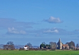
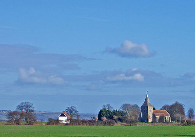
Romney Marsh is a sparsely populated wetland
area in the counties of Kent
and East Sussex
in the south-east of England. It covers about 100 mi ² (260 km²).
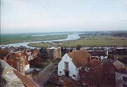 The River Rother
today flows into the sea below Rye
; but until 1287 its mouth lay between Romney
and Lydd
. It was tidal far upstream, almost to Bodiam
. The river mouth was wide with a huge lagoon
, making Rye a port at its western end. That lagoon lay behind a large island, which now makes up a large part of the Denge Marsh, on which stood the ports of Lydd and the old Winchelsea
. All these ports were affiliated to (as "limbs" of) the Cinque Ports
.
The most significant feature of the Marsh is the Rhee wall (Rhee is a word for river), forming a prominent ridge. This feature was extended as a waterway in three stages from Appledore to New Romney in the 13th century. Sluices controlled the flow of water, which was then released to flush silt from the harbour at New Romney. Ultimately, the battle was lost; the harbour silted up and New Romney declined in importance. The Rhee kept part of the old port open until the 15th century.
The wall at Dymchurch
was built around the same time; storms had breached the shingle barrier, which had protected it until that time. It is a common misconception that both these structures were built by the Romans.
Those same storms, however, helped to build up more shingle: such beaches now ran along practically the whole seaward side of the marshland.
The Marsh became the property of the Priory
of Canterbury
in the 9th century, who granted the first tenancy on the land to a man called Baldwin, sometime between 1152 and 1167, for "as much land as Baldwin himself can enclose and drain against the sea"; Baldwin's Sewer (drainage ditch) remains in use. The marsh has since become covered by a dense network of drainage ditches and once supported large farming communities. These watercourses are maintained and managed for sustainable water levels by the Romney Marsh Area Internal Drainage Board
 Romney Marsh is adjacent to the High Weald
Area of Outstanding Natural Beauty
(AONB), which is less developed than many other areas in Kent and Sussex. The decline in sheep prices meant that even the local stock (sold around the world for breeding for over two centuries) became unsustainable. Turf
ing had always been a lesser practice due to the grassland kept short by the sheep reared upon it, but farms are increasing in size to compensate for the decline in sustainable livestock
farming. Some view this as unsustainable due to the damage to soil ecology of the Marsh. The only other alternative, since 1946, has been for farmers to turn to arable farming, changing the landscape from a patchwork of small family farms to a few extensive arable production units.
has been developed at Little Cheyne Court in Ivychurch
. It has been built by npower
renewables and cost around £50 million. The 26 towers, each 116 m (380 ft) high, are distributed over an area of 4 km² (1.5 mi²) and will generate a proportion of the district's electricity needs. The site has proved controversial and has been opposed by parish, district and county councils, the local MP and other groups as detrimental to the visual appearance of the Marshhttp://www.yes2wind.com/debunk.html and a threat to wildlife. However, they were overruled by Central Government, and the turbines were erected in the period June - October 2008http://www.npower-renewables.com/littlecheynecourt/index.asp. The DTI indicated that a significant number of local people submitted comments in favour of the project, whilst a consistent 70% to 80% of the UK public support wind farms http://www.bwea.com/pdf/briefings/attitudes-2005.pdf. Some local campaigners still oppose the development, attracting accusations of "rural nimbyism
" and being under the "sinister" influence of the nuclear lobby http://www.guardian.co.uk/climatechange/story/0,,1282314,00.html. Conversely, campaigners for the siting attract accusations of "professional" self-interest (see the History page of this article) and of hiding behind the truism that obviously renewable energy is beneficial.
The RSPB
http://www.rspb.org.uk/england/southeast/action/sites/cheynecourt.asp, CPRE Kent and English Nature http://www.englishnature.org/News/story.asp?ID=772 all objected to the use of this particular site as a wind farm on environmental grounds. The proximity of the site to the internationally important RSPB reserve and the land's status as an SSSI
were particularly controversial.
(Readers are referred to the Discussion page of this article for differing versions, and also to the Discussion page.)
, then known as ague or marsh fever, which caused high mortality rates until the 1730s. It remained a major problem until the completion of the Royal Military Canal
in 1806, which greatly improved the drainage of the area.
This disease probably arrived here as soon as the weather became warm enough after the end of the last glacial, around or before the time of the Roman occupation. The strain responsible was most probably Plasmodium vivax
, as records and texts describe agues or fevers at three or four-day intervals. Prior Anselm, of nearby Canterbury, recorded in 1070s and 1080s a case that had every appearance of malaria.
With five indigenous mosquitoes capable of being hosts for the malarial parasite, only the Anopheles
atroparvus species breeds in sufficient numbers here to act as an efficient vector. However, P. vivax likes brackish waters and with the recreation of the old coastal wetlands coming into favour, this could expand the future malarial parasite host reserve still further. Therefore, together with this and the average temperatures in England increasing again, it may be possible to see English malaria successfully re-establish in the marshes.
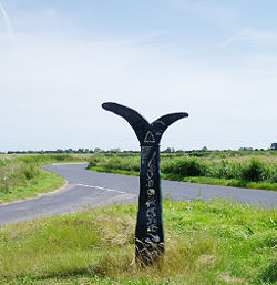
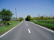 Roads across the Marsh have always been narrow and winding. This is partly because of the hundreds of sewers and smaller drainage ditches, and because the grazing land is far more important than the roads. The lack of road signs and few villages can make navigating across the marsh very confusing for the unwary. Several minor roads have no finger posts at junctions at all and at others, it is possible to find two or three lanes apparently leading to the same village.
Many of these lanes are built on the remains of enclosures used to "in" the Marsh. There is a dramatic section near Brookland
, where a lane linking the Woolpack pub to Lydd
is perched 2 or 3 m above the surrounding farmland, on the "Hook" wall. The section of road between Brenzett
and Lydd Lane end is built on the Rhee wall, a medieval canal that brought water from higher up the river Rother
.
The main road is the A259
from Rye, which is narrow and winding to Brookland and Brenzett, where it splits in two. One arm (excellent all the way) becomes the A2070 and runs parallel to the railway to link the Marsh to Hamstreet
, Ashford
and the wider world. The other, still the A259, is good only as far as the junction with Lydd Lane (B2075) and leads to New Romney
, Dymchurch
, Hythe
and eventually, Folkestone
.
 The best way to see the Marsh is on cycle; the almost flat terrain, the narrow almost deserted lanes, make it ideal for family jaunts. National Cycle Route 2 passes through the area; the section between Rye and Lydd is mostly off road. It then uses quiet lanes from Lydd to Hythe, where it is possible to cycle along the sea wall to Folkestone and ultimately (off road) to reach Dover.
to Hastings
line, with stations at Hamstreet
, Appledore
, Rye
, and Winchelsea
. The one-time branch to New Romney from Appledore (its small offshoot to Dungeness closed in 1937) was closed to passenger traffic in 1967. It was possible to travel directly from Dungeness to London, and the 2 h journey time was quicker than by road and rail today. The line is still in place about a mile short of Dungeness and is used to transfer waste from the nuclear power plant.
The Romney, Hythe and Dymchurch Railway
has been operating along the Romney Marsh coast since 1927.
starts at Gravesend
, Kent
and traces the coast as it was in Roman
times as far as Hastings
, East Sussex
, 163 mi (262 km) in total, crossing the Marsh.
(allegedly built by King Arthur
), which they destroyed.
was in their strategic situation opposite the narrowest part of the English Channel. Within the Romney Marsh, Romney and Hythe were two of the ports; Rye and Winchelsea were later added as “Antient Towns”.
stretches for 28 miles hugging the old cliff line that borders the Romney Marsh from Hythe in the north east to Cliff End in the south west. It was completed in April 1809.
in East Sussex
. They were built between 1805 and 1808.
s were conducted at Denge
. These were largely unsuccessful and the technology very quickly became obsolete with the invention of radar
.
. The latter has a large danger area marked on maps south of Lydd towards the sea.
.
The villages, shown below with the modern Ordnance Survey
map information on Sheet 189, were:
paradise throughout the 17th, 18th and into the 19th centuries. The traffic was two-way, since wool was also smuggled to the Continent.
The Victorians made smugglers into romantic anti-heroes; in truth they were unscrupulous villains. The main gangs on the Marsh were the Hawkhurst Gang
, the Mayfield Gang and the Aldington Gang
, known also as the Blues.
Smugglers on the Marshes were known as Owlers - rumoured to be because of the owl-like sounds these made to communicate at night.
novels; and the children's writer Monica Edwards
, author of the Romney Marsh books in which Rye Harbour becomes "Westling", Rye is renamed "Dunsford", and Winchelsea is known as "Winklesea". Rosemary Sutcliff
's 1955 historical novel Outcast
depicts Roman
efforts to build the Rhee Wall and reclaim land from the sea.
Many other well-known writers have been associated with the area: Henry James
, who lived in Rye; H.G. Wells, Joseph Conrad
, Stephen Crane
, Radclyffe Hall
, Noel Coward
, Edith Nesbit
, Rumer Godden
, and Conrad Aiken
. Rudyard Kipling
and his Smugglers' Song are famous.
Wetland
A wetland is an area of land whose soil is saturated with water either permanently or seasonally. Wetlands are categorised by their characteristic vegetation, which is adapted to these unique soil conditions....
area in the counties of Kent
Kent
Kent is a county in southeast England, and is one of the home counties. It borders East Sussex, Surrey and Greater London and has a defined boundary with Essex in the middle of the Thames Estuary. The ceremonial county boundaries of Kent include the shire county of Kent and the unitary borough of...
and East Sussex
East Sussex
East Sussex is a county in South East England. It is bordered by the counties of Kent, Surrey and West Sussex, and to the south by the English Channel.-History:...
in the south-east of England. It covers about 100 mi ² (260 km²).
Quotations
- “As Egypt was the gift of the Nile, this level tract ... has by the bounty of the sea been by degrees added to the land, so that I may not without reason call it the Gift of the Sea." (from Britannia by William CamdenWilliam CamdenWilliam Camden was an English antiquarian, historian, topographer, and officer of arms. He wrote the first chorographical survey of the islands of Great Britain and Ireland and the first detailed historical account of the reign of Elizabeth I of England.- Early years :Camden was born in London...
1551-1623)
- "The world according to the best geographers is divided into Europe, Asia, Africa, America, and Romney Marsh" from Ingoldsby Legends, Reverend Richard Harris BarhamRichard Harris BarhamRichard Harris Barham was an English cleric of the Church of England, novelist, and humorous poet. He was known better by his nom de plume Thomas Ingoldsby.-Life:Richard Harris Barham was born in Canterbury...
(Rector of SnargateSnargateSnargate is a village near New Romney in Kent, England.Snargate's most surprising claim to fame in the late 19th century, is that it was home to an important artist. Harold Gilman, sometimes called the English Van Gogh, was a British Impressionist and a member of the Camden Town Group. He grew up...
) about 100.000 people live there.
Areas of Romney Marsh
Romney Marsh is flat and low-lying, with parts below sea-level. It consists of several areas:- the Romney Marsh proper, lying north of a line between New RomneyNew RomneyNew Romney is a small town in Kent, England, on the edge of Romney Marsh, an area of flat, rich agricultural land reclaimed from the sea after the harbour began to be silted up. New Romney was once a sea port, with the harbour adjacent to the church, but is now more than a mile from the sea...
and AppledoreAppledore, KentAppledore is a village and civil parish in the Ashford District of Kent, England. The village centre is 12 miles south-west of Ashford town, and on the northern edge of the Romney Marsh The northerly part of this village is Appledore Heath....
; - the Walland Marsh, south of that line to approximately the Kent/East Sussex border;
- the East GuldefordEast GuldefordEast Guldeford is a village and civil parish in the Rother District of East Sussex, England. The village is located one mile east of Rye on the A259 road. The parish is controlled by a parish meeting....
Level, south again to RyeRye, East SussexRye is a small town in East Sussex, England, which stands approximately two miles from the open sea and is at the confluence of three rivers: the Rother, the Tillingham and the Brede...
; - the DengeDengeDenge is a former Royal Air Force site near Dungeness, in Kent, England. It is best known for the early experimental acoustic mirrors which remain there....
Marsh, south-east of LyddLyddLydd is a town in Kent, England, lying on the Romney Marsh. It is one of the larger towns on the Marsh, and the most southerly town in Kent. Actually located on Denge Marsh, Lydd was one of the first sandy islands to form as the bay evolved into what is now called the Romney Marsh...
, which now includes Denge Beach and Dungeness; - the Rother Levels, which, with various ditches, lie around the Isle of OxneyIsle of OxneyIsle of Oxney is the name given to an area in Kent, England.In the 13th century, the island was part of the coastline bordering what is now the Romney Marsh. As that silted up, and until the later 17th century, the River Rother which enters the sea beyond Rye and flowed across Kent in a west-east...
; and - the Rye, WinchelseaWinchelseaWinchelsea is a small village in East Sussex, England, located between the High Weald and the Romney Marsh, approximately two miles south west of Rye and seven miles north east of Hastings...
and Pett Levels.
The River Rother
River Rother (Eastern)
The River Rother , at 35 miles , is a river flowing through both East Sussex and Kent, England. Its source is near Rotherfield , and its mouth is on Rye Bay, part of the English Channel....
today flows into the sea below Rye
Rye
Rye is a grass grown extensively as a grain and as a forage crop. It is a member of the wheat tribe and is closely related to barley and wheat. Rye grain is used for flour, rye bread, rye beer, some whiskeys, some vodkas, and animal fodder...
; but until 1287 its mouth lay between Romney
New Romney
New Romney is a small town in Kent, England, on the edge of Romney Marsh, an area of flat, rich agricultural land reclaimed from the sea after the harbour began to be silted up. New Romney was once a sea port, with the harbour adjacent to the church, but is now more than a mile from the sea...
and Lydd
Lydd
Lydd is a town in Kent, England, lying on the Romney Marsh. It is one of the larger towns on the Marsh, and the most southerly town in Kent. Actually located on Denge Marsh, Lydd was one of the first sandy islands to form as the bay evolved into what is now called the Romney Marsh...
. It was tidal far upstream, almost to Bodiam
Bodiam
Bodiam is a small village and civil parish in East Sussex, England, in the valley of the River Rother near to the villages of Sandhurst and Ewhurst Green. It is home to Bodiam Castle, a small range of houses, a pub opposite Bodiam Castle, and a restaurant...
. The river mouth was wide with a huge lagoon
Lagoon
A lagoon is a body of shallow sea water or brackish water separated from the sea by some form of barrier. The EU's habitat directive defines lagoons as "expanses of shallow coastal salt water, of varying salinity or water volume, wholly or partially separated from the sea by sand banks or shingle,...
, making Rye a port at its western end. That lagoon lay behind a large island, which now makes up a large part of the Denge Marsh, on which stood the ports of Lydd and the old Winchelsea
Winchelsea
Winchelsea is a small village in East Sussex, England, located between the High Weald and the Romney Marsh, approximately two miles south west of Rye and seven miles north east of Hastings...
. All these ports were affiliated to (as "limbs" of) the Cinque Ports
Cinque Ports
The Confederation of Cinque Ports is a historic series of coastal towns in Kent and Sussex. It was originally formed for military and trade purposes, but is now entirely ceremonial. It lies at the eastern end of the English Channel, where the crossing to the continent is narrowest...
.
Reclamation
The Romney Marsh has been gradually built up over the centuries.The most significant feature of the Marsh is the Rhee wall (Rhee is a word for river), forming a prominent ridge. This feature was extended as a waterway in three stages from Appledore to New Romney in the 13th century. Sluices controlled the flow of water, which was then released to flush silt from the harbour at New Romney. Ultimately, the battle was lost; the harbour silted up and New Romney declined in importance. The Rhee kept part of the old port open until the 15th century.
The wall at Dymchurch
Dymchurch
Dymchurch is a village and civil parish in the Shepway District of Kent, England. The village is located on the coast five miles south-west of Hythe, and on the Romney Marsh. It is typical of this part of the coast, having been a village which became larger during the 1930s...
was built around the same time; storms had breached the shingle barrier, which had protected it until that time. It is a common misconception that both these structures were built by the Romans.
- In 1250 and in the following years, a series of violent storms broke through the coastal shingle banks, flooding significant areas and returning it to marsh, and destroying the harbour at New RomneyNew RomneyNew Romney is a small town in Kent, England, on the edge of Romney Marsh, an area of flat, rich agricultural land reclaimed from the sea after the harbour began to be silted up. New Romney was once a sea port, with the harbour adjacent to the church, but is now more than a mile from the sea...
. In 1287 water destroyed the port town of Old WinchelseaWinchelseaWinchelsea is a small village in East Sussex, England, located between the High Weald and the Romney Marsh, approximately two miles south west of Rye and seven miles north east of Hastings...
(now located some 2 mi (3 km) out in Rye bay), which had been under threat from the sea since at least 1236. Winchelsea, the third largest port in England and a major importer of wine, was relocated on higher land, with a harbour consisting of 82 wharfs.
Those same storms, however, helped to build up more shingle: such beaches now ran along practically the whole seaward side of the marshland.
- By the 14th century, much of the Walland and Denge Marshes had been reclaimed by "innings", the process of throwing up an embankment around the sea-marsh and using the low-tide to let it run dry by means of one-way drains set into the new seawall, running off into a network of dykes called locally "sewers"
- In 1462, the Romney Marsh Corporation was established to install drainage and sea defences for the marsh, which it continued to build into the 16th century.
- By the 16th century, the course of the Rother had been changed to its channel today; most of the remainder of the area had now been reclaimed from the sea.
- The shingle continues to be deposited. As a result, all the original Cinque Ports of the Marsh are now far from the sea. Dungeness Point is still being added to: although (especially near Dungeness and HytheHythe, KentHythe , is a small coastal market town on the edge of Romney Marsh, in the District of Shepway on the south coast of Kent. The word Hythe or Hithe is an Old English word meaning Haven or Landing Place....
) a daily operation is in place to counter the reshaping of the shingle banks, using boats to dredge and move the drifting shingle.- NB a map in the *Romney Marsh Gazetteer shows the stages clearly.
The Marsh became the property of the Priory
Priory
A priory is a house of men or women under religious vows that is headed by a prior or prioress. Priories may be houses of mendicant friars or religious sisters , or monasteries of monks or nuns .The Benedictines and their offshoots , the Premonstratensians, and the...
of Canterbury
Canterbury
Canterbury is a historic English cathedral city, which lies at the heart of the City of Canterbury, a district of Kent in South East England. It lies on the River Stour....
in the 9th century, who granted the first tenancy on the land to a man called Baldwin, sometime between 1152 and 1167, for "as much land as Baldwin himself can enclose and drain against the sea"; Baldwin's Sewer (drainage ditch) remains in use. The marsh has since become covered by a dense network of drainage ditches and once supported large farming communities. These watercourses are maintained and managed for sustainable water levels by the Romney Marsh Area Internal Drainage Board
Internal Drainage Board
An internal drainage board is a type of operating authority which is established in areas of special drainage need in England and Wales with permissive powers to undertake work to secure clean water drainage and water level management within drainage districts...
Weald
The Weald is the name given to an area in South East England situated between the parallel chalk escarpments of the North and the South Downs. It should be regarded as three separate parts: the sandstone "High Weald" in the centre; the clay "Low Weald" periphery; and the Greensand Ridge which...
Area of Outstanding Natural Beauty
Area of Outstanding Natural Beauty
An Area of Outstanding Natural Beauty is an area of countryside considered to have significant landscape value in England, Wales or Northern Ireland, that has been specially designated by the Countryside Agency on behalf of the United Kingdom government; the Countryside Council for Wales on...
(AONB), which is less developed than many other areas in Kent and Sussex. The decline in sheep prices meant that even the local stock (sold around the world for breeding for over two centuries) became unsustainable. Turf
Sod
Sod or turf is grass and the part of the soil beneath it held together by the roots, or a piece of thin material.The term sod may be used to mean turf grown and cut specifically for the establishment of lawns...
ing had always been a lesser practice due to the grassland kept short by the sheep reared upon it, but farms are increasing in size to compensate for the decline in sustainable livestock
Livestock
Livestock refers to one or more domesticated animals raised in an agricultural setting to produce commodities such as food, fiber and labor. The term "livestock" as used in this article does not include poultry or farmed fish; however the inclusion of these, especially poultry, within the meaning...
farming. Some view this as unsustainable due to the damage to soil ecology of the Marsh. The only other alternative, since 1946, has been for farmers to turn to arable farming, changing the landscape from a patchwork of small family farms to a few extensive arable production units.
Wind farm
A wind farmWind farm
A wind farm is a group of wind turbines in the same location used to produce electric power. A large wind farm may consist of several hundred individual wind turbines, and cover an extended area of hundreds of square miles, but the land between the turbines may be used for agricultural or other...
has been developed at Little Cheyne Court in Ivychurch
Ivychurch
For Ivychurch, Wiltshire, see Ivychurch PrioryIvychurch is a village and civil parish in the Shepway District of Kent, England. The village is located on the Romney Marsh, three miles north-west of New Romney. The parish council consists of five members.The village has a public house but has...
. It has been built by npower
Npower (UK)
RWE Npower plc is a UK-based electricity and gas supply generation company, formerly known as Innogy plc. As Innogy plc it was listed on the London Stock Exchange and was a constituent of the FTSE 100 Index...
renewables and cost around £50 million. The 26 towers, each 116 m (380 ft) high, are distributed over an area of 4 km² (1.5 mi²) and will generate a proportion of the district's electricity needs. The site has proved controversial and has been opposed by parish, district and county councils, the local MP and other groups as detrimental to the visual appearance of the Marshhttp://www.yes2wind.com/debunk.html and a threat to wildlife. However, they were overruled by Central Government, and the turbines were erected in the period June - October 2008http://www.npower-renewables.com/littlecheynecourt/index.asp. The DTI indicated that a significant number of local people submitted comments in favour of the project, whilst a consistent 70% to 80% of the UK public support wind farms http://www.bwea.com/pdf/briefings/attitudes-2005.pdf. Some local campaigners still oppose the development, attracting accusations of "rural nimbyism
NIMBY
NIMBY or Nimby is an acronym for the phrase "not in my back yard". The term is used pejoratively to describe opposition by residents to a proposal for a new development close to them. Opposing residents themselves are sometimes called Nimbies...
" and being under the "sinister" influence of the nuclear lobby http://www.guardian.co.uk/climatechange/story/0,,1282314,00.html. Conversely, campaigners for the siting attract accusations of "professional" self-interest (see the History page of this article) and of hiding behind the truism that obviously renewable energy is beneficial.
The RSPB
Royal Society for the Protection of Birds
Bird Notes and News was first published in April 1903.The title changed to 'Bird Notes' in 1947. In the 1950s, there were four copies per year . Each volume covered two years, spread over three calendar years...
http://www.rspb.org.uk/england/southeast/action/sites/cheynecourt.asp, CPRE Kent and English Nature http://www.englishnature.org/News/story.asp?ID=772 all objected to the use of this particular site as a wind farm on environmental grounds. The proximity of the site to the internationally important RSPB reserve and the land's status as an SSSI
Site of Special Scientific Interest
A Site of Special Scientific Interest is a conservation designation denoting a protected area in the United Kingdom. SSSIs are the basic building block of site-based nature conservation legislation and most other legal nature/geological conservation designations in Great Britain are based upon...
were particularly controversial.
(Readers are referred to the Discussion page of this article for differing versions, and also to the Discussion page.)
Romney Marsh sheep
The economy and landscape of Romney Marsh in the 19th Century was dominated by sheep. Improved methods of pasture management and husbandry meant the marsh could sustain a stock density greater than anywhere else in the world. The Romney Marsh sheep became one of the most successful and important breeds of sheep. Their main characteristic is an ability to feed in wet situations; they are considered to be more resistant to foot rot and internal parasites than any other breed. Romney sheep have been exported globally, in particular to Australia, to where they were first exported in 1872.Malaria
From 1564 the health of the marsh population suffered from malariaMalaria
Malaria is a mosquito-borne infectious disease of humans and other animals caused by eukaryotic protists of the genus Plasmodium. The disease results from the multiplication of Plasmodium parasites within red blood cells, causing symptoms that typically include fever and headache, in severe cases...
, then known as ague or marsh fever, which caused high mortality rates until the 1730s. It remained a major problem until the completion of the Royal Military Canal
Royal Military Canal
The Royal Military Canal is a canal running for 28 miles between Seabrook near Folkestone and Cliff End near Hastings, following the old cliff line bordering Romney Marsh.-Construction:...
in 1806, which greatly improved the drainage of the area.
This disease probably arrived here as soon as the weather became warm enough after the end of the last glacial, around or before the time of the Roman occupation. The strain responsible was most probably Plasmodium vivax
Plasmodium vivax
Plasmodium vivax is a protozoal parasite and a human pathogen. The most frequent and widely distributed cause of recurring malaria, P. vivax is one of the four species of malarial parasite that commonly infect humans. It is less virulent than Plasmodium falciparum, which is the deadliest of the...
, as records and texts describe agues or fevers at three or four-day intervals. Prior Anselm, of nearby Canterbury, recorded in 1070s and 1080s a case that had every appearance of malaria.
With five indigenous mosquitoes capable of being hosts for the malarial parasite, only the Anopheles
Anopheles
Anopheles is a genus of mosquito. There are approximately 460 recognized species: while over 100 can transmit human malaria, only 30–40 commonly transmit parasites of the genus Plasmodium, which cause malaria in humans in endemic areas...
atroparvus species breeds in sufficient numbers here to act as an efficient vector. However, P. vivax likes brackish waters and with the recreation of the old coastal wetlands coming into favour, this could expand the future malarial parasite host reserve still further. Therefore, together with this and the average temperatures in England increasing again, it may be possible to see English malaria successfully re-establish in the marshes.
Roads
Many of these lanes are built on the remains of enclosures used to "in" the Marsh. There is a dramatic section near Brookland
Brookland, Kent
Brookland is a village and civil parish in the Shepway district of Kent, England, about west of New Romney. According to the 2001 census the parish had a population of 453. It is located on the A259 road in Romney Marsh....
, where a lane linking the Woolpack pub to Lydd
Lydd
Lydd is a town in Kent, England, lying on the Romney Marsh. It is one of the larger towns on the Marsh, and the most southerly town in Kent. Actually located on Denge Marsh, Lydd was one of the first sandy islands to form as the bay evolved into what is now called the Romney Marsh...
is perched 2 or 3 m above the surrounding farmland, on the "Hook" wall. The section of road between Brenzett
Brenzett
Brenzett is a village and civil parish in the Shepway District of Kent, England. The village lies on the Romney Marsh, three miles west of New Romney....
and Lydd Lane end is built on the Rhee wall, a medieval canal that brought water from higher up the river Rother
River Rother (Eastern)
The River Rother , at 35 miles , is a river flowing through both East Sussex and Kent, England. Its source is near Rotherfield , and its mouth is on Rye Bay, part of the English Channel....
.
The main road is the A259
A259 road
The A259 is a busy road on the south coast of England passing through Hampshire, West Sussex, East Sussex and part of Kent. Part of the road was named "the most dangerous road in South East England" in 2008.-Description:...
from Rye, which is narrow and winding to Brookland and Brenzett, where it splits in two. One arm (excellent all the way) becomes the A2070 and runs parallel to the railway to link the Marsh to Hamstreet
Hamstreet
Hamstreet is a village in Kent, in South East England.The village is located some 6 miles south of Ashford on the A2070, the main road between Ashford and Hastings...
, Ashford
Ashford, Kent
Ashford is a town in the borough of Ashford in Kent, England. In 2005 it was voted the fourth best place to live in the United Kingdom. It lies on the Great Stour river, the M20 motorway, and the South Eastern Main Line and High Speed 1 railways. Its agricultural market is one of the most...
and the wider world. The other, still the A259, is good only as far as the junction with Lydd Lane (B2075) and leads to New Romney
New Romney
New Romney is a small town in Kent, England, on the edge of Romney Marsh, an area of flat, rich agricultural land reclaimed from the sea after the harbour began to be silted up. New Romney was once a sea port, with the harbour adjacent to the church, but is now more than a mile from the sea...
, Dymchurch
Dymchurch
Dymchurch is a village and civil parish in the Shepway District of Kent, England. The village is located on the coast five miles south-west of Hythe, and on the Romney Marsh. It is typical of this part of the coast, having been a village which became larger during the 1930s...
, Hythe
Hythe, Kent
Hythe , is a small coastal market town on the edge of Romney Marsh, in the District of Shepway on the south coast of Kent. The word Hythe or Hithe is an Old English word meaning Haven or Landing Place....
and eventually, Folkestone
Folkestone
Folkestone is the principal town in the Shepway District of Kent, England. Its original site was in a valley in the sea cliffs and it developed through fishing and its closeness to the Continent as a landing place and trading port. The coming of the railways, the building of a ferry port, and its...
.
Railways
The main line railway known as the Marsh Link Line is the AshfordAshford, Kent
Ashford is a town in the borough of Ashford in Kent, England. In 2005 it was voted the fourth best place to live in the United Kingdom. It lies on the Great Stour river, the M20 motorway, and the South Eastern Main Line and High Speed 1 railways. Its agricultural market is one of the most...
to Hastings
Hastings
Hastings is a town and borough in the county of East Sussex on the south coast of England. The town is located east of the county town of Lewes and south east of London, and has an estimated population of 86,900....
line, with stations at Hamstreet
Hamstreet
Hamstreet is a village in Kent, in South East England.The village is located some 6 miles south of Ashford on the A2070, the main road between Ashford and Hastings...
, Appledore
Appledore, Kent
Appledore is a village and civil parish in the Ashford District of Kent, England. The village centre is 12 miles south-west of Ashford town, and on the northern edge of the Romney Marsh The northerly part of this village is Appledore Heath....
, Rye
Rye, East Sussex
Rye is a small town in East Sussex, England, which stands approximately two miles from the open sea and is at the confluence of three rivers: the Rother, the Tillingham and the Brede...
, and Winchelsea
Winchelsea
Winchelsea is a small village in East Sussex, England, located between the High Weald and the Romney Marsh, approximately two miles south west of Rye and seven miles north east of Hastings...
. The one-time branch to New Romney from Appledore (its small offshoot to Dungeness closed in 1937) was closed to passenger traffic in 1967. It was possible to travel directly from Dungeness to London, and the 2 h journey time was quicker than by road and rail today. The line is still in place about a mile short of Dungeness and is used to transfer waste from the nuclear power plant.
The Romney, Hythe and Dymchurch Railway
Romney, Hythe and Dymchurch Railway
The Romney, Hythe & Dymchurch Railway is a gauge light railway in Kent, England. The line runs from the Cinque Port of Hythe via Dymchurch, St...
has been operating along the Romney Marsh coast since 1927.
Walks
The Saxon Shore WaySaxon Shore Way
The Saxon Shore Way is a long-distance footpath in England, starting at Gravesend, Kent and traces the coast as it was in Roman times as far as Hastings, East Sussex, in total.-History:...
starts at Gravesend
Gravesend, Kent
Gravesend is a town in northwest Kent, England, on the south bank of the Thames, opposite Tilbury in Essex. It is the administrative town of the Borough of Gravesham and, because of its geographical position, has always had an important role to play in the history and communications of this part of...
, Kent
Kent
Kent is a county in southeast England, and is one of the home counties. It borders East Sussex, Surrey and Greater London and has a defined boundary with Essex in the middle of the Thames Estuary. The ceremonial county boundaries of Kent include the shire county of Kent and the unitary borough of...
and traces the coast as it was in Roman
Roman Empire
The Roman Empire was the post-Republican period of the ancient Roman civilization, characterised by an autocratic form of government and large territorial holdings in Europe and around the Mediterranean....
times as far as Hastings
Hastings
Hastings is a town and borough in the county of East Sussex on the south coast of England. The town is located east of the county town of Lewes and south east of London, and has an estimated population of 86,900....
, East Sussex
East Sussex
East Sussex is a county in South East England. It is bordered by the counties of Kent, Surrey and West Sussex, and to the south by the English Channel.-History:...
, 163 mi (262 km) in total, crossing the Marsh.
The Marsh in war
Throughout its history, the proximity of the marsh to the European mainland has meant that the areas has been in the front line whenever invasion has threatened. In AD 892, one such invasion was successful. The Danish fleet of 250 ships sailed right into the Rother and took the fortress at AppledoreAppledore, Kent
Appledore is a village and civil parish in the Ashford District of Kent, England. The village centre is 12 miles south-west of Ashford town, and on the northern edge of the Romney Marsh The northerly part of this village is Appledore Heath....
(allegedly built by King Arthur
King Arthur
King Arthur is a legendary British leader of the late 5th and early 6th centuries, who, according to Medieval histories and romances, led the defence of Britain against Saxon invaders in the early 6th century. The details of Arthur's story are mainly composed of folklore and literary invention, and...
), which they destroyed.
The Cinque Ports
The importance of the Cinque PortsCinque Ports
The Confederation of Cinque Ports is a historic series of coastal towns in Kent and Sussex. It was originally formed for military and trade purposes, but is now entirely ceremonial. It lies at the eastern end of the English Channel, where the crossing to the continent is narrowest...
was in their strategic situation opposite the narrowest part of the English Channel. Within the Romney Marsh, Romney and Hythe were two of the ports; Rye and Winchelsea were later added as “Antient Towns”.
Royal Military Canal
The Royal Military CanalRoyal Military Canal
The Royal Military Canal is a canal running for 28 miles between Seabrook near Folkestone and Cliff End near Hastings, following the old cliff line bordering Romney Marsh.-Construction:...
stretches for 28 miles hugging the old cliff line that borders the Romney Marsh from Hythe in the north east to Cliff End in the south west. It was completed in April 1809.
The Martello Towers
Martello Towers are fortifications that were built by the British Army for coastal defence during the nineteenth century. Seventy-four towers were built along the south coast; Tower 1 was at Folkestone, overlooking the harbour, and Tower 74 guarded the beach at SeafordSeaford, East Sussex
Seaford is a coastal town in the county of East Sussex, on the south coast of England. Lying east of Newhaven and Brighton and west of Eastbourne, it is the largest town in Lewes district, with a population of about 23,000....
in East Sussex
East Sussex
East Sussex is a county in South East England. It is bordered by the counties of Kent, Surrey and West Sussex, and to the south by the English Channel.-History:...
. They were built between 1805 and 1808.
Sound Mirrors
Prior to World War II, experiments to detect enemy aircraft with huge concrete acoustic mirrorAcoustic mirror
An acoustic mirror is a passive device used to reflect and perhaps to focus sound waves.- Overview :Prior to World War II and the invention of radar, acoustic mirrors were built as early warning devices around the coasts of Great Britain, with the aim of detecting airborne invasions...
s were conducted at Denge
Denge
Denge is a former Royal Air Force site near Dungeness, in Kent, England. It is best known for the early experimental acoustic mirrors which remain there....
. These were largely unsuccessful and the technology very quickly became obsolete with the invention of radar
Radar
Radar is an object-detection system which uses radio waves to determine the range, altitude, direction, or speed of objects. It can be used to detect aircraft, ships, spacecraft, guided missiles, motor vehicles, weather formations, and terrain. The radar dish or antenna transmits pulses of radio...
.
World War II
It was planned that in case of a German invasion the marsh would be flooded, then covered with oil, ready to be set alight as soon as the invaders arrived.Military Training
There are two military establishments on the Marsh: the Hythe and Lydd RangesLydd Ranges
Lydd Ranges is a military firing range south of Lydd, in Kent, England. It extends as far as the coast.It has been used for military training for over 150 years and is part of the Dungeness, Romney Marsh and Rye Bay Site of Special Scientific Interest...
. The latter has a large danger area marked on maps south of Lydd towards the sea.
"Lost villages" of the Marsh
These lost communities on the Marsh are further instances of the modern decline of the rural communities, except that these probably occurred over the centuries. In 1348, for example, many villages were hit by the Black DeathBlack Death
The Black Death was one of the most devastating pandemics in human history, peaking in Europe between 1348 and 1350. Of several competing theories, the dominant explanation for the Black Death is the plague theory, which attributes the outbreak to the bacterium Yersinia pestis. Thought to have...
.
The villages, shown below with the modern Ordnance Survey
Ordnance Survey
Ordnance Survey , an executive agency and non-ministerial government department of the Government of the United Kingdom, is the national mapping agency for Great Britain, producing maps of Great Britain , and one of the world's largest producers of maps.The name reflects its creation together with...
map information on Sheet 189, were:
- Buttdarts: Buttdart Bridge, over one of the larger marsh drains
- ”Dengemarsh”: south of Lydd: village closed when the Lydd ranges were opened in WWII [not marked on OS Map: ?TR 0417]
- Eastbridge: Eastbridge House, on DymchurchDymchurchDymchurch is a village and civil parish in the Shepway District of Kent, England. The village is located on the coast five miles south-west of Hythe, and on the Romney Marsh. It is typical of this part of the coast, having been a village which became larger during the 1930s...
to BonningtonBonningtonBonnington is a dispersed village and civil parish on the northern edge of the Romney Marsh in Ashford District of Kent, England. The village is located eight miles to the south of the town of Ashford on the B2067 ....
road: the road is named Eastbridge Road out of Dymchurch. Remains: large part of west wall of the tower, some other fragments. Village had a population of 21 (1801 Census). - Fairfield: Fairfield Court, NW of BrooklandBrookland, KentBrookland is a village and civil parish in the Shepway district of Kent, England, about west of New Romney. According to the 2001 census the parish had a population of 453. It is located on the A259 road in Romney Marsh....
- Falconhurst: Falconhurst: a house north of the Royal Military CanalHythe, KentHythe , is a small coastal market town on the edge of Romney Marsh, in the District of Shepway on the south coast of Kent. The word Hythe or Hithe is an Old English word meaning Haven or Landing Place....
six miles west of Hythe. - Galloways south of Lydd: village closed when the Lydd ranges were opened in WWII [not marked on OS Map: ?TR 0017]
- Hope All Saints: Hope Farm, NW of New Romney. The remains of the church are marked on the map. (See Romney Marsh Gazeteer)
- Midley: Midley Cottages, SW of Old Romney This was once a small island in the Rother between the larger ones of Romney and Lydd, and the name means "middle island". In the 8th century there was a village on this site, and 23 people still lived here in 1801. Now, only the ruined west wall of the church remains. During World War IIWorld War IIWorld War II, or the Second World War , was a global conflict lasting from 1939 to 1945, involving most of the world's nations—including all of the great powers—eventually forming two opposing military alliances: the Allies and the Axis...
, there was an RAF airfield here. - Orgarswick: Orgarswick Farm, NW of Dymchurch
- Shorne: no modern trace, although there are unnamed church remains NNW of New Romney near Chapel Land Farm
- Snave Although the church still stands, it is used only once a year for a harvest festival service and today falls under the Hamstreet group of churches. (See Romney Marsh Gazeteer)
Smuggling
The flat, almost empty landscape made for a smuggler'sSmuggling
Smuggling is the clandestine transportation of goods or persons, such as out of a building, into a prison, or across an international border, in violation of applicable laws or other regulations.There are various motivations to smuggle...
paradise throughout the 17th, 18th and into the 19th centuries. The traffic was two-way, since wool was also smuggled to the Continent.
The Victorians made smugglers into romantic anti-heroes; in truth they were unscrupulous villains. The main gangs on the Marsh were the Hawkhurst Gang
Hawkhurst Gang
The Hawkhurst Gang was a notorious criminal organisation involved in smuggling throughout southeast England from 1735 until 1749. One of the more infamous gangs of the early 18th century, they extended their influence from Dorset, where they successfully raided the customs house at Poole, to the...
, the Mayfield Gang and the Aldington Gang
The Aldington Gang
Aldington was the stronghold of The Aldington Gang, a band of smugglers roaming the Romney Marshes and shores of Kent. The gang's leaders, made the local inn, , their headquarters and drop for their contraband. The Inn was often used when they waited for others of their group to bring in goods from...
, known also as the Blues.
Smugglers on the Marshes were known as Owlers - rumoured to be because of the owl-like sounds these made to communicate at night.
Literary associations
Romney Marsh has a distinguished literary history. Three authors who specifically used the marsh as settings for their works were E.F. Benson, author of the Mapp and Lucia novels; Russell Thorndike, author of the Doctor SynDoctor Syn
The Reverend Doctor Christopher Syn is the smuggler hero of a series of novels by Russell Thorndike. The first book, Doctor Syn: A Tale of the Romney Marsh was published in 1915. The story idea came from smuggling in the 18th century Romney Marsh, where brandy and tobacco were brought in at night...
novels; and the children's writer Monica Edwards
Monica Edwards
Monica Edwards was an English children's writer of the mid-twentieth century best known for her Romney Marsh and Punchbowl Farm series of children's novels.-Early life:...
, author of the Romney Marsh books in which Rye Harbour becomes "Westling", Rye is renamed "Dunsford", and Winchelsea is known as "Winklesea". Rosemary Sutcliff
Rosemary Sutcliff
Rosemary Sutcliff CBE was a British novelist, and writer for children, best known as a writer of historical fiction and children's literature. Although she was primarily a children's author, the quality and depth of her writing also appeals to adults; Sutcliff herself once commented that she wrote...
's 1955 historical novel Outcast
Outcast (Sutcliff novel)
Outcast is a historical novel for children written by Rosemary Sutcliff and published in 1955.It takes place in Roman Britain and tells the tale of an orphaned Roman child who is shipwrecked on a coast of Dumnonia in Celtic Britain, outside of Roman rule...
depicts Roman
Roman Britain
Roman Britain was the part of the island of Great Britain controlled by the Roman Empire from AD 43 until ca. AD 410.The Romans referred to the imperial province as Britannia, which eventually comprised all of the island of Great Britain south of the fluid frontier with Caledonia...
efforts to build the Rhee Wall and reclaim land from the sea.
Many other well-known writers have been associated with the area: Henry James
Henry James
Henry James, OM was an American-born writer, regarded as one of the key figures of 19th-century literary realism. He was the son of Henry James, Sr., a clergyman, and the brother of philosopher and psychologist William James and diarist Alice James....
, who lived in Rye; H.G. Wells, Joseph Conrad
Joseph Conrad
Joseph Conrad was a Polish-born English novelist.Conrad is regarded as one of the great novelists in English, although he did not speak the language fluently until he was in his twenties...
, Stephen Crane
Stephen Crane
Stephen Crane was an American novelist, short story writer, poet and journalist. Prolific throughout his short life, he wrote notable works in the Realist tradition as well as early examples of American Naturalism and Impressionism...
, Radclyffe Hall
Radclyffe Hall
Radclyffe Hall was an English poet and author, best known for the lesbian classic The Well of Loneliness.- Life :...
, Noel Coward
Noël Coward
Sir Noël Peirce Coward was an English playwright, composer, director, actor and singer, known for his wit, flamboyance, and what Time magazine called "a sense of personal style, a combination of cheek and chic, pose and poise".Born in Teddington, a suburb of London, Coward attended a dance academy...
, Edith Nesbit
E. Nesbit
Edith Nesbit was an English author and poet whose children's works were published under the name of E. Nesbit. She wrote or collaborated on over 60 books of fiction for children, several of which have been adapted for film and television...
, Rumer Godden
Rumer Godden
Margaret Rumer Godden OBE was an English author of over 60 fiction and nonfiction books written under the name of Rumer Godden. A few of her works were co-written by her sister, Jon Godden, who wrote several novels on her own...
, and Conrad Aiken
Conrad Aiken
Conrad Potter Aiken was an American novelist and poet, whose work includes poetry, short stories, novels, a play and an autobiography.-Early years:...
. Rudyard Kipling
Rudyard Kipling
Joseph Rudyard Kipling was an English poet, short-story writer, and novelist chiefly remembered for his celebration of British imperialism, tales and poems of British soldiers in India, and his tales for children. Kipling received the 1907 Nobel Prize for Literature...
and his Smugglers' Song are famous.
See also
- The FensThe FensThe Fens, also known as the , are a naturally marshy region in eastern England. Most of the fens were drained several centuries ago, resulting in a flat, damp, low-lying agricultural region....
of East AngliaEast AngliaEast Anglia is a traditional name for a region of eastern England, named after an ancient Anglo-Saxon kingdom, the Kingdom of the East Angles. The Angles took their name from their homeland Angeln, in northern Germany. East Anglia initially consisted of Norfolk and Suffolk, but upon the marriage of...
and the Somerset LevelsSomerset LevelsThe Somerset Levels, or the Somerset Levels and Moors as they are less commonly but more correctly known, is a sparsely populated coastal plain and wetland area of central Somerset, South West England, between the Quantock and Mendip Hills...
, for other wetlands in England. - Geology of the United Kingdom#Holocene Epoch
External links
- Romney Marsh FM
- Romney Marsh Times - local news
- RomneyMarsh.net
- http://www.kentwildlifetrust.org.uk/index.php?option=com_content&task=view&id=82&Itemid=127Romney Marsh Local Nature Reserve and Visitor Centre (Kent Wildlife TrustKent Wildlife TrustKent Wildlife Trust covers the county of Kent, England, and is one of the largest of the 47 Wildlife Trust organisations in the United Kingdom, the Isle of Man and Alderney...
)] - Romney Marsh Visitor Centre
- Romney Hythe and Dymchurch Railway
- Royal Military Canal
- Malaria in England
- Rye & Camber - A Marsh Railway
- Wild Rye - discover the wildlife of Romney Marsh