

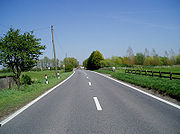
A259 road
Encyclopedia
The A259 is a busy road
on the south coast of England passing through Hampshire
, West Sussex
, East Sussex
and part of Kent
. Part of the road was named "the most dangerous road in South East England" in 2008.
 The A259 is a busy two-lane road
running along the south coast of England
; part is almost parallel to the A27 road
. The A259 runs east from Emsworth
in Hampshire
, into West Sussex
via Chichester
, Bognor Regis
, Littlehampton
, Ferring
, Worthing
, Lancing
, Shoreham-by-Sea
, Portslade
And East Sussex
via Hove
, Brighton
, Peacehaven
, Newhaven
, Seaford
, Eastbourne
, Pevensey
, Bexhill
, Hastings
and Rye
. Over the border in Kent
, it continues through New Romney
and Hythe
to terminate at Folkestone
.
The road forms part of the Hastings Ring Road and passes through the town of Winchelsea
, England's first new town
. The road has Trunk Road status between Pevensey and Brenzett
(A2070) and forms part of the South Coast Trunk Road. This section of A259 is almost entirely single-carriageway, with only a 1 km stretch of urban dual carriageway
in Bexhill.
report publish by the Road Safety Foundation.
white paper
and would have included the following elements: 'Guestling and Icklesham bypass', the'Winchelsea bypass', 'Rye
bypass', 'Ham Street bypass', 'A259 New Romney bypass' and the 'A259 St. Mary's Bay and Dymchurch bypass'. This scheme along with many others proposed at the time were shelved in 1996-7 after a number of major road protests in the UK.
Plans for a 'Hastings Bexhill bypass' which would have provided a dual-carriageway from the Pevensey roundabout passing to the north of Bexhill and Hastings to join the current A259 near Icklesham at a cost of £120-£130 million were rejected in 2001. The scheme, which was supported by the South East England Regional Assembly
and by the Deputy Prime Minister, John Prescott
was opposed by English Nature
who highlighted the damage to a number of Sites of Special Scientific Interest (SSSIs), including the High Weald area of outstanding natural beauty
. They were also concerned about the negative effect the scheme would have on several ancient woodlands and the habitats of the dormouse
and great crested newt
.
The section between Brenzett and Folkestone was de-trunked in 2003 (i.e. removed trunk road status) and control reverted to Kent County Council
.
Other development proposals for the road were considered in 2004.
It was named as one of the most dangerous road in South East England
in 2008.
The South East Regional Assembly included the scheme within its Regional Funding Advice package. This was provisionally signed off in July 2009 by the Department for Transport, with the caveat that individual schemes would still need to be assessed for value for money and compatibility with greenhouse gas emission targets. Although originally estimated at £45 million, the scheme is now expected to cost over £100 million. £33 million was expected to come from developer contributions, but the County Council has been unable to obtain them. "Although opportunities will be explored to seek developer contributions in the future, at the present it has been considered prudent to plan to fund all future local contributions from the County Council’s capital programme".
The County Council says that "The driving force of the scheme is to enable essential economic regeneration for Bexhill and Hastings, which is currently compromised by the poor accessibility within and between the two towns... the Bexhill Hastings Link Road would make a major contribution to meeting the need to improve access between the towns and linking Trunk Roads which serve the area". They also identify that scheme would provide "faster and more reliable access to the Conquest Hospital", "easier access to jobs", "create access to much-needed additional housing"; and that it would "re-route traffic from less suitable roads" and "reduce the number of accidents on local roads".
A number of organisations have objected to the scheme. The Hastings Alliance, which is supported by 11 national bodies including the Campaign for the Protection of Rural England, the Council for National Parks
and WWF-UK and also 16 local groups points to the Hastings Five Point Plan, commissioned by the South East Regional Assembly, which found that the key requirement for regeneration is to "improve the strategic accessibility of Hastings – that is Hastings’ access to London, other major towns, and other parts of the South East" and says that improving rail links are fundamental to regenerating that area. In addition they objected to the impact on the Combe Haven valley, a Site of Special Scientific Interest
, which would be cut in two by the scheme. The Campaign for Better Transport say that, contrary to Government guidance, the County Council "has never really considered whether building a link road is the best way to improve transport on the Sussex coast". The Woodland Trust
also object as the road would seriously impact on the Marline Valley Woods Site of Special Scientific Interest, an ancient ghyll woodland. This sort of woodland is only found on steep sided valleys and are hugely important for wildlife but are highly sensitive to pollution. The road would also pass within metres of Church wood (ancient woodland) and other nationally and locally protected wildlife sites. Friends of the Earth
are concerned that building roads generates more traffic in the surrounding area and in particular would result in more vehicles using the roads to the north creating pressure in for communities on the approach roads (such as the A21 and the A28
). They also believe is would create pressure to build a 'Hastings Eastern Bypass' which would pass through the High Weald Area of Outstanding Natural Beauty
(AONB) which they claim is one of Britain’s finest landscapes.
Surveys have indicated that the majority of local people in the Hastings and Bexhill area support the scheme for the economic regeneration benefits it will bring, and resent interference by environmental groups based outside the area.
A public inquiry
into the scheme started on the 10 November 2009.
and the Shoreham
Port Authority are proposing to spend a £5million grant from the DfT to 'improve the A259 in relation to a new project to build 10,000 homes scheme.
Road
A road is a thoroughfare, route, or way on land between two places, which typically has been paved or otherwise improved to allow travel by some conveyance, including a horse, cart, or motor vehicle. Roads consist of one, or sometimes two, roadways each with one or more lanes and also any...
on the south coast of England passing through Hampshire
Hampshire
Hampshire is a county on the southern coast of England in the United Kingdom. The county town of Hampshire is Winchester, a historic cathedral city that was once the capital of England. Hampshire is notable for housing the original birthplaces of the Royal Navy, British Army, and Royal Air Force...
, West Sussex
West Sussex
West Sussex is a county in the south of England, bordering onto East Sussex , Hampshire and Surrey. The county of Sussex has been divided into East and West since the 12th century, and obtained separate county councils in 1888, but it remained a single ceremonial county until 1974 and the coming...
, East Sussex
East Sussex
East Sussex is a county in South East England. It is bordered by the counties of Kent, Surrey and West Sussex, and to the south by the English Channel.-History:...
and part of Kent
Kent
Kent is a county in southeast England, and is one of the home counties. It borders East Sussex, Surrey and Greater London and has a defined boundary with Essex in the middle of the Thames Estuary. The ceremonial county boundaries of Kent include the shire county of Kent and the unitary borough of...
. Part of the road was named "the most dangerous road in South East England" in 2008.
Description
Road
A road is a thoroughfare, route, or way on land between two places, which typically has been paved or otherwise improved to allow travel by some conveyance, including a horse, cart, or motor vehicle. Roads consist of one, or sometimes two, roadways each with one or more lanes and also any...
running along the south coast of England
England
England is a country that is part of the United Kingdom. It shares land borders with Scotland to the north and Wales to the west; the Irish Sea is to the north west, the Celtic Sea to the south west, with the North Sea to the east and the English Channel to the south separating it from continental...
; part is almost parallel to the A27 road
A27 road
The A27 is a major road in England. It runs from its junction with the A36 at Whiteparish in the county of Wiltshire. It closely parallels the south coast, where it passes through West Sussex and terminates at Pevensey in East Sussex.Between Portsmouth and Lewes, it is one of the busiest trunk...
. The A259 runs east from Emsworth
Emsworth
Emsworth is a large village the south coast of England, situated on the Hampshire side of the border between Hampshire and West Sussex. The village lies at the north end of an arm of Chichester Harbour, a large but shallow inlet of the English Channel....
in Hampshire
Hampshire
Hampshire is a county on the southern coast of England in the United Kingdom. The county town of Hampshire is Winchester, a historic cathedral city that was once the capital of England. Hampshire is notable for housing the original birthplaces of the Royal Navy, British Army, and Royal Air Force...
, into West Sussex
West Sussex
West Sussex is a county in the south of England, bordering onto East Sussex , Hampshire and Surrey. The county of Sussex has been divided into East and West since the 12th century, and obtained separate county councils in 1888, but it remained a single ceremonial county until 1974 and the coming...
via Chichester
Chichester
Chichester is a cathedral city in West Sussex, within the historic County of Sussex, South-East England. It has a long history as a settlement; its Roman past and its subsequent importance in Anglo-Saxon times are only its beginnings...
, Bognor Regis
Bognor Regis
Bognor Regis is a seaside resort town and civil parish in the Arun district of West Sussex, on the south coast of England. It is south-south-west of London, west of Brighton, and south-east of the city of Chichester. Other nearby towns include Littlehampton east-north-east and Selsey to the...
, Littlehampton
Littlehampton
Littlehampton is a seaside resort town and civil parish in the Arun District of West Sussex, England, on the east bank at the mouth of the River Arun. It lies south southwest of London, west of Brighton and east of the county town of Chichester....
, Ferring
Ferring
Ferring is a village and civil parish in the Arun District of West Sussex, England. It is part of the built-up area of Worthing and is located on the A259 road west of the town. The parish has a land area of 430.6 hectares...
, Worthing
Worthing
Worthing is a large seaside town with borough status in West Sussex, within the historic County of Sussex, forming part of the Brighton/Worthing/Littlehampton conurbation. It is situated at the foot of the South Downs, west of Brighton, and east of the county town of Chichester...
, Lancing
Lancing, West Sussex
Lancing is a town and civil parish in the Adur district of West Sussex, England, on the western edge of the Adur Valley. It lies on the coastal plain between Sompting to the west, Shoreham-by-Sea to the east and the parish of Coombes to the north...
, Shoreham-by-Sea
Shoreham-by-Sea
Shoreham-by-Sea is a small town, port and seaside resort in West Sussex, England. Shoreham-by-Sea railway station is located less than a mile from the town centre and London Gatwick Airport is away...
, Portslade
Portslade
Portslade is the name of an area of the city of Brighton and Hove, England. Portslade Village, the original settlement a mile inland to the north, was built up in the 16th century...
And East Sussex
East Sussex
East Sussex is a county in South East England. It is bordered by the counties of Kent, Surrey and West Sussex, and to the south by the English Channel.-History:...
via Hove
Hove
Hove is a town on the south coast of England, immediately to the west of its larger neighbour Brighton, with which it forms the unitary authority Brighton and Hove. It forms a single conurbation together with Brighton and some smaller towns and villages running along the coast...
, Brighton
Brighton
Brighton is the major part of the city of Brighton and Hove in East Sussex, England on the south coast of Great Britain...
, Peacehaven
Peacehaven
Peacehaven is a town and civil parish in the Lewes district of East Sussex, England. It is located above the chalk cliffs of the South Downs approximately six miles east of Brighton city centre, on the A259 road...
, Newhaven
Newhaven, East Sussex
Newhaven is a town in the Lewes District of East Sussex in England. It lies at the mouth of the River Ouse, on the English Channel coast, and is a ferry port for services to France.-Origins:...
, Seaford
Seaford, East Sussex
Seaford is a coastal town in the county of East Sussex, on the south coast of England. Lying east of Newhaven and Brighton and west of Eastbourne, it is the largest town in Lewes district, with a population of about 23,000....
, Eastbourne
Eastbourne
Eastbourne is a large town and borough in East Sussex, on the south coast of England between Brighton and Hastings. The town is situated at the eastern end of the chalk South Downs alongside the high cliff at Beachy Head...
, Pevensey
Pevensey
Pevensey is a village and civil parish in the Wealden district of East Sussex, England. The main village is located 5 miles north-east of Eastbourne, one mile inland from Pevensey Bay. The settlement of Pevensey Bay forms part of the parish.-Geography:The village of Pevensey is located on...
, Bexhill
Bexhill-on-Sea
Bexhill-on-Sea is a town and seaside resort in the county of East Sussex, in the south of England, within the District of Rother. It has a population of approximately 40,000...
, Hastings
Hastings
Hastings is a town and borough in the county of East Sussex on the south coast of England. The town is located east of the county town of Lewes and south east of London, and has an estimated population of 86,900....
and Rye
Rye, East Sussex
Rye is a small town in East Sussex, England, which stands approximately two miles from the open sea and is at the confluence of three rivers: the Rother, the Tillingham and the Brede...
. Over the border in Kent
Kent
Kent is a county in southeast England, and is one of the home counties. It borders East Sussex, Surrey and Greater London and has a defined boundary with Essex in the middle of the Thames Estuary. The ceremonial county boundaries of Kent include the shire county of Kent and the unitary borough of...
, it continues through New Romney
New Romney
New Romney is a small town in Kent, England, on the edge of Romney Marsh, an area of flat, rich agricultural land reclaimed from the sea after the harbour began to be silted up. New Romney was once a sea port, with the harbour adjacent to the church, but is now more than a mile from the sea...
and Hythe
Hythe, Kent
Hythe , is a small coastal market town on the edge of Romney Marsh, in the District of Shepway on the south coast of Kent. The word Hythe or Hithe is an Old English word meaning Haven or Landing Place....
to terminate at Folkestone
Folkestone
Folkestone is the principal town in the Shepway District of Kent, England. Its original site was in a valley in the sea cliffs and it developed through fishing and its closeness to the Continent as a landing place and trading port. The coming of the railways, the building of a ferry port, and its...
.
The road forms part of the Hastings Ring Road and passes through the town of Winchelsea
Winchelsea
Winchelsea is a small village in East Sussex, England, located between the High Weald and the Romney Marsh, approximately two miles south west of Rye and seven miles north east of Hastings...
, England's first new town
New town
A new town is a specific type of a planned community, or planned city, that was carefully planned from its inception and is typically constructed in a previously undeveloped area. This contrasts with settlements that evolve in a more ad hoc fashion. Land use conflicts are uncommon in new...
. The road has Trunk Road status between Pevensey and Brenzett
Brenzett
Brenzett is a village and civil parish in the Shepway District of Kent, England. The village lies on the Romney Marsh, three miles west of New Romney....
(A2070) and forms part of the South Coast Trunk Road. This section of A259 is almost entirely single-carriageway, with only a 1 km stretch of urban dual carriageway
Dual carriageway
A dual carriageway is a class of highway with two carriageways for traffic travelling in opposite directions separated by a central reservation...
in Bexhill.
Road safety
In June 2008, a 19 km stretch of the A259 between Hastings and Eastbourne was named as the most dangerous road in the South East of England. A single-carriageway stretch had 47 fatal and serious injury collisions between 2004 and 2006, and was rated as Red—the second highest risk band—in the EuroRAPEuroRAP
European Road Assessment Programme is a non-profit road safety organisation which aims to reduce death and serious injury on Europe's roads...
report publish by the Road Safety Foundation.
Landmarks
- ButlinsButlinsButlins is a chain of large holiday camps in the United Kingdom. Butlins was founded by Billy Butlin to provide affordable holidays for ordinary British families....
South Coast World in Bognor RegisBognor RegisBognor Regis is a seaside resort town and civil parish in the Arun district of West Sussex, on the south coast of England. It is south-south-west of London, west of Brighton, and south-east of the city of Chichester. Other nearby towns include Littlehampton east-north-east and Selsey to the... - Shoreham Power Station
- West Pier in BrightonBrightonBrighton is the major part of the city of Brighton and Hove in East Sussex, England on the south coast of Great Britain...
- Telscombe Cliffs near PeacehavenPeacehavenPeacehaven is a town and civil parish in the Lewes district of East Sussex, England. It is located above the chalk cliffs of the South Downs approximately six miles east of Brighton city centre, on the A259 road...
and SaltdeanSaltdeanSaltdean is a residential district located on the chalk cliffs of the south coast of England in East Sussex, United Kingdom. It is situated on the eastern edge of the city of Brighton and Hove, with part outside the city boundary in Lewes district... - Cuckmere HavenCuckmere HavenCuckmere Haven is an area of flood plains in Sussex, England where the river Cuckmere meets the English Channel between Eastbourne and Seaford. The river is an example of a meandering river, and contains several oxbow lakes...
between SeafordSeaford, East SussexSeaford is a coastal town in the county of East Sussex, on the south coast of England. Lying east of Newhaven and Brighton and west of Eastbourne, it is the largest town in Lewes district, with a population of about 23,000....
and EastbourneEastbourneEastbourne is a large town and borough in East Sussex, on the south coast of England between Brighton and Hastings. The town is situated at the eastern end of the chalk South Downs alongside the high cliff at Beachy Head... - Romney, Hythe and Dymchurch RailwayRomney, Hythe and Dymchurch RailwayThe Romney, Hythe & Dymchurch Railway is a gauge light railway in Kent, England. The line runs from the Cinque Port of Hythe via Dymchurch, St...
, which shares the route for 8 miles (12.9 km) from New RomneyNew RomneyNew Romney is a small town in Kent, England, on the edge of Romney Marsh, an area of flat, rich agricultural land reclaimed from the sea after the harbour began to be silted up. New Romney was once a sea port, with the harbour adjacent to the church, but is now more than a mile from the sea...
to HytheHythe, KentHythe , is a small coastal market town on the edge of Romney Marsh, in the District of Shepway on the south coast of Kent. The word Hythe or Hithe is an Old English word meaning Haven or Landing Place....
History
In 1989 the government of the day proposed to dual the road from Pevensey to Bexhill and make other corridor improvements as detailed in their Roads for ProsperityRoads for Prosperity
Roads for Prosperity was a controversial white paper published by the Conservative UK Government in 1989 detailing the 'largest road building program for the UK since the Romans' produced in response to rapid increases in car ownership and use over the previous decade...
white paper
White paper
A white paper is an authoritative report or guide that helps solve a problem. White papers are used to educate readers and help people make decisions, and are often requested and used in politics, policy, business, and technical fields. In commercial use, the term has also come to refer to...
and would have included the following elements: 'Guestling and Icklesham bypass', the'Winchelsea bypass', 'Rye
Rye, East Sussex
Rye is a small town in East Sussex, England, which stands approximately two miles from the open sea and is at the confluence of three rivers: the Rother, the Tillingham and the Brede...
bypass', 'Ham Street bypass', 'A259 New Romney bypass' and the 'A259 St. Mary's Bay and Dymchurch bypass'. This scheme along with many others proposed at the time were shelved in 1996-7 after a number of major road protests in the UK.
Plans for a 'Hastings Bexhill bypass' which would have provided a dual-carriageway from the Pevensey roundabout passing to the north of Bexhill and Hastings to join the current A259 near Icklesham at a cost of £120-£130 million were rejected in 2001. The scheme, which was supported by the South East England Regional Assembly
South East England Regional Assembly
South East England Regional Assembly was the regional assembly for the South East England region of the United Kingdom . Regional Assemblies are described in the Regional Development Agencies Act 1998 as "Regional Chambers" and their function of consultation is shown in Section 8 of the Act...
and by the Deputy Prime Minister, John Prescott
John Prescott
John Leslie Prescott, Baron Prescott is a British politician who was Deputy Prime Minister of the United Kingdom from 1997 to 2007. Born in Prestatyn, Wales, he represented Hull East as the Labour Member of Parliament from 1970 to 2010...
was opposed by English Nature
English Nature
English Nature was the United Kingdom government agency that promoted the conservation of wildlife, geology and wild places throughout England between 1990 and 2006...
who highlighted the damage to a number of Sites of Special Scientific Interest (SSSIs), including the High Weald area of outstanding natural beauty
Area of Outstanding Natural Beauty
An Area of Outstanding Natural Beauty is an area of countryside considered to have significant landscape value in England, Wales or Northern Ireland, that has been specially designated by the Countryside Agency on behalf of the United Kingdom government; the Countryside Council for Wales on...
. They were also concerned about the negative effect the scheme would have on several ancient woodlands and the habitats of the dormouse
Dormouse
Dormice are rodents of the family Gliridae. Dormice are mostly found in Europe, although some live in Africa and Asia. They are particularly known for their long periods of hibernation...
and great crested newt
Great Crested Newt
The Great Crested Newt, also called Northern Crested Newt or Warty Newt is a newt in the family Salamandridae, found across Europe and parts of Asia.-Distribution:...
.
The section between Brenzett and Folkestone was de-trunked in 2003 (i.e. removed trunk road status) and control reverted to Kent County Council
Kent County Council
Kent County Council is the county council that governs the majority of the county of Kent in England. It provides the upper tier of local government, below which are 12 district councils, and around 300 town and parish councils. The county council has 84 elected councillors...
.
Other development proposals for the road were considered in 2004.
It was named as one of the most dangerous road in South East England
South East England
South East England is one of the nine official regions of England, designated in 1994 and adopted for statistical purposes in 1999. It consists of Berkshire, Buckinghamshire, East Sussex, Hampshire, Isle of Wight, Kent, Oxfordshire, Surrey and West Sussex...
in 2008.
Bexhill to Hastings link road
East Sussex County Council has proposed building a new link road between Bexhill and Hastings, which would form a 5 km long road from its junction with the A259 in Bexhill to a junction with the B2092 Queensway in Hastings.The South East Regional Assembly included the scheme within its Regional Funding Advice package. This was provisionally signed off in July 2009 by the Department for Transport, with the caveat that individual schemes would still need to be assessed for value for money and compatibility with greenhouse gas emission targets. Although originally estimated at £45 million, the scheme is now expected to cost over £100 million. £33 million was expected to come from developer contributions, but the County Council has been unable to obtain them. "Although opportunities will be explored to seek developer contributions in the future, at the present it has been considered prudent to plan to fund all future local contributions from the County Council’s capital programme".
The County Council says that "The driving force of the scheme is to enable essential economic regeneration for Bexhill and Hastings, which is currently compromised by the poor accessibility within and between the two towns... the Bexhill Hastings Link Road would make a major contribution to meeting the need to improve access between the towns and linking Trunk Roads which serve the area". They also identify that scheme would provide "faster and more reliable access to the Conquest Hospital", "easier access to jobs", "create access to much-needed additional housing"; and that it would "re-route traffic from less suitable roads" and "reduce the number of accidents on local roads".
A number of organisations have objected to the scheme. The Hastings Alliance, which is supported by 11 national bodies including the Campaign for the Protection of Rural England, the Council for National Parks
Council for National Parks
The Campaign for National Parks - formerly the Council for National Parks - is a UK registered charity promoting the National Parks of England and Wales....
and WWF-UK and also 16 local groups points to the Hastings Five Point Plan, commissioned by the South East Regional Assembly, which found that the key requirement for regeneration is to "improve the strategic accessibility of Hastings – that is Hastings’ access to London, other major towns, and other parts of the South East" and says that improving rail links are fundamental to regenerating that area. In addition they objected to the impact on the Combe Haven valley, a Site of Special Scientific Interest
Site of Special Scientific Interest
A Site of Special Scientific Interest is a conservation designation denoting a protected area in the United Kingdom. SSSIs are the basic building block of site-based nature conservation legislation and most other legal nature/geological conservation designations in Great Britain are based upon...
, which would be cut in two by the scheme. The Campaign for Better Transport say that, contrary to Government guidance, the County Council "has never really considered whether building a link road is the best way to improve transport on the Sussex coast". The Woodland Trust
Woodland Trust
The Woodland Trust is a conservation charity in the United Kingdom concerned with the protection and sympathetic management of native woodland heritage.-History:...
also object as the road would seriously impact on the Marline Valley Woods Site of Special Scientific Interest, an ancient ghyll woodland. This sort of woodland is only found on steep sided valleys and are hugely important for wildlife but are highly sensitive to pollution. The road would also pass within metres of Church wood (ancient woodland) and other nationally and locally protected wildlife sites. Friends of the Earth
Friends of the Earth
Friends of the Earth International is an international network of environmental organizations in 76 countries.FOEI is assisted by a small secretariat which provides support for the network and its agreed major campaigns...
are concerned that building roads generates more traffic in the surrounding area and in particular would result in more vehicles using the roads to the north creating pressure in for communities on the approach roads (such as the A21 and the A28
A28 road
The A28 is a trunk road in southern England. It runs south-west from the seaside resort of Margate in Kent via Westgate and Birchington, reaching open countryside at Sarre. The road continues via Upstreet and Hersden to Sturry, and on to the cathedral city of Canterbury...
). They also believe is would create pressure to build a 'Hastings Eastern Bypass' which would pass through the High Weald Area of Outstanding Natural Beauty
Area of Outstanding Natural Beauty
An Area of Outstanding Natural Beauty is an area of countryside considered to have significant landscape value in England, Wales or Northern Ireland, that has been specially designated by the Countryside Agency on behalf of the United Kingdom government; the Countryside Council for Wales on...
(AONB) which they claim is one of Britain’s finest landscapes.
Surveys have indicated that the majority of local people in the Hastings and Bexhill area support the scheme for the economic regeneration benefits it will bring, and resent interference by environmental groups based outside the area.
A public inquiry
Public inquiry
A Tribunal of Inquiry is an official review of events or actions ordered by a government body in Common Law countries such as the United Kingdom, Ireland or Canada. Such a public inquiry differs from a Royal Commission in that a public inquiry accepts evidence and conducts its hearings in a more...
into the scheme started on the 10 November 2009.
A21 Baldslow Junction Improvements
If the Bexhill to Hastings Link Road is approved then changes would need to be made to the A21 Baldslow / Queensway (which would lead to the proposed link road). Work would be completed 2012 at a cost of £18m.'£5m improvements near Shoreham'
Brighton and Hove City Council, Adur District Council and West Sussex County CouncilWest Sussex County Council
West Sussex County Council is the authority that governs the non-metropolitan county of West Sussex. The county also contains 7 district and borough councils, and 159 town, parish and neighbourhood councils. The county council has 71 elected councillors...
and the Shoreham
Shoreham
Shoreham is the name of several different places:* Shoreham-by-Sea, West Sussex, UK** Shoreham 1974–1997** New Shoreham 1295–1885* Shoreham, Kent, UK* Shoreham, Michigan, USA...
Port Authority are proposing to spend a £5million grant from the DfT to 'improve the A259 in relation to a new project to build 10,000 homes scheme.
External links
- A259 Folkestone-Havant — From SABRE's "Roads By 10".
- Hastings Alliance Opposition to the Bexhill to Hastings Link Road
- EuroRAP GB Tracking Survey Results 2008
- Road Safety Foundation