
Polder
Encyclopedia
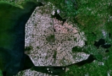
.png)
Hydrology
Hydrology is the study of the movement, distribution, and quality of water on Earth and other planets, including the hydrologic cycle, water resources and environmental watershed sustainability...
entity, meaning it has no connection with outside water other than through manually-operated devices. There are three types of polder:
- Land reclaimedLand reclamationLand reclamation, usually known as reclamation, is the process to create new land from sea or riverbeds. The land reclaimed is known as reclamation ground or landfill.- Habitation :...
from a body of water, such as a lake or the sea bedSeaA sea generally refers to a large body of salt water, but the term is used in other contexts as well. Most commonly, it means a large expanse of saline water connected with an ocean, and is commonly used as a synonym for ocean...
. - Flood plains separated from the sea or river by a dike.
- Marshes separated from the surrounding water by a dike and consequently drained.
The ground level in drained marshes subsides over time and thus all polders will eventually be below the surrounding water level some or all of the time.
Water enters the low-lying polder through ground swell due to water pressure on ground water or rain fall and transportation of water by rivers and canals. This usually means that the polder has an excess of water that needs to be pumped out or drained by opening sluice
Sluice
A sluice is a water channel that is controlled at its head by a gate . For example, a millrace is a sluice that channels water toward a water mill...
s at low tide.
However, care must be taken in not setting the internal water level too low. Polder land made up of peat
Peat
Peat is an accumulation of partially decayed vegetation matter or histosol. Peat forms in wetland bogs, moors, muskegs, pocosins, mires, and peat swamp forests. Peat is harvested as an important source of fuel in certain parts of the world...
(former marshland) will show accelerated compression due to the peat decomposing in dry conditions.
Polders are at risk from flooding at all times and care must be taken to protect the surrounding dikes. Dikes are mostly built using locally available materials and each has its own risk factor: sand is prone to collapse due to oversaturation by water while dry peat is lighter than water, making the barrier potentially unstable in very dry seasons. Some animals dig tunnels in the barrier, undermining the structure; the muskrat
Muskrat
The muskrat , the only species in genus Ondatra, is a medium-sized semi-aquatic rodent native to North America, and introduced in parts of Europe, Asia, and South America. The muskrat is found in wetlands and is a very successful animal over a wide range of climates and habitats...
is notorious for this behavior. For this reason in the Netherlands it is actively hunted to extinction. No such care is taken in neighboring Germany though, causing the stock to be constantly resupplied across the border.
Polders are most commonly found, though not exclusively so, in river deltas, former fen
Fen
A fen is a type of wetland fed by mineral-rich surface water or groundwater. Fens are characterised by their water chemistry, which is neutral or alkaline, with relatively high dissolved mineral levels but few other plant nutrients...
lands and coastal areas.
Polders and the Netherlands
The Netherlands is frequently associated with polders. This is illustrated by the English saying: God created the world, but the Dutch created Holland.The Dutch have a long history of reclamation of marshes and fenland, resulting in some 3,000 polders nationwide. About half of all polder surface within northwest Europe is located within the Netherlands. The first embankments in Europe were constructed in Roman times. The first polders were constructed in the 11th century. Due to flooding disasters, water board
Water board (The Netherlands)
Dutch water boards are regional government bodies charged with managing the water barriers, the waterways, the water levels, water quality and sewage treatment in their respective regions...
s called waterschap (when situated more inland) or hoogheemraadschap (near the sea, mainly used in Holland) were set up to maintain the integrity of the water defences around polders, maintain the waterways inside a polder and control the various water levels inside and outside the polder. Water bodies hold separate elections, levy taxes and function independently from other government bodies. Their function is basically unchanged even currently. As such, they are the oldest democratic institution in the country. The necessary co-operation between all ranks in maintaining polder integrity also gave its name to the Dutch
Netherlands
The Netherlands is a constituent country of the Kingdom of the Netherlands, located mainly in North-West Europe and with several islands in the Caribbean. Mainland Netherlands borders the North Sea to the north and west, Belgium to the south, and Germany to the east, and shares maritime borders...
version of third way politics
Third way (centrism)
The Third Way refers to various political positions which try to reconcile right-wing and left-wing politics by advocating a varying synthesis of right-wing economic and left-wing social policies. Third Way approaches are commonly viewed from within the first- and second-way perspectives as...
- the Polder Model
Polder Model
The polder model is a term with uncertain origin that was first used to describe the internationally acclaimed Dutch version of consensus policy in economics, specifically in the 1980s and 1990s. However, the term was quickly adopted for a much wider meaning, for similar cases of consensus...
.
The 1953 flood disaster
North Sea flood of 1953
The 1953 North Sea flood was a major flood caused by a heavy storm, that occurred on the night of Saturday 31 January 1953 and morning of 1 February 1953. The floods struck the Netherlands, Belgium, England and Scotland.A combination of a high spring tide and a severe European windstorm caused a...
prompted a new approach to the design of dikes and other water-retaining structures, based on an acceptable probability of overflowing. Risk is defined as the product of probability and consequences. The damage in lives, property and rebuilding costs is offset against the cost of water defences. From these calculations follow an acceptable flood risk from the sea at 1 in 4,000–10,000 years, while it is 1 in 100–2,500 years for a river flood. The established policy forces the Dutch government to improve flood defences as new data on threat levels becomes available.
- Haarlemmermeerpolder
- Wieringermeerpolder
- FlevopolderFlevopolderThe Flevopolder is a region entirely conquered on the water. This territory consists of the Estern Flevoland and Southern Flevoland. The Flevopolder, contrary to what the name suggests, is a unique polder...
/FlevolandFlevolandFlevoland is a province of the Netherlands. Located in the centre of the country, at the location of the former Zuiderzee, the province was established on January 1, 1986; the twelfth province of the country, with Lelystad as its capital... - NoordoostpolderNoordoostpolderNoordoostpolder is a municipality in the Flevoland province in the central Netherlands. Formerly, it was also called Urker Land. Emmeloord is the administrative center, located in the heart of the Noordoostpolder. The municipality has the largest land area in the Netherlands...
- BeemsterBeemsterBeemster is a municipality in the Netherlands, in the province of North Holland. Also, the Beemster is the first so-called polder in the Netherlands that was reclaimed from a lake, the water being extracted out of the lake by windmills. The Beemster Polder was dried during the period 1609 through...
Belgium
- De Moeren, near VeurneVeurneVeurne is a city and municipality in the Belgian province of West Flanders. The municipality comprises the town of Veurne proper and the settlements of Avekapelle, Booitshoeke, Bulskamp, De Moeren, Eggewaartskapelle, Houtem, Steenkerke, Vinkem, Wulveringem, and Zoutenaaie.-Origins in the 15th...
in West Flanders - Polders of Muisbroek and Ettenhoven, in EkerenEkerenEkeren is a northern district of the municipality of Antwerp in the Flemish Region of Belgium. The suburb celebrated its 850th birthday in 2005; the name of the town was first mentioned in 1155, as "Hecerna"....
and Hoevenen - Polder of Stabroek, in StabroekStabroekStabroek is a municipality located in the Belgian province of Antwerp. The municipality comprises the towns of Hoevenen and Stabroek proper. On December 31, 2006 Stabroek had a total population of 17,618. The total area is 21.51 km² which gives a population density of 818 inhabitants per km². In...
- Kabeljauwpolder, in ZandvlietZandvlietZandvliet is a Belgian town forming part of the Antwerp district of Berendrecht-Zandvliet-Lillo. The place dates back to 1135 when it was known as Santflit, meaning "a navigable passage through sand"....
- Scheldepolders on the left bank of the ScheldtScheldtThe Scheldt is a 350 km long river in northern France, western Belgium and the southwestern part of the Netherlands...
- Uitkerkse polders, near Blankenberge in West Flanders
France
- Marais PoitevinMarais PoitevinThe Marais Poitevin is a large area of marshland in Western France, a remnant of the former Gulf of Poitou...
- Les MoëresLes MoëresDe Moeren or Les Moëres are a marshy region in the Westhoek, politically divided between the French-Belgian border. At one time the area was inhabited by the Gallic people known as the Morini; they are believed to have lent their name to the territory.For many centuries, beginning around 800,...
, adjacent to the Flemish polder De Moeren in Belgium.
Germany
- Altes Land near Hamburg
- Blockland & Hollerland near Bremen
- Nordstrand, GermanyNordstrand, GermanyNordstrand is a peninsula and former island in North Frisia on the North Sea coast of Germany. It is part of the Nordfriesland district in the federal state of Schleswig-Holstein. Its area is 50 km², and its population is 2,300...
- Bormerkoog and Meggerkoog near FriedrichstadtFriedrichstadtFriedrichstadt is a town in the district of Nordfriesland, in Schleswig-Holstein, Germany. It is situated on the river Eider approx. 12 km south of Husum. It was founded in 1621 by Dutch settlers...
Japan
- HachirogataHachirogataHachirōgata is a lake in the Akita Prefecture in northern Japan. Its formal name is Lake Hachirō , but it is also called Hachirōgata Regulating Pond . At 4 meters below sea level, Hachirōgata is now the lowest point in Japan.Hachirōgata was the second-largest lake in Japan after Lake Biwa...
in Akita PrefectureAkita Prefectureis a prefecture of Japan located in the Tōhoku Region of northern Honshu, the main island of Japan. The capital is the city of Akita.- History :The area of Akita has been created from the ancient provinces of Dewa and Mutsu....
- Isahaya Bay in KyushuKyushuis the third largest island of Japan and most southwesterly of its four main islands. Its alternate ancient names include , , and . The historical regional name is referred to Kyushu and its surrounding islands....
- Kojima Bay in Okayama PrefectureOkayama Prefectureis a prefecture of Japan located in the Chūgoku region on Honshū island. The capital is the city of Okayama.- History :During the Meiji Restoration, the area of Okayama Prefecture was known as Bitchū Province, Bizen Province and Mimasaka Province.- Geography :...
Korea, Republic of
- Parts of the coast of Ganghwa IslandGanghwa IslandGanghwa Island is an island in the estuary of the Han River, on the west coast of South Korea. Ganghwa Island is separated from Gimpo, on the mainland, by a narrow channel, which is spanned by two bridges. The main channel of the Han River separates the island from Gaeseong in North Korea.About...
, adjacent to the river HanHan River (Korea)The Han River is a major river in South Korea and the fourth longest river on the Korean peninsula after the Amnok, Duman, and Nakdong rivers. It is formed by the confluence of the Namhan River , which originates in Mount Daedeok, and the Bukhan River , which originates on the slopes of Mount...
in IncheonIncheonThe Incheon Metropolitan City is located in northwestern South Korea. The city was home to just 4,700 people when Jemulpo port was built in 1883. Today 2.76 million people live in the city, making it Korea’s third most populous city after Seoul and Busan Metropolitan City... - Delta of the river NakdongNakdong RiverThe Nakdong River is the longest river in South Korea, and passes through major cities such as Daegu and Busan.-Geography:...
in BusanBusanBusan , formerly spelled Pusan is South Korea's second largest metropolis after Seoul, with a population of around 3.6 million. The Metropolitan area population is 4,399,515 as of 2010. It is the largest port city in South Korea and the fifth largest port in the world... - SaemangeumSaemangeumSaemangeum is an estuarine tidal flat on the coast of the Yellow Sea in South Korea. It was dammed by the government of South Korea's Saemangeum Seawall Project, completed in April 2006, after a long fight between the government and environmental activists, and is scheduled to be converted into...
in Jeollabuk-doJeollabuk-doJeollabuk-do is a province in the southwest of South Korea. The province was formed in 1896 from the northern half of the former Jeolla province, and remained a province of Korea until the country's division in 1945, then became part of South Korea...
Monaco
- Most of La CondamineLa CondamineLa Condamine is the second oldest district in Monaco, after Monaco-Ville. It is known for its distinctive wide harbor and moored expensive yachts.- Location in Monaco :By broad definition, it is one of the four traditional quartiers...
- Under development Le PortierFontvieille, MonacoFontvieille is the newest of the four traditional quarters in the principality of Monaco, and one of ten Wards for modern administrative purposes. It is located in the western part of Monaco...
part of FontvieilleFontvieilleFontvieille may refer to:*Fontvieille, Bouches-du-Rhône, a commune in the French département of Bouches-du-Rhône*Fontvieille, Monaco, a community within Monaco consisting of land reclaimed from the Mediterranean Sea...
Netherlands
- AlblasserwaardAlblasserwaardThe Alblasserwaard is a polder in the province South Holland in the Netherlands. It is mainly known for the windmills of Kinderdijk, a village in the northwest of the Alblasserwaard.-History:...
, containing the windmills of KinderdijkKinderdijkKinderdijk is a village in the Netherlands, belonging to the municipality of Nieuw-Lekkerland, in the province South Holland, about 15 km east of Rotterdam. Kinderdijk is situated in a polder at the confluence of the Lek and Noord rivers. To drain the polder, a system of 19 windmills was built...
, a World Heritage SiteWorld Heritage SiteA UNESCO World Heritage Site is a place that is listed by the UNESCO as of special cultural or physical significance... - AndijkAndijkAndijk is a former municipality and a village bordering Lake IJssel in the Netherlands, in the province of North Holland and the region of West-Frisia. Since 1 January 2011 Andijk has been part of Medemblik municipality....
- Anna PaulownapolderAnna PaulownapolderThe Anna Paulownapolder is a polder in the municipality of Anna Paulowna in the province of Noord-Holland in the Netherlands. The area of the polder is 50 square kilometres and it forms an important horticulture area, with among other things flower bulb cultivation.The Anna Paulownapolder was from...
- BeemsterBeemsterBeemster is a municipality in the Netherlands, in the province of North Holland. Also, the Beemster is the first so-called polder in the Netherlands that was reclaimed from a lake, the water being extracted out of the lake by windmills. The Beemster Polder was dried during the period 1609 through...
, a World Heritage Site - BijlmermeerBijlmermeerThe Bijlmermeer or colloquially Bijlmer is one of the neighbourhoods that form the Amsterdam Zuidoost borough of Amsterdam, Netherlands. To many people, the Bijlmer designation is used to refer to Amsterdam Zuidoost and Diemen Zuid as a pars pro toto...
- HaarlemmermeerHaarlemmermeerHaarlemmermeer is a municipality in the Netherlands, in the province of North Holland. It is a polder, consisting of land reclaimed from water, and the name Haarlemmermeer means Haarlem's Lake, still referring to the body of water from which the region was reclaimed in the 19th century.Its main...
, containing Schiphol airport - KrimpenerwaardKrimpenerwaardThe Krimpenerwaard, located in the province of South Holland in the Netherlands, is the rural area just south of Gouda and just east of the Rotterdam conurbation...
- LauwersmeerLauwersmeerLauwersmeer is a man-made lake in the north of the Netherlands, on the border of the provinces of Groningen and Friesland. The lake was formed on 1969-05-23, when the dike between the bay called "Lauwers Sea" and the Wadden Sea was closed....
- MastenbroekMastenbroekMastenbroek is a polder in the Dutch province of Overijssel. It lies north of the city of Zwolle. "Mastenbroek" is also the name of a small village, built around a church in the middle of the poder....
- NoordoostpolderNoordoostpolderNoordoostpolder is a municipality in the Flevoland province in the central Netherlands. Formerly, it was also called Urker Land. Emmeloord is the administrative center, located in the heart of the Noordoostpolder. The municipality has the largest land area in the Netherlands...
- Ooijpolder
- Prins Alexanderpolder
- PurmerPurmerPurmer is a polder and reclaimed lake in the Netherlands province of North Holland, located between the towns of Purmerend and Edam-Volendam. Windmill reclamation activity began in 1618. Hydraulic engineer Jan Adriaanszoon Leeghwater also had stakes in the reclamation, although he was not directly...
- SchermerSchermerSchermer is a municipality in the Netherlands, in the province of North Holland. The name came from "skir mere", which means "bright lake" Schermer (West Frisian: Skirmare) is a municipality in the Netherlands, in the province of North Holland. The name came from "skir mere", which means "bright...
- Rosandepolder
- WatergraafsmeerWatergraafsmeerThe Watergraafsmeer is a polder in The Netherlands. It was reclaimed in 1629. In the 17th and 18th centuries, there were many buitenplaatsen in the Watergraafsmeer, though nowadays only one, Frankendael, remains....
- WieringermeerWieringermeerWieringermeer is a municipality and a polder in the Netherlands, in the province of North Holland.- Population centres :The municipality of Wieringermeer consists of the following cities, towns, villages and/or districts: Kreileroord, Middenmeer, Slootdorp, Wieringerwerf.- History :Around the year...
- WieringerwaardWieringerwaardWieringerwaard is a polder and a village in the municipality of Anna Paulowna in the Dutch province of Noord-Holland. Wieringerwaard was formerly a separate municipality, until it merged with Barsingerhorn in 1970....
- WijdewormerWijdewormerWijdewormer is a hamlet in the Dutch province of North Holland. It is located in the municipality of Wormerland, about 5 km east of the town of Wormer, in the polder "De Wijde Wormer"....
- Zijpe- en Hazepolder
- ZuidplaspolderZuidplaspolderThe Zuidplaspolder is a polder in the Netherlands, containing the lowest point of Western Europe and in the entire European Union...
- Eastern and Southern FlevolandFlevolandFlevoland is a province of the Netherlands. Located in the centre of the country, at the location of the former Zuiderzee, the province was established on January 1, 1986; the twelfth province of the country, with Lelystad as its capital...
polders, containing the cities of LelystadLelystadLelystad is a municipality and a city in the centre of the Netherlands, and it is the capital of the province of Flevoland. The city, built on reclaimed land, was founded in 1967 and was named after Cornelis Lely, who engineered the Afsluitdijk, making the reclamation possible...
and AlmereAlmereAlmere is a planned city and municipality in the province of Flevoland, the Netherlands, bordering Lelystad and Zeewolde. The municipality of Almere comprises the districts Almere Stad, Almere Haven, Almere Buiten, Almere Hout, Almere Poort and Almere Pampus .Almere is the youngest city in the...
, respectively. Together these polders are also known as the Flevopolder.
Poland
- VistulaVistulaThe Vistula is the longest and the most important river in Poland, at 1,047 km in length. The watershed area of the Vistula is , of which lies within Poland ....
delta near ElblągElblagElbląg is a city in northern Poland with 127,892 inhabitants . It is the capital of Elbląg County and has been assigned to the Warmian-Masurian Voivodeship since 1999. Before then it was the capital of Elbląg Voivodeship and a county seat in Gdańsk Voivodeship...
and Nowy Dwor GdanskiNowy Dwór GdanskiNowy Dwór Gdański is a town in Poland, capital of Nowy Dwór Gdański County, located in Pomeranian Voivodeship, with 10,123 inhabitants .-Twin towns — Sister cities:Nowy Dwór Gdański is twinned with:-External links:*... - Warta delta near Kostrzyn nad OdraKostrzyn nad OdraKostrzyn nad Odrą is a town in western Poland, at the confluence of the Oder and Warta rivers, on the border with Germany. Located in the Lubusz Voivodeship, in Gorzów County, it had 19,952 inhabitants as of 2007.- History :...
United Kingdom
- Traeth MawrTraeth MawrThe Traeth Mawr is a polder near Porthmadog in Gwynedd in Wales. It was formerly the tidal estuary of the Afon Glaslyn, and many travellers sank in its quicksands trying to cross it. Much of it is between high mountains...
- Sunk IslandSunk IslandSunk Island is a Crown Estate village and civil parish in the East Riding of Yorkshire, England. It lies south of Ottringham and to the north of the Humber Estuary...
, on the north shore of the HumberHumberThe Humber is a large tidal estuary on the east coast of Northern England. It is formed at Trent Falls, Faxfleet, by the confluence of the tidal River Ouse and the tidal River Trent. From here to the North Sea, it forms part of the boundary between the East Riding of Yorkshire on the north bank...
east of HullKingston upon HullKingston upon Hull , usually referred to as Hull, is a city and unitary authority area in the ceremonial county of the East Riding of Yorkshire, England. It stands on the River Hull at its junction with the Humber estuary, 25 miles inland from the North Sea. Hull has a resident population of... - Parts of The FensThe FensThe Fens, also known as the , are a naturally marshy region in eastern England. Most of the fens were drained several centuries ago, resulting in a flat, damp, low-lying agricultural region....
- Branston Island, by the River WithamRiver WithamThe River Witham is a river, almost entirely in the county of Lincolnshire, in the east of England. It rises south of Grantham close to South Witham, at SK8818, passes Lincoln at SK9771 and at Boston, TF3244, flows into The Haven, a tidal arm of The Wash, near RSPB Frampton Marsh...
outside the conventional area of the fens but connected to them.
- Branston Island, by the River Witham
- Parts of the coast of EssexEssexEssex is a ceremonial and non-metropolitan county in the East region of England, and one of the home counties. It is located to the northeast of Greater London. It borders with Cambridgeshire and Suffolk to the north, Hertfordshire to the west, Kent to the South and London to the south west...
- Some land along the River PlymRiver PlymThe River Plym is a river in Devon, England. Its source is some 450m above sea level on Dartmoor, in an upland marshy area called Plym Head. From the upper reaches which contain antiquities and mining remains the river flows roughly southwest and enters the sea near to the city of Plymouth, where...
in PlymouthPlymouthPlymouth is a city and unitary authority area on the coast of Devon, England, about south-west of London. It is built between the mouths of the rivers Plym to the east and Tamar to the west, where they join Plymouth Sound... - Some land around Meathop east of Grange-over-SandsGrange-over-SandsGrange-over-Sands is a town and civil parish by the sea – with a wide tidal range, hence the "sands" name – in Cumbria, England. Historically, Grange-over-Sands was part of the County of Lancashire until 1974, when Cumbria was created under Local Government re-organisation which absorbed the area...
, reclaimed as a side-effect of building a railway embankmentEmbankment (transportation)To keep a road or railway line straight or flat, and where the comparative cost or practicality of alternate solutions is prohibitive, the land over which the road or rail line will travel is built up to form an embankment. An embankment is therefore in some sense the opposite of a cutting, and... - The Somerset LevelsSomerset LevelsThe Somerset Levels, or the Somerset Levels and Moors as they are less commonly but more correctly known, is a sparsely populated coastal plain and wetland area of central Somerset, South West England, between the Quantock and Mendip Hills...
and North Somerset LevelsNorth Somerset LevelsThe North Somerset Levels is a coastal plain, an expanse of low-lying flat ground, which occupies an area between Weston-super-Mare and Bristol in North Somerset, England... - Romney marsh
See also
- Flood control in the NetherlandsFlood control in the NetherlandsFlood control in the Netherlands is an important issue for the Netherlands as about two thirds of the country is vulnerable to flooding while at the same time the country is among the most densely populated on earth. Natural sand dunes and man made dikes, dams and floodgates provide defense against...
- AfsluitdijkAfsluitdijkThe Afsluitdijk is a major causeway in the Netherlands, constructed between 1927 and 1933 and running from Den Oever on Wieringen in North Holland province, to the village of Zurich in Friesland province, over a length of and a width of 90 m, at an initial height of 7.25 m above sea-level.It is...
- Land reclamationLand reclamationLand reclamation, usually known as reclamation, is the process to create new land from sea or riverbeds. The land reclaimed is known as reclamation ground or landfill.- Habitation :...
- IJsselmeerIJsselmeerIJsselmeer is a shallow artificial lake of 1100 km² in the central Netherlands bordering the provinces of Flevoland, North Holland and Friesland, with an average depth of 5 to 6 m. The IJsselmeer is the largest lake in Western Europe....
- Zuiderzee WorksZuiderzee WorksThe Zuiderzee Works are a manmade system of dams, land reclamation and water drainage works, the largest hydraulic engineering project undertaken by the Netherlands during the twentieth century. The project involved the damming of the Zuiderzee, a large, shallow inlet of the North Sea, and the...
- WindpumpWindpumpA windpump is a windmill used for pumping water, either as a source of fresh water from wells, or for draining low-lying areas of land. Once a common fixture on farms in semi-arid areas, windpumps are still used today where electric power is not available or too expensive.-History:Windmills were...
External links
- Polder landscapes in the Netherlands within a northwest European and is also a landmark context
- How to make a polder - online film
- http://watercanon.nederlandleeftmetwater.nl/view/canon/professionalisation