

Traeth Mawr
Encyclopedia
The Traeth Mawr is a polder
near Porthmadog
in Gwynedd
in Wales
. It was formerly the tidal estuary
of the Afon Glaslyn
, and many travellers sank in its quicksand
s trying to cross it. Much of it is between high mountains. Pont Aberglaslyn is at its upper end.

 Between 1770 and 1800 about 1500 acres (607 ha) of it were reclaimed
piecemeal by various landowners, in portions between 50 acres (20.2 ha) and 100 acres (40.5 ha) in size.
Some time after 1789, William Madocks
reclaimed an area of sand and built Tremadog
on it. Madocks obtained an Act of Parliament
(1 August 1807 - 47 George III Cap. 71) permitting him to complete the reclamation. Between 1808 and 1811 he constructed an embankment called "the Cob" from the island of Ynys Towyn (now part of Porthmadog
) near the Caernarfonshire
shore to Boston Lodge
on the Meirionnydd shore in order to cut off the estuary from the sea; this gained 1500 acres (607 ha). Soon after, in 1812 the embankment broke in a violent storm, but the breach was mended by the end of September 1814.
The Ffestiniog Railway
has crossed the embankment since 1836 when a carriageway was constructed at a lower level on the inland side to take the public road, which is now the A487. The embankment is officially regarded as a bridge and a toll was payable by road vehicles until September 2003, when the Cob was bought by the Welsh Assembly Government
. That tollgate was notorious for causing traffic jams at peak holiday travel times: it was not exceptional for the queue to back up all the way to Minffordd
, 1 miles (1.6 km) away. The road on the Cob was widened in 2002, and a separate path added for walkers and cyclists. This path now forms part of Lôn Las Cymru, the national cycle route.
At its seaward end, Traeth Mawr joins "Traeth Bach" ("little sands"), the estuary of the Afon Dwyryd
.
Polder
A polder is a low-lying tract of land enclosed by embankments known as dikes, that forms an artificial hydrological entity, meaning it has no connection with outside water other than through manually-operated devices...
near Porthmadog
Porthmadog
Porthmadog , known locally as "Port", and historically rendered into English as Portmadoc, is a small coastal town and community in the Eifionydd area of Gwynedd, in Wales. Prior to the Local Government Act 1972 it was in the administrative county of Caernarfonshire. The town lies east of...
in Gwynedd
Gwynedd
Gwynedd is a county in north-west Wales, named after the old Kingdom of Gwynedd. Although the second biggest in terms of geographical area, it is also one of the most sparsely populated...
in Wales
Wales
Wales is a country that is part of the United Kingdom and the island of Great Britain, bordered by England to its east and the Atlantic Ocean and Irish Sea to its west. It has a population of three million, and a total area of 20,779 km²...
. It was formerly the tidal estuary
Estuary
An estuary is a partly enclosed coastal body of water with one or more rivers or streams flowing into it, and with a free connection to the open sea....
of the Afon Glaslyn
River Glaslyn
The Afon Glaslyn is a river in Gwynedd, north-west Wales. Whilst not of great significance in terms of its length , it is one of Gwynedd's primary rivers, and has greatly influenced the landscape in which it flows....
, and many travellers sank in its quicksand
Quicksand
Quicksand is a colloid hydrogel consisting of fine granular matter , clay, and water.Water circulation underground can focus in an area with the optimal mixture of fine sands and other materials such as clay. The water moves up and then down slowly in a convection-like manner throughout a column...
s trying to cross it. Much of it is between high mountains. Pont Aberglaslyn is at its upper end.
Land reclamation
Land reclamation, usually known as reclamation, is the process to create new land from sea or riverbeds. The land reclaimed is known as reclamation ground or landfill.- Habitation :...
piecemeal by various landowners, in portions between 50 acres (20.2 ha) and 100 acres (40.5 ha) in size.
Some time after 1789, William Madocks
William Madocks
William Alexander Madocks was a landowner and Member of Parliament for the town of Boston in Lincolnshire from 1802 to 1820, and then for Chippenham in Wiltshire from 1820 to 1826...
reclaimed an area of sand and built Tremadog
Tremadog
Tremadog is a village on the outskirts of Porthmadog, in Gwynedd, north west Wales. It was a planned settlement, founded by William Madocks, who bought the land in 1798...
on it. Madocks obtained an Act of Parliament
Act of Parliament
An Act of Parliament is a statute enacted as primary legislation by a national or sub-national parliament. In the Republic of Ireland the term Act of the Oireachtas is used, and in the United States the term Act of Congress is used.In Commonwealth countries, the term is used both in a narrow...
(1 August 1807 - 47 George III Cap. 71) permitting him to complete the reclamation. Between 1808 and 1811 he constructed an embankment called "the Cob" from the island of Ynys Towyn (now part of Porthmadog
Porthmadog
Porthmadog , known locally as "Port", and historically rendered into English as Portmadoc, is a small coastal town and community in the Eifionydd area of Gwynedd, in Wales. Prior to the Local Government Act 1972 it was in the administrative county of Caernarfonshire. The town lies east of...
) near the Caernarfonshire
Caernarfonshire
Caernarfonshire , historically spelled as Caernarvonshire or Carnarvonshire in English during its existence, was one of the thirteen historic counties, a vice-county and a former administrative county of Wales....
shore to Boston Lodge
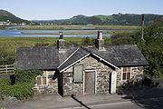
Boston Lodge
This article is about the locomotive works. For the station see Boston Lodge Halt.Boston Lodge is situated at Penrhyn Isa, Minffordd, Penrhyndeudraeth, on the A487 road about 1 mile SE across the Afon Glaslyn causeway from Porthmadog, Gwynedd in north-west Wales.It has a station on the Ffestiniog...
on the Meirionnydd shore in order to cut off the estuary from the sea; this gained 1500 acres (607 ha). Soon after, in 1812 the embankment broke in a violent storm, but the breach was mended by the end of September 1814.
The Ffestiniog Railway
Ffestiniog Railway
The Ffestiniog Railway is a narrow gauge heritage railway, located in Gwynedd, Wales. It is a major tourist attraction located mainly within the Snowdonia National Park....
has crossed the embankment since 1836 when a carriageway was constructed at a lower level on the inland side to take the public road, which is now the A487. The embankment is officially regarded as a bridge and a toll was payable by road vehicles until September 2003, when the Cob was bought by the Welsh Assembly Government
Welsh Assembly Government
The Welsh Government is the devolved government of Wales. It is accountable to the National Assembly for Wales, the legislature which represents the interests of the people of Wales and makes laws for Wales...
. That tollgate was notorious for causing traffic jams at peak holiday travel times: it was not exceptional for the queue to back up all the way to Minffordd
Minffordd
Minffordd is a village within the Welsh county of Gwynedd. It is situated on the A487 road between Porthmadog and Penrhyndeudraeth....
, 1 miles (1.6 km) away. The road on the Cob was widened in 2002, and a separate path added for walkers and cyclists. This path now forms part of Lôn Las Cymru, the national cycle route.
At its seaward end, Traeth Mawr joins "Traeth Bach" ("little sands"), the estuary of the Afon Dwyryd
River Dwyryd
The Afon Dwyryd is a river in Gwynedd, North Wales, which flows principally westwards draining to the sea into Tremadog Bay south of Porthmadog....
.