

Water board (The Netherlands)
Encyclopedia
Dutch water boards are regional government bodies charged with managing the water barriers, the waterways, the water levels, water quality and sewage treatment
in their respective regions. These regional water authorities are among the oldest forms of local government
in the Netherlands
, some of them having been founded in the 13th century.
is below sea level. Four main rivers run through this relatively small country: the Rhine, the Meuse, the Scheldt
, and the Ems. Historically there had always been a good deal of coastal and riverine flooding. Flood control in the Netherlands
is a national priority as about two thirds of the country is vulnerable to flooding while at the same time the country is among the most densely populated on earth. Natural sand dunes and man made dikes, dams and floodgate
s provide defense against storm surge
s from the sea. River dikes prevent flooding from water flowing into the country by the major rivers Rhine and Meuse, while a complicated system of drainage ditches, canals and pumping station
s (historically: windmill
s) keep the low lying parts dry for habitation and agriculture. Water boards are the independent local government bodies responsible for maintaining this system.
 This method of controlling water emerged as the unpredictable water system was tamed and the land drained for agriculture. The first dikes and water control structures were built and maintained by those directly benefiting from them, mostly farmers. As the structures got more extensive and complex, councils were formed from people with a common interest in the control of water levels on their land. The first water boards were formed in the 13th century
. These often controlled only a small area, a single polder or dike.
As these boards became more organised, the counts of Holland
began granting charters to the boards. They were also granted the right to make their own bylaw
s. The ever-present threat of loss of life and land required short lines of communication between the authorities and the residents who maintained the infrastructure. The threat of flooding in a heerlijkheid
was best dealt with by local authorities, so the water boads were originally chaired by the local nobility.
The local water boards were set up to maintain the integrity of the water defences around the local polders, to maintain the waterways inside the local polders and to control the various water levels inside and outside the local polders. The mandate of these water boards (which is largely unchanged) was the maintenance of dikes and dunes, maintenance of the waterways (and roads too, in several municipalities), controlling the water quantity (i.e. the water level), and controlling the quality of all surface water (including punishing polluters). The original water boards differed much from each other in organisation, power and area they managed. The differences were often regional and dictated by differing circumstances, whether they had to defend a sea dike against a storm surge or keep the water level in a polder within bounds. Hoogheemraadschappen were responsible for protecting the land against the sea and for regulating the water levels of the various canals and lakes into which water was pumped from the polder
s and waterschappen.
The dikes were maintained by the individuals who benefited from their existence, every farmer having been designated a part of the dike to maintain, with a review every three years by the water board directors. The old rule was "He whom the water harms stops the water" (Dutch: Wie het water deert, die het water keert). This meant that those living at the dike had to pay and care for it. Those living at or near the dike itself could go bankrupt from having to repair a breached dike. Those living further inland often refused to pay for or help in the upkeep of the dikes, even though they were just as affected by floods. This system led to haphazard maintenance and it is believed that many floods would not have happened or would not have been as severe if the dikes had been in better condition.
The punishment usually meted out by water boards were fines for misdemeanors such as emptying waste in the nearest canal; however, according to various historical documents, the death penalty was used more than once for serious offenders who threatened dike safety or water quality.
in the 16th and 17th centuries.
The mandate of the Rijkswaterstaat
(English: Directorate General for Public Works and Water Management), established in 1798 under French rule, was to centralise water control in the Netherlands. The local water boards were too attached to their autonomy, however, so the Rijkswaterstaat ended up working alongside the local water boards. Today the Rijkswaterstaat has responsibility over many major water control structures, in addition to its other infrastructural functions of building railroads and motorways.
By 1850 there were about 3,500 in the country. In modern times, water boards began to merge as they dealt with joint and sometimes conflicting interests. Mergers eventually reduced this number until there were just 27 water boards on 1 January 2009. This is comparable to the organisation of other government services. For example, in 2010 there were 26 police departments in the Netherlands.
The function of the water boards has basically remained unchanged to this day. Having a rich history dating back to the medieval period, they are the oldest governing bodies and the oldest democratic institutions in the Netherlands. Dutch water boards each have their own coat of arms
, a colourful reminder of their importance in Dutch history. Another legacy are the historic buildings that used to headquarter the water boards. Called a gemeenlandshuis
or waterschaphuis, these charming old buildings can be found at the heart of many Dutch towns.
in the Netherlands. Water boards still levy their own taxes, but they no longer have the power to penalize offenders. To control the quality of the surface water (canals, lakes, ponds and streams), water boards fulfil several tasks: policy making, planning and projects, permit issuance (sewage discharge requiring a permit), and the treatment of sewage and by-products. The various municipalities within the geographic area covered by a water board are responsible for collecting sewage from households and industries, but the water boards transport and treat the sewage.
Within its territory, a water board is responsible for:
Dutch water boards are not responsible for the supply of public water and are therefore not considered a utility
.
In addition to the taxes raised by the water boards, the central government contributes to its financial system by paying for the cost of constructing and maintaining the water barriers and the main waterways. The costs of wastewater treatment are financed by a water pollution levy, which is based on the polluter pays principle
.
Unlike municipal council elections, voters do not usually have to go to a polling station but they can vote by mail or even by telephone. (The water boards also wanted to offer voting by Internet, however, the Dutch government has determined that this process is not yet secure enough.)
The constituencies of the members of the general administrative body are the various categories of stakeholders: landholders, leaseholders, owners of buildings, companies and, since recently, all residents as well. The nature of the interest and financial contribution are factors in determining how many representatives each category may have on the water board.
or hoogheemraden
in Dutch, traditionally represent four types of water users: the local population (residences), industry (factories and industrial buildings), municipalities (urban areas) and farmers (agricultural land and public parks).
in provincial government.
s or watersheds
. The territory of a water board generally covers several municipalities and may even include areas in two or more provinces. In 2011, there were 25 water boards in the Netherlands.
The Wateschap Roer and Overmaas and the Waterschap Peel and Maasvallei have jointly set up a company called “Waterschapsbedrijf Limburg”. One of its tasks is to ensure that the sewage treatment plants function efficiently.
, (European Union of Water Management Associations).
.
The term waterschap refers to the jurisdiction or to the administrative body. This also applies to hoogheemraadschap. In Dutch, the plural of waterschap is waterschappen. The plural of hoogheemraadschap is hoogheemraadschappen. In present-day usage, the official term is waterschap. However, the term hoogheemraadschap is still used by some Dutch water boards for historical reasons or when a number of waterschappen are grouped together into a larger regional body.
Officially, there is no difference between a hoogheemraadschap and a waterschap. The Water Board Act (Waterschapswet), the Dutch statute that governs regional water authorities, refers only to the term waterschap. A Dutch water board that still uses hoogheemraadschap in its name (e.g. the Hoogheemraadschap van Delfland) may have chosen to do so because hoogheemraadschap was part of the historical name. However, a waterschap that styles itself as a hoogheemraadschap no longer has its traditional structure with subordinate waterschappen. They have been merged into the hoogheemraadschap itself. Some Dutch regional water authorities chose the name hoogheemraadschap after the merger of a number of waterschappen into a larger regional water authority (e.g. Hoogheemraadschap De Stichtse Rijnlanden). When used in this sense, the word hoogheemraadschap refers to a large, regional waterschap.
The term "water board" or "regional water authority" may be confusing in the Dutch
context, as water boards and regional water authorities in other countries are often responsible for water supply
. A waterschap or hoogheemraadschap in the Netherlands
is charged with the control and management of water as well as treatment of wastewater, but not with the supply of water.
Sewage treatment
Sewage treatment, or domestic wastewater treatment, is the process of removing contaminants from wastewater and household sewage, both runoff and domestic. It includes physical, chemical, and biological processes to remove physical, chemical and biological contaminants...
in their respective regions. These regional water authorities are among the oldest forms of local government
Local government
Local government refers collectively to administrative authorities over areas that are smaller than a state.The term is used to contrast with offices at nation-state level, which are referred to as the central government, national government, or federal government...
in the Netherlands
Netherlands
The Netherlands is a constituent country of the Kingdom of the Netherlands, located mainly in North-West Europe and with several islands in the Caribbean. Mainland Netherlands borders the North Sea to the north and west, Belgium to the south, and Germany to the east, and shares maritime borders...
, some of them having been founded in the 13th century.
The struggle against the water
Around 55% of the NetherlandsNetherlands
The Netherlands is a constituent country of the Kingdom of the Netherlands, located mainly in North-West Europe and with several islands in the Caribbean. Mainland Netherlands borders the North Sea to the north and west, Belgium to the south, and Germany to the east, and shares maritime borders...
is below sea level. Four main rivers run through this relatively small country: the Rhine, the Meuse, the Scheldt
Scheldt
The Scheldt is a 350 km long river in northern France, western Belgium and the southwestern part of the Netherlands...
, and the Ems. Historically there had always been a good deal of coastal and riverine flooding. Flood control in the Netherlands
Flood control in the Netherlands
Flood control in the Netherlands is an important issue for the Netherlands as about two thirds of the country is vulnerable to flooding while at the same time the country is among the most densely populated on earth. Natural sand dunes and man made dikes, dams and floodgates provide defense against...
is a national priority as about two thirds of the country is vulnerable to flooding while at the same time the country is among the most densely populated on earth. Natural sand dunes and man made dikes, dams and floodgate
Floodgate
Floodgates are adjustable gates used to control water flow in flood barriers, reservoir, river, stream, or levee systems. They may be designed to set spillway crest heights in dams, to adjust flow rates in sluices and canals, or they may be designed to stop water flow entirely as part of a levee or...
s provide defense against storm surge
Storm surge
A storm surge is an offshore rise of water associated with a low pressure weather system, typically tropical cyclones and strong extratropical cyclones. Storm surges are caused primarily by high winds pushing on the ocean's surface. The wind causes the water to pile up higher than the ordinary sea...
s from the sea. River dikes prevent flooding from water flowing into the country by the major rivers Rhine and Meuse, while a complicated system of drainage ditches, canals and pumping station
Pumping station
Pumping stations are facilities including pumps and equipment for pumping fluids from one place to another. They are used for a variety of infrastructure systems, such as the supply of water to canals, the drainage of low-lying land, and the removal of sewage to processing sites.A pumping station...
s (historically: windmill
Windmill
A windmill is a machine which converts the energy of wind into rotational energy by means of vanes called sails or blades. Originally windmills were developed for milling grain for food production. In the course of history the windmill was adapted to many other industrial uses. An important...
s) keep the low lying parts dry for habitation and agriculture. Water boards are the independent local government bodies responsible for maintaining this system.
Origins and early development
13th century
As a means of recording the passage of time, the 13th century was that century which lasted from 1201 through 1300 in accordance with the Julian calendar in the Christian/Common Era...
. These often controlled only a small area, a single polder or dike.
As these boards became more organised, the counts of Holland
Count of Holland
The Counts of Holland ruled over the County of Holland in the Low Countries between the 10th and the 16th century.-House of Holland:The first count of Holland, Dirk I, was the son or foster-son of Gerolf, Count in Frisia...
began granting charters to the boards. They were also granted the right to make their own bylaw
Bylaw
By-law can refer to a law of local or limited application passed under the authority of a higher law specifying what things may be regulated by the by-law...
s. The ever-present threat of loss of life and land required short lines of communication between the authorities and the residents who maintained the infrastructure. The threat of flooding in a heerlijkheid
Heerlijkheid
A heerlijkheid was the basic administrative and judicial unit in rural areas in Dutch-speaking lands before 1800. It originated in the feudal subdivision of government authority in the Middle Ages. The closest English equivalents of the word are "seigniory" and "manor"...
was best dealt with by local authorities, so the water boads were originally chaired by the local nobility.
The local water boards were set up to maintain the integrity of the water defences around the local polders, to maintain the waterways inside the local polders and to control the various water levels inside and outside the local polders. The mandate of these water boards (which is largely unchanged) was the maintenance of dikes and dunes, maintenance of the waterways (and roads too, in several municipalities), controlling the water quantity (i.e. the water level), and controlling the quality of all surface water (including punishing polluters). The original water boards differed much from each other in organisation, power and area they managed. The differences were often regional and dictated by differing circumstances, whether they had to defend a sea dike against a storm surge or keep the water level in a polder within bounds. Hoogheemraadschappen were responsible for protecting the land against the sea and for regulating the water levels of the various canals and lakes into which water was pumped from the polder
Polder
A polder is a low-lying tract of land enclosed by embankments known as dikes, that forms an artificial hydrological entity, meaning it has no connection with outside water other than through manually-operated devices...
s and waterschappen.
The dikes were maintained by the individuals who benefited from their existence, every farmer having been designated a part of the dike to maintain, with a review every three years by the water board directors. The old rule was "He whom the water harms stops the water" (Dutch: Wie het water deert, die het water keert). This meant that those living at the dike had to pay and care for it. Those living at or near the dike itself could go bankrupt from having to repair a breached dike. Those living further inland often refused to pay for or help in the upkeep of the dikes, even though they were just as affected by floods. This system led to haphazard maintenance and it is believed that many floods would not have happened or would not have been as severe if the dikes had been in better condition.
The punishment usually meted out by water boards were fines for misdemeanors such as emptying waste in the nearest canal; however, according to various historical documents, the death penalty was used more than once for serious offenders who threatened dike safety or water quality.
Later development
In the 17th century there were many of these independent local bodies levying their own taxes and administering justice. This early form of local government played a role in the development of a political system in the Netherlands that was decentralised and dependent on communal cooperation. Widespread experience with decentralized government was a factor in the formation of the Dutch RepublicDutch Republic
The Dutch Republic — officially known as the Republic of the Seven United Netherlands , the Republic of the United Netherlands, or the Republic of the Seven United Provinces — was a republic in Europe existing from 1581 to 1795, preceding the Batavian Republic and ultimately...
in the 16th and 17th centuries.
The mandate of the Rijkswaterstaat
Rijkswaterstaat
Rijkswaterstaat, founded in 1798 as the Bureau voor den Waterstaat, is part of the Dutch Ministry of Infrastructure and the Environment, the former Ministry of Transport, Public Works and Water Management...
(English: Directorate General for Public Works and Water Management), established in 1798 under French rule, was to centralise water control in the Netherlands. The local water boards were too attached to their autonomy, however, so the Rijkswaterstaat ended up working alongside the local water boards. Today the Rijkswaterstaat has responsibility over many major water control structures, in addition to its other infrastructural functions of building railroads and motorways.
By 1850 there were about 3,500 in the country. In modern times, water boards began to merge as they dealt with joint and sometimes conflicting interests. Mergers eventually reduced this number until there were just 27 water boards on 1 January 2009. This is comparable to the organisation of other government services. For example, in 2010 there were 26 police departments in the Netherlands.
The function of the water boards has basically remained unchanged to this day. Having a rich history dating back to the medieval period, they are the oldest governing bodies and the oldest democratic institutions in the Netherlands. Dutch water boards each have their own coat of arms
Coat of arms
A coat of arms is a unique heraldic design on a shield or escutcheon or on a surcoat or tabard used to cover and protect armour and to identify the wearer. Thus the term is often stated as "coat-armour", because it was anciently displayed on the front of a coat of cloth...
, a colourful reminder of their importance in Dutch history. Another legacy are the historic buildings that used to headquarter the water boards. Called a gemeenlandshuis
Gemeenlandshuis
A Gemeenlandshuis, or Waterschapshuis is a building that is or was formerly used as the headquarters of one of the Waterboards of the Netherlands. The Netherlands has 27 Waterboards or Waterschappen.-History:...
or waterschaphuis, these charming old buildings can be found at the heart of many Dutch towns.
Responsibilities
Water boards act independently from the national government to manage the continuing struggle against the waterFlood control in the Netherlands
Flood control in the Netherlands is an important issue for the Netherlands as about two thirds of the country is vulnerable to flooding while at the same time the country is among the most densely populated on earth. Natural sand dunes and man made dikes, dams and floodgates provide defense against...
in the Netherlands. Water boards still levy their own taxes, but they no longer have the power to penalize offenders. To control the quality of the surface water (canals, lakes, ponds and streams), water boards fulfil several tasks: policy making, planning and projects, permit issuance (sewage discharge requiring a permit), and the treatment of sewage and by-products. The various municipalities within the geographic area covered by a water board are responsible for collecting sewage from households and industries, but the water boards transport and treat the sewage.
Within its territory, a water board is responsible for:
- management and maintenance of water barriers: dunes, dikes, quays and levees;
- management and maintenance of waterways;
- maintenance of a proper water level in polders and waterways;
- maintenance of surface water quality through wastewater treatmentWastewater TreatmentWastewater treatment may refer to:* Sewage treatment* Industrial wastewater treatment...
.
Dutch water boards are not responsible for the supply of public water and are therefore not considered a utility
Public utility
A public utility is an organization that maintains the infrastructure for a public service . Public utilities are subject to forms of public control and regulation ranging from local community-based groups to state-wide government monopolies...
.
In addition to the taxes raised by the water boards, the central government contributes to its financial system by paying for the cost of constructing and maintaining the water barriers and the main waterways. The costs of wastewater treatment are financed by a water pollution levy, which is based on the polluter pays principle
Polluter pays principle
In environmental law, the polluter pays principle is enacted to make the party responsible for producing pollution responsible for paying for the damage done to the natural environment. It is regarded as a regional custom because of the strong support it has received in most Organisation for...
.
Organization
Water boards hold separate elections, levy taxes and function independently from other government bodies. Water board structure varies, but they each have an elected general administrative body, an executive board and a chair.Hoofdingelanden
Most of the members of the general administrative body of the water boards (the hoofdingelanden) are elected democratically, although some stakeholders (e.g. environmental organisations) may have the power to appoint members. The members of the general administrative body are elected for a period of four years.Unlike municipal council elections, voters do not usually have to go to a polling station but they can vote by mail or even by telephone. (The water boards also wanted to offer voting by Internet, however, the Dutch government has determined that this process is not yet secure enough.)
The constituencies of the members of the general administrative body are the various categories of stakeholders: landholders, leaseholders, owners of buildings, companies and, since recently, all residents as well. The nature of the interest and financial contribution are factors in determining how many representatives each category may have on the water board.
Hoogheemraden
The general administrative body elects some of its own members to sit on the executive board. These executive board members, who are called called heemradenHeemraad
A Heemraad, or Hoogheemraad is a local official of a Dutch water board. The term can be pluralized to heemraden, but sometimes the word heemraad also means more than one man in the sense of a meeting of heemraden, such as decisions made by the heemraad...
or hoogheemraden
Heemraad
A Heemraad, or Hoogheemraad is a local official of a Dutch water board. The term can be pluralized to heemraden, but sometimes the word heemraad also means more than one man in the sense of a meeting of heemraden, such as decisions made by the heemraad...
in Dutch, traditionally represent four types of water users: the local population (residences), industry (factories and industrial buildings), municipalities (urban areas) and farmers (agricultural land and public parks).
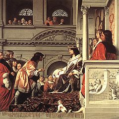
Dijkgraaf
Each water board is headed by a chair (dijkgraaf, literally: "dike count", but sometimes called "dike reeve" or "dike warden" in English), an ancient office that dates back to the medieval period. The chair is appointed by the government for a period of six years. The chair presides over the executive board and the general administrative body and has certain ceremonial duties as well. The chair of a water board is at the same level as a mayor in local government and a queen's commissionerQueen's Commissioner
The Queen's Commissioner is the head of a province in the Netherlands, who is chairman of both the Provinciale Staten and the Gedeputeerde Staten , but only has a right to vote in the latter...
in provincial government.
List of Dutch water boards
Typically, a water board’s territory is made up of one or more polderPolder
A polder is a low-lying tract of land enclosed by embankments known as dikes, that forms an artificial hydrological entity, meaning it has no connection with outside water other than through manually-operated devices...
s or watersheds
Drainage basin
A drainage basin is an extent or an area of land where surface water from rain and melting snow or ice converges to a single point, usually the exit of the basin, where the waters join another waterbody, such as a river, lake, reservoir, estuary, wetland, sea, or ocean...
. The territory of a water board generally covers several municipalities and may even include areas in two or more provinces. In 2011, there were 25 water boards in the Netherlands.
- Waterschap Noorderzijlvest (GroningenGroningen (province)Groningen [] is the northeasternmost province of the Netherlands. In the east it borders the German state of Niedersachsen , in the south Drenthe, in the west Friesland and in the north the Wadden Sea...
, FrieslandFrieslandFriesland is a province in the north of the Netherlands and part of the ancient region of Frisia.Until the end of 1996, the province bore Friesland as its official name. In 1997 this Dutch name lost its official status to the Frisian Fryslân...
and DrentheDrentheDrenthe is a province of the Netherlands, located in the north-east of the country. The capital city is Assen. It is bordered by Overijssel to the south, Friesland to the west, Groningen to the north, and Germany to the east.-History:Drenthe, unlike many other parts of the Netherlands, has been a...
) - Wetterskip Fryslân (FrieslandFrieslandFriesland is a province in the north of the Netherlands and part of the ancient region of Frisia.Until the end of 1996, the province bore Friesland as its official name. In 1997 this Dutch name lost its official status to the Frisian Fryslân...
and GroningenGroningen (province)Groningen [] is the northeasternmost province of the Netherlands. In the east it borders the German state of Niedersachsen , in the south Drenthe, in the west Friesland and in the north the Wadden Sea...
) - Waterschap Blija Buitendijks (FrieslandFrieslandFriesland is a province in the north of the Netherlands and part of the ancient region of Frisia.Until the end of 1996, the province bore Friesland as its official name. In 1997 this Dutch name lost its official status to the Frisian Fryslân...
) - Waterschap Hunze en Aa's (GroningenGroningen (province)Groningen [] is the northeasternmost province of the Netherlands. In the east it borders the German state of Niedersachsen , in the south Drenthe, in the west Friesland and in the north the Wadden Sea...
and DrentheDrentheDrenthe is a province of the Netherlands, located in the north-east of the country. The capital city is Assen. It is bordered by Overijssel to the south, Friesland to the west, Groningen to the north, and Germany to the east.-History:Drenthe, unlike many other parts of the Netherlands, has been a...
) - Waterschap Reest en Wieden (DrentheDrentheDrenthe is a province of the Netherlands, located in the north-east of the country. The capital city is Assen. It is bordered by Overijssel to the south, Friesland to the west, Groningen to the north, and Germany to the east.-History:Drenthe, unlike many other parts of the Netherlands, has been a...
and OverijsselOverijsselOverijssel is a province of the Netherlands in the central eastern part of the country. The region has a NUTS classification of NL21. The province's name means "Lands across river IJssel". The capital city of Overijssel is Zwolle and the largest city is Enschede...
) - Waterschap Velt en Vecht (DrentheDrentheDrenthe is a province of the Netherlands, located in the north-east of the country. The capital city is Assen. It is bordered by Overijssel to the south, Friesland to the west, Groningen to the north, and Germany to the east.-History:Drenthe, unlike many other parts of the Netherlands, has been a...
and OverijsselOverijsselOverijssel is a province of the Netherlands in the central eastern part of the country. The region has a NUTS classification of NL21. The province's name means "Lands across river IJssel". The capital city of Overijssel is Zwolle and the largest city is Enschede...
) - Waterschap Groot Salland (OverijsselOverijsselOverijssel is a province of the Netherlands in the central eastern part of the country. The region has a NUTS classification of NL21. The province's name means "Lands across river IJssel". The capital city of Overijssel is Zwolle and the largest city is Enschede...
) - Waterschap Regge en Dinkel (OverijsselOverijsselOverijssel is a province of the Netherlands in the central eastern part of the country. The region has a NUTS classification of NL21. The province's name means "Lands across river IJssel". The capital city of Overijssel is Zwolle and the largest city is Enschede...
) - Waterschap Veluwe (GelderlandGelderlandGelderland is the largest province of the Netherlands, located in the central eastern part of the country. The capital city is Arnhem. The two other major cities, Nijmegen and Apeldoorn have more inhabitants. Other major regional centers in Gelderland are Ede, Doetinchem, Zutphen, Tiel, Wijchen,...
) - Waterschap Rijn en IJssel (GelderlandGelderlandGelderland is the largest province of the Netherlands, located in the central eastern part of the country. The capital city is Arnhem. The two other major cities, Nijmegen and Apeldoorn have more inhabitants. Other major regional centers in Gelderland are Ede, Doetinchem, Zutphen, Tiel, Wijchen,...
) - Waterschap Vallei en Eem (UtrechtUtrecht (province)Utrecht is the smallest province of the Netherlands in terms of area, and is located in the centre of the country. It is bordered by the Eemmeer in the north, Gelderland in the east, the river Rhine in the south, South Holland in the west, and North Holland in the northwest...
and GelderlandGelderlandGelderland is the largest province of the Netherlands, located in the central eastern part of the country. The capital city is Arnhem. The two other major cities, Nijmegen and Apeldoorn have more inhabitants. Other major regional centers in Gelderland are Ede, Doetinchem, Zutphen, Tiel, Wijchen,...
) - Hoogheemraadschap De Stichtse Rijnlanden (UtrechtUtrecht (province)Utrecht is the smallest province of the Netherlands in terms of area, and is located in the centre of the country. It is bordered by the Eemmeer in the north, Gelderland in the east, the river Rhine in the south, South Holland in the west, and North Holland in the northwest...
and South HollandSouth HollandSouth Holland is a province situated on the North Sea in the western part of the Netherlands. The provincial capital is The Hague and its largest city is Rotterdam.South Holland is one of the most densely populated and industrialised areas in the world...
) - Hoogheemraadschap Amstel, Gooi en Vecht (North HollandNorth HollandNorth Holland |West Frisian]]: Noard-Holland) is a province situated on the North Sea in the northwest part of the Netherlands. The provincial capital is Haarlem and its largest city is Amsterdam.-Geography:...
and UtrechtUtrecht (province)Utrecht is the smallest province of the Netherlands in terms of area, and is located in the centre of the country. It is bordered by the Eemmeer in the north, Gelderland in the east, the river Rhine in the south, South Holland in the west, and North Holland in the northwest...
) - Hoogheemraadschap Hollands Noorderkwartier (North HollandNorth HollandNorth Holland |West Frisian]]: Noard-Holland) is a province situated on the North Sea in the northwest part of the Netherlands. The provincial capital is Haarlem and its largest city is Amsterdam.-Geography:...
) - Hoogheemraadschap van RijnlandHoogheemraadschap van RijnlandThe Hoogheemraadschap van Rijnland is the oldest Water board of the Netherlands, having received its first commission to protect the land from flooding back in 1248 from William II of Holland. It conducts water control activities in the general area known as Rijnland...
(South HollandSouth HollandSouth Holland is a province situated on the North Sea in the western part of the Netherlands. The provincial capital is The Hague and its largest city is Rotterdam.South Holland is one of the most densely populated and industrialised areas in the world...
and North HollandNorth HollandNorth Holland |West Frisian]]: Noard-Holland) is a province situated on the North Sea in the northwest part of the Netherlands. The provincial capital is Haarlem and its largest city is Amsterdam.-Geography:...
) - Hoogheemraadschap van Delfland (South HollandSouth HollandSouth Holland is a province situated on the North Sea in the western part of the Netherlands. The provincial capital is The Hague and its largest city is Rotterdam.South Holland is one of the most densely populated and industrialised areas in the world...
) - Hoogheemraadschap van Schieland en de Krimpenerwaard (South HollandSouth HollandSouth Holland is a province situated on the North Sea in the western part of the Netherlands. The provincial capital is The Hague and its largest city is Rotterdam.South Holland is one of the most densely populated and industrialised areas in the world...
) - Waterschap Hollandse Delta (South HollandSouth HollandSouth Holland is a province situated on the North Sea in the western part of the Netherlands. The provincial capital is The Hague and its largest city is Rotterdam.South Holland is one of the most densely populated and industrialised areas in the world...
) - Waterschap Scheldestromen (ZeelandZeelandZeeland , also called Zealand in English, is the westernmost province of the Netherlands. The province, located in the south-west of the country, consists of a number of islands and a strip bordering Belgium. Its capital is Middelburg. With a population of about 380,000, its area is about...
) - Waterschap Brabantse Delta (North BrabantNorth BrabantNorth Brabant , sometimes called Brabant, is a province of the Netherlands, located in the south of the country, bordered by Belgium in the south, the Meuse River in the north, Limburg in the east and Zeeland in the west.- History :...
) - Waterschap De Dommel (North BrabantNorth BrabantNorth Brabant , sometimes called Brabant, is a province of the Netherlands, located in the south of the country, bordered by Belgium in the south, the Meuse River in the north, Limburg in the east and Zeeland in the west.- History :...
) - Waterschap Aa en Maas (North BrabantNorth BrabantNorth Brabant , sometimes called Brabant, is a province of the Netherlands, located in the south of the country, bordered by Belgium in the south, the Meuse River in the north, Limburg in the east and Zeeland in the west.- History :...
) - Waterschap Peel en Maasvallei (LimburgLimburg (Netherlands)Limburg is the southernmost of the twelve provinces of the Netherlands. It is located in the southeastern part of the country and bordered by the province of Gelderland to the north, Germany to the east, Belgium to the south and part of the west, andthe Dutch province of North Brabant partly to...
) - Waterschap Roer en Overmaas (LimburgLimburg (Netherlands)Limburg is the southernmost of the twelve provinces of the Netherlands. It is located in the southeastern part of the country and bordered by the province of Gelderland to the north, Germany to the east, Belgium to the south and part of the west, andthe Dutch province of North Brabant partly to...
) - Waterschap Zuiderzeeland (FlevolandFlevolandFlevoland is a province of the Netherlands. Located in the centre of the country, at the location of the former Zuiderzee, the province was established on January 1, 1986; the twelfth province of the country, with Lelystad as its capital...
)
The Wateschap Roer and Overmaas and the Waterschap Peel and Maasvallei have jointly set up a company called “Waterschapsbedrijf Limburg”. One of its tasks is to ensure that the sewage treatment plants function efficiently.
Unie van Waterschappen
The Unie van Waterschappen (Association of Regional Water Authorities) promotes the interests of Dutch water boards at a national and international level. All 25 water boards are members of this association, which focuses on protecting government and parliamentary interests. The Unie van Waterschappen acts collaboratively with other appropriate bodies or institutions to pursue the Association's objectives including linking to Europe through with membership of the EUWMAEuropean Union of Water Management Associations
European Union of Water Management Associations members are organizations in the EU member states representing organizations based on public law responsible for regional and local water management such as internal drainage boards or Waterschappen.At present, organizations from Belgium, France,...
, (European Union of Water Management Associations).
Historical terms
Historically, a hoogheemraadschap was the name used for a large area comprising a number of smaller waterschappen within its jurisdiction. The term hoogheemraadschap was also traditionally the term used for water boards located along the Rijn and the VechtVecht (Utrecht)
thumb|right|[[Satellite]] [[image]] of the surroundings of [[Utrecht |Utrecht]] showing river Vecht and the [[Amsterdam-Rhine Canal]] .220px|thumb|right|Location of river Vecht ....
.
The term waterschap refers to the jurisdiction or to the administrative body. This also applies to hoogheemraadschap. In Dutch, the plural of waterschap is waterschappen. The plural of hoogheemraadschap is hoogheemraadschappen. In present-day usage, the official term is waterschap. However, the term hoogheemraadschap is still used by some Dutch water boards for historical reasons or when a number of waterschappen are grouped together into a larger regional body.
Officially, there is no difference between a hoogheemraadschap and a waterschap. The Water Board Act (Waterschapswet), the Dutch statute that governs regional water authorities, refers only to the term waterschap. A Dutch water board that still uses hoogheemraadschap in its name (e.g. the Hoogheemraadschap van Delfland) may have chosen to do so because hoogheemraadschap was part of the historical name. However, a waterschap that styles itself as a hoogheemraadschap no longer has its traditional structure with subordinate waterschappen. They have been merged into the hoogheemraadschap itself. Some Dutch regional water authorities chose the name hoogheemraadschap after the merger of a number of waterschappen into a larger regional water authority (e.g. Hoogheemraadschap De Stichtse Rijnlanden). When used in this sense, the word hoogheemraadschap refers to a large, regional waterschap.
English translation
When referring to the administrative body, the English translation of waterschap is "water board", "water control board", "district water board" or "regional water authority", with the last term being recently adopted by the water boards as a preferred English translation on the grounds that it is less ambiguous. The jurisdiction of a Dutch regional water authority is generally referred to as the "water board district" or "regional water authority district". These translations also apply to hoogheemraadschap, which is translated in the same way as waterschap.The term "water board" or "regional water authority" may be confusing in the Dutch
Netherlands
The Netherlands is a constituent country of the Kingdom of the Netherlands, located mainly in North-West Europe and with several islands in the Caribbean. Mainland Netherlands borders the North Sea to the north and west, Belgium to the south, and Germany to the east, and shares maritime borders...
context, as water boards and regional water authorities in other countries are often responsible for water supply
Water supply
Water supply is the provision of water by public utilities, commercial organisations, community endeavours or by individuals, usually via a system of pumps and pipes...
. A waterschap or hoogheemraadschap in the Netherlands
Netherlands
The Netherlands is a constituent country of the Kingdom of the Netherlands, located mainly in North-West Europe and with several islands in the Caribbean. Mainland Netherlands borders the North Sea to the north and west, Belgium to the south, and Germany to the east, and shares maritime borders...
is charged with the control and management of water as well as treatment of wastewater, but not with the supply of water.
See also
- http://commons.wikimedia.org/wiki/Category:Coats_of_arms_of_water_boards_in_the_Netherlands
- GemeenlandshuisGemeenlandshuisA Gemeenlandshuis, or Waterschapshuis is a building that is or was formerly used as the headquarters of one of the Waterboards of the Netherlands. The Netherlands has 27 Waterboards or Waterschappen.-History:...
- Dijkgraaf
- HeemraadHeemraadA Heemraad, or Hoogheemraad is a local official of a Dutch water board. The term can be pluralized to heemraden, but sometimes the word heemraad also means more than one man in the sense of a meeting of heemraden, such as decisions made by the heemraad...
- Hoogheemraadschap van RijnlandHoogheemraadschap van RijnlandThe Hoogheemraadschap van Rijnland is the oldest Water board of the Netherlands, having received its first commission to protect the land from flooding back in 1248 from William II of Holland. It conducts water control activities in the general area known as Rijnland...
- Flood control in the NetherlandsFlood control in the NetherlandsFlood control in the Netherlands is an important issue for the Netherlands as about two thirds of the country is vulnerable to flooding while at the same time the country is among the most densely populated on earth. Natural sand dunes and man made dikes, dams and floodgates provide defense against...
- Floods in the NetherlandsFloods in the NetherlandsThis is a chronological list of floods that have occurred in the Netherlands, until 1500 most parts of the Netherlands were in Frisia.*838 December 26: A large part of the northwest of the Netherlands was flooded by a storm. Lack of good dikes was an important cause of this flood disaster...
- Room for the River (Netherlands)