
Ozark-St. Francis National Forest
Encyclopedia
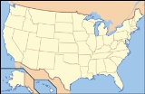
The Ozark – St. Francis National Forest is a United States National Forest
that is located in the state
of Arkansas
. It is composed of two separate forest
s, Ozark National Forest and St. Francis National Forest, each with their own biological, topographical, and geological differences. Together, the two forests are home to 23 developed campgrounds, and include nine swimming areas, 395 miles (636 km) of hiking
trail
s, and 370 miles (595.5 km) of stream
s for fishing
. The majority of the trails in what are now the Ozark National Forest and St. Francis National Forest were constructed under the Works Progress Administration
and Civilian Conservation Corps
.
The Forest contains 11000 acres (44.5 km²) of old-growth forests. The old-growth forests typically occur in the southern portion of the Forest on ridges and steep south-facing slopes and are dominated by Shortleaf Pine and various oak
s, including Post Oak, Blackjack Oak
, Eastern Black Oak, White Oak
, and Northern Red Oak
. The Forest is also home to six different endangered species
.
Several National Scenic Byway
s cross the Ozark-St. Francis National Forest, including the Scenic 7 Byway which runs from Missouri
to Louisiana
, 60 miles (96.6 km) of which are within the Ozark National Forest. Scenic 7 Byway offers the greatest variety of Ozark topography and scenic vistas. The Ozark Highlands Byway provides access to the Mulberry River
, Big Piney Creek
, and Buffalo National River
for fisherman and canoeists. The Mount Magazine Byway offers scenic overlooks of the Arkansas River
Valley, and the Sylamore Scenic Byway
offers a scenic drive to the Blanchard Springs Caverns
. Forest headquarters are located in Russellville, Arkansas
.
. The forest contains the tallest mountain in Arkansas, Mount Magazine
, and Blanchard Springs Caverns
. The southern section of the forest lies along the Arkansas River
Valley south to the Ouachita Mountains
.
The forest was created in 1908 by proclamation of President Theodore Roosevelt
. The forest is home to over 500 species of trees and woody plants. Hardwoods, predominantly oak
and hickory
, comprise the majority of the forest. The forest contains five designated wilderness areas and several Wildlife Management Areas
.
The Ozark Highlands Trail
, built and maintained by over 3,000 volunteers, is the longest hiking
trail in the forest and extends for 165 miles (265.5 km) from the Buffalo National River
to Lake Fort Smith State Park in the far western portion of the state. The forest also contains several multi-use trails including the Pedestal Rock Trail and the Alum Cove Natural Bridge Trail and a few wheelchair-accessible trails.
In addition to the hiking trails, the forest provides trails designated for horseback riding, canoeing
, mountain biking
, and all-terrain vehicle
s. The longest horse trail is the Sylamore Trail with a length of 80 miles (128.7 km). This trail passes over rocky bluffs, into deep hollows, and across mountain streams. The Huckleberry Mountain Horse Trail has a stop at the Sorghum Hollow Horse Camp which was built and maintained by local horsemen.
Ozark National Forest is located in parts of 16 counties. In descending order of forestland they are Newton
, Pope, Johnson, Franklin, Crawford, Logan
, Baxter
, Stone, Madison
, Yell
, Van Buren, Searcy, Washington
, Benton
, Conway, and Marion counties. There are local ranger
district offices located in Clarksville
, Hector
, Jasper
, Mountain View
, Ozark
, and Paris
.
. It covers 22600 acres (91 km²) in eastern Arkansas along the Mississippi River
, in Lee and Phillips counties, and is one of the smallest national forests in the United States. There are local ranger
district offices located in Marianna
. The majority of the Forest is situated on Crowley's Ridge
, but it extends into the low, flat lands along the Mississippi and St. Francis River
s. St. Francis National Forest is the only place in the National Forest System where the public can enjoy the Mississippi River from the shoreline.
While lacking the broad range of recreational activity available in other national forests, St. Francis National Forest is known for its fishing. The two largest lakes, Bear Creek Reservoir
and Storm Creek Lake, enjoy large populations of Largemouth bass
, Crappie
, Warmouth
, and Channel catfish
.
United States National Forest
National Forest is a classification of federal lands in the United States.National Forests are largely forest and woodland areas owned by the federal government and managed by the United States Forest Service, part of the United States Department of Agriculture. Land management of these areas...
that is located in the state
U.S. state
A U.S. state is any one of the 50 federated states of the United States of America that share sovereignty with the federal government. Because of this shared sovereignty, an American is a citizen both of the federal entity and of his or her state of domicile. Four states use the official title of...
of Arkansas
Arkansas
Arkansas is a state located in the southern region of the United States. Its name is an Algonquian name of the Quapaw Indians. Arkansas shares borders with six states , and its eastern border is largely defined by the Mississippi River...
. It is composed of two separate forest
Forest
A forest, also referred to as a wood or the woods, is an area with a high density of trees. As with cities, depending where you are in the world, what is considered a forest may vary significantly in size and have various classification according to how and what of the forest is composed...
s, Ozark National Forest and St. Francis National Forest, each with their own biological, topographical, and geological differences. Together, the two forests are home to 23 developed campgrounds, and include nine swimming areas, 395 miles (636 km) of hiking
Hiking
Hiking is an outdoor activity which consists of walking in natural environments, often in mountainous or other scenic terrain. People often hike on hiking trails. It is such a popular activity that there are numerous hiking organizations worldwide. The health benefits of different types of hiking...
trail
Trail
A trail is a path with a rough beaten or dirt/stone surface used for travel. Trails may be for use only by walkers and in some places are the main access route to remote settlements...
s, and 370 miles (595.5 km) of stream
Stream
A stream is a body of water with a current, confined within a bed and stream banks. Depending on its locale or certain characteristics, a stream may be referred to as a branch, brook, beck, burn, creek, "crick", gill , kill, lick, rill, river, syke, bayou, rivulet, streamage, wash, run or...
s for fishing
Fishing
Fishing is the activity of trying to catch wild fish. Fish are normally caught in the wild. Techniques for catching fish include hand gathering, spearing, netting, angling and trapping....
. The majority of the trails in what are now the Ozark National Forest and St. Francis National Forest were constructed under the Works Progress Administration
Works Progress Administration
The Works Progress Administration was the largest and most ambitious New Deal agency, employing millions of unskilled workers to carry out public works projects, including the construction of public buildings and roads, and operated large arts, drama, media, and literacy projects...
and Civilian Conservation Corps
Civilian Conservation Corps
The Civilian Conservation Corps was a public work relief program that operated from 1933 to 1942 in the United States for unemployed, unmarried men from relief families, ages 18–25. A part of the New Deal of President Franklin D...
.
The Forest contains 11000 acres (44.5 km²) of old-growth forests. The old-growth forests typically occur in the southern portion of the Forest on ridges and steep south-facing slopes and are dominated by Shortleaf Pine and various oak
Oak
An oak is a tree or shrub in the genus Quercus , of which about 600 species exist. "Oak" may also appear in the names of species in related genera, notably Lithocarpus...
s, including Post Oak, Blackjack Oak
Blackjack oak
Quercus marilandica is a small oak, one of the red oak group Quercus sect. Lobatae, but fairly isolated from the others...
, Eastern Black Oak, White Oak
White oak
Quercus alba, the white oak, is one of the pre-eminent hardwoods of eastern North America. It is a long-lived oak of the Fagaceae family, native to eastern North America and found from southern Quebec west to eastern Minnesota and south to northern Florida and eastern Texas. Specimens have been...
, and Northern Red Oak
Northern Red Oak
Quercus rubra, commonly called northern red oak or champion oak, , is an oak in the red oak group . It is a native of North America, in the northeastern United States and southeast Canada...
. The Forest is also home to six different endangered species
Endangered species
An endangered species is a population of organisms which is at risk of becoming extinct because it is either few in numbers, or threatened by changing environmental or predation parameters...
.
Several National Scenic Byway
National Scenic Byway
A National Scenic Byway is a road recognized by the United States Department of Transportation for its archeological, cultural, historic, natural, recreational, and/or scenic qualities. The program was established by Congress in 1991 to preserve and protect the nation's scenic but often...
s cross the Ozark-St. Francis National Forest, including the Scenic 7 Byway which runs from Missouri
Missouri
Missouri is a US state located in the Midwestern United States, bordered by Iowa, Illinois, Kentucky, Tennessee, Arkansas, Oklahoma, Kansas and Nebraska. With a 2010 population of 5,988,927, Missouri is the 18th most populous state in the nation and the fifth most populous in the Midwest. It...
to Louisiana
Louisiana
Louisiana is a state located in the southern region of the United States of America. Its capital is Baton Rouge and largest city is New Orleans. Louisiana is the only state in the U.S. with political subdivisions termed parishes, which are local governments equivalent to counties...
, 60 miles (96.6 km) of which are within the Ozark National Forest. Scenic 7 Byway offers the greatest variety of Ozark topography and scenic vistas. The Ozark Highlands Byway provides access to the Mulberry River
Mulberry River (Arkansas)
The Mulberry River is a tributary of the Arkansas River in northwestern Arkansas in the United States. Via the Arkansas River, it is part of the watershed of the Mississippi River. It has been designated a National Wild and Scenic River....
, Big Piney Creek
Big Piney Creek
Big Piney Creek is a body of water located in Ozark National Forest in the state of Arkansas. It is a tributary of the Arkansas River and therefore part of the Mississippi River watershed. Managed by the United States Forest Service, it flows for through Pope, Johnson and Newton counties...
, and Buffalo National River
Buffalo National River
The Buffalo River, located in northern Arkansas, was the first National River to be designated in the United States. The Buffalo River is slightly more than in length, with the lower flowing within the boundaries of an area managed by the National Park Service, where it is designated the '. The...
for fisherman and canoeists. The Mount Magazine Byway offers scenic overlooks of the Arkansas River
Arkansas River
The Arkansas River is a major tributary of the Mississippi River. The Arkansas generally flows to the east and southeast as it traverses the U.S. states of Colorado, Kansas, Oklahoma, and Arkansas. The river's initial basin starts in the Western United States in Colorado, specifically the Arkansas...
Valley, and the Sylamore Scenic Byway
Sylamore Scenic Byway
The Sylamore Scenic Byway is one of ten Arkansas Scenic Byways. The route runs through the Ozark-St. Francis National Forest in Arkansas for , almost all in Stone County. It passes through undeveloped forest land as a scenic route to Blanchard Springs Caverns....
offers a scenic drive to the Blanchard Springs Caverns
Blanchard Springs Caverns
Blanchard Springs Caverns is a cave system located in the Ozark National Forest in Stone County in northern Arkansas, 2 miles off Highway 14 a short distance north of Mountain View. Blanchard Springs Caverns is a three-level cave system, two of which are open for guided tours. The Dripstone Trail...
. Forest headquarters are located in Russellville, Arkansas
Russellville, Arkansas
Russellville is the county seat and largest city in Pope County, Arkansas, United States, with a population of 27,920, according to the 2010 Census. It is home to Arkansas Tech University and Arkansas Nuclear One, Arkansas' only nuclear power plant...
.
Ozark National Forest
The Ozark National Forest encompasses 1200000 acres (4,856 km²) primarily in the scenic Ozark Mountains in northern ArkansasArkansas
Arkansas is a state located in the southern region of the United States. Its name is an Algonquian name of the Quapaw Indians. Arkansas shares borders with six states , and its eastern border is largely defined by the Mississippi River...
. The forest contains the tallest mountain in Arkansas, Mount Magazine
Mount Magazine
Mount Magazine is the name commonly used for the tallest mountain in the state of Arkansas and is the site of Arkansas's newest state park. The mountain is a flat-topped plateau with a sandstone cap rimmed by precipitous rock cliffs...
, and Blanchard Springs Caverns
Blanchard Springs Caverns
Blanchard Springs Caverns is a cave system located in the Ozark National Forest in Stone County in northern Arkansas, 2 miles off Highway 14 a short distance north of Mountain View. Blanchard Springs Caverns is a three-level cave system, two of which are open for guided tours. The Dripstone Trail...
. The southern section of the forest lies along the Arkansas River
Arkansas River
The Arkansas River is a major tributary of the Mississippi River. The Arkansas generally flows to the east and southeast as it traverses the U.S. states of Colorado, Kansas, Oklahoma, and Arkansas. The river's initial basin starts in the Western United States in Colorado, specifically the Arkansas...
Valley south to the Ouachita Mountains
Ouachita Mountains
The Ouachita Mountains are a mountain range in west central Arkansas and southeastern Oklahoma. The range's subterranean roots may extend as far as central Texas, or beyond it to the current location of the Marathon Uplift. Along with the Ozark Mountains, the Ouachita Mountains form the U.S...
.
The forest was created in 1908 by proclamation of President Theodore Roosevelt
Theodore Roosevelt
Theodore "Teddy" Roosevelt was the 26th President of the United States . He is noted for his exuberant personality, range of interests and achievements, and his leadership of the Progressive Movement, as well as his "cowboy" persona and robust masculinity...
. The forest is home to over 500 species of trees and woody plants. Hardwoods, predominantly oak
Oak
An oak is a tree or shrub in the genus Quercus , of which about 600 species exist. "Oak" may also appear in the names of species in related genera, notably Lithocarpus...
and hickory
Hickory
Trees in the genus Carya are commonly known as hickory, derived from the Powhatan language of Virginia. The genus includes 17–19 species of deciduous trees with pinnately compound leaves and big nuts...
, comprise the majority of the forest. The forest contains five designated wilderness areas and several Wildlife Management Areas
National Wildlife Refuge
National Wildlife Refuge is a designation for certain protected areas of the United States managed by the United States Fish and Wildlife Service. The National Wildlife Refuge System is the world's premiere system of public lands and waters set aside to conserve America's fish, wildlife and plants...
.
The Ozark Highlands Trail
Ozark Highlands Trail
The Ozark Highlands Trail roams through parts of seven counties in northwest Arkansas. It stretches from Lake Fort Smith State Park, across the Ozark National Forest, to the Buffalo National River. The trail passes through some of the most remote and scenic portions of the Ozark Mountains, like...
, built and maintained by over 3,000 volunteers, is the longest hiking
Hiking
Hiking is an outdoor activity which consists of walking in natural environments, often in mountainous or other scenic terrain. People often hike on hiking trails. It is such a popular activity that there are numerous hiking organizations worldwide. The health benefits of different types of hiking...
trail in the forest and extends for 165 miles (265.5 km) from the Buffalo National River
Buffalo National River
The Buffalo River, located in northern Arkansas, was the first National River to be designated in the United States. The Buffalo River is slightly more than in length, with the lower flowing within the boundaries of an area managed by the National Park Service, where it is designated the '. The...
to Lake Fort Smith State Park in the far western portion of the state. The forest also contains several multi-use trails including the Pedestal Rock Trail and the Alum Cove Natural Bridge Trail and a few wheelchair-accessible trails.
In addition to the hiking trails, the forest provides trails designated for horseback riding, canoeing
Canoeing
Canoeing is an outdoor activity that involves a special kind of canoe.Open canoes may be 'poled' , sailed, 'lined and tracked' or even 'gunnel-bobbed'....
, mountain biking
Mountain biking
Mountain biking is a sport which consists of riding bicycles off-road, often over rough terrain, using specially adapted mountain bikes. Mountain bikes share similarities with other bikes, but incorporate features designed to enhance durability and performance in rough terrain.Mountain biking can...
, and all-terrain vehicle
All-terrain vehicle
An all-terrain vehicle , also known as a quad, quad bike, three wheeler, or four wheeler, is defined by the American National Standards Institute as a vehicle that travels on low pressure tires, with a seat that is straddled by the operator, along with handlebars for steering control...
s. The longest horse trail is the Sylamore Trail with a length of 80 miles (128.7 km). This trail passes over rocky bluffs, into deep hollows, and across mountain streams. The Huckleberry Mountain Horse Trail has a stop at the Sorghum Hollow Horse Camp which was built and maintained by local horsemen.
Ozark National Forest is located in parts of 16 counties. In descending order of forestland they are Newton
Newton County, Arkansas
Newton County is a county located in the U.S. state of Arkansas. As of 2010, the population is 8,330. The county seat is Jasper. Newton County is Arkansas's 46th county, formed on December 14, 1842, and named for Thomas W. Newton, an Arkansas Congressman...
, Pope, Johnson, Franklin, Crawford, Logan
Logan County, Arkansas
Logan County is a county located in the U.S. state of Arkansas. As of 2010, the population was 22,353. There are two county seats: Booneville and Paris.-History :...
, Baxter
Baxter County, Arkansas
Baxter County is a county located in the U.S. state of Arkansas. It is in the northern part of the state, and shares a border with Missouri. It is commonly referred to as the Twin Lakes Area because it is bordered by two of Arkansas' largest lakes, Bull Shoals Lake and Norfork Lake...
, Stone, Madison
Madison County, Arkansas
Madison County is a county located in the U.S. state of Arkansas. As of 2010, the population was 15,717. The county seat is Huntsville. The county was formed on September 30, 1836, and named for James Madison, President of the United States...
, Yell
Yell County, Arkansas
Yell County is a county located in the U.S. state of Arkansas. As of 2010, the population was 22,185. The county has two county seats, Dardanelle and Danville...
, Van Buren, Searcy, Washington
Washington County, Arkansas
Washington County is a county located in the northwest part of the U.S. state of Arkansas. As of 2010, the population was 203,065. The county seat is Fayetteville. Washington County is Arkansas's 17th county, formed on October 17, 1828, and named for George Washington, the first President of the...
, Benton
Benton County, Arkansas
Benton County is a county located in the U.S. state of Arkansas. As of the 2000 census, the population was 153,406. The U.S. Census Bureau 2010 population is 221,339. The county seat is Bentonville. Benton County was formed on 30 September 1836 and was named after Thomas Hart Benton, a U.S...
, Conway, and Marion counties. There are local ranger
National Park Ranger
National Park Service Rangers are among the uniformed employees charged with protecting and preserving areas set aside in the National Park System by the United States Congress and/or the President of the United States...
district offices located in Clarksville
Clarksville, Arkansas
Clarksville is a city in Johnson County, Arkansas, United States. The population was approximately 9,300 at the 2010 census. The city is the county seat of Johnson County.. Clarksville is nestled between the Arkansas River and the foot hills of the Ozark Mountains and Interstate 40 and US Hwy 64...
, Hector
Hector, Arkansas
Hector is a town in Pope County, Arkansas, United States. The population was 506 at the 2000 census. It is part of the Russellville Micropolitan Statistical Area.-Geography:Hector is located at ....
, Jasper
Jasper, Arkansas
Jasper is a city in Newton County, Arkansas, United States. The population was 498 at the 2000 census. The city is the county seat of Newton County.Jasper is part of the Harrison Micropolitan Statistical Area.-Geography:...
, Mountain View
Mountain View, Arkansas
Mountain View is the largest city in and the county seat of Stone County in the north-central region of the U.S. state of Arkansas. According to 2005 Census Bureau estimates, the population of the city was 2,998. The town's name comes from its location in a valley surrounded by the eastern Ozark...
, Ozark
Ozark, Arkansas
Ozark is a city in Franklin County, Arkansas, United States, and one of the two county seats of Franklin County. It is part of the Fort Smith, Arkansas-Oklahoma Metropolitan Statistical Area. The population was 3,525 at the 2000 census, making Ozark the ninth largest municipality in the metro area...
, and Paris
Paris, Arkansas
Paris is a city in Logan County, Arkansas, United States, and serves as the county seat for the northern district of Logan County; its southern district counterpart is Booneville. The population was 3,707 at the 2000 census.-Geography:...
.
St. Francis National Forest
The St. Francis National Forest was established on November 8, 1960 by President Dwight D. EisenhowerDwight D. Eisenhower
Dwight David "Ike" Eisenhower was the 34th President of the United States, from 1953 until 1961. He was a five-star general in the United States Army...
. It covers 22600 acres (91 km²) in eastern Arkansas along the Mississippi River
Mississippi River
The Mississippi River is the largest river system in North America. Flowing entirely in the United States, this river rises in western Minnesota and meanders slowly southwards for to the Mississippi River Delta at the Gulf of Mexico. With its many tributaries, the Mississippi's watershed drains...
, in Lee and Phillips counties, and is one of the smallest national forests in the United States. There are local ranger
National Park Ranger
National Park Service Rangers are among the uniformed employees charged with protecting and preserving areas set aside in the National Park System by the United States Congress and/or the President of the United States...
district offices located in Marianna
Marianna, Arkansas
Marianna is a city in and the county seat of Lee County, Arkansas, United States, along the L'Anguille River. The community was established by Col. Walter H. Otey in 1848 and was known as Walnut Ridge until 1852 when it became known as Marianna...
. The majority of the Forest is situated on Crowley's Ridge
Crowley's Ridge
Crowley's Ridge is an unusual geological formation that rises 250 to above the alluvial plain of the Mississippi embayment in a line from southeastern Missouri to the Mississippi River near Helena, Arkansas. It is the most prominent feature in the Mississippi Alluvial Plain between Cape...
, but it extends into the low, flat lands along the Mississippi and St. Francis River
St. Francis River
The Saint Francis River is a tributary of the Mississippi River, about long, in southeastern Missouri and northeastern Arkansas in the United States...
s. St. Francis National Forest is the only place in the National Forest System where the public can enjoy the Mississippi River from the shoreline.
While lacking the broad range of recreational activity available in other national forests, St. Francis National Forest is known for its fishing. The two largest lakes, Bear Creek Reservoir
Bear Creek Reservoir
The Bear Creek Reservoir is a reservoir located in Franklin County, Alabama, along Bear Creek.-See also:*List of dams and reservoirs in the United States*List of lakes*List of Alabama dams and reservoirs...
and Storm Creek Lake, enjoy large populations of Largemouth bass
Largemouth bass
The largemouth bass is a species of black bass in the sunfish family native to North America . It is also known as widemouth bass, bigmouth, black bass, bucketmouth, Potter's fish, Florida bass, Florida largemouth, green bass, green trout, linesides, Oswego bass, southern largemouth...
, Crappie
Crappie
Crappie is a genus of freshwater fish in the sunfish family of order Perciformes. The type species is P. annularis, the white crappie...
, Warmouth
Warmouth
The common name of Lepomis gulosus is the warmouth. It is one of the 324 fish species found in Tennessee.-Introduction:The following is a description of a monitoring plan for the Warmouth . One of the eleven species in the Lepomis genus, the species name gulosus refers to the warmouths big eyes...
, and Channel catfish
Channel catfish
Channel catfish, Ictalurus punctatus, is North America's most numerous catfish species. It is the official fish of Missouri, Iowa, Nebraska, Kansas, and Tennessee, and is informally referred to as a "channel cat". In the United States they are the most fished catfish species with approximately 8...
.