
Manitoba Provincial Highway 1
Encyclopedia
Provincial Trunk Highway 1 (PTH 1) is the Manitoba
section of the Trans-Canada Highway
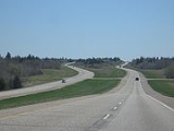
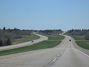
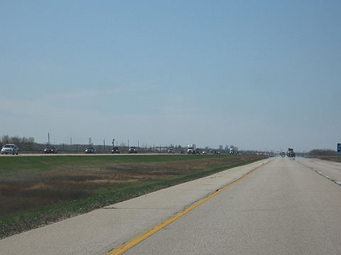
mainline route. It is a heavily used, 4-lane divided highway
, with the exception of a short 18 km section in the southeastern corner of the province. It is the main link between southern Manitoba's largest cities, and also serves as the province's main transportation link to the neighbouring provinces of Saskatchewan
(to the west) and Ontario
(to the east). The highway is the only major east-west divided highway
in Manitoba, and carries a large majority of east-west traffic within and through the province. It has full freeway status sections at Portage La Prairie and Winnipeg
. The total distance of the Trans-Canada Highway
in Manitoba
is 490 km (304.5 mi).
Manitoba Highway 1 is a very important part of the national highway system in Canada
, as it is the sole highway linking the eastern and western regions of the country. It is the only road that links the province of Manitoba
with the province of Ontario
, making it a major section of Canada's primary commercial and leisure route for all traffic travelling between Canada's largest cities, from Toronto
and Montreal
in the east to Calgary
and Vancouver
in the west.
 The highway is routed from west to east across the province of Manitoba. It begins at the western provincial border with Saskatchewan, connecting with Saskatchewan's Highway 1
to become Manitoba Trans-Canada 1. The highway is designated as T-C 1 throughout Manitoba until it reaches the eastern provincial border with Ontario
, where it continues as the main route to Kenora, Ontario
and the rest of Eastern Canada
as Highway 17.
The entire length of the Trans-Canada Highway
in the province of Manitoba
is a 4-lane divided highway
, with the exception of the Winnipeg city route and an 18 kilometre section in eastern Manitoba
between the town of Falcon Lake
and the Manitoba
-Ontario
provincial border which is a two-lane highway.
Manitoba PTH 1 has full expressway
status on the routes around Winnipeg
on the Perimeter Highway, and around Portage La Prairie. Plans do exist to bring the entire length of Highway 1 (except the Winnipeg city route) to full expressway status in the future (mentioned at the list of Manitoba expressways). Currently, exit numbers only exist at two interchange
s, and only small sections of Highway 1 and the Perimeter Highway have freeway status.
In the Winnipeg metro area, the Trans-Canada Highway has two official routes. The main route passes directly through the city of Winnipeg on city streets, entering the city from the west and continuing along Portage Avenue, Broadway, Main Street, Queen Elizabeth Way, St.Mary's Road, St.Anne's Road, and Fermor Avenue where it re-joins the Perimeter Highway (T-C 100) and continues east on TC 1.
An alternate routing exits the main T-C 1 route on the western edge of Winnipeg onto the Perimeter Highway (T-C 100), which by-passes the city completely. The Perimeter Highway is a ring road
which encircles Winnipeg and is frequently used by commuters and through traffic on the Trans Canada Highway wishing to avoid congested city streets.
By the early 1950s, Highway 1 had become an important east-west route in all of the western provinces. Most of the provincial highways that Highway 1 originally traversed on were re-numbered and designated as Highway 4 in the mid-1960s, and the #1 was relocated to its present route. In 1962, the Trans-Canada Highway in Manitoba was fully completed, and Highway 1 across all of the western provinces was incorporated as part of the Trans-Canada Highway.
In 1955, most intra-city traffic in the Winnipeg area was diverted onto the (then) newly-built Perimeter Highway
. Later that year, the Perimeter Highway's southern (PTH 100) section was merged with the Trans-Canada Highway
system, due to the amount of traffic using it to bypass the city. That section of the highway was highly used, and still is today.
On October 25, 2007, a major federal/provincial construction project twinning the highway in western Manitoba between the Saskatchewan
-Manitoba
provincial border and the town of Hargrave was completed, with 34 kilometres (21.1 mi) of newly divided highway lanes opened to traffic.
On April 9, 2008, the Government of Manitoba
announced that construction of a new interchange
will begin in the summer of 2008 at the intersection of Highway 16 (the Yellowhead Highway
) and the Trans Canada Highway mainline route, located a short distance west of Portage la Prairie
.
. The speed limit was officially raised on July 1, 2009, though it was only raised on one portion of the highway between the Saskatchewan border to Virden
. The remainder of the highway is still at 100 km/h, but this may change in the future.
 Saskatchewan border to Virden- 110 km/h (68 mph)
Virden- 80 km/h (50 mph)
Western Manitoba- 100 km/h (60 mph)
Brandon- 80 km/h (50 mph)
Portage La Prairie (Freeway)- 100 km/h (60 mph)
Elie- 80 km/h (50 mph)
Headingley-70 km/h (40 mph)
Winnipeg bypass (Perimeter Hwy. PTH #100) - 100 km/h (60 mph)
Winnipeg city route
Portage Ave. - 60 km/h (35 mph) (50 km/h (30 mph) in downtown)
Broadway - 50 km/h (30 mph)
Queen Elizabeth Way. (S. Main Street) - 60 km/h (35 mph)
St. Mary's Rd. - 60 km/h (35 mph)
St. Annes Rd. - 60 km/h (35 mph)
Fermor Ave. (To Lagimodiere Blvd.) - 70 km/h (40 mph)
Fermor Ave. (To Perimeter Hwy.) - 90 km/h (55 mph)
Eastern Manitoba- 100 km/h (60 mph)
All at-grade intersections with traffic lights -80 km/h (50 mph)
intersections
are included. (In Winnipeg
, only major road intersections
are included). This list is routed from West to East, starting at the Saskatchewan-Manitoba border to the Manitoba-Ontario border.
Manitoba
Manitoba is a Canadian prairie province with an area of . The province has over 110,000 lakes and has a largely continental climate because of its flat topography. Agriculture, mostly concentrated in the fertile southern and western parts of the province, is vital to the province's economy; other...
section of the Trans-Canada Highway
Trans-Canada Highway
The Trans-Canada Highway is a federal-provincial highway system that joins the ten provinces of Canada. It is, along with the Trans-Siberian Highway and Australia's Highway 1, one of the world's longest national highways, with the main route spanning 8,030 km...
mainline route. It is a heavily used, 4-lane divided highway
Divided Highway
Divided Highway is a compilation album by American rock band The Doobie Brothers, released in 2003. . All tracks are taken from the albums Cycles and Brotherhood .-Track listing:...
, with the exception of a short 18 km section in the southeastern corner of the province. It is the main link between southern Manitoba's largest cities, and also serves as the province's main transportation link to the neighbouring provinces of Saskatchewan
Saskatchewan
Saskatchewan is a prairie province in Canada, which has an area of . Saskatchewan is bordered on the west by Alberta, on the north by the Northwest Territories, on the east by Manitoba, and on the south by the U.S. states of Montana and North Dakota....
(to the west) and Ontario
Ontario
Ontario is a province of Canada, located in east-central Canada. It is Canada's most populous province and second largest in total area. It is home to the nation's most populous city, Toronto, and the nation's capital, Ottawa....
(to the east). The highway is the only major east-west divided highway
Divided Highway
Divided Highway is a compilation album by American rock band The Doobie Brothers, released in 2003. . All tracks are taken from the albums Cycles and Brotherhood .-Track listing:...
in Manitoba, and carries a large majority of east-west traffic within and through the province. It has full freeway status sections at Portage La Prairie and Winnipeg
Winnipeg
Winnipeg is the capital and largest city of Manitoba, Canada, and is the primary municipality of the Winnipeg Capital Region, with more than half of Manitoba's population. It is located near the longitudinal centre of North America, at the confluence of the Red and Assiniboine Rivers .The name...
. The total distance of the Trans-Canada Highway
Trans-Canada Highway
The Trans-Canada Highway is a federal-provincial highway system that joins the ten provinces of Canada. It is, along with the Trans-Siberian Highway and Australia's Highway 1, one of the world's longest national highways, with the main route spanning 8,030 km...
in Manitoba
Manitoba
Manitoba is a Canadian prairie province with an area of . The province has over 110,000 lakes and has a largely continental climate because of its flat topography. Agriculture, mostly concentrated in the fertile southern and western parts of the province, is vital to the province's economy; other...
is 490 km (304.5 mi).
Manitoba Highway 1 is a very important part of the national highway system in Canada
Canada
Canada is a North American country consisting of ten provinces and three territories. Located in the northern part of the continent, it extends from the Atlantic Ocean in the east to the Pacific Ocean in the west, and northward into the Arctic Ocean...
, as it is the sole highway linking the eastern and western regions of the country. It is the only road that links the province of Manitoba
Manitoba
Manitoba is a Canadian prairie province with an area of . The province has over 110,000 lakes and has a largely continental climate because of its flat topography. Agriculture, mostly concentrated in the fertile southern and western parts of the province, is vital to the province's economy; other...
with the province of Ontario
Ontario
Ontario is a province of Canada, located in east-central Canada. It is Canada's most populous province and second largest in total area. It is home to the nation's most populous city, Toronto, and the nation's capital, Ottawa....
, making it a major section of Canada's primary commercial and leisure route for all traffic travelling between Canada's largest cities, from Toronto
Toronto
Toronto is the provincial capital of Ontario and the largest city in Canada. It is located in Southern Ontario on the northwestern shore of Lake Ontario. A relatively modern city, Toronto's history dates back to the late-18th century, when its land was first purchased by the British monarchy from...
and Montreal
Montreal
Montreal is a city in Canada. It is the largest city in the province of Quebec, the second-largest city in Canada and the seventh largest in North America...
in the east to Calgary
Calgary
Calgary is a city in the Province of Alberta, Canada. It is located in the south of the province, in an area of foothills and prairie, approximately east of the front ranges of the Canadian Rockies...
and Vancouver
Vancouver
Vancouver is a coastal seaport city on the mainland of British Columbia, Canada. It is the hub of Greater Vancouver, which, with over 2.3 million residents, is the third most populous metropolitan area in the country,...
in the west.
Routing
Saskatchewan Highway 1
Highway 1 is the Saskatchewan section of the Trans-Canada Highway mainland route. The total distance of the Trans-Canada Highway in Saskatchewan is . The highway traverses Saskatchewan from the western border with Alberta, from Highway 1, to Manitoba where it continues as Highway 1, PTH 1. The...
to become Manitoba Trans-Canada 1. The highway is designated as T-C 1 throughout Manitoba until it reaches the eastern provincial border with Ontario
Ontario
Ontario is a province of Canada, located in east-central Canada. It is Canada's most populous province and second largest in total area. It is home to the nation's most populous city, Toronto, and the nation's capital, Ottawa....
, where it continues as the main route to Kenora, Ontario
Ontario
Ontario is a province of Canada, located in east-central Canada. It is Canada's most populous province and second largest in total area. It is home to the nation's most populous city, Toronto, and the nation's capital, Ottawa....
and the rest of Eastern Canada
Eastern Canada
Eastern Canada is generally considered to be the region of Canada east of Manitoba, consisting of the following provinces:* New Brunswick* Newfoundland and Labrador* Nova Scotia* Ontario* Prince Edward Island* Quebec...
as Highway 17.
The entire length of the Trans-Canada Highway
Trans-Canada Highway
The Trans-Canada Highway is a federal-provincial highway system that joins the ten provinces of Canada. It is, along with the Trans-Siberian Highway and Australia's Highway 1, one of the world's longest national highways, with the main route spanning 8,030 km...
in the province of Manitoba
Manitoba
Manitoba is a Canadian prairie province with an area of . The province has over 110,000 lakes and has a largely continental climate because of its flat topography. Agriculture, mostly concentrated in the fertile southern and western parts of the province, is vital to the province's economy; other...
is a 4-lane divided highway
Divided Highway
Divided Highway is a compilation album by American rock band The Doobie Brothers, released in 2003. . All tracks are taken from the albums Cycles and Brotherhood .-Track listing:...
, with the exception of the Winnipeg city route and an 18 kilometre section in eastern Manitoba
Manitoba
Manitoba is a Canadian prairie province with an area of . The province has over 110,000 lakes and has a largely continental climate because of its flat topography. Agriculture, mostly concentrated in the fertile southern and western parts of the province, is vital to the province's economy; other...
between the town of Falcon Lake
Falcon Lake, Manitoba
-External links:*...
and the Manitoba
Manitoba
Manitoba is a Canadian prairie province with an area of . The province has over 110,000 lakes and has a largely continental climate because of its flat topography. Agriculture, mostly concentrated in the fertile southern and western parts of the province, is vital to the province's economy; other...
-Ontario
Ontario
Ontario is a province of Canada, located in east-central Canada. It is Canada's most populous province and second largest in total area. It is home to the nation's most populous city, Toronto, and the nation's capital, Ottawa....
provincial border which is a two-lane highway.
Manitoba PTH 1 has full expressway
Limited-access road
A limited-access road known by various terms worldwide, including limited-access highway, dual-carriageway and expressway, is a highway or arterial road for high-speed traffic which has many or most characteristics of a controlled-access highway , including limited or no access to adjacent...
status on the routes around Winnipeg
Winnipeg
Winnipeg is the capital and largest city of Manitoba, Canada, and is the primary municipality of the Winnipeg Capital Region, with more than half of Manitoba's population. It is located near the longitudinal centre of North America, at the confluence of the Red and Assiniboine Rivers .The name...
on the Perimeter Highway, and around Portage La Prairie. Plans do exist to bring the entire length of Highway 1 (except the Winnipeg city route) to full expressway status in the future (mentioned at the list of Manitoba expressways). Currently, exit numbers only exist at two interchange
Interchange (road)
In the field of road transport, an interchange is a road junction that typically uses grade separation, and one or more ramps, to permit traffic on at least one highway to pass through the junction without directly crossing any other traffic stream. It differs from a standard intersection, at which...
s, and only small sections of Highway 1 and the Perimeter Highway have freeway status.
In the Winnipeg metro area, the Trans-Canada Highway has two official routes. The main route passes directly through the city of Winnipeg on city streets, entering the city from the west and continuing along Portage Avenue, Broadway, Main Street, Queen Elizabeth Way, St.Mary's Road, St.Anne's Road, and Fermor Avenue where it re-joins the Perimeter Highway (T-C 100) and continues east on TC 1.
An alternate routing exits the main T-C 1 route on the western edge of Winnipeg onto the Perimeter Highway (T-C 100), which by-passes the city completely. The Perimeter Highway is a ring road
Ring road
A ring road, orbital motorway, beltway, circumferential highway, or loop highway is a road that encircles a town or city...
which encircles Winnipeg and is frequently used by commuters and through traffic on the Trans Canada Highway wishing to avoid congested city streets.
History
The first provincial trunk highways in Manitoba were numbered in 1926. The original highway 1 was one of nine highways fanning out from Winnipeg, but was different in that it fanned out from the west and the east. Highway 1 was routed via many already-existing highways and provincial secondary roads. (From west to east), these are :- Highway 1A into and out of Brandon
- Provincial Road 351 into and out of Carberry
- Highway 1A through Portage la Prairie
- Highway 26Manitoba Highway 26Provincial Trunk Highway 26 is a short east-west highway that begins and ends at the Trans-Canada Highway. The western terminus is located at the eastern outskirts of Portage La Prairie, while the eastern terminus is three kilometers east of St. François Xavier and thirteen kilometres west of the...
from Portage la Prairie to HeadingleyHeadingley, ManitobaHeadingley is a rural municipality in Manitoba, Canada. It is located directly west of Winnipeg and has a population of 2,726 people as of the 2006 census. The Trans-Canada Highway and the Assiniboine River run through the municipality. The portion located on the south bank of the Assiniboine is...
- Highway 59 from downtown Winnipeg to Highway 44Manitoba Highway 44Provincial Trunk Highway 44 is a provincial highway in the Canadian province of Manitoba.It begins at Highway 9 in the town of Lockport, just north of Winnipeg. From Lockport the highway travels east, passing through Beausejour before heading south-east after Highway 11 branches north towards Lac...
- Highway 44 to Whiteshell Provincial ParkWhiteshell Provincial ParkWhiteshell Provincial Park is a 2,729 km2 park centrally located in Canada in the province of Manitoba. It can be found in the southeast of the province along the Manitoba-Ontario border, approximately 130 km east of Winnipeg. The park is located in the Canadian Shield region and has many...
By the early 1950s, Highway 1 had become an important east-west route in all of the western provinces. Most of the provincial highways that Highway 1 originally traversed on were re-numbered and designated as Highway 4 in the mid-1960s, and the #1 was relocated to its present route. In 1962, the Trans-Canada Highway in Manitoba was fully completed, and Highway 1 across all of the western provinces was incorporated as part of the Trans-Canada Highway.
In 1955, most intra-city traffic in the Winnipeg area was diverted onto the (then) newly-built Perimeter Highway
Perimeter Highway (Winnipeg)
Provincial Trunk Highways 100 and 101 form a beltway around Winnipeg, Manitoba. The Perimeter is approximately long...
. Later that year, the Perimeter Highway's southern (PTH 100) section was merged with the Trans-Canada Highway
Trans-Canada Highway
The Trans-Canada Highway is a federal-provincial highway system that joins the ten provinces of Canada. It is, along with the Trans-Siberian Highway and Australia's Highway 1, one of the world's longest national highways, with the main route spanning 8,030 km...
system, due to the amount of traffic using it to bypass the city. That section of the highway was highly used, and still is today.
Recent History
On October 6, 2006 the Trans-Canada Highway Portage La Prairie by-pass was closed due to a structural defect found in the bridge over the CN Rail Line. On October 31, 2007, a $19 million project to rebuild the bridge was completed, and the by-pass was fully re-opened to traffic.On October 25, 2007, a major federal/provincial construction project twinning the highway in western Manitoba between the Saskatchewan
Saskatchewan
Saskatchewan is a prairie province in Canada, which has an area of . Saskatchewan is bordered on the west by Alberta, on the north by the Northwest Territories, on the east by Manitoba, and on the south by the U.S. states of Montana and North Dakota....
-Manitoba
Manitoba
Manitoba is a Canadian prairie province with an area of . The province has over 110,000 lakes and has a largely continental climate because of its flat topography. Agriculture, mostly concentrated in the fertile southern and western parts of the province, is vital to the province's economy; other...
provincial border and the town of Hargrave was completed, with 34 kilometres (21.1 mi) of newly divided highway lanes opened to traffic.
On April 9, 2008, the Government of Manitoba
Manitoba
Manitoba is a Canadian prairie province with an area of . The province has over 110,000 lakes and has a largely continental climate because of its flat topography. Agriculture, mostly concentrated in the fertile southern and western parts of the province, is vital to the province's economy; other...
announced that construction of a new interchange
Cloverleaf interchange
A cloverleaf interchange is a two-level interchange in which left turns, reverse direction in left-driving regions, are handled by ramp roads...
will begin in the summer of 2008 at the intersection of Highway 16 (the Yellowhead Highway
Yellowhead Highway
The Yellowhead Highway is a major east-west highway connecting the four western Canadian provinces of British Columbia, Alberta, Saskatchewan, and Manitoba. Although part of the Trans-Canada Highway system, the highway should not be confused with the more southerly, originally-designated...
) and the Trans Canada Highway mainline route, located a short distance west of Portage la Prairie
Portage la Prairie, Manitoba
-Transportation:Portage la Prairie railway station is served by Via Rail with both The Canadian and Winnipeg – Churchill trains calling at the station....
.
Speed limits
On February 27, 2008 the Manitoba Highway Traffic Board approved a request by the Government of Manitoba to raise the speed limit on the Trans Canada Highway in Manitoba to 110 km/h along the section between the Saskatchewan-Manitoba border and WinnipegWinnipeg
Winnipeg is the capital and largest city of Manitoba, Canada, and is the primary municipality of the Winnipeg Capital Region, with more than half of Manitoba's population. It is located near the longitudinal centre of North America, at the confluence of the Red and Assiniboine Rivers .The name...
. The speed limit was officially raised on July 1, 2009, though it was only raised on one portion of the highway between the Saskatchewan border to Virden
Virden, Manitoba
Virden, Manitoba is a town in southwestern Manitoba. Oil was first discovered in 1951, and Virden has since come to be known as the "Oil Capital of Manitoba"....
. The remainder of the highway is still at 100 km/h, but this may change in the future.
Virden- 80 km/h (50 mph)
Western Manitoba- 100 km/h (60 mph)
Brandon- 80 km/h (50 mph)
Portage La Prairie (Freeway)- 100 km/h (60 mph)
Elie- 80 km/h (50 mph)
Headingley-70 km/h (40 mph)
Winnipeg bypass (Perimeter Hwy. PTH #100) - 100 km/h (60 mph)
Winnipeg city route
Portage Ave. - 60 km/h (35 mph) (50 km/h (30 mph) in downtown)
Broadway - 50 km/h (30 mph)
Queen Elizabeth Way. (S. Main Street) - 60 km/h (35 mph)
St. Mary's Rd. - 60 km/h (35 mph)
St. Annes Rd. - 60 km/h (35 mph)
Fermor Ave. (To Lagimodiere Blvd.) - 70 km/h (40 mph)
Fermor Ave. (To Perimeter Hwy.) - 90 km/h (55 mph)
Eastern Manitoba- 100 km/h (60 mph)
All at-grade intersections with traffic lights -80 km/h (50 mph)
List of exits/intersections
The following is a list of exits/intersections along PTH 1. Only named (in cities and towns only) and numbered highwayHighway
A highway is any public road. In American English, the term is common and almost always designates major roads. In British English, the term designates any road open to the public. Any interconnected set of highways can be variously referred to as a "highway system", a "highway network", or a...
intersections
Intersection (road)
An intersection is a road junction where two or more roads either meet or cross at grade . An intersection may be 3-way - a T junction or fork, 4-way - a crossroads, or 5-way or more...
are included. (In Winnipeg
Winnipeg
Winnipeg is the capital and largest city of Manitoba, Canada, and is the primary municipality of the Winnipeg Capital Region, with more than half of Manitoba's population. It is located near the longitudinal centre of North America, at the confluence of the Red and Assiniboine Rivers .The name...
, only major road intersections
Intersection (road)
An intersection is a road junction where two or more roads either meet or cross at grade . An intersection may be 3-way - a T junction or fork, 4-way - a crossroads, or 5-way or more...
are included). This list is routed from West to East, starting at the Saskatchewan-Manitoba border to the Manitoba-Ontario border.
Saskatchewan border to Brandon
| km | Municipality | Location | Interescting highway | Notes |
|---|---|---|---|---|
| 0 | Wallace R.M. Wallace, Manitoba Wallace is a rural municipality in the province of Manitoba in Western Canada. The town of Virden and the village of Elkhorn are separately administered urban communities that lie within the borders of Wallace R.M.-External links:*... |
Saskatchewan Saskatchewan Saskatchewan is a prairie province in Canada, which has an area of . Saskatchewan is bordered on the west by Alberta, on the north by the Northwest Territories, on the east by Manitoba, and on the south by the U.S. states of Montana and North Dakota.... -Manitoba Border |
Manitoba section of Trans-Canada Highway Trans-Canada Highway The Trans-Canada Highway is a federal-provincial highway system that joins the ten provinces of Canada. It is, along with the Trans-Siberian Highway and Australia's Highway 1, one of the world's longest national highways, with the main route spanning 8,030 km... PTH 1 begins |
|
| 6 | Kirkella Kirkella, Manitoba Kirkella is an unincorporated hamlet in southwestern Manitoba, Canada.It is located in the Rural Municipality of Wallace, approximately 115 kilometers west of Brandon.-References:... |
|||
| 18 | Elkhorn Elkhorn, Manitoba Elkhorn is a village in southwestern Manitoba, Canada.Incorporated on January 2, 1906, it is located approximately 105 kilometers west of Brandon. It is surrounded by the Rural Municipality of Wallace.-History:... |
|||
| 19 | Maharg Rd. | |||
| 20 | Richhill Ave. / Mile 66N | formerly PR 441 east | ||
| 32 | Hargrave | Mile 158W | formerly PR 252 south | |
| 35 | begin PTH 83 south concurrence | |||
| 40 | ||||
| 41 | , Minot Minot, North Dakota Minot is a city located in north central North Dakota in the United States. It is most widely known for the Air Force base located approximately 15 miles north of the city. With a population of 40,888 at the 2010 census, Minot is the fourth largest city in the state... |
end PTH 83 south concurrence | ||
| 44 | Virden Virden, Manitoba Virden, Manitoba is a town in southwestern Manitoba. Oil was first discovered in 1951, and Virden has since come to be known as the "Oil Capital of Manitoba".... |
Thomas Dr. | ||
| 45 | King St. | Secondary access to | ||
| 48 | ||||
| 62 | Sifton R.M. Sifton, Manitoba (rural municipality) For the town found in the Dauphin area, go to Sifton, Manitoba.The Sifton rural municipality is located in the southwestern portion of the province of Manitoba, with a population of 766... |
– Oak Lake Beach Oak Lake, Manitoba Oak Lake, Manitoba is a town in the south-western "Westman region" of Manitoba, Canada. It is located west of Brandon along the Trans-Canada Highway.... |
begin PR 254 north concurrence | |
| 67 | Oak Lake Oak Lake, Manitoba Oak Lake, Manitoba is a town in the south-western "Westman region" of Manitoba, Canada. It is located west of Brandon along the Trans-Canada Highway.... |
end PR 254 north concurrence | ||
| 80 | Griswold | |||
| 92 | Whitehead R.M. Whitehead, Manitoba -External links:*... |
Alexander | begin PR 250 south concurrence | |
| 96 | end PR 250 south concurrence | |||
| 104 | (City Route) | PTH 1 turns northeast and descends into Grand Valley trucks required to stay on PTH 1 due to a substandard railway underpass east of Kemnay Kemnay, Manitoba Kemnay is a small community in Manitoba, located in the Rural Municipality of Whitehead, about 10 kilometres west of Brandon. Kemnay has the same name as Kemnay, a community in Scotland.... on PTH 1A PTH 1A is known as Victoria Avenue and 1st Street inside Brandon city limits |
||
| 109 | PTH 1 passes over the Assiniboine River Assiniboine River The Assiniboine River is a river that runs through the prairies of Western Canada in Saskatchewan and Manitoba. It is a tributary of the Red River. The Assiniboine is a typical meandering river with a single main channel embanked within a flat, shallow valley in some places and a steep valley in... and turns east after ascending out of Grand Valley |
|||
| 112 | Elton R.M. Elton, Manitoba Elton is a rural municipality in the Canadian province of Manitoba, located to the north of the city of Brandon. The community was incorporated in 1883, and its first officials took office the following year.Its population in 2001 was 1,321.-External links:... / Cornwallis R.M. Cornwallis, Manitoba Cornwallis is a rural municipality in the province of Manitoba in Western Canada. It is the rural area that surrounds most of the city of Brandon, Manitoba's second-largest city.-External links:*... |
|||
Brandon
| km | City | Location | Interescting highway | Notes |
|---|---|---|---|---|
| 120 | Brandon Brandon, Manitoba Brandon is the second largest city in Manitoba, Canada, and is located in the southwestern area of the province. Brandon is the largest city in the Westman region of Manitoba. The city is located along the Assiniboine River. Spruce Woods Provincial Park and CFB Shilo are a relatively short distance... |
, International Peace Garden International Peace Garden The International Peace Garden is a 3.65 sq. mi. park located on the international border between Canada and the United States, in the state of North Dakota and the province of Manitoba. Established on July 14, 1932, the park plants over 150,000 flowers each year... |
18 Street N. begin PTH 10 north concurrence |
|
| 121 | Black St. | |||
| 122 | – City Center |
1 Street N. end PTH 10 north concurrence |
||
Brandon to Portage La Prairie
| km | Municipality | Location | Interescting highway | Notes |
|---|---|---|---|---|
| 130 | Elton R.M. Elton, Manitoba Elton is a rural municipality in the Canadian province of Manitoba, located to the north of the city of Brandon. The community was incorporated in 1883, and its first officials took office the following year.Its population in 2001 was 1,321.-External links:... / Cornwallis R.M. Cornwallis, Manitoba Cornwallis is a rural municipality in the province of Manitoba in Western Canada. It is the rural area that surrounds most of the city of Brandon, Manitoba's second-largest city.-External links:*... |
|||
| 138 | ||||
| 146 | North Cypress R.M. North Cypress, Manitoba North Cypress is a Rural Municipality in the province of Manitoba, Canada. As of 2006, the population of North Cypress is 1,902.-Overview:... |
|||
| 147 | ||||
| 163 | ||||
| 181 | ||||
| 183 | North Norfolk R.M. North Norfolk, Manitoba North Norfolk is a rural municipality in the province of Manitoba in Western Canada. The separately administered town of MacGregor lies within the borders of the municipality, just northeast of its centre.-External links:*... |
Sidney | ||
| 195 | Austin Austin, Manitoba Austin is a community in western Manitoba on the Trans-Canada Highway about west of Winnipeg. It is part of the Rural Municipality of North Norfolk. It sits at the western edge of the table-flat Portage Plains, but to the south and west is surrounded by miles of low wooded hills known as the... |
|||
| 208 | MacGregor | |||
| 218 | Bagot | |||
| 230 | Portage La Prairie R.M. | Bloom | – Hood Bridge |
Yellowhead Highway (not numbered) continues along PTH 1 to Winnipeg |
Portage La Prairie
| km | City | Location | Interescting highway | Notes |
|---|---|---|---|---|
| 238 | Portage La Prairie | (City Route) | Saskatchewan Avenue W. | |
| 247 | River Rd. | |||
| 252 | (City Route) | Saskatchewan Avenue E. westbound exit only |
||
| 253 | ||||
Portage La Prairie to Winnipeg
| km | Municipality | Location | Interescting highway/road/street | Notes |
|---|---|---|---|---|
| 268 | Portage La Prairie R.M. | , St. Ambroise St. Ambroise Beach Provincial Park St. Ambroise Beach Campground is located on the southern shores of lake Manitoba. This campground offers 122 sites perfect for wilderness adventures. There are several picnic areas and a playground located within the park... |
||
| 276 | Fortier Road | formerly PR 331 west | ||
| 279 | Cartier R.M. Cartier, Manitoba Rural Municipality of Cartier is part of the Central Plains Region in the province of Manitoba, Canada. It is named after Sir George-Étienne Cartier who was a leader in bringing Quebec into Confederation.It was part of a larger municipality, St... |
Benard | Benard Road | formerly PR 426 north |
| 287 | Elie Elie, Manitoba Elie is the largest community in the Rural Municipality of Cartier in the Canadian province of Manitoba. The town of approximately 550 people is located approximately west of Winnipeg along the Trans-Canada Highway. The Assiniboine River forms the northern boundary of the municipality of... |
|||
| 296 | ||||
| 304 | formerly PR 241 | |||
| 306 | ||||
| 311 | Headingley Headingley, Manitoba Headingley is a rural municipality in Manitoba, Canada. It is located directly west of Winnipeg and has a population of 2,726 people as of the 2006 census. The Trans-Canada Highway and the Assiniboine River run through the municipality. The portion located on the south bank of the Assiniboine is... |
Gaol Road | Gaol Road access to Headingley Correctional Centre | |
| 313 | begin PR 334 south concurrence | |||
| 314 | Hudson St | |||
| 314 | end PR 334 south concurrence | |||
| 315 | Lyons Street / Bresaylor Road | |||
| 316 | Cameron Street / Inglenook Road | |||
| 318 | Race Track Road / McCarthy Street | Race Track Road access to Assiniboia Downs Assiniboia Downs Assiniboia Downs is a Canadian horse race track opened in June 1958 in Winnipeg, Manitoba. The main track is a six-and-one-half furlong oval.... |
||
| 319 | , Kenora Kenora, Ontario Kenora , originally named Rat Portage, is a small city situated on the Lake of the Woods in Northwestern Ontario, Canada, close to the Manitoba boundary, and about east of Winnipeg... |
Perimeter Highway PTH 1 enters Winnipeg Winnipeg Winnipeg is the capital and largest city of Manitoba, Canada, and is the primary municipality of the Winnipeg Capital Region, with more than half of Manitoba's population. It is located near the longitudinal centre of North America, at the confluence of the Red and Assiniboine Rivers .The name... with Route 85 as Portage Avenue |
||
Winnipeg
(Major roads only, as there are many local roads PTH 1 intersects.)| km | Municipality | Location | Interescting highway/route/street | Notes |
|---|---|---|---|---|
| 319.5 | Winnipeg Winnipeg Winnipeg is the capital and largest city of Manitoba, Canada, and is the primary municipality of the Winnipeg Capital Region, with more than half of Manitoba's population. It is located near the longitudinal centre of North America, at the confluence of the Red and Assiniboine Rivers .The name... |
Buchanan Blvd. | ||
| 320.5 | Cavalier Dr. |
|||
| 321 | Westwood Dr. | |||
| 323 | Sturgeon Rd. | |||
| 325 | Route 96 south – Moray St | |||
| 327 | Route 90 Winnipeg Route 90 Route 90 is a city route in Winnipeg, Manitoba, connecting the PTH 100 at PTH 7 and Route 165 .Route 90 is a north-south city route. It is a major arterial road. Route 90 starts as Brookside Blvd at the Perimeter Highway. Just south of Inkster Boulevard, Route 90 turns into Oak Point Hwy... – Century St |
northbound access to Winnipeg International Airport | ||
| 327.5 | Empress St | northbound access to Polo Park Shopping Centre and Canad Inns Stadium Canad Inns Stadium Canad Inns Stadium is a Canadian football stadium located north of Polo Park Shopping Centre in Winnipeg, Manitoba. The Stadium, named for hotel chain Canad Inns, and originally completed in 1953, seats 29,533 for football... |
||
| 329 | Broadway | PTH 1 diverts right on to Broadway from Portage Avenue Yellowhead Highway Yellowhead Highway The Yellowhead Highway is a major east-west highway connecting the four western Canadian provinces of British Columbia, Alberta, Saskatchewan, and Manitoba. Although part of the Trans-Canada Highway system, the highway should not be confused with the more southerly, originally-designated... continues along Portage Avenue and ends at Main St |
||
| 329.5 | Route 70 south – Maryland St | |||
| 329.5 | Route 70 north – Sherbrook St | |||
| 330.5 | Route 62 Winnipeg Route 62 Route 62 is a major north-south arterial route in Winnipeg, Manitoba that has eight different street names.The official route begins on Salter Street in the city's North End; its northernmost point is often given on maps as the intersection of Salter Street and Redwood Avenue... – Osborne St |
Manitoba Legislature is located on south-east corner | ||
| 331 | Route 42 Winnipeg Route 42 Route 42 is a major arterial road located in Winnipeg, Manitoba. It connects the suburbs of North Kildonan, East Kildonan, Fort Rouge, Fort Garry, and St. Norbert with the city's downtown core... south – Donald St |
|||
| 331 | Route 42 Winnipeg Route 42 Route 42 is a major arterial road located in Winnipeg, Manitoba. It connects the suburbs of North Kildonan, East Kildonan, Fort Rouge, Fort Garry, and St. Norbert with the city's downtown core... north – Smith St |
|||
| 331.5 | Route 52 Winnipeg Route 52 Route 52 is a major north-south arterial route in Winnipeg, Manitoba. It comprises all of Main Street from the northern city limits to the Main Street Bridge over the Assiniboine River; Queen Elizabeth Way from the Main Street Bridge to the Norwood Bridge over the Red River; and St. Mary's Road... – Main St |
PTH 1 turns right on Main St. | ||
| 332 | joins Queen Elizabeth Way Winnipeg Route 52 Route 52 is a major north-south arterial route in Winnipeg, Manitoba. It comprises all of Main Street from the northern city limits to the Main Street Bridge over the Assiniboine River; Queen Elizabeth Way from the Main Street Bridge to the Norwood Bridge over the Red River; and St. Mary's Road... , from the Main Street Bridge to the Norwood Bridge |
PTH 1 crosses the Assiniboine River Assiniboine River The Assiniboine River is a river that runs through the prairies of Western Canada in Saskatchewan and Manitoba. It is a tributary of the Red River. The Assiniboine is a typical meandering river with a single main channel embanked within a flat, shallow valley in some places and a steep valley in... and the Red River Red River of the North The Red River is a North American river. Originating at the confluence of the Bois de Sioux and Otter Tail rivers in the United States, it flows northward through the Red River Valley and forms the border between the U.S. states of Minnesota and North Dakota before continuing into Manitoba, Canada... ; route now becomes St. Mary's Road |
||
| 332 | Route 115 Winnipeg Route 115 Route 115 is a major east-west arterial route in the Winnipeg suburbs of St. Boniface and Transcona. It is the western extension of Manitoba Highway 15, which runs eastward to the communities of Dugald and Elma, Manitoba. Within the city boundaries it connects the largely industrial areas of south... east – Marion St |
|||
| 335 | St. Anne's Rd | PTH 1 turns left from St. Mary's Rd | ||
| 337 | Route 135 – Fermor Ave. / Route 150 south – St. Anne's Rd | PTH 1 turns left on Fermor Ave. | ||
| 339 | Route 30 north – Archibald St. | access to St. Boniface Saint Boniface, Manitoba Saint Boniface is a city ward of Winnipeg, home to much of the Franco-Manitoban community. It features such landmarks as the Cathédrale de Saint Boniface , Boulevard Provencher, the Provencher Bridge, Esplanade Riel, St. Boniface Hospital, the Collège universitaire de Saint-Boniface and the Royal... and the Winnipeg Stock Yards |
||
| 342 | / Route 20 – Lagimodiere Blvd. | southbound access to the Royal Canadian Mint Royal Canadian Mint The Royal Canadian Mint produces all of Canada's circulation coins, and manufactures circulation coins on behalf of other nations. The Mint also designs and manufactures: precious and base metal collector coins; gold, silver, palladium, and platinum bullion coins; medals, as well as medallions and... |
||
| 345 | Plessis Rd. | |||
| 349 | Perimeter Highway PTH 1 leaves Winnipeg |
|||
Winnipeg to Ontario border
| km | Municipality | Location | Interescting highway | Notes |
|---|---|---|---|---|
| 351 | Springfield R.M. Springfield, Manitoba Springfield is Manitoba's oldest and largest rural municipality. Established in 1873, Springfield stretches from urban industrial development on the eastern boundary of the City of Winnipeg, through urban, rural residential, agricultural and natural landscapes, to the Agassiz Provincial Forest on... |
|||
| 359 | Taché R.M. Taché, Manitoba Incorporated in 1880, Taché is a rural municipality in Manitoba, Canada. Named after the Bishop Taché , it is located to the south-east of Winnipeg, stretching from the Red River Floodway in the west to the beginning of the Canadian Shield in the east... |
begin PR 206 south concurrence | ||
| 362 | end PR 206 south concurrence | |||
| 366 | ||||
| 373 | Ste. Anne R.M. Ste. Anne, Manitoba (rural municipality) Ste. Anne is a rural municipality lying southeast of Winnipeg, Manitoba, Canada. It is part of the Eastman Region and the Manitoba Census Division No. 2. Its 2001 census population was 4,427. The separately administered town of Ste. Anne lies within the borders of the municipality, in its... |
, Warroad Warroad, Minnesota As of the census of 2000, there were 1,722 people, 657 households, and 419 families residing in the city. The population density was . There were 766 housing units at an average density of . The racial makeup of the city was 81.65% White, 0.29% Black or African American, 7.38% Native American,... |
||
| 385 | ||||
| 392 | Richer Richer, Manitoba Richer is a small agricultural community in south eastern Manitoba, 25 miles east of Winnipeg. It is located in the Rural Municipality of Ste. Anne.- Services :... |
|||
| 418 | Reynolds R.M. Reynolds, Manitoba The Rural Municipality of Reynolds is located in southeastern Manitoba, Canada. By area, it is the largest rural municipality in Manitoba, at 3,573.3 km² .-External links:*... |
Forestry Rd. | formerly PR 506 north | |
| 432 | ||||
| 434 | ||||
| 440 | ||||
| 454 | ||||
| 476 | Whiteshell Provincial Park Whiteshell Provincial Park Whiteshell Provincial Park is a 2,729 km2 park centrally located in Canada in the province of Manitoba. It can be found in the southeast of the province along the Manitoba-Ontario border, approximately 130 km east of Winnipeg. The park is located in the Canadian Shield region and has many... |
|||
| 486 | ||||
| 490 | Manitoba-Ontario Ontario Ontario is a province of Canada, located in east-central Canada. It is Canada's most populous province and second largest in total area. It is home to the nation's most populous city, Toronto, and the nation's capital, Ottawa.... Border |
PTH 1 ends Trans-Canada Highway Trans-Canada Highway The Trans-Canada Highway is a federal-provincial highway system that joins the ten provinces of Canada. It is, along with the Trans-Siberian Highway and Australia's Highway 1, one of the world's longest national highways, with the main route spanning 8,030 km... continues as Highway 17 to Kenora and Thunder Bay Thunder Bay -In Canada:Thunder Bay is the name of three places in the province of Ontario, Canada along Lake Superior:*Thunder Bay District, Ontario, a district in Northwestern Ontario*Thunder Bay, a city in Thunder Bay District*Thunder Bay, Unorganized, Ontario... |
||