

Perimeter Highway (Winnipeg)
Encyclopedia
Winnipeg
Winnipeg is the capital and largest city of Manitoba, Canada, and is the primary municipality of the Winnipeg Capital Region, with more than half of Manitoba's population. It is located near the longitudinal centre of North America, at the confluence of the Red and Assiniboine Rivers .The name...
, Manitoba
Manitoba
Manitoba is a Canadian prairie province with an area of . The province has over 110,000 lakes and has a largely continental climate because of its flat topography. Agriculture, mostly concentrated in the fertile southern and western parts of the province, is vital to the province's economy; other...
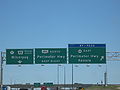
. The Perimeter is approximately 90 km (55.9 mi) long. It is an alternate route around Winnipeg for through traffic, as there are no freeways through the city.
History
The highway was originally built in 1955, following the cancellation of a freeway system to accommodate traffic around Winnipeg to avoid the city centre rush hour traffic. The northeast section was left unbuilt at the time, as PTH 59Manitoba Provincial Highway 59
Provincial Trunk Highway 59 is a provincial highway in the Canadian province of Manitoba. It runs from the U.S. border north to 8th Ave. in Victoria Beach on Lake Winnipeg....
had received significant upgrades, making the need for a northeast section less pressing. PTH 59 continued to serve as the de facto northeast leg of the Perimeter until the mid-1990s, when the remaining segments of the highway were completed. The highway now encircles Winnipeg.
Most of the Perimeter is a four-lane divided expressway
Limited-access road
A limited-access road known by various terms worldwide, including limited-access highway, dual-carriageway and expressway, is a highway or arterial road for high-speed traffic which has many or most characteristics of a controlled-access highway , including limited or no access to adjacent...
, with interchange
Interchange (road)
In the field of road transport, an interchange is a road junction that typically uses grade separation, and one or more ramps, to permit traffic on at least one highway to pass through the junction without directly crossing any other traffic stream. It differs from a standard intersection, at which...
s and at-grade intersection
At-grade intersection
An at-grade intersection is a junction at which two or more transport axes cross at the same level .-Traffic management:With areas of high or fast traffic, an at-grade intersection normally requires a traffic control device such as a stop sign, traffic light or railway signal to manage conflicting...
s. The only section that remain two-lane is in the vicinity of the PTH 59N interchange.
The southern segment of the Perimeter Highway is part of the Trans-Canada Highway
Trans-Canada Highway
The Trans-Canada Highway is a federal-provincial highway system that joins the ten provinces of Canada. It is, along with the Trans-Siberian Highway and Australia's Highway 1, one of the world's longest national highways, with the main route spanning 8,030 km...
, and is designated as Highway 100. The northern segment is a provincial highway designated as PTH 101.
The Perimeter Highway bridge across the Red River and roadway at Pembina Highway was constructed in 1958. The job was tendered to Peter Leitch Construction Ltd. at a cost of $188,670. In December 1957, Dominion Bridge was awarded the contract ($80,157) to supply the structural steel for the overpass.
Exit list
| km | # Exit number An exit number is a number assigned to a road junction, usually an exit from a freeway. It is usually marked on the same sign as the destinations of the exit, as well as a sign in the gore.... |
Destinations | Notes |
|---|---|---|---|
| 0 | 1 | – Kenora Kenora, Ontario Kenora , originally named Rat Portage, is a small city situated on the Lake of the Woods in Northwestern Ontario, Canada, close to the Manitoba boundary, and about east of Winnipeg... |
Signed as exits 1A (west) and 1B (east) The Perimeter Highway designation is Hwy 100 south of here and Hwy 101 north of here. |
| 2.0 | Murdock Road | At-grade | |
| 3.6 | Symington Road | At-grade | |
| 5.2 | Plessis Road | At-grade | |
| 6.8 | 8 | Signed as exit 8 | |
| 7.9 | Melnick Road (north) / Budd Road (south) | At-grade | |
| 8.0 | Canadian Pacific Railway | Level crossing | |
| 8.1 | Aimes Road (north) / Sumka Road (south) | At-grade | |
| 8.8 | At-grade / Traffic Signals | ||
| 12.4 | At-grade / Traffic Signals | ||
| 15.9 | 18 | Signed as exits 18A (north) and 18B (south) | |
| 16.2 | Canadian National Railway | Level crossing | |
| 17.2 | At-grade / Traffic Signals | ||
| 20.2 | Brady Road | At-grade | |
| 21.4 | At-grade | ||
| 21.9 | Canadian Pacific Railway | Level crossing | |
| 23.1 | Municipal Road 9E | At-grade | |
| 24.7 | Municipal Road 8E | At-grade | |
| 26.4 | Municipal Road 7E | At-grade | |
| 26.8 | At-grade | ||
| 28.0 | At-grade / Traffic Signals | ||
| 29.8 | Oakland Road | At-grade | |
| 30.2 | Central Manitoba Railway (CEMR) | Level crossing | |
| 30.7 | La Verendrye Road | At-grade | |
| 35.3 | |||
| 36.1 | At-grade | ||
| 37.2 | Caron Road (west) No access when traveling northbound (clockwise) | At-grade | |
| 38.1 | 40 | Signed as exit 40 clockwise Signed as exits 40A (east) and 40B (west) counterclockwise |
|
| 38.6 | Assiniboine River | ||
| 39.3 | Augier Ave (east) No access when traveling southbound (counter-clockwise) Oak Forest Cres (west) No access when traveling northbound (clockwise) |
At-grade | |
| 40.0 | 42 | Signed as exits 42A (east) and 42B (west) The Perimeter Highway designation is Hwy 100 south of here and Hwy 101 north of here. |
|
| 40.7 | Assiniboia Downs Assiniboia Downs Assiniboia Downs is a Canadian horse race track opened in June 1958 in Winnipeg, Manitoba. The main track is a six-and-one-half furlong oval.... (west) Maybe no access when traveling northbound (clockwise) |
At-grade | |
| 42 | At-grade / Traffic Signals | ||
| 42 | Canadian Pacific Railway | Level crossing | |
| 43.1 | Paddock Road | At-grade | |
| 44.0 | Boychuk Road | At-grade | |
| 45.6 | Selkirk Avenue, Township Road 63 | At-grade | |
| 47.3 | Township Road 64 | At-grade | |
| 48.5 | |||
| 51.2 | At-grade | ||
| 51.3 | Canadian National Railway | Level crossing | |
| 52.1 | At-grade / Traffic Signals | ||
| 52.9 | Summit Road | At-grade | |
| 54.6 | Sturgeon Road | At-grade | |
| 56.2 | Klimpke Road | At-grade | |
| 57.9 | |||
| 59.5 | King Edward Street | At-grade | |
| 59.8 | Canadian Pacific Railway | Level crossing | |
| 62.8 | At-grade / Traffic Signals | ||
| 65.5 | Second Street (south) / Holmes Road (north) | ||
| 66.8 | 69 | Signed as exits 69A (south) and 69B (north) | |
| 69.0 | Canadian Pacific Railway | Level crossing | |
| 69.6 | 71 | Signed as exits 71A (south) and 71B (north) | |
| 70.3 | Red River | ||
| 70.7 | 72 | Signed as exit 72 | |
| 72.5 | Raleigh St (south) No access when traveling westbound (counter clockwise) / Sperring Ave (north) No access when traveling eastbound (clockwise) | At-grade | |
| 73.8 | At-grade / Traffic signals | ||
| 76.2 | Wenzel Street | At-grade | |
| 77.0 | Central Manitoba Railway (CEMR) | Level crossing | |
| 80.2 | Gunn Road | At-grade | |
| 83.5 | Canadian Pacific Railway | Level crossing | |
| 83.6 | At-grade / Traffic Signals | ||
| 85.3 | St. Boniface Road | At-grade | |
| 87.0 | Niakwa Road | At-grade | |
| 87.2 | Great Winnipeg Water District Railway (GWWDRR) | Level crossing | |
| 88.6 | Navin Road | At-grade | |
| 89.5 | 1 | – Kenora, Ontario Ontario Ontario is a province of Canada, located in east-central Canada. It is Canada's most populous province and second largest in total area. It is home to the nation's most populous city, Toronto, and the nation's capital, Ottawa.... |
The Perimeter Highway designation is Hwy 100 south of here and Hwy 101 north of here. |
Inner city beltway, the second half of the Perimeter plan
This roadway is what was to be part of a two ring road system. That being, the outer Perimeter Highway, and an inner ring. The inner ring was initially tabled in the 1960s and was slow to progress.The inner ring, also sometimes referred to as the inner city beltway, was to be (Route 17) the Chief Peguis Trail to the north, heading west to Route 96 (the Moray Bridge), circling to Route 165 (Bishop Grandin Blvd), and from there to a point near Northern Blower on Route 37 (Regent). Several years ago a group working with a councellor, worked to stop the loop from going into the Transcona area, and had the roadway's land designated a natural prairie grass park. From this point on Regent, the road was supposed to loop north back to Route 17 (Chief Peguis). The current plan has had to move the eastern portion to Plessis Road. Plessis Road is not as suited to the required connection and space for intersections, but is the only remaining viable option.
While construction of the east west Bishop Grandin portion was done years ago, the northern portions have remained unlinked, with only the short portion between Route 52 (Main Street) and Route 42 (Henderson Hwy). This has provided an effective link over the Red River, but the short span of road leaves much of the north part of the city with difficult navigation choices on a east west basis, often pushing major cross town traffic to use residential roads and regional arteries like Inkster, MacIvor and Springfield Roads. The absence of a link between the intersection of Route 52 (Main) and Route 17 (Chief Peguis) toward Route 90 (Brookside) makes east west travel difficult, and is an important link for the north part of town to significant areas like the Airport, and Red River Community College.
The land for these links is owned by the city and simply awaits the laying of roadway. These type of major traffic arteries are designed to carry crosstown traffic efficiently with fewer environmentally damaging starts and stops. Further these roadways are designed to move traffic away from direct contact with residential streets.