

Winnipeg Route 42
Encyclopedia
Downtown Winnipeg
Downtown Winnipeg is centred around Portage Avenue and Main Street, and is bounded by the Assiniboine River on the south, Colony and Balmoral Streets on the west, Notre Dame Avenue, Princess Street, and Logan Avenue on the north, and the Red River on the east. It includes the Exchange District,...
. In the north, it is a continuation of Manitoba Provincial Road 204
Manitoba Provincial Road 204
Provincial Road 204 is a provincial road in the Canadian province of Manitoba. Running under the names Henderson Highway and Eaton Avenue, PR 204 stretches from the Province's capital, Winnipeg to Selkirk. It has a short concurrency with PTH 44 in Lockport, MB.- Route description :Provincial Road...
; in the south, it is a continuation of Manitoba Highway 75.
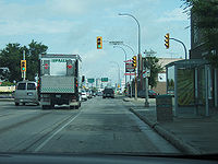
The route begins at the intersection of Provincial Road 204 and the Perimeter Highway North and, as Henderson Highway, runs south parallel to the east bank of the Red River
Red River of the North
The Red River is a North American river. Originating at the confluence of the Bois de Sioux and Otter Tail rivers in the United States, it flows northward through the Red River Valley and forms the border between the U.S. states of Minnesota and North Dakota before continuing into Manitoba, Canada...
. It passes Chief Peguis Trail and Hespeler Avenue
Winnipeg Route 37
Route 37 is a major east-west arterial route in Winnipeg, Manitoba which connects the suburbs of Transcona and Elmwood with the downtown core.- Route :...
before crossing the Red River at the Disraeli Bridge and passing through the neighbourhood of Point Douglas
North Point Douglas
North Point Douglas is a small neighbourhood located in the city of Winnipeg, Canada.North Point Douglas comprises the northern portion of a peninsula of the Red River. Its boundaries are Main Street , Redwood Avenue , the Red River , and the Canadian Pacific Railway mainline , which bisects the...
as the Disraeli Freeway. It veers east and crosses Main Street
Winnipeg Route 52
Route 52 is a major north-south arterial route in Winnipeg, Manitoba. It comprises all of Main Street from the northern city limits to the Main Street Bridge over the Assiniboine River; Queen Elizabeth Way from the Main Street Bridge to the Norwood Bridge over the Red River; and St. Mary's Road...
, then turns south as Princess Street (southbound) and King Street (northbound), becoming Donald Street (southbound) and Smith Street (northbound) at Notre Dame Avenue
Winnipeg Route 57
Route 57 is a major arterial road located in Winnipeg, Manitoba. It connects the suburbs of St. James and St. Boniface with the city's West End and the downtown core.The route begins on Dublin Avenue in the St. James Industrial Area of the city's northwest...
. After passing through the downtown core, it crosses the Assiniboine River
Assiniboine River
The Assiniboine River is a river that runs through the prairies of Western Canada in Saskatchewan and Manitoba. It is a tributary of the Red River. The Assiniboine is a typical meandering river with a single main channel embanked within a flat, shallow valley in some places and a steep valley in...
at the Midtown Bridge, taking the name Donald Street in both directions until it reaches Confusion Corner
Confusion Corner
Osborne Junction, more commonly known as Confusion Corner, is a street intersection in Winnipeg, Manitoba. Located at the junction of City Route 62 and City Route 42 in the city's Fort Rouge neighbourhood, the intersection is a major traffic hub through which most traffic between downtown and the...
, where it becomes Pembina Highway. It then runs south-southwest through the suburbs of Fort Garry (passing by the University of Manitoba
University of Manitoba
The University of Manitoba , in Winnipeg, Manitoba, Canada, is the largest university in the province of Manitoba. It is Manitoba's most comprehensive and only research-intensive post-secondary educational institution. It was founded in 1877, making it Western Canada’s first university. It placed...
) and St. Norbert before leaving the city at the Perimeter Highway South as Manitoba Highway 75.
The persons whom the various roads making up Route 42 were named after vary from local pioneers to businessmen to members of the British Royal Family
British Royal Family
The British Royal Family is the group of close relatives of the monarch of the United Kingdom. The term is also commonly applied to the same group of people as the relations of the monarch in her or his role as sovereign of any of the other Commonwealth realms, thus sometimes at variance with...
. Henderson Highway was named for early Manitoba pioneer Samuel Robert Henderson, Disraeli Freeway was named for Benjamin Disraeli, and Princess Street was named for Princess Louise, Duchess of Argyll
Princess Louise, Duchess of Argyll
The Princess Louise was a member of the British Royal Family, the sixth child and fourth daughter of Queen Victoria and her husband, Albert, Prince Consort.Louise's early life was spent moving between the various royal residences in the...
, while King Street was named for John Mark King, a local clergyman, and Donald Street and Smith Street for a Hudson's Bay Company official. Pembina Highway was originally a trail leading to Fort Pembina, North Dakota
Pembina, North Dakota
Pembina is a city in Pembina County, North Dakota in the United States. The population was 592 at the 2010 census.The area of Pembina was long inhabited by various indigenous peoples...
.