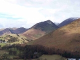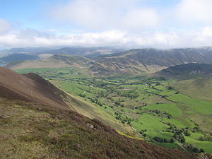
Ard Crags
Encyclopedia

Fell
“Fell” is a word used to refer to mountains, or certain types of mountainous landscape, in Scandinavia, the Isle of Man, and parts of northern England.- Etymology :...
in the Lake District
Lake District
The Lake District, also commonly known as The Lakes or Lakeland, is a mountainous region in North West England. A popular holiday destination, it is famous not only for its lakes and its mountains but also for its associations with the early 19th century poetry and writings of William Wordsworth...
in Cumbria
Cumbria
Cumbria , is a non-metropolitan county in North West England. The county and Cumbria County Council, its local authority, came into existence in 1974 after the passage of the Local Government Act 1972. Cumbria's largest settlement and county town is Carlisle. It consists of six districts, and in...
, England
England
England is a country that is part of the United Kingdom. It shares land borders with Scotland to the north and Wales to the west; the Irish Sea is to the north west, the Celtic Sea to the south west, with the North Sea to the east and the English Channel to the south separating it from continental...
, it is situated in the Newlands Valley
Newlands Valley
The Newlands Valley is in the Lake District National Park in Cumbria, England. It is regarded as one of the most picturesque and quiet valleys in the national park, even though it is situated very close to the popular tourist town of Keswick and the busy A66 road.The valley forms part of the civil...
just off the minor road between Keswick
Keswick, Cumbria
Keswick is a market town and civil parish within the Borough of Allerdale in Cumbria, England. It had a population of 4,984, according to the 2001 census, and is situated just north of Derwent Water, and a short distance from Bassenthwaite Lake, both in the Lake District National Park...
and Buttermere
Buttermere
Buttermere is a lake in the English Lake District in North West England. The adjacent village of Buttermere takes its name from the lake. Historically within the former county of Cumberland, the lake is now within the county of Cumbria. It is owned by the National Trust, forming part of their...
. The Ordnance Survey
Ordnance Survey
Ordnance Survey , an executive agency and non-ministerial government department of the Government of the United Kingdom, is the national mapping agency for Great Britain, producing maps of Great Britain , and one of the world's largest producers of maps.The name reflects its creation together with...
officially records the fell's altitude at 581 metres (1,906 feet), considerably more than the approximate 1,860 feet that Alfred Wainwright
Alfred Wainwright
Alfred Wainwright MBE was a British fellwalker, guidebook author and illustrator. His seven-volume Pictorial Guide to the Lakeland Fells, published between 1955 and 1966 and consisting entirely of reproductions of his manuscript, has become the standard reference work to 214 of the fells of the...
attributed to it in his Pictorial Guide to the North Western Fells, published in 1964 well before the advent of satellite mapping. Ard Crags is situated close to other higher fells such as Causey Pike
Causey Pike
Causey Pike is a fell in the English Lake District. It is situated in the Newlands Valley, 5 km south west of the town of Keswick. Even though it has a modest height of 637 metres it is one of the most distinctive fells when viewed from the Derwent Water and Keswick area due to its...
and Eel Crag and can be easily overlooked. However, viewed from certain points in the Rigg Beck or Newlands valley area it presents a clearly defined and pyramidal shape which catches the eye.
Topography
A long high ridge sweeps east from Whiteless PikeWhiteless Pike
Whiteless Pike is a fell in the north-western English Lake District. It stands immediately east of Crummock Water and forms a perfect pyramid shape when viewed from Rannerdale. In his celebrated guide to the Lakeland fells, Alfred Wainwright called it "the Weisshorn of Buttermere"...
, via Wandope
Wandope
Wandope is a fell in the north-western area of the English Lake District. It lies to the east of Crummock Water and south of Crag Hill...
, Crag Hill
Crag Hill
Crag Hill is a mountain in the North Western part of the English Lake District. It was formerly known as Eel Crag; however, the Ordnance Survey now marks Eel Crag as referring to the northern crags of the fell....
, Sail (Lake District)
Sail (Lake District)
Sail is a hill in the English Lake District, lying between Derwentwater and Crummock Water.-Topography:The North Western Fells occupy the area between the rivers Derwent and Cocker, a broadly oval swathe of hilly country, elongated on a north-south axis. Two roads cross from east to west, dividing...
and Causey Pike
Causey Pike
Causey Pike is a fell in the English Lake District. It is situated in the Newlands Valley, 5 km south west of the town of Keswick. Even though it has a modest height of 637 metres it is one of the most distinctive fells when viewed from the Derwent Water and Keswick area due to its...
, crossing from Buttermere
Buttermere
Buttermere is a lake in the English Lake District in North West England. The adjacent village of Buttermere takes its name from the lake. Historically within the former county of Cumberland, the lake is now within the county of Cumbria. It is owned by the National Trust, forming part of their...
to Stair. Running parallel to the south is a lower ridge, a tenuous connection made centrally at Sail. This lower ridge consists of Knott Rigg
Knott Rigg
Knott Rigg is a fell at the head of the Newlands Valley in the English Lake District. It is situated some 8.5 kilometres south west of Keswick and has a modest height of 556 metres . Its name is derived from the Old English language and means “hill on a knobbly ridge”...
and Ard Crags, and has a beautiful narrow and airy character. Ard Crags forms the eastern half of the ridge, rising between Keskadale and the side valley of Rigg Beck. It is sometimes referred to as Aikin Knott, the name of the rash of rock on the nose of the ridge.
Geology
The Ard Crags ridge is an example of the Buttermere Formation, an olistostromeOlistostrome
The term olistostrome is derived from olio - a dish of many ingredients or stew; a mixture of heterogeneous elements; hodgepodge. and stroma - a bed covering...
of disrupted, sheared and folded mudstone
Mudstone
Mudstone is a fine grained sedimentary rock whose original constituents were clays or muds. Grain size is up to 0.0625 mm with individual grains too small to be distinguished without a microscope. With increased pressure over time the platey clay minerals may become aligned, with the...
, siltstone
Siltstone
Siltstone is a sedimentary rock which has a grain size in the silt range, finer than sandstone and coarser than claystones.- Description :As its name implies, it is primarily composed of silt sized particles, defined as grains 1/16 - 1/256 mm or 4 to 8 on the Krumbein phi scale...
and sandstone
Sandstone
Sandstone is a sedimentary rock composed mainly of sand-sized minerals or rock grains.Most sandstone is composed of quartz and/or feldspar because these are the most common minerals in the Earth's crust. Like sand, sandstone may be any colour, but the most common colours are tan, brown, yellow,...
.
Ascents
The fell is linked by a ridge to another “Wainwright” fell, Knott RiggKnott Rigg
Knott Rigg is a fell at the head of the Newlands Valley in the English Lake District. It is situated some 8.5 kilometres south west of Keswick and has a modest height of 556 metres . Its name is derived from the Old English language and means “hill on a knobbly ridge”...
and most walkers will climb both hills together in the same walk. There are two possible starting points, one is at Rigg Beck in Newlands, near the site of the eccentrically painted “purple house” which was destroyed by fire in June 2008. This route goes directly up the eastern ridge passing the outcrop of Aikin Knott after which the ridge narrows considerably to reach the heather covered summit which gives a precipitous view of Newlands. The alternative starting point is the car park at Newlands Hause which stands at an altitude of 333 metres (1,093 feet), the summit of Knott Rigg is crossed first before continuing onto Ard Crags.
Summit and view
The narrow ridge is carpeted with heather, the top marked by a small cairnCairn
Cairn is a term used mainly in the English-speaking world for a man-made pile of stones. It comes from the or . Cairns are found all over the world in uplands, on moorland, on mountaintops, near waterways and on sea cliffs, and also in barren desert and tundra areas...
. The view from the summit is severely restricted in a north and westerly direction by the higher Eel Crag to Causey Pike ridge, the best feature of the view is the aerial view of the Newlands valley while Scafell Pike
Scafell Pike
Scafell Pike is the highest mountain in England at . It is located in Lake District National Park sometimes confused with the neighbouring Sca Fell, to which it is connected by the col of Mickledore...
can be glimpsed eight miles away through a gap in the hills to the south.

