

List of crossings of the Upper Mississippi River
Encyclopedia
Bridge
A bridge is a structure built to span physical obstacles such as a body of water, valley, or road, for the purpose of providing passage over the obstacle...
s or other crossings of the Upper
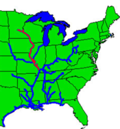
Upper Mississippi River
The Upper Mississippi River is the portion of the Mississippi River upstream of Cairo, Illinois, United States. From the headwaters at Lake Itasca, Minnesota, the river flows approximately 2000 kilometers to Cairo, where it is joined by the Ohio River to form the Lower Mississippi...
Mississippi River
Mississippi River
The Mississippi River is the largest river system in North America. Flowing entirely in the United States, this river rises in western Minnesota and meanders slowly southwards for to the Mississippi River Delta at the Gulf of Mexico. With its many tributaries, the Mississippi's watershed drains...
which begins at the Mississippi River's source and extends to its confluence with the Ohio River
Ohio River
The Ohio River is the largest tributary, by volume, of the Mississippi River. At the confluence, the Ohio is even bigger than the Mississippi and, thus, is hydrologically the main stream of the whole river system, including the Allegheny River further upstream...
at Cairo, Illinois
Cairo, Illinois
Cairo is the southernmost city in the U.S. state of Illinois. It is the county seat of Alexander County. Cairo is located at the confluence of the Mississippi and Ohio rivers. The rivers converge at Fort Defiance State Park, an American Civil War fort that was commanded by General Ulysses S. Grant...
.
Crossings
| Crossing | Carries | Location | Miles above the Ohio | Coordinates |
|---|---|---|---|---|
Minnesota |
||||
| Lake Itasca Lake Itasca Lake Itasca is a small glacial lake, approximately in area, in the Headwaters area of north central Minnesota. The lake is located in southeastern Clearwater County within Itasca State Park and it has an average depth of 20–35 feet , and is 1,475 ft above sea level.The Ojibwe name for... - Source of the Mississippi |
47°14′23"N 95°12′28"W | |||
| Headwaters dam covered with rock pedestrian ford Ford (crossing) A ford is a shallow place with good footing where a river or stream may be crossed by wading or in a vehicle. A ford is mostly a natural phenomenon, in contrast to a low water crossing, which is an artificial bridge that allows crossing a river or stream when water is low.The names of many towns... |
Hiking trail | Itasca State Park Itasca State Park Itasca State Park is a state park of Minnesota, United States, and contains the headwaters of the Mississippi River. The park spans of northern Minnesota, and is located about north of Park Rapids, Minnesota and from Bagley, Minnesota... |
||
| Footbridge | Hiking trail | |||
| Hiking / Bicycle Bridge | Hiking / Bicycle path | |||
| Road Bridge | Clearwater County Road 117 (Wilderness Drive) | 47°14′35.8"N 95°12′39"W | ||
| Highway Bridge | Just north of Itasca S.P. Rural Clearwater Co. Clearwater County, Minnesota As of the census of 2000, there were 8,423 people, 3,330 households, and 2,287 families residing in the county. The population density was 8 people per square mile . There were 4,114 housing units at an average density of 4 per square mile... |
47°15′12.4"N 95°13′31.7"W | ||
| Highway Bridge | Clearwater County Road 37 | 6½ miles east of Zerkel Rural Clearwater Co. |
||
| Highway Bridge | Clearwater County Road 2 (Great River Road Great River Road The Great River Road is a collection of state, provincial, federal, and local roads which follow the course of the Mississippi River through ten states of the United States... ) |
4 miles (6.4 km) south of Alida Rural Clearwater Co. |
||
| Highway Bridge | Clearwater County Road 40 | 7 miles (11.3 km) west of Becida Rural Clearwater Co. |
||
| Gravel Road Bridge | Stumpghes Rapids Road State Forest Road |
Mississippi Headwaters State Forest Rural Hubbard Co. Hubbard County, Minnesota As of the census of 2000, there were 18,376 people, 7,435 households, and 5,345 families residing in the county. The population density was 20 people per square mile . There were 12,229 housing units at an average density of 13 per square mile... |
||
| Highway Bridge | Beltrami County Road 5 | 6 miles (9.7 km) south of Solway Solway, Minnesota Solway is a city in Beltrami County, Minnesota, United States. The population was 96 at the 2010 census. Solway serves as a bedroom community for nearby Bemidji.-Geography:... Rural Beltrami Co. Beltrami County, Minnesota Beltrami County is a county located in the northern part of the U.S. state of Minnesota. As of 2010, the population was 44,442. Its county seat is Bemidji. Portions of the Leech Lake and Red Lake Indian reservations are in the county. The northernmost portion of the Mississippi River flows... |
||
| Highway Bridge | Beltrami County Road 7 | 6½ miles southwest of Bemidji Rural Beltrami Co. |
||
| Gravel Road Bridge | Jefferson Ave. South Fern Lake Road |
4 miles (6.4 km) southwest of Bemidji Rural Beltrami Co. |
||
| Highway Bridge | Beltrami County Road 11 (Carr Lake SW) | 2½ miles south of Bemidji Rural Beltrami Co. |
47°26′11"N 94°53′38"W | |
| Expressway Bridges | Just southwest of Bemidji | |||
| Road Bridge | Yellowhead Rd. SE | |||
| Rail Bridge | BNSF Railway BNSF Railway The BNSF Railway is a wholly owned subsidiary of Berkshire Hathaway Inc., and is headquartered in Fort Worth, Texas. It is one of seven North American Class I railroads and the second largest freight railroad network in North America, second only to the Union Pacific Railroad, its primary... |
Bemidji Bemidji, Minnesota Bemidji is a city in Beltrami County, Minnesota, United States. Its population was at 13,431 at the 2010 census. It is the county seat of Beltrami County. Bemidji is the most major city in North Central Minnesota and the largest commercial center between Grand Forks, North Dakota and Duluth,... |
||
| Abandoned Rail Bridge | Former Soo Line Railroad Soo Line Railroad The Soo Line Railroad is the primary United States railroad subsidiary of the Canadian Pacific Railway , controlled through the Soo Line Corporation, and one of seven U.S. Class I railroads. Although it is named for the Minneapolis, St. Paul and Sault Ste... |
47°28′00"N 94°52′43"W | ||
| Old Midway Drive Bridge | Midway Drive (closed) | 47°28′01"N 94°52′42"W | ||
| Paul Bunyan Drive Bridges | 47°28′03"N 94°52′43"W | |||
| Rail Bridge | Paul Bunyan State Trail Paul Bunyan State Trail The Paul Bunyan State Trail is a multi-use recreational rail trail in north-central Minnesota, USA, running between the cities of Brainerd and Bemidji. Named after the giant lumberjack Paul Bunyan of American folklore, the trail is one of the longest continuously paved rail trails in the United... Former Northern Pacific Railway Northern Pacific Railway The Northern Pacific Railway was a railway that operated in the west along the Canadian border of the United States. Construction began in 1870 and the main line opened all the way from the Great Lakes to the Pacific when former president Ulysses S. Grant drove in the final "golden spike" in... |
47°29′30"N 94°50′04"W | ||
| Highway Bridge | Lake Avenue | 47°29′30"N 94°49′56"W | ||
| Highway Bridge | Power Dam Road | 7 miles (11.3 km) east of Bemidji Rural Beltrami Co. |
47°28′58"N 94°43′39"W | |
| Highway Bridge | Beltrami County Road 8 (Roosevelt Road) | 7 miles (11.3 km) east of Bemidji Rural Beltrami Co. |
47°27′12"N 94°42′41"W | |
| Highway Bridge | Beltrami County Road 8 (Roosevelt Road) | 9½ miles east of Bemidji Rural Beltrami Co. |
47°26′17"N 94°40′19"W | |
| Highway Bridge | Beltrami County Road 33 (Mission Road) | 4 miles (6.4 km) north of the town of Cass Lake Cass Lake, Minnesota As of the census of 2000, there were 860 people, 331 households, and 192 families residing in the city. The population density was 753.2 people per square mile . There were 384 housing units at an average density of 336.3 per square mile . The racial makeup of the city was 30.12% White, 64.42%... Rural Beltrami Co. |
47°26′01"N 94°38′36"W | |
| Highway Bridge | Beltrami County Road 39 | East end of Cass Lake Cass Lake (Minnesota) Cass Lake is a glacially-formed lake in north central Minnesota in the United States. It is approximately long and wide, located in Cass and Beltrami counties, within the Chippewa National Forest and the Leech Lake Indian Reservation, adjacent to its namesake city of Cass Lake... Rural Beltrami Co. |
47°27′17"N 94°28′29"W | |
| Gravel Road Bridge | Forest Route 2171 | 2½ miles east of County Road 39 Rural Beltrami Co. |
47°26′39"N 94°25′31"W | |
| Demolished Bridge | Former Forest Route 2171 | 1 miles (1.6 km) east of current USFS Rt. 2171 Itasca Co. Itasca County, Minnesota Itasca County is a county located in the U.S. state of Minnesota. It is named after Lake Itasca, which is in turn a shortened version the Latin words veritas caput, meaning 'truth' and 'head', a reference to the source of the Mississippi River. As of 2010, the population was 45,058. Its county seat... / Cass Co. Cass County, Minnesota Cass County is a county located in the U.S. state of Minnesota. As of 2010, the population was 28,567. Its county seat is Walker. A portion of the Leech Lake Indian Reservation is in the county.-Geography:... |
47°26′43"N 94°24′57"W | |
| Lake Winnibigoshish Dam | Itasca County Road 9 / Cass County Road 9 | About 15 miles (24.1 km) northwest of Deer River Deer River, Minnesota As of the census of 2000, there were 903 people, 389 households, and 220 families residing in the city. The population density was 850.9 people per square mile . There were 415 housing units at an average density of 391.1 per square mile . The racial makeup of the city was 84.05% White, 12.07%... Itasca Co. / Cass Co. |
47°25′47"N 94°03′04"W | |
| Highway Bridge | Ball Club, Minnesota Morse Township, Itasca County, Minnesota Morse Township is a township in Itasca County, Minnesota, United States. The population was 605 at the 2000 census. Morse Township includes the unorganized settlement of Ball Club, Minnesota.-Geography:... |
47°19′29"N 93°57′35"W | ||
| Rail Bridge | BNSF Railway BNSF Railway The BNSF Railway is a wholly owned subsidiary of Berkshire Hathaway Inc., and is headquartered in Fort Worth, Texas. It is one of seven North American Class I railroads and the second largest freight railroad network in North America, second only to the Union Pacific Railroad, its primary... |
47°19′28"N 93°57′35"W | ||
| Highway Bridge | Itasca County Road 18/Cass County Road 3 | 3 miles (4.8 km) southeast of Ball Club Itasca Co. / Cass Co. |
||
| Days High Landing Bridge | Itasca County Road 18/Cass County Road 3 | 10 miles (16.1 km) south of Deer River Morse Twp. Morse Township, Itasca County, Minnesota Morse Township is a township in Itasca County, Minnesota, United States. The population was 605 at the 2000 census. Morse Township includes the unorganized settlement of Ball Club, Minnesota.-Geography:... , Itasca Co. Itasca County, Minnesota Itasca County is a county located in the U.S. state of Minnesota. It is named after Lake Itasca, which is in turn a shortened version the Latin words veritas caput, meaning 'truth' and 'head', a reference to the source of the Mississippi River. As of 2010, the population was 45,058. Its county seat... and Wahnea Twp. Wahnena, Minnesota Wahnena is an unorganized territory in Cass County, Minnesota, United States. The population was 197 at the 2000 census. It is part of the Brainerd Micropolitan Statistical Area.-Geography:... , Cass Co. Cass County, Minnesota Cass County is a county located in the U.S. state of Minnesota. As of 2010, the population was 28,567. Its county seat is Walker. A portion of the Leech Lake Indian Reservation is in the county.-Geography:... |
||
| Minnesota Highway 6 Bridge (Morse Township) | Morse Township, Minnesota Morse Township, Itasca County, Minnesota Morse Township is a township in Itasca County, Minnesota, United States. The population was 605 at the 2000 census. Morse Township includes the unorganized settlement of Ball Club, Minnesota.-Geography:... |
47°13′45"N 93°45′29"W | ||
| Central Avenue Bridge (Cohasset) | Central Avenue | Cohasset, Minnesota Cohasset, Minnesota Cohasset is a city in Itasca County, Minnesota, USA. The population was 2,698 at the 2010 census.U.S. Highway 2 serves as a main arterial route in the city.-Geography:... |
47°15′44"N 93°37′22"W | |
| BNSF Grand Rapids Rail Bridge | Railroad | NW of Grand Rapids, Minnesota Grand Rapids, Minnesota As of the census of 2000, there were 7,764 people, 3,446 households, and 1,943 families residing in the city. The population density was 1,057.8 people per square mile . There were 3,621 housing units at an average density of 493.3 per square mile... |
47°15′05"N 93°35′25"W | |
| Itasca County Highway 63 Bridge | Itasca County Road 63 | Grand Rapids, Minnesota Grand Rapids, Minnesota As of the census of 2000, there were 7,764 people, 3,446 households, and 1,943 families residing in the city. The population density was 1,057.8 people per square mile . There were 3,621 housing units at an average density of 493.3 per square mile... |
47°14′23"N 93°37′07"W | |
| Pokegama Avenue Bridge | Pokegama Avenue | Grand Rapids, Minnesota Grand Rapids, Minnesota As of the census of 2000, there were 7,764 people, 3,446 households, and 1,943 families residing in the city. The population density was 1,057.8 people per square mile . There were 3,621 housing units at an average density of 493.3 per square mile... |
47°13′56"N 93°31′42"W | |
| Robert K. Horn Bridge | 7th Avenue East | Grand Rapids, Minnesota Grand Rapids, Minnesota As of the census of 2000, there were 7,764 people, 3,446 households, and 1,943 families residing in the city. The population density was 1,057.8 people per square mile . There were 3,621 housing units at an average density of 493.3 per square mile... |
47°13′50"N 93°31′4"W | |
| Blackberry Bridge | Itasca County Road 441 | Blackberry Township, Minnesota Blackberry Township, Minnesota Blackberry Township is a township in Itasca County, Minnesota, United States. The population was 717 at the 2000 census.-Geography:According to the United States Census Bureau, the township has a total area of , of which, of it is land and of it is water.-Demographics:As of the census of 2000,... |
47°10′28"N 93°25′15"W | |
| Mississippi, Hill City and Western Railway Co Rail Bridge (Historical) | Demolished | North of Jacobson, Minnesota Jacobson, Minnesota Jacobson is a small unincorporated community in Aitkin County, Minnesota, United States.Formerly known as "Mississippi Landing," it is named after Paul Jacobson, who started the local post office and mail route in 1901.... |
47°01′15"N 93°15′46"W | |
| Minnesota Highway 200E Bridge | Jacobson, Minnesota Jacobson, Minnesota Jacobson is a small unincorporated community in Aitkin County, Minnesota, United States.Formerly known as "Mississippi Landing," it is named after Paul Jacobson, who started the local post office and mail route in 1901.... |
47°00′05"N 93°16′07"W | ||
| 480th Street Bridge | Palisade, Minnesota Palisade, Minnesota Palisade is a city in Aitkin County, Minnesota, United States. The population was 167 at the 2010 census.-Geography:According to the United States Census Bureau, the city has a total area of , all of it land.... |
46°42′33"N 93°29′04"W | ||
| Palisade Rail Bridge | Palisade, Minnesota Palisade, Minnesota Palisade is a city in Aitkin County, Minnesota, United States. The population was 167 at the 2010 census.-Geography:According to the United States Census Bureau, the city has a total area of , all of it land.... |
46°42′32"N 93°29′11"W | ||
| US Highway 169 Bridge | About 11 miles (17.7 km) northeast of Aitkin, Minnesota Aitkin, Minnesota As of the census of 2000, there were 1,984 people, 892 households, and 434 families residing in the city. The population density was 1,150.3 people per square mile . There were 969 housing units at an average density of 561.8 per square mile... |
46°39′04"N 93°36′45"W | ||
| 410th Avenue Bridge | 410th Avenue | Aitkin, Minnesota Aitkin, Minnesota As of the census of 2000, there were 1,984 people, 892 households, and 434 families residing in the city. The population density was 1,150.3 people per square mile . There were 969 housing units at an average density of 561.8 per square mile... |
46°32′26"N 93°42′27"W | |
| Minnesota Highway 6 Bridge | East of Wolford, Minnesota Wolford Township, Minnesota Wolford Township is a township in Crow Wing County, Minnesota, United States. The population was 326 at the 2000 census.-Geography:According to the United States Census Bureau, the township has a total area of 17.0 square miles , of which, 14.6 square miles of it is land and... |
46°32′39"N 93°57′22"W | ||
| County Road 3 Bridge | Crow Wing County Road 3, formerly | North of Brainerd, Minnesota Brainerd, Minnesota Brainerd is a city in Crow Wing County, Minnesota, United States. The population was 13,590 at the 2010 census. It is the county seat of Crow Wing County and one of the largest cities in Central Minnesota... |
46°22′59"N 94°10′35"W | |
| Washington Street Bridge Washington Street Bridge The Washington Street Bridge was built 1932-1934 in Brainerd in the U.S. state of Minnesota. It carries four lanes of Minnesota State Highway 210 across the Upper Mississippi River.... |
Brainerd, Minnesota Brainerd, Minnesota Brainerd is a city in Crow Wing County, Minnesota, United States. The population was 13,590 at the 2010 census. It is the county seat of Crow Wing County and one of the largest cities in Central Minnesota... |
46°21′29"N 94°12′41"W | ||
| Brainerd Rail Bridge | BNSF Railroad | Brainerd, Minnesota Brainerd, Minnesota Brainerd is a city in Crow Wing County, Minnesota, United States. The population was 13,590 at the 2010 census. It is the county seat of Crow Wing County and one of the largest cities in Central Minnesota... |
46°21′23"N 94°12′38"W | |
| Laurel Street Bridge | Laurel Street | Brainerd, Minnesota Brainerd, Minnesota Brainerd is a city in Crow Wing County, Minnesota, United States. The population was 13,590 at the 2010 census. It is the county seat of Crow Wing County and one of the largest cities in Central Minnesota... |
46°21′20"N 94°12′37"W | |
| College Drive Bridge | College Drive | Brainerd, Minnesota Brainerd, Minnesota Brainerd is a city in Crow Wing County, Minnesota, United States. The population was 13,590 at the 2010 census. It is the county seat of Crow Wing County and one of the largest cities in Central Minnesota... |
46°20′55"N 94°12′28"W | |
| Minnesota Highway 371 Bridge Minnesota Highway 371 Bridge The Minnesota Highway 371 Bridge is a 4-lane bridge carrying Minnesota State Highway 371 over the Mississippi River in the town of Baxter. It opened in 2000 as part of the Hwy. 371 bypass of Brainerd.... |
South of Baxter, Minnesota Baxter, Minnesota As of the census of 2000, there were 5,555 people, 1,921 households, and 1,586 families residing in the city. The population density was 320.7 people per square mile . There were 1,979 housing units at an average density of 114.3 per square mile... |
46°18′46"N 94°16′3"W | ||
| Minnesota Highway 115 Bridge | North of Little Falls, Minnesota Little Falls, Minnesota As of the census of 2000, there were 7,719 people , 3,197 households, and 1,899 families residing in the city. The population density was 1,232.5 people per square mile . There were 3,358 housing units at an average density of 536.2 per square mile... |
46°04′28"N 94°20′06"W | ||
| United States Highway 10 Bridge | North of Little Falls, Minnesota Little Falls, Minnesota As of the census of 2000, there were 7,719 people , 3,197 households, and 1,899 families residing in the city. The population density was 1,232.5 people per square mile . There were 3,358 housing units at an average density of 536.2 per square mile... |
46°00′00"N 94°22′00"W | ||
| Little Falls North Rail Bridge | BNSF Railroad | Little Falls, Minnesota Little Falls, Minnesota As of the census of 2000, there were 7,719 people , 3,197 households, and 1,899 families residing in the city. The population density was 1,232.5 people per square mile . There were 3,358 housing units at an average density of 536.2 per square mile... |
45°59′07"N 94°21′43"W | |
| Broadway Bridge (Little Falls) Broadway Bridge (Little Falls) The Little Falls Broadway Bridge is the only road bridge within the city limits of Little Falls, Minnesota. The bridge was built in the 1940s and is the 3rd bridge to occupy the current spot. It is located less than one block north of the Little Falls Dam and connects the city's "east side" and... |
Little Falls, Minnesota Little Falls, Minnesota As of the census of 2000, there were 7,719 people , 3,197 households, and 1,899 families residing in the city. The population density was 1,232.5 people per square mile . There were 3,358 housing units at an average density of 536.2 per square mile... |
45°58′38"N 94°22′06"W | ||
| Little Falls South Rail Bridge | BNSF Railroad | Little Falls, Minnesota Little Falls, Minnesota As of the census of 2000, there were 7,719 people , 3,197 households, and 1,899 families residing in the city. The population density was 1,232.5 people per square mile . There were 3,358 housing units at an average density of 536.2 per square mile... |
45°58′12"N 94°12′11"W | |
| Bowlus Rail Bridge | Bike Trail | Bowlus, Minnesota Bowlus, Minnesota Bowlus is a city in Morrison County, Minnesota, United States. The population was 290 at the 2010 census.-Geography:According to the United States Census Bureau, the city has a total area of , all of it land.... |
45°51′38"N 94°21′34"W | |
| Nature Road Bridge Nature Road Bridge The Nature Road Bridge is a bridge that crosses the Mississippi River in the U.S. state of Minnesota.-See also:*List of crossings of the Upper Mississippi River... |
Morrison County Road 26 (Nature Road) | West of Royalton, Minnesota Royalton, Minnesota As of the census of 2000, there were 816 people, 322 households, and 209 families residing in the city. The population density was 473.7 people per square mile . There were 328 housing units at an average density of 190.4 per square mile . The racial makeup of the city was 98.77% White, 0.25%... |
45°49′32"N 94°21′24"W | |
| 125th Street Bridge 125th Street Bridge The 125th Street Bridge, also known as the Rice Bridge, is a bridge that crosses the Mississippi River in the U.S. state of Minnesota.-See also:*List of crossings of the Upper Mississippi River... |
Stearns County Road 1/Benton County Road 2 (125th Street NW) | West of Rice, Minnesota Rice, Minnesota As of the census of 2000, there were 711 people, 247 households, and 185 families residing in the city. The population density was 118.8 people per square mile . There were 250 housing units at an average density of 41.8 per square mile . The racial makeup of the city was 98.87% White, 0.70% Native... |
45°44′52"N 94°15′42"W | |
| Old Sartell Bridge | Utility lines | Sartell, Minnesota Sartell, Minnesota Sartell is a city in Benton and Stearns counties in the U.S. state of Minnesota. It is part of the St. Cloud Metropolitan Statistical Area. The population was 15,876 at the 2010 census, making it St. Cloud's most populous suburb and the largest city in the central Minnesota region after St... |
45°37′05"N 94°12′11"W | |
| Sartell Bridge | Benton County Road 29/Stearns County Road 78 | Sartell, Minnesota Sartell, Minnesota Sartell is a city in Benton and Stearns counties in the U.S. state of Minnesota. It is part of the St. Cloud Metropolitan Statistical Area. The population was 15,876 at the 2010 census, making it St. Cloud's most populous suburb and the largest city in the central Minnesota region after St... |
45°36′58"N 94°12′05"W | |
| Bridge of Hope Bridge of Hope The Bridge of Hope is a concrete girder bridge that spans the Mississippi River between Sartell, Minnesota and Sauk Rapids, Minnesota. The bridge was completed eight months early, aided by favorable weather and trouble-free construction... |
Sauk Rapids, Minnesota Sauk Rapids, Minnesota As of the census of 2000, there were 10,213 people, 3,921 households, and 2,599 families residing in the city. The population density was 2,234.1 people per square mile . There were 4,017 housing units at an average density of 878.7 per square mile... |
45°35′54"N 94°11′18"W | ||
| Sauk Rapids Regional Bridge | 9th Avenue North (St. Cloud) / 2nd Street North (Sauk Rapids) | Sauk Rapids, Minnesota Sauk Rapids, Minnesota As of the census of 2000, there were 10,213 people, 3,921 households, and 2,599 families residing in the city. The population density was 2,234.1 people per square mile . There were 4,017 housing units at an average density of 878.7 per square mile... |
45°35′17"N 94°10′12"W | |
| Sauk Rapids Bridge Sauk Rapids Bridge The Sauk Rapids Bridge was a steel spandrel braced arch bridge that spanned the Mississippi River between the cities of St. Cloud and Sauk Rapids in the U.S. state of Minnesota. It was built in 1942 and was designed by the Minnesota Department of Transportation. The bridge consisted of three spans... (Historical) |
Demolished Replaced by Sauk Rapids Regional Bridge |
Sauk Rapids, Minnesota Sauk Rapids, Minnesota As of the census of 2000, there were 10,213 people, 3,921 households, and 2,599 families residing in the city. The population density was 2,234.1 people per square mile . There were 4,017 housing units at an average density of 878.7 per square mile... |
45°35′11"N 94°10′10"W | |
| St. Cloud Rail Bridge St. Cloud Rail Bridge The St. Cloud Rail Bridge is a pin-connected truss bridge that spans the Mississippi River in St. Cloud, Minnesota. It was built in 1892 by Great Northern Railway and was probably designed by the railroad. Two of the piers are stone, while a third pier is newer and made of concrete... |
BNSF Railway | St. Cloud, Minnesota St. Cloud, Minnesota St. Cloud is a city in the U.S. state of Minnesota and the largest population center in the state's central region. The population was 65,842 at the 2010 census. It is the county seat of Stearns County... |
45°33′50"N 94°09′27"W | |
| Veterans Bridge Veterans Bridge (St. Cloud, Minnesota) Veterans Bridge is a steel girder bridge that spans the Mississippi River in St. Cloud, Minnesota. It was built in 1971 and was designed by Howard, Needles, Tammen & Bergendoff.... |
First Street North/East Saint Germain Street | St. Cloud, Minnesota St. Cloud, Minnesota St. Cloud is a city in the U.S. state of Minnesota and the largest population center in the state's central region. The population was 65,842 at the 2010 census. It is the county seat of Stearns County... |
45°33′47"N 94°09′22"W | |
| Granite City Crossing Granite City Crossing The Granite City Crossing is a bridge that spans the Mississippi River in the city of St. Cloud, Minnesota. It was built to replace the DeSoto Bridge in the same location. Construction began in the fall of 2008, after the demolition of the De Soto Bridge was completed... |
St. Cloud, Minnesota St. Cloud, Minnesota St. Cloud is a city in the U.S. state of Minnesota and the largest population center in the state's central region. The population was 65,842 at the 2010 census. It is the county seat of Stearns County... |
45°33′40"N 94°09′07"W | ||
| University Bridge University Bridge (St. Cloud) University Bridge is a concrete girder bridge that spans the Mississippi River in Saint Cloud, Minnesota. This is the 2nd newest bridge in St. Cloud, after the new Hwy 23 Bridge. It was built in 1985 and was designed by Howard Needles Tammen & Bergendoff. It is named for its proximity to St. Cloud... |
University Drive | St. Cloud, Minnesota St. Cloud, Minnesota St. Cloud is a city in the U.S. state of Minnesota and the largest population center in the state's central region. The population was 65,842 at the 2010 census. It is the county seat of Stearns County... |
45°32′56.5"N 94°08′51"W | |
| Highway 24 Bridge Highway 24 Bridge The Highway 24 Bridge is a steel girder bridge that spans the Mississippi River between Clearwater, Minnesota and Clear Lake, Minnesota. It was designed and built in 1958 by the Minnesota Department of Transportation. The bridge is longer than any other bridge upstream of the Richard P. Braun... |
Clearwater, Minnesota Clearwater, Minnesota As of the census of 2000, there were 858 people, 327 households, and 223 families residing in the city. The population density was 740.9 people per square mile . There were 355 housing units at an average density of 306.5 per square mile... |
45°25′04"N 93°02′37"W | ||
| New I-94 and Highway 10 Interregional Connection Bridge New I-94 and Highway 10 Interregional Connection Bridge The New I-94 and Highway 10 Interregional Connection Bridge is a proposed bridge that will span the Mississippi River near Clearwater, Minnesota. The existing two-lane Highway 24 Bridge serves as a major route for weekend recreational traffic transferring between Interstate 94 and US Highway 10... |
East of Clearwater, Minnesota Clearwater, Minnesota As of the census of 2000, there were 858 people, 327 households, and 223 families residing in the city. The population density was 740.9 people per square mile . There were 355 housing units at an average density of 306.5 per square mile... |
|||
| Highway 25 Bridge | Monticello, Minnesota Monticello, Minnesota Monticello is a city in Wright County, Minnesota, United States. Monticello was founded in 1856 and celebrated its 150th anniversary in 2006. The population was 12,759 at the 2010 census. The name Monticello is derived from the Italian word for "Little Mountain," it translates literally to... |
45°18′31"N 93°47′29"W | ||
| Parrish Avenue Bridge | Wright County Road 42 (Parrish Avenue) | Otsego, Minnesota Otsego, Minnesota As of the census of 2000, there were 6,389 people, 2,062 households, and 1,674 families residing in the city. The population density was 217.5 people per square mile . There were 2,120 housing units at an average density of 72.2 per square mile... and Elk River, Minnesota Elk River, Minnesota As of the census of 2000, there were 16,447 people, 5,664 households, and 4,400 families residing in the city. Recent estimates show the population at 21,329 as of 2005. The population density was 385.5 people per square mile . There were 5,782 housing units at an average density of 135.5 per... |
45°18′06"N 93°33′56"W | |
| Betty Adkins Bridge Betty Adkins Bridge Betty Adkins Bridge is a pair of concrete girder bridges spanning the Mississippi River between Otsego, Minnesota and Elk River, Minnesota. The northbound bridge was built in 2001, replacing a plate girder bridge that was originally built in 1967 as a two-lane bridge for Minnesota State Highway... |
Otsego, Minnesota Otsego, Minnesota As of the census of 2000, there were 6,389 people, 2,062 households, and 1,674 families residing in the city. The population density was 217.5 people per square mile . There were 2,120 housing units at an average density of 72.2 per square mile... and Elk River, Minnesota Elk River, Minnesota As of the census of 2000, there were 16,447 people, 5,664 households, and 4,400 families residing in the city. Recent estimates show the population at 21,329 as of 2005. The population density was 385.5 people per square mile . There were 5,782 housing units at an average density of 135.5 per... |
45°17′19"N 93°33′29"W | ||
| Ferry Street Bridge | Anoka, Minnesota Anoka, Minnesota At the 2000 census, there were 18,076 people, 7,262 households and 4,408 families residing in the city. The population density was 2,709.0 per square mile . There were 7,398 housing units at an average density of 1,108.7 per square mile... and Champlin, Minnesota Champlin, Minnesota Champlin is a city in Hennepin County, Minnesota, United States. The population was 23,089 at the 2010 census.U.S. Route 169 serves as a main arterial route in the city.- Geography :... |
45°11′30"N 93°23′43"W | ||
| Coon Rapids Dam pedestrian and bicycle bridge | pedestrian and bicycle trail | Brooklyn Park, Minnesota Brooklyn Park, Minnesota According to the 2010 census, there were 75,781 people residing in the city. The racial makeup of the city was 52% White, 24% African American, 1% Native American, 15% Asian, 42 residents identifying themselves as Pacific Islander, 4% from other races, and 4% from two or more races... and Coon Rapids, Minnesota Coon Rapids, Minnesota As of the census of 2000, there were 61,627 people, 22,578 households, and 16,572 families residing in the city. The population density was 2,718.1 people per square mile . There were 22,828 housing units at an average density of 1,007.2 per square mile... |
45°08′37.64"N 93°18′41.77"W | |
| Richard P. Braun Bridge Richard P. Braun Bridge Richard P. Braun Bridge is a pair of 10-span concrete girder bridges spanning the Mississippi River between Brooklyn Park, Minnesota and Coon Rapids, Minnesota. The eastbound span was built in 1985 to connect Minnesota State Highway 252 with Minnesota State Highway 610 in Coon Rapids... |
Brooklyn Park, Minnesota Brooklyn Park, Minnesota According to the 2010 census, there were 75,781 people residing in the city. The racial makeup of the city was 52% White, 24% African American, 1% Native American, 15% Asian, 42 residents identifying themselves as Pacific Islander, 4% from other races, and 4% from two or more races... and Coon Rapids, Minnesota Coon Rapids, Minnesota As of the census of 2000, there were 61,627 people, 22,578 households, and 16,572 families residing in the city. The population density was 2,718.1 people per square mile . There were 22,828 housing units at an average density of 1,007.2 per square mile... |
~865 | 45°07′45"N 93°17′57"W | |
| I-694 Bridge I-694 Bridge The I-694 Bridge is a pair of girder bridges that spans the Mississippi River between the cities of Brooklyn Center and Fridley in Minnesota. The westbound bridge was built in 1963 by the Minnesota Department of Transportation, and widened in 1987 with a new structure above the piers... |
Brooklyn Center, Minnesota Brooklyn Center, Minnesota As of the census of 2010, there were 30,104 residents in Brooklyn Center. The racial makeup of the city was 49% White, 26% African American, 1% Native American, 14% Asian, 0.07% Pacific Islander, 5% from other races, and 4% from two or more races... and Fridley, Minnesota Fridley, Minnesota As of the census of 2000, there were 27,449 people, 11,328 households, and 7,317 families residing in the city. The population density was 2,701.3 people per square mile . There were 11,504 housing units at an average density of 1,132.1 per square mile... |
~860.4 | 45°04′09"N 93°16′54"W | |
| Camden Bridge Camden Bridge Camden Bridge is a continuous span plate girder bridge, that spans the Mississippi River in Minneapolis, Minnesota. It connects 42nd Avenue North in the Camden community on the west side of the river to 37th Avenue Northeast in Northeast Minneapolis on the east side. It also links Webber Parkway ... |
42nd Avenue North to 37th Avenue Northeast | Minneapolis, Minnesota Minneapolis, Minnesota Minneapolis , nicknamed "City of Lakes" and the "Mill City," is the county seat of Hennepin County, the largest city in the U.S. state of Minnesota, and the 48th largest in the United States... |
~857.8 | 45°01′56"N 93°17′00"W |
| Canadian Pacific Camden Place Rail Bridge Canadian Pacific Camden Place Rail Bridge Canadian Pacific Camden Place Rail Bridge is a truss bridge that spans the Mississippi River in Minneapolis, Minnesota. This bridge is the official end of the navigable channel for river traffic. It was built in 1905 by the Minneapolis, St. Paul and Sault Ste. Marie Railway. In 1977, the bridge... |
Canadian Pacific Railway Canadian Pacific Railway The Canadian Pacific Railway , formerly also known as CP Rail between 1968 and 1996, is a historic Canadian Class I railway founded in 1881 and now operated by Canadian Pacific Railway Limited, which began operations as legal owner in a corporate restructuring in 2001... |
Minneapolis, Minnesota Minneapolis, Minnesota Minneapolis , nicknamed "City of Lakes" and the "Mill City," is the county seat of Hennepin County, the largest city in the U.S. state of Minnesota, and the 48th largest in the United States... |
~857.6 | 45°01′56"N 93°17′00"W |
| Lowry Avenue Bridge Lowry Avenue Bridge The Lowry Avenue Bridge is a steel tied-arch bridge under construction over the Mississippi River in Minneapolis, Minnesota since 2010. It is expected to be completed in 2012.-History:... |
Lowry Avenue | Minneapolis, Minnesota Minneapolis, Minnesota Minneapolis , nicknamed "City of Lakes" and the "Mill City," is the county seat of Hennepin County, the largest city in the U.S. state of Minnesota, and the 48th largest in the United States... |
~856.4 | 45°00′47"N 93°16′28"W |
| Northern Pacific-BNSF Minneapolis Rail Bridge Northern Pacific-BNSF Minneapolis Rail Bridge Northern Pacific-BNSF Minneapolis Rail Bridge is a combination plate girder bridge and truss bridge that spans the Mississippi River in Minneapolis, Minnesota.... |
BNSF Railway BNSF Railway The BNSF Railway is a wholly owned subsidiary of Berkshire Hathaway Inc., and is headquartered in Fort Worth, Texas. It is one of seven North American Class I railroads and the second largest freight railroad network in North America, second only to the Union Pacific Railroad, its primary... |
Minneapolis, Minnesota Minneapolis, Minnesota Minneapolis , nicknamed "City of Lakes" and the "Mill City," is the county seat of Hennepin County, the largest city in the U.S. state of Minnesota, and the 48th largest in the United States... |
~855.8 | 45°00′16"N 93°16′28"W |
| Broadway Avenue Bridge Broadway Avenue Bridge Broadway Avenue Bridge is a girder bridge that spans the Mississippi River in Minneapolis, Minnesota. It was built in 1987 and was designed by Norman C. Davis and Shawn Pierson Bruns of VanDoren-Hazard-Stallings. The bridge has a rather streamlined shape, but its piers are more ornate... |
Broadway Avenue | Minneapolis, Minnesota Minneapolis, Minnesota Minneapolis , nicknamed "City of Lakes" and the "Mill City," is the county seat of Hennepin County, the largest city in the U.S. state of Minnesota, and the 48th largest in the United States... |
~855.4 | 44°59′56"N 93°16′31"W |
| Plymouth Avenue Bridge Plymouth Avenue Bridge The Plymouth Avenue Bridge is a segmental bridge that spans the Mississippi River in Minneapolis, Minnesota. It was built in 1983 and was designed by VanDoren-Hazard-Stallings. The construction of this bridge was unique, for it was the first segmental concrete girder bridge built in Minnesota... |
Plymouth Avenue | Minneapolis, Minnesota Minneapolis, Minnesota Minneapolis , nicknamed "City of Lakes" and the "Mill City," is the county seat of Hennepin County, the largest city in the U.S. state of Minnesota, and the 48th largest in the United States... |
~855 | 44°59′35"N 93°16′23"W |
| Minneapolis BNSF Rail Bridge Minneapolis BNSF Rail Bridge Minneapolis BNSF Rail Bridge is a combination plate girder bridge and truss bridge that spans the main channel of the Mississippi River between downtown Minneapolis, Minnesota and Nicollet Island in Minneapolis. It is located adjacent to the current Federal Reserve Bank of Minneapolis.-History:It... |
BNSF Railway | Minneapolis, Minnesota Minneapolis, Minnesota Minneapolis , nicknamed "City of Lakes" and the "Mill City," is the county seat of Hennepin County, the largest city in the U.S. state of Minnesota, and the 48th largest in the United States... |
~854.5 | 44°59′16"N 93°15′57"W |
| Hennepin Avenue Bridge Hennepin Avenue Bridge The Hennepin Avenue Bridge is the structure that carries Hennepin County State Aid Highway 52, Hennepin Avenue, across the Mississippi River in Minneapolis, Minnesota at Nicollet Island. Officially, it is the Father Louis Hennepin Bridge, in honor of the 17th-century explorer Louis Hennepin, who... |
Hennepin Avenue | Minneapolis, Minnesota Minneapolis, Minnesota Minneapolis , nicknamed "City of Lakes" and the "Mill City," is the county seat of Hennepin County, the largest city in the U.S. state of Minnesota, and the 48th largest in the United States... |
~854.3 | 44°59′07"N 93°15′50"W |
| Third Avenue Bridge Third Avenue Bridge (Minneapolis) The Third Avenue Bridge is a landmark structure of the city of Minneapolis, Minnesota, originally known as the St. Anthony Falls Bridge. It carries road traffic across the Mississippi River and right over the upper fringes of Saint Anthony Falls... |
Third Avenue | Minneapolis, Minnesota Minneapolis, Minnesota Minneapolis , nicknamed "City of Lakes" and the "Mill City," is the county seat of Hennepin County, the largest city in the U.S. state of Minnesota, and the 48th largest in the United States... |
~854.1 | 44°58′58"N 93°15′40"W |
| Stone Arch Bridge | pedestrian and bicycle traffic | Minneapolis, Minnesota Minneapolis, Minnesota Minneapolis , nicknamed "City of Lakes" and the "Mill City," is the county seat of Hennepin County, the largest city in the U.S. state of Minnesota, and the 48th largest in the United States... |
~853.6 | 44°58′51"N 93°15′13"W |
| I-35W Mississippi River bridge | Collapsed August 1, 2007 formerly |
Minneapolis, Minnesota Minneapolis, Minnesota Minneapolis , nicknamed "City of Lakes" and the "Mill City," is the county seat of Hennepin County, the largest city in the U.S. state of Minnesota, and the 48th largest in the United States... |
~853.2 | 44°58′44"N 93°14′42"W |
| I-35W Saint Anthony Falls Bridge | Minneapolis, Minnesota Minneapolis, Minnesota Minneapolis , nicknamed "City of Lakes" and the "Mill City," is the county seat of Hennepin County, the largest city in the U.S. state of Minnesota, and the 48th largest in the United States... |
~853.2 | 44°58′44"N 93°14′42"W | |
| 10th Avenue Bridge | 10th Avenue SE to 19th Avenue South | Minneapolis, Minnesota Minneapolis, Minnesota Minneapolis , nicknamed "City of Lakes" and the "Mill City," is the county seat of Hennepin County, the largest city in the U.S. state of Minnesota, and the 48th largest in the United States... |
~853.1 | 44°58′44"N 93°14′38"W |
| Northern Pacific Bridge Number 9 Northern Pacific Bridge Number 9 Northern Pacific Bridge #9 is a deck truss bridge that spans the Mississippi River in Minneapolis, Minnesota, between the Seven Corners area and the University of Minnesota campus. It was built in 1924 and was designed by Frederick W. Cappelen. Railroad use of the bridge ended in 1981, and in 1999... |
pedestrian and bicycle trail | Minneapolis, Minnesota Minneapolis, Minnesota Minneapolis , nicknamed "City of Lakes" and the "Mill City," is the county seat of Hennepin County, the largest city in the U.S. state of Minnesota, and the 48th largest in the United States... |
~853 | 44°58′40"N 93°14′28"W |
| Washington Avenue Bridge (Minneapolis) Washington Avenue Bridge (Minneapolis) The Washington Avenue Bridge carries County Road 122 across the Mississippi River in Minneapolis, Minnesota and connects the East Bank and West Bank portions of the University of Minnesota's main campus... |
Washington Avenue | Minneapolis, Minnesota Minneapolis, Minnesota Minneapolis , nicknamed "City of Lakes" and the "Mill City," is the county seat of Hennepin County, the largest city in the U.S. state of Minnesota, and the 48th largest in the United States... |
~852.6 | 44°58′24"N 93°14′21"W |
| Dartmouth Bridge Dartmouth Bridge The Dartmouth Bridge is a steel girder bridge that spans the Mississippi River in Minneapolis, Minnesota, between the Cedar-Riverside area and the University of Minnesota campus area. It was built in 1964 and was designed by Parsons Brinckerhoff, Quade and Douglas.The original span was an... |
Minneapolis, Minnesota Minneapolis, Minnesota Minneapolis , nicknamed "City of Lakes" and the "Mill City," is the county seat of Hennepin County, the largest city in the U.S. state of Minnesota, and the 48th largest in the United States... |
~851.7 | 44°57′58"N 93°13′33"W | |
| Franklin Avenue Bridge Franklin Avenue Bridge The Franklin Avenue Bridge, officially the F.W. Cappelen Memorial Bridge, carries Franklin Avenue over the Mississippi River in Minneapolis, Minnesota. It was designed by Frederick William Cappelen, assisted by Kristoffer Olsen Oustad, both of whom were among four important Norwegian-American... |
Franklin Avenue | Minneapolis, Minnesota Minneapolis, Minnesota Minneapolis , nicknamed "City of Lakes" and the "Mill City," is the county seat of Hennepin County, the largest city in the U.S. state of Minnesota, and the 48th largest in the United States... |
~851.5 | 44°57′50"N 93°13′22"W |
| Short Line Bridge Short Line Bridge The Short Line Bridge is a truss bridge that spans the Mississippi River in Minneapolis, Minnesota. It was originally built in the 1880s and upgraded a few years later by Chicago, Milwaukee, St. Paul and Pacific Railroad and was designed by American Bridge Company.The bridge is entirely within... |
Canadian Pacific Railway | Minneapolis, Minnesota Minneapolis, Minnesota Minneapolis , nicknamed "City of Lakes" and the "Mill City," is the county seat of Hennepin County, the largest city in the U.S. state of Minnesota, and the 48th largest in the United States... |
~850.7 | 44°57′22"N 93°12′45"W |
| Lake Street-Marshall Bridge | Lake Street and Marshall Avenue | Minneapolis, Minnesota Minneapolis, Minnesota Minneapolis , nicknamed "City of Lakes" and the "Mill City," is the county seat of Hennepin County, the largest city in the U.S. state of Minnesota, and the 48th largest in the United States... and St. Paul, Minnesota Saint Paul, Minnesota Saint Paul is the capital and second-most populous city of the U.S. state of Minnesota. The city lies mostly on the east bank of the Mississippi River in the area surrounding its point of confluence with the Minnesota River, and adjoins Minneapolis, the state's largest city... |
~849.9 | 44°56′54"N 93°15′06"W |
| Intercity Bridge Intercity Bridge The Intercity Bridge, more commonly known as the Ford Parkway Bridge , is a reinforced concrete arch bridge that spans the Mississippi River between Minneapolis, Minnesota and St. Paul, Minnesota. It connects 46th Street in Minneapolis with Ford Parkway in Saint Paul... / Ford Bridge Intercity Bridge The Intercity Bridge, more commonly known as the Ford Parkway Bridge , is a reinforced concrete arch bridge that spans the Mississippi River between Minneapolis, Minnesota and St. Paul, Minnesota. It connects 46th Street in Minneapolis with Ford Parkway in Saint Paul... |
46th Street and Ford Parkway | Minneapolis, Minnesota Minneapolis, Minnesota Minneapolis , nicknamed "City of Lakes" and the "Mill City," is the county seat of Hennepin County, the largest city in the U.S. state of Minnesota, and the 48th largest in the United States... and St. Paul, Minnesota Saint Paul, Minnesota Saint Paul is the capital and second-most populous city of the U.S. state of Minnesota. The city lies mostly on the east bank of the Mississippi River in the area surrounding its point of confluence with the Minnesota River, and adjoins Minneapolis, the state's largest city... |
~847.6 | 44°55′04"N 93°12′05"W |
| Fort Road Bridge Fort Road Bridge Fort Road Bridge is a girder bridge that spans the Mississippi River between St. Paul, Minnesota and Fort Snelling, Minnesota. It was built in 1960 by the Minnesota Department of Transportation and was designed by Sverdrup & Parcel Engineering Company. It is the third bridge on the site, the... |
Saint Paul, Minnesota Saint Paul, Minnesota Saint Paul is the capital and second-most populous city of the U.S. state of Minnesota. The city lies mostly on the east bank of the Mississippi River in the area surrounding its point of confluence with the Minnesota River, and adjoins Minneapolis, the state's largest city... and Fort Snelling, Minnesota Fort Snelling, Minnesota Fort Snelling, originally known as Fort Saint Anthony, was a military fortification located at the confluence of the Minnesota River and Mississippi River in Hennepin County, Minnesota... |
~845.6 | 44°53′40"N 93°10′54"W | |
| Lexington Bridge Lexington Bridge (Mississippi River) Lexington Bridge is a plate girder bridge that spans the Mississippi River between St. Paul, Minnesota and Lilydale, Minnesota. It was built in 2004 by the Minnesota Department of Transportation.... |
Saint Paul, Minnesota Saint Paul, Minnesota Saint Paul is the capital and second-most populous city of the U.S. state of Minnesota. The city lies mostly on the east bank of the Mississippi River in the area surrounding its point of confluence with the Minnesota River, and adjoins Minneapolis, the state's largest city... and Lilydale, Minnesota Lilydale, Minnesota Lilydale is a city in Dakota County, Minnesota, United States. The population was 623 at the 2010 census.-Geography:According to the United States Census Bureau, the city has a total area of , of which, of it is land and of it is water.... |
~843.3 | 44°54′16"N 93°08′20"W | |
| Omaha Road Bridge Number 15 Omaha Road Bridge Number 15 Omaha Road Bridge Number 15 is a swing bridge that spans the Mississippi River in St. Paul, Minnesota.It was built in 1915 by the Chicago, St. Paul, Minneapolis and Omaha Railway , though it, and the line from St. Paul to Mendota, was jointly owned with the Chicago, Milwaukee and St. Paul... |
Union Pacific Railroad Union Pacific Railroad The Union Pacific Railroad , headquartered in Omaha, Nebraska, is the largest railroad network in the United States. James R. Young is president, CEO and Chairman.... |
Saint Paul, Minnesota Saint Paul, Minnesota Saint Paul is the capital and second-most populous city of the U.S. state of Minnesota. The city lies mostly on the east bank of the Mississippi River in the area surrounding its point of confluence with the Minnesota River, and adjoins Minneapolis, the state's largest city... |
~841.4 | 44°55′24"N 93°07′02"W |
| High Bridge (St. Paul) | Saint Paul, Minnesota Saint Paul, Minnesota Saint Paul is the capital and second-most populous city of the U.S. state of Minnesota. The city lies mostly on the east bank of the Mississippi River in the area surrounding its point of confluence with the Minnesota River, and adjoins Minneapolis, the state's largest city... |
~840.5 | 44°56′00"N 93°06′16"W | |
| Wabasha Street Bridge Wabasha Street Bridge The previous bridge was an iron cantilever deck-truss bridge, which was an advanced engineering feat at the time. That bridge was listed in the National Register of Historic Places in 1989... |
Wabasha Street | Saint Paul, Minnesota Saint Paul, Minnesota Saint Paul is the capital and second-most populous city of the U.S. state of Minnesota. The city lies mostly on the east bank of the Mississippi River in the area surrounding its point of confluence with the Minnesota River, and adjoins Minneapolis, the state's largest city... |
~839.5 | 44°56′34"N 93°05′31"W |
| St. Paul Union Pacific Vertical-lift Rail Bridge St. Paul Union Pacific Vertical-lift Rail Bridge The St. Paul Union Pacific Vertical-lift Rail Bridge is a vertical-lift bridge that spans the Mississippi River in downtown St. Paul, Minnesota. This is one of only three vertical-lift bridges along the Mississippi River, along with the Hastings Rail Bridge in Hastings, Minnesota and the Wabash... |
Union Pacific Railroad Union Pacific Railroad The Union Pacific Railroad , headquartered in Omaha, Nebraska, is the largest railroad network in the United States. James R. Young is president, CEO and Chairman.... |
Saint Paul, Minnesota Saint Paul, Minnesota Saint Paul is the capital and second-most populous city of the U.S. state of Minnesota. The city lies mostly on the east bank of the Mississippi River in the area surrounding its point of confluence with the Minnesota River, and adjoins Minneapolis, the state's largest city... |
~839.3 | 44°56′39"N 93°05′18"W |
| Robert Street Bridge Robert Street Bridge The Robert Street Bridge is a reinforced concrete multiple-arch bridge that spans the Mississippi River in downtown St. Paul, Minnesota. The bridge is notable for its complex design that was required to accommodate river traffic, the St. Paul Union Pacific Vertical-lift Rail Bridge crossing... |
Robert Street | Saint Paul, Minnesota Saint Paul, Minnesota Saint Paul is the capital and second-most populous city of the U.S. state of Minnesota. The city lies mostly on the east bank of the Mississippi River in the area surrounding its point of confluence with the Minnesota River, and adjoins Minneapolis, the state's largest city... |
~839.2 | 44°56′38.13"N 93°05′14.65"W |
| Lafayette Bridge Lafayette Bridge The Lafayette Bridge is a bridge carrying U.S. Route 52 across the Mississippi River in downtown St. Paul. At this point, US 52 is on the Lafayette Freeway. The bridge spans across railroad yards north of the Mississippi, the river itself, and industrial areas south of the Mississippi... |
Saint Paul, Minnesota Saint Paul, Minnesota Saint Paul is the capital and second-most populous city of the U.S. state of Minnesota. The city lies mostly on the east bank of the Mississippi River in the area surrounding its point of confluence with the Minnesota River, and adjoins Minneapolis, the state's largest city... |
~838.8 | 44°56′48"N 93°04′45"W | |
| St. Paul Union Pacific Rail Bridge St. Paul Union Pacific Rail Bridge St. Paul Union Pacific Rail Bridge is a swing bridge that spans the Mississippi River between South Saint Paul, Minnesota and Saint Paul, Minnesota. It was built in 1910 by the St. Paul Bridge and Terminal Railway, and was rebuilt in 1925, after a flood in 1951, and again in 1982... |
Union Pacific Railroad Union Pacific Railroad The Union Pacific Railroad , headquartered in Omaha, Nebraska, is the largest railroad network in the United States. James R. Young is president, CEO and Chairman.... |
Saint Paul, Minnesota Saint Paul, Minnesota Saint Paul is the capital and second-most populous city of the U.S. state of Minnesota. The city lies mostly on the east bank of the Mississippi River in the area surrounding its point of confluence with the Minnesota River, and adjoins Minneapolis, the state's largest city... and West Saint Paul, Minnesota |
~835.6 | 44°55′07"N 93°02′03"W |
| Wakota Bridge Wakota Bridge -External links:***... |
South St. Paul, Minnesota South St. Paul, Minnesota South St. Paul is a city in Dakota County, Minnesota, immediately south and southeast of the city of Saint Paul, Minnesota. It is also southeast of West St. Paul, Minnesota. The population was 20,160 at the 2010 census. It is notable as one of the historic major meat packing cities in the United... and Newport, Minnesota Newport, Minnesota Newport is a city in Washington County, Minnesota, United States. The population was 3,435 at the 2010 census.-Geography:According to the United States Census Bureau, the city has a total area of , of which, of it is land and of it is water.... |
~832.4 | 44°52′59"N 93°00′54"W | |
| Rock Island Swing Bridge | Former Rock Island Railroad and 66th Street East to 3rd Avenue East | Inver Grove Heights, Minnesota Inver Grove Heights, Minnesota As of the census of 2000, there were 29,751 people, 11,257 households, and 7,924 families residing in the city. The population density was 1,038.8 people per square mile . There were 11,457 housing units at an average density of 400.1 per square mile... and Saint Paul Park, Minnesota |
~830.3 | 44°51′12"N 93°00′32"W |
| Hastings High Bridge Hastings High Bridge Hastings High Bridge is a continuous steel through truss bridge that spans the Mississippi River in Hastings, Minnesota. It was built in 1951 and was designed by Sverdrup and Parcel... |
Hastings, Minnesota Hastings, Minnesota Hastings is a city in Dakota counties in the U.S. state of Minnesota, near the confluence of the Mississippi and St. Croix Rivers. The population was 22,172 at the 2010 census. It is the county seat of Dakota County. The bulk of Hastings is in Dakota County; only a small part of the city extends... |
~814 | 44°44′47"N 92°51′10"W | |
| Hastings Rail Bridge Hastings Rail Bridge Hastings Rail Bridge is a vertical-lift bridge that spans the Mississippi River in Hastings, Minnesota. It is one of only three lift spans on the Mississippi River, the others being at Hannibal, Missouri, and in downtown St. Paul, Minnesota... |
Canadian Pacific Railway (Former Milwaukee Road) | Hastings, Minnesota Hastings, Minnesota Hastings is a city in Dakota counties in the U.S. state of Minnesota, near the confluence of the Mississippi and St. Croix Rivers. The population was 22,172 at the 2010 census. It is the county seat of Dakota County. The bulk of Hastings is in Dakota County; only a small part of the city extends... |
~813.7 | 44°44′48"N 92°50′52"W |
Minnesota |
||||
| Dwight D. Eisenhower Bridge | Red Wing, Minnesota Red Wing, Minnesota Red Wing is a city in Goodhue County, Minnesota, United States, on the Mississippi River. The population was 16,459 at the 2010 census. It is the county seat of Goodhue County.... |
~790.6 | 44°34′12"N 92°32′02"W | |
| Wabasha Rail Bridge (historical) | Demolished Railroad | Wabasha, Minnesota Wabasha, Minnesota As of the census of 2000, there were 2,599 people, 1,062 households, and 665 families residing in the city. The population density was 318.4 people per square mile . There were 1,166 housing units at an average density of 142.9 per square mile... |
~762.6 | 44°24′02"N 92°04′17"W |
| Wabasha-Nelson Bridge Wabasha-Nelson Bridge The Wabasha–Nelson Bridge bridges is a truss bridge that connects Wabasha, Minnesota with Nelson, Wisconsin. It is an automobile bridge that traverses the Mississippi River.The bridge has a street setup, with one lane in either direction... |
TH 60 Minnesota State Highway 60 Minnesota State Highway 60 is a highway in southern Minnesota, which runs from Iowa Highway 60 at the Iowa state line and continues east-northeast to its eastern terminus at the Wisconsin state line , where the route becomes Wisconsin Highway 25 upon crossing the Mississippi River.Highway 60 is... /WIS 25 |
Wabasha, Minnesota Wabasha, Minnesota As of the census of 2000, there were 2,599 people, 1,062 households, and 665 families residing in the city. The population density was 318.4 people per square mile . There were 1,166 housing units at an average density of 142.9 per square mile... |
~760.2 | 44°25′09"N 92°01′58"W |
| Main Channel Bridge (Winona) Main Channel Bridge (Winona) Main Channel Bridge is a cantilever bridge that spans the Mississippi River between Winona, Minnesota and Fountain City, Wisconsin. Construction on the bridge was started just before the United States entered World War II, and the construction was hastened to finish in November 1942, despite labor... and North Channel Bridge North Channel Bridge For the former North Channel Bridge in Queens County, New York, see Joseph P. Addabbo Memorial Bridge.The North Channel Bridge bridge connects Winona, Minnesota with Buffalo County, Wisconsin. It is an automobile bridge that traverses the Mississippi River... |
TH 43 Minnesota State Highway 43 Minnesota State Highway 43 is a highway in southeast Minnesota, which runs from its intersection with State Highway 44 in Mabel and continues north to its northern terminus at the Wisconsin state line at Winona, where it becomes Wisconsin Highway 54 upon crossing the Mississippi River.Highway 43 is... /WIS 54 Highway 54 (Wisconsin) State Trunk Highway 54 is a Wisconsin state highway running east–west across central Wisconsin. It is in length.-Termini:... |
Winona, Minnesota Winona, Minnesota Winona is a city in and the county seat of Winona County, in the U.S. State of Minnesota. Located in picturesque bluff country on the Mississippi River, its most noticeable physical landmark is Sugar Loaf.... |
~725.8 | 44°03′26"N 91°38′24"W |
| Winona Rail Bridge (historical) | Demolished Railroad | Winona, Minnesota Winona, Minnesota Winona is a city in and the county seat of Winona County, in the U.S. State of Minnesota. Located in picturesque bluff country on the Mississippi River, its most noticeable physical landmark is Sugar Loaf.... |
~725.7 | 44°03′30"N 91°38′11"W |
| Winona Green Bay and Western Rail Bridge (historical) | Demolished Railroad | Winona, Minnesota Winona, Minnesota Winona is a city in and the county seat of Winona County, in the U.S. State of Minnesota. Located in picturesque bluff country on the Mississippi River, its most noticeable physical landmark is Sugar Loaf.... |
~723.9 | 44°02′41"N 91°36′24"W |
| I-90 Mississippi River Bridge I-90 Mississippi River Bridge The I-90 Mississippi River Bridge is a plate girder bridge that connects La Crosse, Wisconsin to rural Winona County, Minnesota. It is an automobile bridge that traverses the Mississippi River, and is part of the Interstate 90 route. The railing consists of solid concrete; the steel structure is... |
La Crosse, Wisconsin La Crosse, Wisconsin La Crosse is a city in and the county seat of La Crosse County, Wisconsin, United States. The city lies alongside the Mississippi River.The 2011 Census Bureau estimates the city had a population of 52,485... |
~701.8 | 43°51′28"N 91°17′57"W | |
| La Crosse Rail Bridge La Crosse Rail Bridge La Crosse Rail Bridge is a swing bridge that spans the Mississippi River between La Crescent, Minnesota and La Crosse, Wisconsin.This bridge was one of the first 15 bridges across the Mississippi River. It was designed and built in 1876 by Chicago, Milwaukee, St. Paul and Pacific Railroad... |
Canadian Pacific Railway Canadian Pacific Railway The Canadian Pacific Railway , formerly also known as CP Rail between 1968 and 1996, is a historic Canadian Class I railway founded in 1881 and now operated by Canadian Pacific Railway Limited, which began operations as legal owner in a corporate restructuring in 2001... |
La Crosse, Wisconsin La Crosse, Wisconsin La Crosse is a city in and the county seat of La Crosse County, Wisconsin, United States. The city lies alongside the Mississippi River.The 2011 Census Bureau estimates the city had a population of 52,485... |
~699.8 | 43°49′59"N 91°16′54"W |
| La Crosse West Channel Bridge La Crosse West Channel Bridge The La Crosse West Channel Bridge is a plate girder bridge that spans the west channel of the Mississippi River between Barron Island in Wisconsin, and La Crescent, MN. Together with the Mississippi River Bridge it forms a connection between La Crescent and downtown La Crosse, Wisconsin.-See... Mississippi River Bridge (Main Channel) |
US 14 U.S. Route 14 U.S. Route 14 , an east–west route, is one of the original United States highways of 1926. It currently has a length of 1,398 miles , but it had a peak length of 1,429 miles . For much of its length, it runs roughly parallel to Interstate 90.As of 2004, the highway's eastern terminus is in... /US 61 U.S. Route 61 U.S. Route 61 is the official designation for a United States highway that runs from New Orleans, Louisiana, to the city of Wyoming, Minnesota. The highway generally follows the course of the Mississippi River, and is designated the Great River Road for much of its route. As of 2004, the highway's... /MN-16 Minnesota State Highway 16 Minnesota State Highway 16 is a two-lane highway in southeast Minnesota, which runs from its interchange with Interstate Highway 90 in Dexter and continues east to its eastern terminus at its intersection with U.S. Highways 14 and 61 in La Crescent.... /WIS 16 Highway 16 (Wisconsin) State Trunk Highway 16 is a Wisconsin state highway running from Pewaukee across the state to La Crosse. Much of its route in the state parallels the former mainline of the Chicago, Milwaukee, St. Paul and Pacific Railroad . The route parallels I-90 or I-94 for most of its length in the state... |
La Crosse, Wisconsin La Crosse, Wisconsin La Crosse is a city in and the county seat of La Crosse County, Wisconsin, United States. The city lies alongside the Mississippi River.The 2011 Census Bureau estimates the city had a population of 52,485... |
~697.5 | 43°48′33"N 91°15′34"W |
Iowa |
||||
| Black Hawk Bridge Black Hawk Bridge The Black Hawk Bridge spans the Mississippi River, joining the town of Lansing, in Allamakee County, Iowa, to rural Crawford County, Wisconsin. It is the northernmost Mississippi River bridge in Iowa.... |
IA 9/WIS 82 Highway 82 (Wisconsin) State Trunk Highway 82 is a state highway in the U.S. state of Wisconsin. It runs east–west in southwest and south central Wisconsin from the Iowa border near Lansing, IA to Oxford.... |
Lansing, Iowa Lansing, Iowa Lansing is a city in Lansing Township, Allamakee County, Iowa, United States. The population was 1,012 at the 2000 census.-Geography:Lansing's longitude and latitude coordinatesin decimal form are 43.361525, -91.223378... |
~663.4 | 43°21′55"N 91°12′54"W |
| Pile-Pontoon Railroad Bridge Pile-Pontoon Railroad Bridge The Pile–Pontoon Railroad Bridge was a floating bridge which crossed the Mississippi River in northern Iowa.Marquette, Iowa became a major hub on the Chicago, Milwaukee and St. Paul Railway, as grain from throughout Iowa and Minnesota was sent through the city en route to Lake Michigan... http://wisconsinhistory.org/whi/fullRecord.asp?id=24811&...+and+construction (Historical) |
Demolished Railroad | Prairie du Chien, Wisconsin Prairie du Chien, Wisconsin Prairie du Chien is a city in and the county seat of Crawford County, Wisconsin, United States. The population was 5,911 at the 2010 census. Its Zip Code is 53821.... |
~634.7 | 43°02′38"N 91°10′33"W |
| Marquette-Joliet Bridge Marquette-Joliet Bridge The Marquette–Joliet Bridge is a bridge crossing the Mississippi River, connecting Marquette, Iowa and Prairie du Chien, Wisconsin. Local residents refer to the bridge as the Prairie Bridge or the Marquette Bridge; both terms are used equally.... |
US 18 U.S. Route 18 U.S. Route 18 is an east–west U.S. highway in the Midwestern United States. The western terminus is in Orin, Wyoming at an interchange with Interstate 25. Its eastern terminus of US 18 is in downtown Milwaukee, Wisconsin. However, US 18 runs concurrent with other U.S... /WIS 60 Highway 60 (Wisconsin) State Trunk Highway 60 is a state highway in the U.S. state of Wisconsin. It runs east–west in southern Wisconsin from the town of Grafton on Lake Michigan, to Prairie du Chien on the Mississippi River at the Iowa state line.... |
Prairie du Chien, Wisconsin Prairie du Chien, Wisconsin Prairie du Chien is a city in and the county seat of Crawford County, Wisconsin, United States. The population was 5,911 at the 2010 census. Its Zip Code is 53821.... |
~634.7 | 43°02′38"N 91°10′33"W |
| Eagle Point Bridge Eagle Point Bridge The Eagle Point Bridge was a very narrow two lane automobile bridge that connected urban Dubuque, Iowa and rural Grant County, Wisconsin. It was part of the US 61/US 151 route, and was a toll bridge. After the new Dubuque-Wisconsin Bridge was built in 1983, the Eagle Point Bridge was torn down... (Historical) |
Former | Dubuque, Iowa Dubuque, Iowa Dubuque is a city in and the county seat of Dubuque County, Iowa, United States, located along the Mississippi River. In 2010 its population was 57,637, making it the ninth-largest city in the state and the county's population was 93,653.... |
~583 | 42°32′14"N 90°38′34"W |
| Dubuque-Wisconsin Bridge Dubuque-Wisconsin Bridge The Dubuque–Wisconsin Bridge is a steel tied arch bridge connecting Dubuque, Iowa, with still largely rural Grant County, Wisconsin. It is an automobile bridge that traverses the Mississippi River. It is one of two automobile bridges in the Dubuque area. A railroad bridge is between them... |
Dubuque, Iowa Dubuque, Iowa Dubuque is a city in and the county seat of Dubuque County, Iowa, United States, located along the Mississippi River. In 2010 its population was 57,637, making it the ninth-largest city in the state and the county's population was 93,653.... |
~581 | 42°30′56"N 90°38′08"W | |
Iowa |
||||
| Dubuque Rail Bridge Dubuque Rail Bridge The Dubuque Rail Bridge carries a single rail line across the Mississippi River between Dubuque, Iowa, and East Dubuque, Illinois, near river mile 580. The original swing bridge was constructed by Andrew Carnegie and operated by the Dunleith & Dubuque Bridge Company opening in December 1868,... |
Railroad Canadian National Railway Canadian National Railway The Canadian National Railway Company is a Canadian Class I railway headquartered in Montreal, Quebec. CN's slogan is "North America's Railroad".... , former Illinois Central Railroad Illinois Central Railroad The Illinois Central Railroad , sometimes called the Main Line of Mid-America, is a railroad in the central United States, with its primary routes connecting Chicago, Illinois with New Orleans, Louisiana and Birmingham, Alabama. A line also connected Chicago with Sioux City, Iowa... , former Chicago Great Western Railway Chicago Great Western Railway The Chicago Great Western Railway was a Class I railroad that linked Chicago, Minneapolis, Omaha, and Kansas City. It was founded by Alpheus Beede Stickney in 1885 as a regional line between St. Paul and the Iowa state line called the Minnesota and Northwestern Railroad... had crossing rights |
Dubuque, Iowa Dubuque, Iowa Dubuque is a city in and the county seat of Dubuque County, Iowa, United States, located along the Mississippi River. In 2010 its population was 57,637, making it the ninth-largest city in the state and the county's population was 93,653.... |
580 | 42°29′55"N 90°39′01"W |
| Julien Dubuque Bridge Julien Dubuque Bridge The Julien Dubuque Bridge traverses the Mississippi River. It joins the cities of Dubuque, Iowa, and East Dubuque, Illinois. The bridge is part of the U.S. Highway 20 route... |
Dubuque, Iowa Dubuque, Iowa Dubuque is a city in and the county seat of Dubuque County, Iowa, United States, located along the Mississippi River. In 2010 its population was 57,637, making it the ninth-largest city in the state and the county's population was 93,653.... |
~579.5 | 42°29′30"N 90°39′22"W | |
| Savanna-Sabula Bridge Savanna-Sabula Bridge The Savanna–Sabula Bridge is a truss bridge and causeway crossing the Mississippi River and connecting the city of Savanna, Illinois with the island city of Sabula, Iowa. The bridge carries U.S. Highway 52 over the river. It is also the terminus of both Iowa Highway 64 and Illinois Route 64... |
US 52 U.S. Route 52 U.S. Route 52 is a United States highway that runs across the northern, eastern and southeastern regions of the United States. Contrary to most other even-numbered U.S... /IA 64/IL 64 Illinois Route 64 Illinois Route 64 is an east–west road in north-central Illinois. Its western terminus is at the Iowa state line, connecting with U.S. Route 52 and Iowa Highway 64 via the Savanna-Sabula Bridge at the Mississippi River west of Savanna... |
Sabula, Iowa Sabula, Iowa Sabula is a city in Jackson County, Iowa, United States. The population was 670 at the 2000 census. Sabula is the site of Iowa's only island city. The island has a beach and a campground. It also has a harbor with boat docks and storage sheds to store some boats during the winter... |
537.7 | 42°06′16"N 90°09′38"W |
| Sabula Rail Bridge Sabula Rail Bridge The Sabula Rail Bridge is a swing bridge that carries a single rail line across the Mississippi River between the island town of Sabula, Iowa and Savanna, Illinois... |
Railroad Canadian Pacific, former Iowa, Chicago, & Eastern Railroad, Milwaukee Road |
Sabula, Iowa Sabula, Iowa Sabula is a city in Jackson County, Iowa, United States. The population was 670 at the 2000 census. Sabula is the site of Iowa's only island city. The island has a beach and a campground. It also has a harbor with boat docks and storage sheds to store some boats during the winter... |
535 | 42°03′51"N 90°09′58"W |
| Lyons-Fulton Bridge Lyons-Fulton Bridge The Mark N. Morris Bridge is a 2 lane automobile truss bridge across the Mississippi River in the United States. It connects the cities of Clinton, Iowa and Fulton, Illinois.... |
IA 136/IL 136 Illinois Route 136 Illinois Route 136 is an east–west road in northwestern Illinois. It runs from the Mark N. Norris Bridge over the Mississippi River, connecting to Iowa Highway 136 in Clinton, Iowa, east to U.S. Route 30 east of Fulton. This is a distance of .... |
Clinton, Iowa Clinton, Iowa Clinton is a city in and the county seat of Clinton County, Iowa, United States. The population was 26231as of 2010. Clinton, along with DeWitt, Iowa , was named in honor of the seventh governor of New York, DeWitt Clinton. Clinton is the principal city of the Clinton Micropolitan Statistical... and Fulton, Illinois Fulton, Illinois Fulton is a city in Whiteside County, Illinois, United States. The population was 3,481 at the 2010 census, down from 3,881 at the 2000 census. Fulton is located across the Mississippi River from Clinton, Iowa.-Geography:... |
520 | 41°51′53"N 90°10′23"W |
| Gateway Bridge (Illinois-Iowa) Gateway Bridge (Illinois-Iowa) The Gateway Bridge is a suspension bridge over the Mississippi River in Clinton, Iowa, USA. It carries U.S. Route 30 from Iowa into Illinois just south of Fulton, Illinois... |
Clinton, Iowa Clinton, Iowa Clinton is a city in and the county seat of Clinton County, Iowa, United States. The population was 26231as of 2010. Clinton, along with DeWitt, Iowa , was named in honor of the seventh governor of New York, DeWitt Clinton. Clinton is the principal city of the Clinton Micropolitan Statistical... and Fulton, Illinois Fulton, Illinois Fulton is a city in Whiteside County, Illinois, United States. The population was 3,481 at the 2010 census, down from 3,881 at the 2000 census. Fulton is located across the Mississippi River from Clinton, Iowa.-Geography:... |
~518 | 41°50′16"N 90°11′02"W | |
| Chicago and Northwestern Railroad Bridge Chicago and Northwestern Railroad Bridge The Clinton Railroad Bridge, also called the Chicago and North Western Railroad Bridge or more simply the Clinton Bridge, carries double tracked rail lines across the Mississippi River between Clinton, Iowa and Illinois. The bridge is a truss bridge with a swing span crossing the main river channel... |
Railroad Union Pacific Railroad Union Pacific Railroad The Union Pacific Railroad , headquartered in Omaha, Nebraska, is the largest railroad network in the United States. James R. Young is president, CEO and Chairman.... former Chicago and North Western Railway Chicago and North Western Railway The Chicago and North Western Transportation Company was a Class I railroad in the Midwest United States. It was also known as the North Western. The railroad operated more than of track as of the turn of the 20th century, and over of track in seven states before retrenchment in the late 1970s... |
Clinton, Iowa Clinton, Iowa Clinton is a city in and the county seat of Clinton County, Iowa, United States. The population was 26231as of 2010. Clinton, along with DeWitt, Iowa , was named in honor of the seventh governor of New York, DeWitt Clinton. Clinton is the principal city of the Clinton Micropolitan Statistical... and Fulton, Illinois Fulton, Illinois Fulton is a city in Whiteside County, Illinois, United States. The population was 3,481 at the 2010 census, down from 3,881 at the 2000 census. Fulton is located across the Mississippi River from Clinton, Iowa.-Geography:... |
518 | 41°50′11"N 90°11′05"W |
| Fred Schwengel Memorial Bridge Fred Schwengel Memorial Bridge The Fred Schwengel Memorial Bridge is a 4-lane steel girder bridge that carries Interstate 80 across the Mississippi River between LeClaire, Iowa and Rapids City, Illinois. The bridge is named for Fred Schwengel, a former U.S. Representative from Davenport, Iowa and one of the driving forces behind... |
LeClaire, Iowa and Rapids City, Illinois Rapids City, Illinois Rapids City is a village in Rock Island County, Illinois, United States. The population was 953 at the 2000 census.-Geography:Rapids City is located at .... |
~495.5 | 41°34′49"N 90°21′54"W | |
| I-74 Bridge I-74 Bridge The Interstate 74 Bridge, originally known as the Iowa-Illinois Memorial Bridge, and often called The Twin Bridges, or the I-74 Bridge, is a pair of suspension bridges that cross the Mississippi River and connect Bettendorf, Iowa and Moline, Illinois. It is located near the geographic center of... / Iowa-Illinois Memorial Bridge |
Bettendorf, Iowa Bettendorf, Iowa Bettendorf is a city in Scott County, Iowa, United States. Bettendorf is the fifteenth largest city in the U.S. state of Iowa and the fourth largest city in the "Quad Cities". As of the 2010 United States Census the population grew to 33,217. Bettendorf is one of the Quad Cities, along with... and Moline, Illinois Moline, Illinois Moline is a city located in Rock Island County, Illinois, United States, with a population of 45,792 in 2010. Moline is one of the Quad Cities, along with neighboring East Moline and Rock Island in Illinois and the cities of Davenport and Bettendorf in Iowa. The Quad Cities has a population of... |
~485 | 41°31′12"N 90°30′48"W | |
| Government Bridge | Automotive and railroad Iowa Interstate Railroad Iowa Interstate Railroad The Iowa Interstate Railroad is a Class II railroad operating in the central United States. The railroad is owned by Railroad Development Corporation of Pittsburgh, Pennsylvania.-History:... former Chicago, Rock Island and Pacific Railroad Chicago, Rock Island and Pacific Railroad The Chicago, Rock Island and Pacific Railroad was a Class I railroad in the United States. It was also known as the Rock Island Line, or, in its final years, The Rock.-Incorporation:... |
Davenport, Iowa Davenport, Iowa Davenport is a city located along the Mississippi River in Scott County, Iowa, United States. Davenport is the county seat of and largest city in Scott County. Davenport was founded on May 14, 1836 by Antoine LeClaire and was named for his friend, George Davenport, a colonel during the Black Hawk... and Rock Island, Illinois Rock Island, Illinois Rock Island is the county seat of Rock Island County, Illinois, United States. The population was 40,884 at the 2010 census. Located on the Mississippi River, it is one of the Quad Cities, along with neighboring Moline, East Moline, and the Iowa cities of Davenport and Bettendorf. The Quad Cities... |
483 | 41°31′09"N 90°34′01"W |
| Rock Island Centennial Bridge Rock Island Centennial Bridge The Centennial Bridge, or Rock Island Centennial Bridge, connects Rock Island, Illinois and Davenport, Iowa. The bridge is long and stands above water level. On September 4, 1988, lights were installed on the arches, which make the bridge a very scenic sight at night.Construction of the bridge... |
Davenport, Iowa Davenport, Iowa Davenport is a city located along the Mississippi River in Scott County, Iowa, United States. Davenport is the county seat of and largest city in Scott County. Davenport was founded on May 14, 1836 by Antoine LeClaire and was named for his friend, George Davenport, a colonel during the Black Hawk... and Rock Island, Illinois Rock Island, Illinois Rock Island is the county seat of Rock Island County, Illinois, United States. The population was 40,884 at the 2010 census. Located on the Mississippi River, it is one of the Quad Cities, along with neighboring Moline, East Moline, and the Iowa cities of Davenport and Bettendorf. The Quad Cities... |
482 | 41°30′54"N 90°34′54"W | |
| Crescent Rail Bridge Crescent Rail Bridge The Crescent Rail Bridge carries a rail line across the Mississippi River between Davenport, Iowa and Rock Island, Illinois. It was formerly owned by the Davenport, Rock Island and North Western Railway, a joint subsidiary of the Chicago, Burlington and Quincy Railroad and Chicago, Milwaukee, St... |
Railroad BNSF Railway BNSF Railway The BNSF Railway is a wholly owned subsidiary of Berkshire Hathaway Inc., and is headquartered in Fort Worth, Texas. It is one of seven North American Class I railroads and the second largest freight railroad network in North America, second only to the Union Pacific Railroad, its primary... , former Davenport, Rock Island and Northwestern Railroad or DRI Line |
Davenport, Iowa Davenport, Iowa Davenport is a city located along the Mississippi River in Scott County, Iowa, United States. Davenport is the county seat of and largest city in Scott County. Davenport was founded on May 14, 1836 by Antoine LeClaire and was named for his friend, George Davenport, a colonel during the Black Hawk... and Rock Island, Illinois Rock Island, Illinois Rock Island is the county seat of Rock Island County, Illinois, United States. The population was 40,884 at the 2010 census. Located on the Mississippi River, it is one of the Quad Cities, along with neighboring Moline, East Moline, and the Iowa cities of Davenport and Bettendorf. The Quad Cities... |
~481.5 | 41°30′42"N 90°35′41"W |
| I-280 Bridge I-280 Bridge The Sergeant John F. Baker, Jr., Bridge, also the Baker Bridge or Interstate 280 Bridge, carries Interstate 280 across the Mississippi River between Davenport, Iowa and Rock Island, Illinois. The bridge opened in 1973 with a blue and yellow color scheme, thought to be unique in the state. In... |
Davenport, Iowa Davenport, Iowa Davenport is a city located along the Mississippi River in Scott County, Iowa, United States. Davenport is the county seat of and largest city in Scott County. Davenport was founded on May 14, 1836 by Antoine LeClaire and was named for his friend, George Davenport, a colonel during the Black Hawk... and Rock Island, Illinois Rock Island, Illinois Rock Island is the county seat of Rock Island County, Illinois, United States. The population was 40,884 at the 2010 census. Located on the Mississippi River, it is one of the Quad Cities, along with neighboring Moline, East Moline, and the Iowa cities of Davenport and Bettendorf. The Quad Cities... |
~478.3 | 41°28′45"N 90°37′56"W | |
| Norbert F. Beckey Bridge Norbert F. Beckey Bridge The Norbert F. Beckey Bridge, or Beckey Bridge for short, carries Iowa Highway 92 and Illinois Route 92 across the Mississippi River between Muscatine, Iowa and Rock Island County, Illinois. Completed in December 1972, it replaced the Muscatine High Bridge which stood from 1891-1973... |
IA 92/IL 92 Illinois Route 92 Illinois Route 92 is an east–west state highway in northwest Illinois. It runs from Iowa Highway 92 at the Norbert F. Beckey Bridge across the Mississippi River to Muscatine, Iowa east to U.S. Route 34 in La Moille. This is a distance of .... |
Muscatine, Iowa Muscatine, Iowa Muscatine is a city in Muscatine County, Iowa, United States. The population was 22,886 in the 2010 census, an increase from 22,697 in the 2000 census. It is the county seat of Muscatine County... |
456 | 41°25′21"N 91°02′01"W |
| Keithsburg Rail Bridge Keithsburg Rail Bridge The Keithsburg Bridge was a vertical lift bridge that carried a single railroad track across the Mississippi River between Louisa County, Iowa and Keithsburg, Illinois.... |
Railroad (abandoned) former Minneapolis and St. Louis Railway Minneapolis and St. Louis Railway The Minneapolis and St. Louis Railway was an American Class I railroad that built and operated lines radiating south and west from Minneapolis, Minnesota which existed for 90 years from 1870 to 1960.... |
Keithsburg, Illinois Keithsburg, Illinois Keithsburg is a city in Mercer County, Illinois, United States. The population was 714 at the 2000 census.-Geography:Keithsburg is located at .... |
428 | 41°06′18"N 90°57′10"W |
| Great River Bridge Great River Bridge The Great River Bridge is an asymmetrical, one-tower cable-stayed bridge over the Mississippi River. It carries U.S. Route 34 from Burlington, Iowa to the town of Gulf Port, Illinois.-History:... |
Burlington, Iowa Burlington, Iowa Burlington is a city in, and the county seat of Des Moines County, Iowa, United States. The population was 25,663 in the 2010 census, a decline from the 26,839 population in the 2000 census. Burlington is the center of a micropolitan area including West Burlington, Iowa and Middletown, Iowa and... and Gulf Port, Illinois Gulf Port, Illinois Gulf Port is a village in Henderson County, Illinois, in the United States. As of the 2000 census, the village population was 207. It is part of the Burlington, IA–IL Micropolitan Statistical Area. The village was completely submerged, save the roofs of some homes and buildings, by a levee... |
404 | 40°48′43"N 91°05′44"W | |
| Burlington Rail Bridge Burlington Rail Bridge The Burlington Bridge carries double tracked rail lines across the Mississippi River between Burlington, Iowa, and Gulf Port, Illinois. The bridge is currently owned by BNSF Railway as part of its Chicago to Denver mainline. It is somewhat controversial in that its swing-span only allows one barge... |
Railroad BNSF Railway BNSF Railway The BNSF Railway is a wholly owned subsidiary of Berkshire Hathaway Inc., and is headquartered in Fort Worth, Texas. It is one of seven North American Class I railroads and the second largest freight railroad network in North America, second only to the Union Pacific Railroad, its primary... , former Chicago, Burlington & Quincy Railroad |
Burlington, Iowa Burlington, Iowa Burlington is a city in, and the county seat of Des Moines County, Iowa, United States. The population was 25,663 in the 2010 census, a decline from the 26,839 population in the 2000 census. Burlington is the center of a micropolitan area including West Burlington, Iowa and Middletown, Iowa and... |
403 | 40°47′55"N 91°05′31"W |
| Fort Madison Toll Bridge | IA 2/IL 9 Illinois Route 9 Illinois Route 9 is a cross-state, east–west rural state highway in central Illinois. It runs from the Fort Madison Toll Bridge over the Mississippi River to Iowa in Niota east to State Road 26 at the Indiana border. This is a distance of .... BNSF Railway BNSF Railway The BNSF Railway is a wholly owned subsidiary of Berkshire Hathaway Inc., and is headquartered in Fort Worth, Texas. It is one of seven North American Class I railroads and the second largest freight railroad network in North America, second only to the Union Pacific Railroad, its primary... , former Santa Fe Railway |
Fort Madison, Iowa Fort Madison, Iowa Fort Madison, situated on the Mississippi River, is a city in and one of the county seats of Lee County, Iowa, United States. The other county seat is Keokuk. The population was 10,715 at the 2000 census... |
~384 | 40°37′37"N 91°17′45"W |
| Keokuk Rail Bridge Keokuk Rail Bridge The Keokuk Bridge, also known as the Keokuk & Hamilton Bridge, carries a double deck single track railway and highway bridge across the Mississippi River in the USA between Keokuk, Iowa and Hamilton, Illinois, just downstream of Mississippi Lock and Dam number 19... |
Railroad Keokuk Junction Railway Keokuk Junction Railway The Keokuk Junction Railway Company , is a Class III railroad terminal railroad in the US states of Illinois and Iowa.KJRY started service as a terminal railroad operating over tracks built in 1857 as part of the Keokuk & Des Moines Valley Railroad... , former Toledo, Peoria and Western Railroad |
Keokuk, Iowa Keokuk, Iowa Keokuk is a city in the southeastern part of the U.S. state of Iowa and one of the county seats of Lee County. The other county seat is Fort Madison. The population was 11,427 at the 2000 census. The city is named after the Sauk Chief Keokuk, who is thought to be buried in Rand Park... |
~364.1 | 40°23′28"N 91°22′24"W |
| Keokuk-Hamilton Bridge Keokuk-Hamilton Bridge The Keokuk-Hamilton bridge is a steel girder, 4-lane bridge from Keokuk, Iowa to Hamilton, Illinois. It carries U.S. Route 136 across the Mississippi River.... |
Keokuk, Iowa Keokuk, Iowa Keokuk is a city in the southeastern part of the U.S. state of Iowa and one of the county seats of Lee County. The other county seat is Fort Madison. The population was 11,427 at the 2000 census. The city is named after the Sauk Chief Keokuk, who is thought to be buried in Rand Park... |
~363.9 | 40°23′25"N 91°22′24"W | |
Missouri |
||||
| Quincy Rail Bridge Quincy Rail Bridge The Quincy Rail Bridge carries rail lines across the Mississippi River between West Quincy, Missouri, and Quincy, Illinois, USA. It was originally constructed for the Chicago, Burlington and Quincy Railroad, a predecessor of BNSF Railway.... |
Railroad BNSF Railway BNSF Railway The BNSF Railway is a wholly owned subsidiary of Berkshire Hathaway Inc., and is headquartered in Fort Worth, Texas. It is one of seven North American Class I railroads and the second largest freight railroad network in North America, second only to the Union Pacific Railroad, its primary... , former Chicago, Burlington & Quincy Railroad |
Quincy, Illinois Quincy, Illinois Quincy, known as Illinois' "Gem City," is a river city along the Mississippi River and the county seat of Adams County. As of the 2010 census the city held a population of 40,633. The city anchors its own micropolitan area and is the economic and regional hub of West-central Illinois, catering a... |
328 | 39°56′30"N 91°25′51"W |
| Bayview Bridge Bayview Bridge The Bayview Bridge is a cable-stayed bridge bringing westbound U.S. Highway 24 over the Mississippi River. It connects the cities of West Quincy, Missouri and Quincy, Illinois. Eastbound U.S. 24 is served by the older Quincy Memorial Bridge.... |
Quincy, Illinois Quincy, Illinois Quincy, known as Illinois' "Gem City," is a river city along the Mississippi River and the county seat of Adams County. As of the 2010 census the city held a population of 40,633. The city anchors its own micropolitan area and is the economic and regional hub of West-central Illinois, catering a... |
327 | 39°56′00"N 91°25′17"W | |
| Quincy Memorial Bridge Quincy Memorial Bridge The Quincy Memorial Bridge is a truss bridge over the Mississippi River in Quincy, Illinois. It brings eastbound U.S. Highway 24 into the city of Quincy from Missouri... |
Quincy, Illinois Quincy, Illinois Quincy, known as Illinois' "Gem City," is a river city along the Mississippi River and the county seat of Adams County. As of the 2010 census the city held a population of 40,633. The city anchors its own micropolitan area and is the economic and regional hub of West-central Illinois, catering a... |
327 | 39°55′53"N 91°25′14"W | |
| Wabash Bridge Wabash Bridge The Wabash Bridge carries rail lines across the Mississippi River between Hannibal, Missouri and Illinois.-History:It has been a vertical lift bridge since 1994, but it was originally constructed as a swing span. The vertical lift span was relocated from a bridge over the Tennessee River at... |
Railroad Norfolk Southern Railway Norfolk Southern Railway The Norfolk Southern Railway is a Class I railroad in the United States, owned by the Norfolk Southern Corporation. With headquarters in Norfolk, Virginia, the company operates 21,500 route miles in 22 eastern states, the District of Columbia and the province of Ontario, Canada... , former Wabash Railroad Wabash Railroad The Wabash Railroad was a Class I railroad that operated in the mid-central United States. It served a large area, including trackage in the states of Ohio, Indiana, Illinois, Iowa, Michigan, Missouri and Ontario. Its primary connections included Chicago, Illinois, Kansas City, Missouri, Detroit,... |
Hannibal, Missouri Hannibal, Missouri Hannibal is a city in Marion and Ralls counties in the U.S. state of Missouri. Hannibal is located at the intersection of Interstate 72 and U.S. Routes 24, 36 and 61, approximately northwest of St. Louis. According to the 2010 U.S. Census the population was 17,606... |
~309.9 | 39°43′27"N 91°21′44"W |
| Mark Twain Memorial Bridge Mark Twain Memorial Bridge The Mark Twain Memorial Bridge is the name for two bridges over the Mississippi River at Hannibal, Missouri, childhood home of Mark Twain, for whom the bridge is named. The current bridge, north of the original site, was finished in 2000; the original bridge, built in 1936, was demolished. The... |
Hannibal, Missouri Hannibal, Missouri Hannibal is a city in Marion and Ralls counties in the U.S. state of Missouri. Hannibal is located at the intersection of Interstate 72 and U.S. Routes 24, 36 and 61, approximately northwest of St. Louis. According to the 2010 U.S. Census the population was 17,606... |
~309.5 | 39°43′13"N 91°21′30"W | |
| Old Mark Twain Memorial Bridge Mark Twain Memorial Bridge The Mark Twain Memorial Bridge is the name for two bridges over the Mississippi River at Hannibal, Missouri, childhood home of Mark Twain, for whom the bridge is named. The current bridge, north of the original site, was finished in 2000; the original bridge, built in 1936, was demolished. The... (Historical) |
Demolished | Hannibal, Missouri Hannibal, Missouri Hannibal is a city in Marion and Ralls counties in the U.S. state of Missouri. Hannibal is located at the intersection of Interstate 72 and U.S. Routes 24, 36 and 61, approximately northwest of St. Louis. According to the 2010 U.S. Census the population was 17,606... |
309 | 39°42′58"N 91°21′15"W |
| Champ Clark Bridge Champ Clark Bridge The Champ Clark Bridge is a five-span truss bridge over the Mississippi River connecting Louisiana, Missouri with the state of Illinois. It carries U.S. Route 54 northeast to Pittsfield, Illinois, where U.S. 54 terminates.... |
Louisiana, Missouri Louisiana, Missouri Louisiana is a city in Pike County, Missouri, United States. The population was 3,863 at the 2000 census, making it the largest city in Pike Couunty. Louisiana is located in northeast Missouri, on the Mississippi River south of Hannibal.... |
283 | 39°27′24"N 91°02′52"W | |
| Louisiana Rail Bridge Louisiana Rail Bridge The Louisiana Railroad Bridge carries a single track rail line across the Mississippi River between Louisiana, Missouri and Pike County, Illinois. It is currently owned by the Kansas City Southern Railway. This bridge was opened for service in 1873.... |
Railroad Kansas City Southern Railway Kansas City Southern Railway The Kansas City Southern Railway , owned by Kansas City Southern Industries, is the smallest and second-oldest Class I railroad company still in operation. KCS was founded in 1887 and is currently operating in a region consisting of ten central U.S. states... , former Alton Railroad Alton Railroad The Alton Railroad was the final name of a railroad linking Chicago to Alton, Illinois, St. Louis, Missouri, and Kansas City, Missouri. Its predecessor, the Chicago and Alton Railroad , was purchased by the Baltimore and Ohio Railroad in 1931 and was controlled until 1942 when the Alton was... |
Louisiana, Missouri Louisiana, Missouri Louisiana is a city in Pike County, Missouri, United States. The population was 3,863 at the 2000 census, making it the largest city in Pike Couunty. Louisiana is located in northeast Missouri, on the Mississippi River south of Hannibal.... |
282 | 39°26′43"N 91°02′01"W |
| Alton Bridge (Historical) | Demolished Railroad former Alton Railroad Alton Railroad The Alton Railroad was the final name of a railroad linking Chicago to Alton, Illinois, St. Louis, Missouri, and Kansas City, Missouri. Its predecessor, the Chicago and Alton Railroad , was purchased by the Baltimore and Ohio Railroad in 1931 and was controlled until 1942 when the Alton was... |
Alton, Illinois Alton, Illinois Alton is a city on the Mississippi River in Madison County, Illinois, United States, about north of St. Louis, Missouri. The population was 27,865 at the 2010 census. It is a part of the Metro-East region of the Greater St. Louis metropolitan area in Southern Illinois... |
~202.9 | 38°52′53"N 90°11′09"W |
| Old Clark Bridge Old Clark Bridge The Old Clark Bridge was a bridge that carried U.S. Route 67 across the Mississippi River between West Alton, Missouri and Alton, Illinois. It was constructed beginning in 1927, was replaced by the Clark Bridge and was demolished in 1994.- Notes :... (Historical) |
Demolished | Alton, Illinois Alton, Illinois Alton is a city on the Mississippi River in Madison County, Illinois, United States, about north of St. Louis, Missouri. The population was 27,865 at the 2010 census. It is a part of the Metro-East region of the Greater St. Louis metropolitan area in Southern Illinois... |
~202.9 | 38°53′01"N 90°10′57"W |
| Clark Bridge Clark Bridge The Clark Bridge is a cable-stayed bridge across the Mississippi River between West Alton, Missouri and Alton, Illinois. Named after explorer William Clark like the bridge it replaced, the cable-stayed bridge opened in 1994. It carries U.S. Route 67 across the river... |
Alton, Illinois Alton, Illinois Alton is a city on the Mississippi River in Madison County, Illinois, United States, about north of St. Louis, Missouri. The population was 27,865 at the 2010 census. It is a part of the Metro-East region of the Greater St. Louis metropolitan area in Southern Illinois... |
~202.8 | 38°52′56"N 90°10′44"W | |
| New Chain of Rocks Bridge New Chain of Rocks Bridge The New Chain of Rocks Bridge is a pair of bridges across the Mississippi River on the north edge of St. Louis, Missouri. It was constructed in 1966 to bypass the Chain of Rocks Bridge immediately to the south. It originally carried traffic for Bypass US 66 and currently carries traffic for... |
I-270 Interstate 270 (Illinois-Missouri) Interstate 270 makes up a large portion of the outer belt freeway in the St. Louis, Missouri metropolitan area. The counterclockwise terminus of I-270 is at the junction with Interstate 55 in Mehlville, Missouri; the clockwise terminus of the freeway is at the junction with I-55 and I-70 north of... |
St. Louis, Missouri St. Louis, Missouri St. Louis is an independent city on the eastern border of Missouri, United States. With a population of 319,294, it was the 58th-largest U.S. city at the 2010 U.S. Census. The Greater St... |
~190.8 | 38°45′53"N 90°10′25"W |
| Chain of Rocks Bridge Chain of Rocks Bridge The Chain of Rocks Bridge spans the Mississippi River on the north edge of St. Louis, Missouri. The eastern end of the bridge is on Chouteau Island, , while the western end is on the Missouri shoreline.... |
Bicycle trail Segregated cycle facilities Segregated cycle facilities are marked lanes, tracks, shoulders and paths designated for use by cyclists from which motorised traffic is generally excluded... |
St. Louis, Missouri St. Louis, Missouri St. Louis is an independent city on the eastern border of Missouri, United States. With a population of 319,294, it was the 58th-largest U.S. city at the 2010 U.S. Census. The Greater St... |
~190.5 | 38°45′38"N 90°10′35"W |
| Merchants Bridge Merchants Bridge The Merchants Bridge is a rail bridge crossing the Mississippi River in St. Louis, Missouri owned by the Terminal Railroad Association of St. Louis. It opened in May 1889 and crossed the river three miles north of the Eads Bridge.... |
Railroad Terminal Railroad Association of St. Louis Terminal Railroad Association of St. Louis The Terminal Railroad Association of St. Louis is a terminal railroad owned by railroads in St. Louis, Missouri which handles traffic through its metropolitan area.-Components:It was founded in 1889 in a deal orchestrated by Jay Gould by:... |
St. Louis, Missouri St. Louis, Missouri St. Louis is an independent city on the eastern border of Missouri, United States. With a population of 319,294, it was the 58th-largest U.S. city at the 2010 U.S. Census. The Greater St... |
~183.3 | 38°40′29"N 90°11′10"W |
| McKinley Bridge McKinley Bridge The McKinley Bridge is a steel truss bridge across the Mississippi River. It connects northern portions of the city of St. Louis, Missouri with Venice, Illinois. It opened in 1910 and was taken out of service on October 30, 2001. The bridge was reopened for pedestrian and bicyclists on November 17,... |
Automobile and former Illinois Traction System interurban electric railway Illinois Terminal Railroad The Illinois Terminal Railroad, known as the Illinois Traction System until 1937, was a heavy duty interurban electric railroad with extensive passenger and freight business in central and southern Illinois from 1896 to 1982... |
St. Louis, Missouri St. Louis, Missouri St. Louis is an independent city on the eastern border of Missouri, United States. With a population of 319,294, it was the 58th-largest U.S. city at the 2010 U.S. Census. The Greater St... |
~182.6 | 38°39′54"N 90°10′58"W |
| New Mississippi River Bridge New Mississippi River Bridge The New Mississippi River Bridge is a bridge, currently under construction, which will eventually cross the Mississippi River, connecting St. Clair County, Illinois to the city of St. Louis, Missouri... |
Future | St. Louis, Missouri St. Louis, Missouri St. Louis is an independent city on the eastern border of Missouri, United States. With a population of 319,294, it was the 58th-largest U.S. city at the 2010 U.S. Census. The Greater St... |
~181.2 | Est.38°38′40"N 90°10′42"W |
| Martin Luther King Bridge (St. Louis) Martin Luther King Bridge (St. Louis) The Martin Luther King Bridge in St. Louis is a cantilever truss bridge of about in total length across the Mississippi River, connecting St. Louis with East St. Louis, Illinois. The bridge serves as traffic relief connecting the concurrent freeways of Interstate 55, Interstate 70, Interstate... |
St. Louis, Missouri St. Louis, Missouri St. Louis is an independent city on the eastern border of Missouri, United States. With a population of 319,294, it was the 58th-largest U.S. city at the 2010 U.S. Census. The Greater St... |
~180.2 | 38°37′52"N 90°10′46"W | |
| Eads Bridge Eads Bridge The Eads Bridge is a combined road and railway bridge over the Mississippi River at St. Louis, connecting St. Louis and East St. Louis, Illinois.... |
Road and Railway St. Louis MetroLink St. Louis Metrolink MetroLink is the light rail transit system in the Greater St. Louis area of Missouri and the Metro East area of Illinois. The entire system currently consists of two lines connecting Lambert-St. Louis International Airport and Shrewsbury, MO with Scott Air Force Base near Shiloh, Illinois through... former Terminal Railroad Association of St. Louis Terminal Railroad Association of St. Louis The Terminal Railroad Association of St. Louis is a terminal railroad owned by railroads in St. Louis, Missouri which handles traffic through its metropolitan area.-Components:It was founded in 1889 in a deal orchestrated by Jay Gould by:... |
St. Louis, Missouri St. Louis, Missouri St. Louis is an independent city on the eastern border of Missouri, United States. With a population of 319,294, it was the 58th-largest U.S. city at the 2010 U.S. Census. The Greater St... |
~180 | 38°37′45"N 90°10′47"W |
| Poplar Street Bridge Poplar Street Bridge The Poplar Street Bridge, officially the Bernard F. Dickmann Bridge, completed in 1967, is a long deck girder bridge across the Mississippi River between St. Louis, Missouri and East St. Louis, Illinois... |
St. Louis, Missouri St. Louis, Missouri St. Louis is an independent city on the eastern border of Missouri, United States. With a population of 319,294, it was the 58th-largest U.S. city at the 2010 U.S. Census. The Greater St... |
~179.2 | 38°37′05"N 90°10′59"W | |
| MacArthur Bridge (St. Louis) MacArthur Bridge (St. Louis) The MacArthur Bridge over the Mississippi River between St. Louis, Missouri and East St. Louis, Illinois is a 647 foot long truss bridge. Construction on the bridge was begun in 1909 by the city of St. Louis to break the Terminal Railroad Association of St. Louis's monopoly on the area's railroad... |
Terminal Railroad Association of St. Louis Terminal Railroad Association of St. Louis The Terminal Railroad Association of St. Louis is a terminal railroad owned by railroads in St. Louis, Missouri which handles traffic through its metropolitan area.-Components:It was founded in 1889 in a deal orchestrated by Jay Gould by:... |
St. Louis, Missouri St. Louis, Missouri St. Louis is an independent city on the eastern border of Missouri, United States. With a population of 319,294, it was the 58th-largest U.S. city at the 2010 U.S. Census. The Greater St... |
~178.8 | 38°36′53"N 90°11′01"W |
| Jefferson Barracks Bridge Jefferson Barracks Bridge The Jefferson Barracks Bridge, often called the J.B. Bridge, is a pair of bridges that span the Mississippi River on the south side of St. Louis, Missouri. Both bridges are long steel arch bridges. The first bridge was built in 1983, the south bridge opened in 1992... |
St. Louis, Missouri St. Louis, Missouri St. Louis is an independent city on the eastern border of Missouri, United States. With a population of 319,294, it was the 58th-largest U.S. city at the 2010 U.S. Census. The Greater St... |
~168.8 | 38°29′14"N 90°16′38"W | |
| Chester Bridge Chester Bridge The Chester Bridge is a truss bridge connecting Missouri's Route 51 with Illinois Route 150 across the Mississippi River between Perryville, Missouri and Chester, Illinois... |
MO 51 Missouri State Highway 51 Route 51 is a highway in southeastern Missouri. Its northern terminus is the Illinois state line near Chester, Illinois; its southern terminus is at the Arkansas state line northwest of Piggott, Arkansas... /Illinois Route 150 Illinois Route 150 Illinois Route 150 is an east–west state road in southern Illinois. It runs from the Chester Bridge, a truss bridge over the Mississippi River to Route 51 in the state of Missouri, to Illinois Route 154 in rural Perry County well west of Pinckneyville... |
Perryville, Missouri Perryville, Missouri Perryville is a city in Perry County, Missouri, United States. The population was 7,667 at the 2000 census. The 2008 estimated population is 8,172. It is the county seat of Perry County.-Governance:... -Chester, Illinois Chester, Illinois Chester is a city located on the bluffs of the Mississippi River Valley in Randolph County, Illinois, United States. The population was 8,400 at the 2000 census. It is the county seat of Randolph County and is located south of St. Louis, Missouri.-History:... |
~109.9 | 37°54′11"N 89°50′11"W |
| Grand Tower Pipeline Bridge Grand Tower Pipeline Bridge The Grand Tower Pipeline Bridge is a suspension bridge carrying a natural gas pipeline across the Mississippi River near Grand Tower, Illinois.-External links:***... |
Natural gas Natural gas Natural gas is a naturally occurring gas mixture consisting primarily of methane, typically with 0–20% higher hydrocarbons . It is found associated with other hydrocarbon fuel, in coal beds, as methane clathrates, and is an important fuel source and a major feedstock for fertilizers.Most natural... |
Grand Tower, Illinois Grand Tower, Illinois Grand Tower is a city in Jackson County, Illinois, United States. The population was 624 at the 2000 census. The town gets its name from Tower Rock, a landmark island in the Mississippi River.-Geography:Grand Tower is located at .... |
~80.8 | 37°38′31"N 89°31′03"W |
| Cape Girardeau Bridge (Historical) | Demolished | Cape Girardeau, Missouri Cape Girardeau, Missouri Cape Girardeau is a city located in Cape Girardeau and Scott counties in Southeast Missouri in the United States. It is located approximately southeast of St. Louis and north of Memphis. As of the 2010 census, the city's population was 37,941. A college town, it is the home of Southeast Missouri... |
~51.6 | 37°17′50"N 89°30′57"W |
| Bill Emerson Memorial Bridge Bill Emerson Memorial Bridge The Bill Emerson Memorial Bridge is a cable-stayed bridge connecting Missouri's Route 34 and Route 74 with Illinois Route 146 across the Mississippi River between Cape Girardeau, Missouri and East Cape Girardeau, Illinois.... |
MO 34 Missouri State Highway 34 Route 34 is a highway in southeastern Missouri. Its eastern terminus is at the Illinois state line on the Mississippi River at Cape Girardeau where it overlaps Route 74. Its western terminus is at U.S. Route 60 near Van Buren. The road continues into Illinois as Illinois Route 146.Route 34 is... /MO 74 Missouri State Highway 74 Route 74 is a highway in Cape Girardeau County, Missouri. Its eastern terminus is at the Illinois state line at the Mississippi River at Cape Girardeau where it overlaps Route 34. The western terminus is at Route 25 in Dutchtown. The road continues into Illinois as Illinois Route 146. No other... /Illinois Route 146 Illinois Route 146 Illinois Route 146 is an east–west state highway in the U.S. state of Illinois. It serves the extreme southern region of the state, commonly called Little Egypt or the Illinois Ozarks. IL-146 is long. An east–west highway, it serves Hardin County, Pope County, Johnson County, and... |
Cape Girardeau, Missouri Cape Girardeau, Missouri Cape Girardeau is a city located in Cape Girardeau and Scott counties in Southeast Missouri in the United States. It is located approximately southeast of St. Louis and north of Memphis. As of the 2010 census, the city's population was 37,941. A college town, it is the home of Southeast Missouri... |
~51.5 | 37°17′43"N 89°30′57"W |
| Thebes Bridge Thebes Bridge The Thebes Bridge is a truss bridge carrying the Union Pacific Railroad across the Mississippi River between Illmo, Missouri and Thebes, Illinois... |
Railroad Southern Illinois and Missouri Bridge Company, former joint owners St. Louis Southwestern Railway St. Louis Southwestern Railway The St. Louis Southwestern Railway , known by its nickname of "The Cotton Belt Route" or simply Cotton Belt, was organized on January 15, 1891, although it had its origins in a series of short lines founded in Tyler, Texas, in 1870 that connected northeastern Texas to Arkansas and southeastern... and Missouri Pacific Railroad Missouri Pacific Railroad The Missouri Pacific Railroad , also known as the MoPac, was one of the first railroads in the United States west of the Mississippi River. MoPac was a Class I railroad growing from dozens of predecessors and mergers, including the St. Louis, Iron Mountain and Southern Railway , Texas and Pacific... |
Thebes, Illinois Thebes, Illinois Thebes is a village in Alexander County, Illinois, United States. The population was 478 at the 2000 census. It is part of the Cape Girardeau–Jackson, MO-IL Metropolitan Statistical Area.-Geography:Thebes is located at .... |
~43.6 | 37°13′00"N 89°28′01"W |
| Cairo I-57 Bridge Cairo I-57 Bridge The Cairo I-57 Bridge is an arch bridge carrying 4 lanes of Interstate 57 across the Mississippi River between Charleston, Missouri and Cairo, Illinois. It was opened in 1978.-See also:*List of crossings of the Upper Mississippi River... |
Charleston, Missouri Charleston, Missouri Charleston is a city in Mississippi County, Missouri, United States. The population was 4,732 at the 2000 census. It is the county seat of Mississippi County and it is a home to a local correctional facility.-History:... -Cairo, Illinois Cairo, Illinois Cairo is the southernmost city in the U.S. state of Illinois. It is the county seat of Alexander County. Cairo is located at the confluence of the Mississippi and Ohio rivers. The rivers converge at Fort Defiance State Park, an American Civil War fort that was commanded by General Ulysses S. Grant... |
~7.5 | 37°01′23"N 89°12′42"W | |
| Cairo Mississippi River Bridge Cairo Mississippi River Bridge The Cairo Mississippi River Bridge is a cantilever bridge carrying U.S. Route 60 and U.S. Route 62 across the Mississippi River between Bird's Point, Missouri and Cairo, Illinois.... |
Cairo, Illinois Cairo, Illinois Cairo is the southernmost city in the U.S. state of Illinois. It is the county seat of Alexander County. Cairo is located at the confluence of the Mississippi and Ohio rivers. The rivers converge at Fort Defiance State Park, an American Civil War fort that was commanded by General Ulysses S. Grant... |
~1.5 | 36°58′43"N 89°08′52"W | |
Confluence with the Ohio River (See List of crossings of the Lower Mississippi River)
See also
- List of crossings of the Lower Mississippi River
- List of crossings of the Ohio River
- List of crossings of the Missouri River
- List of locks and dams of the Upper Mississippi River