

List of civil parishes in Cheshire
Encyclopedia

England
England is a country that is part of the United Kingdom. It shares land borders with Scotland to the north and Wales to the west; the Irish Sea is to the north west, the Celtic Sea to the south west, with the North Sea to the east and the English Channel to the south separating it from continental...
. There are 332 civil parishes in the ceremonial county of Cheshire
Cheshire
Cheshire is a ceremonial county in North West England. Cheshire's county town is the city of Chester, although its largest town is Warrington. Other major towns include Widnes, Congleton, Crewe, Ellesmere Port, Runcorn, Macclesfield, Winsford, Northwich, and Wilmslow...
, most of the county being parished. At the 2001 census, there were 565,259 people living in the 332 parishes, accounting for 57.5 per cent of the county's population.
History
Parishes arose from Church of EnglandChurch of England
The Church of England is the officially established Christian church in England and the Mother Church of the worldwide Anglican Communion. The church considers itself within the tradition of Western Christianity and dates its formal establishment principally to the mission to England by St...
divisions, and were originally purely ecclesiastical divisions. Over time they acquired civil administration powers.
The Highways Act 1555
Highways Act 1555
The Highways Act 1555 , sometimes the First Statute of Highways, was an Act of Parliament of the Parliament of England passed in 1555...
made parishes responsible for the upkeep of roads. Every adult inhabitant of the parish was obliged to work four days a year on the roads, providing their own tools, carts and horses; the work was overseen by an unpaid local appointee, the Surveyor of Highways.
The poor were looked after by the monasteries
Monastery
Monastery denotes the building, or complex of buildings, that houses a room reserved for prayer as well as the domestic quarters and workplace of monastics, whether monks or nuns, and whether living in community or alone .Monasteries may vary greatly in size – a small dwelling accommodating only...
, until their dissolution
Dissolution of the Monasteries
The Dissolution of the Monasteries, sometimes referred to as the Suppression of the Monasteries, was the set of administrative and legal processes between 1536 and 1541 by which Henry VIII disbanded monasteries, priories, convents and friaries in England, Wales and Ireland; appropriated their...
. In 1572, magistrates were given power to 'survey the poor' and impose taxes for their relief. This system was made more formal by the Poor Law Act 1601
Elizabethan Poor Law (1601)
The Act for the Relief of the Poor 1601, popularly known as the "Elizabethan Poor Law", "43rd Elizabeth" or the "Old Poor Law" was an Act of Parliament passed in 1601 which created a national poor law system for England and Wales....
, which made parishes responsible for administering the Poor Law
Poor Law
The English Poor Laws were a system of poor relief which existed in England and Wales that developed out of late-medieval and Tudor-era laws before being codified in 1587–98...
; overseers were appointed to charge a rate
Rates (tax)
Rates are a type of property tax system in the United Kingdom, and in places with systems deriving from the British one, the proceeds of which are used to fund local government...
to support the poor of the parish. The 19th century saw an increase in the responsibility of parishes, although the Poor Law powers were transferred to Poor Law Unions. The Public Health Act 1872
Sanitary district
Sanitary districts were established in England and Wales in 1875 and in Ireland in 1878. The districts were of two types, based on existing structures:*Urban sanitary districts in towns with existing local government bodies...
grouped parishes into Rural Sanitary Districts, based on the Poor Law Unions; these subsequently formed the basis for Rural District
Rural district
Rural districts were a type of local government area – now superseded – established at the end of the 19th century in England, Wales, and Ireland for the administration of predominantly rural areas at a level lower than that of the administrative counties.-England and Wales:In England...
s.
Parishes were run by vestries
Vestry
A vestry is a room in or attached to a church or synagogue in which the vestments, vessels, records, etc., are kept , and in which the clergy and choir robe or don their vestments for divine service....
, meeting annually to appoint officials, and were generally identical to ecclesiastical parishes, although some township
Township (England)
In England, a township is a local division or district of a large parish containing a village or small town usually having its own church...
s in large parishes administered the Poor Law themselves; under the Divided Parishes and Poor Law Amendment Act 1882
Divided Parishes and Poor Law Amendment Act 1882
Divided Parishes and Poor Law Amendment Act 1882 was an Act of Parliament in Britain which gave the Local Government Board increased powers relating to dissolving and creating Poor Law Unions. It followed the Divided Parishes and Poor Law Amendment Act 1876 ....
, all extra-parochial area
Extra-parochial area
In the United Kingdom, an extra-parochial area or extra-parochial place was an area considered to be outside any parish. They were therefore exempt from payment of any poor or church rate and usually tithe...
s and township
Township (England)
In England, a township is a local division or district of a large parish containing a village or small town usually having its own church...
s that levied a separate rate became independent civil parishes.
Civil parishes in their modern sense date from the Local Government Act 1894
Local Government Act 1894
The Local Government Act 1894 was an Act of the Parliament of the United Kingdom that reformed local government in England and Wales outside the County of London. The Act followed the reforms carried out at county level under the Local Government Act 1888...
, which abolished vestries
Vestry
A vestry is a room in or attached to a church or synagogue in which the vestments, vessels, records, etc., are kept , and in which the clergy and choir robe or don their vestments for divine service....
; established elected parish councils in all rural parishes with more than 300 electors; grouped rural parishes into Rural Districts; and aligned parish boundaries with county and borough boundaries. Urban civil parishes continued to exist, and were generally coterminous with the Urban District
Urban district
In the England, Wales and Ireland, an urban district was a type of local government district that covered an urbanised area. Urban districts had an elected Urban District Council , which shared local government responsibilities with a county council....
, Municipal Borough
Municipal borough
Municipal boroughs were a type of local government district which existed in England and Wales between 1835 and 1974, in Northern Ireland from 1840 to 1973 and in the Republic of Ireland from 1840 to 2002...
or County Borough
County borough
County borough is a term introduced in 1889 in the United Kingdom of Great Britain and Ireland , to refer to a borough or a city independent of county council control. They were abolished by the Local Government Act 1972 in England and Wales, but continue in use for lieutenancy and shrievalty in...
in which they were situated; many large towns contained a number of parishes, and these were usually merged into one. Parish councils were not formed in urban areas, and the only function of the parish was to elect guardians to Poor Law Unions; with the abolition of the Poor Law system in 1930 the parishes had only a nominal existence.
The Local Government Act 1972
Local Government Act 1972
The Local Government Act 1972 is an Act of Parliament in the United Kingdom that reformed local government in England and Wales on 1 April 1974....
retained civil parishes in rural areas, and many former Urban District
Urban district
In the England, Wales and Ireland, an urban district was a type of local government district that covered an urbanised area. Urban districts had an elected Urban District Council , which shared local government responsibilities with a county council....
s and Municipal Borough
Municipal borough
Municipal boroughs were a type of local government district which existed in England and Wales between 1835 and 1974, in Northern Ireland from 1840 to 1973 and in the Republic of Ireland from 1840 to 2002...
s that were being abolished, were replaced by new successor parishes; urban areas that were considered too large to be single parishes became unparished area
Unparished area
In England, an unparished area is an area that is not covered by a civil parish. Most urbanised districts of England are either entirely or partly unparished. Many towns and some cities in otherwise rural districts are also unparished areas and therefore no longer have a town council or city...
s.
The current position
Recent governments have encouraged the formation of town and parish councils in unparished areas, and the Local Government and Rating Act 1997Local Government and Rating Act 1997
The Local Government and Rating Act 1997 allows a community at the village, neighbourhood, town or similar level beneath a district or borough council to demand its own elected parish or town council. This right only applies to communities within England and outside of Greater London...
gave local residents the right to demand the creation of a new civil parish.
A parish council can become a town council unilaterally, simply by resolution; and a civil parish can also gain city status
City status in the United Kingdom
City status in the United Kingdom is granted by the British monarch to a select group of communities. The holding of city status gives a settlement no special rights other than that of calling itself a "city". Nonetheless, this appellation carries its own prestige and, consequently, competitions...
, but only if that is granted by the Crown
British monarchy
The monarchy of the United Kingdom is the constitutional monarchy of the United Kingdom and its overseas territories. The present monarch, Queen Elizabeth II, has reigned since 6 February 1952. She and her immediate family undertake various official, ceremonial and representational duties...
. The chairman of a town or city council is called a mayor. The Local Government and Public Involvement in Health Act 2007
Local Government and Public Involvement in Health Act 2007
The Local Government and Public Involvement in Health Act 2007 is an Act of the Parliament of the United Kingdom.The Act allows for the implementation of many provisions outlined in the Government white paper Strong and Prosperous Communities including changes to local government in England...
introduced alternative names: a parish council can now choose to be called a community; village; or neighbourhood council.
List of civil parishes and unparished areas
| Image | Name | Status | Population | District | Former local authority | Refs |
|---|---|---|---|---|---|---|
| Acton Acton, Cheshire Acton is a small village and civil parish lying immediately west of the town of Nantwich in the unitary authority of Cheshire East and the ceremonial county of... |
Civil parish | 311 | Cheshire East Cheshire East Cheshire East is a unitary authority area with borough status in the ceremonial county of Cheshire, England.The borough was established in April 2009 as part of the 2009 structural changes to local government in England, by virtue of an order under the Local Government and Public Involvement in... |
Nantwich Rural District Nantwich Rural District Nantwich Rural District was a division of Cheshire until 1974, when it merged with the Nantwich and Crewe Urban districts to create the borough of Crewe and Nantwich.... |
|
|
| Adlington Adlington, Cheshire Adlington is a village and civil parish in the unitary authority of Cheshire East and the ceremonial county of Cheshire, England. It is known as Eduluintune in the Domesday Book. According to the 2001 census the civil parish had a population of 1,081 people across 401 households... |
Civil parish | 1,081 | Cheshire East Cheshire East Cheshire East is a unitary authority area with borough status in the ceremonial county of Cheshire, England.The borough was established in April 2009 as part of the 2009 structural changes to local government in England, by virtue of an order under the Local Government and Public Involvement in... |
Macclesfield Rural District Macclesfield Rural District Macclesfield Rural District was a rural district of Cheshire, England from 1894 to 1974. All of it is now part of the borough of Macclesfield.Macclesfield as a Municipal Borough and Bollington as an urban district formed an enclave which was surrounded by Macclesfield RD.The district was formed in... |
|
|
| Agden | Civil parish | 146 | Cheshire East Cheshire East Cheshire East is a unitary authority area with borough status in the ceremonial county of Cheshire, England.The borough was established in April 2009 as part of the 2009 structural changes to local government in England, by virtue of an order under the Local Government and Public Involvement in... |
Bucklow Rural District Bucklow Rural District Bucklow Rural District was, from 1894 to 1974, a local government district in the north of the administrative county of Cheshire, England. Following the Local Government Act 1972, this rural district was split between the new Greater Manchester boroughs of Trafford and Manchester, and Macclesfield,... |
|
|
 |
Alderley Edge Alderley Edge Alderley Edge is a village and civil parish within the unitary authority of Cheshire East and the ceremonial county of Cheshire, England. According to the 2001 census the parish had a population of 4,409.... |
Civil parish | 4,409 | Cheshire East Cheshire East Cheshire East is a unitary authority area with borough status in the ceremonial county of Cheshire, England.The borough was established in April 2009 as part of the 2009 structural changes to local government in England, by virtue of an order under the Local Government and Public Involvement in... |
Alderley Edge Urban District Alderley Edge Alderley Edge is a village and civil parish within the unitary authority of Cheshire East and the ceremonial county of Cheshire, England. According to the 2001 census the parish had a population of 4,409.... |
|
| Alpraham Alpraham Alpraham is a village and civil parish in the unitary authority of Cheshire East and the ceremonial county of Cheshire, England. It is on the A51 road, between Nantwich and Chester, and is about seven miles north-west of Nantwich... |
Civil parish | 373 | Cheshire East Cheshire East Cheshire East is a unitary authority area with borough status in the ceremonial county of Cheshire, England.The borough was established in April 2009 as part of the 2009 structural changes to local government in England, by virtue of an order under the Local Government and Public Involvement in... |
Nantwich Rural District Nantwich Rural District Nantwich Rural District was a division of Cheshire until 1974, when it merged with the Nantwich and Crewe Urban districts to create the borough of Crewe and Nantwich.... |
|
|
| Alsager Alsager Alsager is a town and civil parish in the unitary authority of Cheshire East and the ceremonial county of Cheshire, England, to the north-west of the city of Stoke-on-Trent, and east of the railway town of Crewe... |
Town | 12,578 | Cheshire East Cheshire East Cheshire East is a unitary authority area with borough status in the ceremonial county of Cheshire, England.The borough was established in April 2009 as part of the 2009 structural changes to local government in England, by virtue of an order under the Local Government and Public Involvement in... |
Alsager Urban District Alsager Alsager is a town and civil parish in the unitary authority of Cheshire East and the ceremonial county of Cheshire, England, to the north-west of the city of Stoke-on-Trent, and east of the railway town of Crewe... |
|
|
| Arclid Arclid Arclid is a village and civil parish in the unitary authority of Cheshire East and the ceremonial county of Cheshire, England. It is about two miles east of Sandbach and five miles west of Congleton. The parish had a population of 199 according to the 2001 census.... |
Civil parish | 199 | Cheshire East Cheshire East Cheshire East is a unitary authority area with borough status in the ceremonial county of Cheshire, England.The borough was established in April 2009 as part of the 2009 structural changes to local government in England, by virtue of an order under the Local Government and Public Involvement in... |
Congleton Rural District |
|
|
| Ashley Ashley, Cheshire Ashley is a village and civil parish in the unitary authority of Cheshire East and the ceremonial county of Cheshire, England. According to the 2001 census it had a population of 261. The village is at a crossroads close to the border of Cheshire with Greater Manchester, and is just to the south... |
Civil parish | 261 | Cheshire East Cheshire East Cheshire East is a unitary authority area with borough status in the ceremonial county of Cheshire, England.The borough was established in April 2009 as part of the 2009 structural changes to local government in England, by virtue of an order under the Local Government and Public Involvement in... |
Bucklow Rural District Bucklow Rural District Bucklow Rural District was, from 1894 to 1974, a local government district in the north of the administrative county of Cheshire, England. Following the Local Government Act 1972, this rural district was split between the new Greater Manchester boroughs of Trafford and Manchester, and Macclesfield,... |
|
|
 |
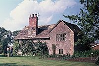
Aston by Budworth Aston by Budworth Aston by Budworth is a civil parish in the unitary authority of Cheshire East and the ceremonial county of Cheshire, England. The main villages in the parish are Arley, which is the site of Arley Hall, and Bate Green. According to the 2001 census the parish had a population of 281.-External links:... |
Civil parish | 281 | Cheshire East Cheshire East Cheshire East is a unitary authority area with borough status in the ceremonial county of Cheshire, England.The borough was established in April 2009 as part of the 2009 structural changes to local government in England, by virtue of an order under the Local Government and Public Involvement in... |
Bucklow Rural District Bucklow Rural District Bucklow Rural District was, from 1894 to 1974, a local government district in the north of the administrative county of Cheshire, England. Following the Local Government Act 1972, this rural district was split between the new Greater Manchester boroughs of Trafford and Manchester, and Macclesfield,... |
|
| Aston juxta Mondrum Aston juxta Mondrum Aston juxta Mondrum is a village and civil parish in the unitary authority of Cheshire East and the ceremonial county of Cheshire, England. It is about four miles north of Nantwich. The civil parish also includes part of Worleston village.-History:... |
Civil parish | 133 | Cheshire East Cheshire East Cheshire East is a unitary authority area with borough status in the ceremonial county of Cheshire, England.The borough was established in April 2009 as part of the 2009 structural changes to local government in England, by virtue of an order under the Local Government and Public Involvement in... |
Nantwich Rural District Nantwich Rural District Nantwich Rural District was a division of Cheshire until 1974, when it merged with the Nantwich and Crewe Urban districts to create the borough of Crewe and Nantwich.... |
|
|
| Audlem Audlem Audlem is a large village and civil parish located in the unitary authority of Cheshire East and the ceremonial county of Cheshire in the north west of England, approximately south of Nantwich. Close to the border with the neighbouring county of Shropshire, the village is eight miles east of... |
Civil parish | 1,790 | Cheshire East Cheshire East Cheshire East is a unitary authority area with borough status in the ceremonial county of Cheshire, England.The borough was established in April 2009 as part of the 2009 structural changes to local government in England, by virtue of an order under the Local Government and Public Involvement in... |
Nantwich Rural District Nantwich Rural District Nantwich Rural District was a division of Cheshire until 1974, when it merged with the Nantwich and Crewe Urban districts to create the borough of Crewe and Nantwich.... |
|
|
| Austerson | Civil parish | 145 | Cheshire East Cheshire East Cheshire East is a unitary authority area with borough status in the ceremonial county of Cheshire, England.The borough was established in April 2009 as part of the 2009 structural changes to local government in England, by virtue of an order under the Local Government and Public Involvement in... |
Nantwich Rural District Nantwich Rural District Nantwich Rural District was a division of Cheshire until 1974, when it merged with the Nantwich and Crewe Urban districts to create the borough of Crewe and Nantwich.... |
|
|
| Baddiley Baddiley Baddiley is a scattered settlement and civil parish in the unitary authority of Cheshire East and the ceremonial county of Cheshire, England. The civil parish also includes the north-western part of the village of Ravensmoor , as well as the small settlements of Baddiley Hulse, Batterley Hill, and... |
Civil parish | 226 | Cheshire East Cheshire East Cheshire East is a unitary authority area with borough status in the ceremonial county of Cheshire, England.The borough was established in April 2009 as part of the 2009 structural changes to local government in England, by virtue of an order under the Local Government and Public Involvement in... |
Nantwich Rural District Nantwich Rural District Nantwich Rural District was a division of Cheshire until 1974, when it merged with the Nantwich and Crewe Urban districts to create the borough of Crewe and Nantwich.... |
|
|
| Baddington Baddington Baddington is a civil parish in the unitary authority of Cheshire East and the ceremonial county of Cheshire, England, which lies immediately to the south west of Nantwich and north of Audlem... |
Civil parish | 98 | Cheshire East Cheshire East Cheshire East is a unitary authority area with borough status in the ceremonial county of Cheshire, England.The borough was established in April 2009 as part of the 2009 structural changes to local government in England, by virtue of an order under the Local Government and Public Involvement in... |
Nantwich Rural District Nantwich Rural District Nantwich Rural District was a division of Cheshire until 1974, when it merged with the Nantwich and Crewe Urban districts to create the borough of Crewe and Nantwich.... |
|
|
| Barthomley Barthomley Barthomley is a village and ancient parish, and is now a civil parish in the unitary authority of Cheshire East and the ceremonial county of Cheshire, England. According to the 2001 census the parish had a population of 202. The village is situated near junction 16 of the M6 motorway and by the... |
Civil parish | 202 | Cheshire East Cheshire East Cheshire East is a unitary authority area with borough status in the ceremonial county of Cheshire, England.The borough was established in April 2009 as part of the 2009 structural changes to local government in England, by virtue of an order under the Local Government and Public Involvement in... |
Nantwich Rural District Nantwich Rural District Nantwich Rural District was a division of Cheshire until 1974, when it merged with the Nantwich and Crewe Urban districts to create the borough of Crewe and Nantwich.... |
|
|
| Basford Basford, Cheshire Basford is a civil parish in the unitary authority of Cheshire East and the ceremonial county of Cheshire, England, just south of Crewe. According to the 2001 census it had a population of 266.-Governance:... |
Civil parish | 266 | Cheshire East Cheshire East Cheshire East is a unitary authority area with borough status in the ceremonial county of Cheshire, England.The borough was established in April 2009 as part of the 2009 structural changes to local government in England, by virtue of an order under the Local Government and Public Involvement in... |
Nantwich Rural District Nantwich Rural District Nantwich Rural District was a division of Cheshire until 1974, when it merged with the Nantwich and Crewe Urban districts to create the borough of Crewe and Nantwich.... |
|
|
| Batherton Batherton Batherton is a hamlet and civil parish in the unitary authority of Cheshire East and the ceremonial county of Cheshire, England. It is just south of Nantwich, and according to the 2001 census had a population of 36.-Governance:... |
Civil parish | 36 | Cheshire East Cheshire East Cheshire East is a unitary authority area with borough status in the ceremonial county of Cheshire, England.The borough was established in April 2009 as part of the 2009 structural changes to local government in England, by virtue of an order under the Local Government and Public Involvement in... |
Nantwich Rural District Nantwich Rural District Nantwich Rural District was a division of Cheshire until 1974, when it merged with the Nantwich and Crewe Urban districts to create the borough of Crewe and Nantwich.... |
|
|
| Betchton Betchton Betchton is a civil parish in the unitary authority of Cheshire East and the ceremonial county of Cheshire, England. According to the 2001 census it had a population of 620... |
Civil parish | 620 | Cheshire East Cheshire East Cheshire East is a unitary authority area with borough status in the ceremonial county of Cheshire, England.The borough was established in April 2009 as part of the 2009 structural changes to local government in England, by virtue of an order under the Local Government and Public Involvement in... |
Congleton Rural District |
|
|
| Bexton Bexton Bexton is a village and civil parish in the unitary authority of Cheshire East and the ceremonial county of Cheshire, England. According to the 2001 census it had a population of 9. The parish includes Bexton Hall and is to the south of Knutsford.... |
Civil parish | 9 | Cheshire East Cheshire East Cheshire East is a unitary authority area with borough status in the ceremonial county of Cheshire, England.The borough was established in April 2009 as part of the 2009 structural changes to local government in England, by virtue of an order under the Local Government and Public Involvement in... |
Bucklow Rural District Bucklow Rural District Bucklow Rural District was, from 1894 to 1974, a local government district in the north of the administrative county of Cheshire, England. Following the Local Government Act 1972, this rural district was split between the new Greater Manchester boroughs of Trafford and Manchester, and Macclesfield,... |
|
|
| Bickerton Bickerton, Cheshire Bickerton is a village and civil parish in the unitary authority of Cheshire East and the ceremonial county of Cheshire, England, about eight miles north of Whitchurch in Shropshire. The parish also includes the small settlement of Gallantry Bank, with a total population of over 200... |
Civil parish | 234 | Cheshire East Cheshire East Cheshire East is a unitary authority area with borough status in the ceremonial county of Cheshire, England.The borough was established in April 2009 as part of the 2009 structural changes to local government in England, by virtue of an order under the Local Government and Public Involvement in... |
Nantwich Rural District Nantwich Rural District Nantwich Rural District was a division of Cheshire until 1974, when it merged with the Nantwich and Crewe Urban districts to create the borough of Crewe and Nantwich.... |
|
|
| Blakenhall Blakenhall, Cheshire Blakenhall is a village and civil parish in the unitary authority of Cheshire East and the ceremonial county of Cheshire, England, about seven miles south-east of Nantwich... |
Civil parish | 125 | Cheshire East Cheshire East Cheshire East is a unitary authority area with borough status in the ceremonial county of Cheshire, England.The borough was established in April 2009 as part of the 2009 structural changes to local government in England, by virtue of an order under the Local Government and Public Involvement in... |
Nantwich Rural District Nantwich Rural District Nantwich Rural District was a division of Cheshire until 1974, when it merged with the Nantwich and Crewe Urban districts to create the borough of Crewe and Nantwich.... |
|
|
| Bollington Bollington Bollington is a small rural town and civil parish in the county of Cheshire, , England, in the unitary authority of Cheshire East. It is located east of Prestbury. In the Middle Ages it was part of the Earl of Chester's manor of Macclesfield., and the ancient parish of Prestbury... |
Town | 7,095 | Cheshire East Cheshire East Cheshire East is a unitary authority area with borough status in the ceremonial county of Cheshire, England.The borough was established in April 2009 as part of the 2009 structural changes to local government in England, by virtue of an order under the Local Government and Public Involvement in... |
Bollington Urban District Bollington Bollington is a small rural town and civil parish in the county of Cheshire, , England, in the unitary authority of Cheshire East. It is located east of Prestbury. In the Middle Ages it was part of the Earl of Chester's manor of Macclesfield., and the ancient parish of Prestbury... |
|
|
| Bosley Bosley Bosley is a village and civil parish in the unitary authority of Cheshire East and the ceremonial county of Cheshire, England. According to the 2001 census it had a population of 406. The village is on the A523 road about six miles south of Macclesfield... |
Civil parish | 406 | Cheshire East Cheshire East Cheshire East is a unitary authority area with borough status in the ceremonial county of Cheshire, England.The borough was established in April 2009 as part of the 2009 structural changes to local government in England, by virtue of an order under the Local Government and Public Involvement in... |
Macclesfield Rural District Macclesfield Rural District Macclesfield Rural District was a rural district of Cheshire, England from 1894 to 1974. All of it is now part of the borough of Macclesfield.Macclesfield as a Municipal Borough and Bollington as an urban district formed an enclave which was surrounded by Macclesfield RD.The district was formed in... |
|
|
| Bradwall Bradwall Bradwall is a small village and civil parish in the unitary authority of Cheshire East, situated near Sandbach in the ceremonial county of Cheshire, England. According to the 2001 census, the population of the entire parish was 166... |
Civil parish | 166 | Cheshire East Cheshire East Cheshire East is a unitary authority area with borough status in the ceremonial county of Cheshire, England.The borough was established in April 2009 as part of the 2009 structural changes to local government in England, by virtue of an order under the Local Government and Public Involvement in... |
Congleton Rural District |
|
|
| Brereton Brereton, Cheshire Brereton is a civil parish, containing the hamlet of Brereton Green in the unitary authority of Cheshire East and the ceremonial county of Cheshire, England. It also contains the hamlets of Brereton Heath and Smethwick Green. According to the 2001 census, the population of the entire civil parish... |
Civil parish | 1,012 | Cheshire East Cheshire East Cheshire East is a unitary authority area with borough status in the ceremonial county of Cheshire, England.The borough was established in April 2009 as part of the 2009 structural changes to local government in England, by virtue of an order under the Local Government and Public Involvement in... |
Congleton Rural District |
|
|
| Bridgemere Bridgemere Bridgemere is a village and civil parish in the unitary authority of Cheshire East and the ceremonial county of Cheshire, England. It is around south east of Nantwich and west of Stoke-on-Trent. The southern boundary of the parish is on the border with Shropshire... |
Civil parish | 133 | Cheshire East Cheshire East Cheshire East is a unitary authority area with borough status in the ceremonial county of Cheshire, England.The borough was established in April 2009 as part of the 2009 structural changes to local government in England, by virtue of an order under the Local Government and Public Involvement in... |
Nantwich Rural District Nantwich Rural District Nantwich Rural District was a division of Cheshire until 1974, when it merged with the Nantwich and Crewe Urban districts to create the borough of Crewe and Nantwich.... |
|
|
| Brindley Brindley Brindley is a village and civil parish in the unitary authority of Cheshire East and the ceremonial county of Cheshire, England. The village lies 3¾ miles to the west of Nantwich. The parish also includes the settlements of Brindley Lea, Ryders Bank and part of Radmore Green, with a total... |
Civil parish | 134 | Cheshire East Cheshire East Cheshire East is a unitary authority area with borough status in the ceremonial county of Cheshire, England.The borough was established in April 2009 as part of the 2009 structural changes to local government in England, by virtue of an order under the Local Government and Public Involvement in... |
Nantwich Rural District Nantwich Rural District Nantwich Rural District was a division of Cheshire until 1974, when it merged with the Nantwich and Crewe Urban districts to create the borough of Crewe and Nantwich.... |
|
|
| Broomhall Broomhall Green Broomhall Green or Broomhall is a village and civil parish in the unitary authority of Cheshire East and the ceremonial county of Cheshire, England. It includes part of the settlement of Sandford. According to the 2001 Census the parish had a population of 206. The village is about 3½ miles... |
Civil parish | 206 | Cheshire East Cheshire East Cheshire East is a unitary authority area with borough status in the ceremonial county of Cheshire, England.The borough was established in April 2009 as part of the 2009 structural changes to local government in England, by virtue of an order under the Local Government and Public Involvement in... |
Nantwich Rural District Nantwich Rural District Nantwich Rural District was a division of Cheshire until 1974, when it merged with the Nantwich and Crewe Urban districts to create the borough of Crewe and Nantwich.... |
|
|
| Buerton | Civil parish | 492 | Cheshire East Cheshire East Cheshire East is a unitary authority area with borough status in the ceremonial county of Cheshire, England.The borough was established in April 2009 as part of the 2009 structural changes to local government in England, by virtue of an order under the Local Government and Public Involvement in... |
Nantwich Rural District Nantwich Rural District Nantwich Rural District was a division of Cheshire until 1974, when it merged with the Nantwich and Crewe Urban districts to create the borough of Crewe and Nantwich.... |
|
|
| Bulkeley Bulkeley Bulkeley is a village and civil parish in the unitary authority of Cheshire East and the ceremonial county of Cheshire, England. The village is situated at on the A534 about 9 miles west of Nantwich. The civil parish also includes the small settlement of Bulkelehay at , with a total population... |
Civil parish | 240 | Cheshire East Cheshire East Cheshire East is a unitary authority area with borough status in the ceremonial county of Cheshire, England.The borough was established in April 2009 as part of the 2009 structural changes to local government in England, by virtue of an order under the Local Government and Public Involvement in... |
Nantwich Rural District Nantwich Rural District Nantwich Rural District was a division of Cheshire until 1974, when it merged with the Nantwich and Crewe Urban districts to create the borough of Crewe and Nantwich.... |
|
|
| Bunbury Bunbury, Cheshire Bunbury is a village and civil parish in the unitary authority of Cheshire East and the ceremonial county of Cheshire, England, south of Tarporley, north west of Nantwich, and on the Shropshire Union Canal... |
Civil parish | 1,308 | Cheshire East Cheshire East Cheshire East is a unitary authority area with borough status in the ceremonial county of Cheshire, England.The borough was established in April 2009 as part of the 2009 structural changes to local government in England, by virtue of an order under the Local Government and Public Involvement in... |
Nantwich Rural District Nantwich Rural District Nantwich Rural District was a division of Cheshire until 1974, when it merged with the Nantwich and Crewe Urban districts to create the borough of Crewe and Nantwich.... |
|
|
| Burland Burland Burland is a village and civil parish in the unitary authority of Cheshire East and the ceremonial county of Cheshire, England, about 2½ miles west of Nantwich. The civil parish also includes the small settlements of Burland Lower Green, Burland Upper Green, Hollin Green and Stoneley Green, as well... |
Civil parish | 582 | Cheshire East Cheshire East Cheshire East is a unitary authority area with borough status in the ceremonial county of Cheshire, England.The borough was established in April 2009 as part of the 2009 structural changes to local government in England, by virtue of an order under the Local Government and Public Involvement in... |
Nantwich Rural District Nantwich Rural District Nantwich Rural District was a division of Cheshire until 1974, when it merged with the Nantwich and Crewe Urban districts to create the borough of Crewe and Nantwich.... |
|
|
| Calveley Calveley Calveley is a village and civil parish in the unitary authority of Cheshire East and the ceremonial county of Cheshire, England. The village lies 5½ miles to the north west of Nantwich. The parish also includes parts of the settlements of Barrets Green and Wardle Bank. Nearby villages include... |
Civil parish | 269 | Cheshire East Cheshire East Cheshire East is a unitary authority area with borough status in the ceremonial county of Cheshire, England.The borough was established in April 2009 as part of the 2009 structural changes to local government in England, by virtue of an order under the Local Government and Public Involvement in... |
Nantwich Rural District Nantwich Rural District Nantwich Rural District was a division of Cheshire until 1974, when it merged with the Nantwich and Crewe Urban districts to create the borough of Crewe and Nantwich.... |
|
|
| Checkley cum Wrinehill Checkley cum Wrinehill Checkley cum Wrinehill is a civil parish in the unitary authority of Cheshire East and the ceremonial county of Cheshire, England, which lies adjacent to the boundaries with Shropshire and Staffordshire. The hamlet of Checkley lies to the south east of Crewe and to the west of Newcastle-under-Lyme... |
Civil parish | 104 | Cheshire East Cheshire East Cheshire East is a unitary authority area with borough status in the ceremonial county of Cheshire, England.The borough was established in April 2009 as part of the 2009 structural changes to local government in England, by virtue of an order under the Local Government and Public Involvement in... |
Nantwich Rural District Nantwich Rural District Nantwich Rural District was a division of Cheshire until 1974, when it merged with the Nantwich and Crewe Urban districts to create the borough of Crewe and Nantwich.... |
|
|
| Chelford Chelford Chelford is a village and civil parish in the unitary authority of Cheshire East and the ceremonial county of Cheshire, England. It is near to the junction of the A537 and A535 roads, about six miles west of Macclesfield, and six miles south-east of Knutsford. It is served by a small railway... |
Civil parish | 1,254 | Cheshire East Cheshire East Cheshire East is a unitary authority area with borough status in the ceremonial county of Cheshire, England.The borough was established in April 2009 as part of the 2009 structural changes to local government in England, by virtue of an order under the Local Government and Public Involvement in... |
Macclesfield Rural District Macclesfield Rural District Macclesfield Rural District was a rural district of Cheshire, England from 1894 to 1974. All of it is now part of the borough of Macclesfield.Macclesfield as a Municipal Borough and Bollington as an urban district formed an enclave which was surrounded by Macclesfield RD.The district was formed in... |
|
|
| Cholmondeley Cholmondeley, Cheshire Cholmondeley is a civil parish in the unitary authority of Cheshire East and the ceremonial county of Cheshire, England, which lies to the north east of Malpas and to the west of Nantwich. It includes the small settlements of Croxton Green and Dowse Green , with a total population of a little... |
Civil parish | 136 | Cheshire East Cheshire East Cheshire East is a unitary authority area with borough status in the ceremonial county of Cheshire, England.The borough was established in April 2009 as part of the 2009 structural changes to local government in England, by virtue of an order under the Local Government and Public Involvement in... |
Nantwich Rural District Nantwich Rural District Nantwich Rural District was a division of Cheshire until 1974, when it merged with the Nantwich and Crewe Urban districts to create the borough of Crewe and Nantwich.... |
|
|
| Cholmondeston Cholmondeston Cholmondeston is a village and civil parish in the unitary authority of Cheshire East and the ceremonial county of Cheshire, England. The village lies 5 miles to the north west of Nantwich. Nearby villages include Aston juxta Mondrum, Barbridge, Calveley and Wettenhall... |
Civil parish | 153 | Cheshire East Cheshire East Cheshire East is a unitary authority area with borough status in the ceremonial county of Cheshire, England.The borough was established in April 2009 as part of the 2009 structural changes to local government in England, by virtue of an order under the Local Government and Public Involvement in... |
Nantwich Rural District Nantwich Rural District Nantwich Rural District was a division of Cheshire until 1974, when it merged with the Nantwich and Crewe Urban districts to create the borough of Crewe and Nantwich.... |
|
|
| Chorley | Civil parish | 100 | Cheshire East Cheshire East Cheshire East is a unitary authority area with borough status in the ceremonial county of Cheshire, England.The borough was established in April 2009 as part of the 2009 structural changes to local government in England, by virtue of an order under the Local Government and Public Involvement in... |
Nantwich Rural District Nantwich Rural District Nantwich Rural District was a division of Cheshire until 1974, when it merged with the Nantwich and Crewe Urban districts to create the borough of Crewe and Nantwich.... |
|
|
| Chorley | Civil parish | 399 | Cheshire East Cheshire East Cheshire East is a unitary authority area with borough status in the ceremonial county of Cheshire, England.The borough was established in April 2009 as part of the 2009 structural changes to local government in England, by virtue of an order under the Local Government and Public Involvement in... |
Macclesfield Rural District Macclesfield Rural District Macclesfield Rural District was a rural district of Cheshire, England from 1894 to 1974. All of it is now part of the borough of Macclesfield.Macclesfield as a Municipal Borough and Bollington as an urban district formed an enclave which was surrounded by Macclesfield RD.The district was formed in... |
|
|
| Chorlton | Civil parish | 113 | Cheshire East Cheshire East Cheshire East is a unitary authority area with borough status in the ceremonial county of Cheshire, England.The borough was established in April 2009 as part of the 2009 structural changes to local government in England, by virtue of an order under the Local Government and Public Involvement in... |
Nantwich Rural District Nantwich Rural District Nantwich Rural District was a division of Cheshire until 1974, when it merged with the Nantwich and Crewe Urban districts to create the borough of Crewe and Nantwich.... |
|
|
| Church Lawton Church Lawton Church Lawton is a small village and civil parish located in the unitary authority of Cheshire East and the ceremonial county of Cheshire in England... |
Civil parish | 2,201 | Cheshire East Cheshire East Cheshire East is a unitary authority area with borough status in the ceremonial county of Cheshire, England.The borough was established in April 2009 as part of the 2009 structural changes to local government in England, by virtue of an order under the Local Government and Public Involvement in... |
Congleton Rural District |
|
|
| Church Minshull Church Minshull Church Minshull is a village and civil parish in the unitary authority of Cheshire East and the ceremonial county of Cheshire, England. The village is located approximately north west of Crewe and to the west of the River Weaver and the Shropshire Union Canal... |
Civil parish | 431 | Cheshire East Cheshire East Cheshire East is a unitary authority area with borough status in the ceremonial county of Cheshire, England.The borough was established in April 2009 as part of the 2009 structural changes to local government in England, by virtue of an order under the Local Government and Public Involvement in... |
Nantwich Rural District Nantwich Rural District Nantwich Rural District was a division of Cheshire until 1974, when it merged with the Nantwich and Crewe Urban districts to create the borough of Crewe and Nantwich.... |
|
|
| Congleton Congleton Congleton is a town and civil parish in the unitary authority of Cheshire East and the ceremonial county of Cheshire, England, on the banks of the River Dane, to the west of the Macclesfield Canal and 21 miles south of Manchester. It has a population of 25,750.-History:The first settlements in... |
Town | 25,750 | Cheshire East Cheshire East Cheshire East is a unitary authority area with borough status in the ceremonial county of Cheshire, England.The borough was established in April 2009 as part of the 2009 structural changes to local government in England, by virtue of an order under the Local Government and Public Involvement in... |
Congleton Municipal Borough Congleton Congleton is a town and civil parish in the unitary authority of Cheshire East and the ceremonial county of Cheshire, England, on the banks of the River Dane, to the west of the Macclesfield Canal and 21 miles south of Manchester. It has a population of 25,750.-History:The first settlements in... |
|
|
| Coole Pilate Coole Pilate Coole Pilate is a civil parish in the unitary authority of Cheshire East and the ceremonial county of Cheshire, England, which lies to the north of Audlem and to the south of Nantwich. The area is predominantly rural with scattered farms, and a total population of 60 people... |
Civil parish | 60 | Cheshire East Cheshire East Cheshire East is a unitary authority area with borough status in the ceremonial county of Cheshire, England.The borough was established in April 2009 as part of the 2009 structural changes to local government in England, by virtue of an order under the Local Government and Public Involvement in... |
Nantwich Rural District Nantwich Rural District Nantwich Rural District was a division of Cheshire until 1974, when it merged with the Nantwich and Crewe Urban districts to create the borough of Crewe and Nantwich.... |
|
|
| Cranage Cranage Cranage is a village and civil parish in the unitary authority of Cheshire East and the ceremonial county of Cheshire, England. According to the 2001 Official UK Census, the population of the entire civil parish was 1,130.-History:... |
Civil parish | 1,130 | Cheshire East Cheshire East Cheshire East is a unitary authority area with borough status in the ceremonial county of Cheshire, England.The borough was established in April 2009 as part of the 2009 structural changes to local government in England, by virtue of an order under the Local Government and Public Involvement in... |
Congleton Rural District |
|
|
| Crewe Crewe Crewe is a railway town within the unitary authority area of Cheshire East and the ceremonial county of Cheshire, England. According to the 2001 census the urban area had a population of 67,683... |
Unparished area | 48,592 | Cheshire East Cheshire East Cheshire East is a unitary authority area with borough status in the ceremonial county of Cheshire, England.The borough was established in April 2009 as part of the 2009 structural changes to local government in England, by virtue of an order under the Local Government and Public Involvement in... |
Crewe Municipal Borough Crewe Crewe is a railway town within the unitary authority area of Cheshire East and the ceremonial county of Cheshire, England. According to the 2001 census the urban area had a population of 67,683... |
|
|
.jpg) |
Crewe Green Crewe Green Crewe Green is a small village and civil parish in the unitary authority of Cheshire East and the ceremonial county of Cheshire, England. The village lies 1½ miles to the east of the centre of Crewe... |
Civil parish | 140 | Cheshire East Cheshire East Cheshire East is a unitary authority area with borough status in the ceremonial county of Cheshire, England.The borough was established in April 2009 as part of the 2009 structural changes to local government in England, by virtue of an order under the Local Government and Public Involvement in... |
Nantwich Rural District Nantwich Rural District Nantwich Rural District was a division of Cheshire until 1974, when it merged with the Nantwich and Crewe Urban districts to create the borough of Crewe and Nantwich.... |
|
| Disley Disley Disley is a village and civil parish in the unitary authority of Cheshire East and the ceremonial county of Cheshire, England. It is located on the very edge of the Peak District, in the Goyt Valley, very close to the county boundary with Derbyshire at New Mills, and south of Stockport, Greater... |
Civil parish | 4,301 | Cheshire East Cheshire East Cheshire East is a unitary authority area with borough status in the ceremonial county of Cheshire, England.The borough was established in April 2009 as part of the 2009 structural changes to local government in England, by virtue of an order under the Local Government and Public Involvement in... |
Disley Rural District Disley Disley is a village and civil parish in the unitary authority of Cheshire East and the ceremonial county of Cheshire, England. It is located on the very edge of the Peak District, in the Goyt Valley, very close to the county boundary with Derbyshire at New Mills, and south of Stockport, Greater... |
|
|
| Dodcott cum Wilkesley Dodcott cum Wilkesley Dodcott cum Wilkesley is a civil parish in the unitary authority of Cheshire East and the ceremonial county of Cheshire, England. The hamlet of Wilkesley lies 2½ miles to the west of Audlem and 7 miles to the south west of Nantwich. The parish also includes the small settlements of Butterley... |
Civil parish | 380 | Cheshire East Cheshire East Cheshire East is a unitary authority area with borough status in the ceremonial county of Cheshire, England.The borough was established in April 2009 as part of the 2009 structural changes to local government in England, by virtue of an order under the Local Government and Public Involvement in... |
Nantwich Rural District Nantwich Rural District Nantwich Rural District was a division of Cheshire until 1974, when it merged with the Nantwich and Crewe Urban districts to create the borough of Crewe and Nantwich.... |
|
|
 |
Doddington Doddington, Cheshire Doddington is a civil parish in the unitary authority of Cheshire East and the ceremonial county of Cheshire, England, which lies to the north east of Audlem and to the south of Crewe. Nearby villages include Blakenhall, Bridgemere, Checkley, Hatherton, Walgherton and Wybunbury... |
Civil parish | 44 | Cheshire East Cheshire East Cheshire East is a unitary authority area with borough status in the ceremonial county of Cheshire, England.The borough was established in April 2009 as part of the 2009 structural changes to local government in England, by virtue of an order under the Local Government and Public Involvement in... |
Nantwich Rural District Nantwich Rural District Nantwich Rural District was a division of Cheshire until 1974, when it merged with the Nantwich and Crewe Urban districts to create the borough of Crewe and Nantwich.... |
|
| Eaton | Civil parish | 289 | Cheshire East Cheshire East Cheshire East is a unitary authority area with borough status in the ceremonial county of Cheshire, England.The borough was established in April 2009 as part of the 2009 structural changes to local government in England, by virtue of an order under the Local Government and Public Involvement in... |
Macclesfield Rural District Macclesfield Rural District Macclesfield Rural District was a rural district of Cheshire, England from 1894 to 1974. All of it is now part of the borough of Macclesfield.Macclesfield as a Municipal Borough and Bollington as an urban district formed an enclave which was surrounded by Macclesfield RD.The district was formed in... |
|
|
| Edleston Edleston Edleston is a civil parish in the unitary authority of Cheshire East and the ceremonial county of Cheshire, England, which lies immediately to the south west of Nantwich. For administrative purposes, it is combined with adjacent civil parishes of Acton and Henhull to form a total area of 765 hectares... |
Civil parish | 53 | Cheshire East Cheshire East Cheshire East is a unitary authority area with borough status in the ceremonial county of Cheshire, England.The borough was established in April 2009 as part of the 2009 structural changes to local government in England, by virtue of an order under the Local Government and Public Involvement in... |
Nantwich Rural District Nantwich Rural District Nantwich Rural District was a division of Cheshire until 1974, when it merged with the Nantwich and Crewe Urban districts to create the borough of Crewe and Nantwich.... |
|
|
| Egerton Egerton, Cheshire Egerton is a civil parish in the unitary authority of Cheshire East and the ceremonial county of Cheshire, England. A largely rural area, the parish includes the small settlement of Egerton Green , which lies 3¾ miles to the north east of Malpas and 8 miles to the west of Nantwich, as well as Fairy... |
Civil parish | 81 | Cheshire East Cheshire East Cheshire East is a unitary authority area with borough status in the ceremonial county of Cheshire, England.The borough was established in April 2009 as part of the 2009 structural changes to local government in England, by virtue of an order under the Local Government and Public Involvement in... |
Nantwich Rural District Nantwich Rural District Nantwich Rural District was a division of Cheshire until 1974, when it merged with the Nantwich and Crewe Urban districts to create the borough of Crewe and Nantwich.... |
|
|
| Faddiley Faddiley Faddiley is a small village and civil parish in the unitary authority of Cheshire East and the ceremonial county of Cheshire, England. The village is located 4 miles to the west of Nantwich. The parish also includes the small settlements of Larden Green and Woodhey or Woodhey Green, with a total... |
Civil parish | 163 | Cheshire East Cheshire East Cheshire East is a unitary authority area with borough status in the ceremonial county of Cheshire, England.The borough was established in April 2009 as part of the 2009 structural changes to local government in England, by virtue of an order under the Local Government and Public Involvement in... |
Nantwich Rural District Nantwich Rural District Nantwich Rural District was a division of Cheshire until 1974, when it merged with the Nantwich and Crewe Urban districts to create the borough of Crewe and Nantwich.... |
|
|
| Gawsworth Gawsworth Gawsworth is a civil parish and village in the unitary authority of Cheshire East and the ceremonial county of Cheshire, England. It is one of the eight ancient parishes of Macclesfield Hundred. Twenty acres of the civil parish were transferred to Macclesfield civil parish in 1936The country houses... |
Civil parish | 1,673 | Cheshire East Cheshire East Cheshire East is a unitary authority area with borough status in the ceremonial county of Cheshire, England.The borough was established in April 2009 as part of the 2009 structural changes to local government in England, by virtue of an order under the Local Government and Public Involvement in... |
Macclesfield Rural District Macclesfield Rural District Macclesfield Rural District was a rural district of Cheshire, England from 1894 to 1974. All of it is now part of the borough of Macclesfield.Macclesfield as a Municipal Borough and Bollington as an urban district formed an enclave which was surrounded by Macclesfield RD.The district was formed in... |
|
|
| Goostrey Goostrey Goostrey is an old farming village and civil parish in the unitary authority of Cheshire East and the ceremonial county of Cheshire, England. It is located off Junction 18 of the M6 motorway, near Jodrell Bank Observatory. According to the 2001 Census, the civil parish had a total population of... |
Civil parish | 2,201 | Cheshire East Cheshire East Cheshire East is a unitary authority area with borough status in the ceremonial county of Cheshire, England.The borough was established in April 2009 as part of the 2009 structural changes to local government in England, by virtue of an order under the Local Government and Public Involvement in... |
Congleton Rural District |
|
|
| Great Warford Great Warford Great Warford is a small village and civil parish in the unitary authority of Cheshire East and the ceremonial county of Cheshire, England.... |
Civil parish | 615 | Cheshire East Cheshire East Cheshire East is a unitary authority area with borough status in the ceremonial county of Cheshire, England.The borough was established in April 2009 as part of the 2009 structural changes to local government in England, by virtue of an order under the Local Government and Public Involvement in... |
Macclesfield Rural District Macclesfield Rural District Macclesfield Rural District was a rural district of Cheshire, England from 1894 to 1974. All of it is now part of the borough of Macclesfield.Macclesfield as a Municipal Borough and Bollington as an urban district formed an enclave which was surrounded by Macclesfield RD.The district was formed in... |
|
|
| Hankelow Hankelow Hankelow is a village and civil parish in the unitary authority of Cheshire East and the ceremonial county of Cheshire, England. It used to be a township within the township of Audlem, one mile away on the Nantwich Road. According to the 2001 Census, the parish had a population of 272.Hankelow is... |
Civil parish | 272 | Cheshire East Cheshire East Cheshire East is a unitary authority area with borough status in the ceremonial county of Cheshire, England.The borough was established in April 2009 as part of the 2009 structural changes to local government in England, by virtue of an order under the Local Government and Public Involvement in... |
Nantwich Rural District Nantwich Rural District Nantwich Rural District was a division of Cheshire until 1974, when it merged with the Nantwich and Crewe Urban districts to create the borough of Crewe and Nantwich.... |
|
|
| Haslington Haslington Haslington is a village and civil parish in the unitary authority of Cheshire East and the ceremonial county of Cheshire, England. It lies about 2 miles north-east of the much larger railway town of Crewe and approximately 4 miles south of Sandbach... |
Civil parish | 6,781 | Cheshire East Cheshire East Cheshire East is a unitary authority area with borough status in the ceremonial county of Cheshire, England.The borough was established in April 2009 as part of the 2009 structural changes to local government in England, by virtue of an order under the Local Government and Public Involvement in... |
Nantwich Rural District Nantwich Rural District Nantwich Rural District was a division of Cheshire until 1974, when it merged with the Nantwich and Crewe Urban districts to create the borough of Crewe and Nantwich.... |
|
|
| Hassall Hassall Hassall is a village and civil parish in the Borough of Cheshire East and the ceremonial county of Cheshire, England. The civil parish contains the very small hamlet of Day Green. According to the 2001 Official UK Census, the population was 281.... |
Civil parish | 281 | Cheshire East Cheshire East Cheshire East is a unitary authority area with borough status in the ceremonial county of Cheshire, England.The borough was established in April 2009 as part of the 2009 structural changes to local government in England, by virtue of an order under the Local Government and Public Involvement in... |
Congleton Rural District |
|
|
| Hatherton Hatherton, Cheshire Hatherton is a hamlet and civil parish in the unitary authority of Cheshire East and the ceremonial county of Cheshire, England. The hamlet is located 2¾ miles to the north east of Audlem and 3¾ miles to the south east of Nantwich. The parish also includes the small settlements of Birchall Moss,... |
Civil parish | 344 | Cheshire East Cheshire East Cheshire East is a unitary authority area with borough status in the ceremonial county of Cheshire, England.The borough was established in April 2009 as part of the 2009 structural changes to local government in England, by virtue of an order under the Local Government and Public Involvement in... |
Nantwich Rural District Nantwich Rural District Nantwich Rural District was a division of Cheshire until 1974, when it merged with the Nantwich and Crewe Urban districts to create the borough of Crewe and Nantwich.... |
|
|
| Haughton Haughton, Cheshire Haughton is a village and civil parish which lies northwest of Nantwich in the unitary authority of Cheshire East and the ceremonial county of Cheshire, England... |
Civil parish | 223 | Cheshire East Cheshire East Cheshire East is a unitary authority area with borough status in the ceremonial county of Cheshire, England.The borough was established in April 2009 as part of the 2009 structural changes to local government in England, by virtue of an order under the Local Government and Public Involvement in... |
Nantwich Rural District Nantwich Rural District Nantwich Rural District was a division of Cheshire until 1974, when it merged with the Nantwich and Crewe Urban districts to create the borough of Crewe and Nantwich.... |
|
|
| Henbury Henbury, Cheshire Henbury is a village and civil parish in the unitary authority of Cheshire East and the ceremonial county of Cheshire, England. According to the 2001 census, the entire civil parish had a population of 594.... |
Civil parish | 594 | Cheshire East Cheshire East Cheshire East is a unitary authority area with borough status in the ceremonial county of Cheshire, England.The borough was established in April 2009 as part of the 2009 structural changes to local government in England, by virtue of an order under the Local Government and Public Involvement in... |
Macclesfield Rural District Macclesfield Rural District Macclesfield Rural District was a rural district of Cheshire, England from 1894 to 1974. All of it is now part of the borough of Macclesfield.Macclesfield as a Municipal Borough and Bollington as an urban district formed an enclave which was surrounded by Macclesfield RD.The district was formed in... |
|
|
| Henhull Henhull Henhull is a civil parish in the unitary authority of Cheshire East and the ceremonial county of Cheshire, England, which lies to the north west of Nantwich. For administrative purposes, it is combined with adjacent civil parishes of Acton and Edleston to form a total area of 765 hectares... |
Civil parish | 71 | Cheshire East Cheshire East Cheshire East is a unitary authority area with borough status in the ceremonial county of Cheshire, England.The borough was established in April 2009 as part of the 2009 structural changes to local government in England, by virtue of an order under the Local Government and Public Involvement in... |
Nantwich Rural District Nantwich Rural District Nantwich Rural District was a division of Cheshire until 1974, when it merged with the Nantwich and Crewe Urban districts to create the borough of Crewe and Nantwich.... |
|
|
| High Legh High Legh High Legh is a village and civil parish in the unitary authority of Cheshire East and the ceremonial county of Cheshire, England. It lies six miles north west of Knutsford, seven miles east of Warrington and seventeen miles south west of Manchester City Centre.... |
Civil parish | 1,632 | Cheshire East Cheshire East Cheshire East is a unitary authority area with borough status in the ceremonial county of Cheshire, England.The borough was established in April 2009 as part of the 2009 structural changes to local government in England, by virtue of an order under the Local Government and Public Involvement in... |
Bucklow Rural District Bucklow Rural District Bucklow Rural District was, from 1894 to 1974, a local government district in the north of the administrative county of Cheshire, England. Following the Local Government Act 1972, this rural district was split between the new Greater Manchester boroughs of Trafford and Manchester, and Macclesfield,... |
|
|
| Higher Hurdsfield Higher Hurdsfield Higher Hurdsfield is a village and civil parish in the unitary authority of Cheshire East and the ceremonial county of Cheshire, England. It has a population of around 300, and is situated on the eastern outskirts of Macclesfield around 7 miles from the border of Derbyshire and Cheshire. The... |
Civil parish | 688 | Cheshire East Cheshire East Cheshire East is a unitary authority area with borough status in the ceremonial county of Cheshire, England.The borough was established in April 2009 as part of the 2009 structural changes to local government in England, by virtue of an order under the Local Government and Public Involvement in... |
Macclesfield Rural District Macclesfield Rural District Macclesfield Rural District was a rural district of Cheshire, England from 1894 to 1974. All of it is now part of the borough of Macclesfield.Macclesfield as a Municipal Borough and Bollington as an urban district formed an enclave which was surrounded by Macclesfield RD.The district was formed in... |
|
|
| Holmes Chapel Holmes Chapel Holmes Chapel is a village and civil parish in the unitary authority of Cheshire East and the ceremonial county of Cheshire, England. Until 1974 the parish was known as Church Hulme.At the 2001 Census the population of the village was recorded as 5,669... |
Civil parish | 5,669 | Cheshire East Cheshire East Cheshire East is a unitary authority area with borough status in the ceremonial county of Cheshire, England.The borough was established in April 2009 as part of the 2009 structural changes to local government in England, by virtue of an order under the Local Government and Public Involvement in... |
Congleton Rural District |
|
|
| Hough Hough, Cheshire Hough is a village and civil parish in the unitary authority of Cheshire East and the ceremonial county of Cheshire, England. The village is located 3 miles to the south of Crewe and 4 miles to the east of Nantwich. The parish also includes part of the settlement of Goodalls Corner. The total... |
Civil parish | 783 | Cheshire East Cheshire East Cheshire East is a unitary authority area with borough status in the ceremonial county of Cheshire, England.The borough was established in April 2009 as part of the 2009 structural changes to local government in England, by virtue of an order under the Local Government and Public Involvement in... |
Nantwich Rural District Nantwich Rural District Nantwich Rural District was a division of Cheshire until 1974, when it merged with the Nantwich and Crewe Urban districts to create the borough of Crewe and Nantwich.... |
|
|
| Hulme Walfield Hulme Walfield Hulme Walfield is a small village and civil parish, just north of Congleton, in the unitary authority of Cheshire East and the ceremonial county of Cheshire. It is home to most of Westlow Mere... |
Civil parish | 140 | Cheshire East Cheshire East Cheshire East is a unitary authority area with borough status in the ceremonial county of Cheshire, England.The borough was established in April 2009 as part of the 2009 structural changes to local government in England, by virtue of an order under the Local Government and Public Involvement in... |
Congleton Rural District |
|
|
| Hunsterson Hunsterson Hunsterson is a hamlet and civil parish in the unitary authority of Cheshire East and the ceremonial county of Cheshire, England. The hamlet is located 2¾ miles to the north east of Audlem and 6 miles to the south of Crewe. The parish also includes the settlements of Brown Moss, Four Lane End,... |
Civil parish | 156 | Cheshire East Cheshire East Cheshire East is a unitary authority area with borough status in the ceremonial county of Cheshire, England.The borough was established in April 2009 as part of the 2009 structural changes to local government in England, by virtue of an order under the Local Government and Public Involvement in... |
Nantwich Rural District Nantwich Rural District Nantwich Rural District was a division of Cheshire until 1974, when it merged with the Nantwich and Crewe Urban districts to create the borough of Crewe and Nantwich.... |
|
|
| Hurleston Hurleston Hurleston is a civil parish in the unitary authority of Cheshire East and the ceremonial county of Cheshire, England, which lies to the north west of Nantwich. The parish is predominantly rural with scattered farms and buildings and no settlements... |
Civil parish | 64 | Cheshire East Cheshire East Cheshire East is a unitary authority area with borough status in the ceremonial county of Cheshire, England.The borough was established in April 2009 as part of the 2009 structural changes to local government in England, by virtue of an order under the Local Government and Public Involvement in... |
Nantwich Rural District Nantwich Rural District Nantwich Rural District was a division of Cheshire until 1974, when it merged with the Nantwich and Crewe Urban districts to create the borough of Crewe and Nantwich.... |
|
|
 |
Kettleshulme Kettleshulme Kettleshulme is a small village and civil parish in the unitary authority of Cheshire East and the ceremonial county of Cheshire, England. The village is close to the border with Derbyshire, on the B5470 road from Whaley Bridge to Macclesfield, in the valley of the Todd Brook, a tributary of the... |
Civil parish | 315 | Cheshire East Cheshire East Cheshire East is a unitary authority area with borough status in the ceremonial county of Cheshire, England.The borough was established in April 2009 as part of the 2009 structural changes to local government in England, by virtue of an order under the Local Government and Public Involvement in... |
Macclesfield Rural District Macclesfield Rural District Macclesfield Rural District was a rural district of Cheshire, England from 1894 to 1974. All of it is now part of the borough of Macclesfield.Macclesfield as a Municipal Borough and Bollington as an urban district formed an enclave which was surrounded by Macclesfield RD.The district was formed in... |
|
| Knutsford Knutsford Knutsford is a town and civil parish in the unitary authority area of Cheshire East and the ceremonial county of Cheshire, in North West England... |
Town | 12,656 | Cheshire East Cheshire East Cheshire East is a unitary authority area with borough status in the ceremonial county of Cheshire, England.The borough was established in April 2009 as part of the 2009 structural changes to local government in England, by virtue of an order under the Local Government and Public Involvement in... |
Knutsford Urban District Knutsford Knutsford is a town and civil parish in the unitary authority area of Cheshire East and the ceremonial county of Cheshire, in North West England... |
|
|
| Lea Lea, Cheshire Lea is a civil parish in the unitary authority of Cheshire East and the ceremonial county of Cheshire, England, which lies to the north east of Audlem and to the south of Crewe. The parish is predominantly rural, but it includes the hamlet of Lea Forge... |
Civil parish | 25 | Cheshire East Cheshire East Cheshire East is a unitary authority area with borough status in the ceremonial county of Cheshire, England.The borough was established in April 2009 as part of the 2009 structural changes to local government in England, by virtue of an order under the Local Government and Public Involvement in... |
Nantwich Rural District Nantwich Rural District Nantwich Rural District was a division of Cheshire until 1974, when it merged with the Nantwich and Crewe Urban districts to create the borough of Crewe and Nantwich.... |
|
|
| Leighton Leighton, Cheshire Leighton is a scattered settlement and civil parish in the unitary authority of Cheshire East and the ceremonial county of Cheshire, England, which lies immediately north west of Crewe. The parish also includes the village of Barrows Green , which lies on the northern outskirts of Crewe, 1½ miles... |
Civil parish | 4,863 | Cheshire East Cheshire East Cheshire East is a unitary authority area with borough status in the ceremonial county of Cheshire, England.The borough was established in April 2009 as part of the 2009 structural changes to local government in England, by virtue of an order under the Local Government and Public Involvement in... |
Nantwich Rural District Nantwich Rural District Nantwich Rural District was a division of Cheshire until 1974, when it merged with the Nantwich and Crewe Urban districts to create the borough of Crewe and Nantwich.... |
|
|
| Little Bollington Little Bollington Little Bollington is a village and civil parish in the unitary authority of Cheshire East and the ceremonial county of Cheshire, England. The Bridgewater Canal runs through the western side of the parish from south-west to north, and Dunham Park lies to the north east of the parish, across the... |
Civil parish | 162 | Cheshire East Cheshire East Cheshire East is a unitary authority area with borough status in the ceremonial county of Cheshire, England.The borough was established in April 2009 as part of the 2009 structural changes to local government in England, by virtue of an order under the Local Government and Public Involvement in... |
Bucklow Rural District Bucklow Rural District Bucklow Rural District was, from 1894 to 1974, a local government district in the north of the administrative county of Cheshire, England. Following the Local Government Act 1972, this rural district was split between the new Greater Manchester boroughs of Trafford and Manchester, and Macclesfield,... |
|
|
| Little Warford Little Warford Little Warford is a village and civil parish in the unitary authority of Cheshire East and the ceremonial county of Cheshire, England. It has a population of 275. The parish contains the The David Lewis Centre, a charity set up by David Lewis, the founder of Lewis's... |
Civil parish | 275 | Cheshire East Cheshire East Cheshire East is a unitary authority area with borough status in the ceremonial county of Cheshire, England.The borough was established in April 2009 as part of the 2009 structural changes to local government in England, by virtue of an order under the Local Government and Public Involvement in... |
Bucklow Rural District Bucklow Rural District Bucklow Rural District was, from 1894 to 1974, a local government district in the north of the administrative county of Cheshire, England. Following the Local Government Act 1972, this rural district was split between the new Greater Manchester boroughs of Trafford and Manchester, and Macclesfield,... |
|
|
| Lower Withington Lower Withington Lower Withington is a civil parish and village in the unitary authority of Cheshire East and the ceremonial county of Cheshire, England. At the 2001 census, it had a total population of 492... |
Civil parish | 492 | Cheshire East Cheshire East Cheshire East is a unitary authority area with borough status in the ceremonial county of Cheshire, England.The borough was established in April 2009 as part of the 2009 structural changes to local government in England, by virtue of an order under the Local Government and Public Involvement in... |
Macclesfield Rural District Macclesfield Rural District Macclesfield Rural District was a rural district of Cheshire, England from 1894 to 1974. All of it is now part of the borough of Macclesfield.Macclesfield as a Municipal Borough and Bollington as an urban district formed an enclave which was surrounded by Macclesfield RD.The district was formed in... |
|
|
| Lyme Handley | Civil parish | 151 | Cheshire East Cheshire East Cheshire East is a unitary authority area with borough status in the ceremonial county of Cheshire, England.The borough was established in April 2009 as part of the 2009 structural changes to local government in England, by virtue of an order under the Local Government and Public Involvement in... |
Macclesfield Rural District Macclesfield Rural District Macclesfield Rural District was a rural district of Cheshire, England from 1894 to 1974. All of it is now part of the borough of Macclesfield.Macclesfield as a Municipal Borough and Bollington as an urban district formed an enclave which was surrounded by Macclesfield RD.The district was formed in... |
|
|
| Macclesfield Macclesfield Macclesfield is a market town within the unitary authority of Cheshire East, the county palatine of Chester, also known as the ceremonial county of Cheshire, England. The population of the Macclesfield urban sub-area at the time of the 2001 census was 50,688... |
Unparished area | 49,531 | Cheshire East Cheshire East Cheshire East is a unitary authority area with borough status in the ceremonial county of Cheshire, England.The borough was established in April 2009 as part of the 2009 structural changes to local government in England, by virtue of an order under the Local Government and Public Involvement in... |
Macclesfield Municipal Borough Macclesfield Macclesfield is a market town within the unitary authority of Cheshire East, the county palatine of Chester, also known as the ceremonial county of Cheshire, England. The population of the Macclesfield urban sub-area at the time of the 2001 census was 50,688... |
|
|
| Macclesfield Forest and Wildboarclough Macclesfield Forest and Wildboarclough Macclesfield Forest and Wildboarclough is a civil parish in the unitary authority of Cheshire East and the ceremonial county of Cheshire, England. It lies on the western fringe of the Peak District National park.... |
Civil parish | 201 | Cheshire East Cheshire East Cheshire East is a unitary authority area with borough status in the ceremonial county of Cheshire, England.The borough was established in April 2009 as part of the 2009 structural changes to local government in England, by virtue of an order under the Local Government and Public Involvement in... |
Macclesfield Rural District Macclesfield Rural District Macclesfield Rural District was a rural district of Cheshire, England from 1894 to 1974. All of it is now part of the borough of Macclesfield.Macclesfield as a Municipal Borough and Bollington as an urban district formed an enclave which was surrounded by Macclesfield RD.The district was formed in... |
|
|
| Marbury cum Quoisley | Civil parish | 244 | Cheshire East Cheshire East Cheshire East is a unitary authority area with borough status in the ceremonial county of Cheshire, England.The borough was established in April 2009 as part of the 2009 structural changes to local government in England, by virtue of an order under the Local Government and Public Involvement in... |
Nantwich Rural District Nantwich Rural District Nantwich Rural District was a division of Cheshire until 1974, when it merged with the Nantwich and Crewe Urban districts to create the borough of Crewe and Nantwich.... |
|
|
| Marthall Marthall Marthall is a village in the unitary authority of Cheshire East and the ceremonial county of Cheshire, England. It is around 3 miles from Knutsford.... |
Civil parish | 165 | Cheshire East Cheshire East Cheshire East is a unitary authority area with borough status in the ceremonial county of Cheshire, England.The borough was established in April 2009 as part of the 2009 structural changes to local government in England, by virtue of an order under the Local Government and Public Involvement in... |
Bucklow Rural District Bucklow Rural District Bucklow Rural District was, from 1894 to 1974, a local government district in the north of the administrative county of Cheshire, England. Following the Local Government Act 1972, this rural district was split between the new Greater Manchester boroughs of Trafford and Manchester, and Macclesfield,... |
|
|
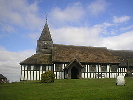 |
Marton Marton, Cheshire Marton, Cheshire is a small village and civil parish in the unitary authority of Cheshire East and the ceremonial county of Cheshire, England on the A34 road 3 miles north of Congleton .... |
Civil parish | 222 | Cheshire East Cheshire East Cheshire East is a unitary authority area with borough status in the ceremonial county of Cheshire, England.The borough was established in April 2009 as part of the 2009 structural changes to local government in England, by virtue of an order under the Local Government and Public Involvement in... |
Macclesfield Rural District Macclesfield Rural District Macclesfield Rural District was a rural district of Cheshire, England from 1894 to 1974. All of it is now part of the borough of Macclesfield.Macclesfield as a Municipal Borough and Bollington as an urban district formed an enclave which was surrounded by Macclesfield RD.The district was formed in... |
|
| Mere Mere, Cheshire Mere is a civil parish and linear village along the A556 road in the unitary authority of Cheshire East and the ceremonial county of Cheshire, North West England, about south-west of Altrincham. Bucklow Hill is at its northeast end, and the Mere crossroads is at the far end. The village of Mere is... |
Civil parish | 601 | Cheshire East Cheshire East Cheshire East is a unitary authority area with borough status in the ceremonial county of Cheshire, England.The borough was established in April 2009 as part of the 2009 structural changes to local government in England, by virtue of an order under the Local Government and Public Involvement in... |
Bucklow Rural District Bucklow Rural District Bucklow Rural District was, from 1894 to 1974, a local government district in the north of the administrative county of Cheshire, England. Following the Local Government Act 1972, this rural district was split between the new Greater Manchester boroughs of Trafford and Manchester, and Macclesfield,... |
|
|
| Middlewich Middlewich Middlewich is a market town in the unitary authority of Cheshire East and the ceremonial county of Cheshire, England. It is east of the city of Chester, east of Winsford, southeast of Northwich and northwest of Sandbach.... |
Town | 13,101 | Cheshire East Cheshire East Cheshire East is a unitary authority area with borough status in the ceremonial county of Cheshire, England.The borough was established in April 2009 as part of the 2009 structural changes to local government in England, by virtue of an order under the Local Government and Public Involvement in... |
Middlewich Urban District Middlewich Middlewich is a market town in the unitary authority of Cheshire East and the ceremonial county of Cheshire, England. It is east of the city of Chester, east of Winsford, southeast of Northwich and northwest of Sandbach.... |
|
|
| Millington Millington, Cheshire Millington is a civil parish in the Borough of Cheshire East in England. It has a population of 244.-External links:... |
Civil parish | 244 | Cheshire East Cheshire East Cheshire East is a unitary authority area with borough status in the ceremonial county of Cheshire, England.The borough was established in April 2009 as part of the 2009 structural changes to local government in England, by virtue of an order under the Local Government and Public Involvement in... |
Bucklow Rural District Bucklow Rural District Bucklow Rural District was, from 1894 to 1974, a local government district in the north of the administrative county of Cheshire, England. Following the Local Government Act 1972, this rural district was split between the new Greater Manchester boroughs of Trafford and Manchester, and Macclesfield,... |
|
|
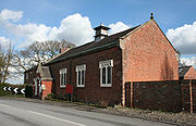 |
Minshull Vernon Minshull Vernon Minshull Vernon is a hamlet and civil parish in the unitary authority of Cheshire East and the ceremonial county of Cheshire, England. The hamlet lies to the north west of Crewe, south east of Winsford and south west of Middlewich. The parish also includes the small settlements of Bradfield Green,... |
Civil parish | 224 | Cheshire East Cheshire East Cheshire East is a unitary authority area with borough status in the ceremonial county of Cheshire, England.The borough was established in April 2009 as part of the 2009 structural changes to local government in England, by virtue of an order under the Local Government and Public Involvement in... |
Nantwich Rural District Nantwich Rural District Nantwich Rural District was a division of Cheshire until 1974, when it merged with the Nantwich and Crewe Urban districts to create the borough of Crewe and Nantwich.... |
|
| Mobberley Mobberley Mobberley is a semi-rural village and civil parish in the unitary authority of Cheshire East and the ceremonial county of Cheshire, situated between Wilmslow and Knutsford. Mobberley railway station lies on the Manchester to Northwich and Chester line and was opened on 12 May, 1862 by the Cheshire... |
Civil parish | 2,546 | Cheshire East Cheshire East Cheshire East is a unitary authority area with borough status in the ceremonial county of Cheshire, England.The borough was established in April 2009 as part of the 2009 structural changes to local government in England, by virtue of an order under the Local Government and Public Involvement in... |
Bucklow Rural District Bucklow Rural District Bucklow Rural District was, from 1894 to 1974, a local government district in the north of the administrative county of Cheshire, England. Following the Local Government Act 1972, this rural district was split between the new Greater Manchester boroughs of Trafford and Manchester, and Macclesfield,... |
|
|
| Moreton cum Alcumlow Moreton cum Alcumlow Moreton cum Alcumlow is a small civil parish in the unitary authority of Cheshire East and the ceremonial county of Cheshire, England. In the census of 2001 it was recorded as having a population of 150... |
Civil parish | 150 | Cheshire East Cheshire East Cheshire East is a unitary authority area with borough status in the ceremonial county of Cheshire, England.The borough was established in April 2009 as part of the 2009 structural changes to local government in England, by virtue of an order under the Local Government and Public Involvement in... |
Congleton Rural District |
|
|
| Moston | Civil parish | 375 | Cheshire East Cheshire East Cheshire East is a unitary authority area with borough status in the ceremonial county of Cheshire, England.The borough was established in April 2009 as part of the 2009 structural changes to local government in England, by virtue of an order under the Local Government and Public Involvement in... |
Congleton Rural District |
|
|
| Mottram St Andrew | Civil parish | 629 | Cheshire East Cheshire East Cheshire East is a unitary authority area with borough status in the ceremonial county of Cheshire, England.The borough was established in April 2009 as part of the 2009 structural changes to local government in England, by virtue of an order under the Local Government and Public Involvement in... |
Macclesfield Rural District Macclesfield Rural District Macclesfield Rural District was a rural district of Cheshire, England from 1894 to 1974. All of it is now part of the borough of Macclesfield.Macclesfield as a Municipal Borough and Bollington as an urban district formed an enclave which was surrounded by Macclesfield RD.The district was formed in... |
|
|
| Nantwich Nantwich Nantwich is a market town and civil parish in the Borough of Cheshire East and the ceremonial county of Cheshire, England. The town gives its name to the parliamentary constituency of Crewe and Nantwich... |
Town | 12,515 | Cheshire East Cheshire East Cheshire East is a unitary authority area with borough status in the ceremonial county of Cheshire, England.The borough was established in April 2009 as part of the 2009 structural changes to local government in England, by virtue of an order under the Local Government and Public Involvement in... |
Nantwich Urban District Nantwich Nantwich is a market town and civil parish in the Borough of Cheshire East and the ceremonial county of Cheshire, England. The town gives its name to the parliamentary constituency of Crewe and Nantwich... |
|
|
| Nether Alderley Nether Alderley Nether Alderley is a village and civil parish in the unitary authority of Cheshire East and the ceremonial county of Cheshire, England. It lies on the A34 road about a mile and a half south of Alderley Edge.... |
Civil parish | 571 | Cheshire East Cheshire East Cheshire East is a unitary authority area with borough status in the ceremonial county of Cheshire, England.The borough was established in April 2009 as part of the 2009 structural changes to local government in England, by virtue of an order under the Local Government and Public Involvement in... |
Macclesfield Rural District Macclesfield Rural District Macclesfield Rural District was a rural district of Cheshire, England from 1894 to 1974. All of it is now part of the borough of Macclesfield.Macclesfield as a Municipal Borough and Bollington as an urban district formed an enclave which was surrounded by Macclesfield RD.The district was formed in... |
|
|
| Newbold Astbury Newbold Astbury thumb|AstburyNewbold Astbury is a village and civil parish in the unitary authority of Cheshire East and the ceremonial county of Cheshire, in the north-west of England. It is situated to the south of Congleton on the A34 road to Scholar Green; the A34 forms one side of the triangular village green... |
Civil parish | 475 | Cheshire East Cheshire East Cheshire East is a unitary authority area with borough status in the ceremonial county of Cheshire, England.The borough was established in April 2009 as part of the 2009 structural changes to local government in England, by virtue of an order under the Local Government and Public Involvement in... |
Congleton Rural District |
|
|
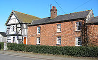 |
Newhall Newhall, Cheshire Newhall is a village and civil parish in the unitary authority of Cheshire East and the ceremonial county of Cheshire, England. The village lies 3½ miles to the west of Audlem and 5 miles to the south west of Nantwich... |
Civil parish | 669 | Cheshire East Cheshire East Cheshire East is a unitary authority area with borough status in the ceremonial county of Cheshire, England.The borough was established in April 2009 as part of the 2009 structural changes to local government in England, by virtue of an order under the Local Government and Public Involvement in... |
Nantwich Rural District Nantwich Rural District Nantwich Rural District was a division of Cheshire until 1974, when it merged with the Nantwich and Crewe Urban districts to create the borough of Crewe and Nantwich.... |
|
| Norbury Norbury, Cheshire Norbury is a civil parish in the unitary authority of Cheshire East and the ceremonial county of Cheshire. According to the 2001 census, the parish had a population of 190.-External links:... |
Civil parish | 190 | Cheshire East Cheshire East Cheshire East is a unitary authority area with borough status in the ceremonial county of Cheshire, England.The borough was established in April 2009 as part of the 2009 structural changes to local government in England, by virtue of an order under the Local Government and Public Involvement in... |
Nantwich Rural District Nantwich Rural District Nantwich Rural District was a division of Cheshire until 1974, when it merged with the Nantwich and Crewe Urban districts to create the borough of Crewe and Nantwich.... |
|
|
| North Rode North Rode North Rode is a small village and civil parish in the unitary authority of Cheshire East and the ceremonial county of Cheshire, England. According to the 2001 census, the population of the entire civil parish was 178.... |
Civil parish | 178 | Cheshire East Cheshire East Cheshire East is a unitary authority area with borough status in the ceremonial county of Cheshire, England.The borough was established in April 2009 as part of the 2009 structural changes to local government in England, by virtue of an order under the Local Government and Public Involvement in... |
Macclesfield Rural District Macclesfield Rural District Macclesfield Rural District was a rural district of Cheshire, England from 1894 to 1974. All of it is now part of the borough of Macclesfield.Macclesfield as a Municipal Borough and Bollington as an urban district formed an enclave which was surrounded by Macclesfield RD.The district was formed in... |
|
|
| Odd Rode Odd Rode Odd Rode is a civil parish in the unitary authority of Cheshire East and the ceremonial county of Cheshire, England. It is located near to Stoke-on-Trent, and includes the settlements of:*Scholar Green*Mow Cop*Mount Pleasant*Rode Heath*The Bank*Thurlwood... |
Civil parish | 5,552 | Cheshire East Cheshire East Cheshire East is a unitary authority area with borough status in the ceremonial county of Cheshire, England.The borough was established in April 2009 as part of the 2009 structural changes to local government in England, by virtue of an order under the Local Government and Public Involvement in... |
Congleton Rural District |
|
|
| Ollerton Ollerton, Cheshire Ollerton is a village in the Borough of Cheshire East and the ceremonial county of Cheshire, England. It is situated approximately south east of the town of Knutsford, and has a population of 323.... |
Civil parish | 323 | Cheshire East Cheshire East Cheshire East is a unitary authority area with borough status in the ceremonial county of Cheshire, England.The borough was established in April 2009 as part of the 2009 structural changes to local government in England, by virtue of an order under the Local Government and Public Involvement in... |
Bucklow Rural District Bucklow Rural District Bucklow Rural District was, from 1894 to 1974, a local government district in the north of the administrative county of Cheshire, England. Following the Local Government Act 1972, this rural district was split between the new Greater Manchester boroughs of Trafford and Manchester, and Macclesfield,... |
|
|
| Over Alderley Over Alderley Over Alderley is a civil parish in the Borough of Cheshire East and the ceremonial county of Cheshire, England. It has a population of 335.St Catherine's Church, Over Alderley is a Grade II* listed building, and Birtles Hall is listed Grade II.... |
Civil parish | 335 | Cheshire East Cheshire East Cheshire East is a unitary authority area with borough status in the ceremonial county of Cheshire, England.The borough was established in April 2009 as part of the 2009 structural changes to local government in England, by virtue of an order under the Local Government and Public Involvement in... |
Macclesfield Rural District Macclesfield Rural District Macclesfield Rural District was a rural district of Cheshire, England from 1894 to 1974. All of it is now part of the borough of Macclesfield.Macclesfield as a Municipal Borough and Bollington as an urban district formed an enclave which was surrounded by Macclesfield RD.The district was formed in... |
|
|
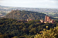 |
Peckforton Peckforton Peckforton is a scattered settlement and civil parish in the unitary authority of Cheshire East and the ceremonial county of Cheshire, England. The settlement is located to the north east of Malpas and miles to the west of Nantwich. The total population of the civil parish is somewhat over 100... |
Civil parish | 116 | Cheshire East Cheshire East Cheshire East is a unitary authority area with borough status in the ceremonial county of Cheshire, England.The borough was established in April 2009 as part of the 2009 structural changes to local government in England, by virtue of an order under the Local Government and Public Involvement in... |
Nantwich Rural District Nantwich Rural District Nantwich Rural District was a division of Cheshire until 1974, when it merged with the Nantwich and Crewe Urban districts to create the borough of Crewe and Nantwich.... |
|
| Peover Inferior Peover Inferior Peover Inferior is a civil parish in the Borough of Cheshire East and the ceremonial county of Cheshire, England. It has a population of 102.... |
Civil parish | 102 | Cheshire East Cheshire East Cheshire East is a unitary authority area with borough status in the ceremonial county of Cheshire, England.The borough was established in April 2009 as part of the 2009 structural changes to local government in England, by virtue of an order under the Local Government and Public Involvement in... |
Bucklow Rural District Bucklow Rural District Bucklow Rural District was, from 1894 to 1974, a local government district in the north of the administrative county of Cheshire, England. Following the Local Government Act 1972, this rural district was split between the new Greater Manchester boroughs of Trafford and Manchester, and Macclesfield,... |
|
|
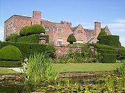 |
Peover Superior Peover Superior Peover Superior is a civil parish in the unitary authority of Cheshire East and the ceremonial county of Cheshire, England.It contains the village of Over Peover and Peover Hall. St Lawrence's Church, Over Peover is a Grade I listed building.... |
Civil parish | 658 | Cheshire East Cheshire East Cheshire East is a unitary authority area with borough status in the ceremonial county of Cheshire, England.The borough was established in April 2009 as part of the 2009 structural changes to local government in England, by virtue of an order under the Local Government and Public Involvement in... |
Bucklow Rural District Bucklow Rural District Bucklow Rural District was, from 1894 to 1974, a local government district in the north of the administrative county of Cheshire, England. Following the Local Government Act 1972, this rural district was split between the new Greater Manchester boroughs of Trafford and Manchester, and Macclesfield,... |
|
| Pickmere Pickmere Pickmere is a village and civil parish near Northwich in the Borough of Cheshire East. It has a population of 541. Landmarks in and around the village include a lake, Pick Mere, at .... |
Civil parish | 541 | Cheshire East Cheshire East Cheshire East is a unitary authority area with borough status in the ceremonial county of Cheshire, England.The borough was established in April 2009 as part of the 2009 structural changes to local government in England, by virtue of an order under the Local Government and Public Involvement in... |
Bucklow Rural District Bucklow Rural District Bucklow Rural District was, from 1894 to 1974, a local government district in the north of the administrative county of Cheshire, England. Following the Local Government Act 1972, this rural district was split between the new Greater Manchester boroughs of Trafford and Manchester, and Macclesfield,... |
|
|
| Plumley Plumley Plumley is a village and civil parish in the unitary authority of Cheshire East and the ceremonial county of Cheshire, England.In the village there are two public houses, The Golden Pheasant and The Smoker , a village hall, a Methodist church, tennis courts, riding stables, a post office and a golf... |
Civil parish | 649 | Cheshire East Cheshire East Cheshire East is a unitary authority area with borough status in the ceremonial county of Cheshire, England.The borough was established in April 2009 as part of the 2009 structural changes to local government in England, by virtue of an order under the Local Government and Public Involvement in... |
Bucklow Rural District Bucklow Rural District Bucklow Rural District was, from 1894 to 1974, a local government district in the north of the administrative county of Cheshire, England. Following the Local Government Act 1972, this rural district was split between the new Greater Manchester boroughs of Trafford and Manchester, and Macclesfield,... |
|
|
| Poole Poole, Cheshire Poole is a civil parish in the unitary authority of Cheshire East and the ceremonial county of Cheshire, England, which lies to the north west of Nantwich and to the west of Crewe. The Shropshire Union Canal runs through the parish... |
Civil parish | 101 | Cheshire East Cheshire East Cheshire East is a unitary authority area with borough status in the ceremonial county of Cheshire, England.The borough was established in April 2009 as part of the 2009 structural changes to local government in England, by virtue of an order under the Local Government and Public Involvement in... |
Nantwich Rural District Nantwich Rural District Nantwich Rural District was a division of Cheshire until 1974, when it merged with the Nantwich and Crewe Urban districts to create the borough of Crewe and Nantwich.... |
|
|
| Pott Shrigley Pott Shrigley Pott Shrigley is a small village and civil parish in the unitary authority of Cheshire East and the ceremonial county of Cheshire, England. According to the 2001 census, the civil parish and village has a population of 220. The nearest town is Bollington to the southwest.The village has a Church... |
Civil parish | 220 | Cheshire East Cheshire East Cheshire East is a unitary authority area with borough status in the ceremonial county of Cheshire, England.The borough was established in April 2009 as part of the 2009 structural changes to local government in England, by virtue of an order under the Local Government and Public Involvement in... |
Macclesfield Rural District Macclesfield Rural District Macclesfield Rural District was a rural district of Cheshire, England from 1894 to 1974. All of it is now part of the borough of Macclesfield.Macclesfield as a Municipal Borough and Bollington as an urban district formed an enclave which was surrounded by Macclesfield RD.The district was formed in... |
|
|
| Poynton with Worth Poynton Poynton is a town within the civil parish of Poynton-with-Worth, and the unitary authority area of Cheshire East, England. For ceremonial purposes it is part of the county of Cheshire. Poynton is located at the eastern most fringe of the Cheshire Plain, north of Macclesfield, south of Stockport... |
Town | 14,433 | Cheshire East Cheshire East Cheshire East is a unitary authority area with borough status in the ceremonial county of Cheshire, England.The borough was established in April 2009 as part of the 2009 structural changes to local government in England, by virtue of an order under the Local Government and Public Involvement in... |
Macclesfield Rural District Macclesfield Rural District Macclesfield Rural District was a rural district of Cheshire, England from 1894 to 1974. All of it is now part of the borough of Macclesfield.Macclesfield as a Municipal Borough and Bollington as an urban district formed an enclave which was surrounded by Macclesfield RD.The district was formed in... |
|
|
 |
Prestbury Prestbury, Cheshire Prestbury is a village, civil parish and ecclesiastical parish in the unitary authority of Cheshire East and the ceremonial county of Cheshire, England. Prestbury is a long, narrow parish covering 1,165 hectares to the west of the Peak Park foothills and to the east of the sandstone ridge which is... |
Civil parish | 3,324 | Cheshire East Cheshire East Cheshire East is a unitary authority area with borough status in the ceremonial county of Cheshire, England.The borough was established in April 2009 as part of the 2009 structural changes to local government in England, by virtue of an order under the Local Government and Public Involvement in... |
Macclesfield Rural District Macclesfield Rural District Macclesfield Rural District was a rural district of Cheshire, England from 1894 to 1974. All of it is now part of the borough of Macclesfield.Macclesfield as a Municipal Borough and Bollington as an urban district formed an enclave which was surrounded by Macclesfield RD.The district was formed in... |
|
| Rainow Rainow Rainow is a village and civil parish in the unitary authority of Cheshire East, located, mostly, on the eastern side of the River Dean valley next to the B5470 road, between Macclesfield and Kettleshulme in the ceremonial county of Cheshire, England. It straddles the eastern side of the Peak... |
Civil parish | 1,282 | Cheshire East Cheshire East Cheshire East is a unitary authority area with borough status in the ceremonial county of Cheshire, England.The borough was established in April 2009 as part of the 2009 structural changes to local government in England, by virtue of an order under the Local Government and Public Involvement in... |
Macclesfield Rural District Macclesfield Rural District Macclesfield Rural District was a rural district of Cheshire, England from 1894 to 1974. All of it is now part of the borough of Macclesfield.Macclesfield as a Municipal Borough and Bollington as an urban district formed an enclave which was surrounded by Macclesfield RD.The district was formed in... |
|
|
| Ridley Ridley, Cheshire Ridley is a civil parish in the unitary authority of Cheshire East and the ceremonial county of Cheshire, England, which lies to the north east of Malpas and to the west of Nantwich. The parish is largely rural with scattered farms and buildings and no significant settlements. In 2001, the... |
Civil parish | 120 | Cheshire East Cheshire East Cheshire East is a unitary authority area with borough status in the ceremonial county of Cheshire, England.The borough was established in April 2009 as part of the 2009 structural changes to local government in England, by virtue of an order under the Local Government and Public Involvement in... |
Nantwich Rural District Nantwich Rural District Nantwich Rural District was a division of Cheshire until 1974, when it merged with the Nantwich and Crewe Urban districts to create the borough of Crewe and Nantwich.... |
|
|
| Rope Rope, Cheshire Rope is a scattered settlement and civil parish in the unitary authority of Cheshire East and the ceremonial county of Cheshire, England. It lies immediately to the south of Crewe, with the centre of the parish being around 2¼ miles from the centre of Crewe. Nearby villages include Shavington,... |
Civil parish | 2,155 | Cheshire East Cheshire East Cheshire East is a unitary authority area with borough status in the ceremonial county of Cheshire, England.The borough was established in April 2009 as part of the 2009 structural changes to local government in England, by virtue of an order under the Local Government and Public Involvement in... |
Nantwich Rural District Nantwich Rural District Nantwich Rural District was a division of Cheshire until 1974, when it merged with the Nantwich and Crewe Urban districts to create the borough of Crewe and Nantwich.... |
|
|
| Rostherne Rostherne Rostherne is a civil parish and village in the unitary authority of Cheshire East and the ceremonial county of Cheshire, England .To the north of the village is Rostherne Mere and to the south is Tatton Park... |
Civil parish | 160 | Cheshire East Cheshire East Cheshire East is a unitary authority area with borough status in the ceremonial county of Cheshire, England.The borough was established in April 2009 as part of the 2009 structural changes to local government in England, by virtue of an order under the Local Government and Public Involvement in... |
Bucklow Rural District Bucklow Rural District Bucklow Rural District was, from 1894 to 1974, a local government district in the north of the administrative county of Cheshire, England. Following the Local Government Act 1972, this rural district was split between the new Greater Manchester boroughs of Trafford and Manchester, and Macclesfield,... |
|
|
| Sandbach Sandbach Sandbach is a market town and civil parish in the unitary authority of Cheshire East and the ceremonial county of Cheshire, England. The civil parish contains four settlements; Sandbach itself, Elworth, Ettiley Heath and Wheelock.... |
Town | 17,630 | Cheshire East Cheshire East Cheshire East is a unitary authority area with borough status in the ceremonial county of Cheshire, England.The borough was established in April 2009 as part of the 2009 structural changes to local government in England, by virtue of an order under the Local Government and Public Involvement in... |
Sandbach Urban District Sandbach Sandbach is a market town and civil parish in the unitary authority of Cheshire East and the ceremonial county of Cheshire, England. The civil parish contains four settlements; Sandbach itself, Elworth, Ettiley Heath and Wheelock.... |
|
|
| Shavington cum Gresty Shavington cum Gresty Shavington cum Gresty is a civil parish in the unitary authority of Cheshire East and the ceremonial county of Cheshire, England. It lies to the south of Crewe. It includes the large village of Shavington , which lies 2½ miles south of Crewe, as well as the smaller settlements of Dodds Bank, Park... |
Civil parish | 4,849 | Cheshire East Cheshire East Cheshire East is a unitary authority area with borough status in the ceremonial county of Cheshire, England.The borough was established in April 2009 as part of the 2009 structural changes to local government in England, by virtue of an order under the Local Government and Public Involvement in... |
Nantwich Rural District Nantwich Rural District Nantwich Rural District was a division of Cheshire until 1974, when it merged with the Nantwich and Crewe Urban districts to create the borough of Crewe and Nantwich.... |
|
|
| Siddington Siddington, Cheshire Siddington is a civil parish in the unitary authority of Cheshire East and the ceremonial county of Cheshire, England. It consists of farms, a picnic site, Redesmere, a half-mile long lake, and the Capesthorne Estate. The village is located at the crossroads of the A34 with the B5392 approximately... |
Civil parish | 376 | Cheshire East Cheshire East Cheshire East is a unitary authority area with borough status in the ceremonial county of Cheshire, England.The borough was established in April 2009 as part of the 2009 structural changes to local government in England, by virtue of an order under the Local Government and Public Involvement in... |
Macclesfield Rural District Macclesfield Rural District Macclesfield Rural District was a rural district of Cheshire, England from 1894 to 1974. All of it is now part of the borough of Macclesfield.Macclesfield as a Municipal Borough and Bollington as an urban district formed an enclave which was surrounded by Macclesfield RD.The district was formed in... |
|
|
| Smallwood Smallwood, Cheshire Smallwood is a civil parish and small village in the unitary authority of Cheshire East and the ceremonial county of Cheshire, England. The village is situated approximately three miles east of Sandbach and 3 miles south west of Congleton.... |
Civil parish | 491 | Cheshire East Cheshire East Cheshire East is a unitary authority area with borough status in the ceremonial county of Cheshire, England.The borough was established in April 2009 as part of the 2009 structural changes to local government in England, by virtue of an order under the Local Government and Public Involvement in... |
Congleton Rural District |
|
|
| Snelson Snelson, Cheshire Snelson is a civil parish in the Borough of Cheshire East and ceremonial county of Cheshire in England. It has a population of 157.-References:... |
Civil parish | 157 | Cheshire East Cheshire East Cheshire East is a unitary authority area with borough status in the ceremonial county of Cheshire, England.The borough was established in April 2009 as part of the 2009 structural changes to local government in England, by virtue of an order under the Local Government and Public Involvement in... |
Macclesfield Rural District Macclesfield Rural District Macclesfield Rural District was a rural district of Cheshire, England from 1894 to 1974. All of it is now part of the borough of Macclesfield.Macclesfield as a Municipal Borough and Bollington as an urban district formed an enclave which was surrounded by Macclesfield RD.The district was formed in... |
|
|
| Somerford Somerford Somerford is a civil parish in the unitary authority of Cheshire East and the ceremonial county of Cheshire, England. It is adjacent to the north west of Congleton, from which town it has some housing overflow. According to the 2001 census, the population of the civil parish was 343.-References:... |
Civil parish | 343 | Cheshire East Cheshire East Cheshire East is a unitary authority area with borough status in the ceremonial county of Cheshire, England.The borough was established in April 2009 as part of the 2009 structural changes to local government in England, by virtue of an order under the Local Government and Public Involvement in... |
Congleton Rural District |
|
|
| Somerford Booths Somerford Booths Somerford Booths is a small civil parish in the unitary authority of Cheshire East and the ceremonial county of Cheshire, England. In the census of 2001 it was recorded as having a population of 175... |
Civil parish | 175 | Cheshire East Cheshire East Cheshire East is a unitary authority area with borough status in the ceremonial county of Cheshire, England.The borough was established in April 2009 as part of the 2009 structural changes to local government in England, by virtue of an order under the Local Government and Public Involvement in... |
Congleton Rural District |
|
|
| Sound Sound, Cheshire Sound is a hamlet and civil parish in the unitary authority of Cheshire East and the ceremonial county of Cheshire, England. The hamlet is located 3¼ miles to the south west of Nantwich. The parish also includes the small settlements of Newtown and Sound Heath... |
Civil parish | 233 | Cheshire East Cheshire East Cheshire East is a unitary authority area with borough status in the ceremonial county of Cheshire, England.The borough was established in April 2009 as part of the 2009 structural changes to local government in England, by virtue of an order under the Local Government and Public Involvement in... |
Nantwich Rural District Nantwich Rural District Nantwich Rural District was a division of Cheshire until 1974, when it merged with the Nantwich and Crewe Urban districts to create the borough of Crewe and Nantwich.... |
|
|
| Spurstow Spurstow Spurstow is a village and civil parish in the unitary authority of Cheshire East and the ceremonial county of Cheshire, England, which is located 6½ miles to the north west of Nantwich. The parish also includes the settlement of Spurstow Sketh and part of Radmore Green. Nearby villages include... |
Civil parish | 394 | Cheshire East Cheshire East Cheshire East is a unitary authority area with borough status in the ceremonial county of Cheshire, England.The borough was established in April 2009 as part of the 2009 structural changes to local government in England, by virtue of an order under the Local Government and Public Involvement in... |
Nantwich Rural District Nantwich Rural District Nantwich Rural District was a division of Cheshire until 1974, when it merged with the Nantwich and Crewe Urban districts to create the borough of Crewe and Nantwich.... |
|
|
| Stapeley Stapeley Stapeley is a hamlet and civil parish in the unitary authority of Cheshire East and the ceremonial county of Cheshire, England. The hamlet lies 2¼ miles to the south east of Nantwich... |
Civil parish | 1,048 | Cheshire East Cheshire East Cheshire East is a unitary authority area with borough status in the ceremonial county of Cheshire, England.The borough was established in April 2009 as part of the 2009 structural changes to local government in England, by virtue of an order under the Local Government and Public Involvement in... |
Nantwich Rural District Nantwich Rural District Nantwich Rural District was a division of Cheshire until 1974, when it merged with the Nantwich and Crewe Urban districts to create the borough of Crewe and Nantwich.... |
|
|
| Stoke | Civil parish | 201 | Cheshire East Cheshire East Cheshire East is a unitary authority area with borough status in the ceremonial county of Cheshire, England.The borough was established in April 2009 as part of the 2009 structural changes to local government in England, by virtue of an order under the Local Government and Public Involvement in... |
Nantwich Rural District Nantwich Rural District Nantwich Rural District was a division of Cheshire until 1974, when it merged with the Nantwich and Crewe Urban districts to create the borough of Crewe and Nantwich.... |
|
|
| Sutton | Civil parish | 2,464 | Cheshire East Cheshire East Cheshire East is a unitary authority area with borough status in the ceremonial county of Cheshire, England.The borough was established in April 2009 as part of the 2009 structural changes to local government in England, by virtue of an order under the Local Government and Public Involvement in... |
Macclesfield Rural District Macclesfield Rural District Macclesfield Rural District was a rural district of Cheshire, England from 1894 to 1974. All of it is now part of the borough of Macclesfield.Macclesfield as a Municipal Borough and Bollington as an urban district formed an enclave which was surrounded by Macclesfield RD.The district was formed in... |
|
|
| Swettenham Swettenham Swettenham is a village and civil parish in the unitary authority of Cheshire East and the ceremonial county of Cheshire, England. According to the 2001 Official UK Census, the population of the entire civil parish was 248.... |
Civil parish | 248 | Cheshire East Cheshire East Cheshire East is a unitary authority area with borough status in the ceremonial county of Cheshire, England.The borough was established in April 2009 as part of the 2009 structural changes to local government in England, by virtue of an order under the Local Government and Public Involvement in... |
Congleton Rural District |
|
|
 |
Tabley Inferior Tabley Inferior Tabley Inferior is a civil parish in the Borough of Cheshire East and ceremonial county of Cheshire in England.. It has a population of 137.-References:... |
Civil parish | 137 | Cheshire East Cheshire East Cheshire East is a unitary authority area with borough status in the ceremonial county of Cheshire, England.The borough was established in April 2009 as part of the 2009 structural changes to local government in England, by virtue of an order under the Local Government and Public Involvement in... |
Bucklow Rural District Bucklow Rural District Bucklow Rural District was, from 1894 to 1974, a local government district in the north of the administrative county of Cheshire, England. Following the Local Government Act 1972, this rural district was split between the new Greater Manchester boroughs of Trafford and Manchester, and Macclesfield,... |
|
| Tabley Superior Tabley Superior Tabley Superior is a civil parish in the Borough of Cheshire East and ceremonial county of Cheshire in England. It has a population of 316. The parish contains the village of Over Tabley.-References:... |
Civil parish | 316 | Cheshire East Cheshire East Cheshire East is a unitary authority area with borough status in the ceremonial county of Cheshire, England.The borough was established in April 2009 as part of the 2009 structural changes to local government in England, by virtue of an order under the Local Government and Public Involvement in... |
Bucklow Rural District Bucklow Rural District Bucklow Rural District was, from 1894 to 1974, a local government district in the north of the administrative county of Cheshire, England. Following the Local Government Act 1972, this rural district was split between the new Greater Manchester boroughs of Trafford and Manchester, and Macclesfield,... |
|
|
 |
Tatton Tatton, Cheshire Tatton is a civil parish in the Borough of Cheshire East and ceremonial county of Cheshire in England. It has a population of 35.-See also:* Tatton Old Hall* Tatton Park* Tatton Park Gardens* Tatton Park Flower Show-References:... |
Civil parish | 35 | Cheshire East Cheshire East Cheshire East is a unitary authority area with borough status in the ceremonial county of Cheshire, England.The borough was established in April 2009 as part of the 2009 structural changes to local government in England, by virtue of an order under the Local Government and Public Involvement in... |
Bucklow Rural District Bucklow Rural District Bucklow Rural District was, from 1894 to 1974, a local government district in the north of the administrative county of Cheshire, England. Following the Local Government Act 1972, this rural district was split between the new Greater Manchester boroughs of Trafford and Manchester, and Macclesfield,... |
|
| Toft Toft, Cheshire Toft is a village and civil parish in the unitary authority of Cheshire East and the ceremonial county of Cheshire, England. It is located immediately to the south of Knutsford and is split by the A50 road to more southern Holmes Chapel... |
Civil parish | 81 | Cheshire East Cheshire East Cheshire East is a unitary authority area with borough status in the ceremonial county of Cheshire, England.The borough was established in April 2009 as part of the 2009 structural changes to local government in England, by virtue of an order under the Local Government and Public Involvement in... |
Bucklow Rural District Bucklow Rural District Bucklow Rural District was, from 1894 to 1974, a local government district in the north of the administrative county of Cheshire, England. Following the Local Government Act 1972, this rural district was split between the new Greater Manchester boroughs of Trafford and Manchester, and Macclesfield,... |
|
|
| Twemlow Twemlow Twemlow is a civil parish, containing the village of Twemlow Green in the unitary authority of Cheshire East and the ceremonial county of Cheshire, England. According to the 2001 Official UK Census, the population of the entire civil parish was 168.Twemlow lies along the A535 road.From the 16th to... |
Civil parish | 168 | Cheshire East Cheshire East Cheshire East is a unitary authority area with borough status in the ceremonial county of Cheshire, England.The borough was established in April 2009 as part of the 2009 structural changes to local government in England, by virtue of an order under the Local Government and Public Involvement in... |
Congleton Rural District |
|
|
| Walgherton Walgherton Walgherton is a village and civil parish in the unitary authority of Cheshire East and the ceremonial county of Cheshire, England. The village lies 3½ miles to the south east of Nantwich and 4½ miles to the south of Crewe. It also includes the settlement of Hussey's Nook. Nearby villages include... |
Civil parish | 121 | Cheshire East Cheshire East Cheshire East is a unitary authority area with borough status in the ceremonial county of Cheshire, England.The borough was established in April 2009 as part of the 2009 structural changes to local government in England, by virtue of an order under the Local Government and Public Involvement in... |
Nantwich Rural District Nantwich Rural District Nantwich Rural District was a division of Cheshire until 1974, when it merged with the Nantwich and Crewe Urban districts to create the borough of Crewe and Nantwich.... |
|
|
| Wardle Wardle, Cheshire Wardle is a village and civil parish in the unitary authority of Cheshire East and the ceremonial county of Cheshire, England. The village lies 4 miles to the north west of Nantwich. Nearby villages include Barbridge, Calveley and Haughton. The Shropshire Union Canal and the A51 run side by side... |
Civil parish | 181 | Cheshire East Cheshire East Cheshire East is a unitary authority area with borough status in the ceremonial county of Cheshire, England.The borough was established in April 2009 as part of the 2009 structural changes to local government in England, by virtue of an order under the Local Government and Public Involvement in... |
Nantwich Rural District Nantwich Rural District Nantwich Rural District was a division of Cheshire until 1974, when it merged with the Nantwich and Crewe Urban districts to create the borough of Crewe and Nantwich.... |
|
|
| Warmingham Warmingham Warmingham is a village and civil parish in the unitary authority of Cheshire East and the ceremonial county of Cheshire, England. The village lies 3¼ miles to the north of Crewe and 3¼ miles to the west of Sandbach. The parish also includes the settlement of Lane Ends. Nearby villages include... |
Civil parish | 175 | Cheshire East Cheshire East Cheshire East is a unitary authority area with borough status in the ceremonial county of Cheshire, England.The borough was established in April 2009 as part of the 2009 structural changes to local government in England, by virtue of an order under the Local Government and Public Involvement in... |
Nantwich Rural District Nantwich Rural District Nantwich Rural District was a division of Cheshire until 1974, when it merged with the Nantwich and Crewe Urban districts to create the borough of Crewe and Nantwich.... |
|
|
| Weston Weston, Cheshire Weston is a village and civil parish in the unitary authority of Cheshire East and the ceremonial county of Cheshire, England. The village lies 3 miles to the south east of Crewe. The parish also includes the small settlements of Carters Green, Gorsthill, Rose Hill, Snape, Stowford and part of... |
Civil parish | 969 | Cheshire East Cheshire East Cheshire East is a unitary authority area with borough status in the ceremonial county of Cheshire, England.The borough was established in April 2009 as part of the 2009 structural changes to local government in England, by virtue of an order under the Local Government and Public Involvement in... |
Nantwich Rural District Nantwich Rural District Nantwich Rural District was a division of Cheshire until 1974, when it merged with the Nantwich and Crewe Urban districts to create the borough of Crewe and Nantwich.... |
|
|
| Wettenhall Wettenhall Wettenhall is a village and civil parish in the unitary authority of Cheshire East and the ceremonial county of Cheshire, England. The village lies 3½ miles to the south west of Winsford and 6 miles to the north west of Crewe. The parish also includes the settlements of Chapel Green and Woodside... |
Civil parish | 135 | Cheshire East Cheshire East Cheshire East is a unitary authority area with borough status in the ceremonial county of Cheshire, England.The borough was established in April 2009 as part of the 2009 structural changes to local government in England, by virtue of an order under the Local Government and Public Involvement in... |
Nantwich Rural District Nantwich Rural District Nantwich Rural District was a division of Cheshire until 1974, when it merged with the Nantwich and Crewe Urban districts to create the borough of Crewe and Nantwich.... |
|
|
| Willaston | Civil parish | 2,973 | Cheshire East Cheshire East Cheshire East is a unitary authority area with borough status in the ceremonial county of Cheshire, England.The borough was established in April 2009 as part of the 2009 structural changes to local government in England, by virtue of an order under the Local Government and Public Involvement in... |
Nantwich Rural District Nantwich Rural District Nantwich Rural District was a division of Cheshire until 1974, when it merged with the Nantwich and Crewe Urban districts to create the borough of Crewe and Nantwich.... |
|
|
| Wilmslow Wilmslow -Economy:Wilmslow is well known, like Alderley Edge, for having many famous residents, notably footballers, stars of Coronation Street and rich North West businessmen. The town is part of the so-called Golden Triangle in the north west together with Alderley Edge and Prestbury... |
Unparished area | 30,326 | Cheshire East Cheshire East Cheshire East is a unitary authority area with borough status in the ceremonial county of Cheshire, England.The borough was established in April 2009 as part of the 2009 structural changes to local government in England, by virtue of an order under the Local Government and Public Involvement in... |
Wilmslow Urban District Wilmslow -Economy:Wilmslow is well known, like Alderley Edge, for having many famous residents, notably footballers, stars of Coronation Street and rich North West businessmen. The town is part of the so-called Golden Triangle in the north west together with Alderley Edge and Prestbury... |
|
|
| Wincle Wincle Wincle is a small village and civil parish in the unitary authority of Cheshire East and the ceremonial county of Cheshire. The parish contains the village of Danebridge, which is larger than the village of Wincle itself. It holds parish meetings rather than parish council meetings.-External links:... |
Civil parish | 164 | Cheshire East Cheshire East Cheshire East is a unitary authority area with borough status in the ceremonial county of Cheshire, England.The borough was established in April 2009 as part of the 2009 structural changes to local government in England, by virtue of an order under the Local Government and Public Involvement in... |
Macclesfield Rural District Macclesfield Rural District Macclesfield Rural District was a rural district of Cheshire, England from 1894 to 1974. All of it is now part of the borough of Macclesfield.Macclesfield as a Municipal Borough and Bollington as an urban district formed an enclave which was surrounded by Macclesfield RD.The district was formed in... |
|
|
| Wirswall Wirswall Wirswall is a village and civil parish in the unitary authority of Cheshire East and the ceremonial county of Cheshire, England, located at SJ544441 near the Shropshire border, around 1½ miles north of Whitchurch. The historical township had an area of... |
Civil parish | 76 | Cheshire East Cheshire East Cheshire East is a unitary authority area with borough status in the ceremonial county of Cheshire, England.The borough was established in April 2009 as part of the 2009 structural changes to local government in England, by virtue of an order under the Local Government and Public Involvement in... |
Nantwich Rural District Nantwich Rural District Nantwich Rural District was a division of Cheshire until 1974, when it merged with the Nantwich and Crewe Urban districts to create the borough of Crewe and Nantwich.... |
|
|
| Wistaston Wistaston Wistaston is a civil parish and village in the unitary authority of Cheshire East and the ceremonial county of Cheshire, in north-west England. It is approximately west of Crewe town centre and east of Nantwich town centre... |
Civil parish | 8,222 | Cheshire East Cheshire East Cheshire East is a unitary authority area with borough status in the ceremonial county of Cheshire, England.The borough was established in April 2009 as part of the 2009 structural changes to local government in England, by virtue of an order under the Local Government and Public Involvement in... |
Nantwich Rural District Nantwich Rural District Nantwich Rural District was a division of Cheshire until 1974, when it merged with the Nantwich and Crewe Urban districts to create the borough of Crewe and Nantwich.... |
|
|
| Woolstanwood Woolstanwood Woolstanwood is a village and civil parish in the unitary authority of Cheshire East and the ceremonial county of... |
Civil parish | 723 | Cheshire East Cheshire East Cheshire East is a unitary authority area with borough status in the ceremonial county of Cheshire, England.The borough was established in April 2009 as part of the 2009 structural changes to local government in England, by virtue of an order under the Local Government and Public Involvement in... |
Nantwich Rural District Nantwich Rural District Nantwich Rural District was a division of Cheshire until 1974, when it merged with the Nantwich and Crewe Urban districts to create the borough of Crewe and Nantwich.... |
|
|
 |
Worleston Worleston Worleston is a village and civil parish in the unitary authority of Cheshire East and the ceremonial county of Cheshire, England. The village lies 2½ miles north of Nantwich and 3 miles west of Crewe... |
Civil parish | 404 | Cheshire East Cheshire East Cheshire East is a unitary authority area with borough status in the ceremonial county of Cheshire, England.The borough was established in April 2009 as part of the 2009 structural changes to local government in England, by virtue of an order under the Local Government and Public Involvement in... |
Nantwich Rural District Nantwich Rural District Nantwich Rural District was a division of Cheshire until 1974, when it merged with the Nantwich and Crewe Urban districts to create the borough of Crewe and Nantwich.... |
|
| Wrenbury cum Frith Wrenbury Wrenbury is a village in the civil parish of Wrenbury cum Frith, the unitary authority of Cheshire East, and the ceremonial county of Cheshire, England... |
Civil parish | 1,060 | Cheshire East Cheshire East Cheshire East is a unitary authority area with borough status in the ceremonial county of Cheshire, England.The borough was established in April 2009 as part of the 2009 structural changes to local government in England, by virtue of an order under the Local Government and Public Involvement in... |
Nantwich Rural District Nantwich Rural District Nantwich Rural District was a division of Cheshire until 1974, when it merged with the Nantwich and Crewe Urban districts to create the borough of Crewe and Nantwich.... |
|
|
| Wybunbury Wybunbury Wybunbury is a village and civil parish in the unitary authority of Cheshire East and the ceremonial county of Cheshire, England. The village lies 3¼ miles to the south east of Nantwich and 3¾ miles to the south of Crewe. The parish also includes the settlements of Clannor Heath, Daisy Hill, The... |
Civil parish | 1,474 | Cheshire East Cheshire East Cheshire East is a unitary authority area with borough status in the ceremonial county of Cheshire, England.The borough was established in April 2009 as part of the 2009 structural changes to local government in England, by virtue of an order under the Local Government and Public Involvement in... |
Nantwich Rural District Nantwich Rural District Nantwich Rural District was a division of Cheshire until 1974, when it merged with the Nantwich and Crewe Urban districts to create the borough of Crewe and Nantwich.... |
|
|
| Acton Bridge Acton Bridge right|thumb|Map of the civil parish of Acton Bridge within the former borough of Vale RoyalActon Bridge is a village and civil parish in Cheshire, England. Located within the unitary authority of Cheshire West and Chester on the River Weaver, it is near the Trent and Mersey Canal at approximately... |
Civil parish | 602 | Cheshire West and Chester Cheshire West and Chester Cheshire West and Chester is a unitary authority area with borough status, in the ceremonial county of Cheshire. It was established in April 2009 as part of the 2009 structural changes to local government in England, by virtue of an order under the Local Government and Public Involvement in Health... |
Northwich Rural District Northwich Rural District Northwich Rural District was a rural district surrounding, but not including the towns of Northwich and Winsford in Cheshire. It was created in 1894 from the Runcorn Rural Sanitary District.... |
|
|
| Agden | Civil parish | 42 | Cheshire West and Chester Cheshire West and Chester Cheshire West and Chester is a unitary authority area with borough status, in the ceremonial county of Cheshire. It was established in April 2009 as part of the 2009 structural changes to local government in England, by virtue of an order under the Local Government and Public Involvement in Health... |
Tarvin Rural District Tarvin Rural District Tarvin was, from 1894 to 1974, a rural district in the administrative county of Cheshire, England. The district was named after the village of Tarvin, and saw considerable boundary changes throughout its life.-Creation:... |
|
|
| Aldersey Aldersey Aldersey is a civil parish in the unitary authority of Cheshire West and Chesterand the ceremonial county of Cheshire, England. It contains the villages of Aldersey Green and Aldersey Park , and is about south-east of Chester. According to the 2001 census the parish had a population of 72.... |
Civil parish | 72 | Cheshire West and Chester Cheshire West and Chester Cheshire West and Chester is a unitary authority area with borough status, in the ceremonial county of Cheshire. It was established in April 2009 as part of the 2009 structural changes to local government in England, by virtue of an order under the Local Government and Public Involvement in Health... |
Tarvin Rural District Tarvin Rural District Tarvin was, from 1894 to 1974, a rural district in the administrative county of Cheshire, England. The district was named after the village of Tarvin, and saw considerable boundary changes throughout its life.-Creation:... |
|
|
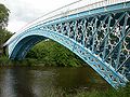 |
Aldford Aldford Aldford is a village and civil parish in the county of Cheshire, England, south of Chester . It has a population of 213.The village lies on the east bank of the River Dee... |
Civil parish | 213 | Cheshire West and Chester Cheshire West and Chester Cheshire West and Chester is a unitary authority area with borough status, in the ceremonial county of Cheshire. It was established in April 2009 as part of the 2009 structural changes to local government in England, by virtue of an order under the Local Government and Public Involvement in Health... |
Chester Rural District Chester Rural District Chester was a rural district of Cheshire, England, from 1894 to 1974. It was based around the city and county borough of Chester but did not include it. The district saw various boundary changes throughout its life... |
|
| Allostock Allostock thumb|right|200px|Map of Allostock civil parish within the former borough of Vale RoyalAllostock is a village and civil parish in the unitary authority of Cheshire West and Chester and the ceremonial county of Cheshire, England, about five miles south of Knutsford. It has a population of 783... |
Civil parish | 783 | Cheshire West and Chester Cheshire West and Chester Cheshire West and Chester is a unitary authority area with borough status, in the ceremonial county of Cheshire. It was established in April 2009 as part of the 2009 structural changes to local government in England, by virtue of an order under the Local Government and Public Involvement in Health... |
Northwich Rural District Northwich Rural District Northwich Rural District was a rural district surrounding, but not including the towns of Northwich and Winsford in Cheshire. It was created in 1894 from the Runcorn Rural Sanitary District.... |
|
|
 |
Alvanley Alvanley right|thumb|200px|Map of civil parish of Alvanley within the former borough of [[Vale Royal]].Alvanley is a small rural village and civil parish near the village of Helsby, in the unitary authority of Cheshire West and Chester and the ceremonial county of Cheshire, England... |
Civil parish | 485 | Cheshire West and Chester Cheshire West and Chester Cheshire West and Chester is a unitary authority area with borough status, in the ceremonial county of Cheshire. It was established in April 2009 as part of the 2009 structural changes to local government in England, by virtue of an order under the Local Government and Public Involvement in Health... |
Runcorn Rural District Runcorn Rural District Runcorn was a rural district in Cheshire, England from 1894 to 1974. It was named after but did not include Runcorn, a town on the River Mersey to the north-west of the district, which formed its own urban district.... |
|
| Anderton with Marbury Anderton with Marbury right|thumb|Map of civil parish of Anderton with Marbury within the former borough of Vale RoyalAnderton with Marbury is a civil parish in the unitary authority of Cheshire West and Chester and the ceremonial county of Cheshire, England. It had a population of 582 according to the 2001 census, and... |
Civil parish | 582 | Cheshire West and Chester Cheshire West and Chester Cheshire West and Chester is a unitary authority area with borough status, in the ceremonial county of Cheshire. It was established in April 2009 as part of the 2009 structural changes to local government in England, by virtue of an order under the Local Government and Public Involvement in Health... |
Northwich Rural District Northwich Rural District Northwich Rural District was a rural district surrounding, but not including the towns of Northwich and Winsford in Cheshire. It was created in 1894 from the Runcorn Rural Sanitary District.... |
|
|
| Antrobus | Civil parish | 832 | Cheshire West and Chester Cheshire West and Chester Cheshire West and Chester is a unitary authority area with borough status, in the ceremonial county of Cheshire. It was established in April 2009 as part of the 2009 structural changes to local government in England, by virtue of an order under the Local Government and Public Involvement in Health... |
Runcorn Rural District Runcorn Rural District Runcorn was a rural district in Cheshire, England from 1894 to 1974. It was named after but did not include Runcorn, a town on the River Mersey to the north-west of the district, which formed its own urban district.... |
|
|
| Ashton Hayes Ashton Hayes Ashton Hayes is a village and civil parish in the unitary authority of Cheshire West and Chester and ceremonial county of Cheshire, England. It is located about 8 miles east of Chester on the B5393 road. The nearest villages are Mouldsworth to the north east and Kelsall to the south east... |
Civil parish | 919 | Cheshire West and Chester Cheshire West and Chester Cheshire West and Chester is a unitary authority area with borough status, in the ceremonial county of Cheshire. It was established in April 2009 as part of the 2009 structural changes to local government in England, by virtue of an order under the Local Government and Public Involvement in Health... |
Tarvin Rural District Tarvin Rural District Tarvin was, from 1894 to 1974, a rural district in the administrative county of Cheshire, England. The district was named after the village of Tarvin, and saw considerable boundary changes throughout its life.-Creation:... |
|
|
| Aston | Civil parish | 111 | Cheshire West and Chester Cheshire West and Chester Cheshire West and Chester is a unitary authority area with borough status, in the ceremonial county of Cheshire. It was established in April 2009 as part of the 2009 structural changes to local government in England, by virtue of an order under the Local Government and Public Involvement in Health... |
Runcorn Rural District Runcorn Rural District Runcorn was a rural district in Cheshire, England from 1894 to 1974. It was named after but did not include Runcorn, a town on the River Mersey to the north-west of the district, which formed its own urban district.... |
|
|
| Bache Bache, Cheshire Bache is a small civil parish and suburb of Chester, Cheshire, England.-History:The name "Bache" comes from a large tidal lagoon that was once linked to the River Dee at Blacon. The area, which now lies under Liverpool Road and a supermarket car park, was slowly reclaimed and raised when the... |
Civil parish | 158 | Cheshire West and Chester Cheshire West and Chester Cheshire West and Chester is a unitary authority area with borough status, in the ceremonial county of Cheshire. It was established in April 2009 as part of the 2009 structural changes to local government in England, by virtue of an order under the Local Government and Public Involvement in Health... |
Chester Rural District Chester Rural District Chester was a rural district of Cheshire, England, from 1894 to 1974. It was based around the city and county borough of Chester but did not include it. The district saw various boundary changes throughout its life... |
|
|
| Backford Backford Backford is a village and civil parish in the unitary authority of Cheshire West and Chester and ceremonial county of Cheshire, England. It is situated between Chester and Ellesmere Port on the A41 trunk road, to the north of the Shropshire Union Canal.... |
Civil parish | 109 | Cheshire West and Chester Cheshire West and Chester Cheshire West and Chester is a unitary authority area with borough status, in the ceremonial county of Cheshire. It was established in April 2009 as part of the 2009 structural changes to local government in England, by virtue of an order under the Local Government and Public Involvement in Health... |
Chester Rural District Chester Rural District Chester was a rural district of Cheshire, England, from 1894 to 1974. It was based around the city and county borough of Chester but did not include it. The district saw various boundary changes throughout its life... |
|
|
| Barnton Barnton Barnton is a civil parish and village in the north-west of England, just outside the town of Northwich, in the unitary authority of Cheshire West and Chester and the ceremonial county of Cheshire... |
Civil parish | 5,527 | Cheshire West and Chester Cheshire West and Chester Cheshire West and Chester is a unitary authority area with borough status, in the ceremonial county of Cheshire. It was established in April 2009 as part of the 2009 structural changes to local government in England, by virtue of an order under the Local Government and Public Involvement in Health... |
Northwich Rural District Northwich Rural District Northwich Rural District was a rural district surrounding, but not including the towns of Northwich and Winsford in Cheshire. It was created in 1894 from the Runcorn Rural Sanitary District.... |
|
|
| Barrow Barrow, Cheshire Barrow is a civil parish containing the villages of Great Barrow, Little Barrow and Stamford Bridge. It is situated about east-north-east of Chester, north-west of Tarporley, and south of Frodsham.-See also:*St Bartholomew's Church, Barrow... |
Civil parish | 943 | Cheshire West and Chester Cheshire West and Chester Cheshire West and Chester is a unitary authority area with borough status, in the ceremonial county of Cheshire. It was established in April 2009 as part of the 2009 structural changes to local government in England, by virtue of an order under the Local Government and Public Involvement in Health... |
Chester Rural District Chester Rural District Chester was a rural district of Cheshire, England, from 1894 to 1974. It was based around the city and county borough of Chester but did not include it. The district saw various boundary changes throughout its life... |
|
|
| Barton Barton, Cheshire Barton is a village and civil parish in the unitary authority of Cheshire West and Chester and the ceremonial county of Cheshire, England. The village is located near the Welsh border, about twelve miles south of Chester, and only about eight miles east of Wrexham in Wales.According to the 2001... |
Civil parish | 71 | Cheshire West and Chester Cheshire West and Chester Cheshire West and Chester is a unitary authority area with borough status, in the ceremonial county of Cheshire. It was established in April 2009 as part of the 2009 structural changes to local government in England, by virtue of an order under the Local Government and Public Involvement in Health... |
Tarvin Rural District Tarvin Rural District Tarvin was, from 1894 to 1974, a rural district in the administrative county of Cheshire, England. The district was named after the village of Tarvin, and saw considerable boundary changes throughout its life.-Creation:... |
|
|
| Beeston Beeston, Cheshire Beeston is a village and civil parish in the unitary authority of Cheshire West and Chester and the ceremonial county of Cheshire in the north of England. It is south of Tarporley, and close to the Shropshire Union Canal. Beeston Castle nearby is a spectacular clifftop ruin in the care of English... |
Civil parish | 199 | Cheshire West and Chester Cheshire West and Chester Cheshire West and Chester is a unitary authority area with borough status, in the ceremonial county of Cheshire. It was established in April 2009 as part of the 2009 structural changes to local government in England, by virtue of an order under the Local Government and Public Involvement in Health... |
Tarvin Rural District Tarvin Rural District Tarvin was, from 1894 to 1974, a rural district in the administrative county of Cheshire, England. The district was named after the village of Tarvin, and saw considerable boundary changes throughout its life.-Creation:... |
|
|
| Bickley Bickley, Cheshire Bickley is a civil parish in the unitary authority of Cheshire West and Chester and ceremonial county of Cheshire, England. According to the 2001 Census it had a population of 498. The parish includes the villages of Bickley Town and Bickley Moss.... |
Civil parish | 498 | Cheshire West and Chester Cheshire West and Chester Cheshire West and Chester is a unitary authority area with borough status, in the ceremonial county of Cheshire. It was established in April 2009 as part of the 2009 structural changes to local government in England, by virtue of an order under the Local Government and Public Involvement in Health... |
Tarvin Rural District Tarvin Rural District Tarvin was, from 1894 to 1974, a rural district in the administrative county of Cheshire, England. The district was named after the village of Tarvin, and saw considerable boundary changes throughout its life.-Creation:... |
|
|
| Bostock Bostock right|200px|thumb|Map of civil parish of Bostock in the former borough of Vale RoyalBostock is a village and civil parish in the unitary authority of Cheshire West and Chester and the ceremonial county of Cheshire, England. According to the 2001 census it had a population of 229. The village is... |
Civil parish | 229 | Cheshire West and Chester Cheshire West and Chester Cheshire West and Chester is a unitary authority area with borough status, in the ceremonial county of Cheshire. It was established in April 2009 as part of the 2009 structural changes to local government in England, by virtue of an order under the Local Government and Public Involvement in Health... |
Northwich Rural District Northwich Rural District Northwich Rural District was a rural district surrounding, but not including the towns of Northwich and Winsford in Cheshire. It was created in 1894 from the Runcorn Rural Sanitary District.... |
|
|
| Bradley Bradley, Cheshire Bradley is a civil parish in the Borough of Cheshire West and Chester and ceremonial county of Cheshire in England. It has a population of 61. The main settlement in the parish is the village of Bradley Green.... |
Civil parish | 61 | Cheshire West and Chester Cheshire West and Chester Cheshire West and Chester is a unitary authority area with borough status, in the ceremonial county of Cheshire. It was established in April 2009 as part of the 2009 structural changes to local government in England, by virtue of an order under the Local Government and Public Involvement in Health... |
Tarvin Rural District Tarvin Rural District Tarvin was, from 1894 to 1974, a rural district in the administrative county of Cheshire, England. The district was named after the village of Tarvin, and saw considerable boundary changes throughout its life.-Creation:... |
|
|
| Bridge Trafford Bridge Trafford Bridge Trafford is a hamlet and civil parish situated near to Chester, in the unitary authority of Cheshire West and Chester and ceremonial county of Cheshire, England. The hamlet lies some to the north of the centre of the village of Mickle Trafford on the A56 road... |
Civil parish | 33 | Cheshire West and Chester Cheshire West and Chester Cheshire West and Chester is a unitary authority area with borough status, in the ceremonial county of Cheshire. It was established in April 2009 as part of the 2009 structural changes to local government in England, by virtue of an order under the Local Government and Public Involvement in Health... |
Chester Rural District Chester Rural District Chester was a rural district of Cheshire, England, from 1894 to 1974. It was based around the city and county borough of Chester but did not include it. The district saw various boundary changes throughout its life... |
|
|
| Broxton | Civil parish | 390 | Cheshire West and Chester Cheshire West and Chester Cheshire West and Chester is a unitary authority area with borough status, in the ceremonial county of Cheshire. It was established in April 2009 as part of the 2009 structural changes to local government in England, by virtue of an order under the Local Government and Public Involvement in Health... |
Tarvin Rural District Tarvin Rural District Tarvin was, from 1894 to 1974, a rural district in the administrative county of Cheshire, England. The district was named after the village of Tarvin, and saw considerable boundary changes throughout its life.-Creation:... |
|
|
| Bruen Stapleford Bruen Stapleford Bruen Stapleford is a civil parish in the unitary authority of Cheshire West and Chester and the ceremonial county of Cheshire, England. According to the 2001 census it had a population of 66.-External links:... |
Civil parish | 66 | Cheshire West and Chester Cheshire West and Chester Cheshire West and Chester is a unitary authority area with borough status, in the ceremonial county of Cheshire. It was established in April 2009 as part of the 2009 structural changes to local government in England, by virtue of an order under the Local Government and Public Involvement in Health... |
Tarvin Rural District Tarvin Rural District Tarvin was, from 1894 to 1974, a rural district in the administrative county of Cheshire, England. The district was named after the village of Tarvin, and saw considerable boundary changes throughout its life.-Creation:... |
|
|
| Buerton | Civil parish | 22 | Cheshire West and Chester Cheshire West and Chester Cheshire West and Chester is a unitary authority area with borough status, in the ceremonial county of Cheshire. It was established in April 2009 as part of the 2009 structural changes to local government in England, by virtue of an order under the Local Government and Public Involvement in Health... |
Chester Rural District Chester Rural District Chester was a rural district of Cheshire, England, from 1894 to 1974. It was based around the city and county borough of Chester but did not include it. The district saw various boundary changes throughout its life... |
|
|
| Burton | Civil parish | 50 | Cheshire West and Chester Cheshire West and Chester Cheshire West and Chester is a unitary authority area with borough status, in the ceremonial county of Cheshire. It was established in April 2009 as part of the 2009 structural changes to local government in England, by virtue of an order under the Local Government and Public Involvement in Health... |
Tarvin Rural District Tarvin Rural District Tarvin was, from 1894 to 1974, a rural district in the administrative county of Cheshire, England. The district was named after the village of Tarvin, and saw considerable boundary changes throughout its life.-Creation:... |
|
|
| Burton | Unparished area | 715 | Cheshire West and Chester Cheshire West and Chester Cheshire West and Chester is a unitary authority area with borough status, in the ceremonial county of Cheshire. It was established in April 2009 as part of the 2009 structural changes to local government in England, by virtue of an order under the Local Government and Public Involvement in Health... |
Neston Urban District |
|
|
| Burwardsley Burwardsley Burwardsley is a village and civil parish the unitary authority of Cheshire West and Chester and the ceremonial county of Cheshire, England. The parish also includes the small villages of Burwardsley, Burwardsley Hill, Higher Burwardsley. The parish also includes Burwardsley Hall and is part of... |
Civil parish | 167 | Cheshire West and Chester Cheshire West and Chester Cheshire West and Chester is a unitary authority area with borough status, in the ceremonial county of Cheshire. It was established in April 2009 as part of the 2009 structural changes to local government in England, by virtue of an order under the Local Government and Public Involvement in Health... |
Tarvin Rural District Tarvin Rural District Tarvin was, from 1894 to 1974, a rural district in the administrative county of Cheshire, England. The district was named after the village of Tarvin, and saw considerable boundary changes throughout its life.-Creation:... |
|
|
| Byley Byley right|thumb|200px|Map of civil parish of Byley within the former borough of Vale RoyalByley is a village and civil parish in the unitary authority of Cheshire West and Chester and the ceremonial county of Cheshire, England, about 2½ miles north of Middlewich.... |
Civil parish | 202 | Cheshire West and Chester Cheshire West and Chester Cheshire West and Chester is a unitary authority area with borough status, in the ceremonial county of Cheshire. It was established in April 2009 as part of the 2009 structural changes to local government in England, by virtue of an order under the Local Government and Public Involvement in Health... |
Northwich Rural District Northwich Rural District Northwich Rural District was a rural district surrounding, but not including the towns of Northwich and Winsford in Cheshire. It was created in 1894 from the Runcorn Rural Sanitary District.... |
|
|
| Caldecott Caldecott, Cheshire Caldecott is a civil parish in the Borough of Cheshire West and Chester and ceremonial county of Cheshire in England. It has a population of 24. The main settlement is Caldecott Green.-External links:... |
Civil parish | 24 | Cheshire West and Chester Cheshire West and Chester Cheshire West and Chester is a unitary authority area with borough status, in the ceremonial county of Cheshire. It was established in April 2009 as part of the 2009 structural changes to local government in England, by virtue of an order under the Local Government and Public Involvement in Health... |
Tarvin Rural District Tarvin Rural District Tarvin was, from 1894 to 1974, a rural district in the administrative county of Cheshire, England. The district was named after the village of Tarvin, and saw considerable boundary changes throughout its life.-Creation:... |
|
|
| Capenhurst Capenhurst Capenhurst is a village and civil parish in the unitary authority of Cheshire West and Chester and the ceremonial county of Cheshire, England and located on the Wirral Peninsula to the south west of the town of Ellesmere Port... |
Civil parish | 237 | Cheshire West and Chester Cheshire West and Chester Cheshire West and Chester is a unitary authority area with borough status, in the ceremonial county of Cheshire. It was established in April 2009 as part of the 2009 structural changes to local government in England, by virtue of an order under the Local Government and Public Involvement in Health... |
Chester Rural District Chester Rural District Chester was a rural district of Cheshire, England, from 1894 to 1974. It was based around the city and county borough of Chester but did not include it. The district saw various boundary changes throughout its life... |
|
|
| Carden | Civil parish | 69 | Cheshire West and Chester Cheshire West and Chester Cheshire West and Chester is a unitary authority area with borough status, in the ceremonial county of Cheshire. It was established in April 2009 as part of the 2009 structural changes to local government in England, by virtue of an order under the Local Government and Public Involvement in Health... |
Tarvin Rural District Tarvin Rural District Tarvin was, from 1894 to 1974, a rural district in the administrative county of Cheshire, England. The district was named after the village of Tarvin, and saw considerable boundary changes throughout its life.-Creation:... |
|
|
| Caughall Caughall Caughall is a civil parish in the Borough of Cheshire West and Chester and ceremonial county of Cheshire in England. It has a population of 29. The parish includes Caughall Manor and Chester Zoo.-External links:... |
Civil parish | 29 | Cheshire West and Chester Cheshire West and Chester Cheshire West and Chester is a unitary authority area with borough status, in the ceremonial county of Cheshire. It was established in April 2009 as part of the 2009 structural changes to local government in England, by virtue of an order under the Local Government and Public Involvement in Health... |
Chester Rural District Chester Rural District Chester was a rural district of Cheshire, England, from 1894 to 1974. It was based around the city and county borough of Chester but did not include it. The district saw various boundary changes throughout its life... |
|
|
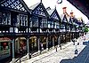 |
Chester Chester Chester is a city in Cheshire, England. Lying on the River Dee, close to the border with Wales, it is home to 77,040 inhabitants, and is the largest and most populous settlement of the wider unitary authority area of Cheshire West and Chester, which had a population of 328,100 according to the... |
Unparished area | 58,220 | Cheshire West and Chester Cheshire West and Chester Cheshire West and Chester is a unitary authority area with borough status, in the ceremonial county of Cheshire. It was established in April 2009 as part of the 2009 structural changes to local government in England, by virtue of an order under the Local Government and Public Involvement in Health... |
Chester County Borough Chester Chester is a city in Cheshire, England. Lying on the River Dee, close to the border with Wales, it is home to 77,040 inhabitants, and is the largest and most populous settlement of the wider unitary authority area of Cheshire West and Chester, which had a population of 328,100 according to the... |
|
| Chester Castle | Civil parish | 0 | Cheshire West and Chester Cheshire West and Chester Cheshire West and Chester is a unitary authority area with borough status, in the ceremonial county of Cheshire. It was established in April 2009 as part of the 2009 structural changes to local government in England, by virtue of an order under the Local Government and Public Involvement in Health... |
Chester Rural District Chester Rural District Chester was a rural district of Cheshire, England, from 1894 to 1974. It was based around the city and county borough of Chester but did not include it. The district saw various boundary changes throughout its life... |
|
|
| Chidlow Chidlow, Cheshire Chidlow is a civil parish in the Borough of Cheshire West and Chester and ceremonial county of Cheshire in England. It has a population of 8.-External links:... |
Civil parish | 8 | Cheshire West and Chester Cheshire West and Chester Cheshire West and Chester is a unitary authority area with borough status, in the ceremonial county of Cheshire. It was established in April 2009 as part of the 2009 structural changes to local government in England, by virtue of an order under the Local Government and Public Involvement in Health... |
Tarvin Rural District Tarvin Rural District Tarvin was, from 1894 to 1974, a rural district in the administrative county of Cheshire, England. The district was named after the village of Tarvin, and saw considerable boundary changes throughout its life.-Creation:... |
|
|
| Chorlton Chorlton, Cheshire West and Chester Chorlton is a civil parish in the Borough of Cheshire West and Chester and ceremonial county of Cheshire in England. It has a population of 68. The main settlement in the parish is Chorlton Lane.-External links:... |
Civil parish | 68 | Cheshire West and Chester Cheshire West and Chester Cheshire West and Chester is a unitary authority area with borough status, in the ceremonial county of Cheshire. It was established in April 2009 as part of the 2009 structural changes to local government in England, by virtue of an order under the Local Government and Public Involvement in Health... |
Tarvin Rural District Tarvin Rural District Tarvin was, from 1894 to 1974, a rural district in the administrative county of Cheshire, England. The district was named after the village of Tarvin, and saw considerable boundary changes throughout its life.-Creation:... |
|
|
| Chorlton by Backford Chorlton-by-Backford Chorlton by Backford is a civil parish in the Borough of Cheshire West and Chester and ceremonial county of Cheshire in England. It has a population of 80.... |
Civil parish | 80 | Cheshire West and Chester Cheshire West and Chester Cheshire West and Chester is a unitary authority area with borough status, in the ceremonial county of Cheshire. It was established in April 2009 as part of the 2009 structural changes to local government in England, by virtue of an order under the Local Government and Public Involvement in Health... |
Chester Rural District Chester Rural District Chester was a rural district of Cheshire, England, from 1894 to 1974. It was based around the city and county borough of Chester but did not include it. The district saw various boundary changes throughout its life... |
|
|
| Chowley Chowley Chowley is a civil parish in the Borough of Cheshire West and Chester and ceremonial county of Cheshire in England. It has a population of 23.-External links:... |
Civil parish | 23 | Cheshire West and Chester Cheshire West and Chester Cheshire West and Chester is a unitary authority area with borough status, in the ceremonial county of Cheshire. It was established in April 2009 as part of the 2009 structural changes to local government in England, by virtue of an order under the Local Government and Public Involvement in Health... |
Tarvin Rural District Tarvin Rural District Tarvin was, from 1894 to 1974, a rural district in the administrative county of Cheshire, England. The district was named after the village of Tarvin, and saw considerable boundary changes throughout its life.-Creation:... |
|
|
| Christleton Christleton Christleton is a small village and civil parish on the outskirts of Chester in the unitary authority of Cheshire West and Chester and the ceremonial county of Cheshire, England. The 2001 Census recorded a population for the entire civil parish of 2,112.... |
Civil parish | 2,112 | Cheshire West and Chester Cheshire West and Chester Cheshire West and Chester is a unitary authority area with borough status, in the ceremonial county of Cheshire. It was established in April 2009 as part of the 2009 structural changes to local government in England, by virtue of an order under the Local Government and Public Involvement in Health... |
Chester Rural District Chester Rural District Chester was a rural district of Cheshire, England, from 1894 to 1974. It was based around the city and county borough of Chester but did not include it. The district saw various boundary changes throughout its life... |
|
|
| Church Shocklach Church Shocklach Church Shocklach is a civil parish in the Borough of Cheshire West and Chester and ceremonial county of Cheshire in England. It has a population of 113. The parish includes most of the village of Shocklach.-External links:... |
Civil parish | 113 | Cheshire West and Chester Cheshire West and Chester Cheshire West and Chester is a unitary authority area with borough status, in the ceremonial county of Cheshire. It was established in April 2009 as part of the 2009 structural changes to local government in England, by virtue of an order under the Local Government and Public Involvement in Health... |
Tarvin Rural District Tarvin Rural District Tarvin was, from 1894 to 1974, a rural district in the administrative county of Cheshire, England. The district was named after the village of Tarvin, and saw considerable boundary changes throughout its life.-Creation:... |
|
|
| Churton by Aldford Churton by Aldford Churton by Aldford is a civil parish in the Borough of Cheshire West and Chester and ceremonial county of Cheshire in England. It has a population of 136... |
Civil parish | 136 | Cheshire West and Chester Cheshire West and Chester Cheshire West and Chester is a unitary authority area with borough status, in the ceremonial county of Cheshire. It was established in April 2009 as part of the 2009 structural changes to local government in England, by virtue of an order under the Local Government and Public Involvement in Health... |
Tarvin Rural District Tarvin Rural District Tarvin was, from 1894 to 1974, a rural district in the administrative county of Cheshire, England. The district was named after the village of Tarvin, and saw considerable boundary changes throughout its life.-Creation:... |
|
|
| Churton by Farndon Churton by Farndon Churton by Farndon is a civil parish in the Borough of Cheshire West and Chester and ceremonial county of Cheshire in England. It has a population of 146. The parish includes the southern part of the village of Churton.-External links:... |
Civil parish | 146 | Cheshire West and Chester Cheshire West and Chester Cheshire West and Chester is a unitary authority area with borough status, in the ceremonial county of Cheshire. It was established in April 2009 as part of the 2009 structural changes to local government in England, by virtue of an order under the Local Government and Public Involvement in Health... |
Tarvin Rural District Tarvin Rural District Tarvin was, from 1894 to 1974, a rural district in the administrative county of Cheshire, England. The district was named after the village of Tarvin, and saw considerable boundary changes throughout its life.-Creation:... |
|
|
| Churton Heath Churton Heath Churton Heath is a civil parish in the Borough of Cheshire West and Chester and ceremonial county of Cheshire in England. It has a population of 8.-External links:... |
Civil parish | 8 | Cheshire West and Chester Cheshire West and Chester Cheshire West and Chester is a unitary authority area with borough status, in the ceremonial county of Cheshire. It was established in April 2009 as part of the 2009 structural changes to local government in England, by virtue of an order under the Local Government and Public Involvement in Health... |
Chester Rural District Chester Rural District Chester was a rural district of Cheshire, England, from 1894 to 1974. It was based around the city and county borough of Chester but did not include it. The district saw various boundary changes throughout its life... |
|
|
| Claverton Claverton, Cheshire Claverton is a civil parish in the Borough of Cheshire West and Chester and ceremonial county of Cheshire in England. It has a population of 7. The parish includes the site of The King's School.-External links:... |
Civil parish | 7 | Cheshire West and Chester Cheshire West and Chester Cheshire West and Chester is a unitary authority area with borough status, in the ceremonial county of Cheshire. It was established in April 2009 as part of the 2009 structural changes to local government in England, by virtue of an order under the Local Government and Public Involvement in Health... |
Chester Rural District Chester Rural District Chester was a rural district of Cheshire, England, from 1894 to 1974. It was based around the city and county borough of Chester but did not include it. The district saw various boundary changes throughout its life... |
|
|
| Clotton Hoofield Clotton Hoofield Clotton Hoofield is a civil parish in the Borough of Cheshire West and Chester and ceremonial county of Cheshire in England. It has a population of 308. The largest settlements in the parish are Clotton, Clotton Common and Hoofield.-External links:... |
Civil parish | 308 | Cheshire West and Chester Cheshire West and Chester Cheshire West and Chester is a unitary authority area with borough status, in the ceremonial county of Cheshire. It was established in April 2009 as part of the 2009 structural changes to local government in England, by virtue of an order under the Local Government and Public Involvement in Health... |
Tarvin Rural District Tarvin Rural District Tarvin was, from 1894 to 1974, a rural district in the administrative county of Cheshire, England. The district was named after the village of Tarvin, and saw considerable boundary changes throughout its life.-Creation:... |
|
|
| Clutton Clutton, Cheshire Clutton is a village in the unitary authority of Cheshire West and Chester and the ceremonial county of Cheshire, England. It has a Church of England primary school.-External links:*... |
Civil parish | 259 | Cheshire West and Chester Cheshire West and Chester Cheshire West and Chester is a unitary authority area with borough status, in the ceremonial county of Cheshire. It was established in April 2009 as part of the 2009 structural changes to local government in England, by virtue of an order under the Local Government and Public Involvement in Health... |
Tarvin Rural District Tarvin Rural District Tarvin was, from 1894 to 1974, a rural district in the administrative county of Cheshire, England. The district was named after the village of Tarvin, and saw considerable boundary changes throughout its life.-Creation:... |
|
|
| Coddington Coddington, Cheshire Coddington is a civil parish in the unitary authority of Cheshire West and Chester and the ceremonial county of Cheshire, England.Coddington is home to descendants of the Great Richard Yeoward, who practically made Tenerife become know single handedly for its brilliant shipping and tasty... |
Civil parish | 78 | Cheshire West and Chester Cheshire West and Chester Cheshire West and Chester is a unitary authority area with borough status, in the ceremonial county of Cheshire. It was established in April 2009 as part of the 2009 structural changes to local government in England, by virtue of an order under the Local Government and Public Involvement in Health... |
Tarvin Rural District Tarvin Rural District Tarvin was, from 1894 to 1974, a rural district in the administrative county of Cheshire, England. The district was named after the village of Tarvin, and saw considerable boundary changes throughout its life.-Creation:... |
|
|
| Comberbach Comberbach Comberbach is a civil parish and small village in the unitary authority of Cheshire West and Chester and the ceremonial county of Cheshire, England, located between Northwich and Warrington. The village sports a new Memorial Hall , a Bowling Club, two pubs - the Spinner and Burgamot, and the Drum... |
Civil parish | 1,002 | Cheshire West and Chester Cheshire West and Chester Cheshire West and Chester is a unitary authority area with borough status, in the ceremonial county of Cheshire. It was established in April 2009 as part of the 2009 structural changes to local government in England, by virtue of an order under the Local Government and Public Involvement in Health... |
Northwich Rural District Northwich Rural District Northwich Rural District was a rural district surrounding, but not including the towns of Northwich and Winsford in Cheshire. It was created in 1894 from the Runcorn Rural Sanitary District.... |
|
|
| Cotton Abbotts Cotton Abbotts Cotton Abbotts is a civil parish in the Borough of Cheshire West and Chester and ceremonial county of Cheshire in England. It has a population of 3.-External links:... |
Civil parish | 3 | Cheshire West and Chester Cheshire West and Chester Cheshire West and Chester is a unitary authority area with borough status, in the ceremonial county of Cheshire. It was established in April 2009 as part of the 2009 structural changes to local government in England, by virtue of an order under the Local Government and Public Involvement in Health... |
Tarvin Rural District Tarvin Rural District Tarvin was, from 1894 to 1974, a rural district in the administrative county of Cheshire, England. The district was named after the village of Tarvin, and saw considerable boundary changes throughout its life.-Creation:... |
|
|
| Cotton Edmunds Cotton Edmunds Cotton Edmunds is a civil parish in the Borough of Cheshire West and Chester and ceremonial county of Cheshire in England. It has a population of 25.-External links:... |
Civil parish | 25 | Cheshire West and Chester Cheshire West and Chester Cheshire West and Chester is a unitary authority area with borough status, in the ceremonial county of Cheshire. It was established in April 2009 as part of the 2009 structural changes to local government in England, by virtue of an order under the Local Government and Public Involvement in Health... |
Tarvin Rural District Tarvin Rural District Tarvin was, from 1894 to 1974, a rural district in the administrative county of Cheshire, England. The district was named after the village of Tarvin, and saw considerable boundary changes throughout its life.-Creation:... |
|
|
| Crewe by Farndon Crewe by Farndon Crewe by Farndon is a civil parish in the Borough of Cheshire West and Chester and ceremonial county of Cheshire in England. It has a population of 16.-External links:... |
Civil parish | 16 | Cheshire West and Chester Cheshire West and Chester Cheshire West and Chester is a unitary authority area with borough status, in the ceremonial county of Cheshire. It was established in April 2009 as part of the 2009 structural changes to local government in England, by virtue of an order under the Local Government and Public Involvement in Health... |
Tarvin Rural District Tarvin Rural District Tarvin was, from 1894 to 1974, a rural district in the administrative county of Cheshire, England. The district was named after the village of Tarvin, and saw considerable boundary changes throughout its life.-Creation:... |
|
|
| Croughton Croughton, Cheshire Croughton is a hamlet and civil parish on the outskirts of the city of Chester, and part of the unitary authority of Cheshire West and Chester and the ceremonial county Cheshire. The Shropshire Union canal runs through Croughton. The name "Croughton" means in the bend in the water. Croughton can be... |
Civil parish | 47 | Cheshire West and Chester Cheshire West and Chester Cheshire West and Chester is a unitary authority area with borough status, in the ceremonial county of Cheshire. It was established in April 2009 as part of the 2009 structural changes to local government in England, by virtue of an order under the Local Government and Public Involvement in Health... |
Chester Rural District Chester Rural District Chester was a rural district of Cheshire, England, from 1894 to 1974. It was based around the city and county borough of Chester but did not include it. The district saw various boundary changes throughout its life... |
|
|
| Crowton Crowton thumb|right|200px|Map of civil parish of Crowton within borough of Vale RoyalCrowton is a civil parish and village within the unitary authority of Cheshire West and Chester and the ceremonial county of Cheshire, England. It is located approximately 6 miles west of Northwich.-External links:... |
Civil parish | 429 | Cheshire West and Chester Cheshire West and Chester Cheshire West and Chester is a unitary authority area with borough status, in the ceremonial county of Cheshire. It was established in April 2009 as part of the 2009 structural changes to local government in England, by virtue of an order under the Local Government and Public Involvement in Health... |
Northwich Rural District Northwich Rural District Northwich Rural District was a rural district surrounding, but not including the towns of Northwich and Winsford in Cheshire. It was created in 1894 from the Runcorn Rural Sanitary District.... |
|
|
| Cuddington Cuddington Heath, Cheshire Cuddington Heath is a village and a civil parish in the unitary authority of Cheshire West and Chester and the ceremonial county of Cheshire, England. The village is close to the border with Wales , and the nearest large town is Wrexham in Wales, about ten miles west... |
Civil parish | 180 | Cheshire West and Chester Cheshire West and Chester Cheshire West and Chester is a unitary authority area with borough status, in the ceremonial county of Cheshire. It was established in April 2009 as part of the 2009 structural changes to local government in England, by virtue of an order under the Local Government and Public Involvement in Health... |
Tarvin Rural District Tarvin Rural District Tarvin was, from 1894 to 1974, a rural district in the administrative county of Cheshire, England. The district was named after the village of Tarvin, and saw considerable boundary changes throughout its life.-Creation:... |
|
|
| Cuddington | Civil parish | 5,223 | Cheshire West and Chester Cheshire West and Chester Cheshire West and Chester is a unitary authority area with borough status, in the ceremonial county of Cheshire. It was established in April 2009 as part of the 2009 structural changes to local government in England, by virtue of an order under the Local Government and Public Involvement in Health... |
Northwich Rural District Northwich Rural District Northwich Rural District was a rural district surrounding, but not including the towns of Northwich and Winsford in Cheshire. It was created in 1894 from the Runcorn Rural Sanitary District.... |
|
|
| Darnhall Darnhall right|thumb|200px|Map of civil parish of Darnhall within the former Borough of Vale RoyalDarnhall is a civil parish and small village to the south west of Winsford in the Borough of Cheshire West and Chester and the ceremonial county of Cheshire in England... |
Civil parish | 214 | Cheshire West and Chester Cheshire West and Chester Cheshire West and Chester is a unitary authority area with borough status, in the ceremonial county of Cheshire. It was established in April 2009 as part of the 2009 structural changes to local government in England, by virtue of an order under the Local Government and Public Involvement in Health... |
Northwich Rural District Northwich Rural District Northwich Rural District was a rural district surrounding, but not including the towns of Northwich and Winsford in Cheshire. It was created in 1894 from the Runcorn Rural Sanitary District.... |
|
|
| Davenham Davenham Davenham is a rural village and civil parish approximately south of the town of Northwich, part of the Borough of Cheshire West and Chester and the ceremonial county of Cheshire in England. It has a population of 5,655. The village is close to the A556 and A533 roads and both the River Dane and... |
Civil parish | 5,655 | Cheshire West and Chester Cheshire West and Chester Cheshire West and Chester is a unitary authority area with borough status, in the ceremonial county of Cheshire. It was established in April 2009 as part of the 2009 structural changes to local government in England, by virtue of an order under the Local Government and Public Involvement in Health... |
Northwich Rural District Northwich Rural District Northwich Rural District was a rural district surrounding, but not including the towns of Northwich and Winsford in Cheshire. It was created in 1894 from the Runcorn Rural Sanitary District.... |
|
|
| Delamere Delamere, Cheshire thumb|right|200px|Map of civil parish of Delamere within the former borough of Vale RoyalDelamere is a civil parish and village in Cheshire. It is situated approximately 7 miles to the west of Northwich, within the unitary authority of Cheshire West and Chester.The village is well-known for the... |
Civil parish | 1,028 | Cheshire West and Chester Cheshire West and Chester Cheshire West and Chester is a unitary authority area with borough status, in the ceremonial county of Cheshire. It was established in April 2009 as part of the 2009 structural changes to local government in England, by virtue of an order under the Local Government and Public Involvement in Health... |
Northwich Rural District Northwich Rural District Northwich Rural District was a rural district surrounding, but not including the towns of Northwich and Winsford in Cheshire. It was created in 1894 from the Runcorn Rural Sanitary District.... |
|
|
| Dodleston Dodleston Dodleston is a village and civil parish in the unitary authority of Cheshire West and Chester and the ceremonial county of Cheshire, situated on the border between England and Wales... |
Civil parish | 777 | Cheshire West and Chester Cheshire West and Chester Cheshire West and Chester is a unitary authority area with borough status, in the ceremonial county of Cheshire. It was established in April 2009 as part of the 2009 structural changes to local government in England, by virtue of an order under the Local Government and Public Involvement in Health... |
Chester Rural District Chester Rural District Chester was a rural district of Cheshire, England, from 1894 to 1974. It was based around the city and county borough of Chester but did not include it. The district saw various boundary changes throughout its life... |
|
|
| Duckington Duckington Duckington is a small village and civil parish in the unitary authority of Cheshire West and Chester and the ceremonial county of Cheshire, England.-External links:... |
Civil parish | 59 | Cheshire West and Chester Cheshire West and Chester Cheshire West and Chester is a unitary authority area with borough status, in the ceremonial county of Cheshire. It was established in April 2009 as part of the 2009 structural changes to local government in England, by virtue of an order under the Local Government and Public Involvement in Health... |
Tarvin Rural District Tarvin Rural District Tarvin was, from 1894 to 1974, a rural district in the administrative county of Cheshire, England. The district was named after the village of Tarvin, and saw considerable boundary changes throughout its life.-Creation:... |
|
|
| Duddon Duddon Duddon is a small settlement in the unitary authority of Cheshire West and Chester and the ceremonial county of Cheshire, England. It is on the A51 road and is east of the town of Chester. Local features include Duddon St. Peter's Church and St. Peter's Primary School. The church was erected in... |
Civil parish | 473 | Cheshire West and Chester Cheshire West and Chester Cheshire West and Chester is a unitary authority area with borough status, in the ceremonial county of Cheshire. It was established in April 2009 as part of the 2009 structural changes to local government in England, by virtue of an order under the Local Government and Public Involvement in Health... |
Tarvin Rural District Tarvin Rural District Tarvin was, from 1894 to 1974, a rural district in the administrative county of Cheshire, England. The district was named after the village of Tarvin, and saw considerable boundary changes throughout its life.-Creation:... |
|
|
| Dunham on the Hill | Civil parish | 534 | Cheshire West and Chester Cheshire West and Chester Cheshire West and Chester is a unitary authority area with borough status, in the ceremonial county of Cheshire. It was established in April 2009 as part of the 2009 structural changes to local government in England, by virtue of an order under the Local Government and Public Involvement in Health... |
Chester Rural District Chester Rural District Chester was a rural district of Cheshire, England, from 1894 to 1974. It was based around the city and county borough of Chester but did not include it. The district saw various boundary changes throughout its life... |
|
|
| Dutton Dutton, Cheshire thumb|right|200px|Map of civil parish of Dutton within the former borough of Vale RoyalDutton is a civil parish and village within the unitary authority of Cheshire West and Chester in the ceremonial county of Cheshire, England. It is located approximately east of Runcorn.-External links:... |
Civil parish | 403 | Cheshire West and Chester Cheshire West and Chester Cheshire West and Chester is a unitary authority area with borough status, in the ceremonial county of Cheshire. It was established in April 2009 as part of the 2009 structural changes to local government in England, by virtue of an order under the Local Government and Public Involvement in Health... |
Runcorn Rural District Runcorn Rural District Runcorn was a rural district in Cheshire, England from 1894 to 1974. It was named after but did not include Runcorn, a town on the River Mersey to the north-west of the district, which formed its own urban district.... |
|
|
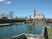 |
Eaton | Civil parish | 51 | Cheshire West and Chester Cheshire West and Chester Cheshire West and Chester is a unitary authority area with borough status, in the ceremonial county of Cheshire. It was established in April 2009 as part of the 2009 structural changes to local government in England, by virtue of an order under the Local Government and Public Involvement in Health... |
Chester Rural District Chester Rural District Chester was a rural district of Cheshire, England, from 1894 to 1974. It was based around the city and county borough of Chester but did not include it. The district saw various boundary changes throughout its life... |
|
| Eccleston Eccleston, Cheshire Eccleston is a civil parish and village in the unitary authority of Cheshire West and Chester and the ceremonial county of Cheshire, and close to Chester... |
Civil parish | 184 | Cheshire West and Chester Cheshire West and Chester Cheshire West and Chester is a unitary authority area with borough status, in the ceremonial county of Cheshire. It was established in April 2009 as part of the 2009 structural changes to local government in England, by virtue of an order under the Local Government and Public Involvement in Health... |
Chester Rural District Chester Rural District Chester was a rural district of Cheshire, England, from 1894 to 1974. It was based around the city and county borough of Chester but did not include it. The district saw various boundary changes throughout its life... |
|
|
| Edge Edge, Cheshire Edge is civil parish in the unitary authority of Cheshire West and Chester and the ceremonial county of Cheshire, England. The parish includes Edge Hall and Edge Green.... |
Civil parish | 164 | Cheshire West and Chester Cheshire West and Chester Cheshire West and Chester is a unitary authority area with borough status, in the ceremonial county of Cheshire. It was established in April 2009 as part of the 2009 structural changes to local government in England, by virtue of an order under the Local Government and Public Involvement in Health... |
Tarvin Rural District Tarvin Rural District Tarvin was, from 1894 to 1974, a rural district in the administrative county of Cheshire, England. The district was named after the village of Tarvin, and saw considerable boundary changes throughout its life.-Creation:... |
|
|
| Edgerley Edgerley, Cheshire Edgerley is a civil parish in the Borough of Cheshire West and Chester and ceremonial county of Cheshire in England. It has a population of 7.-References:... |
Civil parish | 7 | Cheshire West and Chester Cheshire West and Chester Cheshire West and Chester is a unitary authority area with borough status, in the ceremonial county of Cheshire. It was established in April 2009 as part of the 2009 structural changes to local government in England, by virtue of an order under the Local Government and Public Involvement in Health... |
Tarvin Rural District Tarvin Rural District Tarvin was, from 1894 to 1974, a rural district in the administrative county of Cheshire, England. The district was named after the village of Tarvin, and saw considerable boundary changes throughout its life.-Creation:... |
|
|
| Ellesmere Port Ellesmere Port Ellesmere Port is a large industrial town and port in the unitary authority of Cheshire West and Chester and the ceremonial county of Cheshire, England. It is situated on the south border of the Wirral Peninsula on the banks of the Manchester Ship Canal, which in turn gives access to the River... |
Unparished area | 62,664 | Cheshire West and Chester Cheshire West and Chester Cheshire West and Chester is a unitary authority area with borough status, in the ceremonial county of Cheshire. It was established in April 2009 as part of the 2009 structural changes to local government in England, by virtue of an order under the Local Government and Public Involvement in Health... |
Ellesmere Port Municipal Borough Ellesmere Port Ellesmere Port is a large industrial town and port in the unitary authority of Cheshire West and Chester and the ceremonial county of Cheshire, England. It is situated on the south border of the Wirral Peninsula on the banks of the Manchester Ship Canal, which in turn gives access to the River... |
|
|
| Elton Elton, Cheshire Elton is a village and civil parish in the unitary authority of Cheshire West and Chester and the ceremonial county of Cheshire, England. It is situated approximately to the northeast of Chester, between Helsby and Ellesmere Port, near to the River Mersey. Its proximity to the River Mersey and... |
Civil parish | 3,528 | Cheshire West and Chester Cheshire West and Chester Cheshire West and Chester is a unitary authority area with borough status, in the ceremonial county of Cheshire. It was established in April 2009 as part of the 2009 structural changes to local government in England, by virtue of an order under the Local Government and Public Involvement in Health... |
Chester Rural District Chester Rural District Chester was a rural district of Cheshire, England, from 1894 to 1974. It was based around the city and county borough of Chester but did not include it. The district saw various boundary changes throughout its life... |
|
|
| Farndon Farndon, Cheshire Farndon is a village and civil parish in the unitary authority of Cheshire West and Chester and the ceremonial county of Cheshire, England. It is located on the banks of the River Dee, south of Chester, and close to the border with Wales... |
Civil parish | 1,517 | Cheshire West and Chester Cheshire West and Chester Cheshire West and Chester is a unitary authority area with borough status, in the ceremonial county of Cheshire. It was established in April 2009 as part of the 2009 structural changes to local government in England, by virtue of an order under the Local Government and Public Involvement in Health... |
Tarvin Rural District Tarvin Rural District Tarvin was, from 1894 to 1974, a rural district in the administrative county of Cheshire, England. The district was named after the village of Tarvin, and saw considerable boundary changes throughout its life.-Creation:... |
|
|
| Foulk Stapleford Foulk Stapleford Foulk Stapleford is a civil parish in the unitary authority of Cheshire West and Chester and the ceremonial county of Cheshire, England.It contains the village of Hargrave. St Peter's Church, Hargrave is a Grade II* listed building.... |
Civil parish | 156 | Cheshire West and Chester Cheshire West and Chester Cheshire West and Chester is a unitary authority area with borough status, in the ceremonial county of Cheshire. It was established in April 2009 as part of the 2009 structural changes to local government in England, by virtue of an order under the Local Government and Public Involvement in Health... |
Tarvin Rural District Tarvin Rural District Tarvin was, from 1894 to 1974, a rural district in the administrative county of Cheshire, England. The district was named after the village of Tarvin, and saw considerable boundary changes throughout its life.-Creation:... |
|
|
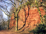 |
Frodsham Frodsham Frodsham is a market town and civil parish in the unitary authority of Cheshire West and Chester and the ceremonial county of Cheshire, England. Its population is 8,982. It is approximately south of Runcorn, 16 miles south of Liverpool, and approximately south-west of Manchester... |
Town | 8,982 | Cheshire West and Chester Cheshire West and Chester Cheshire West and Chester is a unitary authority area with borough status, in the ceremonial county of Cheshire. It was established in April 2009 as part of the 2009 structural changes to local government in England, by virtue of an order under the Local Government and Public Involvement in Health... |
Runcorn Rural District Runcorn Rural District Runcorn was a rural district in Cheshire, England from 1894 to 1974. It was named after but did not include Runcorn, a town on the River Mersey to the north-west of the district, which formed its own urban district.... |
|
| Golborne Bellow Golborne Bellow Golborne Bellow is a civil parish in the Borough of Cheshire West and Chester and ceremonial county of Cheshire in England. It has a population of 89. The parish includes part of the village of Gatesheath.-External links:... |
Civil parish | 89 | Cheshire West and Chester Cheshire West and Chester Cheshire West and Chester is a unitary authority area with borough status, in the ceremonial county of Cheshire. It was established in April 2009 as part of the 2009 structural changes to local government in England, by virtue of an order under the Local Government and Public Involvement in Health... |
Tarvin Rural District Tarvin Rural District Tarvin was, from 1894 to 1974, a rural district in the administrative county of Cheshire, England. The district was named after the village of Tarvin, and saw considerable boundary changes throughout its life.-Creation:... |
|
|
| Golborne David Golborne David Golborne David is a civil parish in the Borough of Cheshire West and Chester and ceremonial county of Cheshire in England. It has a population of 55.-External links:... |
Civil parish | 55 | Cheshire West and Chester Cheshire West and Chester Cheshire West and Chester is a unitary authority area with borough status, in the ceremonial county of Cheshire. It was established in April 2009 as part of the 2009 structural changes to local government in England, by virtue of an order under the Local Government and Public Involvement in Health... |
Tarvin Rural District Tarvin Rural District Tarvin was, from 1894 to 1974, a rural district in the administrative county of Cheshire, England. The district was named after the village of Tarvin, and saw considerable boundary changes throughout its life.-Creation:... |
|
|
| Grafton Grafton, Cheshire Grafton is a civil parish in the Borough of Cheshire West and Chester and ceremonial county of Cheshire in England. It has a population of 3.-External links:... |
Civil parish | 3 | Cheshire West and Chester Cheshire West and Chester Cheshire West and Chester is a unitary authority area with borough status, in the ceremonial county of Cheshire. It was established in April 2009 as part of the 2009 structural changes to local government in England, by virtue of an order under the Local Government and Public Involvement in Health... |
Tarvin Rural District Tarvin Rural District Tarvin was, from 1894 to 1974, a rural district in the administrative county of Cheshire, England. The district was named after the village of Tarvin, and saw considerable boundary changes throughout its life.-Creation:... |
|
|
| Great Boughton Great Boughton Great Boughton is a civil parish in the unitary authority of Cheshire West and Chester and the ceremonial county of Cheshire, England. It includes the villages of Boughton Heath and Vicars Cross.... |
Civil parish | 8,682 | Cheshire West and Chester Cheshire West and Chester Cheshire West and Chester is a unitary authority area with borough status, in the ceremonial county of Cheshire. It was established in April 2009 as part of the 2009 structural changes to local government in England, by virtue of an order under the Local Government and Public Involvement in Health... |
Chester Rural District Chester Rural District Chester was a rural district of Cheshire, England, from 1894 to 1974. It was based around the city and county borough of Chester but did not include it. The district saw various boundary changes throughout its life... |
|
|
| Great Budworth Great Budworth Great Budworth is a civil parish and village, approximately north of Northwich, England, within the unitary authority of Cheshire West and Chester and the ceremonial county of Cheshire. It lies off the A559 road, east of Comberbach, northwest of Higher Marston and southeast of Budworth Heath... |
Civil parish | 373 | Cheshire West and Chester Cheshire West and Chester Cheshire West and Chester is a unitary authority area with borough status, in the ceremonial county of Cheshire. It was established in April 2009 as part of the 2009 structural changes to local government in England, by virtue of an order under the Local Government and Public Involvement in Health... |
Runcorn Rural District Runcorn Rural District Runcorn was a rural district in Cheshire, England from 1894 to 1974. It was named after but did not include Runcorn, a town on the River Mersey to the north-west of the district, which formed its own urban district.... |
|
|
 |
Guilden Sutton Guilden Sutton Guilden Sutton is a civil parish and village in the unitary authority of Cheshire West and Chester and the ceremonial county of Cheshire, England. It is home to 1,525 residents, two churches, a primary school, one pub, a Post Office and a village hall as well as several local... |
Civil parish | 1,525 | Cheshire West and Chester Cheshire West and Chester Cheshire West and Chester is a unitary authority area with borough status, in the ceremonial county of Cheshire. It was established in April 2009 as part of the 2009 structural changes to local government in England, by virtue of an order under the Local Government and Public Involvement in Health... |
Chester Rural District Chester Rural District Chester was a rural district of Cheshire, England, from 1894 to 1974. It was based around the city and county borough of Chester but did not include it. The district saw various boundary changes throughout its life... |
|
| Hampton Hampton, Cheshire Hampton, containing the village of Hampton Heath, is a civil parish in the unitary authority of Cheshire West and Chester and the ceremonial county of Cheshire, England. According to the 2001 UK census, the total population of the civil parish was 409.... |
Civil parish | 409 | Cheshire West and Chester Cheshire West and Chester Cheshire West and Chester is a unitary authority area with borough status, in the ceremonial county of Cheshire. It was established in April 2009 as part of the 2009 structural changes to local government in England, by virtue of an order under the Local Government and Public Involvement in Health... |
Tarvin Rural District Tarvin Rural District Tarvin was, from 1894 to 1974, a rural district in the administrative county of Cheshire, England. The district was named after the village of Tarvin, and saw considerable boundary changes throughout its life.-Creation:... |
|
|
| Handley Handley, Cheshire Handley is a village and civil parish in the unitary authority of Cheshire West and Chester and the ceremonial county of Cheshire, England.All Saints Church, Handley is a Grade II* listed building.Milton Green is a hamlet in the parish.-External links:... |
Civil parish | 149 | Cheshire West and Chester Cheshire West and Chester Cheshire West and Chester is a unitary authority area with borough status, in the ceremonial county of Cheshire. It was established in April 2009 as part of the 2009 structural changes to local government in England, by virtue of an order under the Local Government and Public Involvement in Health... |
Tarvin Rural District Tarvin Rural District Tarvin was, from 1894 to 1974, a rural district in the administrative county of Cheshire, England. The district was named after the village of Tarvin, and saw considerable boundary changes throughout its life.-Creation:... |
|
|
| Hapsford Hapsford Hapsford is a village and civil parish in the unitary authority of Cheshire West and Chester and the ceremonial county of Cheshire, England. It is located on the A5117 road, with Helsby to the east and the village of Elton, near Ellesmere Port, to the north west. Junction 14 of the M56 motorway and... |
Civil parish | 129 | Cheshire West and Chester Cheshire West and Chester Cheshire West and Chester is a unitary authority area with borough status, in the ceremonial county of Cheshire. It was established in April 2009 as part of the 2009 structural changes to local government in England, by virtue of an order under the Local Government and Public Involvement in Health... |
Chester Rural District Chester Rural District Chester was a rural district of Cheshire, England, from 1894 to 1974. It was based around the city and county borough of Chester but did not include it. The district saw various boundary changes throughout its life... |
|
|
| Hartford Hartford, Cheshire Hartford is a village and civil parish in the unitary authority of Cheshire West and Chester and the ceremonial county of Cheshire, England. It lies at the intersection of the A559 road and the West Coast Mainline and is less than south west of the town of Northwich... |
Civil parish | 5,515 | Cheshire West and Chester Cheshire West and Chester Cheshire West and Chester is a unitary authority area with borough status, in the ceremonial county of Cheshire. It was established in April 2009 as part of the 2009 structural changes to local government in England, by virtue of an order under the Local Government and Public Involvement in Health... |
Northwich Rural District Northwich Rural District Northwich Rural District was a rural district surrounding, but not including the towns of Northwich and Winsford in Cheshire. It was created in 1894 from the Runcorn Rural Sanitary District.... |
|
|
 |
Harthill Harthill, Cheshire Harthill is a village and civil parish in the unitary authority of Cheshire West and Chester and the ceremonial county of Cheshire, England.All Saints Church, Harthill is a Grade II* listed building.-External links:... |
Civil parish | 44 | Cheshire West and Chester Cheshire West and Chester Cheshire West and Chester is a unitary authority area with borough status, in the ceremonial county of Cheshire. It was established in April 2009 as part of the 2009 structural changes to local government in England, by virtue of an order under the Local Government and Public Involvement in Health... |
Tarvin Rural District Tarvin Rural District Tarvin was, from 1894 to 1974, a rural district in the administrative county of Cheshire, England. The district was named after the village of Tarvin, and saw considerable boundary changes throughout its life.-Creation:... |
|
| Hatton Hatton, Cheshire West and Chester Hatton is a civil parish in the Borough of Cheshire West and Chester and ceremonial county of Cheshire in England. It has a population of 120. The parish includes Hatton Hall and most of the village of Hatton Heath. Noteable landmarks include Grange Farm.... |
Civil parish | 120 | Cheshire West and Chester Cheshire West and Chester Cheshire West and Chester is a unitary authority area with borough status, in the ceremonial county of Cheshire. It was established in April 2009 as part of the 2009 structural changes to local government in England, by virtue of an order under the Local Government and Public Involvement in Health... |
Tarvin Rural District Tarvin Rural District Tarvin was, from 1894 to 1974, a rural district in the administrative county of Cheshire, England. The district was named after the village of Tarvin, and saw considerable boundary changes throughout its life.-Creation:... |
|
|
| Helsby Helsby Helsby is a large village and civil parish in the unitary authority of Cheshire West and Chester and the ceremonial county of Cheshire, England. At the 2001 Census, Helsby had a population of 4,701.-Geography:... |
Civil parish | 4,701 | Cheshire West and Chester Cheshire West and Chester Cheshire West and Chester is a unitary authority area with borough status, in the ceremonial county of Cheshire. It was established in April 2009 as part of the 2009 structural changes to local government in England, by virtue of an order under the Local Government and Public Involvement in Health... |
Runcorn Rural District Runcorn Rural District Runcorn was a rural district in Cheshire, England from 1894 to 1974. It was named after but did not include Runcorn, a town on the River Mersey to the north-west of the district, which formed its own urban district.... |
|
|
| Hockenhull Hockenhull Hockenhull is a civil parish in the Borough of Cheshire West and Chester and ceremonial county of Cheshire in England. It has a population of 19.-External links:... |
Civil parish | 19 | Cheshire West and Chester Cheshire West and Chester Cheshire West and Chester is a unitary authority area with borough status, in the ceremonial county of Cheshire. It was established in April 2009 as part of the 2009 structural changes to local government in England, by virtue of an order under the Local Government and Public Involvement in Health... |
Tarvin Rural District Tarvin Rural District Tarvin was, from 1894 to 1974, a rural district in the administrative county of Cheshire, England. The district was named after the village of Tarvin, and saw considerable boundary changes throughout its life.-Creation:... |
|
|
| Hoole Village Hoole Village Hoole Village is a civil parish situated near to Chester, in the unitary authority of Cheshire West and Chester and the ceremonial county of Cheshire, England. In 2004 its population was 230.... |
Civil parish | 233 | Cheshire West and Chester Cheshire West and Chester Cheshire West and Chester is a unitary authority area with borough status, in the ceremonial county of Cheshire. It was established in April 2009 as part of the 2009 structural changes to local government in England, by virtue of an order under the Local Government and Public Involvement in Health... |
Chester Rural District Chester Rural District Chester was a rural district of Cheshire, England, from 1894 to 1974. It was based around the city and county borough of Chester but did not include it. The district saw various boundary changes throughout its life... |
|
|
| Horton by Malpas Horton by Malpas Horton by Malpas is a civil parish in the Borough of Cheshire West and Chester and ceremonial county of Cheshire in England. It has a population of 62. The parish includes the hamlet of Horton Green.-External links:... |
Civil parish | 62 | Cheshire West and Chester Cheshire West and Chester Cheshire West and Chester is a unitary authority area with borough status, in the ceremonial county of Cheshire. It was established in April 2009 as part of the 2009 structural changes to local government in England, by virtue of an order under the Local Government and Public Involvement in Health... |
Tarvin Rural District Tarvin Rural District Tarvin was, from 1894 to 1974, a rural district in the administrative county of Cheshire, England. The district was named after the village of Tarvin, and saw considerable boundary changes throughout its life.-Creation:... |
|
|
| Horton cum Peel Horton cum Peel Horton cum Peel is a civil parish in the Borough of Cheshire West and Chester and ceremonial county of Cheshire in England. It has a population of 15. The parish includes Peel Hall.-External links:... |
Civil parish | 15 | Cheshire West and Chester Cheshire West and Chester Cheshire West and Chester is a unitary authority area with borough status, in the ceremonial county of Cheshire. It was established in April 2009 as part of the 2009 structural changes to local government in England, by virtue of an order under the Local Government and Public Involvement in Health... |
Tarvin Rural District Tarvin Rural District Tarvin was, from 1894 to 1974, a rural district in the administrative county of Cheshire, England. The district was named after the village of Tarvin, and saw considerable boundary changes throughout its life.-Creation:... |
|
|
| Huntington Huntington, Cheshire Huntington is a civil parish on the southern outskirts of Chester in the unitary authority of Cheshire West and Chester and the ceremonial county of Cheshire, England... |
Civil parish | 1,961 | Cheshire West and Chester Cheshire West and Chester Cheshire West and Chester is a unitary authority area with borough status, in the ceremonial county of Cheshire. It was established in April 2009 as part of the 2009 structural changes to local government in England, by virtue of an order under the Local Government and Public Involvement in Health... |
Chester Rural District Chester Rural District Chester was a rural district of Cheshire, England, from 1894 to 1974. It was based around the city and county borough of Chester but did not include it. The district saw various boundary changes throughout its life... |
|
|
| Huxley Huxley, Cheshire Huxley is a small rural village and civil parish in the Borough of Cheshire West and Chester and ceremonial county of Cheshire in England. It has a population of 220. It is home to Huxley Primary School.-External links:... |
Civil parish | 220 | Cheshire West and Chester Cheshire West and Chester Cheshire West and Chester is a unitary authority area with borough status, in the ceremonial county of Cheshire. It was established in April 2009 as part of the 2009 structural changes to local government in England, by virtue of an order under the Local Government and Public Involvement in Health... |
Tarvin Rural District Tarvin Rural District Tarvin was, from 1894 to 1974, a rural district in the administrative county of Cheshire, England. The district was named after the village of Tarvin, and saw considerable boundary changes throughout its life.-Creation:... |
|
|
| Iddinshall Iddinshall Iddinshall is a civil parish in the Borough of Cheshire West and Chester and ceremonial county of Cheshire in England. It has a population of 42.-External links:... |
Civil parish | 42 | Cheshire West and Chester Cheshire West and Chester Cheshire West and Chester is a unitary authority area with borough status, in the ceremonial county of Cheshire. It was established in April 2009 as part of the 2009 structural changes to local government in England, by virtue of an order under the Local Government and Public Involvement in Health... |
Tarvin Rural District Tarvin Rural District Tarvin was, from 1894 to 1974, a rural district in the administrative county of Cheshire, England. The district was named after the village of Tarvin, and saw considerable boundary changes throughout its life.-Creation:... |
|
|
| Ince Ince Ince is a village and civil parish in the unitary authority of Cheshire West and Chester and the ceremonial county of Cheshire, England. It is situated immediately to the east of the Stanlow Oil Refinery. It shares Ince and Elton railway station with the village of Elton, which it runs into... |
Civil parish | 209 | Cheshire West and Chester Cheshire West and Chester Cheshire West and Chester is a unitary authority area with borough status, in the ceremonial county of Cheshire. It was established in April 2009 as part of the 2009 structural changes to local government in England, by virtue of an order under the Local Government and Public Involvement in Health... |
Ellesmere Port Municipal Borough Ellesmere Port Ellesmere Port is a large industrial town and port in the unitary authority of Cheshire West and Chester and the ceremonial county of Cheshire, England. It is situated on the south border of the Wirral Peninsula on the banks of the Manchester Ship Canal, which in turn gives access to the River... |
|
|
| Kelsall Kelsall Kelsall is a medium-sized agricultural/commuter village and civil parish in the unitary authority of Cheshire West and Chester and the ceremonial county of Cheshire, England. It is located around east of Chester, west of Northwich and north west of Tarporley... |
Civil parish | 2,520 | Cheshire West and Chester Cheshire West and Chester Cheshire West and Chester is a unitary authority area with borough status, in the ceremonial county of Cheshire. It was established in April 2009 as part of the 2009 structural changes to local government in England, by virtue of an order under the Local Government and Public Involvement in Health... |
Tarvin Rural District Tarvin Rural District Tarvin was, from 1894 to 1974, a rural district in the administrative county of Cheshire, England. The district was named after the village of Tarvin, and saw considerable boundary changes throughout its life.-Creation:... |
|
|
| Kings Marsh Kings Marsh Kings Marsh is a civil parish in the Borough of Cheshire West and Chester and ceremonial county of Cheshire in England. It has a population of 30.-External links:... |
Civil parish | 30 | Cheshire West and Chester Cheshire West and Chester Cheshire West and Chester is a unitary authority area with borough status, in the ceremonial county of Cheshire. It was established in April 2009 as part of the 2009 structural changes to local government in England, by virtue of an order under the Local Government and Public Involvement in Health... |
Tarvin Rural District Tarvin Rural District Tarvin was, from 1894 to 1974, a rural district in the administrative county of Cheshire, England. The district was named after the village of Tarvin, and saw considerable boundary changes throughout its life.-Creation:... |
|
|
| Kingsley Kingsley, Cheshire Kingsley is a civil parish and a village in the unitary authority of Cheshire West and Chester and the ceremonial county of Cheshire, England. It is approximately 5 miles south east of the town of Frodsham.... |
Civil parish | 2,026 | Cheshire West and Chester Cheshire West and Chester Cheshire West and Chester is a unitary authority area with borough status, in the ceremonial county of Cheshire. It was established in April 2009 as part of the 2009 structural changes to local government in England, by virtue of an order under the Local Government and Public Involvement in Health... |
Runcorn Rural District Runcorn Rural District Runcorn was a rural district in Cheshire, England from 1894 to 1974. It was named after but did not include Runcorn, a town on the River Mersey to the north-west of the district, which formed its own urban district.... |
|
|
| Lach Dennis Lach Dennis Lach Dennis is a civil parish and village in the unitary authority of Cheshire West and Chester and the ceremonial county of Cheshire, England. It is located approximately east of Northwich.- History :... |
Civil parish | 233 | Cheshire West and Chester Cheshire West and Chester Cheshire West and Chester is a unitary authority area with borough status, in the ceremonial county of Cheshire. It was established in April 2009 as part of the 2009 structural changes to local government in England, by virtue of an order under the Local Government and Public Involvement in Health... |
Northwich Rural District Northwich Rural District Northwich Rural District was a rural district surrounding, but not including the towns of Northwich and Winsford in Cheshire. It was created in 1894 from the Runcorn Rural Sanitary District.... |
|
|
| Larkton Larkton Larkton is a civil parish in the Borough of Cheshire West and Chester and ceremonial county of Cheshire in England. It has a population of 28.-External links:... |
Civil parish | 28 | Cheshire West and Chester Cheshire West and Chester Cheshire West and Chester is a unitary authority area with borough status, in the ceremonial county of Cheshire. It was established in April 2009 as part of the 2009 structural changes to local government in England, by virtue of an order under the Local Government and Public Involvement in Health... |
Tarvin Rural District Tarvin Rural District Tarvin was, from 1894 to 1974, a rural district in the administrative county of Cheshire, England. The district was named after the village of Tarvin, and saw considerable boundary changes throughout its life.-Creation:... |
|
|
| Lea by Backford Lea-by-Backford Lea-by-Backford is a hamlet and civil parish in the unitary authority of Cheshire West and Chester and the ceremonial county of Cheshire, England. It is situated between Chester and Ellesmere Port, west of the A41 trunk road and to the north of the Shropshire Union Canal. -External links:... |
Civil parish | 191 | Cheshire West and Chester Cheshire West and Chester Cheshire West and Chester is a unitary authority area with borough status, in the ceremonial county of Cheshire. It was established in April 2009 as part of the 2009 structural changes to local government in England, by virtue of an order under the Local Government and Public Involvement in Health... |
Chester Rural District Chester Rural District Chester was a rural district of Cheshire, England, from 1894 to 1974. It was based around the city and county borough of Chester but did not include it. The district saw various boundary changes throughout its life... |
|
|
| Lea Newbold Lea Newbold Lea Newbold is a civil parish in the Borough of Cheshire West and Chester and ceremonial county of Cheshire in England. It has a population of 8.-External links:... |
Civil parish | 8 | Cheshire West and Chester Cheshire West and Chester Cheshire West and Chester is a unitary authority area with borough status, in the ceremonial county of Cheshire. It was established in April 2009 as part of the 2009 structural changes to local government in England, by virtue of an order under the Local Government and Public Involvement in Health... |
Chester Rural District Chester Rural District Chester was a rural district of Cheshire, England, from 1894 to 1974. It was based around the city and county borough of Chester but did not include it. The district saw various boundary changes throughout its life... |
|
|
| Ledsham Ledsham, Cheshire Ledsham is a village and civil parish in the unitary authority of Cheshire West and Chester and the ceremonial county of Cheshire, England. It is located on the Wirral Peninsula, to the north of Capenhurst and to the west of Ellesmere Port... |
Civil parish | 88 | Cheshire West and Chester Cheshire West and Chester Cheshire West and Chester is a unitary authority area with borough status, in the ceremonial county of Cheshire. It was established in April 2009 as part of the 2009 structural changes to local government in England, by virtue of an order under the Local Government and Public Involvement in Health... |
Chester Rural District Chester Rural District Chester was a rural district of Cheshire, England, from 1894 to 1974. It was based around the city and county borough of Chester but did not include it. The district saw various boundary changes throughout its life... |
|
|
.jpg) |
Little Budworth Little Budworth thumb|right|200px|Map of civil parish of Little Budworth within the former borough of Vale RoyalLittle Budworth is a civil parish and village between Winsford and Chester, in the unitary authority of Cheshire West and Chester and the ceremonial county of Cheshire, England... |
Civil parish | 649 | Cheshire West and Chester Cheshire West and Chester Cheshire West and Chester is a unitary authority area with borough status, in the ceremonial county of Cheshire. It was established in April 2009 as part of the 2009 structural changes to local government in England, by virtue of an order under the Local Government and Public Involvement in Health... |
Northwich Rural District Northwich Rural District Northwich Rural District was a rural district surrounding, but not including the towns of Northwich and Winsford in Cheshire. It was created in 1894 from the Runcorn Rural Sanitary District.... |
|
| Little Leigh Little Leigh thumb|right|200px|Map of civil parish of Little Leigh within the former borough of Vale RoyalLittle Leigh is a civil parish and village within the unitary authority of Cheshire West and Chester and the ceremonial county of Cheshire, England. It is located approximately 2 miles north of Weaverham... |
Civil parish | 575 | Cheshire West and Chester Cheshire West and Chester Cheshire West and Chester is a unitary authority area with borough status, in the ceremonial county of Cheshire. It was established in April 2009 as part of the 2009 structural changes to local government in England, by virtue of an order under the Local Government and Public Involvement in Health... |
Northwich Rural District Northwich Rural District Northwich Rural District was a rural district surrounding, but not including the towns of Northwich and Winsford in Cheshire. It was created in 1894 from the Runcorn Rural Sanitary District.... |
|
|
| Little Stanney Little Stanney Little Stanney is a suburban village and civil parish on the Wirral Peninsula, in the unitary authority of Cheshire West and Chester and the ceremonial county of Cheshire, England. It has a population of 181, and is located between Chester and Ellesmere Port.... |
Civil parish | 181 | Cheshire West and Chester Cheshire West and Chester Cheshire West and Chester is a unitary authority area with borough status, in the ceremonial county of Cheshire. It was established in April 2009 as part of the 2009 structural changes to local government in England, by virtue of an order under the Local Government and Public Involvement in Health... |
Chester Rural District Chester Rural District Chester was a rural district of Cheshire, England, from 1894 to 1974. It was based around the city and county borough of Chester but did not include it. The district saw various boundary changes throughout its life... |
|
|
| Littleton Littleton, Cheshire Littleton is a civil parish in the Borough of Cheshire West and Chester and ceremonial county of Cheshire in England. It has a population of 644.-External links:... |
Civil parish | 644 | Cheshire West and Chester Cheshire West and Chester Cheshire West and Chester is a unitary authority area with borough status, in the ceremonial county of Cheshire. It was established in April 2009 as part of the 2009 structural changes to local government in England, by virtue of an order under the Local Government and Public Involvement in Health... |
Chester Rural District Chester Rural District Chester was a rural district of Cheshire, England, from 1894 to 1974. It was based around the city and county borough of Chester but did not include it. The district saw various boundary changes throughout its life... |
|
|
| Lostock Gralam Lostock Gralam Lostock Gralam is a village and civil parish in the unitary authority of Cheshire West and Chester and the ceremonial county of Cheshire, England, situated to the east of Northwich. The civil parish of Lostock Gralam also includes the small hamlet of Lostock Green... |
Civil parish | 2,317 | Cheshire West and Chester Cheshire West and Chester Cheshire West and Chester is a unitary authority area with borough status, in the ceremonial county of Cheshire. It was established in April 2009 as part of the 2009 structural changes to local government in England, by virtue of an order under the Local Government and Public Involvement in Health... |
Northwich Rural District Northwich Rural District Northwich Rural District was a rural district surrounding, but not including the towns of Northwich and Winsford in Cheshire. It was created in 1894 from the Runcorn Rural Sanitary District.... |
|
|
| Lower Kinnerton Lower Kinnerton Lower Kinnerton is a village and civil parish in the unitary authority of Cheshire West and Chester and the ceremonial county of Cheshire, situated on the border between England and Wales. It has a population of 119. The village is located south of Broughton and to the north west of the parish... |
Civil parish | 119 | Cheshire West and Chester Cheshire West and Chester Cheshire West and Chester is a unitary authority area with borough status, in the ceremonial county of Cheshire. It was established in April 2009 as part of the 2009 structural changes to local government in England, by virtue of an order under the Local Government and Public Involvement in Health... |
Chester Rural District Chester Rural District Chester was a rural district of Cheshire, England, from 1894 to 1974. It was based around the city and county borough of Chester but did not include it. The district saw various boundary changes throughout its life... |
|
|
| Macefen Macefen Macefen is a civil parish in the unitary authority of Cheshire West and Chester and the ceremonial county of Cheshire, England. It lies east of the village of Malpas and north west of Whitchurch, Salop. Part of the village of No Man's Heath lies within the northern boundary of Macefen.Macefen is... |
Civil parish | 81 | Cheshire West and Chester Cheshire West and Chester Cheshire West and Chester is a unitary authority area with borough status, in the ceremonial county of Cheshire. It was established in April 2009 as part of the 2009 structural changes to local government in England, by virtue of an order under the Local Government and Public Involvement in Health... |
Tarvin Rural District Tarvin Rural District Tarvin was, from 1894 to 1974, a rural district in the administrative county of Cheshire, England. The district was named after the village of Tarvin, and saw considerable boundary changes throughout its life.-Creation:... |
|
|
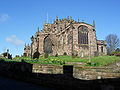 |
Malpas Malpas, Cheshire Malpas is a large village which used to be a market town, and it is also a civil parish in the unitary authority of Cheshire West and Chester and the ceremonial county of Cheshire, England. The parish lies on the border with Shropshire and Wales... |
Civil parish | 1,628 | Cheshire West and Chester Cheshire West and Chester Cheshire West and Chester is a unitary authority area with borough status, in the ceremonial county of Cheshire. It was established in April 2009 as part of the 2009 structural changes to local government in England, by virtue of an order under the Local Government and Public Involvement in Health... |
Tarvin Rural District Tarvin Rural District Tarvin was, from 1894 to 1974, a rural district in the administrative county of Cheshire, England. The district was named after the village of Tarvin, and saw considerable boundary changes throughout its life.-Creation:... |
|
| Manley Manley, Cheshire right|thumb|200px|Map of civil parish of Manley within the former borough of Vale RoyalManley is a village and civil parish in the unitary authority of Cheshire West and Chester and the ceremonial county of Cheshire, in the north west of England.-External links:... |
Civil parish | 548 | Cheshire West and Chester Cheshire West and Chester Cheshire West and Chester is a unitary authority area with borough status, in the ceremonial county of Cheshire. It was established in April 2009 as part of the 2009 structural changes to local government in England, by virtue of an order under the Local Government and Public Involvement in Health... |
Runcorn Rural District Runcorn Rural District Runcorn was a rural district in Cheshire, England from 1894 to 1974. It was named after but did not include Runcorn, a town on the River Mersey to the north-west of the district, which formed its own urban district.... |
|
|
| Marlston cum Lache Marlston cum Lache Marlston cum Lache is a civil parish in the Borough of Cheshire West and Chester and ceremonial county of Cheshire in England. It has a population of 112.-External links:... |
Civil parish | 112 | Cheshire West and Chester Cheshire West and Chester Cheshire West and Chester is a unitary authority area with borough status, in the ceremonial county of Cheshire. It was established in April 2009 as part of the 2009 structural changes to local government in England, by virtue of an order under the Local Government and Public Involvement in Health... |
Chester Rural District Chester Rural District Chester was a rural district of Cheshire, England, from 1894 to 1974. It was based around the city and county borough of Chester but did not include it. The district saw various boundary changes throughout its life... |
|
|
| Marston Marston, Cheshire thumb|right|200px|Map of civil parish of Marston within the former borough of Vale RoyalMarston is a village and civil parish in the unitary authority of Cheshire West and Chester and the ceremonial county of Cheshire in the north west of England, on the River Weaver, close to Anderton and the... |
Civil parish | 525 | Cheshire West and Chester Cheshire West and Chester Cheshire West and Chester is a unitary authority area with borough status, in the ceremonial county of Cheshire. It was established in April 2009 as part of the 2009 structural changes to local government in England, by virtue of an order under the Local Government and Public Involvement in Health... |
Northwich Rural District Northwich Rural District Northwich Rural District was a rural district surrounding, but not including the towns of Northwich and Winsford in Cheshire. It was created in 1894 from the Runcorn Rural Sanitary District.... |
|
|
| Mickle Trafford Mickle Trafford Mickle Trafford is a village and civil parish in the unitary authority of Cheshire West and Chester and the ceremonial county of Cheshire, England. It includes the area known as Plemstall. In 2004 the population of the civil parish was estimated to be 2,140, although the 2001 census recorded... |
Civil parish | 1,831 | Cheshire West and Chester Cheshire West and Chester Cheshire West and Chester is a unitary authority area with borough status, in the ceremonial county of Cheshire. It was established in April 2009 as part of the 2009 structural changes to local government in England, by virtue of an order under the Local Government and Public Involvement in Health... |
Chester Rural District Chester Rural District Chester was a rural district of Cheshire, England, from 1894 to 1974. It was based around the city and county borough of Chester but did not include it. The district saw various boundary changes throughout its life... |
|
|
| Mollington Mollington, Cheshire Mollington is a small village and civil parish in the unitary authority of Cheshire West and Chester and the ceremonial county of Cheshire, England, It is located two miles north of the city of Chester, with approximate boundaries formed by the A41 Liverpool-Chester trunk road and Shropshire Union... |
Civil parish | 663 | Cheshire West and Chester Cheshire West and Chester Cheshire West and Chester is a unitary authority area with borough status, in the ceremonial county of Cheshire. It was established in April 2009 as part of the 2009 structural changes to local government in England, by virtue of an order under the Local Government and Public Involvement in Health... |
Chester Rural District Chester Rural District Chester was a rural district of Cheshire, England, from 1894 to 1974. It was based around the city and county borough of Chester but did not include it. The district saw various boundary changes throughout its life... |
|
|
| Moston | Civil parish | 680 | Cheshire West and Chester Cheshire West and Chester Cheshire West and Chester is a unitary authority area with borough status, in the ceremonial county of Cheshire. It was established in April 2009 as part of the 2009 structural changes to local government in England, by virtue of an order under the Local Government and Public Involvement in Health... |
Chester Rural District Chester Rural District Chester was a rural district of Cheshire, England, from 1894 to 1974. It was based around the city and county borough of Chester but did not include it. The district saw various boundary changes throughout its life... |
|
|
| Mouldsworth Mouldsworth Mouldsworth is a village and civil parish on the outskirts of Chester in the unitary authority of Cheshire West and Chester and the ceremonial county of Cheshire, England. It is located about 8 miles north east of Chester City Centre on the B5393 road. The nearest villages are Manley to the north... |
Civil parish | 302 | Cheshire West and Chester Cheshire West and Chester Cheshire West and Chester is a unitary authority area with borough status, in the ceremonial county of Cheshire. It was established in April 2009 as part of the 2009 structural changes to local government in England, by virtue of an order under the Local Government and Public Involvement in Health... |
Tarvin Rural District Tarvin Rural District Tarvin was, from 1894 to 1974, a rural district in the administrative county of Cheshire, England. The district was named after the village of Tarvin, and saw considerable boundary changes throughout its life.-Creation:... |
|
|
| Moulton Moulton, Cheshire thumb|right|200px|Map of civil parish of Moulton within the former borough of Vale RoyalMoulton is a civil parish and village in the unitary authority of Cheshire West and Chester and near the centre of the ceremonial county of Cheshire, England, situated south of Northwich and north of... |
Civil parish | 2,442 | Cheshire West and Chester Cheshire West and Chester Cheshire West and Chester is a unitary authority area with borough status, in the ceremonial county of Cheshire. It was established in April 2009 as part of the 2009 structural changes to local government in England, by virtue of an order under the Local Government and Public Involvement in Health... |
Northwich Rural District Northwich Rural District Northwich Rural District was a rural district surrounding, but not including the towns of Northwich and Winsford in Cheshire. It was created in 1894 from the Runcorn Rural Sanitary District.... |
|
|
| Neston | Town | 15,162 | Cheshire West and Chester Cheshire West and Chester Cheshire West and Chester is a unitary authority area with borough status, in the ceremonial county of Cheshire. It was established in April 2009 as part of the 2009 structural changes to local government in England, by virtue of an order under the Local Government and Public Involvement in Health... |
Neston Urban District |
|
|
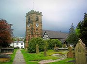 |
Nether Peover Lower Peover right|thumb|200px|Map of civil parish of Nether Peover within the former borough of Vale RoyalLower Peover is a village in the civil parish of Nether Peover in the unitary authority of Cheshire West and Chester and the ceremonial county of Cheshire, England, approximately 6 miles east of Northwich... |
Civil parish | 417 | Cheshire West and Chester Cheshire West and Chester Cheshire West and Chester is a unitary authority area with borough status, in the ceremonial county of Cheshire. It was established in April 2009 as part of the 2009 structural changes to local government in England, by virtue of an order under the Local Government and Public Involvement in Health... |
Northwich Rural District Northwich Rural District Northwich Rural District was a rural district surrounding, but not including the towns of Northwich and Winsford in Cheshire. It was created in 1894 from the Runcorn Rural Sanitary District.... |
|
| Newton by Malpas Newton by Malpas Newton by Malpas is a civil parish in the Borough of Cheshire West and Chester and ceremonial county of Cheshire in England. It has a population of 11.-External links:... |
Civil parish | 11 | Cheshire West and Chester Cheshire West and Chester Cheshire West and Chester is a unitary authority area with borough status, in the ceremonial county of Cheshire. It was established in April 2009 as part of the 2009 structural changes to local government in England, by virtue of an order under the Local Government and Public Involvement in Health... |
Tarvin Rural District Tarvin Rural District Tarvin was, from 1894 to 1974, a rural district in the administrative county of Cheshire, England. The district was named after the village of Tarvin, and saw considerable boundary changes throughout its life.-Creation:... |
|
|
| Newton by Tattenhall Newton by Tattenhall Newton by Tattenhall is a civil parish in the Borough of Cheshire West and Chester and ceremonial county of Cheshire in England. It has a population of 116.-External links:... |
Civil parish | 116 | Cheshire West and Chester Cheshire West and Chester Cheshire West and Chester is a unitary authority area with borough status, in the ceremonial county of Cheshire. It was established in April 2009 as part of the 2009 structural changes to local government in England, by virtue of an order under the Local Government and Public Involvement in Health... |
Tarvin Rural District Tarvin Rural District Tarvin was, from 1894 to 1974, a rural district in the administrative county of Cheshire, England. The district was named after the village of Tarvin, and saw considerable boundary changes throughout its life.-Creation:... |
|
|
| Norley Norley thumb|right|200px|Map of civil parish of Norley within the former borough of Vale RoyalNorley is a village and civil parish in the unitary authority of Cheshire West and Chester and the ceremonial county of Cheshire, England. It lies to the north of Delamere Forest, near the village of Cuddington... |
Civil parish | 1,186 | Cheshire West and Chester Cheshire West and Chester Cheshire West and Chester is a unitary authority area with borough status, in the ceremonial county of Cheshire. It was established in April 2009 as part of the 2009 structural changes to local government in England, by virtue of an order under the Local Government and Public Involvement in Health... |
Runcorn Rural District Runcorn Rural District Runcorn was a rural district in Cheshire, England from 1894 to 1974. It was named after but did not include Runcorn, a town on the River Mersey to the north-west of the district, which formed its own urban district.... |
|
|
| Northwich Northwich Northwich is a town and civil parish in the unitary authority of Cheshire West and Chester and the ceremonial county of Cheshire, England. It lies in the heart of the Cheshire Plain, at the confluence of the rivers Weaver and Dane... |
Town | 19,259 | Cheshire West and Chester Cheshire West and Chester Cheshire West and Chester is a unitary authority area with borough status, in the ceremonial county of Cheshire. It was established in April 2009 as part of the 2009 structural changes to local government in England, by virtue of an order under the Local Government and Public Involvement in Health... |
Northwich Urban District Northwich Northwich is a town and civil parish in the unitary authority of Cheshire West and Chester and the ceremonial county of Cheshire, England. It lies in the heart of the Cheshire Plain, at the confluence of the rivers Weaver and Dane... |
|
|
| Oakmere Oakmere Oakmere is a village and civil parish in the unitary authority of Cheshire West and Chester and the ceremonial county of Cheshire, England.Oakmere is situated on the A556 road, approximately west of Frodsham... |
Civil parish | 543 | Cheshire West and Chester Cheshire West and Chester Cheshire West and Chester is a unitary authority area with borough status, in the ceremonial county of Cheshire. It was established in April 2009 as part of the 2009 structural changes to local government in England, by virtue of an order under the Local Government and Public Involvement in Health... |
Northwich Rural District Northwich Rural District Northwich Rural District was a rural district surrounding, but not including the towns of Northwich and Winsford in Cheshire. It was created in 1894 from the Runcorn Rural Sanitary District.... |
|
|
| Oldcastle Oldcastle, Cheshire Oldcastle is a civil parish in the Borough of Cheshire West and Chester and ceremonial county of Cheshire in England. It has a population of 54.-External links:... |
Civil parish | 54 | Cheshire West and Chester Cheshire West and Chester Cheshire West and Chester is a unitary authority area with borough status, in the ceremonial county of Cheshire. It was established in April 2009 as part of the 2009 structural changes to local government in England, by virtue of an order under the Local Government and Public Involvement in Health... |
Tarvin Rural District Tarvin Rural District Tarvin was, from 1894 to 1974, a rural district in the administrative county of Cheshire, England. The district was named after the village of Tarvin, and saw considerable boundary changes throughout its life.-Creation:... |
|
|
| Overton Overton, Cheshire Overton is a civil parish in the Borough of Cheshire West and Chester and ceremonial county of Cheshire in England. It has a population of 68. It is the site of a deserted village, a Scheduled Ancient Monument, the sole remains of which are earthworks.... |
Civil parish | 68 | Cheshire West and Chester Cheshire West and Chester Cheshire West and Chester is a unitary authority area with borough status, in the ceremonial county of Cheshire. It was established in April 2009 as part of the 2009 structural changes to local government in England, by virtue of an order under the Local Government and Public Involvement in Health... |
Tarvin Rural District Tarvin Rural District Tarvin was, from 1894 to 1974, a rural district in the administrative county of Cheshire, England. The district was named after the village of Tarvin, and saw considerable boundary changes throughout its life.-Creation:... |
|
|
| Picton Picton, Cheshire Picton is a hamlet and civil parish situated near to Chester, in the Borough of Cheshire West and Chester and the ceremonial county of Cheshire in England. It has a population of 58.... |
Civil parish | 58 | Cheshire West and Chester Cheshire West and Chester Cheshire West and Chester is a unitary authority area with borough status, in the ceremonial county of Cheshire. It was established in April 2009 as part of the 2009 structural changes to local government in England, by virtue of an order under the Local Government and Public Involvement in Health... |
Chester Rural District Chester Rural District Chester was a rural district of Cheshire, England, from 1894 to 1974. It was based around the city and county borough of Chester but did not include it. The district saw various boundary changes throughout its life... |
|
|
| Poulton Poulton, Cheshire Poulton is a civil parish in the Borough of Cheshire West and Chester and ceremonial county of Cheshire in England. It has a population of 92.-External links:... |
Civil parish | 92 | Cheshire West and Chester Cheshire West and Chester Cheshire West and Chester is a unitary authority area with borough status, in the ceremonial county of Cheshire. It was established in April 2009 as part of the 2009 structural changes to local government in England, by virtue of an order under the Local Government and Public Involvement in Health... |
Chester Rural District Chester Rural District Chester was a rural district of Cheshire, England, from 1894 to 1974. It was based around the city and county borough of Chester but did not include it. The district saw various boundary changes throughout its life... |
|
|
| Prior's Heys Prior's Heys Prior's Heys is a civil parish in the Borough of Cheshire West and Chester and ceremonial county of Cheshire in England. It has a population of 10.... |
Civil parish | 10 | Cheshire West and Chester Cheshire West and Chester Cheshire West and Chester is a unitary authority area with borough status, in the ceremonial county of Cheshire. It was established in April 2009 as part of the 2009 structural changes to local government in England, by virtue of an order under the Local Government and Public Involvement in Health... |
Tarvin Rural District Tarvin Rural District Tarvin was, from 1894 to 1974, a rural district in the administrative county of Cheshire, England. The district was named after the village of Tarvin, and saw considerable boundary changes throughout its life.-Creation:... |
|
|
| Puddington Puddington, Cheshire Puddington is a village and civil parish on the Wirral Peninsula, in the unitary authority of Cheshire West and Chester and the ceremonial county of Cheshire, England, located close to the border with Wales .... |
Civil parish | 325 | Cheshire West and Chester Cheshire West and Chester Cheshire West and Chester is a unitary authority area with borough status, in the ceremonial county of Cheshire. It was established in April 2009 as part of the 2009 structural changes to local government in England, by virtue of an order under the Local Government and Public Involvement in Health... |
Chester Rural District Chester Rural District Chester was a rural district of Cheshire, England, from 1894 to 1974. It was based around the city and county borough of Chester but did not include it. The district saw various boundary changes throughout its life... |
|
|
| Pulford Pulford Pulford is a village and civil parish in the unitary authority of Cheshire West and Chester and the ceremonial county of Cheshire, England. It is situated on the B5445 road, to the south west of Chester and on the border with Wales. It is believed that the name of the village is derived from the... |
Civil parish | 395 | Cheshire West and Chester Cheshire West and Chester Cheshire West and Chester is a unitary authority area with borough status, in the ceremonial county of Cheshire. It was established in April 2009 as part of the 2009 structural changes to local government in England, by virtue of an order under the Local Government and Public Involvement in Health... |
Chester Rural District Chester Rural District Chester was a rural district of Cheshire, England, from 1894 to 1974. It was based around the city and county borough of Chester but did not include it. The district saw various boundary changes throughout its life... |
|
|
 |
Rowton Rowton, Cheshire Rowton is a village and civil parish in the Borough of Cheshire West and Chester and ceremonial county of Cheshire in England. It has a population of 497. The Battle of Rowton Heath took place in the village on 24 September 1645 during the English Civil War. It resulted in a decisive... |
Civil parish | 497 | Cheshire West and Chester Cheshire West and Chester Cheshire West and Chester is a unitary authority area with borough status, in the ceremonial county of Cheshire. It was established in April 2009 as part of the 2009 structural changes to local government in England, by virtue of an order under the Local Government and Public Involvement in Health... |
Chester Rural District Chester Rural District Chester was a rural district of Cheshire, England, from 1894 to 1974. It was based around the city and county borough of Chester but did not include it. The district saw various boundary changes throughout its life... |
|
| Rudheath Rudheath right|thumb|200px|Map of civil parish of Rudheath within the former borough of Vale RoyalRudheath is a village and civil parish in the unitary authority of Cheshire West and Chester and the ceremonial county of Cheshire, in the north west of England, approximately 2 miles east of Northwich.This... |
Civil parish | 3,822 | Cheshire West and Chester Cheshire West and Chester Cheshire West and Chester is a unitary authority area with borough status, in the ceremonial county of Cheshire. It was established in April 2009 as part of the 2009 structural changes to local government in England, by virtue of an order under the Local Government and Public Involvement in Health... |
Northwich Rural District Northwich Rural District Northwich Rural District was a rural district surrounding, but not including the towns of Northwich and Winsford in Cheshire. It was created in 1894 from the Runcorn Rural Sanitary District.... |
|
|
| Rushton Rushton, Cheshire right|thumb|200px|Map of civil parish of Rushton within the former borough of Vale RoyalRushton is a village and civil parish in the unitary authority of Cheshire West and Chester and the ceremonial county of Cheshire, in the north west of England, approximately 6 miles west of Winsford and 2 miles... |
Civil parish | 419 | Cheshire West and Chester Cheshire West and Chester Cheshire West and Chester is a unitary authority area with borough status, in the ceremonial county of Cheshire. It was established in April 2009 as part of the 2009 structural changes to local government in England, by virtue of an order under the Local Government and Public Involvement in Health... |
Northwich Rural District Northwich Rural District Northwich Rural District was a rural district surrounding, but not including the towns of Northwich and Winsford in Cheshire. It was created in 1894 from the Runcorn Rural Sanitary District.... |
|
|
| Saighton Saighton Saighton is a civil parish and village in the unitary authority of Cheshire West and Chester and the ceremonial county of Cheshire, England, a few miles south of Chester... |
Civil parish | 192 | Cheshire West and Chester Cheshire West and Chester Cheshire West and Chester is a unitary authority area with borough status, in the ceremonial county of Cheshire. It was established in April 2009 as part of the 2009 structural changes to local government in England, by virtue of an order under the Local Government and Public Involvement in Health... |
Chester Rural District Chester Rural District Chester was a rural district of Cheshire, England, from 1894 to 1974. It was based around the city and county borough of Chester but did not include it. The district saw various boundary changes throughout its life... |
|
|
| Saughall Saughall Saughall is a civil parish and village in the unitary authority of Cheshire West and Chester and the ceremonial county of Cheshire, England. It is situated approximately north west of Chester and close to the Welsh border.... |
Civil parish | 3,084 | Cheshire West and Chester Cheshire West and Chester Cheshire West and Chester is a unitary authority area with borough status, in the ceremonial county of Cheshire. It was established in April 2009 as part of the 2009 structural changes to local government in England, by virtue of an order under the Local Government and Public Involvement in Health... |
Chester Rural District Chester Rural District Chester was a rural district of Cheshire, England, from 1894 to 1974. It was based around the city and county borough of Chester but did not include it. The district saw various boundary changes throughout its life... |
|
|
| Shocklach Oviatt Shocklach Oviatt Shocklach Oviatt is a civil parish in the unitary authority of Cheshire West and Chester and the ceremonial county of Cheshire, England. It includes the village of Shocklach.St Edith's Church, Shocklach is a Grade I listed building.... |
Civil parish | 78 | Cheshire West and Chester Cheshire West and Chester Cheshire West and Chester is a unitary authority area with borough status, in the ceremonial county of Cheshire. It was established in April 2009 as part of the 2009 structural changes to local government in England, by virtue of an order under the Local Government and Public Involvement in Health... |
Tarvin Rural District Tarvin Rural District Tarvin was, from 1894 to 1974, a rural district in the administrative county of Cheshire, England. The district was named after the village of Tarvin, and saw considerable boundary changes throughout its life.-Creation:... |
|
|
| Shotwick Shotwick Shotwick is a village and civil parish on the Wirral Peninsula in the unitary authority of Cheshire West and Chester and the ceremonial county of Cheshire, England... |
Civil parish | 58 | Cheshire West and Chester Cheshire West and Chester Cheshire West and Chester is a unitary authority area with borough status, in the ceremonial county of Cheshire. It was established in April 2009 as part of the 2009 structural changes to local government in England, by virtue of an order under the Local Government and Public Involvement in Health... |
Chester Rural District Chester Rural District Chester was a rural district of Cheshire, England, from 1894 to 1974. It was based around the city and county borough of Chester but did not include it. The district saw various boundary changes throughout its life... |
|
|
| Shotwick Park Shotwick Park Shotwick Park is a civil parish in the unitary authority of Cheshire West and Chester and the ceremonial county of Cheshire, England. Located near the village of Shotwick, it is four miles north west of Chester and close to the Welsh border.... |
Civil parish | 56 | Cheshire West and Chester Cheshire West and Chester Cheshire West and Chester is a unitary authority area with borough status, in the ceremonial county of Cheshire. It was established in April 2009 as part of the 2009 structural changes to local government in England, by virtue of an order under the Local Government and Public Involvement in Health... |
Chester Rural District Chester Rural District Chester was a rural district of Cheshire, England, from 1894 to 1974. It was based around the city and county borough of Chester but did not include it. The district saw various boundary changes throughout its life... |
|
|
| Sproston Sproston Sproston is a village and civil parish in the unitary authority of Cheshire West and Chester and the ceremonial county of county of Cheshire, in the north west of England, approximately 2 miles east of Middlewich.... |
Civil parish | 197 | Cheshire West and Chester Cheshire West and Chester Cheshire West and Chester is a unitary authority area with borough status, in the ceremonial county of Cheshire. It was established in April 2009 as part of the 2009 structural changes to local government in England, by virtue of an order under the Local Government and Public Involvement in Health... |
Northwich Rural District Northwich Rural District Northwich Rural District was a rural district surrounding, but not including the towns of Northwich and Winsford in Cheshire. It was created in 1894 from the Runcorn Rural Sanitary District.... |
|
|
| Stanthorne Stanthorne right|thumb|200px|Map of civil parish of Rushton within the former borough of Vale RoyalStanthorne is a village and civil parish in the unitary authority of Cheshire West and Chester and the ceremonial county of Cheshire, in the north west of England, approximately 2 miles west of... |
Civil parish | 136 | Cheshire West and Chester Cheshire West and Chester Cheshire West and Chester is a unitary authority area with borough status, in the ceremonial county of Cheshire. It was established in April 2009 as part of the 2009 structural changes to local government in England, by virtue of an order under the Local Government and Public Involvement in Health... |
Northwich Rural District Northwich Rural District Northwich Rural District was a rural district surrounding, but not including the towns of Northwich and Winsford in Cheshire. It was created in 1894 from the Runcorn Rural Sanitary District.... |
|
|
| Stockton Stockton, Cheshire Stockton is a civil parish in the Borough of Cheshire West and Chester and ceremonial county of Cheshire in England. It has a population of 21.... |
Civil parish | 21 | Cheshire West and Chester Cheshire West and Chester Cheshire West and Chester is a unitary authority area with borough status, in the ceremonial county of Cheshire. It was established in April 2009 as part of the 2009 structural changes to local government in England, by virtue of an order under the Local Government and Public Involvement in Health... |
Tarvin Rural District Tarvin Rural District Tarvin was, from 1894 to 1974, a rural district in the administrative county of Cheshire, England. The district was named after the village of Tarvin, and saw considerable boundary changes throughout its life.-Creation:... |
|
|
| Stoke | Civil parish | 145 | Cheshire West and Chester Cheshire West and Chester Cheshire West and Chester is a unitary authority area with borough status, in the ceremonial county of Cheshire. It was established in April 2009 as part of the 2009 structural changes to local government in England, by virtue of an order under the Local Government and Public Involvement in Health... |
Chester Rural District Chester Rural District Chester was a rural district of Cheshire, England, from 1894 to 1974. It was based around the city and county borough of Chester but did not include it. The district saw various boundary changes throughout its life... |
|
|
| Stretton | Civil parish | 51 | Cheshire West and Chester Cheshire West and Chester Cheshire West and Chester is a unitary authority area with borough status, in the ceremonial county of Cheshire. It was established in April 2009 as part of the 2009 structural changes to local government in England, by virtue of an order under the Local Government and Public Involvement in Health... |
Tarvin Rural District Tarvin Rural District Tarvin was, from 1894 to 1974, a rural district in the administrative county of Cheshire, England. The district was named after the village of Tarvin, and saw considerable boundary changes throughout its life.-Creation:... |
|
|
| Sutton | Civil parish | 457 | Cheshire West and Chester Cheshire West and Chester Cheshire West and Chester is a unitary authority area with borough status, in the ceremonial county of Cheshire. It was established in April 2009 as part of the 2009 structural changes to local government in England, by virtue of an order under the Local Government and Public Involvement in Health... |
Runcorn Rural District Runcorn Rural District Runcorn was a rural district in Cheshire, England from 1894 to 1974. It was named after but did not include Runcorn, a town on the River Mersey to the north-west of the district, which formed its own urban district.... |
|
|
| Tarporley Tarporley Tarporley is a large village and civil parish in the unitary authority of Cheshire West and Chester and the ceremonial county of Cheshire, England.... |
Civil parish | 2,634 | Cheshire West and Chester Cheshire West and Chester Cheshire West and Chester is a unitary authority area with borough status, in the ceremonial county of Cheshire. It was established in April 2009 as part of the 2009 structural changes to local government in England, by virtue of an order under the Local Government and Public Involvement in Health... |
Northwich Rural District Northwich Rural District Northwich Rural District was a rural district surrounding, but not including the towns of Northwich and Winsford in Cheshire. It was created in 1894 from the Runcorn Rural Sanitary District.... |
|
|
| Tarvin Tarvin Tarvin is a village in the unitary authority of Cheshire West and Chester and the ceremonial county of Cheshire, England. It had a population of 2,693 people at the 2001 UK census, and the ward covers about .-Location:... |
Civil parish | 2,693 | Cheshire West and Chester Cheshire West and Chester Cheshire West and Chester is a unitary authority area with borough status, in the ceremonial county of Cheshire. It was established in April 2009 as part of the 2009 structural changes to local government in England, by virtue of an order under the Local Government and Public Involvement in Health... |
Tarvin Rural District Tarvin Rural District Tarvin was, from 1894 to 1974, a rural district in the administrative county of Cheshire, England. The district was named after the village of Tarvin, and saw considerable boundary changes throughout its life.-Creation:... |
|
|
| Tattenhall Tattenhall Tattenhall is a village and civil parish, 8 miles south-east of Chester, in the unitary authority of Cheshire West and Chester and the ceremonial county of Cheshire, England. At the 2001 Census, the population was recorded as 1,986.-History:... |
Civil parish | 1,986 | Cheshire West and Chester Cheshire West and Chester Cheshire West and Chester is a unitary authority area with borough status, in the ceremonial county of Cheshire. It was established in April 2009 as part of the 2009 structural changes to local government in England, by virtue of an order under the Local Government and Public Involvement in Health... |
Tarvin Rural District Tarvin Rural District Tarvin was, from 1894 to 1974, a rural district in the administrative county of Cheshire, England. The district was named after the village of Tarvin, and saw considerable boundary changes throughout its life.-Creation:... |
|
|
| Thornton le Moors Thornton-le-Moors Thornton-le-Moors is a village and civil parish in the unitary authority of Cheshire West and Chester and the ceremonial county of Cheshire, England. At the census of 2001 it had a population of 260.... |
Civil parish | 260 | Cheshire West and Chester Cheshire West and Chester Cheshire West and Chester is a unitary authority area with borough status, in the ceremonial county of Cheshire. It was established in April 2009 as part of the 2009 structural changes to local government in England, by virtue of an order under the Local Government and Public Involvement in Health... |
Chester Rural District Chester Rural District Chester was a rural district of Cheshire, England, from 1894 to 1974. It was based around the city and county borough of Chester but did not include it. The district saw various boundary changes throughout its life... |
|
|
| Threapwood Threapwood Threapwood is a small village and civil parish in the unitary authority of Cheshire West and Chester and the ceremonial county of Cheshire, England. It is close to the villages of Shocklach, Worthenbury and Malpas... |
Civil parish | 285 | Cheshire West and Chester Cheshire West and Chester Cheshire West and Chester is a unitary authority area with borough status, in the ceremonial county of Cheshire. It was established in April 2009 as part of the 2009 structural changes to local government in England, by virtue of an order under the Local Government and Public Involvement in Health... |
Tarvin Rural District Tarvin Rural District Tarvin was, from 1894 to 1974, a rural district in the administrative county of Cheshire, England. The district was named after the village of Tarvin, and saw considerable boundary changes throughout its life.-Creation:... |
|
|
| Tilston Tilston Tilston is a village and a civil parish in the unitary authority of Cheshire West and Chester and the ceremonial county of Cheshire, England. At the 2001 Census, the population was recorded as 627.St Mary's Church, Tilston is a Grade II* listed building.... |
Civil parish | 627 | Cheshire West and Chester Cheshire West and Chester Cheshire West and Chester is a unitary authority area with borough status, in the ceremonial county of Cheshire. It was established in April 2009 as part of the 2009 structural changes to local government in England, by virtue of an order under the Local Government and Public Involvement in Health... |
Tarvin Rural District Tarvin Rural District Tarvin was, from 1894 to 1974, a rural district in the administrative county of Cheshire, England. The district was named after the village of Tarvin, and saw considerable boundary changes throughout its life.-Creation:... |
|
|
| Tilstone Fearnall Tilstone Fearnall Tilstone Fearnall is a civil parish in the Borough of Cheshire West and Chester and ceremonial county of Cheshire in England. It has a population of 99.-External links:... |
Civil parish | 99 | Cheshire West and Chester Cheshire West and Chester Cheshire West and Chester is a unitary authority area with borough status, in the ceremonial county of Cheshire. It was established in April 2009 as part of the 2009 structural changes to local government in England, by virtue of an order under the Local Government and Public Involvement in Health... |
Tarvin Rural District Tarvin Rural District Tarvin was, from 1894 to 1974, a rural district in the administrative county of Cheshire, England. The district was named after the village of Tarvin, and saw considerable boundary changes throughout its life.-Creation:... |
|
|
| Tiverton Tiverton, Cheshire Tiverton is a civil parish in the Borough of Cheshire West and Chester and ceremonial county of Cheshire in England. It has a population of 406.-External links:... |
Civil parish | 406 | Cheshire West and Chester Cheshire West and Chester Cheshire West and Chester is a unitary authority area with borough status, in the ceremonial county of Cheshire. It was established in April 2009 as part of the 2009 structural changes to local government in England, by virtue of an order under the Local Government and Public Involvement in Health... |
Tarvin Rural District Tarvin Rural District Tarvin was, from 1894 to 1974, a rural district in the administrative county of Cheshire, England. The district was named after the village of Tarvin, and saw considerable boundary changes throughout its life.-Creation:... |
|
|
| Tushingham cum Grindley | Civil parish | 166 | Cheshire West and Chester Cheshire West and Chester Cheshire West and Chester is a unitary authority area with borough status, in the ceremonial county of Cheshire. It was established in April 2009 as part of the 2009 structural changes to local government in England, by virtue of an order under the Local Government and Public Involvement in Health... |
Tarvin Rural District Tarvin Rural District Tarvin was, from 1894 to 1974, a rural district in the administrative county of Cheshire, England. The district was named after the village of Tarvin, and saw considerable boundary changes throughout its life.-Creation:... |
|
|
| Upton by Chester | Civil parish | 7,800 | Cheshire West and Chester Cheshire West and Chester Cheshire West and Chester is a unitary authority area with borough status, in the ceremonial county of Cheshire. It was established in April 2009 as part of the 2009 structural changes to local government in England, by virtue of an order under the Local Government and Public Involvement in Health... |
Chester Rural District Chester Rural District Chester was a rural district of Cheshire, England, from 1894 to 1974. It was based around the city and county borough of Chester but did not include it. The district saw various boundary changes throughout its life... |
|
|
| Utkinton Utkinton thumb|200px|Map of civil parish of Utkinton within the former borough of Vale RoyalUtkinton is a civil parish and small village in the unitary authority of Cheshire West and Chester and the ceremonial county of Cheshire, England. It is approximately 8 miles west of Winsford and north of Tarporley... |
Civil parish | 651 | Cheshire West and Chester Cheshire West and Chester Cheshire West and Chester is a unitary authority area with borough status, in the ceremonial county of Cheshire. It was established in April 2009 as part of the 2009 structural changes to local government in England, by virtue of an order under the Local Government and Public Involvement in Health... |
Northwich Rural District Northwich Rural District Northwich Rural District was a rural district surrounding, but not including the towns of Northwich and Winsford in Cheshire. It was created in 1894 from the Runcorn Rural Sanitary District.... |
|
|
| Waverton Waverton, Cheshire Waverton is a village and civil parish in the unitary authority of Cheshire West and Chester and the ceremonial county of Cheshire, England. It lies about 5 km south east of Chester... |
Civil parish | 1,560 | Cheshire West and Chester Cheshire West and Chester Cheshire West and Chester is a unitary authority area with borough status, in the ceremonial county of Cheshire. It was established in April 2009 as part of the 2009 structural changes to local government in England, by virtue of an order under the Local Government and Public Involvement in Health... |
Tarvin Rural District Tarvin Rural District Tarvin was, from 1894 to 1974, a rural district in the administrative county of Cheshire, England. The district was named after the village of Tarvin, and saw considerable boundary changes throughout its life.-Creation:... |
|
|
| Weaverham Weaverham right|thumb|200px|Map of civil parish of Weaverham within former borough of Vale RoyalWeaverham is a village and civil parish in the Borough of Cheshire West and Chester and the ceremonial county of Cheshire in England. Just off the A49, it is just to the west of Northwich and south of the River... |
Civil parish | 6,589 | Cheshire West and Chester Cheshire West and Chester Cheshire West and Chester is a unitary authority area with borough status, in the ceremonial county of Cheshire. It was established in April 2009 as part of the 2009 structural changes to local government in England, by virtue of an order under the Local Government and Public Involvement in Health... |
Northwich Rural District Northwich Rural District Northwich Rural District was a rural district surrounding, but not including the towns of Northwich and Winsford in Cheshire. It was created in 1894 from the Runcorn Rural Sanitary District.... |
|
|
| Wervin Wervin Wervin is a small village and civil parish in the unitary authority of Cheshire West and Chester and the ceremonial county of Cheshire, England. It is situated between Chester and Ellesmere Port, in close proximity to the Shropshire Union Canal and the M53 motorway. At the 2001 Census, Wervin had a... |
Civil parish | 118 | Cheshire West and Chester Cheshire West and Chester Cheshire West and Chester is a unitary authority area with borough status, in the ceremonial county of Cheshire. It was established in April 2009 as part of the 2009 structural changes to local government in England, by virtue of an order under the Local Government and Public Involvement in Health... |
Chester Rural District Chester Rural District Chester was a rural district of Cheshire, England, from 1894 to 1974. It was based around the city and county borough of Chester but did not include it. The district saw various boundary changes throughout its life... |
|
|
| Whitegate and Marton Whitegate and Marton thumb|right|200px|Map of civil parish of Whitegate and Marton within the former borough of Vale RoyalWhitegate and Marton is a civil parish in the unitary authority of Cheshire West and Chester and the ceremonial county of Cheshire... |
Civil parish | 971 | Cheshire West and Chester Cheshire West and Chester Cheshire West and Chester is a unitary authority area with borough status, in the ceremonial county of Cheshire. It was established in April 2009 as part of the 2009 structural changes to local government in England, by virtue of an order under the Local Government and Public Involvement in Health... |
Northwich Rural District Northwich Rural District Northwich Rural District was a rural district surrounding, but not including the towns of Northwich and Winsford in Cheshire. It was created in 1894 from the Runcorn Rural Sanitary District.... |
|
|
| Whitley Whitley, Cheshire Whitley is a civil parish in the unitary authority of Cheshire West and Chester and the ceremonial county of Cheshire, England. It is surrounded by the parishes of Antrobus, Comberbach, Little Leigh and Dutton... |
Civil parish | 508 | Cheshire West and Chester Cheshire West and Chester Cheshire West and Chester is a unitary authority area with borough status, in the ceremonial county of Cheshire. It was established in April 2009 as part of the 2009 structural changes to local government in England, by virtue of an order under the Local Government and Public Involvement in Health... |
Runcorn Rural District Runcorn Rural District Runcorn was a rural district in Cheshire, England from 1894 to 1974. It was named after but did not include Runcorn, a town on the River Mersey to the north-west of the district, which formed its own urban district.... |
|
|
| Wigland Wigland Wigland is a civil parish in the Borough of Cheshire West and Chester and ceremonial county of Cheshire in England. It has a population of 104.-External links:... |
Civil parish | 104 | Cheshire West and Chester Cheshire West and Chester Cheshire West and Chester is a unitary authority area with borough status, in the ceremonial county of Cheshire. It was established in April 2009 as part of the 2009 structural changes to local government in England, by virtue of an order under the Local Government and Public Involvement in Health... |
Tarvin Rural District Tarvin Rural District Tarvin was, from 1894 to 1974, a rural district in the administrative county of Cheshire, England. The district was named after the village of Tarvin, and saw considerable boundary changes throughout its life.-Creation:... |
|
|
| Willaston | Unparished area | 2,922 | Cheshire West and Chester Cheshire West and Chester Cheshire West and Chester is a unitary authority area with borough status, in the ceremonial county of Cheshire. It was established in April 2009 as part of the 2009 structural changes to local government in England, by virtue of an order under the Local Government and Public Involvement in Health... |
Neston Urban District |
|
|
| Willington Willington, Cheshire Willington is a village and civil parish, about from Chester, in the unitary authority of Cheshire West and Chester and the ceremonial county of Cheshire, England.... |
Civil parish | 113 | Cheshire West and Chester Cheshire West and Chester Cheshire West and Chester is a unitary authority area with borough status, in the ceremonial county of Cheshire. It was established in April 2009 as part of the 2009 structural changes to local government in England, by virtue of an order under the Local Government and Public Involvement in Health... |
Tarvin Rural District Tarvin Rural District Tarvin was, from 1894 to 1974, a rural district in the administrative county of Cheshire, England. The district was named after the village of Tarvin, and saw considerable boundary changes throughout its life.-Creation:... |
|
|
| Wimbolds Trafford Wimbolds Trafford Wimbolds Trafford is a hamlet and civil parish in the unitary authority of Cheshire West and Chester and the ceremonial county of Cheshire, England. The hamlet lies on the B5132 road, approximately to the north east of Chester and north of the village of Mickle Trafford. -External links:... |
Civil parish | 97 | Cheshire West and Chester Cheshire West and Chester Cheshire West and Chester is a unitary authority area with borough status, in the ceremonial county of Cheshire. It was established in April 2009 as part of the 2009 structural changes to local government in England, by virtue of an order under the Local Government and Public Involvement in Health... |
Chester Rural District Chester Rural District Chester was a rural district of Cheshire, England, from 1894 to 1974. It was based around the city and county borough of Chester but did not include it. The district saw various boundary changes throughout its life... |
|
|
| Wimboldsley Wimboldsley right|thumb|200px|Map of civil parish of Wimboldsley within the former borough of Vale RoyalWimboldsley is a village and civil parish in the unitary authority of Cheshire West and Chester and the ceremonial county of Cheshire, in the north west of England, approximately 2 miles south of... |
Civil parish | 135 | Cheshire West and Chester Cheshire West and Chester Cheshire West and Chester is a unitary authority area with borough status, in the ceremonial county of Cheshire. It was established in April 2009 as part of the 2009 structural changes to local government in England, by virtue of an order under the Local Government and Public Involvement in Health... |
Northwich Rural District Northwich Rural District Northwich Rural District was a rural district surrounding, but not including the towns of Northwich and Winsford in Cheshire. It was created in 1894 from the Runcorn Rural Sanitary District.... |
|
|
| Wincham Wincham right|thumb|200px|Map of civil parish of Wincham in the former borough of Vale RoyalWincham is a civil parish and village in the unitary authority of Cheshire West and Chester and the ceremonial county of Cheshire, England. It is situated about three miles north of Northwich in the Cheshire Plain... |
Civil parish | 2,289 | Cheshire West and Chester Cheshire West and Chester Cheshire West and Chester is a unitary authority area with borough status, in the ceremonial county of Cheshire. It was established in April 2009 as part of the 2009 structural changes to local government in England, by virtue of an order under the Local Government and Public Involvement in Health... |
Northwich Rural District Northwich Rural District Northwich Rural District was a rural district surrounding, but not including the towns of Northwich and Winsford in Cheshire. It was created in 1894 from the Runcorn Rural Sanitary District.... |
|
|
| Winsford Winsford Winsford is a town and civil parish within the unitary authority of Cheshire West and Chester and the ceremonial county of Cheshire, England. It lies on the River Weaver south of Northwich and west of Middlewich, and grew around the salt mining industry after the river was canalised in the... |
Town | 29,683 | Cheshire West and Chester Cheshire West and Chester Cheshire West and Chester is a unitary authority area with borough status, in the ceremonial county of Cheshire. It was established in April 2009 as part of the 2009 structural changes to local government in England, by virtue of an order under the Local Government and Public Involvement in Health... |
Winsford Urban District Winsford Winsford is a town and civil parish within the unitary authority of Cheshire West and Chester and the ceremonial county of Cheshire, England. It lies on the River Weaver south of Northwich and west of Middlewich, and grew around the salt mining industry after the river was canalised in the... |
|
|
| Woodbank Woodbank, Cheshire Woodbank is a village and civil parish in the unitary authority of Cheshire West and Chester and the ceremonial county of Cheshire in northwest England... |
Civil parish | 62 | Cheshire West and Chester Cheshire West and Chester Cheshire West and Chester is a unitary authority area with borough status, in the ceremonial county of Cheshire. It was established in April 2009 as part of the 2009 structural changes to local government in England, by virtue of an order under the Local Government and Public Involvement in Health... |
Chester Rural District Chester Rural District Chester was a rural district of Cheshire, England, from 1894 to 1974. It was based around the city and county borough of Chester but did not include it. The district saw various boundary changes throughout its life... |
|
|
| Wychough Wychough Wychough is a civil parish in the Borough of Cheshire West and Chester and ceremonial county of Cheshire in England. It has a population of 11.-External links:... |
Civil parish | 11 | Cheshire West and Chester Cheshire West and Chester Cheshire West and Chester is a unitary authority area with borough status, in the ceremonial county of Cheshire. It was established in April 2009 as part of the 2009 structural changes to local government in England, by virtue of an order under the Local Government and Public Involvement in Health... |
Tarvin Rural District Tarvin Rural District Tarvin was, from 1894 to 1974, a rural district in the administrative county of Cheshire, England. The district was named after the village of Tarvin, and saw considerable boundary changes throughout its life.-Creation:... |
|
|
| Daresbury Daresbury Daresbury is a small rural village, civil parish and ward in the unitary authority of Halton and part of the ceremonial county of Cheshire, England. It is covered by the Weaver Vale constituency... |
Civil parish | 216 | Halton | Runcorn Rural District Runcorn Rural District Runcorn was a rural district in Cheshire, England from 1894 to 1974. It was named after but did not include Runcorn, a town on the River Mersey to the north-west of the district, which formed its own urban district.... |
|
|
| Hale Hale, Halton Hale is a village and civil parish in the Halton unitary authority of Cheshire, England. According to the 2001 Census it had a population of 1,898.... |
Civil parish | 1,898 | Halton | Whiston Rural District Whiston Rural District Whiston Rural District was a rural district of the administrative county of Lancashire, England. It was created in 1895 by renaming the Prescot Rural District when the parish of Prescot was removed from that rural district and created a separate urban district. Later the parish of Speke was... |
|
|
| Halebank Halebank Halebank is a civil parish in the borough of Halton, Cheshire, England. It was created by the Halton Order 2008. The parish lies in the western part of the town of Widnes.-References:... |
Civil parish | 1,046 | Halton | Widnes Municipal Borough Widnes Widnes is an industrial town within the borough of Halton, in Cheshire, England, with an urban area population of 57,663 in 2004. It is located on the northern bank of the River Mersey where the estuary narrows to form the Runcorn Gap. Directly to the south across the Mersey is the town of Runcorn... |
|
|
| Moore Moore, Cheshire Moore is a village and civil parish in the Borough of Halton, Cheshire, England. It has a population of 807.The name 'Moore' comes from the Old English word mor, meaning 'moor, or fen'... |
Civil parish | 807 | Halton | Runcorn Rural District Runcorn Rural District Runcorn was a rural district in Cheshire, England from 1894 to 1974. It was named after but did not include Runcorn, a town on the River Mersey to the north-west of the district, which formed its own urban district.... |
|
|
| Preston Brook Preston Brook Preston Brook is a civil parish in the borough of Halton, a unitary authority in the ceremonial county of Cheshire, England. It is located to the south-east of Runcorn and is adjacent to the M56 motorway. It contains the villages of Preston Brook and Preston on the Hill.In the 2001 Census, the... |
Civil parish | 716 | Halton | Runcorn Rural District Runcorn Rural District Runcorn was a rural district in Cheshire, England from 1894 to 1974. It was named after but did not include Runcorn, a town on the River Mersey to the north-west of the district, which formed its own urban district.... |
|
|
| Runcorn Runcorn Runcorn is an industrial town and cargo port within the borough of Halton in the ceremonial county of Cheshire, England. In 2009, its population was estimated to be 61,500. The town is on the southern bank of the River Mersey where the estuary narrows to form Runcorn Gap. Directly to the north... |
Unparished area | 58,503 | Halton | Runcorn Urban District Runcorn Runcorn is an industrial town and cargo port within the borough of Halton in the ceremonial county of Cheshire, England. In 2009, its population was estimated to be 61,500. The town is on the southern bank of the River Mersey where the estuary narrows to form Runcorn Gap. Directly to the north... |
|
|
| Sandymoor Sandymoor Sandymoor is a civil parish in the borough of Halton, Cheshire, England. It was created by the Halton Order 2008. The parish lies in the eastern part of the town of Runcorn.... |
Civil parish | 1,761 | Halton | Runcorn Urban District Runcorn Runcorn is an industrial town and cargo port within the borough of Halton in the ceremonial county of Cheshire, England. In 2009, its population was estimated to be 61,500. The town is on the southern bank of the River Mersey where the estuary narrows to form Runcorn Gap. Directly to the north... |
|
|
| |
Widnes Widnes Widnes is an industrial town within the borough of Halton, in Cheshire, England, with an urban area population of 57,663 in 2004. It is located on the northern bank of the River Mersey where the estuary narrows to form the Runcorn Gap. Directly to the south across the Mersey is the town of Runcorn... |
Unparished area | 53,261 | Halton | Widnes Municipal Borough Widnes Widnes is an industrial town within the borough of Halton, in Cheshire, England, with an urban area population of 57,663 in 2004. It is located on the northern bank of the River Mersey where the estuary narrows to form the Runcorn Gap. Directly to the south across the Mersey is the town of Runcorn... |
|
| Appleton | Civil parish | 10,477 | Warrington Warrington Warrington is a town, borough and unitary authority area of Cheshire, England. It stands on the banks of the River Mersey, which is tidal to the west of the weir at Howley. It lies 16 miles east of Liverpool, 19 miles west of Manchester and 8 miles south of St Helens... |
Runcorn Rural District Runcorn Rural District Runcorn was a rural district in Cheshire, England from 1894 to 1974. It was named after but did not include Runcorn, a town on the River Mersey to the north-west of the district, which formed its own urban district.... |
|
|
| Birchwood Birchwood Birchwood is a civil parish in the north-eastern part of Warrington, Cheshire, England with a population of 11,395 . Historically a part of Lancashire, it is the easternmost part of the Warrington urban area. It was built during the time of much expansion in Warrington as it became a "new town"... |
Town | 11,395 | Warrington Warrington Warrington is a town, borough and unitary authority area of Cheshire, England. It stands on the banks of the River Mersey, which is tidal to the west of the weir at Howley. It lies 16 miles east of Liverpool, 19 miles west of Manchester and 8 miles south of St Helens... |
Warrington Rural District Warrington Rural District Warrington Rural District was, from 1894 to 1974, a local government district in the administrative county of Lancashire.It was formed a rural district under the Local Government Act 1894 from the Warrington rural sanitary district, and was centred on territory north of the town of Warrington... |
|
|
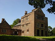 |
Burtonwood and Westbrook Burtonwood Burtonwood and Westbrook is a civil parish in the outermost suburbs of Warrington in Cheshire, England. Historically within Lancashire, the name Burtonwood is known worldwide as the location of the former RAF Station Burtonwood military camp. Burtonwood village itself is a few miles away from the... |
Civil parish | 11,265 | Warrington Warrington Warrington is a town, borough and unitary authority area of Cheshire, England. It stands on the banks of the River Mersey, which is tidal to the west of the weir at Howley. It lies 16 miles east of Liverpool, 19 miles west of Manchester and 8 miles south of St Helens... |
Warrington Rural District Warrington Rural District Warrington Rural District was, from 1894 to 1974, a local government district in the administrative county of Lancashire.It was formed a rural district under the Local Government Act 1894 from the Warrington rural sanitary district, and was centred on territory north of the town of Warrington... |
|
| Croft Croft, Cheshire Croft is a village and civil parish in Warrington, Cheshire, England, about five miles north of Warrington town centre. According to the 2001 Census it had a population of 2,920. It is a rural, residential district.... |
Civil parish | 2,920 | Warrington Warrington Warrington is a town, borough and unitary authority area of Cheshire, England. It stands on the banks of the River Mersey, which is tidal to the west of the weir at Howley. It lies 16 miles east of Liverpool, 19 miles west of Manchester and 8 miles south of St Helens... |
Warrington Rural District Warrington Rural District Warrington Rural District was, from 1894 to 1974, a local government district in the administrative county of Lancashire.It was formed a rural district under the Local Government Act 1894 from the Warrington rural sanitary district, and was centred on territory north of the town of Warrington... |
|
|
| Cuerdley Cuerdley Cuerdley is a civil parish in Warrington, Cheshire, England. It has a population of 107 and much of its area is farmland. A large part of Cuerdley is occupied by the Fiddlers Ferry Power Station.... |
Civil parish | 105 | Warrington Warrington Warrington is a town, borough and unitary authority area of Cheshire, England. It stands on the banks of the River Mersey, which is tidal to the west of the weir at Howley. It lies 16 miles east of Liverpool, 19 miles west of Manchester and 8 miles south of St Helens... |
Warrington Rural District Warrington Rural District Warrington Rural District was, from 1894 to 1974, a local government district in the administrative county of Lancashire.It was formed a rural district under the Local Government Act 1894 from the Warrington rural sanitary district, and was centred on territory north of the town of Warrington... |
|
|
| Culcheth and Glazebury Culcheth and Glazebury Culcheth and Glazebury is a civil parish within the Unitary Authority of Warrington Borough in the ceremonial county of Cheshire, England.-Culcheth:... |
Civil parish | 8,534 | Warrington Warrington Warrington is a town, borough and unitary authority area of Cheshire, England. It stands on the banks of the River Mersey, which is tidal to the west of the weir at Howley. It lies 16 miles east of Liverpool, 19 miles west of Manchester and 8 miles south of St Helens... |
Golborne Urban District Golborne Golborne is a town within the Metropolitan Borough of Wigan, in Greater Manchester, England.It lies south-southeast of Wigan, northeast of Warrington and to the west of the city of Manchester. It has a population of 23,119.... |
|
|
| Grappenhall and Thelwall Grappenhall and Thelwall Grappenhall and Thelwall is a civil parish within the Borough of Warrington and the ceremonial county of Cheshire in England. It has a population of 9,377.... |
Civil parish | 9,377 | Warrington Warrington Warrington is a town, borough and unitary authority area of Cheshire, England. It stands on the banks of the River Mersey, which is tidal to the west of the weir at Howley. It lies 16 miles east of Liverpool, 19 miles west of Manchester and 8 miles south of St Helens... |
Runcorn Rural District Runcorn Rural District Runcorn was a rural district in Cheshire, England from 1894 to 1974. It was named after but did not include Runcorn, a town on the River Mersey to the north-west of the district, which formed its own urban district.... |
|
|
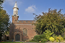 |
Great Sankey Great Sankey Great Sankey is a civil parish and suburban area of the Borough of Warrington and the ceremonial county of Cheshire in England. It is west of Warrington town centre. It has a population of 24,211.-History:... |
Civil parish | 24,211 | Warrington Warrington Warrington is a town, borough and unitary authority area of Cheshire, England. It stands on the banks of the River Mersey, which is tidal to the west of the weir at Howley. It lies 16 miles east of Liverpool, 19 miles west of Manchester and 8 miles south of St Helens... |
Warrington Rural District Warrington Rural District Warrington Rural District was, from 1894 to 1974, a local government district in the administrative county of Lancashire.It was formed a rural district under the Local Government Act 1894 from the Warrington rural sanitary district, and was centred on territory north of the town of Warrington... |
|
| Hatton Hatton, Warrington Hatton is a small village some 6 km south of Warrington, Cheshire .It lies on the B5356 road between the villages of Daresbury and Stretton. It has one public house, The Hatton Arms. This is a Grade II listed building which formerly incorporated a post office and a village store.-External... |
Civil parish | 316 | Warrington Warrington Warrington is a town, borough and unitary authority area of Cheshire, England. It stands on the banks of the River Mersey, which is tidal to the west of the weir at Howley. It lies 16 miles east of Liverpool, 19 miles west of Manchester and 8 miles south of St Helens... |
Runcorn Rural District Runcorn Rural District Runcorn was a rural district in Cheshire, England from 1894 to 1974. It was named after but did not include Runcorn, a town on the River Mersey to the north-west of the district, which formed its own urban district.... |
|
|
| Lymm Lymm Lymm is a large village and civil parish within the Warrington borough of Cheshire, in North West England. Lymm was an urban district of Cheshire from 1894 to 1974. The civil parish of Lymm incorporates the hamlets of Booths Hill, Broomedge, Church Green, Deansgreen, Heatley, Heatley Heath, Little... |
Civil parish | 10,552 | Warrington Warrington Warrington is a town, borough and unitary authority area of Cheshire, England. It stands on the banks of the River Mersey, which is tidal to the west of the weir at Howley. It lies 16 miles east of Liverpool, 19 miles west of Manchester and 8 miles south of St Helens... |
Lymm Urban District Lymm Lymm is a large village and civil parish within the Warrington borough of Cheshire, in North West England. Lymm was an urban district of Cheshire from 1894 to 1974. The civil parish of Lymm incorporates the hamlets of Booths Hill, Broomedge, Church Green, Deansgreen, Heatley, Heatley Heath, Little... |
|
|
| Penketh Penketh Penketh is a civil parish in the Borough of Warrington in Cheshire, England. It is about west of Warrington town centre. It has a population of 8,699.The emblem/badge of Penketh is three kingfishers.-History:... |
Civil parish | 8,699 | Warrington Warrington Warrington is a town, borough and unitary authority area of Cheshire, England. It stands on the banks of the River Mersey, which is tidal to the west of the weir at Howley. It lies 16 miles east of Liverpool, 19 miles west of Manchester and 8 miles south of St Helens... |
Warrington Rural District Warrington Rural District Warrington Rural District was, from 1894 to 1974, a local government district in the administrative county of Lancashire.It was formed a rural district under the Local Government Act 1894 from the Warrington rural sanitary district, and was centred on territory north of the town of Warrington... |
|
|
| Poulton with Fearnhead Poulton-with-Fearnhead Poulton-with-Fearnhead is a civil parish in the Borough of Warrington in Cheshire, England. According to the 2001 census it had a population of 17,019... |
Civil parish | 17,019 | Warrington Warrington Warrington is a town, borough and unitary authority area of Cheshire, England. It stands on the banks of the River Mersey, which is tidal to the west of the weir at Howley. It lies 16 miles east of Liverpool, 19 miles west of Manchester and 8 miles south of St Helens... |
Warrington Rural District Warrington Rural District Warrington Rural District was, from 1894 to 1974, a local government district in the administrative county of Lancashire.It was formed a rural district under the Local Government Act 1894 from the Warrington rural sanitary district, and was centred on territory north of the town of Warrington... |
|
|
| Rixton with Glazebrook Rixton-with-Glazebrook Rixton-with-Glazebrook is a civil parish in the unitary authority of Warrington, Cheshire, England. It lies to the east of Warrington and borders Irlam, and is largely farmland. It has a railway station at Glazebrook and is served by buses along the A57 road. The parish was originally a township... |
Civil parish | 1,884 | Warrington Warrington Warrington is a town, borough and unitary authority area of Cheshire, England. It stands on the banks of the River Mersey, which is tidal to the west of the weir at Howley. It lies 16 miles east of Liverpool, 19 miles west of Manchester and 8 miles south of St Helens... |
Warrington Rural District Warrington Rural District Warrington Rural District was, from 1894 to 1974, a local government district in the administrative county of Lancashire.It was formed a rural district under the Local Government Act 1894 from the Warrington rural sanitary district, and was centred on territory north of the town of Warrington... |
|
|
| Stockton Heath Stockton Heath Stockton Heath is a civil parish and suburban area of the Borough of Warrington in Cheshire, England. It is located to the north of the Bridgewater Canal and to the south of the Manchester Ship Canal, which divides Stockton Heath from Latchford and north Warrington... |
Civil parish | 6,396 | Warrington Warrington Warrington is a town, borough and unitary authority area of Cheshire, England. It stands on the banks of the River Mersey, which is tidal to the west of the weir at Howley. It lies 16 miles east of Liverpool, 19 miles west of Manchester and 8 miles south of St Helens... |
Runcorn Rural District Runcorn Rural District Runcorn was a rural district in Cheshire, England from 1894 to 1974. It was named after but did not include Runcorn, a town on the River Mersey to the north-west of the district, which formed its own urban district.... |
|
|
| Stretton | Civil parish | 1,009 | Warrington Warrington Warrington is a town, borough and unitary authority area of Cheshire, England. It stands on the banks of the River Mersey, which is tidal to the west of the weir at Howley. It lies 16 miles east of Liverpool, 19 miles west of Manchester and 8 miles south of St Helens... |
Runcorn Rural District Runcorn Rural District Runcorn was a rural district in Cheshire, England from 1894 to 1974. It was named after but did not include Runcorn, a town on the River Mersey to the north-west of the district, which formed its own urban district.... |
|
|
| Walton Walton, Cheshire Walton is a civil parish within the borough of Warrington in Cheshire, northern England.Walton is at the southwest edge of the borough, next to the parish of Stockton Heath. It is also close to Daresbury and Moore, although these are in the neighbouring borough of Halton.Walton is divided into... |
Civil parish | 1,594 | Warrington Warrington Warrington is a town, borough and unitary authority area of Cheshire, England. It stands on the banks of the River Mersey, which is tidal to the west of the weir at Howley. It lies 16 miles east of Liverpool, 19 miles west of Manchester and 8 miles south of St Helens... |
Runcorn Rural District Runcorn Rural District Runcorn was a rural district in Cheshire, England from 1894 to 1974. It was named after but did not include Runcorn, a town on the River Mersey to the north-west of the district, which formed its own urban district.... |
|
|
 |
Warrington Warrington Warrington is a town, borough and unitary authority area of Cheshire, England. It stands on the banks of the River Mersey, which is tidal to the west of the weir at Howley. It lies 16 miles east of Liverpool, 19 miles west of Manchester and 8 miles south of St Helens... |
Unparished area | 53,093 | Warrington Warrington Warrington is a town, borough and unitary authority area of Cheshire, England. It stands on the banks of the River Mersey, which is tidal to the west of the weir at Howley. It lies 16 miles east of Liverpool, 19 miles west of Manchester and 8 miles south of St Helens... |
Warrington County Borough County Borough of Warrington The County Borough of Warrington was, from 1900 to 1974, a local government district centred on Warrington in the northwest of England. It was alternatively known as Warrington County Borough and the County of Warrington.... |
|
| Winwick Winwick, Cheshire Winwick is a village and civil parish in the borough of Warrington in Cheshire, England. Historically within Lancashire, until 1 April 1974, Winwick was administered as part of Lancashire with the rest of north Warrington. It is situated about three miles north of Warrington town centre, near... |
Civil parish | 4,366 | Warrington Warrington Warrington is a town, borough and unitary authority area of Cheshire, England. It stands on the banks of the River Mersey, which is tidal to the west of the weir at Howley. It lies 16 miles east of Liverpool, 19 miles west of Manchester and 8 miles south of St Helens... |
Warrington Rural District Warrington Rural District Warrington Rural District was, from 1894 to 1974, a local government district in the administrative county of Lancashire.It was formed a rural district under the Local Government Act 1894 from the Warrington rural sanitary district, and was centred on territory north of the town of Warrington... |
|
|
| Woolston | Civil parish | 7,868 | Warrington Warrington Warrington is a town, borough and unitary authority area of Cheshire, England. It stands on the banks of the River Mersey, which is tidal to the west of the weir at Howley. It lies 16 miles east of Liverpool, 19 miles west of Manchester and 8 miles south of St Helens... |
Warrington Rural District Warrington Rural District Warrington Rural District was, from 1894 to 1974, a local government district in the administrative county of Lancashire.It was formed a rural district under the Local Government Act 1894 from the Warrington rural sanitary district, and was centred on territory north of the town of Warrington... |
|
External links
- Office for National Statistics : Geographical Area Listings
- Cheshire East Council : Clerks of Town Councils, Parish Councils and Parish Meetings
- Cheshire West and Chester Council : Contact Details for Local Council Clerks
- Halton Borough Council : Parish Councils
- Warrington Borough Council : Parish and Town Councils