

Burtonwood
Encyclopedia
Burtonwood and Westbrook is a civil parish
in the outermost suburbs of Warrington
in Cheshire
, England
. Historically within Lancashire
, the name Burtonwood is known worldwide as the location of the former RAF Station Burtonwood
military camp. Burtonwood village itself is a few miles away from the site of the former station. The civil parish also includes Westbrook, which is a council ward and suburb of Warrington. According to the 2001 census
, the population of the entire civil parish was 11,265.
in the ancient parish of Warrington, in the West Derby
Hundred
of Lancashire
. It was later created a civil parish and was part of the Warrington
Poor Law Union
and then the Warrington Rural District
. In 1974 it became part of Warrington District and is now part of the Warrington Unitary Authority
. It is still a civil parish (now named Burtonwood and Westbrook) and thus has its own parish council. Burtonwood's population rose from 990 in 1861 to 2,408 in 1911 as the mining and brewing industries grew. The parish population leaped to 8,238 in 1951 due to the Americans with the arrival of the United States Air Force
(USAF) personnel but dropped to 4,899 in 1971, before rising to 11,265 today as a result of housing development on the old RAF station site. Nowadays, there is work being done on the station and two of the camps have been knocked down. This is because of the Omega Project.
 RAF Burtonwood
was mainly used by the United States Air Force
between 1942 and closure of the main airfield in 1958 and was the biggest US airbase in Europe.
or college and the nearest high school
is Great Sankey High School
, which has a sixth-form attached to it. Also St Aelred's Catholic Technology College in nearby Newton-le-willows
which also has a sixth form attached, Priestley Sixth Form College in Warrington town centre is the nearest specialised sixth form college.
Burtonwood village also has two doctors' surgeries, known as Burtonwood Surgery on Clay Lane, and Kinnock Park Surgery. There is also a small Co-operative store (Mercer Street), as you walk in to the village there is a fish and chip shop, an independent betting shop, a Lloyd's chemist and a post office
, all located on Clay Lane.
In the former youth club, which prior to that was an old grammar school
, there is a relatively new Asian restaurant (2007). This is located opposite the Bridge pub on Phipp's Lane.
Burtonwood also has three nature reserve
s. Wheatacre Woods (access via Clay Lane / Gorsey Lane), the Old Colliery Moss (access via Bold Lane / Back Lane) and an area known as the Picnik Area which is accessed primarily from the footpath adjacent to the bowling green.
, Warrington Borough Transport 29 to Collins Green (subject to rural bus grant) and Ogden 141 (St Helens to Newton) run on behalf of Merseytravel
). The nearest major bus interchanges are in Warrington (6 miles) and Wigan
(8.19 miles). The nearest railway station was Collins Green
, but is now Earlestown
, two miles to the north of the village. Liverpool John Lennon Airport
is the nearest airport (10 miles to the west).
Civil parish
In England, a civil parish is a territorial designation and, where they are found, the lowest tier of local government below districts and counties...
in the outermost suburbs of Warrington
Warrington
Warrington is a town, borough and unitary authority area of Cheshire, England. It stands on the banks of the River Mersey, which is tidal to the west of the weir at Howley. It lies 16 miles east of Liverpool, 19 miles west of Manchester and 8 miles south of St Helens...
in Cheshire
Cheshire
Cheshire is a ceremonial county in North West England. Cheshire's county town is the city of Chester, although its largest town is Warrington. Other major towns include Widnes, Congleton, Crewe, Ellesmere Port, Runcorn, Macclesfield, Winsford, Northwich, and Wilmslow...
, England
England
England is a country that is part of the United Kingdom. It shares land borders with Scotland to the north and Wales to the west; the Irish Sea is to the north west, the Celtic Sea to the south west, with the North Sea to the east and the English Channel to the south separating it from continental...
. Historically within Lancashire
Lancashire
Lancashire is a non-metropolitan county of historic origin in the North West of England. It takes its name from the city of Lancaster, and is sometimes known as the County of Lancaster. Although Lancaster is still considered to be the county town, Lancashire County Council is based in Preston...
, the name Burtonwood is known worldwide as the location of the former RAF Station Burtonwood
RAF Burtonwood
RAF Burtonwood was a Royal Air Force station in England, 2 miles north-west of Warrington, Lancashire. During World War II and the Cold War it was used by the United States Air Force and was also known as USAAF station 590.- Overview :...
military camp. Burtonwood village itself is a few miles away from the site of the former station. The civil parish also includes Westbrook, which is a council ward and suburb of Warrington. According to the 2001 census
United Kingdom Census 2001
A nationwide census, known as Census 2001, was conducted in the United Kingdom on Sunday, 29 April 2001. This was the 20th UK Census and recorded a resident population of 58,789,194....
, the population of the entire civil parish was 11,265.
History
Burtonwood was a chapelryChapelry
A chapelry was a subdivision of an ecclesiastical parish in England, and parts of Lowland Scotland up to the mid 19th century. It had a similar status to a township but was so named as it had a chapel which acted as a subsidiary place of worship to the main parish church...
in the ancient parish of Warrington, in the West Derby
West Derby
West Derby is a suburb in the north of Liverpool, Merseyside, England. It is also a Liverpool City Council ward. At the 2001 Census, the population of the ward was 14,801 .-History:...
Hundred
Hundred
Hundred usually refers to the number 100It may also refer to:* Hundred , historically a number not necessarily 100* Hundred , a mostly obsolete geographic term...
of Lancashire
Lancashire
Lancashire is a non-metropolitan county of historic origin in the North West of England. It takes its name from the city of Lancaster, and is sometimes known as the County of Lancaster. Although Lancaster is still considered to be the county town, Lancashire County Council is based in Preston...
. It was later created a civil parish and was part of the Warrington
Warrington
Warrington is a town, borough and unitary authority area of Cheshire, England. It stands on the banks of the River Mersey, which is tidal to the west of the weir at Howley. It lies 16 miles east of Liverpool, 19 miles west of Manchester and 8 miles south of St Helens...
Poor Law Union
Poor Law Union
A Poor Law Union was a unit used for local government in the United Kingdom from the 19th century. The administration of the Poor Law was the responsibility of parishes, which varied wildly in their size, populations, financial resources, rateable values and requirements...
and then the Warrington Rural District
Warrington Rural District
Warrington Rural District was, from 1894 to 1974, a local government district in the administrative county of Lancashire.It was formed a rural district under the Local Government Act 1894 from the Warrington rural sanitary district, and was centred on territory north of the town of Warrington...
. In 1974 it became part of Warrington District and is now part of the Warrington Unitary Authority
Unitary authority
A unitary authority is a type of local authority that has a single tier and is responsible for all local government functions within its area or performs additional functions which elsewhere in the relevant country are usually performed by national government or a higher level of sub-national...
. It is still a civil parish (now named Burtonwood and Westbrook) and thus has its own parish council. Burtonwood's population rose from 990 in 1861 to 2,408 in 1911 as the mining and brewing industries grew. The parish population leaped to 8,238 in 1951 due to the Americans with the arrival of the United States Air Force
United States Air Force
The United States Air Force is the aerial warfare service branch of the United States Armed Forces and one of the American uniformed services. Initially part of the United States Army, the USAF was formed as a separate branch of the military on September 18, 1947 under the National Security Act of...
(USAF) personnel but dropped to 4,899 in 1971, before rising to 11,265 today as a result of housing development on the old RAF station site. Nowadays, there is work being done on the station and two of the camps have been knocked down. This is because of the Omega Project.
RAF Burtonwood
RAF Burtonwood was a Royal Air Force station in England, 2 miles north-west of Warrington, Lancashire. During World War II and the Cold War it was used by the United States Air Force and was also known as USAAF station 590.- Overview :...
was mainly used by the United States Air Force
United States Air Force
The United States Air Force is the aerial warfare service branch of the United States Armed Forces and one of the American uniformed services. Initially part of the United States Army, the USAF was formed as a separate branch of the military on September 18, 1947 under the National Security Act of...
between 1942 and closure of the main airfield in 1958 and was the biggest US airbase in Europe.
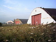
Brewery
The village is known for its brewery, which brews the Burtonwood ales. The brewery was founded in 1867, and built up a large estate of pubs. In 1964 Burtonwood Breweries became a public company, but retained its head office in the village. In 1998 the company formed a joint venture with Thomas Hardy Holdings, known as Thomas Hardy Burtonwood.Facilities
Burtonwood has five public houses, the Elm Tree, the Bridge Inn, the Chapel House, the Pear Tree and the Fiddle i' th' Bag Inn, three social clubs and three churches, St. Michael's, St. Paul's and the Methodist church. There are two recreational parks and two primary schools, Burtonwood Community Primary School and St Paul of the Cross Primary School. The village does not have a secondary schoolSecondary school
Secondary school is a term used to describe an educational institution where the final stage of schooling, known as secondary education and usually compulsory up to a specified age, takes place...
or college and the nearest high school
High school
High school is a term used in parts of the English speaking world to describe institutions which provide all or part of secondary education. The term is often incorporated into the name of such institutions....
is Great Sankey High School
Great Sankey High School
Great Sankey High School is a secondary school located in Warrington, Cheshire. The school is a state school, built in the 1970s and extensions have included a mathematics & humanities block and theatre. The school also has a linking leisure centre and arts theatre...
, which has a sixth-form attached to it. Also St Aelred's Catholic Technology College in nearby Newton-le-willows
Newton-le-Willows
Newton-le-Willows is a small market town within the Metropolitan Borough of St Helens, in Merseyside, England. Historically a part of Lancashire, it is situated about midway between the cities of Manchester and Liverpool, to the east of St Helens, to the north of Warrington and to the south of...
which also has a sixth form attached, Priestley Sixth Form College in Warrington town centre is the nearest specialised sixth form college.
Burtonwood village also has two doctors' surgeries, known as Burtonwood Surgery on Clay Lane, and Kinnock Park Surgery. There is also a small Co-operative store (Mercer Street), as you walk in to the village there is a fish and chip shop, an independent betting shop, a Lloyd's chemist and a post office
Post office
A post office is a facility forming part of a postal system for the posting, receipt, sorting, handling, transmission or delivery of mail.Post offices offer mail-related services such as post office boxes, postage and packaging supplies...
, all located on Clay Lane.
In the former youth club, which prior to that was an old grammar school
Grammar school
A grammar school is one of several different types of school in the history of education in the United Kingdom and some other English-speaking countries, originally a school teaching classical languages but more recently an academically-oriented secondary school.The original purpose of mediaeval...
, there is a relatively new Asian restaurant (2007). This is located opposite the Bridge pub on Phipp's Lane.
Burtonwood also has three nature reserve
Nature reserve
A nature reserve is a protected area of importance for wildlife, flora, fauna or features of geological or other special interest, which is reserved and managed for conservation and to provide special opportunities for study or research...
s. Wheatacre Woods (access via Clay Lane / Gorsey Lane), the Old Colliery Moss (access via Bold Lane / Back Lane) and an area known as the Picnik Area which is accessed primarily from the footpath adjacent to the bowling green.
Transport
The village is fairly small, with only three bus routes through it, (Arriva 329 to St HelensSt Helens, Merseyside
St Helens is a large town in Merseyside, England. It is the largest settlement and administrative centre of the Metropolitan Borough of St Helens with a population of just over 100,000, part of an urban area with a total population of 176,843 at the time of the 2001 Census...
, Warrington Borough Transport 29 to Collins Green (subject to rural bus grant) and Ogden 141 (St Helens to Newton) run on behalf of Merseytravel
Merseytravel
Merseytravel Merseytravel Merseytravel (MPTE, or Merseyside Passenger Transport Executive, is the Passenger Transport Executive responsible for the coordination of public transport in the metropolitan county of Merseyside, England...
). The nearest major bus interchanges are in Warrington (6 miles) and Wigan
Wigan
Wigan is a town in Greater Manchester, England. It stands on the River Douglas, south-west of Bolton, north of Warrington and west-northwest of Manchester. Wigan is the largest settlement in the Metropolitan Borough of Wigan and is its administrative centre. The town of Wigan had a total...
(8.19 miles). The nearest railway station was Collins Green
Collins Green railway station
Collins Green railway station was a railway station in Lancashire, later Cheshire, which was in operation between 1830 and 1951.-Opening and location:The station was opened by the Liverpool & Manchester Railway on 15 September 1830...
, but is now Earlestown
Earlestown railway station
Earlestown railway station is a railway station in Earlestown, Newton-le-Willows in Merseyside, England. Since recent restoration of a platform for Warrington Bank Quay to Liverpool trains, it is one of the few "triangular" stations in Britain ....
, two miles to the north of the village. Liverpool John Lennon Airport
Liverpool John Lennon Airport
Liverpool John Lennon Airport is an international airport serving the city of Liverpool and the North West of England. Formerly known as Speke Airport, RAF Speke, and Liverpool Airport the airport is located within the City of Liverpool adjacent to the estuary of the River Mersey some southeast...
is the nearest airport (10 miles to the west).
Population and race
- Population: 11,265
- Population, Males: 5,554
- Population, Females: 5,711
Population and race
- Population: 5,595
- Population ratio (Male:Female): 49.2%:50.8%
- White origin: 98.48%
- Mixed origin: 0.00%
- Asian origin: 0.57%
- Black origin: 0.01%
- Other origin: 0.23%
Housing
- Total households: 2,265
- Owner occupied: 84.68%
- Shared ownership: 0.26%
- Council accommodation: 10.64%
- Housing association accommodation: 0.18%
- Other rented accommodation: 4.24%