

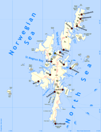
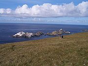
List of Shetland islands
Encyclopedia
30jan1973.jpg)
Scotland
Scotland is a country that is part of the United Kingdom. Occupying the northern third of the island of Great Britain, it shares a border with England to the south and is bounded by the North Sea to the east, the Atlantic Ocean to the north and west, and the North Channel and Irish Sea to the...
. The Shetland archipelago is located 100 kilometres (62.1 mi) north of mainland Scotland and the capital Lerwick
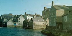
Lerwick
Lerwick is the capital and main port of the Shetland Islands, Scotland, located more than 100 miles off the north coast of mainland Scotland on the east coast of the Shetland Mainland...
is almost equidistant from Bergen
Bergen
Bergen is the second largest city in Norway with a population of as of , . Bergen is the administrative centre of Hordaland county. Greater Bergen or Bergen Metropolitan Area as defined by Statistics Norway, has a population of as of , ....
in Norway
Norway
Norway , officially the Kingdom of Norway, is a Nordic unitary constitutional monarchy whose territory comprises the western portion of the Scandinavian Peninsula, Jan Mayen, and the Arctic archipelago of Svalbard and Bouvet Island. Norway has a total area of and a population of about 4.9 million...
and Aberdeen
Aberdeen
Aberdeen is Scotland's third most populous city, one of Scotland's 32 local government council areas and the United Kingdom's 25th most populous city, with an official population estimate of ....
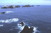
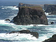
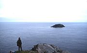
in Scotland. The Shetland archipelago comprises about 300 islands and skerries
Skerry
A skerry is a small rocky island, usually defined to be too small for habitation. It may simply be a rocky reef. A skerry can also be called a low sea stack....
, of which 16 are inhabited. In addition to the Shetland Mainland
Shetland Mainland
The Mainland is the main island of Shetland, Scotland. The island contains Shetland's only burgh, Lerwick, and is the centre of Shetland's ferry and air connections....
the larger islands are Unst
Unst
Unst is one of the North Isles of the Shetland Islands, Scotland. It is the northernmost of the inhabited British Isles and is the third largest island in Shetland after the Mainland and Yell. It has an area of .Unst is largely grassland, with coastal cliffs...
, Yell and Fetlar
Fetlar
Fetlar is one of the North Isles of Shetland, Scotland, with a population of 86 at the time of the 2001 census. Its main settlement is Houbie on the south coast, home to the Fetlar Interpretive Centre...
.
The definition of an island used in this list is that it is land that is surrounded by seawater on a daily basis, but not necessarily at all stages of the tide, excluding human devices such as bridges and causeways. There are four islands joined to the Shetland Mainland by bridges, East Burra
East Burra
East Burra is one of the Scalloway Islands, a subgroup of the Shetland Islands in Scotland. It is connected by a bridge to West Burra.With an area of two square miles, it is the eleventh largest of the Shetland Islands....
, West Burra, Trondra
Trondra
Trondra is one of the Scalloway Islands, a subgroup of the Shetland Islands in Scotland. It shelters the harbour of Scalloway and has an area of .-History:...
, and Muckle Roe
Muckle Roe
Muckle Roe is an island in Shetland, Scotland, in Saint Magnus Bay, to the west of Mainland, Shetland. It has a population of around 100 people, who mainly croft and live in the south east of the island...
. There is also a bridge from Housay
Housay
Housay, also known as West Isle, is one of the three islands that form the Out Skerries island group, the most easterly part of the Shetland Isles...
to Bruray
Bruray
Bruray is one of the three Out Skerries islands of Shetland, and contains Scotland's most easterly settlement.It is separated from Housay by North Mouth and South Mouth.-Infrastructure:...
. Nowhere in Shetland is more than three miles (5 km) from the sea. Mavis Grind (Old Norse
Old Norse
Old Norse is a North Germanic language that was spoken by inhabitants of Scandinavia and inhabitants of their overseas settlements during the Viking Age, until about 1300....
: gate of the narrow isthmus
Isthmus
An isthmus is a narrow strip of land connecting two larger land areas usually with waterforms on either side.Canals are often built through isthmuses where they may be particularly advantageous to create a shortcut for marine transportation...
) is a narrow neck of land little more than 100 metres (328 feet) wide separating St Magnus Bay and the Atlantic in the west from Sullom Voe
Sullom Voe
Sullom Voe is an inlet between North Mainland and Northmavine on Shetland in Scotland. It is a location of the Sullom Voe oil terminal. The word Voe is from the Old Norse vagr and denotes a small bay or narrow creek...
and the North Sea
North Sea
In the southwest, beyond the Straits of Dover, the North Sea becomes the English Channel connecting to the Atlantic Ocean. In the east, it connects to the Baltic Sea via the Skagerrak and Kattegat, narrow straits that separate Denmark from Norway and Sweden respectively...
in the east.
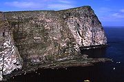
The geology
Geology
Geology is the science comprising the study of solid Earth, the rocks of which it is composed, and the processes by which it evolves. Geology gives insight into the history of the Earth, as it provides the primary evidence for plate tectonics, the evolutionary history of life, and past climates...
of Shetland is complex with numerous faults and fold axes. These islands are the northern outpost of the Caledonian orogeny
Caledonian orogeny
The Caledonian orogeny is a mountain building era recorded in the northern parts of the British Isles, the Scandinavian Mountains, Svalbard, eastern Greenland and parts of north-central Europe. The Caledonian orogeny encompasses events that occurred from the Ordovician to Early Devonian, roughly...
and there are outcrops of Lewisian
Lewisian complex
The Lewisian complex or Lewisian Gneiss is a suite of Precambrian metamorphic rocks that outcrop in the northwestern part of Scotland, forming part of the Hebridean Terrane. These rocks are of Archaean and Paleoproterozoic age, ranging from 3.0–1.7 Ga. They form the basement on which the...
, Dalradian and Moine
Moine Supergroup
The Moine Supergroup is a sequence of Neoproterozoic metamorphic rocks that form the dominant outcrop of the Scottish Highlands between the Moine Thrust Belt to the northwest and the Great Glen Fault to the southeast. The sequence is metasedimentary in nature and was metamorphosed and deformed in a...
metamorphic rocks with similar histories to their equivalents on the Scottish mainland. Similarly, there are also Old Red Sandstone
Old Red Sandstone
The Old Red Sandstone is a British rock formation of considerable importance to early paleontology. For convenience the short version of the term, 'ORS' is often used in literature on the subject.-Sedimentology:...
deposits and granite
Granite
Granite is a common and widely occurring type of intrusive, felsic, igneous rock. Granite usually has a medium- to coarse-grained texture. Occasionally some individual crystals are larger than the groundmass, in which case the texture is known as porphyritic. A granitic rock with a porphyritic...
intrusions. The most distinctive feature is the ultrabasic ophiolite
Ophiolites
An ophiolite is a section of the Earth's oceanic crust and the underlying upper mantle that has been uplifted and exposed above sea level and often emplaced onto continental crustal rocks...
, peridotite
Peridotite
A peridotite is a dense, coarse-grained igneous rock, consisting mostly of the minerals olivine and pyroxene. Peridotite is ultramafic, as the rock contains less than 45% silica. It is high in magnesium, reflecting the high proportions of magnesium-rich olivine, with appreciable iron...
and gabbro
Gabbro
Gabbro refers to a large group of dark, coarse-grained, intrusive mafic igneous rocks chemically equivalent to basalt. The rocks are plutonic, formed when molten magma is trapped beneath the Earth's surface and cools into a crystalline mass....
on Unst and Fetlar, which is a remnant of the Iapetus Ocean
Iapetus Ocean
The Iapetus Ocean was an ocean that existed in the Neoproterozoic and Paleozoic eras of the geologic timescale . The Iapetus Ocean was situated in the southern hemisphere, between the paleocontinents of Laurentia, Baltica and Avalonia...
floor. Much of the island's economy depends on the oil-bearing sediments in the surrounding seas. In the post-glacial epoch, circa 8150 BC, the islands experienced a tsunami up to 20 metres high caused by the Storegga Slide
Storegga Slide
The three Storegga Slides are considered to be amongst the largest known landslides. They occurred under water, at the edge of Norway's continental shelf , in the Norwegian Sea, 100 km north-west of the Møre coast, causing a very large tsunami in the North Atlantic Ocean...
s, an immense underwater landslip off the coast of Norway.
The islands all fall within the Shetland Islands Council
Shetland Islands Council
The Shetland Islands Council is the local authority for Shetland. It was established by the Local Government Act 1973 and is the successor to the former Lerwick Town Council and Zetland County Council...
local authority. They have been continuously inhabited since Neolithic
Neolithic
The Neolithic Age, Era, or Period, or New Stone Age, was a period in the development of human technology, beginning about 9500 BC in some parts of the Middle East, and later in other parts of the world. It is traditionally considered as the last part of the Stone Age...
times and experienced Norse
Norsemen
Norsemen is used to refer to the group of people as a whole who spoke what is now called the Old Norse language belonging to the North Germanic branch of Indo-European languages, especially Norwegian, Icelandic, Faroese, Swedish and Danish in their earlier forms.The meaning of Norseman was "people...
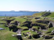
rule for several centuries, the first written records being the Norse sagas. The excavations at Jarlshof
Jarlshof
Jarlshof is the best known prehistoric archaeological site in Shetland, Scotland. It lies near the southern tip of the Shetland Mainland and has been described as "one of the most remarkable archaeological sites ever excavated in the British Isles"...
near the southern end of the Mainland have provided archaeological evidence of life in Shetland since Bronze Age
Bronze Age
The Bronze Age is a period characterized by the use of copper and its alloy bronze as the chief hard materials in the manufacture of some implements and weapons. Chronologically, it stands between the Stone Age and Iron Age...
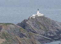
times and the annual Up Helly Aa fire festivals are a living reminder of Shetland's Viking past. The archipelago is exposed to wind and tide and there are numerous lighthouse
Lighthouse
A lighthouse is a tower, building, or other type of structure designed to emit light from a system of lamps and lenses or, in older times, from a fire, and used as an aid to navigation for maritime pilots at sea or on inland waterways....
s as an aid to navigation. A small wind farm on Shetland recently achieved a world record of 58% capacity over the course of a year. The indigenous Shetland ponies
Shetland pony
The Shetland pony is a breed of pony originating in the Shetland Isles. Shetlands range in size from a minimum height of approximately 28 inches to an official maximum height of 42 inches at the withers. Shetland ponies have heavy coats, short legs and are considered quite intelligent...
are reputed for their strength and hardiness.
Main list

Scalloway Islands
The Scalloway Islands are in Shetland opposite Scalloway on south west of the Mainland . They form a mini-archipelago and include:* Burra ** West Burra...
are a small archipelago at the entrance to Weisdale Voe in the South West. The North Isles
North Isles
The North Isles are the northern islands of the Shetland Islands, Scotland. The main islands in the group are Yell, Unst and Fetlar. Sometimes the islands in Yell Sound are included in this group.- Importance :...
is the name given to the group including Yell, Unst and Fetlar. There are also numerous islands in Yell Sound
Yell Sound
Yell Sound is the strait running between Yell and Mainland, Shetland. It is the boundary between the Mainland and the North Isles and it contains many small islands. Sullom Voe, on the shores of which is a substantial oil terminal, is an arm of Yell Sound....
between the Mainland and Yell and in St. Magnus Bay to the west, especially near the strait of Swarbacks Minn, but the number and diverse locations of the Shetland islands makes further classification difficult.
Records for the last date of settlement for the smaller uninhabited islands are incomplete, but all of the islands listed here would have been inhabited at some point during the Neolithic
Neolithic
The Neolithic Age, Era, or Period, or New Stone Age, was a period in the development of human technology, beginning about 9500 BC in some parts of the Middle East, and later in other parts of the world. It is traditionally considered as the last part of the Stone Age...
, Pictish
Picts
The Picts were a group of Late Iron Age and Early Mediaeval people living in what is now eastern and northern Scotland. There is an association with the distribution of brochs, place names beginning 'Pit-', for instance Pitlochry, and Pictish stones. They are recorded from before the Roman conquest...
or Norse
Norsemen
Norsemen is used to refer to the group of people as a whole who spoke what is now called the Old Norse language belonging to the North Germanic branch of Indo-European languages, especially Norwegian, Icelandic, Faroese, Swedish and Danish in their earlier forms.The meaning of Norseman was "people...
periods.
'Ward' appears regularly as the name of the highest point on the island. The derivation of the name is from those high places being used for the lighting of warning beacons.
| Island | Location | Area (ha Hectare The hectare is a metric unit of area defined as 10,000 square metres , and primarily used in the measurement of land. In 1795, when the metric system was introduced, the are was defined as being 100 square metres and the hectare was thus 100 ares or 1/100 km2... ) |
Population | Last inhabited | Highest point | Height (m) |
|---|---|---|---|---|---|---|
| Balta Balta Island Balta is an uninhabited island in Shetland, Scotland.-Geography:Balta lies off the east coast of Unst and Balta Sound... |
North Isles North Isles The North Isles are the northern islands of the Shetland Islands, Scotland. The main islands in the group are Yell, Unst and Fetlar. Sometimes the islands in Yell Sound are included in this group.- Importance :... |
80 | 0 | Norse times or later | Muckle Head | 44 |
| Bigga Bigga, Shetland Bigga is an uninhabited island in the Sound of Yell between the Mainland and Yell in Shetland, Scotland.-Geography and geology:Just over long, Bigga is in size, and is tall at its highest point. Bigga is a long thin island with a "head" and a "torso"... |
Yell Sound | 78 | 0 | 1930s | 34 | |
| Bressay Bressay -Geography and geology:Bressay lies due south of Whalsay, west of Noss, and north of Mousa. At , it is the fifth largest island in Shetland. The population is around 400 people, concentrated in the middle of the west coast, around Glebe, Fullaburn and Maryfield.... |
East of Lerwick | 2805 | 384 | Ward of Bressay | 226 | |
| Brother Isle Brother Isle Brother Isle is a small, uninhabited island in Shetland, Scotland. It lies between the islands of Yell and Shetland Mainland. It is in size.- Geography and geology :The island's rock is "undifferentiated moine gneiss and quartzite."- History :... |
Yell Sound | 40 | 0 | 1820s? | 25 | |
| Bruray Bruray Bruray is one of the three Out Skerries islands of Shetland, and contains Scotland's most easterly settlement.It is separated from Housay by North Mouth and South Mouth.-Infrastructure:... |
Out Skerries | 55 | 26 | Bruray Ward | 53 | |
| East Burra East Burra East Burra is one of the Scalloway Islands, a subgroup of the Shetland Islands in Scotland. It is connected by a bridge to West Burra.With an area of two square miles, it is the eleventh largest of the Shetland Islands.... |
Scalloway Islands Scalloway Islands The Scalloway Islands are in Shetland opposite Scalloway on south west of the Mainland . They form a mini-archipelago and include:* Burra ** West Burra... |
515 | 66 | Easter Heog | 81 | |
| Fair Isle Fair Isle Fair Isle is an island in northern Scotland, lying around halfway between mainland Shetland and the Orkney islands. It is famous for its bird observatory and a traditional style of knitting.-Geography:... |
Outlier | 768 | 69 | Ward Hill | 217 | |
| Fetlar Fetlar Fetlar is one of the North Isles of Shetland, Scotland, with a population of 86 at the time of the 2001 census. Its main settlement is Houbie on the south coast, home to the Fetlar Interpretive Centre... |
North Isles North Isles The North Isles are the northern islands of the Shetland Islands, Scotland. The main islands in the group are Yell, Unst and Fetlar. Sometimes the islands in Yell Sound are included in this group.- Importance :... |
4078 | 86 | Ward Hill | 158 | |
| Foula Foula Foula in the Shetland Islands of Scotland is one of Great Britain’s most remote permanently inhabited islands. Owned since the turn of the 20th century by the Holbourn family, the island was the location for the film The Edge of the World... |
Outlier | 1265 | 31 | The Sneug | 418 | |
| Hascosay Hascosay Hascosay is a small island lying between Yell and Fetlar in the Shetland Islands, Scotland.-Geography and geology:The island's rock is coarse micaceous gneiss.... |
Colgrave Sound, Yell | 275 | 0 | 1850s | 30 | |
| Hildasay Hildasay Hildasay , also known as Hildisay, is an uninhabited island off the west coast of the Shetland Mainland.-Geography and geology:... |
Scalloway Islands Scalloway Islands The Scalloway Islands are in Shetland opposite Scalloway on south west of the Mainland . They form a mini-archipelago and include:* Burra ** West Burra... |
108 | 0 | 1890s | 32 | |
| Housay Housay Housay, also known as West Isle, is one of the three islands that form the Out Skerries island group, the most easterly part of the Shetland Isles... |
Out Skerries | 163 | 50 | North Hill | 53 | |
| Lamba Lamba (island) Lamba is an uninhabited island in Yell Sound in the Shetland Islands. It lies north of the entrance to the Sullom Voe inlet. Rising 35 metres above sea level, it has an area of . Its main features are a 27m high light marking the entrance to Sullom Voe, and an adjacent communications mast.There... |
Yell Sound | 43 | 0 | unknown | 35 | |
| Linga near Muckle Roe Linga, Muckle Roe Linga is a small, uninhabited island, 1 km east of Muckle Roe in the Shetland Islands. The island is roughly circular in shape and its highest elevation is . Its area is .-Geography and geology:... |
Swarbacks Minn | 70 | 0 | unknown | 69 | |
| Linga Linga, Yell Linga is a very small uninhabited island in the Bluemull Sound, Shetland, Scotland. It is one of many islands in Shetland called Linga. It has an area of 45 ha and is 26m at its highest point.-Geography and geology:... |
Bluemull Sound, Yell | 45 | 0 | unknown | 26 | |
| Mainland Shetland Mainland The Mainland is the main island of Shetland, Scotland. The island contains Shetland's only burgh, Lerwick, and is the centre of Shetland's ferry and air connections.... |
Mainland | 96879 | 17550 | Ronas Hill Ronas Hill Ronas Hill is a Marilyn, the highest point of Mainland, Shetland, in Scotland. There is a Neolithic chambered cairn near the summit.-Location:... |
450 | |
| Mousa Mousa Mousa is a small island in Shetland, Scotland, uninhabited since the nineteenth century. The island is known for the Broch of Mousa, an Iron Age round tower, and is designated as a Special Protection Area for storm-petrel breeding colonies.-Geography:... |
East of Mainland | 180 | 0 | 1841-60 | Mid Field | 55 |
| Muckle Roe Muckle Roe Muckle Roe is an island in Shetland, Scotland, in Saint Magnus Bay, to the west of Mainland, Shetland. It has a population of around 100 people, who mainly croft and live in the south east of the island... |
Swarbacks Minn | 1773 | 104 | South Ward | 267 | |
| Noss Noss Noss is a small, previously inhabited island in Shetland, Scotland. It is a sheep farm and has been a National Nature Reserve since 1955.-Geography:... |
Bressay | 343 | 0 | 1930s | Noup of Noss | 181 |
| Oxna Oxna Oxna is one of the Scalloway Islands, lying north west of Burra in Shetland, Scotland. Oxna has an area of 68 ha .The island has been uninhabited since World War I, but there is a house which is still used as a holiday home..... |
Scalloway Islands Scalloway Islands The Scalloway Islands are in Shetland opposite Scalloway on south west of the Mainland . They form a mini-archipelago and include:* Burra ** West Burra... |
68 | 0 | 1901–1930 | Muckle Ward | 38 |
| Papa Papa, Shetland Papa is an uninhabited island in the Scalloway Islands, Shetland, Scotland.Papa lies north west of Burra and east of Oxna in the Shetland Islands.-Footnotes:... |
Scalloway Islands Scalloway Islands The Scalloway Islands are in Shetland opposite Scalloway on south west of the Mainland . They form a mini-archipelago and include:* Burra ** West Burra... |
59 | 0 | 1891–1930 | 32 | |
| Papa Little Papa Little Papa Little is an island in Shetland, Scotland.The island lies at the head of Aith Voe in north west Mainland, Shetland, south of Muckle Roe... |
Swarbacks Minn | 226 | 0 | 1840s | North Ward | 82 |
| Papa Stour Papa Stour Papa Stour is one of the Shetland Islands in Scotland, with a population of under twenty people, some of whom immigrated after an appeal for residents in the 1970s. Located to the west of mainland Shetland and with an area of 828 hectares , Papa Stour is the eighth largest island in Shetland... |
St Magnus Bay | 828 | 23 | Virda Field | 87 | |
| Samphrey Samphrey left|thumb|Samphrey and the view down [[Yell Sound]]Samphrey is an uninhabited island in the Shetland Islands, Scotland. One of Fair Isle's old names is "Friðarey" which is of similar origin.... |
Yell Sound | 76 | 0 | 1841–1880 | 29 | |
| South Havra South Havra South Havra is an uninhabited island in the Scalloway Islands, Shetland, Scotland.-Geography and geology:South Havra lies south of Burra and west of the southern peninsula of the Mainland, Shetland.... |
Scalloway Islands Scalloway Islands The Scalloway Islands are in Shetland opposite Scalloway on south west of the Mainland . They form a mini-archipelago and include:* Burra ** West Burra... |
59 | 0 | 1923 | 42 | |
| Trondra Trondra Trondra is one of the Scalloway Islands, a subgroup of the Shetland Islands in Scotland. It shelters the harbour of Scalloway and has an area of .-History:... |
Scalloway Islands Scalloway Islands The Scalloway Islands are in Shetland opposite Scalloway on south west of the Mainland . They form a mini-archipelago and include:* Burra ** West Burra... |
275 | 133 | 60 | ||
| Unst Unst Unst is one of the North Isles of the Shetland Islands, Scotland. It is the northernmost of the inhabited British Isles and is the third largest island in Shetland after the Mainland and Yell. It has an area of .Unst is largely grassland, with coastal cliffs... |
North Isles North Isles The North Isles are the northern islands of the Shetland Islands, Scotland. The main islands in the group are Yell, Unst and Fetlar. Sometimes the islands in Yell Sound are included in this group.- Importance :... |
12068 | 720 | Saxa Vord | 284 | |
| Uyea, Northmavine | North Mainland | 45 | 0 | unknown | 70 | |
| Uyea, Unst | North Isles North Isles The North Isles are the northern islands of the Shetland Islands, Scotland. The main islands in the group are Yell, Unst and Fetlar. Sometimes the islands in Yell Sound are included in this group.- Importance :... |
205 | 0 | 1931-60 | The Ward | 50 |
| Vaila Vaila Vaila is an island in Shetland, Scotland, lying south of the Westland peninsula of the Shetland Mainland. It has an area of , and is at its highest point.Vaila is home to an organic sheep farm and is also known for its mountain hares.... |
Gruting Voe | 327 | 2 | East Ward | 95 | |
| Vementry Vementry Vementry is an uninhabited island in Shetland, Scotland, on the north side of the West Mainland, lying south of Muckle Roe.... |
Swarbacks Minn | 370 | 0 | 1840s | Muckle Ward | 90 |
| West Burra | Scalloway Islands Scalloway Islands The Scalloway Islands are in Shetland opposite Scalloway on south west of the Mainland . They form a mini-archipelago and include:* Burra ** West Burra... |
743 | 753 | Hill of Sandwick | 65 | |
| West Linga West Linga West Linga is an uninhabited island located between Mainland and Whalsay in Shetland, Scotland.-Geography and geology:West Linga is a long narrow island covered in rough heath. It is separated from Whalsay by Linga Sound, and Lunning on Mainland, Shetland to the west. Little Linga, Swarta Skerry,... |
Whalsay | 125 | 0 | late 18th century | 52 | |
| Whalsay Whalsay -Geography:Whalsay, also known as "The Bonnie Isle", is a peat-covered island in the Shetland Islands. It is situated east of the Shetland Mainland and has an area of . The main settlement is Symbister, where the fishing fleet is based. The fleet is composed of both pelagic and demersal vessels... |
Whalsay | 1970 | 1034 | Ward of Clett | 119 | |
| Yell | North Isles North Isles The North Isles are the northern islands of the Shetland Islands, Scotland. The main islands in the group are Yell, Unst and Fetlar. Sometimes the islands in Yell Sound are included in this group.- Importance :... |
21211 | 957 | Hill of Arisdale | 210 |
Smaller islets and skerries


Holm (island)
This page is a set index; for other uses of the term, see Holm There are numerous islands containing the word Holm, especially in Scotland. In many cases the name is derived from the Old Norse holmr, meaning "a small and rounded islet"...
" from the Old Norse
Old Norse
Old Norse is a North Germanic language that was spoken by inhabitants of Scandinavia and inhabitants of their overseas settlements during the Viking Age, until about 1300....
holmr, meaning a "small and rounded islet". "Swarta Skerry" (Old Norse:' svartar sker) - "black skerry" is also a common name, as are "Linga", meaning "heather island", "Taing" (Old Norse: tangi) meaning "tongue" and "Flaesh" (Old Norse: fles) meaning "flat skerry". "Hog" and "calf" are used to indicate a small island, usually adjacent to a larger one.
Surrounding the mainland
- North-east Mainland: Bronga, Flat Stack, Green Isle, Hamera Head, Hellam, Hog Island, Linga near SamphreyLinga, SamphreyLinga is one of the Shetland Islands, in Yell Sound.-Geography and geology:Linga is an extremely common name in Shetland, meaning heather island. This Linga is not far from Firth and Firths Voe, in the West. Fish Holm is to the North and Lunna Ness to the east.Linga is made of coarse gneiss, with...
, Little HolmLittle Holm, Yell SoundLittle Holm is a small island in Yell Sound, in Shetland. It lies between Northmavine and the Isle of Yell. There is a lighthouse here.In 1983, the Royal Navy cleared ordnance from the area, and their bomb disposal team discovered an unrecorded shipwreck nearby. Its identity is still not...
, Longa Skerry, Mid Head, Muckle Holm, Muckle Stack, Quilsa Taing, Sandrift Skerries, Scarve Skerry, Skerry of Lunning, Stack of the Skersons, Stany Hog, Swarta Skerry (3), Taing. - South Nesting Bay: Climnie, Corn Holm, Cunning Holm, Fiska Skerry, Haerie, Holm of Skellister, Inner Voder, Linga Skerries, Litla Billan, Muckla Billan, Muckle Fladdicap, South Holm, Spentlie Holm.
- East Mainland: Aiplin, Aswick Skerries, Brethren, Eswick Holm, Gult Holm, Holm of Califf, Holms of Vatsland, Hoo Stack, Little Holm, North Isle of Gletness, South Holm, South Isle of Gletness, Stacks of Vatsland, Stunger, Tainga Skerry.
- South Mainland: Balla Skerry, Big Kiln, Big Skerry, Black Skerry, Broad Stack, Clocki Stack, ColsayColsayColsay is an uninhabited island off the South West coast of Mainland, Shetland. Fora Ness lies to the south, across the Muckle Sound. The highest elevation is , and there is an ancient cairn on the summit....
, Deda Skerry, Great Skerry, Hog of the Holm, Hog of the Ness, Holm of Helliness, Holm of Sound, Horse HolmHorse HolmThe Horse Holm , referred to on maps as Horse Island, known to locals simply as Da Holm, and used as an alignment point by local fishermen for several fishing marks, lies about 2.3 km west of Sumburgh Head at the south tip of the Mainland, Shetland.-Footnotes:This article incorporates text from ...
, Lady's HolmLady's HolmLady's Holm is an island off southern Mainland in the Shetland Islands. It is not to be confused with the Maiden Stack, which is also known as "Frau Stack"...
, Little HolmLittle Holm, ScatnessLittle Holm is a small island to the west of South Mainland in Shetland. It is near Scatness and Lady's Holm-References:*...
, Little Tind, Longa Skerry, Loos Laward, Lyoonigie Skerry, Muckle Hallitie, Ord Skerries, Ripack Stack, Scarfa Skerry, Scarfi Skerry, Scarf Taing, Scottle Holm, Seli Stack, Skerries of Longi-geo, Skerries of Sunngeo, Skerry of Okraquoy, Skersan, Skersund Skerry, Stack of Baronsgeo, Stack of Billyageo, Stack of Okraquoy, Stack of Otter Geo, Starling Rock, Swarta Skerry, The Moul, Wester Skerry, Whale Back. - St Ninian's Isle: Coar Holm, Fora Stack, High Herbi Clett, Hevda, Hich Holm, Inns Holm, Loose Head, Sand Skerry, Sweyn Holm.
- South West Mainland: Billia Cletts, Black Skerry, Burwick HolmBurwick HolmBurwick Holm is a small island off the west coast of Mainland, Shetland. It is in the inlet called Bur Wick, and near Scalloway....
, Cure Holm, Griskerry, Holm of Maywick, Hoove Holm, Housensellar, Kirk Skerry, Little Fogla Stack, Sheep-pund, The Skerry. - Weisdale Voe: Flotta, Greena, Havra Skerry, Holm of Quoyness, Holms of Hogaland, Hoggs of Hoy, HoyHoy, ShetlandHoy is a small island in Weisdale Voe, an arm of the sea in the Shetland islands, Scotland. Nearby are the smaller islets of Hoggs of Hoy and Junk. The Sound of Hoy lies between Hoy and Strom Ness peninsula on the Shetland Mainland. The highest point of the island is 35 metres above sea...
, Ingra Pund, Junk, North Havra, Scarf Stane, Silver Skerry. - Walls and Sandness: Aaskerry, Aaskery Taing, Berga Stack, Bousta Skerries, Braga, Broch of West Burrafirth, Brough Skerries, Buid Stacks, Burga Stacks, Burnant Stack, Clett (2), Cley Stacks, Crabba Skerry, Daa Skerry, Erne's Stack (2), Fore Holm, Galta Skerry, Galta Stack, Giltarump, Grava Skerries, Groni Stack, Grossa Stack, Holm of Gruting, Holm of Sefster, Isle of West Burrafirth. Kirk Holm, Lang Stack, Litla Stack, Little Flaes, Long Skerry, Moo Stack, Muckle Flaes, Muman Skerry, Neean Skerry, Riv Skerries, Rusna Stacks, Seli Stack, Skerries of Easter Pail, Skerries of Tunasdaal, Skerries of Watsness, Skerry of Dale, Skerry of Stool, Skerry of the Wick, Snap, Swaaba Stack, Tainga Skerries, The Bak, The Heag, The Peak, Trea Wick, Turl Stack.
- Swarbacks Minn & Olna Firth: Burgastoo, Green Holm, Heathery Holm, Holm of Burrafirth, Inga's Holm, Oggar Holm, Skult.
- Northmavine: Black Skerry, Black Skerry of Ramnageo, Burroo Stacks, Dore HolmDore HolmDore Holm is a small but solidly-built islet off the south coast of Eshaness, in the west of Mainland, Shetland. It is notable for having one of the finest natural arches in the Shetland islands, giving dramatic views from the coast between Tangwick and Stenness. The island is a notable scenic...
, Egilsay, Eina Stack, Gill Stack, Gruna Stack, Holm of Culsetter, Isle of Gunnister, Isle of Nibon, Isle of Niddister, Isle of Westerhouse, Little Ossa, Moo Stack (2), Muckle Ossa, Nista Skerries, Scarf Skerry, Skerry of Eshaness, Isle of StennessIsle of StennessThe Isle of Stenness is one of the Shetland Islands. It is off north west Mainland, Shetland in the Northmavine.It sheltered the old fishing harbour at Esha Ness on the mainland. The Skerry of Eshaness and Dore Holm are not far away....
, Stivva, Swart Skerry, Targies, The Bruddans, The Drongs, The Hogg, The Runk. - North Roe: Buska Stack, Burka Stack, Fugla Ness, Galti Stack (2), Gruna Stack, Hevda Skerries, Inner Booth, Little Gruna Stacks, Longa Skerry, Moo Stack, Munga Skerries, Nista Skerries, Outer Booth, Ship's Stone, Skerries of Fuglaness, Skerry of Skersound, Stack of Sumra, Stack of Weinnia-neep, Stuack, The Cleiver, The Hog, The Roodrans, The Stab, Troll Kona Stack, Valti Stack, Wilma Stack.
- GruneyGruneyGruney is a small, uninhabited island in Shetland, Scotland. It lies north of the Northmavine peninsula of the Shetland Mainland, from which it is separated by the Gruney Sound....
and the Ramna StacksRamna StacksThe Ramna Stacks are a group of skerries in the Shetland islands. They are north of the northern tip of Mainland, and along with nearby Gruney they are a special protection area on account of their birdlife.From north to south they consist of:*Gaut Skerries...
: Barlcudda, Fladda, Flae-ass, Gaut Skerries, Hyter, Ofoora, Outer Stack, Scordar, The Club, Turla.
- Gruney
- Yell Sound and Sullom VoeSullom VoeSullom Voe is an inlet between North Mainland and Northmavine on Shetland in Scotland. It is a location of the Sullom Voe oil terminal. The word Voe is from the Old Norse vagr and denotes a small bay or narrow creek...
: Bark Stack, Billia Skerry, Fish HolmFish HolmFish Holm is a small island, east of Mainland, Shetland. It is near the village of Mossbank.It is at its highest point, and a mile south of Samphrey in Yell Sound.- References :*...
, Little RoeLittle Roe-History:The island's name is Norse in origin, from , meaning "small red island" in contradistinction to Muckle Roe, which is not nearby, but in St Magnus BayIn 1841, eleven people lived here, all in the same house.A light beacon has been built on the island....
, Longa Skerry, Lunna HolmLunna HolmLunna Holm is a small island near Lunna Ness , in the Shetland Islands. It is at its highest point.The island also has a lighthouse.-References:*...
, Meokame Skerry, North Holm of Barravoe, Outer Skerry, Pund of Barravoe, Sand Skerry, Setter Holm, Sinna Skerry, Skea Skerry, South Holm of Burravoe, Stack of Stavgeo, The Castle, The Flaess, The Neap, Trolla Stack, Trunka, Ungam, Wether Holm.
a. Lunna Holm to The Keen. b. The Keen to Moul of Eswick. c. Moul of Eswick to Easter Rova Head by Lerwick. d. Easter Rova Head to St Ninian's Isle. e. St Ninian's Isle to Usta Ness. f. Usta Ness to Fora Ness. g. Fora Ness to Face of Neeans. h. Face of Neeans to Roe Sound. i. Roe Sound to The Faither. j. The Faither to Point of Fethaland. k. Point of Fethaland to Lunna Holm.
Surrounding other islands
- Bigga; Sigga Skerry, UynareyUynareyUynarey is one of the Shetland islands in Yell Sound, just to the north of Bigga, and east of Brother Island. It is an RSPB reserve.The name comes from the Norse for "venerated island", and this may reflect a Culdee connection.-Geology and geography:...
. - Brother Isle; Stoura Baa, Tinga Skerry.
- Bressay; Flada Cap, Fugla Skerry, Holm of Beosetter, Holm of Cruester, Holm of Gunista, Holm of Mel, Holm Skerry of Beosetter, Inner Score, Loofa Baa, Outer Score, Stoura Clett.
- East Burra; Holm of Hous, Holm of Papil, Peerie Hom of Clett, Scark Skerry, Stacks of Houssness, Taing of Symbister.
- Fair Isle; Breiti Stack, Fogli Stack, Hoiliff, Lang Cole, Oa Stack, Point Saider, Stacks of Skroo, Swabi Cole, The Burrian, The Criv, The Fless, The Keels, The Skerry.
- Fetlar; Braga, Calf of Daaey, Daaey, Outer Brough, Ruir Holm, Scarf Skerry, Stacks of Scambro, Stany Holm, The Flaeshins, The Fludir, Urie LingeyUrie LingeyFor other islands with similar names, see Linga Urie Lingey is one of the Shetland Islands. It is between Fetlar and Unst, and Yell is to the west.-Geography:...
. - Foula; Arvra Skerry, Blobrick, Da Baas o Stremness, Da Buddle Stane, Da Gloor, Da Rippack Stack, Da Sheepie, Da Skerries o da Rokness, Da Skerry o Hellabrik, Gaada Stack, Hesti Geo, Muntavie Stack.
- Hildasay; Easter Score Holm, Hogg of Linga, Hoe Skerry (east), Hoe Skerry (north), LangaLanga, ShetlandLanga is an uninhabited island off Hildasay, in Shetland, Scotland. It is not to be confused with the numerous islands called "Linga" in Shetland .-History:...
, LingaLinga, HildasayLinga is a small island off Hildasay in the Shetland Islands. It is one of the Scalloway Islands. Haswell-Smith compares Hildasay and the adjacent islands to a yeti's footprint, with Linga as a the big toe...
, Lunga Skerries, North Score Holm, Sanda Little, Sanda Stour, Swarta Skerry, The Nev, The Skerry, The Skult. - Mousa; Perie Bard.
- Muckle Roe; Burks Skerries, Crog Holm, Lee Skerries, Lothan, Murbie Stacks, Riding Stack, Spindle, Swabi Stack, Tame Holm.
- Noss; Holm of NossHolm of NossThe Holm of Noss or Cradle Holm is an uninhabited islet of the Shetland Islands. It is about 48m at its highest point.-Geography and geology:...
. - Out Skerries; Billia Skerry, Bound SkerryBound SkerryBound Skerry is part of the Out Skerries group in the Shetland Islands. As well as being the most easterly island of that group, it is also the easternmost point of Scotland....
, Easter Skerry, Filla, Flat Lamba Stack, GrunayGrunayGrunay is an uninhabited island in the Out Skerries group, the most easterly part of Shetland, Scotland.The island is the site of the lighthouse keeper's house for the lighthouse on the nearby Bound Skerry. This house was abandoned following the automation of the light in 1972.A Blenheim IV bomber...
, Hevda Skerries, Horn Skerry, Lamba Stack, Little Bound Skerry, Little Skerry, Long Guen, Muckle SkerryMuckle SkerryMuckle Skerry is the largest of the Pentland Skerries that lie off the north coast of Scotland. It is home to the Pentland Skerries Lighthouse.Muckle Skerry lies in the Pentland Firth at . It is the westernmost of the skerries...
, North Benelip, Old Man's Stack, Short Guen, South Benelip, Swaba Stack, Tamma Skerry, The Hogg, Vongs, Wether Holm. - Oxna; Bullia Skerry, Bulta, Bulta Skerry, Burrian, CheyniesCheyniesThe Cheynies are a group of reefs and small islands, between Oxna and Hildasay in the Shetland Islands. They have been considerably eroded in the historic past, and some of the islands are still connected at low tides...
, Hogg of Oxna, Retta Skerries, Spoose Holm, Steggies. - Papa; Hogg of Papa, Papa Skerry, Skerry of Bag, West Head of PapaWest Head of PapaWest Head of Papa is a small tidal island off Papa in Shetland, and is one of the Scalloway Islands. It is 21m at its highest point. East Head of Papa is part of Papa itself, so it is possible that West Head became separated in recent history.- References :...
. - Papa Stour; Aesha Stack, Boinna Skerry, Borse Skerry, Brei HolmBrei HolmBrei Holm is a tiny tidal islet in the western Shetland Islands. It is due east of Papa Stour, to which it is connected at low tide, just outside Housa Voe...
, Fogla Skerry, Forewick HolmForewick HolmForewick Holm is a island in the Sound of Papa in the Shetland islands, Scotland. located between Papa Stour and the Sandness peninsula.-Location:...
, Galti Stacks, Holm of Melby, Koda Skerry, Lyra Skerry, Maiden StackMaiden StackThe Maiden Stack or Frau Stack is a tiny stack in the western Shetland Islands to the north of Brei Holm and east of Housa Voe in Papa Stour....
, Skerries of Quidaness, Skerry of Lambaness, Sula Stack, Swat Skerry, The Horn, Tiptans Skerry, Wilma Skerry.- Ve SkerriesVe SkerriesVe Skerries, , are a group of low skerries 3 miles north west of Papa Stour, on the west coast of Shetland.-Skerries:The individual skerries are; North Skerry, Ormal, The Clubb, Reaverack, and Helligobolo.- Ve Skerries Lighthouse :...
: Helliogoblo, North Skerry, Ormal, Reaverack, The Clubb.
- Ve Skerries
- South Havra: Little HavraLittle HavraLittle Havra is a small island off the west of South Mainland in Shetland. It is at its highest point, upon which there is a cairn. It is located west of South Havra.-References:*...
. - Trondra: Black Skerry, Burland Skerry, Green Holm, Merry Holm, Skervie Skerry, Whaleback Skerry.
- Unst; Baa Skerries, Braava Skerries, Brindacks, Brough HolmBrough HolmBrough Holm is a small island off Unst, in the North Isles of Shetland. It is off Westing, which as the name implies is on the west coast of Unst.The word "brough" refers to the remains of the broch on it.-References:...
, Crickie's Chair, Cudda Stack, Flodda Stack, Haaf GruneyHaaf GruneyHaaf Gruney is a small island in the north east of the Shetland Islands.-Geography and geology:The island is between Unst and Fetlar which are to the north and south respectively. Between it and Yell are a mini-archipelago of small islands including Linga, Sound Gruney, Urie Lingey, Daaey and...
, Hevda Skerry, Hinda Stack, Holm of Heogland, Holm of Skaw, Humla Stack, HuneyHuneyHuney is an uninhabited island due east of the island of Unst in the Shetland Islands, Scotland. The island is located approximately 1 kilometre south west of the Balta and has an area of just . Huney is linked to Unst at an extremely low tide by a sandy tombolo called the Yei of Huney...
, Hunts Holm, Inner Flaess, Lang Holm, Leegal Skerry, Little Flugga, Littlewick Stack, Longa Stacks, Muckle FluggaMuckle FluggaMuckle Flugga is a small rocky island north of Unst in the Shetland Islands, Scotland. It is often described as the northernmost point of the British Isles, but the smaller islet of Out Stack is actually farther north...
, Neapna Stack, North Croga Skerry, North Holms, Out StackOut StackOut Stack or Ootsta in Shetland, Scotland, is the northernmost of the British Isles, lying immediately to the north of Muckle Flugga and north of the island of Unst. It is one of the North Isles of the Shetland Islands and lies within the Hermaness National Nature Reserve.Out Stack is little more...
, Reasings, Round Holm, Rumblings, Ruskock, Sound GruneySound GruneyFor other islands with similar names, see Gruney Sound Gruney is one of the Shetland islands. It lies about north of Hamars Ness on Fetlar, south of Unst, and to the east of Yell.-Geography:...
, South Croga Skerry, South Holms, Stackingro, Stackins-hocka, Stacks of Poindie, The Buss, The Greing, The Taing, Tipta Skerry, Tonga Stack, Tooa Stack, Tooral Stack, The Trinks o' Clave, The Vere, Urda Stack, Vesta Skerry, Whid Stack, Wilna Stack, Wurs Stack. - Uyea, Northmavine: Big Nev, Dorra Stack, Little Nev, Out Shuna Stack, Robert Irvine's Skerry, The Burrier.
- Uyea, Unst: Cliva Skerries, Scarf Stack, Wedder Holm.
- Vaila: Burrier Stacks, Gaada Stacks, Gluibuil, Holm of Breibister, Holm of Burrastow, Holm of Scapness, Humla Stack, Gluibuil, LingaLinga, VailaLinga is one of the Shetland Islands, near Vaila and Walls on Mainland, Shetland.-Geography and geology:Linga is made up of sandstone, subjected to ancient glacial erosion....
, Skerries of Linga, Stack of the Cuillian. - Vementry: Black Stane, Gruna, Holms of Uyea-sound, LingaLinga, VementryLinga is one of the Shetland Islands, near Vementry. It is one of many islands in Shetland called Linga.-Geography and geology:Linga's rock is schist and gneiss.The islands of Gruna and the Heag are to the North....
, Skewart Holm, Swaba Stacks, Swarbacks Skerry, The Heag. - West Burra: Atla Holm, Black Stacks, Fugla Stack, Inner Skerry, Muckle Skerry, Red Skerries, Stack of Sandwick, Trondra Skerry, Ukna Skerry, West Skerry.
- West Linga: Beilla Skerry, Bruse Holm, Calf of Linga, Calf of Little Linga, Calf of Score Holm, Hunder Holm, Kettil Holm' Little LingaLittle LingaLittle Linga is a small island in the Shetland Islands. It is near West Linga and Vidlin on Mainland, Shetland. It is at its highest point. Surrounding islands include the Calf of Little Linga, Score Holm, and Beilla Skerry.It measures from north to south....
, Longa Skerry, Marra Flaeshins, Score Holm, Swarta Skerry, The Flaeshans, Wether Holm. - Whalsay; Flaeshans of Sandwick, Holm of Sandwick, Inner Holm of Skaw, Isbister Holm, Mooa, Nacka Skerry, Nista, Outer Holm of Skaw, Sava Skerry, Skate of Maarister, Trota Stack.
- East LingaEast LingaEast Linga is one of the Shetland Islands. It lies between Whalsay , and Grif Skerry to the east.-Geography and geology:The bed rock is gneiss with granite veins....
; Burlastack of Rumble, Calf of Linga, Flaeshans of Rumble, Grif SkerryGrif SkerryGrif Skerry is an islet to the east of Whalsay in the Shetland Islands. Its name comes from the Norse or Norn for "deep sea skerry".The island is uninhabited, although there are some buildings on it...
, Longa Skerries, Longa Stack, Rumble, Swarta Skerries.
- East Linga
- Yell; Aastack, BiggaBigga, ShetlandBigga is an uninhabited island in the Sound of Yell between the Mainland and Yell in Shetland, Scotland.-Geography and geology:Just over long, Bigga is in size, and is tall at its highest point. Bigga is a long thin island with a "head" and a "torso"...
, Black Skerry, Brother IsleBrother IsleBrother Isle is a small, uninhabited island in Shetland, Scotland. It lies between the islands of Yell and Shetland Mainland. It is in size.- Geography and geology :The island's rock is "undifferentiated moine gneiss and quartzite."- History :...
, Brough, Burravoe Chest, Fish Holm, Gloup HolmGloup HolmGloup Holm is an islet in the Shetland Islands, lying to the north of Yell.-Geography and geology:Gloup Holm is near to the part of Yell called North Heaps, near Gloup. Rocks to the north include the Clapper, Eagle Stack and Whilkie Stack...
, Gold Skerry, Green Holm, Grey Stack, Holm of West Sandwick, Horns of the Roc, Kay Holm, LingaLinga, YellLinga is a very small uninhabited island in the Bluemull Sound, Shetland, Scotland. It is one of many islands in Shetland called Linga. It has an area of 45 ha and is 26m at its highest point.-Geography and geology:...
, Muckle HolmMuckle Holm, Yell SoundMuckle Holm is a small island in Shetland. It is in Yell Sound, near the Northmavine. It is 23m at its highest point.There is a lighthouse, first lit in 1976.-References:...
, Neapaback Skerries, OrfasayOrfasayOrfasay is one of the Shetland Islands.-Geography:Orfasay is a tidal island in Yell Sound, connected to Yell at low tide. This is reflected in the island's name....
, Outsta Ness, Rug, Skerry Wick, Stacks of Stuis, Sweinna Stack, The Clapper, The Quidin, Whalegeo Stacks, Whilkie Stack.
Tidal islands
St Ninian's Isle
St Ninian's Isle is a small island connected by the largest active tombolo in the UK to the south-western coast of the Mainland, Shetland, in Scotland. The tombolo, known locally as an ayre, from the Old Norse for 'gravel bank', is 500 metres long. Except at extremely high tides, the sand is above...
is connected to Mainland Shetland by the largest active tombolo
Tombolo
A tombolo, from the Italian tombolo, derived from the Latin tumulus, meaning 'mound,' and sometimes translated as ayre , is a deposition landform in which an island is attached to the mainland by a narrow piece of land such as a spit or bar. Once attached, the island is then known as a tied island...
in the United Kingdom
United Kingdom
The United Kingdom of Great Britain and Northern IrelandIn the United Kingdom and Dependencies, other languages have been officially recognised as legitimate autochthonous languages under the European Charter for Regional or Minority Languages...
. Although the 'isle' is greater than 40 hectares in size it fails to meet the definition of an island used in this list as it is only surrounded by water during occasional spring tides and storms.
At spring tides The Huney
Huney
Huney is an uninhabited island due east of the island of Unst in the Shetland Islands, Scotland. The island is located approximately 1 kilometre south west of the Balta and has an area of just . Huney is linked to Unst at an extremely low tide by a sandy tombolo called the Yei of Huney...
also has a tombolo that connects it to Unst
Unst
Unst is one of the North Isles of the Shetland Islands, Scotland. It is the northernmost of the inhabited British Isles and is the third largest island in Shetland after the Mainland and Yell. It has an area of .Unst is largely grassland, with coastal cliffs...
.
MarilynsMarilyn (hill)A Marilyn is a mountain or hill in the United Kingdom, Republic of Ireland or Isle of Man with a relative height of at least 150 metres , regardless of absolute height or other merit...
| Peak | Height (m) | Prom. (m) | Col (m) | Grid ref. | Parent | Island |
|---|---|---|---|---|---|---|
| Ronas Hill Ronas Hill Ronas Hill is a Marilyn, the highest point of Mainland, Shetland, in Scotland. There is a Neolithic chambered cairn near the summit.-Location:... |
450 | 450 | Sea | none | Mainland Shetland Mainland The Mainland is the main island of Shetland, Scotland. The island contains Shetland's only burgh, Lerwick, and is the centre of Shetland's ferry and air connections.... |
|
| The Sneug | 418 | 418 | Sea | none | Foula Foula Foula in the Shetland Islands of Scotland is one of Great Britain’s most remote permanently inhabited islands. Owned since the turn of the 20th century by the Holbourn family, the island was the location for the film The Edge of the World... |
|
| Royl Field | 293 | 287 | 6 | Ronas Hill Ronas Hill Ronas Hill is a Marilyn, the highest point of Mainland, Shetland, in Scotland. There is a Neolithic chambered cairn near the summit.-Location:... |
Mainland Shetland Mainland The Mainland is the main island of Shetland, Scotland. The island contains Shetland's only burgh, Lerwick, and is the centre of Shetland's ferry and air connections.... |
|
| Saxa Vord | 284 | 284 | Sea | none | Unst Unst Unst is one of the North Isles of the Shetland Islands, Scotland. It is the northernmost of the inhabited British Isles and is the third largest island in Shetland after the Mainland and Yell. It has an area of .Unst is largely grassland, with coastal cliffs... |
|
| Fitful Head | 283 | 270 | 13 | Royl Field | Mainland Shetland Mainland The Mainland is the main island of Shetland, Scotland. The island contains Shetland's only burgh, Lerwick, and is the centre of Shetland's ferry and air connections.... |
|
| Scalla Field | 281 | 266 | 15 | Royl Field | Mainland Shetland Mainland The Mainland is the main island of Shetland, Scotland. The island contains Shetland's only burgh, Lerwick, and is the centre of Shetland's ferry and air connections.... |
|
| Sandness Hill | 249 | 226 | 23 | Scalla Field | Mainland Shetland Mainland The Mainland is the main island of Shetland, Scotland. The island contains Shetland's only burgh, Lerwick, and is the centre of Shetland's ferry and air connections.... |
|
| Ward of Bressay | 226 | 226 | Sea | none | Bressay Bressay -Geography and geology:Bressay lies due south of Whalsay, west of Noss, and north of Mousa. At , it is the fifth largest island in Shetland. The population is around 400 people, concentrated in the middle of the west coast, around Glebe, Fullaburn and Maryfield.... |
|
| Ward Hill | 217 | 217 | Sea | none | Fair Isle Fair Isle Fair Isle is an island in northern Scotland, lying around halfway between mainland Shetland and the Orkney islands. It is famous for its bird observatory and a traditional style of knitting.-Geography:... |
|
| Hill of Arisdale | 210 | 210 | Sea | none | Yell | |
| Dalescord Hill | 252 | 203 | 49 | Scalla Field | Mainland Shetland Mainland The Mainland is the main island of Shetland, Scotland. The island contains Shetland's only burgh, Lerwick, and is the centre of Shetland's ferry and air connections.... |
|
| Valla Field | 216 | 201 | 15 | Saxa Vord | Unst Unst Unst is one of the North Isles of the Shetland Islands, Scotland. It is the northernmost of the inhabited British Isles and is the third largest island in Shetland after the Mainland and Yell. It has an area of .Unst is largely grassland, with coastal cliffs... |
|
| Noss Head | 181 | 181 | Sea | none | Noss Noss Noss is a small, previously inhabited island in Shetland, Scotland. It is a sheep farm and has been a National Nature Reserve since 1955.-Geography:... |
|
| The Noup | 248 | 179 | 69 | The Sneug | Foula Foula Foula in the Shetland Islands of Scotland is one of Great Britain’s most remote permanently inhabited islands. Owned since the turn of the 20th century by the Holbourn family, the island was the location for the film The Edge of the World... |
|
| Scrae Field | 216 | 178 | 38 | Royl Field | Mainland Shetland Mainland The Mainland is the main island of Shetland, Scotland. The island contains Shetland's only burgh, Lerwick, and is the centre of Shetland's ferry and air connections.... |
|
| Mid Ward | 172 | 172 | Sea | none | Muckle Roe Muckle Roe Muckle Roe is an island in Shetland, Scotland, in Saint Magnus Bay, to the west of Mainland, Shetland. It has a population of around 100 people, who mainly croft and live in the south east of the island... |
|
| Ward of Scousburgh | 263 | 166 | 97 | Royl Field | Mainland Shetland Mainland The Mainland is the main island of Shetland, Scotland. The island contains Shetland's only burgh, Lerwick, and is the centre of Shetland's ferry and air connections.... |
|
| Vord Hill | 159 | 159 | Sea | none | Fetlar Fetlar Fetlar is one of the North Isles of Shetland, Scotland, with a population of 86 at the time of the 2001 census. Its main settlement is Houbie on the south coast, home to the Fetlar Interpretive Centre... |
|
| White Grunafirth | 173 | 155 | 18 | Ronas Hill Ronas Hill Ronas Hill is a Marilyn, the highest point of Mainland, Shetland, in Scotland. There is a Neolithic chambered cairn near the summit.-Location:... |
Mainland Shetland Mainland The Mainland is the main island of Shetland, Scotland. The island contains Shetland's only burgh, Lerwick, and is the centre of Shetland's ferry and air connections.... |
See also
- List of Orkney islands
- List of Outer Hebrides
- List of islands of Scotland
- North Sea islands
- List of islands called Linga
- Geology of ScotlandGeology of ScotlandThe geology of Scotland is unusually varied for a country of its size, with a large number of differing geological features. There are three main geographical sub-divisions: the Highlands and Islands is a diverse area which lies to the north and west of the Highland Boundary Fault; the Central...
- Geography of Shetland
- Shetland population