List of Hong Kong post offices
Encyclopedia
Post offices are scattered throughout Hong Kong
. All of them are managed by Hongkong Post
. As of 2007, there are 34 of post offices on Hong Kong Island
, 42 at Kowloon
, 45 in the New Territories
and 8 on the Outlying Islands
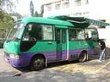
. There are two mobile post offices providing postal services in remote areas in the New Territories.
Notes
# - Philatelic office
Service in the Chinese University of Hong Kong
and Hong Kong University of Science and Technology
has been suspended.
Hong Kong
Hong Kong is one of two Special Administrative Regions of the People's Republic of China , the other being Macau. A city-state situated on China's south coast and enclosed by the Pearl River Delta and South China Sea, it is renowned for its expansive skyline and deep natural harbour...
. All of them are managed by Hongkong Post
Hongkong Post
Hongkong Post is a department under the Government of Hong Kong responsible for postal services, though operated as a Trading Fund. Founded in 1841, it was known as Postal Department or Post Office before the handover of Hong Kong in 1997...
. As of 2007, there are 34 of post offices on Hong Kong Island
Hong Kong Island
Hong Kong Island is an island in the southern part of the Hong Kong Special Administrative Region. It has a population of 1,289,500 and its population density is 16,390/km², as of 2008...
, 42 at Kowloon
Kowloon
Kowloon is an urban area in Hong Kong comprising the Kowloon Peninsula and New Kowloon. It is bordered by the Lei Yue Mun strait in the east, Mei Foo Sun Chuen and Stonecutter's Island in the west, Tate's Cairn and Lion Rock in the north, and Victoria Harbour in the south. It had a population of...
, 45 in the New Territories
New Territories
New Territories is one of the three main regions of Hong Kong, alongside Hong Kong Island and the Kowloon Peninsula. It makes up 86.2% of Hong Kong's territory. Historically, it is the region described in The Convention for the Extension of Hong Kong Territory...
and 8 on the Outlying Islands
Outlying Islands, Hong Kong
In Hong Kong, the Outlying Islands are the groups of islands that surround Hong Kong Island as well as Kowloon and the New Territories on the mainland. There are 236 islands in Hong Kong, the majority of which are part of Islands District in the south and southwest, Sai Kung District in the...
. There are two mobile post offices providing postal services in remote areas in the New Territories.

Post offices on Hong Kong Island
| Name | Year of establishment |
Image | Location |
|---|---|---|---|
| Aberdeen # (香港仔郵政局) |
1986 | -- | Aberdeen Main Road, Aberdeen |
| Ap Lei Chau (鴨脷洲郵政局) |
1980 | -- | Ap Lei Chau Ap Lei Chau Ap Lei Chau , or Aberdeen Island, is an island of Hong Kong, located south-west of Hong Kong Island, next to Aberdeen Harbour and Aberdeen Channel, with an area of 1.30 km². Administratively, it is part of Southern District. Ap Lei Chau is the third most densely populated island in the world.-... Estate |
| Causeway Bay # (銅鑼灣郵政局) |
2011 | -- | Shops 1015-1018, 10th Floor, Windsor House, Causeway Bay |
| Chai Wan (柴灣郵政局) |
1978 | Yue Wan Estate, Chai Wan Road Chai Wan Road Chai Wan Road located in Hong Kong, is one of the major roads in Chai Wan on Hong Kong Island. It runs from Shau Kei Wan to Chai Wan through Chai Wan Gap; with one of the steepest inclines in Hong Kong on either side, with signs posted 1 in 10 gradient... , Chai Wan Chai Wan Chai Wan , formerly mistakenly known as Sai Wan , lies at the east end of the urban area of Hong Kong Island next to Shau Kei Wan. The area is administratively part of the Eastern District, and is a mosaic of industrial and residential areas... |
|
| Cloud View Road (雲景道郵政局) |
1983 | -- | Cloud View Road, Hong Kong Hong Kong Hong Kong is one of two Special Administrative Regions of the People's Republic of China , the other being Macau. A city-state situated on China's south coast and enclosed by the Pearl River Delta and South China Sea, it is renowned for its expansive skyline and deep natural harbour... |
| Cyberport # (數碼港郵政局) |
2003 | 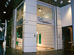 |
Cyberport Cyberport Cyberport is a creative digital community with a cluster of technology and digital content tenants. It is owned and managed by Hong Kong Cyberport Management Company Limited which is wholly owned by the Hong Kong SAR Government... Road, Aberdeen |
| General Post Office General Post Office, Hong Kong General Post Office is the headquarters of Hongkong Post. Built in 1976, it is located at Connaught Place, Central, Hong Kong. The office is adjacent to former Star Ferry Pier, Jardine House and International Finance Centre... # (郵政總局) |
1976 | 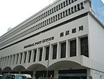 |
Connaught Place Connaught Place, Hong Kong Connaught Place, formerly called Connaught Centre, is a square near Jardine House in Central, Hong Kong.The General Post Office and Exchange Square have Connaught Place addresses.... , Central Central, Hong Kong Central is the central business district of Hong Kong. It is located in Central and Western District, on the north shore of Hong Kong Island, across Victoria Harbour from Tsim Sha Tsui, the southernmost point of Kowloon Peninsula... |
| Gloucester Road (告士打道郵政局) |
1992 | -- | Gloucester Road, Wan Chai Wan Chai Wan Chai is a metropolitan area situated at the western part of the Wan Chai District on the northern shore of Hong Kong Island, in Hong Kong. Its other boundaries are Canal Road to the east, Arsenal Street to the west and Bowen Road to the south. The area north of Gloucester Road is often called... |
| Happy Valley (跑馬地郵政局) |
1990 |  |
Sing Woo Road, Happy Valley Happy Valley, Hong Kong Happy Valley is a mostly residential suburb of Hong Kong, located in the northern part of Hong Kong Island. Administratively, it is part of Wan Chai District.... |
| Heng Fa Chuen (杏花邨郵政局) |
1989 | -- | Heng Fa Chuen |
| Hennessy Road # (軒尼詩道郵政局) |
1969 |  |
Hennessy Road Hennessy Road Hennessy Road is a thoroughfare on Hong Kong Island, Hong Kong. It connects Yee Wo Street on the east in Causeway Bay, and Queensway on the western end in Wan Chai.The road is named after John Pope Hennessy, the Governor of Hong Kong between 1877 and 1882.... , Wan Chai |
| Hing Fat Street (興發街郵政局) |
1983 |  |
Causeway Bay Kaifong Welfare Association Building, Hing Fat Street |
| Hing Man Street (興民街郵政局) |
1995 | -- | Wing Hing Court, Hing Man Street, Sai Wan Ho Sai Wan Ho Sai Wan Ho is a primarily residential area on the northeastern shore of Hong Kong Island, Hong Kong, between Quarry Bay and Shau Kei Wan. It is part of the Eastern District, and is administered together with surrounding areas under the Eastern District Council.-Location:Sai Wan Ho is conventionally... |
| Kennedy Town (堅尼地城郵政局) |
2006 | 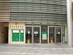 |
Kennedy Town Community Complex, Rock Hill Street, Kennedy Town Kennedy Town Kennedy Town is at the western end of Sai Wan on Hong Kong Island in Hong Kong. It was named after Arthur Edward Kennedy, the 7th Governor of Hong Kong from 1872 to 1877... |
| King's Road # (英皇道郵政局) |
2005 | -- | Olympia Plaza, King's Road King's Road, Hong Kong King's Road is a major east-west street along the northern shore of Hong Kong Island, Hong Kong, extending from Causeway Bay, where it joins Causeway Road, to Sai Wan Ho, where it joins Shau Kei Wan Road.-History:... , North Point North Point North Point is a mixed-use urban area in the Eastern District of Hong Kong. It is the northernmost point of Hong Kong Island, adjacent to both Causeway Bay and Quarry Bay, and projecting toward Kowloon Bay. Fortress Hill occupies the western end of the North Point area.-History:In 1899, The... |
| Lei Tung (利東郵政局) |
1990 (relocated in 2011) |
-- | Lei Tung Estate, Ap Lei Chau |
| Morrison Hill (摩理臣山郵政局) |
1980 | 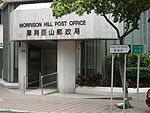 |
Oi Kwan Road, Wan Chai |
| Peak # (山頂郵政局) |
1995 | -- | The Peak Tower Peak Tower The Peak Tower is a leisure and shopping complex located at Victoria Gap, near the summit of Victoria Peak on Hong Kong Island, Hong Kong. It also houses the upper terminal of the Peak Tram. Both the Peak Tower and the Peak Tram are owned by the Hongkong and Shanghai Hotels group, the owner of... , Peak Road, the Peak Victoria Peak Victoria Peak is a mountain in Hong Kong. It is also known as Mount Austin, and locally as The Peak. The mountain is located in the western half of Hong Kong Island... |
| Perkins Road (白建時道郵政局) |
1975 | -- | Perkins Road, Jardine's Lookout Jardine's Lookout Jardine's Lookout is a mountain and a residential area on the Hong Kong Island in Hong Kong. It is located Southeast of the Wan Chai district and South of the Tai Hang area, at an altitude of about 433 metres. Nearby hills include Mount Nicholson, Violet Hill and Mount Butler etc.It is named after... |
| Pok Fu Lam (薄扶林郵政局) |
1993 | -- | Fu Wing Yuen, Chi Fu Fa Yuen, Pok Fu Lam Pok Fu Lam Pok Fu Lam or Pokfulam is a residential area on Hong Kong Island, at the western end of the Southern District.Pok Fu Lam is a valley between Victoria Peak and Mount Kellet, around Telegraph Bay.... |
| Queen's Road (皇后大道郵政局) |
2004 | 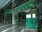 |
The Center The Center The Center is the fifth tallest skyscraper in Hong Kong, after International Commerce Centre, Two International Finance Centre , Central Plaza and Bank of China Tower. With a height of 346 m , it comprises 73 stories. The Center is one of the few skyscrapers in Hong Kong that is entirely... , Queen's Road Central, Central |
| Repulse Bay (淺水灣郵政局) |
Temporarily closed due to renovation | ||
| Sai Ying Pun (西營盤郵政局) |
1967 | -- | 27 Pok Fu Lam Road Pok Fu Lam Road Pokfulam Road, or Pok Fu Lam Road, is a four-lane road in Hong Kong. Built on Hong Kong Island, the road runs between Sai Ying Pun and Wah Fu, through Pok Fu Lam.... |
| Shau Kei Wan # (筲箕灣郵政局) |
1988 | -- | Perfect Mount Gardens, Po Man Street, Shau Kei Wan Shau Kei Wan Shau Kei Wan or Shaukeiwan, Shaukiwan is a town in Eastern District, Hong Kong. Literally, Shau Kei means a pail, and Wan implies that the town is developed along the coast. Nowadays it is a relatively densely populated town compared with some developing areas.-Name:The name Shau Kei Wan comes... |
| Sheung Wan # (上環郵政局) |
1988 as Western Branch 1914 as Sheung Wan 1991 current office |
-- | West Exchange Tower, Morrison Street, Sheung Wan Sheung Wan Sheung Wan is an area in Hong Kong, located in the north-west of Hong Kong Island, between Central and Sai Ying Pun. Administratively, it is part of the Central and Western District... |
| Siu Sai Wan (小西灣郵政局) |
1995 | -- | Siu Sai Wan Siu Sai Wan Siu Sai Wan is a newly developed residential area in the northeastern part of Hong Kong Island in Hong Kong. It is located in the eastern part of Chai Wan, and is administratively under the Eastern District. The population is about 80,000.-Location:... Estate, Chai Wan |
| Stanley (赤柱郵政局) |
1937 (the oldest post office in service, Hong Kong Hong Kong Hong Kong is one of two Special Administrative Regions of the People's Republic of China , the other being Macau. A city-state situated on China's south coast and enclosed by the Pearl River Delta and South China Sea, it is renowned for its expansive skyline and deep natural harbour... ) |
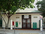 |
Wong Ma Kok Road, Stanley Stanley, Hong Kong Stanley is a town and a tourist attraction in Hong Kong. It located on a peninsula on the southeastern part of Hong Kong Island. It is east of Repulse Bay and west of Shek O, adjacent to Chung Hom Kok... |
| Tai Koo Shing # (太古城郵政局) |
1994 | -- | Kam Sing Mansion, Tai Fung Avenue, Taikoo Shing Taikoo Shing Taikoo Shing, or Tai Koo Shing , is a private residential in Quarry Bay, Hong Kong Island, Hong Kong. It forms a part of the Swire Properties's Island East residential and retail branding, along with TaiKoo Place, the adjacent Cityplaza retail and office complex and EAST, a lifestyle business... |
| Tsat Tsz Mui (七姊妹郵政局) |
1989 | -- | Model Housing Estate Model Housing Estate Model Housing Estate is a public housing estate located at King's Road between Quarry Bay and North Point in Hong Kong, near MTR Quarry Bay Station Exit C. It is the oldest existing public housing estate in Hong Kong... , King's Road, North Point |
| Wah Fu (華富郵政局) |
1968 | 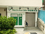 |
Wah Chun House, Wah Fu Estate Wah Fu Estate Wah Fu Estate is a public housing estate located by the Kellett Bay, Pok Fu Lam, Southern District, Hong Kong. It was built on a new town concept in 1967 and was renovated in around 2003... |
| Wan Chai # (灣仔郵政局) |
1992 | 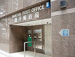 |
Wu Chung House, Queen's Road East |
| Wyndham Street (雲咸街郵政局) |
1984 | 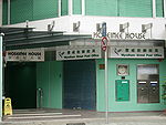 |
Hoseinee House, Wyndham Street Wyndham Street Wyndham Street is a one-way street in Central, Hong Kong. It is one of the earliest colonial streets, once known as Pedder Hill.It starts at the junction with Hollywood Road and Arbuthnot Road, near the Central Police Station, and heads downhill to terminate at Queen's Road Central, near the... |
Post offices at Kowloon
| Name | Year of establishment |
Image | Location |
|---|---|---|---|
| Cheung Sha Wan # (長沙灣郵政局) |
1966 | Cheung Sha Wan Road Cheung Sha Wan Road Cheung Sha Wan Road is the most major road in western urban New Kowloon of Hong Kong. It starts from Sham Shui Po, passes through Cheung Sha Wan, and ends near Lai Chi Kok.-Route:... , Cheung Sha Wan Cheung Sha Wan Cheung Sha Wan is an area between Lai Chi Kok and Sham Shui Po in New Kowloon, Hong Kong. It is mainly residential to the north and south, with an industrial area in between. Administratively it is part of Sham Shui Po District. The Sham Shui Po District includes Mei Foo as well as Lai Chi... |
|
| Choi Hung Chuen (彩虹邨郵政局) |
1963 | 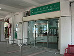 |
Choi Hung Estate |
| Choi Ming (彩明郵政局) |
2004 | Choi Ming Court, Tseung Kwan O Tseung Kwan O Tseung Kwan O is a bay in Sai Kung District, New Territories, Hong Kong. In the northern tip of the bay lies the Tseung Kwan O Village.... |
|
| Chuk Yuen (竹園郵政局) |
1988 | Chuk Yuen Chuk Yuen Chuk Yuen or Chuk Un was a village and an area in New Kowloon of Hong Kong. The area is approximately present-day Wong Tai Sin. The name now also refers to two public housing estates, Chuk Yuen North and Chuk Yuen South Estates.... (South) Estate |
|
| Fu Shan (富山郵政局) |
1979 | 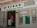 |
Fu Shan Estate |
| Gillies Avenue # (機利士路郵政局) |
1963 | Gillies Avenue North, Hung Hom Hung Hom Hung Hom is an area of Kowloon, in Hong Kong, administratively part of the Kowloon City District, with a portion west of the railway in the Yau Tsim Mong District. Hung Hom serves mainly residential purposes though is mixed with some industrial buildings in the north.-Geography:Hung Hom is located... |
|
| Granville Road # (加連威老道郵政局) |
1983 | 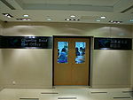 |
Albion Plaza, Granville Road, Tsim Sha Tsui Tsim Sha Tsui Tsim Sha Tsui , often abbreviated as TST, is an urbanized area in southern Kowloon, Hong Kong. The area is administratively part of the Yau Tsim Mong District. Tsim Sha Tsui East is a piece of land reclaimed from the Hung Hom Bay now east of Tsim Sha Tsui... |
| Ho Man Tin (何文田郵政局) |
2002 | Homantin Estate, Homantin | |
| Hung Hom Bay # (紅磡灣郵政局) |
1989 |  |
Cherry Mansion, Whampoa Garden Whampoa Garden Whampoa Garden is the largest private housing estate located in Hung Hom, Kowloon, Hong Kong. It was built on the site of the former Whampoa Dockyards under Hutchison Whampoa Property's "garden city" concept and completed in 1991.-Features:... , Hung Hom |
| International Mail Centre (國際郵件中心郵政局) |
1982 | 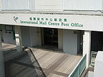 |
International Mail Centre, Salisbury Road Salisbury Road, Hong Kong Salisbury Road is a major road in Tsim Sha Tsui, Kowloon, Hong Kong. It runs parallel to Victoria Harbour, starting from its western end at the Star Ferry Pier, passing by Blackhead Point, to Tsim Sha Tsui East... , Hung Hom |
| Kowloon Bay (九龍灣郵政局) |
2008 | Enterprise Square, Sheung Yuet Road, Kowloon Bay Kowloon Bay Kowloon Bay is a bay located at the east of the Kowloon Peninsula and north of Hong Kong Island in Hong Kong. It is the eastern portion of Victoria Harbour, between Hung Hom and Lei Yue Mun... |
|
| Kowloon Central Kowloon Central Post Office Kowloon Central Post Office is the main post office in Kowloon, Hong Kong. It is located at 405 Nathan Road, Yau Ma Tei, just beneath the Kowloon Government Offices.-References:... # (九龍中央郵政局) |
1967 | 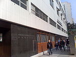 |
Kowloon Government Offices, Nathan Road, Yau Ma Tei Yau Ma Tei Yau Ma Tei, also known as Waterloo , is an area in the Yau Tsim Mong District in the south of the Kowloon Peninsula in Hong Kong.-Name:Yau Ma Tei is a phonetic transliteration of the name 油麻地 in Cantonese... |
| Kowloon City # (九龍城郵政局) |
1959 | Lung Kong Road, Kowloon City Kowloon City Kowloon City is an area in Kowloon, Hong Kong. It is named after the Kowloon Walled City, and is administratively part of Kowloon City District.... |
|
| Kowloon East (東九龍郵政局) |
1985 | Kowloon East Government Offices Building, Lei Yue Mun Road Lei Yue Mun Road Lei Yue Mun Road is a major road in Lam Tin, Hong Kong. It runs from the junction with Tsui Ping Road and Kwun Tong Road near MTR Kwun Tong Station to the roundabout with Ko Chiu Road near Lei Yue Mun Estate in Yau Tong... , Kwun Tong Kwun Tong Kwun Tong is an area in Kwun Tong District, situated at the eastern part of the Kowloon Peninsula, and its boundary stretches from Lion Rock in the north to Lei Yue Mun in the south, and from the winding paths of Kowloon Peak in the east to the north coast of the former Kai Tak Airport runway in... |
|
| Kwong Wa Street # (廣華街郵政局) |
1988 | 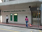 |
Kwong Fai Mansion, Kwong Wa Street Kwong Wa Street Kwong Wa Street is a street between Dundas Street and Yim Po Fong Street in Mong Kok, Kowloon, Hong Kong. The street is famous for shops selling airsoft, RC racing and other modelling and other hobbying equipment.Airsoft retailers on the street includes:... , Mong Kok Mong Kok Mong Kok , less often known as Argyle , is an area in the Yau Tsim Mong District on Kowloon Peninsula, Hong Kong... |
| Kwun Tong # (觀塘郵政局) |
1962 | Kwun Tong District Branch Offices Building, Tung Yan Street, Kwun Tong | |
| Lai Kok (麗閣郵政局) |
1982 | Lai Kok Estate, Cheung Sha Wan Cheung Sha Wan Cheung Sha Wan is an area between Lai Chi Kok and Sham Shui Po in New Kowloon, Hong Kong. It is mainly residential to the north and south, with an industrial area in between. Administratively it is part of Sham Shui Po District. The Sham Shui Po District includes Mei Foo as well as Lai Chi... |
|
| Lam Tin (藍田郵政局) |
2001 | Kai Tin Estate, Lam Tin Lam Tin Lam Tin is an area in the Kwun Tong District in southeastern New Kowloon, Hong Kong. Lam Tin is primarily a residential area, though it also hosts a major transport interchange and the location of several renowned shopping attractions. Lam Tin was once a large field in the vicinity of Kowloon Bay.... |
|
| Lei Cheng Uk (李鄭屋郵政局) |
1986 | Lei Cheng Uk Lei Cheng Uk Lei Cheng Uk was a group for villages of families of Lei/Lee/Li and Cheng . The villages were demolished for building a public housing estate, Lei Cheng Uk Estate... , Cheung Sha Wan |
|
| Lok Fu (樂富郵政局) |
1986 (relocated in 2011) |
Lok Fu | |
| Lok Wah (樂華郵政局) |
1989 | Lok Wah North Estate Lok Wah Estate Lok Wah Estate is a public housing estate located in Ngau Tau Kok, Kwun Tong, Kowloon, Hong Kong.... |
|
| Mei Foo Sun Chuen (美孚新邨郵政局) |
2005 | West Rail Line Mei Foo Station Mei Foo (MTR) Mei Foo is a Hong Kong MTR station located in Mei Foo Sun Chuen, Lai Chi Kok, Kowloon. It is an interchange station between the Tsuen Wan Line and the West Rail Line, situated between Lai Chi Kok and Lai King stations on the Tsuen Wan Line and Nam Cheong Station and Tsuen Wan West... |
|
| Mong Kok # (旺角郵政局) |
1993 | Mongkok Exchange, Bute Street Bute Street Bute Street is a street in Mong Kok, Kowloon, Hong Kong.On one east end the street, it is the exit to Mong Kok East MTR Station and Grand Century Place of an extensive elevated walkway in the eastern Mong Kok.... , Mong Kok |
|
| Ngau Chi Wan (牛池灣郵政局) |
1981 | Choi Wan Estate, Ngau Chi Wan Ngau Chi Wan Ngau Chi Wan was a bay beneath Hammer Hill in New Kowloon, Hong Kong. Its geographical coordinates are 22° 20' 0" North, 114° 12' 0" East. It now refers to an area north of Choi Hung Estate.... |
|
| Ngau Tau Kok (牛頭角郵政局) |
1986 | Ngau Tau Kok Ngau Tau Kok Ngau Tau Kok is an area of Kowloon, Hong Kong, located at the northern part of Kwun Tong District, next to Kowloon Bay. It covers Jordan Valley, Ngau Tau Kok and Upper Kwun Tong town centre. The population of Ngau Tau Kok exceeds 210,000... |
|
| Oi Man (愛民郵政局) |
1980 relocated in 2011 |
Oi Man Estate, Homantin | |
| Po Lam (寶琳郵政局) |
1990 | Po Lam Po Lam Po Lam is an area in the northern part of Tseung Kwan O, New Territories, Hong Kong. The name of the area came from the first road in Tseung Kwan O, the Po Lam Road, built in 1950s. An MTR station with the same name is located there.... Estate, Tseung Kwan O |
|
| San Po Kong (新蒲崗郵政局) |
2006 | 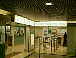 |
Yue Xiu Plaza, Ning Yuen Street, San Po Kong San Po Kong San Po Kong is an area in New Kowloon in Hong Kong. South of Wong Tai Sin and Diamond Hill, and north of the former Kai Tak International Airport, the area is bounded by Choi Hung Road and Prince Edward Road. San Po Kong is largely industrial and partly residential. Administratively, it belongs... |
| Sau Mau Ping (秀茂坪郵政局) |
2003 | Sau Mau Ping Estate Sau Mau Ping Estate Sau Mau Ping Estate is one of the earliest public housing estates in Kwun Tong District, New Kowloon, Hong Kong. It has 18 blocks, providing a total of 12,310 rental flats. Each of them has a size of 10.6 - 52.2 sq. metres... , Sau Ming Road |
|
| Sham Shui Po # (深水埗郵政局) |
1986 | Un Chau Street, Sham Shui Po Sham Shui Po Sham Shui Po, or Shamshuipo, is an area of Sham Shui Po District, Hong Kong, situated in the northwestern part of the Kowloon Peninsula, north of Tai Kok Tsui, east of Cheung Sha Wan and south of Shek Kip Mei. Sham Shui Po is known for its street market for electronic devices.-History:Sham Shui Po... |
|
| Shek Kip Mei (石硤尾郵政局) |
2006 | Shek Kip Mei Estate Shek Kip Mei Estate Shek Kip Mei Estate is the first public housing estate in Hong Kong. It is located in Sham Shui Po and is under the management of the Hong Kong Housing Authority... , Shek Kip Mei Shek Kip Mei Shek Kip Mei, originally known as Kap Shek Mi, is an area in New Kowloon, the North Eastern Kowloon Peninsula of Hong Kong.-History:A major fire on 25 December 1953, destroyed the Shek Kip Mei shantytown of immigrants from Mainland China that had fled to Hong Kong, leaving 53,000 people... |
|
| Sheung Tak (尚德郵政局) |
1999 | Sheung Tak Estate, Tseung Kwan O | |
| Shun Lee (順利郵政局) |
1981 | Shun Lee Shun Lee Shun Lee is an area north of Sau Mau Ping and east of Ngau Chi Wan in Hong Kong. The area original known as Rennie's Farm. It is later named after the first public housing estate in the area, Shun Lee Estate. It is also known as Sze Shun Shun Lee (Chinese: 順利) is an area north of Sau Mau Ping... Estate |
|
| Tai Kok Tsui (大角咀郵政局) |
1989 | Anchor Street, Tai Kok Tsui Tai Kok Tsui Tai Kok Tsui is an area west of Mong Kok in Kowloon, Hong Kong. The mixed land use of industrial and residential is present in the old area. The Cosmopolitan Dock and oil depots were previously located there... |
|
| To Kwa Wan # (土瓜灣郵政局) |
1994 | Hang Chien Court, Wyler Garden, Mei King Street, To Kwa Wan To Kwa Wan To Kwa Wan is a bay and an area of the eastern shore of Kowloon peninsula of Hong Kong. The area is part of urban Hong Kong, and is adjacent to Hok Yuen, Hung Hom, Ma Tau Wai and Ma Tau Kok... |
|
| Tseung Kwan O # (將軍澳郵政局) |
1994 | Hau Tak Estate, Tseung Kwan O | |
| Tsim Sha Tsui # (尖沙咀郵政局) |
1983 | 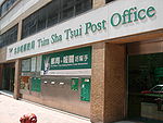 |
Hermes House, Middle Road Middle Road, Hong Kong Middle Road is a street in the southern part of Tsim Sha Tsui of Kowloon in Hong Kong, across Nathan Road and parallel to Salisbury Road.-History:... , Tsim Sha Tsui |
| Tsz Wan Shan (慈雲山郵政局) |
1998 | 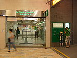 |
Yuk Wah Street, Tsz Wan Shan Tsz Wan Shan Tsz Wan Shan is a residential area in New Kowloon, Hong Kong. Located at the foot of Temple Hill, it is administratively part of Wong Tai Sin District.... |
| Wong Tai Sin (黃大仙郵政局) |
1987 | Lower Wong Tai Sin Wong Tai Sin, Hong Kong Wong Tai Sin is an area in Wong Tai Sin District, New Kowloon, Hong Kong. The area was named after the Wong Tai Sin Temple.Wong Tai Sin is surrounded by northeast Tsz Wan Shan, east Diamond Hill, south San Po Kong, south west Tung Tau and west Wang Tai Hom... Estate |
|
| Yau Tong (油塘郵政局) |
2003 | Yau Tong Yau Tong Yau Tong is an area in the eastern Kowloon, Hong Kong, located between Lei Yue Mun and Lam Tin, at the east shore of Victoria Harbour. Administratively, it is under Kwun Tong District.... Estate |
|
| Yau Yat Tsuen (又一村郵政局) |
1967 | Fa Po Street, Yau Yat Tsuen, Kowloon Tong Kowloon Tong Kowloon Tong , formerly Kau Lung Tong, is an area in Hong Kong. Within New Kowloon, it is administratively divided by Kowloon City District and Sham Shui Po District... |
Post offices in the New Territories
| Name | Year of establishment |
Image | Location |
|---|---|---|---|
| Butterfly # (蝴蝶郵政局) |
1985 | Butterfly Estate, Tuen Mun Tuen Mun Tuen Mun is a town near the mouth of Tuen Mun River and Castle Peak Bay in the New Territories, Hong Kong. It was one of the earliest settlements in Hong Kong which can be dated back to the Neolithic period. In the more recent past, it was home to many Tanka fishermen who gathered at the Castle... |
|
| Cheung Fat # (長發郵政局) |
1990 | 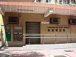 |
Cheung Fat Estate, Tsing Yi Tsing Yi Tsing Yi , or Tsing Yi Island is an island in the urban area of Hong Kong, to the northwest of Hong Kong Island and south of Tsuen Wan. With an area of 10.69 km², the island has extended drastically by reclamation along almost all its natural shore and the annexation of Nga Ying Chau and Chau... |
| City One Shatin # (沙田第一城郵政局) Yuen Chau Kok, prior to 2005 |
1988 | 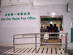 |
City One City One City One Shatin is a residential area in the District of Sha Tin, New Territories, Hong Kong. City One is located 12.5 kilometres north of Central. City One is the largest private residential estate in Sha Tin District. There are a total of 52 blocks of residential buildings... Plaza, Sha Tin Sha Tin Sha Tin, also spelled Shatin, is an area around the Shing Mun River in the New Territories of Hong Kong. Administratively, it is part of the Sha Tin District.-Geography:... |
| Fairview Park (錦繡花園郵政局) |
1984 | -- | Fairview Park Fairview Park (Hong Kong) Fairview Park is a substantial private residential estate in Yuen Long District, New Territories, Hong Kong.-History:... , San Tin San Tin San Tin , or San Tin Heung , is an area located near Lok Ma Chau area in the New Territories and belongs to the Yuen Long District, Hong Kong.... |
| Fanling (粉嶺郵政局) |
1990 | North District Government Offices Building, Fanling Fanling Fanling , also known as Fan Ling and Fan Leng, is an area in the New Territories of Hong Kong. Administratively, it is part of the North District... |
|
| Fo Tan (火炭郵政局) |
1991 | Shan Mei Street, Fo Tan Fo Tan Fo Tan is a suburb of Sha Tin District, Hong Kong. It was developed as a light industrial area, but this activity has declined markedly in recent years. There are residential areas to the east, alongside the MTR line, and in the foothills to the west.... , Sha Tin |
|
| Fu Shin (富善郵政局) |
1988 | -- | Fu Shin Estate, Tai Po Tai Po Tai Po is an area in the New Territories of Hong Kong. It refers to the vicinity of the traditional market towns in the area presently known as Tai Po Old Market or Tai Po Kau Hui and the Tai Wo Town on the other side of the Lam Tsuen River, near the old Tai Po Market Station of the... |
| Fu Tai (富泰郵政局) |
2001 | -- | Fu Tai Estate, Tuen Mun |
| Heng On (恒安郵政局) |
1990 | -- | Heng On Estate, Ma On Shan, Sha Tin |
| Hin Keng # (顯徑郵政局) |
1989 | -- | Hin Keng Estate, Sha Tin |
| Kam Tai (錦泰郵政局) |
2004 | 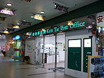 |
Kam Tai Court, Ma On Shan, Sha Tin |
| Kam Tin (錦田郵政局) |
1965 | Kam Tin Government Offices Building, Kam Tin Kam Tin Kam Tin , or Kam Tin Heung , is an area in the New Territories, Hong Kong. It is north of Tai Mo Shan and east of Yuen Long. It was formerly known as Sham Tin... |
|
| Kwai Chung (葵涌郵政局) |
1998 | Kwai Chung Estate, Kwai Chung Kwai Chung Kwai Chung is a town in the New Territories of Hong Kong. Together with Tsing Yi Island, it is part of the Kwai Tsing District of Hong Kong. Kwai Chung is the site of the container port. It is also part of Tsuen Wan New Town. In 2000, it had a population of 287,000... |
|
| Kwai Fong (葵芳郵政局) |
1993 | -- | Kwai Fong Estate, Kwai Fong Kwai Fong Kwai Fong is an area of Kwai Chung Town, Kwai Tsing District, Hong Kong. The mainly residential area extends to Kwai Hing in the north, Lai King in the south, Tsing Yi Bridge to the west, and Tai Lin Pai Industrial Area to the east. It is part of the reclamation of Gin Drinkers Bay in 1960s.Kwai... |
| Kwai Shing (葵盛郵政局) |
1980 | -- | Kwai Shing West Estate, Kwai Shing Kwai Shing Kwai Shing is an area on the hill between Kwai Fong and Tai Wo Hau in the Kwai Chung area of Hong Kong. The area is named after the two major public housing estates on the hill, Kwai Shing East Estate and Kwai Shing West Estate, accommodating the influx of immigrants after World War II.The area... |
| Kwong Yuen (廣源郵政局) |
1992 | -- | Kwong Yuen Estate Kwong Yuen Estate Kwong Yuen Estate is a public housing estate and Tenants Purchase Scheme estate in Siu Lek Yuen, Sha Tin, Hong Kong. Unlike other public estates in Sha Tin, Kwong Yuen Estate is built on sloping platform, instead of reclaimed land... , Sha Tin |
| Lai King (荔景郵政局) |
1976 | 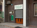 |
Lai King Estate, Kwai Chung |
| Lee On (利安郵政局) |
1993 | Lee On Estate, Ma On Shan | |
| Lei Muk Shue (梨木樹郵政局) |
2000 | -- | Lei Muk Shue Lei Muk Shue Lei Muk Shue , formerly Lai Muk Shu, is an area in Kwai Chung of Hong Kong. It includes the area surrounding Lei Muk Shue Estate on a hill slope near Wo Yee Hop... Estate |
| Leung King (良景郵政局) |
1990 (relocated in 2011) |
Leung King Estate, Tuen Mun | |
| Ma On Shan # (馬鞍山郵政局) |
1997 | -- | Sunshine City Phase 4, On Luk Street, Ma On Shan, Sha Tin |
| Mei Lam (美林郵政局) |
1982 | -- | Mei Lam Estate, Sha Tin |
| On Ting (安定郵政局) |
1994 | 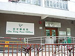 |
On Ting Estate, Tuen Mun |
| Sai Kung # (西貢郵政局) |
1984 | 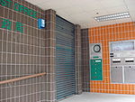 |
Sai Kung Government Offices Building, Chan Man Street, Sai Kung |
| San Tin (新田郵政局) |
1964 | Castle Peak Road Castle Peak Road Castle Peak Road is the longest road in Hong Kong. It runs from Tai Po Road in Sham Shui Po, Kowloon to the very north of the New Territories, serving south, west and north New Territories, being one of the most distant roads in early Hong Kong.-Name:... , San Tin San Tin San Tin , or San Tin Heung , is an area located near Lok Ma Chau area in the New Territories and belongs to the Yuen Long District, Hong Kong.... Section |
|
| Sha Kok (沙角郵政局) |
1982 | -- | Sha Kok Estate, Sha Tin |
| Sha Tau Kok (沙頭角郵政局) |
1962 | -- | Sha Tau Kok Government Offices Building, Sha Tau Kok Road Sha Tau Kok Road Sha Tau Kok Road is a road connecting Sha Tau Kok and Fan Ling in the New Territories, Hong Kong. It had been the only road access to mainland China from Hong Kong since its construction in 1927. The road replaced Sha Tau Kok Railway as the connection between two areas.-See also:* List of... , Sha Tau Kok Sha Tau Kok Sha Tau Kok or Shataukok or Sathewkok is a town in the northeastern corner of Hong Kong. Located on the border with mainland China, there is another town of same Chinese name, Shatoujiao, romanized using Hanyu Pinyin, across the Sham Chun River-defined border in Shenzhen of mainland... |
| Sha Tin Central # (沙田中央郵政局) |
2002 |  |
Shatin Government Offices, Sha Tin |
| Shek Lei (石籬郵政局) |
1999 | Shek Lei, Kwai Chung | |
| Shek Wai Kok (石圍角郵政局) |
1983 | -- | Shek Wai Kok Shek Wai Kok Shek Wai Kok is an hilly area at the northwest of Tsuen Wan. In late 19th Century, it is one of four yeuk in Tsuen Wan, together with Hoi Pa , Kwai Chung and Tsing Yi. And the heads of four yeuks formed a 荃灣安全局 to securing the area of Tsuen Wan.It was a place occupied by villages... Estate, Tsuen Wan Tsuen Wan Tsuen Wan is a bay in the Kowloon area of Hong Kong, opposite to Tsing Yi Island across Rambler Channel. The market town of Tsuen Wan emerged for the surrounding villages and fleets of fishing boats in the area. The town is around the present-day Tsuen Wan Station of the MTR... |
| Shek Wu Hui # (石湖墟郵政局) |
1959 | 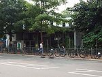 |
San Fung Avenue, Shek Wu Hui, Sheung Shui Sheung Shui Sheung Shui is an area in New Territories, Hong Kong. Sheung Shui Town, a part of this area, is part of the Fanling-Sheung Shui New Town in the North District of Hong Kong. Fanling Town is to its southeast.-History:... |
| Sun Chui (新翠郵政局) |
1984 | Sun Chui Estate, Sha Tin | |
| Tai Hing (大興郵政局) |
1981 | 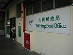 |
Tai Hing Estate, Tuen Mun |
| Tai Po # (大埔郵政局) |
1979 | -- | Tai Po Government Office Building, Tai Po |
| Tin Yiu (天耀郵政局) |
1992 (relocated in 2008) |
Tin Yiu Estate, Tin Shui Wai Tin Shui Wai Tin Shui Wai is an area of Hong Kong, located in Yuen Long District, in the northwestern part of the New Territories. Originally a gei wai fish pond area, the ponds were reclaimed for the development of Tin Shui Wai New Town in the late 1980s... |
|
| Tin Yuet (天悅郵政局) |
2002 | -- | Tin Yuet Estate, Tin Shui Wai |
| Tsing Yi (青衣郵政局) |
1982 | 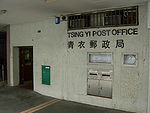 |
Cheung Hong Estate, Tsing Yi |
| Tsuen Wan # (荃灣郵政局) |
1992 | Tsuen Wan Government Offices Building, Sai Lau Kok Road, Tsuen Wan | |
| Tsuen Wan West (荃灣西郵政局) |
1992 | -- | Bayview Garden, Castle Peak Road, Tsuen Wan |
| Tuen Mun Central # (屯門中央郵政局) |
1989 |  |
Library and Post Office Building, Tuen Mun |
| Wah Ming (華明郵政局) |
1991 | Wah Ming Estate, Fanling | |
| Wan Tau Tong (運頭塘郵政局) |
1992 | Wan Tau Tong Estate, Tai Po | |
| Wo Che (禾輋郵政局) |
1988 | -- | Tak Hau Street, Wo Che Wo Che Wo Che is an area in Sha Tin of Hong Kong. South of Fo Tan and north of proper Sha Tin, it is divided into Sheung Wo Che and Ha Wo Che , and the reclamation by Shing Mun River.... Estate, Sha Tin |
| Yeung Uk Road (楊屋道郵政局) |
2008 | -- | Indihome, Yeung Uk Road, Tsuen Wan |
| Yuen Long # (元朗郵政局) |
2002 | 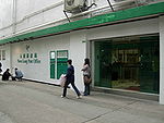 |
Yuen Long Pau Cheung Square, Yuen Long Town Yuen Long Town Yuen Long Town is located in the district centre of Yuen Long District, New Territories, Hong Kong. It is the heart of Yuen Long and Yuen Long New Town, with a population of around 200,000.- Geography :Yuen Long Town is located in the centre of Yuen Long... |
Post offices on the Outlying Islands
| Name | Year of establishment |
Image | Location |
|---|---|---|---|
| Airport # (機場郵政局) |
1998 | 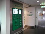 |
Terminal 1, Hong Kong International Airport Hong Kong International Airport Hong Kong International Airport is the main airport in Hong Kong. It is colloquially known as Chek Lap Kok Airport , being built on the island of Chek Lap Kok by land reclamation, and also to distinguish it from its predecessor, the closed Kai Tak Airport.The airport opened for commercial... |
| Cheung Chau # (長洲郵政局) |
1991 | Regional Council Cheung Chau Complex, Cheung Chau Cheung Chau Cheung Chau is a small island 10 km southwest of Hong Kong Island, is nicknamed as the 'dumbbell island' for its shape. It has been inhabited for longer than most other places in the territory of Hong Kong, with a population of about 23,000 up to 2006... |
|
| Discovery Bay (愉景灣郵政局) |
1998 | Discovery Bay Plaza, Discovery Bay Discovery Bay Discovery Bay is a mixed, primarily residential, development comprising a residential development and private and public recreational facilities in Hong Kong. It is situated on the north-eastern coast of Lantau Island in the New Territories. The development spans an area of 650 hectares , and... , Lantau Island Lantau Island Lantau Island , based on the old local name of Lantau Peak , is the largest island in Hong Kong, located at the mouth of the Pearl River. Administratively, most of Lantau Island is part of the Islands District of Hong Kong... |
|
| Lamma (南丫郵政局) |
1984 | Main Street, Yung Shue Wan Yung Shue Wan Yung Shue Wan is the main population centre on Lamma Island, Hong Kong. It has a population of approximately 6,000.-Features:The village is a mix of residential properties, shops and restaurants. Yung Shue Wan gives a Mediterranean feeling when walking through it... , Lamma Island Lamma Island Lamma Island , also known as Pok Liu Chau or simply Pok Liu , is the third largest island in Hong Kong. Administratively, it is part of the Islands District.-Name:... |
|
| Mui Wo (梅窩郵政局) |
1990 | Mui Wo Government Offices Building, Mui Wo Mui Wo Mui Wo is a rural town on the eastern coast of Lantau Island in Hong Kong. The main beach in Mui Wo is known as Silver Mine Bay .-History:... , Lantau Island |
|
| Peng Chau (坪洲郵政局) |
1961 | 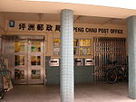 |
Government Building, Peng Chau Peng Chau Peng Chau is a small island located off the north-eastern coast of Lantau Island, Hong Kong, which has an area of 0.99 km².Peng Chau is known for its small island lifestyle, accessibility to fresh seafood, and several temples located around the island... |
| Tai O (大澳郵政局) |
1962 | 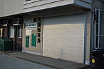 |
Tai O Government Building, Tai O Tai O Tai O is a fishing town, partly located on an island of the same name, on the western side of Lantau Island in Hong Kong.-Geography:On the main part of Lantau Island, a river splits to the north and west and at this fork lies the island referred to as Tai O. Two pedestrian bridges cross the river... , Lantau Island |
| Tung Chung (東涌郵政局) |
2000 |  |
Mei Tung Street, Tung Chung Tung Chung Tung Chung, meaning 'eastern stream', is an area situated on the north-western coast of Lantau Island in Hong Kong. Tung Chung, currently one of the latest generation of new towns, was formerly a rural village around Tung Chung Wan, and along the delta and lower courses of Tung Chung River and Ma... , Lantau Island |
Notes
Mobile post offices
- Mobile Post Office No.1 serves New Territories areas without post offices nearby. Areas served include Tsuen Wan, Tuen Mun, Yuen Long, Sheung Shui, Fanling, Tai Po and Shatin.
- Mobile Post Office No.2 also serves the remote areas, namely Clear Water Bay, Sai Kung, Shatin and Tai Po.
Service in the Chinese University of Hong Kong
Chinese University of Hong Kong
The Chinese University of Hong Kong is a research-led university in Hong Kong.CUHK is the only tertiary education institution in Hong Kong with Nobel Prize winners on its faculty, including Chen Ning Yang, James Mirrlees, Robert Alexander Mundell and Charles K. Kao...
and Hong Kong University of Science and Technology
Hong Kong University of Science and Technology
The Hong Kong University of Science and Technology is a public university located in Hong Kong. Established in 1991 under Hong Kong Law Chapter 1141 , it is one of the nine universities in Hong Kong.Professor Tony F. Chan is the president of HKUST...
has been suspended.
Defunct post offices
| Name | Year of establishment |
Image | Location | Recent situation |
|---|---|---|---|---|
| Canton Road (廣東道郵政局) |
1971 | 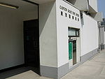 |
393 Canton Road Canton Road Canton Road is a road in Hong Kong, linking the former west reclamation shore in Tsim Sha Tsui, Jordan, Yau Ma Tei and Mong Kok on the Kowloon Peninsula. The road runs mostly parallel and west to Nathan Road. It starts from the junction with Salisbury Road in the south and ends in the north at the... , Jordan |
Closed from January 1, 2008 due to low utilisation and heavy operational losses, and then Canton Road Government Offices was demolished in 2011 |
| Old Wan Chai Post Office Old Wan Chai Post Office The Old Wan Chai Post Office is the oldest surviving post office building in Hong Kong. It is situated at No. 221 Queen's Road East, at the junction with Wan Chai Gap Road.-History:... (舊灣仔郵政局) |
1915 | 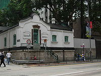 |
221 Queen's Road East, Wan Chai | Listed as a declared monument Declared monuments of Hong Kong Declared monuments of Hong Kong are places, structures or buildings legally declared to be "protected". In Hong Kong, declaring a monument requires consulting the Antiquities Advisory Board, the approval of the Chief Executive as well as the publication of the notice in government gazette.As of 12... on 18 May 1990; acts as one of the Environmental Resource Centres of the EPD Environmental Protection Department Environmental Protection Department is a department of Hong Kong Government concerning the issues of environmental protection in Hong Kong.-History:... |
| Garden Road # (花園道郵政局) |
2002 | -- | Cheung Kong Centre Cheung Kong Center Cheung Kong Center is a skyscraper in Central, Hong Kong designed by Cesar Pelli. It is 62 storeys tall with height of and a gross floor area of . When completed in 1999, it was the third-tallest building in the city. It sits on the combined sites of the former Hong Kong Hilton, which was... , Queen's Road Central Queen's Road Queen's Road is the first road in Hong Kong built by the Government of Hong Kong between 1841 and 1843, spanning across Victoria City from Shek Tong Tsui to Wan Chai... |
Closed from 1st November, 2007 due to low utilisation and heavy operational losses |
| Harbour Building (海港政府大樓郵政局) |
1985 |  |
Harbour Building, Pier Road, Central | Closed from 1st November, 2007 due to low utilisation and heavy operational losses |
| North Point (北角郵政局) |
2002 | -- | FitFort, King's Road, North Point | Closed from May 18, 2008 due to operational losses |
| Texaco Road (德士古道郵政局) |
1993 | -- | Wealthy Garden, Texaco Road, Tsuen Wan | Closed from April 20, 2008 as it is undesirable to continue operation in the severely deteriorated premises; replaced by Yeung Uk Road Post Office, which is a 10-minute walk apart. |
| Wong Chuk Hang (黃竹坑郵政局) |
1975 | -- | Wong Chuk Hang Wong Chuk Hang Wong Chuk Hang is an industrial and residential town to the east of Aberdeen and to the north of Nam Long Shan and to the west of Shouson Hill, on Hong Kong Island, Hong Kong... Estate |
Closed from 30th September, 2007, due to the demolition of the estate |
Other postal buildings
| Name | Year of establishment |
Image | Location |
|---|---|---|---|
| Air Mail Centre (空郵中心) |
1998 | 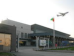 |
Catering Road West, Hong Kong International Airport Hong Kong International Airport Hong Kong International Airport is the main airport in Hong Kong. It is colloquially known as Chek Lap Kok Airport , being built on the island of Chek Lap Kok by land reclamation, and also to distinguish it from its predecessor, the closed Kai Tak Airport.The airport opened for commercial... |
| International Mail Centre (國際郵件中心) |
1980 | 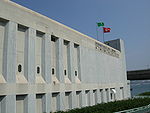 |
Salisbury Road, Hung Hom |

