
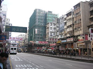
Cheung Sha Wan Road
Encyclopedia

New Kowloon
New Kowloon is an area in Kowloon, Hong Kong, bounded in the south by Boundary Street, and in the north by the ranges of the Lion Rock, Beacon Hill, Tate's Cairn and Kowloon Peak...
of Hong Kong
Hong Kong
Hong Kong is one of two Special Administrative Regions of the People's Republic of China , the other being Macau. A city-state situated on China's south coast and enclosed by the Pearl River Delta and South China Sea, it is renowned for its expansive skyline and deep natural harbour...
. It starts from Sham Shui Po
Sham Shui Po
Sham Shui Po, or Shamshuipo, is an area of Sham Shui Po District, Hong Kong, situated in the northwestern part of the Kowloon Peninsula, north of Tai Kok Tsui, east of Cheung Sha Wan and south of Shek Kip Mei. Sham Shui Po is known for its street market for electronic devices.-History:Sham Shui Po...
, passes through Cheung Sha Wan
Cheung Sha Wan
Cheung Sha Wan is an area between Lai Chi Kok and Sham Shui Po in New Kowloon, Hong Kong. It is mainly residential to the north and south, with an industrial area in between. Administratively it is part of Sham Shui Po District. The Sham Shui Po District includes Mei Foo as well as Lai Chi...
, and ends near Lai Chi Kok
Lai Chi Kok
Lai Chi Kok is a neighborhood in New Kowloon, Hong Kong, east of Kwai Chung and west of Cheung Sha Wan. Mei Foo Sun Chuen is the largest housing estate in the area. Administratively, it belongs to the Sham Shui Po District.-History:...
.
Route
On the ground, the road extends Nathan Road north-westward at the junction with Boundary StreetBoundary Street
[[Image:Boundary st hongkong.JPG|thumb|right|250px|Boundary Street near [[Kowloon Tong]]Boundary Street is a three-lane one-way street in [[Kowloon]], [[Hong Kong]]...
near Tai Po Road
Tai Po Road
Tai Po Road is the second longest road in Hong Kong . It spans from Sham Shui Po in Kowloon to Tai Po in the New Territories of Hong Kong. Initially, the road was named Frontier Road....
in Mong Kok
Mong Kok
Mong Kok , less often known as Argyle , is an area in the Yau Tsim Mong District on Kowloon Peninsula, Hong Kong...
. An flyover links the road with Boundary Street near Maple Street. The road remains two-way until it meets Butterfly Valley Road
Butterfly Valley Road
Butterfly Valley Road is an alternative road of Castle Peak Road in Lai Chi Kok in Hong Kong. South of Butterfly Valley, the road joins Castle Peak Road, Lai Chi Kok Road, Cheung Sha Wan Road and Kwai Chung Road in its south end and Castle Peak Road and Ching Cheung Road in the north end.The road...
in west end of Cheung Sha Wan. The section in Lai Chi Kok is Kowloon-bound only and the New Territories
New Territories
New Territories is one of the three main regions of Hong Kong, alongside Hong Kong Island and the Kowloon Peninsula. It makes up 86.2% of Hong Kong's territory. Historically, it is the region described in The Convention for the Extension of Hong Kong Territory...
-bound is left to Lai Chi Kok Road
Lai Chi Kok Road
Lai Chi Kok Road is a road in the western part of New Kowloon, Hong Kong. It links Lai Chi Kok to Mong Kok, via Tai Kok Tsui, Sham Shui Po and Cheung Sha Wan. It starts from the junction with Nathan Road near Pioneer Centre in the south and ends near Mei Foo Sun Chuen...
, separated by the flyover of Kwai Chung Road
Kwai Chung Road
Kwai Chung Road is a main road in Kwai Chung, New Territories, Hong Kong. It starts from the junction with Cheung Sha Wan Road, Lai Chi Kok Road and Butterfly Valley Road in Cheung Sha Wan, via Mei Foo, Lai Chi Kok Bridge, Chung Kwai Chung, to the junction with Castle Peak Road and Cheung Wing...
.
Mass Transit Railway
The Mass Transit Railway (MTR) was built beneath the road with three stations, namely, Sham Shui Po Station, Cheung Sha Wan Station and Lai Chi Kok Station. As the stations and the underground tunnels were constructed by cut-and-cover, the construction caused serious traffic congestionTraffic congestion
Traffic congestion is a condition on road networks that occurs as use increases, and is characterized by slower speeds, longer trip times, and increased vehicular queueing. The most common example is the physical use of roads by vehicles. When traffic demand is great enough that the interaction...
in the western New Kowloon.