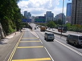
Lam Tin
Encyclopedia
Lam Tin is an area in the Kwun Tong District
Kwun Tong District
Kwun Tong is one of the 18 districts of Hong Kong. It is located in Kowloon. It had a population of 562,427 in 2001. The district has the third highest population while the income is below average....
in southeastern New Kowloon
New Kowloon
New Kowloon is an area in Kowloon, Hong Kong, bounded in the south by Boundary Street, and in the north by the ranges of the Lion Rock, Beacon Hill, Tate's Cairn and Kowloon Peak...
, Hong Kong
Hong Kong
Hong Kong is one of two Special Administrative Regions of the People's Republic of China , the other being Macau. A city-state situated on China's south coast and enclosed by the Pearl River Delta and South China Sea, it is renowned for its expansive skyline and deep natural harbour...
. Lam Tin is primarily a residential area, though it also hosts a major transport interchange and the location of several renowned shopping attractions. Lam Tin was once a large field in the vicinity of Kowloon Bay
Kowloon Bay
Kowloon Bay is a bay located at the east of the Kowloon Peninsula and north of Hong Kong Island in Hong Kong. It is the eastern portion of Victoria Harbour, between Hung Hom and Lei Yue Mun...
. Under the Song Dynasty
Song Dynasty
The Song Dynasty was a ruling dynasty in China between 960 and 1279; it succeeded the Five Dynasties and Ten Kingdoms Period, and was followed by the Yuan Dynasty. It was the first government in world history to issue banknotes or paper money, and the first Chinese government to establish a...
, it was the site of salt
Salt
In chemistry, salts are ionic compounds that result from the neutralization reaction of an acid and a base. They are composed of cations and anions so that the product is electrically neutral...
production. Over time, houses replaced the salt fields, and during the 1980s
1980s in Hong Kong
1980s in Hong Kong marks a period when the territory was known for its wealth and trademark lifestyle. Hong Kong would be recognised internationally for its politics, entertainment and skyrocketing real estate prices.-Background:...
, a number of large building projects transformed Lam Tin.
A high-density residential district built on a coastal knoll
Hill
A hill is a landform that extends above the surrounding terrain. Hills often have a distinct summit, although in areas with scarp/dip topography a hill may refer to a particular section of flat terrain without a massive summit A hill is a landform that extends above the surrounding terrain. Hills...
, Lam Tin hosts residential housing estate
Housing estate
A housing estate is a group of buildings built together as a single development. The exact form may vary from country to country. Accordingly, a housing estate is usually built by a single contractor, with only a few styles of house or building design, so they tend to be uniform in appearance...
s, transport infrastructure, mass-transit
Public transport
Public transport is a shared passenger transportation service which is available for use by the general public, as distinct from modes such as taxicab, car pooling or hired buses which are not shared by strangers without private arrangement.Public transport modes include buses, trolleybuses, trams...
facilities, shopping centres, recreational areas and many other buildings and structures. It is home to 130,000 residents, making up a fifth of Kwun Tong District's population.
Geographical location
In common speech, the name Lam Tin in the past usually included the areas of Lei Yue MunLei Yue Mun
Lei Yue Mun is a short channel in Hong Kong, between Junk Bay and Victoria Harbour, separating Kowloon and Hong Kong Island. The channel is an important passage in the South China Sea. It is the east gate of Victoria Harbour.The lands around the channel are also called Lei Yue Mun...
and Yau Tong
Yau Tong
Yau Tong is an area in the eastern Kowloon, Hong Kong, located between Lei Yue Mun and Lam Tin, at the east shore of Victoria Harbour. Administratively, it is under Kwun Tong District....
. However, new infrastructure and housing estates that were built in those places are excluded from Lam Tin nowadays. Conventional boundaries of Lam Tin: west to Laguna City, southeast to Kwong Tin Estate, north to the entrance of Tseung Kwan O Tunnel
Tseung Kwan O Tunnel
Tseung Kwan O Tunnel is a 900-metre tunnel beneath Ma Yau Tong in Hong Kong. Part of Route 7, it links Sau Mau Ping, Kwun Tong of East Kowloon and the new town of Tseung Kwan O , Sai Kung in New Territories...
, southwest to Victoria Harbour
Victoria Harbour
Victoria Harbour is a natural landform harbour situated between Hong Kong Island and the Kowloon Peninsula in Hong Kong. The harbour's deep, sheltered waters and strategic location on the South China Sea were instrumental in Hong Kong's establishment as a British colony and its subsequent...
.
Geography
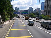
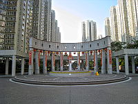
Granite
Granite is a common and widely occurring type of intrusive, felsic, igneous rock. Granite usually has a medium- to coarse-grained texture. Occasionally some individual crystals are larger than the groundmass, in which case the texture is known as porphyritic. A granitic rock with a porphyritic...
from the Cretaceous
Cretaceous
The Cretaceous , derived from the Latin "creta" , usually abbreviated K for its German translation Kreide , is a geologic period and system from circa to million years ago. In the geologic timescale, the Cretaceous follows the Jurassic period and is followed by the Paleogene period of the...
period. Most granite rock in Lam Tin is medium-grained. The granite in Lam Tin is of the Lion Rock
Lion Rock
Lion Rock, or less formally Lion Rock Hill, is a famous hill in Hong Kong. It is located between Kowloon Tong in Kowloon and Tai Wai in the New Territories, and is 495 metres high...
suite. Farther towards the shore, a small area of land to the west of Cha Kwo Ling
Cha Kwo Ling
Cha Kwo Ling is a hill in the eastern New Kowloon of Hong Kong, and the area around it. It is adjacent to Victoria Harbour and located to the west of Yau Tong and southwest of Lam Tin. Administratively, it belongs to the Kwun Tong District...
was reclaimed
Land reclamation in Hong Kong
Land is in short supply in Hong Kong, and land reclamation has been conducted there since the mid-19th century.-Projects:One of the earliest and famous project was the Praya Reclamation Scheme, which added 50 to of land in 1890 during the second phase of construction...
.
Politics
The entire Lam Tin area is located in Kwun Tong DistrictKwun Tong District
Kwun Tong is one of the 18 districts of Hong Kong. It is located in Kowloon. It had a population of 562,427 in 2001. The district has the third highest population while the income is below average....
. Politically, Lam Tin is the name of a constituency of Kwun Tong District, which includes the area of the former Lam Tin Estate. However, in common speech, the name Lam Tin usually refers to a larger area which includes nine constituencies of Kwun Tong District.
Constituencies of the Kwun Tong District Council within the Lam Tin area
- J14 Hing Tin (興田)
- J15 Tak Tin (德田)
- J16 Lam Tin (藍田)
- J17 Kwong Tak (廣德)
- J18 Ping Tin (平田)
- J19 Hong Pak (康柏)
- J21 Yau Tong Sze Shan West (油塘四山西)
- J22 Lai Kong (麗港)
- J23 King Tin (景田)
History

Nanyue
Nanyue was an ancient kingdom that consisted of parts of the modern Chinese provinces of Guangdong, Guangxi, and Yunnan and northern Vietnam. Nanyue was established in 204 BC at the final collapse of the Qin Dynasty by Zhao Tuo, who was the military commander of Nanhai Commandery at the time, and...
people. Qin Shi Huang
Qin Shi Huang
Qin Shi Huang , personal name Ying Zheng , was king of the Chinese State of Qin from 246 BC to 221 BC during the Warring States Period. He became the first emperor of a unified China in 221 BC...
conquered the Nan Yue in the late 3rd century BC as part of their unification of China. Since then, the land presently known as Lam Tin became identified as part of China.
Lam Tin, called Ham Tin Shan (鹹田山) at that time, literally meaning "salty field hill", had been part of Kowloon Bay
Kowloon Bay
Kowloon Bay is a bay located at the east of the Kowloon Peninsula and north of Hong Kong Island in Hong Kong. It is the eastern portion of Victoria Harbour, between Hung Hom and Lei Yue Mun...
salt-fields (九龍灣鹽田, also known as Guanfuchang 官富場) under the management of Dongguan
Dongguan
Dongguan is a prefecture-level city in central Guangdong province, People's Republic of China.An important industrial city located in the Pearl River Delta, Dongguan borders the provincial capital of Guangzhou to the north, Huizhou to the northeast, Shenzhen to the south, and the Pearl River to...
County or Xin'an County
Xin'an County
Xin'an County is a part of Luoyang City, Henan Province, People's Republic of China.-History:...
in different dynasties. The salt-fields were first officially operated by the Song Dynasty
Song Dynasty
The Song Dynasty was a ruling dynasty in China between 960 and 1279; it succeeded the Five Dynasties and Ten Kingdoms Period, and was followed by the Yuan Dynasty. It was the first government in world history to issue banknotes or paper money, and the first Chinese government to establish a...
in 1163.
The Kowloon Bay salt-fields were rich in salt, and this brought wealth to the residents near the bay. Gradually, Ham Tin Shan became villages. Because of the region's shoreline location, agricultural activities started with the plantation of high-salinity crops
Halophyte
A halophyte is a plant that grows where it is affected by salinity in the root area or by salt spray, such as in saline semi-deserts, mangrove swamps, marshes and sloughs, and seashores. An example of a halophyte is the salt marsh grass Spartina alterniflora . Relatively few plant species are...
. With a quarry found in So Mo Ping (now Sau Mau Ping
Sau Mau Ping
Sau Mau Ping is an area in eastern New Kowloon, Hong Kong.Its Chinese name was formerly So Mau Ping , but this was often mis-rendered So Mo Ping , meaning a place to 'visit one's ancestors'. In fact, during World War II, much of the area was used as a cemetery...
), the region gradually became a small fishing, farming and quarrying town.
In 1662, Emperor Kangxi
Kangxi Emperor
The Kangxi Emperor ; Manchu: elhe taifin hūwangdi ; Mongolian: Энх-Амгалан хаан, 4 May 1654 –20 December 1722) was the fourth emperor of the Qing Dynasty, the first to be born on Chinese soil south of the Pass and the second Qing emperor to rule over China proper, from 1661 to 1722.Kangxi's...
moved all residents along southern China coastline inland by 50 Chinese mile
Li (unit)
The li is a traditional Chinese unit of distance, which has varied considerably over time but now has a standardized length of 500 meters or half a kilometer...
s and abandoned the salt-fields in hopes of weakening the pirate Zheng Chenggong
Koxinga
Koxinga is the customary Western spelling of the popular appellation of Zheng Chenggong , a military leader who was born in 1624 in Hirado, Japan to Zheng Zhilong, a Chinese merchant/pirate, and his Japanese wife and died in 1662 on the island of Formosa .A Ming loyalist and the arch commander of...
's power through cutting his support from coastline residents. Although the residents were allowed to return in 1669, after Kangxi discovered that the migration brought great economic harm, the salt industry in Ham Tin never prospered again.
In 1841, the British Empire occupied Hong Kong. The western half of the Kowloon Bay salt-fields were acquired by Britain in 1860 and the eastern half in 1898. Under the British rule, the salt-fields were abandoned for reclamation to facilitate the building of Kai Tak Airport
Kai Tak Airport
Kai Tak Airport was the international airport of Hong Kong from 1925 until 1998. It was officially known as the Hong Kong International Airport from 1954 to 6 July 1998, when it was closed and replaced by the new Hong Kong International Airport at Chek Lap Kok, 30 km to the west...
. To reflect this change in land usage, Ham Tin was renamed Lam Tin of similar pronunciation because the village no longer produced salt. The name Lam Tin came from Lantian, Shaanxi
Shaanxi
' is a province in the central part of Mainland China, and it includes portions of the Loess Plateau on the middle reaches of the Yellow River in addition to the Qinling Mountains across the southern part of this province...
, which came from a phrase "藍田生玉", literally "produced from the blue fields is jade". The name Lam Tin was officially endorsed on 1 September 1970.
The colonial government built Lam Tin Estate in the 1960s
1960s in Hong Kong
1960s in Hong Kong continued with the development and expansion of manufacturing that began in the previous decade. The economic progress made in the period would categorise Hong Kong as one of Four Asian Tigers along with Singapore, South Korea, and Taiwan.-Background:Economically, this era is...
to settle low-income residents during the influx of population from mainland China after the Korean War
Korean War
The Korean War was a conventional war between South Korea, supported by the United Nations, and North Korea, supported by the People's Republic of China , with military material aid from the Soviet Union...
. Gradually, Lam Tin became a common term to Hongkongers describing the areas around Lam Tin Estate. The dragon emblem painted on block 15 of Lam Tin Estate was a sign of Lam Tin's unity before the building's demolition in 1998. The land of Lam Tin Estate was rebuilt into Ping Tin Estate, Kai Tin Estate, Tak Tin Estate and Kwong Tin Estate.
With the building of three major transport infrastructures in the late 20th century — the Kwun Tong Bypass
Kwun Tong Bypass
Kwun Tong Bypass is an elevated bypass expressway in Kwun Tong, Kowloon, Hong Kong with three lanes in each direction and a posted speed limit of 70-80 kilometres per hour. It comprises part of Route 2 and has links to Route 5 and Route 7....
, the Eastern Harbour Crossing
Eastern Harbour Crossing
The Eastern Harbour Crossing, abbreviated as "EHC" , is a tunnel in Hong Kong. It is a combined road and MTR rail link under Victoria Harbour between Quarry Bay in Hong Kong Island and Cha Kwo Ling in Kowloon.- History :...
, and the MTR
MTR
Mass Transit Railway is the rapid transit railway system in Hong Kong. Originally opened in 1979, the system now includes 211.6 km of rail with 155 stations, including 86 railway stations and 69 light rail stops...
— Lam Tin became even more connected with other parts of Hong Kong, spurring a population surge in the district. Lam Tin has become one of the major transport interchanges in Hong Kong.
Infrastructure
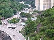

Interchange station
An interchange station or a transfer station is a train station for more than one railway route in a public transport system, and allows passengers to change from one route to another. Transfer may occur within the same mode, or between rail modes, or to buses...
in East Kowloon.
Before British occupation, most Lam Tin residents travelled on foot or by boat to nearby villages such as Ma Tau Wai
Ma Tau Wai
Ma Tau Wai is an area in Kowloon City District, Kowloon, Hong Kong. It was originally a walled village between present-day Argyle Street and Prince Edward Road West, east of St Teresa's Hospital....
. During the occupation, roads, tunnels and railways were built in Lam Tin to facilitate transport between Lam Tin and other districts, making Lam Tin a bridge between different areas of Eastern Hong Kong.
Highway and road surface
The first road was Lei Yue Mun RoadLei Yue Mun Road
Lei Yue Mun Road is a major road in Lam Tin, Hong Kong. It runs from the junction with Tsui Ping Road and Kwun Tong Road near MTR Kwun Tong Station to the roundabout with Ko Chiu Road near Lei Yue Mun Estate in Yau Tong...
, which succeeded Kwun Tong Road
Kwun Tong Road
Kwun Tong Road is a major road in Kwun Tong of New Kowloon in Hong Kong. It starts at the junction with Prince Edward Road East, Clear Water Bay Road and Lung Cheung Road in Ngau Chi Wan...
and ran between Kwun Tong
Kwun Tong
Kwun Tong is an area in Kwun Tong District, situated at the eastern part of the Kowloon Peninsula, and its boundary stretches from Lion Rock in the north to Lei Yue Mun in the south, and from the winding paths of Kowloon Peak in the east to the north coast of the former Kai Tak Airport runway in...
and Lei Yue Mun
Lei Yue Mun
Lei Yue Mun is a short channel in Hong Kong, between Junk Bay and Victoria Harbour, separating Kowloon and Hong Kong Island. The channel is an important passage in the South China Sea. It is the east gate of Victoria Harbour.The lands around the channel are also called Lei Yue Mun...
. Cha Kwo Ling Road was later built to tap traffic to Cha Kwo Ling
Cha Kwo Ling
Cha Kwo Ling is a hill in the eastern New Kowloon of Hong Kong, and the area around it. It is adjacent to Victoria Harbour and located to the west of Yau Tong and southwest of Lam Tin. Administratively, it belongs to the Kwun Tong District...
. However, both roads did not have the capacity to effectively serve the district. Both Lei Yue Mun Road and Kwun Tong Road were widened and became segments of today's Route 7
Route 7 (Hong Kong)
Route 7 is a highway route running through New Kowloon in Hong Kong between Tseung Kwan O and Kwai Chung.The first sections of road were built as a 5 lane trunk road , it was expanded to the current 6 lane highway...
.
The first road that carried commuters into and out of Lam Tin was Kai Tin Road. It was built in the 1960s to facilitate major road transports. The construction of Kai Tin Road required the blasting of Lam Tin Hill, which attracted much attention to nearby residents. Owing to its method of construction, Kai Tin Road became a direct outlet from the hill.
Built together with Kai Tin Road were Ping Tin Street, On Tin Street and Tak Tin Street, which all served Lam Tin Estate. Later Ping Tin and Tak Tin became names of new residential areas after Lam Tin Estate was demolished.
In 1989 Eastern Harbour Crossing was completed. Kwun Tong Bypass was completed in 1991. To construct an interchange
Interchange (road)
In the field of road transport, an interchange is a road junction that typically uses grade separation, and one or more ramps, to permit traffic on at least one highway to pass through the junction without directly crossing any other traffic stream. It differs from a standard intersection, at which...
for both roads, the intersection between Lei Yue Mun Road and Kai Tin Road was rebuilt into a flyover
Overpass
An overpass is a bridge, road, railway or similar structure that crosses over another road or railway...
-roundabout
Roundabout
A roundabout is the name for a road junction in which traffic moves in one direction around a central island. The word dates from the early 20th century. Roundabouts are common in many countries around the world...
. This made Lam Tin a bridge between the Eastern Harbour Crossing and the Kwun Tong Bypass of Route 2
Route 2 (Hong Kong)
Route 2 of Hong Kong runs from Quarry Bay of Hong Kong Island to Ma Liu Shui of the New Territories, formerly known as route 6, and renamed as route 2 in 2004 under the route numbering scheme proposed in the same year....
, with Lei Yue Mun Interchange as the exit point.
In 1990 Tseung Kwan O Tunnel
Tseung Kwan O Tunnel
Tseung Kwan O Tunnel is a 900-metre tunnel beneath Ma Yau Tong in Hong Kong. Part of Route 7, it links Sau Mau Ping, Kwun Tong of East Kowloon and the new town of Tseung Kwan O , Sai Kung in New Territories...
was built with its southern entrance in Lam Tin, adding a convenient and direct route to Tseung Kwan O
Tseung Kwan O
Tseung Kwan O is a bay in Sai Kung District, New Territories, Hong Kong. In the northern tip of the bay lies the Tseung Kwan O Village....
. Tseung Kwan O Chinese Permanent Cemetery was built in the same year. Despite being located in Tseung Kwan O, the cemetery's only motor-enabled exit is located in Lam Tin. As a result Lam Tin becomes crowded with people tending graves during the various festivals.
The 1990 and 1992 construction of Sceneway Garden and Laguna City, respectively, increased the traffic congestion
Traffic congestion
Traffic congestion is a condition on road networks that occurs as use increases, and is characterized by slower speeds, longer trip times, and increased vehicular queueing. The most common example is the physical use of roads by vehicles. When traffic demand is great enough that the interaction...
in the Lam Tin area, mainly near Sai Tso Wan
Sai Tso Wan
There are several places in Hong Kong with the name Sai Tso Wan:*Sai Tso Wan, Lantau on Lantau Island, New Territories, near Sham Wat*Sai Tso Wan, Kowloon in Kwun Tong District, Kowloon, near Lam Tin and Cha Kwo Ling - see Sai Tso Wan Recreation Ground...
. One of the new arteries built to relieve the problem is Wai Fat Road, a four-lane dual carriageway
Dual carriageway
A dual carriageway is a class of highway with two carriageways for traffic travelling in opposite directions separated by a central reservation...
which serves as an interchange between Route 2 and Route 7 and an outlet from Kwun Tong Bypass to Kwun Tong Industrial Area.
Pik Wan Road and Lin Tak Road were also built in 1992 to facilitate transport to newly-built areas higher up Lam Tin Hill. Because it hangs off a precipice and carries only two-lanes, Lin Tak Road was surrounded by both questions of convenience and concerns about its safety.
As part of the 2001 construction of Ocean Shores in Tseung Kwan O, a segment of the former Po Lam Road South was rebuilt and extended to meet Pik Wan Road near Kwong Tin Estate. The reconstructed road was renamed O King Road and became the first road connection to modern Tiu Keng Leng
Tiu Keng Leng
Tiu Keng Leng is an area of Hong Kong in the Sai Kung District adjacent to Tseung Kwan O .-History:...
.
MTR
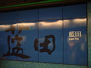
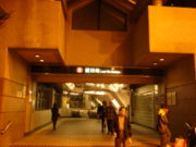
Between 1979 and 1989, the Kwun Tong Line of the MTR
MTR
Mass Transit Railway is the rapid transit railway system in Hong Kong. Originally opened in 1979, the system now includes 211.6 km of rail with 155 stations, including 86 railway stations and 69 light rail stops...
terminated at Kwun Tong Station. A storage railroad depot that developed behind the station, consisting of three parallel and interchanged tracks, terminating at Kwun Tong Law Court, eventually became part of the passenger railway after the later extension of Kwun Tong Line.
In 1984, the government decided to build a second railway tunnel and a second road tunnel to alleviate traffic congestion in the Cross Harbour Tunnel resulting in Eastern Harbour Crossing, the first railway-road tunnel in Hong Kong. The tunnel enabled Kwun Tong Line's extension to Quarry Bay, with an additional stop, Lam Tin, built in the middle. The new MTR station, opened in 8 November 1989, caused an influx of population into Lam Tin.
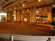
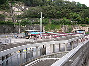
Built at the same was Lam Tin Bus Terminus, located on the opposite side of Lei Yue Mun Road and housing platforms for franchised buses, minibuses, taxis and cross-border buses. It is also connected to Sceneway Plaza
Sceneway Plaza
Sceneway Plaza is a shopping center in Hong Kong and the location of the Immigration Department East Kowloon Office. Established in 1991, it is located in Lam Tin, Kowloon, atop the Lam Tin MTR Station...
by staircases and escalators. Following the construction of these new facilities, Lam Tin gradually became a major transport interchange in Hong Kong.
As part of the Tseung Kwan O Line project, Kwun Tong line was briefly extended to North Point on 27 September 2001 but soon diverted to Tiu Keng Leng when the Tseung Kwan O Line opened in 18 August 2002. Now, Lam Tin is on the Kwun Tong Line, the third station from the terminus station of Tiu Keng Leng at Rennie's Mill
Tiu Keng Leng
Tiu Keng Leng is an area of Hong Kong in the Sai Kung District adjacent to Tseung Kwan O .-History:...
.
Franchised buses

Bus terminus
A bus terminus is a designated place where a bus or coach starts or ends its scheduled route. The terminus is the designated place that a timetable is timed from. Termini can be located at bus stations, interchanges, bus garages or simple bus stops. Termini can both start and stop at the same...
built in Lam Tin was then called Lam Tin Bus Terminus, which is today's Tak Tin Bus Terminus. It is built on the slope of Lam Tin Hill, in the north part of Lam Tin Estate, to serve the neighbourhood's residents. Buses ran from Kwun Tong to the bus terminus through Lei Yue Mun Road, then turned left and ascended the hill along Kai Tin Road, Ping Tin Street, On Tin Street and Tak Tin Street.
Between 1989 to 1994, Lam Tin MTR Station, Laguna City and Pik Wan Road were built. To serve these newly populated areas, three new bus termini were constructed: Lam Tin MTR Bus Terminus, now commonly named Lam Tin Bus Terminus as shown on the wall painting of the terminus; Laguna City Bus Terminus, which took up routes originally terminating at Kwun Tong Ferry
Kwun Tong Pier
Kwun Tong Pier is a ferry pier situated on Hoi Yuen Road, Kwun Tong, Kowloon, Hong Kong. The pier was originally situated at Ngau Tau Kok called "Ngau Tau Kok Ferry Pier" , but during the 1960s, due to reclamation work, the pier was moved to Kwun Tong.The pier complex consists of three piers: a...
; and Kwong Tin Bus Terminus, with new routes initiated to serve exclusively Lam Tin and the area nearby.
To disambiguate the names of the termini from one another, the original Lam Tin Bus Terminus was renamed Lam Tin (North) Bus Terminus, and "Lam Tin Bus Terminus" now usually refers to Lam Tin MTR Bus Terminus. After reconstruction of Lam Tin Estate, Lam Tin (North) Bus Terminus was surrounded by Tak Tin Estate. As a result, the terminus got a common name "Tak Tin Bus Terminus".
The area near Ping Tin Street became Ping Tin Estate after the reconstruction. A space underneath the buildings was reserved for a new bus terminus. On 6 July 2003, Ping Tin Bus Terminus was opened and overtook most of the routes from Tak Tin Bus Terminus.
Bus termini and routes in Lam Tin
There are five bus terminals in Lam Tin, namely:- Lam Tin Bus Terminus (with the full name Lam Tin MTR Station Bus Terminus) with routes A22, 42C, 61R, 74S, 89D, 89P, 93M, 216M, 258D, 298P
- Laguna City Bus Terminus with routes 40, 219P, 219X, 621
- Ping Tin Bus Terminus with routes 15, 15A, 15P, 38, 277X, 603, 603P, 603S, 889
- Tak Tin Bus Terminus (with the official name Lam Tin (North) Bus Terminus) with route E22
- Kwong Tin Bus Terminus (with the full name Lam Tin (Kwong Tin Estate) Bus Terminus) with routes 14B, 16, 215X
Excluding the bus routes mentioned above, the following routes also stop in Lam Tin, but not terminating: 14, 14C, 14S, 16M, E22P, R22, 62X, 70X, N216, 259D, 302, 307, 373, 373P, 601, N601, 606, 619, 619P, N619, 641, 671, 680, 680A, 680X, N680, 681, 681P, N681, 682, 690, 690P, N690, N691, 692, 694, 698R.
For a total, 64 bus routes run through Lam Tin.
Surface transport
Surrounded by hills, Lam Tin does not have direct access to the Victoria Harbour. However, merchant ships and ferries dock at Kwun Tong PierKwun Tong Pier
Kwun Tong Pier is a ferry pier situated on Hoi Yuen Road, Kwun Tong, Kowloon, Hong Kong. The pier was originally situated at Ngau Tau Kok called "Ngau Tau Kok Ferry Pier" , but during the 1960s, due to reclamation work, the pier was moved to Kwun Tong.The pier complex consists of three piers: a...
and Lei Yue Mun
Lei Yue Mun
Lei Yue Mun is a short channel in Hong Kong, between Junk Bay and Victoria Harbour, separating Kowloon and Hong Kong Island. The channel is an important passage in the South China Sea. It is the east gate of Victoria Harbour.The lands around the channel are also called Lei Yue Mun...
Pier, which are both within 15 minutes' walk from Lam Tin, and provide surface transport for Lam Tin residents. Another reason for Lam Tin's absence of an outlet to the Harbour is the presence of an Eastern Harbour Crossing
Eastern Harbour Crossing
The Eastern Harbour Crossing, abbreviated as "EHC" , is a tunnel in Hong Kong. It is a combined road and MTR rail link under Victoria Harbour between Quarry Bay in Hong Kong Island and Cha Kwo Ling in Kowloon.- History :...
entrance inside the district, whose buses and MTR overtook ferries for cross-harbour transport.
Residence
The first modern housing estateHousing estate
A housing estate is a group of buildings built together as a single development. The exact form may vary from country to country. Accordingly, a housing estate is usually built by a single contractor, with only a few styles of house or building design, so they tend to be uniform in appearance...
in Lam Tin was Lam Tin Estate. The estate was built in the 1960s
1960s in Hong Kong
1960s in Hong Kong continued with the development and expansion of manufacturing that began in the previous decade. The economic progress made in the period would categorise Hong Kong as one of Four Asian Tigers along with Singapore, South Korea, and Taiwan.-Background:Economically, this era is...
and the 1970s
1970s in Hong Kong
1970s in Hong Kong underwent many changes that shaped its future. Economically, it reinvented itself from a manufacturing base into a financial centre. The market also began leaning toward corporations and franchises.-Background:...
to settle the influx of mainland immigrants.The late 1980s
1980s in Hong Kong
1980s in Hong Kong marks a period when the territory was known for its wealth and trademark lifestyle. Hong Kong would be recognised internationally for its politics, entertainment and skyrocketing real estate prices.-Background:...
saw the district's first private residential buildings. Various facilities built during the 1990s
1990s in Hong Kong
The 1990s in Hong Kong marked a transitional period and the last decade of Colonial Hong Kong.-Background:The 1984 Sino-British Joint Declaration paved the way for a series of changes that would facilitate the transfer of sovereignty from the United Kingdom to the People's Republic of China . In...
made Lam Tin a compact residential area, however Lam Tin Estate was demolished
Urban renewal
Urban renewal is a program of land redevelopment in areas of moderate to high density urban land use. Renewal has had both successes and failures. Its modern incarnation began in the late 19th century in developed nations and experienced an intense phase in the late 1940s – under the rubric of...
in the 1990s and was redeveloped
Development Plan
A development plan is an aspect of town and country planning in the United Kingdom comprising a set of documents that set out the local authority's policies and proposals for the development and use of land in their area...
into Ping Tin Estate, Tak Tin Estate and Kai Tin Estate.
Most of the residents in Lam Tin are Chinese
Zhonghua minzu
Zhonghua minzu , usually translated as Chinese ethnic groups or Chinese nationality, refers to the modern notion of a Chinese nationality transcending ethnic divisions, with a central identity for China as a whole...
, but due to an influx of Japanese immigrant
Japanese people in Hong Kong
Japanese people in Hong Kong are composed primarily of expatriate businesspeople and their families, although there are also a sizable number of single women. Their numbers are smaller when compared to the sizable presence of Americans, British and Canadian expatriates. , 21,518 Japanese citizens...
s during the 1990s, people of Japanese descent have become common in Lam Tin, particularly in Sceneway Garden
Sceneway Garden
Sceneway Garden is a private housing estate in Lam Tin, Hong Kong, built by Cheung Kong Holdings, completed in 1992.-Structure and location:...
and Laguna City, which now features a Japanese kindergarten
Kindergarten
A kindergarten is a preschool educational institution for children. The term was created by Friedrich Fröbel for the play and activity institute that he created in 1837 in Bad Blankenburg as a social experience for children for their transition from home to school...
.
Lam Tin Estate

Tower block
A tower block, high-rise, apartment tower, office tower, apartment block, or block of flats, is a tall building or structure used as a residential and/or office building...
s numbered 1 to 24. Blocks 1 to 14 of Lam Tin Estate were built between 1962 and 1965 as type 4 public housing
Public housing
Public housing is a form of housing tenure in which the property is owned by a government authority, which may be central or local. Social housing is an umbrella term referring to rental housing which may be owned and managed by the state, by non-profit organizations, or by a combination of the...
buildings (第四型公屋); the other 10 towers were built between 1969 and 1975 as type 6 public housing buildings (第六型公屋). There was no Block 9, leaving the number of buildings in Lam Tin Estate at 23.
The Chinese dragon
Chinese dragon
Chinese dragons are legendary creatures in Chinese mythology and folklore, with mythic counterparts among Japanese, Korean, Vietnamese, Bhutanese, Western and Turkic dragons. In Chinese art, dragons are typically portrayed as long, scaled, serpentine creatures with four legs...
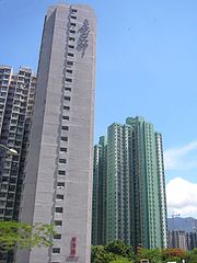
, which has symbolized unity of Chinese people since it was the first national emblem of unified China, is painted in multicolour on Block 15's south and north facing walls because it was the 500th public housing building in Hong Kong. Block 15's distinctive imagery made it a recognisable symbol of Lam Tin and the district's unity. After demolition and reconstruction, Block 15 became part of Ping Tin Estate.
Building structure of Lam Tin Estate's blocks is standardized by the government. As types 3, 4 and 6 buildings, the 23 towers of Lam Tin Estate were shaped as cuboid
Cuboid
In geometry, a cuboid is a solid figure bounded by six faces, forming a convex polyhedron. There are two competing definitions of a cuboid in mathematical literature...
s and resembled candy-boxes standing on a knoll. Most buildings were 16-storeys high and housed about 800 units. Each building had an estimated capacity of 3,000 residents and an approximate space allocation at 30 ft² per person. Bathroom
Bathroom
A bathroom is a room for bathing in containing a bathtub and/or a shower and optionally a toilet, a sink/hand basin/wash basin and possibly also a bidet....
s and kitchen
Kitchen
A kitchen is a room or part of a room used for cooking and food preparation.In the West, a modern residential kitchen is typically equipped with a stove, a sink with hot and cold running water, a refrigerator and kitchen cabinets arranged according to a modular design. Many households have a...
s were combined into one compartment, as were living room
Living room
A living room, also known as sitting room, lounge room or lounge , is a room for entertaining adult guests, reading, or other activities...
s and bedroom
Bedroom
A bedroom is a private room where people usually sleep for the night or relax during the day.About one third of our lives are spent sleeping and most of the time we are asleep, we are sleeping in a bedroom. To be considered a bedroom the room needs to have bed. Bedrooms can range from really simple...
s. Lift
Elevator
An elevator is a type of vertical transport equipment that efficiently moves people or goods between floors of a building, vessel or other structures...
s only reached some of the floors. To access the other floors, one needed to exit the lift at a level nearby and hike upstairs or downstairs. On the ground floor beneath the buildings were a variety of shops which served the residents. Although densely packed, the living environment of Lam Tin Estate fostered close relationships in the neighbourhood.
Owing to the ageing of buildings, the reconstruction of Lam Tin Estate was announced in September 1995 as part of an urban renewal project. Demolition started in 1997 and was completed in 2002. After reconstruction, Lam Tin Estate became Kai Tin Estate, Tak Tin Estate, Ping Tin Estate and Hong Yat Court.
Laguna City and Sceneway Garden
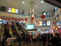
In the late 1980s, Cheung Kong acquired two pieces of land in Lam Tin, one being a former Shell
Shell Oil Company
Shell Oil Company is the United States-based subsidiary of Royal Dutch Shell, a multinational oil company of Anglo Dutch origins, which is amongst the largest oil companies in the world. Approximately 22,000 Shell employees are based in the U.S. The head office in the U.S. is in Houston, Texas...
oil depot
Oil depot
An oil depot is an industrial facility for the storage of oil and/or petrochemical products and from which these products are usually transported to end users or further storage facilities...
, the other above the newly-built Lam Tin MTR Station and bus terminus, and developed them into Laguna City and Sceneway Garden respectively. Laguna City was completed in 1991 and Sceneway Garden was completed in 1992.
Sceneway Garden is built on the podium
Podium
A podium is a platform that is used to raise something to a short distance above its surroundings. It derives from the Greek πόδι In architecture a building can rest on a large podium. Podia can also be used to raise people, for instance the conductor of an orchestra stands on a podium as do many...
above Lam Tin Station. The podium was built in a valley between Cha Kwo Ling
Cha Kwo Ling
Cha Kwo Ling is a hill in the eastern New Kowloon of Hong Kong, and the area around it. It is adjacent to Victoria Harbour and located to the west of Yau Tong and southwest of Lam Tin. Administratively, it belongs to the Kwun Tong District...
and Lam Tin Hill, which hosted a waste-car dump-site
Wrecking yard
A scrapyard or junkyard is the location of a dismantling business where wrecked or decommissioned vehicles are brought, their usable parts are sold for use in operating vehicles, while the unusable metal parts, known as scrap metal parts, are sold to metal-recycling companies...
before its construction. It has a total of 17 towers and a gross floor area of 280,760 m². There are altogether 4112 flats housing approximately 20,000 people. It also has two carparks, one for residents and one for visitors. Built together with Sceneway Garden was Sceneway Plaza
Sceneway Plaza
Sceneway Plaza is a shopping center in Hong Kong and the location of the Immigration Department East Kowloon Office. Established in 1991, it is located in Lam Tin, Kowloon, atop the Lam Tin MTR Station...
, which is a major shopping mall in southeastern Kowloon.
Laguna City is built along Lam Tin's waterfront taking over the land from the former oil depot. Part of Laguna City is built on reclaimed land
Land reclamation in Hong Kong
Land is in short supply in Hong Kong, and land reclamation has been conducted there since the mid-19th century.-Projects:One of the earliest and famous project was the Praya Reclamation Scheme, which added 50 to of land in 1890 during the second phase of construction...
. Laguna City consists of four phases, totalling 38 towers upon its 1991 completion. Built together with Laguna City was Laguna Park, which was completed in 1994 and then handed over to Urban Council
Urban Council, Hong Kong
The Urban Council was a municipal council in Hong Kong responsible for municipal services on Hong Kong Island and in Kowloon . These services were provided by the Urban Services Department. The equivalent body for the New Territories was the Regional Council.-History:The Urban Council was first...
. Laguna Park has a total area of 320000 sq ft (29,729 m²). Phases 1, 2 and 4 of Laguna City are managed by the same company, while phase 3 has an independent management authority. Similarly, phases 1, 2 and 4 share the same owners' committee, whereas phase 3 has its own.
List of villages and housing estates in Lam Tin
Yau Tong
Yau Tong is an area in the eastern Kowloon, Hong Kong, located between Lei Yue Mun and Lam Tin, at the east shore of Victoria Harbour. Administratively, it is under Kwun Tong District....
and Ma Yau Tong Village in Tiu Keng Leng
Tiu Keng Leng
Tiu Keng Leng is an area of Hong Kong in the Sai Kung District adjacent to Tseung Kwan O .-History:...
are sometimes considered part of Lam Tin.
Facilities
Being a compact residential area, Lam Tin has various facilities to satisfy its residents' daily needs. These include shopping malls, recreational facilities, water and other supplies. Furthermore, during the 1970s and 1980s, Lam Tin hosted landfillLandfill
A landfill site , is a site for the disposal of waste materials by burial and is the oldest form of waste treatment...
s.
Shopping
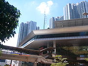
Shopping mall
A shopping mall, shopping centre, shopping arcade, shopping precinct or simply mall is one or more buildings forming a complex of shops representing merchandisers, with interconnecting walkways enabling visitors to easily walk from unit to unit, along with a parking area — a modern, indoor version...
s and markets. Most residential estates host individual shopping malls, and some of them have wet market
Wet market
A wet market is generally an open food market. Some of the common names include "Cultural Markets", "traditional markets", "Gaai Si", "Gaai See".-Terminology:...
s in addition to malls. These include:
Schools
To serve its residents, Lam Tin has a number of schools. They include kindergartens, primary schools and secondary schools. Some schools in Lam Tin are subsidized, others are private.List of schools in Lam Tin
Recreation
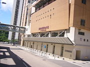
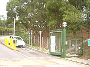
Lam Tin Park was built along Black Hill in 1991 to serve the needs of the fast-growing community. It consists mainly of hiking trail
Trail
A trail is a path with a rough beaten or dirt/stone surface used for travel. Trails may be for use only by walkers and in some places are the main access route to remote settlements...
s and walkways
Sidewalk
A sidewalk, or pavement, footpath, footway, and sometimes platform, is a path along the side of a road. A sidewalk may accommodate moderate changes in grade and is normally separated from the vehicular section by a curb...
, with a 5-a-side football pitch
Association football pitch
An association football pitch is the playing surface for the game of association football made of turf. Its dimensions and markings are defined by Law 1 of the Laws of the Game, "The Field of Play".All line markings on the pitch form part of the area which they define...
and a children's playground
Playground
A playground or play area is a place with a specific design for children be able to play there. It may be indoors but is typically outdoors...
. It also serves as an entrance to the Wilson Trail
Wilson Trail
The Wilson Trail is a 78 km long-distance footpath in Hong Kong, only 15 km run through non-park countryside or other areas. It was named after David Wilson, Baron Wilson of Tillyorn, who was Governor of Hong Kong from 1987 to 1992. The Wilson Trail was developed by Friends of the...
. The whole of Lam Tin and Victoria Harbour
Victoria Harbour
Victoria Harbour is a natural landform harbour situated between Hong Kong Island and the Kowloon Peninsula in Hong Kong. The harbour's deep, sheltered waters and strategic location on the South China Sea were instrumental in Hong Kong's establishment as a British colony and its subsequent...
can be viewed from the lookout point at the peak of Lam Tin Park.
Sai Tso Wan Recreation Ground
Sai Tso Wan Recreation Ground
Sai Tso Wan Recreation Ground is a multi-purpose playground in Lam Tin, Hong Kong. It is most notable being the first permanent recreational facility in Hong Kong built from a landfill.-History:...
was built between 1995 and 2004 over the former Sai Tso Wan Landfill. During the construction, the former landfill underwent a series of restoration works. A final capping layer was added to prevent leakage; a landfill gas
Landfill gas
Landfill gas is a complex mix of different gases created by the action of microorganisms within a landfill.-Production:Landfill gas production results from chemical reactions and microbes acting upon the waste as the putrescible materials begins to break down in the landfill...
control system was used to deploy methane
Methane
Methane is a chemical compound with the chemical formula . It is the simplest alkane, the principal component of natural gas, and probably the most abundant organic compound on earth. The relative abundance of methane makes it an attractive fuel...
from the decomposed rubbish as fuel, and a leachate
Leachate
Leachate is any liquid that, in passing through matter, extracts solutes, suspended solids or any other component of the material through which it has passed....
management system was built to collect leachate for further processing. The recreation ground started its operation in 30 April 2004.
Besides recreation grounds, Lam Tin also hosts Stage 3 of Wilson Trail. The section starts at Exit A of Lam Tin MTR Station, runs east along Kai Tin Road and Lei Yue Mun Road
Lei Yue Mun Road
Lei Yue Mun Road is a major road in Lam Tin, Hong Kong. It runs from the junction with Tsui Ping Road and Kwun Tong Road near MTR Kwun Tong Station to the roundabout with Ko Chiu Road near Lei Yue Mun Estate in Yau Tong...
, up Black Hill along the road towards Tseung Kwan O Chinese Permanent Cemetery, west along the Black Hill, and finally leaves Lam Tin near Ma Yau Tong
Ma Yau Tong
Ma Yau Tong is an area on a mountain pass between Po Lam of Tseung Kwan O New Town and Lam Tin of urban New Kowloon in Hong Kong. It is named after the village of the same name. It is known as Lau Tong and Ma Lau Tong in early 20th Century maps...
towards the section's terminus at Tseng Lan Shue
Tseng Lan Shue
Tseng Lan Shue is a small village in Sai Kung District, Kowloon, Hong Kong. It is located about 1 mile east of Fei Ngo Shan along the famous Clear Water Bay Road, and not far from Pik Uk. The village crosses Clear Water Bay Road and has about 250 settlements...
.
Supplies
Lam Tin has an underground network of safe waterDrinking water
Drinking water or potable water is water pure enough to be consumed or used with low risk of immediate or long term harm. In most developed countries, the water supplied to households, commerce and industry is all of drinking water standard, even though only a very small proportion is actually...
, town gas and domestic electricity supplies. Electricity in the area is served by China Light and Power. Town gas in the area is served by the Towngas Company
The Hong Kong and China Gas Company Limited
The Hong Kong and China Gas Company Limited , commonly known as Towngas, is the sole provider of towngas in Hong Kong. Founded in 1862, it is one of the oldest listed companies in the territory....
.
The entire Lam Tin area is served by both tap water
Tap water
Tap water is a principal component of "indoor plumbing", which became available in urban areas of the developed world during the last quarter of the 19th century, and common during the mid-20th century...
and flushing sea water supplies. The tap water is piped either from surface water or Dongjiang River
Dongjiang River
The Dong River is the eastern tributary of the Pearl River in Guangdong province, southern China. The other two main tributaries of Pearl River are Xijiang River and Beijiang River....
into two service reservoir
Reservoir
A reservoir , artificial lake or dam is used to store water.Reservoirs may be created in river valleys by the construction of a dam or may be built by excavation in the ground or by conventional construction techniques such as brickwork or cast concrete.The term reservoir may also be used to...
s and then pumped to individual households. The two service reservoirs that serve Lam Tin are Lam Tin Low Level Fresh Water Service Reservoir and Lam Tin High Level Service Reservoir. Built together with Lam Tin Estate, the low level reservoir is covered with a concrete-surfaced football field. The reservoir is now located between Kai Tin Estate and Tak Tin Estate. The high level reservoir, on the other hand, is farther away from residential estates. It is located near Lam Tin Park, on the slope of Black Hill.
Waste disposal
From 1978 to 1981, Sai Tso Wan Landfill (茜草灣堆填區) served East Kowloon. Approximately 1.6 million tonneTonne
The tonne, known as the metric ton in the US , often put pleonastically as "metric tonne" to avoid confusion with ton, is a metric system unit of mass equal to 1000 kilograms. The tonne is not an International System of Units unit, but is accepted for use with the SI...
s of domestic waste and commercial waste
Commercial waste
Commercial waste consists of waste from premises used wholly or mainly for the purposes of a trade or business or for the purpose of sport, recreation, education or entertainment but not including household; agricultural or industrial waste .-See also:...
were dumped in the site during its four-year operation. The disposed waste stacked up to 65 metres high. After its closure in 1981, it was sealed with soil and planted over with Grassland
Grassland
Grasslands are areas where the vegetation is dominated by grasses and other herbaceous plants . However, sedge and rush families can also be found. Grasslands occur naturally on all continents except Antarctica...
s and trees. Sin Fat Road, which runs up the hill and hosts Sceneway Garden Minibus
Minibus
A minibus or minicoach is a passenger carrying motor vehicle that is designed to carry more people than a multi-purpose vehicle or minivan, but fewer people than a full-size bus. In the United Kingdom, the word "minibus" is used to describe any full-sized passenger carrying van. Minibuses have a...
Terminus, was constructed. Sai Tso Wan Landfill was later rebuilt into Sai Tso Wan Recreation Ground.
An area in Ma Yau Tong near today's Lam Tin Park was known as Ma Yau Tong Central Landfill (馬游塘中堆填區). The area measured 10.87 hectare
Hectare
The hectare is a metric unit of area defined as 10,000 square metres , and primarily used in the measurement of land. In 1795, when the metric system was introduced, the are was defined as being 100 square metres and the hectare was thus 100 ares or 1/100 km2...
s, and operated until 1986 when it became the last urban landfill to be closed, after which it was sealed and converted to government-owned grassland.
Since the total closure of urban landfills in 1986, rubbish from Lam Tin is first transferred to a treatment plant in Kowloon Bay
Kowloon Bay
Kowloon Bay is a bay located at the east of the Kowloon Peninsula and north of Hong Kong Island in Hong Kong. It is the eastern portion of Victoria Harbour, between Hung Hom and Lei Yue Mun...
where it is compressed, and then to New Territories Southeast Landfill (新界東南堆填區) where it is disposed of.

