

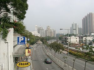
Castle Peak Road
Encyclopedia
Castle Peak Road is the longest road
in Hong Kong
. It runs from Tai Po Road
in Sham Shui Po
, Kowloon
to the very north of the New Territories
, serving south, west and north New Territories, being one of the most distant roads in early Hong Kong.
 The road was named after Castle Peak
, a peak in the western New Territories. The area to the east of the peak was hence named Castle Peak. Later at the dawn of the development of new town, the area was renamed to its old name, Tuen Mun
.
The road was originally known in Chinese as Tsing Shan To (青山道) for its entire length. The Chinese name of the section of the road in the New Territories was later changed to Tsing Shan Kung Lo (青山公路), lit. Castle Peak public road (or Castle Peak Highway). In everyday conversation, however, the term 青山道 survives for the stretches within Tsuen Wan and Yuen Long.
in Sham Shui Po
and passes through Cheung Sha Wan
and Lai Chi Kok
in Kowloon. On both sides of the road are old residential blocks, with some dated back to pre-World War II
. Towards Lai Chi Kok, it is surrounded by industrial buildings instead. The road is one-way eastbound between Kom Tsun Street & its terminus at Tai Po Road.
 After leaving Kowloon
, it goes uphill past Kau Wa Keng and Tai Ching Cheung along a four-lane expressway to Kwai Chung
and downhill into Tsuen Wan
. The stretch within Tsuen Wan
is also commonly called 大馬路 ("main thoroughfare"), especially among the older generations.
Next, it goes along the south shore of the Western New Territories, via Yau Kom Tau
, Ting Kau
, Sham Tseng
, Tsing Lung Tau
, Tai Lam, Siu Lam and So Kwun Wat
and then reaches the Tuen Mun New Town
, which was also known as Castle Peak
(after which the road was named). Much of this stretch was bypassed by Tuen Mun Road
between 1977 and 1983.
It continues north-east as a six-laned road, paralleling the light rail through Lam Tei
, Hung Shui Kiu
, Ping Shan
and goes through another new town, Yuen Long New Town
. The section within Yuen Long, again, is also called 大馬路. This section was bypassed by the Yuen Long Highway
in 1992.
It then turns north at Au Tau
, just west of Kam Tin
. This section is overshadowed by the San Tin Highway
, constructed between 1991 & 1993. It then passes through Mai Po, San Tin
, Lok Ma Chau
(near the Mainland border), Pak Shek Au and Kwu Tung
before terminating at Fan Kam Road
in Sheung Shui
.
Road
A road is a thoroughfare, route, or way on land between two places, which typically has been paved or otherwise improved to allow travel by some conveyance, including a horse, cart, or motor vehicle. Roads consist of one, or sometimes two, roadways each with one or more lanes and also any...
in Hong Kong
Hong Kong
Hong Kong is one of two Special Administrative Regions of the People's Republic of China , the other being Macau. A city-state situated on China's south coast and enclosed by the Pearl River Delta and South China Sea, it is renowned for its expansive skyline and deep natural harbour...
. It runs from Tai Po Road
Tai Po Road
Tai Po Road is the second longest road in Hong Kong . It spans from Sham Shui Po in Kowloon to Tai Po in the New Territories of Hong Kong. Initially, the road was named Frontier Road....
in Sham Shui Po
Sham Shui Po
Sham Shui Po, or Shamshuipo, is an area of Sham Shui Po District, Hong Kong, situated in the northwestern part of the Kowloon Peninsula, north of Tai Kok Tsui, east of Cheung Sha Wan and south of Shek Kip Mei. Sham Shui Po is known for its street market for electronic devices.-History:Sham Shui Po...
, Kowloon
Kowloon
Kowloon is an urban area in Hong Kong comprising the Kowloon Peninsula and New Kowloon. It is bordered by the Lei Yue Mun strait in the east, Mei Foo Sun Chuen and Stonecutter's Island in the west, Tate's Cairn and Lion Rock in the north, and Victoria Harbour in the south. It had a population of...
to the very north of the New Territories
New Territories
New Territories is one of the three main regions of Hong Kong, alongside Hong Kong Island and the Kowloon Peninsula. It makes up 86.2% of Hong Kong's territory. Historically, it is the region described in The Convention for the Extension of Hong Kong Territory...
, serving south, west and north New Territories, being one of the most distant roads in early Hong Kong.
Name
Castle Peak, Hong Kong
Castle Peak or Pui To Shan is a 583 m high peak in the western New Territories of Hong Kong.In contrast to its Chinese name, which means green hill, Castle Peak is notorious for its severe loss of vegetation and weathering of its Granite surface.The area to the west of the hill was also named...
, a peak in the western New Territories. The area to the east of the peak was hence named Castle Peak. Later at the dawn of the development of new town, the area was renamed to its old name, Tuen Mun
Tuen Mun
Tuen Mun is a town near the mouth of Tuen Mun River and Castle Peak Bay in the New Territories, Hong Kong. It was one of the earliest settlements in Hong Kong which can be dated back to the Neolithic period. In the more recent past, it was home to many Tanka fishermen who gathered at the Castle...
.
The road was originally known in Chinese as Tsing Shan To (青山道) for its entire length. The Chinese name of the section of the road in the New Territories was later changed to Tsing Shan Kung Lo (青山公路), lit. Castle Peak public road (or Castle Peak Highway). In everyday conversation, however, the term 青山道 survives for the stretches within Tsuen Wan and Yuen Long.
Kowloon
The road starts east at Tai Po RoadTai Po Road
Tai Po Road is the second longest road in Hong Kong . It spans from Sham Shui Po in Kowloon to Tai Po in the New Territories of Hong Kong. Initially, the road was named Frontier Road....
in Sham Shui Po
Sham Shui Po
Sham Shui Po, or Shamshuipo, is an area of Sham Shui Po District, Hong Kong, situated in the northwestern part of the Kowloon Peninsula, north of Tai Kok Tsui, east of Cheung Sha Wan and south of Shek Kip Mei. Sham Shui Po is known for its street market for electronic devices.-History:Sham Shui Po...
and passes through Cheung Sha Wan
Cheung Sha Wan
Cheung Sha Wan is an area between Lai Chi Kok and Sham Shui Po in New Kowloon, Hong Kong. It is mainly residential to the north and south, with an industrial area in between. Administratively it is part of Sham Shui Po District. The Sham Shui Po District includes Mei Foo as well as Lai Chi...
and Lai Chi Kok
Lai Chi Kok
Lai Chi Kok is a neighborhood in New Kowloon, Hong Kong, east of Kwai Chung and west of Cheung Sha Wan. Mei Foo Sun Chuen is the largest housing estate in the area. Administratively, it belongs to the Sham Shui Po District.-History:...
in Kowloon. On both sides of the road are old residential blocks, with some dated back to pre-World War II
World War II
World War II, or the Second World War , was a global conflict lasting from 1939 to 1945, involving most of the world's nations—including all of the great powers—eventually forming two opposing military alliances: the Allies and the Axis...
. Towards Lai Chi Kok, it is surrounded by industrial buildings instead. The road is one-way eastbound between Kom Tsun Street & its terminus at Tai Po Road.
New Territories
Kowloon
Kowloon is an urban area in Hong Kong comprising the Kowloon Peninsula and New Kowloon. It is bordered by the Lei Yue Mun strait in the east, Mei Foo Sun Chuen and Stonecutter's Island in the west, Tate's Cairn and Lion Rock in the north, and Victoria Harbour in the south. It had a population of...
, it goes uphill past Kau Wa Keng and Tai Ching Cheung along a four-lane expressway to Kwai Chung
Kwai Chung
Kwai Chung is a town in the New Territories of Hong Kong. Together with Tsing Yi Island, it is part of the Kwai Tsing District of Hong Kong. Kwai Chung is the site of the container port. It is also part of Tsuen Wan New Town. In 2000, it had a population of 287,000...
and downhill into Tsuen Wan
Tsuen Wan
Tsuen Wan is a bay in the Kowloon area of Hong Kong, opposite to Tsing Yi Island across Rambler Channel. The market town of Tsuen Wan emerged for the surrounding villages and fleets of fishing boats in the area. The town is around the present-day Tsuen Wan Station of the MTR...
. The stretch within Tsuen Wan
Tsuen Wan
Tsuen Wan is a bay in the Kowloon area of Hong Kong, opposite to Tsing Yi Island across Rambler Channel. The market town of Tsuen Wan emerged for the surrounding villages and fleets of fishing boats in the area. The town is around the present-day Tsuen Wan Station of the MTR...
is also commonly called 大馬路 ("main thoroughfare"), especially among the older generations.
Next, it goes along the south shore of the Western New Territories, via Yau Kom Tau
Yau Kom Tau
Yau Kom Tau is a geographical feature at the north shore of the Tsing Yi Island. It originally was a flat headland formed by a small hill with a bay, Ngau Kok Wan, on its east and a valley and a swamp on its west. Its natural shore was reclaimed for relocation of shipyards from Cheung Sha Wan...
, Ting Kau
Ting Kau
Ting Kau is an area in west Tsuen Wan District, New Territories, Hong Kong. Ting Kau Village is a village near the shore. The beach nearby, Ting Kau Beach was once a popular beach in Hong Kong. The water quality affected by the treated water injected into Victoria Harbour.Ting Kau is also famous...
, Sham Tseng
Sham Tseng
Sham Tseng is a coastal area in Tsuen Wan District, Hong Kong, between Ting Kau and Tsing Lung Tau.In 1982, the Government launched a new town project for the area. There were proposals for a massive housing scheme, where the population of the village, then estimated at 6,000, was set to increase...
, Tsing Lung Tau
Tsing Lung Tau
Tsing Lung Tau is a small area in Tsuen Wan West, New Territories in Hong Kong.-Geographical information:It is located on the southwest coast of the New Territories in Hong Kong, between Tsuen Wan and Tuen Mun. There are two villages: Tsing Lung Tau Village and Yuen Tun Village, with many...
, Tai Lam, Siu Lam and So Kwun Wat
So Kwun Wat
So Kwun Wat, commonly pronounced So Kwun Fat , is an area on the south coast of the western mainland New Territory in Hong Kong. The proper So Kwun Wat is a human inhabitant in the valley between Siu Lam and Sam Shing Hui...
and then reaches the Tuen Mun New Town
Tuen Mun New Town
Tuen Mun New Town is a new town developed by Hong Kong Government in Tuen Mun of the New Territories, Hong Kong in 1970s. At the time of planning in 1965, the satellite town, as new town was then known as, was named Castle Peak....
, which was also known as Castle Peak
Castle Peak, Hong Kong
Castle Peak or Pui To Shan is a 583 m high peak in the western New Territories of Hong Kong.In contrast to its Chinese name, which means green hill, Castle Peak is notorious for its severe loss of vegetation and weathering of its Granite surface.The area to the west of the hill was also named...
(after which the road was named). Much of this stretch was bypassed by Tuen Mun Road
Tuen Mun Road
Tuen Mun Road is a major expressway in Hong Kong which connects Tuen Mun in the New Territories with Tsuen Wan. It is part of Hong Kong's Route 9, which circumnavigates the New Territories...
between 1977 and 1983.
It continues north-east as a six-laned road, paralleling the light rail through Lam Tei
Lam Tei
Lam Tei is an area in the Tuen Mun District, New Territories, Hong Kong. The region lies at the north end of Tuen Mun city. It is highly rural, with Miu Fat Monastery being a landmark of the region. The Sherwood and Botania Villa are two residential estate in Lam Tei.-Transportation:Lam Tei is...
, Hung Shui Kiu
Hung Shui Kiu
Hung Shui Kiu is an area between Ping Shan and Lam Tei, in the western part of the New Territories of Hong Kong. It covers parts of Yuen Long andTuen Mun districts. It is largely rural residential.-Transportation:...
, Ping Shan
Ping Shan
Ping Shan is an area in the New Territories of Hong Kong. It is located west of Yuen Long Town and Shui Pin Wai, and south of Tin Shui Wai. Administratively, it is part of Yuen Long District.-Geography:...
and goes through another new town, Yuen Long New Town
Yuen Long New Town
Yuen Long New Town is a new town in the northwest New Territories, Hong Kong. It was developed from the traditional market town of Yuen Long Town from the late 1970s....
. The section within Yuen Long, again, is also called 大馬路. This section was bypassed by the Yuen Long Highway
Yuen Long Highway
Yuen Long Highway is a Hong Kong road connecting Au Tau in Yuen Long and Lam Tei in Tuen Mun of New Territories. It is part of Route 9. It was completed in July 1993 and provides a continuation of route 9 from Tuen Mun to Yuen Long leading to the Shap Pat Heung Interchange and Pok Oi Interchange...
in 1992.
It then turns north at Au Tau
Au Tau
Au Tau is an area of Yuen Long District, Hong Kong, located directly west of Yuen Long.Pok Oi Hospital is located in Au Tau.Pun Uk, a former mansion and a Grade I Historic Building is located in Au Tau, next to the hospital....
, just west of Kam Tin
Kam Tin
Kam Tin , or Kam Tin Heung , is an area in the New Territories, Hong Kong. It is north of Tai Mo Shan and east of Yuen Long. It was formerly known as Sham Tin...
. This section is overshadowed by the San Tin Highway
San Tin Highway
San Tin Highway is an expressway in North-Western New Territories of Hong Kong, leading off Fanling Highway near the rural village of San Tin and connects Tsing Long Highway on the north of Au Tau, near the new town of Yuen Long. It is also part of Route 9....
, constructed between 1991 & 1993. It then passes through Mai Po, San Tin
San Tin
San Tin , or San Tin Heung , is an area located near Lok Ma Chau area in the New Territories and belongs to the Yuen Long District, Hong Kong....
, Lok Ma Chau
Lok Ma Chau
Lok Ma Chau or Lokmachau is a village in Hong Kong's New Territories and also a major pedestrian and road border crossing point between Hong Kong and mainland China. It lies just south of the Sham Chun River , which forms the border between Hong Kong and mainland China...
(near the Mainland border), Pak Shek Au and Kwu Tung
Kwu Tung
Kwu Tung is an area in the northern New Territories, west of Sheung Shui and Fanling, and east of Lok Ma Chau and San Tin, in Hong Kong.Kwu Tung literally means "old cave" in the Cantonese language. Tung also indicates that it was the habitat of ancient native Cantonese people...
before terminating at Fan Kam Road
Fan Kam Road
Fan Kam Road is a road connecting Sheung Shui and Pat Heung near Kam Tin in the New Territories, Hong Kong. It continues north as Po Shek Wu Road-See also:* Lam Tsuen Country Park* Lam Kam Road* List of streets and roads in Hong Kong-External links:*...
in Sheung Shui
Sheung Shui
Sheung Shui is an area in New Territories, Hong Kong. Sheung Shui Town, a part of this area, is part of the Fanling-Sheung Shui New Town in the North District of Hong Kong. Fanling Town is to its southeast.-History:...
.