

Climate of south-west England
Encyclopedia
The climate of south-west England is classed as oceanic
(Cfb) according to the Köppen climate classification
. The oceanic climate is typified by cool winters with warmer summers and precipitation all year round, with more experienced in winter. Annual rainfall is about 1000 millimetres (39.4 in) and up to 2000 millimetres (78.7 in) on higher ground. Summer maxima averages range from 18 °C (64.4 °F) to 22 °C (71.6 °F) and winter minima averages range from 1 °C (33.8 °F) to 4 °C (39.2 °F) across the south-west. It is the second windiest area of the United Kingdom, the majority of winds coming from the south-west and north-east. Government organisations predict the area will experience a rise in temperature and become the hottest region in the United Kingdom.
Inland areas of low altitude experience the least amount of precipitation. They have the highest summer maxima temperatures, but winter minima are colder than those of the coast. Snowfalls are more frequent in comparison to the coast, but less so in comparison to higher ground. They experience the lowest wind speeds and the total sunshine hours are between those of the coast and the moors. This typical climate of inland areas is more noticeable the further north-east into the region.
In comparison to inland areas, the coast experiences high minimum temperatures, especially in winter
, and slightly lower maximum temperatures during the summer. Rainfall is lowest at the coast and snowfall there is rarer than the rest of the region. Coastal areas are the windiest parts of the peninsula and they receive the most sunshine. The general coastal climate becomes more prevalent further south-west into the region.
The south-west
has areas of moorland
inland such as Bodmin Moor
, Dartmoor
and Exmoor
. Because of their high altitude they experience lower temperatures and more precipitation than the rest of the south west (approximately twice as much rainfall as lowland areas). Both of these factors also result in the highest levels of snowfall and the lowest levels of sunshine. Exposed areas of the moors are windier than the lowlands and can be almost as windy as the coast.
definition of south-west England, which covers Cornwall
, Devon
, Somerset
, North Somerset
, Bath and North East Somerset
, South Gloucestershire
, the City of Bristol
and the Isles of Scilly
. This is a smaller area than the UK Government's South West England
region, which also covers Gloucestershire
, Wiltshire
and Dorset
. The region is also sometimes loosely described as the West Country
.
and Devon
are coldest in February with daily minima ranging from 1.5 °C (34.7 °F) in inland Devon to 5 °C (41 °F) on the Isles of Scilly
. The sea has less influence towards the north-east of the region, causing January to be the coldest month with mean minimum temperatures from 1 °C (33.8 °F) or 2 °C (35.6 °F). In the months of July and August (the hottest part of the year) daily maxima range from about 19 °C (66.2 °F) on the coast of Cornwall to 21 °C (69.8 °F) across inland areas of the north-east (Somerset
and North Somerset
).
The sea surrounding the south-west peninsula has the highest annual mean temperature of any sea in the United Kingdom, with a temperature close to 11 °C (51.8 °F) — 12 °C (53.6 °F). Coastal areas of Cornwall and the Isles of Scilly experience annual mean temperatures similar to that of the sea as the prevailing wind is from the sea. Towards the north-east of the region, the annual mean temperature decreases and is closer to 10 °C/15 °F The sea's influence on annual temperature range is highest in west Cornwall, where the range is approximately 9 °C/14 °F. In the north-east of the region, the range is approximately 12 °C/22 °F. Inland areas are affected by their altitude: the mean temperature decreases as altitude increases. Princetown
on Dartmoor, with an altitude of 414 metres (1,358.3 ft), has a mean temperature of 8 °C (46.4 °F).
The sea's influence in the south-west usually prevents cold temperatures, however temperatures can plummet during periods of cold easterly air flow: all of which have been recorded in January. In 1987 the minimum temperature recorded at St Mawgan
, Cornwall was -9 °C and -6.4 °C was noted on the Isles of Scilly. Inland areas have experienced even colder conditions with -15 °C at Exeter International Airport
, Devon in 1958 and at Bastreet, Cornwall in 1979. Further to the north-east of the region, temperatures reached -16.1 °C in Yeovilton
, Somerset in 1982.
Extremely high temperatures (heat wave
s) are rare in the south-west. Their occurrence is caused by south-easterly air flow that blows hot air from mainland Europe, combined with strong summer sunshine. The hottest recorded temperature in the south west is 35.4 °C (95.7 °F), on 3 August 1990, at Saunton Sands
, Devon.
 Average annual sunshine totals rise above 1,600 hours along the coast — higher totals are recorded on the region's southern coast at the English Channel
than on its northern coast along the Bristol Channel
. 1,400 — 1,600 hours of annual sunshine are to be expected in inland areas of the south west. In June 1925, the highest monthly sunshine totals were recorded: 381.7 hours at Pendennis Point
, Cornwall
and 334.8 hours at Long Ashton
, Somerset
. During the winter months, which are the dullest, less than 20 hours of monthly sunshine have occasionally been recorded. In December 1998 there were 20 days without sun recorded at Yeovilton.
In general, June is the sunniest month, because the days are at their longest, and December is the dullest. The Azores high
pressure system affects the south-west of England as it extends north-eastwards towards the British Isles
. The Azores is more influential in summer. The high pressure reduces cloud cover through the process of subsidence
. In spring and summer, the sea is cool compared to the air temperature, causing less convective cloud
cover. The convective cloud forms more frequently inland, especially on higher ground such as Dartmoor, Exmoor and Bodmin Moor, thus reducing the amount of sunshine. Coastal areas of the south-west have more hours of sunshine.
. Most of the rainfall in autumn and winter is caused by the Atlantic depressions, which is when they are most active. In summer, a large proportion of the rainfall is caused by sun heating the ground leading to convection and to showers and thunderstorms.
The Isles of Scilly have annual rainfall totals of about 850–900 mm (33–35 in). Coastal areas of Cornwall and Devon typically receive 900–1,000 mm (35–39 in) of rainfall annually. The altitude increases the amount of rainfall. Highland areas are cooler, causing moist air to cool below the dew point
as it rises over high ground forming clouds and then rain. Princetown is 23 kilometres (14.3 mi) from Plymouth
and 403 metres (1,322.2 ft) higher, and has double the rainfall. Areas that fall in the rain shadow
s (lees) of higher ground have lower levels of rainfall: 800 mm (31.5 in) near Exeter
(east of Dartmoor) and 700 mm (27.6 in) in parts of central Somerset
(east of Exmoor). The Mendip Hills
, to the north-east of the region, receive over 1100 mm (43.3 in) per year and the Bath-Bristol
area receives around 800–900 mm (31–35 in).
The sea reaches its highest temperature in late summer/autumn and its lowest in late winter/spring. As a result, the highest rainfall can be expected in autumn and lowest in spring. The months with the most rainfall are in autumn and winter. Monthly rainfall can be variable. On the coast, most months have recorded less than 20 millimetre (0.78740157480315 in) and, some months, less than 10 millimetre (0.393700787401575 in) at some point. The wettest station of the region, Princetown, has recorded 7 millimetre (0.275590551181102 in) of rain during May.
The number of days with at least 1 millimetre (0.0393700787401575 in) of rainfall correlates to the pattern of quantity of rainfall. In late spring/summer, 9–10 days per month recorded rain in coastal areas, 7–9 days in the north-east and 12–13 days at high altitude (Princetown). In winter these values increase to 15–16 on the coast, 12–13 in the north-east and over 18 days in high altitude.
Very heavy rainfall-—spanning 5–15 hours—-is rare in the south-west. Such incidences include the Lynmouth disaster of 15 August 1952, caused by 228 millimetres (9 in) of rainfall falling locally on Exmoor
over 12 hours. Also, on 8 June 1957, 203 millimetres (8 in) fell at Camelford
, Cornwall and in June 1917, 243 millimetres (9.6 in) fell in 13 hours in Bruton
, Somerset. The north-Cornish village of Boscastle
was flooded
on 16 August 2004; a peak hourly rainfall of 80 millimetres (3.1 in) was recorded. Approximately 100 people had to be rescued by helicopter and 116 cars were swept out to sea.
fall normally occurs between November and April and short snowfalls can occur between October and May on higher ground. The snow usually only settles between the months of December and March. Snow rarely falls when temperatures are greater than 4 °C (39.2 °F) and for snow to settle temperatures must normally be lower than 4 °C (39.2 °F).
In the south-west the number of days of snowfall increases with altitude: per approximately every 100 m (328.1 ft) increase in altitude, the number of days of snow falling increases by five days. From 1979 to 2000, on average there were less than 10 days per winter in which snow fell in the islands of the south-west and the coastal areas of Devon and Cornwall, and slightly more than 10 days on average near to the Severn Estuary
. Inland areas received between 8–15 days of snow falling; more days of snow fall were noted particularly to the north-east. Some upland areas received, on average, over 25 days per year of snow falling.
Similarly to the ratio of days of snow falling to altitude, the number of days in which snow settles on the ground increases by five days per every 100 m (328.1 ft) increase in altitude. In the south-west, it is rare that snow settles on the ground. From 1979 to 2000 on average, lowland areas did not record any lying snow in one out of every three years. During this period, snow settled, on average, less than three days per year across the Isles of Scilly and on the coasts of Devon and Cornwall. Inland areas had an average of 5–10 days of snow lying per year and, as with the days of snow falling; this was higher towards the north-east of the region. More than 20 days of snow lying can be expected on the high grounds of Dartmoor and Exmoor.
The south-west, although the mildest region of the British Isles, has been affected by some of the most severe blizzard
s. Blizzards are a rare occurrence in the United Kingdom, but can occur when especially cold easterly winds from the continent meet an Atlantic depression, causing a prolonged snowstorm and high winds. This occurred in February 1978, when 50 cm (19.7 in) of snow accumulated in inland Devon and 90 cm (35.4 in) on Dartmoor and Exmoor, causing by -2 °C winds at 25 knots (13.6 m/s). In January 1982, snow drifts were 1 m (3.3 ft) deep around the Bristol
area. Convective showers on 12 January 1987 left parts of Cornwall with deep snow: 35 cm (13.8 in) at Falmouth
, 39 cm (15.4 in) Penzance
and 23 cm (9.1 in) on the Isles of Scilly.
. The strong winds are caused by deep depressions across or close to the British Isles
. Winds are stronger in the winter-half year, as the depressions' strength and frequency increase. The lightest mean wind speeds are in summer. The speed of peak gusts and mean wind speed follow a similar pattern throughout the year.
Mean wind speeds are generally lower to the north-east of the region and in inland areas. Yeovilton, lowland Somerset, has a mean wind speed that is two thirds that of St. Mawgan in coastal Cornwall. An increase in altitude in inland areas generally increases the mean wind speed; similar wind speeds are recorded on the highest parts of Exmoor and Dartmoor as on the coast.
The majority, and the strongest, of the winds are from the south-west and north-east as Atlantic depressions pass from west to east over the United Kingdom. When an Atlantic depression reaches the United Kingdom, winds usually blow from the south or south-west, and they change to west or north-west when the depression leaves. If a depression passes along the English Channel, strong winds can occur from the east or north-east. Due to anticyclogenesis
over Scandinavia
, the majority of winds in Spring are from the north-east. Coastal areas of the south-west usually experience calm or very light winds that do not have a classifiable wind direction less than 6% of the time; this figure is 15% in the north-east and inland areas.
Islands and exposed headlands have the highest number of days per year of gale
-force winds (averaged out over ten consecutive minutes). A gale-force wind is defined as being at least 34 knots, which is 8 on the modern Beaufort scale
. Gales are recorded approximately 24 days per year in the Isles of Scilly and coastal Cornwall. Further north-east and further inland, the number of days decreases. Plymouth, coastal Devon, receives 16 days; Yeovilton, Somerset, receives seven; and Long Ashton, north-west Somerset, receives four. Wind speeds can vary on local topography
: wooded or urban areas sheltered by hills receive less days of gales and lower wind speeds.
On 15 December 1979, there were gusts of 91 knots at Lizard Point
, Cornwall 99 knots at St Mary's, Isles of Scilly and 103 knots at Gwennap Head
, Cornwall. Widespread winds from the Burns' Day storm
on 25 January 1990 overturned vehicles and damaged buildings. It caused the highest wind speed during the 1971–2001 period to be recorded in two stations: 84 knots at Plymouth
and 85 knots at St Mawgan. 79 knots was recorded on top of a building in Bristol as well as 74 knots at Exeter International Airport and 68 knots at Yeovilton. At Plymouth, the maximum hourly mean speed was 60 knots and at Yeovilton, 45 knots. The Bristol Channel floods
on 30 January 1607 apparently caused "many thousand" deaths and may have destroyed several small harbours. The cause of it is disputed to be either a European windstorm
or a tsunami
.
, within 40 years the average temperature is likely to increase by 2 °C (4 °F) in the south-west and the average warmerst summer day will increase by 3 °C (6 °F) to be 31 °C (87.8 °F). It predicts that the region will have one of the highest annual temperatures in the United Kingdom and there will be an estimated 53 millimetres (2.1 in) incease in winter precipitation.
The rise in temperature could lead to outdoor citrus
cultivation being possible. Sea level rises could cause spring tides to rise over many of the region's harbour walls and an increase in sea level by about 40 centimetres (15.7 in) at Newlyn
. Following the announcement, the government of the United Kingdom called on the local authorities and other organisation to prepare for the consequences. All major government investments will have to consider the risks as a result of future climate change.
A report from the Environment Agency
said that, over the next 25 years, investment would need to double for the building and upkeep of flood defences in order to maintain the current levels of flood protection and counter the effects of climate change. Flooding from rivers and the sea currently puts 65,369 properties at risk in Devon and Cornwall, 29,577 of which are at "significant risk". Current flood defence schemes protect some of these properties from flooding. Richard Cresswell, the regional director for the Environment Agency in the south west, said:
£
357 million on flood risk management in Cornwall, Devon, Dorset, Somerset, South Gloucestershire
and Wiltshire
has been spent since 2002, which includes spending continuing into 2009/10.
Rising sea levels are likely to cause more flooding on the Somerset Levels
. Since 1990 the drainage board has been charged with looking at the rhyne
s, cleaning them out and keeping them clear, with the Environment Agency
overseeing the work. With rising sea levels the work required to maintain the current sea defences is likely to become more expensive and it has been proposed by Ian Liddell-Grainger (Bridgwater
-MP
), that two inland seas are created.
Oceanic climate
An oceanic climate, also called marine west coast climate, maritime climate, Cascadian climate and British climate for Köppen climate classification Cfb and subtropical highland for Köppen Cfb or Cwb, is a type of climate typically found along the west coasts at the middle latitudes of some of the...
(Cfb) according to the Köppen climate classification
Köppen climate classification
The Köppen climate classification is one of the most widely used climate classification systems. It was first published by Crimea German climatologist Wladimir Köppen in 1884, with several later modifications by Köppen himself, notably in 1918 and 1936...
. The oceanic climate is typified by cool winters with warmer summers and precipitation all year round, with more experienced in winter. Annual rainfall is about 1000 millimetres (39.4 in) and up to 2000 millimetres (78.7 in) on higher ground. Summer maxima averages range from 18 °C (64.4 °F) to 22 °C (71.6 °F) and winter minima averages range from 1 °C (33.8 °F) to 4 °C (39.2 °F) across the south-west. It is the second windiest area of the United Kingdom, the majority of winds coming from the south-west and north-east. Government organisations predict the area will experience a rise in temperature and become the hottest region in the United Kingdom.
Inland areas of low altitude experience the least amount of precipitation. They have the highest summer maxima temperatures, but winter minima are colder than those of the coast. Snowfalls are more frequent in comparison to the coast, but less so in comparison to higher ground. They experience the lowest wind speeds and the total sunshine hours are between those of the coast and the moors. This typical climate of inland areas is more noticeable the further north-east into the region.
In comparison to inland areas, the coast experiences high minimum temperatures, especially in winter
Winter
Winter is the coldest season of the year in temperate climates, between autumn and spring. At the winter solstice, the days are shortest and the nights are longest, with days lengthening as the season progresses after the solstice.-Meteorology:...
, and slightly lower maximum temperatures during the summer. Rainfall is lowest at the coast and snowfall there is rarer than the rest of the region. Coastal areas are the windiest parts of the peninsula and they receive the most sunshine. The general coastal climate becomes more prevalent further south-west into the region.
The south-west
South West England
South West England is one of the regions of England defined by the Government of the United Kingdom for statistical and other purposes. It is the largest such region in area, covering and comprising Bristol, Gloucestershire, Somerset, Dorset, Wiltshire, Devon, Cornwall and the Isles of Scilly. ...
has areas of moorland
Moorland
Moorland or moor is a type of habitat, in the temperate grasslands, savannas, and shrublands biome, found in upland areas, characterised by low-growing vegetation on acidic soils and heavy fog...
inland such as Bodmin Moor
Bodmin Moor
Bodmin Moor is a granite moorland in northeastern Cornwall, England, United Kingdom. It is in size, and originally dates from the Carboniferous period of geological history....
, Dartmoor
Dartmoor
Dartmoor is an area of moorland in south Devon, England. Protected by National Park status, it covers .The granite upland dates from the Carboniferous period of geological history. The moorland is capped with many exposed granite hilltops known as tors, providing habitats for Dartmoor wildlife. The...
and Exmoor
Exmoor
Exmoor is an area of hilly open moorland in west Somerset and north Devon in South West England, named after the main river that flows out of the district, the River Exe. The moor has given its name to a National Park, which includes the Brendon Hills, the East Lyn Valley, the Vale of Porlock and ...
. Because of their high altitude they experience lower temperatures and more precipitation than the rest of the south west (approximately twice as much rainfall as lowland areas). Both of these factors also result in the highest levels of snowfall and the lowest levels of sunshine. Exposed areas of the moors are windier than the lowlands and can be almost as windy as the coast.
Definition
Information in this article relates to the Met OfficeMet Office
The Met Office , is the United Kingdom's national weather service, and a trading fund of the Department for Business, Innovation and Skills...
definition of south-west England, which covers Cornwall
Cornwall
Cornwall is a unitary authority and ceremonial county of England, within the United Kingdom. It is bordered to the north and west by the Celtic Sea, to the south by the English Channel, and to the east by the county of Devon, over the River Tamar. Cornwall has a population of , and covers an area of...
, Devon
Devon
Devon is a large county in southwestern England. The county is sometimes referred to as Devonshire, although the term is rarely used inside the county itself as the county has never been officially "shired", it often indicates a traditional or historical context.The county shares borders with...
, Somerset
Somerset
The ceremonial and non-metropolitan county of Somerset in South West England borders Bristol and Gloucestershire to the north, Wiltshire to the east, Dorset to the south-east, and Devon to the south-west. It is partly bounded to the north and west by the Bristol Channel and the estuary of the...
, North Somerset
North Somerset
North Somerset is a unitary authority in England. Its area covers part of the ceremonial county of Somerset but it is administered independently of the non-metropolitan county. Its administrative headquarters is in the town hall in Weston-super-Mare....
, Bath and North East Somerset
Bath and North East Somerset
Bath and North East Somerset is a unitary authority that was created on 1 April 1996 following the abolition of the County of Avon. It is part of the Ceremonial county of Somerset...
, South Gloucestershire
South Gloucestershire
South Gloucestershire is a unitary district in the ceremonial county of Gloucestershire, in South West England.-History:The district was created in 1996, when the county of Avon was abolished, by the merger of former area of the districts of Kingswood and Northavon...
, the City of Bristol
Bristol
Bristol is a city, unitary authority area and ceremonial county in South West England, with an estimated population of 433,100 for the unitary authority in 2009, and a surrounding Larger Urban Zone with an estimated 1,070,000 residents in 2007...
and the Isles of Scilly
Isles of Scilly
The Isles of Scilly form an archipelago off the southwestern tip of the Cornish peninsula of Great Britain. The islands have had a unitary authority council since 1890, and are separate from the Cornwall unitary authority, but some services are combined with Cornwall and the islands are still part...
. This is a smaller area than the UK Government's South West England
South West England
South West England is one of the regions of England defined by the Government of the United Kingdom for statistical and other purposes. It is the largest such region in area, covering and comprising Bristol, Gloucestershire, Somerset, Dorset, Wiltshire, Devon, Cornwall and the Isles of Scilly. ...
region, which also covers Gloucestershire
Gloucestershire
Gloucestershire is a county in South West England. The county comprises part of the Cotswold Hills, part of the flat fertile valley of the River Severn, and the entire Forest of Dean....
, Wiltshire
Wiltshire
Wiltshire is a ceremonial county in South West England. It is landlocked and borders the counties of Dorset, Somerset, Hampshire, Gloucestershire, Oxfordshire and Berkshire. It contains the unitary authority of Swindon and covers...
and Dorset
Dorset
Dorset , is a county in South West England on the English Channel coast. The county town is Dorchester which is situated in the south. The Hampshire towns of Bournemouth and Christchurch joined the county with the reorganisation of local government in 1974...
. The region is also sometimes loosely described as the West Country
West Country
The West Country is an informal term for the area of south western England roughly corresponding to the modern South West England government region. It is often defined to encompass the historic counties of Cornwall, Devon, Dorset and Somerset and the City of Bristol, while the counties of...
.
Temperature
The south-west experiences a seasonal temperature variation, although it is less extreme than most of the United Kingdom. This is because the sea is in closer proximity to inland areas of the south-west than inland areas of most of the United Kingdom and the sea has less seasonal temperature variance. The sea is coldest between February and March; as a result CornwallCornwall
Cornwall is a unitary authority and ceremonial county of England, within the United Kingdom. It is bordered to the north and west by the Celtic Sea, to the south by the English Channel, and to the east by the county of Devon, over the River Tamar. Cornwall has a population of , and covers an area of...
and Devon
Devon
Devon is a large county in southwestern England. The county is sometimes referred to as Devonshire, although the term is rarely used inside the county itself as the county has never been officially "shired", it often indicates a traditional or historical context.The county shares borders with...
are coldest in February with daily minima ranging from 1.5 °C (34.7 °F) in inland Devon to 5 °C (41 °F) on the Isles of Scilly
Isles of Scilly
The Isles of Scilly form an archipelago off the southwestern tip of the Cornish peninsula of Great Britain. The islands have had a unitary authority council since 1890, and are separate from the Cornwall unitary authority, but some services are combined with Cornwall and the islands are still part...
. The sea has less influence towards the north-east of the region, causing January to be the coldest month with mean minimum temperatures from 1 °C (33.8 °F) or 2 °C (35.6 °F). In the months of July and August (the hottest part of the year) daily maxima range from about 19 °C (66.2 °F) on the coast of Cornwall to 21 °C (69.8 °F) across inland areas of the north-east (Somerset
Somerset
The ceremonial and non-metropolitan county of Somerset in South West England borders Bristol and Gloucestershire to the north, Wiltshire to the east, Dorset to the south-east, and Devon to the south-west. It is partly bounded to the north and west by the Bristol Channel and the estuary of the...
and North Somerset
North Somerset
North Somerset is a unitary authority in England. Its area covers part of the ceremonial county of Somerset but it is administered independently of the non-metropolitan county. Its administrative headquarters is in the town hall in Weston-super-Mare....
).
The sea surrounding the south-west peninsula has the highest annual mean temperature of any sea in the United Kingdom, with a temperature close to 11 °C (51.8 °F) — 12 °C (53.6 °F). Coastal areas of Cornwall and the Isles of Scilly experience annual mean temperatures similar to that of the sea as the prevailing wind is from the sea. Towards the north-east of the region, the annual mean temperature decreases and is closer to 10 °C/15 °F The sea's influence on annual temperature range is highest in west Cornwall, where the range is approximately 9 °C/14 °F. In the north-east of the region, the range is approximately 12 °C/22 °F. Inland areas are affected by their altitude: the mean temperature decreases as altitude increases. Princetown
Princetown
Princetown is a town situated on Dartmoor in the English county of Devon.In 1785, Sir Thomas Tyrwhitt, Secretary to the Prince of Wales, leased a large area of moorland from the Duchy of Cornwall estate, hoping to convert it into good farmland. He encouraged people to live in the area and suggested...
on Dartmoor, with an altitude of 414 metres (1,358.3 ft), has a mean temperature of 8 °C (46.4 °F).
The sea's influence in the south-west usually prevents cold temperatures, however temperatures can plummet during periods of cold easterly air flow: all of which have been recorded in January. In 1987 the minimum temperature recorded at St Mawgan
St Mawgan
St Mawgan in Pydar is a civil parish in Cornwall, United Kingdom. The village of St Mawgan is situated four miles northeast of Newquay....
, Cornwall was -9 °C and -6.4 °C was noted on the Isles of Scilly. Inland areas have experienced even colder conditions with -15 °C at Exeter International Airport
Exeter International Airport
Exeter International Airport is an airport located at Clyst Honiton in the District of East Devon close to the city of Exeter and within the county of Devon, South West England....
, Devon in 1958 and at Bastreet, Cornwall in 1979. Further to the north-east of the region, temperatures reached -16.1 °C in Yeovilton
Yeovilton
Yeovilton is a village and civil parish in Somerset, England, situated east of Ilchester, north of Yeovil, in the South Somerset district. The village has a population of approximately 670....
, Somerset in 1982.
Extremely high temperatures (heat wave
Heat wave
A heat wave is a prolonged period of excessively hot weather, which may be accompanied by high humidity. There is no universal definition of a heat wave; the term is relative to the usual weather in the area...
s) are rare in the south-west. Their occurrence is caused by south-easterly air flow that blows hot air from mainland Europe, combined with strong summer sunshine. The hottest recorded temperature in the south west is 35.4 °C (95.7 °F), on 3 August 1990, at Saunton Sands
Saunton Sands
Saunton Sands on a wet and windy day|right|thumbSaunton Sands is a beach in the English village of Saunton on the North Devon coast near Braunton, popular as a longboard surfing location. Its southern end, 'Crow Point', lies at mouth of the River Taw estuary...
, Devon.
Sunshine
English Channel
The English Channel , often referred to simply as the Channel, is an arm of the Atlantic Ocean that separates southern England from northern France, and joins the North Sea to the Atlantic. It is about long and varies in width from at its widest to in the Strait of Dover...
than on its northern coast along the Bristol Channel
Bristol Channel
The Bristol Channel is a major inlet in the island of Great Britain, separating South Wales from Devon and Somerset in South West England. It extends from the lower estuary of the River Severn to the North Atlantic Ocean...
. 1,400 — 1,600 hours of annual sunshine are to be expected in inland areas of the south west. In June 1925, the highest monthly sunshine totals were recorded: 381.7 hours at Pendennis Point
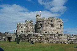
Pendennis Castle
Pendennis Castle is a Henrician castle, also known as one of Henry VIII's Device Forts, in the English county of Cornwall. It was built in 1539 for King Henry VIII to guard the entrance to the River Fal on its west bank, near Falmouth. St Mawes Castle is its opposite number on the east bank and...
, Cornwall
Cornwall
Cornwall is a unitary authority and ceremonial county of England, within the United Kingdom. It is bordered to the north and west by the Celtic Sea, to the south by the English Channel, and to the east by the county of Devon, over the River Tamar. Cornwall has a population of , and covers an area of...
and 334.8 hours at Long Ashton
Long Ashton
Long Ashton is a village and civil parish in Somerset, England. It falls within the Unitary Authority of North Somerset, a few miles south west of the city of Bristol. The parish has a population of 4,981...
, Somerset
Somerset
The ceremonial and non-metropolitan county of Somerset in South West England borders Bristol and Gloucestershire to the north, Wiltshire to the east, Dorset to the south-east, and Devon to the south-west. It is partly bounded to the north and west by the Bristol Channel and the estuary of the...
. During the winter months, which are the dullest, less than 20 hours of monthly sunshine have occasionally been recorded. In December 1998 there were 20 days without sun recorded at Yeovilton.
In general, June is the sunniest month, because the days are at their longest, and December is the dullest. The Azores high
Azores High
The Azores High is a large subtropical semi-permanent centre of high atmospheric pressure found near the Azores in the Atlantic Ocean, at the Horse latitudes...
pressure system affects the south-west of England as it extends north-eastwards towards the British Isles
British Isles
The British Isles are a group of islands off the northwest coast of continental Europe that include the islands of Great Britain and Ireland and over six thousand smaller isles. There are two sovereign states located on the islands: the United Kingdom of Great Britain and Northern Ireland and...
. The Azores is more influential in summer. The high pressure reduces cloud cover through the process of subsidence
Subsidence (atmosphere)
Subsidence in the Earth's atmosphere is most commonly caused by low temperatures: as air cools, it becomes denser and moves towards the ground, just as warm air becomes less dense and moves upwards...
. In spring and summer, the sea is cool compared to the air temperature, causing less convective cloud
Atmospheric convection
Atmospheric convection is the result of a parcel-environment instability, or temperature difference, layer in the atmosphere. Different lapse rates within dry and moist air lead to instability. Mixing of air during the day which expands the height of the planetary boundary layer leads to...
cover. The convective cloud forms more frequently inland, especially on higher ground such as Dartmoor, Exmoor and Bodmin Moor, thus reducing the amount of sunshine. Coastal areas of the south-west have more hours of sunshine.
Rainfall
Most the rainfall in the south-west is caused by Atlantic depressions or by convectionConvection
Convection is the movement of molecules within fluids and rheids. It cannot take place in solids, since neither bulk current flows nor significant diffusion can take place in solids....
. Most of the rainfall in autumn and winter is caused by the Atlantic depressions, which is when they are most active. In summer, a large proportion of the rainfall is caused by sun heating the ground leading to convection and to showers and thunderstorms.
The Isles of Scilly have annual rainfall totals of about 850–900 mm (33–35 in). Coastal areas of Cornwall and Devon typically receive 900–1,000 mm (35–39 in) of rainfall annually. The altitude increases the amount of rainfall. Highland areas are cooler, causing moist air to cool below the dew point
Dew point
The dew point is the temperature to which a given parcel of humid air must be cooled, at constant barometric pressure, for water vapor to condense into liquid water. The condensed water is called dew when it forms on a solid surface. The dew point is a saturation temperature.The dew point is...
as it rises over high ground forming clouds and then rain. Princetown is 23 kilometres (14.3 mi) from Plymouth
Plymouth
Plymouth is a city and unitary authority area on the coast of Devon, England, about south-west of London. It is built between the mouths of the rivers Plym to the east and Tamar to the west, where they join Plymouth Sound...
and 403 metres (1,322.2 ft) higher, and has double the rainfall. Areas that fall in the rain shadow
Rain shadow
A rain shadow is a dry area on the lee side of a mountainous area. The mountains block the passage of rain-producing weather systems, casting a "shadow" of dryness behind them. As shown by the diagram to the right, the warm moist air is "pulled" by the prevailing winds over a mountain...
s (lees) of higher ground have lower levels of rainfall: 800 mm (31.5 in) near Exeter
Exeter
Exeter is a historic city in Devon, England. It lies within the ceremonial county of Devon, of which it is the county town as well as the home of Devon County Council. Currently the administrative area has the status of a non-metropolitan district, and is therefore under the administration of the...
(east of Dartmoor) and 700 mm (27.6 in) in parts of central Somerset
Somerset
The ceremonial and non-metropolitan county of Somerset in South West England borders Bristol and Gloucestershire to the north, Wiltshire to the east, Dorset to the south-east, and Devon to the south-west. It is partly bounded to the north and west by the Bristol Channel and the estuary of the...
(east of Exmoor). The Mendip Hills
Mendip Hills
The Mendip Hills is a range of limestone hills to the south of Bristol and Bath in Somerset, England. Running east to west between Weston-super-Mare and Frome, the hills overlook the Somerset Levels to the south and the Avon Valley to the north...
, to the north-east of the region, receive over 1100 mm (43.3 in) per year and the Bath-Bristol
Bristol
Bristol is a city, unitary authority area and ceremonial county in South West England, with an estimated population of 433,100 for the unitary authority in 2009, and a surrounding Larger Urban Zone with an estimated 1,070,000 residents in 2007...
area receives around 800–900 mm (31–35 in).
The sea reaches its highest temperature in late summer/autumn and its lowest in late winter/spring. As a result, the highest rainfall can be expected in autumn and lowest in spring. The months with the most rainfall are in autumn and winter. Monthly rainfall can be variable. On the coast, most months have recorded less than 20 millimetre (0.78740157480315 in) and, some months, less than 10 millimetre (0.393700787401575 in) at some point. The wettest station of the region, Princetown, has recorded 7 millimetre (0.275590551181102 in) of rain during May.
The number of days with at least 1 millimetre (0.0393700787401575 in) of rainfall correlates to the pattern of quantity of rainfall. In late spring/summer, 9–10 days per month recorded rain in coastal areas, 7–9 days in the north-east and 12–13 days at high altitude (Princetown). In winter these values increase to 15–16 on the coast, 12–13 in the north-east and over 18 days in high altitude.
Very heavy rainfall-—spanning 5–15 hours—-is rare in the south-west. Such incidences include the Lynmouth disaster of 15 August 1952, caused by 228 millimetres (9 in) of rainfall falling locally on Exmoor
Exmoor
Exmoor is an area of hilly open moorland in west Somerset and north Devon in South West England, named after the main river that flows out of the district, the River Exe. The moor has given its name to a National Park, which includes the Brendon Hills, the East Lyn Valley, the Vale of Porlock and ...
over 12 hours. Also, on 8 June 1957, 203 millimetres (8 in) fell at Camelford
Camelford
Camelford is a town and civil parish in north Cornwall, United Kingdom, situated in the River Camel valley northwest of Bodmin Moor. The town is approximately ten miles north of Bodmin and is governed by Camelford Town Council....
, Cornwall and in June 1917, 243 millimetres (9.6 in) fell in 13 hours in Bruton
Bruton
Bruton is a town and civil parish in Somerset, England, situated on the River Brue seven miles south-east of Shepton Mallet, just south of Snakelake Hill and Coombe Hill, ten miles north-west of Gillingham and twelve miles south-west of Frome in the South Somerset district. The town has a...
, Somerset. The north-Cornish village of Boscastle
Boscastle
Boscastle is a village and fishing port on the north coast of Cornwall, England, in the civil parish of Forrabury and Minster. It is situated 14 miles south of Bude and 5 miles north-east of Tintagel....
was flooded
Boscastle flood of 2004
The Boscastle flood of 2004 occurred on Monday, 16 August 2004 in the two villages of Boscastle and Crackington Haven in Cornwall, England, United Kingdom. The villages suffered extensive damage after flash floods caused by an exceptional amount of rain that fell over eight hours that afternoon...
on 16 August 2004; a peak hourly rainfall of 80 millimetres (3.1 in) was recorded. Approximately 100 people had to be rescued by helicopter and 116 cars were swept out to sea.
Snowfall
SnowSnow
Snow is a form of precipitation within the Earth's atmosphere in the form of crystalline water ice, consisting of a multitude of snowflakes that fall from clouds. Since snow is composed of small ice particles, it is a granular material. It has an open and therefore soft structure, unless packed by...
fall normally occurs between November and April and short snowfalls can occur between October and May on higher ground. The snow usually only settles between the months of December and March. Snow rarely falls when temperatures are greater than 4 °C (39.2 °F) and for snow to settle temperatures must normally be lower than 4 °C (39.2 °F).
In the south-west the number of days of snowfall increases with altitude: per approximately every 100 m (328.1 ft) increase in altitude, the number of days of snow falling increases by five days. From 1979 to 2000, on average there were less than 10 days per winter in which snow fell in the islands of the south-west and the coastal areas of Devon and Cornwall, and slightly more than 10 days on average near to the Severn Estuary
Severn Estuary
The Severn Estuary is the estuary of the River Severn, the longest river in Great Britain. Its high tidal range means it has been at the centre of discussions in the UK regarding renewable energy.-Geography:...
. Inland areas received between 8–15 days of snow falling; more days of snow fall were noted particularly to the north-east. Some upland areas received, on average, over 25 days per year of snow falling.
Similarly to the ratio of days of snow falling to altitude, the number of days in which snow settles on the ground increases by five days per every 100 m (328.1 ft) increase in altitude. In the south-west, it is rare that snow settles on the ground. From 1979 to 2000 on average, lowland areas did not record any lying snow in one out of every three years. During this period, snow settled, on average, less than three days per year across the Isles of Scilly and on the coasts of Devon and Cornwall. Inland areas had an average of 5–10 days of snow lying per year and, as with the days of snow falling; this was higher towards the north-east of the region. More than 20 days of snow lying can be expected on the high grounds of Dartmoor and Exmoor.
The south-west, although the mildest region of the British Isles, has been affected by some of the most severe blizzard
Blizzard
A blizzard is a severe snowstorm characterized by strong winds. By definition, the difference between blizzard and a snowstorm is the strength of the wind. To be a blizzard, a snow storm must have winds in excess of with blowing or drifting snow which reduces visibility to 400 meters or ¼ mile or...
s. Blizzards are a rare occurrence in the United Kingdom, but can occur when especially cold easterly winds from the continent meet an Atlantic depression, causing a prolonged snowstorm and high winds. This occurred in February 1978, when 50 cm (19.7 in) of snow accumulated in inland Devon and 90 cm (35.4 in) on Dartmoor and Exmoor, causing by -2 °C winds at 25 knots (13.6 m/s). In January 1982, snow drifts were 1 m (3.3 ft) deep around the Bristol
Bristol
Bristol is a city, unitary authority area and ceremonial county in South West England, with an estimated population of 433,100 for the unitary authority in 2009, and a surrounding Larger Urban Zone with an estimated 1,070,000 residents in 2007...
area. Convective showers on 12 January 1987 left parts of Cornwall with deep snow: 35 cm (13.8 in) at Falmouth
Falmouth, Cornwall
Falmouth is a town, civil parish and port on the River Fal on the south coast of Cornwall, England, United Kingdom. It has a total resident population of 21,635.Falmouth is the terminus of the A39, which begins some 200 miles away in Bath, Somerset....
, 39 cm (15.4 in) Penzance
Penzance
Penzance is a town, civil parish, and port in Cornwall, England, in the United Kingdom. It is the most westerly major town in Cornwall and is approximately 75 miles west of Plymouth and 300 miles west-southwest of London...
and 23 cm (9.1 in) on the Isles of Scilly.
Wind
The south-west is the second most exposed area of the United Kingdom; second to western ScotlandScotland
Scotland is a country that is part of the United Kingdom. Occupying the northern third of the island of Great Britain, it shares a border with England to the south and is bounded by the North Sea to the east, the Atlantic Ocean to the north and west, and the North Channel and Irish Sea to the...
. The strong winds are caused by deep depressions across or close to the British Isles
British Isles
The British Isles are a group of islands off the northwest coast of continental Europe that include the islands of Great Britain and Ireland and over six thousand smaller isles. There are two sovereign states located on the islands: the United Kingdom of Great Britain and Northern Ireland and...
. Winds are stronger in the winter-half year, as the depressions' strength and frequency increase. The lightest mean wind speeds are in summer. The speed of peak gusts and mean wind speed follow a similar pattern throughout the year.
Mean wind speeds are generally lower to the north-east of the region and in inland areas. Yeovilton, lowland Somerset, has a mean wind speed that is two thirds that of St. Mawgan in coastal Cornwall. An increase in altitude in inland areas generally increases the mean wind speed; similar wind speeds are recorded on the highest parts of Exmoor and Dartmoor as on the coast.
The majority, and the strongest, of the winds are from the south-west and north-east as Atlantic depressions pass from west to east over the United Kingdom. When an Atlantic depression reaches the United Kingdom, winds usually blow from the south or south-west, and they change to west or north-west when the depression leaves. If a depression passes along the English Channel, strong winds can occur from the east or north-east. Due to anticyclogenesis
Anticyclogenesis
Anticyclogenesis is the development or strengthening of anticyclonic circulation in the atmosphere. It is the opposite of anticyclolysis, and has a cyclonic equivalent—cyclogenesis. Anticyclones are alternatively referred to as high pressure systems. High pressure areas form due to downward...
over Scandinavia
Scandinavia
Scandinavia is a cultural, historical and ethno-linguistic region in northern Europe that includes the three kingdoms of Denmark, Norway and Sweden, characterized by their common ethno-cultural heritage and language. Modern Norway and Sweden proper are situated on the Scandinavian Peninsula,...
, the majority of winds in Spring are from the north-east. Coastal areas of the south-west usually experience calm or very light winds that do not have a classifiable wind direction less than 6% of the time; this figure is 15% in the north-east and inland areas.
Islands and exposed headlands have the highest number of days per year of gale
Gale
A gale is a very strong wind. There are conflicting definitions of how strong a wind must be to be considered a gale. The U.S. government's National Weather Service defines a gale as 34–47 knots of sustained surface winds. Forecasters typically issue gale warnings when winds of this strength are...
-force winds (averaged out over ten consecutive minutes). A gale-force wind is defined as being at least 34 knots, which is 8 on the modern Beaufort scale
Beaufort scale
The Beaufort Scale is an empirical measure that relates wind speed to observed conditions at sea or on land. Its full name is the Beaufort Wind Force Scale.-History:...
. Gales are recorded approximately 24 days per year in the Isles of Scilly and coastal Cornwall. Further north-east and further inland, the number of days decreases. Plymouth, coastal Devon, receives 16 days; Yeovilton, Somerset, receives seven; and Long Ashton, north-west Somerset, receives four. Wind speeds can vary on local topography
Topography
Topography is the study of Earth's surface shape and features or those ofplanets, moons, and asteroids...
: wooded or urban areas sheltered by hills receive less days of gales and lower wind speeds.
On 15 December 1979, there were gusts of 91 knots at Lizard Point
Lizard Point, Cornwall
Lizard Point in Cornwall is at the southern tip of the Lizard Peninsula. It is situated half-a-mile south of Lizard village in the civil parish of Landewednack and approximately 11 miles southeast of Helston....
, Cornwall 99 knots at St Mary's, Isles of Scilly and 103 knots at Gwennap Head
Gwennap Head
Gwennap Head is the most southerly headland on the south coast of the Penwith peninsula, Cornwall, United Kingdom. The South West Coast Path closely follows the entire coastline around the headland. Its intricate and varied granite cliffs include the famous Chair Ladder crag, making it a popular...
, Cornwall. Widespread winds from the Burns' Day storm
Burns' Day storm
The Burns' Day Storm occurred on 25–26 January, 1990, over north-western Europe, and is one of the strongest storms on record. This storm has received different names as there is no official list of such events in Europe. It is also known as Daria. Starting on the birthday of Scottish poet...
on 25 January 1990 overturned vehicles and damaged buildings. It caused the highest wind speed during the 1971–2001 period to be recorded in two stations: 84 knots at Plymouth
Plymouth
Plymouth is a city and unitary authority area on the coast of Devon, England, about south-west of London. It is built between the mouths of the rivers Plym to the east and Tamar to the west, where they join Plymouth Sound...
and 85 knots at St Mawgan. 79 knots was recorded on top of a building in Bristol as well as 74 knots at Exeter International Airport and 68 knots at Yeovilton. At Plymouth, the maximum hourly mean speed was 60 knots and at Yeovilton, 45 knots. The Bristol Channel floods
Bristol Channel floods, 1607
The Bristol Channel floods, which occurred on 30 January 1607 , resulted in the drowning of a large number of people and the destruction of a large amount of farmland and livestock...
on 30 January 1607 apparently caused "many thousand" deaths and may have destroyed several small harbours. The cause of it is disputed to be either a European windstorm
European windstorm
A European windstorm is a severe cyclonic windstorm associated with areas of low atmospheric pressure that track across the North Atlantic towards northwestern Europe. They are most common in the winter months...
or a tsunami
Tsunami
A tsunami is a series of water waves caused by the displacement of a large volume of a body of water, typically an ocean or a large lake...
.
Future
According to a study by the Met OfficeMet Office
The Met Office , is the United Kingdom's national weather service, and a trading fund of the Department for Business, Innovation and Skills...
, within 40 years the average temperature is likely to increase by 2 °C (4 °F) in the south-west and the average warmerst summer day will increase by 3 °C (6 °F) to be 31 °C (87.8 °F). It predicts that the region will have one of the highest annual temperatures in the United Kingdom and there will be an estimated 53 millimetres (2.1 in) incease in winter precipitation.
The rise in temperature could lead to outdoor citrus
Citrus
Citrus is a common term and genus of flowering plants in the rue family, Rutaceae. Citrus is believed to have originated in the part of Southeast Asia bordered by Northeastern India, Myanmar and the Yunnan province of China...
cultivation being possible. Sea level rises could cause spring tides to rise over many of the region's harbour walls and an increase in sea level by about 40 centimetres (15.7 in) at Newlyn
Newlyn
Newlyn is a town and fishing port in southwest Cornwall, England, United Kingdom.Newlyn forms a conurbation with the neighbouring town of Penzance and is part of Penzance civil parish...
. Following the announcement, the government of the United Kingdom called on the local authorities and other organisation to prepare for the consequences. All major government investments will have to consider the risks as a result of future climate change.
A report from the Environment Agency
Environment Agency
The Environment Agency is a British non-departmental public body of the Department for Environment, Food and Rural Affairs and an Assembly Government Sponsored Body of the Welsh Assembly Government that serves England and Wales.-Purpose:...
said that, over the next 25 years, investment would need to double for the building and upkeep of flood defences in order to maintain the current levels of flood protection and counter the effects of climate change. Flooding from rivers and the sea currently puts 65,369 properties at risk in Devon and Cornwall, 29,577 of which are at "significant risk". Current flood defence schemes protect some of these properties from flooding. Richard Cresswell, the regional director for the Environment Agency in the south west, said:
"The latest UK climate change data shows that the risk of flooding and coastal erosion will continue to increase in future due to rising sea levels and more frequent and heavy storms."
£
Pound sterling
The pound sterling , commonly called the pound, is the official currency of the United Kingdom, its Crown Dependencies and the British Overseas Territories of South Georgia and the South Sandwich Islands, British Antarctic Territory and Tristan da Cunha. It is subdivided into 100 pence...
357 million on flood risk management in Cornwall, Devon, Dorset, Somerset, South Gloucestershire
South Gloucestershire
South Gloucestershire is a unitary district in the ceremonial county of Gloucestershire, in South West England.-History:The district was created in 1996, when the county of Avon was abolished, by the merger of former area of the districts of Kingswood and Northavon...
and Wiltshire
Wiltshire
Wiltshire is a ceremonial county in South West England. It is landlocked and borders the counties of Dorset, Somerset, Hampshire, Gloucestershire, Oxfordshire and Berkshire. It contains the unitary authority of Swindon and covers...
has been spent since 2002, which includes spending continuing into 2009/10.
Rising sea levels are likely to cause more flooding on the Somerset Levels
Somerset Levels
The Somerset Levels, or the Somerset Levels and Moors as they are less commonly but more correctly known, is a sparsely populated coastal plain and wetland area of central Somerset, South West England, between the Quantock and Mendip Hills...
. Since 1990 the drainage board has been charged with looking at the rhyne
Rhyne
A rhyne , rhine/rhyne , or reen is a drainage ditch, or canal, used to turn areas of wetland at around sea level into useful pasture....
s, cleaning them out and keeping them clear, with the Environment Agency
Environment Agency
The Environment Agency is a British non-departmental public body of the Department for Environment, Food and Rural Affairs and an Assembly Government Sponsored Body of the Welsh Assembly Government that serves England and Wales.-Purpose:...
overseeing the work. With rising sea levels the work required to maintain the current sea defences is likely to become more expensive and it has been proposed by Ian Liddell-Grainger (Bridgwater
Bridgwater (UK Parliament constituency)
Bridgwater was a parliamentary constituency represented in the House of Commons of the Parliament of the United Kingdom, until 2010 when it was replaced by the Bridgwater and West Somerset constituency...
-MP
Member of Parliament
A Member of Parliament is a representative of the voters to a :parliament. In many countries with bicameral parliaments, the term applies specifically to members of the lower house, as upper houses often have a different title, such as senate, and thus also have different titles for its members,...
), that two inland seas are created.