
North Somerset
Encyclopedia
North Somerset is a unitary authority
in England. Its area covers part of the ceremonial county
of Somerset
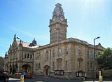
but it is administered independently of the non-metropolitan county. Its administrative headquarters is in the town hall in Weston-super-Mare
.
North Somerset borders the local government areas of Bristol
, Bath and North East Somerset
, Mendip
and Sedgemoor
. North Somerset contains the parliamentary constituencies of Weston-super-Mare
and North Somerset
.
, an isolated mediaeval church near the coast just north east of Weston-super-Mare). The district of Woodspring was formed from the municipal borough
s of Weston-super-Mare
, Clevedon
and Portishead
urban district
s, Long Ashton Rural District
, and part of Axbridge Rural District
.
Though the government proposed that the new unitary area be known as "North West Somerset" from 1 April 1996, the council voted instead to adopt the name "North Somerset" and so the name "North West Somerset" was never widely used. There remained some legal doubt as to whether the council had validly changed the name to "North Somerset", but in 2005 the council passed a resolution to put the matter beyond doubt.
s being elected at each election. Since the first election to the unitary authority in 1995, the council has either been under Conservative party
control, or no party has held a majority. Most recently the Conservatives gained a majority at the 2007 election
, and as of the 2011 election
the council is composed of the following councillors:
.
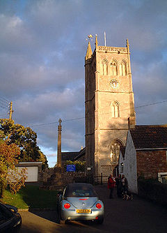
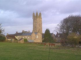
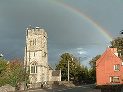
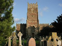
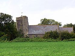
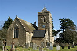
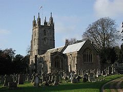
The district is noted for the religious buildings at:
In the 19th century the major port city of Bristol found that modern ships had outgrown the narrow river approach and the Port of Bristol
company began seeking locations for new docks on the coast. The first of these was Portishead Dock, which handled coal from South Wales, though this too has seen shipping outgrow its facilities. The newer Royal Portbury Dock
is noted for the large volume of car imports.
This is a chart of trend of regional gross value added
of North and North East Somerset and South Gloucestershire at current basic prices (pp. 240–253) by Office for National Statistics with figures in millions of British Pounds Sterling.
Components may not sum to totals due to rounding
includes hunting and forestry
includes energy and construction
includes financial intermediation services indirectly measured
North Somerset covers an area of around 145 square miles (375.5 km²) and has a resident population of 193,000 (1.4% BME) living in 85,000 households.
The population of North Somerset has doubled since the 1950s and is predicted to rise by 6,184 or 3.0% to 2011 and by 17% to 2026. Whilst the proportion of people in North Somerset who are under 45 is lower than the national average, population growth is predicted to be strongest in the 2034 age group. Conversely North Somerset has a 4.2% higher percentage of older people (60+ female, 65+ male) than the rest of England and Wales. This disparity increases with age with the percentage of the population over 75 years almost 30% higher than the national average, resulting in a relatively aged population.
In 2001 there were 134,132 people of working age living in North Somerset and 91,767 were in employment; an economic activity rate of 68.4%. This is very close to the economic activity rate of the West of England sub-region which was 68.8% in the 2001 census.
The 2001 census stated that 1.38% of North Somerset residents identified themselves as belonging to a visible ethnic group and a further 1.27% identified themselves as ‘white other’.
of North Somerset, provides support for 78 schools, delivering education to approximately 28,000 pupils.
They are listed at List of schools in North Somerset
Unitary authority
A unitary authority is a type of local authority that has a single tier and is responsible for all local government functions within its area or performs additional functions which elsewhere in the relevant country are usually performed by national government or a higher level of sub-national...
in England. Its area covers part of the ceremonial county
Ceremonial counties of England
The ceremonial counties are areas of England to which are appointed a Lord Lieutenant, and are defined by the government as counties and areas for the purposes of the Lieutenancies Act 1997 with reference to the metropolitan and non-metropolitan counties of England and Lieutenancies Act 1997...
of Somerset
Somerset
The ceremonial and non-metropolitan county of Somerset in South West England borders Bristol and Gloucestershire to the north, Wiltshire to the east, Dorset to the south-east, and Devon to the south-west. It is partly bounded to the north and west by the Bristol Channel and the estuary of the...
but it is administered independently of the non-metropolitan county. Its administrative headquarters is in the town hall in Weston-super-Mare
Weston-super-Mare
Weston-super-Mare is a seaside resort, town and civil parish in the unitary authority of North Somerset, which is within the ceremonial county of Somerset, England. It is located on the Bristol Channel coast, south west of Bristol, spanning the coast between the bounding high ground of Worlebury...
.
North Somerset borders the local government areas of Bristol
Bristol
Bristol is a city, unitary authority area and ceremonial county in South West England, with an estimated population of 433,100 for the unitary authority in 2009, and a surrounding Larger Urban Zone with an estimated 1,070,000 residents in 2007...
, Bath and North East Somerset
Bath and North East Somerset
Bath and North East Somerset is a unitary authority that was created on 1 April 1996 following the abolition of the County of Avon. It is part of the Ceremonial county of Somerset...
, Mendip
Mendip
Mendip is a local government district of Somerset in England. The Mendip district covers a largely rural area of ranging from the Mendip Hills through on to the Somerset Levels. It has a population of approximately 110,000...
and Sedgemoor
Sedgemoor
Sedgemoor is a low lying area of land in Somerset, England. It lies close to sea level south of the Polden Hills, historically largely marsh . The eastern part is known as King's Sedgemoor, and the western part West Sedgemoor. Sedgemoor is part of the area now known as the Somerset Levels...
. North Somerset contains the parliamentary constituencies of Weston-super-Mare
Weston-super-Mare (UK Parliament constituency)
Weston-super-Mare is a constituency represented in the House of Commons of the Parliament of the United Kingdom. It elects one Member of Parliament by the first past the post system of election.-Boundaries:...
and North Somerset
North Somerset (UK Parliament constituency)
North Somerset is a county constituency represented in the House of Commons of the Parliament of the United Kingdom. It elects one Member of Parliament by the first past the post system of election...
.
History
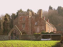
Between 1 April 1974 and 31 March 1996, it was the Woodspring district of the county of Avon (named after Woodspring PrioryWoodspring Priory
Woodspring Priory is a former Augustinian priory beside the Severn Estuary about north-east of Weston-super-Mare, North Somerset. It was founded in the early thirteenth century, and dedicated to Thomas Becket . After the Dissolution of the Monasteries, the priory was converted into a farmhouse...
, an isolated mediaeval church near the coast just north east of Weston-super-Mare). The district of Woodspring was formed from the municipal borough
Municipal borough
Municipal boroughs were a type of local government district which existed in England and Wales between 1835 and 1974, in Northern Ireland from 1840 to 1973 and in the Republic of Ireland from 1840 to 2002...
s of Weston-super-Mare
Weston-super-Mare
Weston-super-Mare is a seaside resort, town and civil parish in the unitary authority of North Somerset, which is within the ceremonial county of Somerset, England. It is located on the Bristol Channel coast, south west of Bristol, spanning the coast between the bounding high ground of Worlebury...
, Clevedon
Clevedon
Clevedon is a town and civil parish in the unitary authority of North Somerset, which covers part of the ceremonial county of Somerset, England...
and Portishead
Portishead, Somerset
Portishead is a coastal town on the Severn Estuary within the unitary authority of North Somerset, which falls within the ceremonial county of Somerset England. It has a population of 22,000, an increase of over 3,000 since the 2001 census, with a growth rate of 40 per cent, considerably in excess...
urban district
Urban district
In the England, Wales and Ireland, an urban district was a type of local government district that covered an urbanised area. Urban districts had an elected Urban District Council , which shared local government responsibilities with a county council....
s, Long Ashton Rural District
Long Ashton Rural District
Long Ashton was a rural district in Somerset, England, from 1894 to 1974.It was created in 1894 under the Local Government Act 1894.In 1974 it was abolished under the Local Government Act 1972 to become part of North Somerset....
, and part of Axbridge Rural District
Axbridge Rural District
Axbridge was a rural district in Somerset, England, from 1894 to 1974. It was named after the town of Axbridge.It was created in 1894 under the Local Government Act 1894 as a successor to the Axbridge rural sanitary district....
.
Though the government proposed that the new unitary area be known as "North West Somerset" from 1 April 1996, the council voted instead to adopt the name "North Somerset" and so the name "North West Somerset" was never widely used. There remained some legal doubt as to whether the council had validly changed the name to "North Somerset", but in 2005 the council passed a resolution to put the matter beyond doubt.
Politics
North Somerset unitary council is elected every four years, with currently 61 councillorCouncillor
A councillor or councilor is a member of a local government council, such as a city council.Often in the United States, the title is councilman or councilwoman.-United Kingdom:...
s being elected at each election. Since the first election to the unitary authority in 1995, the council has either been under Conservative party
Conservative Party (UK)
The Conservative Party, formally the Conservative and Unionist Party, is a centre-right political party in the United Kingdom that adheres to the philosophies of conservatism and British unionism. It is the largest political party in the UK, and is currently the largest single party in the House...
control, or no party has held a majority. Most recently the Conservatives gained a majority at the 2007 election
North Somerset Council election, 2007
The 2007 North Somerset Council election took place on 3 May 2007 to elect members of North Somerset Unitary Council in Somerset, England. The whole council was up for election and the Conservative Party gained overall control of the council from no overall control.-Background:Since the 2003...
, and as of the 2011 election
North Somerset Council election, 2011
The 2011 North Somerset Council election took place on 5 May 2011 to elect members of North Somerset Unitary Council in Somerset, England. The whole council was up for election and the Conservative Party stayed in overall control of the council.-Background:...
the council is composed of the following councillors:
| Party | Councillors |
|
| Conservative Party Conservative Party (UK) The Conservative Party, formally the Conservative and Unionist Party, is a centre-right political party in the United Kingdom that adheres to the philosophies of conservatism and British unionism. It is the largest political party in the UK, and is currently the largest single party in the House... |
42 | |
| Independent Independent (politician) In politics, an independent or non-party politician is an individual not affiliated to any political party. Independents may hold a centrist viewpoint between those of major political parties, a viewpoint more extreme than any major party, or they may have a viewpoint based on issues that they do... |
7 | |
| Liberal Democrats | 6 | |
| Labour Party Labour Party (UK) The Labour Party is a centre-left democratic socialist party in the United Kingdom. It surpassed the Liberal Party in general elections during the early 1920s, forming minority governments under Ramsay MacDonald in 1924 and 1929-1931. The party was in a wartime coalition from 1940 to 1945, after... |
5 | |
| Green Party Green Party of England and Wales The Green Party of England and Wales is a political party in England and Wales which follows the traditions of Green politics and maintains a strong commitment to social progressivism. It is the largest Green party in the United Kingdom, containing within it various regional divisions including... |
1 | |
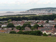
Settlements and communications
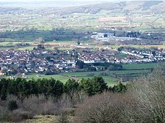
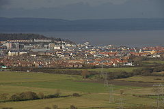
The principal towns in the district are the coastal towns of Weston-super-Mare, Portishead and Clevedon and the commuter town NailseaNailsea
Nailsea is a town in the unitary authority of North Somerset within the ceremonial county of Somerset, England, approximately to the southwest of Bristol and about to the northeast of the seaside resort of Weston-super-Mare. The nearest village is Backwell, which lies south of Nailsea on the...
.
- Abbots LeighAbbots LeighAbbots Leigh is a village and civil parish in Somerset, England, about west of the centre of Bristol.-History:The original Middle English name was Lega and the village became Abbots Leigh in the mid 12th century when Robert Fitzharding , who acquired the village as Lord of the Manor, gave the...
, - BackwellBackwellBackwell is a suburban village and civil parish in Somerset, England. It falls within the Unitary Authority of North Somerset and has a population of 5,455.It is south west of Bristol, on the A370 to Weston-super-Mare...
, BanwellBanwellBanwell is a village and civil parish on the River Banwell in the North Somerset district of Somerset, England. Its population was 2,923 according to the 2001 census.-History:...
, Barrow GurneyBarrow GurneyBarrow Gurney is a village and civil parish in Somerset, England, situated in the Unitary Authority of North Somerset on the B3130, midway between the A38 and A370 near the Long Ashton bypass and Bristol Airport, south west of Bristol city centre...
, BlagdonBlagdonBlagdon is a village and civil parish in the ceremonial county of Somerset, within the unitary authority of North Somerset, in England. It is located in the Mendip Hills, a recognised Area of Outstanding Natural Beauty. According to the 2001 census it has a population of 1,172...
, BleadonBleadonBleadon is a village and civil parish in the historic countyof Somerset, England. It is about south of Weston-super-Mare and, according to the 2001 census, has a population of 1,068.-History:...
, Bourton, BrockleyBrockley, SomersetBrockley is a village and civil parish in Somerset, England. The parish is within the Unitary authority of North Somerset, about south of Nailsea, and includes the village of Chelvey. According to the 2001 census it had a population of 271.-History:...
, BurringtonBurrington, SomersetBurrington is a small village and civil parish in Somerset, England. It is situated in the Unitary authority of North Somerset, north east of Axbridge and about east of Weston-super-Mare...
, ButcombeButcombeButcombe is a village and civil parish in Somerset, England. The village is situated just north of Blagdon Lake, in North Somerset. The parish has a population of 232 and mainly consists of family-owned farmland...
, - Chelvey, Christon, ChurchillChurchill, SomersetChurchill is a village and civil parish in Somerset, England. It is located in the unitary authority of North Somerset, on the western edge of the Mendip Hills about east of Weston-super-Mare...
, Clapton in GordanoClapton in GordanoClapton in Gordano is a village and civil parish in Somerset, England. It is situated within the Unitary authority of North Somerset on the southern side of the Gordano Valley, immediately adjacent to the M5 motorway...
, Claverham, ClevedonClevedonClevedon is a town and civil parish in the unitary authority of North Somerset, which covers part of the ceremonial county of Somerset, England...
, CleeveCleeve, SomersetCleeve is a village and civil parish in the ceremonial county of Somerset, England. It is situated within the unitary authority of North Somerset, south west of Bristol and has a population of 941 .-History:...
, CongresburyCongresburyCongresbury is a village and civil parish in Somerset, England. It is situated in the Unitary authority of North Somerset, and in 2001 had a population of 3,400. It lies on the A370, roughly equidistant between Junction 21 of the M5 and Bristol Airport, approximately south of Bristol city centre,... - Downside, DundryDundryDundry is a village and civil parish, situated on Dundry Hill in the northern part of the Mendip Hills, between Bristol and the Chew Valley Lake, in the English county of Somerset. The parish includes the hamlets of Maiden Head and East Dundry...
- East End, East Rolstone, Easton in GordanoEaston in GordanoEaston in Gordano sometimes shortened to "E-I-G" is a village and civil parish in Somerset, England. It is within the District of North Somerset and in 2001 the population was 4,719....
- FailandFailandFailand is a village in Somerset, England. It lies within the civil parish of Wraxall and Failand and the unitary authority area of North Somerset....
, Farleigh, Felton, Flax BourtonFlax BourtonFlax Bourton is a village and civil parish in Somerset, England. The parish, with a population of 659, is situated within the Unitary Authority of North Somerset, on the edge of Nailsea Moor on the A370 road south west of Bristol city centre.... - Ham Green, Hewish, HuttonHutton, SomersetHutton is a village and civil parish in Somerset, England. The parish, which has a population of 2,627, is within the Unitary Authority of North Somerset and located on the western edge of the Mendip Hills, close to Weston-super-Mare....
- Icelton
- KennKenn, SomersetKenn is a small village and civil parish in county of Somerset, England. It falls within the area of the North Somerset unitary authority. It lies on the B3133 road near Clevedon in the North Somerset Levels...
, KewstokeKewstokeKewstoke is a civil parish and village in Somerset, England, within the unitary authority of North Somerset, located next to the strip of coast called Sand Bay...
, Kingston SeymourKingston SeymourKingston Seymour is a small village and civil parish in Somerset, England. It is situated within the unitary authority of North Somerset, between Clevedon and Weston-super-Mare on the North Somerset Levels. The parish has a population of 338... - Leigh WoodsLeigh WoodsLeigh Woods is a 2 square kilometre area of woodland on the south-west side of the Avon Gorge, opposite the English city of Bristol and north of the Ashton Court estate. It has been designated as a National Nature Reserve. Small mountain biking circuits are present in the woods and the area is a...
, LockingLocking, North SomersetLocking is a village and civil parish in Somerset, England. It is a predominantly quiet residential area of North Somerset, south east of the town of Weston-super-Mare and houses a large farming contingent....
, Long AshtonLong AshtonLong Ashton is a village and civil parish in Somerset, England. It falls within the Unitary Authority of North Somerset, a few miles south west of the city of Bristol. The parish has a population of 4,981...
, Lower LangfordLower LangfordLower Langford is a village within the civil parish of Churchill in the unitary authority of North Somerset, England. It is located on the western edge of the Mendip Hills about east of Weston-super-Mare. It was a village built around estate of Sidney Hill who was the original inhabitant of the...
, Lower Failand, LoxtonLoxton, North SomersetLoxton is a village and civil parish in Somerset, England. It is close to the M5 motorway in the Unitary Authority of North Somerset. The parish includes the village of Christon and has a population of 202.-History:...
, Lulsgate Bottom - Maiden Head, Milton
- NailseaNailseaNailsea is a town in the unitary authority of North Somerset within the ceremonial county of Somerset, England, approximately to the southwest of Bristol and about to the northeast of the seaside resort of Weston-super-Mare. The nearest village is Backwell, which lies south of Nailsea on the...
, North End - PortisheadPortishead, SomersetPortishead is a coastal town on the Severn Estuary within the unitary authority of North Somerset, which falls within the ceremonial county of Somerset England. It has a population of 22,000, an increase of over 3,000 since the 2001 census, with a growth rate of 40 per cent, considerably in excess...
- Pill, PortburyPortburyPortbury is a village and civil parish in Somerset, England within the Unitary Authority of North Somerset.The parish includes the hamlet of Sheepway which is situated on the moorland at the northern edge of the Gordano valley, between the Gordano services on the M5 motorway and Portishead, near...
, PuxtonPuxtonPuxton is a village and civil parish, north west of Axbridge in the Unitary Authority of North Somerset within the ceremonial county of Somerset, England.The civil parish includes the isolated hamlets of East Hewish and West Hewish.-History:... - Redcliff Bay, RedhillRedhill, SomersetRedhill is a village in the parish of Wrington, Somerset, England, on the A38 Bridgwater Road about south of Bristol and close to Bristol International Airport. It falls within the Unitary Authority of North Somerset-History:...
, Regil, Rickford - SandfordSandford, SomersetSandford is a village between Churchill and Banwell on the A368 in North Somerset, England.The Parish of Winscombe and Sandford, centred around the Parish Church of Saint James, includes the villages of Barton, Oakridge, Sandford, Sidcot and Woodborough....
, Sheepway, SidcotWinscombeWinscombe is a village in North Somerset, England, close to the settlements of Axbridge and Cheddar, on the western edge of the Mendip Hills, south-east of Weston-super-Mare and south-west of Bristol...
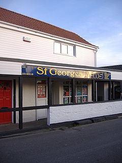
, St GeorgesSt. Georges, North SomersetSt. Georges is a civil parish and village in the unitary authority of North Somerset, England. Its population in the 2001 census was 1,214.The parish is a modern creation, the area having previously been part of the parish of Banwell....
, St Mary's Grove - TickenhamTickenhamTickenham is a village and civil parish near Clevedon and Nailsea, North Somerset, England. The parish has a population of 909. It has a primary school and a village hall, but no shops, although it formerly had a post office....
- UphillUphillUphill is a village on the edge of Weston-super-Mare in North Somerset, England.-History:There is evidence of a port at Uphill since Roman times, probably for the export of lead from the Mendip Hills...
, Upper Town - Walton in GordanoWalton in GordanoWalton in Gordano is a village and civil parish in North Somerset, England. It is situated in a small valley at the side of the south-western end of the Gordano Valley, about a mile from Clevedon...
, West Wick, West Hill, West End, West Town, Weston in GordanoWeston in GordanoWeston in Gordano is a village and civil parish in Somerset, England. It is situated in the middle of the Gordano valley on the north side, and in the Unitary Authority of North Somerset, on the road between Clevedon and Portishead...
, Weston-super-MareWeston-super-MareWeston-super-Mare is a seaside resort, town and civil parish in the unitary authority of North Somerset, which is within the ceremonial county of Somerset, England. It is located on the Bristol Channel coast, south west of Bristol, spanning the coast between the bounding high ground of Worlebury...
, Wick St. LawrenceWick St. LawrenceWick St. Lawrence is a civil parish and village in Somerset, England. It falls within the unitary authority of North Somerset. The population of the parish, which includes Bourton, in the 2001 census was 1,296.-History:...
, WinfordWinfordWinford is a small village and civil parish within the Chew Valley, Somerset, England. It is within the unitary authority of North Somerset about south of Bristol...
, WinscombeWinscombeWinscombe is a village in North Somerset, England, close to the settlements of Axbridge and Cheddar, on the western edge of the Mendip Hills, south-east of Weston-super-Mare and south-west of Bristol...
, WorleWorleWorle is a village in North Somerset that is now totally absorbed by the seaside town of Weston-super-Mare. Despite this, Worle pre-dates Weston and was mentioned in the Domesday Book of 1086. In the book, it is said that Worle was owned by Walter of Douai, and consisted of and valued at 6.5...
, WraxallWraxall, SomersetWraxall is a village in North Somerset in England. The parish of the same name also included Nailsea and Flax Bourton until 1811. It is now within the parish of Wraxall and Failand.-History:...
, WringtonWringtonWrington is a village and civil parish in North Somerset, England. It lies in the valley of the Congresbury Yeo river about east of Weston-super-Mare and south-east of Yatton. It is both a civil parish, with a population of 2,896, and an ecclesiastical parish... - YattonYattonYatton is a village and civil parish within the unitary authority of North Somerset, which falls within the ceremonial county of Somerset, England. It is located south-west of Bristol. Its population in 2001 was 9,176...
Places of interest
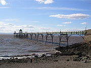
North Somerset's natural environment and coastal towns attract visitors from the nearby cities. Notable geographical features include:- Gordano ValleyGordano ValleyGordano is an area of North Somerset, in England. It has been designated as a National Nature Reserve.The name Gordano comes from Old English and is descriptive of the triangular shape of the whole valley from Clevedon to Portishead, being the ablative singular of the Latinised form of Gorden...
- Mendip HillsMendip HillsThe Mendip Hills is a range of limestone hills to the south of Bristol and Bath in Somerset, England. Running east to west between Weston-super-Mare and Frome, the hills overlook the Somerset Levels to the south and the Avon Valley to the north...
– the ridgeway forms part of the district boundary - Sand BaySand BaySand Bay is a strip of coast in North Somerset bordered to the south by Worlebury Hill and to the north by Middle Hope and Sand Point. It lies north of the seaside resort of Weston-super-Mare, and across the Bristol Channel from South Wales. It is adjacent to the village of Kewstoke.The north end...
and Sand PointSand Point, SomersetSand Point in Somerset is the peninsula stretching out from Middle Hope, which lies to the north of the village of Kewstoke, and the stretch of coastline called Sand Bay. It is owned by the National Trust and is a popular place for walking... - Worlebury HillWorlebury HillWorlebury Hill is the name given to an upland area lying between the flatlands of Weston-super-Mare and the Kewstoke area of North Somerset, England. Worlebury Hill's rises from sea level to its highest point of , and the western end of the hill forms a peninsula, jutting out into the Bristol...
- Burrington CombeBurrington CombeBurrington Combe is a carboniferous limestone gorge near the village of Burrington, on the north side of the Mendip Hills Area of Outstanding Natural Beauty, in North Somerset, England....
, Goblin CombeGoblin CombeGoblin Combe is a valley in North Somerset which stretches from Redhill, near Bristol International Airport on the A38 through to Cleeve on the A370. The combe is located at , and is a biological Site of Special Scientific Interest originally notified in 1999, with being managed as a nature...
, Brockley CombeBrockley CombeBrockley Combe is a wooded combe near the village of Brockley in North Somerset, England. The combe cuts in to the western edge of the Lulsgate Plateau, the Carboniferous limestone hills which form a northern outlier of the Mendips, south west of Bristol.... - North Somerset LevelsNorth Somerset LevelsThe North Somerset Levels is a coastal plain, an expanse of low-lying flat ground, which occupies an area between Weston-super-Mare and Bristol in North Somerset, England...
The district is noted for the religious buildings at:
- St. Paul's Church, KewstokeKewstokeKewstoke is a civil parish and village in Somerset, England, within the unitary authority of North Somerset, located next to the strip of coast called Sand Bay...
- Woodspring PrioryWoodspring PrioryWoodspring Priory is a former Augustinian priory beside the Severn Estuary about north-east of Weston-super-Mare, North Somerset. It was founded in the early thirteenth century, and dedicated to Thomas Becket . After the Dissolution of the Monasteries, the priory was converted into a farmhouse...
Parishes
| Image | Name | Status | Population | Former local authority | Coordinates | Refs |
|---|---|---|---|---|---|---|
 |
Abbots Leigh Abbots Leigh Abbots Leigh is a village and civil parish in Somerset, England, about west of the centre of Bristol.-History:The original Middle English name was Lega and the village became Abbots Leigh in the mid 12th century when Robert Fitzharding , who acquired the village as Lord of the Manor, gave the... |
Civil parish | Long Ashton Rural District Long Ashton Rural District Long Ashton was a rural district in Somerset, England, from 1894 to 1974.It was created in 1894 under the Local Government Act 1894.In 1974 it was abolished under the Local Government Act 1972 to become part of North Somerset.... |
51.46°N 2.65°W | ||
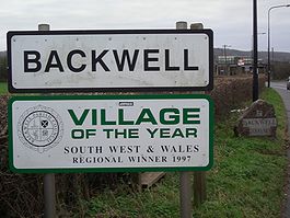 |
Backwell Backwell Backwell is a suburban village and civil parish in Somerset, England. It falls within the Unitary Authority of North Somerset and has a population of 5,455.It is south west of Bristol, on the A370 to Weston-super-Mare... |
Civil parish | Long Ashton Rural District Long Ashton Rural District Long Ashton was a rural district in Somerset, England, from 1894 to 1974.It was created in 1894 under the Local Government Act 1894.In 1974 it was abolished under the Local Government Act 1972 to become part of North Somerset.... |
51.41°N 2.73°W | ||
 |
Banwell Banwell Banwell is a village and civil parish on the River Banwell in the North Somerset district of Somerset, England. Its population was 2,923 according to the 2001 census.-History:... |
Civil parish | Axbridge Rural District Axbridge Rural District Axbridge was a rural district in Somerset, England, from 1894 to 1974. It was named after the town of Axbridge.It was created in 1894 under the Local Government Act 1894 as a successor to the Axbridge rural sanitary district.... |
51.32°N 2.86°W | ||
 |
Barrow Gurney Barrow Gurney Barrow Gurney is a village and civil parish in Somerset, England, situated in the Unitary Authority of North Somerset on the B3130, midway between the A38 and A370 near the Long Ashton bypass and Bristol Airport, south west of Bristol city centre... |
Civil parish | Long Ashton Rural District Long Ashton Rural District Long Ashton was a rural district in Somerset, England, from 1894 to 1974.It was created in 1894 under the Local Government Act 1894.In 1974 it was abolished under the Local Government Act 1972 to become part of North Somerset.... |
51.40°N 2.67°W | ||
| Blagdon Blagdon Blagdon is a village and civil parish in the ceremonial county of Somerset, within the unitary authority of North Somerset, in England. It is located in the Mendip Hills, a recognised Area of Outstanding Natural Beauty. According to the 2001 census it has a population of 1,172... |
Civil parish | Axbridge Rural District Axbridge Rural District Axbridge was a rural district in Somerset, England, from 1894 to 1974. It was named after the town of Axbridge.It was created in 1894 under the Local Government Act 1894 as a successor to the Axbridge rural sanitary district.... |
51.33°N 2.72°W | |||
 |
Bleadon Bleadon Bleadon is a village and civil parish in the historic countyof Somerset, England. It is about south of Weston-super-Mare and, according to the 2001 census, has a population of 1,068.-History:... |
Civil parish | Axbridge Rural District Axbridge Rural District Axbridge was a rural district in Somerset, England, from 1894 to 1974. It was named after the town of Axbridge.It was created in 1894 under the Local Government Act 1894 as a successor to the Axbridge rural sanitary district.... |
51.31°N 2.94°W | ||
 |
Brockley Brockley, Somerset Brockley is a village and civil parish in Somerset, England. The parish is within the Unitary authority of North Somerset, about south of Nailsea, and includes the village of Chelvey. According to the 2001 census it had a population of 271.-History:... |
Civil parish | Long Ashton Rural District Long Ashton Rural District Long Ashton was a rural district in Somerset, England, from 1894 to 1974.It was created in 1894 under the Local Government Act 1894.In 1974 it was abolished under the Local Government Act 1972 to become part of North Somerset.... |
51.39°N 2.76°W | ||
| Burrington Burrington, Somerset Burrington is a small village and civil parish in Somerset, England. It is situated in the Unitary authority of North Somerset, north east of Axbridge and about east of Weston-super-Mare... |
Civil parish | Axbridge Rural District Axbridge Rural District Axbridge was a rural district in Somerset, England, from 1894 to 1974. It was named after the town of Axbridge.It was created in 1894 under the Local Government Act 1894 as a successor to the Axbridge rural sanitary district.... |
51.33°N 2.74°W | |||
 |
Butcombe Butcombe Butcombe is a village and civil parish in Somerset, England. The village is situated just north of Blagdon Lake, in North Somerset. The parish has a population of 232 and mainly consists of family-owned farmland... |
Civil parish | Axbridge Rural District Axbridge Rural District Axbridge was a rural district in Somerset, England, from 1894 to 1974. It was named after the town of Axbridge.It was created in 1894 under the Local Government Act 1894 as a successor to the Axbridge rural sanitary district.... |
51.35°N 2.69°W | ||
 |
Churchill Churchill, Somerset Churchill is a village and civil parish in Somerset, England. It is located in the unitary authority of North Somerset, on the western edge of the Mendip Hills about east of Weston-super-Mare... |
Civil parish | Axbridge Rural District Axbridge Rural District Axbridge was a rural district in Somerset, England, from 1894 to 1974. It was named after the town of Axbridge.It was created in 1894 under the Local Government Act 1894 as a successor to the Axbridge rural sanitary district.... |
51.33°N 2.79°W | ||
 |
Clapton in Gordano | Civil parish | Long Ashton Rural District Long Ashton Rural District Long Ashton was a rural district in Somerset, England, from 1894 to 1974.It was created in 1894 under the Local Government Act 1894.In 1974 it was abolished under the Local Government Act 1972 to become part of North Somerset.... |
51.46°N 2.75°W | ||
 |
Cleeve Cleeve, Somerset Cleeve is a village and civil parish in the ceremonial county of Somerset, England. It is situated within the unitary authority of North Somerset, south west of Bristol and has a population of 941 .-History:... |
Civil parish | Long Ashton Rural District Long Ashton Rural District Long Ashton was a rural district in Somerset, England, from 1894 to 1974.It was created in 1894 under the Local Government Act 1894.In 1974 it was abolished under the Local Government Act 1972 to become part of North Somerset.... |
51.39°N 2.77°W | ||
 |
Clevedon Clevedon Clevedon is a town and civil parish in the unitary authority of North Somerset, which covers part of the ceremonial county of Somerset, England... |
Town | Clevedon Urban District Clevedon Clevedon is a town and civil parish in the unitary authority of North Somerset, which covers part of the ceremonial county of Somerset, England... |
51.43°N 2.85°W | ||
| Congresbury Congresbury Congresbury is a village and civil parish in Somerset, England. It is situated in the Unitary authority of North Somerset, and in 2001 had a population of 3,400. It lies on the A370, roughly equidistant between Junction 21 of the M5 and Bristol Airport, approximately south of Bristol city centre,... |
Civil parish | Axbridge Rural District Axbridge Rural District Axbridge was a rural district in Somerset, England, from 1894 to 1974. It was named after the town of Axbridge.It was created in 1894 under the Local Government Act 1894 as a successor to the Axbridge rural sanitary district.... |
51.37°N 2.81°W | |||
 |
Dundry Dundry Dundry is a village and civil parish, situated on Dundry Hill in the northern part of the Mendip Hills, between Bristol and the Chew Valley Lake, in the English county of Somerset. The parish includes the hamlets of Maiden Head and East Dundry... |
Civil parish | Long Ashton Rural District Long Ashton Rural District Long Ashton was a rural district in Somerset, England, from 1894 to 1974.It was created in 1894 under the Local Government Act 1894.In 1974 it was abolished under the Local Government Act 1972 to become part of North Somerset.... |
51.39°N 2.64°W | ||
 |
Easton in Gordano Easton in Gordano Easton in Gordano sometimes shortened to "E-I-G" is a village and civil parish in Somerset, England. It is within the District of North Somerset and in 2001 the population was 4,719.... |
Civil parish | Long Ashton Rural District Long Ashton Rural District Long Ashton was a rural district in Somerset, England, from 1894 to 1974.It was created in 1894 under the Local Government Act 1894.In 1974 it was abolished under the Local Government Act 1972 to become part of North Somerset.... |
51.48°N 2.69°W | ||
 |
Flax Bourton Flax Bourton Flax Bourton is a village and civil parish in Somerset, England. The parish, with a population of 659, is situated within the Unitary Authority of North Somerset, on the edge of Nailsea Moor on the A370 road south west of Bristol city centre.... |
Civil parish | Long Ashton Rural District Long Ashton Rural District Long Ashton was a rural district in Somerset, England, from 1894 to 1974.It was created in 1894 under the Local Government Act 1894.In 1974 it was abolished under the Local Government Act 1972 to become part of North Somerset.... |
51.42°N 2.71°W | ||
 |
Hutton Hutton, Somerset Hutton is a village and civil parish in Somerset, England. The parish, which has a population of 2,627, is within the Unitary Authority of North Somerset and located on the western edge of the Mendip Hills, close to Weston-super-Mare.... |
Civil parish | Axbridge Rural District Axbridge Rural District Axbridge was a rural district in Somerset, England, from 1894 to 1974. It was named after the town of Axbridge.It was created in 1894 under the Local Government Act 1894 as a successor to the Axbridge rural sanitary district.... |
51.32°N 2.93°W | ||
 |
Kenn Kenn, Somerset Kenn is a small village and civil parish in county of Somerset, England. It falls within the area of the North Somerset unitary authority. It lies on the B3133 road near Clevedon in the North Somerset Levels... |
Civil parish | Long Ashton Rural District Long Ashton Rural District Long Ashton was a rural district in Somerset, England, from 1894 to 1974.It was created in 1894 under the Local Government Act 1894.In 1974 it was abolished under the Local Government Act 1972 to become part of North Somerset.... |
51.42°N 2.84°W | ||
| Kewstoke Kewstoke Kewstoke is a civil parish and village in Somerset, England, within the unitary authority of North Somerset, located next to the strip of coast called Sand Bay... |
Civil parish | Axbridge Rural District Axbridge Rural District Axbridge was a rural district in Somerset, England, from 1894 to 1974. It was named after the town of Axbridge.It was created in 1894 under the Local Government Act 1894 as a successor to the Axbridge rural sanitary district.... |
51.37°N 2.96°W | |||
 |
Kingston Seymour Kingston Seymour Kingston Seymour is a small village and civil parish in Somerset, England. It is situated within the unitary authority of North Somerset, between Clevedon and Weston-super-Mare on the North Somerset Levels. The parish has a population of 338... |
Civil parish | Long Ashton Rural District Long Ashton Rural District Long Ashton was a rural district in Somerset, England, from 1894 to 1974.It was created in 1894 under the Local Government Act 1894.In 1974 it was abolished under the Local Government Act 1972 to become part of North Somerset.... |
51.39°N 2.86°W | ||
| – | Locking Locking, North Somerset Locking is a village and civil parish in Somerset, England. It is a predominantly quiet residential area of North Somerset, south east of the town of Weston-super-Mare and houses a large farming contingent.... |
Civil parish | Axbridge Rural District Axbridge Rural District Axbridge was a rural district in Somerset, England, from 1894 to 1974. It was named after the town of Axbridge.It was created in 1894 under the Local Government Act 1894 as a successor to the Axbridge rural sanitary district.... |
51.33°N 2.91°W | ||
 |
Long Ashton Long Ashton Long Ashton is a village and civil parish in Somerset, England. It falls within the Unitary Authority of North Somerset, a few miles south west of the city of Bristol. The parish has a population of 4,981... |
Civil parish | Long Ashton Rural District Long Ashton Rural District Long Ashton was a rural district in Somerset, England, from 1894 to 1974.It was created in 1894 under the Local Government Act 1894.In 1974 it was abolished under the Local Government Act 1972 to become part of North Somerset.... |
51.43°N 2.65°W | ||
| Loxton Loxton, North Somerset Loxton is a village and civil parish in Somerset, England. It is close to the M5 motorway in the Unitary Authority of North Somerset. The parish includes the village of Christon and has a population of 202.-History:... |
Civil parish | Axbridge Rural District Axbridge Rural District Axbridge was a rural district in Somerset, England, from 1894 to 1974. It was named after the town of Axbridge.It was created in 1894 under the Local Government Act 1894 as a successor to the Axbridge rural sanitary district.... |
51.29°N 2.89°W | |||
 |
Nailsea Nailsea Nailsea is a town in the unitary authority of North Somerset within the ceremonial county of Somerset, England, approximately to the southwest of Bristol and about to the northeast of the seaside resort of Weston-super-Mare. The nearest village is Backwell, which lies south of Nailsea on the... |
Town | Long Ashton Rural District Long Ashton Rural District Long Ashton was a rural district in Somerset, England, from 1894 to 1974.It was created in 1894 under the Local Government Act 1894.In 1974 it was abolished under the Local Government Act 1972 to become part of North Somerset.... |
51.43°N 2.76°W | ||
 |
Portbury Portbury Portbury is a village and civil parish in Somerset, England within the Unitary Authority of North Somerset.The parish includes the hamlet of Sheepway which is situated on the moorland at the northern edge of the Gordano valley, between the Gordano services on the M5 motorway and Portishead, near... |
Civil parish | Long Ashton Rural District Long Ashton Rural District Long Ashton was a rural district in Somerset, England, from 1894 to 1974.It was created in 1894 under the Local Government Act 1894.In 1974 it was abolished under the Local Government Act 1972 to become part of North Somerset.... |
51.47°N 2.72°W | ||
 |
Portishead and North Weston Portishead and North Weston Portishead and North Weston is a civil parish with a Town Council in North Somerset, England. The parish includes the coastal town of Portishead along with the village of North Weston... |
Town | Long Ashton Rural District Long Ashton Rural District Long Ashton was a rural district in Somerset, England, from 1894 to 1974.It was created in 1894 under the Local Government Act 1894.In 1974 it was abolished under the Local Government Act 1972 to become part of North Somerset.... Portishead Urban District Portishead and North Weston Portishead and North Weston is a civil parish with a Town Council in North Somerset, England. The parish includes the coastal town of Portishead along with the village of North Weston... |
51.48°N 2.77°W | ||
 |
Puxton Puxton Puxton is a village and civil parish, north west of Axbridge in the Unitary Authority of North Somerset within the ceremonial county of Somerset, England.The civil parish includes the isolated hamlets of East Hewish and West Hewish.-History:... |
Civil parish | Axbridge Rural District Axbridge Rural District Axbridge was a rural district in Somerset, England, from 1894 to 1974. It was named after the town of Axbridge.It was created in 1894 under the Local Government Act 1894 as a successor to the Axbridge rural sanitary district.... |
51.37°N 2.85°W | ||
 |
St Georges | Civil parish | Axbridge Rural District Axbridge Rural District Axbridge was a rural district in Somerset, England, from 1894 to 1974. It was named after the town of Axbridge.It was created in 1894 under the Local Government Act 1894 as a successor to the Axbridge rural sanitary district.... |
51.36°N 2.90°W | ||
| Tickenham Tickenham Tickenham is a village and civil parish near Clevedon and Nailsea, North Somerset, England. The parish has a population of 909. It has a primary school and a village hall, but no shops, although it formerly had a post office.... |
Civil parish | Axbridge Rural District Axbridge Rural District Axbridge was a rural district in Somerset, England, from 1894 to 1974. It was named after the town of Axbridge.It was created in 1894 under the Local Government Act 1894 as a successor to the Axbridge rural sanitary district.... |
51.44°N 2.80°W | |||
| Walton in Gordano Walton in Gordano Walton in Gordano is a village and civil parish in North Somerset, England. It is situated in a small valley at the side of the south-western end of the Gordano Valley, about a mile from Clevedon... |
Civil parish | Axbridge Rural District Axbridge Rural District Axbridge was a rural district in Somerset, England, from 1894 to 1974. It was named after the town of Axbridge.It was created in 1894 under the Local Government Act 1894 as a successor to the Axbridge rural sanitary district.... |
51.45°N 2.83°W | |||
 |
Weston in Gordano Weston in Gordano Weston in Gordano is a village and civil parish in Somerset, England. It is situated in the middle of the Gordano valley on the north side, and in the Unitary Authority of North Somerset, on the road between Clevedon and Portishead... |
Civil parish | Axbridge Rural District Axbridge Rural District Axbridge was a rural district in Somerset, England, from 1894 to 1974. It was named after the town of Axbridge.It was created in 1894 under the Local Government Act 1894 as a successor to the Axbridge rural sanitary district.... |
51.46°N 2.79°W | ||
 |
Weston super Mare Weston-super-Mare Weston-super-Mare is a seaside resort, town and civil parish in the unitary authority of North Somerset, which is within the ceremonial county of Somerset, England. It is located on the Bristol Channel coast, south west of Bristol, spanning the coast between the bounding high ground of Worlebury... |
Town | Axbridge Rural District Axbridge Rural District Axbridge was a rural district in Somerset, England, from 1894 to 1974. It was named after the town of Axbridge.It was created in 1894 under the Local Government Act 1894 as a successor to the Axbridge rural sanitary district.... Weston super Mare Municipal Borough Weston-super-Mare Weston-super-Mare is a seaside resort, town and civil parish in the unitary authority of North Somerset, which is within the ceremonial county of Somerset, England. It is located on the Bristol Channel coast, south west of Bristol, spanning the coast between the bounding high ground of Worlebury... |
51.35°N 2.97°W | ||
| Wick St Lawrence Wick St. Lawrence Wick St. Lawrence is a civil parish and village in Somerset, England. It falls within the unitary authority of North Somerset. The population of the parish, which includes Bourton, in the 2001 census was 1,296.-History:... |
Civil parish | Axbridge Rural District Axbridge Rural District Axbridge was a rural district in Somerset, England, from 1894 to 1974. It was named after the town of Axbridge.It was created in 1894 under the Local Government Act 1894 as a successor to the Axbridge rural sanitary district.... |
51.38°N 2.91°W | |||
| Winford Winford Winford is a small village and civil parish within the Chew Valley, Somerset, England. It is within the unitary authority of North Somerset about south of Bristol... |
Civil parish | Long Ashton Rural District Long Ashton Rural District Long Ashton was a rural district in Somerset, England, from 1894 to 1974.It was created in 1894 under the Local Government Act 1894.In 1974 it was abolished under the Local Government Act 1972 to become part of North Somerset.... |
51.38°N 2.66°W | |||
| Winscombe and Sandford Winscombe and Sandford Winscombe and Sandford is a civil parish in Somerset, England. It includes the villages of Winscombe and Sandford. The parish has a population of 4,332.-Governance:... |
Civil parish | Axbridge Rural District Axbridge Rural District Axbridge was a rural district in Somerset, England, from 1894 to 1974. It was named after the town of Axbridge.It was created in 1894 under the Local Government Act 1894 as a successor to the Axbridge rural sanitary district.... |
51.31°N 2.83°W | |||
 |
Wraxall and Failand Wraxall and Failand Wraxall and Failand is a civil parish in Somerset, England. It includes the villages of Wraxall and Failand. It has a population of 2,360.-Governance:... |
Civil parish | Long Ashton Rural District Long Ashton Rural District Long Ashton was a rural district in Somerset, England, from 1894 to 1974.It was created in 1894 under the Local Government Act 1894.In 1974 it was abolished under the Local Government Act 1972 to become part of North Somerset.... |
51.44°N 2.73°W | ||
| Wrington Wrington Wrington is a village and civil parish in North Somerset, England. It lies in the valley of the Congresbury Yeo river about east of Weston-super-Mare and south-east of Yatton. It is both a civil parish, with a population of 2,896, and an ecclesiastical parish... |
Civil parish | Axbridge Rural District Axbridge Rural District Axbridge was a rural district in Somerset, England, from 1894 to 1974. It was named after the town of Axbridge.It was created in 1894 under the Local Government Act 1894 as a successor to the Axbridge rural sanitary district.... |
51.36°N 2.76°W | |||
 |
Yatton Yatton Yatton is a village and civil parish within the unitary authority of North Somerset, which falls within the ceremonial county of Somerset, England. It is located south-west of Bristol. Its population in 2001 was 9,176... |
Civil parish | Long Ashton Rural District Long Ashton Rural District Long Ashton was a rural district in Somerset, England, from 1894 to 1974.It was created in 1894 under the Local Government Act 1894.In 1974 it was abolished under the Local Government Act 1972 to become part of North Somerset.... |
51.39°N 2.83°W |
Economy
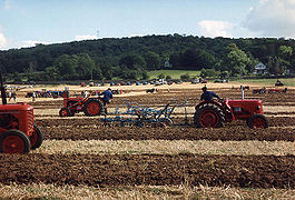
North Somerset's economy is traditionally based on agriculture, including sheep raised for wool on the Mendip Hills and dairy farming in the valleys. During the Georgian era tourism became a significant economic sector in the coastal towns, most notably Weston-super-Mare which grew from a small village to a large resort town. Though tourism declined in the mid to late-20th century, in common with most British coastal resorts, this sector of the economy has stabilised.In the 19th century the major port city of Bristol found that modern ships had outgrown the narrow river approach and the Port of Bristol
Port of Bristol
The Port of Bristol comprises the commercial, and former commercial, docks situated in and near the city of Bristol in England. The Port of Bristol Authority was the commercial title of the Bristol City, Avonmouth, Portishead and Royal Portbury Docks when they were operated by Bristol City Council,...
company began seeking locations for new docks on the coast. The first of these was Portishead Dock, which handled coal from South Wales, though this too has seen shipping outgrow its facilities. The newer Royal Portbury Dock
Royal Portbury Dock
The Royal Portbury Dock is part of the Port of Bristol, in England. It is situated near the village of Portbury on the southern side of the mouth of the Avon, where the river joins the Severn estuary — the Avonmouth Docks are on the opposite side of the Avon, within Avonmouth...
is noted for the large volume of car imports.
This is a chart of trend of regional gross value added
Gross value added
Gross Value Added ' is a measure in economics of the value of goods and services produced in an area, industry or sector of an economy...
of North and North East Somerset and South Gloucestershire at current basic prices (pp. 240–253) by Office for National Statistics with figures in millions of British Pounds Sterling.
| Year | Regional Gross Value Added | Agriculture | Industry | Services |
|---|---|---|---|---|
| 1995 | 5,916 | 125 | 1,919 | 3,872 |
| 2000 | 8,788 | 86 | 2,373 | 6,330 |
| 2003 | 10,854 | 67 | 2,873 | 7,914 |
Components may not sum to totals due to rounding
includes hunting and forestry
includes energy and construction
includes financial intermediation services indirectly measured
Demographics
| North Somerset compared | |||
|---|---|---|---|
| UK Census 2001 United Kingdom Census 2001 A nationwide census, known as Census 2001, was conducted in the United Kingdom on Sunday, 29 April 2001. This was the 20th UK Census and recorded a resident population of 58,789,194.... |
North Somerset UA | South West England South West England South West England is one of the regions of England defined by the Government of the United Kingdom for statistical and other purposes. It is the largest such region in area, covering and comprising Bristol, Gloucestershire, Somerset, Dorset, Wiltshire, Devon, Cornwall and the Isles of Scilly. ... |
England |
| Total population | 188,564 | 4,928,434 | 49,138,831 |
| Foreign born | 9.5% | 9.4% | 9.2% |
| White | 97.1% | 97.7% | 91% |
| Asian | 1.7% | 0.7% | 4.6% |
| Black | 0.9% | 0.4% | 2.3% |
| Christian | 75.0% | 74.0% | 72% |
| Muslim | 0.2% | 0.5% | 3.1% |
| Hindu | 0.1% | 0.2% | 1.1% |
| No religion | 16.6% | 16.8% | 15% |
| Over 75 years old | 9.9% | 9.3% | 7.5% |
| Unemployed | 2.1% | 2.6% | 3.3% |
North Somerset covers an area of around 145 square miles (375.5 km²) and has a resident population of 193,000 (1.4% BME) living in 85,000 households.
The population of North Somerset has doubled since the 1950s and is predicted to rise by 6,184 or 3.0% to 2011 and by 17% to 2026. Whilst the proportion of people in North Somerset who are under 45 is lower than the national average, population growth is predicted to be strongest in the 2034 age group. Conversely North Somerset has a 4.2% higher percentage of older people (60+ female, 65+ male) than the rest of England and Wales. This disparity increases with age with the percentage of the population over 75 years almost 30% higher than the national average, resulting in a relatively aged population.
In 2001 there were 134,132 people of working age living in North Somerset and 91,767 were in employment; an economic activity rate of 68.4%. This is very close to the economic activity rate of the West of England sub-region which was 68.8% in the 2001 census.
The 2001 census stated that 1.38% of North Somerset residents identified themselves as belonging to a visible ethnic group and a further 1.27% identified themselves as ‘white other’.
| Population since 1801 | |||||||||||||
| Year | 1801 | 1851 | 1901 | 1911 | 1921 | 1931 | 1941 | 1951 | 1961 | 1971 | 1981 | 1991 | 2001 |
|---|---|---|---|---|---|---|---|---|---|---|---|---|---|
| Population North Somerset | 16,670 | 33,774 | 60,066 | 68,410 | 75,276 | 82,833 | 91,967 | 102,119 | 119,509 | 139,924 | 160,353 | 179,865 | 188,556 |
Education
The Unitary AuthorityUnitary authority
A unitary authority is a type of local authority that has a single tier and is responsible for all local government functions within its area or performs additional functions which elsewhere in the relevant country are usually performed by national government or a higher level of sub-national...
of North Somerset, provides support for 78 schools, delivering education to approximately 28,000 pupils.
They are listed at List of schools in North Somerset