

Cibolo Creek
Encyclopedia
Cibolo Creek is a stream in South
Central Texas
, United States
that runs approximately 96 miles (154.5 km) from its source at Turkey Knob (in the Texas Hill Country
) near Boerne, Texas
, to its confluence with the San Antonio River
in Karnes County
. The creek serves as a tributary
of the San Antonio River and forms the easternmost boundary of its watershed.
The steam is used for both recreational and political purposes, serving as the eastern boundary of Bexar County, Texas
. A wide variety of fish and other wildlife are known to occupy the waters, and several parks have been established along its banks including Cibolo Nature Center, Boerne City Park and Jackson Nature Center. Additionally, numerous human settlements have been founded on the creek such as Boerne, Fair Oaks Ranch
, San Antonio
, Bulverde
, Bracken
, Selma
, Schertz
, Universal City
, Cibolo
, Zuehl
, New Berlin
, La Vernia
, Cestohowa
, Sutherland Springs
and Panna Maria
.
northwest of Boerne
in Kendall County, Texas
. Every second, approximately 30 cubic feet (849.5 l) of water passes through on its southeastern journey to the San Antonio River
. It has been judged as a "scenic" and "picturesque" stream, especially in the upper reaches as steady flows travel through deep canyons and rocky flats to form falls. Just ahead of its entry into Boerne, the stream is dammed to form Boerne City Lake, which provides drinking water for the town's residents. In Boerne, the creek flows through the center of town before reaching the Cibolo Nature Center, noted for its shores lined with Bald cypress trees. East of the nature center, the Cibolo Canyonlands begin, which features even deeper canyons and direct groundwater recharge. Part of this area is protected by the University of Texas at San Antonio
for environmental research purposes.
Further downstream, the creek passes through Fair Oaks Ranch
and Bulverde
. The steady flow begins to dissipate in certain areas as it approaches Camp Bullis
in Northern San Antonio
, leaving dry patches that reveal a rocky bottom. Such dry patches continue as it heads east, forming the boundary between Bexar and Comal County
. Steady flows pick up on the boundary between Bexar and Guadalupe counties
, passing through Randolph Air Force Base
.
At its lower reaches, the terrain grows flatter and less rocky, supporting oak, mesquite and juniper. As it meanders through Wilson
and Karnes counties, passing Zuehl
, New Berlin
, La Vernia
, Sutherland Springs
, and Cestohowa
, Cibolo Creek meets with the San Antonio River near the ghost town
of Helena.
of Cibolo Creek is located in the lower reaches of the Cretaceous
Glen Rose Formation
along the southeastern edge of the Edwards Plateau
. Many springs located in the upper and mid-reaches of the watershed, engage in karst
activity in the limestone
prevalent below the surface, forming such caves as Cascade Caverns and Natural Bridge Caverns
. An exchange occurs between the stream and these numerous underground springs that serve as a recharge
for the Edwards-Trinity aquifer system
. This system provides drinking water for millions of people in the surrounding area. Near the recharge zone, distributaries of the creek have carved deep canyons in the landscape of the Texas Hill Country, forming what is known as the Cibolo Canyonlands. The Cibolo Nature Center claims 1300 acre (5.3 km²; 2 sq mi) of the watershed, to protect the water quality from the hazards of rapid development and population growth.
Several streams serve as distributaries and tributaries of Cibolo Creek, and are included in the watershed. Balcones Creek, a 13 miles (20.9 km) long stream that rises in Bandera County
and acts as the boundary between Bexar and Kendall counties, is a main tributary of Cibolo Creek that converges at the meeting of Bexar, Kendall and Bandera Counties. Tributaries in the lower watershed include Martinez Creek
, a 16 miles (25.7 km) long stream with a Mesquite tree-supporting bed of clay and sandy loam, located near Windcrest
in eastern Bexar County; and Santa Clara Creek, a 19.5 miles (31.4 km) long stream in Guadalupe County near New Berlin
that supports conifers along its shores.
 Prior to European settlement, Cibolo Creek was referred to as Xoloton by the Coahuiltecan
Indians. The Tonkawa
called it Bata Coniquiyoqui, as noted by Father Damian Massanet, who referred to the creek as Santa Crecencia in 1691. It is thought that Coahuila
Governor Alonso de Leon
had one of the earliest encounters with the creek in 1689 while on the first Spanish entrada to explore the French
-claimed lands believed to lie beyond the Nueces River
. Records suggest that a camp was set up on the creek, identified as Arroyo del Leon, coined from the discovery of a dead mountain lion along the banks. Explorer Domingo Terán de los Ríos
named the creek San Ygnacio de Loyola in 1691 during an expedition and Domingo Ramón
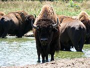
referred to it as San Xavier in 1716. The first known use of the term Cibolo came from Marqués de San Miguel de Aguayo who identified the stream as Río Cibolo, or Cibolo River in 1721. Cibolo is a Spanish and Native American term for Buffalo
, which used to inhabit the area. It is believed that Native Americans used the steep banks bluffs along the creek as hunting grounds, chasing herds of buffalo into the bed where the creatures would fall to their deaths.
Marqués de Rubí
included Cibolo Creek in his 1768 list of potential sites for posts to solidify the Spanish
hold on Texas
, and a fort called El Fuerte de Santa Cruz del Cíbolo, built along the banks of Cibolo Creek in 1734 to protect livestock from Apache Indian
attacks, was resurrected in 1771. However, the fort was destroyed without a trace in 1782, and eventually the Spanish lost the creek and Texas following the Mexican Revolution
. During the Texas Revolution
, the creek was the site of two separate skirmishes. First, in October 1835, at the beginning of the war, Captain Ben Milam was dispatched by Stephen F. Austin
to survey the unfamiliar territory toward Cibolo Creek. Milam set up camp and soon discovered the tracks of a Mexican force of about one hundred cavalrymen. Austin sent additional scouts, and one group was confronted by about ten advancing Mexican patrols. The group's Lieutenant led an offensive against the patrols, and forced the Mexicans to retreat back to San Antonio, allowing the Texans to march to Salado Creek
. One Austin-aide remarked: "this little skirmish...had a happy effect in the army...[and] was regarded as a favorable omen." The second skirmish occurred in April 1836, outside Camp Houston, a post established by Juan Seguín
on the creek banks near present day Stockdale
. Seguín set the post after being ordered to withdraw from San Antonio, with a regimen that severely lacked resources, including clothing and horses. During an exploration of the creek to find wild horses, Seguín and six men met up with hostile Tonkawas. In a brief skirmish, two of the Native Americans were killed, allowing Seguín and his men to return to camp with two additional horses.
In the late 1840s and early 1850s the communities of Selma, Sutherland Springs, Boerne, La Vernia, and Bulverde were established along the creek. Later on, Cibolo, Schertz, and Universal City were founded. These settlements dealt with torrential flood
s that cost many their homes and lives in later years. The destruction was prominently witnessed during the October 1998 Central Texas floods
, and four years later during the flood of July 2002. The San Antonio River Authority
authorized $114,599 to help clean debris from the creek in 2003, hoping to improve water quality. Above average levels of bacteria have been found in certain areas of the creek, leading to such initiatives as the Upper Cibolo Watershed Protection plan, which began in 2010. Another plan to create a Cibolo Reservoir near Stockdale aimed to control flooding and provide fresh water, met fierce opposition from local citizens concerned about the destruction of historic sites along the creek, and the loss of taxable land.
and other game, as well as separate locations for archery
and fishing. An 18 miles (29 km) section of the creek, between Oak Village North and Luxello, is classified as a class two whitewater
flow. The area is a popular camping destination, and is ideal for whitewater rafting
and kayaking
. Additional locations include Universal City Cibolo Creek Preserve area in Universal City, where a frisbee golf course has been established for play. Between Stockdale and Floresville, Cibolo Creek forms the eastern boundary of Jackson Nature Park, a 50 acres (202,343 m²) public park owned by Wilson County and operated by the San Antonio River Authority
. The park offers a looped trail network showcasing south central Texas plants, animals, and geology.
Several locations are available for fishing. According to Texas Parks and Wildlife, the following fish have been caught in the stream: Largemouth bass
, Bluegill
, Channel catfish
, Rio Grande cichlid, Longnose gar
, Green sunfish
, Sunfish hybrid
, Redbreast sunfish
, and Redear sunfish
.
South Texas
South Texas is a region of the U.S. state of Texas that lies roughly south of and including San Antonio. The southern and western boundary is the Rio Grande River, and to the east it is the Gulf of Mexico. The population of this region is about 3.7 million. The southern portion of this region is...
Central Texas
Central Texas
Central Texas , is a region in the U.S. state of Texas. It is roughly bordered by San Marcos to Fredericksburg to Waco, and to Brenham, and includes the Austin–Round Rock, Killeen-Temple-Fort Hood, Bryan-College Station, and Waco metropolitan areas...
, United States
United States
The United States of America is a federal constitutional republic comprising fifty states and a federal district...
that runs approximately 96 miles (154.5 km) from its source at Turkey Knob (in the Texas Hill Country
Texas Hill Country
The Texas Hill Country is a vernacular term applied to a region of Central Texas featuring tall rugged hills consisting of thin layers of soil atop limestone or granite. It also includes the Llano Uplift and the second largest granite monadnock in the United States, Enchanted Rock, which is located...
) near Boerne, Texas
Boerne, Texas
Boerne is a city in the Hill Country of Texas in the United States. It is the county seat of Kendall County. Boerne was named in honor of Ludwig Börne, a Jewish German author and publicist, and its population was 10, 471 in the 2010 census. The city is noted for the landmark U.S. Supreme Court...
, to its confluence with the San Antonio River
San Antonio River
The San Antonio River is a major waterway that originates in central Texas in a cluster of springs in north central San Antonio, approximately four miles north of downtown, and follows a roughly southeastern path through the state. It eventually feeds into the Guadalupe River about ten miles from...
in Karnes County
Karnes County, Texas
Karnes County is a county located in the U.S. state of Texas. As of 2000, the population was 15,446. Its county seat is Karnes City. Karnes County is named for Henry Karnes, a soldier in the Texas Revolution.-Geography:...
. The creek serves as a tributary
Tributary
A tributary or affluent is a stream or river that flows into a main stem river or a lake. A tributary does not flow directly into a sea or ocean...
of the San Antonio River and forms the easternmost boundary of its watershed.
The steam is used for both recreational and political purposes, serving as the eastern boundary of Bexar County, Texas
Bexar County, Texas
As of the census of 2000, there were 1,392,931 people, 488,942 households, and 345,681 families residing in the county. The population density was 1,117 people per square mile . There were 521,359 housing units at an average density of 418 per square mile...
. A wide variety of fish and other wildlife are known to occupy the waters, and several parks have been established along its banks including Cibolo Nature Center, Boerne City Park and Jackson Nature Center. Additionally, numerous human settlements have been founded on the creek such as Boerne, Fair Oaks Ranch
Fair Oaks Ranch, Texas
Fair Oaks Ranch is a city in Bexar, Comal, and Kendall Counties in the U.S. state of Texas. The population was 4,695 at the 2000 census. It is part of the San Antonio Metropolitan Statistical Area.-Geography:...
, San Antonio
San Antonio, Texas
San Antonio is the seventh-largest city in the United States of America and the second-largest city within the state of Texas, with a population of 1.33 million. Located in the American Southwest and the south–central part of Texas, the city serves as the seat of Bexar County. In 2011,...
, Bulverde
Bulverde, Texas
Bulverde is a city in Comal County, Texas, United States. The population was 3,761 at the 2000 census. It is part of the San Antonio Metropolitan Statistical Area.-Geography:Bulverde is located at , about 23 miles north of downtown San Antonio....
, Bracken
Bracken, Texas
Bracken is an unincorporated community in Comal County, Texas, United States. It lies along the eastern bank of Cibolo Creek, southwest of New Braunfels. The community is found in close proximity to Garden Ridge, and is included in the Greater San Antonio area....
, Selma
Selma, Texas
Selma is a city in Bexar, Comal, and Guadalupe Counties in the U.S. state of Texas. It is part of the San Antonio Metropolitan Statistical Area...
, Schertz
Schertz, Texas
Schertz is a city in Bexar, Comal, and Guadalupe counties in the U.S. state of Texas within the metropolitan area. The population was 31,465 at the 2010 census.On July 16, 2007 CNNMoney.com rated Schertz one of the best places to live in the United States...
, Universal City
Universal City, Texas
Universal City is a city in Bexar and Guadalupe Counties in the U.S. state of Texas. It borders San Antonio to the northeast, and is adjacent to Randolph Air Force Base. The population was 14,849 at the 2000 census. Through Universal City is Pat Booker Road, the commercial thoroughfare of the city...
, Cibolo
Cibolo, Texas
Cibolo is a city in Guadalupe County in the U.S. state of Texas.-Schools:The City of Cibolo is served by the Schertz-Cibolo-Universal City Independent School District .Maxine and Lutrell Watts ElementaryO.G. Wiederstein Elementary...
, Zuehl
Zuehl, Texas
Zuehl is a census-designated place in southwestern Guadalupe County, Texas, United States. It is part of the San Antonio Metropolitan Statistical Area. Located on Cibolo Creek, it lies 14 miles southwest of Seguin. The population was 346 at the 2000 census. Once known as Perryman's Crossing, it was...
, New Berlin
New Berlin, Texas
New Berlin is a city in Guadalupe County, Texas, United States. The population was 467 at the 2000 census. It is part of the San Antonio Metropolitan Statistical Area.-Geography:New Berlin is located at ....
, La Vernia
La Vernia, Texas
La Vernia is a city in Wilson County, Texas, United States. The population was 931 at the 2000 census. It is part of the San Antonio Metropolitan Statistical Area.-History:...
, Cestohowa
Cestohowa, Texas
Cestohowa is an unincorporated community in Karnes County, Texas, United States. According to the Handbook of Texas, the community had an estimated population of 110 in 2000.-Geography:...
, Sutherland Springs
Sutherland Springs, Texas
Sutherland Springs is an unincorporated community located on the old Spanish land grant of Manuel Tarin in northern Wilson County, Texas, United States. It is on U.S. Highway 87 at the intersection with Farm Road 539, about twenty-one miles east of San Antonio...
and Panna Maria
Panna Maria, Texas
Panna Maria is a small unincorporated community in Karnes County, Texas, United States. It is the oldest Polish settlement in the United States. A Franciscan missionary, Father Leopold Moczygemba, started recruiting Upper Silesians in 1852, when Silesia was part of the Kingdom of Prussia. The...
.
Course
Cibolo Creek rises in the Texas Hill CountryTexas Hill Country
The Texas Hill Country is a vernacular term applied to a region of Central Texas featuring tall rugged hills consisting of thin layers of soil atop limestone or granite. It also includes the Llano Uplift and the second largest granite monadnock in the United States, Enchanted Rock, which is located...
northwest of Boerne
Boerne, Texas
Boerne is a city in the Hill Country of Texas in the United States. It is the county seat of Kendall County. Boerne was named in honor of Ludwig Börne, a Jewish German author and publicist, and its population was 10, 471 in the 2010 census. The city is noted for the landmark U.S. Supreme Court...
in Kendall County, Texas
Kendall County, Texas
Kendall County is a county located on the Edwards Plateau in the U.S. state of Texas. In 2008 census, its population was 32,886. Its seat is Boerne....
. Every second, approximately 30 cubic feet (849.5 l) of water passes through on its southeastern journey to the San Antonio River
San Antonio River
The San Antonio River is a major waterway that originates in central Texas in a cluster of springs in north central San Antonio, approximately four miles north of downtown, and follows a roughly southeastern path through the state. It eventually feeds into the Guadalupe River about ten miles from...
. It has been judged as a "scenic" and "picturesque" stream, especially in the upper reaches as steady flows travel through deep canyons and rocky flats to form falls. Just ahead of its entry into Boerne, the stream is dammed to form Boerne City Lake, which provides drinking water for the town's residents. In Boerne, the creek flows through the center of town before reaching the Cibolo Nature Center, noted for its shores lined with Bald cypress trees. East of the nature center, the Cibolo Canyonlands begin, which features even deeper canyons and direct groundwater recharge. Part of this area is protected by the University of Texas at San Antonio
University of Texas at San Antonio
The University of Texas at San Antonio, commonly referred to as UTSA, is a state university in San Antonio, Texas. With an enrollment of more than 30,000 students, it is the third-largest of nine universities and six health institutions in the University of Texas System and the eighth-largest in...
for environmental research purposes.
Further downstream, the creek passes through Fair Oaks Ranch
Fair Oaks Ranch, Texas
Fair Oaks Ranch is a city in Bexar, Comal, and Kendall Counties in the U.S. state of Texas. The population was 4,695 at the 2000 census. It is part of the San Antonio Metropolitan Statistical Area.-Geography:...
and Bulverde
Bulverde, Texas
Bulverde is a city in Comal County, Texas, United States. The population was 3,761 at the 2000 census. It is part of the San Antonio Metropolitan Statistical Area.-Geography:Bulverde is located at , about 23 miles north of downtown San Antonio....
. The steady flow begins to dissipate in certain areas as it approaches Camp Bullis
Camp Bullis
Camp Bullis Military Training Reservation is a U.S. Army training camp located in Bexar County, Texas, just northwest of San Antonio, USA. The camp is named for Brigadier General John Lapham Bullis ,...
in Northern San Antonio
San Antonio, Texas
San Antonio is the seventh-largest city in the United States of America and the second-largest city within the state of Texas, with a population of 1.33 million. Located in the American Southwest and the south–central part of Texas, the city serves as the seat of Bexar County. In 2011,...
, leaving dry patches that reveal a rocky bottom. Such dry patches continue as it heads east, forming the boundary between Bexar and Comal County
Comal County, Texas
Comal County is a county located on the Edwards Plateau in the U.S. state of Texas. In 2010, its population was 108,472. Its seat is New Braunfels.Comal County is part of the San Antonio Metropolitan Statistical Area.-History Timeline:...
. Steady flows pick up on the boundary between Bexar and Guadalupe counties
Guadalupe County, Texas
Guadalupe County is a county located in the U.S. state of Texas. In 2000, its population was 89,023. It is named for the Guadalupe River. The seat of the county is Seguin. It was founded in 1846....
, passing through Randolph Air Force Base
Randolph Air Force Base
Randolph Air Force Base is a United States Air Force base located east-northeast of San Antonio, Texas. The base is under the jurisdiction of the 902d Mission Support Group, Air Education and Training Command ....
.
At its lower reaches, the terrain grows flatter and less rocky, supporting oak, mesquite and juniper. As it meanders through Wilson
Wilson County, Texas
Wilson County is a county located in the U.S. state of Texas. In 2000, its population was 32,408. Its county seat is Floresville. The county is named after James Charles Wilson....
and Karnes counties, passing Zuehl
Zuehl, Texas
Zuehl is a census-designated place in southwestern Guadalupe County, Texas, United States. It is part of the San Antonio Metropolitan Statistical Area. Located on Cibolo Creek, it lies 14 miles southwest of Seguin. The population was 346 at the 2000 census. Once known as Perryman's Crossing, it was...
, New Berlin
New Berlin, Texas
New Berlin is a city in Guadalupe County, Texas, United States. The population was 467 at the 2000 census. It is part of the San Antonio Metropolitan Statistical Area.-Geography:New Berlin is located at ....
, La Vernia
La Vernia, Texas
La Vernia is a city in Wilson County, Texas, United States. The population was 931 at the 2000 census. It is part of the San Antonio Metropolitan Statistical Area.-History:...
, Sutherland Springs
Sutherland Springs, Texas
Sutherland Springs is an unincorporated community located on the old Spanish land grant of Manuel Tarin in northern Wilson County, Texas, United States. It is on U.S. Highway 87 at the intersection with Farm Road 539, about twenty-one miles east of San Antonio...
, and Cestohowa
Cestohowa, Texas
Cestohowa is an unincorporated community in Karnes County, Texas, United States. According to the Handbook of Texas, the community had an estimated population of 110 in 2000.-Geography:...
, Cibolo Creek meets with the San Antonio River near the ghost town
Ghost town
A ghost town is an abandoned town or city. A town often becomes a ghost town because the economic activity that supported it has failed, or due to natural or human-caused disasters such as floods, government actions, uncontrolled lawlessness, war, or nuclear disasters...
of Helena.
Watershed
The drainage basinDrainage basin
A drainage basin is an extent or an area of land where surface water from rain and melting snow or ice converges to a single point, usually the exit of the basin, where the waters join another waterbody, such as a river, lake, reservoir, estuary, wetland, sea, or ocean...
of Cibolo Creek is located in the lower reaches of the Cretaceous
Cretaceous
The Cretaceous , derived from the Latin "creta" , usually abbreviated K for its German translation Kreide , is a geologic period and system from circa to million years ago. In the geologic timescale, the Cretaceous follows the Jurassic period and is followed by the Paleogene period of the...
Glen Rose Formation
Glen Rose Formation
The Glen Rose Formation is a shallow marine to shoreline geological formation from the lower Cretaceous period exposed over a large area from South Central to North Central Texas...
along the southeastern edge of the Edwards Plateau
Edwards Plateau
The Edwards Plateau is a region of west-central Texas which is bounded by the Balcones Fault to the south and east, the Llano Uplift and the Llano Estacado to the north, and the Pecos River and Chihuahuan Desert to the west. San Angelo, Austin, San Antonio and Del Rio roughly outline the area...
. Many springs located in the upper and mid-reaches of the watershed, engage in karst
KARST
Kilometer-square Area Radio Synthesis Telescope is a Chinese telescope project to which FAST is a forerunner. KARST is a set of large spherical reflectors on karst landforms, which are bowlshaped limestone sinkholes named after the Kras region in Slovenia and Northern Italy. It will consist of...
activity in the limestone
Limestone
Limestone is a sedimentary rock composed largely of the minerals calcite and aragonite, which are different crystal forms of calcium carbonate . Many limestones are composed from skeletal fragments of marine organisms such as coral or foraminifera....
prevalent below the surface, forming such caves as Cascade Caverns and Natural Bridge Caverns
Natural Bridge Caverns
Natural Bridge Caverns are the largest known commercial caverns in the state of Texas.The name was derived from the 20 m natural limestone slab bridge that spans the amphitheater setting of the cavern's entrance...
. An exchange occurs between the stream and these numerous underground springs that serve as a recharge
Recharge
Groundwater recharge or deep drainage or deep percolation is a hydrologic process where water moves downward from surface water to groundwater. This process usually occurs in the vadose zone below plant roots and is often expressed as a flux to the water table surface...
for the Edwards-Trinity aquifer system
Edwards Aquifer
The Edwards Aquifer is one of the most prolific artesian aquifers in the world. Located on the eastern edge of Edwards Plateau in the U.S. state of Texas, it discharges about of water a year and directly serves about two million people...
. This system provides drinking water for millions of people in the surrounding area. Near the recharge zone, distributaries of the creek have carved deep canyons in the landscape of the Texas Hill Country, forming what is known as the Cibolo Canyonlands. The Cibolo Nature Center claims 1300 acre (5.3 km²; 2 sq mi) of the watershed, to protect the water quality from the hazards of rapid development and population growth.
Several streams serve as distributaries and tributaries of Cibolo Creek, and are included in the watershed. Balcones Creek, a 13 miles (20.9 km) long stream that rises in Bandera County
Bandera County, Texas
Bandera County, formed in 1856 from Bexar and Uvalde counties, is a county located on the Edwards Plateau in the U.S. state of Texas. As of 2000, the population is 17,645. Its county seat is Bandera. Bandera is named for the Spanish word for flag...
and acts as the boundary between Bexar and Kendall counties, is a main tributary of Cibolo Creek that converges at the meeting of Bexar, Kendall and Bandera Counties. Tributaries in the lower watershed include Martinez Creek
Martinez Creek
-References:**USGS Hydrologic Unit Map - State of Texas...
, a 16 miles (25.7 km) long stream with a Mesquite tree-supporting bed of clay and sandy loam, located near Windcrest
Windcrest, Texas
Windcrest is a city in Bexar County, Texas, United States. The population was 5,105 at the 2000 census. It is part of the San Antonio Metropolitan Statistical Area.-Geography:Windcrest is located at ....
in eastern Bexar County; and Santa Clara Creek, a 19.5 miles (31.4 km) long stream in Guadalupe County near New Berlin
New Berlin, Texas
New Berlin is a city in Guadalupe County, Texas, United States. The population was 467 at the 2000 census. It is part of the San Antonio Metropolitan Statistical Area.-Geography:New Berlin is located at ....
that supports conifers along its shores.
History
Coahuiltecan
Coahuiltecan or Paikawa was a proposed language family in John Wesley Powell's 1891 classification of Native American languages that consisted of Coahuilteco and Cotoname. The proposal was expanded to include Comecrudo, Karankawa, and Tonkawa...
Indians. The Tonkawa
Tonkawa
The Tickanwa•tic Tribe , better known as the Tonkawa , are a Native American people indigenous to present-day Oklahoma and Texas. They once spoke the now-extinct Tonkawa language believed to have been a language isolate not related to any other indigenous tongues...
called it Bata Coniquiyoqui, as noted by Father Damian Massanet, who referred to the creek as Santa Crecencia in 1691. It is thought that Coahuila
Coahuila
Coahuila, formally Coahuila de Zaragoza , officially Estado Libre y Soberano de Coahuila de Zaragoza is one of the 31 states which, with the Federal District, comprise the 32 Federal Entities of Mexico...
Governor Alonso de Leon
Alonso De León
Alonso de León wasexplorer and governor, who led several expeditions into the area that is now northeastern Mexico and southern Texas.-Early life:...
had one of the earliest encounters with the creek in 1689 while on the first Spanish entrada to explore the French
France
The French Republic , The French Republic , The French Republic , (commonly known as France , is a unitary semi-presidential republic in Western Europe with several overseas territories and islands located on other continents and in the Indian, Pacific, and Atlantic oceans. Metropolitan France...
-claimed lands believed to lie beyond the Nueces River
Nueces River
The Nueces River is a river in the U.S. state of Texas, approximately long. It drains a region in central and southern Texas southeastward into the Gulf of Mexico. It is the southernmost major river in Texas northeast of the Rio Grande...
. Records suggest that a camp was set up on the creek, identified as Arroyo del Leon, coined from the discovery of a dead mountain lion along the banks. Explorer Domingo Terán de los Ríos
Domingo Terán de los Ríos
Domingo Terán de los Ríos served as the first governor of Spanish Texas from 1691 to 1692.-Previous service:Terán served the Spanish crown in Peru for two decades. He came to Mexico in 1681, and was governor of the province of Sonora y Sinaloa for approximately five years...
named the creek San Ygnacio de Loyola in 1691 during an expedition and Domingo Ramón
Domingo Ramón
Domingo Jesús Ramón Menargues is a retired long-distance runner from Spain, known for winning the bronze medal in the men's 3000 m steeplechase event at the 1982 European Championships in Athens, Greece. He represented his native country in two Summer Olympics...
referred to it as San Xavier in 1716. The first known use of the term Cibolo came from Marqués de San Miguel de Aguayo who identified the stream as Río Cibolo, or Cibolo River in 1721. Cibolo is a Spanish and Native American term for Buffalo
American Bison
The American bison , also commonly known as the American buffalo, is a North American species of bison that once roamed the grasslands of North America in massive herds...
, which used to inhabit the area. It is believed that Native Americans used the steep banks bluffs along the creek as hunting grounds, chasing herds of buffalo into the bed where the creatures would fall to their deaths.
Marqués de Rubí
Marqués de Rubí
Cayetano Pignatelli, 3rd Marquis of Rubí, , was a Spanish nobleman and military figure who played an important role in determining Spanish policy towards Texas and Mexico. He abandoned the east Texas colonies in the 18th century....
included Cibolo Creek in his 1768 list of potential sites for posts to solidify the Spanish
Spain
Spain , officially the Kingdom of Spain languages]] under the European Charter for Regional or Minority Languages. In each of these, Spain's official name is as follows:;;;;;;), is a country and member state of the European Union located in southwestern Europe on the Iberian Peninsula...
hold on Texas
Texas
Texas is the second largest U.S. state by both area and population, and the largest state by area in the contiguous United States.The name, based on the Caddo word "Tejas" meaning "friends" or "allies", was applied by the Spanish to the Caddo themselves and to the region of their settlement in...
, and a fort called El Fuerte de Santa Cruz del Cíbolo, built along the banks of Cibolo Creek in 1734 to protect livestock from Apache Indian
Apache
Apache is the collective term for several culturally related groups of Native Americans in the United States originally from the Southwest United States. These indigenous peoples of North America speak a Southern Athabaskan language, which is related linguistically to the languages of Athabaskan...
attacks, was resurrected in 1771. However, the fort was destroyed without a trace in 1782, and eventually the Spanish lost the creek and Texas following the Mexican Revolution
Mexican Revolution
The Mexican Revolution was a major armed struggle that started in 1910, with an uprising led by Francisco I. Madero against longtime autocrat Porfirio Díaz. The Revolution was characterized by several socialist, liberal, anarchist, populist, and agrarianist movements. Over time the Revolution...
. During the Texas Revolution
Texas Revolution
The Texas Revolution or Texas War of Independence was an armed conflict between Mexico and settlers in the Texas portion of the Mexican state Coahuila y Tejas. The war lasted from October 2, 1835 to April 21, 1836...
, the creek was the site of two separate skirmishes. First, in October 1835, at the beginning of the war, Captain Ben Milam was dispatched by Stephen F. Austin
Stephen F. Austin
Stephen Fuller Austin was born in Virginia and raised in southeastern Missouri. He was known as the Father of Texas, led the second, but first legal and ultimately successful colonization of the region by bringing 300 families from the United States. The capital of Texas, Austin in Travis County,...
to survey the unfamiliar territory toward Cibolo Creek. Milam set up camp and soon discovered the tracks of a Mexican force of about one hundred cavalrymen. Austin sent additional scouts, and one group was confronted by about ten advancing Mexican patrols. The group's Lieutenant led an offensive against the patrols, and forced the Mexicans to retreat back to San Antonio, allowing the Texans to march to Salado Creek
Salado Creek
Salado Creek is a waterway in San Antonio that runs from Northern Bexar County for about to the San Antonio River near Buena Vista.-Watershed:...
. One Austin-aide remarked: "this little skirmish...had a happy effect in the army...[and] was regarded as a favorable omen." The second skirmish occurred in April 1836, outside Camp Houston, a post established by Juan Seguín
Juan Seguín
Juan Nepomuceno Seguín was a 19th-century Texas Senator, Mayor, Judge, and Justice of the Peace and a prominent participant in the Texas Revolution.-Early life and family:...
on the creek banks near present day Stockdale
Stockdale, Texas
Stockdale is a city in Wilson County, Texas, United States. The population was 1,398 at the 2000 census. It is part of the San Antonio Metropolitan Statistical Area.-Geography:Stockdale is located at ....
. Seguín set the post after being ordered to withdraw from San Antonio, with a regimen that severely lacked resources, including clothing and horses. During an exploration of the creek to find wild horses, Seguín and six men met up with hostile Tonkawas. In a brief skirmish, two of the Native Americans were killed, allowing Seguín and his men to return to camp with two additional horses.
In the late 1840s and early 1850s the communities of Selma, Sutherland Springs, Boerne, La Vernia, and Bulverde were established along the creek. Later on, Cibolo, Schertz, and Universal City were founded. These settlements dealt with torrential flood
Flood
A flood is an overflow of an expanse of water that submerges land. The EU Floods directive defines a flood as a temporary covering by water of land not normally covered by water...
s that cost many their homes and lives in later years. The destruction was prominently witnessed during the October 1998 Central Texas floods
October 1998 Central Texas floods
The October 1998 Texas Flooding was a flood event that occurred across parts of South Texas and Southeast Texas on the weekend of October 17 and October 18, 1998. The storm that caused it was one of the costliest in the recorded meteorological history of the United States, bringing rainfall of over...
, and four years later during the flood of July 2002. The San Antonio River Authority
San Antonio River Authority
The San Antonio River Authority or SARA was formed in 1937 by the Texas legislature. Its main concerns are water supply and water conservation in the San Antonio River basin in Bexar, Goliad, Karnes, and Wilson counties...
authorized $114,599 to help clean debris from the creek in 2003, hoping to improve water quality. Above average levels of bacteria have been found in certain areas of the creek, leading to such initiatives as the Upper Cibolo Watershed Protection plan, which began in 2010. Another plan to create a Cibolo Reservoir near Stockdale aimed to control flooding and provide fresh water, met fierce opposition from local citizens concerned about the destruction of historic sites along the creek, and the loss of taxable land.
Recreation
Several areas along the creek have been established for recreational use. Boerne City Park in Boerne, provides trails for hiking, nature walks and horseback riding, and is a part of the larger Cibolo Nature Center. Camp Bullis, a military training ground found along the stream in north Bexar County, allows hunting for deerDeer
Deer are the ruminant mammals forming the family Cervidae. Species in the Cervidae family include white-tailed deer, elk, moose, red deer, reindeer, fallow deer, roe deer and chital. Male deer of all species and female reindeer grow and shed new antlers each year...
and other game, as well as separate locations for archery
Archery
Archery is the art, practice, or skill of propelling arrows with the use of a bow, from Latin arcus. Archery has historically been used for hunting and combat; in modern times, however, its main use is that of a recreational activity...
and fishing. An 18 miles (29 km) section of the creek, between Oak Village North and Luxello, is classified as a class two whitewater
Whitewater
Whitewater is formed in a rapid, when a river's gradient increases enough to disturb its laminar flow and create turbulence, i.e. form a bubbly, or aerated and unstable current; the frothy water appears white...
flow. The area is a popular camping destination, and is ideal for whitewater rafting
Rafting
Rafting or white water rafting is a challenging recreational outdoor activity using an inflatable raft to navigate a river or other bodies of water. This is usually done on white water or different degrees of rough water, in order to thrill and excite the raft passengers. The development of this...
and kayaking
Kayaking
Kayaking is the use of a kayak for moving across water. Kayaking and canoeing are also known as paddling. Kayaking is distinguished from canoeing by the sitting position of the paddler and the number of blades on the paddle...
. Additional locations include Universal City Cibolo Creek Preserve area in Universal City, where a frisbee golf course has been established for play. Between Stockdale and Floresville, Cibolo Creek forms the eastern boundary of Jackson Nature Park, a 50 acres (202,343 m²) public park owned by Wilson County and operated by the San Antonio River Authority
San Antonio River Authority
The San Antonio River Authority or SARA was formed in 1937 by the Texas legislature. Its main concerns are water supply and water conservation in the San Antonio River basin in Bexar, Goliad, Karnes, and Wilson counties...
. The park offers a looped trail network showcasing south central Texas plants, animals, and geology.
Several locations are available for fishing. According to Texas Parks and Wildlife, the following fish have been caught in the stream: Largemouth bass
Largemouth bass
The largemouth bass is a species of black bass in the sunfish family native to North America . It is also known as widemouth bass, bigmouth, black bass, bucketmouth, Potter's fish, Florida bass, Florida largemouth, green bass, green trout, linesides, Oswego bass, southern largemouth...
, Bluegill
Bluegill
The Bluegill is a species of freshwater fish sometimes referred to as bream, brim, or copper nose. It is a member of the sunfish family Centrarchidae of the order Perciformes.-Range and distribution:...
, Channel catfish
Channel catfish
Channel catfish, Ictalurus punctatus, is North America's most numerous catfish species. It is the official fish of Missouri, Iowa, Nebraska, Kansas, and Tennessee, and is informally referred to as a "channel cat". In the United States they are the most fished catfish species with approximately 8...
, Rio Grande cichlid, Longnose gar
Longnose gar
The longnose gar, Lepisosteus osseus, is a primitive ray-finned fish of the gar family. It is also known as the needlenose gar.- Description :...
, Green sunfish
Green sunfish
The green sunfish is a species of freshwater fish in the sunfish family of order Perciformes. A panfish popular with anglers, the green sunfish is also kept as an aquarium fish by hobbyists. They are usually caught by accident, while fishing for other game fish...
, Sunfish hybrid
Sunfish
-Saltwater fishes:*Molidae, family of Ocean Sunfishes*Opah, family Lampridae; two species-Freshwater fishes:* Pygmy sunfish, six members of the genus Elassoma* Centrarchidae, a perciform family of about 27 species...
, Redbreast sunfish
Redbreast sunfish
The redbreast sunfish is a species of freshwater fish in the sunfish family of order Perciformes. The type species of its genus, it is native to the river systems of eastern Canada and the United States....
, and Redear sunfish
Redear sunfish
The redear sunfish , also known as the shellcracker, Georgia bream, cherry gill, chinquapin, improved bream, rouge ear sunfish and sun perch, is native to the southeastern United States, but since it is a popular sport fish it has been introduced to bodies of water all over North America...
.