
Karnes County, Texas
Encyclopedia
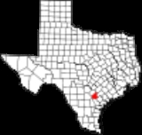
Karnes County is a county located in the U.S. state
of Texas
. As of 2000, the population was 15,446. Its county seat
is Karnes City
. Karnes County is named for Henry Karnes, a soldier in the Texas Revolution
.
, the county has a total area of 754 square miles (1,952.9 km²), of which 750 square miles (1,942.5 km²) is land and 3 square miles (7.8 km²) (0.43%) is water.
of 2000, there were 15,446 people, 4,454 households, and 3,246 families residing in the county. The population density
was 21 people per square mile (8/km²). There were 5,479 housing units at an average density of 7 per square mile (3/km²). The racial makeup of the county was 68.55% White
, 10.79% Black or African American
, 0.68% Native American
, 0.43% Asian American
, 0.06% Pacific Islander
, 17.23% of other races, and 2.26% of two or more races
. 47.42% of the population were Hispanic or Latino American
of any race.
There were 4,454 households out of which 34.00% had children under the age of 18 living with them, 53.60% were married couples
living together, 13.70% had a female householder with no husband present, and 27.10% were non-families. 24.40% of all households were made up of individuals and 13.60% had someone living alone who was 65 years of age or older. The average household size was 2.66 and the average family size was 3.15.
In the county, the population was spread out with 21.80% under the age of 18, 11.50% from 18 to 24, 34.20% from 25 to 44, 18.20% from 45 to 64, and 14.40% who were 65 years of age or older. The median age was 34 years. For every 100 females there were 146.20 males. For every 100 females age 18 and over, there were 162.50 males.
The median income for a household in the county was $26,526, and the median income for a family was $30,565. Males had a median income of $27,260 versus $19,367 for females. The per capita income
for the county was $13,603. About 18.50% of families and 21.90% of the population were below the poverty line, including 29.10% of those under age 18 and 20.50% of those age 65 or over.
U.S. state
A U.S. state is any one of the 50 federated states of the United States of America that share sovereignty with the federal government. Because of this shared sovereignty, an American is a citizen both of the federal entity and of his or her state of domicile. Four states use the official title of...
of Texas
Texas
Texas is the second largest U.S. state by both area and population, and the largest state by area in the contiguous United States.The name, based on the Caddo word "Tejas" meaning "friends" or "allies", was applied by the Spanish to the Caddo themselves and to the region of their settlement in...
. As of 2000, the population was 15,446. Its county seat
County seat
A county seat is an administrative center, or seat of government, for a county or civil parish. The term is primarily used in the United States....
is Karnes City
Karnes City, Texas
Karnes City is a city in Karnes County, Texas, United States. The population was 3,457 at the 2000 census. It is the county seat of Karnes County. The town was named after Henry Karnes of the Texas Revolution. Karnes is some twenty-five miles south of Floresville on U.S...
. Karnes County is named for Henry Karnes, a soldier in the Texas Revolution
Texas Revolution
The Texas Revolution or Texas War of Independence was an armed conflict between Mexico and settlers in the Texas portion of the Mexican state Coahuila y Tejas. The war lasted from October 2, 1835 to April 21, 1836...
.
Geography
According to the U.S. Census BureauUnited States Census Bureau
The United States Census Bureau is the government agency that is responsible for the United States Census. It also gathers other national demographic and economic data...
, the county has a total area of 754 square miles (1,952.9 km²), of which 750 square miles (1,942.5 km²) is land and 3 square miles (7.8 km²) (0.43%) is water.
Major highways
 U.S. Highway 183
 State Highway 72State Highway 72 (Texas)State Highway 72 or SH 72 is a Texas state highway that runs from near Fowlerton to near Cuero.-History:SH 72 was originally proposed in 1926 from Kenedy to Carmine, absorbing previously designated SH 3B. By 1939, it had been readjusted, with the section north of Cuero transferred to U.S. Highway...
 State Highway 80
 State Highway 123State Highway 123 (Texas)State Highway 123 is a north–south state highway that runs from Interstate 35 in San Marcos to US 181 in Karnes City. The route was initially proposed in 1928 and has had minimal changes to its routing since then.-Route description:...
 State Highway 239State Highway 239 (Texas)State Highway 239 or SH 239 is a Texas state highway that runs from Kenedy southwestward to Austwell. The route was designated in 1939, and was extended twice, once in 1966 from U.S. Highway 183 to U.S. Highway 77 and again in 1976 it was extended southeast, replacing SH 113.-Junction list:...
Adjacent counties
- Gonzales CountyGonzales County, TexasGonzales County is a county located in the U.S. state of Texas. In 2000, its population was 18,628. It is named for its seat, the city of Gonzales.-History Timeline:* Paleo-Indians Hunter-gatherers, and later Coahuiltecan, Tonkawa, Karankawa...
(northeast) - DeWitt CountyDeWitt County, TexasDeWitt County is a county located in the U.S. state of Texas. In 2000, its population was 20,013. DeWitt County is named for Green DeWitt, who founded an early colony in Texas. The seat of the county is Cuero. It was founded in 1846.-Geography:...
(east) - Goliad County (southeast)
- Bee CountyBee County, TexasBee County is a county located in the U.S. state of Texas. Bee County was founded December 8, 1857. As of 2010, the population was 31,861. Its county seat is Beeville. Bee County is named for Barnard E...
(south) - Live Oak County (southwest)
- Atascosa County (west)
- Wilson CountyWilson County, TexasWilson County is a county located in the U.S. state of Texas. In 2000, its population was 32,408. Its county seat is Floresville. The county is named after James Charles Wilson....
(northwest)
Demographics
As of the censusCensus
A census is the procedure of systematically acquiring and recording information about the members of a given population. It is a regularly occurring and official count of a particular population. The term is used mostly in connection with national population and housing censuses; other common...
of 2000, there were 15,446 people, 4,454 households, and 3,246 families residing in the county. The population density
Population density
Population density is a measurement of population per unit area or unit volume. It is frequently applied to living organisms, and particularly to humans...
was 21 people per square mile (8/km²). There were 5,479 housing units at an average density of 7 per square mile (3/km²). The racial makeup of the county was 68.55% White
White American
White Americans are people of the United States who are considered or consider themselves White. The United States Census Bureau defines White people as those "having origins in any of the original peoples of Europe, the Middle East, or North Africa...
, 10.79% Black or African American
African American
African Americans are citizens or residents of the United States who have at least partial ancestry from any of the native populations of Sub-Saharan Africa and are the direct descendants of enslaved Africans within the boundaries of the present United States...
, 0.68% Native American
Native Americans in the United States
Native Americans in the United States are the indigenous peoples in North America within the boundaries of the present-day continental United States, parts of Alaska, and the island state of Hawaii. They are composed of numerous, distinct tribes, states, and ethnic groups, many of which survive as...
, 0.43% Asian American
Asian American
Asian Americans are Americans of Asian descent. The U.S. Census Bureau definition of Asians as "Asian” refers to a person having origins in any of the original peoples of the Far East, Southeast Asia, or the Indian subcontinent, including, for example, Cambodia, China, India, Indonesia, Japan,...
, 0.06% Pacific Islander
Pacific Islander
Pacific Islander , is a geographic term to describe the indigenous inhabitants of any of the three major sub-regions of Oceania: Polynesia, Melanesia and Micronesia.According to the Encyclopædia Britannica, these three regions, together with their islands consist of:Polynesia:...
, 17.23% of other races, and 2.26% of two or more races
Multiracial American
Multiracial Americans, US residents who identify themselves as of "two or more races", were numbered at around 9 million, or 2.9% of the population, in the census of 2010. However there is considerable evidence that the real number is far higher. Prior to the mid-20th century many people hid their...
. 47.42% of the population were Hispanic or Latino American
Hispanic and Latino Americans
Hispanic or Latino Americans are Americans with origins in the Hispanic countries of Latin America or in Spain, and in general all persons in the United States who self-identify as Hispanic or Latino.1990 Census of Population and Housing: A self-designated classification for people whose origins...
of any race.
There were 4,454 households out of which 34.00% had children under the age of 18 living with them, 53.60% were married couples
Marriage
Marriage is a social union or legal contract between people that creates kinship. It is an institution in which interpersonal relationships, usually intimate and sexual, are acknowledged in a variety of ways, depending on the culture or subculture in which it is found...
living together, 13.70% had a female householder with no husband present, and 27.10% were non-families. 24.40% of all households were made up of individuals and 13.60% had someone living alone who was 65 years of age or older. The average household size was 2.66 and the average family size was 3.15.
In the county, the population was spread out with 21.80% under the age of 18, 11.50% from 18 to 24, 34.20% from 25 to 44, 18.20% from 45 to 64, and 14.40% who were 65 years of age or older. The median age was 34 years. For every 100 females there were 146.20 males. For every 100 females age 18 and over, there were 162.50 males.
The median income for a household in the county was $26,526, and the median income for a family was $30,565. Males had a median income of $27,260 versus $19,367 for females. The per capita income
Per capita income
Per capita income or income per person is a measure of mean income within an economic aggregate, such as a country or city. It is calculated by taking a measure of all sources of income in the aggregate and dividing it by the total population...
for the county was $13,603. About 18.50% of families and 21.90% of the population were below the poverty line, including 29.10% of those under age 18 and 20.50% of those age 65 or over.
Cities and towns
- CestohowaCestohowa, TexasCestohowa is an unincorporated community in Karnes County, Texas, United States. According to the Handbook of Texas, the community had an estimated population of 110 in 2000.-Geography:...
- EcletoEcleto, TexasEcleto is an unincorporated community in Karnes County, Texas, United States. It is located along FM 627, approximately six miles southeast of Gillett. According to the Handbook of Texas, the community had an estimated population of 22 in 2000.-External links:...
- Falls CityFalls City, TexasFalls City, a mile southeast of the Wilson county line and seven miles northwest of Karnes City in northern Karnes County, owes its development to the railroad...
- GillettGillett, TexasGillett is an unincorporated community in Karnes County, Texas, United States. According to the Handbook of Texas, the community had an estimated population of 120 in 2000....
- HelenaHelena, TexasHelena is a ghost town in Texas located approximately southeast of San Antonio in Karnes County. The seat of Karnes County from 1854 to 1894, Helena was once known as the self-proclaimed "toughest town on earth" in the mid-19th century...
(ghost townGhost townA ghost town is an abandoned town or city. A town often becomes a ghost town because the economic activity that supported it has failed, or due to natural or human-caused disasters such as floods, government actions, uncontrolled lawlessness, war, or nuclear disasters...
) - HobsonHobson, TexasHobson is an unincorporated community in Karnes County, Texas, United States. According to the Handbook of Texas, the community had an estimated population of 135 in 2000.- External links :...
- Karnes CityKarnes City, TexasKarnes City is a city in Karnes County, Texas, United States. The population was 3,457 at the 2000 census. It is the county seat of Karnes County. The town was named after Henry Karnes of the Texas Revolution. Karnes is some twenty-five miles south of Floresville on U.S...
- KenedyKenedy, TexasKenedy is a city in Karnes County, Texas, United States, named for Mifflin Kenedy, who bought and wanted to develop a new town that would carry his name...
- Panna MariaPanna Maria, TexasPanna Maria is a small unincorporated community in Karnes County, Texas, United States. It is the oldest Polish settlement in the United States. A Franciscan missionary, Father Leopold Moczygemba, started recruiting Upper Silesians in 1852, when Silesia was part of the Kingdom of Prussia. The...
- RungeRunge, TexasRunge is a town in Karnes County, Texas, United States. The population was 1,080 at the 2000 census.-Geography:Runge is located at .According to the United States Census Bureau, the town has a total area of , all of it land....
- WintergreenWintergreen, TexasWintergreen is a ghost town in northeastern Karnes County, Texas, United States. It once stood at the intersection of the Victoria-San Antonio Roads and the lower Helena-Gonzales Roads. Wintergreen appeared on maps from 1858 to 1868, including an 1865 Civil War map.-Notes:...
(ghost town)
See also
- National Register of Historic Places listings in Karnes County, Texas