

Chad Basin
Encyclopedia
The Chad Basin, also known as the Lake Chad Basin, is a large lowland area in north-central Africa
. In all directions from the center of this area the elevation changes are gentle. The Chad Basin is an endorheic
(closed) basin - its water does not flow into any ocean
. It has a long history of human settlement, and for a long time was an important crossroads for the Trans-Saharan trade
from north to south and west to east in Africa. The first known developed civilization in the northern area of the Chad Basin was that of the Garamantes
during the Roman Empire
; the second was the Sao civilization in the 6th century, located south of Lake Chad
.
The most significant feature inside the basin is Lake Chad. The lake has been known outside Africa since the Middle Ages. However, despite the region's important role in the development of cultures and history in northern and central Africa, social scientists have recently discovered that it is a rich and promising area for research. In 17th century maps, the lake was designated as Borno Lake and was a mystery to Western scientists. The next reports about this area came from the German Heinrich Barth
in the middle of the 19th century. He was the first to report rock art
in the northern mountainous areas of the basin. This was the first time that Western scientists had heard of a wet paleoclimate
in the Sahara
desert and the Chad Basin.
The existence of Lake Chad has contributed to the development of peoples, flora, and fauna in this region for many thousands of years. As a source of water between the desert and the savannah, the region has attracted many immigrants, explorers, and adventurers. The annual fluctuation of the lake's water level, and the floods which are associated with this cyclical change, opened opportunities for the development of cultures and nations as well as a place of refuge and protection. The Chad Basin served as a region in which ruling dynasties could develop new political formations with momentum that carried them far beyond this region. However, at the same time, the region was a natural barrier that prevented greater trade and interaction.
The Chad Basin is surrounded by high mountain ranges which rise up to the highland of the North Equatorial Plateau (known in some countries as the Asande Barrier). This plateau includes parts of the Adamawa Plateau
in the west and the Bongo Massif
in the east.
In the east, the Chad Basin extends to the 3088 m high Jebel Marra
in Darfur
. In the northeast, the basin -- known as the Ennedi Plateau
-- rises to 1450 m. In the north of the basin the volcanic mountains of Tibesti
are located, with 3415 meter high Emi Koussi being the highest point of the central Sahara; to the west lies the Djado Plateau
. The border in the northwest is marked by the mountains of Tassili n'Ajjer
in Algeria, the highest peak being Jebel Azao at 2158 meters. The western boundary is formed by the Aïr Mountains
and the Termit Massif
in Niger
. In the southwestern Chad Basin the Jos Plateau
, the Biu Plateau
and the Mandara Mountains
mark the geographical boundary. In the center of the Chad Basin is the Bodélé Depression
, which is also the deepest part of the basin, about 155 meters above sea level. Lake Chad is 275 meters above sea level.
, Niger
, Nigeria
, Cameroon
, Central African Republic
(CAR), Algeria
, Libya
, and Sudan
. The biggest part of the basin lies in Chad, around 1,123 million km² covering the center. The western part, 674,000 km², is in Niger. In the north and northwest 91,000 km² are in Algeria and 5,100 km² in Libya. In the southwest there are 179,000 km² in Nigeria and 47,400 km² in Cameroon. The southern part of the basin, 216,000 km², is in the territory of the Central African Republic, and the eastern part, 97,700 km², is in the Islamic Republic of Sudan.
(LCBC) was created on 22 May 1964 and is headquartered in Fort Lamy, now N'Djamena
. It was founded by Cameroon, Niger, Nigeria and Chad. The LCBC now has six country members: Chad, Central African Republic, Cameroon, Nigeria, Niger, and since April 2007, Libya
. Sudan
has an observer status. The commission is responsible for regulating and monitoring the use of water and other natural resources within the Lake Chad Basin. One of its sub-divisions, the Basin Committee for Strategic Planning (BCSP), coordinates local activities among the member states.
The LCBC controls and monitors the hydroactive regions in the Chad Basin and the so-called conventional basin. The initial conventional basin consisted of approximately 427,500 km² of the total area of the Chad basin in 1964. This definition excludes most of the terminal depression consisting of desert that provides little or no effective hydrological contribution to the conventional basin. This was subsequently expanded to include additional watersheds in northern Nigeria, southern Chad, and northern Central African Republic, with a current total area of 967,000 km².
period with the geological and geomorphological development of the basin being conditioned by the slow and "cool" rifting of the Mesozoic-Tertiary rift system in Central and West Africa. The rift system developed primarily in the Early Cretaceous, during the opening of the South Atlantic and a regional NE-SW extension. This tectonic movement of the lithosphere formed a regional hydrological sink known as the Chad Artesian Sub-Basin and Chari-Logone Artesian Sub-Basin. The greater Chad Basin is part of the major meridional zone of depressions extending from the Gulf of Gabes
in the north of Africa to the Karoo aquifer in the south.
Most of the basin is covered by Quaternary
sands. Below the sands, at about 75 m depth, are clays of the Pliocene
with a mean thickness of approximately 280 m. Further down, a layer of sand about 30 m thick is encountered that belong to the Lower Pliocene. These sands give place to the real Pliocene aquifer, as the clays are generally considered to be impermeable. Further down, sandstones of the Continental Terminal appear; they formed in the Tertiary period and are about 150 m thick. The deepest known rock formation is the Continental Hamadien, formed in the Cretaceous period. It also consists of sandstone.
The basement of the Tibesti region is Precambrian
schist
, overlaid with Palaeozoic sandstones, all capped by Tertiary
and Pleistocene
outpourings of basalt
.
Undifferentiated granites and gneisses are found in the eastern part of the basin. Lower Paleozoic sandstone sequences are found on the border to the Kufra Basin in the northeast, close to the border to Libya and Sudan. They are overlaid by Nubian sandstones in the area of the Ennedi and Erdi Plateau.
The groundwater quality of the Quaternary phreatic aquifer is suitable for domestic consumption by the local population and livestock. The Lower Pliocene Aquifer, found at depths of about 250 m with an average thickness of 60 m, is an artesian aquifer intensively used in the Nigerian part of the basin. The reserves of the Lower Pliocene Aquifer are unknown; exploration of this aquifer has led to estimates of about 3 million m³ per year. The Continental Terminal aquifer is essentially an alternation of sandstone and clay. The deepest aquifer is the Continental Hamadien. This is an important aquifer in some West African regions, but very little reliable information is available about it.
In general, the area of the active hydrographic basin covers about 967,000 km²; toward the north and northeastern borders of the basin lie the Nubian Sandstone Aquifer System
and the Iullemeden Aquifer System is at the western border.
in the northern areas, characterized by the deserts
, semiarid
climate in the zone of the Sahel
and subhumid climate further south in the area of Lake Chad, with humid subtropical climate
in the mountainous regions of Nigeria
, Cameroon
and the Central African Republic
.
The Basin is principally located in the transition zone between the Sahara desert over Sahel and Sudan
to the rainforest areas in the Congo Basin
. Rainfall is a very important factor to conditioning the hydrology and the climate in this region. The Chad Basin is under the influence of the Inter-Tropical Convergence Zone (ITCZ), which oscillates seasonally between about 15° N and 15° S latitude. In the north of the basin is also high pressure zone and prevents the Sahara from rainfall. Except during the Boreal winter when occasionally cold air descends from the north, its the dry Harmattan
winds. Rain only occurs over the region after the ITCZ has moved past this area towards the north. From April to October, rainfall occurs but is generally heaviest in August, corresponding with the maximum northward extent of the ITCZ, followed by July and then September. About 90% of the rain falls from June to September. Its the time of wet south west Passat
winds, also known as West African Monsoon System
. In the last decade, the Isohyet-lines have moved somewhat southwards, as the high pressure system over the Sahara has extend southwards. This movement of the ITCZ is corresponding to the movement of North Atlantic oscillation
and responsibly of drought periods in the last century. Since the 1960s the annual rainfall has decreased by as much as 25% in some regions of the basin. For example, on the dry northeast side of Lake Chad, at the town of Bol
, rainfall from 1954 to 1972 ranged from 125 to 565 mm per year and averaging 315 mm. In general the annual rainfall over the Chad Basin is characterized by a sharp meridional gradient, varying from 1200–1600 mm at the southern edge to 50–100 mm at the northern edge. The variability of the position and intensity of rain-belt over the Chad Basin is dominated by the West African monsoon (WAM) and is very important for the region's rain-fed agriculture, water resources, health, and climatically sensitive natural environments. The socio-economic and environmental shocks resulting from the dramatic decline in rainfall since the mid-1960s have produced widespread human misery and environmental degradation. Some of the countries in the Basin generate 80% of their gross national product from agriculture activities.
potential (ETP) is high and peaks in April and May, when the saturation deficit is high, and falls during July and August as the saturation deficit reduces. There is a brief rise during September and October as the saturation deficit increases once more, falling to a minimum in December and January, when air temperatures are at a minimum in the region. Mean annual ETP increases northwards by about 60 mm per degree of latitude. In general, the ETP varies over the area from 1,500 - 1,800 mm year in northeastern Nigeria to 2,300mm northeast of Lake Chad to 6,000 mm in desert lowlands in the northeastern part of the basin.
Investigations by the African Monsoon Multidisciplinary Analyses project (AMMA) have shown that the formation of cold water in the Guinean Gulf plays a determining role in the monsoon onset. Similarly, meteorological conditions in the Mediterranean Sea
or in the Indian Ocean
are key factors in the variability and the retreat of the monsoon. The annual cycle of the sea surface temperature (SST) in the Gulf of Guinea
is asymmetrical with a rapid cooling from the highest SST in April to the lowest SST in August, and a gradual increase up to the next April. West African rainfall, including the Chad Basin, is significantly influenced by SST through the advection of marine boundary layer temperature anomalies over Africa which cause sea level pressure and surface wind convergence anomalies. They study also showed that seasonal changes in insolation control the seasonal changes in the net budget of energy input in the atmospheric column, which is balanced by horizontal energy export in the thermally direct circulation associated with convection in the ITCZ. This modulates the moisture advection
inland and controls the rainfall production over West Africa.
Reasons for the variability of the WAM over the last decades are not clear; there has been an abrupt ITCZ shift. Further investigation is needed.
One can prove the existence of an older dune zone, called Erg Ancien, that extended over the current 800 mm isohyet-line and suggests an extremely arid climate 40,000 years ago. This was followed by a wetter period of years 40,000 to 20,000 years ago. This humid period was followed by an extreme drought, called the Ogolien and the Kanemi, which lasted until 12 000 years ago. At that time the dune advanced; it is called Erg Recent and extended up to today's 500 mm the isohyet line. About 10,000 years ago the well known period of humid climate began in the Sahara area, also called Tschadien; it ended with a dry period from 7500–7000 years ago. From 9,000 to 5,000 years ago there were two phases in which Lake Chad had a much greater extent than today. This lake, also named Megalake Chad or Paläochad, covered an area of approximately 350,000 km² with a constant elevation of 325 m above the current sea level. The historical sea borders can be identified by the dark brown sediments deposited in the former shore area; they are now a few tens of centimeters thick.
A short humid phase 3500–2500 years ago, demonstrated by shallow lakes and large wetland areas, ended in an increase in aridity with minor fluctuations. This resulted in the Sahara as we know it, but also started the remobilization of sand dunes in the Sahel, a process continuing to the present day.
-Logone-Riversystem and the Komadugu Yobe
Riversystem. There has formed a wide Floodplain
s and Wetland
s foremost in the south and western part of the basin. From the highland of the Adamawa Plateau and Mandara Mountains flow also the EL Beid River, the Ngadda River
and the Yedseram River in the southern sea basin of Lake Chad
.
which flows from the area around Kano
, the particular is the Jama'are River
and flows from Jos Plataeu. The two River forms the Hadejia-Nguru wetlands
and join in the near of Gashua
and now designated as Komadugu Yobe River. These River is also temporary supplied by the Misau River, also known as Komadugu Gana, which flows from the north of Bauchi
and joins the Komadugu-Yobe 120 km from historical seashore of Lake Chad. The annual rainfall is very different in this sub-basin area. In the north, in Niger, falls only 200 mm/m² per year, in the area of Hadejia-Nguru wetlands is up to 500mm/m² and on Jos Plateau up to 1.600 mm/m².
(CAR) constitutes the headwater region. The Ouham
in CAR, becoming the Bahr Sara in Chad, is the main tributary of the Chari River with its confluence located at Manda, downstream of Sarh
. Its contribution was estimated to be twice that of the Bahr Aouk, despite having a smaller catchment area. The Bahr Aouk drains the entire northeastern part of CAR and together with its tributaries, is a true floodplain river. The Bamingui and Bangoran rivers drain the northern part of CAR and form the transition between the northeast and the more populated northwestern areas. All rivers in the CAR parts of the Basin have their main flow during and following the rainy season from July to September. The Logone River forms the border between Cameroon and Chad until N'Djamena
where it flows together with the Chari River northwards to the Lake Chad. The Chari and Logone rivers have a tropical regime with a single flood occurring at the end of the rainy season, which lasts from August to November and feeds the extensive Waza-Logone floodplains in northern Cameroon.
, about 250 km south of Lake Chad. About 30 km west of Bama
, south of the Gombole Forest Reserve, the Yedseram is joined by the Ngadda River in a large swamp (Sambissa) covering about 130 km², where the main water courses are not defined.
the lake.
s, the temporary or seasonal water run from the mountains into the lowlands. In the region of Darfur lie the valley of Wadi Kaya. Also springing in the Darfur the Wadi Bahr Azoum and seasonal forms a part of the Chari-Logone river system. From the Tassili n'Ajjer range coming from the Wadi Tafassassed and reached the northern edge of the Ténéré
desert.
In the region of the Tibesti Mountains the Wadis are known as Enneri. Five major Enneris flow north into the Sarir-Tibesti region in Libya, where the water runoff is dependent on the yield of precipitation. So at Enneri Bardargué were a water discharge rate of 453m ³/s, recorded in 1954. This flood peak was followed by 4 years with an average discharge rate of 5 m³/s and in 1963 he obtained three flood peaks with 4, 9 and 32 m³/s. After raining in the mountains temporarily filled with water the Enneri Touaoul, Tegaham, Enneri Wed, Enneri Ké and flow in the surrounding desert areas. The Touaoul and Ké join in the south of the Tibesti and form the Enneri Miski that does to flow into the Borkou plain. The Enneri`s of the Tibesti Mountains forms impressed Gorges and support flora and fauna in this desertlike area.
The Wadi `s of the Ennedi- and Ouaddaï massif
are designated as regional Ouadi or called only by name. They form an extensive drainage system ranging from Ennedi Highlands to the region around the town of Abeche. The largest is the Batha, Ouadi Achim and -Enné. The Batha River
reaches in the west the Lake Fitri
.
In the region around the Lake Chad springing in the near of the oasis Safi the Wadi Bahr-el-Ghazal and regionally known as Soro. He reached the eastern edge of Lake Chad.
In the western part of the Basin lie the Dilia or Dillia de Lagané. Is a wide valley and extend 200 km in north-western direction from Nguigmi, at the edge of the former extent of Lake Chad, to the southern end of the Termit Massif
. The valley is possible created by tectonic forces and forms a depression, which historically carried water to Lake Chad during periods when the climate was wetter.
is the largest lake in the Chad Basin and has a long history. It can described "from Mega-Lake Chad to the small Lake Chad". It reached the greatest extension in age of the Tschadien, in age of 10,000 to 5,000 years in the past and covered an area of approximately 350,000 km2.
The size of Lake Chad has changed constantly until to the present day. In 1962/63 he included almost 23,000 km², he shrank 1985 to 3,000 km² and in the new century the lake size is falls under 2,000 km².
The shrinkage of the lake in the modern age is related by two factors: the first is the average annual rainfall has decreased since the sixties, about 25%. The second is the abstraction of water for agricultural projects on the tributaries increased steadily. 90% of the amount of water supplied to the lake from the river system of Logone-Chari, only 10% of local rainfall and the Nigerian rivers, which will also be withdrawn by the increasing use of agricultural water. The water level has its annual low point in July, then slowly rises during the rainy season and reached the peak in December.
is located in Chad and has a surface area of 300 km² and during the dry season is part of a large biosphere reserve covering 1,950 km². It is normally a freshwater Sahelian lake, fed by seasonal rainfall and runoff from the seasonal Batha River. Unlike Lake Chad, it is one of the few Sahelian water bodies that has not experienced large-scale hydrological change, although it became desiccated during the 1984-1985 severe drought.
is a small lake, 15 km long and up to 7 km wide, is situated (10°05'N/19°25'E) some 5 km north of the Bahr Salamat
, with which it is more or less continuous at high water. It is 387 m asl at low water and then has an area approaching 10 000 ha. A floodplain is continuous between the lake and the river, but the northern lakeshore is not extensively flooded. The lake is fringed by dense herbaceous vegetation.
deposited in the inter-dune troughs where the lakes now occur. The three Djikare Lakes are situated closest to Lake Chad. The largest is Lake Bodou and is located 71 km NW of Bol and 11 km inland from the shore line of "normal" lake Chad. It cover an area of 40 ha and a maximum depth of 2 m. The water of this lake is more saline. The two Moilo Lakes are located 31 km northeast of Bol
, and cover areas of about 60 ha and depths close to 2 m. Lake Rombou is located 70 km NE of Bol. It cover an area up to 15 ha and is in maximum 1m deep. Direct precipitation over the lakes is less than 300 mm/yr and insolation averages 3000 hrs/yr, while the evaporation potential is over 2200 mm/m² and year. All of these lakes are fringed by lush green vegetation. In those lakes with a low bicarbonate content in the water.
This is a sandstone structure area and the lakes owe there existence the fact, that a groundwater aquifer reaches the surface in valleys between the sand dunes and ridges. In general this lakes are at all permanent and divided in two groups. The first group of lakes are at Ounianga Kebir
(19°05 'N/20°31 'E), the largest lake is the Lake Joa (345m asl) and cover an area of 370 ha and a maximum depth of 25 m, and there are 3 smaller lakes close by, known as Lakes Uma, Mioji and Forodom. The second group of lakes 50 km east and cover an Area near by the Ounianga Serir (18°55'N/21 °51'E). Here ten lakes lie in rough parallel; these are the lakes of Melekoui, Dierke, Ardiou, Teli, Abrome, Hogou, Diara, Tarem, Tibichei and Bokou. Lake Teli is the largest, covering an area of 70 ha, with a maximum depth of 10 m at an elevation nearby 360 m asl. The lakes are a unique habitat in the Sahara dessert and have conserved the genetic heritage of the Sahara's humid past over more than 3000 years of hyperaridity.
About half of the basin area (the north) is occupied by the Ténéré Desert, Erg du Bilma and Erg du Djourab. To the south of the desert in the belt of Sahel-zone is occupied by thorny scrub savannas and dry savannah. Along the rivers Chari, Logone and Komadougou Yobe find flooding savannas and riparian forests and dry forests in the far south. Along the major river systems are in widespread flooding large wetland areas Sategui-Deressia-, Massénya floodplains in Chad, Grand Yaeres in the border region Cameroon/Chad and Hadejia-Nguru wetlands
in Nigeria.
, Chech or Raoui. The stone plateaus called Hamada
s, gravel plains called Reg
, dry riverbeds called Wadi
in Libyia, Enneri in Tibesti/Djado region, Qued in Algeria and Ouadi in eastern Chad. The term Adrar means a single standing Mount in this Area and is used in Niger and Algeria. Salt flats can be found in depressions. Vast underground aquifers underlie large areas of the region, on some points reach the Aquifer system the surface, forms Oases and support the people, animals and plants to survife in this hyperarid Area.
The annual rainfall is below 25 mm and mean annual temperatures are around 25°C. In the hottest months, temperatures can rise over 50°C,
and temperatures can fall below freezing in the winter.
The flora of the Sahara Desert is very poor and estimated to include only 500 species. As many as 162 of the plant species are
endemic to the Sahara. The vegetation of the region shows strictly Sahara-Arabian affinities and exceptional adaptations to aridity. The vegetation occupied small areas in wadis, channels, runnels, depressions and hill slopes.
The fauna of the central Sahara is richer than earlier believed. Arthropod
s are dominated, especially ants. Among the Sahara-Sindian
biome avifauna are Greater hoopoe-lark
(Alaemon alaudipes) and Desert sparrow
(Passer simplex).
is a transition zone from the Sahara to the Sahel-region and is only 100 or 200 km wide. The vegetation belt oriented on the rainfall Isohyte-lines of 100 to 200 mm per year. In the southern portion of this ecoregion the temperatures are between 26°C and 30°C.
The vegetation in the northern area are characterised by summer grassland pasture composed of the grasses Eragrostis, Aristida, and Stipagrostis
spp. with the Herbs Tribulus
, Heliotropium
and Pulicharia. Woody species include Acacia tortilis
and Acacia ehrenbergiana, which mainly grow along the dry river beds and stand alone or in small groups of trees.
The Fauna include small and scattered groups of Animals, the important species are included the Addax
(Addax nasomaculatus),
Slender-horned gazelle (Gazella leptoceros), Dama gazelle
(Gazella dama), Striped hyena
(Hyaena hyaena), Cheetah
(Acinonyx jubatus), African wild dog
(Lycaon pictus), and the Ostrich
(Struthio camelus).
is made up of two isolated montane areas in the central and the eastern part of the Sahara Desert. The Tibesti Mountains is located in the northern part of the basin and the Jebel Uweinat
is located on the border of Egypt
, Libyia and Sudan outside of the basin. Annual average rainfall in the surrounding Sahara Desert is under 100 mm/m² and reached in the higher mountain area up to 600 mm/m² and year. The mean maximum temperature is approximately 30°C in the lowlands and falls to 20°C in the higher elevations. Mean minimum temperatures are 12°C in the lowlands, but fall to 9°C over most of the ecoregion and are as low as 0°C at the highest elevations during the winter months.
The Tibesti mountain vegetation varies according to elevation and slope. Large Enneri valleys penetrate the mountain areas in all directions and supporting tree species such as the Doum palm
(Hyphaene thebaica), Salvadora persica
, Tamarix articulata
and Acacia albida, and other tropical herbs in the genera Abutilon
, Hibiscus
and Tephrosia
.
The Saharamontane vegetation of the higher elevations supports a few endemic plants like the Ficus teloukat, which grows on the south and southwestern slopes, Myrtus nivellei on the western slopes, and Tamarix gallica nilotica on the wetter northern slopes. Some tropical and Mediterranean plant species are a relict of the wetter climate in the past and seen throughout this ecoregion, including Palm
s, Hibiscus
sp. and Rhynchosia
sp.
This vegetation supports populations of several important Saharan large mammals including the Dorcas gazelle
(Gazella dorcas),
Barbary sheep
(Ammotragus lervia) and the cheetah (Acinonyx jubatus).
is a ecoregion in the mountain areas of the Aïr and the Tassili n'Ajjer
on the north west border of the Basin. Climatically, it is cold and dry in the winter and hot and dry in the summer season. Rainfall is variable, but averages less than 150 mm per year, with most falling at higher elevations. The mean maximum temperature reaches 30°C at the lower elevations and 18 to 12°C at the highest elevations, whereas the mean minimum temperatures are as low as 3°C at the highest elevations.
This ecoregion supports an interesting relict flora, with Mediterranean, Sudano-Deccan and Saharo-Sindien affinities and contains a number of endemic and rare species. The most notable of these is the Tarout (Cupressus depreziana), Wild olive (Olea lapperrini) and myrtle (Myrtus nivellei), all of which are relict Saharan-Mediterranean species.
The plateaus that comprise this ecoregion are biologically important, and function as one of the last refuges for some species.
These include populations of globally threatened antelope, such as Dorcas gazelle
(Gazella dorcas) and Dama gazelle
(Gazella dama). Migratory birds use this ecoregion as a rest area because of the year round water and cooler temperatures. Many reptiles are also present including the snakes Telescopus obtusus and Echis leucogaster
. Amphibians include the European green toad
(Bufo viridis).
 The Sahelian Acacia Savannah is the largest vegetation belt inside the Basin and encompasses the floodsavannas around Lake Chad. This type of savanna is symbolic around the planet for the Sahel. The topography is mainly flat and the climate is tropical hot and divided in two season. The geographic borders of the vegetation belt oriented on the 200 mm Isoheyt line in north and 600 mm Isohyete line in south. The soils of the vegetation belt are mainly Entisol
s, with some Aridisols, and most are sandy and highly permeable, so that permanent surface water is rare. The monthly mean maximum temperatures vary from 33 to 36°C and monthly mean minimum temperatures are between 18 to 21°C.
Wooded grassland is widespread on sandy soils in the southern part, with many thorny shrubs and small trees including several Ziziphus species. Grass cover is continuous but often dominated by short annual species such as Aristida mutabil, Chloris prieurii and
Cenchrus biflorus
. In the northern part, short grasslands grow on deep, sandy soils, with widely dispersed shrubs. Most plant species are
widespread and fairly common. There are a number of endemic plants such as the Indigofera sengalenisis and Panicum laetum.
This part of the Basin hosts several endemic animals, mainly small rodents adapted to arid climate conditions. Three bird species are considered near-endemic: the Rusty lark
(Mirafra rufa), the Masked shrike
(Lanius nubicus) and the Sennar penduline-tit
(Anthoscopus punctifrons). For reptiles, endemism is more pronounced, with 10 species regarded as strictly endemic in this area.
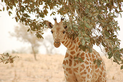
Prior to the 20th century vast herds of ungulates and other large animals, including elephant, giraffe and ostrich were found
in this ecoregion. Most of the large populations have been reduced to scattered remnants due to unregulated hunting with modern firearms.
The Scimitar-horned oryx(Oryx dammah) is presumed to be extinct in this area. Other species are only found in a handful of protected areas e.g. the West African Giraffe
(Giraffa camelopardus peralta) are only found in Niger. In Nigeria the African elephant near to extinct only survived in the Chad Basin National Park
. The pronounced dry season signals a significant migration of fauna within the ecoregion. This includes the annual passage of large numbers of migrant birds on the Afrotropical-Palaearctic flyway.
The vegetation consists of woodland with a understory of long grasses, shrubs, and herbs. The northern portion hosts mainly grasslands dominated by numerous short grasses. Shrubland is scattered in patches throughout the ecoregion. Riparian forests occur along many waterways and small areas of adaphic vegetation such as grassy floodplains, or Fadamas are found in the Komadugu-Yobe Basin.
This typ of savanna supports a relatively rich fauna, including a number of endemic species. Common large animals are
Bushbuck
(Tragelaphus scriptus), Warthog
(Phacochoerus africanus), Vervet monkey
(Chlorocebus aethiops), Baboon
s (Papio hamadryas papio and P.h. anubis) and Savannah monitor lizard
(Varanus exanthematicus).
Most large mammals have been heavily hunted and many species only survive sparsely, mainly in protected areas. The pronounced dry season
signals a migration of fauna within the ecoregion. This includes the annual passage of migrant birds on the Afrotropical-Palaearctic flyway.
The vegetation is undifferentiated woodland with trees that are mainly deciduous in the dry season, with an understory of grasses, shrubs and herbs. Typical trees in the Lake Chad Basin sector of this ecoregion include Anogeissus leiocarpus
, Kigelia aethiopica, Acacia seyal
and species of Combretum
and Terminalia
.
The East Sudanian Savannah ecoregion closely resembles the West Sudanian Savannah in habitat structure and species composition. The two ecoregions differ somewhat in terms of their species assemblages and the degree to which the habitat and mammal assemblages are intact. The Eastern Sudanian Savannah has low rates of faunal endemism. For example there is only one endemic mammal (a mouse, Mus goundae) and two strictly endemic reptiles (Rhamphiophis maradiensis and Panaspis wilsoni). Threatened mammal species include large herds of African elephant (Loxodonta africana) in Chad and Central African Republic and African wild dog (Lycaon pictus), Cheetah (Acinonyx
jubatus) and Lion
(Panthera leo).
 The Northern Congolian Forest-Savannah Mosaic is a narrow transition zone marked by an abrupt habitat discontinuity between the extensive Congolian rainforests and Sudanian/Sahelian grasslands. It contains the northernmost savannah woodlands in Africa. The forest savannah mosaics with their characteristically diverse habitat complexes, support a high proportion of ecotonal habitats, which have high species richness and are possible loci of tropical differentiation and speciation. This ecoregion lies in the tropical savannah climate zone. Mean annual precipitation ranges locally from about 1200 mm to 1600 mm per year. This ecoregion experiences small seasonal temperature fluctuations, with rainy season mean daily maximum temperatures of 31 to 34°C and dry season mean daily minimum temperatures of 13 to 18°C. The Chad Basin proportion of this ecoregion consists of western CAR, which is underlain by relatively new and unweathered entisols, and central Cameroon, which consists of a mixture of oxisols and ultisols, highly weathered soils that often contain a fragipan.
Vegetation common either to the Sudanian or Congolian provinces characterises much of the region. In the relatively arid corners in the northeast Cameroon and northwest portion of the ecoregion, the transitional Isoberlinia
spp. dominated Sudanian woodlands and wooded savannahs characterise the flora where cultivation has not drastically altered the system.
The savannah sub-species of African Bush Elephant
(Loxodonta africana africana) occupies the savannah woodlands where it denudes trees and suppresses sapling growth, effectively creating a more fire-prone system. The ecoregion provides a unique set of habitats and resources that supports moderate levels of diversity, including many species with broad distributions in tropical Africa. The Red-flanked Duiker
(Cephalophus rufilatis) inhabits forest patches within the savannah matrix across the Guineo-Congolian/Sudanian transition zone. Widespread mammals in these savannah forest mosaics include the Black rhinoceros
(Diceros bicornis longipes) now however restricted to a few individuals remaining in Cameroon, Giant eland
(Taurotragus derbianus) and in the eastern sector, Bongo
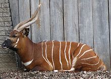
(Tragelaphus eurycerus).
Africa
Africa is the world's second largest and second most populous continent, after Asia. At about 30.2 million km² including adjacent islands, it covers 6% of the Earth's total surface area and 20.4% of the total land area...
. In all directions from the center of this area the elevation changes are gentle. The Chad Basin is an endorheic
Endorheic
An endorheic basin is a closed drainage basin that retains water and allows no outflow to other bodies of water such as rivers or oceans...
(closed) basin - its water does not flow into any ocean
Ocean
An ocean is a major body of saline water, and a principal component of the hydrosphere. Approximately 71% of the Earth's surface is covered by ocean, a continuous body of water that is customarily divided into several principal oceans and smaller seas.More than half of this area is over 3,000...
. It has a long history of human settlement, and for a long time was an important crossroads for the Trans-Saharan trade
Trans-Saharan trade
Trans-Saharan trade requires travel across the Sahara to reach sub-Saharan Africa. While existing from prehistoric times, the peak of trade extended from the 8th century until the late 16th century.- Increasing desertification and economic incentive :...
from north to south and west to east in Africa. The first known developed civilization in the northern area of the Chad Basin was that of the Garamantes
Garamantes
The Garamantes were a Saharan people who used an elaborate underground irrigation system, and founded a prosperous Berber kingdom in the Fezzan area of modern-day Libya, in the Sahara desert. They were a local power in the Sahara between 500 BC and 700 AD.There is little textual information about...
during the Roman Empire
Roman Empire
The Roman Empire was the post-Republican period of the ancient Roman civilization, characterised by an autocratic form of government and large territorial holdings in Europe and around the Mediterranean....
; the second was the Sao civilization in the 6th century, located south of Lake Chad
Lake Chad
Lake Chad is a historically large, shallow, endorheic lake in Africa, whose size has varied over the centuries. According to the Global Resource Information Database of the United Nations Environment Programme, it shrank as much as 95% from about 1963 to 1998; yet it also states that "the 2007 ...
.
The most significant feature inside the basin is Lake Chad. The lake has been known outside Africa since the Middle Ages. However, despite the region's important role in the development of cultures and history in northern and central Africa, social scientists have recently discovered that it is a rich and promising area for research. In 17th century maps, the lake was designated as Borno Lake and was a mystery to Western scientists. The next reports about this area came from the German Heinrich Barth
Heinrich Barth
Heinrich Barth was a German explorer of Africa and scholar.Barth is one of the greatest of the European explorers of Africa, not necessarily because of the length of his travels or the time he spent alone without European company in Africa, but because of his singular character.-Biography:Barth...
in the middle of the 19th century. He was the first to report rock art
Rock art
Rock art is a term used in archaeology for any human-made markings made on natural stone. They can be divided into:*Petroglyphs - carvings into stone surfaces*Pictographs - rock and cave paintings...
in the northern mountainous areas of the basin. This was the first time that Western scientists had heard of a wet paleoclimate
Paleoclimatology
Paleoclimatology is the study of changes in climate taken on the scale of the entire history of Earth. It uses a variety of proxy methods from the Earth and life sciences to obtain data previously preserved within rocks, sediments, ice sheets, tree rings, corals, shells and microfossils; it then...
in the Sahara
Sahara
The Sahara is the world's second largest desert, after Antarctica. At over , it covers most of Northern Africa, making it almost as large as Europe or the United States. The Sahara stretches from the Red Sea, including parts of the Mediterranean coasts, to the outskirts of the Atlantic Ocean...
desert and the Chad Basin.
The existence of Lake Chad has contributed to the development of peoples, flora, and fauna in this region for many thousands of years. As a source of water between the desert and the savannah, the region has attracted many immigrants, explorers, and adventurers. The annual fluctuation of the lake's water level, and the floods which are associated with this cyclical change, opened opportunities for the development of cultures and nations as well as a place of refuge and protection. The Chad Basin served as a region in which ruling dynasties could develop new political formations with momentum that carried them far beyond this region. However, at the same time, the region was a natural barrier that prevented greater trade and interaction.
Geography
The Chad Basin extends between 6°N and 24°N latitude, and between 8°E and 24°E longitude. It covers an area of approximately 2.434 million km², equivalent to 8% of the total area of the African continent.The Chad Basin is surrounded by high mountain ranges which rise up to the highland of the North Equatorial Plateau (known in some countries as the Asande Barrier). This plateau includes parts of the Adamawa Plateau
Adamawa Plateau
The Adamawa Plateau is a plateau region in west-central Africa stretching from south-eastern Nigeria through north-central Cameroon to the Central African Republic. The plateau was named after Fulani Muslim leader Modibo Adama. The part of the plateau that lies in Nigeria is more popularly known...
in the west and the Bongo Massif
Bongo Massif
The Bongo Massif , also known as the Tondou Massif, is a mountain range in north-eastern Central African Republic, near the Sudan border. The source of Bahr al-Arab is found within the massif. South of the massif is the Plateau of Ouadda ....
in the east.
In the east, the Chad Basin extends to the 3088 m high Jebel Marra
Marrah Mountains
The Marrah Mountains or Marra Mountains is a range of volcanic peaks created by a massif that rises up to 3,000 m. It is located in the center of the Darfur region of Sudan, specifically within Dar Zagahawa and neighboring areas. The highest point is Deriba Caldera...
in Darfur
Darfur
Darfur is a region in western Sudan. An independent sultanate for several hundred years, it was incorporated into Sudan by Anglo-Egyptian forces in 1916. The region is divided into three federal states: West Darfur, South Darfur, and North Darfur...
. In the northeast, the basin -- known as the Ennedi Plateau
Ennedi Plateau
The Ennedi Plateau, located in the North-East of Chad, in the Bourkou-Ennedi-Tibesti Region, is a sandstone bulwark in the middle of the Sahara. It is assailed by the sands on all sides, that encroach the deep valleys of the Ennedi...
-- rises to 1450 m. In the north of the basin the volcanic mountains of Tibesti
Tibesti Mountains
The Tibesti Mountains are a range of inactive volcanoes located on the northern edge of the Chad Basin in the Borkou- and Tibesti Region of northern Chad. The massif is one of the most prominent features of the Central-Sahara desert and covers an area of approximately 100,000 km². The northern...
are located, with 3415 meter high Emi Koussi being the highest point of the central Sahara; to the west lies the Djado Plateau
Djado Plateau
The Djado Plateau lies in the Sahara, in north eastern Niger. It is known for its cave art , but is now largely uninhabited, with abandoned towns and forts visible.- World Heritage Status :...
. The border in the northwest is marked by the mountains of Tassili n'Ajjer
Tassili n'Ajjer
Tassili n'Ajjer is a mountain range in the Algerian section of the Sahara Desert. It is a vast plateau in south-east Algeria at the borders of Libya, Niger and Mali, covering an area of 72,000 sq...
in Algeria, the highest peak being Jebel Azao at 2158 meters. The western boundary is formed by the Aïr Mountains
Aïr Mountains
The Aïr Mountains is a triangular massif, located in northern Niger, within the Sahara desert...
and the Termit Massif
Termit Massif
The Termit Massif is a mountainous region in southeastern Niger. Just to the south of the dunes of Tenere desert and the Erg of Bilma, the northern areas of the Termit, called the Gossololom consists of black volcanic peaks which jut from surrounding sand seas...
in Niger
Niger
Niger , officially named the Republic of Niger, is a landlocked country in Western Africa, named after the Niger River. It borders Nigeria and Benin to the south, Burkina Faso and Mali to the west, Algeria and Libya to the north and Chad to the east...
. In the southwestern Chad Basin the Jos Plateau
Jos Plateau
The Jos Plateau is a plateau located near the center of Nigeria. It covers 8600 km² and is bounded by 300-600 meter escarpments around much of its circumference. With an average altitude of 1280 metres and its highest point is Shere Hills 1829 meters...
, the Biu Plateau
Biu Plateau
The Biu Plateau is a highland area in Northeastern Nigeria containing many recently extinct volcanoes. It covers about and has an average elevation of . The plateau lies between the Upper Benue Basin to the south and the Chad Basin to the north. High points are Wade Hill at above sea level and...
and the Mandara Mountains
Mandara Mountains
The Mandara Mountains are a volcanic range extending about 200km along the northern part of the Cameroon-Nigeria border, from the Benue River in the south to the north-west of Maroua in the north . The highest elevation is 1,494 m , the summit of Mount Oupay .The region is densely populated,...
mark the geographical boundary. In the center of the Chad Basin is the Bodélé Depression
Bodélé Depression
The Bodélé Depression , located at the southern edge of the Sahara Desert in north central Africa, is the lowest point in Chad. Dust storms from the Bodélé Depression occur on average about 100 days per year , one typical example being the massive dust storms that swept over West Africa and the...
, which is also the deepest part of the basin, about 155 meters above sea level. Lake Chad is 275 meters above sea level.
Countries in the Chad Basin
The Basin is shared among the countries of Republic of ChadChad
Chad , officially known as the Republic of Chad, is a landlocked country in Central Africa. It is bordered by Libya to the north, Sudan to the east, the Central African Republic to the south, Cameroon and Nigeria to the southwest, and Niger to the west...
, Niger
Niger
Niger , officially named the Republic of Niger, is a landlocked country in Western Africa, named after the Niger River. It borders Nigeria and Benin to the south, Burkina Faso and Mali to the west, Algeria and Libya to the north and Chad to the east...
, Nigeria
Nigeria
Nigeria , officially the Federal Republic of Nigeria, is a federal constitutional republic comprising 36 states and its Federal Capital Territory, Abuja. The country is located in West Africa and shares land borders with the Republic of Benin in the west, Chad and Cameroon in the east, and Niger in...
, Cameroon
Cameroon
Cameroon, officially the Republic of Cameroon , is a country in west Central Africa. It is bordered by Nigeria to the west; Chad to the northeast; the Central African Republic to the east; and Equatorial Guinea, Gabon, and the Republic of the Congo to the south. Cameroon's coastline lies on the...
, Central African Republic
Central African Republic
The Central African Republic , is a landlocked country in Central Africa. It borders Chad in the north, Sudan in the north east, South Sudan in the east, the Democratic Republic of the Congo and the Republic of the Congo in the south, and Cameroon in the west. The CAR covers a land area of about ,...
(CAR), Algeria
Algeria
Algeria , officially the People's Democratic Republic of Algeria , also formally referred to as the Democratic and Popular Republic of Algeria, is a country in the Maghreb region of Northwest Africa with Algiers as its capital.In terms of land area, it is the largest country in Africa and the Arab...
, Libya
Libya
Libya is an African country in the Maghreb region of North Africa bordered by the Mediterranean Sea to the north, Egypt to the east, Sudan to the southeast, Chad and Niger to the south, and Algeria and Tunisia to the west....
, and Sudan
Sudan
Sudan , officially the Republic of the Sudan , is a country in North Africa, sometimes considered part of the Middle East politically. It is bordered by Egypt to the north, the Red Sea to the northeast, Eritrea and Ethiopia to the east, South Sudan to the south, the Central African Republic to the...
. The biggest part of the basin lies in Chad, around 1,123 million km² covering the center. The western part, 674,000 km², is in Niger. In the north and northwest 91,000 km² are in Algeria and 5,100 km² in Libya. In the southwest there are 179,000 km² in Nigeria and 47,400 km² in Cameroon. The southern part of the basin, 216,000 km², is in the territory of the Central African Republic, and the eastern part, 97,700 km², is in the Islamic Republic of Sudan.
Population of the Chad Basin
Presently (2011), more than 30 million inhabitants, including migrants from various African countries, live in the Chad Basin where they draw the essence of their livelihood through activities like fishing, agriculture and animal husbandry. The Population in the Chad Basin had in 2001 a growth rate of 2.72% per year and some administrations expect that in 2020 there will be more than 50 million people living in the basin. The areas in Algeria and Libya are unoccupied.Lake Chad Basin Commission
The Lake Chad Basin CommissionLake Chad Basin Commission
The Lake Chad Basin Commission is an intergovernmental organization of the countries nearest to Lake Chad which coordinates actions that might affect the waters of Lake Chad. The organization's secretariat is located in N'Djamena, Chad...
(LCBC) was created on 22 May 1964 and is headquartered in Fort Lamy, now N'Djamena
N'Djamena
N'Djamena is the capital and largest city of Chad. A port on the Chari River, near the confluence with the Logone River, it directly faces the Cameroonian town of Kousséri, to which the city is connected by a bridge. It is also a special statute region, divided in 10 arrondissements. It is a...
. It was founded by Cameroon, Niger, Nigeria and Chad. The LCBC now has six country members: Chad, Central African Republic, Cameroon, Nigeria, Niger, and since April 2007, Libya
Libya
Libya is an African country in the Maghreb region of North Africa bordered by the Mediterranean Sea to the north, Egypt to the east, Sudan to the southeast, Chad and Niger to the south, and Algeria and Tunisia to the west....
. Sudan
Sudan
Sudan , officially the Republic of the Sudan , is a country in North Africa, sometimes considered part of the Middle East politically. It is bordered by Egypt to the north, the Red Sea to the northeast, Eritrea and Ethiopia to the east, South Sudan to the south, the Central African Republic to the...
has an observer status. The commission is responsible for regulating and monitoring the use of water and other natural resources within the Lake Chad Basin. One of its sub-divisions, the Basin Committee for Strategic Planning (BCSP), coordinates local activities among the member states.
The LCBC controls and monitors the hydroactive regions in the Chad Basin and the so-called conventional basin. The initial conventional basin consisted of approximately 427,500 km² of the total area of the Chad basin in 1964. This definition excludes most of the terminal depression consisting of desert that provides little or no effective hydrological contribution to the conventional basin. This was subsequently expanded to include additional watersheds in northern Nigeria, southern Chad, and northern Central African Republic, with a current total area of 967,000 km².
Geology
The Chad Basin was formed by extensional tectonic forces during the CretaceousCretaceous
The Cretaceous , derived from the Latin "creta" , usually abbreviated K for its German translation Kreide , is a geologic period and system from circa to million years ago. In the geologic timescale, the Cretaceous follows the Jurassic period and is followed by the Paleogene period of the...
period with the geological and geomorphological development of the basin being conditioned by the slow and "cool" rifting of the Mesozoic-Tertiary rift system in Central and West Africa. The rift system developed primarily in the Early Cretaceous, during the opening of the South Atlantic and a regional NE-SW extension. This tectonic movement of the lithosphere formed a regional hydrological sink known as the Chad Artesian Sub-Basin and Chari-Logone Artesian Sub-Basin. The greater Chad Basin is part of the major meridional zone of depressions extending from the Gulf of Gabes
Gulf of Gabès
The Gulf of Gabès is a gulf on Tunisia's east coast in the Mediterranean Sea, off North Africa. The gulf roughly spans the coast from modern day the town of Mahrès in Sfax Gouvernorate to Djerba...
in the north of Africa to the Karoo aquifer in the south.
Most of the basin is covered by Quaternary
Quaternary
The Quaternary Period is the most recent of the three periods of the Cenozoic Era in the geologic time scale of the ICS. It follows the Neogene Period, spanning 2.588 ± 0.005 million years ago to the present...
sands. Below the sands, at about 75 m depth, are clays of the Pliocene
Pliocene
The Pliocene Epoch is the period in the geologic timescale that extends from 5.332 million to 2.588 million years before present. It is the second and youngest epoch of the Neogene Period in the Cenozoic Era. The Pliocene follows the Miocene Epoch and is followed by the Pleistocene Epoch...
with a mean thickness of approximately 280 m. Further down, a layer of sand about 30 m thick is encountered that belong to the Lower Pliocene. These sands give place to the real Pliocene aquifer, as the clays are generally considered to be impermeable. Further down, sandstones of the Continental Terminal appear; they formed in the Tertiary period and are about 150 m thick. The deepest known rock formation is the Continental Hamadien, formed in the Cretaceous period. It also consists of sandstone.
The basement of the Tibesti region is Precambrian
Precambrian
The Precambrian is the name which describes the large span of time in Earth's history before the current Phanerozoic Eon, and is a Supereon divided into several eons of the geologic time scale...
schist
Schist
The schists constitute a group of medium-grade metamorphic rocks, chiefly notable for the preponderance of lamellar minerals such as micas, chlorite, talc, hornblende, graphite, and others. Quartz often occurs in drawn-out grains to such an extent that a particular form called quartz schist is...
, overlaid with Palaeozoic sandstones, all capped by Tertiary
Tertiary
The Tertiary is a deprecated term for a geologic period 65 million to 2.6 million years ago. The Tertiary covered the time span between the superseded Secondary period and the Quaternary...
and Pleistocene
Pleistocene
The Pleistocene is the epoch from 2,588,000 to 11,700 years BP that spans the world's recent period of repeated glaciations. The name pleistocene is derived from the Greek and ....
outpourings of basalt
Basalt
Basalt is a common extrusive volcanic rock. It is usually grey to black and fine-grained due to rapid cooling of lava at the surface of a planet. It may be porphyritic containing larger crystals in a fine matrix, or vesicular, or frothy scoria. Unweathered basalt is black or grey...
.
Undifferentiated granites and gneisses are found in the eastern part of the basin. Lower Paleozoic sandstone sequences are found on the border to the Kufra Basin in the northeast, close to the border to Libya and Sudan. They are overlaid by Nubian sandstones in the area of the Ennedi and Erdi Plateau.
Aquifers
The four aquifers in the Chad Basin are composed of a series of sediment deposits and include the Upper Quaternary phreatic aquifer, the Lower Pliocene, the Continental Terminal and the Continental Hamadien. Investigations suggest the main recharge to the aquifers is from surface water bodies. They are very sensitive to climate changes and especially to open water surface runoff regimes.The groundwater quality of the Quaternary phreatic aquifer is suitable for domestic consumption by the local population and livestock. The Lower Pliocene Aquifer, found at depths of about 250 m with an average thickness of 60 m, is an artesian aquifer intensively used in the Nigerian part of the basin. The reserves of the Lower Pliocene Aquifer are unknown; exploration of this aquifer has led to estimates of about 3 million m³ per year. The Continental Terminal aquifer is essentially an alternation of sandstone and clay. The deepest aquifer is the Continental Hamadien. This is an important aquifer in some West African regions, but very little reliable information is available about it.
In general, the area of the active hydrographic basin covers about 967,000 km²; toward the north and northeastern borders of the basin lie the Nubian Sandstone Aquifer System
Nubian Sandstone Aquifer System
The Nubian Sandstone Aquifer System is the world’s largest known fossil water aquifer system. It is located underground in the Eastern end of the Sahara Desert and spans the political boundaries of four countries in north-eastern Africa...
and the Iullemeden Aquifer System is at the western border.
Climate
The types of climate in the Chad Basin is very varied: hyperarid climateArid
A region is said to be arid when it is characterized by a severe lack of available water, to the extent of hindering or even preventing the growth and development of plant and animal life...
in the northern areas, characterized by the deserts
Déserts
Déserts is a piece by Edgard Varèse for brass , percussion , piano, and tape. Percussion instruments are exploited for their resonant potential, rather than used solely as accompaniment...
, semiarid
Arid
A region is said to be arid when it is characterized by a severe lack of available water, to the extent of hindering or even preventing the growth and development of plant and animal life...
climate in the zone of the Sahel
Sahel
The Sahel is the ecoclimatic and biogeographic zone of transition between the Sahara desert in the North and the Sudanian Savannas in the south.It stretches across the North African continent between the Atlantic Ocean and the Red Sea....
and subhumid climate further south in the area of Lake Chad, with humid subtropical climate
Humid subtropical climate
A humid subtropical climate is a climate zone characterized by hot, humid summers and mild to cool winters...
in the mountainous regions of Nigeria
Nigeria
Nigeria , officially the Federal Republic of Nigeria, is a federal constitutional republic comprising 36 states and its Federal Capital Territory, Abuja. The country is located in West Africa and shares land borders with the Republic of Benin in the west, Chad and Cameroon in the east, and Niger in...
, Cameroon
Cameroon
Cameroon, officially the Republic of Cameroon , is a country in west Central Africa. It is bordered by Nigeria to the west; Chad to the northeast; the Central African Republic to the east; and Equatorial Guinea, Gabon, and the Republic of the Congo to the south. Cameroon's coastline lies on the...
and the Central African Republic
Central African Republic
The Central African Republic , is a landlocked country in Central Africa. It borders Chad in the north, Sudan in the north east, South Sudan in the east, the Democratic Republic of the Congo and the Republic of the Congo in the south, and Cameroon in the west. The CAR covers a land area of about ,...
.
The Basin is principally located in the transition zone between the Sahara desert over Sahel and Sudan
Sudan (region)
The Sudan is the name given to a geographic region to the south of the Sahara, stretching from Western to Eastern Africa. The name derives from the Arabic bilâd as-sûdân or "land of the Blacks"...
to the rainforest areas in the Congo Basin
Congo Basin
The Congo Basin is the sedimentary basin that is the drainage of the Congo River of west equatorial Africa. The basin begins in the highlands of the East African Rift system with input from the Chambeshi River, the Uele and Ubangi Rivers in the upper reaches and the Lualaba River draining wetlands...
. Rainfall is a very important factor to conditioning the hydrology and the climate in this region. The Chad Basin is under the influence of the Inter-Tropical Convergence Zone (ITCZ), which oscillates seasonally between about 15° N and 15° S latitude. In the north of the basin is also high pressure zone and prevents the Sahara from rainfall. Except during the Boreal winter when occasionally cold air descends from the north, its the dry Harmattan
Harmattan
The Harmattan is a dry and dusty West African trade wind. It blows south from the Sahara into the Gulf of Guinea between the end of November and the middle of March...
winds. Rain only occurs over the region after the ITCZ has moved past this area towards the north. From April to October, rainfall occurs but is generally heaviest in August, corresponding with the maximum northward extent of the ITCZ, followed by July and then September. About 90% of the rain falls from June to September. Its the time of wet south west Passat
Trade wind
The trade winds are the prevailing pattern of easterly surface winds found in the tropics, within the lower portion of the Earth's atmosphere, in the lower section of the troposphere near the Earth's equator...
winds, also known as West African Monsoon System
Monsoon
Monsoon is traditionally defined as a seasonal reversing wind accompanied by corresponding changes in precipitation, but is now used to describe seasonal changes in atmospheric circulation and precipitation associated with the asymmetric heating of land and sea...
. In the last decade, the Isohyet-lines have moved somewhat southwards, as the high pressure system over the Sahara has extend southwards. This movement of the ITCZ is corresponding to the movement of North Atlantic oscillation
North Atlantic oscillation
The North Atlantic oscillation is a climatic phenomenon in the North Atlantic Ocean of fluctuations in the difference of atmospheric pressure at sea level between the Icelandic low and the Azores high. Through east-west oscillation motions of the Icelandic low and the Azores high, it controls the...
and responsibly of drought periods in the last century. Since the 1960s the annual rainfall has decreased by as much as 25% in some regions of the basin. For example, on the dry northeast side of Lake Chad, at the town of Bol
Bol
Boľ is a village and municipality in the Trebišov District in the Košice Region of eastern Slovakia....
, rainfall from 1954 to 1972 ranged from 125 to 565 mm per year and averaging 315 mm. In general the annual rainfall over the Chad Basin is characterized by a sharp meridional gradient, varying from 1200–1600 mm at the southern edge to 50–100 mm at the northern edge. The variability of the position and intensity of rain-belt over the Chad Basin is dominated by the West African monsoon (WAM) and is very important for the region's rain-fed agriculture, water resources, health, and climatically sensitive natural environments. The socio-economic and environmental shocks resulting from the dramatic decline in rainfall since the mid-1960s have produced widespread human misery and environmental degradation. Some of the countries in the Basin generate 80% of their gross national product from agriculture activities.
Evapotranspiration potential
The evapotranspirationEvapotranspiration
Evapotranspiration is a term used to describe the sum of evaporation and plant transpiration from the Earth's land surface to atmosphere. Evaporation accounts for the movement of water to the air from sources such as the soil, canopy interception, and waterbodies...
potential (ETP) is high and peaks in April and May, when the saturation deficit is high, and falls during July and August as the saturation deficit reduces. There is a brief rise during September and October as the saturation deficit increases once more, falling to a minimum in December and January, when air temperatures are at a minimum in the region. Mean annual ETP increases northwards by about 60 mm per degree of latitude. In general, the ETP varies over the area from 1,500 - 1,800 mm year in northeastern Nigeria to 2,300mm northeast of Lake Chad to 6,000 mm in desert lowlands in the northeastern part of the basin.
West African monsoon system
The West African monsoon (WAM) is a coupled atmosphere-ocean-land system characterized by summer rainfall over the continent and winter drought. The processes that couple the land, ocean, and atmosphere involve multiple interacting space- and time-scales.Investigations by the African Monsoon Multidisciplinary Analyses project (AMMA) have shown that the formation of cold water in the Guinean Gulf plays a determining role in the monsoon onset. Similarly, meteorological conditions in the Mediterranean Sea
Mediterranean Sea
The Mediterranean Sea is a sea connected to the Atlantic Ocean surrounded by the Mediterranean region and almost completely enclosed by land: on the north by Anatolia and Europe, on the south by North Africa, and on the east by the Levant...
or in the Indian Ocean
Indian Ocean
The Indian Ocean is the third largest of the world's oceanic divisions, covering approximately 20% of the water on the Earth's surface. It is bounded on the north by the Indian Subcontinent and Arabian Peninsula ; on the west by eastern Africa; on the east by Indochina, the Sunda Islands, and...
are key factors in the variability and the retreat of the monsoon. The annual cycle of the sea surface temperature (SST) in the Gulf of Guinea
Gulf of Guinea
The Gulf of Guinea is the northeasternmost part of the tropical Atlantic Ocean between Cape Lopez in Gabon, north and west to Cape Palmas in Liberia. The intersection of the Equator and Prime Meridian is in the gulf....
is asymmetrical with a rapid cooling from the highest SST in April to the lowest SST in August, and a gradual increase up to the next April. West African rainfall, including the Chad Basin, is significantly influenced by SST through the advection of marine boundary layer temperature anomalies over Africa which cause sea level pressure and surface wind convergence anomalies. They study also showed that seasonal changes in insolation control the seasonal changes in the net budget of energy input in the atmospheric column, which is balanced by horizontal energy export in the thermally direct circulation associated with convection in the ITCZ. This modulates the moisture advection
Moisture advection
Moisture advection is the horizontal transport of water vapor by the wind. Measurement and knowledge of atmospheric water vapor, or "moisture", is crucial in the prediction of all weather elements, especially clouds, fog, temperature, humidity thermal comfort indices and...
inland and controls the rainfall production over West Africa.
Reasons for the variability of the WAM over the last decades are not clear; there has been an abrupt ITCZ shift. Further investigation is needed.
Climate history
Little is known about the climactic history of the Chad Basin. Only the younger age of the Quaternary period has been sufficiently explored, since the prevailing transformation of landscapes and the beginning of hull surface fragmentation in the Early Quaternary period has been newly recognized as leading to river valleys. The effects of frequent changes of humid Pluvial and desert-like Interpluvial times on the relief, however, have been adequately investigated despite the absence of radiometric age determinations, a lack of datable preserved traces, and the extinction of older relief states.One can prove the existence of an older dune zone, called Erg Ancien, that extended over the current 800 mm isohyet-line and suggests an extremely arid climate 40,000 years ago. This was followed by a wetter period of years 40,000 to 20,000 years ago. This humid period was followed by an extreme drought, called the Ogolien and the Kanemi, which lasted until 12 000 years ago. At that time the dune advanced; it is called Erg Recent and extended up to today's 500 mm the isohyet line. About 10,000 years ago the well known period of humid climate began in the Sahara area, also called Tschadien; it ended with a dry period from 7500–7000 years ago. From 9,000 to 5,000 years ago there were two phases in which Lake Chad had a much greater extent than today. This lake, also named Megalake Chad or Paläochad, covered an area of approximately 350,000 km² with a constant elevation of 325 m above the current sea level. The historical sea borders can be identified by the dark brown sediments deposited in the former shore area; they are now a few tens of centimeters thick.
A short humid phase 3500–2500 years ago, demonstrated by shallow lakes and large wetland areas, ended in an increase in aridity with minor fluctuations. This resulted in the Sahara as we know it, but also started the remobilization of sand dunes in the Sahel, a process continuing to the present day.
River Systems
The Chad Basin has two major river systems, the ChariChari River
The Chari or Shari River is a 949-kilometer-long river of central Africa. It flows from the Central African Republic through Chad into Lake Chad, following the Cameroon border from N'Djamena, where it joins the Logone River waters....
-Logone-Riversystem and the Komadugu Yobe
Yobe River
The Yobe River is a river in West Africa that flows into Lake Chad through Nigeria and Niger.Its tributaries include the Hadejia River and the Jama'are River...
Riversystem. There has formed a wide Floodplain
Floodplain
A floodplain, or flood plain, is a flat or nearly flat land adjacent a stream or river that stretches from the banks of its channel to the base of the enclosing valley walls and experiences flooding during periods of high discharge...
s and Wetland
Wetland
A wetland is an area of land whose soil is saturated with water either permanently or seasonally. Wetlands are categorised by their characteristic vegetation, which is adapted to these unique soil conditions....
s foremost in the south and western part of the basin. From the highland of the Adamawa Plateau and Mandara Mountains flow also the EL Beid River, the Ngadda River
Ngadda River
The Ngadda River is a river in Nigeria that flows into Lake Chad and the Chad Basin. The Alau dam built on the river has interfered with fertile seasonal floodplains in the region of Maiduguri....
and the Yedseram River in the southern sea basin of Lake Chad
Lake Chad
Lake Chad is a historically large, shallow, endorheic lake in Africa, whose size has varied over the centuries. According to the Global Resource Information Database of the United Nations Environment Programme, it shrank as much as 95% from about 1963 to 1998; yet it also states that "the 2007 ...
.
Komadugu Yobe
The Komadugu-Yobe sub-system has a basin area of 148 000 km²,85.000 km² in Nigeria and 43.000 km² in Niger, but contributes less than 2.5% of the total riverine inflow into Lake Chad basin. In present times the River Doesn't reach the open water surface of the lake. The Komadugu-Yobe River is formed by various tributaries, the main tribuary is the Hadejia RiverHadejia River
The Hadejia River is a river in northern Nigeria and is a tributary of the Yobe River .Among the cities and towns that lie on or near its banks are Hadejia and Nguru....
which flows from the area around Kano
Kano
Kano is a city in Nigeria and the capital of Kano State in Northern Nigeria. Its metropolitan population is the second largest in Nigeria after Lagos. The Kano Urban area covers 137 sq.km and comprises six Local Government Area - Kano Municipal, Fagge, Dala, Gwale, Tarauni and Nassarawa - with a...
, the particular is the Jama'are River
Jama'are River
The Jama'are River, also known as the Bunga River in its upper reaches, starts in the highlands near Jos, Plateau State, Nigeria and flows northeast through Bauchi State and Yobe State before joining the Hadejia River to form the Yobe River...
and flows from Jos Plataeu. The two River forms the Hadejia-Nguru wetlands
Hadejia-Nguru wetlands
thumb|right|300px|[[Yobe River]] catchment area showing location of the Hadejia-Nguru wetlandsThe Hadejia-Nguru wetlands in Yobe State in northern Nigeria, which include Nguru Lake, are ecologically and economically important...
and join in the near of Gashua
Gashua
Gashua is a community in Yobe State in northeastern Nigeria, on the Yobe River a few miles below the convergence of the Hadejia River and the Jama'are River. Average elevation is about 299 m. The population in 2006 was about 125,000....
and now designated as Komadugu Yobe River. These River is also temporary supplied by the Misau River, also known as Komadugu Gana, which flows from the north of Bauchi
Bauchi
Bauchi is a city in northeast Nigeria, the capital of Bauchi State, of the Bauchi Local Government Area within that State, and of the traditional Bauchi Emirate. The city has a population of 316,173...
and joins the Komadugu-Yobe 120 km from historical seashore of Lake Chad. The annual rainfall is very different in this sub-basin area. In the north, in Niger, falls only 200 mm/m² per year, in the area of Hadejia-Nguru wetlands is up to 500mm/m² and on Jos Plateau up to 1.600 mm/m².
Chari-Logone
The Chari-Logone sub-system has a basin area of approximately 650.000 km² and extents from Dafur in Sudan to the Adamawa Plateau in Cameroon. The Chari River himself extends 1.400 km in length. The parts of the sub-system lying in Central African RepublicCentral African Republic
The Central African Republic , is a landlocked country in Central Africa. It borders Chad in the north, Sudan in the north east, South Sudan in the east, the Democratic Republic of the Congo and the Republic of the Congo in the south, and Cameroon in the west. The CAR covers a land area of about ,...
(CAR) constitutes the headwater region. The Ouham
Ouham
Ouham is one of the 14 prefectures of the Central African Republic. Its capital is Bossangoa.-Geography:The prefecture is in the nord-west of the Central African Republic. In the north it has a border with the Chad. In the south is the prefecture Ombella-Mpoko, in the west the prefecture...
in CAR, becoming the Bahr Sara in Chad, is the main tributary of the Chari River with its confluence located at Manda, downstream of Sarh
Sarh
Sarh is the third largest city in Chad, after N'Djamena and Moundou. It is the capital of Moyen-Chari region and the department of Barh Köh. It lies 350 miles south-east of the capital Ndjamena on the Chari River...
. Its contribution was estimated to be twice that of the Bahr Aouk, despite having a smaller catchment area. The Bahr Aouk drains the entire northeastern part of CAR and together with its tributaries, is a true floodplain river. The Bamingui and Bangoran rivers drain the northern part of CAR and form the transition between the northeast and the more populated northwestern areas. All rivers in the CAR parts of the Basin have their main flow during and following the rainy season from July to September. The Logone River forms the border between Cameroon and Chad until N'Djamena
N'Djamena
N'Djamena is the capital and largest city of Chad. A port on the Chari River, near the confluence with the Logone River, it directly faces the Cameroonian town of Kousséri, to which the city is connected by a bridge. It is also a special statute region, divided in 10 arrondissements. It is a...
where it flows together with the Chari River northwards to the Lake Chad. The Chari and Logone rivers have a tropical regime with a single flood occurring at the end of the rainy season, which lasts from August to November and feeds the extensive Waza-Logone floodplains in northern Cameroon.
Yedseram River
The Yedseram River, also known as Mbuli River, has a catchment area of 16,320 km². The source of the river is in the Mandara MountainsMandara Mountains
The Mandara Mountains are a volcanic range extending about 200km along the northern part of the Cameroon-Nigeria border, from the Benue River in the south to the north-west of Maroua in the north . The highest elevation is 1,494 m , the summit of Mount Oupay .The region is densely populated,...
, about 250 km south of Lake Chad. About 30 km west of Bama
Bama, Nigeria
Bama is a Local Government Area of Borno State, Nigeria. Its headquarters are in the town of Bama.It has an area of 4,997 km² and a population of 269,986 at the 2006 census.The postal code of the area is 610....
, south of the Gombole Forest Reserve, the Yedseram is joined by the Ngadda River in a large swamp (Sambissa) covering about 130 km², where the main water courses are not defined.
Ngadda River
The Ngadda River has a catchment area of 14,400 km². It drains into several lakes and swamps in its north westerly flow, before it is dispersed in the low flow zone of the old Lake Chad bed. The Ngadda River does not, therefore, succeed in maintaining a definite course tothe lake.
EL Beid River
The El Beid River, locally known as the Ebeji, forms a long part of the border between Nigeria and the Cameroon for more as 400 km. The River has a catchment area of approximately 22,640 km². This stream flows most of the year, beginning in June or July and ending in the following May. Peak discharge occurs in November or December, when the Yaeres floodplain dry up. The El-Beid is by far the water richest Nigerian river flowing into Lake Chad. The El Beid has three main sources of water: direct runoff from the Mandara Mountains, flood overspill from the Logone River into Yaeres and relatively small overspills from the Serbewel River.Wadis
In the north and east of the Chad Basin, there are only a few wadiWadi
Wadi is the Arabic term traditionally referring to a valley. In some cases, it may refer to a dry riverbed that contains water only during times of heavy rain or simply an intermittent stream.-Variant names:...
s, the temporary or seasonal water run from the mountains into the lowlands. In the region of Darfur lie the valley of Wadi Kaya. Also springing in the Darfur the Wadi Bahr Azoum and seasonal forms a part of the Chari-Logone river system. From the Tassili n'Ajjer range coming from the Wadi Tafassassed and reached the northern edge of the Ténéré
Ténéré
The Ténéré is a desert region in the south central Sahara. It comprises a vast plain of sand stretching from northeastern Niger into western Chad, occupying an area of over...
desert.
In the region of the Tibesti Mountains the Wadis are known as Enneri. Five major Enneris flow north into the Sarir-Tibesti region in Libya, where the water runoff is dependent on the yield of precipitation. So at Enneri Bardargué were a water discharge rate of 453m ³/s, recorded in 1954. This flood peak was followed by 4 years with an average discharge rate of 5 m³/s and in 1963 he obtained three flood peaks with 4, 9 and 32 m³/s. After raining in the mountains temporarily filled with water the Enneri Touaoul, Tegaham, Enneri Wed, Enneri Ké and flow in the surrounding desert areas. The Touaoul and Ké join in the south of the Tibesti and form the Enneri Miski that does to flow into the Borkou plain. The Enneri`s of the Tibesti Mountains forms impressed Gorges and support flora and fauna in this desertlike area.
The Wadi `s of the Ennedi- and Ouaddaï massif
Ouaddaï highlands
Ouaddaï Highlands is an area in east of Chad along the border with Sudan. The Ennedi Plateau and the Ouaddaï highlands in the east of Chad complete the image of a gradually sloping basin, which descends towards Lake Chad...
are designated as regional Ouadi or called only by name. They form an extensive drainage system ranging from Ennedi Highlands to the region around the town of Abeche. The largest is the Batha, Ouadi Achim and -Enné. The Batha River
Batha River
The Batha River is an ephemeral river in Chad. As with any rivers or lakes in this region, its existence depends on the amount of rainfall. The river's delta is at Lake Fitri in Chad. Batha River carries water west from Ouaddaï highlands during rainy seasons, usually during flash flooding....
reaches in the west the Lake Fitri
Lake Fitri
Lake Fitri is located in the center of Chad about 300 km east of N’Djamena. The normal size of the lake is about 50,000 hectacre. The size of this lake can triple in wetter years. This freshwater lake is shallow and is fed by seasonal rainfall and run-off from a catchment area estimated at 70,000 km²...
.
In the region around the Lake Chad springing in the near of the oasis Safi the Wadi Bahr-el-Ghazal and regionally known as Soro. He reached the eastern edge of Lake Chad.
In the western part of the Basin lie the Dilia or Dillia de Lagané. Is a wide valley and extend 200 km in north-western direction from Nguigmi, at the edge of the former extent of Lake Chad, to the southern end of the Termit Massif
Termit Massif
The Termit Massif is a mountainous region in southeastern Niger. Just to the south of the dunes of Tenere desert and the Erg of Bilma, the northern areas of the Termit, called the Gossololom consists of black volcanic peaks which jut from surrounding sand seas...
. The valley is possible created by tectonic forces and forms a depression, which historically carried water to Lake Chad during periods when the climate was wetter.
Lake Chad
Lake ChadLake Chad
Lake Chad is a historically large, shallow, endorheic lake in Africa, whose size has varied over the centuries. According to the Global Resource Information Database of the United Nations Environment Programme, it shrank as much as 95% from about 1963 to 1998; yet it also states that "the 2007 ...
is the largest lake in the Chad Basin and has a long history. It can described "from Mega-Lake Chad to the small Lake Chad". It reached the greatest extension in age of the Tschadien, in age of 10,000 to 5,000 years in the past and covered an area of approximately 350,000 km2.
The size of Lake Chad has changed constantly until to the present day. In 1962/63 he included almost 23,000 km², he shrank 1985 to 3,000 km² and in the new century the lake size is falls under 2,000 km².
The shrinkage of the lake in the modern age is related by two factors: the first is the average annual rainfall has decreased since the sixties, about 25%. The second is the abstraction of water for agricultural projects on the tributaries increased steadily. 90% of the amount of water supplied to the lake from the river system of Logone-Chari, only 10% of local rainfall and the Nigerian rivers, which will also be withdrawn by the increasing use of agricultural water. The water level has its annual low point in July, then slowly rises during the rainy season and reached the peak in December.
Lake Fitri
Lake FitriLake Fitri
Lake Fitri is located in the center of Chad about 300 km east of N’Djamena. The normal size of the lake is about 50,000 hectacre. The size of this lake can triple in wetter years. This freshwater lake is shallow and is fed by seasonal rainfall and run-off from a catchment area estimated at 70,000 km²...
is located in Chad and has a surface area of 300 km² and during the dry season is part of a large biosphere reserve covering 1,950 km². It is normally a freshwater Sahelian lake, fed by seasonal rainfall and runoff from the seasonal Batha River. Unlike Lake Chad, it is one of the few Sahelian water bodies that has not experienced large-scale hydrological change, although it became desiccated during the 1984-1985 severe drought.
Lake Iro
Lake IroIro Lake
Iro Lake is a cyclically occurring lake in the Moyen-Chari Region in southeastern Chad. It is in the summer and autumn months from the eastern arm of the Bahr Salamat feded, which forks seven kilometers southwest of the lake. The lake is about 100 kilometers north of the border with the Central...
is a small lake, 15 km long and up to 7 km wide, is situated (10°05'N/19°25'E) some 5 km north of the Bahr Salamat
Bahr Salamat
Bahr Salamat is an intermittent river in Chad. It flows south into the Chari River. The river flows, when it does, through the community of Am Timan and through the a protected area, the Bahr Salamat Faunal Reserve. It flows with water....
, with which it is more or less continuous at high water. It is 387 m asl at low water and then has an area approaching 10 000 ha. A floodplain is continuous between the lake and the river, but the northern lakeshore is not extensively flooded. The lake is fringed by dense herbaceous vegetation.
Lakes in the Kanem Region
Several small permanent lakes occur saisonal the region in the east of Lake Chad, in the Dune Area of Kanem Region, where the water table reaches the surface in the troughs between dunes. In previous more pluvial times the area has been a part of Lake Chad and clays have beendeposited in the inter-dune troughs where the lakes now occur. The three Djikare Lakes are situated closest to Lake Chad. The largest is Lake Bodou and is located 71 km NW of Bol and 11 km inland from the shore line of "normal" lake Chad. It cover an area of 40 ha and a maximum depth of 2 m. The water of this lake is more saline. The two Moilo Lakes are located 31 km northeast of Bol
Bol
Boľ is a village and municipality in the Trebišov District in the Košice Region of eastern Slovakia....
, and cover areas of about 60 ha and depths close to 2 m. Lake Rombou is located 70 km NE of Bol. It cover an area up to 15 ha and is in maximum 1m deep. Direct precipitation over the lakes is less than 300 mm/yr and insolation averages 3000 hrs/yr, while the evaporation potential is over 2200 mm/m² and year. All of these lakes are fringed by lush green vegetation. In those lakes with a low bicarbonate content in the water.
The Ounianga Lakes
In the north east of the Chad Basin and southeast of the Tibesti Mountains is located the Ounianga Lakes (18°44'-18°05'N/20°31'-21°51'E)oriented from Northwest to southeast.This is a sandstone structure area and the lakes owe there existence the fact, that a groundwater aquifer reaches the surface in valleys between the sand dunes and ridges. In general this lakes are at all permanent and divided in two groups. The first group of lakes are at Ounianga Kebir
Ounianga Kebir
Ounianga Kebir is a town in the Sahara Desert in the Borkou-Ennedi-Tibesti Region of northern Chad. Located within the Ennedi Ouest Department, Ounianga also makes up a sub prefecture.-External links:*...
(19°05 'N/20°31 'E), the largest lake is the Lake Joa (345m asl) and cover an area of 370 ha and a maximum depth of 25 m, and there are 3 smaller lakes close by, known as Lakes Uma, Mioji and Forodom. The second group of lakes 50 km east and cover an Area near by the Ounianga Serir (18°55'N/21 °51'E). Here ten lakes lie in rough parallel; these are the lakes of Melekoui, Dierke, Ardiou, Teli, Abrome, Hogou, Diara, Tarem, Tibichei and Bokou. Lake Teli is the largest, covering an area of 70 ha, with a maximum depth of 10 m at an elevation nearby 360 m asl. The lakes are a unique habitat in the Sahara dessert and have conserved the genetic heritage of the Sahara's humid past over more than 3000 years of hyperaridity.
Mare De Zoui
The Mare De Zoui is locatet by the Coordinates 21°20'N/17°05'E and is a small permanent lake on the northern flank of the Tibesti Mountains. The lake cover an area of few hectares, the nearst town is Bardai 10 km south and is situated in the valley of the Enneri Bardaquè. The narrow lake is supplied by springs at the head of the gorge. After rain it overflows and a small stream cascades and trickles down the gorge through small marshy patches and pools.Vegetation Belts and ecological regions
The Lake Chad Basin contains a variety of habitats, including deserts, shrub steppes, savannahs, forests, lakes, wetlands and mountains.About half of the basin area (the north) is occupied by the Ténéré Desert, Erg du Bilma and Erg du Djourab. To the south of the desert in the belt of Sahel-zone is occupied by thorny scrub savannas and dry savannah. Along the rivers Chari, Logone and Komadougou Yobe find flooding savannas and riparian forests and dry forests in the far south. Along the major river systems are in widespread flooding large wetland areas Sategui-Deressia-, Massénya floodplains in Chad, Grand Yaeres in the border region Cameroon/Chad and Hadejia-Nguru wetlands
Hadejia-Nguru wetlands
thumb|right|300px|[[Yobe River]] catchment area showing location of the Hadejia-Nguru wetlandsThe Hadejia-Nguru wetlands in Yobe State in northern Nigeria, which include Nguru Lake, are ecologically and economically important...
in Nigeria.
Sahara Desert
The surface of the desert ranges from large areas of sand dunes, they called ErgErg
An erg is the unit of energy and mechanical work in the centimetre-gram-second system of units, symbol "erg". Its name is derived from the Greek ergon, meaning "work"....
, Chech or Raoui. The stone plateaus called Hamada
Hamada
A hamada is a type of desert landscape consisting of largely barren, hard, rocky plateaus, with very little sand. A hamada may sometimes also be called a reg , though this more properly refers to a stony plain rather than a highland.Hamadas exist in contrast to ergs, which are large areas of...
s, gravel plains called Reg
Reg
Reg may refer to:* The stock market abbreviation for the motion picture exhibition company Regal Entertainment Group* Desert pavement or Reg, a vast stony plain in a desert...
, dry riverbeds called Wadi
Wadi
Wadi is the Arabic term traditionally referring to a valley. In some cases, it may refer to a dry riverbed that contains water only during times of heavy rain or simply an intermittent stream.-Variant names:...
in Libyia, Enneri in Tibesti/Djado region, Qued in Algeria and Ouadi in eastern Chad. The term Adrar means a single standing Mount in this Area and is used in Niger and Algeria. Salt flats can be found in depressions. Vast underground aquifers underlie large areas of the region, on some points reach the Aquifer system the surface, forms Oases and support the people, animals and plants to survife in this hyperarid Area.
The annual rainfall is below 25 mm and mean annual temperatures are around 25°C. In the hottest months, temperatures can rise over 50°C,
and temperatures can fall below freezing in the winter.
The flora of the Sahara Desert is very poor and estimated to include only 500 species. As many as 162 of the plant species are
endemic to the Sahara. The vegetation of the region shows strictly Sahara-Arabian affinities and exceptional adaptations to aridity. The vegetation occupied small areas in wadis, channels, runnels, depressions and hill slopes.
The fauna of the central Sahara is richer than earlier believed. Arthropod
Arthropod
An arthropod is an invertebrate animal having an exoskeleton , a segmented body, and jointed appendages. Arthropods are members of the phylum Arthropoda , and include the insects, arachnids, crustaceans, and others...
s are dominated, especially ants. Among the Sahara-Sindian
biome avifauna are Greater hoopoe-lark
Greater Hoopoe-lark
The Greater Hoopoe-lark or Hoopoe Lark , is a passerine bird which is a breeding resident of arid, desert and semi-desert regions from the Cape Verde Islands across much of north Africa, through the Arabian peninsula , Syria, Afghanistan, Pakistan and India...
(Alaemon alaudipes) and Desert sparrow
Desert Sparrow
The Desert Sparrow is a bird of the sparrow family Passeridae. It is found in desert and sandy areas of northern and central Africa, with a distinct subspecies in areas of Iran, Turkmenistan, and Uzbekistan sometimes called the Asian Desert Sparrow or Zarudny's Sparrow .The Desert Sparrow is not...
(Passer simplex).
South Saharan Steppe and Woodlands
The South Saharan steppe and woodlandsSouth Saharan steppe and woodlands
The South Saharan steppe and woodlands is a deserts and xeric shrublands ecoregion of northern Africa.The ecoregion covers in Algeria, Chad, Mali, Mauritania, and Sudan...
is a transition zone from the Sahara to the Sahel-region and is only 100 or 200 km wide. The vegetation belt oriented on the rainfall Isohyte-lines of 100 to 200 mm per year. In the southern portion of this ecoregion the temperatures are between 26°C and 30°C.
The vegetation in the northern area are characterised by summer grassland pasture composed of the grasses Eragrostis, Aristida, and Stipagrostis
Stipagrostis
Stipagrostis is a genus of grass in the Poaceae family.-External links:*...
spp. with the Herbs Tribulus
Tribulus
Tribulus is a genus of plants found in many warm regions. The best-known member is T. terrestris , a widespread weed and also the source of a dietary supplement....
, Heliotropium
Heliotropium
Heliotropium is a genus of flowering plants in the borage family, Boraginaceae. There are 250 to 300 species in this genus, which are commonly known as heliotropes ....
and Pulicharia. Woody species include Acacia tortilis
Acacia tortilis
Acacia tortilis, the Umbrella Thorn Acacia, also known as Umbrella Thorn and Israeli Babool, is a medium to large canopied tree native primarily to the savanna and Sahel of Africa , but also occurring in the Middle East....
and Acacia ehrenbergiana, which mainly grow along the dry river beds and stand alone or in small groups of trees.
The Fauna include small and scattered groups of Animals, the important species are included the Addax
Addax
The Addax , also known as the screwhorn antelope, is a critically endangered species of antelope that lives in the Sahara desert. As suggested by its alternative name, this pale antelope has long, twisted horns. It is closely related to the oryx, but differs from other antelopes by having large...
(Addax nasomaculatus),
Slender-horned gazelle (Gazella leptoceros), Dama gazelle
Dama Gazelle
The Dama Gazelle is a species of gazelle. It lives in Africa in the Sahara desert and migrates south in search of food during the dry season. Their habitat includes open steppes, bushy, grassy steppes, semi-desert, and deserts, while their diet includes grasses, leaves, shoots, fruit, and...
(Gazella dama), Striped hyena
Striped Hyena
The Striped Hyena is a species of true hyena native to North and East Africa, the Caucasus, the Middle East, Middle and Central Asia and the Indian Subcontinent...
(Hyaena hyaena), Cheetah
Cheetah
The cheetah is a large-sized feline inhabiting most of Africa and parts of the Middle East. The cheetah is the only extant member of the genus Acinonyx, most notable for modifications in the species' paws...
(Acinonyx jubatus), African wild dog
African Wild Dog
Lycaon pictus is a large canid found only in Africa, especially in savannas and lightly wooded areas. It is variously called the African wild dog, African hunting dog, Cape hunting dog, painted dog, painted wolf, painted hunting dog, spotted dog, or ornate wolf...
(Lycaon pictus), and the Ostrich
Ostrich
The Ostrich is one or two species of large flightless birds native to Africa, the only living member of the genus Struthio. Some analyses indicate that the Somali Ostrich may be better considered a full species apart from the Common Ostrich, but most taxonomists consider it to be a...
(Struthio camelus).
Tibesti-Jebel Uweinat Montane Xeric Woodlands
The Tibesti-Jebel Uweinat montane xeric woodlandsTibesti-Jebel Uweinat montane xeric woodlands
The Tibesti-Jebel Uweinat montane xeric woodlands ecoregion, in the deserts and xeric shrublands Biome, is located in the Maghreb of North Africa...
is made up of two isolated montane areas in the central and the eastern part of the Sahara Desert. The Tibesti Mountains is located in the northern part of the basin and the Jebel Uweinat
Jebel Uweinat
Jebel Uweinat is a mountain range in the area of the Egyptian-Libyan-Sudanese border. The mountain lies about 40 km S-SE of Jabal Arkanu...
is located on the border of Egypt
Egypt
Egypt , officially the Arab Republic of Egypt, Arabic: , is a country mainly in North Africa, with the Sinai Peninsula forming a land bridge in Southwest Asia. Egypt is thus a transcontinental country, and a major power in Africa, the Mediterranean Basin, the Middle East and the Muslim world...
, Libyia and Sudan outside of the basin. Annual average rainfall in the surrounding Sahara Desert is under 100 mm/m² and reached in the higher mountain area up to 600 mm/m² and year. The mean maximum temperature is approximately 30°C in the lowlands and falls to 20°C in the higher elevations. Mean minimum temperatures are 12°C in the lowlands, but fall to 9°C over most of the ecoregion and are as low as 0°C at the highest elevations during the winter months.
The Tibesti mountain vegetation varies according to elevation and slope. Large Enneri valleys penetrate the mountain areas in all directions and supporting tree species such as the Doum palm
Doum palm
Hyphaene thebaica, with common names doum palm and gingerbread tree, is a type of palm tree with edible oval fruit. It is native to the Nile valley in Egypt and Sudan, and in riverine areas of northwestern Kenya.-Uses:...
(Hyphaene thebaica), Salvadora persica
Salvadora persica
Salvadora persica , is a species of Salvadora....
, Tamarix articulata
Tamarix articulata
Tamarix articulata, also called farash , is a moderate sized tree with feathery foliage and an erect stem usually attaining a height of 40 feet to 50 feet and girth of 5 to 6 feet...
and Acacia albida, and other tropical herbs in the genera Abutilon
Abutilon
Abutilon is a large genus of approximately 150 species of broadleaf evergreens in the mallow family, Malvaceae. The genus includes annuals, perennials, shrubs, and small trees from 1–10 m tall, and is found in the tropical and subtropical regions of all continents. The leaves are alternate,...
, Hibiscus
Hibiscus
Hibiscus is a genus of flowering plants in the mallow family, Malvaceae. It is quite large, containing several hundred species that are native to warm-temperate, subtropical and tropical regions throughout the world...
and Tephrosia
Tephrosia
Tephrosia is a genus of flowering plants in the pea family, Fabaceae. The generic name is derived from the Greek word τεφρος , meaning "ash-colored," referring to the greyish tint given to the leaves by their dense trichomes.-Uses:...
.
The Saharamontane vegetation of the higher elevations supports a few endemic plants like the Ficus teloukat, which grows on the south and southwestern slopes, Myrtus nivellei on the western slopes, and Tamarix gallica nilotica on the wetter northern slopes. Some tropical and Mediterranean plant species are a relict of the wetter climate in the past and seen throughout this ecoregion, including Palm
Palm
Palm may refer to :* Palm, the central region of the front of the hand, see Hand#Human anatomy or metacarpus.-People:* August Palm , Swedish socialist activist* Conny Palm, , Swedish electrical engineer and statistician...
s, Hibiscus
Hibiscus
Hibiscus is a genus of flowering plants in the mallow family, Malvaceae. It is quite large, containing several hundred species that are native to warm-temperate, subtropical and tropical regions throughout the world...
sp. and Rhynchosia
Rhynchosia
Rhynchosia is a genus of plants in the Fabaceae family.Species include:* Rhynchosia americana* Rhynchosia calosperma* Rhynchosia caribaea* Rhynchosia chapmanii* Rhynchosia chimanimaniensis...
sp.
This vegetation supports populations of several important Saharan large mammals including the Dorcas gazelle
Dorcas Gazelle
The Dorcas Gazelle , also known as the Ariel Gazelle, is a small and common gazelle. The Dorcas Gazelle stands approximately 55-65 cm . Dorcas gazelle have a head and body length of 90-110 cm and a weight of 15-20 kg...
(Gazella dorcas),
Barbary sheep
Barbary sheep
The Barbary Sheep is a species of caprid native to rocky mountains in North Africa. Six subspecies have been described. Although it is rare in its native North Africa, it has been introduced to North America, southern Europe and elsewhere...
(Ammotragus lervia) and the cheetah (Acinonyx jubatus).
West Saharan Montane Xeric Woodlands
The West Saharan montane xeric woodlandsWest Saharan montane xeric woodlands
The West Saharan montane xeric woodlands is an ecoregion that extends across several highland regions in the Sahara. Surrounded at lower elevations by the largely barren Sahara, the West Saharan montane xeric woodlands are isolated refuges of plants and animals that can survive in the higher...
is a ecoregion in the mountain areas of the Aïr and the Tassili n'Ajjer
Tassili n'Ajjer
Tassili n'Ajjer is a mountain range in the Algerian section of the Sahara Desert. It is a vast plateau in south-east Algeria at the borders of Libya, Niger and Mali, covering an area of 72,000 sq...
on the north west border of the Basin. Climatically, it is cold and dry in the winter and hot and dry in the summer season. Rainfall is variable, but averages less than 150 mm per year, with most falling at higher elevations. The mean maximum temperature reaches 30°C at the lower elevations and 18 to 12°C at the highest elevations, whereas the mean minimum temperatures are as low as 3°C at the highest elevations.
This ecoregion supports an interesting relict flora, with Mediterranean, Sudano-Deccan and Saharo-Sindien affinities and contains a number of endemic and rare species. The most notable of these is the Tarout (Cupressus depreziana), Wild olive (Olea lapperrini) and myrtle (Myrtus nivellei), all of which are relict Saharan-Mediterranean species.
The plateaus that comprise this ecoregion are biologically important, and function as one of the last refuges for some species.
These include populations of globally threatened antelope, such as Dorcas gazelle
Dorcas Gazelle
The Dorcas Gazelle , also known as the Ariel Gazelle, is a small and common gazelle. The Dorcas Gazelle stands approximately 55-65 cm . Dorcas gazelle have a head and body length of 90-110 cm and a weight of 15-20 kg...
(Gazella dorcas) and Dama gazelle
Dama Gazelle
The Dama Gazelle is a species of gazelle. It lives in Africa in the Sahara desert and migrates south in search of food during the dry season. Their habitat includes open steppes, bushy, grassy steppes, semi-desert, and deserts, while their diet includes grasses, leaves, shoots, fruit, and...
(Gazella dama). Migratory birds use this ecoregion as a rest area because of the year round water and cooler temperatures. Many reptiles are also present including the snakes Telescopus obtusus and Echis leucogaster
Echis leucogaster
Echis leucogaster is a venomous viper species found in West and Northwest Africa. It is named after its white, unmarked belly. No subspecies are currently recognized.-Description:...
. Amphibians include the European green toad
European Green Toad
The species group of the green toads is an anuran group toad found in mainland Europe, Asia, and Northern Africa. They live in many areas, including steppes, mountainous areas, semi-deserts, and urban areas...
(Bufo viridis).
Sahelian Acacia Savannah
Entisol
In USA soil taxonomy, Entisols are defined as soils that do not show any profile development other than an A horizon. An Entisol has no diagnostic horizons, and most are basically unaltered from their parent material, which can be unconsolidated sediment or rock...
s, with some Aridisols, and most are sandy and highly permeable, so that permanent surface water is rare. The monthly mean maximum temperatures vary from 33 to 36°C and monthly mean minimum temperatures are between 18 to 21°C.
Wooded grassland is widespread on sandy soils in the southern part, with many thorny shrubs and small trees including several Ziziphus species. Grass cover is continuous but often dominated by short annual species such as Aristida mutabil, Chloris prieurii and
Cenchrus biflorus
Cenchrus biflorus
Cenchrus biflorus is a species of annual grass in the Poaceae family. Common names include Indian sandbur, Bhurat or Bhurut in India, Haskaneet in Sudan, K 'arangiya in the Hausa language of Nigeria, and Ngibbi in the Kanuri language of Nigeria...
. In the northern part, short grasslands grow on deep, sandy soils, with widely dispersed shrubs. Most plant species are
widespread and fairly common. There are a number of endemic plants such as the Indigofera sengalenisis and Panicum laetum.
This part of the Basin hosts several endemic animals, mainly small rodents adapted to arid climate conditions. Three bird species are considered near-endemic: the Rusty lark
Rusty Lark
The Rusty Bush Lark , also known as the Rusty Lark is a species of lark in the Alaudidae family.-Distribution and habitat:...
(Mirafra rufa), the Masked shrike
Masked Shrike
The Masked Shrike, Lanius nubicus, is a member of the shrike family Laniidae. It breeds in southeastern Europe and the eastern end of the Mediterranean, with a separate population in western Iran. It is a common species in Turkey, Cyprus, Israel and Syria...
(Lanius nubicus) and the Sennar penduline-tit
Sennar Penduline-tit
The Sennar Penduline-tit is a species of bird in the Remizidae family.It is found in Cameroon, Chad, Eritrea, Ethiopia, Mali, Mauritania, Niger, Nigeria, Senegal, and Sudan....
(Anthoscopus punctifrons). For reptiles, endemism is more pronounced, with 10 species regarded as strictly endemic in this area.
Prior to the 20th century vast herds of ungulates and other large animals, including elephant, giraffe and ostrich were found
in this ecoregion. Most of the large populations have been reduced to scattered remnants due to unregulated hunting with modern firearms.
The Scimitar-horned oryx(Oryx dammah) is presumed to be extinct in this area. Other species are only found in a handful of protected areas e.g. the West African Giraffe
West African Giraffe
The West African Giraffe, Niger Giraffe or Nigerian Giraffe is a subspecies of giraffe distinguished by its light colored spots, which is found in the Sahel regions of West Africa...
(Giraffa camelopardus peralta) are only found in Niger. In Nigeria the African elephant near to extinct only survived in the Chad Basin National Park
Chad Basin National Park
The Chad Basin National Park is a national park in northeastern Nigeria, with a total area of about 2,258 km².The park is fragmented, with three sectors.The Chingurmi-Duguma sector is in Borno State, in a Sudanian Savanna ecological zone....
. The pronounced dry season signals a significant migration of fauna within the ecoregion. This includes the annual passage of large numbers of migrant birds on the Afrotropical-Palaearctic flyway.
West Sudanian Savannah
The West Sudanian savannah is mainly a flat area and the climate is tropical hot and strongly seasonal. The highest average daily temperatures vary from 35 to 40°C whilst the lowest average daily temperatures are between 15 and 20°C. Mean annual precipitation ranges up to 1600 mm in the south, but declines to 600 mm per year on the northern border with the Sahelian Acacia Savannah. The rainfall in this northern region of the ecoregion is close to 600 mm. The Mandara Plateau, in northwest Nigeria and northern Cameroon, separates the West and East Sudanian savannahs. Soil fertility is relatively low in the heavily weathered lateritic soils.The vegetation consists of woodland with a understory of long grasses, shrubs, and herbs. The northern portion hosts mainly grasslands dominated by numerous short grasses. Shrubland is scattered in patches throughout the ecoregion. Riparian forests occur along many waterways and small areas of adaphic vegetation such as grassy floodplains, or Fadamas are found in the Komadugu-Yobe Basin.
This typ of savanna supports a relatively rich fauna, including a number of endemic species. Common large animals are
Bushbuck
Bushbuck
The bushbuck is the most widespread antelope in Sub-Saharan Africa, and is found in rain forests, montane forests, forest-savanna mosaics and bush savannaforest and woodland. Recently, genetic studies have shown that the bushbuck, is in fact a complex of two geographically and phenotypically...
(Tragelaphus scriptus), Warthog
Warthog
The Warthog or Common Warthog is a wild member of the pig family that lives in grassland, savanna, and woodland in Sub-Saharan Africa. In the past it was commonly treated as a subspecies of P...
(Phacochoerus africanus), Vervet monkey
Vervet Monkey
The vervet monkey , or simply vervet, is an Old World monkey of the family Cercopithecidae native to Africa. The term "vervet" is also used to refer to all the members of the genus Chlorocebus....
(Chlorocebus aethiops), Baboon
Baboon
Baboons are African and Arabian Old World monkeys belonging to the genus Papio, part of the subfamily Cercopithecinae. There are five species, which are some of the largest non-hominoid members of the primate order; only the mandrill and the drill are larger...
s (Papio hamadryas papio and P.h. anubis) and Savannah monitor lizard
Savannah monitor
The savanna monitor is a species of monitor lizard native to Africa. The species is known as Bosc's monitor in Europe, since French scientist Louis Bosc first described the species...
(Varanus exanthematicus).
Most large mammals have been heavily hunted and many species only survive sparsely, mainly in protected areas. The pronounced dry season
signals a migration of fauna within the ecoregion. This includes the annual passage of migrant birds on the Afrotropical-Palaearctic flyway.
East Sudanian Savannah
The East Sudanian Savannah is mainly a flat area, with a climate that is tropical and highly seasonal. Average high temperatures range from 30 to 33°C and lows fall between 18 to 21°C. Annual rainfall is as high as 1000 mm in the south. During the rainy season, which lasts from April to October, large areas of southern Chad and northern Central African Republic become totally flooded and inaccessible. During the dry season, however, most of the trees lose their leaves, and the grasses dry up and may burn. The soils are mainly ultisols and alfisols in the south and entisols in the north.The vegetation is undifferentiated woodland with trees that are mainly deciduous in the dry season, with an understory of grasses, shrubs and herbs. Typical trees in the Lake Chad Basin sector of this ecoregion include Anogeissus leiocarpus
Anogeissus leiocarpus
Anogeissus leiocarpa is a tall evergreen tree native to savannas of Tropical Africa. It is the sole West African species of the genus Anogeissus, a genus otherwise distributed from tropical central and east Africa through tropical Southeast Asia. A...
, Kigelia aethiopica, Acacia seyal
Acacia seyal
Acacia seyal, the Red acacia, known also as the shittah tree , is a thorny, 6–10 m high tree with a pale greenish or reddish bark. At the base of the 3–10 cm feathery leaves there are two straight, light grey thorns, growing to 7–20 cm long...
and species of Combretum
Combretum
The bushwillows or combretums, Combretum, make up the type genus of the family Combretaceae. The genus comprises about 370 species of trees and shrubs, roughly 300 of which are native to tropical and southern Africa, about 5 to Madagascar, some 25 to tropical Asia and approximately 40 to tropical...
and Terminalia
Terminalia (plant)
Terminalia is a genus of large trees of the flowering plant family Combretaceae, comprising around 100 species distributed in tropical regions of the world. This genus gets it name from Latin terminus, referring to the fact that the leaves appear at the very tips of the shoots.Trees of this genus...
.
The East Sudanian Savannah ecoregion closely resembles the West Sudanian Savannah in habitat structure and species composition. The two ecoregions differ somewhat in terms of their species assemblages and the degree to which the habitat and mammal assemblages are intact. The Eastern Sudanian Savannah has low rates of faunal endemism. For example there is only one endemic mammal (a mouse, Mus goundae) and two strictly endemic reptiles (Rhamphiophis maradiensis and Panaspis wilsoni). Threatened mammal species include large herds of African elephant (Loxodonta africana) in Chad and Central African Republic and African wild dog (Lycaon pictus), Cheetah (Acinonyx
jubatus) and Lion
Lion
The lion is one of the four big cats in the genus Panthera, and a member of the family Felidae. With some males exceeding 250 kg in weight, it is the second-largest living cat after the tiger...
(Panthera leo).
Northern Congolian Forest-Savannah Mosaic
Vegetation common either to the Sudanian or Congolian provinces characterises much of the region. In the relatively arid corners in the northeast Cameroon and northwest portion of the ecoregion, the transitional Isoberlinia
Isoberlinia
Isoberlinia is a genus in the family Fabaceae of five species of tree native to the hotter parts of tropical Africa. They are an important component of miombo woodlands...
spp. dominated Sudanian woodlands and wooded savannahs characterise the flora where cultivation has not drastically altered the system.
The savannah sub-species of African Bush Elephant
African Bush Elephant
The African Bush Elephant or African Savanna Elephant is the larger of the two species of African elephant. Both it and the African Forest Elephant have usually been classified as a single species, known simply as the African Elephant...
(Loxodonta africana africana) occupies the savannah woodlands where it denudes trees and suppresses sapling growth, effectively creating a more fire-prone system. The ecoregion provides a unique set of habitats and resources that supports moderate levels of diversity, including many species with broad distributions in tropical Africa. The Red-flanked Duiker
Red-flanked Duiker
The Red-flanked Duiker , is a tiny antelope found in western and central Africa.Red-flanked Duikers grow to almost 15 inches in height and weigh up to 31 pounds...
(Cephalophus rufilatis) inhabits forest patches within the savannah matrix across the Guineo-Congolian/Sudanian transition zone. Widespread mammals in these savannah forest mosaics include the Black rhinoceros
Black Rhinoceros
The Black Rhinoceros or Hook-lipped Rhinoceros , is a species of rhinoceros, native to the eastern and central areas of Africa including Kenya, Tanzania, Cameroon, South Africa, Namibia, Zimbabwe, and Angola...
(Diceros bicornis longipes) now however restricted to a few individuals remaining in Cameroon, Giant eland
Giant Eland
The giant eland is an open forest savannah antelope. It is found in Central African Republic, South Sudan, Cameroon and Senegal. There are two subspecies: the endangered T. d. derbianus, found in Senegal's Niokolo-Koba National Park, and the low risk T. d...
(Taurotragus derbianus) and in the eastern sector, Bongo
Bongo (antelope)
The western or lowland bongo, Tragelaphus eurycerus eurycerus, is a herbivorous, mostly nocturnal forest ungulate and among the largest of the African forest antelope species....
(Tragelaphus eurycerus).
External links
- Lake Chad Basin Project
- Philip Mulholland (University of Lancaster, UK): West African Monsoon crosses the Sahara desert (August 2007)
- Ancient lakes of the Sahara
- historical maps of Africa