

British narrow gauge railways
Encyclopedia
Industrial railway
An industrial railway is a type of railway that is not available for public transportation and is used exclusively to serve a particular industrial, logistics or military site...
s. Many notable events in British railway history happened on narrow gauge railways including the first use of steam locomotives, the first public railway and the first preserved railway
Heritage railway
thumb|right|the Historical [[Khyber train safari|Khyber Railway]] goes through the [[Khyber Pass]], [[Pakistan]]A heritage railway , preserved railway , tourist railway , or tourist railroad is a railway that is run as a tourist attraction, in some cases by volunteers, and...
.
Early railways: before 1865
The earliest narrow gauge railways were crude wooden trackways used in coal mines to guide wooden tubsQuarry tub
Tub is the commonly used name for a type of railway or tramway wagon used in quarries and other industrial locations for the transport of minerals from a quarry or mine face to processing plants or between various parts of an industrial site...
. Because of the restricted loading gauge
Loading gauge
A loading gauge defines the maximum height and width for railway vehicles and their loads to ensure safe passage through bridges, tunnels and other structures...
of the tunnels and the need for the tubs to be small enough to be pushed by one man, these railways were almost all narrow gauge. These underground lines often had short above ground sections as well.
After the start of the Industrial Revolution
Industrial Revolution
The Industrial Revolution was a period from the 18th to the 19th century where major changes in agriculture, manufacturing, mining, transportation, and technology had a profound effect on the social, economic and cultural conditions of the times...
it became possible to create railways with iron tracks and wheels, which reduced the friction involved in moving wagons and made longer horse-hauled trains possible. These could move more material over longer distances, allowing the construction of railways from mines and quarries to transshipment points on rivers, canals and the coast. The earliest narrow gauge railways that were more than simply internal mine or quarry systems were all horse drawn industrial
Industrial railway
An industrial railway is a type of railway that is not available for public transportation and is used exclusively to serve a particular industrial, logistics or military site...
railways of this sort. Prominent examples include the gauge Little Eaton Gangway
Little Eaton Gangway
The Little Eaton Gangway, or, to give it its official title, the Derby Canal Railway, was a narrow gauge industrial wagonway serving the Derby Canal, in England, at Little Eaton in Derbyshire.- The Derby Canal :...
of 1793, the gauge Lake Lock Rail Road
Lake Lock Rail Road
The Lake Lock Rail Road was an early narrow gauge railway built near Wakefield, West Yorkshire, England.- The Company :The Lake Lock Rail Road Company was formed in 1796 with the capital being raised from 128 shares. These were purchased by a broad range of people including a lawyer, banker,...
of 1796, the gauge Llandegai Tramway
Penrhyn Quarry Railway
The Penrhyn Quarry Railway first opened in 1798 as the Llandegai Tramway; it became the Penrhyn Railway in 1801 although on a different route. Constructed to transport slate from Lord Penrhyn's slate quarries at Bethesda to Port Penrhyn at Bangor, Wales. The railway was around six miles long...
of 1798 and the gauge Surrey Iron Railway
Surrey Iron Railway
The Surrey Iron Railway was a horse drawn plateway whose width approximated to a standard gauge railway that linked the former Surrey towns of Wandsworth and Croydon via Mitcham...
of 1803. The Surrey Iron Railway was the world's first public railway.
Meanwhile, the development of the stationary steam engine was proceeding to the point where early steam locomotives were being proposed. In 1804, Richard Trevithick
Richard Trevithick
Richard Trevithick was a British inventor and mining engineer from Cornwall. His most significant success was the high pressure steam engine and he also built the first full-scale working railway steam locomotive...
demonstrated the first locomotive-hauled railway in the world: the gauge Penydarren Tramway
Penydarren
Penydarren Ironworks was the fourth of the great ironworks established at Merthyr Tydfil in South Wales.Built in 1784 by the brothers Samuel Homfray, Jeremiah Homfray, and Thomas Homfray, all sons of Francis Homfray of Stourbridge. Their father, Francis, for a time managed a nail warehouse there...
in south Wales
Wales
Wales is a country that is part of the United Kingdom and the island of Great Britain, bordered by England to its east and the Atlantic Ocean and Irish Sea to its west. It has a population of three million, and a total area of 20,779 km²...
. Although this first use of locomotives was a limited and short-lived experiment, in 1812, the gauge Middleton Railway
Middleton Railway
The Middleton Railway is the world's oldest continuously working railway. It was founded in 1758 and is now a heritage railway run by volunteers from The Middleton Railway Trust Ltd...
in Leeds became the first in the world to make commercial use of steam haulage.
Steam technology developed rapidly in the early 19th century, allowing smaller locomotives to haul more goods. The horse-drawn Ffestiniog Railway
Ffestiniog Railway
The Ffestiniog Railway is a narrow gauge heritage railway, located in Gwynedd, Wales. It is a major tourist attraction located mainly within the Snowdonia National Park....
opened in 1836 to connect the slate quarries
Slate industry
The slate industry is the industry related to the extraction and processing of slate. Slate is either quarried from a slate quarry or reached by tunneling in a slate mine. Common uses for slate include as a roofing material, a flooring material, gravestones and memorial tablets, and for electrical...
at Blaenau Ffestiniog
Blaenau Ffestiniog
Blaenau Ffestiniog is a town in Gwynedd, north-west Wales. It has a population of 5,000, including Llan Ffestiniog, which makes it the third largest town in Gwynedd, behind Caernarfon & Porthmadog. Although the population reached 12,000 at the peak of the slate industry, the population fell due to...
with the coastal port of Porthmadog
Porthmadog
Porthmadog , known locally as "Port", and historically rendered into English as Portmadoc, is a small coastal town and community in the Eifionydd area of Gwynedd, in Wales. Prior to the Local Government Act 1972 it was in the administrative county of Caernarfonshire. The town lies east of...
. The traffic on the line quickly grew to the point where the horses could no longer haul the empty slate wagons back to the quarries quickly enough to meet demand. In 1863, steam locomotives were introduced on the gauge railway, with passenger services following in 1865. This was the first steam operated railway providing both freight and passenger services on such a small gauge and it proved the model for the introduction of narrow gauge railways across the world.
In 1846, the British Parliament
Parliament of the United Kingdom
The Parliament of the United Kingdom of Great Britain and Northern Ireland is the supreme legislative body in the United Kingdom, British Crown dependencies and British overseas territories, located in London...
passed the Gauges Act that established as the standard gauge for Britain. After the Gauges Act, most of the railway track laid in Great Britain was to standard gauge
Standard gauge
The standard gauge is a widely-used track gauge . Approximately 60% of the world's existing railway lines are built to this gauge...
. However many minor railways, both public and industrial, were built to narrower gauges. These lines either followed local traditions or were built in locations where the smaller size of the railway proved more economical or was simply necessary due to physical limitations such as bridges and tunnels.
The boom years: 1865-1900
The success of the Ffestiniog Railway triggered a boom in the construction of narrow gauge railways, not just in Britain but around the world. In the United KingdomUnited Kingdom
The United Kingdom of Great Britain and Northern IrelandIn the United Kingdom and Dependencies, other languages have been officially recognised as legitimate autochthonous languages under the European Charter for Regional or Minority Languages...
, the centre of narrow gauge construction was North Wales
Wales
Wales is a country that is part of the United Kingdom and the island of Great Britain, bordered by England to its east and the Atlantic Ocean and Irish Sea to its west. It has a population of three million, and a total area of 20,779 km²...
. The mountains of the north held large quantities of slate
Slate
Slate is a fine-grained, foliated, homogeneous metamorphic rock derived from an original shale-type sedimentary rock composed of clay or volcanic ash through low-grade regional metamorphism. The result is a foliated rock in which the foliation may not correspond to the original sedimentary layering...
and their narrow valleys and steep hillsides meant that the smaller narrow gauge railways were cost effective. The major slate mining regions at Bethesda
Bethesda, Wales
Bethesda is a town lying on the River Ogwen and the A5 road on the edge of Snowdonia, in Gwynedd, north-west Wales, colloquially called Pesda by the locals.- History :...
, Llanberis
Llanberis
Llanberis is a village in Gwynedd, North Wales, lying on the southern banks of Llyn Padarn in Snowdonia. It takes its name from Saint Peris, an early Welsh saint.According to the United Kingdom Census 2001, the population of Llanberis was 1,954...
, Blaenau Ffestiniog
Blaenau Ffestiniog
Blaenau Ffestiniog is a town in Gwynedd, north-west Wales. It has a population of 5,000, including Llan Ffestiniog, which makes it the third largest town in Gwynedd, behind Caernarfon & Porthmadog. Although the population reached 12,000 at the peak of the slate industry, the population fell due to...
and Corris
Corris
Corris is a village in the south of Snowdonia in the Welsh county of Gwynedd. Although the Snowdonia National Park covers much of the area around Corris, the village is not within the park. The name is possibly derived from the English word "quarries", and the extensive slate quarries that surround...
all developed multiple railways to serve the quarries. Some of these lines, like the Ffestiniog Railway, the Corris Railway
Corris Railway
The Corris Railway is a narrow gauge preserved railway based in Corris on the border between Merionethshire and Montgomeryshire in Mid-Wales....
and the Talyllyn Railway
Talyllyn Railway
The Talyllyn Railway is a narrow-gauge preserved railway in Wales running for from Tywyn on the Mid-Wales coast to Nant Gwernol near the village of Abergynolwyn. The line was opened in 1866 to carry slate from the quarries at Bryn Eglwys to Tywyn, and was the first narrow gauge railway in Britain...
were common carriers, while others like the Penrhyn Quarry Railway
Penrhyn Quarry Railway
The Penrhyn Quarry Railway first opened in 1798 as the Llandegai Tramway; it became the Penrhyn Railway in 1801 although on a different route. Constructed to transport slate from Lord Penrhyn's slate quarries at Bethesda to Port Penrhyn at Bangor, Wales. The railway was around six miles long...
and the Padarn Railway
Padarn Railway
The Padarn Railway was a narrow gauge railway line in Wales, built to the unusual gauge of . It was built to carry slate from the Dinorwic Quarry to Port Dinorwic. It opened in 1842, replacing the previous Dinorwic Railway. The Padarn Railway closed in 1961 .An unusual feature of the railway were...
were purely industrial lines.
Outside Wales, other industries started to use narrow gauge railways to move freight, notably ironstone, limestone, china clay, brick clay and metals. Many common carrier lines were built: all of the railways on the Isle of Man were narrow gauge - mostly gauge. A number of railways were built to connect standard gauge
Standard gauge
The standard gauge is a widely-used track gauge . Approximately 60% of the world's existing railway lines are built to this gauge...
railways with smaller towns, including the Southwold Railway
Southwold Railway
- External links :* * * *...
, the Wolverton and Stony Stratford Tramway
Wolverton and Stony Stratford Tramway
The Wolverton and Stony Stratford Tramway was a narrow gauge street tramway between the London and North Western Railway's Wolverton railway works and Wolverton railway station and Stony Stratford in Buckinghamshire, two miles to the east, and onwards to Deanshanger, Northamptonshire.- History...
and the famous Lynton and Barnstaple Railway
Lynton and Barnstaple Railway
The Lynton & Barnstaple Railway opened as an independent railway in May 1898. It was a single track narrow gauge railway slightly over long running through the rugged and picturesque area bordering Exmoor in North Devon, England. Although opened after the 1896 Light Railways Act came into force,...
in Devon
Devon
Devon is a large county in southwestern England. The county is sometimes referred to as Devonshire, although the term is rarely used inside the county itself as the county has never been officially "shired", it often indicates a traditional or historical context.The county shares borders with...
. These lines allowed communities that did not merit a full railway service to connect to the mainline network at low cost.
The 1880s were the high point of British narrow gauge railways as traffic on many of these lines reached its peak volume and new lines were built across the country.
There were many narrow gauge lines, as the 1904 Railway Clearing House Railway Atlas shows:
| Railway | gauge |
|---|---|
| Southwold Railway Southwold Railway - External links :* * * *... |
|
| Ffestiniog Railway Ffestiniog Railway The Ffestiniog Railway is a narrow gauge heritage railway, located in Gwynedd, Wales. It is a major tourist attraction located mainly within the Snowdonia National Park.... |
|
| Croesor Tramway Croesor Tramway The Croesor Tramway was a Welsh narrow gauge railway line built to carry slate from the Croesor slate mines to Porthmadog. It was built in 1864 without an Act of Parliament and was operated using horse power.... |
|
| Welsh Highland Railway Welsh Highland Railway The Welsh Highland Railway is a long restored narrow gauge heritage railway in North Wales, operating from Caernarfon to Porthmadog, and passing through a number of popular tourist destinations including Beddgelert and the Aberglaslyn Pass. At Porthmadog it connects with the Ffestiniog Railway... |
|
| Talyllyn Railway Talyllyn Railway The Talyllyn Railway is a narrow-gauge preserved railway in Wales running for from Tywyn on the Mid-Wales coast to Nant Gwernol near the village of Abergynolwyn. The line was opened in 1866 to carry slate from the quarries at Bryn Eglwys to Tywyn, and was the first narrow gauge railway in Britain... |
|
| Corris Railway Corris Railway The Corris Railway is a narrow gauge preserved railway based in Corris on the border between Merionethshire and Montgomeryshire in Mid-Wales.... |
|
| Welshpool & Llanfair Railway | |
| Vale of Rheidol Railway Vale of Rheidol Railway The Vale of Rheidol Railway is a narrow-gauge gauge heritage railway that runs for between Aberystwyth and Devil's Bridge in the county of Ceredigion, Wales... |
|
| Lynton and Barnstaple Railway Lynton and Barnstaple Railway The Lynton & Barnstaple Railway opened as an independent railway in May 1898. It was a single track narrow gauge railway slightly over long running through the rugged and picturesque area bordering Exmoor in North Devon, England. Although opened after the 1896 Light Railways Act came into force,... |
|
| East Cornwall Mineral Railway East Cornwall Mineral Railway The East Cornwall Mineral Railway was a narrow gauge industrial railway opened in 1872 to serve the iron ore and stone quarries around Callington in Cornwall.... |
later converted Gauge conversion In rail transport, gauge conversion is the process of converting a railway from one rail gauge to another, through the alteration of the railway tracks... to standard gauge Standard gauge The standard gauge is a widely-used track gauge . Approximately 60% of the world's existing railway lines are built to this gauge... |
| Pentewan Railway Pentewan Railway The Pentewan Railway was a British narrow gauge railway in Cornwall. It was built as a horse-drawn tramway carrying china clay from St Austell to the harbour at Pentewan. In 1874 the line was rebuilt by engineer John Barraclough Fell and converted to locomotive working, at which time the gauge was... |
Decline of the narrow gauge: 1900-1950
In 1896, the Light Railways ActLight Railways Act 1896
The Light Railways Act 1896 was an Act of the Parliament of the United Kingdom of Great Britain and Ireland . Before the Act each new railway line built in the country required a specific Act of Parliament to be obtained by the company that wished to construct it, which greatly added to the cost...
was passed which allowed the construction of railways to less stringent standards than had previously been allowed. This led to a short resurgence in the building of narrow gauge railways, especially in rural locations. In Wales, the Welshpool and Llanfair Light Railway
Welshpool and Llanfair Light Railway
The Welshpool and Llanfair Light Railway is a narrow gauge heritage railway in Powys, Wales. The line is around long and runs westwards from the town of Welshpool via Castle Caereinion to the village of Llanfair Caereinion. The track gauge is ....
was built to serve farming communities; in England the Leek and Manifold Valley Light Railway
Leek and Manifold Valley Light Railway
The Leek and Manifold Valley Light Railway was a narrow gauge railway in Staffordshire, Great Britain that operated between 1904 and 1934. When in operation, the line mainly carried milk from dairies in the region, acting as a feeder to the standard gauge system. It also provided passenger...
served similar purposes in the Derbyshire Dales.
However, rail traffic was declining and the invention of the practical motor car at the turn of the 20th century marked the beginning of the decline of public narrow gauge lines in Britain. Most of these railways were built to serve marginal traffic that would not support a larger line. As road competition increased, many existing lines fell into decline and few new railways were built.
The First World War saw a brief resurgence of the narrow gauge as surplus equipment from the War Department Light Railways
War Department Light Railways
The War Department Light Railways were a system of narrow gauge trench railways run by the British War Department in World War I. Light railways made an important contribution to the Allied war effort in the First World War, and were used for the supply of ammunition and stores, the transport of...
(WDLR) became available. Several industrial railways were built using second hand WDLR equipment, notably the Leighton Buzzard Light Railway
Leighton Buzzard Light Railway
The Leighton Buzzard Light Railway is a narrow gauge light railway in Leighton Buzzard in Bedfordshire, England. It operates on a gauge, and is just under long. The line was built after the First World War to serve sand quarries north of the town...
. Other lines such as the Glyn Valley Tramway
Glyn Valley Tramway
The Glyn Valley Tramway was a narrow gauge railway that connected Chirk with Glyn Ceiriog in Denbighshire , Wales. The gauge of the line was...
and the Snailbeach District Railways
Snailbeach District Railways
Snailbeach District Railways was a British narrow gauge railway in Shropshire. It was built to carry lead ore from mines in the Stiperstones to Pontesbury where the ore was transshipped to the Great Western Railway's Minsterley branch line. Coal from the Pontesford coal mines travelled in the...
were able to replace ageing locomotives relatively cheaply and continue to operate on shoestring budgets. Even the famed Ffestiniog Railway
Ffestiniog Railway
The Ffestiniog Railway is a narrow gauge heritage railway, located in Gwynedd, Wales. It is a major tourist attraction located mainly within the Snowdonia National Park....
acquired a Baldwin
Baldwin Locomotive Works
The Baldwin Locomotive Works was an American builder of railroad locomotives. It was located in Philadelphia, Pennsylvania, originally, and later in nearby Eddystone, Pennsylvania. Although the company was very successful as a producer of steam locomotives, its transition to the production of...
locomotive to shore up the fleet working the Welsh Highland Railway
Welsh Highland Railway
The Welsh Highland Railway is a long restored narrow gauge heritage railway in North Wales, operating from Caernarfon to Porthmadog, and passing through a number of popular tourist destinations including Beddgelert and the Aberglaslyn Pass. At Porthmadog it connects with the Ffestiniog Railway...
which it now owned.
The last commercial carrier, narrow gauge line in Britain was the Ashover Light Railway, opened in 1925 using surplus war equipment. This was the epitome of cheaply constructed light railways and was one of several minor railways owned by Colonel Stephens
H. F. Stephens
Colonel Holman Fred Stephens was a British light railway civil engineer and manager. During his lifetime he was engaged in engineering and building, and later managing, 16 light railways in England and Wales.- Biography :...
.
Meanwhile, the use of narrow gauge railways in industry continued to flourish. Many small railways were built to serve sand and gravel pits, cement works and the peat and timber extraction industries. Again, these often used rolling stock brought second hand from the WDLR.
However, the continued development of road transport and the economic crises of the 1930s saw a slow decline in the use of narrow gauge railways across the country. The advent of the Second World War pushed many struggling enterprises into bankruptcy as labour and materials were diverted to the war effort. During and immediately after the war, the majority of the remaining lines closed: between 1946 and 1950 the Ffestiniog, Corris, Talyllyn, Ashover Light, Rye and Camber
Rye and Camber Tramway
The Rye and Camber Tramway was an English narrow gauge railway in East Sussex. It was of gauge. It operated from 1895 until 1939, connecting Rye to the nearby coast at Camber. It was a short line, only about in length, and had three stations - Rye, Golf Links and Camber Sands...
and Eaton Hall
Eaton Hall Railway
The Eaton Hall Railway was an early gauge narrow gauge estate railway built in 1896 at Eaton Hall in Cheshire.It was built for the Duke of Westminster by Sir Arthur Percival Heywood, who had pioneered the fifteen inch gauge with his Duffield Bank Railway, and connected the hall to the GWR...
railways all closed. Many industrial lines did not survive the war years.
The narrow gauge after 1950
The use of narrow gauge railways in Britain declined throughout the first half of the 20th century. This decline accelerated after the Second World War as improved road transport displaced railways in industry and for passenger service .In 1951 however, a group of railway enthusiasts
Railfan
A railfan or rail buff , railway enthusiast or railway buff , or trainspotter , is a person interested in a recreational capacity in rail transport...
, alarmed at the loss of this part of British industrial heritage, stepped in to save the failing Talyllyn Railway
Talyllyn Railway
The Talyllyn Railway is a narrow-gauge preserved railway in Wales running for from Tywyn on the Mid-Wales coast to Nant Gwernol near the village of Abergynolwyn. The line was opened in 1866 to carry slate from the quarries at Bryn Eglwys to Tywyn, and was the first narrow gauge railway in Britain...
. This became the first railway to be run entirely by volunteers and sparked a movement to preserve many railways, both narrow and standard gauge as tourist attractions
Heritage railway
thumb|right|the Historical [[Khyber train safari|Khyber Railway]] goes through the [[Khyber Pass]], [[Pakistan]]A heritage railway , preserved railway , tourist railway , or tourist railroad is a railway that is run as a tourist attraction, in some cases by volunteers, and...
. Since then many lines have been preserved as working museums, and new narrow gauge railways are being constructed for the tourist industry.
In the 21st century a very few industrial
Industrial railway
An industrial railway is a type of railway that is not available for public transportation and is used exclusively to serve a particular industrial, logistics or military site...
and common carrier
Common carrier
A common carrier in common-law countries is a person or company that transports goods or people for any person or company and that is responsible for any possible loss of the goods during transport...
lines survive. Notable amongst the latter are the Glasgow Subway
Glasgow Subway
The Glasgow Subway is an underground metro line in Glasgow, Scotland. Opened on 14 December 1896, it is the third-oldest underground metro system in the world after the London Underground and the Budapest Metro. Formerly a cable railway, the Subway was later electrified, but its twin circular lines...
, an underground metro line that operates on a gauge, and the Manx Electric Railway
Manx Electric Railway
The Manx Electric Railway is an electric inter-urban tramway connecting Douglas, Laxey and Ramsey in the Isle of Man. It connects with the Douglas Bay Horse Tramway at its southern terminus at Derby Castle at the northern end of the promenade in Douglas, and with the Snaefell Mountain Railway at...
on the Isle of Man
Isle of Man
The Isle of Man , otherwise known simply as Mann , is a self-governing British Crown Dependency, located in the Irish Sea between the islands of Great Britain and Ireland, within the British Isles. The head of state is Queen Elizabeth II, who holds the title of Lord of Mann. The Lord of Mann is...
.
Significant lines
Amongst the most well-known narrow gauge lines in Britain are the Ffestiniog - now the oldest independent railway company in the world - the Vale of RheidolVale of Rheidol Railway
The Vale of Rheidol Railway is a narrow-gauge gauge heritage railway that runs for between Aberystwyth and Devil's Bridge in the county of Ceredigion, Wales...
, and the Welshpool & Llanfair
Welshpool and Llanfair Light Railway
The Welshpool and Llanfair Light Railway is a narrow gauge heritage railway in Powys, Wales. The line is around long and runs westwards from the town of Welshpool via Castle Caereinion to the village of Llanfair Caereinion. The track gauge is ....
in Wales, and the Lynton & Barnstaple
Lynton and Barnstaple Railway
The Lynton & Barnstaple Railway opened as an independent railway in May 1898. It was a single track narrow gauge railway slightly over long running through the rugged and picturesque area bordering Exmoor in North Devon, England. Although opened after the 1896 Light Railways Act came into force,...
in England. Unique amongst British railways is the rack-and-pinion Snowdon Mountain Railway
Snowdon Mountain Railway
The Snowdon Mountain Railway is a narrow gauge rack and pinion mountain railway in Gwynedd, north-west Wales. It is a tourist railway that travels for from Llanberis to the summit of Snowdon, the highest peak in England and Wales....
which climbs to just below the summit of Wales' highest peak.
The gauge Isle of Man Steam Railway operates as a tourist attraction. Also on the Isle of Man is the gauge Snaefell Mountain Railway
Snaefell Mountain Railway
The Snaefell Mountain Railway is an electric mountain railway on the Isle of Man in Europe. It joins the town of Laxey with the summit of Snaefell, at above sea level the highest point on the island. It connects with the Manx Electric Railway in Laxey. The line is long, built to gauge and...
which climbs the island's main peak and is the sole operating Fell system railway in the world.
Public railways
These are narrow-gauge railways that ran public passenger trains for a significant portion of their existence. In 1951 the Talyllyn RailwayTalyllyn Railway
The Talyllyn Railway is a narrow-gauge preserved railway in Wales running for from Tywyn on the Mid-Wales coast to Nant Gwernol near the village of Abergynolwyn. The line was opened in 1866 to carry slate from the quarries at Bryn Eglwys to Tywyn, and was the first narrow gauge railway in Britain...
was the first railway in the world to be taken over and preserved by volunteers. This was the birth of the heritage railway
Heritage railway
thumb|right|the Historical [[Khyber train safari|Khyber Railway]] goes through the [[Khyber Pass]], [[Pakistan]]A heritage railway , preserved railway , tourist railway , or tourist railroad is a railway that is run as a tourist attraction, in some cases by volunteers, and...
movement, which has flourished in Britain and around the world in the years since. As a result, many of these lines passed from being common carriers and were preserved as heritage railways after their demise. Where this has happened their heritage existence is included as a second row.
| !Name | Years of operation | Gauge | Length | Location | Notes |
|---|---|---|---|---|---|
| Abbey Light Railway Abbey Light Railway The Abbey Light Railway is a narrow gauge railway in Kirkstall, Leeds, West Yorkshire, England.Built by enthusiasts, the Railway runs from the nearby Bridge Street commercial area into the grounds of Kirkstall Abbey. It operates most Sundays.- History :... |
1978–present | Unknown | Kirkstall Abbey Kirkstall Abbey Kirkstall Abbey is a ruined Cistercian monastery in Kirkstall north-west of Leeds city centre in West Yorkshire. It is set in a public park on the north bank of the River Aire. It was founded c.1152. It was disestablished during the Dissolution of the Monasteries under the auspices of Henry... , Leeds Leeds Leeds is a city and metropolitan borough in West Yorkshire, England. In 2001 Leeds' main urban subdivision had a population of 443,247, while the entire city has a population of 798,800 , making it the 30th-most populous city in the European Union.Leeds is the cultural, financial and commercial... , England England England is a country that is part of the United Kingdom. It shares land borders with Scotland to the north and Wales to the west; the Irish Sea is to the north west, the Celtic Sea to the south west, with the North Sea to the east and the English Channel to the south separating it from continental... |
Half mile from opposite the shopping zone into the Abbey grounds. Industrial diesels, runs most Sundays | |
| Albany Steam Museum Forest Road Light Railway | before 1973-unknown | Unknown | Newport Newport, Isle of Wight Newport is a civil parish and a county town of the Isle of Wight, an island off the south coast of England. Newport has a population of 23,957 according to the 2001 census... , England England England is a country that is part of the United Kingdom. It shares land borders with Scotland to the north and Wales to the west; the Irish Sea is to the north west, the Celtic Sea to the south west, with the North Sea to the east and the English Channel to the south separating it from continental... |
Steam and diesel locomotives on the site of a planned railway. Closed due to lack of planning permission for the site. | |
| Alford and Sutton Tramway Alford and Sutton Tramway The Alford and Sutton Tramway was a steam narrow gauge street tramway between the seaside town of Sutton-on-Sea and the nearby Great Northern Railway line at Alford in Lincolnshire... |
1884–1889 | 7 miles (11.3 km) | Alford Alford, Lincolnshire - Notable residents :* Captain John Smith who lived in nearby Willoughby* Anne Hutchinson, pioneer settler and religious reformer in the United States* Thomas Paine, who was an excise officer in the town.... , England England England is a country that is part of the United Kingdom. It shares land borders with Scotland to the north and Wales to the west; the Irish Sea is to the north west, the Celtic Sea to the south west, with the North Sea to the east and the English Channel to the south separating it from continental... |
Steam-hauled street tramway. | |
| Alford Valley Railway | 1979–present | 1.5 miles (2.4 km) | Alford Alford, Aberdeenshire Alford is a large village in Aberdeenshire, north-east Scotland, lying just south of the River Don. It lies within the Howe of Alford which occupies the middle reaches of the River Don.... , Scotland Scotland Scotland is a country that is part of the United Kingdom. Occupying the northern third of the island of Great Britain, it shares a border with England to the south and is bounded by the North Sea to the east, the Atlantic Ocean to the north and west, and the North Channel and Irish Sea to the... |
Built on the old standard gauge branch from Upper Donside to Kintore Junction | |
| Almond Valley Light Railway Almond Valley Light Railway The Almond Valley Light Railway is a narrow gauge heritage railway running at the Almond Valley Heritage Trust site at Livingston, Scotland. The railway operates at weekends between Easter and the end of September, and daily during some school holiday periods. There are two stations, both with... |
1993–present | 0.25 mile (0.402335 km) | Livingston, Scotland Scotland Scotland is a country that is part of the United Kingdom. Occupying the northern third of the island of Great Britain, it shares a border with England to the south and is bounded by the North Sea to the east, the Atlantic Ocean to the north and west, and the North Channel and Irish Sea to the... |
Short line at a heritage museum featuring diesel locomotives from armaments factories | |
| Ashover Light Railway | 1925–1950 | 7.5 miles (12.1 km) | Clay Cross Clay Cross Clay Cross is a former mining town and civil parish in the North East Derbyshire district of Derbyshire, England, about six miles south of Chesterfield. It is directly on the A61, the former Roman road Ryknield Street... , England England England is a country that is part of the United Kingdom. It shares land borders with Scotland to the north and Wales to the west; the Irish Sea is to the north west, the Celtic Sea to the south west, with the North Sea to the east and the English Channel to the south separating it from continental... |
Mineral and passenger line owned by the Clay Cross Company built using ex-WDLR War Department Light Railways The War Department Light Railways were a system of narrow gauge trench railways run by the British War Department in World War I. Light railways made an important contribution to the Allied war effort in the First World War, and were used for the supply of ammunition and stores, the transport of... equipment |
|
| Bala Lake Railway Bala Lake Railway The Bala Lake Railway is a preserved railway at Bala Lake, in Gwynedd, north Wales, which runs for a distance of using gauge rolling stock.... |
1972–present | 4.5 miles (7.2 km) | Llanuwchllyn Llanuwchllyn Llanuwchllyn is a village in Gwynedd, Wales, near the southern end of Bala Lake . Its population according to the United Kingdom Census 2001 was 834., of which approximately 81% were Welsh-speaking.... , Wales Wales Wales is a country that is part of the United Kingdom and the island of Great Britain, bordered by England to its east and the Atlantic Ocean and Irish Sea to its west. It has a population of three million, and a total area of 20,779 km²... |
Steam-hauled tourist railway built on the trackbed of the standard gauge Morfa Mawddach-Ruabon line. | |
| Blists Hill Clay Mine Railway | 2009-present | 235yards | Telford Telford Telford is a large new town in the borough of Telford and Wrekin and ceremonial county of Shropshire, England, approximately east of Shrewsbury, and west of Birmingham... , Shropshire Shropshire Shropshire is a county in the West Midlands region of England. For Eurostat purposes, the county is a NUTS 3 region and is one of four counties or unitary districts that comprise the "Shropshire and Staffordshire" NUTS 2 region. It borders Wales to the west... |
Operates at Blists Hill Victorian Town Blists Hill Victorian Town Blists Hill is an open air museum, one of ten museums operated by the Ironbridge Gorge Museum Trust, built on a former industrial complex located in the Madeley area of Telford, Shropshire, England... |
|
| Brecon Mountain Railway Brecon Mountain Railway The Brecon Mountain Railway is a narrow gauge preserved railway that runs through the Brecon Beacons along the full length of the Pontsticill Reservoir... |
1980–present | 3.5 miles (5.6 km) | Merthyr Tydfil Merthyr Tydfil Merthyr Tydfil is a town in Wales, with a population of about 30,000. Although once the largest town in Wales, it is now ranked as the 15th largest urban area in Wales. It also gives its name to a county borough, which has a population of around 55,000. It is located in the historic county of... , Wales Wales Wales is a country that is part of the United Kingdom and the island of Great Britain, bordered by England to its east and the Atlantic Ocean and Irish Sea to its west. It has a population of three million, and a total area of 20,779 km²... |
Steam-hauled tourist railway built on the trackbed of the standard gauge Brecon & Merthyr Railway. | |
| Bredgar & Wormshill Light Railway | 1975–present | 0.5 mile (0.80467 km) | Hollingbourne Hollingbourne Hollingbourne is a village and civil parish in the Maidstone District of Kent, England. The parish is located on the southward slope of the North Downs to the east of the county town, Maidstone. The parish population is almost 1000 persons and includes Hollingbourne village as well as Broad... , England England England is a country that is part of the United Kingdom. It shares land borders with Scotland to the north and Wales to the west; the Irish Sea is to the north west, the Celtic Sea to the south west, with the North Sea to the east and the English Channel to the south separating it from continental... |
A half-mile long private steam railway that holds regular open days | |
| Camborne and Redruth Tramway | 1902–1934 | 3.5 miles (5.6 km) | Redruth Redruth Redruth is a town and civil parish traditionally in the Penwith Hundred in Cornwall, United Kingdom. It has a population of 12,352. Redruth lies approximately at the junction of the A393 and A3047 roads, on the route of the old London to Land's End trunk road , and is approximately west of... , England England England is a country that is part of the United Kingdom. It shares land borders with Scotland to the north and Wales to the west; the Irish Sea is to the north west, the Celtic Sea to the south west, with the North Sea to the east and the English Channel to the south separating it from continental... |
Cornwall's only electric tramway. As well as a passenger service, mineral traffic was carried behind electric locomotives. | |
| Campbeltown and Machrihanish Light Railway Campbeltown and Machrihanish Light Railway The Campbeltown and Machrihanish Light Railway was a narrow gauge railway in Kintyre, Scotland, between the towns of Campbeltown and Machrihanish... |
1877-1932 | 6 miles (9.7 km) | Mull of Kintyre Mull of Kintyre The Mull of Kintyre is the southwesternmost tip of the Kintyre Peninsula in southwest Scotland. From here, the Antrim coast is visible and an historic lighthouse, the second commissioned in Scotland, guides shipping in the intervening North Channel... , Scotland Scotland Scotland is a country that is part of the United Kingdom. Occupying the northern third of the island of Great Britain, it shares a border with England to the south and is bounded by the North Sea to the east, the Atlantic Ocean to the north and west, and the North Channel and Irish Sea to the... |
Remote line serving coal mines and passengers on the Kintyre peninsula. | |
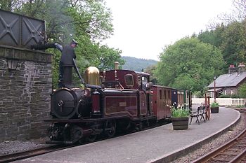
| Corris Railway Corris Railway The Corris Railway is a narrow gauge preserved railway based in Corris on the border between Merionethshire and Montgomeryshire in Mid-Wales.... |
1859–1948 | 12.25 miles (19.7 km) | Machynlleth Machynlleth Machynlleth is a market town in Powys, Wales. It is in the Dyfi Valley at the intersection of the A487 and the A489 roads.Machynlleth was the seat of Owain Glyndŵr's Welsh Parliament in 1404, and as such claims to be the "ancient capital of Wales". However, it has never held any official... , Wales Wales Wales is a country that is part of the United Kingdom and the island of Great Britain, bordered by England to its east and the Atlantic Ocean and Irish Sea to its west. It has a population of three million, and a total area of 20,779 km²... |
Built to carry slate from the Corris district. Closed after flooding of the Afon Dyfi River Dyfi The River Dyfi is a river in Mid Wales. The Dyfi estuary forms the border between the counties of Gwynedd and Ceredigion.- Source :... . |
|
| Corris Railway Corris Railway The Corris Railway is a narrow gauge preserved railway based in Corris on the border between Merionethshire and Montgomeryshire in Mid-Wales.... |
1967–present | 1 miles (1.6 km) | Corris Corris Corris is a village in the south of Snowdonia in the Welsh county of Gwynedd. Although the Snowdonia National Park covers much of the area around Corris, the village is not within the park. The name is possibly derived from the English word "quarries", and the extensive slate quarries that surround... , Wales Wales Wales is a country that is part of the United Kingdom and the island of Great Britain, bordered by England to its east and the Atlantic Ocean and Irish Sea to its west. It has a population of three million, and a total area of 20,779 km²... |
Heritage railway Heritage railway thumb|right|the Historical [[Khyber train safari|Khyber Railway]] goes through the [[Khyber Pass]], [[Pakistan]]A heritage railway , preserved railway , tourist railway , or tourist railroad is a railway that is run as a tourist attraction, in some cases by volunteers, and... revival of the Corris Railway. Reopened in 2002. |
|
| Devil's Dyke Steep Grade Railway | 1897–1908 | Unknown | Brighton Brighton Brighton is the major part of the city of Brighton and Hove in East Sussex, England on the south coast of Great Britain... , England England England is a country that is part of the United Kingdom. It shares land borders with Scotland to the north and Wales to the west; the Irish Sea is to the north west, the Celtic Sea to the south west, with the North Sea to the east and the English Channel to the south separating it from continental... |
A tourist funicular Funicular A funicular, also known as an inclined plane or cliff railway, is a cable railway in which a cable attached to a pair of tram-like vehicles on rails moves them up and down a steep slope; the ascending and descending vehicles counterbalance each other.-Operation:The basic principle of funicular... railway climbing the South Downs South Downs The South Downs is a range of chalk hills that extends for about across the south-eastern coastal counties of England from the Itchen Valley of Hampshire in the west to Beachy Head, near Eastbourne, East Sussex, in the east. It is bounded on its northern side by a steep escarpment, from whose... . |
|
| Devon Railway Centre Devon Railway Centre The Devon Railway Centre is in the village of Bickleigh in Mid Devon, England, at the former Cadeleigh railway station on the closed Great Western Railway branch from Exeter to Dulverton, also known as the Exe Valley Railway. The Centre operates a 2ft gauge passenger railway and has the largest... |
1997–present | Unknown | Tiverton, England England England is a country that is part of the United Kingdom. It shares land borders with Scotland to the north and Wales to the west; the Irish Sea is to the north west, the Celtic Sea to the south west, with the North Sea to the east and the English Channel to the south separating it from continental... |
A tourist railway and locomotive collection. | |
| East Hayling Light Railway | 1998–present | Unknown | Hayling Island Hayling Island -Leisure activities:Although largely residential, Hayling is also a holiday, windsurfing and sailing centre, the site where windsurfing was invented.... , England England England is a country that is part of the United Kingdom. It shares land borders with Scotland to the north and Wales to the west; the Irish Sea is to the north west, the Celtic Sea to the south west, with the North Sea to the east and the English Channel to the south separating it from continental... |
Newly constructed narrow gauge pleasure railway using diesel locomotives. | |
| Fairbourne Railway Fairbourne Railway The Fairbourne Railway is a gauge miniature railway running for from the village of Fairbourne on the Mid-Wales coast, alongside the beach to the end of a peninsula at Barmouth Ferry, where there is a connection with a pedestrian ferry across the Mawddach estuary to the seaside resort of... |
1895–present | 2 miles (3.2 km) | Fairbourne Fairbourne Fairbourne is a village on the coast of Barmouth Bay to the south of the estuary of the River Mawddach in Gwynedd, surrounded by the Snowdonia National Park. Before the seaside resort was built the coastal area was known as Morfa Henddol, while the outcrop now occupied by the Fairbourne Hotel was... , Wales Wales Wales is a country that is part of the United Kingdom and the island of Great Britain, bordered by England to its east and the Atlantic Ocean and Irish Sea to its west. It has a population of three million, and a total area of 20,779 km²... |
Built as a horse drawn tramway to carry building materials for Fairbourne village. Has been carrying passengers from Fairbourne village to Penrhyn Point ever since. | |
| Festiniog and Blaenau Railway Festiniog and Blaenau Railway The Festiniog & Blaenau Railway was a narrow gauge railway built in 1868 to connect the town of Blaenau Ffestiniog with the slate quarries around Tanymanod and the smaller town of Llan Ffestiniog. At Blaenau Ffestiniog it made a direct connection with the Ffestiniog Railway with which it was... |
1868–1883 | 3.5 miles (5.6 km) | Blaenau Ffestiniog Blaenau Ffestiniog Blaenau Ffestiniog is a town in Gwynedd, north-west Wales. It has a population of 5,000, including Llan Ffestiniog, which makes it the third largest town in Gwynedd, behind Caernarfon & Porthmadog. Although the population reached 12,000 at the peak of the slate industry, the population fell due to... , Wales Wales Wales is a country that is part of the United Kingdom and the island of Great Britain, bordered by England to its east and the Atlantic Ocean and Irish Sea to its west. It has a population of three million, and a total area of 20,779 km²... |
Independent line feeding the Ffestiniog Railway Ffestiniog Railway The Ffestiniog Railway is a narrow gauge heritage railway, located in Gwynedd, Wales. It is a major tourist attraction located mainly within the Snowdonia National Park.... to which it was connected. Converted to a standard gauge Standard gauge The standard gauge is a widely-used track gauge . Approximately 60% of the world's existing railway lines are built to this gauge... branch of the Great Western Railway Great Western Railway The Great Western Railway was a British railway company that linked London with the south-west and west of England and most of Wales. It was founded in 1833, received its enabling Act of Parliament in 1835 and ran its first trains in 1838... in 1883. |
|
| Ffestiniog Railway Ffestiniog Railway The Ffestiniog Railway is a narrow gauge heritage railway, located in Gwynedd, Wales. It is a major tourist attraction located mainly within the Snowdonia National Park.... |
1836 -1946 | 13.5 miles (21.7 km) | Porthmadog Porthmadog Porthmadog , known locally as "Port", and historically rendered into English as Portmadoc, is a small coastal town and community in the Eifionydd area of Gwynedd, in Wales. Prior to the Local Government Act 1972 it was in the administrative county of Caernarfonshire. The town lies east of... , Wales Wales Wales is a country that is part of the United Kingdom and the island of Great Britain, bordered by England to its east and the Atlantic Ocean and Irish Sea to its west. It has a population of three million, and a total area of 20,779 km²... |
Built to carry slate from the Blaenau Ffestiniog Blaenau Ffestiniog Blaenau Ffestiniog is a town in Gwynedd, north-west Wales. It has a population of 5,000, including Llan Ffestiniog, which makes it the third largest town in Gwynedd, behind Caernarfon & Porthmadog. Although the population reached 12,000 at the peak of the slate industry, the population fell due to... district to the coast. |
|
| Ffestiniog Railway Ffestiniog Railway The Ffestiniog Railway is a narrow gauge heritage railway, located in Gwynedd, Wales. It is a major tourist attraction located mainly within the Snowdonia National Park.... |
1954–present | 13.5 miles (21.7 km) | Porthmadog Porthmadog Porthmadog , known locally as "Port", and historically rendered into English as Portmadoc, is a small coastal town and community in the Eifionydd area of Gwynedd, in Wales. Prior to the Local Government Act 1972 it was in the administrative county of Caernarfonshire. The town lies east of... , Wales Wales Wales is a country that is part of the United Kingdom and the island of Great Britain, bordered by England to its east and the Atlantic Ocean and Irish Sea to its west. It has a population of three million, and a total area of 20,779 km²... |
Heritage revival of the original company. | |
| Gartell Light Railway | 1990–Present | 0.75 miles (1.2 km) | Yeston, Somerset Somerset The ceremonial and non-metropolitan county of Somerset in South West England borders Bristol and Gloucestershire to the north, Wiltshire to the east, Dorset to the south-east, and Devon to the south-west. It is partly bounded to the north and west by the Bristol Channel and the estuary of the... , England England England is a country that is part of the United Kingdom. It shares land borders with Scotland to the north and Wales to the west; the Irish Sea is to the north west, the Celtic Sea to the south west, with the North Sea to the east and the English Channel to the south separating it from continental... |
Built partly along the track of the old Somerset and Dorset Joint Railway Somerset and Dorset Joint Railway The Somerset & Dorset Joint Railway – almost always referred to as "the S&D" – was an English railway line connecting Bath in north east Somerset and Bournemouth now in south east Dorset but then in Hampshire... . |
|
| Glasgow Subway Glasgow Subway The Glasgow Subway is an underground metro line in Glasgow, Scotland. Opened on 14 December 1896, it is the third-oldest underground metro system in the world after the London Underground and the Budapest Metro. Formerly a cable railway, the Subway was later electrified, but its twin circular lines... |
1896–present | 6.5 miles (10.5 km) | Glasgow Glasgow Glasgow is the largest city in Scotland and third most populous in the United Kingdom. The city is situated on the River Clyde in the country's west central lowlands... , Scotland Scotland Scotland is a country that is part of the United Kingdom. Occupying the northern third of the island of Great Britain, it shares a border with England to the south and is bounded by the North Sea to the east, the Atlantic Ocean to the north and west, and the North Channel and Irish Sea to the... |
Underground cable-hauled Cable car (railway) A cable car or cable railway is a mass transit system using rail cars that are hauled by a continuously moving cable running at a constant speed. Individual cars stop and start by releasing and gripping this cable as required... metro Rapid transit A rapid transit, underground, subway, elevated railway, metro or metropolitan railway system is an electric passenger railway in an urban area with a high capacity and frequency, and grade separation from other traffic. Rapid transit systems are typically located either in underground tunnels or on... line, converted to third rail Third rail A third rail is a method of providing electric power to a railway train, through a semi-continuous rigid conductor placed alongside or between the rails of a railway track. It is used typically in a mass transit or rapid transit system, which has alignments in its own corridors, fully or almost... operation in 1935 and modernised 1977-1980. Still in operation as a common carrier Common carrier A common carrier in common-law countries is a person or company that transports goods or people for any person or company and that is responsible for any possible loss of the goods during transport... . |
|
| Glyn Valley Tramway Glyn Valley Tramway The Glyn Valley Tramway was a narrow gauge railway that connected Chirk with Glyn Ceiriog in Denbighshire , Wales. The gauge of the line was... |
1873–1935 | 8.75 miles (14.1 km) | Chirk Chirk Chirk is a small town and local government community, the lowest tier of local government, part of Wrexham County Borough in Wales. It has a population of over 4,000.... , Wales Wales Wales is a country that is part of the United Kingdom and the island of Great Britain, bordered by England to its east and the Atlantic Ocean and Irish Sea to its west. It has a population of three million, and a total area of 20,779 km²... |
Carried granite and passengers along the Ceriog Valley, much of the length as a roadside tramway. | |
| Great Bush Railway Great Bush Railway The Great Bush Railway is a private 2' gauge railway running round the edge of Tinker's Park, Hadlow Down, Sussex. The railway is operated by the Claude Jessett Trust Company.- Locomotives :-See also:* British narrow gauge railways*... |
early 1970s-present | 0.25 mile (0.402335 km) | Hadlow Down Hadlow Down Hadlow Down is a village and civil parish in the Wealden District of East Sussex, England. It is located on the A272 road three miles north-east of Heathfield. The parish is within the High Weald Area of Outstanding Natural Beauty... , England England England is a country that is part of the United Kingdom. It shares land borders with Scotland to the north and Wales to the west; the Irish Sea is to the north west, the Celtic Sea to the south west, with the North Sea to the east and the English Channel to the south separating it from continental... |
Private Railway running around Tinker's Park | |
| Great Laxey Mine Railway Great Laxey Mine Railway The Great Laxey Mine Railway was originally constructed to serve the Isle of Man's Great Laxey Mine, a lead mine located in Laxey. The gauge railway runs from the old mine entrance to the washing floors along a right of way that passes through the Isle of Man's only railway tunnel under the gauge... |
2004–present | 0.25 mile (0.402335 km) | Laxey Laxey Laxey is a village on the east coast of the Isle of Man. Its name derives from the Old Norse Laxa meaning 'Salmon River'.The village lies on the A2, the main Douglas to Ramsey road. Laxey Glen is one of the Manx National Glens, with Dhoon Glen being located close by... , Isle of Man Isle of Man The Isle of Man , otherwise known simply as Mann , is a self-governing British Crown Dependency, located in the Irish Sea between the islands of Great Britain and Ireland, within the British Isles. The head of state is Queen Elizabeth II, who holds the title of Lord of Mann. The Lord of Mann is... |
Replica locomotives running passenger trains on the original trackbed of the Laxey mines railway. | |
| Great Orme Tramway Great Orme Tramway The Great Orme Tramway is a cable-hauled gauge tramway in Llandudno in north Wales.This is Great Britain's only remaining cable operated street tramway and one of only three surviving in the world . It takes passengers from Llandudno Victoria Station to just below the summit of the Great Orme... |
1902–present | 1.25 miles (2 km) | Llandudno Llandudno Llandudno is a seaside resort and town in Conwy County Borough, Wales. In the 2001 UK census it had a population of 20,090 including that of Penrhyn Bay and Penrhynside, which are within the Llandudno Community... , Wales Wales Wales is a country that is part of the United Kingdom and the island of Great Britain, bordered by England to its east and the Atlantic Ocean and Irish Sea to its west. It has a population of three million, and a total area of 20,779 km²... |
Cable-hauled tourist railway carrying passengers to the top of the Great Orme Great Orme The Great Orme is a prominent limestone headland on the north coast of Wales situated in Llandudno. It is referred to as Cyngreawdr Fynydd in a poem by the 12th century poet Gwalchmai ap Meilyr... headland. |
|
| Groudle Glen Railway Groudle Glen Railway The Groudle Glen Railway is a narrow gauge railway north of Douglas in the Isle of Man which is owned and operated by members of the Isle of Man Steam Railway Supporters' Association and operates on summer Sundays; May to September and Wednesday evenings in July and August along with a number of... |
1896–1962 | 0.75 miles (1.2 km) | Isle of Man Isle of Man The Isle of Man , otherwise known simply as Mann , is a self-governing British Crown Dependency, located in the Irish Sea between the islands of Great Britain and Ireland, within the British Isles. The head of state is Queen Elizabeth II, who holds the title of Lord of Mann. The Lord of Mann is... |
Tourist railway along the clifftops at Groudle Glen | |
| Groudle Glen Railway Groudle Glen Railway The Groudle Glen Railway is a narrow gauge railway north of Douglas in the Isle of Man which is owned and operated by members of the Isle of Man Steam Railway Supporters' Association and operates on summer Sundays; May to September and Wednesday evenings in July and August along with a number of... |
1986–present | Unknown | Isle of Man Isle of Man The Isle of Man , otherwise known simply as Mann , is a self-governing British Crown Dependency, located in the Irish Sea between the islands of Great Britain and Ireland, within the British Isles. The head of state is Queen Elizabeth II, who holds the title of Lord of Mann. The Lord of Mann is... |
Tourist railway along the clifftops at Groudle Glen | |
| Hayling Seaside Railway Hayling Seaside Railway The Hayling Seaside Railway, formerly East Hayling Light Railway, is a gauge narrow gauge railway on Hayling Island, Hampshire, England. It is mainly a diesel operated railway, though the railway often hires steam locomotives from other narrow gauge railways... |
2003–present | 1.1 miles (1.8 km) | Hayling Island Hayling Island -Leisure activities:Although largely residential, Hayling is also a holiday, windsurfing and sailing centre, the site where windsurfing was invented.... |
Runs along Hayling Island sea front | |
| Herne Bay Pier Railway | 1896–1939 | 0.75 miles (1.2 km) | Herne Bay Herne Bay, Kent Herne Bay is a seaside town in Kent, South East England, with a population of 35,188. On the south coast of the Thames Estuary, it is north of Canterbury and east of Whitstable. It neighbours the ancient villages of Herne and Reculver and is part of the City of Canterbury local government district... , England England England is a country that is part of the United Kingdom. It shares land borders with Scotland to the north and Wales to the west; the Irish Sea is to the north west, the Celtic Sea to the south west, with the North Sea to the east and the English Channel to the south separating it from continental... |
Pier construction railway that was retained for passenger use. | |
| Hythe Pier Railway Hythe Pier, Railway and Ferry Hythe Pier, the Hythe Pier Railway and the Hythe Ferry together provide a transport link between the English port city of Southampton and the Hampshire village of Hythe on the opposite side of Southampton Water... |
1879–present | 0.33 mile (0.5310822 km) | Hythe Hythe, Hampshire Hythe is a village near Southampton, Hampshire, England. It is located by the shore of Southampton Water, and has a ferry service connecting it to Southampton... , England England England is a country that is part of the United Kingdom. It shares land borders with Scotland to the north and Wales to the west; the Irish Sea is to the north west, the Celtic Sea to the south west, with the North Sea to the east and the English Channel to the south separating it from continental... |
Originally hand operated. Relaid and converted to third rail electric operation in 1922. Forms part of an integrated rail and ferry transport link from Hythe to Southampton Southampton Southampton is the largest city in the county of Hampshire on the south coast of England, and is situated south-west of London and north-west of Portsmouth. Southampton is a major port and the closest city to the New Forest... . |
|
| Isle of Man Steam Railway | 1873–present | 46 miles (74 km) | Douglas Douglas, Isle of Man right|thumb|250px|Douglas Promenade, which runs nearly the entire length of beachfront in Douglasright|thumb|250px|Sea terminal in DouglasDouglas is the capital and largest town of the Isle of Man, with a population of 26,218 people . It is located at the mouth of the River Douglas, and a sweeping... , Isle of Man Isle of Man The Isle of Man , otherwise known simply as Mann , is a self-governing British Crown Dependency, located in the Irish Sea between the islands of Great Britain and Ireland, within the British Isles. The head of state is Queen Elizabeth II, who holds the title of Lord of Mann. The Lord of Mann is... |
An extensive network of lines covering the island. Now reduced to one main line that is principally a steam-hauled tourist railway. | |
| Jersey Railway Jersey Railway The Jersey Railway was opened in 1870 and was originally a standard gauge railway, long, in Jersey in the Channel Islands. Converted to narrow gauge in 1884 and extended, the line closed in 1936. It is not to be confused with the Jersey Eastern Railway.... |
1870–1936 | 8.5 miles (13.7 km) | Saint Helier Saint Helier Saint Helier is one of the twelve parishes of Jersey, the largest of the Channel Islands in the English Channel. St. Helier has a population of about 28,000, roughly 31.2% of the total population of Jersey, and is the capital of the Island . The urban area of the parish of St... , Jersey Jersey Jersey, officially the Bailiwick of Jersey is a British Crown Dependency off the coast of Normandy, France. As well as the island of Jersey itself, the bailiwick includes two groups of small islands that are no longer permanently inhabited, the Minquiers and Écréhous, and the Pierres de Lecq and... |
Passenger and goods services in the island of Jersey. | |
| Launceston Steam Railway Launceston Steam Railway The Launceston Steam Railway is narrow gauge railway operating from the town of Launceston in Cornwall. The railway is built on the trackbed of the North Cornwall Railway to the gauge of and runs for 2½ miles to Newmills, where there is a farm park.... |
1983–present | 2.5 miles (4 km) | Launceston, England England England is a country that is part of the United Kingdom. It shares land borders with Scotland to the north and Wales to the west; the Irish Sea is to the north west, the Celtic Sea to the south west, with the North Sea to the east and the English Channel to the south separating it from continental... |
Steam-hauled tourist railway built on the trackbed of the standard gauge North Cornwall Railway | |
| Leadhills and Wanlockhead Railway Leadhills and Wanlockhead Railway The Leadhills and Wanlockhead Railway, a gauge railway in South Lanarkshire, Scotland, is laid on the trackbed of the former Leadhills and Wanlockhead Branch of the Caledonian Railway which led off the main line between and Glasgow at Elvanfoot.- Overview :... |
1986–present | 0.75 miles (1.2 km) | Leadhills Leadhills Leadhills is a village in South Lanarkshire, Scotland, 5¾ miles WSW of Elvanfoot. Population 835. Originally known as Waterhead, It is the second highest village in Scotland after Wanlockhead, lying 395m above sea-level, near the source of Glengonnar Water, an affluent of the River Clyde... , Scotland Scotland Scotland is a country that is part of the United Kingdom. Occupying the northern third of the island of Great Britain, it shares a border with England to the south and is bounded by the North Sea to the east, the Atlantic Ocean to the north and west, and the North Channel and Irish Sea to the... |
Passenger carrying tourist line built on a standard gauge Standard gauge The standard gauge is a widely-used track gauge . Approximately 60% of the world's existing railway lines are built to this gauge... trackbed. |
|
| Leek and Manifold Valley Light Railway Leek and Manifold Valley Light Railway The Leek and Manifold Valley Light Railway was a narrow gauge railway in Staffordshire, Great Britain that operated between 1904 and 1934. When in operation, the line mainly carried milk from dairies in the region, acting as a feeder to the standard gauge system. It also provided passenger... |
1904–1934 | 8.5 miles (13.7 km) | Leek Leek, Staffordshire Leek is a market town in the county of Staffordshire, England, on the River Churnet. It is an ancient borough and was granted its royal charter in 1214.It is the administrative centre for the Staffordshire Moorlands District Council... , England England England is a country that is part of the United Kingdom. It shares land borders with Scotland to the north and Wales to the west; the Irish Sea is to the north west, the Celtic Sea to the south west, with the North Sea to the east and the English Channel to the south separating it from continental... |
Agricultural and passenger service for the Manifold valley in the Derbyshire Dales Derbyshire Dales Derbyshire Dales is a local government district in Derbyshire, England. Much of the district is situated in the Peak District, although most of its population lies along the River Derwent.... . |
|
| Leighton Buzzard Railway | 1968–present | 3 miles (4.8 km) | Leighton Buzzard Leighton Buzzard -Lower schools:*Beaudesert Lower School - Apennine Way*Clipstone Brook Lower School - Brooklands Drive*Greenleas Lower School - Derwent Road*Dovery Down Lower School - Heath Road*Heathwood Lower School - Heath Road*Leedon Lower School - Highfield Road... , England England England is a country that is part of the United Kingdom. It shares land borders with Scotland to the north and Wales to the west; the Irish Sea is to the north west, the Celtic Sea to the south west, with the North Sea to the east and the English Channel to the south separating it from continental... |
Heritage railway Heritage railway thumb|right|the Historical [[Khyber train safari|Khyber Railway]] goes through the [[Khyber Pass]], [[Pakistan]]A heritage railway , preserved railway , tourist railway , or tourist railroad is a railway that is run as a tourist attraction, in some cases by volunteers, and... operating over the tracks of the Leighton Buzzard Light Railway |
|
| Lincolnshire Coast Light Railway Lincolnshire Coast Light Railway The Lincolnshire Coast Light Railway was a narrow gauge heritage railway built in 1958 using equipment from the Nocton Potato Estate railway.The railway was built by a group of railway enthusiasts who wished to preserve the stock and atmosphere of the Lincolnshire area potato railways... |
1958–1985 | Unknown | Humberstone, England England England is a country that is part of the United Kingdom. It shares land borders with Scotland to the north and Wales to the west; the Irish Sea is to the north west, the Celtic Sea to the south west, with the North Sea to the east and the English Channel to the south separating it from continental... |
Tourist line built using ex-Nocton Potato Estate railway equipment | |
| Llanberis Lake Railway Llanberis Lake Railway The Llanberis Lake Railway is a narrow gauge heritage railway that runs for along the northern shore of Llyn Padarn in north Wales in the Snowdonia National Park. The starting point is the town of Llanberis at the eastern end of the lake , with the western terminus at Pen Llyn in the Padarn... |
1972–present | Unknown | Llanberis Llanberis Llanberis is a village in Gwynedd, North Wales, lying on the southern banks of Llyn Padarn in Snowdonia. It takes its name from Saint Peris, an early Welsh saint.According to the United Kingdom Census 2001, the population of Llanberis was 1,954... , Wales Wales Wales is a country that is part of the United Kingdom and the island of Great Britain, bordered by England to its east and the Atlantic Ocean and Irish Sea to its west. It has a population of three million, and a total area of 20,779 km²... |
Tourist railway running along part of the trackbed of the Padarn Railway using equipment from the Dinorwic quarry railway. | |
| Lynton and Barnstaple Railway Lynton and Barnstaple Railway The Lynton & Barnstaple Railway opened as an independent railway in May 1898. It was a single track narrow gauge railway slightly over long running through the rugged and picturesque area bordering Exmoor in North Devon, England. Although opened after the 1896 Light Railways Act came into force,... |
1898–1935 | 19.25 miles (31 km) | Barnstaple Barnstaple Barnstaple is a town and civil parish in the local government district of North Devon in the county of Devon, England, UK. It lies west southwest of Bristol, north of Plymouth and northwest of the county town of Exeter. The old spelling Barnstable is now obsolete.It is the main town of the... , England England England is a country that is part of the United Kingdom. It shares land borders with Scotland to the north and Wales to the west; the Irish Sea is to the north west, the Celtic Sea to the south west, with the North Sea to the east and the English Channel to the south separating it from continental... |
Carried passengers and general freight for 20 miles (32.2 km) of rugged countryside around Exmoor Exmoor Exmoor is an area of hilly open moorland in west Somerset and north Devon in South West England, named after the main river that flows out of the district, the River Exe. The moor has given its name to a National Park, which includes the Brendon Hills, the East Lyn Valley, the Vale of Porlock and ... , Devon. Part of the line is now being restored as a heritage railway, and reopened to passengers in 2004. The line was extended to just over 1 miles (1.6 km) in May, 2006. |
|
| Lynton and Barnstaple Railway Lynton and Barnstaple Railway The Lynton & Barnstaple Railway opened as an independent railway in May 1898. It was a single track narrow gauge railway slightly over long running through the rugged and picturesque area bordering Exmoor in North Devon, England. Although opened after the 1896 Light Railways Act came into force,... |
2003–present | 1 miles (1.6 km) | Woody Bay Woody Bay Three miles west of Lynton and eight east of Combe Martin on the North Devon coast of England, stoney-beached Woody Bay nestles among the steep cliffs of the rugged coast below the heights of Exmoor... , England England England is a country that is part of the United Kingdom. It shares land borders with Scotland to the north and Wales to the west; the Irish Sea is to the north west, the Celtic Sea to the south west, with the North Sea to the east and the English Channel to the south separating it from continental... |
Restoration of the Lynton and Barnstaple railway, on the trackbed of the original line | |
| Manx Electric Railway Manx Electric Railway The Manx Electric Railway is an electric inter-urban tramway connecting Douglas, Laxey and Ramsey in the Isle of Man. It connects with the Douglas Bay Horse Tramway at its southern terminus at Derby Castle at the northern end of the promenade in Douglas, and with the Snaefell Mountain Railway at... |
1893 -present | 17 miles (27 km) | Douglas Douglas, Isle of Man right|thumb|250px|Douglas Promenade, which runs nearly the entire length of beachfront in Douglasright|thumb|250px|Sea terminal in DouglasDouglas is the capital and largest town of the Isle of Man, with a population of 26,218 people . It is located at the mouth of the River Douglas, and a sweeping... , Isle of Man Isle of Man The Isle of Man , otherwise known simply as Mann , is a self-governing British Crown Dependency, located in the Irish Sea between the islands of Great Britain and Ireland, within the British Isles. The head of state is Queen Elizabeth II, who holds the title of Lord of Mann. The Lord of Mann is... |
An electric tramway running from Douglas Douglas, Isle of Man right|thumb|250px|Douglas Promenade, which runs nearly the entire length of beachfront in Douglasright|thumb|250px|Sea terminal in DouglasDouglas is the capital and largest town of the Isle of Man, with a population of 26,218 people . It is located at the mouth of the River Douglas, and a sweeping... to Ramsey Ramsey, Isle of Man Ramsey is a town in the north of the Isle of Man. It is the second largest town on the island after Douglas. Its population is 7,309 according to the 2006 census . It has one of the biggest harbours on the island, and has a prominent derelict pier, called the Queen's Pier. It was formerly one of... along the east coast of the Isle of Man. |
|
| Manx Northern Railway Manx Northern Railway The Manx Northern Railway was the second common carrier railway built in the Isle of Man. It operated as an independent concern only from 1879 to 1905.- History :... |
1879–1905 | 16.75 miles (27 km) | Ramsey Ramsey, Isle of Man Ramsey is a town in the north of the Isle of Man. It is the second largest town on the island after Douglas. Its population is 7,309 according to the 2006 census . It has one of the biggest harbours on the island, and has a prominent derelict pier, called the Queen's Pier. It was formerly one of... , Isle of Man Isle of Man The Isle of Man , otherwise known simply as Mann , is a self-governing British Crown Dependency, located in the Irish Sea between the islands of Great Britain and Ireland, within the British Isles. The head of state is Queen Elizabeth II, who holds the title of Lord of Mann. The Lord of Mann is... |
Steam railway from St John's to Ramsey on the Isle of Man. Incorporated into the Isle of Man Railway Isle of Man Railway The Isle of Man Railway is a narrow gauge steam-operated railway connecting Douglas with Castletown and Port Erin in the Isle of Man. The line is built to gauge and is long... in 1905. |
|
| Margam Park Railway | Unknown | 990yards | Margam Country Park Margam Country Park Margam Country Park is a country park estate in Britain, of around 850 acres . It is situated in Margam, about 2 miles from Port Talbot in south Wales it was once owned by the Mansel Talbot family and is now owned and administered by the local council, Neath Port Talbot County Borough Council... |
Operates in Margam Country Park, not open in winter. | |
| Foxdale Railway Foxdale Railway The Foxdale Railway was a branch line which ran from St. John's to Foxdale on the Isle of Man.-History:The line was officially opened by the Foxdale Railway Company Ltd. on allowing rail access to the lead mining workings around the village of Foxdale... |
1886–1905 | 2.5 miles (4 km) | Foxdale Foxdale Foxdale is a village located at the heart of the Isle of Man. The village falls within the sheading and constituency of Glenfaba and is currently represented in Tynwald and the House of Keys by David Anderson MHK who was elected in 2001 and again in 2006. The village is served by Patrick Parish... , Isle of Man Isle of Man The Isle of Man , otherwise known simply as Mann , is a self-governing British Crown Dependency, located in the Irish Sea between the islands of Great Britain and Ireland, within the British Isles. The head of state is Queen Elizabeth II, who holds the title of Lord of Mann. The Lord of Mann is... |
Carried lead and silver ore from mines at Foxdale Foxdale Foxdale is a village located at the heart of the Isle of Man. The village falls within the sheading and constituency of Glenfaba and is currently represented in Tynwald and the House of Keys by David Anderson MHK who was elected in 2001 and again in 2006. The village is served by Patrick Parish... to St John's for onward transport to Ramsey Ramsey, Isle of Man Ramsey is a town in the north of the Isle of Man. It is the second largest town on the island after Douglas. Its population is 7,309 according to the 2006 census . It has one of the biggest harbours on the island, and has a prominent derelict pier, called the Queen's Pier. It was formerly one of... via the Manx Northern Railway Manx Northern Railway The Manx Northern Railway was the second common carrier railway built in the Isle of Man. It operated as an independent concern only from 1879 to 1905.- History :... who operated the line. |
|
| North Gloucestershire Railway North Gloucestershire Railway The North Gloucestershire Railway is a narrow gauge railway running alongside the Gloucestershire and Warwickshire Railway at Toddington. It was built in 1985 when the Dowty Railway Preservation Society needed a new home for its collection of narrow gauge rolling stock. The rail used on the... |
1985–present | 0.2 mile (0.321868 km) | Toddington Toddington, Gloucestershire Toddington is a village and civil parish in north Gloucestershire in Tewkesbury Borough, located approx. 20 km north-east of Cheltenham with a population of around 300 people.... , England England England is a country that is part of the United Kingdom. It shares land borders with Scotland to the north and Wales to the west; the Irish Sea is to the north west, the Celtic Sea to the south west, with the North Sea to the east and the English Channel to the south separating it from continental... |
A short railway laid beside the Gloucestershire and Warwickshire Railway, replacing the Dowty Railway Society | |
| North Wales Narrow Gauge Railways North Wales Narrow Gauge Railways The North Wales Narrow Gauge Railways was a gauge railway running from Dinas to Bryngwyn, Wales, which was authorised by Act of Parliament 1872. The same act authorised a branch from Tryfan Junction to South Snowdon... |
1877–1916 | 12.25 miles (19.7 km) | Dinas Dinas, Gwynedd Dinas is a large hamlet near Bontnewydd, Caernarfon, in Gwynedd, north-west Wales.It is in the ancient parish and modern community of Llanwnda and is served by the parish church of St... , Wales Wales Wales is a country that is part of the United Kingdom and the island of Great Britain, bordered by England to its east and the Atlantic Ocean and Irish Sea to its west. It has a population of three million, and a total area of 20,779 km²... |
One of the precursors to the WHR Welsh Highland Railway The Welsh Highland Railway is a long restored narrow gauge heritage railway in North Wales, operating from Caernarfon to Porthmadog, and passing through a number of popular tourist destinations including Beddgelert and the Aberglaslyn Pass. At Porthmadog it connects with the Ffestiniog Railway... . Carried passengers, slate and general freight. |
|
| Perrygrove Railway Perrygrove Railway The Perrygrove Railway is a minimum gauge railway of gauge. It is a private heritage railway at Perrygrove Farm in the Royal Forest of Dean near Coleford, Gloucestershire, England... |
1995–present | 1+1/2 mi | Royal Forest of Dean, England England England is a country that is part of the United Kingdom. It shares land borders with Scotland to the north and Wales to the west; the Irish Sea is to the north west, the Celtic Sea to the south west, with the North Sea to the east and the English Channel to the south separating it from continental... |
A steam hauled tourist railway. | |
| Plynlimon and Hafan Tramway Plynlimon and Hafan Tramway The Plynlimon and Hafan Tramway was a gauge narrow gauge railway in Cardiganshire in Mid Wales. It ran from Llanfihangel station on the Cambrian Railways via the village of Talybont and the valley of the Afon Leri into the foothills of Plynlimon Fawr... |
1897–1899 | 7 miles (11.3 km) | Talybont Talybont Talybont is the name of several villages in Wales:*Tal-y-bont, Ceredigion*Tal-y-bont, Conwy*Talybont, Bangor near Bangor in Gwynedd*Talybont, Barmouth near Barmouth in Gwynedd*Talybont-on-Usk, Powys*Talybont Reservoir... , Wales Wales Wales is a country that is part of the United Kingdom and the island of Great Britain, bordered by England to its east and the Atlantic Ocean and Irish Sea to its west. It has a population of three million, and a total area of 20,779 km²... |
Short-lived line serving the lead mines around Hafan. | |
| Portmadoc, Beddgelert and South Snowdon Railway Portmadoc, Beddgelert and South Snowdon Railway The Porthmadog, Beddgelert and South Snowdon Railway was a narrow gauge railway intended to connect Porthmadog with the North Wales Narrow Gauge Railways link terminus at Rhyd Ddu... |
1901–1908 | Unknown | Porthmadog Porthmadog Porthmadog , known locally as "Port", and historically rendered into English as Portmadoc, is a small coastal town and community in the Eifionydd area of Gwynedd, in Wales. Prior to the Local Government Act 1972 it was in the administrative county of Caernarfonshire. The town lies east of... , Wales Wales Wales is a country that is part of the United Kingdom and the island of Great Britain, bordered by England to its east and the Atlantic Ocean and Irish Sea to its west. It has a population of three million, and a total area of 20,779 km²... |
An attempt to connect Porthmadog to Beddgelert and the NWNGR North Wales Narrow Gauge Railways The North Wales Narrow Gauge Railways was a gauge railway running from Dinas to Bryngwyn, Wales, which was authorised by Act of Parliament 1872. The same act authorised a branch from Tryfan Junction to South Snowdon... . Although it never opened to traffic, much of the trackbed was built and formed part of the WHR Welsh Highland Railway The Welsh Highland Railway is a long restored narrow gauge heritage railway in North Wales, operating from Caernarfon to Porthmadog, and passing through a number of popular tourist destinations including Beddgelert and the Aberglaslyn Pass. At Porthmadog it connects with the Ffestiniog Railway... . |
|
| Radstock Light Railway | 1995–present | Unknown | Radstock Radstock Radstock is a town in Somerset, England, south west of Bath, and north west of Frome. It is within the unitary authority of Bath and North East Somerset and had a population of 5,275 according to the 2001 Census... , England England England is a country that is part of the United Kingdom. It shares land borders with Scotland to the north and Wales to the west; the Irish Sea is to the north west, the Celtic Sea to the south west, with the North Sea to the east and the English Channel to the south separating it from continental... |
Equipment on the Somerset and Avon Railway Association's site, mostly from the former Vobster Railway. | |
| Ramsgate Harbour Railway | Unknown-1965 | Unknown | Ramsgate Ramsgate Ramsgate is a seaside town in the district of Thanet in east Kent, England. It was one of the great English seaside towns of the 19th century and is a member of the ancient confederation of Cinque Ports. It has a population of around 40,000. Ramsgate's main attraction is its coastline and its main... , England England England is a country that is part of the United Kingdom. It shares land borders with Scotland to the north and Wales to the west; the Irish Sea is to the north west, the Celtic Sea to the south west, with the North Sea to the east and the English Channel to the south separating it from continental... |
Steeply graded tourist line running mainly in a tunnel under Ramsgate | |
| Ravenglass and Eskdale Railway Ravenglass and Eskdale Railway The Ravenglass and Eskdale Railway is a minimum gauge heritage railway in Cumbria, England. The line runs from Ravenglass to Dalegarth Station near Boot in the valley of Eskdale, in the Lake District... |
1875–1913 | 6.75 miles (10.9 km) | Ravenglass Ravenglass Ravenglass is a small coastal village and natural harbour in Cumbria, England. It is the only coastal town within the Lake District National Park... , England England England is a country that is part of the United Kingdom. It shares land borders with Scotland to the north and Wales to the west; the Irish Sea is to the north west, the Celtic Sea to the south west, with the North Sea to the east and the English Channel to the south separating it from continental... |
A line serving the iron ore mines and local passengers in the western Lake District Lake District The Lake District, also commonly known as The Lakes or Lakeland, is a mountainous region in North West England. A popular holiday destination, it is famous not only for its lakes and its mountains but also for its associations with the early 19th century poetry and writings of William Wordsworth... . Was subsequently converted to a minimum gauge railway Minimum gauge railway Minimum gauge railways have a gauge of less than or , most commonly , , or . The notion of minimum gauge railways was originally developed by estate railways and by the French company of Decauville for industrial railways.... which is still in operation. |
|
| Romney, Hythe and Dymchurch Railway Romney, Hythe and Dymchurch Railway The Romney, Hythe & Dymchurch Railway is a gauge light railway in Kent, England. The line runs from the Cinque Port of Hythe via Dymchurch, St... |
1927–present | 13.5 miles (21.7 km) | Kent Kent Kent is a county in southeast England, and is one of the home counties. It borders East Sussex, Surrey and Greater London and has a defined boundary with Essex in the middle of the Thames Estuary. The ceremonial county boundaries of Kent include the shire county of Kent and the unitary borough of... , England |
Running a mixture of steam and diesel trains; mainly operates as a tourist attraction but also provides local services and transport to and from school for local children. | |
| Rothesay and Ettrick Bay Light Railway Rothesay and Ettrick Bay Light Railway The Rothesay and Ettrick Bay Light Railway was a narrow gauge electric tramway on the Isle of Bute, Scotland.- History :The original tramway was opened in 1882 - a horse-drawn gauge tramway running from the promenade at Rothesay to Port Bannatyne. It was regauged to , electrified and extended to... |
1879–1936 | , converted to in 1902 | 4.75 miles (7.6 km) | Rothesay Rothesay, Argyll and Bute The town of Rothesay is the principal town on the Isle of Bute, in the council area of Argyll and Bute, Scotland. It can be reached by ferry from Wemyss Bay which offers an onward rail link to Glasgow. At the centre of the town is Rothesay Castle, a ruined castle which dates back to the 13th... , Scotland Scotland Scotland is a country that is part of the United Kingdom. Occupying the northern third of the island of Great Britain, it shares a border with England to the south and is bounded by the North Sea to the east, the Atlantic Ocean to the north and west, and the North Channel and Irish Sea to the... |
A horse tramway, converted to an electric tramway in 1936. |
| Rye and Camber Tramway Rye and Camber Tramway The Rye and Camber Tramway was an English narrow gauge railway in East Sussex. It was of gauge. It operated from 1895 until 1939, connecting Rye to the nearby coast at Camber. It was a short line, only about in length, and had three stations - Rye, Golf Links and Camber Sands... |
1895–1946 | 2.5 miles (4 km) | Rye Rye, East Sussex Rye is a small town in East Sussex, England, which stands approximately two miles from the open sea and is at the confluence of three rivers: the Rother, the Tillingham and the Brede... , England England England is a country that is part of the United Kingdom. It shares land borders with Scotland to the north and Wales to the west; the Irish Sea is to the north west, the Celtic Sea to the south west, with the North Sea to the east and the English Channel to the south separating it from continental... |
Passenger railway serving the seaside resorts and golf courses around Rye. | |
| Seaton Tramway Seaton Tramway The Seaton Tramway is an narrow gauge electric tramway which operates over the route of a a former British Railways branch line in Seaton, Devon... |
1969-present | 2ft 9in | 3 miles (4.8 km) | Seaton Seaton, Devon Seaton is a seaside town in East Devon on the south coast of England. It faces onto Lyme Bay, to the west of the mouth of the River Axe with red cliffs to one side and white cliffs on the other. Axmouth and Beer are nearby... , Devon Devon Devon is a large county in southwestern England. The county is sometimes referred to as Devonshire, although the term is rarely used inside the county itself as the county has never been officially "shired", it often indicates a traditional or historical context.The county shares borders with... , England England England is a country that is part of the United Kingdom. It shares land borders with Scotland to the north and Wales to the west; the Irish Sea is to the north west, the Celtic Sea to the south west, with the North Sea to the east and the English Channel to the south separating it from continental... |
Operates over a former axed British Rail branch line. |
| Shipley Glen Tramway Shipley Glen Tramway The Shipley Glen Tramway is a historic funicular tramway situated in the wooded Shipley Glen near the village of Saltaire in the English county of West Yorkshire.... |
1895–present | Unknown | Saltaire Saltaire Saltaire is a Victorian model village within the City of Bradford Metropolitan District, West Yorkshire, England, by the River Aire and the Leeds and Liverpool Canal... , England England England is a country that is part of the United Kingdom. It shares land borders with Scotland to the north and Wales to the west; the Irish Sea is to the north west, the Celtic Sea to the south west, with the North Sea to the east and the English Channel to the south separating it from continental... |
Rope-hauled inclined tourist railway. | |
| Sittingbourne & Kemsley Light Railway | 1969–present | 3.5 miles (5.6 km) | Sittingbourne Sittingbourne Sittingbourne is an industrial town about eight miles east of Gillingham in England, beside the Roman Watling Street off a creek in the Swale, a channel separating the Isle of Sheppey from mainland Kent... , England England England is a country that is part of the United Kingdom. It shares land borders with Scotland to the north and Wales to the west; the Irish Sea is to the north west, the Celtic Sea to the south west, with the North Sea to the east and the English Channel to the south separating it from continental... |
Heritage railway Heritage railway thumb|right|the Historical [[Khyber train safari|Khyber Railway]] goes through the [[Khyber Pass]], [[Pakistan]]A heritage railway , preserved railway , tourist railway , or tourist railroad is a railway that is run as a tourist attraction, in some cases by volunteers, and... founded by the Locomotive Club of Great Britain, operating over part of the Bowater Light Railway. |
|
| Snaefell Mountain Railway Snaefell Mountain Railway The Snaefell Mountain Railway is an electric mountain railway on the Isle of Man in Europe. It joins the town of Laxey with the summit of Snaefell, at above sea level the highest point on the island. It connects with the Manx Electric Railway in Laxey. The line is long, built to gauge and... |
1895–present | 5 miles (8 km) | Laxey Laxey Laxey is a village on the east coast of the Isle of Man. Its name derives from the Old Norse Laxa meaning 'Salmon River'.The village lies on the A2, the main Douglas to Ramsey road. Laxey Glen is one of the Manx National Glens, with Dhoon Glen being located close by... , Isle of Man Isle of Man The Isle of Man , otherwise known simply as Mann , is a self-governing British Crown Dependency, located in the Irish Sea between the islands of Great Britain and Ireland, within the British Isles. The head of state is Queen Elizabeth II, who holds the title of Lord of Mann. The Lord of Mann is... |
Steeply graded electric-powered Fell railway climbing to the summit of Snaefell Snaefell Snaefell is the highest mountain and the only summit higher than on the Isle of Man, at above sea level. The summit is crowned by a train station, cafe, and several communications masts.- Views :... , the Isle of Man's highest peak. |
|
| Snowdon Mountain Railway Snowdon Mountain Railway The Snowdon Mountain Railway is a narrow gauge rack and pinion mountain railway in Gwynedd, north-west Wales. It is a tourist railway that travels for from Llanberis to the summit of Snowdon, the highest peak in England and Wales.... |
1896–present | 5 miles (8 km) | Llanberis Llanberis Llanberis is a village in Gwynedd, North Wales, lying on the southern banks of Llyn Padarn in Snowdonia. It takes its name from Saint Peris, an early Welsh saint.According to the United Kingdom Census 2001, the population of Llanberis was 1,954... , Wales Wales Wales is a country that is part of the United Kingdom and the island of Great Britain, bordered by England to its east and the Atlantic Ocean and Irish Sea to its west. It has a population of three million, and a total area of 20,779 km²... |
Britain's only rack railway, built to carry passengers to the top of Wales' highest mountain. | |
| South Tynedale Railway South Tynedale Railway The South Tynedale Railway is a heritage railway in England and is England's highest narrow gauge railway. The route runs from Alston in Cumbria to Kirkhaugh in Northumberland via the South Tyne Viaduct, the Gilderdale Viaduct and the Whitley Viaduct... |
1983–present | 2.25 miles (3.6 km) | Alston Alston, Cumbria Alston is a small town in Cumbria, England on the River South Tyne. It is one of the highest elevation towns in the country, at about 1,000 feet above sea level.-Geography:... , England England England is a country that is part of the United Kingdom. It shares land borders with Scotland to the north and Wales to the west; the Irish Sea is to the north west, the Celtic Sea to the south west, with the North Sea to the east and the English Channel to the south separating it from continental... |
Steam-hauled line running on part of the trackbed of the standard gauge Standard gauge The standard gauge is a widely-used track gauge . Approximately 60% of the world's existing railway lines are built to this gauge... Newcastle and Carlisle Railway's Haltwhistle to Alston Branch. |
|
| Southend Pier Railway Southend Pier Railway The Southend Pier Railway is a narrow gauge railway in the English seaside resort of Southend-on-Sea. It runs the length of Southend Pier, providing public passenger transport from the shore to the pier head.-Operation:... |
1830–Present | converted to Gauge conversion In rail transport, gauge conversion is the process of converting a railway from one rail gauge to another, through the alteration of the railway tracks... in the late 1970s |
1.34 miles (2.2 km) | Southend, England England England is a country that is part of the United Kingdom. It shares land borders with Scotland to the north and Wales to the west; the Irish Sea is to the north west, the Celtic Sea to the south west, with the North Sea to the east and the English Channel to the south separating it from continental... |
Pier construction railway later used for passenger haulage. Converted to gauge in the late 1970s. |
| Southport Pier Tramway Southport Pier Tramway The Southport Pier Tramway is a tramway in the English seaside resort of Southport. It runs the length of Southport Pier, providing public passenger transport to the pier head.-History:... |
1863–Present | ( between 1950 and 2002) | 0.68 miles (1.1 km) | Southport Southport Southport is a seaside town in the Metropolitan Borough of Sefton in Merseyside, England. During the 2001 census Southport was recorded as having a population of 90,336, making it the eleventh most populous settlement in North West England... , England England England is a country that is part of the United Kingdom. It shares land borders with Scotland to the north and Wales to the west; the Irish Sea is to the north west, the Celtic Sea to the south west, with the North Sea to the east and the English Channel to the south separating it from continental... |
Pier tramway, originally built for baggage and later used for passenger haulage. Variously operated by cable, electric, diesel and (currently) battery traction. |
| Southwold Railway Southwold Railway - External links :* * * *... |
1879–1929 | 8.75 miles (14.1 km) | Southwold Southwold Southwold is a town on the North Sea coast, in the Waveney district of the English county of Suffolk. It is located on the North Sea coast at the mouth of the River Blyth within the Suffolk Coast and Heaths Area of Outstanding Natural Beauty. The town is around south of Lowestoft and north-east... , England England England is a country that is part of the United Kingdom. It shares land borders with Scotland to the north and Wales to the west; the Irish Sea is to the north west, the Celtic Sea to the south west, with the North Sea to the east and the English Channel to the south separating it from continental... |
Steam-hauled line connecting Southwold Southwold Southwold is a town on the North Sea coast, in the Waveney district of the English county of Suffolk. It is located on the North Sea coast at the mouth of the River Blyth within the Suffolk Coast and Heaths Area of Outstanding Natural Beauty. The town is around south of Lowestoft and north-east... with Halesworth Halesworth Halesworth is a small market town in the northeastern corner of Suffolk, England. It is located south west of Lowestoft, and straddles the River Blyth, 9 miles upstream from Southwold. The town is served by Halesworth railway station on the Ipswich-Lowestoft East Suffolk Line... along the Suffolk Suffolk Suffolk is a non-metropolitan county of historic origin in East Anglia, England. It has borders with Norfolk to the north, Cambridgeshire to the west and Essex to the south. The North Sea lies to the east... coast. |
|
| Steeple Grange Light Railway Steeple Grange Light Railway The Steeple Grange Light Railway is a heritage railway at Wirksworth in Derbyshire, UK. It uses industrial locomotives and rolling stock from disused mines, quarries, and steelworks around the country.-The line:... |
1988–present | ; | Unknown | Wirksworth Wirksworth Wirksworth is a small market town in Derbyshire, England, with a population of over 9,000.The population of the Wirksworth area including Cromford, Bolehill and Middleton-by-Wirksworth is about 12,000. Wirksworth is listed in the Domesday Book in 1086. Within it is the source of the River... , England England England is a country that is part of the United Kingdom. It shares land borders with Scotland to the north and Wales to the west; the Irish Sea is to the north west, the Celtic Sea to the south west, with the North Sea to the east and the English Channel to the south separating it from continental... |
Passenger-hauling minimum gauge railway Minimum gauge railway Minimum gauge railways have a gauge of less than or , most commonly , , or . The notion of minimum gauge railways was originally developed by estate railways and by the French company of Decauville for industrial railways.... running on the trackbed of the Killer's Branch of the standard gauge Standard gauge The standard gauge is a widely-used track gauge . Approximately 60% of the world's existing railway lines are built to this gauge... Cromford and High Peak Railway Cromford and High Peak Railway The Cromford and High Peak Railway in Derbyshire, England, was completed in 1831, to carry minerals and goods between the Cromford Canal wharf at High Peak Junction and the Peak Forest Canal at Whaley Bridge -Origins:... . |
| Talyllyn Railway Talyllyn Railway The Talyllyn Railway is a narrow-gauge preserved railway in Wales running for from Tywyn on the Mid-Wales coast to Nant Gwernol near the village of Abergynolwyn. The line was opened in 1866 to carry slate from the quarries at Bryn Eglwys to Tywyn, and was the first narrow gauge railway in Britain... |
1865–present | 7.25 miles (11.7 km) | Tywyn Tywyn Tywyn is a town and seaside resort on the Cardigan Bay coast of southern Gwynedd , in north Wales. The name derives from the Welsh tywyn and the town is sometimes referred to as Tywyn Meirionnydd... , Wales Wales Wales is a country that is part of the United Kingdom and the island of Great Britain, bordered by England to its east and the Atlantic Ocean and Irish Sea to its west. It has a population of three million, and a total area of 20,779 km²... |
Built to carry slate from Bryneglwys quarry to the coast. First heritage railway in the world to be preserved and run by volunteers. | |
| Teifi Valley Railway Teifi Valley Railway The Teifi Valley Railway is a gauge railway operating between Llandysul and Newcastle Emlyn along the River Teifi, South Wales. It is a narrow-gauge tourist railway built on the GWR part of the Carmarthen and Cardigan Railway and currently operating on about two miles of track... |
1986–present | Unknown | Henllan Henllan Henllan is a village in Denbighshire, Wales with a population of approximately 750 and lies in the countryside, approximately 2.25 miles north-west of the walled-town of Denbigh.-Church and tower:... , Wales Wales Wales is a country that is part of the United Kingdom and the island of Great Britain, bordered by England to its east and the Atlantic Ocean and Irish Sea to its west. It has a population of three million, and a total area of 20,779 km²... |
A steam-hauled tourist railway on the trackbed of a standard gauge GWR Great Western Railway The Great Western Railway was a British railway company that linked London with the south-west and west of England and most of Wales. It was founded in 1833, received its enabling Act of Parliament in 1835 and ran its first trains in 1838... branch to Camarthen. |
|
| Torrington and Marland Railway Torrington and Marland Railway The Torrington and Marland Railway was a narrow gauge railway built to carry clay from the quarries at Clay Moor to Torrington in north Devon.- History :... |
1880–1971 | 6.25 miles (10.1 km) | Torrington Torrington -People:* Jeff Torrington, Scottish writer* George Byng, 1st Viscount Torrington, British naval officer and statesman-Places:In Australia:* Torrington, New South WalesIn Canada:* Torrington, AlbertaIn the United Kingdom:... , England England England is a country that is part of the United Kingdom. It shares land borders with Scotland to the north and Wales to the west; the Irish Sea is to the north west, the Celtic Sea to the south west, with the North Sea to the east and the English Channel to the south separating it from continental... |
Built to carry clay from the pits at Marland. | |
| Twyford Waterworks Trust | Unknown-present | Unknown | Twyford Twyford, Hampshire For other places of the same name, see Twyford.Twyford is a village and civil parish in Hampshire, England, approximately three miles south of Winchester and near the M3 motorway and Twyford Down. In 2001, the population of the parish was 1,456... , England England England is a country that is part of the United Kingdom. It shares land borders with Scotland to the north and Wales to the west; the Irish Sea is to the north west, the Celtic Sea to the south west, with the North Sea to the east and the English Channel to the south separating it from continental... |
Short industrial narrow gauge railway line | |
| Vale of Rheidol Railway Vale of Rheidol Railway The Vale of Rheidol Railway is a narrow-gauge gauge heritage railway that runs for between Aberystwyth and Devil's Bridge in the county of Ceredigion, Wales... |
1902–present | 11.75 miles (18.9 km) | Aberystwyth Aberystwyth Aberystwyth is a historic market town, administrative centre and holiday resort within Ceredigion, Wales. Often colloquially known as Aber, it is located at the confluence of the rivers Ystwyth and Rheidol.... , Wales Wales Wales is a country that is part of the United Kingdom and the island of Great Britain, bordered by England to its east and the Atlantic Ocean and Irish Sea to its west. It has a population of three million, and a total area of 20,779 km²... |
Originally built to serve the lead mines of the Vale of Rheidol and the tourist trade, now a purely heritage line. | |
| Volks Electric Railway | 1883–present | 2 foot | 1.25 miles (2 km) | Brighton Brighton Brighton is the major part of the city of Brighton and Hove in East Sussex, England on the south coast of Great Britain... , England England England is a country that is part of the United Kingdom. It shares land borders with Scotland to the north and Wales to the west; the Irish Sea is to the north west, the Celtic Sea to the south west, with the North Sea to the east and the English Channel to the south separating it from continental... |
Britain's first electric railway, running along the beachfront at Brighton. |
| Welsh Highland Railway Welsh Highland Railway The Welsh Highland Railway is a long restored narrow gauge heritage railway in North Wales, operating from Caernarfon to Porthmadog, and passing through a number of popular tourist destinations including Beddgelert and the Aberglaslyn Pass. At Porthmadog it connects with the Ffestiniog Railway... |
1922–1937 | 22 miles (35 km) | Porthmadog Porthmadog Porthmadog , known locally as "Port", and historically rendered into English as Portmadoc, is a small coastal town and community in the Eifionydd area of Gwynedd, in Wales. Prior to the Local Government Act 1972 it was in the administrative county of Caernarfonshire. The town lies east of... , Wales Wales Wales is a country that is part of the United Kingdom and the island of Great Britain, bordered by England to its east and the Atlantic Ocean and Irish Sea to its west. It has a population of three million, and a total area of 20,779 km²... |
An ambitious but short lived project to create Britain's longest narrow gauge railway. Now rebuilt. | |
| Welsh Highland Railway Welsh Highland Railway The Welsh Highland Railway is a long restored narrow gauge heritage railway in North Wales, operating from Caernarfon to Porthmadog, and passing through a number of popular tourist destinations including Beddgelert and the Aberglaslyn Pass. At Porthmadog it connects with the Ffestiniog Railway... |
1997–present | 25 miles (40.2 km) | Caernarfon Caernarfon Caernarfon is a Royal town, community and port in Gwynedd, Wales, with a population of 9,611. It lies along the A487 road, on the east banks of the Menai Straits, opposite the Isle of Anglesey. The city of Bangor is to the northeast, while Snowdonia fringes Caernarfon to the east and southeast... , Wales Wales Wales is a country that is part of the United Kingdom and the island of Great Britain, bordered by England to its east and the Atlantic Ocean and Irish Sea to its west. It has a population of three million, and a total area of 20,779 km²... |
Restoration of the main line of the Welsh Highland Railway. | |
| Welsh Highland Heritage Railway | 1964–present | 0.75 miles (1.2 km) | Porthmadog Porthmadog Porthmadog , known locally as "Port", and historically rendered into English as Portmadoc, is a small coastal town and community in the Eifionydd area of Gwynedd, in Wales. Prior to the Local Government Act 1972 it was in the administrative county of Caernarfonshire. The town lies east of... , Wales Wales Wales is a country that is part of the United Kingdom and the island of Great Britain, bordered by England to its east and the Atlantic Ocean and Irish Sea to its west. It has a population of three million, and a total area of 20,779 km²... |
Concentrating on the heritage aspects of the Welsh Highland Railway, including a museum and miniature railway. | |
| Welshpool and Llanfair Light Railway Welshpool and Llanfair Light Railway The Welshpool and Llanfair Light Railway is a narrow gauge heritage railway in Powys, Wales. The line is around long and runs westwards from the town of Welshpool via Castle Caereinion to the village of Llanfair Caereinion. The track gauge is .... |
1903–1956 | 9 miles (14.5 km) | Welshpool Welshpool Welshpool is a town in Powys, Wales, or ancient county Montgomeryshire, from the Wales-England border. The town is low-lying on the River Severn; the Welsh language name Y Trallwng literally meaning 'the marshy or sinking land'... , Wales Wales Wales is a country that is part of the United Kingdom and the island of Great Britain, bordered by England to its east and the Atlantic Ocean and Irish Sea to its west. It has a population of three million, and a total area of 20,779 km²... |
Agricultural and passenger services in the Welsh borders. | |
| Welshpool and Llanfair Light Railway Welshpool and Llanfair Light Railway The Welshpool and Llanfair Light Railway is a narrow gauge heritage railway in Powys, Wales. The line is around long and runs westwards from the town of Welshpool via Castle Caereinion to the village of Llanfair Caereinion. The track gauge is .... |
1963–present | 8 miles (12.9 km) | Welshpool Welshpool Welshpool is a town in Powys, Wales, or ancient county Montgomeryshire, from the Wales-England border. The town is low-lying on the River Severn; the Welsh language name Y Trallwng literally meaning 'the marshy or sinking land'... , Wales Wales Wales is a country that is part of the United Kingdom and the island of Great Britain, bordered by England to its east and the Atlantic Ocean and Irish Sea to its west. It has a population of three million, and a total area of 20,779 km²... |
Heritage revival of the line. | |
| West Lancashire Light Railway West Lancashire Light Railway The West Lancashire Light Railway operates at Hesketh Bank, situated between Preston and Southport in North West England. The Railway is narrow gauge and has a running length of . The full line is longer than this however it follows a ledge above the old clay pit which is narrow enough to prohibit... |
1966–present | 0.43 mile (0.6920162 km) | Hesketh Bank Hesketh Bank -Economy:Due to the village's position on the West Lancashire Coastal Plain it has a rich soil, suitable for the farming of flowers and vegetables - this is still the main economic activity in the area.A Booths supermarket opened on 11 November 2010.-Transport:... , England England England is a country that is part of the United Kingdom. It shares land borders with Scotland to the north and Wales to the west; the Irish Sea is to the north west, the Celtic Sea to the south west, with the North Sea to the east and the English Channel to the south separating it from continental... |
Developed as a private railway, now operating as a tourist line with ex-industrial steam and diesel locomotives. | |
| Wey Valley Light Railway | before 1971-1982 | Unknown | Farnham Farnham Farnham is a town in Surrey, England, within the Borough of Waverley. The town is situated some 42 miles southwest of London in the extreme west of Surrey, adjacent to the border with Hampshire... , England England England is a country that is part of the United Kingdom. It shares land borders with Scotland to the north and Wales to the west; the Irish Sea is to the north west, the Celtic Sea to the south west, with the North Sea to the east and the English Channel to the south separating it from continental... |
Passenger-carrying railway run by Farnham District Scouts The Scout Association The Scout Association is the World Organization of the Scout Movement recognised Scouting association in the United Kingdom. Scouting began in 1907 through the efforts of Robert Baden-Powell. The Scout Association was formed under its previous name, The Boy Scout Association, in 1910 by the grant... . Became the Old Kiln Light Railway |
|
| Wolverton and Stony Stratford Tramway Wolverton and Stony Stratford Tramway The Wolverton and Stony Stratford Tramway was a narrow gauge street tramway between the London and North Western Railway's Wolverton railway works and Wolverton railway station and Stony Stratford in Buckinghamshire, two miles to the east, and onwards to Deanshanger, Northamptonshire.- History... |
1886–1926 | 4.5 miles (7.2 km) | Milton Keynes Milton Keynes Milton Keynes , sometimes abbreviated MK, is a large town in Buckinghamshire, in the south east of England, about north-west of London. It is the administrative centre of the Borough of Milton Keynes... , England England England is a country that is part of the United Kingdom. It shares land borders with Scotland to the north and Wales to the west; the Irish Sea is to the north west, the Celtic Sea to the south west, with the North Sea to the east and the English Channel to the south separating it from continental... |
Steam-hauled roadside tramway. | |
| Yaxham Light Railway Yaxham Light Railway Yaxham Light Railway is a narrow gauge light railway situated adjacent to Yaxham railway station on the Mid-Norfolk Railway. It is located in the village of Yaxham in the English county of Norfolk.- History :... |
1967–present | Unknown | Yaxham Yaxham Yaxham is a village and civil parish in centre of the English county of Norfolk. The parish includes the village of Yaxham, together with the neighbouring community of Clint Green. Together, they lay some south of Dereham and west of Norwich.... , England England England is a country that is part of the United Kingdom. It shares land borders with Scotland to the north and Wales to the west; the Irish Sea is to the north west, the Celtic Sea to the south west, with the North Sea to the east and the English Channel to the south separating it from continental... |
Steam-hauled passenger line at the former GER Great Eastern Railway The Great Eastern Railway was a pre-grouping British railway company, whose main line linked London Liverpool Street to Norwich and which had other lines through East Anglia... railway station at Yaxham. |
Estate railways
Narrow-gauge railways serving private estates. These were often minimum gauge railways.| !Name | Years of operation | Gauge | Length | Location | Notes |
|---|---|---|---|---|---|
| Ardkinglas Railway Ardkinglas Railway The Ardkinglas Railway was a narrow gauge estate railway built to serve the Ardkinglas Estate, former seat of Sir James Campbell, 2nd Baronet, of Ardkinglass on the shores of Loch Fyne.The railway ran along the shore of the loch from a boat house at Caspian.... |
before 1879-early 20th century | Unknown | Ardkinglas Estate, Scotland Scotland Scotland is a country that is part of the United Kingdom. Occupying the northern third of the island of Great Britain, it shares a border with England to the south and is bounded by the North Sea to the east, the Atlantic Ocean to the north and west, and the North Channel and Irish Sea to the... |
Private estate railway | |
| Dalmunzie Railway | 1920–1978 | 2.5 miles (4 km) | Dalmunzie Hotel, Scotland Scotland Scotland is a country that is part of the United Kingdom. Occupying the northern third of the island of Great Britain, it shares a border with England to the south and is bounded by the North Sea to the east, the Atlantic Ocean to the north and west, and the North Channel and Irish Sea to the... |
Estate railway serving the grouse Grouse Grouse are a group of birds from the order Galliformes. They are sometimes considered a family Tetraonidae, though the American Ornithologists' Union and many others include grouse as a subfamily Tetraoninae in the family Phasianidae... shooting moors and stone quarry above the hotel |
|
| Duchal Moor Railway Duchal Moor Railway The old Duchal Moor Railway grouse railway lies in the Duchal Moor and Muirshiel Hills within the Clyde Muirshiel Regional Park, 3 miles west southwest of Kilmacolm in Scotland.-History and infrastructure:... |
1922 - 1970s | 7 miles (11.3 km) | Duchal Moor, Scotland Scotland Scotland is a country that is part of the United Kingdom. Occupying the northern third of the island of Great Britain, it shares a border with England to the south and is bounded by the North Sea to the east, the Atlantic Ocean to the north and west, and the North Channel and Irish Sea to the... |
Estate railway serving the grouse Grouse Grouse are a group of birds from the order Galliformes. They are sometimes considered a family Tetraonidae, though the American Ornithologists' Union and many others include grouse as a subfamily Tetraoninae in the family Phasianidae... shooting moors |
|
| Duffield Bank Railway Duffield Bank Railway The Duffield Bank Railway was built by Sir Arthur Percival Heywood in the grounds of his house on the hillside overlooking Duffield, Derbyshire in 1874. Although the Ordnance Survey map circa 1880 does not show the railway itself, it does show two tunnels and two signal posts.-Overview:It was more... |
1874–1916 | Unknown | Duffield, Derbyshire Derbyshire Derbyshire is a county in the East Midlands of England. A substantial portion of the Peak District National Park lies within Derbyshire. The northern part of Derbyshire overlaps with the Pennines, a famous chain of hills and mountains. The county contains within its boundary of approx... |
Private demonstration estate railway built by Sir Arthur Heywood Arthur Percival Heywood Sir Arthur Percival Heywood, 3rd Baronet was the eldest son of Sir Thomas Percival Heywood. He grew up in the family home of Dove Leys at Denstone in Staffordshire.- Early life :... |
|
| Eaton Hall Railway Eaton Hall Railway The Eaton Hall Railway was an early gauge narrow gauge estate railway built in 1896 at Eaton Hall in Cheshire.It was built for the Duke of Westminster by Sir Arthur Percival Heywood, who had pioneered the fifteen inch gauge with his Duffield Bank Railway, and connected the hall to the GWR... |
1896–1947 | 3.75 miles (6 km) | Eaton Hall Eaton Hall Eaton Hall may refer to:* Eaton Hall, Cheshire, England, a private country house owned by the Duke of Westminster* Eaton Hall in King City, Ontario, Canada, a Norman-style chateau converted to a public hotel... , Cheshire Cheshire Cheshire is a ceremonial county in North West England. Cheshire's county town is the city of Chester, although its largest town is Warrington. Other major towns include Widnes, Congleton, Crewe, Ellesmere Port, Runcorn, Macclesfield, Winsford, Northwich, and Wilmslow... |
Estate railway connecting Eaton Hall Eaton Hall Eaton Hall may refer to:* Eaton Hall, Cheshire, England, a private country house owned by the Duke of Westminster* Eaton Hall in King City, Ontario, Canada, a Norman-style chateau converted to a public hotel... to the GWR Great Western Railway The Great Western Railway was a British railway company that linked London with the south-west and west of England and most of Wales. It was founded in 1833, received its enabling Act of Parliament in 1835 and ran its first trains in 1838... at Balderton Balderton Balderton is a village and civil parish in the Newark and Sherwood district of Nottinghamshire, England. The parish, which then included Fernwood had a population of 10,298 as of 2001.... partially reconstructed as the Eaton Park Railway |
|
| Saint Michael's Mount Cliff Railway | 1912–present | 200 m (656 ft) | St. Michael's Mount, Marazion Marazion Marazion is a civil parish and town in Cornwall, United Kingdom. It is situated on the shore of Mount's Bay, two miles east of Penzance and one mile east of Long Rock.St Michael's Mount is half-a-mile offshore from Marazion... , Cornwall Cornwall Cornwall is a unitary authority and ceremonial county of England, within the United Kingdom. It is bordered to the north and west by the Celtic Sea, to the south by the English Channel, and to the east by the county of Devon, over the River Tamar. Cornwall has a population of , and covers an area of... |
Funicular running mainly in tunnel, linking quay with house. Purpose: goods traffic. | |
| Sand Hutton Light Railway | 1912–1932 | 7 miles (11.3 km) | Warthill Warthill Warthill is a village and civil parish in the Ryedale district of North Yorkshire, England, about six miles east of York. The village is part of Ryedale District Council.... , England England England is a country that is part of the United Kingdom. It shares land borders with Scotland to the north and Wales to the west; the Irish Sea is to the north west, the Celtic Sea to the south west, with the North Sea to the east and the English Channel to the south separating it from continental... |
Passenger and general freight line serving the Sand Hutton estate. |
Museums
This list contains those narrow-gauge railways that are primarily run as museums.
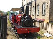
| !Name | Opened | Closed | Gauge | Length | Location | Notes |
|---|---|---|---|---|---|---|
| Amberley Working Museum Amberley Working Museum Amberley Museum & Heritage Centre is a museum at Amberley, near Arundel in West Sussex, England.The museum was founded in 1979 by the Southern Industrial History Centre Trust and has previously been known as the Amberley Working Museum, Amberley Chalk Pits Museum or plain Amberley Museum.The museum... |
1979 | Present | mainly | 800 yards (732 m) | Amberley Amberley, West Sussex Amberley is a village and civil parish in the Horsham District of West Sussex, England.Amberley is situated at the foot of the South Downs. Its neighbours are Storrington, West Chiltington and Arundel. The village is noted for its many thatched cottages... , England England England is a country that is part of the United Kingdom. It shares land borders with Scotland to the north and Wales to the west; the Irish Sea is to the north west, the Celtic Sea to the south west, with the North Sea to the east and the English Channel to the south separating it from continental... |
Large industrial museum with extensive narrow gauge railway collection, mainly from lines in the southeast of England. |
| Armley Mills Industrial Museum Armley Mills Industrial Museum The Armley Mills Leeds Industrial Museum is a museum of industrial heritage located in Armley, west Leeds, West Yorkshire, England. It includes collections of textile machinery, railway equipment and heavy engineering amongst others.... |
? | Present | various | 60 yards (55 m) | Leeds Leeds Leeds is a city and metropolitan borough in West Yorkshire, England. In 2001 Leeds' main urban subdivision had a population of 443,247, while the entire city has a population of 798,800 , making it the 30th-most populous city in the European Union.Leeds is the cultural, financial and commercial... , England England England is a country that is part of the United Kingdom. It shares land borders with Scotland to the north and Wales to the west; the Irish Sea is to the north west, the Celtic Sea to the south west, with the North Sea to the east and the English Channel to the south separating it from continental... |
Industrial museum highlighting the industrial heritage of Leeds. Has a significant collection of Leeds-built locomotives and a short demonstration line. |
| Brockham Museum | 1962 | 1983 | various | ? | Dorking Dorking Dorking is a historic market town at the foot of the North Downs approximately south of London, in Surrey, England.- History and development :... , England England England is a country that is part of the United Kingdom. It shares land borders with Scotland to the north and Wales to the west; the Irish Sea is to the north west, the Celtic Sea to the south west, with the North Sea to the east and the English Channel to the south separating it from continental... |
Large collection of narrow gauge railway equipment from the south-east of England. The collection moved to the Amberley Chalk Pits Museum |
| Bursledon Brickworks Museum | 1990 | Present | ? | Bursledon Bursledon Bursledon is a village on the River Hamble in Hampshire, England. It is located within the borough of Eastleigh. Close to the city of Southampton, Bursledon has a railway station, a marina, dockyards and the Bursledon Windmill. Nearby villages include Swanwick, Hamble-le-Rice, Netley and Sarisbury... , England England England is a country that is part of the United Kingdom. It shares land borders with Scotland to the north and Wales to the west; the Irish Sea is to the north west, the Celtic Sea to the south west, with the North Sea to the east and the English Channel to the south separating it from continental... |
Steam-railway run by the Hampshire Narrow Gauge Railway Society. | |
| China Clay Industry Museum | ? | Present | ? | St Austell St Austell St Austell is a civil parish and a major town in Cornwall, England, United Kingdom. It is situated on the south coast approximately ten miles south of Bodmin and 30 miles west of the border with Devon at Saltash... , England England England is a country that is part of the United Kingdom. It shares land borders with Scotland to the north and Wales to the west; the Irish Sea is to the north west, the Celtic Sea to the south west, with the North Sea to the east and the English Channel to the south separating it from continental... |
Static display of ex-Lee Moor tramway locomotive | |
| Conwy Valley Railway Museum Conwy Valley Railway Museum The Conwy Valley Railway Museum is located at Betws-y-Coed railway station, Betws-y-Coed, North Wales, on the site of the old railway goods yard.-Museum:... |
1965 (?) | Present | Various | ? | Betws-y-Coed Betws-y-Coed Betws-y-Coed is a village and community in the Conwy valley in Conwy County Borough, Wales. It has a population of 534. The name Betws or Bettws is generally thought to be derived from the Anglo-Saxon Old English 'bed-hus' - i.e. a bead-house - a house of prayer, or oratory... , Wales Wales Wales is a country that is part of the United Kingdom and the island of Great Britain, bordered by England to its east and the Atlantic Ocean and Irish Sea to its west. It has a population of three million, and a total area of 20,779 km²... |
Small railway museum including a number of narrow gauge artifacts. |
| Dowty Railway Preservation Society | 1962 | 1985 | various | ? | Tewkesbury Tewkesbury Tewkesbury is a town in Gloucestershire, England. It stands at the confluence of the River Severn and the River Avon, and also minor tributaries the Swilgate and Carrant Brook... , England England England is a country that is part of the United Kingdom. It shares land borders with Scotland to the north and Wales to the west; the Irish Sea is to the north west, the Celtic Sea to the south west, with the North Sea to the east and the English Channel to the south separating it from continental... |
Society of railway enthusiasts from the Dowty Group of companies with a substantial collection of narrow gauge locomotives. See the North Gloucestershire Railway entry. |
| Durley Light Railway | 1968 | after 1996 | ? | Durley Durley Durley is a village in the City of Winchester district of Hampshire, England. It is located approximately 7½ miles northeast of Southampton and has a population of around 500.-Governance:... , England England England is a country that is part of the United Kingdom. It shares land borders with Scotland to the north and Wales to the west; the Irish Sea is to the north west, the Celtic Sea to the south west, with the North Sea to the east and the English Channel to the south separating it from continental... |
Collection of steam and diesel locomotives originally located at Stoke Park sand pit from 1962, moved to Durley in 1968 where a railway was established. | |
| Gloddfa Ganol Narrow Gauge Railway Centre | 1978 | 2000 (?) | ? | Blaenau Ffestiniog Blaenau Ffestiniog Blaenau Ffestiniog is a town in Gwynedd, north-west Wales. It has a population of 5,000, including Llan Ffestiniog, which makes it the third largest town in Gwynedd, behind Caernarfon & Porthmadog. Although the population reached 12,000 at the peak of the slate industry, the population fell due to... , Wales Wales Wales is a country that is part of the United Kingdom and the island of Great Britain, bordered by England to its east and the Atlantic Ocean and Irish Sea to its west. It has a population of three million, and a total area of 20,779 km²... |
At one time the largest collection of narrow gauge locomotives in Britain, housed in the former Oakely slate quarry. | |
| Golden Valley Light Railway | Late 1980's | Present | Just under 1 miles (1.6 km) | Butterley Butterley Butterley is a village in the English county of Derbyshire near to Ripley. It is the site of the Midland Railway - Butterley, as well as the old Butterley Brickworks.- Notable residents :... , England England England is a country that is part of the United Kingdom. It shares land borders with Scotland to the north and Wales to the west; the Irish Sea is to the north west, the Celtic Sea to the south west, with the North Sea to the east and the English Channel to the south separating it from continental... |
Scenic passenger line laid on the old Butterley works tramway, running to Newlands Inn through the country park. Large collection of working narrow gauge locomotives and rolling stock housed within a large purpose built shed at the Midland Railway - Butterley Midland Railway - Butterley The Midland Railway – Butterley is a heritage railway, formerly known until 2004 as the Midland Railway Centre, at Butterley, near Ripley in Derbyshire.-Overview:... . |
|
| Herefordshire Waterworks Museum | 1982 | Present | ? | Hereford Hereford Hereford is a cathedral city, civil parish and county town of Herefordshire, England. It lies on the River Wye, approximately east of the border with Wales, southwest of Worcester, and northwest of Gloucester... , England England England is a country that is part of the United Kingdom. It shares land borders with Scotland to the north and Wales to the west; the Irish Sea is to the north west, the Celtic Sea to the south west, with the North Sea to the east and the English Channel to the south separating it from continental... |
Short demonstration line. | |
| Hollycombe Steam Collection Hollycombe Steam Collection The Hollycombe Steam Collection is a collection of steam-powered vehicles, rides and attractions based near Liphook in Hampshire. The collection includes fairground rides, a display farm and two railways.- History :... |
1968 | Present | ? | Liphook Liphook Liphook is a large village in the East Hampshire district of Hampshire, England. It is 4.1 miles west of Haslemere, on the A3 road, and lies on the Hampshire/West Sussex border.Liphook has its own railway station, on the Portsmouth Direct Line.... , England England England is a country that is part of the United Kingdom. It shares land borders with Scotland to the north and Wales to the west; the Irish Sea is to the north west, the Celtic Sea to the south west, with the North Sea to the east and the English Channel to the south separating it from continental... |
Working steam museum | |
| Irchester Narrow Gauge Railway Museum | 1980s | Present | ? | Irchester Irchester Irchester is a civil parish and village in the county of Northamptonshire, England. It is about 2 miles south-east of the town of Wellingborough and 2 miles south-west of Rushden, and equidistant from London, south, and Birmingham, to the north-west... , England England England is a country that is part of the United Kingdom. It shares land borders with Scotland to the north and Wales to the west; the Irish Sea is to the north west, the Celtic Sea to the south west, with the North Sea to the east and the English Channel to the south separating it from continental... |
Collection of rolling stock from Midlands ironstone railways and a short demonstration line. | |
| Kew Bridge Steam Museum Kew Bridge Steam Museum Kew Bridge Steam Museum houses a museum of water supply and a collection of water pumping steam engines. The museum is an Anchor Point of ERIH, The European Route of Industrial Heritage... |
1986 | Present | 200 yards (183 m) | London London London is the capital city of :England and the :United Kingdom, the largest metropolitan area in the United Kingdom, and the largest urban zone in the European Union by most measures. Located on the River Thames, London has been a major settlement for two millennia, its history going back to its... , England England England is a country that is part of the United Kingdom. It shares land borders with Scotland to the north and Wales to the west; the Irish Sea is to the north west, the Celtic Sea to the south west, with the North Sea to the east and the English Channel to the south separating it from continental... |
Waterworks museum with a short demonstration line, run since 1992 by the Hampshire Narrow Gauge Railway Society | |
| Klondyke Steam Museum | 1981 | 1982 | ? | Draycott-on-the-clay, England England England is a country that is part of the United Kingdom. It shares land borders with Scotland to the north and Wales to the west; the Irish Sea is to the north west, the Celtic Sea to the south west, with the North Sea to the east and the English Channel to the south separating it from continental... |
A proposed steam museum using the Ffestiniog Railway locomotive Palmerston. Never opened (?) | |
| Llechwedd Slate Caverns Llechwedd Slate Caverns Llechwedd Slate Caverns is a visitor attraction in Blaenau Ffestiniog, Gwynedd, Wales. Visitors can travel on the Miners' Tramway or descend into the Deep Mine, via a funicular railway, to explore the former Llechwedd slate quarry and learn how slate was extracted and processed and about the lives... |
1972 | present | Unknown | Blaenau Ffestiniog Blaenau Ffestiniog Blaenau Ffestiniog is a town in Gwynedd, north-west Wales. It has a population of 5,000, including Llan Ffestiniog, which makes it the third largest town in Gwynedd, behind Caernarfon & Porthmadog. Although the population reached 12,000 at the peak of the slate industry, the population fell due to... , Wales Wales Wales is a country that is part of the United Kingdom and the island of Great Britain, bordered by England to its east and the Atlantic Ocean and Irish Sea to its west. It has a population of three million, and a total area of 20,779 km²... |
Passenger carrying railway, mainly underground in the Llechwedd slate mine. Operated with battery-electric locomotives. | |
| Monkton Farleigh Mine Museum | before 1987 | 1990 | ? | Bath, England England England is a country that is part of the United Kingdom. It shares land borders with Scotland to the north and Wales to the west; the Irish Sea is to the north west, the Celtic Sea to the south west, with the North Sea to the east and the English Channel to the south separating it from continental... |
4wDM locomotive at a mining museum in an abandoned quarry. | |
| Morwellham Open Air Museum | ? | Present | ? | Tavistock, England England England is a country that is part of the United Kingdom. It shares land borders with Scotland to the north and Wales to the west; the Irish Sea is to the north west, the Celtic Sea to the south west, with the North Sea to the east and the English Channel to the south separating it from continental... |
Passenger-carrying tourist railway at the museum | |
| Moseley Industrial Narrow Gauge Tramway and Museum Tumblydown Farm railway | 2001 | Present | 600 yards (549 m) | Tolgus Mount, England England England is a country that is part of the United Kingdom. It shares land borders with Scotland to the north and Wales to the west; the Irish Sea is to the north west, the Celtic Sea to the south west, with the North Sea to the east and the English Channel to the south separating it from continental... |
Part of the original Moseley Tramway collection now relocated to Cornwall. | |
| Moseley Railway Trust Moseley Railway Trust The Moseley Railway Trust is a major British collection of industrial narrow gauge locomotives and other equipment. It originally had its base in south Manchester, but has completely relocated to the Apedale Country Park near Newcastle-under-Lyme, Staffordshire where a passenger railway is now open... |
1968 | Present | mainly | ? | Newcastle-under-Lyme Newcastle-under-Lyme Newcastle-under-Lyme is a market town in Staffordshire, England, and is the principal town of the Borough of Newcastle-under-Lyme. It is part of The Potteries Urban Area and North Staffordshire. In the 2001 census the town had a population of 73,944... , England England England is a country that is part of the United Kingdom. It shares land borders with Scotland to the north and Wales to the west; the Irish Sea is to the north west, the Celtic Sea to the south west, with the North Sea to the east and the English Channel to the south separating it from continental... |
A significant collection of industrial locomotives currently in store, but due to re-open at the Apedale Heritage Center in 2006. |
| Narrow Gauge Railway Museum Narrow Gauge Railway Museum The Narrow Gauge Railway Museum is a purpose-built museum dedicated to narrow gauge railways situated at the station of the Talyllyn Railway in Tywyn, Gwynedd, Wales.... |
1956 | Present | Various | ? | Tywyn Tywyn Tywyn is a town and seaside resort on the Cardigan Bay coast of southern Gwynedd , in north Wales. The name derives from the Welsh tywyn and the town is sometimes referred to as Tywyn Meirionnydd... , Wales Wales Wales is a country that is part of the United Kingdom and the island of Great Britain, bordered by England to its east and the Atlantic Ocean and Irish Sea to its west. It has a population of three million, and a total area of 20,779 km²... |
Static exhibits at the Talyllyn Railway's Tywyn Wharf station. |
| North Western Museum of Science and Industry | before 1981 | Present | ? | Liverpool Liverpool Liverpool is a city and metropolitan borough of Merseyside, England, along the eastern side of the Mersey Estuary. It was founded as a borough in 1207 and was granted city status in 1880... , England England England is a country that is part of the United Kingdom. It shares land borders with Scotland to the north and Wales to the west; the Irish Sea is to the north west, the Celtic Sea to the south west, with the North Sea to the east and the English Channel to the south separating it from continental... |
Static exhibit of ex-Isle of Man Railway Isle of Man Railway The Isle of Man Railway is a narrow gauge steam-operated railway connecting Douglas with Castletown and Port Erin in the Isle of Man. The line is built to gauge and is long... No. 3 Pender |
|
| Penrhyn Castle Railway Museum Penrhyn Castle Railway Museum The Penrhyn Castle Railway Museum is a museum of industrial railway equipment, located at Penrhyn Castle near Bangor in Wales.In the nineteenth century, Penrhyn Castle was the home of the Pennant family , owners of the Penrhyn slate quarry at Bethesda... |
1951 | Present | various | ? | Bangor Bangor, Gwynedd Bangor is a city in Gwynedd, north west Wales, and one of the smallest cities in Britain. It is a university city with a population of 13,725 at the 2001 census, not including around 10,000 students at Bangor University. Including nearby Menai Bridge on Anglesey, which does not however form part of... , Wales Wales Wales is a country that is part of the United Kingdom and the island of Great Britain, bordered by England to its east and the Atlantic Ocean and Irish Sea to its west. It has a population of three million, and a total area of 20,779 km²... |
Collection of industrial Industrial railway An industrial railway is a type of railway that is not available for public transportation and is used exclusively to serve a particular industrial, logistics or military site... narrow gauge locomotives and artifacts |
| Purbeck Mineral and Mining Museum | 2004 | Present | various | ? | Norden, England England England is a country that is part of the United Kingdom. It shares land borders with Scotland to the north and Wales to the west; the Irish Sea is to the north west, the Celtic Sea to the south west, with the North Sea to the east and the English Channel to the south separating it from continental... |
Collection of narrow gauge rolling stock from the Purbeck clay mining industry. A demonstration railway is under construction. |
| Tolgus Tin Mine Museum | ? | ? | ? | Redruth Redruth Redruth is a town and civil parish traditionally in the Penwith Hundred in Cornwall, United Kingdom. It has a population of 12,352. Redruth lies approximately at the junction of the A393 and A3047 roads, on the route of the old London to Land's End trunk road , and is approximately west of... , England England England is a country that is part of the United Kingdom. It shares land borders with Scotland to the north and Wales to the west; the Irish Sea is to the north west, the Celtic Sea to the south west, with the North Sea to the east and the English Channel to the south separating it from continental... |
Static display of mining locomotive | |
| Welland Valley Vintage Traction Club | ? | ? | ? | Market Harborough Market Harborough Market Harborough is a market town within the Harborough district of Leicestershire, England.It has a population of 20,785 and is the administrative headquarters of Harborough District Council. It sits on the Northamptonshire-Leicestershire border... , England England England is a country that is part of the United Kingdom. It shares land borders with Scotland to the north and Wales to the west; the Irish Sea is to the north west, the Celtic Sea to the south west, with the North Sea to the east and the English Channel to the south separating it from continental... |
Ex-ironstone quarry railway equipment on static exhibition, including Kettering Ironstone Railway Kettering Ironstone Railway The Kettering Ironstone Railway was an industrial narrow gauge railway that served the ironstone quarries around Kettering.- Locomotives :-See also:* British industrial narrow gauge railways... No. 8 |
|
| Westonzoyland Pumping Station Museum Westonzoyland Pumping Station Museum The Westonzoyland Pumping Station Museum is a small Industrial Heritage museum dedicated to steam powered machinery in Westonzoyland, Somerset, England.... |
? | 2004 | ? | Westonzoyland Westonzoyland Westonzoyland is a village and civil parish in Somerset, England. It is situated on the Somerset Levels, south east of Bridgwater.-History:The name of the parish derives from its location on the "island" of Sowy, an area of slightly higher ground on the Somerset Levels between the River Cary and... , England England England is a country that is part of the United Kingdom. It shares land borders with Scotland to the north and Wales to the west; the Irish Sea is to the north west, the Celtic Sea to the south west, with the North Sea to the east and the English Channel to the south separating it from continental... |
Small industrial museum at restored pumphouse with a short demonstration railway. |
Visitor attractions
Many tourist-oriented theme and amusement parks, stately homes etc. include narrow-gauge railways as part of the attraction as well as to provide internal transportation within the venue.| !Name | Years of operation | Gauge | Length | Location | Notes |
|---|---|---|---|---|---|
| Alton Towers Railway | 1929–1996 | Unknown | Farley, Staffordshire, England England England is a country that is part of the United Kingdom. It shares land borders with Scotland to the north and Wales to the west; the Irish Sea is to the north west, the Celtic Sea to the south west, with the North Sea to the east and the English Channel to the south separating it from continental... |
A short tourist line at the Alton Towers amusement park. | |
| Amerton Railway Amerton Railway The Amerton Railway is a narrow gauge heritage railway in the English county of Staffordshire. It is owned by the Staffordshire Narrow Gauge Railway Society.Construction of the railway was begun in 1990 in a field at the side of Amerton Working Farm... |
1990–present | 0.5 mi (0.80467 km) | Amerton Amerton Amerton is a village in Staffordshire, England.Amerton is a small village south of uttoxeter. You can visit Amerton Farm and the British Wildlife Rescue Centre... , England England England is a country that is part of the United Kingdom. It shares land borders with Scotland to the north and Wales to the west; the Irish Sea is to the north west, the Celtic Sea to the south west, with the North Sea to the east and the English Channel to the south separating it from continental... |
A steam-hauled passenger line running round the Amerton Working Farm. | |
| Battersea Park Battersea Park Battersea Park is a 200 acre green space at Battersea in the London Borough of Wandsworth in England. It is situated on the south bank of the River Thames opposite Chelsea, and was opened in 1858.... Far Tottering and Oystercreek Railway |
1951–1953 | 0.5 mi (0.80467 km) | Battersea Battersea Battersea is an area of the London Borough of Wandsworth, England. It is an inner-city district of South London, situated on the south side of the River Thames, 2.9 miles south-west of Charing Cross. Battersea spans from Fairfield in the west to Queenstown in the east... , England England England is a country that is part of the United Kingdom. It shares land borders with Scotland to the north and Wales to the west; the Irish Sea is to the north west, the Celtic Sea to the south west, with the North Sea to the east and the English Channel to the south separating it from continental... |
A whimsical attraction at the Festival of Britain Festival of Britain The Festival of Britain was a national exhibition in Britain in the summer of 1951. It was organised by the government to give Britons a feeling of recovery in the aftermath of war and to promote good quality design in the rebuilding of British towns and cities. The Festival's centrepiece was in... Pleasure Gardens built to the designs of the Punch Punch (magazine) Punch, or the London Charivari was a British weekly magazine of humour and satire established in 1841 by Henry Mayhew and engraver Ebenezer Landells. Historically, it was most influential in the 1840s and 50s, when it helped to coin the term "cartoon" in its modern sense as a humorous illustration... cartoonist Emett Frederick Roland Emett Frederick Rowland Emett OBE, his name frequently misspelled as Roland Emmett, was an English cartoonist and constructor of whimsical kinetic sculpture.- Early Life :... . |
|
| Bicton Woodland Railway Bicton Woodland Railway The Bicton Woodland Railway is a narrow gauge railway running in gardens in the grounds of Bicton House near Budleigh Salterton in Devon.The line was built in 1962 as a tourist attraction for visitors to the house... |
1963–present | Unknown | Budleigh Salterton Budleigh Salterton Budleigh Salterton is a small town on the south coast of Devon, England 15 miles south of Exeter. It is situated within an Area of Outstanding Natural Beauty designated East Devon AONB.- Features :... , England England England is a country that is part of the United Kingdom. It shares land borders with Scotland to the north and Wales to the west; the Irish Sea is to the north west, the Celtic Sea to the south west, with the North Sea to the east and the English Channel to the south separating it from continental... |
A tourist railway running round Bicton Gardens, originally equipped with stock from the Woolwich Arsenal Railway. | |
| Billing Aquadrome Railway | ?-present | Unknown | Billing, Northamptonshire Billing, Northamptonshire Billing is a civil parish in eastern Northampton in England, covering the Great Billing, Little Billing, Ecton Brook and Bellinge areas. It is geographically the largest area of Northampton. According to the 2001 census the parish had a population of 8,642, but is now over 10,000... |
A lakeside circuit at the Billing Aquadrome Billing Aquadrome Billing Aquadrome is a leisure park in Great Billing, in the eastern district of Northampton, England. Facilities within the 235-acre park, which is based around various mature gravel pits, include a caravan site, marina and funfair... holiday park. |
|
| Blenheim Palace Railway | 1990s?-present | Unknown | Blenheim Palace Blenheim Palace Blenheim Palace is a monumental country house situated in Woodstock, Oxfordshire, England, residence of the dukes of Marlborough. It is the only non-royal non-episcopal country house in England to hold the title of palace. The palace, one of England's largest houses, was built between... , Oxfordshire Oxfordshire Oxfordshire is a county in the South East region of England, bordering on Warwickshire and Northamptonshire , Buckinghamshire , Berkshire , Wiltshire and Gloucestershire .... |
The line runs between car park and palace, through parkland surrounding the ancestral home of the Dukes of Marlborough. The steam-outline diesel locomotive, built by Alan Keef Alan Keef Alan Keef Ltd is a British narrow gauge railway engineer which manufactures, overhauls and deals in narrow gauge locomotives, rolling stock and associated equipment.... , is named after Winston Churchill Winston Churchill Sir Winston Leonard Spencer-Churchill, was a predominantly Conservative British politician and statesman known for his leadership of the United Kingdom during the Second World War. He is widely regarded as one of the greatest wartime leaders of the century and served as Prime Minister twice... , who was born at Blenheim in 1874. |
|
| Bressingham Steam Museum | 1970s-present | 2.5 mi (4 km) | Diss Diss Diss is a town in Norfolk, England close to the border with the neighbouring East Anglian county of Suffolk.The town lies in the valley of the River Waveney, around a mere that covers . The mere is up to deep, although there is another of mud, making it one of the deepest natural inland lakes... , Norfolk Norfolk Norfolk is a low-lying county in the East of England. It has borders with Lincolnshire to the west, Cambridgeshire to the west and southwest and Suffolk to the south. Its northern and eastern boundaries are the North Sea coast and to the north-west the county is bordered by The Wash. The county... |
Short passenger carrying line around the famous Bloom gardens at Bressingham; part of a larger steam collection. | |
| Chessington Zoo Chessington World of Adventures Chessington World of Adventures Resort is a theme park and zoo in South West London, England. It lies south of Central London. Historically opened as Chessington Zoo in 1931, a theme park was developed alongside it, opening in 1987... |
1970–1978 | Unknown | Chessington Chessington Chessington is a town in the Royal Borough of Kingston upon Thames in Greater London, England. The Hogsmill river runs through it. Neighbouring settlements include: Tolworth, Ewell, Surbiton, Claygate, Epsom, Oxshott, Leatherhead, Esher, Kingston upon Thames and Worcester Park.-History:Its name... , England England England is a country that is part of the United Kingdom. It shares land borders with Scotland to the north and Wales to the west; the Irish Sea is to the north west, the Celtic Sea to the south west, with the North Sea to the east and the English Channel to the south separating it from continental... |
Passenger carrying tourist line that was built to replace a 12 in gauge miniature railway Ridable miniature railway A ridable miniature railway is a ground-level, large scale model railway that hauls passengers using locomotives that are models of full-sized railway locomotives .-Overview:Typically they have a rail track gauge between and , though both larger and... . |
|
| Cotswold Wildlife Park Cotswold Wildlife Park The Cotswold Wildlife Park and Gardens exhibits mammals, birds, reptiles, amphibians and invertebrates from all around the world. The Park is set in of landscaped parkland and gardens in Oxfordshire, England. Around 350,000 people visited the park in 2005.... |
1970s-present | Unknown | Burford Burford Burford is a small town on the River Windrush in the Cotswold hills in west Oxfordshire, England, about west of Oxford, southeast of Cheltenham and only from the Gloucestershire boundary... , England England England is a country that is part of the United Kingdom. It shares land borders with Scotland to the north and Wales to the west; the Irish Sea is to the north west, the Celtic Sea to the south west, with the North Sea to the east and the English Channel to the south separating it from continental... |
Passenger carrying tourist line around the wildlife park. | |
| Doddington Park Light Railway | ?-present | Unknown | Chipping Sodbury Chipping Sodbury Chipping Sodbury is a market town in the county of South Gloucestershire, south-west England, founded in the 12th century by William Crassus . The villages of Old Sodbury and Little Sodbury are nearby... , England England England is a country that is part of the United Kingdom. It shares land borders with Scotland to the north and Wales to the west; the Irish Sea is to the north west, the Celtic Sea to the south west, with the North Sea to the east and the English Channel to the south separating it from continental... |
A tourist railway in the grounds of Doddington House stately home Stately home A stately home is a "great country house". It is thus a palatial great house or in some cases an updated castle, located in the British Isles, mostly built between the mid-16th century and the early part of the 20th century, as well as converted abbeys and other church property... . |
|
| Drusillas Park Railway | 1946–present | Unknown | Alfriston Alfriston Alfriston is a village and civil parish in the East Sussex district of Wealden, England. The village lies in the valley of the River Cuckmere, about four miles north-east of Seaford and south of the main A27 trunk road and part of the large area of Polegate... , England England England is a country that is part of the United Kingdom. It shares land borders with Scotland to the north and Wales to the west; the Irish Sea is to the north west, the Celtic Sea to the south west, with the North Sea to the east and the English Channel to the south separating it from continental... |
Short tourist line around an amusement park Amusement park thumb|Cinderella Castle in [[Magic Kingdom]], [[Disney World]]Amusement and theme parks are terms for a group of entertainment attractions and rides and other events in a location for the enjoyment of large numbers of people... . |
|
| Gardner's Pleasure Resort | 1893–1934 | Unknown | Unknown | Riddlesdown Riddlesdown Riddlesdown is a place in the London Borough of Croydon, one mile east from the centre of Purley. The name applies both to an area of chalk downland, which is maintained by the City of London Corporation as common land, and to the nearby residential district.... , England England England is a country that is part of the United Kingdom. It shares land borders with Scotland to the north and Wales to the west; the Irish Sea is to the north west, the Celtic Sea to the south west, with the North Sea to the east and the English Channel to the south separating it from continental... |
Early pleasure railway with home-built steam locomotive which survived until 1948. |
| Knebworth Park and Winter Green Railway Knebworth Park and Winter Green Railway The Knebworth and Winter Green Railway was a narrow gauge railway built in the grounds of Knebworth House in 1972 as a tourist attraction.The railway was built by Pleasurerail Ltd. a company set up to build and operate private tourist railways which included the Great Whipsnade Railway and also... |
1972–1990 | 1.5 mi (2.4 km) | Knebworth Knebworth Knebworth is a village and civil parish in the north of Hertfordshire, England immediately south of Stevenage. The civil parish covers an area between the villages of Datchworth, Woolmer Green, Codicote, Kimpton, Whitwell, St Paul's Walden and Langley, and encompasses the village of Knebworth, the... , England England England is a country that is part of the United Kingdom. It shares land borders with Scotland to the north and Wales to the west; the Irish Sea is to the north west, the Celtic Sea to the south west, with the North Sea to the east and the English Channel to the south separating it from continental... |
Steam-hauled passenger line in the grounds of Knebworth House Knebworth House Knebworth House is a country house in the civil parish of Knebworth in Hertfordshire, England.-History and description:The home of the Lytton family since 1490, when Thomas Bourchier sold the reversion of the manor to Sir Robert Lytton, Knebworth House was originally a genuine red-brick Late Gothic... |
|
| Margam Train | ?-present | Unknown | Margam Country Park Margam Country Park Margam Country Park is a country park estate in Britain, of around 850 acres . It is situated in Margam, about 2 miles from Port Talbot in south Wales it was once owned by the Mansel Talbot family and is now owned and administered by the local council, Neath Port Talbot County Borough Council... , Wales Wales Wales is a country that is part of the United Kingdom and the island of Great Britain, bordered by England to its east and the Atlantic Ocean and Irish Sea to its west. It has a population of three million, and a total area of 20,779 km²... |
Tourist railway round the Country Park hauled by a steam-outline diesel locomotive | |
| Old Kiln Light Railway Old Kiln Light Railway The Old Kiln Light Railway is a gauge railway located at the Rural Life Centre open air museum in Tilford, near Farnham, Surrey. It has a collection of historic locomotives and rolling stock including two steam locomotives. It operates on Sundays and Bank Holidays during the summer... |
1982–present | Unknown | Tilford Tilford Tilford is a small village about two miles south of Farnham in Surrey, England. It lies within the Surrey Hills Area of Outstanding Natural Beauty- History :The name "Tilford" is probably derived from "Tila's ford" or "Tilla's ford".... , England England England is a country that is part of the United Kingdom. It shares land borders with Scotland to the north and Wales to the west; the Irish Sea is to the north west, the Celtic Sea to the south west, with the North Sea to the east and the English Channel to the south separating it from continental... |
Short steam-hauled railway at the Rural Life Centre. | |
| Overstone Solarium Light Railway | 1969-? | Unknown | Sywell Sywell Sywell is a small village in Northamptonshire, England. The village is governed by The Borough Council of Wellingborough. The name Sywell is thought to mean seven wells.-Facilities:The facilities found in the village include:... , England England England is a country that is part of the United Kingdom. It shares land borders with Scotland to the north and Wales to the west; the Irish Sea is to the north west, the Celtic Sea to the south west, with the North Sea to the east and the English Channel to the south separating it from continental... |
A short line running as a tourist attraction round the Overstone Solarium amusement park. | |
| Seaton Tramway Seaton Tramway The Seaton Tramway is an narrow gauge electric tramway which operates over the route of a a former British Railways branch line in Seaton, Devon... |
1971–present | 3 mi (4.8 km) | Seaton Seaton, Devon Seaton is a seaside town in East Devon on the south coast of England. It faces onto Lyme Bay, to the west of the mouth of the River Axe with red cliffs to one side and white cliffs on the other. Axmouth and Beer are nearby... , England England England is a country that is part of the United Kingdom. It shares land borders with Scotland to the north and Wales to the west; the Irish Sea is to the north west, the Celtic Sea to the south west, with the North Sea to the east and the English Channel to the south separating it from continental... |
Electric tramway using half-scale models of trams. | |
| Telford Town Tramway | 1980-1990? | Unknown | Telford Telford Telford is a large new town in the borough of Telford and Wrekin and ceremonial county of Shropshire, England, approximately east of Shrewsbury, and west of Birmingham... , England England England is a country that is part of the United Kingdom. It shares land borders with Scotland to the north and Wales to the west; the Irish Sea is to the north west, the Celtic Sea to the south west, with the North Sea to the east and the English Channel to the south separating it from continental... |
A steam-hauled tramway in Telford new town. | |
| Thorpe Park Thorpe Park Thorpe Park is a theme park located in Chertsey, Surrey, England, UK. It was built in 1979 on the site of a gravel pit which was partially flooded, the intention of creating a water based theme for the park. The park's first large roller coaster, Colossus, was added in 2002... Treasure Island Railway |
1983–1993 | Unknown | Chertsey Chertsey Chertsey is a town in Surrey, England, on the River Thames and its tributary rivers such as the River Bourne. It can be accessed by road from junction 11 of the M25 London orbital motorway. It shares borders with Staines, Laleham, Shepperton, Addlestone, Woking, Thorpe and Egham... , England England England is a country that is part of the United Kingdom. It shares land borders with Scotland to the north and Wales to the west; the Irish Sea is to the north west, the Celtic Sea to the south west, with the North Sea to the east and the English Channel to the south separating it from continental... |
Short tourist line at an amusement park Amusement park thumb|Cinderella Castle in [[Magic Kingdom]], [[Disney World]]Amusement and theme parks are terms for a group of entertainment attractions and rides and other events in a location for the enjoyment of large numbers of people... in Surrey. A small train based attraction around an Island featuring live actors and audience participation loosely based on the novel Treasure Island Treasure Island Treasure Island is an adventure novel by Scottish author Robert Louis Stevenson, narrating a tale of "pirates and buried gold". First published as a book on May 23, 1883, it was originally serialized in the children's magazine Young Folks between 1881–82 under the title Treasure Island; or, the... by Robert Louis Stevenson Robert Louis Stevenson Robert Louis Balfour Stevenson was a Scottish novelist, poet, essayist and travel writer. His best-known books include Treasure Island, Kidnapped, and Strange Case of Dr Jekyll and Mr Hyde.... . |
|
| Thorpe Park Thorpe Park Thorpe Park is a theme park located in Chertsey, Surrey, England, UK. It was built in 1979 on the site of a gravel pit which was partially flooded, the intention of creating a water based theme for the park. The park's first large roller coaster, Colossus, was added in 2002... Canada Creek Railway |
1989–present | Unknown | Chertsey Chertsey Chertsey is a town in Surrey, England, on the River Thames and its tributary rivers such as the River Bourne. It can be accessed by road from junction 11 of the M25 London orbital motorway. It shares borders with Staines, Laleham, Shepperton, Addlestone, Woking, Thorpe and Egham... , England England England is a country that is part of the United Kingdom. It shares land borders with Scotland to the north and Wales to the west; the Irish Sea is to the north west, the Celtic Sea to the south west, with the North Sea to the east and the English Channel to the south separating it from continental... |
Short tourist line at an amusement park Amusement park thumb|Cinderella Castle in [[Magic Kingdom]], [[Disney World]]Amusement and theme parks are terms for a group of entertainment attractions and rides and other events in a location for the enjoyment of large numbers of people... in Surrey. From 1989 to 2006 this train carried guests to and from Thorpe Farm. This railway now does a closed circuit around the Canada Creek area of the park. |
|
| Whipsnade and Umfolozi Railway | 1970–present | Unknown | Dunstable Dunstable Dunstable is a market town and civil parish located in Bedfordshire, England. It lies on the eastward tail spurs of the Chiltern Hills, 30 miles north of London. These geographical features form several steep chalk escarpments most noticeable when approaching Dunstable from the north.-Etymology:In... , England England England is a country that is part of the United Kingdom. It shares land borders with Scotland to the north and Wales to the west; the Irish Sea is to the north west, the Celtic Sea to the south west, with the North Sea to the east and the English Channel to the south separating it from continental... |
Steam-hauled passenger line running around the grounds of Whipsnade Zoo. Rolling stock came from the Bowater Light Railway. | |
| Yafford Mill Railway | 1994–2000 | 0.75 mi (1.2 km) | Newport Newport, Isle of Wight Newport is a civil parish and a county town of the Isle of Wight, an island off the south coast of England. Newport has a population of 23,957 according to the 2001 census... , England England England is a country that is part of the United Kingdom. It shares land borders with Scotland to the north and Wales to the west; the Irish Sea is to the north west, the Celtic Sea to the south west, with the North Sea to the east and the English Channel to the south separating it from continental... |
Short-lived passenger railway using ex-MOD diesel locomotives and stock built by Alan Keef |
Private railways
These are private lines or collections owned by individuals or small groups and generally not open to the public.Industrial railways
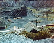
Great Britain was home to many industrial narrow gauge railways, ranging from temporary hand-powered lines a few yards long to significant locomotive-worked complexes of lines that served substantial industrial concerns.
Military railways
Many British military establishments and former UK Government-owned explosives sites used narrow gauge railways. These locations were often subject to the Official Secrets Act and other government restrictions, so many of them are less well documented.The industrial use of narrow-gauge railways was quite extensive amongst the various military and civilian explosive factories, for example ICI Nobel's works at Ardeer and the Agency Explosive Factories run by ICI Nobel in the Second World War. To give an example, the Ministry of Supply (MOS) Factory Dalbeattie used gauge with a variety of bogie trucks mostly pushed by teams of three to six women. Stores, explosives, chemicals, rubbish and sewage, were all transported on this narrow-gauge system, which used at least 8 miles (12.9 km) of track.
See also
- British industrial narrow gauge railwaysBritish industrial narrow gauge railwaysBritish industrial narrow gauge railways are narrow gauge railways in the United Kingdom and the Isle of Man that were primarily built to serve one or more industries. Some offered passenger services for employees or workmen, but they did not run public passenger trains...
- DecauvilleDecauvilleThe Decauville manufacturing company was founded by Paul Decauville , a French pioneer in industrial railways. Decauville's major innovation was the use of ready-made sections of light, narrow gauge track fastened to steel sleepers; this track was portable and could be disassembled and transported...
- List of British heritage and private railways
- List of narrow gauge railways in Ireland
- Industrial railwayIndustrial railwayAn industrial railway is a type of railway that is not available for public transportation and is used exclusively to serve a particular industrial, logistics or military site...
s - Miniature railwaysRidable miniature railwayA ridable miniature railway is a ground-level, large scale model railway that hauls passengers using locomotives that are models of full-sized railway locomotives .-Overview:Typically they have a rail track gauge between and , though both larger and...