
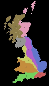
B roads in Zone 2 of the Great Britain numbering scheme
Encyclopedia
Great Britain
Great Britain or Britain is an island situated to the northwest of Continental Europe. It is the ninth largest island in the world, and the largest European island, as well as the largest of the British Isles...
of lesser importance than A roads. See the article Great Britain road numbering scheme
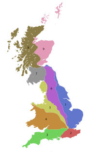
Great Britain road numbering scheme
The Great Britain road numbering scheme is a numbering scheme used to classify and identify all roads in Great Britain. Each road is given a single letter, which represents the road's category, and a subsequent number, with a length of between 1 and 4 digits. Originally introduced to arrange...
for the rationale behind the numbers allocated.
Zone 2 (3 digits)
| Road | From | To | Notes |
|---|---|---|---|
| B202 | A100, Greater London Greater London Greater London is the top-level administrative division of England covering London. It was created in 1965 and spans the City of London, including Middle Temple and Inner Temple, and the 32 London boroughs. This territory is coterminate with the London Government Office Region and the London... , Tower Bridge Road |
A200 A200 road The A200 is an A road in London running from London Bridge to Greenwich. It runs south-east from the A3 road along Duke Street Hill, then Tooley Street and Jamaica Road, following the River Thames until the junction with Rotherhithe Tunnel when it turns south down Lower Road. It follows the Thames... , Jamaica Road |
Road Name: Abbey Street |
| B203 | A2 A2 road (Great Britain) The A2 is a major road in southern England, connecting London with the English Channel port of Dover in Kent. This route has always been of importance as a connection between the British capital of London and sea trade routes to Continental Europe... , Old Kent Road Old Kent Road The Old Kent Road is a road in South East London, England and forms part of Watling Street, the Roman road which ran from Dover to Holyhead. The street is famous as the equal cheapest property on the London Monopoly board and as the only one in South London.... |
A2206, Southwark Park Road | Road Name: Dunton Road |
| B204 | A2208, Camberwell Camberwell Camberwell is a district of south London, England, and forms part of the London Borough of Southwark. It is a built-up inner city district located southeast of Charing Cross. To the west it has a boundary with the London Borough of Lambeth.-Toponymy:... , Rotherhithe New Road |
B203 | Road Names: Catlin Street, Rolls Road |
| B205 | A200 A200 road The A200 is an A road in London running from London Bridge to Greenwich. It runs south-east from the A3 road along Duke Street Hill, then Tooley Street and Jamaica Road, following the River Thames until the junction with Rotherhithe Tunnel when it turns south down Lower Road. It follows the Thames... , Jamaica Road |
A200 A200 road The A200 is an A road in London running from London Bridge to Greenwich. It runs south-east from the A3 road along Duke Street Hill, then Tooley Street and Jamaica Road, following the River Thames until the junction with Rotherhithe Tunnel when it turns south down Lower Road. It follows the Thames... , Lower Road |
Rotherhithe Rotherhithe Rotherhithe is a residential district in inner southeast London, England and part of the London Borough of Southwark. It is located on a peninsula on the south bank of the Thames, facing Wapping and the Isle of Dogs on the north bank, and is a part of the Docklands area... peninsula. Road Names: Brunel Road, Salter Road, Redriff Road |
| B206 | A200 A200 road The A200 is an A road in London running from London Bridge to Greenwich. It runs south-east from the A3 road along Duke Street Hill, then Tooley Street and Jamaica Road, following the River Thames until the junction with Rotherhithe Tunnel when it turns south down Lower Road. It follows the Thames... /A2000 Junction at Lower Road |
A200 A200 road The A200 is an A road in London running from London Bridge to Greenwich. It runs south-east from the A3 road along Duke Street Hill, then Tooley Street and Jamaica Road, following the River Thames until the junction with Rotherhithe Tunnel when it turns south down Lower Road. It follows the Thames... , Evelyn Street |
Road Names: Plough Way, Grove Street |
| B207 | A2 A2 road (Great Britain) The A2 is a major road in southern England, connecting London with the English Channel port of Dover in Kent. This route has always been of importance as a connection between the British capital of London and sea trade routes to Continental Europe... , New Cross New Cross New Cross is a district and ward of the London Borough of Lewisham, England. It is situated 4 miles south-east of Charing Cross. The ward covered by London post town and the SE 14 postcode district. New Cross is near St Johns, Telegraph Hill, Nunhead, Peckham, Brockley, Deptford and Greenwich... , New Cross Road |
A2208 | Road Names: Pagnell Street, Edward Street, Stanford Street, Trundley's Road, |
| B208 | A206 A206 road The A206 road links Greenwich with Greenhithe following the line of the River Thames. Today it is approximately 15 miles in length, although the final section is a relatively new road. Its primary purpose is to link into the London Orbital motorway at the Dartford Crossing and is heavily used by... , Greenwich Greenwich Greenwich is a district of south London, England, located in the London Borough of Greenwich.Greenwich is best known for its maritime history and for giving its name to the Greenwich Meridian and Greenwich Mean Time... , Greenwich High Road |
A200 A200 road The A200 is an A road in London running from London Bridge to Greenwich. It runs south-east from the A3 road along Duke Street Hill, then Tooley Street and Jamaica Road, following the River Thames until the junction with Rotherhithe Tunnel when it turns south down Lower Road. It follows the Thames... , Creek Road |
Road Name: Norman Road |
| B209 | A206 A206 road The A206 road links Greenwich with Greenhithe following the line of the River Thames. Today it is approximately 15 miles in length, although the final section is a relatively new road. Its primary purpose is to link into the London Orbital motorway at the Dartford Crossing and is heavily used by... , Greenwich Greenwich Greenwich is a district of south London, England, located in the London Borough of Greenwich.Greenwich is best known for its maritime history and for giving its name to the Greenwich Meridian and Greenwich Mean Time... , Greenwich High Road |
B210 road, Shooters Hill Road | Road Names: Royal Hill, Hyde Vale |
| B210 | A2 A2 road (Great Britain) The A2 is a major road in southern England, connecting London with the English Channel port of Dover in Kent. This route has always been of importance as a connection between the British capital of London and sea trade routes to Continental Europe... , Blackheath Blackheath, London Blackheath is a district of South London, England. It is named from the large open public grassland which separates it from Greenwich to the north and Lewisham to the west... , Greenwich Park Greenwich Park Greenwich Park is a former hunting park in Greenwich and one of the largest single green spaces in south east London. One of the Royal Parks of London, and the first to be enclosed , it covers , and is part of the Greenwich World Heritage Site. It commands fine views over the River Thames, Isle of... |
A206 A206 road The A206 road links Greenwich with Greenhithe following the line of the River Thames. Today it is approximately 15 miles in length, although the final section is a relatively new road. Its primary purpose is to link into the London Orbital motorway at the Dartford Crossing and is heavily used by... , Woolwich Woolwich Woolwich is a district in south London, England, located in the London Borough of Greenwich. The area is identified in the London Plan as one of 35 major centres in Greater London.Woolwich formed part of Kent until 1889 when the County of London was created... , Woolwich Arsenal railway station Woolwich Arsenal railway station Woolwich Arsenal station is a National Rail and Docklands Light Railway interchange station located in Woolwich in the London Borough of Greenwich. It acts as a local station on the North Kent Line between London and Gillingham, served by Southeastern, and is the southern terminus of the Woolwich... |
Via Charlton Charlton, London Charlton is a district of south London, England, and part of the London Borough of Greenwich. It is located east-southeast of Charing Cross. Charlton next Woolwich was an ancient parish in the county of Kent, which became part of the metropolitan area of London in 1855. It is home to Charlton... , A205 A205 road The A205 or South Circular Road is a direct route which crosses South London, UK, running from Woolwich in the east to the junction of the A406 , the M4 and the A4 at Gunnersbury in the west.... , Royal Artillery Barracks Royal Artillery Barracks The Royal Artillery Barracks at Woolwich in South East London is the "home" of the Royal Artillery. It is famous for having the longest continuous building facade in the UK as well as for having the largest parade square of any UK barracks.-History:... ; road names: Charlton Way, Vanburgh Park, Charlton Road, The Village, Charlton Park Road, MacArthur Terrace, Little Heath, Hill Reach, Artillery Place, Wellington Street, |
| B211 | B210, Blackheath, Vanburgh Park | A207, Shooters Hill Road | Road Name: Old Dover Road |
| B212 | B210, B211, Blackheath Blackheath, London Blackheath is a district of South London, England. It is named from the large open public grassland which separates it from Greenwich to the north and Lewisham to the west... |
A20, A2212 A2212 road The A2212 road is a 4-digit, non-primary A road in southeast London, England; it is long and runs in a north to south direction from Lee Green, to Bromley passing through Grove Park, Downham, Plaistow and Sundridge... , Lee Green |
Via B220, Blackheath railway station Blackheath railway station Blackheath railway station is situated in the heart of Blackheath village in London at . The track passes through the village and is crossed by a road overbridge on which the station buildings stand.... ; road names:Stratheden Road, Prince of Wales Road, Montpelier Row, Montpelier Vale, Tranquil Vale, Blackheath Village, Lee Road |
| B213 | A2016, Bronze Age Way | A2041, Harrow Manor Way | Road names: Lower Road, Picardy Street, Gilbert Road, Abbey Road |
| B214 | A2 A2 road (Great Britain) The A2 is a major road in southern England, connecting London with the English Channel port of Dover in Kent. This route has always been of importance as a connection between the British capital of London and sea trade routes to Continental Europe... , Old Kent Road |
A215 A215 road The A215 is an A road in South London, from Elephant and Castle to Shirley. It runs through the London Boroughs of Lambeth, Southwark and Croydon.... , Camberwell Road |
Road name: Albany Road |
| B215 | A2 A2 road (Great Britain) The A2 is a major road in southern England, connecting London with the English Channel port of Dover in Kent. This route has always been of importance as a connection between the British capital of London and sea trade routes to Continental Europe... , Old Kent Road |
A202 A202 road The A202 is a primary A road in London. It runs from New Cross Gate to London Victoria station. The section forming part of the London Inner Ring Road is known as Vauxhall Bridge Road.-Camberwell New Road:... , Peckham High Street |
Road names: Trafalgar Avenue, Willwbrook Road, Peckham Hill Street |
| B216 | A2 A2 road (Great Britain) The A2 is a major road in southern England, connecting London with the English Channel port of Dover in Kent. This route has always been of importance as a connection between the British capital of London and sea trade routes to Continental Europe... , Old Kent Road |
B215, Peckham Hill Street | Road names: Peckham Park Road, Butler Close |
| B217 | A202 A202 road The A202 is a primary A road in London. It runs from New Cross Gate to London Victoria station. The section forming part of the London Inner Ring Road is known as Vauxhall Bridge Road.-Camberwell New Road:... , Peckham Road |
A215 A215 road The A215 is an A road in South London, from Elephant and Castle to Shirley. It runs through the London Boroughs of Lambeth, Southwark and Croydon.... , Camberwell Road |
Road name: Southampton Way, New Church Road |
| B218 | A205 A205 road The A205 or South Circular Road is a direct route which crosses South London, UK, running from Woolwich in the east to the junction of the A406 , the M4 and the A4 at Gunnersbury in the west.... , Forest Hill Forest Hill, London Forest Hill is a district of south London, England, located in the London Borough of Lewisham. It situated between Dulwich and Sydenham. The area has enjoyed extensive investment since plans to extend the East London Line to Forest Hill were unveiled in 2004.... , Stanstead Road |
A2 A2 road (Great Britain) The A2 is a major road in southern England, connecting London with the English Channel port of Dover in Kent. This route has always been of importance as a connection between the British capital of London and sea trade routes to Continental Europe... , New Cross New Cross New Cross is a district and ward of the London Borough of Lewisham, England. It is situated 4 miles south-east of Charing Cross. The ward covered by London post town and the SE 14 postcode district. New Cross is near St Johns, Telegraph Hill, Nunhead, Peckham, Brockley, Deptford and Greenwich... , New Cross Road |
Road Names: Brockley Rise, Stondon Park, Brockley Road, Malpas Road, Florence Road |
| B219 | A2214/A2215 junction at East Dulwich Road / Peckham Rye | A2216 A2216 road The A2216 is an A road in South London. It runs from Denmark Hill to Sydenham. Part of the road is an ancient thoroughfare, Lordship Lane. In Dulwich the road runs via the South Circular Road.... , Camberwell Camberwell Camberwell is a district of south London, England, and forms part of the London Borough of Southwark. It is a built-up inner city district located southeast of Charing Cross. To the west it has a boundary with the London Borough of Lambeth.-Toponymy:... , Lordship Lane |
Road Names: Peckham Rye, Barry Road |
| B220 | A20, Lewisham Lewisham Lewisham is a district in South London, England, located in the London Borough of Lewisham. It is situated south-east of Charing Cross. The area is identified in the London Plan as one of 35 major centres in Greater London.-History:... , Lee High Road |
B212 | Road Names: Belmont Hill, Lee Terrace |
| B221 | A3 A3 road The A3, known as the Portsmouth Road for much of its length, is a dual carriageway, or expressway, which follows the historic route between London and Portsmouth passing close to Kingston upon Thames, Guildford, Haslemere and Petersfield. For much of its length, it is classified as a trunk road... , Clapham High Street Clapham High Street Clapham High Street is the main through road and shopping area in Clapham, South London, England, in the London Borough of Lambeth.-History:Clapham High Street is of historical importance because it not only houses two of London's deep level air raid shelters, it was also damaged by bombs during... |
A205 A205 road The A205 or South Circular Road is a direct route which crosses South London, UK, running from Woolwich in the east to the junction of the A406 , the M4 and the A4 at Gunnersbury in the west.... , Atkins Road |
Road Name: King's Ave |
| B222 | A2214, Half Moon Lane | A2217 A2217 road The A2217 is an A road in London, England. It connects Clapham Common with Camberwell via Brixton.It is made up of two streets, Acre Lane and Coldharbour Lane.-Acre Lane:... , Coldharbour Lane |
Road Names: Milkwood Road, Hinton Road |
| B223 | A23 A23 road The A23 road is a major road in the United Kingdom between London and Brighton, East Sussex. It became an arterial route following the construction of Westminster Bridge in 1750 and the consequent improvement of roads leading to the bridge south of the river by the Turnpike Trusts... , Brixton Road Brixton Road Brixton Road is a road in the London Borough of Lambeth , leading from the Oval at Kennington to Brixton, where it forms the high street and then forks into Effra Road and Brixton Hill at St Mathews church at the crossroads with Acre Lane and Coldharbour Lane... |
A2214, Dulwich Road | Road Names: Railton Road, Atlantic Road |
| B224 | A3 A3 road The A3, known as the Portsmouth Road for much of its length, is a dual carriageway, or expressway, which follows the historic route between London and Portsmouth passing close to Kingston upon Thames, Guildford, Haslemere and Petersfield. For much of its length, it is classified as a trunk road... , Long Road, The Pavement |
A3216, Queenstown Road | Road Names: Consists of 3 entrances: Clapham Common North Side, Rookery Road, The Pavement and 2 exits Broughton Street, Silverthorne Road |
| B225 | B260, Main Road | B255 | Road Name: Whitehill Road |
| B226 | A2212 A2212 road The A2212 road is a 4-digit, non-primary A road in southeast London, England; it is long and runs in a north to south direction from Lee Green, to Bromley passing through Grove Park, Downham, Plaistow and Sundridge... , Grove Park |
A208, Mottingham Mottingham Mottingham is a district of south London, England; located at the convergence of the London Borough of Bromley, the London Borough of Lewisham and the London Borough of Greenwich... |
Via Chinbrook Chinbrook Chinbrook is a suburb in southeast London; it is located southeast of Charing Cross and is in the southeast corner of the London Borough of Lewisham on its boundary with the London Borough of Bromley... ; road names: Grove Park Road, Chinbrook Road |
| B227 | A205 A205 road The A205 or South Circular Road is a direct route which crosses South London, UK, running from Woolwich in the east to the junction of the A406 , the M4 and the A4 at Gunnersbury in the west.... , Forest Hill Forest Hill, London Forest Hill is a district of south London, England, located in the London Borough of Lewisham. It situated between Dulwich and Sydenham. The area has enjoyed extensive investment since plans to extend the East London Line to Forest Hill were unveiled in 2004.... , Waldram Park Road / Waldram Crescent |
A212 A212 road The A212 is an A road in South London, linking Lewisham to Croydon. It runs southwest from the South Circular at Catford, going through Sydenham, Norwood and Crystal Palace before heading south to Croydon... , Sydenham Sydenham Sydenham is an area and electoral ward in the London Borough of Lewisham; although some streets towards Crystal Palace Park, Forest Hill and Penge are outside the ward and in the London Borough of Bromley, and some streets off Sydenham Hill are in the London Borough of Southwark. Sydenham was in... , Bell Green |
Road names: Perry Vale, Perry Rise |
| B228 | A21, Bromley Bromley Bromley is a large suburban town in south east London, England and the administrative headquarters of the London Borough of Bromley. It was historically a market town, and prior to 1963 was in the county of Kent and formed the administrative centre of the Municipal Borough of Bromley... , Masons Hill / Kentish Way |
B251, Bromley Bromley Bromley is a large suburban town in south east London, England and the administrative headquarters of the London Borough of Bromley. It was historically a market town, and prior to 1963 was in the county of Kent and formed the administrative centre of the Municipal Borough of Bromley... , Hayes Lane / Pickhurst Lane |
Road names: Masons Hill, Westmoreland road |
| B229 | A217 A217 road The A217 is a road in the United Kingdom. It runs south from Kings Road in Fulham, London, crossing the Thames at Wandsworth Bridge, then passing through Wandsworth, Tooting, Mitcham, Cheam, Banstead, crossing the M25 motorway at Junction 8, then passing through Reigate and terminating shortly... , Summerstown Summerstown, London Summerstown is a district in southwest London.Summerstown lies east of Wimbledon south of Earlsfield, west of Tooting and north of Collier's Wood. The district is bisected by the main A217 road and bordered by the River Wandle... |
A3 A3 road The A3, known as the Portsmouth Road for much of its length, is a dual carriageway, or expressway, which follows the historic route between London and Portsmouth passing close to Kingston upon Thames, Guildford, Haslemere and Petersfield. For much of its length, it is classified as a trunk road... , Battersea Battersea Battersea is an area of the London Borough of Wandsworth, England. It is an inner-city district of South London, situated on the south side of the River Thames, 2.9 miles south-west of Charing Cross. Battersea spans from Fairfield in the west to Queenstown in the east... Rise |
Road names: Burntwood Lane, Bellevue Road, Nightingale Lane, Bolingbroke Grove, Broomwood Road, Northcote Road |
| B230 | A214 A214 road The A214 is a part primary, part non-primary A road in London, England. It runs from Wandsworth to West Wickham. The section at Wandsworth, which is part of Trinity Road, was to be part of the London Ringways and is built as a three lane dual carriageway. The route runs through the London... , Bromley Bromley Bromley is a large suburban town in south east London, England and the administrative headquarters of the London Borough of Bromley. It was historically a market town, and prior to 1963 was in the county of Kent and formed the administrative centre of the Municipal Borough of Bromley... |
A2015, Bromley Bromley Bromley is a large suburban town in south east London, England and the administrative headquarters of the London Borough of Bromley. It was historically a market town, and prior to 1963 was in the county of Kent and formed the administrative centre of the Municipal Borough of Bromley... , High Street |
Road names: S Eden Park Road, Wickham Road, Bromley Road |
| B231 | A204, Lambeth Lambeth Lambeth is a district of south London, England, and part of the London Borough of Lambeth. It is situated southeast of Charing Cross.-Toponymy:... , at Tulse Hill |
A2214, Lambeth Lambeth Lambeth is a district of south London, England, and part of the London Borough of Lambeth. It is situated southeast of Charing Cross.-Toponymy:... , Brixton Water Lane / Dulwich Road |
Road names: Morval Road, Dulwich Road |
| B232 | A214 A214 road The A214 is a part primary, part non-primary A road in London, England. It runs from Wandsworth to West Wickham. The section at Wandsworth, which is part of Trinity Road, was to be part of the London Ringways and is built as a three lane dual carriageway. The route runs through the London... , Wandsworth Wandsworth Wandsworth is a district of south London, England, in the London Borough of Wandsworth. It is situated southwest of Charing Cross. The area is identified in the London Plan as one of 35 major centres in Greater London.-Toponymy:... |
A215 A215 road The A215 is an A road in South London, from Elephant and Castle to Shirley. It runs through the London Boroughs of Lambeth, Southwark and Croydon.... , Lambeth Lambeth Lambeth is a district of south London, England, and part of the London Borough of Lambeth. It is situated southeast of Charing Cross.-Toponymy:... |
Road names: Elder Road, Norwood High Street |
| B234 | A217 A217 road The A217 is a road in the United Kingdom. It runs south from Kings Road in Fulham, London, crossing the Thames at Wandsworth Bridge, then passing through Wandsworth, Tooting, Mitcham, Cheam, Banstead, crossing the M25 motorway at Junction 8, then passing through Reigate and terminating shortly... , Earlsfield Earlsfield Earlsfield is an area within the London Borough of Wandsworth, London, England.Earlsfield is a typical London suburb and comprises mostly residential Victorian terraced houses with a high street of shops, bars, and restaurants between Garratt Lane, Allfarthing Lane, and Burntwood Lane... |
A3 A3 road The A3, known as the Portsmouth Road for much of its length, is a dual carriageway, or expressway, which follows the historic route between London and Portsmouth passing close to Kingston upon Thames, Guildford, Haslemere and Petersfield. For much of its length, it is classified as a trunk road... at Battersea Rise |
Road names: Earlsfield Road, Spencer Park |
| B235 | Raynes Park Raynes Park Raynes Park is a suburb within the London Borough of Merton south-west London, centred around Raynes Park station and situated between Wimbledon and New Malden. It is 8.2 miles south-west of Charing Cross. The area is effectively divided into two by the Waterloo - Southampton mainline railway... |
Summerstown Summerstown, London Summerstown is a district in southwest London.Summerstown lies east of Wimbledon south of Earlsfield, west of Tooting and north of Collier's Wood. The district is bisected by the main A217 road and bordered by the River Wandle... |
Road names: Worple Road, Alexandra Road, Gap Road, Plough Lane, Summerstown |
| B236 | B218 | A21 | Road names: Adelaide Avenue, Ladywell Road |
| B237 | A24 | A214 A214 road The A214 is a part primary, part non-primary A road in London, England. It runs from Wandsworth to West Wickham. The section at Wandsworth, which is part of Trinity Road, was to be part of the London Ringways and is built as a three lane dual carriageway. The route runs through the London... |
Road names: Nightingale Lane, St James's Drive |
| B238 | B218 | B219 | Road names: Honor Oak Park, Forest Hill Road, Peckham Rye |
| B240 | Borough Road Borough Road Borough Road is in Southwark, London SE1. It runs east-west between St George's Circus and Borough High Street.- History and location :The route was created as part of the planning and road improvements associated with the completion of Westminster Bridge in 1750, to provide access to Southwark... , Borough High Street Borough High Street Borough High Street is a main street in Southwark, London running south-west from London Bridge, forming part of the A3 road, which runs from London to Portsmouth.- Overview :... |
New Kent Road New Kent Road New Kent Road is a road in the London Borough of Southwark. The road was created in 1751 when the Turnpike Trust upgraded a local footpath. This was done as part of the general road improvements associated with the creation of Westminster Bridge; in effect it was possible to travel from the West... |
Road name: Harper Road |
| B241 | A214 A214 road The A214 is a part primary, part non-primary A road in London, England. It runs from Wandsworth to West Wickham. The section at Wandsworth, which is part of Trinity Road, was to be part of the London Ringways and is built as a three lane dual carriageway. The route runs through the London... at Tooting Bec Road |
Consists of two exits: A216 at Mitcham Lane, A217 A217 road The A217 is a road in the United Kingdom. It runs south from Kings Road in Fulham, London, crossing the Thames at Wandsworth Bridge, then passing through Wandsworth, Tooting, Mitcham, Cheam, Banstead, crossing the M25 motorway at Junction 8, then passing through Reigate and terminating shortly... at Mitcham Road |
Road names: Church Lane, Rectory Lane, Southcroft Road |
| B242 | A205 A205 road The A205 or South Circular Road is a direct route which crosses South London, UK, running from Woolwich in the east to the junction of the A406 , the M4 and the A4 at Gunnersbury in the west.... |
A24 | Road names: Cathles Road ⊃- Poynders Road, Cavendish Road, Rossiter Road Balham Station Road ⊃- Bedford Hill, Garrard's Road |
| B243 | A215 A215 road The A215 is an A road in South London, from Elephant and Castle to Shirley. It runs through the London Boroughs of Lambeth, Southwark and Croydon.... |
A222 A222 road The A222 is a non-primary A road between Bexley and Croydon. The road passes through three London boroughs.-Route:The A222 starts in the narrow Bexley High Street, which has a great deal of character. It passes Bexley railway station and the B2210, then it carries on along the train lines until it... |
Road names: Woodside Green, Morland Road |
| B245 | A227 A227 road The A227 road in England runs from Gravesend in Kent in a generally south-south-westerly direction to Tonbridge. It is about in length.-Overview:... at Tonbridge |
A21/A225 A225 road The A225 road runs in a north-south direction, connecting Dartford with Sevenoaks in Kent, England. For much of its journey it follows the valley of the River Darenth.-Overview:... Junction at Sevenoaks Weald |
Road names: London Road, Tonbridge Road, London Road |
| B250 | A206 A206 road The A206 road links Greenwich with Greenhithe following the line of the River Thames. Today it is approximately 15 miles in length, although the final section is a relatively new road. Its primary purpose is to link into the London Orbital motorway at the Dartford Crossing and is heavily used by... |
B213 at Picardy Street | Road name: Picardy Road |
| B251 | B265 | B230 | Road names: Pickhurst Lane, Hayes Lane |
| B253 | A2016 | B213 | Road names: Picardy Manorway |
| B255 | A226 A226 road The A226 road travels in a west-east direction, from Crayford in the London Borough of Bexley, along north Kent through Gravesend to the Medway Towns. It is about 11 miles in length. Before road numbering began in the United Kingdom, the road was part of the major route between London and Dover,... |
B225 | at the center it meets the A2 A2 road (Great Britain) The A2 is a major road in southern England, connecting London with the English Channel port of Dover in Kent. This route has always been of importance as a connection between the British capital of London and sea trade routes to Continental Europe... Road names: Highcross Road, Southfleet Road, High Street, Bean Lane, High Street, Bean Lane, St Clement's Way, Station Road, High Street, The Ave |
| B256 | A226 A226 road The A226 road travels in a west-east direction, from Crayford in the London Borough of Bexley, along north Kent through Gravesend to the Medway Towns. It is about 11 miles in length. Before road numbering began in the United Kingdom, the road was part of the major route between London and Dover,... at New Road |
A226 A226 road The A226 road travels in a west-east direction, from Crayford in the London Borough of Bexley, along north Kent through Gravesend to the Medway Towns. It is about 11 miles in length. Before road numbering began in the United Kingdom, the road was part of the major route between London and Dover,... at Bath Street |
Road names: West Street, Stuart Road |
| B258 | A225 A225 road The A225 road runs in a north-south direction, connecting Dartford with Sevenoaks in Kent, England. For much of its journey it follows the valley of the River Darenth.-Overview:... Hawley Road, Dartford |
A224 Cray Avenue, Orpington | Road names: Church Hill, High Road, Barn End Lane, Top Dartford Road, Main Road, Swanley Lane, High Street, Goldsel Road, Green Court Road, Broadway, Main Road, Cray Road, Crockenhill Road, Blacksmiths Lane, High Street, Mill Brook Road, Station Road |
| B259 | A226 A226 road The A226 road travels in a west-east direction, from Crayford in the London Borough of Bexley, along north Kent through Gravesend to the Medway Towns. It is about 11 miles in length. Before road numbering began in the United Kingdom, the road was part of the major route between London and Dover,... |
A2260 at Hall Road | Road names: High Street, Stanhope Road, Southfleet Road, Watling Street |
| B260 | A227 A227 road The A227 road in England runs from Gravesend in Kent in a generally south-south-westerly direction to Tonbridge. It is about in length.-Overview:... at Meopham Station |
A226 A226 road The A226 road travels in a west-east direction, from Crayford in the London Borough of Bexley, along north Kent through Gravesend to the Medway Towns. It is about 11 miles in length. Before road numbering began in the United Kingdom, the road was part of the major route between London and Dover,... at Dartford |
Road names: Longfield Road, Main Road, Green Street Green Road, Trolling Down Hill, Green Street Green Road |
| B261 | A226 A226 road The A226 road travels in a west-east direction, from Crayford in the London Borough of Bexley, along north Kent through Gravesend to the Medway Towns. It is about 11 miles in length. Before road numbering began in the United Kingdom, the road was part of the major route between London and Dover,... at Green Street Green Road |
A226 A226 road The A226 road travels in a west-east direction, from Crayford in the London Borough of Bexley, along north Kent through Gravesend to the Medway Towns. It is about 11 miles in length. Before road numbering began in the United Kingdom, the road was part of the major route between London and Dover,... at Rochester Road |
Road names: Dover Road, Dover Road East, Old Road West, Old Road East, Echo Square, Old Road East |
| B262 | A2260 at Dartford | B260 at Green Street Green Road | Road names: Park Corner Road, Foxhounds Lane Sandbanks Hill, Betsham Road, Station Road ⊃- Station Road |
| B263 | A211, Eltham | A222 A222 road The A222 is a non-primary A road between Bexley and Croydon. The road passes through three London boroughs.-Route:The A222 starts in the narrow Bexley High Street, which has a great deal of character. It passes Bexley railway station and the B2210, then it carries on along the train lines until it... , Chislehurst Chislehurst Chislehurst is a suburban district in south-east London, England, and an electoral ward of the London Borough of Bromley. It is south-east of Charing Cross.-Toponymy:... |
Via New Eltham New Eltham New Eltham is a commuter suburb in the London Borough of Greenwich, England, although the Dulverton catchment area to the North side of Footscray Road falls within the London Borough of Bexley.... , A20, A208; road names: Green Lane, Heathfield Lane, Loop Road, Prince Imperial Road |
| B264 | A222 A222 road The A222 is a non-primary A road between Bexley and Croydon. The road passes through three London boroughs.-Route:The A222 starts in the narrow Bexley High Street, which has a great deal of character. It passes Bexley railway station and the B2210, then it carries on along the train lines until it... , Bickley Bickley Bickley is an affluent residential area and electoral ward in the London Borough of Bromley, England. It is a suburban development situated 10.4 miles south east of Charing Cross... |
A208, Chislehurst Chislehurst Chislehurst is a suburban district in south-east London, England, and an electoral ward of the London Borough of Bromley. It is south-east of Charing Cross.-Toponymy:... |
Road names: Chislehurst Road, Old Hill, Watts Lane, Manor Park Road |
| B265 | A222 A222 road The A222 is a non-primary A road between Bexley and Croydon. The road passes through three London boroughs.-Route:The A222 starts in the narrow Bexley High Street, which has a great deal of character. It passes Bexley railway station and the B2210, then it carries on along the train lines until it... , Bickley Bickley Bickley is an affluent residential area and electoral ward in the London Borough of Bromley, England. It is a suburban development situated 10.4 miles south east of Charing Cross... |
A233 at Westerham Road | Road names: Page Heath Lane, Homesdale Road, Hayes Lane, Hayes Street, Baston Road, Heathfield Road |
| B266 | A23 A23 road The A23 road is a major road in the United Kingdom between London and Brighton, East Sussex. It became an arterial route following the construction of Westminster Bridge in 1750 and the consequent improvement of roads leading to the bridge south of the river by the Turnpike Trusts... , Thornton Heath Pond |
A215, South Norwood Hill | Road names Brigstock Road, High Street, Whitehorse Lane (past Selhurst Park football ground) |
| B269 | Sanderstead Road, South Croydon South Croydon South Croydon is a locality in Greater London, the area surrounding the valley south of central Croydon about 1 km in radius, centred on the Red Deer public house on the Brighton Road. It is part of the South Croydon post town and in the London Borough of Croydon... |
Pootings Road, Four Elms Four Elms Four Elms is a village within the civil parish of Hever in the Sevenoaks District of Kent, England. The village is located on a crossroads between Edenbridge and Sevenoaks, two miles northeast of the former place.... |
Road names Pootings Road, Spout Lane, Main Road, Kent Hatch Road, High Street, Titsey Road, Titsey Hill, Croydon Road, Limpsfield Road, The Green, Limpsfield Road, Sanderstead Hill, Sanderstead Road |
| B270 | A22 A22 road The A22 is one of the two-digit major roads in the south east of England. It carries traffic from London to Eastbourne on the East Sussex coast... at Godstone Road |
B269 at Limpsfield Road | Road names Hillbury Road, Westhall Road |
| B271 | A232 A232 road The A232 is a road running east-west across South London, which connects the A24 in Ewell with the A224 Orpington bypass.Between Croydon and Ewell the road runs close to the Sutton & Mole Valley Line... |
A23 A23 road The A23 road is a major road in the United Kingdom between London and Brighton, East Sussex. It became an arterial route following the construction of Westminster Bridge in 1750 and the consequent improvement of roads leading to the bridge south of the river by the Turnpike Trusts... |
Road names Beynon Road, Carshalton Park Road, Ruskin Road, Park Lane, Boundary Road, Stanley Park Road, Stafford Road |
| B272 | A23 A23 road The A23 road is a major road in the United Kingdom between London and Brighton, East Sussex. It became an arterial route following the construction of Westminster Bridge in 1750 and the consequent improvement of roads leading to the bridge south of the river by the Turnpike Trusts... at Streatham High Road |
B271 at Stafford Road | Road names Greyhound Lane, Streatham Vale, Greyhound Terrace, Rowan Road, Manor Road, Windmill Road, Beddington Lane, Hillier's Lane, Plough Lane, |
| B273 | A23 A23 road The A23 road is a major road in the United Kingdom between London and Brighton, East Sussex. It became an arterial route following the construction of Westminster Bridge in 1750 and the consequent improvement of roads leading to the bridge south of the river by the Turnpike Trusts... , Streatham Streatham Streatham is a district in Surrey, England, located in the London Borough of Lambeth. It is situated south of Charing Cross. The area is identified in the London Plan as one of 35 major centres in Greater London.-History:... /Norbury Norbury Norbury is a town in the London Borough of Croydon, also crossing the London Borough of Merton. It shares the postcode London SW16 with nearby Streatham. Norbury is south of Charing Cross.-History:... |
B266, Thornton Heath Thornton Heath Thornton Heath is a district of south London, England, in the London Borough of Croydon. It is situated south-southeast of Charing Cross.-Geography:... Clock Tower |
Road names Green Lane, Parchmore Road |
| B274 | A212 A212 road The A212 is an A road in South London, linking Lewisham to Croydon. It runs southwest from the South Circular at Catford, going through Sydenham, Norwood and Crystal Palace before heading south to Croydon... , A235 A235 road The A235 is a non-primary A road between Purley and Thornton Heath in the London Borough of Croydon. Before the construction of the Purley Way in the 1920s, it was part of the A23 London to Brighton road.... |
At the end it meets B275 and B243 | Road names Beynon Road, Carshalton Park Road, Ruskin Road, Park Lane, Boundary Road, Stanley Park Road, Stafford Road |
| B275 | Consists of 2 entrances from the A235 A235 road The A235 is a non-primary A road between Purley and Thornton Heath in the London Borough of Croydon. Before the construction of the Purley Way in the 1920s, it was part of the A23 London to Brighton road.... |
A2022 A2022 road The A2022 is a non-primary road in England. It runs south from West Wickham in the South London borough of Bromley through Addington and Purley before entering Surrey and heading through Upper Woodmansterne, Banstead, Epsom Downs and finally Epsom.... |
Road names Upper Selsdon Road, Selsdon Road, South End Road, Bartlett Street |
| B276 | A23 A23 road The A23 road is a major road in the United Kingdom between London and Brighton, East Sussex. It became an arterial route following the construction of Westminster Bridge in 1750 and the consequent improvement of roads leading to the bridge south of the river by the Turnpike Trusts... |
B2030 | Road name Marlpit Lane |
| B283 | A217 A217 road The A217 is a road in the United Kingdom. It runs south from Kings Road in Fulham, London, crossing the Thames at Wandsworth Bridge, then passing through Wandsworth, Tooting, Mitcham, Cheam, Banstead, crossing the M25 motorway at Junction 8, then passing through Reigate and terminating shortly... , Belmont Rise, Belmont, Sutton Belmont, Sutton Belmont is a village in the London Borough of Sutton in southwest Greater London, England. It is located off the A217 road and near to Banstead Downs in Surrey. It is a suburban development situated 10.8 miles south-southwest of Charing Cross.... |
A232 A232 road The A232 is a road running east-west across South London, which connects the A24 in Ewell with the A224 Orpington bypass.Between Croydon and Ewell the road runs close to the Sutton & Mole Valley Line... , Cheam Cheam Cheam is a large suburban village close to Sutton in the London Borough of Sutton, England, and is located close to the southern boundary between Greater London and Surrey. It is divided into two main areas: North Cheam and Cheam Village. North Cheam includes more retail shops and supermarkets,... |
Road name The Crescent, Burdon Lane, Sandy Lane, Station Way |
| B284 | Tolworth Tolworth Tolworth is a mostly residential area of outer South London in the Royal Borough of Kingston upon Thames, located south west of Charing Cross. Neighbouring places include: New Malden, Kingston, Surbiton, Berrylands, Chessington, Ewell and Worcester Park.... |
Burgh Heath Burgh Heath Burgh Heath is a residential area of the borough of Reigate and Banstead in Surrey, England. It is located on the A217 road, between Banstead and Tadworth. A neighbouring village is Nork... |
|
| B291 | A240 A240 road The A240 is a part primary A road in Surrey and Greater London , It connects the A217 with the A3 and beyond to Kingston upon Thames. It can be used to access parts of Greater London whilst avoiding the congested A24.-Route:... |
B284 | Short link road in Burgh Heath Burgh Heath Burgh Heath is a residential area of the borough of Reigate and Banstead in Surrey, England. It is located on the A217 road, between Banstead and Tadworth. A neighbouring village is Nork... |
Zone 2 (4 digits)
| Road | From | To | Notes |
|---|---|---|---|
| B2005 | Sittingbourne Sittingbourne Sittingbourne is an industrial town about eight miles east of Gillingham in England, beside the Roman Watling Street off a creek in the Swale, a channel separating the Isle of Sheppey from mainland Kent... |
||
| B2007 | A249 A249 road The A249 is a road in Kent, England, running from Maidstone to Sheerness on the Isle of Sheppey. It mainly functions as a link between the M2 and M20 motorways, and for goods vehicle traffic to the port at Sheerness.... |
Sheerness Sheerness Sheerness is a town located beside the mouth of the River Medway on the northwest corner of the Isle of Sheppey in north Kent, England. With a population of 12,000 it is the largest town on the island.... |
|
| B2012 | A229 A229 road The A229 is a major road running north-south through Kent.The road begins in the Medway town of Rochester at the foot of Star Hill forming a junction with the A2 road. It then climbs up through the built-up area of Chatham, passing Troy Town and Rochester Airport before descending the slope of the... Maidstone Maidstone Maidstone is the county town of Kent, England, south-east of London. The River Medway runs through the centre of the town linking Maidstone to Rochester and the Thames Estuary. Historically, the river was a source and route for much of the town's trade. Maidstone was the centre of the agricultural... |
A229 in Maidstone | |
| B2214 | A210 A210 road The A210 road is a road in South East London. It forms Eltham High Street for part of its length. The road starts at the junction of the A20 and the A2213 and runs past the Well Hall roundabout where it passes the A205 South Circular, then becomes Eltham Hill, then Eltham High Street, and continues... , Avery Hill, Eltham |
A222 A222 road The A222 is a non-primary A road between Bexley and Croydon. The road passes through three London boroughs.-Route:The A222 starts in the narrow Bexley High Street, which has a great deal of character. It passes Bexley railway station and the B2210, then it carries on along the train lines until it... , Lamorbey Lamorbey Lamorbey is a small district of Sidcup, in the London Borough of Bexley. The area is north of Sidcup station. Perhaps the most significant buildings are Holy Trinity Church, Lamorbey House and some of the original surviving buildings of The Hollies children's home... , Sidcup Sidcup Sidcup is a district in South East London in the London Borough of Bexley and small parts of the district in the London Borough of Greenwich.Located south east of Charing Cross, Sidcup is bordered by the London Boroughs of Greenwich and Bromley and Kent County Council, and whilst now part of... |
Passes Blackfen Blackfen Blackfen is a largely residential area of Sidcup in the London Borough of Bexley, South East London; and makes part of the electoral ward of Blackfen and Lamorbey Ward along with Lamorbey. It is situated 10.2 miles east south-east of Charing Cross. The word "Blackfen" means a black, marshy area... , University of Greenwich University of Greenwich The University of Greenwich is a British university located in the London Borough of Greenwich, London, England. The main campus is located on the grounds of the Old Royal Naval College, a central location within the Maritime Greenwich UNESCO World Heritage Site.-History:The history of the... (Avery Hill), Wyncham Stream Wyncham Stream Wyncham Stream is a small river within the London Boroughs of Bexley and Bromley in southeast London, England, United Kingdom. It is in length and is a tributary of the River Shuttle.... , River Shuttle River Shuttle The River Shuttle is a small tributary of the River Cray in London, United Kingdom.The river rises at two or more springs between Avery Hill and Eltham in the London Borough of Greenwich at the junction of the permeable Blackheath Beds and the denser Woolwich Beds... ; road names: Avery Hill Road, Halfway Street |
| B2024 | A25 A25 road The A25 road is one of the three cross-country two-digit numbered roads in the southeast of England, the others being the A26 from Newhaven to Maidstone and the A27 along the south coast. It carries traffic from Guildford in Surrey through Dorking, and thence eastward along the southern edge of the... in Westerham Westerham Westerham is a town and civil parish in the Sevenoaks District of Kent, in South East England with 5,000 people. The parish is south of the North Downs, ten miles west of Sevenoaks. It covers 5800 acres . It is recorded as early as the 9th century, and was mentioned in the Domesday Book in a... |
B269 near Warlingham Warlingham Warlingham is a large village on the south-eastern boundary of London, England, just across the border in Tandridge district, east Surrey. Neighbouring villages include Sanderstead, Hamsey Green, Whyteleafe, Farleigh, Fickleshole, Tatsfield and Woldingham... |
|
| B2026 | Westerham Westerham Westerham is a town and civil parish in the Sevenoaks District of Kent, in South East England with 5,000 people. The parish is south of the North Downs, ten miles west of Sevenoaks. It covers 5800 acres . It is recorded as early as the 9th century, and was mentioned in the Domesday Book in a... |
A22 A22 road The A22 is one of the two-digit major roads in the south east of England. It carries traffic from London to Eastbourne on the East Sussex coast... near Maresfield Maresfield Maresfield is a village and civil parish in the Wealden District of East Sussex, England. The village itself lies 1.5 miles north from Uckfield; the nearby villages of Nutley and Fairwarp; and the smaller settlements of Duddleswell and Horney Common; and parts of Ashdown Forest all lie within... |
|
| B2028 | B2026 near Edenbridge Edenbridge, Kent Edenbridge is a town and civil parish in the Sevenoaks district of Kent, England. The town's name derives from Old English language "Eadhelmsbrigge" . It is located on the Kent/Surrey border on the upper floodplain of the River Medway and gives its name to the latter's tributary, the River Eden... |
Haywards Heath Haywards Heath -Climate:Haywards Heath experiences an oceanic climate similar to almost all of the United Kingdom.-Rail:Haywards Heath railway station is a major station on the Brighton Main Line... |
|
| B2031 | A23 A23 road The A23 road is a major road in the United Kingdom between London and Brighton, East Sussex. It became an arterial route following the construction of Westminster Bridge in 1750 and the consequent improvement of roads leading to the bridge south of the river by the Turnpike Trusts... north of Merstham Merstham Merstham is a village in the Reigate and Banstead borough of Surrey, England, in the London commuter belt. It is just north of Redhill, near the intersection of the M25 and M23 motorways, on the edge of the North Downs and on the North Downs Way.-History:... |
B2030 in Caterham Caterham Caterham is a town in the Tandridge District of Surrey, England. The town is geographically divided into two sections: Caterham on the Hill and Caterham Valley - the main town centre. The town lies close to the A22, a few miles south of Croydon, in a valley cut into the dip slope of the North Downs... |
|
| B2034 | A25 Redhill Redhill, Surrey Redhill is a town in the borough of Reigate and Banstead, Surrey, England and is part of the London commuter belt. Redhill and the adjacent town of Reigate form a single urban area.-History:... |
A217 Reigate Reigate Reigate is a historic market town in Surrey, England, at the foot of the North Downs, and in the London commuter belt. It is one of the main constituents of the Borough of Reigate and Banstead... |
Blackborough Road West Road |
| B2036 | A23 A23 road The A23 road is a major road in the United Kingdom between London and Brighton, East Sussex. It became an arterial route following the construction of Westminster Bridge in 1750 and the consequent improvement of roads leading to the bridge south of the river by the Turnpike Trusts... at Horley Horley Horley is a town in Surrey, England, situated south of the twin towns of Reigate and Redhill, and north of Gatwick Airport and Crawley.With fast links by train to London from Horley railway station, it has grown popular with commuters in recent years... |
A273 at Burgess Hill Burgess Hill Burgess Hill is a civil parish and a town primarily located in the Mid Sussex district of West Sussex, England, close to the border with East Sussex, on the edge of the South Downs National Park... |
|
| B2037 | B2036 | A264 A264 road The A264 is an east-west road in southern England that runs from Pembury in west Kent to Five Oaks in West Sussex.There have been a number of notable changes in this important east-west route which follows the north Sussex border with Kent and Surrey.... Copthorne Copthorne, West Sussex Copthorne is a village in the Mid Sussex district of West Sussex, England. It lies close to Gatwick Airport, south of London, north of Brighton, and northeast of the county town of Chichester. Nearby towns include Crawley to the southwest and East Grinstead to the east... |
|
| B2046 | A2 A2 road (Great Britain) The A2 is a major road in southern England, connecting London with the English Channel port of Dover in Kent. This route has always been of importance as a connection between the British capital of London and sea trade routes to Continental Europe... and A260 near Barham in Kent |
A257 at Wingham Wingham, Kent Wingham is a civil parish and English Kent village situated along the ancient coastal road, now the A257, from Richborough to London and close to Canterbury. It has existed since the Stone Age but only became established as a village in Roman times. The Domesday book tells us that during Saxon... |
Passes the outer edges of the Villages of Aylesham Aylesham Aylesham is a village and civil parish near the cathedral town of Canterbury. Aylesham has its administrative and political seat in the Dover district of Kent in England. According to the 2001 census the parish had a population of 3,884.... and Adisham Adisham Adisham is a village and civil parish in the English county of Kent. The village, six miles south-east of Canterbury, and located on the B2046 road between Wingham and Barham, is known as Edesham in the Domesday Book.... |
| B2067 | A20 near Lympne Lympne Lympne is a village situated on the former sea cliffs above the Romney Marsh in Kent. It lies approximately west of Folkestone, 2 miles west of Hythe and east of Ashford.... |
Tenterden Tenterden Tenterden is a Cinque Port town in the Ashford District of Kent, England. It stands on the edge of the Weald, overlooking the valley of the River Rother.... |
Passes through Woodchurch Woodchurch Woodchurch is an area of the Wirral Peninsula, in England, which is sometimes considered a suburb of Birkenhead. Administratively, Woodchurch is within the Metropolitan Borough of Wirral and the parliamentary constituency of Wirral West... , Hamstreet Hamstreet Hamstreet is a village in Kent, in South East England.The village is located some 6 miles south of Ashford on the A2070, the main road between Ashford and Hastings... and close to Aldington Aldington, Kent Aldington is a village and civil parish in the Ashford District of Kent, England. The village centre is eight miles south-east of the town of Ashford... |
| B2068 | Canterbury Canterbury Canterbury is a historic English cathedral city, which lies at the heart of the City of Canterbury, a district of Kent in South East England. It lies on the River Stour.... |
Newingreen Newingreen Newingreen is a village near Folkestone in Kent, England. It is situated on the A20, near Junction 11 of the M20. Historically it was at the junction of Stone Street and the road to Folkestone.The village contains the global headquarters of Holiday Extras.... |
Used to end in Lympne but begins at M20 junction 11 and follows the course of the Roman Road, Stone Street. |
| B2070 | A3 near Liphook Liphook Liphook is a large village in the East Hampshire district of Hampshire, England. It is 4.1 miles west of Haslemere, on the A3 road, and lies on the Hampshire/West Sussex border.Liphook has its own railway station, on the Portsmouth Direct Line.... |
A3 south of Petersfield Petersfield, Hampshire Petersfield is a market town and civil parish in the East Hampshire district of Hampshire, England. It is north of Portsmouth, on the A3 road. The town has its own railway station on the Portsmouth Direct Line, the mainline rail link connecting Portsmouth and London. The town is situated on the... |
This was the original route of the A3 until it bypassed with a new section |
| B2080 | Tenterden Tenterden Tenterden is a Cinque Port town in the Ashford District of Kent, England. It stands on the edge of the Weald, overlooking the valley of the River Rother.... |
Brenzett Brenzett Brenzett is a village and civil parish in the Shepway District of Kent, England. The village lies on the Romney Marsh, three miles west of New Romney.... |
Via Appledore Appledore, Kent Appledore is a village and civil parish in the Ashford District of Kent, England. The village centre is 12 miles south-west of Ashford town, and on the northern edge of the Romney Marsh The northerly part of this village is Appledore Heath.... |
| B2082 | Tenterden Tenterden Tenterden is a Cinque Port town in the Ashford District of Kent, England. It stands on the edge of the Weald, overlooking the valley of the River Rother.... |
Rye Rye, East Sussex Rye is a small town in East Sussex, England, which stands approximately two miles from the open sea and is at the confluence of three rivers: the Rother, the Tillingham and the Brede... |
Via Wittersham Wittersham Wittersham is a village and civil parish, part of the Isle of Oxney, south of Ashford in Kent, South East England, near Tenterden.The Domesday Book does not mention Wittersham, but it does assign the manor of Palstre to Odo, Bishop of Bayeux. Palstre was only one of four places in the Weald,... |
| B2085 | A262 Iden Green | A229 A229 road The A229 is a major road running north-south through Kent.The road begins in the Medway town of Rochester at the foot of Star Hill forming a junction with the A2 road. It then climbs up through the built-up area of Chatham, passing Troy Town and Rochester Airport before descending the slope of the... Hartley Hartley, Cranbrook Hartley is a village one mile southwest of Cranbrook in Kent, England. The only retailer in the area is a local farmshop. Hartley lies on the A229. It also has a delightful lake, used frequently for fishing and a well kept retirement home. George is a just one of many happy adolescents whom enjoys... |
|
| B2086 | A28 A28 road The A28 is a trunk road in southern England. It runs south-west from the seaside resort of Margate in Kent via Westgate and Birchington, reaching open countryside at Sarre. The road continues via Upstreet and Hersden to Sturry, and on to the cathedral city of Canterbury... Rolvenden Rolvenden Rolvenden is a village and civil parish in the Ashford District of Kent, England. The village is located on the A28 Ashford to Hastings road, south-west of Tenterden.The settlement of Rolvenden Layne, south of Rolvenden, is also in the parish.-History:... |
A229 A229 road The A229 is a major road running north-south through Kent.The road begins in the Medway town of Rochester at the foot of Star Hill forming a junction with the A2 road. It then climbs up through the built-up area of Chatham, passing Troy Town and Rochester Airport before descending the slope of the... Hartley Hartley, Cranbrook Hartley is a village one mile southwest of Cranbrook in Kent, England. The only retailer in the area is a local farmshop. Hartley lies on the A229. It also has a delightful lake, used frequently for fishing and a well kept retirement home. George is a just one of many happy adolescents whom enjoys... |
|
| B2089 | A21 Vineham Street | Rye Rye, East Sussex Rye is a small town in East Sussex, England, which stands approximately two miles from the open sea and is at the confluence of three rivers: the Rother, the Tillingham and the Brede... |
|
| B2110 | A281 A281 road The A281 is a northwest-southeast road in southern England that passes through the countryside between Guildford, Surrey and Pyecombe, West Sussex near Brighton.-Route :*Guildford *Shalford *Bramley... Lower Beeding Lower Beeding Lower Beeding is a village and civil parish in the Horsham District of West Sussex, England. It lies on the B2110, B2115 and A281 roads 3.5 miles southeast from Horsham... |
A264 A264 road The A264 is an east-west road in southern England that runs from Pembury in west Kent to Five Oaks in West Sussex.There have been a number of notable changes in this important east-west route which follows the north Sussex border with Kent and Surrey.... Langton Green Langton Green Langton Green is a village in the borough of Tunbridge Wells, England, lying around two miles west of the town centre along the A264. It is located within the parish of Speldhurst although it has its own church on the village green. There is a village primary school, Langton Green CP School... |
Follows the route of the A22 A22 road The A22 is one of the two-digit major roads in the south east of England. It carries traffic from London to Eastbourne on the East Sussex coast... for 2.6 miles between East Grinstead East Grinstead East Grinstead is a town and civil parish in the northeastern corner of Mid Sussex, West Sussex in England near the East Sussex, Surrey, and Kent borders. It lies south of London, north northeast of Brighton, and east northeast of the county town of Chichester... and Forest Row Forest Row Forest Row is a village and relatively large civil parish in the Wealden District of East Sussex, England. The village is located three miles south-east of East Grinstead.-History:... |
| B2112 | Haywards Heath Haywards Heath -Climate:Haywards Heath experiences an oceanic climate similar to almost all of the United Kingdom.-Rail:Haywards Heath railway station is a major station on the Brighton Main Line... |
Clayton Clayton, West Sussex Clayton is a small village at the foot of the South Downs in the Mid Sussex district of West Sussex, England. It lies south of London, north of Brighton, and east northeast of the county town of Chichester. Other nearby towns include Burgess Hill to the north and Lewes, the county town of East... |
|
| B2113 | Ditchling Common Ditchling Common Ditchling Common once the King's land as part of the Saxon Manor, is now a Country Park north of Ditchling and lies between Haywards Heath and Lewes to the east of Burgess Hill in West Sussex. It covers an area of and can be found at map reference TQ337181... |
Burgess Hill Burgess Hill Burgess Hill is a civil parish and a town primarily located in the Mid Sussex district of West Sussex, England, close to the border with East Sussex, on the edge of the South Downs National Park... |
|
| B2114 | Handcross Handcross Handcross is a village in the Mid Sussex District of West Sussex, England. It lies on the A23 road 4.2 miles south of Crawley.Nymans Garden, of parklands run by the National Trust, is near to Handcross, as are of woodland and water gardens at High Beeches Garden.Handcross has two public houses,... |
B2115 west of Cuckfield Cuckfield Cuckfield is a large village and civil parish in the Mid Sussex District of West Sussex, England, on the southern slopes of the Weald. It lies south of London, north of Brighton, and east northeast of the county town of Chichester. Nearby towns include Haywards Heath to the southeast and Burgess... |
|
| B2115 | Cuckfield Cuckfield Cuckfield is a large village and civil parish in the Mid Sussex District of West Sussex, England, on the southern slopes of the Weald. It lies south of London, north of Brighton, and east northeast of the county town of Chichester. Nearby towns include Haywards Heath to the southeast and Burgess... |
B2110 east of Lower Beeding Lower Beeding Lower Beeding is a village and civil parish in the Horsham District of West Sussex, England. It lies on the B2110, B2115 and A281 roads 3.5 miles southeast from Horsham... |
|
| B2116 | A281 north of Henfield Henfield Henfield is a large village and civil parish in the Horsham District of West Sussex, England. It lies south of London, northwest of Brighton, and east northeast of the county town of Chichester at the road junction of the A281 and A2037. The parish has a land area of . In the 2001 census 5,012... |
A275 north of Offham | |
| B2123 | A27 A27 road The A27 is a major road in England. It runs from its junction with the A36 at Whiteparish in the county of Wiltshire. It closely parallels the south coast, where it passes through West Sussex and terminates at Pevensey in East Sussex.Between Portsmouth and Lewes, it is one of the busiest trunk... at Falmer Falmer Falmer is a small village and civil parish in the Lewes District of East Sussex, England, lying between Brighton and Lewes, approximately five miles north-east of the former. It is also the site for Brighton & Hove Albion's new stadium.... , close to University of Sussex University of Sussex The University of Sussex is an English public research university situated next to the East Sussex village of Falmer, within the city of Brighton and Hove. The University received its Royal Charter in August 1961.... |
A259 at Rottingdean Rottingdean Rottingdean is a coastal village next to the town of Brighton and technically within the city of Brighton and Hove, in East Sussex, on the south coast of England... |
via Woodingdean Woodingdean Woodingdean is an eastern suburb of the city of Brighton and Hove, East Sussex, separated from the main part of the city by downland and the Brighton Racecourse.-Source of name:... |
| B2128 | Bucks Green | Chilworth Chilworth, Surrey Chilworth is a village in Surrey, England, southeast of Guildford. Chilworth has about 2000 residents , two churches , two schools , a pub and a railway station. The village nestles below the North Downs, overlooked by St. Martha's Hill and St. Martha's Church... |
|
| B2133 | Alfold Alfold Alfold is small village and civil parish on the Surrey/West Sussex border in England. The parish clerk is Mrs L.R. Enticknap.Originally sited perhaps for the glass making . Charcoal was extensively burnt in the parish for gunpowder works in Dunsfold, Cranleigh, and Sussex.Alfold is not mentioned in... |
Ashington Ashington, West Sussex Ashington is a village and civil parish in the Horsham District of West Sussex, England. It lies on the A24 road 3 miles northeast of Storrington.The parish has a land area of 805 hectares... |
|
| B2135 | A24 A24 road (Great Britain) The A24 is a major road in England. It runs south from Clapham in southwest London through Morden before entering Surrey and heading through Ewell, Epsom, Ashtead, Leatherhead and Dorking... near West Grinstead West Grinstead West Grinstead is a village and civil parish in the Horsham District of West Sussex, England. It lies just off the B2135 road four miles northwest from Henfield.It is within the ancient division of the Rape of Bramber... |
Steyning Steyning Steyning is a small town and civil parish in the Horsham District of West Sussex, England. It is located at the north end of the River Adur gap in the South Downs, four miles north of Shoreham-by-Sea... |
|
| B2139 | A29/A284 junction west of Houghton Houghton, West Sussex Houghton is a village and civil parish in the Arun District of West Sussex, England. It is located on the River Arun five kilometres to the north of Arundel... |
Coolham Coolham Coolham is a hamlet in the Horsham District of West Sussex, England. It is located at the crossroads of the A272 and B2139 roads 2.8 miles southeast of Billingshurst... |
|
| B2145 | A27 A27 road The A27 is a major road in England. It runs from its junction with the A36 at Whiteparish in the county of Wiltshire. It closely parallels the south coast, where it passes through West Sussex and terminates at Pevensey in East Sussex.Between Portsmouth and Lewes, it is one of the busiest trunk... at Chichester Chichester Chichester is a cathedral city in West Sussex, within the historic County of Sussex, South-East England. It has a long history as a settlement; its Roman past and its subsequent importance in Anglo-Saxon times are only its beginnings... |
Ends at the coast in Selsey Selsey Selsey is a seaside town and civil parish, about seven miles south of Chichester, in the Chichester District of West Sussex, England. Selsey lies at the southernmost point of the Manhood Peninsula, almost cut off from mainland Sussex by the sea... |
|
| B2146 | A259 A259 road The A259 is a busy road on the south coast of England passing through Hampshire, West Sussex, East Sussex and part of Kent. Part of the road was named "the most dangerous road in South East England" in 2008.-Description:... at Bosham Bosham Bosham is a small coastal village and civil parish in the Chichester District of West Sussex, England, about ) west of Chichester on an inlet of Chichester Harbour.... |
A272 A272 road The A272 is a road in South-East England. It follows an approximate East-West route from near Heathfield, East Sussex to the city of Winchester, Hampshire. It has achieved somewhat unlikely fame in recent years by being the subject of a book by the Dutch author, Pieter Boogaart... near Petersfield Petersfield, Hampshire Petersfield is a market town and civil parish in the East Hampshire district of Hampshire, England. It is north of Portsmouth, on the A3 road. The town has its own railway station on the Portsmouth Direct Line, the mainline rail link connecting Portsmouth and London. The town is situated on the... |
|
| B2147 | B2148 at Emsworth Emsworth Emsworth is a large village the south coast of England, situated on the Hampshire side of the border between Hampshire and West Sussex. The village lies at the north end of an arm of Chichester Harbour, a large but shallow inlet of the English Channel.... |
B2146 near Funtington Funtington Funtington is a village and civil parish in the Chichester district of West Sussex, England. It lies on the B2146 Road 4.5 miles west of Chichester. The parish also contains the villages of East and West Ashling, West Stoke and the Kingley Vale National Nature Reserve lies at its northern tip... |
|
| B2148 | A259 A259 road The A259 is a busy road on the south coast of England passing through Hampshire, West Sussex, East Sussex and part of Kent. Part of the road was named "the most dangerous road in South East England" in 2008.-Description:... at Emsworth Emsworth Emsworth is a large village the south coast of England, situated on the Hampshire side of the border between Hampshire and West Sussex. The village lies at the north end of an arm of Chichester Harbour, a large but shallow inlet of the English Channel.... |
B2149 near Rowland's Castle Rowland's Castle Rowland's Castle is a village and civil parish in the East Hampshire district of Hampshire, England. It is 2.9 miles north of Havant, on the Hampshire/West Sussex border.... |
|
| B2149 | A27 A27 road The A27 is a major road in England. It runs from its junction with the A36 at Whiteparish in the county of Wiltshire. It closely parallels the south coast, where it passes through West Sussex and terminates at Pevensey in East Sussex.Between Portsmouth and Lewes, it is one of the busiest trunk... in Havant Havant Havant is a town in south east Hampshire on the South coast of England, between Portsmouth and Chichester. It gives its name to the borough comprising the town and the surrounding area. The town has rapidly grown since the end of the Second World War.It has good railway connections to London,... |
A3 in Horndean Horndean Horndean is a village and civil parish in the East Hampshire district of Hampshire, England. It is 8 miles north of Portsmouth.The nearest railway station is 2.2 miles southeast of the village at Rowlands Castle.... |
|
| B2150 | A3 near Bedhampton Bedhampton Bedhampton is a former village, and now suburb, located in the Borough of Havant, Hampshire, England. It is located at the northern end of Langstone Harbour and at the foot of the eastern end of Portsdown Hill.... |
A32 A32 road The A32 is a road in Hampshire, southern England, that links Gosport and Alton. Starting at Gosport, facing Portsmouth, it travels north via Fareham, Wickham, Droxford, before joining the A31 road near Alton... |
|
| B2159 | A2100 A2100 road The A2100 is a non-primary A road in East Sussex, England. It runs from near Mountfield, East Sussex to Baldslow in the north of Hastings. It was part of the original A21 road from London to Hastings, and passes through Battle, the site of the Battle of Hastings.Going south, the route starts at... , Ashdown |
A21 and A2102, Silverhill Silverhill, Hastings Silverhill is a suburb and Local Government Ward of Hastings, East Sussex. It has a central location within the town, where the A21 meets the B2159 road.-Toponymy:The origin of the name Silverhill has been relatively unknown... |
|
| B2173 | M20 M20 motorway The M20 is a motorway in Kent, England. It runs from the M25 motorway to Folkestone, providing a link to the Channel Tunnel and the ports at Dover. It is long... , M25 M25 motorway The M25 motorway, or London Orbital, is a orbital motorway that almost encircles Greater London, England, in the United Kingdom. The motorway was first mooted early in the 20th century. A few sections, based on the now abandoned London Ringways plan, were constructed in the early 1970s and it ... , A20 at Swanley Swanley Swanley is a town and civil parish in the Sevenoaks District of Kent, England. It is located on the south-eastern outskirts of London, north of Sevenoaks town. The town boundaries encompass the settlements of Swanley itself, Hextable and Swanley Village... |
A223 at Ruxley Corner | |
| B2177 | B2150 at Bedhampton Bedhampton Bedhampton is a former village, and now suburb, located in the Borough of Havant, Hampshire, England. It is located at the northern end of Langstone Harbour and at the foot of the eastern end of Portsdown Hill.... |
B3354 at Fisher's Pond Colden Common Colden Common is a village and civil parish in Hampshire, England, lying just east of the M3 motorway between Winchester and Southampton. The nearest town is Eastleigh to the south west. Colden Common is in the Winchester District. To the east are the South Downs and to the west is the River Itchen... |
Mostly the former A333 Winchester to Portsmouth (Cosham) road |
| B2178 | B2146 | A286 in Chichester Chichester Chichester is a cathedral city in West Sussex, within the historic County of Sussex, South-East England. It has a long history as a settlement; its Roman past and its subsequent importance in Anglo-Saxon times are only its beginnings... |
|
| B2184 | B2036 Cuckfield Cuckfield Cuckfield is a large village and civil parish in the Mid Sussex District of West Sussex, England, on the southern slopes of the Weald. It lies south of London, north of Brighton, and east northeast of the county town of Chichester. Nearby towns include Haywards Heath to the southeast and Burgess... |
A272 Cuckfield Cuckfield Cuckfield is a large village and civil parish in the Mid Sussex District of West Sussex, England, on the southern slopes of the Weald. It lies south of London, north of Brighton, and east northeast of the county town of Chichester. Nearby towns include Haywards Heath to the southeast and Burgess... |
|
| B2195 | A264 Horsham Horsham Horsham is a market town with a population of 55,657 on the upper reaches of the River Arun in the centre of the Weald, West Sussex, in the historic County of Sussex, England. The town is south south-west of London, north-west of Brighton and north-east of the county town of Chichester... by-pass |
A281 A281 road The A281 is a northwest-southeast road in southern England that passes through the countryside between Guildford, Surrey and Pyecombe, West Sussex near Brighton.-Route :*Guildford *Shalford *Bramley... in Horsham Horsham Horsham is a market town with a population of 55,657 on the upper reaches of the River Arun in the centre of the Weald, West Sussex, in the historic County of Sussex, England. The town is south south-west of London, north-west of Brighton and north-east of the county town of Chichester... town centre |
This route used to belong to the A264 before the Horsham by-pass was built |
| B2220 | Tadworth Tadworth Tadworth is a large suburban village in Surrey, on the south-east slope of Epsom Downs. It forms part of the Borough of Reigate and Banstead. The census area Tadworth and Walton has a population of 7,016. Neighbouring settlements include Walton-on-the-Hill, Kingswood, Epsom, Burgh Heath, Banstead,... |
Walton Heath | |
| B2221 | Tattenham Corner Tattenham Corner Tattenham Corner is a small town in Surrey, UK, located inside the M25 motorway thus being part of the London commuter belt. It is home to the Epsom Downs Racecourse. The location is to the west of the A240, with the M25 approximately five miles to the south... |
Burgh Heath Burgh Heath Burgh Heath is a residential area of the borough of Reigate and Banstead in Surrey, England. It is located on the A217 road, between Banstead and Tadworth. A neighbouring village is Nork... |
|
| B2223 | A24 Worthing Worthing Worthing is a large seaside town with borough status in West Sussex, within the historic County of Sussex, forming part of the Brighton/Worthing/Littlehampton conurbation. It is situated at the foot of the South Downs, west of Brighton, and east of the county town of Chichester... |
A259 Worthing Worthing Worthing is a large seaside town with borough status in West Sussex, within the historic County of Sussex, forming part of the Brighton/Worthing/Littlehampton conurbation. It is situated at the foot of the South Downs, west of Brighton, and east of the county town of Chichester... |
via Ham Way railway station |
| B2231 | A249 A249 road The A249 is a road in Kent, England, running from Maidstone to Sheerness on the Isle of Sheppey. It mainly functions as a link between the M2 and M20 motorways, and for goods vehicle traffic to the port at Sheerness.... at Queenborough Queenborough Queenborough is a small town on the Isle of Sheppey in the Swale borough of Kent in South East England.Queenborough is two miles south of Sheerness. It grew as a port near the Thames Estuary at the westward entrance to The Swale where it joins the River Medway... |
Leysdown-on-Sea Leysdown-on-Sea Leysdown-on-Sea is a coastal village on the east side of the Isle of Sheppey in the Borough of Swale in Kent, England.-History:It was noted in the Domesday book as being called Legesdun and the name is thought to be derived from the Saxon words "Leswe" and "Dun" .A very small hamlet up to late... |
|
| B2237 | A24 north of Horsham Horsham Horsham is a market town with a population of 55,657 on the upper reaches of the River Arun in the centre of the Weald, West Sussex, in the historic County of Sussex, England. The town is south south-west of London, north-west of Brighton and north-east of the county town of Chichester... |
A24 south of Horsham Horsham Horsham is a market town with a population of 55,657 on the upper reaches of the River Arun in the centre of the Weald, West Sussex, in the historic County of Sussex, England. The town is south south-west of London, north-west of Brighton and north-east of the county town of Chichester... |
via Horsham railway station and town centre |