
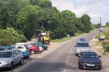
A28 road
Encyclopedia

Trunk road
A trunk road, trunk highway, or strategic road is a major road—usually connecting two or more cities, ports, airports, and other things.—which is the recommended route for long-distance and freight traffic...
in southern England. It runs south-west from the seaside resort
Seaside resort
A seaside resort is a resort, or resort town, located on the coast. Where a beach is the primary focus for tourists, it may be called a beach resort.- Overview :...
of Margate
Margate
-Demography:As of the 2001 UK census, Margate had a population of 40,386.The ethnicity of the town was 97.1% white, 1.0% mixed race, 0.5% black, 0.8% Asian, 0.6% Chinese or other ethnicity....
in Kent
Kent
Kent is a county in southeast England, and is one of the home counties. It borders East Sussex, Surrey and Greater London and has a defined boundary with Essex in the middle of the Thames Estuary. The ceremonial county boundaries of Kent include the shire county of Kent and the unitary borough of...
via Westgate
Westgate-on-Sea
Westgate-on-Sea is a seaside town in northeast Kent, England, with a population of 6,600. It is within the Thanet local government district and borders the larger seaside resort of Margate...
and Birchington
Birchington-on-Sea
Birchington-on-Sea is a village in northeast Kent, England, with a population of around 9,800. It is part of the Thanet district and forms the civil parish of Birchington. It lies on the coast facing the North Sea, east of the Thames Estuary, between the seaside resorts of Herne Bay and Margate.As...
, reaching open countryside at Sarre
Sarre, Kent
Sarre is a village and civil parish in Thanet District in Kent, England. The village is a part of St. Nicholas-at-Wade ecclesiastical parish, after having lost the local church of St. Giles in Elizabethan times; the ecclesiastical parishes were subsequently combined. In its own right Sarre is an...
. The road continues via Upstreet
Upstreet
Upstreet is a village in the civil parish of Chislet in Kent, England. It is in the local government district of Canterbury, and the electoral ward of Marshside....
and Hersden
Hersden
Hersden is a village near Canterbury in Kent, South East England.The village lies on the A28 road, an old Roman road between the City of Canterbury and the Isle of Thanet, in the civil parish of Sturry, bordering the parish of Westbere....
to Sturry
Sturry
Sturry is a village on the Great Stour river three miles north-east of Canterbury in Kent. The large parish of Sturry Church incorporates the former mining village of Hersden and several hamlets.-Geography:...
, and on to the cathedral city of Canterbury
Canterbury
Canterbury is a historic English cathedral city, which lies at the heart of the City of Canterbury, a district of Kent in South East England. It lies on the River Stour....
. It forms part of Canterbury's ring road before leaving via Wincheap
Wincheap
Wincheap is a road that gives its name to a southwest suburb of Canterbury in Kent, England. It forms part of the A28 road, stretching for nearly a mile from the city wall, close by Canterbury East railway station, to the over-crossing of the A2 and the parish of Thanington...
and Thanington Without
Thanington Without
Thanington Without is a civil parish and Community in Canterbury Kent United Kingdom. It extends to the south-west of A2 to the Milton Bridge. The off ramp slip road is at present under construction on the East bound A2...
, where a northward link to the A2 is currently under construction, and passing between the North Downs
North Downs
The North Downs are a ridge of chalk hills in south east England that stretch from Farnham in Surrey to the White Cliffs of Dover in Kent. The North Downs lie within two Areas of Outstanding Natural Beauty , the Surrey Hills and the Kent Downs...
via Chartham
Chartham
Chartham is a village and civil parish in Kent, west of Canterbury.It is located on the Great Stour river which provided power for the paper mills up until some point before 1955. The name literally means ‘Village on rough ground’, and the word "Chart" is also found in other villages in Kent with...
, Chilham
Chilham
Chilham is a parish in the English county of Kent. Visited by tourists worldwide, it is known for its beauty. Chilham has been a location for a number of films and television dramas...
, Godmersham
Godmersham
Godmersham is a village and civil parish in the Ashford District of Kent, England. The village is located on the Great Stour river where it cuts through the North Downs...
and Bilting
Bilting
Bilting is a hamlet within the civil parish of Godmersham in the Ashford District of Kent, England. It is located south of Godmersham, and three miles northwest of Ashford town.The village is home to one of the first mushroom farms in the country....
.
The A28 plunges back into suburbia at Kennington
Kennington, Kent
Kennington is a suburb of Ashford in Kent, England. It is about a mile northeast of the town centre and north of the M20 motorway, and contains the 12th century church, St Mary's. The main A28 Canterbury Road and A251 Faversham Road run through the village...
, a suburb of Ashford
Ashford, Kent
Ashford is a town in the borough of Ashford in Kent, England. In 2005 it was voted the fourth best place to live in the United Kingdom. It lies on the Great Stour river, the M20 motorway, and the South Eastern Main Line and High Speed 1 railways. Its agricultural market is one of the most...
, but skirts around the town centre on a section of dual carriageway
Dual carriageway
A dual carriageway is a class of highway with two carriageways for traffic travelling in opposite directions separated by a central reservation...
. Bypassing Great Chart
Great Chart
Great Chart is a village in civil parish of Great Chart with Singleton in the Ashford District of Kent, England. The parish is split between the ancient village of Great Chart and the modern Singleton housing development, which is part of the western outskirts of Ashford...
, the road undulates around the Kentish Weald
Weald
The Weald is the name given to an area in South East England situated between the parallel chalk escarpments of the North and the South Downs. It should be regarded as three separate parts: the sandstone "High Weald" in the centre; the clay "Low Weald" periphery; and the Greensand Ridge which...
via Bethersden
Bethersden
Bethersden is a small village and civil parish five miles west of Ashford, Kent.The village has two public houses – The Bull and The George...
and High Halden
High Halden
High Halden is a village and civil parish in the Ashford District of Kent, England. The village is located on the A28 road between Ashford town and Tenterden, 3miles north of the latter.-History:...
, to the market town of Tenterden
Tenterden
Tenterden is a Cinque Port town in the Ashford District of Kent, England. It stands on the edge of the Weald, overlooking the valley of the River Rother....
.
The A28 continues via Rolvenden
Rolvenden
Rolvenden is a village and civil parish in the Ashford District of Kent, England. The village is located on the A28 Ashford to Hastings road, south-west of Tenterden.The settlement of Rolvenden Layne, south of Rolvenden, is also in the parish.-History:...
and Newenden before crossing a narrow bridge over the River Rother
River Rother (Eastern)
The River Rother , at 35 miles , is a river flowing through both East Sussex and Kent, England. Its source is near Rotherfield , and its mouth is on Rye Bay, part of the English Channel....
and entering East Sussex
East Sussex
East Sussex is a county in South East England. It is bordered by the counties of Kent, Surrey and West Sussex, and to the south by the English Channel.-History:...
via Northiam
Northiam
Northiam is a village and civil parish in the Rother District of East Sussex, England. The village is located thirteen miles north of Hastings in the valley of the River Rother. The main road that passes through it is the A28 which goes to Canterbury and Hastings.-Governance:The lowest level of...
, beyond which the road becomes very winding. After Brede
Brede
Brede is the name for several places, among others:* the River Brede in East Sussex, England* Brede, East Sussex, a village near the River Brede* Brede, Denmark, a suburb of the Lyngby-Taarbæk municipality...
there is a steep descent to bridge the river of the same name. Next is Westfield
Westfield, East Sussex
Known as Westewelle in the Domesday survey, Westfield in the Rother District of East Sussex is one of the largest villages in the area with a population of around 2,750. The village lies five miles north of Hastings. Carr-Taylor Vineyards is local. There is still a village shop, newsagents,...
, just before the road climbs to terminate at its junction with the A21 just north of Hastings
Hastings
Hastings is a town and borough in the county of East Sussex on the south coast of England. The town is located east of the county town of Lewes and south east of London, and has an estimated population of 86,900....
.