
A232 road
Encyclopedia
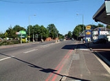
The A232 is a road
running east-west across South London
, which connects the A24
in Ewell
with the A224 Orpington
bypass.
Between Croydon
and Ewell the road runs close to the Sutton & Mole Valley Line
. London Buses route X26
bus runs along the road between Waddon
and Cheam
.
north of Hooley
had the motorway crossing the A232 Croydon Road in Wallington between Hilliers Lane (B272) and Demense Road. It is probable that a junction would have been provided here if the motorway had been built. In the late 1970s, when the M23 plan was scaled back to omit the section across Mitcham Common
, the road may have ended on the A232 at this point.
to the south, over London clay
to the north, especially between Ewell and Addiscombe
. As a result, there are many springs
near the route, and many of the suburb
s it passes through developed out of prehistoric spring line villages.
Road
A road is a thoroughfare, route, or way on land between two places, which typically has been paved or otherwise improved to allow travel by some conveyance, including a horse, cart, or motor vehicle. Roads consist of one, or sometimes two, roadways each with one or more lanes and also any...
running east-west across South London
London
London is the capital city of :England and the :United Kingdom, the largest metropolitan area in the United Kingdom, and the largest urban zone in the European Union by most measures. Located on the River Thames, London has been a major settlement for two millennia, its history going back to its...
, which connects the A24
A24 road (Great Britain)
The A24 is a major road in England. It runs south from Clapham in southwest London through Morden before entering Surrey and heading through Ewell, Epsom, Ashtead, Leatherhead and Dorking...
in Ewell
Ewell
Ewell is a village in the borough of Epsom and Ewell in Surrey, close to the southern boundary of Greater London. It is located 14 miles south-south-west of Charing Cross and forms part of the suburbia that surrounds Greater London. Despite its growing population it is still referred to as a...
with the A224 Orpington
Orpington
Orpington is a suburban town and electoral ward in the London Borough of Bromley. It forms the southeastern edge of London's urban sprawl and is identified in the London Plan as one of 35 major centres in Greater London.-History:...
bypass.
Between Croydon
Croydon
Croydon is a town in South London, England, located within the London Borough of Croydon to which it gives its name. It is situated south of Charing Cross...
and Ewell the road runs close to the Sutton & Mole Valley Line
Sutton & Mole Valley Line
The Sutton & Mole Valley Lines are a group of railway lines constructed between 1847 and 1868 by the London, Brighton and South Coast Railway, the London and South Western Railway and the LBSCR-sponsored Horsham, Dorking and Leatherhead Railway.-Services:The scheduled services run along the Sutton...
. London Buses route X26
London Buses route X26
London Buses route X26 is a Transport for London contracted bus route from Heathrow Airport to West Croydon. The service is currently contracted to Metrobus.The route is the longest London Buses route in London.-History:...
bus runs along the road between Waddon
Waddon
Waddon is a place in the London Borough of Croydon, to the south west of central Croydon on the borders of the London Borough of Sutton. Waddon has an older area with 19th century properties, some even older, close to central Croydon. Further south is a large estate of Council-owned homes and a...
and Cheam
Cheam
Cheam is a large suburban village close to Sutton in the London Borough of Sutton, England, and is located close to the southern boundary between Greater London and Surrey. It is divided into two main areas: North Cheam and Cheam Village. North Cheam includes more retail shops and supermarkets,...
.
History
In the 1970s the plans for the construction of the M23 motorwayM23 motorway
The M23 motorway is a motorway in England. The motorway runs from south of Hooley in Surrey, where it splits from the A23, to Pease Pottage, south of Crawley in West Sussex where it rejoins the A23. The northern end of the motorway starts at junction 7 on what is effectively a spur north from...
north of Hooley
Hooley
Hooley is a small village in Surrey, England. It lies in a "pass" which is the lowest crossing point of the North Downs for some distance in either direction. Both the London, Brighton and South Coast Railway and the South Eastern Railway recognised this pass as the best route to Brighton and built...
had the motorway crossing the A232 Croydon Road in Wallington between Hilliers Lane (B272) and Demense Road. It is probable that a junction would have been provided here if the motorway had been built. In the late 1970s, when the M23 plan was scaled back to omit the section across Mitcham Common
Mitcham Common
Mitcham Common or Seven Islands is 182 hectares of common land situated in South London. It is predominantly in the London borough of Merton, with parts straddling the borders with Sutton and Croydon.- History :...
, the road may have ended on the A232 at this point.
Administrative districts and towns that the A232 passes through
- BromleyLondon Borough of BromleyThe London Borough of Bromley is a London borough of south east London, England and forms part of Outer London. The principal town in the borough is Bromley.-Geography:...
: OrpingtonOrpingtonOrpington is a suburban town and electoral ward in the London Borough of Bromley. It forms the southeastern edge of London's urban sprawl and is identified in the London Plan as one of 35 major centres in Greater London.-History:...
, FarnboroughFarnborough, LondonFarnborough is a settlement in the London Borough of Bromley. It is a suburban development located 13.4 miles southeast of Charing Cross.-History:...
, HayesHayes, BromleyHayes is a place in the London Borough of Bromley, south-east London, England. It has two main areas of activity: the ancient village and suburban Hayes.-The ancient village of Nimrods :...
, West WickhamWest WickhamWest Wickham is a place in the London Borough of Bromley, England. It is 10.3 miles south east of Charing Cross. West Wickham history dates back to early settlements existing since 1068, although the name `Wickham` is an indication of an earlier Anglo-Saxon settlement... - CroydonLondon Borough of CroydonThe London Borough of Croydon is a London borough in South London, England and is part of Outer London. It covers an area of and is the largest London borough by population. It is the southernmost borough of London. At its centre is the historic town of Croydon from which the borough takes its name...
: ShirleyShirley, LondonShirley is a place in the London Borough of Croydon, England. It is a suburban development situated 10 miles south south-east of Charing Cross.-Description:...
, AddiscombeAddiscombeAddiscombe is a district of south London, England, located in the London Borough of Croydon. It is situated south of Charing Cross.It is situated just to the northeast of central Croydon, and is home to a high proportion of people who commute to Central London, owing to its proximity to the busy...
, CroydonCroydonCroydon is a town in South London, England, located within the London Borough of Croydon to which it gives its name. It is situated south of Charing Cross...
, WaddonWaddonWaddon is a place in the London Borough of Croydon, to the south west of central Croydon on the borders of the London Borough of Sutton. Waddon has an older area with 19th century properties, some even older, close to central Croydon. Further south is a large estate of Council-owned homes and a... - SuttonLondon Borough of SuttonThe London Borough of Sutton is a London borough in South London, England and forms part of Outer London. It covers an area of and is the 80th largest local authority in England by population. It is one of the southernmost boroughs of London...
: BeddingtonBeddingtonBeddington is a settlement between the London Boroughs of Sutton and Croydon. The BedZED low energy housing scheme is located here. In Beddington was a static inverter plant of HVDC Kingsnorth....
, WallingtonWallington, LondonWallington is a town in the London Borough of Sutton situated south south-west of Charing Cross. Prior to the merger of the Municipal Borough of Beddington and Wallington into the London Borough of Sutton, it was part of the county of Surrey.- History :...
, CarshaltonCarshaltonCarshalton is a suburban area of the London Borough of Sutton, England. It is located 10 miles south-southwest of Charing Cross, situated in the valley of the River Wandle, one of the sources of which is Carshalton Ponds in the centre of the village. The combined population of the five wards...
, SuttonSutton, LondonSutton is a large suburban town in southwest London, England, and the administrative headquarters of the London Borough of Sutton. It is located south-southwest of Charing Cross and is one of the major metropolitan centres identified in the London Plan. The town was connected to central London by...
, CheamCheamCheam is a large suburban village close to Sutton in the London Borough of Sutton, England, and is located close to the southern boundary between Greater London and Surrey. It is divided into two main areas: North Cheam and Cheam Village. North Cheam includes more retail shops and supermarkets,... - Epsom and EwellEpsom and EwellEpsom and Ewell is a local government district with borough status in Surrey, England, covering the town of Epsom and the village of Ewell. The borough was formed as an urban district in 1894, and was known as Epsom until 1934. It was made a municipal borough in 1937...
: EwellEwellEwell is a village in the borough of Epsom and Ewell in Surrey, close to the southern boundary of Greater London. It is located 14 miles south-south-west of Charing Cross and forms part of the suburbia that surrounds Greater London. Despite its growing population it is still referred to as a...
Major roads intersected by the A232
- A21 at Locksbottom
- A23A23 roadThe A23 road is a major road in the United Kingdom between London and Brighton, East Sussex. It became an arterial route following the construction of Westminster Bridge in 1750 and the consequent improvement of roads leading to the bridge south of the river by the Turnpike Trusts...
(Purley WayPurley WayPurley Way is a section of the A23 trunk road in the London Borough of Croydon, in the areas of Purley, Waddon and West Croydon, and has given its name to the out-of-town shopping area alongside it with a catchment area covering most of South London. It was designed as a bypass for Croydon and was...
) at Waddon - A212A212 roadThe A212 is an A road in South London, linking Lewisham to Croydon. It runs southwest from the South Circular at Catford, going through Sydenham, Norwood and Crystal Palace before heading south to Croydon...
at Croydon - A217A217 roadThe A217 is a road in the United Kingdom. It runs south from Kings Road in Fulham, London, crossing the Thames at Wandsworth Bridge, then passing through Wandsworth, Tooting, Mitcham, Cheam, Banstead, crossing the M25 motorway at Junction 8, then passing through Reigate and terminating shortly...
at CheamCheamCheam is a large suburban village close to Sutton in the London Borough of Sutton, England, and is located close to the southern boundary between Greater London and Surrey. It is divided into two main areas: North Cheam and Cheam Village. North Cheam includes more retail shops and supermarkets,... - A237A237 roadThe A237 is an A road in South London. It runs from the west side of Mitcham Common to Coulsdon. It crosses through 2 London Boroughs which includes the start inside the London Borough of Merton and the ending of the road inside the London Borough of Croydon...
at Wallington
Landmarks on the A232
- Orpington War Memorial
- Orpington railway stationOrpington railway stationOrpington railway station serves the town of Orpington in the London Borough of Bromley, and is in Travelcard Zone 6. Located in Crofton Road, the station is a 500m west of the southern end of Orpington High Street....
- The Princess Royal University Hospital and Locksbottom Sainsbury's
- Hayes Common
- Bethlem Royal HospitalBethlem Royal HospitalThe Bethlem Royal Hospital is a psychiatric hospital located in London, United Kingdom and part of the South London and Maudsley NHS Foundation Trust. Although no longer based at its original location, it is recognised as the world's first and oldest institution to specialise in mental illnesses....
- Trinity SchoolTrinity School of John WhitgiftThe Trinity School of John Whitgift, usually referred to as Trinity School, is a British independent boys' day school with a co-educational Sixth Form, located in Shirley Park, Croydon. The current building was constructed in 1965 on the site of the former Shirley Hotel...
- Shirley Park Golf Course
- Sandilands tram stopSandilands tram stopSandilands tram stop is a light rail stop in the London Borough of Croydon in the southern suburbs of London. It serves the residential area along Addiscombe Road to the east of the centre of the town of Croydon....
- Fairfield HallsFairfield HallsFairfield Hall is an arts centre in Croydon, London, England and opened in 1962. It contains a concert hall, the Ashcroft Theatre , the Arnhem Gallery civic hall and an art gallery....
- Croydon Flyover
- Duppas HillDuppas HillDuppas Hill is a park, road and surrounding residential area in Waddon, near Croydon in Greater London . It is thought to be named after a family called 'Dubber' or 'Double'.Duppas Hill has a long history of sport and recreation...
- Waddon railway stationWaddon railway stationWaddon railway station is in the London Borough of Croydon in south London. The station and all trains serving it are operated by Southern. It is in Travelcard Zone 5....
- Croydon IKEA TowersPurley WayPurley Way is a section of the A23 trunk road in the London Borough of Croydon, in the areas of Purley, Waddon and West Croydon, and has given its name to the out-of-town shopping area alongside it with a catchment area covering most of South London. It was designed as a bypass for Croydon and was...
(not on the A232 but visible from it) - Beddington Park and Carew Manor
- CarshaltonCarshaltonCarshalton is a suburban area of the London Borough of Sutton, England. It is located 10 miles south-southwest of Charing Cross, situated in the valley of the River Wandle, one of the sources of which is Carshalton Ponds in the centre of the village. The combined population of the five wards...
village and duck ponds - St Philomena's School
- Nonsuch ParkNonsuch PalaceNonsuch Palace was a Tudor royal palace, built by Henry VIII in Surrey, England; it stood from 1538 to 1682–3. Its ruins are in Nonsuch Park.- Background :Nonsuch Palace in Surrey was perhaps the grandest of Henry VIII's building projects...
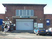
- Ewell East railway stationEwell East railway stationEwell East is a railway station in Ewell, Surrey. It has two platforms, one for services to Sutton, West Croydon and London, the other for services to Epsom. The ticket office and main entrance is on the London-bound side, accessed from Cheam Road...
Rivers that start near the A232
The road closely follows the ridge of chalkChalk
Chalk is a soft, white, porous sedimentary rock, a form of limestone composed of the mineral calcite. Calcite is calcium carbonate or CaCO3. It forms under reasonably deep marine conditions from the gradual accumulation of minute calcite plates shed from micro-organisms called coccolithophores....
to the south, over London clay
Clay
Clay is a general term including many combinations of one or more clay minerals with traces of metal oxides and organic matter. Geologic clay deposits are mostly composed of phyllosilicate minerals containing variable amounts of water trapped in the mineral structure.- Formation :Clay minerals...
to the north, especially between Ewell and Addiscombe
Addiscombe
Addiscombe is a district of south London, England, located in the London Borough of Croydon. It is situated south of Charing Cross.It is situated just to the northeast of central Croydon, and is home to a high proportion of people who commute to Central London, owing to its proximity to the busy...
. As a result, there are many springs
Spring (hydrosphere)
A spring—also known as a rising or resurgence—is a component of the hydrosphere. Specifically, it is any natural situation where water flows to the surface of the earth from underground...
near the route, and many of the suburb
Suburb
The word suburb mostly refers to a residential area, either existing as part of a city or as a separate residential community within commuting distance of a city . Some suburbs have a degree of administrative autonomy, and most have lower population density than inner city neighborhoods...
s it passes through developed out of prehistoric spring line villages.
- CrayRiver CrayThe River Cray is a tributary of the River Darent in southern England. It rises in Priory Gardens in Orpington in the London Borough of Bromley, where rainwater permeates the chalk bedrock and forms a pond at the boundary between the chalk and impermeable clay...
- RavensbourneRiver RavensbourneThe River Ravensbourne is a tributary of the River Thames in South London, England. It flows into the River Thames on the Tideway at Deptford, where its tidal reach is known as Deptford Creek.- Geography :...
- BeckRiver BeckThe River Beck is one of the tributaries of the River Ravensbourne in south London.The source of the River Beck is in Spring Park where Shirley and West Wickham meet. For its first mile or so it forms the border between the London boroughs of Croydon and Bromley. Indeed, historically, this was...
- Pool
- WandleRiver WandleThe River Wandle is a river in south-east England. The names of the river and of Wandsworth are thought to have derived from the Old English "Wendlesworth" meaning "Wendle's Settlement". The river runs through southwest London and is about long...
- Beverley BrookBeverley BrookBeverley Brook is a minor English urban river about 14.3 km long located in south-west London. It rises at Cuddington Recreation Park in Worcester Park, flows through Motspur Park, New Malden, Wimbledon Common, Richmond Park and Barnes...
- HogsmillHogsmillThe Hogsmill River in Surrey is one of the tributaries of the River Thames; it rises in Ewell and flows into the Thames at Kingston upon Thames on the reach above Teddington Lock.-Course:...
External links
- A232 from SABRE Roads
- http://www.cbrd.co.uk/histories/m23/img/a-z.jpgwww.cbrd.co.uk - 1970s A-ZGeographer's A–Z Street AtlasThe A–Z or A to Zed, or in full the Geographers' A–Z Street Atlas, is a name given to any one of a range of atlases of streets in the United Kingdom currently produced by Geographers' A-Z Map Company Limited. The first atlas, of London, was originally compiled in the 1930s by Phyllis Pearsall...
map showing proposed M23 route crossing the A232]