
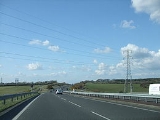
A22 road
Encyclopedia
The A22 is one of the two-digit major road
s in the south east of England
. It carries traffic from London
to Eastbourne
on the East Sussex
coast. For part of its route the A22 utilises the turnpikes
opened in the 18th century:
By 1820 the road ran for 34 miles (54 km) from Stones End Street, Borough
, London to Wych Cross.
The road was extended north to Westminster Bridge which was later renamed the A23
.
to reach its junction with the A23 road
before it travels southwards through Brixton
and Streatham
passing the site of the old Croydon Aerodrome until, at Purley Cross Junction, south of Purley
, the A22 is reached. From here it runs over the North Downs
into Surrey
and on along the Caterham
bypass, one of the oldest such roads in the country with the very early Wapses Lodge roundabout at the northern end. The route from there to Godstone
travels, in part, over an erstwhile Roman road
. It crosses the M25 London Orbital Motorway just north of Godstone and shortly afterwards the old A25.
Just to the north of East Grinstead
the road briefly enters West Sussex
at Felbridge
. At this point the A264 joins the A22 from Crawley
to the west. Immediately north of the town centre the A264 leaves the A22 turning east towards the spa town of Tunbridge Wells, in the county of Kent
. East Grinstead town centre itself is bypassed using a disused railway cutting. This stretch of road is called Beeching Way named after a local resident, Richard Beeching
, whose recommendations in the form of the Beeching Report led to the closure of many branch lines throughout the country. A railway cutting there was in fact converted into the A22 bypass which some local residents wanted to call the "Beeching Cut", bearing in mind his Beeching axe
in 1966 which was responsible for closing the line which originally ran from Three Bridges to Tunbridge Wells Central Line
, so allowing its conversion to bypass.
To the south of the town the A22 crosses into East Sussex
just north of Forest Row
. Between Forest Row and Nutley
the road crosses the ancient Ashdown Forest
: 40 mph (64 km/h) speed limits exist within the Forest, although not on the A22. At the Wych Cross junction the A275 branches south to Lewes
. Between Nutley and Uckfield two important cross country roads cross the path of the A22: the A272
at Maresfield
, and the A26
: the latter road merges with the A22 for the section round Uckfield. East Hoathly, once on the A22, but now with its own bypass, and Hailsham
- also having its own lengthy bypass - leads the road to Polegate
. Here the newly-opened junctions with the A27
and further new road building takes the A22 into Eastbourne.
Road
A road is a thoroughfare, route, or way on land between two places, which typically has been paved or otherwise improved to allow travel by some conveyance, including a horse, cart, or motor vehicle. Roads consist of one, or sometimes two, roadways each with one or more lanes and also any...
s in the south east of England
England
England is a country that is part of the United Kingdom. It shares land borders with Scotland to the north and Wales to the west; the Irish Sea is to the north west, the Celtic Sea to the south west, with the North Sea to the east and the English Channel to the south separating it from continental...
. It carries traffic from London
London
London is the capital city of :England and the :United Kingdom, the largest metropolitan area in the United Kingdom, and the largest urban zone in the European Union by most measures. Located on the River Thames, London has been a major settlement for two millennia, its history going back to its...
to Eastbourne
Eastbourne
Eastbourne is a large town and borough in East Sussex, on the south coast of England between Brighton and Hastings. The town is situated at the eastern end of the chalk South Downs alongside the high cliff at Beachy Head...
on the East Sussex
East Sussex
East Sussex is a county in South East England. It is bordered by the counties of Kent, Surrey and West Sussex, and to the south by the English Channel.-History:...
coast. For part of its route the A22 utilises the turnpikes
Toll road
A toll road is a privately or publicly built road for which a driver pays a toll for use. Structures for which tolls are charged include toll bridges and toll tunnels. Non-toll roads are financed using other sources of revenue, most typically fuel tax or general tax funds...
opened in the 18th century:
- 1718: London to East GrinsteadEast GrinsteadEast Grinstead is a town and civil parish in the northeastern corner of Mid Sussex, West Sussex in England near the East Sussex, Surrey, and Kent borders. It lies south of London, north northeast of Brighton, and east northeast of the county town of Chichester...
opened - 1720: road extended through East Grinstead to Highgate Forest RowForest RowForest Row is a village and relatively large civil parish in the Wealden District of East Sussex, England. The village is located three miles south-east of East Grinstead.-History:...
, the entrance to Ashdown ForestAshdown ForestAshdown Forest is an ancient area of tranquil open heathland occupying the highest sandy ridge-top of the High Weald Area of Outstanding Natural Beauty. It is situated some south of London in the county of East Sussex, England...
By 1820 the road ran for 34 miles (54 km) from Stones End Street, Borough
Borough
A borough is an administrative division in various countries. In principle, the term borough designates a self-governing township although, in practice, official use of the term varies widely....
, London to Wych Cross.
The road was extended north to Westminster Bridge which was later renamed the A23
A23 road
The A23 road is a major road in the United Kingdom between London and Brighton, East Sussex. It became an arterial route following the construction of Westminster Bridge in 1750 and the consequent improvement of roads leading to the bridge south of the river by the Turnpike Trusts...
.
Route
Traffic for Eastbourne begins along the A203 through VauxhallVauxhall
-Demography:Many Vauxhall residents live in social housing. There are several gentrified areas, and areas of terraced townhouses on streets such as Fentiman Road and Heyford Avenue have higher property values in the private market, however by far the most common type of housing stock within...
to reach its junction with the A23 road
A23 road
The A23 road is a major road in the United Kingdom between London and Brighton, East Sussex. It became an arterial route following the construction of Westminster Bridge in 1750 and the consequent improvement of roads leading to the bridge south of the river by the Turnpike Trusts...
before it travels southwards through Brixton
Brixton
Brixton is a district in the London Borough of Lambeth in south London, England. It is south south-east of Charing Cross. The area is identified in the London Plan as one of 35 major centres in Greater London....
and Streatham
Streatham
Streatham is a district in Surrey, England, located in the London Borough of Lambeth. It is situated south of Charing Cross. The area is identified in the London Plan as one of 35 major centres in Greater London.-History:...
passing the site of the old Croydon Aerodrome until, at Purley Cross Junction, south of Purley
Purley, London
Purley is a place in the London Borough of Croydon, England. It is a suburban development situated 11.7 miles south of Charing Cross.The name derives from "pirlea", which means 'Peartree lea'. Purley has a population of about 72,000....
, the A22 is reached. From here it runs over the North Downs
North Downs
The North Downs are a ridge of chalk hills in south east England that stretch from Farnham in Surrey to the White Cliffs of Dover in Kent. The North Downs lie within two Areas of Outstanding Natural Beauty , the Surrey Hills and the Kent Downs...
into Surrey
Surrey
Surrey is a county in the South East of England and is one of the Home Counties. The county borders Greater London, Kent, East Sussex, West Sussex, Hampshire and Berkshire. The historic county town is Guildford. Surrey County Council sits at Kingston upon Thames, although this has been part of...
and on along the Caterham
Caterham
Caterham is a town in the Tandridge District of Surrey, England. The town is geographically divided into two sections: Caterham on the Hill and Caterham Valley - the main town centre. The town lies close to the A22, a few miles south of Croydon, in a valley cut into the dip slope of the North Downs...
bypass, one of the oldest such roads in the country with the very early Wapses Lodge roundabout at the northern end. The route from there to Godstone
Godstone
Godstone is a village in the county of Surrey, England. It is located approximately six miles east of Reigate at the junction of the A22 and A25 major roads, and near the M25 motorway.-History:...
travels, in part, over an erstwhile Roman road
Roman road
The Roman roads were a vital part of the development of the Roman state, from about 500 BC through the expansion during the Roman Republic and the Roman Empire. Roman roads enabled the Romans to move armies and trade goods and to communicate. The Roman road system spanned more than 400,000 km...
. It crosses the M25 London Orbital Motorway just north of Godstone and shortly afterwards the old A25.
Just to the north of East Grinstead
East Grinstead
East Grinstead is a town and civil parish in the northeastern corner of Mid Sussex, West Sussex in England near the East Sussex, Surrey, and Kent borders. It lies south of London, north northeast of Brighton, and east northeast of the county town of Chichester...
the road briefly enters West Sussex
West Sussex
West Sussex is a county in the south of England, bordering onto East Sussex , Hampshire and Surrey. The county of Sussex has been divided into East and West since the 12th century, and obtained separate county councils in 1888, but it remained a single ceremonial county until 1974 and the coming...
at Felbridge
Felbridge
Felbridge is a civil parish in the Tandridge district of Surrey. The village is forms a continuous settlement with East Grinstead.-External links:****...
. At this point the A264 joins the A22 from Crawley
Crawley
Crawley is a town and local government district with Borough status in West Sussex, England. It is south of Charing Cross, north of Brighton and Hove, and northeast of the county town of Chichester, covers an area of and had a population of 99,744 at the time of the 2001 Census.The area has...
to the west. Immediately north of the town centre the A264 leaves the A22 turning east towards the spa town of Tunbridge Wells, in the county of Kent
Kent
Kent is a county in southeast England, and is one of the home counties. It borders East Sussex, Surrey and Greater London and has a defined boundary with Essex in the middle of the Thames Estuary. The ceremonial county boundaries of Kent include the shire county of Kent and the unitary borough of...
. East Grinstead town centre itself is bypassed using a disused railway cutting. This stretch of road is called Beeching Way named after a local resident, Richard Beeching
Richard Beeching
Richard Beeching, Baron Beeching , commonly known as Doctor Beeching, was chairman of British Railways and a physicist and engineer...
, whose recommendations in the form of the Beeching Report led to the closure of many branch lines throughout the country. A railway cutting there was in fact converted into the A22 bypass which some local residents wanted to call the "Beeching Cut", bearing in mind his Beeching axe
Beeching Axe
The Beeching Axe or the Beeching Cuts are informal names for the British Government's attempt in the 1960s to reduce the cost of running British Railways, the nationalised railway system in the United Kingdom. The name is that of the main author of The Reshaping of British Railways, Dr Richard...
in 1966 which was responsible for closing the line which originally ran from Three Bridges to Tunbridge Wells Central Line
Three Bridges to Tunbridge Wells Central Line
The Three Bridges to Tunbridge Wells Central Line was a railway line running from Three Bridges in West Sussex to Tunbridge Wells Central in Kent via East Grinstead in East Sussex, a distance of . Opened in 1855, the main section of the line was a casualty of the Beeching Axe the last train ran on...
, so allowing its conversion to bypass.
To the south of the town the A22 crosses into East Sussex
East Sussex
East Sussex is a county in South East England. It is bordered by the counties of Kent, Surrey and West Sussex, and to the south by the English Channel.-History:...
just north of Forest Row
Forest Row
Forest Row is a village and relatively large civil parish in the Wealden District of East Sussex, England. The village is located three miles south-east of East Grinstead.-History:...
. Between Forest Row and Nutley
Nutley, East Sussex
Nutley is a village in the Wealden District of East Sussex, England. It lies about north-east of Uckfield, the main road being on the A22. Nutley, Fairwarp and Maresfield together form the Maresfield civil parish....
the road crosses the ancient Ashdown Forest
Ashdown Forest
Ashdown Forest is an ancient area of tranquil open heathland occupying the highest sandy ridge-top of the High Weald Area of Outstanding Natural Beauty. It is situated some south of London in the county of East Sussex, England...
: 40 mph (64 km/h) speed limits exist within the Forest, although not on the A22. At the Wych Cross junction the A275 branches south to Lewes
Lewes
Lewes is the county town of East Sussex, England and historically of all of Sussex. It is a civil parish and is the centre of the Lewes local government district. The settlement has a history as a bridging point and as a market town, and today as a communications hub and tourist-oriented town...
. Between Nutley and Uckfield two important cross country roads cross the path of the A22: the A272
A272 road
The A272 is a road in South-East England. It follows an approximate East-West route from near Heathfield, East Sussex to the city of Winchester, Hampshire. It has achieved somewhat unlikely fame in recent years by being the subject of a book by the Dutch author, Pieter Boogaart...
at Maresfield
Maresfield
Maresfield is a village and civil parish in the Wealden District of East Sussex, England. The village itself lies 1.5 miles north from Uckfield; the nearby villages of Nutley and Fairwarp; and the smaller settlements of Duddleswell and Horney Common; and parts of Ashdown Forest all lie within...
, and the A26
A26 road
For the road in Northern Ireland see A26 road The A26 road is one of the three cross-country two-digit numbered roads in the southeast of England, the others being the A25 road and A27 road. It carries traffic from Maidstone in Kent in a generally south-westerly direction to Tunbridge Wells and...
: the latter road merges with the A22 for the section round Uckfield. East Hoathly, once on the A22, but now with its own bypass, and Hailsham
Hailsham
Hailsham is a civil parish and the largest of the five main towns in the Wealden district of East Sussex, England. Mentioned in the Domesday Book, the town of Hailsham has had a long history of industry and agriculture...
- also having its own lengthy bypass - leads the road to Polegate
Polegate
Polegate is a town and civil parish in the Wealden District of East Sussex, England, United Kingdom. It is located five miles north of the seaside resort of Eastbourne, and is part of the greater area of that town. Although once a railway settlement, its importance as such has now waned with...
. Here the newly-opened junctions with the A27
A27 road
The A27 is a major road in England. It runs from its junction with the A36 at Whiteparish in the county of Wiltshire. It closely parallels the south coast, where it passes through West Sussex and terminates at Pevensey in East Sussex.Between Portsmouth and Lewes, it is one of the busiest trunk...
and further new road building takes the A22 into Eastbourne.