
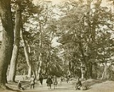
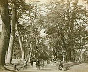
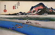
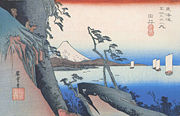
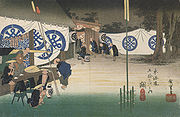
53 Stations of the Tokaido
Encyclopedia
Tokaido (road)
The ' was the most important of the Five Routes of the Edo period, connecting Edo to Kyoto in Japan. Unlike the inland and less heavily travelled Nakasendō, the Tōkaidō travelled along the sea coast of eastern Honshū, hence the route's name....
, which was a coastal route that ran from Nihonbashi
Nihonbashi
, or Nihombashi, is a business district of Chūō, Tokyo, Japan which grew up around the bridge of the same name which has linked two sides of the Nihonbashi River at this site since the 17th century. The first wooden bridge was completed in 1603, and the current bridge made of stone dates from 1911...
in Edo
Edo
, also romanized as Yedo or Yeddo, is the former name of the Japanese capital Tokyo, and was the seat of power for the Tokugawa shogunate which ruled Japan from 1603 to 1868...
(modern-day Tokyo
Tokyo
, ; officially , is one of the 47 prefectures of Japan. Tokyo is the capital of Japan, the center of the Greater Tokyo Area, and the largest metropolitan area of Japan. It is the seat of the Japanese government and the Imperial Palace, and the home of the Japanese Imperial Family...
) to Sanjō Ōhashi
Sanjo Ohashi
is a bridge in Kyoto, Kyoto Prefecture, Japan. It spans the Kamo River as part of Sanjō-dōri . It is well-known because it served as the ending location for both the Nakasendō and the Tōkaidō.-History:...
in Kyoto
Kyoto
is a city in the central part of the island of Honshū, Japan. It has a population close to 1.5 million. Formerly the imperial capital of Japan, it is now the capital of Kyoto Prefecture, as well as a major part of the Osaka-Kobe-Kyoto metropolitan area.-History:...
.
Stations of the Tōkaidō
There were originally 53 government post stationsShukuba
were post stations during the Edo period in Japan, generally located on one of the Edo Five Routes or one of its sub-routes. They were also called shukueki . These post stations were places where travelers could rest on their journey around the nation...
along the Tōkaidō, where travelers had to present traveling permits at each station if wanting to cross. All of the stations, in addition to the starting and ending locations (which are shared with the Nakasendō
Nakasendo
The , also called the , was one of the five routes of the Edo period, and one of the two that connected Edo to Kyoto in Japan. There were 69 stations between Edo and Kyoto, crossing through Musashi, Kōzuke, Shinano, Mino and Ōmi provinces...
), are listed below in order. The stations are divided by their present-day prefecture and include the name of their present-day city
Cities of Japan
||A is a local administrative unit in Japan. Cities are ranked on the same level as and , with the difference that they are not a component of...
/town
Towns of Japan
A town is a local administrative unit in Japan. It is a local public body along with prefecture , city , and village...
/village
Villages of Japan
A is a local administrative unit in Japan.It is a local public body along with , , and . Geographically, a village's extent is contained within a prefecture....
/district
Districts of Japan
The was most recently used as an administrative unit in Japan between 1878 and 1921 and is roughly equivalent to the county of the United States, ranking at the level below prefecture and above city, town or village. As of 2008, cities belong directly to prefectures and are independent from...
s, with historic provinces listed below.
TokyoTokyo, ; officially , is one of the 47 prefectures of Japan. Tokyo is the capital of Japan, the center of the Greater Tokyo Area, and the largest metropolitan area of Japan. It is the seat of the Japanese government and the Imperial Palace, and the home of the Japanese Imperial Family...
- Starting Location: NihonbashiNihonbashi, or Nihombashi, is a business district of Chūō, Tokyo, Japan which grew up around the bridge of the same name which has linked two sides of the Nihonbashi River at this site since the 17th century. The first wooden bridge was completed in 1603, and the current bridge made of stone dates from 1911...
(Chūō-kuChuo, Tokyois one of the 23 special wards that form the heart of Tokyo, Japan. The ward refers to itself as Chūō City in English.Its Japanese name literally means "Central Ward," and it is historically the main commercial center of Tokyo, although Shinjuku has risen to challenge it since the end of World War II...
) - 1. Shinagawa-jukuShinagawa-jukuwas the first of the fifty-three stations of the Tōkaidō. It is presently located in Shinagawa, Tokyo, Japan. Along with Itabashi-shuku , Naitō Shinjuku and Senju-shuku , it was one of the Four Stations of Edo . It was located in the present-day Shinagawa Port area near Shinagawa Station....
(ShinagawaShinagawa, Tokyois one of the 23 special wards of Tokyo, Japan. In English, it is called Shinagawa City. The ward is home to nine embassies.As of 2008, the ward has an estimated population of 344,461 and a density of 15,740 persons per km². The total area is 22.72 km²....
)
Kanagawa PrefectureKanagawa Prefectureis a prefecture located in the southern Kantō region of Japan. The capital is Yokohama. Kanagawa is part of the Greater Tokyo Area.-History:The prefecture has some archaeological sites going back to the Jōmon period...
- 2. Kawasaki-jukuKawasaki-jukuwas the second of the fifty-three stations of the Tōkaidō. It is located in Kawasaki-ku in the present-day city of Kawasaki, Kanagawa Prefecture, Japan.-History:...
(Kawasaki-kuKawasaki-ku, Kawasakiis one of the seven wards of the city of Kawasaki in Kanagawa Prefecture, Japan. As of 2010, the ward had an estimated population of 216,826 and a density of 5,530 persons per km². The total area was 39.21 km²...
, KawasakiKawasaki, Kanagawais a city located in Kanagawa Prefecture, Japan, between Tokyo and Yokohama. It is the 9th most populated city in Japan and one of the main cities forming the Greater Tokyo Area and Keihin Industrial Area....
) - 3. Kanagawa-jukuKanagawa-jukuwas the third of the fifty-three stations of the Tōkaidō. It is located in Kanagawa-ku in the present-day city of Yokohama, Kanagawa Prefecture, Japan. It is close to Kanagawa Port...
(Kanagawa-kuKanagawa-ku, Yokohamais one of the 18 wards of the city of Yokohama in Kanagawa Prefecture, Japan. As of 2010, the ward had an estimated population of 230,401 and a density of 9,650 persons per km²...
, Yokohama) - 4. Hodogaya-jukuHodogaya-jukuwas the fourth of the fifty-three stations of the Tōkaidō. It is located in Hodogaya-ku in the present-day city of Yokohama, Kanagawa Prefecture, Japan. Occasionally, it is also written as .-History:...
(Hodogaya-kuHodogaya-ku, Yokohamais one of the 18 wards of the city of Yokohama in Kanagawa Prefecture, Japan. As of 2010, Hodogaya Ward had an estimated population of 205,887 and a density of 9,400 persons per km². The total area was 21.91 km².-Geography:...
, Yokohama) - 5. Totsuka-jukuTotsuka-jukuwas the fifth of the fifty-three stations of the Tōkaidō. It was the eastern-most post station in Sagami Province. It is now located in Totsuka-ku in the present-day city of Yokohama, Kanagawa Prefecture, Japan.-History:...
(Totsuka-kuTotsuka-ku, Yokohamais one of the 18 wards of the city of Yokohama in Kanagawa Prefecture, Japan. As of 2010, the ward had an estimated population of 273,418 and a density of 7,640 persons per km². The total area was 35.70 km².-Geography:...
, Yokohama) - 6. Fujisawa-shukuFujisawa-shukuwas the sixth of the fifty-three stations of the Tōkaidō. It is located in the present-day city of Fujisawa, Kanagawa Prefecture, Japan.-History:Fujisawa-shuku was established as a post station on the Tōkaidō in 1601, but did not become the sixth post station until Totsuka-juku was later established...
(FujisawaFujisawa, Kanagawais a city located in Kanagawa, Japan. As of 2010, the city had an estimated population of 407,731 and a population density of 5,870 people per km². The total area is 69.51 km²-Geography:...
) - 7. Hiratsuka-jukuHiratsuka-jukuwas the seventh of the fifty-three stations of the Tōkaidō. It is located in the present-day city of Hiratsuka, Kanagawa Prefecture, Japan.-History:...
(HiratsukaHiratsuka, Kanagawais a city located in Kanagawa Prefecture, Japan. As of 2010, the city had an estimated population of 259,991 and the density of 3,830 persons per km²...
) - 8. Ōiso-jukuOiso-jukuwas the eighth of the fifty-three stations of the Tōkaidō. It is located in the present-day town of Ōiso, located in Naka District, Kanagawa Prefecture, Japan.-History:...
(ŌisoOiso, Kanagawais a town located in Naka District, Kanagawa Prefecture, Japan. As of 2010, the town had an estimated population of 32,725 and a density of 1,910 persons per km². The total area was 17.18 km².-Geography:...
, Naka DistrictNaka District, Kanagawais an administrative district of Japan located in central Kanagawa Prefecture. It currently consists of two towns, Ōiso, and Ninomiya.-History:Naka District was one of the four subdivisions of Sagami Province established by the late Hōjō clan of Odawara during the Sengoku period...
) - 9. Odawara-jukuOdawara-jukuwas the ninth of the fifty-three stations of the Tōkaidō. It is located in the present-day city of Odawara, Kanagawa Prefecture, Japan. It was the first post station in a castle town that travelers came to when they exited Edo in Edo period Japan....
(OdawaraOdawara, Kanagawais a city located in western Kanagawa Prefecture, Japan. As of 2010, the city had an estimated population of 198,466 with a population density of 1,740 persons per km² . The total area was .-Geography:...
) - 10. Hakone-jukuHakone-jukuwas the tenth of the fifty-three stations of the Tōkaidō. It is located in the present-day town of Hakone in Ashigarashimo District, Kanagawa Prefecture, Japan...
(HakoneHakone, Kanagawais a town in Ashigarashimo District in Kanagawa Prefecture, Japan. As of 2010, the town had an estimated population of 13,339 and a density of 144 persons per km². The total area was 92.82 km².-Geography:...
, Ashigarashimo DistrictAshigarashimo District, Kanagawais an administrative district of Japan located in western Kanagawa Prefecture. Most of the mountainous district is sparsely populated, and is part of the Fuji-Hakone-Izu National Park.- Towns and villages :*Hakone*Yugawara*Manazuru-History:...
)
Shizuoka PrefectureShizuoka Prefectureis a prefecture of Japan located in the Chūbu region on Honshu island. The capital is the city of Shizuoka.- History :Shizuoka prefecture was formed from the former Tōtōmi, Suruga and Izu provinces.The area was the home of the first Tokugawa Shogun...
- 11. Mishima-shukuMishima-shukuwas the eleventh of the fifty-three stations of the Tōkaidō during Edo period Japan. It is located in the present-day city of Mishima, in Shizuoka Prefecture.-History:...
(MishimaMishima, Shizuokais a city located in eastern Shizuoka Prefecture, Japan. As of 2009, the city has an estimated population of 112,078 and a population density of 1,800 persons per km². The total area is 62.13 km²...
) - 12. Numazu-jukuNumazu-jukuwas the twelfth of the fifty-three stations of the Tōkaidō. It is located in the present-day city of Numazu, Shizuoka Prefecture, Japan.-History:Numazu was the eastern-most post station within Suruga Province, and was the castle town of the daimyo of Numazu Domain...
(NumazuNumazu, Shizuokais a city located in eastern Shizuoka Prefecture, Japan. As of 2009, the city has an estimated population of 205,636 and a population density of 1,100 persons per km². The total area was 187.11 km².- Geography:...
) - 13. Hara-jukuHara-juku (Tokaido)was the thirteenth of the fifty-three stations of the Tōkaidō. It is located in the present-day city of Numazu, Shizuoka Prefecture, Japan.-History:...
(Numazu) - 14. Yoshiwara-jukuYoshiwara-jukuwas the fourteenth of the fifty-three stations of the Tōkaidō. It is located in the present-day city of Fuji, Shizuoka Prefecture, Japan.The Yoshiwara-juku Festival is held each year in October and November in Fuji, showing visitors the area's history.-History:...
(FujiFuji, Shizuokais a city in eastern Shizuoka Prefecture. Fuji is the 3rd largest city in terms of population in Shizuoka Prefecture, trailing Hamamatsu and Shizuoka. As of February 2010, the city has an estimated population of 254,113 and a population density of 1040 persons per km²...
) - 15. Kanbara-jukuKanbara-jukuwas the fifteenth of the fifty-three stations of the Tōkaidō. It is located in what is now part of the Shimizu-ku ward of Shizuoka, Shizuoka Prefecture, Japan...
(Shimizu-kuShimizu-ku, Shizuokais one of three wards of the city of Shizuoka, in Shizuoka Prefecture, Japan, located in the eastern part of the city.-Geography:Shimizu is located on the coast of Suruga Bay of the Pacific Ocean and covers a wide area from a coastal plain to the hills...
, ShizuokaShizuoka, Shizuokais the capital city of Shizuoka Prefecture, Japan, and the prefecture's second-largest city in terms of both population and area. It became one of Japan's 19 "designated cities" in 2005.-Geography:...
) - 16. Yui-shukuYui-shukuwas the sixteenth of the fifty-three stations of the Tōkaidō. It is located in the Shimizu-ku area of Shizuoka, Shizuoka Prefecture, Japan. It is one of four former post stations located in Shimizu-ku.-Area information:...
(Shimizu-ku, Shizuoka) - 17. Okitsu-jukuOkitsu-jukuwas the seventeenth of the fifty-three stations of the Tōkaidō. It is located in what is now part of the Shimizu-ku area of Shizuoka, Shizuoka Prefecture, Japan.-History:...
(Shimizu-ku, Shizuoka) - 18. Ejiri-jukuEjiri-jukuwas the eighteenth of the fifty-three stations of the Tōkaidō. It is one of four former post stations located in what is now part of the Shimizu-ku area of Shizuoka, Shizuoka Prefecture, Japan. It was 3.4 kilometers from Okitsu-juku, the preceding post station....
(Shimizu-ku, Shizuoka) - 19. Fuchū-shukuFuchu-shukuwas the nineteenth of the fifty-three stations of the Tōkaidō. It is located in what is now part of the Aoi-ku area of Shizuoka, Shizuoka Prefecture, Japan.-History:...
(Aoi-kuAoi-ku, Shizuokais one of three wards of Shizuoka, Shizuoka, Japan, located in the northern part of the city. Aoi-ku borders Suruga-ku in the south and Shimizu-ku to the southeast; the west faces Shimada, Fujieda and Kawanehon and its northern tip extends into the border between Nagano Prefecture and Yamanashi...
, Shizuoka) - 20. Mariko-jukuMariko-jukuwas the twentieth of the fifty-three stations of the Tōkaidō. It is located in what is now part of Suruga Ward in Shizuoka City, Shizuoka Prefecture, Japan. It can also be written as 丸子宿 .-History:...
(Suruga-kuSuruga-ku, Shizuokais one of three wards of Shizuoka, Shizuoka, Japan, located in the southern part of the city. The north east of Suruga-ku faces Aoi-ku; the north west faces Shimizu-ku; the south west faces Yaizu city and south east faces Suruga Bay....
, Shizuoka) - 21. Okabe-jukuOkabe-jukuwas the twenty-first of the fifty-three stations of the Tōkaidō. It is located in what is now the city of Fujieda, Shizuoka Prefecture, Japan. Between Okabe-juku and the preceding post station of Mariko-juku runs Route 1, which has part of the ancient trade route....
(FujiedaFujieda, Shizuokais a city located in Shizuoka, Japan. The modern city was founded on March 31, 1954. As of February 2009, the town has an estimated population of 142,023 and a density of 732 persons per km². The total area is 194.03 km².-Geography:...
) - 22. Fujieda-jukuFujieda-jukuwas the twenty-second of the fifty-three stations of the Tōkaidō. It is located in what is now part of the city of Fujieda, Shizuoka Prefecture, Japan.-History:...
(Fujieda) - 23. Shimada-jukuShimada-jukuwas the twenty-third of the fifty-three stations of the Tōkaidō. It is located in what is now part of Shimada, Shizuoka Prefecture, Japan.-History:...
(ShimadaShimada, Shizuokais a city in Shizuoka Prefecture, Japan. As of February 2010, the city has an estimated population of 100,846 and a population density of 319 persons per km². The total area is 315.88 km².-Geography:...
) - 24. Kanaya-jukuKanaya-jukuwas the twenty-fourth of the fifty-three stations of the Tōkaidō. It is located in what is now part of Shimada, Shizuoka Prefecture, Japan. During the Edo period, it was the easternmost post station of Tōtōmi Province.-History:...
(Shimada) - 25. Nissaka-shukuNissaka-shukuwas the twenty-fifth of the fifty-three stations of the Tōkaidō. It is located in what is now part of the city of Kakegawa, Shizuoka Prefecture, Japan.-History:...
(KakegawaKakegawa, Shizuokais a city in western Shizuoka Prefecture, Japan. As of 2010, the city had an estimated population of 117,858 and a population density of 444 persons per km². The total area was 265.63 km².-Geography:...
) - 26. Kakegawa-jukuKakegawa-jukuwas the twenty-sixth of the fifty-three stations of the Tōkaidō. It is located in the what is now the city of Kakegawa, Shizuoka Prefecture, Japan.-History:Kakegawa-juku was originally the castle town of Kakegawa Castle...
(Kakegawa) - 27. Fukuroi-jukuFukuroi-jukuwas the twenty-seventh of the fifty-three stations of the Tōkaidō, making it the center of the route. It is located in what is now the center of the city of Fukuroi, Shizuoka Prefecture, Japan.-History:...
(FukuroiFukuroi, Shizuokais a city located in Shizuoka, Japan. As of February 2009, the city had an estimated population of 85,985 and a density of 792 persons per km². The total area is 108.56 km².-Geography:...
) - 28. Mitsuke-jukuMitsuke-jukuwas the twenty-eighth of the fifty-three stations of the Tōkaidō. It is located in what is now the central part of the city of Iwata, Shizuoka Prefecture, Japan...
(IwataIwata, Shizuokais a city located in Shizuoka, Japan and is known for being the headquarters of the Yamaha Motor Corporation. Iwata is also home to Júbilo Iwata, a J. League soccer team, as well as Yamaha Jubilo, a rugby team. The population was 170,779 as of March 1, 2010...
) - 29. Hamamatsu-jukuHamamatsu-jukuwas the twenty-ninth of the fifty-three stations of the Tōkaidō. It is located in what is now Hamamatsu's Naka-ku in Shizuoka Prefecture, Japan.-History:During the Tenpō era , Hamamatsu-juku was located in Hamamatsu Castle's castle town...
(Naka-kuNaka-ku, Hamamatsuis one of seven wards of Hamamatsu, Shizuoka, Japan, located in the central part of the city. It encompasses the site of Hamamatsu Castle and Hamamatsu Station, the central business district and a number of high density residential areas. Although its area is the smallest of the seven wards of...
, HamamatsuHamamatsu, Shizuokais a city located in western Shizuoka Prefecture, Japan. On July 1, 2005, the city merged with 11 surrounding cities and towns. It became a city designated by government ordinance on April 1, 2007.- History :...
) - 30. Maisaka-jukuMaisaka-jukuwas the thirtieth of the fifty-three stations of the Tōkaidō. It is located in the western portion of Hamamatsu in Shizuoka Prefecture, Japan. During the Edo period, the area was part of Tōtōmi Province. The kanji for the post station were originally written 舞坂 .-History:Maisaka-juku was located on...
(Nishi-kuNishi-ku, Hamamatsuis one of seven wards of Hamamatsu, Shizuoka, Japan, located in the southwest corner of the city. It is bordered by Naka-ku, Kita-ku, Minami-ku, and the city of Kosai...
, Hamamatsu) - 31. Arai-jukuArai-jukuwas the thirty-first of the fifty-three stations of the Tōkaidō. It is located in the city of Kosai, Shizuoka Prefecture, Japan. During the Edo period, it was located in Tōtōmi Province. The kanji for the post station were originally also written as 荒江 and 荒井 .-History:Arai-juku was located on the...
(KosaiKosai, Shizuokais a city located in far western Shizuoka Prefecture, Japan. As of 2010, the city has an estimated population of 60,582 and a density of 699 persons per km². The total area is 85.65 km².-Geography:...
) - 32. Shirasuka-jukuShirasuka-jukuwas the thirty-second of the fifty-three stations of the Tōkaidō. It is located in Kosai, Shizuoka Prefecture, Japan. During the Edo period, it was the westernmost post station of Tōtōmi Province.-History:...
(Kosai)
Aichi PrefectureAichi Prefectureis a prefecture of Japan located in the Chūbu region. The region of Aichi is also known as the Tōkai region. The capital is Nagoya. It is the focus of the Chūkyō Metropolitan Area.- History :...
- 33. Futagawa-jukuFutagawa-jukuwas the thirty-third of the fifty-three stations of the Tōkaidō. It is located in what is now the city of Toyohashi, Aichi Prefecture, Japan. It was the eastern most post station in Mikawa Province.-History:...
(ToyohashiToyohashi, Aichiis a city located in Aichi Prefecture, Japan.The city was founded on August 1, 1906. As of January 1, 2010, the city has an estimated population of 383,691 and a density of 1,468.62 persons per km². The total area is . By size, Toyohashi was Aichi Prefecture's second-largest city until March 31,...
) - 34. Yoshida-jukuYoshida-jukuwas the thirty-fourth of the fifty-three stations of the Tōkaidō. It is located in the center of what is now the city of Toyohashi, Aichi Prefecture, Japan...
(Toyohashi) - 35. Goyu-shukuGoyu-shukuwas the thirty-fifth of the fifty-three stations of the Tōkaidō. It is located in Goyu-chō in the city of Toyokawa, Aichi Prefecture, Japan. A pine tree colonnade, one of the few remnants from the Edo period post town, is a well-known tourist spot...
(ToyokawaToyokawa, Aichiis a medium-sized city of about 180,000 people located in the eastern part of Aichi Prefecture, Japan. The city, founded on June 1, 1943, originally comprised the three formerly independent Hoi-gun towns of Toyokawa , Ko , Ushikubo , and the village of Yawata...
) - 36. Akasaka-jukuAkasaka-juku (Tokaido)was the thirty-sixth of the fifty-three stations of the Tōkaidō. It is located in present-day Toyokawa, Aichi Prefecture, Japan. It was only from Goyu-juku, the preceding post station.-History:...
(Toyokawa) - 37. Fujikawa-shukuFujikawa-shukuwas the thirty-seventh of the fifty-three stations of the Tōkaidō. It is located in the present-day city of Okazaki, in Aichi Prefecture, Japan. It was approximately from Akasaka-juku, the preceding post station...
(OkazakiOkazaki, Aichiis a city located in Aichi Prefecture, Japan. As of August 2011, the city had an estimated population of 373,339 and a population density of 964 persons per km². The total area was 387.24 km².-Geography:...
) - 38. Okazaki-shukuOkazaki-shukuwas the thirty-eighth of the fifty-three stations of the Tōkaidō. It is located in the present-day city of Okazaki, in Aichi Prefecture, Japan.-History:...
(Okazaki) (also part of the Shio no MichiShio no Michiwas an old kaidō in ancient Japan and was used to transport salt from the ocean to the inland portions of central Honshū. In the Middle Ages, salt was brough both from the Sea of Japan and the Pacific Ocean to Shinano Province for processing...
) - 39. Chiryū-jukuChiryu-jukuwas the thirty-ninth of the fifty-three stations of the Tōkaidō. It is located in the present-day city of Chiryū in Aichi Prefecture, Japan. It was the westernmost post town in Mikawa Province, and was from Nihonbashi, the start of the Tōkaidō, so it took approximately 10 days to for average...
(ChiryūChiryu, Aichiis a city located in central Aichi Prefecture, Japan. As of October 2011, the city had an estimated population of 69,127 and a population density of 4230 persons per km². The total area was 16.34 km².-Neighboring municipalities:*Toyota*Kariya* Anjō...
) - 40. Narumi-jukuNarumi-jukuwas the fortieth of the fifty-three stations of the Tōkaidō. It is located in the Midori-ku section of the city of Nagoya, in Aichi Prefecture, Japan.-History:...
(Midori-kuMidori-ku, Nagoyais one of the 16 wards of the city of Nagoya in Aichi Prefecture, Japan.Midori-ku is one of the sixteen wards within Nagoya city and is located to the south east of the city. As of July 1, 2006, it has become the ward with the highest population, surpassing even Nakagawa-ku by a small amount....
, Nagoya) - 41. Miya-jukuMiya-jukuwas the forty-first of the fifty-three stations of the Tōkaidō. It is located in the Atsuta-ku section of the city of Nagoya, in Aichi Prefecture, Japan. It was six km from Narumi-juku, the preceding post station.-History:...
(Atsuta-kuAtsuta-ku, Nagoyais one of the wards of the city of Nagoya in Aichi Prefecture, Japan. At the 2005 census it had a population of 63,608. Atsuta Shrine is well known. The rolling stock manufacturer Nippon Sharyo has its headquarters in the ward.-References:...
, Nagoya)
Mie PrefectureMie Prefectureis a prefecture of Japan which is part of the Kansai regions on Honshū island. The capital is the city of Tsu.- History :Until the Meiji Restoration, Mie prefecture was known as Ise Province and Iga Province....
- 42. Kuwana-jukuKuwana-jukuwas the forty-second of the fifty-three stations of the Tōkaidō. It is located in the present-day city of Kuwana, in Mie Prefecture, Japan. It was located on the western shores of the Ibi River and is considered to be the Eastern most point of the Kansai dialect...
(KuwanaKuwana, Mieis a city located in the northern end of Mie Prefecture, Japan. It is known as a major sightseeing city in the prefecture. Located at the mouth of the three rivers dividing Mie and Aichi prefectures, the city has functioned as a regional center of fishing, industry, business, and culture.As of...
) - 43. Yokkaichi-jukuYokkaichi-jukuwas the forty-third of the fifty-three stations of the Tōkaidō. It is located in the present-day city of Yokkaichi, in Mie Prefecture, Japan. It was 12.8 km from Kuwana-juku, the preceding post town.-History:...
(YokkaichiYokkaichi, Mieis a city located in Mie, Japan.As of October 1, 2010, the city has an estimated population of 314,393. The total area is 205.53 km².The closest major city is Nagoya in Aichi Prefecture....
) - 44. Ishiyakushi-jukuIshiyakushi-jukuwas the forty-fourth of the fifty-three stations of the Tōkaidō. It is located in the present-day city of Suzuka, Mie Prefecture, Japan. It received its name from the nearby Buddhist temple, Ishiyakushi-ji.-History:...
(SuzukaSuzuka, Mieis a city located in Mie, Japan.As of 2011, the city has an estimated population of 198,716 and the density of 1,020 people per km². The total area is 194.67 km².Located about 83 km east from Nara, and 52 km southwest from Nagoya.-History:...
) - 45. Shōno-jukuShono-jukuwas the forty-fifth of the fifty-three stations of the Tōkaidō. It is located in the present-day city of Suzuka, Mie Prefecture, Japan.-History:Shōno-juku established an archives museum in 1998 in one of the former honjin to share the story of the old post station. It contains information on...
(Suzuka) - 46. Kameyama-jukuKameyama-jukuwas the forty-sixth of the fifty-three stations of the Tōkaidō. It is located in the present-day city of Kameyama, in Mie Prefecture, Japan.-History:During the Edo period, Kameyama-juku served as both a post town and a castle town for Kameyama Castle...
(KameyamaKameyama, Mieis a city located in Mie Prefecture, Japan.As of 2006, the city has an estimated population of 48,902 and the density of 256.15 persons per km². The total area is 190.91 km².The city was founded on October 1, 1954....
) - 47. Seki-jukuSeki-juku (Tokaido)was the forty-seventh of the fifty-three stations of the Tōkaidō. It is located in the present-day city of Kameyama, in Mie Prefecture, Japan.-History:...
(Kameyama) - 48. Sakashita-jukuSakashita-jukuwas the forty-eighth of the fifty-three stations of the Tōkaidō. It is located in the present-day city of Kameyama, in Mie Prefecture, Japan.-History:...
(Kameyama)
Shiga PrefectureShiga Prefectureis a prefecture of Japan, which forms part of the Kansai region on Honshu Island. The capital is the city of Ōtsu.- History :Shiga was known as Ōmi Province or Gōshū before the prefectural system was established...
- 49. Tsuchiyama-jukuTsuchiyama-jukuwas the forty-ninth of the fifty-three stations of the Tōkaidō. It is located in the present-day city of Kōka, in Shiga Prefecture, Japan.-History:...
(KōkaKoka, Shigais a city located in the southern part of Shiga Prefecture, Japan....
) - 50. Minakuchi-jukuMinakuchi-jukuwas the fiftieth of the fifty-three stations of the Tōkaidō. It is located in the present-day city of Kōka, in Shiga Prefecture, Japan.-History:This post station was developed as early as the Muromachi period, as its location was convenient for travelers going to Ise Shrine and Ise Bay. On the...
(Kōka) - 51. Ishibe-jukuIshibe-jukuwas the fifty-first of the fifty-three stations of the Tōkaidō. It is located in the downtown area of the present-day city of Konan, Shiga Prefecture, Japan...
(KonanKonan, Shigais a city located in the southern part of Shiga, Japan. The city was founded on October 1, 2004 by the merger of the towns of Kōsei and Ishibe, both from Kōka District. The total area is 70.49 km²....
) - 52. Kusatsu-jukuKusatsu-jukuwas the fifty-second of the fifty-three stations of the Tōkaidō as well as the sixty-eighth of the sixty-nine stations of the Nakasendō. It is located in the downtown area of the present-day city of Kusatsu, Shiga Prefecture, Japan.-History:...
(KusatsuKusatsu, Shigais a city located in Shiga Prefecture, Japan. The city was founded on October 15, 1954, and as of 2008, the city has an estimated population of 123,690 and the density of 1,820 persons per km². The total area is 67.92 km².- Overview :...
) (also part of the NakasendōNakasendoThe , also called the , was one of the five routes of the Edo period, and one of the two that connected Edo to Kyoto in Japan. There were 69 stations between Edo and Kyoto, crossing through Musashi, Kōzuke, Shinano, Mino and Ōmi provinces...
) - 53. Ōtsu-jukuOtsu-jukuwas the last of the sixty-nine stations of the Nakasendō, as well as the last of the fifty-three stations of the Tōkaidō. It was from the previous post town, Kusatsu-juku, and was located in Ōmi Province...
(ŌtsuOtsu, Shigais the capital city of Shiga, Japan. The city was founded on October 1, 1898. As of October 1, 2010, the city has an estimated population of 338,629 with an average age of 40.7 years and a population density of 905.28 persons per km²...
) (also part of the Nakasendō)
Ōsaka Kaidō
In 1619, the Ōsaka Kaidō (大阪街道) was developed to extend the Tōkaidō so that it would reach KōraibashiKoraibashi
lit. "Goryeo Bridge" is a bridge located in Chūō-ku in the city of Osaka, Osaka Prefecture, Japan. It crosses over the Higashi Yokobori River and shares its name with the surrounding area.-Naming:...
in modern-day Osaka
Osaka
is a city in the Kansai region of Japan's main island of Honshu, a designated city under the Local Autonomy Law, the capital city of Osaka Prefecture and also the biggest part of Keihanshin area, which is represented by three major cities of Japan, Kyoto, Osaka and Kobe...
. Instead of going to Sanjō Ōhashi, travelers would leave from Ōtsu-juku and travel towards Fushimi-juku
Fushimi-juku (Tokaido)
was the first station on the Ōsaka Kaidō . It is located in Fushimi-ku in the present-day city of Kyoto, Kyoto Prefecture, Japan.-History:Fushimi-juku was founded in 1619...
. Because of the addition of these four post towns, the Tōkaidō is occasionally referred to as having 57 stations. Another name for this extension was Kyōkaidō (京街道).
Kyoto Prefecture

- 54. Fushimi-jukuFushimi-juku (Tokaido)was the first station on the Ōsaka Kaidō . It is located in Fushimi-ku in the present-day city of Kyoto, Kyoto Prefecture, Japan.-History:Fushimi-juku was founded in 1619...
(Fushimi-kuFushimi-ku, Kyotois one of the eleven wards in the city of Kyoto, in Kyoto Prefecture, Japan. Famous places in Fushimi include the Fushimi Inari Shrine, with thousands of torii lining the paths up and down a mountain; Fushimi Castle, originally built by Toyotomi Hideyoshi, with its rebuilt towers and gold-lined...
, Kyoto) - 55. Yodo-jukuYodo-jukuthumb|The Yodo River was the second station on the Ōsaka Kaidō . It is located in the southern part of Fushimi-ku in the present-day city of Kyoto, Kyoto Prefecture, Japan.-History:...
(Fushimi-ku, Kyoto)
Osaka PrefectureOsaka Prefectureis a prefecture located in the Kansai region on Honshū, the main island of Japan. The capital is the city of Osaka. It is the center of Osaka-Kobe-Kyoto area.- History :...
- 56. Hirakata-jukuHirakata-jukuwas the third station on the Ōsaka Kaidō . It is located in the present-day city of Hirakata, Osaka Prefecture, Japan. It flourished as a port along the Yodo River and traces of the post town can still be seen today.-History:Hirakata was formed in 1596, under the order of Toyotomi Hideyoshi...
(HirakataHirakata, Osakais a city located in north-eastern Osaka, Japan, near the prefectural borders of Nara and Kyoto. It is renowned for its chrysanthemum doll exhibition, as well as Hirakata Park — an amusement park featuring five roller coasters....
) - 57. Moriguchi-jukuMoriguchi-jukuwas the fourth station on the Ōsaka Kaidō . It is located in the present-day city of Moriguchi, Osaka Prefecture, Japan. It spread through the modern Honmachi, Tatsuda-dōri and Hama-machi.-History:...
(MoriguchiMoriguchi, Osakais a city located in Osaka Prefecture, Japan which serves as a satellite town to Osaka.As of 2010, the city has an estimated population of 146,524 and the density of 11,510 persons per km²...
) - Ending location: KōraibashiKoraibashilit. "Goryeo Bridge" is a bridge located in Chūō-ku in the city of Osaka, Osaka Prefecture, Japan. It crosses over the Higashi Yokobori River and shares its name with the surrounding area.-Naming:...
(Chūō-kuChuo-ku, Osaka, Osaka is one of 24 wards of Osaka, Japan. It has an area of 8.88 km2, and a population of 60,085. It houses Osaka's financial district, as well as the Osaka Prefecture offices and principal shopping and tourist areas.-Diplomatic missions:...
, OsakaOsakais a city in the Kansai region of Japan's main island of Honshu, a designated city under the Local Autonomy Law, the capital city of Osaka Prefecture and also the biggest part of Keihanshin area, which is represented by three major cities of Japan, Kyoto, Osaka and Kobe...
)
By historical provincesProvinces of JapanBefore the modern prefecture system was established, the land of Japan was divided into tens of kuni , usually known in English as provinces. Each province was divided into gun ....
During the Edo periodEdo period
The , or , is a division of Japanese history which was ruled by the shoguns of the Tokugawa family, running from 1603 to 1868. The political entity of this period was the Tokugawa shogunate....
, when the Tōkaidō was established, it ran through the following ten historical provinces of Japan.
- Musashi ProvinceMusashi Provincewas a province of Japan, which today comprises Tokyo Prefecture, most of Saitama Prefecture and part of Kanagawa Prefecture. It was sometimes called . The province encompassed Kawasaki and Yokohama...
: Nihonbashi (start) to Hodogaya-juku (#4) - Sagami ProvinceSagami Provincewas an old province in the area that is today the central and western Kanagawa prefecture. It was sometimes called . Sagami bordered on Izu, Musashi, Suruga provinces; and had access to the Pacific Ocean through Sagami Bay...
: Totsuka-juku (#5) to Hakone-juku (#10) - Izu ProvinceIzu Provincewas a province of Japan in the area of Shizuoka Prefecture. Izu bordered on Sagami and Suruga Provinces. Its abbreviated form name was .The mainland portion of Izu Province, comprising the Izu Peninsula is today the eastern portion of Shizuoka Prefecture and the Izu Islands are now part of...
: Mishima-shuku (#11) - Suruga ProvinceSuruga Provincewas an old province in the area that is today the central part of Shizuoka prefecture. It was sometimes called . Suruga bordered on Izu, Kai, Sagami, Shinano, and Tōtōmi provinces; and had access to the Pacific Ocean through Suruga Bay.-History:...
: Numazu-juku (#12) to Shimada-juku (#23) - Tōtōmi ProvinceTotomi Provincewas a province of Japan in the area of Japan that is today western Shizuoka Prefecture. Tōtōmi bordered on Mikawa, Suruga and Shinano Provinces. Its abbreviated form name was .-History:...
: Kanaya-juku (#24) to Shirasuka-juku (#32) - Mikawa ProvinceMikawa Provinceis an old province in the area that today forms the eastern half of Aichi Prefecture. It was sometimes called . Mikawa bordered on Owari, Mino, Shinano, and Tōtōmi Provinces....
: Futagawa-juku (#33) to Chiryū-juku (#39) - Owari ProvinceOwari Provincewas an old province of Japan that is now the western half of present day Aichi Prefecture, including much of modern Nagoya. Its abbreviation is Bishū .-History:The province was created in 646....
: Narumi-juku (#40) and Miya-juku (#41) - Ise ProvinceIse Provinceor was a province of Japan including most of modern Mie Prefecture. Ise bordered Iga, Kii, Mino, Ōmi, Owari, Shima, and Yamato Provinces.The ancient provincial capital was at Suzuka...
: Kuwana-juku (#42) to Sakanoshita-juku (#48) - Ōmi ProvinceOmi Provinceis an old province of Japan, which today comprises Shiga Prefecture. It was one of the provinces that made up the Tōsandō circuit. It is nicknamed as .Lake Biwa, Japan's largest lake, is located at the center of the province...
: Tsuchiyama-juku (#49) to Ōtsu-juku (#53) - Yamashiro ProvinceYamashiro Provincewas a province of Japan, located in Kinai. It overlaps the southern part of modern Kyoto Prefecture on Honshū. Aliases include , the rare , and . It is classified as an upper province in the Engishiki....
: Sanjō Ōhashi (original finish), Fushimi-juku (#54) and Yodo-juku (#55) - Kawachi ProvinceKawachi Provincewas a province of Japan in the eastern part of modern Osaka Prefecture. It originally held the southwestern area that was split off into Izumi Province...
: Hirakata-juku (#56) and Moriguchi-juku (#57) - Settsu ProvinceSettsu Provincewas a province of Japan, which today comprises the eastern part of Hyōgo Prefecture and the northern part of Osaka Prefecture. It was also referred to as or .Osaka and Osaka Castle were the main center of the province.-History:...
: Kōraibashi (finish)
See also
- Edo Five RoutesEdo Five RoutesThe were the five major roads that started at Edo during the Edo period, the most important of which was the Tōkaidō, which linked Edo and Kyoto...
- 69 Stations of the Nakasendō69 Stations of the NakasendoThe are the rest areas along the Nakasendō, which ran from Nihonbashi in Edo to Sanjō Ōhashi in Kyoto. The route stretched approximately and was an alternate trade route to the Tōkaidō.-Stations of the Nakasendō:...
- 44 Stations of the Kōshū Kaidō
- 27 Stations of the Ōshū Kaidō
- 21 Stations of the Nikkō Kaidō
- 69 Stations of the Nakasendō
- Other Routes
- 17 Stations of the Hokkoku Kaidō
- 11 Stations of the Kisoji