
1995 Pacific hurricane season
Encyclopedia
The 1995 Pacific hurricane season was the least active Pacific hurricane season since 1979
. Of the eleven tropical cyclones that formed during the season, four affected land, with the most notable storm of the season being Hurricane Ismael
, which killed at least 116 people in Mexico
. The strongest hurricane in the season was Hurricane Juliette
, which reached peak winds of 150 mph (240 km/h), but did not significantly affect land.
The season officially started on May 15, 1995 in the Eastern Pacific, and on June 1, 1995 in the Central Pacific, and lasted until November 30, 1995. These dates conventionally delimit the period of each year when most tropical cyclones forms in the northeastern Pacific Ocean. The season saw eleven tropical cyclones form, of which ten became tropical storms. Seven storms attained hurricane status, of which three acquired major hurricane status
. The number of tropical storms was much less than the average of 16 storms, while the number of hurricanes and major hurricanes were slightly below average.
 The seasonal activity during 1995 was below normal, and marked the first of several seasons with lower than normal activity, a trend that persists to this date. Four tropical cyclones affected Mexico
: first, Hurricane Flossie passed within 75 miles (120 km) of Baja California
, producing moderate winds and killing seven people. Afterwards, Tropical Storm Gil dropped heavy rainfall in Southern Mexico early in its life, though caused no damage. Hurricane Henriette later made landfall near Cabo San Lucas
with winds of 100 mph (160 km/h), resulting in moderate damage but no deaths. Finally, Ismael
struck the state of Sinaloa
as a minimal hurricane. Offshore, fishermen were caught off guard by the hurricane, causing 57 of them to drown. On land, Ismael destroyed thousands of houses, leaving 30,000 homeless and killing another 59. Both Hurricanes Flossie and Ismael also produced moisture and localized damage in South Western United States.
Activity in the Central Pacific Ocean was below active as well. No tropical storms formed in the basin. For the first time in four years. Barbara was the only tropical cyclone to exist within the basin, but it formed in the Eastern Pacific. It entered as a weakening tropical storm, and quickly dissipated, without affecting land. It was the least activity in the basin since 1979, when the basin was completely quiet, as no storms entered the basin that year.
entered the Pacific Ocean in Mid-May. Convection within the disturbance became more concentrated and organized on May 19 while the wave was located a short distance south of the Gulf of Tehuantepec
. The deep convection concentrated around a low-level circulation with expanding outflow, and the system developed into Tropical Depression One-E on May 21, while located about 400 mi (645 km) south of Manzanillo
, Mexico
. Initially the depression was forecast to strengthen to reach winds of 55 mph (90 km/h) as it moved westward under the influence of a high pressure system to its north. Outflow increased as the storm moved through an area of warm waters and a favorable upper-level environment, and two satellite classifications indicated the system was at tropical storm status around nine hours after forming. Despite the favorable environment and satellite classifications of tropical storm status, the depression failed to organize further. The convection and organization continued to decrease, and on May 23 the depression dissipated.
While it was developing, locally moderate to heavy rainfall fell across southern Mexico along the disturbance's northern periphery, with rainfall totals peaking at 5.18 inches (131.6 mm) at Vallecitos/Petatlan.
organized off the southwest coast of Mexico
during the middle of June. Banding features developed as a circulation persisted on the northeast side of its deep convection, and the system developed into Tropical Depression Two-E on June 15. Under weak steering currents, the depression moved slowly northward, and with deep convection organizing near its center, the depression intensified to Tropical Storm Adolph on June 16. Located in an area of warm waters, Adolph exhibited a well-defined outflow pattern, and rapidly strengthened
to attain hurricane status on June 17 as a banding-type eye
developed. Hurricane Adolph turned to the northwest and attained major hurricane status late that same day. The small eye of the hurricane continued to organize, as very deep convection surrounded the eyewall, and Adolph reached its peak intensity of 135 mph (215 km/h) on June 18, making it a Category 4 hurricane on the Saffir-Simpson scale
. Shortly thereafter, the storm weakened, as the upper-level environment became more hostile, and the system moved over progressively cooler waters. On June 19, Adolph turned to the west, and degenerated back into a tropical storm later that day. On June 20, the storm weakened to a tropical depression, and on June 21, Adolph began to dissipate as its center became devoid of deep convection.
As Adolph moved north towards Mexico while about 290 mi (465 km) off the coast, the Mexican government issued a tropical storm warning
and a hurricane watch from Punta Tejupan to Cabo Corrientes
. When the storm turned to the northwest and later to the west, the government discontinued the warnings as it was determined the storm would not be a threat to land. No damage or casualties were reported.
moved off the coast of Africa. It moved steadily westward through the Atlantic Ocean without any development, and entered the eastern Pacific Ocean on July 5. At this point, convection developed along the wave axis, and the system gradually organized. A circulation developed as it passed through an area of warm waters, and the system developed into Tropical Depression Three-E on July 7, while located about 600 miles (965 km) south of Manzanillo, Colima
. Although the outer rainband
s warmed slightly in the hours after the formation, the convection near the center deepened further with favorable upper-level outflow, and the depression strengthened into Tropical Storm Barbara early on July 8. Barbara steadily intensified, and following the development of a ragged eye
that night, Barbara strengthened into a hurricane on July 9, while located about 700 miles (1130 km) south of the southern tip of Baja California
.
After moving into an area of light vertical shear and warm water temperatures, Barbara quickly intensified to reach major hurricane status
on July 10. The eye continued to become better organized, and Barbara attained winds of 135 mph (215 km/h) later on July 10. After maintaining its intensity for 24 hours, increased wind shear
from an upper-tropospheric trough
degraded the appearance of the deepest convection, and the eye became obscured from satellite images. After weakening to a 115 mph (185 km/h) hurricane, Barbara maintained its intensity for 30 hours before moving into an area with very warm waters and a favorable upper-level environment. On July 13, the hurricane re-organized, a distinct eye again developed, and Barbara strengthened to reach its peak intensity of 140 mph (225 km/h) later that day. Barbara continued westward under the influence of a subtropical ridge
to its north, and began to steadily weaken on July 14 as it moved into an area of cooler water temperatures
. The hurricane degraded to a tropical storm on July 16, and a day later it deteriorated to a tropical depression. As a depression with little to no convection near its center, Barbara continued west-northwestward until dissipating on July 18 while located 720 mi (1160 km) east-southeast of Hilo, Hawai'i
. Barbara remained away from land for its entire lifetime, and it did not cause any damage or deaths.
on July 11. Moving westward, this area slowly organized, and developed a low-level circulation on July 15. The convection developed into curved rainbands, and based on Dvorak classifications
of 35 mph (55 km/h), the National Hurricane Center
estimated that the system developed into Tropical Depression Four-E on July 17, while located about 400 mi (645 km) south-southeast of the southern tip of Baja California
. As the depression was situated in an area with warm waters and moderate upper-level outflow, the system was forecast to slowly intensify to a 50 mph (80 km/h) tropical storm. Initially, the depression followed the forecasts, and it intensified into a tropical storm about 30 hours after developing, receiving the name "Cosme". Cosme was expected to strengthen only slightly due to predicted cooler waters and increased shear.
On July 18, contrary to the predictions, Cosme became much better organized, and well-defined banding features were visible on satellite imagery
. The storm continued to steadily intensify, and subsequent to the development of an eye
, Cosme strengthened into a hurricane late on July 19, while located 380 miles (615 km) west-southwest of the southern tip of Baja California. After maintaining hurricane status for 18 hours, Cosme weakened back to a tropical storm on July 20. Cooler water temperatures deteriorated the convection near the center, resulting in Cosme quickly weakening to a tropical depression on July 21. After turning to the west-southwest, Cosme dissipated on July 22. Cosme never affected land, and as a result caused no damage or fatalities. However, the intensity of the storm is still uncertain; late on July 18, a ship 70 mi (112.7 km) to the east of Cosme reported winds of 17 mph (27 km/h), despite that a normal 50 mph (80 km/h) tropical storm would produce tropical storm force winds for locations within at least 70 mi (110 km) of the center.
moved off the coast of Africa on July 11. It moved westward and quickly developed two areas of convection along the wave axis. One of the areas nearly developed into a tropical depression after moving northwestward, though it failed to organize further and dissipated. The southern area continued westward and ultimately entered the eastern Pacific Ocean on July 21. Thunderstorms along the wave axis became more concentrated a few hundred miles south of the Gulf of Tehuantepec
, and the system developed into Tropical Depression Five-E on July 24 while located 500 mi (800 km) southwest of Manzanillo
, Mexico
.
Located in an area of weak steering currents and easterly wind shear
, the tropical depression drifted to the north-northeast while the convection was displaced up to 70 mi (110 km) west of the circulation. Slightly strengthening occurred, and on July 25 the depression intensified into Tropical Storm Dalila. The storm turned to the northwest, and later to the west-northwest, and remained a minimal tropical storm until July 28 when a decrease in wind shear allowed Dalila to strengthen. A strong anticyclone
developed to the north of the system, causing Dalila to accelerate to the northwest. Late on July 28, Dalila reached a peak intensity of 65 mph (105 km/h) at a position 570 mi (915 km) southwest of Cabo San Lucas
. Tropical Storm Dalila slowly weakened after moving over progressively cooler water temperatures, and on August 1 it degenerated into a tropical depression. Dalila turned to the southwest after much of the convection waned, and the system dissipated on August 2.
exited the coast of Africa, and moved westward. An area of convection along the wave organized slightly on July 18, though the next day the convection diminished. After moving through the Windward Islands
on July 23, deep convection again increased. The system failed to organize further, though convection continued to develop upon entering the eastern Pacific Ocean
on July 27. The cloudiness and thunderstorms became more consolidated off the coast of southern Mexico
, and on July 31 Dvorak classifications
began on the system. A circulation developed, and the system organized into Tropical Depression Six-E on August 1 while located about 520 mi (835 km) south of the southern tip of Baja California
.
Initially, the depression was a small system with moderate amounts of easterly wind shear
. It organized slowly, and after moving to the southwest for 24 hours it turned to the northwest. Subsequent to an increase in convection over the center, the depression intensified into Tropical Storm Erick on August 4. Erick gradually strengthened as it moved to the west-northwest, and reached peak winds of 65 mph (105 km/h) on August 5 while located about 720 miles (1160 km) southwest of Cabo San Lucas
. Operationally, the storm was forecast to continue to strengthen to reach hurricane status, though this did not occur. The mid-level ridge
which had been tracking Erick westward weakened, resulting in Erick to turn to the north over cooler waters. It quickly weakened to a tropical depression on August 6, and after turning to an eastward drift Erick dissipated on August 8 while located 700 mi (1130 km) west-southwest of the southern tip of Baja California
. Erick never affected land.
. Based on its organization, the National Hurricane Center designated the system Tropical Depression Seven-E. On August 8, the depression intensified into Tropical Storm Flossie, based on ship reports. The storm paralleled the coast of Mexico
as it moved northwestward, and after a decrease of wind shear
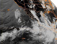
Flossie developed very deep convection over its center. It intensified into a hurricane on August 10, reaching peak winds of 80 mi/h as an embedded warm spot appeared in the center of the storm. After maintaining its peak intensity for 18 hours and passing within 75 mi (120.7 km) of Baja California
, Flossie weakened over cooler waters and degenerated to a tropical storm on August 12. The storm continued to weaken, and early on August 14 Flossie dissipated.
The government of Mexico
issued a tropical storm warning
from Punta Tejupan to Cabo Corrientes
early in its life, though it was discontinued shortly thereafter. Officials issued a tropical storm watch and later a warning for Baja California Sur
south of La Paz
, which was later extended from Loreto
on the east coast to San Juanico on the west coast. The large circulation of Hurricane Flossie produced gusty winds along the west coast of Mexico and southern Baja California
. Cabo San Lucas
reported a gust of 55 mph (90 km/h), and San José del Cabo
recorded a gust of 65 mph (105 km/h). The storm produced heavy rainfall, peaking at 9.72 in (246.9 mm) at San Felipe/Los Cabos. Seven people died in Mexico from the storm, including two that drowned in Cabo San Lucas. A monsoon
surge moving around its eastern periphery produced heavy rainfall in the American Southwest. Flooding from the rainfall killed one person and left eleven motorists stranded. Thunderstorms in Tucson, Arizona
produced hurricane force wind gusts which caused widespread power outages and damage. Damage from the storm in Arizona
totaled to $5 million (1995 USD; $ USD), although damage in Mexico, if any, is unknown.
, persisted and gradually organized in the Gulf of Tehuantepec
. A circulation developed within its deep convection, and the system organized into Tropical Depression Seven-E on August 19 while located about 115 mi (185 km) southeast of Acapulco
. Operationally, it was not until 15 hours later that the National Hurricane Center
initiated advisories on the system. The depression moved westward and quickly intensified into a tropical storm. A nearby ship confirmed the existence of tropical storm force winds, and Gil reached winds of 50 mph (80 km/h) early on August 21. With well-defined outflow and continually developing convection, forecasters predicted Gil to strengthen more and attain hurricane status within two days of becoming a tropical storm. However, increased northeasterly wind shear
initially prevented further strengthening.
On August 22, the cloud pattern of Gil became better organized, though the low-level circulation was located to the northeast of the deep convection due to the wind shear. The shear also limited outflow to the east, preventing further strengthening. Gradually the convection developed nearer to the center. After Gil turned to the northwest, the deep convection organized into a central dense overcast, and it strengthened to reach winds of 60 mph (95 km/h) on August 24. Later that day the storm attained a peak strength of 65 mph (105 km/h) while located 380 mi (610 km) southwest of the southern tip of Baja California
. After maintaining its peak strength for 30 hours, Gil moved over progressively cooler waters, and weakened to a tropical depression on August 26. The depression drifted westward and later turned to the north, and dissipated on August 27 while located 670 mi (1075 km) to the west of Cabo San Lucas
. While located a short distance off of Mexico, Gil produced heavy rainfall near the coast. However, there were no reports of casualties or damages in association with the storm.
moved off the coast of Africa on August 15. It traversed westward and entered the eastern Pacific Ocean on August 29. The system quickly developed deep convection and a low-level circulation, and on September 1 it organized into Tropical Depression Nine-E while located about 170 mi (270 km) off the southwest coast of Mexico
. Under favorable conditions, the depression slowly strengthened to become Tropical Storm Henriette on September 2 while located 220 mi (350 km) west of Manzanillo
. Henriette quickly organized and intensified into a hurricane on September 3 while located 135 mi (235 km) west-southwest of Puerto Vallarta
in Jalisco
. Late on September 3, an eye
began to form in the center of the deep convection as Henriette turned to the northwest. The eye became better defined the next day, and Henriette attained a peak intensity of 100 mph (160 km/h) as the northern portion of the eyewall moved over southern Baja California
. The hurricane quickly crossed the southern tip of Baja California and re-emerged into the Pacific Ocean. Convection gradually waned as the hurricane moved over progressively colder waters, and on September 6 Henriette weakened to a tropical depression.
On September 2, a few hours after Henriette became a tropical storm, the government of Mexico
issued tropical cyclone warnings and watches
for Baja California
. The threat of Hurricane Henriette prompted a Carnival Cruise Line
ship to alter their route. Winds of up to 100 mi/h in southern Baja California Sur
left much of Cabo San Lucas
without water or power. 2,000 people were directly affected by the hurricane. A strong storm surge produced flooding and heavy road damage in the state. 800 people were forced from their homes, and crop damage was reported. No damage estimates are available, and no deaths were reported.
it made landfall on Topolobampo
in the state of Sinaloa
with winds of 80 mph (130 km/h). Ismael rapidly weakened over land, and dissipated on September 16 over northwestern Mexico. The remnants entered the United States and extended eastward into the Mid-Atlantic States
.
Offshore, Ismael produced waves of up to 30 ft (9 m) in height. Hundreds of fishermen were unprepared by the hurricane, which was expected to move more slowly, and as a result 52 ships were wrecked, killing 57 fishermen. The hurricane destroyed thousands of houses, leaving 30,000 people homeless. On land, Ismael caused 59 casualties in mainland Mexico
and resulted in $26 million in damage (1995 USD; $ USD)). Moisture from the storm extended into the United States, causing heavy rainfall and localized moderate damage in southeastern New Mexico
.
off the southwest coast of Mexico
, and moved west-northwest for the early part of its duration. Juliette was smaller than usual tropical cyclones, and as a result it intensified quickly, reaching hurricane status on September 18 and major hurricane status
a day later. On September 20, Juliette reached peak winds of 150 mph (240 km/h), a Category 4 on the Saffir-Simpson Hurricane Scale
. It subsequently began a slow weakening trend and turned toward the northeast, briefly threatening the Baja California Peninsula
. Instead, strong wind shear
overcame the storm, and Juliette dissipated on September 26 without significantly affecting land.
The table on the right shows the Accumulated Cyclone Energy
(ACE) for each storm in the season. The total ACE for the 1995 season was 100.2 x 10⁴ kt2. The ACE is, broadly speaking, a measure of the power of the storm multiplied by the length of time it existed for, so hurricanes that lasted a long time have higher ACEs. Because several storms in the season were long-lasting or intense, the ACE of the season was near normal. The 1995 season total was the lowest since 1981
, though due to a period of inactivity in the following years it has only been surpassed by four seasons.
Hurricane Barbara had the highest overall ACE of the season with a total of 29.83 x 10⁴ kt2.
Source of data: Best track data from the National Hurricane Center's Tropical Cyclone Reports.
. This is the same list used for the 1989 season
. The name Dalila was used for the first time in 1995; in the 1989 season, it was Dalilia, though an error in documents prior to the season changed it. The name change has remained.
No central Pacific names were used; the first name used would have been Oliwa.
retired one name in the spring of 1996: Ismael. It was originally replaced in the 2001 season
by Israel, but for political reasons, due to its connection with Israel
and the coincidence that the first name of 2001 was "Adolph" (later retired for similar reasons), this was changed to Ivo after the season began, but before it reached the "I" storm.
1979 Pacific hurricane season
The 1979 Pacific hurricane season officially started May 15, 1979 in the eastern Pacific, and June 1, 1979 in the central Pacific, and lasted until November 30, 1979. These dates conventionally delimit the period of each year when most tropical cyclones form in the northeast Pacific Ocean.With ten...
. Of the eleven tropical cyclones that formed during the season, four affected land, with the most notable storm of the season being Hurricane Ismael
Hurricane Ismael
Hurricane Ismael was a weak, but deadly Pacific hurricane that killed over one hundred people in northern Mexico in September of the 1995 Pacific hurricane season. It developed from a persistent area of deep convection on September 12, and steadily strengthened as it moved to the north-northwest...
, which killed at least 116 people in Mexico
Mexico
The United Mexican States , commonly known as Mexico , is a federal constitutional republic in North America. It is bordered on the north by the United States; on the south and west by the Pacific Ocean; on the southeast by Guatemala, Belize, and the Caribbean Sea; and on the east by the Gulf of...
. The strongest hurricane in the season was Hurricane Juliette
Hurricane Juliette (1995)
Hurricane Juliette was the strongest hurricane and final tropical cyclone of the inactive 1995 Pacific hurricane season. The tenth named storm of the season, Juliette formed on September 16 from a tropical wave off the southwest coast of Mexico. For the majority of its track, the storm moved...
, which reached peak winds of 150 mph (240 km/h), but did not significantly affect land.
The season officially started on May 15, 1995 in the Eastern Pacific, and on June 1, 1995 in the Central Pacific, and lasted until November 30, 1995. These dates conventionally delimit the period of each year when most tropical cyclones forms in the northeastern Pacific Ocean. The season saw eleven tropical cyclones form, of which ten became tropical storms. Seven storms attained hurricane status, of which three acquired major hurricane status
Tropical cyclone scales
Tropical systems are officially ranked on one of several tropical cyclone scales according to their maximum sustained winds and in what oceanic basin they are located...
. The number of tropical storms was much less than the average of 16 storms, while the number of hurricanes and major hurricanes were slightly below average.
Season summary
Mexico
The United Mexican States , commonly known as Mexico , is a federal constitutional republic in North America. It is bordered on the north by the United States; on the south and west by the Pacific Ocean; on the southeast by Guatemala, Belize, and the Caribbean Sea; and on the east by the Gulf of...
: first, Hurricane Flossie passed within 75 miles (120 km) of Baja California
Baja California
Baja California officially Estado Libre y Soberano de Baja California is one of the 31 states which, with the Federal District, comprise the 32 Federal Entities of Mexico. It is both the northernmost and westernmost state of Mexico. Before becoming a state in 1953, the area was known as the North...
, producing moderate winds and killing seven people. Afterwards, Tropical Storm Gil dropped heavy rainfall in Southern Mexico early in its life, though caused no damage. Hurricane Henriette later made landfall near Cabo San Lucas
Cabo San Lucas
Cabo San Lucas , commonly called Cabo, is a city at the southern tip of the Baja California peninsula, in the municipality of Los Cabos in the Mexican state of Baja California Sur. As of the 2010 census, the population was 68,463 people...
with winds of 100 mph (160 km/h), resulting in moderate damage but no deaths. Finally, Ismael
Hurricane Ismael
Hurricane Ismael was a weak, but deadly Pacific hurricane that killed over one hundred people in northern Mexico in September of the 1995 Pacific hurricane season. It developed from a persistent area of deep convection on September 12, and steadily strengthened as it moved to the north-northwest...
struck the state of Sinaloa
Sinaloa
Sinaloa officially Estado Libre y Soberano de Sinaloa is one of the 31 states which, with the Federal District, comprise the 32 Federal Entities of Mexico. It is divided in 18 municipalities and its capital city is Culiacán Rosales....
as a minimal hurricane. Offshore, fishermen were caught off guard by the hurricane, causing 57 of them to drown. On land, Ismael destroyed thousands of houses, leaving 30,000 homeless and killing another 59. Both Hurricanes Flossie and Ismael also produced moisture and localized damage in South Western United States.
Activity in the Central Pacific Ocean was below active as well. No tropical storms formed in the basin. For the first time in four years. Barbara was the only tropical cyclone to exist within the basin, but it formed in the Eastern Pacific. It entered as a weakening tropical storm, and quickly dissipated, without affecting land. It was the least activity in the basin since 1979, when the basin was completely quiet, as no storms entered the basin that year.
Storms
Eleven Tropical Cyclones, including one Tropical Depression that failed to attain tropical storm status, developed in the Eastern Pacific Ocean in 1995.Tropical Depression One-E
A Westward moving tropical waveTropical wave
Tropical waves, easterly waves, or tropical easterly waves, also known as African easterly waves in the Atlantic region, are a type of atmospheric trough, an elongated area of relatively low air pressure, oriented north to south, which move from east to west across the tropics causing areas of...
entered the Pacific Ocean in Mid-May. Convection within the disturbance became more concentrated and organized on May 19 while the wave was located a short distance south of the Gulf of Tehuantepec
Gulf of Tehuantepec
Gulf of Tehuantepec is a large body of water on the Pacific coast of the Isthmus of Tehuantepec, southeastern Mexico, at . Most of the hurricanes that form in the Eastern Pacific organize in or near this body of water...
. The deep convection concentrated around a low-level circulation with expanding outflow, and the system developed into Tropical Depression One-E on May 21, while located about 400 mi (645 km) south of Manzanillo
Manzanillo, Colima
The name Manzanillo refers to the city as well as its surrounding municipality in the Mexican state of Colima. The city, located on the Pacific Ocean, contains Mexico's busiest port. Manzanillo was the third port created by the Spanish in the Pacific during the New Spain period...
, Mexico
Mexico
The United Mexican States , commonly known as Mexico , is a federal constitutional republic in North America. It is bordered on the north by the United States; on the south and west by the Pacific Ocean; on the southeast by Guatemala, Belize, and the Caribbean Sea; and on the east by the Gulf of...
. Initially the depression was forecast to strengthen to reach winds of 55 mph (90 km/h) as it moved westward under the influence of a high pressure system to its north. Outflow increased as the storm moved through an area of warm waters and a favorable upper-level environment, and two satellite classifications indicated the system was at tropical storm status around nine hours after forming. Despite the favorable environment and satellite classifications of tropical storm status, the depression failed to organize further. The convection and organization continued to decrease, and on May 23 the depression dissipated.
While it was developing, locally moderate to heavy rainfall fell across southern Mexico along the disturbance's northern periphery, with rainfall totals peaking at 5.18 inches (131.6 mm) at Vallecitos/Petatlan.
Hurricane Adolph
An area of disturbed weather associated with a tropical waveTropical wave
Tropical waves, easterly waves, or tropical easterly waves, also known as African easterly waves in the Atlantic region, are a type of atmospheric trough, an elongated area of relatively low air pressure, oriented north to south, which move from east to west across the tropics causing areas of...
organized off the southwest coast of Mexico
Mexico
The United Mexican States , commonly known as Mexico , is a federal constitutional republic in North America. It is bordered on the north by the United States; on the south and west by the Pacific Ocean; on the southeast by Guatemala, Belize, and the Caribbean Sea; and on the east by the Gulf of...
during the middle of June. Banding features developed as a circulation persisted on the northeast side of its deep convection, and the system developed into Tropical Depression Two-E on June 15. Under weak steering currents, the depression moved slowly northward, and with deep convection organizing near its center, the depression intensified to Tropical Storm Adolph on June 16. Located in an area of warm waters, Adolph exhibited a well-defined outflow pattern, and rapidly strengthened
Rapid deepening
Rapid deepening, also known as rapid intensification, is a meteorological condition that occurs when the minimum sea-level atmospheric pressure of a tropical cyclone decreases drastically in a short period of time. The National Weather Service describes rapid deepening as a decrease of...
to attain hurricane status on June 17 as a banding-type eye
Eye (cyclone)
The eye is a region of mostly calm weather found at the center of strong tropical cyclones. The eye of a storm is a roughly circular area and typically 30–65 km in diameter. It is surrounded by the eyewall, a ring of towering thunderstorms where the second most severe weather of a cyclone...
developed. Hurricane Adolph turned to the northwest and attained major hurricane status late that same day. The small eye of the hurricane continued to organize, as very deep convection surrounded the eyewall, and Adolph reached its peak intensity of 135 mph (215 km/h) on June 18, making it a Category 4 hurricane on the Saffir-Simpson scale
Saffir-Simpson Hurricane Scale
The Saffir–Simpson Hurricane Scale , or the Saffir–Simpson Hurricane Wind Scale , classifies hurricanes — Western Hemisphere tropical cyclones that exceed the intensities of tropical depressions and tropical storms — into five categories distinguished by the intensities of their sustained winds...
. Shortly thereafter, the storm weakened, as the upper-level environment became more hostile, and the system moved over progressively cooler waters. On June 19, Adolph turned to the west, and degenerated back into a tropical storm later that day. On June 20, the storm weakened to a tropical depression, and on June 21, Adolph began to dissipate as its center became devoid of deep convection.
As Adolph moved north towards Mexico while about 290 mi (465 km) off the coast, the Mexican government issued a tropical storm warning
Tropical cyclone warnings and watches
Warnings and watches are two levels of alert issued by national weather forecasting bodies to coastal areas threatened by the imminent approach of a tropical cyclone of tropical storm or hurricane intensity. They are notices to the local population and civil authorities to make appropriate...
and a hurricane watch from Punta Tejupan to Cabo Corrientes
Cabo Corrientes
Cabo Corrientes is a cape on the Pacific coast of the Mexican state of Jalisco. It marks the southernmost point of the Bahía de Banderas, upon which the port and resort city of Puerto Vallarta stands. The municipality in which the cape lies is also called Cabo Corrientes.Cabo Corrientes is a...
. When the storm turned to the northwest and later to the west, the government discontinued the warnings as it was determined the storm would not be a threat to land. No damage or casualties were reported.
Hurricane Barbara
A few days later, on June 24, another weak tropical waveTropical wave
Tropical waves, easterly waves, or tropical easterly waves, also known as African easterly waves in the Atlantic region, are a type of atmospheric trough, an elongated area of relatively low air pressure, oriented north to south, which move from east to west across the tropics causing areas of...
moved off the coast of Africa. It moved steadily westward through the Atlantic Ocean without any development, and entered the eastern Pacific Ocean on July 5. At this point, convection developed along the wave axis, and the system gradually organized. A circulation developed as it passed through an area of warm waters, and the system developed into Tropical Depression Three-E on July 7, while located about 600 miles (965 km) south of Manzanillo, Colima
Manzanillo, Colima
The name Manzanillo refers to the city as well as its surrounding municipality in the Mexican state of Colima. The city, located on the Pacific Ocean, contains Mexico's busiest port. Manzanillo was the third port created by the Spanish in the Pacific during the New Spain period...
. Although the outer rainband
Rainband
A rainband is a cloud and precipitation structure associated with an area of rainfall which is significantly elongated. Rainbands can be stratiform or convective, and are generated by differences in temperature. When noted on weather radar imagery, this precipitation elongation is referred to as...
s warmed slightly in the hours after the formation, the convection near the center deepened further with favorable upper-level outflow, and the depression strengthened into Tropical Storm Barbara early on July 8. Barbara steadily intensified, and following the development of a ragged eye
Eye (cyclone)
The eye is a region of mostly calm weather found at the center of strong tropical cyclones. The eye of a storm is a roughly circular area and typically 30–65 km in diameter. It is surrounded by the eyewall, a ring of towering thunderstorms where the second most severe weather of a cyclone...
that night, Barbara strengthened into a hurricane on July 9, while located about 700 miles (1130 km) south of the southern tip of Baja California
Baja California Peninsula
The Baja California peninsula , is a peninsula in northwestern Mexico. Its land mass separates the Pacific Ocean from the Gulf of California. The Peninsula extends from Mexicali, Baja California in the north to Cabo San Lucas, Baja California Sur in the south.The total area of the Baja California...
.
After moving into an area of light vertical shear and warm water temperatures, Barbara quickly intensified to reach major hurricane status
Saffir-Simpson Hurricane Scale
The Saffir–Simpson Hurricane Scale , or the Saffir–Simpson Hurricane Wind Scale , classifies hurricanes — Western Hemisphere tropical cyclones that exceed the intensities of tropical depressions and tropical storms — into five categories distinguished by the intensities of their sustained winds...
on July 10. The eye continued to become better organized, and Barbara attained winds of 135 mph (215 km/h) later on July 10. After maintaining its intensity for 24 hours, increased wind shear
Wind shear
Wind shear, sometimes referred to as windshear or wind gradient, is a difference in wind speed and direction over a relatively short distance in the atmosphere...
from an upper-tropospheric trough
Trough (meteorology)
A trough is an elongated region of relatively low atmospheric pressure, often associated with fronts.Unlike fronts, there is not a universal symbol for a trough on a weather chart. The weather charts in some countries or regions mark troughs by a line. In the United States, a trough may be marked...
degraded the appearance of the deepest convection, and the eye became obscured from satellite images. After weakening to a 115 mph (185 km/h) hurricane, Barbara maintained its intensity for 30 hours before moving into an area with very warm waters and a favorable upper-level environment. On July 13, the hurricane re-organized, a distinct eye again developed, and Barbara strengthened to reach its peak intensity of 140 mph (225 km/h) later that day. Barbara continued westward under the influence of a subtropical ridge
Subtropical ridge
The subtropical ridge is a significant belt of high pressure situated around the latitudes of 30°N in the Northern Hemisphere and 30°S in the Southern Hemisphere. It is characterized by mostly calm winds, which acts to reduce air quality under its axis by causing fog overnight, and haze during...
to its north, and began to steadily weaken on July 14 as it moved into an area of cooler water temperatures
Sea surface temperature
Sea surface temperature is the water temperature close to the oceans surface. The exact meaning of surface varies according to the measurement method used, but it is between and below the sea surface. Air masses in the Earth's atmosphere are highly modified by sea surface temperatures within a...
. The hurricane degraded to a tropical storm on July 16, and a day later it deteriorated to a tropical depression. As a depression with little to no convection near its center, Barbara continued west-northwestward until dissipating on July 18 while located 720 mi (1160 km) east-southeast of Hilo, Hawai'i
Hilo, Hawai'i
Hilo is the largest census-designated place and the largest settlement on the Island of Hawaii, also known as the County of Hawaii. The population was 40,759 at the 2000 census. The population increased by 6.1% to 43,263 at the 2010 census....
. Barbara remained away from land for its entire lifetime, and it did not cause any damage or deaths.
Hurricane Cosme
As Barbara moved away from land, another area of disturbed weather moved off the coast of Central AmericaCentral America
Central America is the central geographic region of the Americas. It is the southernmost, isthmian portion of the North American continent, which connects with South America on the southeast. When considered part of the unified continental model, it is considered a subcontinent...
on July 11. Moving westward, this area slowly organized, and developed a low-level circulation on July 15. The convection developed into curved rainbands, and based on Dvorak classifications
Dvorak technique
The Dvorak technique is a widely used system to subjectively estimate tropical cyclone intensity based solely on visible and infrared satellite images. Several agencies issue Dvorak intensity numbers for cyclones of sufficient intensity...
of 35 mph (55 km/h), the National Hurricane Center
National Hurricane Center
The National Hurricane Center , located at Florida International University in Miami, Florida, is the division of the National Weather Service responsible for tracking and predicting weather systems within the tropics between the Prime Meridian and the 140th meridian west poleward to the 30th...
estimated that the system developed into Tropical Depression Four-E on July 17, while located about 400 mi (645 km) south-southeast of the southern tip of Baja California
Baja California Peninsula
The Baja California peninsula , is a peninsula in northwestern Mexico. Its land mass separates the Pacific Ocean from the Gulf of California. The Peninsula extends from Mexicali, Baja California in the north to Cabo San Lucas, Baja California Sur in the south.The total area of the Baja California...
. As the depression was situated in an area with warm waters and moderate upper-level outflow, the system was forecast to slowly intensify to a 50 mph (80 km/h) tropical storm. Initially, the depression followed the forecasts, and it intensified into a tropical storm about 30 hours after developing, receiving the name "Cosme". Cosme was expected to strengthen only slightly due to predicted cooler waters and increased shear.
On July 18, contrary to the predictions, Cosme became much better organized, and well-defined banding features were visible on satellite imagery
Satellite imagery
Satellite imagery consists of photographs of Earth or other planets made by means of artificial satellites.- History :The first images from space were taken on sub-orbital flights. The U.S-launched V-2 flight on October 24, 1946 took one image every 1.5 seconds...
. The storm continued to steadily intensify, and subsequent to the development of an eye
Eye (cyclone)
The eye is a region of mostly calm weather found at the center of strong tropical cyclones. The eye of a storm is a roughly circular area and typically 30–65 km in diameter. It is surrounded by the eyewall, a ring of towering thunderstorms where the second most severe weather of a cyclone...
, Cosme strengthened into a hurricane late on July 19, while located 380 miles (615 km) west-southwest of the southern tip of Baja California. After maintaining hurricane status for 18 hours, Cosme weakened back to a tropical storm on July 20. Cooler water temperatures deteriorated the convection near the center, resulting in Cosme quickly weakening to a tropical depression on July 21. After turning to the west-southwest, Cosme dissipated on July 22. Cosme never affected land, and as a result caused no damage or fatalities. However, the intensity of the storm is still uncertain; late on July 18, a ship 70 mi (112.7 km) to the east of Cosme reported winds of 17 mph (27 km/h), despite that a normal 50 mph (80 km/h) tropical storm would produce tropical storm force winds for locations within at least 70 mi (110 km) of the center.
Tropical Storm Dalila
A tropical waveTropical wave
Tropical waves, easterly waves, or tropical easterly waves, also known as African easterly waves in the Atlantic region, are a type of atmospheric trough, an elongated area of relatively low air pressure, oriented north to south, which move from east to west across the tropics causing areas of...
moved off the coast of Africa on July 11. It moved westward and quickly developed two areas of convection along the wave axis. One of the areas nearly developed into a tropical depression after moving northwestward, though it failed to organize further and dissipated. The southern area continued westward and ultimately entered the eastern Pacific Ocean on July 21. Thunderstorms along the wave axis became more concentrated a few hundred miles south of the Gulf of Tehuantepec
Gulf of Tehuantepec
Gulf of Tehuantepec is a large body of water on the Pacific coast of the Isthmus of Tehuantepec, southeastern Mexico, at . Most of the hurricanes that form in the Eastern Pacific organize in or near this body of water...
, and the system developed into Tropical Depression Five-E on July 24 while located 500 mi (800 km) southwest of Manzanillo
Manzanillo, Colima
The name Manzanillo refers to the city as well as its surrounding municipality in the Mexican state of Colima. The city, located on the Pacific Ocean, contains Mexico's busiest port. Manzanillo was the third port created by the Spanish in the Pacific during the New Spain period...
, Mexico
Mexico
The United Mexican States , commonly known as Mexico , is a federal constitutional republic in North America. It is bordered on the north by the United States; on the south and west by the Pacific Ocean; on the southeast by Guatemala, Belize, and the Caribbean Sea; and on the east by the Gulf of...
.
Located in an area of weak steering currents and easterly wind shear
Wind shear
Wind shear, sometimes referred to as windshear or wind gradient, is a difference in wind speed and direction over a relatively short distance in the atmosphere...
, the tropical depression drifted to the north-northeast while the convection was displaced up to 70 mi (110 km) west of the circulation. Slightly strengthening occurred, and on July 25 the depression intensified into Tropical Storm Dalila. The storm turned to the northwest, and later to the west-northwest, and remained a minimal tropical storm until July 28 when a decrease in wind shear allowed Dalila to strengthen. A strong anticyclone
Anticyclone
An anticyclone is a weather phenomenon defined by the United States' National Weather Service's glossary as "[a] large-scale circulation of winds around a central region of high atmospheric pressure, clockwise in the Northern Hemisphere, counterclockwise in the Southern Hemisphere"...
developed to the north of the system, causing Dalila to accelerate to the northwest. Late on July 28, Dalila reached a peak intensity of 65 mph (105 km/h) at a position 570 mi (915 km) southwest of Cabo San Lucas
Cabo San Lucas
Cabo San Lucas , commonly called Cabo, is a city at the southern tip of the Baja California peninsula, in the municipality of Los Cabos in the Mexican state of Baja California Sur. As of the 2010 census, the population was 68,463 people...
. Tropical Storm Dalila slowly weakened after moving over progressively cooler water temperatures, and on August 1 it degenerated into a tropical depression. Dalila turned to the southwest after much of the convection waned, and the system dissipated on August 2.
Tropical Storm Erick
On July 17 a tropical waveTropical wave
Tropical waves, easterly waves, or tropical easterly waves, also known as African easterly waves in the Atlantic region, are a type of atmospheric trough, an elongated area of relatively low air pressure, oriented north to south, which move from east to west across the tropics causing areas of...
exited the coast of Africa, and moved westward. An area of convection along the wave organized slightly on July 18, though the next day the convection diminished. After moving through the Windward Islands
Windward Islands
The Windward Islands are the southern islands of the Lesser Antilles, within the West Indies.-Name and geography:The Windward Islands are called such because they were more windward to sailing ships arriving in the New World than the Leeward Islands, given that the prevailing trade winds in the...
on July 23, deep convection again increased. The system failed to organize further, though convection continued to develop upon entering the eastern Pacific Ocean
Pacific Ocean
The Pacific Ocean is the largest of the Earth's oceanic divisions. It extends from the Arctic in the north to the Southern Ocean in the south, bounded by Asia and Australia in the west, and the Americas in the east.At 165.2 million square kilometres in area, this largest division of the World...
on July 27. The cloudiness and thunderstorms became more consolidated off the coast of southern Mexico
Mexico
The United Mexican States , commonly known as Mexico , is a federal constitutional republic in North America. It is bordered on the north by the United States; on the south and west by the Pacific Ocean; on the southeast by Guatemala, Belize, and the Caribbean Sea; and on the east by the Gulf of...
, and on July 31 Dvorak classifications
Dvorak technique
The Dvorak technique is a widely used system to subjectively estimate tropical cyclone intensity based solely on visible and infrared satellite images. Several agencies issue Dvorak intensity numbers for cyclones of sufficient intensity...
began on the system. A circulation developed, and the system organized into Tropical Depression Six-E on August 1 while located about 520 mi (835 km) south of the southern tip of Baja California
Baja California Sur
Baja California Sur , is one of the 31 states which, with the Federal District, comprise the 32 Federal Entities of Mexico. Before becoming a state on October 8, 1974, the area was known as the South Territory of Baja California. It has an area of , or 3.57% of the land mass of Mexico and comprises...
.
Initially, the depression was a small system with moderate amounts of easterly wind shear
Wind shear
Wind shear, sometimes referred to as windshear or wind gradient, is a difference in wind speed and direction over a relatively short distance in the atmosphere...
. It organized slowly, and after moving to the southwest for 24 hours it turned to the northwest. Subsequent to an increase in convection over the center, the depression intensified into Tropical Storm Erick on August 4. Erick gradually strengthened as it moved to the west-northwest, and reached peak winds of 65 mph (105 km/h) on August 5 while located about 720 miles (1160 km) southwest of Cabo San Lucas
Cabo San Lucas
Cabo San Lucas , commonly called Cabo, is a city at the southern tip of the Baja California peninsula, in the municipality of Los Cabos in the Mexican state of Baja California Sur. As of the 2010 census, the population was 68,463 people...
. Operationally, the storm was forecast to continue to strengthen to reach hurricane status, though this did not occur. The mid-level ridge
Ridge (meteorology)
A ridge is an elongated region of relatively high atmospheric pressure, the opposite of a trough....
which had been tracking Erick westward weakened, resulting in Erick to turn to the north over cooler waters. It quickly weakened to a tropical depression on August 6, and after turning to an eastward drift Erick dissipated on August 8 while located 700 mi (1130 km) west-southwest of the southern tip of Baja California
Baja California Peninsula
The Baja California peninsula , is a peninsula in northwestern Mexico. Its land mass separates the Pacific Ocean from the Gulf of California. The Peninsula extends from Mexicali, Baja California in the north to Cabo San Lucas, Baja California Sur in the south.The total area of the Baja California...
. Erick never affected land.
Hurricane Flossie
A large circulation with an area of low pressure persisted in the tropical eastern Pacific Ocean in early August. The large circulation was well-developed by August 7, and the convection concentrated a few hundred miles southwest of AcapulcoAcapulco
Acapulco is a city, municipality and major sea port in the state of Guerrero on the Pacific coast of Mexico, southwest from Mexico City. Acapulco is located on a deep, semi-circular bay and has been a port since the early colonial period of Mexico’s history...
. Based on its organization, the National Hurricane Center designated the system Tropical Depression Seven-E. On August 8, the depression intensified into Tropical Storm Flossie, based on ship reports. The storm paralleled the coast of Mexico
Mexico
The United Mexican States , commonly known as Mexico , is a federal constitutional republic in North America. It is bordered on the north by the United States; on the south and west by the Pacific Ocean; on the southeast by Guatemala, Belize, and the Caribbean Sea; and on the east by the Gulf of...
as it moved northwestward, and after a decrease of wind shear
Wind shear
Wind shear, sometimes referred to as windshear or wind gradient, is a difference in wind speed and direction over a relatively short distance in the atmosphere...
Flossie developed very deep convection over its center. It intensified into a hurricane on August 10, reaching peak winds of 80 mi/h as an embedded warm spot appeared in the center of the storm. After maintaining its peak intensity for 18 hours and passing within 75 mi (120.7 km) of Baja California
Baja California Sur
Baja California Sur , is one of the 31 states which, with the Federal District, comprise the 32 Federal Entities of Mexico. Before becoming a state on October 8, 1974, the area was known as the South Territory of Baja California. It has an area of , or 3.57% of the land mass of Mexico and comprises...
, Flossie weakened over cooler waters and degenerated to a tropical storm on August 12. The storm continued to weaken, and early on August 14 Flossie dissipated.
The government of Mexico
Mexico
The United Mexican States , commonly known as Mexico , is a federal constitutional republic in North America. It is bordered on the north by the United States; on the south and west by the Pacific Ocean; on the southeast by Guatemala, Belize, and the Caribbean Sea; and on the east by the Gulf of...
issued a tropical storm warning
Tropical cyclone warnings and watches
Warnings and watches are two levels of alert issued by national weather forecasting bodies to coastal areas threatened by the imminent approach of a tropical cyclone of tropical storm or hurricane intensity. They are notices to the local population and civil authorities to make appropriate...
from Punta Tejupan to Cabo Corrientes
Cabo Corrientes
Cabo Corrientes is a cape on the Pacific coast of the Mexican state of Jalisco. It marks the southernmost point of the Bahía de Banderas, upon which the port and resort city of Puerto Vallarta stands. The municipality in which the cape lies is also called Cabo Corrientes.Cabo Corrientes is a...
early in its life, though it was discontinued shortly thereafter. Officials issued a tropical storm watch and later a warning for Baja California Sur
Baja California Sur
Baja California Sur , is one of the 31 states which, with the Federal District, comprise the 32 Federal Entities of Mexico. Before becoming a state on October 8, 1974, the area was known as the South Territory of Baja California. It has an area of , or 3.57% of the land mass of Mexico and comprises...
south of La Paz
La Paz
Nuestra Señora de La Paz is the administrative capital of Bolivia, as well as the departmental capital of the La Paz Department, and the second largest city in the country after Santa Cruz de la Sierra...
, which was later extended from Loreto
Loreto, Baja California Sur
Loreto was the first Spanish settlement on the Baja California Peninsula. It served as the capital of Las Californias from 1697 to 1777, and is the current seat of the municipality of Loreto in the Mexican state of Baja California Sur...
on the east coast to San Juanico on the west coast. The large circulation of Hurricane Flossie produced gusty winds along the west coast of Mexico and southern Baja California
Baja California Peninsula
The Baja California peninsula , is a peninsula in northwestern Mexico. Its land mass separates the Pacific Ocean from the Gulf of California. The Peninsula extends from Mexicali, Baja California in the north to Cabo San Lucas, Baja California Sur in the south.The total area of the Baja California...
. Cabo San Lucas
Cabo San Lucas
Cabo San Lucas , commonly called Cabo, is a city at the southern tip of the Baja California peninsula, in the municipality of Los Cabos in the Mexican state of Baja California Sur. As of the 2010 census, the population was 68,463 people...
reported a gust of 55 mph (90 km/h), and San José del Cabo
San José del Cabo
The city of San José del Cabo is located in Baja California Sur Mexico and is the seat of the municipality of Los Cabos at the south end of the Baja California peninsula. In the 2010 census it had a population of 69,788. Together with neighboring Cabo San Lucas it forms a major tourist destination...
recorded a gust of 65 mph (105 km/h). The storm produced heavy rainfall, peaking at 9.72 in (246.9 mm) at San Felipe/Los Cabos. Seven people died in Mexico from the storm, including two that drowned in Cabo San Lucas. A monsoon
Monsoon
Monsoon is traditionally defined as a seasonal reversing wind accompanied by corresponding changes in precipitation, but is now used to describe seasonal changes in atmospheric circulation and precipitation associated with the asymmetric heating of land and sea...
surge moving around its eastern periphery produced heavy rainfall in the American Southwest. Flooding from the rainfall killed one person and left eleven motorists stranded. Thunderstorms in Tucson, Arizona
Tucson, Arizona
Tucson is a city in and the county seat of Pima County, Arizona, United States. The city is located 118 miles southeast of Phoenix and 60 miles north of the U.S.-Mexico border. The 2010 United States Census puts the city's population at 520,116 with a metropolitan area population at 1,020,200...
produced hurricane force wind gusts which caused widespread power outages and damage. Damage from the storm in Arizona
Arizona
Arizona ; is a state located in the southwestern region of the United States. It is also part of the western United States and the mountain west. The capital and largest city is Phoenix...
totaled to $5 million (1995 USD; $ USD), although damage in Mexico, if any, is unknown.
Tropical Storm Gil
An area of disturbed weather, possibly related to a tropical waveTropical wave
Tropical waves, easterly waves, or tropical easterly waves, also known as African easterly waves in the Atlantic region, are a type of atmospheric trough, an elongated area of relatively low air pressure, oriented north to south, which move from east to west across the tropics causing areas of...
, persisted and gradually organized in the Gulf of Tehuantepec
Gulf of Tehuantepec
Gulf of Tehuantepec is a large body of water on the Pacific coast of the Isthmus of Tehuantepec, southeastern Mexico, at . Most of the hurricanes that form in the Eastern Pacific organize in or near this body of water...
. A circulation developed within its deep convection, and the system organized into Tropical Depression Seven-E on August 19 while located about 115 mi (185 km) southeast of Acapulco
Acapulco
Acapulco is a city, municipality and major sea port in the state of Guerrero on the Pacific coast of Mexico, southwest from Mexico City. Acapulco is located on a deep, semi-circular bay and has been a port since the early colonial period of Mexico’s history...
. Operationally, it was not until 15 hours later that the National Hurricane Center
National Hurricane Center
The National Hurricane Center , located at Florida International University in Miami, Florida, is the division of the National Weather Service responsible for tracking and predicting weather systems within the tropics between the Prime Meridian and the 140th meridian west poleward to the 30th...
initiated advisories on the system. The depression moved westward and quickly intensified into a tropical storm. A nearby ship confirmed the existence of tropical storm force winds, and Gil reached winds of 50 mph (80 km/h) early on August 21. With well-defined outflow and continually developing convection, forecasters predicted Gil to strengthen more and attain hurricane status within two days of becoming a tropical storm. However, increased northeasterly wind shear
Wind shear
Wind shear, sometimes referred to as windshear or wind gradient, is a difference in wind speed and direction over a relatively short distance in the atmosphere...
initially prevented further strengthening.
On August 22, the cloud pattern of Gil became better organized, though the low-level circulation was located to the northeast of the deep convection due to the wind shear. The shear also limited outflow to the east, preventing further strengthening. Gradually the convection developed nearer to the center. After Gil turned to the northwest, the deep convection organized into a central dense overcast, and it strengthened to reach winds of 60 mph (95 km/h) on August 24. Later that day the storm attained a peak strength of 65 mph (105 km/h) while located 380 mi (610 km) southwest of the southern tip of Baja California
Baja California Peninsula
The Baja California peninsula , is a peninsula in northwestern Mexico. Its land mass separates the Pacific Ocean from the Gulf of California. The Peninsula extends from Mexicali, Baja California in the north to Cabo San Lucas, Baja California Sur in the south.The total area of the Baja California...
. After maintaining its peak strength for 30 hours, Gil moved over progressively cooler waters, and weakened to a tropical depression on August 26. The depression drifted westward and later turned to the north, and dissipated on August 27 while located 670 mi (1075 km) to the west of Cabo San Lucas
Cabo San Lucas
Cabo San Lucas , commonly called Cabo, is a city at the southern tip of the Baja California peninsula, in the municipality of Los Cabos in the Mexican state of Baja California Sur. As of the 2010 census, the population was 68,463 people...
. While located a short distance off of Mexico, Gil produced heavy rainfall near the coast. However, there were no reports of casualties or damages in association with the storm.
Hurricane Henriette
A tropical waveTropical wave
Tropical waves, easterly waves, or tropical easterly waves, also known as African easterly waves in the Atlantic region, are a type of atmospheric trough, an elongated area of relatively low air pressure, oriented north to south, which move from east to west across the tropics causing areas of...
moved off the coast of Africa on August 15. It traversed westward and entered the eastern Pacific Ocean on August 29. The system quickly developed deep convection and a low-level circulation, and on September 1 it organized into Tropical Depression Nine-E while located about 170 mi (270 km) off the southwest coast of Mexico
Mexico
The United Mexican States , commonly known as Mexico , is a federal constitutional republic in North America. It is bordered on the north by the United States; on the south and west by the Pacific Ocean; on the southeast by Guatemala, Belize, and the Caribbean Sea; and on the east by the Gulf of...
. Under favorable conditions, the depression slowly strengthened to become Tropical Storm Henriette on September 2 while located 220 mi (350 km) west of Manzanillo
Manzanillo, Colima
The name Manzanillo refers to the city as well as its surrounding municipality in the Mexican state of Colima. The city, located on the Pacific Ocean, contains Mexico's busiest port. Manzanillo was the third port created by the Spanish in the Pacific during the New Spain period...
. Henriette quickly organized and intensified into a hurricane on September 3 while located 135 mi (235 km) west-southwest of Puerto Vallarta
Puerto Vallarta
Puerto Vallarta is a Mexican balneario resort city situated on the Pacific Ocean's Bahía de Banderas.The 2010 census reported Puerto Vallarta's population as 255,725 making it the sixth-largest city in the state of Jalisco...
in Jalisco
Jalisco
Jalisco officially Estado Libre y Soberano de Jalisco is one of the 31 states which, with the Federal District, comprise the 32 Federal Entities of Mexico. It is located in Western Mexico and divided in 125 municipalities and its capital city is Guadalajara.It is one of the more important states...
. Late on September 3, an eye
Eye (cyclone)
The eye is a region of mostly calm weather found at the center of strong tropical cyclones. The eye of a storm is a roughly circular area and typically 30–65 km in diameter. It is surrounded by the eyewall, a ring of towering thunderstorms where the second most severe weather of a cyclone...
began to form in the center of the deep convection as Henriette turned to the northwest. The eye became better defined the next day, and Henriette attained a peak intensity of 100 mph (160 km/h) as the northern portion of the eyewall moved over southern Baja California
Baja California Peninsula
The Baja California peninsula , is a peninsula in northwestern Mexico. Its land mass separates the Pacific Ocean from the Gulf of California. The Peninsula extends from Mexicali, Baja California in the north to Cabo San Lucas, Baja California Sur in the south.The total area of the Baja California...
. The hurricane quickly crossed the southern tip of Baja California and re-emerged into the Pacific Ocean. Convection gradually waned as the hurricane moved over progressively colder waters, and on September 6 Henriette weakened to a tropical depression.
On September 2, a few hours after Henriette became a tropical storm, the government of Mexico
Mexico
The United Mexican States , commonly known as Mexico , is a federal constitutional republic in North America. It is bordered on the north by the United States; on the south and west by the Pacific Ocean; on the southeast by Guatemala, Belize, and the Caribbean Sea; and on the east by the Gulf of...
issued tropical cyclone warnings and watches
Tropical cyclone warnings and watches
Warnings and watches are two levels of alert issued by national weather forecasting bodies to coastal areas threatened by the imminent approach of a tropical cyclone of tropical storm or hurricane intensity. They are notices to the local population and civil authorities to make appropriate...
for Baja California
Baja California Peninsula
The Baja California peninsula , is a peninsula in northwestern Mexico. Its land mass separates the Pacific Ocean from the Gulf of California. The Peninsula extends from Mexicali, Baja California in the north to Cabo San Lucas, Baja California Sur in the south.The total area of the Baja California...
. The threat of Hurricane Henriette prompted a Carnival Cruise Line
Carnival Cruise Lines
Carnival Cruise Lines is a British-American owned cruise line, based in Doral, Florida, a suburb of Miami in the United States. Originally an independent company founded in 1972 by Ted Arison, the company is now one of eleven cruise ship brands owned and operated by Carnival Corporation & plc...
ship to alter their route. Winds of up to 100 mi/h in southern Baja California Sur
Baja California Sur
Baja California Sur , is one of the 31 states which, with the Federal District, comprise the 32 Federal Entities of Mexico. Before becoming a state on October 8, 1974, the area was known as the South Territory of Baja California. It has an area of , or 3.57% of the land mass of Mexico and comprises...
left much of Cabo San Lucas
Cabo San Lucas
Cabo San Lucas , commonly called Cabo, is a city at the southern tip of the Baja California peninsula, in the municipality of Los Cabos in the Mexican state of Baja California Sur. As of the 2010 census, the population was 68,463 people...
without water or power. 2,000 people were directly affected by the hurricane. A strong storm surge produced flooding and heavy road damage in the state. 800 people were forced from their homes, and crop damage was reported. No damage estimates are available, and no deaths were reported.
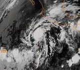
Hurricane Ismael
Hurricane Ismael developed from a persistent area of deep convection on September 12, and steadily strengthened as it moved to the north-northwest. Ismael attained hurricane status on September 14 while located 210 mi (340 km) off the coast of Mexico. It continued to the north, and after passing a short distance east of Baja CaliforniaBaja California Sur
Baja California Sur , is one of the 31 states which, with the Federal District, comprise the 32 Federal Entities of Mexico. Before becoming a state on October 8, 1974, the area was known as the South Territory of Baja California. It has an area of , or 3.57% of the land mass of Mexico and comprises...
it made landfall on Topolobampo
Topolobampo
Topolobampo is a port on the Gulf of California in northwestern Sinaloa, Mexico. It is the fourth-largest town in the municipality of Ahome , reporting a 2005 census population of 6,032 inhabitants....
in the state of Sinaloa
Sinaloa
Sinaloa officially Estado Libre y Soberano de Sinaloa is one of the 31 states which, with the Federal District, comprise the 32 Federal Entities of Mexico. It is divided in 18 municipalities and its capital city is Culiacán Rosales....
with winds of 80 mph (130 km/h). Ismael rapidly weakened over land, and dissipated on September 16 over northwestern Mexico. The remnants entered the United States and extended eastward into the Mid-Atlantic States
Mid-Atlantic States
The Mid-Atlantic states, also called middle Atlantic states or simply the mid Atlantic, form a region of the United States generally located between New England and the South...
.
Offshore, Ismael produced waves of up to 30 ft (9 m) in height. Hundreds of fishermen were unprepared by the hurricane, which was expected to move more slowly, and as a result 52 ships were wrecked, killing 57 fishermen. The hurricane destroyed thousands of houses, leaving 30,000 people homeless. On land, Ismael caused 59 casualties in mainland Mexico
Mexico
The United Mexican States , commonly known as Mexico , is a federal constitutional republic in North America. It is bordered on the north by the United States; on the south and west by the Pacific Ocean; on the southeast by Guatemala, Belize, and the Caribbean Sea; and on the east by the Gulf of...
and resulted in $26 million in damage (1995 USD; $ USD)). Moisture from the storm extended into the United States, causing heavy rainfall and localized moderate damage in southeastern New Mexico
New Mexico
New Mexico is a state located in the southwest and western regions of the United States. New Mexico is also usually considered one of the Mountain States. With a population density of 16 per square mile, New Mexico is the sixth-most sparsely inhabited U.S...
.
Hurricane Juliette
Hurricane Juliette was the strongest and final hurricane of the season. It formed on September 16 from a tropical waveTropical wave
Tropical waves, easterly waves, or tropical easterly waves, also known as African easterly waves in the Atlantic region, are a type of atmospheric trough, an elongated area of relatively low air pressure, oriented north to south, which move from east to west across the tropics causing areas of...
off the southwest coast of Mexico
Mexico
The United Mexican States , commonly known as Mexico , is a federal constitutional republic in North America. It is bordered on the north by the United States; on the south and west by the Pacific Ocean; on the southeast by Guatemala, Belize, and the Caribbean Sea; and on the east by the Gulf of...
, and moved west-northwest for the early part of its duration. Juliette was smaller than usual tropical cyclones, and as a result it intensified quickly, reaching hurricane status on September 18 and major hurricane status
Tropical cyclone scales
Tropical systems are officially ranked on one of several tropical cyclone scales according to their maximum sustained winds and in what oceanic basin they are located...
a day later. On September 20, Juliette reached peak winds of 150 mph (240 km/h), a Category 4 on the Saffir-Simpson Hurricane Scale
Saffir-Simpson Hurricane Scale
The Saffir–Simpson Hurricane Scale , or the Saffir–Simpson Hurricane Wind Scale , classifies hurricanes — Western Hemisphere tropical cyclones that exceed the intensities of tropical depressions and tropical storms — into five categories distinguished by the intensities of their sustained winds...
. It subsequently began a slow weakening trend and turned toward the northeast, briefly threatening the Baja California Peninsula
Baja California Peninsula
The Baja California peninsula , is a peninsula in northwestern Mexico. Its land mass separates the Pacific Ocean from the Gulf of California. The Peninsula extends from Mexicali, Baja California in the north to Cabo San Lucas, Baja California Sur in the south.The total area of the Baja California...
. Instead, strong wind shear
Wind shear
Wind shear, sometimes referred to as windshear or wind gradient, is a difference in wind speed and direction over a relatively short distance in the atmosphere...
overcame the storm, and Juliette dissipated on September 26 without significantly affecting land.
Accumulated Cyclone Energy (ACE) ranking
| ACE (104 kt2) – Storm | |||||
|---|---|---|---|---|---|
| 1 | 29.83 | Barbara | 6 | 5.20 | Gil |
| 2 | 26.53 | Juliette Hurricane Juliette (1995) Hurricane Juliette was the strongest hurricane and final tropical cyclone of the inactive 1995 Pacific hurricane season. The tenth named storm of the season, Juliette formed on September 16 from a tropical wave off the southwest coast of Mexico. For the majority of its track, the storm moved... |
7 | 4.52 | Dalila |
| 3 | 10.68 | Adolph | 8 | 3.65 | Cosme |
| 4 | 7.93 | Henriette Hurricane Henriette (1995) Hurricane Henriette was the ninth tropical cyclone, eight named storm and fifth hurricane of the 1995 Pacific hurricane season. Henriette developed from a tropical wave that emerged from the west coast of Africa on August 15... |
9 | 3.55 | Ismael Hurricane Ismael Hurricane Ismael was a weak, but deadly Pacific hurricane that killed over one hundred people in northern Mexico in September of the 1995 Pacific hurricane season. It developed from a persistent area of deep convection on September 12, and steadily strengthened as it moved to the north-northwest... |
| 5 | 6.39 | Flossie | 10 | 1.92 | Erick |
The table on the right shows the Accumulated Cyclone Energy
Accumulated cyclone energy
Accumulated cyclone energy is a measure used by the National Oceanic and Atmospheric Administration to express the activity of individual tropical cyclones and entire tropical cyclone seasons, particularly the North Atlantic hurricane season. It uses an approximation of the energy used by a...
(ACE) for each storm in the season. The total ACE for the 1995 season was 100.2 x 10⁴ kt2. The ACE is, broadly speaking, a measure of the power of the storm multiplied by the length of time it existed for, so hurricanes that lasted a long time have higher ACEs. Because several storms in the season were long-lasting or intense, the ACE of the season was near normal. The 1995 season total was the lowest since 1981
1981 Pacific hurricane season
The 1981 Pacific hurricane season was a moderately active Pacific hurricane season with six tropical cyclones directly affecting land. The season officially started on May 15 in the eastern Pacific, and on June 1 in the central Pacific, and ended on November 30; these dates conventionally delimit...
, though due to a period of inactivity in the following years it has only been surpassed by four seasons.
Hurricane Barbara had the highest overall ACE of the season with a total of 29.83 x 10⁴ kt2.
Source of data: Best track data from the National Hurricane Center's Tropical Cyclone Reports.
Storm names
The following names were used for named storms that formed in the northeast Pacific in 1995. Names that were not assigned are marked in gray. The names not retired from this list were used again in the 2001 season2001 Pacific hurricane season
The 2001 Pacific hurricane season was an event in tropical cyclone meteorology. The most notable storm that year was Hurricane Juliette, which caused devastating floods in Baja California, leading to 12 fatalities and $400 million worth of damage...
. This is the same list used for the 1989 season
1989 Pacific hurricane season
-Tropical Storm Adolph:The first storm of the season developed out of a weak area of low pressure situated about 570 mi south-southwest of Acapulco, Mexico. Tracking towards the west, the circluation briefly dissipated on May 30, before redeveloping the following day into Tropical...
. The name Dalila was used for the first time in 1995; in the 1989 season, it was Dalilia, though an error in documents prior to the season changed it. The name change has remained.
|
Hurricane Ismael Hurricane Ismael was a weak, but deadly Pacific hurricane that killed over one hundred people in northern Mexico in September of the 1995 Pacific hurricane season. It developed from a persistent area of deep convection on September 12, and steadily strengthened as it moved to the north-northwest... Hurricane Juliette (1995) Hurricane Juliette was the strongest hurricane and final tropical cyclone of the inactive 1995 Pacific hurricane season. The tenth named storm of the season, Juliette formed on September 16 from a tropical wave off the southwest coast of Mexico. For the majority of its track, the storm moved... |
|
No central Pacific names were used; the first name used would have been Oliwa.
Retirement
The World Meteorological OrganizationWorld Meteorological Organization
The World Meteorological Organization is an intergovernmental organization with a membership of 189 Member States and Territories. It originated from the International Meteorological Organization , which was founded in 1873...
retired one name in the spring of 1996: Ismael. It was originally replaced in the 2001 season
2001 Pacific hurricane season
The 2001 Pacific hurricane season was an event in tropical cyclone meteorology. The most notable storm that year was Hurricane Juliette, which caused devastating floods in Baja California, leading to 12 fatalities and $400 million worth of damage...
by Israel, but for political reasons, due to its connection with Israel
Israel
The State of Israel is a parliamentary republic located in the Middle East, along the eastern shore of the Mediterranean Sea...
and the coincidence that the first name of 2001 was "Adolph" (later retired for similar reasons), this was changed to Ivo after the season began, but before it reached the "I" storm.
See also
- List of Pacific hurricanes
- List of Pacific hurricane seasons
- 1995 Atlantic hurricane season1995 Atlantic hurricane seasonThe 1995 Atlantic hurricane season was the third most active Atlantic hurricane season on record. It officially began on June 1, 1995, and lasted until November 30, 1995. These dates conventionally delimit the period of each year when most tropical cyclones form in the north Atlantic ocean...
- 1995 Pacific typhoon season1995 Pacific typhoon season-Typhoon Faye:On July 19, Tropical Storm Faye became the first typhoon of the season, tied for the second latest date of the first typhoon with 1977, only behind Otto of 1998. It tracked northwestward and reached a peak of 120 mph winds 2 days later. Faye turned northward, and after...
- 1995 North Indian Ocean cyclone season1995 North Indian Ocean cyclone seasonThe 1995 North Indian Ocean cyclone season had no bounds, but cyclones tend to form between April and December, with peaks in May and November. These dates conventionally delimit the period of each year when most tropical cyclones form in the northern Indian Ocean.-Season summary:Four tropical...
- South-West Indian Ocean cyclone season: 1994–95, 1995–96
- Australian region cyclone seasons: 1994–95, 1995–961995–96 Australian region cyclone season-Tropical Cyclone Dennis:*Dennis, 13 to 18 February 1996, around Cape York, Queensland-Severe Tropical Cyclone Kirsty:A strong cyclone, Kirsty crossed the coast at Pardoo Station near Port Hedland on 12 March 1996. The cyclone did considerable damage to tourist cabins and other structures...
- South Pacific cyclone seasons: 1994–951994–95 South Pacific cyclone seasonThe 1994–95 South Pacific cyclone season was one of the least active tropical cyclone seasons on record, with only three tropical cyclones officially occurring within the South Pacific Ocean basin between 160°E and 120°W...
, 1995–961995–96 South Pacific cyclone seasonThe 1995–96 South Pacific cyclone season was one of the least active tropical cyclone seasons on record, with only four tropical cyclones occurring within the South Pacific Ocean to the east of 160°E. The season officially ran from November 1, 1995 until April 30, 1996. The first storm developed on...