South Holland
Encyclopedia
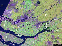
South Holland is a province
Provinces of the Netherlands
A Dutch province represents the administrative layer in between the national government and the local municipalities, having the responsibility for matters of subnational or regional importance. The government of each province consists of three major parts: the Provinciale Staten which is the...

 situated on the North Sea
North Sea
In the southwest, beyond the Straits of Dover, the North Sea becomes the English Channel connecting to the Atlantic Ocean. In the east, it connects to the Baltic Sea via the Skagerrak and Kattegat, narrow straits that separate Denmark from Norway and Sweden respectively...

 in the western part of the Netherlands
Netherlands
The Netherlands is a constituent country of the Kingdom of the Netherlands, located mainly in North-West Europe and with several islands in the Caribbean. Mainland Netherlands borders the North Sea to the north and west, Belgium to the south, and Germany to the east, and shares maritime borders...

. The provincial capital is The Hague
The Hague
The Hague is the capital city of the province of South Holland in the Netherlands. With a population of 500,000 inhabitants , it is the third largest city of the Netherlands, after Amsterdam and Rotterdam...

 and its largest city is Rotterdam
Rotterdam
Rotterdam is the second-largest city in the Netherlands and one of the largest ports in the world. Starting as a dam on the Rotte river, Rotterdam has grown into a major international commercial centre...

.

South Holland is one of the most densely populated and industrialised areas in the world. With a population of 3,502,595 (30 November 2009) and an area of 3,403 km², the province has the highest population density in the Netherlands.

History

For more on the history of South Holland in the context of Dutch history, see the article on the "History of the Netherlands
History of the Netherlands
The history of the Netherlands is the history of a maritime people thriving on a watery lowland river delta at the edge of northwestern Europe. When the Romans and written history arrived in 57 BC, the country was sparsely populated by various tribal groups at the periphery of the empire...

". The history of this province can also be found in the articles on its constituent elements (e.g. Rotterdam
Rotterdam
Rotterdam is the second-largest city in the Netherlands and one of the largest ports in the world. Starting as a dam on the Rotte river, Rotterdam has grown into a major international commercial centre...

, The Hague
The Hague
The Hague is the capital city of the province of South Holland in the Netherlands. With a population of 500,000 inhabitants , it is the third largest city of the Netherlands, after Amsterdam and Rotterdam...

, etc.) The information here pertains just to South Holland itself.

Before 1795

For most of its history, the modern-day province of South Holland was an integral part of Holland.

From the 9th century to the 16th century, Holland was a county of the Holy Roman Empire
Holy Roman Empire
The Holy Roman Empire was a realm that existed from 962 to 1806 in Central Europe.It was ruled by the Holy Roman Emperor. Its character changed during the Middle Ages and the Early Modern period, when the power of the emperor gradually weakened in favour of the princes...

, and was ruled by the counts of Holland. Some of the counts were powerful magnates who also ruled many other territories, culminating in a period of rule by the House of Habsburg which was terminated by the Dutch Revolt
Dutch Revolt
The Dutch Revolt or the Revolt of the Netherlands This article adopts 1568 as the starting date of the war, as this was the year of the first battles between armies. However, since there is a long period of Protestant vs...

.

From the 16th century to 1795, Holland was the wealthiest and most important province in the United Provinces in the Dutch Republic
Dutch Republic
The Dutch Republic — officially known as the Republic of the Seven United Netherlands , the Republic of the United Netherlands, or the Republic of the Seven United Provinces — was a republic in Europe existing from 1581 to 1795, preceding the Batavian Republic and ultimately...

. As the richest and most powerful province, Holland dominated the union. During this period a distinction was sometimes made between the "North Quarter" (Noorderkwartier
Noorderkwartier
Noorderkwartier is an historical term referring to the part of Holland north of the river IJ. It roughly correspondends to the modern province of North Holland. Other historical terms for this area were "North Holland", "Noordeland", "Noorderland" and "Waterland"....

) and the "South Quarter" (Zuiderkwartier), areas that roughly correspond to the two modern provinces.

The emergence of a new province (1795 to 1840)

The province of South Holland as it is today has its origins in the period of French rule from 1795 to 1813. This was a time of bewildering changes to the Dutch system of provinces. In 1795 the old order was swept away and the Batavian Republic
Batavian Republic
The Batavian Republic was the successor of the Republic of the United Netherlands. It was proclaimed on January 19, 1795, and ended on June 5, 1806, with the accession of Louis Bonaparte to the throne of the Kingdom of Holland....

 was established. In the Constitution enacted on 23 April 1798, the old borders were radically changed. The republic was reorganised into eight departments (département) with roughly equal populations. Holland was split up into five departments named "Texel",
"Amstel", "Delf", "Schelde en Maas", and "Rijn". The first three of these lay within the borders of the old Holland; the latter two were made up of parts of different provinces. In 1801 the old borders were restored when the department of Holland was created. This reorganisation had been short-lived, but it gave birth to the concept of breaking up Holland and making it a less powerful province.

In 1807, Holland was reorganised once again. This time the two departments were called "Maasland
Maasland
Maasland is a town in the western Netherlands, in the province of South Holland. It lies in the municipality of Midden-Delfland and covers an area of 24.42 km² ....

" (corresponding to the modern province of South Holland) and "Amstelland
Amstelland
Amstelland is the area along the river Amstel, a river running north towards Amsterdam in southern North Holland.- Location and composition :"Amstelland" today refers generally to the area along the river Amstel just south of the city of Amsterdam...

" (corresponding to the modern province of North Holland). This also did not last long. In 1810, all the Dutch provinces were integrated into the French Empire. Maasland was renamed "Monden van de Maas" (Bouches-de-la-Meuse in French). Amstelland and Utrecht were amalgamated as the department of "Zuiderzee" (Zuyderzée in French).

After the defeat of the French in 1813, this organisation remained unchanged for a year or so. When the 1814 Constitution was introduced, the country was reorganised as provinces and regions (landschappen). Monden van de Maas and Zuiderzee were reunited as the province of "Holland".

However, the division was not totally reversed. When the province of Holland was re-established in 1814, it was given two governors, one for the former department of Maasland (i.e. the area that is now South Holland) and one for the former department of Amstelland (i.e. the area that is now North Holland). Even though the province had been reunited, the two areas were still being treated differently in some ways and the idea of dividing Holland remained alive.

When the constitutional amendments were introduced in 1840, it was decided to split Holland once again, this time into two provinces called "South Holland" and "North Holland". The impetus came largely from Amsterdam
Amsterdam
Amsterdam is the largest city and the capital of the Netherlands. The current position of Amsterdam as capital city of the Kingdom of the Netherlands is governed by the constitution of August 24, 1815 and its successors. Amsterdam has a population of 783,364 within city limits, an urban population...

 in North Holland, which still resented the 1838 relocation of the court of appeal to The Hague
The Hague
The Hague is the capital city of the province of South Holland in the Netherlands. With a population of 500,000 inhabitants , it is the third largest city of the Netherlands, after Amsterdam and Rotterdam...

 in South Holland.

1840 to today

Since 1840, South Holland has ceded three municipalities to the province of Utrecht
Utrecht (province)
Utrecht is the smallest province of the Netherlands in terms of area, and is located in the centre of the country. It is bordered by the Eemmeer in the north, Gelderland in the east, the river Rhine in the south, South Holland in the west, and North Holland in the northwest...

: Oudewater
Oudewater
Oudewater is a municipality and a town in the Netherlands, in the province of Utrecht.-Population centres :The municipality of Oudewater consists of the following cities, towns, villages and/or districts: Hekendorp, Oudewater, Papekop, Snelrewaard....

 in 1970, Woerden
Woerden
Woerden is a municipality and a city in the central Netherlands. Due to its central location between Amsterdam, Rotterdam, The Hague and Utrecht, and the fact that it has excellent rail and road connections to those cities, it is a popular town for commuters who work in those cities.-Population...

 in 1989, and Vianen in 2002.

In the period 2004 to 2006, there was a municipal reorganisation.
  • On 1 January 2004 the municipalities De Lier, 's-Gravenzande, Monster, Naaldwijk and Wateringen were merged into a new municipality Westland, and Maasland and Schipluiden to another one, Midden-Delfland
    Midden-Delfland
    Midden-Delfland is a municipality in the Westland region in the province of South Holland in the Netherlands. It had a population of 17,072 in 2004, and covers an area of 49.38 km² of which 1.93 km² is water...

    .

  • On 1 January 2006 Sassenheim
    Sassenheim
    Sassenheim is a town and former municipality in the western Netherlands, in the province of South Holland.The former municipality covered an area of 6.62 km² and had a population of 14,906 in 2005...

    , Voorhout
    Voorhout
    thumb|250px|right|Location of Voorhout.Voorhout is a town and former municipality in the western Netherlands, in the province of South Holland. The former municipality covered an area of 12.59 km² of which 0.33 km² is covered by water, and had a population of 14,792 in 2004...

     and Warmond
    Warmond
    Warmond is a village and former municipality in the western Netherlands, north of Leiden in the province of South Holland. The municipality covered an area of 14.42 km² of which 4.42 km² is water, and had a population of 4,977 in 2004. Together with Sassenheim and Voorhout, it became...

     were merged into Teylingen
    Teylingen
    Teylingen is a municipality in the province of South Holland, the Netherlands. It was created on January 1, 2006, through the amalgamation of Sassenheim, Voorhout, and Warmond...

    , and Rijnsburg
    Rijnsburg
    Rijnsburg is a community in the eastern part of the city Katwijk, in the western Netherlands, in the province of South Holland. The name means Rhines Burg in Dutch.-History:...

     and Valkenburg
    Valkenburg (South Holland)
    Valkenburg is a village and former municipality in the province of South Holland, in thewestern Netherlands. Valkenburg is now part of the municipality Katwijk....

     were merged into Katwijk
    Katwijk
    Katwijk is a coastal municipality and town in the province of South Holland in the western Netherlands. It has a population of 61,292.-Location:...

    .

  • On 1 January 2007 Ter Aar
    Ter Aar
    Ter Aar is a town and former municipality in the western Netherlands, in the province of South Holland. It is located about 6 km northeast of Alphen aan den Rijn. The town had a population of 9,007 on 1 July 2006....

     and Liemeer
    Liemeer
    thumb|250px|right|Location of Liemeer, until Jan. 2007.Liemeer is a former municipality in the western Netherlands, in the province of South Holland. It was merged into the municipality of Nieuwkoop on January 1, 2007....

     were merged into Nieuwkoop
    Nieuwkoop
    Nieuwkoop is a town and municipality in the western Netherlands, in the province of South Holland. The municipality was enlarged on January 1, 2007, through the amalgamation of Liemeer and Ter Aar....

    , Bleiswijk
    Bleiswijk
    Bleiswijk is a town and former municipality in the western Netherlands, in the province of South Holland. The municipality had a population of 10,222 in 2006, and covered an area of 21.96 km² of which 0.83 km² is water...

    , Berkel en Rodenrijs
    Berkel en Rodenrijs
    thumb|250px|right|Town signBerkel en Rodenrijs is a town and former municipality in the Western part of the Netherlands, and is located in the Dutch province of South Holland.- History :...

     and Bergschenhoek
    Bergschenhoek
    thumb|250px|right|Town signBergschenhoek is a town and former municipality in the Netherlands. It is situated roughly 10 km to the north of Rotterdam in the province of South Holland. The former municipality had a population of 16,608 in 2006, and covered an area of 15.52 km² of which...

     were merged into a new municipallity Lansingerland
    Lansingerland
    Lansingerland is the name for the new municipality in the western Netherlands, in the province of South Holland. It was formed on January 1, 2007, by the merger of the municipalities of Berkel en Rodenrijs, Bleiswijk and Bergschenhoek, collectively known as the "B-Triangle".The name was chosen from...

     and 's-Gravendeel was merged into Binnenmaas
    Binnenmaas
    Binnenmaas is a municipality in the western Netherlands, in the province of South Holland. The municipality had a population of 19,245 in 2004, and covers an area of 54.91 km² of which 4.57 km² is water...

    .

  • On 18 March 2010 Rozenburg
    Rozenburg
    Rozenburg is a town and former municipality in the western Netherlands, in the province of South Holland. The municipality had a population of 13,173 in 2004, and covers an area of 6.50 km² . It was the second-smallest municipality in the Netherlands in area...

     was merged into Rotterdam
    Rotterdam
    Rotterdam is the second-largest city in the Netherlands and one of the largest ports in the world. Starting as a dam on the Rotte river, Rotterdam has grown into a major international commercial centre...

    .

Municipalities

South Holland is divided into 72 municipalities. In the Netherlands a municipality (gemeente) may consist of a single city or town or it may consist of a number of smaller towns and villages.

Municipalities (with links to maps)


A to H
  • Alblasserdam
    Alblasserdam
    Alblasserdam is a town in the western Netherlands, in the province of South Holland. The municipality covers an area of , of which is water. Alblasserdam is officially a part of the Drechtsteden...

     http://www.plattegronden.nl/gemeentenieuwlekkerland/index.html
  • Albrandswaard
    Albrandswaard
    Albrandswaard is a municipality in the western Netherlands, in the province of South Holland. The municipality had a population of 19,607 in 2004, and covers an area of 23.75 km² of which 1.57 km² is water....

     http://www.plattegronden.nl/gemeentealbrandswaard/
  • Alphen aan den Rijn
    Alphen aan den Rijn
    Alphen aan den Rijn is a town and municipality in the western Netherlands, in the province of South Holland, between Leiden and Utrecht. The town is situated on the banks of the river Oude Rijn , where the river Gouwe branches off. The municipality had a population of 72,674 in 2010, and covers an...

     http://www.plattegronden.nl/gemeentealphenadrijn/
  • Barendrecht
    Barendrecht
    Barendrecht is a town in the western Netherlands, in the province of South Holland. The municipality had a population of 43,104 in 2007, and covers an area of 21.72 km² of which 1.45 km² is water....

     http://www.plattegronden.nl/gemeentebarendrecht/
  • Bergambacht
    Bergambacht
    Bergambacht is a village in the western Netherlands, in the province of South Holland. The municipality covers an area of 38.05 km² of which 2.96 km² is water....

     http://www.plattegronden.nl/bergambacht/
  • Bernisse
    Bernisse
    Bernisse is a municipality in the western Netherlands, in the province of South Holland. The municipality had a population of 12,684 in 2004, and covers an area of 68.59 km² of which 11.25 km² is water....

     http://www.plattegronden.nl/gemeentebernisse
  • Binnenmaas
    Binnenmaas
    Binnenmaas is a municipality in the western Netherlands, in the province of South Holland. The municipality had a population of 19,245 in 2004, and covers an area of 54.91 km² of which 4.57 km² is water...

  • Bodegraven-Reeuwijk
    Bodegraven-Reeuwijk
    Bodegraven-Reeuwijk is a municipality in the western Netherlands, in the province of South Holland. It was established by a merger of Bodegraven and Reeuwijk on January 1, 2011. The municipality covers 88.61 km² . It had a population of 32,772 in April 2011.- External links:...

     http://www.plattegronden.nl/gemeentebodegraven-reeuwijk/
  • Boskoop
    Boskoop
    Boskoop is a town and municipality in the western Netherlands, in the province of South Holland. The municipality had a population of 15,217 in 2008, and covers an area of 16.96 km² of which 2.17 km² is water...

     http://www.plattegronden.nl/gemeenteboskoop/
  • Brielle
    Brielle
    Brielle , also called Den Briel is a town and municipality in the western Netherlands, in the province of South Holland, on the north side of the island of Voorne-Putten, at the mouth of the New Maas. The municipality covers an area of 31.12 km² of which 3.63 km² is water...

     http://www.plattegronden.nl/gemeentebrielle/
  • Capelle aan den IJssel
    Capelle aan den IJssel
    Capelle aan den IJssel is a town and municipality in the western Netherlands, in the province of South Holland. The municipality had a population of 65,605 in 2005, and covers an area of 15.42 km² of which 1.13 km² is water...

     http://www.plattegronden.nl/capelleadijssel/
  • Cromstrijen
    Cromstrijen
    Cromstrijen is a municipality on the Hoeksche Waard Island in the western Netherlands, in the province of South Holland. The municipality covers an area of 70.31 km² of which 15.94 km² is water...

     http://www.plattegronden.nl/gemeentecromstrijen/
  • Delft
    Delft
    Delft is a city and municipality in the province of South Holland , the Netherlands. It is located between Rotterdam and The Hague....

     http://www.plattegronden.nl/delft/
  • Den Haag
  • Dirksland
    Dirksland
    Dirksland is a town and municipality on Goeree-Overflakkee Island in the western Netherlands, in the province of South Holland. The municipality had a population of 8,269 in 2004, and covers an area of 74.15 km² of which 18.59 km² is water.The municipality of Dirksland also includes...

     http://www.plattegronden.nl/goeree-overflakkee/
  • Dordrecht
    Dordrecht
    Dordrecht , colloquially Dordt, historically in English named Dort, is a city and municipality in the western Netherlands, located in the province of South Holland. It is the fourth largest city of the province, having a population of 118,601 in 2009...

     http://www.svd-stadsvervoer.nl/kaart/stadskaart.html
  • Giessenlanden
    Giessenlanden
    Giessenlanden is a municipality in the western Netherlands, in the province of South Holland. The municipality covers an area of 65.12 km² of which 1.55 km² is water....

     http://www.plattegronden.nl/giessenlanden/
  • Goedereede
    Goedereede
    Goedereede is a municipality and a town in the western Netherlands, in the province of South Holland. The municipality had a population of 11408 in 2010, and covers an area of 153.85 km² of which 82.53 km² is water...

     http://www.plattegronden.nl/goeree-overflakkee/
  • Gorinchem
    Gorinchem
    Gorinchem , also called Gorkum , is a city and municipality in the western Netherlands, in the province of South Holland. The municipality covers an area of 21.99 km² of which 3.03 km² is water...

     http://www.plattegronden.nl/gemeentegorinchem/
  • Gouda
    Gouda
    Gouda is a city and municipality in the western Netherlands, in the province of South Holland. Gouda, which was granted city rights in 1272, is famous for its Gouda cheese, smoking pipes, and 15th-century city hall....

     http://www.plattegronden.nl/gouda/
  • Graafstroom
    Graafstroom
    Graafstroom is a municipality in the western Netherlands, in the province of South Holland. The municipality had a population of 9,697 in 2004, and covers an area of 69.32 km² of which 2.21 km² is water....

  • Hardinxveld-Giessendam
    Hardinxveld-Giessendam
    Hardinxveld-Giessendam is a municipality in the western Netherlands, in the province of South Holland. The municipality had a population of 17,828 in 2004, and covers an area of 19.35 km² of which 2.44 km² is water....

     http://www.plattegronden.nl/gemeentehardinxveld-giessendam/
  • Hellevoetsluis
    Hellevoetsluis
    Hellevoetsluis is a small city and municipality on Voorne-Putten Island in the western Netherlands, in the province of South Holland...

     http://www.plattegronden.nl/gemeentehellevoetsluis/
  • Hendrik-Ido-Ambacht
    Hendrik-Ido-Ambacht
    Hendrik-Ido-Ambacht is a town and municipality in the western Netherlands. It is located in the Dutch province of South Holland, on the island of IJsselmonde, and borders with Zwijndrecht, Ridderkerk, and the Noord River. The jurisdiction of the municipality covers an area of 11.99 km² of...

     http://www.plattegronden.nl/hendrik-ido-ambacht/
  • Hillegom
    Hillegom
    Hillegom is a town in the western Netherlands, in the province of South Holland. The municipality covers an area of 13.48 km² of which 0.61 km² is water....

     http://www.plattegronden.nl/hillegom/

J to P
  • Kaag en Braassem
    Kaag en Braassem
    Kaag en Braassem is a municipality in the western Netherlands, in the province of South Holland. It was formed on January 1, 2009, through the merger of Alkemade and Jacobswoude....

  • Katwijk
    Katwijk
    Katwijk is a coastal municipality and town in the province of South Holland in the western Netherlands. It has a population of 61,292.-Location:...

     http://www.plattegronden.nl/katwijk/index.html
  • Korendijk
    Korendijk
    Korendijk is a municipality on the Hoeksche Waard Island in the western Netherlands, in the province of South Holland...

     http://www.plattegronden.nl/gemeenteoud-beijerland/
  • Krimpen aan den IJssel
    Krimpen aan den IJssel
    Krimpen aan den IJssel is a town and municipality in the western Netherlands, in the province of South Holland. The municipality had a population of 28800 in 2006, and covers an area of 8.93 km² of which 1.10 km² is water....

     http://www.plattegronden.nl/krimpenadijssel/
  • Lansingerland
    Lansingerland
    Lansingerland is the name for the new municipality in the western Netherlands, in the province of South Holland. It was formed on January 1, 2007, by the merger of the municipalities of Berkel en Rodenrijs, Bleiswijk and Bergschenhoek, collectively known as the "B-Triangle".The name was chosen from...

  • Leerdam
    Leerdam
    Leerdam is a city and municipality in the western Netherlands, in the province of South Holland.The municipality covers an area of 34.32 km² of which 0.53 km² is water. It comprises the town of Leerdam, the rural villages Kedichem, Schoonrewoerd and Oosterwijk. The south border of the...

     http://www.plattegronden.nl/gemeenteleerdam/index.html
  • Leiden http://www.plattegronden.nl/leiden/
  • Leiderdorp
    Leiderdorp
    Leiderdorp is a town and municipality in the western Netherlands, in the province of South Holland near the city of Leiden. It had a population of 26,182 in 2004....

     http://www.plattegronden.nl/leiderdorp/
  • Leidschendam-Voorburg
    Leidschendam-Voorburg
    Leidschendam-Voorburg is a municipality in the western Netherlands, in the province of South Holland. The municipality had a population of 73,832 in 2004, and covers an area of 35.68 km² of which 2.86 km² is water.-Origin:...

     http://www.plattegronden.nl/leidschendam-voorburg/
  • Liesveld
    Liesveld
    Liesveld is a municipality in the western Netherlands, in the province of South Holland. The municipality had a population of 9,810 in 2006, and covers an area of 44.44 km² of which 3.37 km² is water....

  • Lisse
    Lisse
    Lisse is a town and municipality in the western Netherlands, in the province of South Holland. The municipality covers an area of 16.11 km² of which 0.41 km² is water. Its population is 21864...

     http://www.plattegronden.nl/lisse/
  • Maassluis
    Maassluis
    Maassluis is a town in the western Netherlands, in the province of South Holland. The municipality had a population of 32,847 in 2004, and covers an area of 10.11 km² .It received city rights in 1811...

     http://www.plattegronden.nl/maassluis/
  • Middelharnis
    Middelharnis
    Middelharnis is a municipality and a village in the western Netherlands, in the province of South Holland. The municipality covers an area of 86.79 km² ....

     http://www.plattegronden.nl/goeree-overflakkee/
  • Midden-Delfland
    Midden-Delfland
    Midden-Delfland is a municipality in the Westland region in the province of South Holland in the Netherlands. It had a population of 17,072 in 2004, and covers an area of 49.38 km² of which 1.93 km² is water...

  • Nederlek
    Nederlek
    Nederlek is a municipality in the western Netherlands, in the province of South Holland. The municipality had a population of 14,831 in 2004, and covers an area of 31.44 km² . It was formed on January 1, 1985, by the amalgamation of the municipalities Krimpen aan de Lek and Lekkerkerk...

     http://www.plattegronden.nl/gemeentenederlek/
  • Nieuw-Lekkerland
    Nieuw-Lekkerland
    Nieuw-Lekkerland is a town and municipality in the western Netherlands, in the province of South Holland. It is situated on the southern shores of the Lek River, in the north-western part of the Alblasserwaard...

     http://www.plattegronden.nl/gemeentenieuwlekkerland/
  • Nieuwkoop
    Nieuwkoop
    Nieuwkoop is a town and municipality in the western Netherlands, in the province of South Holland. The municipality was enlarged on January 1, 2007, through the amalgamation of Liemeer and Ter Aar....

     http://www.plattegronden.nl/gemeenteliemeer-teraar-nieuwkoop/
  • Noordwijk
    Noordwijk
    Noordwijk is a town and municipality in the western Netherlands, in the province of South Holland. The municipality covers an area of 51.53 km² and had a population of 24,707 in May 2006....

     http://www.plattegronden.nl/gemeentenoordwijk/
  • Noordwijkerhout
    Noordwijkerhout
    Noordwijkerhout is a town and municipality in the western Netherlands, in the province of South Holland. The municipality covers an area of 23.40 km² and had a population of 15,121 in May 2006...

     http://www.plattegronden.nl/gemeentenoordwijk/
  • Oegstgeest
    Oegstgeest
    Oegstgeest is a town and municipality in the province of South Holland in the western Netherlands. Its population was 22,576 in 2008.-Location :...

     http://www.plattegronden.nl/oegstgeest/
  • Oostflakkee
    Oostflakkee
    Oostflakkee is a municipality on the island of Goeree-Overflakkee in the western Netherlands, in the province of South Holland...

     http://www.plattegronden.nl/goeree-overflakkee/
  • Oud-Beijerland
    Oud-Beijerland
    Oud-Beijerland is a town and municipality in the western Netherlands, in the province of South Holland. With a population of 23,797 in 2005, it is the most populated town on the Hoekse Waard island, located on the Oude Maas and Spui Rivers....

     http://www.plattegronden.nl/gemeenteoud-beijerland/
  • Ouderkerk
    Ouderkerk
    Ouderkerk is a municipality in the western Netherlands, in the province of South Holland. The municipality covers an area of 28.53 km²...

     http://www.plattegronden.nl/gemeentenederlek/
  • Papendrecht
    Papendrecht
    Papendrecht is a town and municipality in the western Netherlands, in the province of South Holland, at the crossing of the River Beneden Merwede and the Noord River...

     http://www.plattegronden.nl/papendrecht/
  • Pijnacker-Nootdorp
    Pijnacker-Nootdorp
    Pijnacker-Nootdorp is a suburban municipality in the Randstad conurbation in the Netherlands, in the province of South Holland...


R to Z
  • Ridderkerk
    Ridderkerk
    Ridderkerk is a town and municipality in the western Netherlands, in the province of South Holland. The municipality had a population of 44,886 in 2010, and covers an area of 25.10 km² ....

     http://www.plattegronden.nl/ridderkerk/
  • Rijnwoude
    Rijnwoude
    Rijnwoude is a municipality in the western Netherlands, in the province of South Holland. The municipality covers an area of 57.85 km² of which 1.17 km² is water....

     http://www.plattegronden.nl/rijnwoude/
  • Rijswijk
    Rijswijk
    Rijswijk is a town and municipality in the western Netherlands, in the province of South Holland. It is a suburb of The Hague and covers an area of 14.48 km² ....

     http://www.plattegronden.nl/rijswijk/
  • Rotterdam
    Rotterdam
    Rotterdam is the second-largest city in the Netherlands and one of the largest ports in the world. Starting as a dam on the Rotte river, Rotterdam has grown into a major international commercial centre...

  • Schiedam
    Schiedam
    Schiedam is a city and municipality in the province of South Holland in the Netherlands. It is part of the Rotterdam metropolitan area. The city is located west of Rotterdam, east of Vlaardingen and south of Delft...

     http://www.ifalk.nl/schiedam0h5qnpci/
  • Schoonhoven
    Schoonhoven
    Schoonhoven is a city and municipality in the western Netherlands, in the province of South Holland. The municipality has a population of 12,195 , and covers an area of 6.96 km²...

     http://www.plattegronden.nl/gemeentebergambacht/index.html
  • Sliedrecht
    Sliedrecht
    Sliedrecht is a town and municipality in the western Netherlands, in the province of South Holland. The municipality covers an area of ....

     http://www.plattegronden.nl/sliedrecht/
  • Spijkenisse
    Spijkenisse
    Spijkenisse is a town and municipality in the western Netherlands, in the province of South Holland. The municipality had a population of 74,482 in 2006, and covers an area of 30.23 km²...

     http://www.plattegronden.nl/spijkenisse/
  • Strijen
    Strijen
    Strijen is a town and municipality in the western Netherlands, in the province of South Holland. The municipality, covering an area of 57.72 km² , is located on the Hoeksche Waard island along the Hollands Diep estuary.Strijen hosts a public library, swimming pool, a small shopping centre and...

     http://www.plattegronden.nl/gemeentestrijen/
  • Teylingen
    Teylingen
    Teylingen is a municipality in the province of South Holland, the Netherlands. It was created on January 1, 2006, through the amalgamation of Sassenheim, Voorhout, and Warmond...

  • Vlaardingen
    Vlaardingen
    Vlaardingen is a town in South Holland in the Netherlands. It is located on the north bank of the Nieuwe Maas/Nieuwe Waterweg river at the confluence with the Oude Maas...

     http://www.plattegronden.nl/vlaardingen/
  • Vlist
    Vlist
    Vlist is a village and municipality in the western Netherlands, in the province of South Holland. The municipality covers an area of 56.52 km² and had a population of 9,803 in 2004....

     http://www.plattegronden.nl/gemeentebergambacht/index.html
  • Voorschoten
    Voorschoten
    Voorschoten is a village and municipality in the western Netherlands, in the province of South Holland. It is a smaller town in the Randstad, enclosed by the cities of Leiden and The Hague. The municipality covers an area of 11.59 km²...

     http://www.plattegronden.nl/voorschoten/
  • Waddinxveen
    Waddinxveen
    Waddinxveen is a town and municipality along the Gouwe river in the western Netherlands in the province of South Holland near Gouda. The municipality had a population of 26,304 in 2004, 25.328 on new year's eve of 2010. and covers an area of 29.39 km² .In Waddinxveen, there's the so-called...

     http://www.plattegronden.nl/gemeentewaddinxveen/
  • Wassenaar
    Wassenaar
    Wassenaar is a town in the western Netherlands, in the province of South Holland. A fairly affluent suburb of The Hague, Wassenaar lies 10 km north of that city on the N44 highway near the North Sea coast. It is part of the Haaglanden region...

     http://www.plattegronden.nl/wassenaar/
  • Westland http://www.plattegronden.nl/westland/
  • Westvoorne
    Westvoorne
    Westvoorne is a municipality on the island Voorne-Putten in the western Netherlands, in the province of South Holland. The municipality covers an area of 97.52 km² . It had a population of 14,265 in 2004....

     http://www.plattegronden.nl/gemeentewestvoorne/
  • Zederik
    Zederik
    Zederik is a municipality in the western Netherlands, in the province of South Holland. The municipality covers an area of 76.49 km²...

     http://www.plattegronden.nl/zederik/
  • Zoetermeer
    Zoetermeer
    Zoetermeer is a city in the western Netherlands, in the province of South Holland. The municipality covers an area of 37.06 km² . A small village until the late 1960s, it had 6,392 inhabitants in 1950...

     http://www.plattegronden.nl/zoetermeer/
  • Zoeterwoude
    Zoeterwoude
    Zoeterwoude is a municipality in the western Netherlands, in the province of South Holland. The municipality covers 21.91 km² . It had a population of 8,526 in 2004....

     http://www.plattegronden.nl/zoeterwoude/
  • Zuidplas
    Zuidplas
    Zuidplas is a new municipality by 1 january 2010.Joining of Moordrecht, Nieuwerkerk aan den IJssel and Zevenhuizen-Moerkapelle....

  • Zwijndrecht http://www.plattegronden.nl/zwijndrecht/

Municipalities (table)


Islands of South Holland

The southern part of the province of South Holland consists of a number of island
Island
An island or isle is any piece of sub-continental land that is surrounded by water. Very small islands such as emergent land features on atolls can be called islets, cays or keys. An island in a river or lake may be called an eyot , or holm...

s lying in the Rhine-Meuse
Meuse
Meuse is a department in northeast France, named after the River Meuse.-History:Meuse is one of the original 83 departments created during the French Revolution on March 4, 1790...

 river delta
River delta
A delta is a landform that is formed at the mouth of a river where that river flows into an ocean, sea, estuary, lake, reservoir, flat arid area, or another river. Deltas are formed from the deposition of the sediment carried by the river as the flow leaves the mouth of the river...

. Although technically islands in the sense that they are surrounded by rivers, canals or other bodies of water, most of these islands are well connected to the rest of the province.

The islands are listed here alphabetically. A few of these islands bear the same name as a municipality (and are therefore linked to the information about the municipality).
  • Dordrecht
    Dordrecht
    Dordrecht , colloquially Dordt, historically in English named Dort, is a city and municipality in the western Netherlands, located in the province of South Holland. It is the fourth largest city of the province, having a population of 118,601 in 2009...

     (7 on the map)
  • Goeree-Overflakkee
    Goeree-Overflakkee
    Goeree-Overflakkee is the southernmost delta island of the province of South Holland, Netherlands. It is separated from Voorne-Putten and Hoeksche Waard by the Haringvliet, from the mainland of North Brabant by the Volkerak, and from Schouwen-Duiveland by Lake Grevelingen.From west to east, it...

     (1 on the map)
  • Hoeksche Waard
    Hoeksche Waard
    thumb|right|[[Satellite]] [[image]] of the [[Rhine]]-[[Meuse river|Meuse]] [[river delta|delta]], showing the [[island]] of Hoekse Waard The Hoeksche Waard is an island between the Oude Maas, Dordtsche Kil, Hollands Diep, Haringvliet and Spui rivers in the province of Zuid Holland in the...

     (6 on the map)
  • IJsselmonde (9 on the map)
  • Rozenburg
    Rozenburg
    Rozenburg is a town and former municipality in the western Netherlands, in the province of South Holland. The municipality had a population of 13,173 in 2004, and covers an area of 6.50 km² . It was the second-smallest municipality in the Netherlands in area...

     (10 on the map)
  • Tiengemeten
    Tiengemeten
    Tiengemeten is an island in the Dutch province of South Holland. It is a part of the municipality of Korendijk, and lies about 11 km south of Spijkenisse....

     (2 on the map)
  • Voorne-Putten
    Voorne-Putten
    thumb|225px|right|Satellite image of the [[Rhine]]-[[Meuse river|Meuse]] [[river delta|delta]], showing the island of Voorne-Putten Voorne-Putten is an island between the North Sea, the Brielse meer and the rivers Oude Maas, Spui and Haringvliet in the province of South Holland in the Netherlands...

     (4 & 5 on the map)

Regions in South Holland

Some of the regions in South Holland are official regional groupings artificially created for various administrative purposes. Other regions have developed their own identities for historical, geographic or other reasons. These regions are sometimes undefined and overlapping.

The province is officially divided into four regions:
  • Rijnmond
    Rijnmond
    Rijnmond is an official region of the province of South Holland in the Netherlands. It refers to the city of Rotterdam and its surrounding suburbs and municipalities...

     ("The Rhine Mouth"), also referred to as the "Stadsregio Rotterdam" ("Greater Rotterdam Area")
  • Zuid-Holland Zuid
    Zuid-Holland Zuid
    Zuid-Holland Zuid is an official region of the province of South Holland in the Netherlands.It consists of the following subregions:...

     ("South South Holland")
  • Zuid-Holland West
    Zuid-Holland West
    Zuid-Holland West is an official region of the province of South Holland in the Netherlands.It consists of the following subregions:...

     ("West South Holland")
  • Zuid-Holland Oost
    Zuid-Holland Oost
    Zuid-Holland Oost is an official region of the province of South Holland in the Netherlands.The region consists of the following subregions:...

     ("East South Holland")


Another official region is the Zuidvleugel
Zuidvleugel
Zuidvleugel is a way of describing the band of cities and towns located along the southern wing of the Randstad in the Netherlands. It is that part of the Randstad that is located in the Province of South Holland. This developing conurbation extends around 60 kilometres from Dordrecht to Leiden...

 ("The South Wing"), which refers to the conurbation
Conurbation
A conurbation is a region comprising a number of cities, large towns, and other urban areas that, through population growth and physical expansion, have merged to form one continuous urban and industrially developed area...

 consisting of the southern wing of the Randstad
Randstad
Image:Randstad_with_scale.png|400px|thumb|right|Clickable schematic map of the Randstadcircle 528 380 26 Schipholrect 426 356 498 436 Haarlemmermeerrect 399 166 479 245 Velsencircle 250 716 32 Delftcircle 220 642 60 The Hague...

.

Some of the other regions in South Holland:
  • Alblasserwaard
    Alblasserwaard
    The Alblasserwaard is a polder in the province South Holland in the Netherlands. It is mainly known for the windmills of Kinderdijk, a village in the northwest of the Alblasserwaard.-History:...

  • Bollenstreek
    Bollenstreek
    The Bollenstreek is a region in the Netherlands consisting of areas in North and South Holland that feature the cultivation of flower bulbs...

     (the flower areas found in both North Holland and South Holland)
  • Delfland (the area around Delft
    Delft
    Delft is a city and municipality in the province of South Holland , the Netherlands. It is located between Rotterdam and The Hague....

    )
  • Drechtsteden
    Drechtsteden
    The Drechtsteden are a number of towns and cities bordering each other in the delta area of the rivers Oude Maas, Noord, and Beneden-Merwede in the province of South Holland, the Netherlands...

     ("The Drecht towns")
  • Duin- en Bollenstreek
    Duin- en Bollenstreek
    The Duin- en Bollenstreek is a region in South Holland, The Netherlands, that features coastal dunes and the cultivation of flower bulbs. Situated at the heart of historical Holland between Leiden and Haarlem, the combination of beaches, flower fields, lakes and history makes this area attractive...

     (“Dune and Bulb Region”)
  • Goeree-Overflakkee
    Goeree-Overflakkee
    Goeree-Overflakkee is the southernmost delta island of the province of South Holland, Netherlands. It is separated from Voorne-Putten and Hoeksche Waard by the Haringvliet, from the mainland of North Brabant by the Volkerak, and from Schouwen-Duiveland by Lake Grevelingen.From west to east, it...

  • Gouwestreek
    Gouwestreek
    The Gouwestreek is the area around Gouda in the province of South Holland in the Netherlands. "Gouwe" refers to the river Gouwe, which runs through Gouda...

     ("The Gouwe
    Gouwe
    Gouwe is a village in the Dutch province of North Holland. It is a part of the municipality of Opmeer, and lies about 11 km northwest of Hoorn....

     Area")
  • Groene Hart
    Groene Hart
    The Groene Hart is a relatively thinly populated area in the Dutch Randstad. The major Dutch cities of Rotterdam, Den Haag, Leiden, Haarlem, Amsterdam and Utrecht lie around this area...

     ("The Green Heart")
  • Haaglanden
    Haaglanden
    Haaglanden refers to the conurbation around The Hague in the Province of South Holland in the Netherlands. This area is prominent in the Netherlands because The Hague is the third largest city in the Netherlands and the country's seat of government.-Usage:"Haaglanden" is sometimes used to refer to...

     (the area around The Hague)
  • Hoeksche Waard
    Hoeksche Waard
    thumb|right|[[Satellite]] [[image]] of the [[Rhine]]-[[Meuse river|Meuse]] [[river delta|delta]], showing the [[island]] of Hoekse Waard The Hoeksche Waard is an island between the Oude Maas, Dordtsche Kil, Hollands Diep, Haringvliet and Spui rivers in the province of Zuid Holland in the...

  • Hof van Delfland (the area including the municipalities of The Hague, Zoetermeer, Delft, Westland, Midden-Delfland and north Rotterdam, especially the green areas between them)
  • Holland Rijnland
  • IJsselmonde
    IJsselmonde
    IJsselmonde is a river island between the Nieuwe Maas, Noord and Oude Maas branches rivers of the Rhine-Meuse delta in the Dutch province of South Holland. The city of Rotterdam now occupies most of the northern part of the island and includes the eponymous former village of IJsselmonde, once a...

     (literally, "The Mouth of the IJssel
    Hollandse IJssel
    The Hollandse IJssel is a branch of the Rhine delta that flows westward from Nieuwegein on river Lek through IJsselstein, Gouda and Capelle aan den IJssel to Krimpen aan den IJssel, where it ends in the Nieuwe Maas. Another branch called Enge IJssel flows southwest from Nieuwegein...

    ", but an island in the Maas)
  • Kagerplassen
    Kagerplassen
    The Kagerplassen is a small lake system in South Holland located to the northeast of Leiden. The Kaag Lakes are a popular area for boating, watersports, fishing, camping and walking...

     (The Kaag Lakes)
  • Krimpenerwaard
    Krimpenerwaard
    The Krimpenerwaard, located in the province of South Holland in the Netherlands, is the rural area just south of Gouda and just east of the Rotterdam conurbation...

  • Rijnland
    Rijnland
    The name Rijnland means "Rhineland" in Dutch. When referring to the Rhine in Germany, "Rijnland" has the same meaning as "Rhineland" in English or "Rheinland" in German...

     ("Rhineland")
  • Rijnstreek
    Rijnstreek
    The Rijnstreek is a small region in the province of South Holland in the Netherlands. It includes the municipalities of Alphen aan den Rijn , Jacobswoude, Nieuwkoop and Rijnwoude....

     ("The Rhine Area")
  • Schieland
  • Vijfheerenlanden
  • Voorne-Putten
    Voorne-Putten
    thumb|225px|right|Satellite image of the [[Rhine]]-[[Meuse river|Meuse]] [[river delta|delta]], showing the island of Voorne-Putten Voorne-Putten is an island between the North Sea, the Brielse meer and the rivers Oude Maas, Spui and Haringvliet in the province of South Holland in the Netherlands...

  • De Waarden (Alblasserwaard and Krimpenerwaard)
  • Westhoek
    Westhoek
    Westhoek can refer to the following places:*Westhoek a historical region in western Belgium and northern France*Westhoek, sometimes referred to as Westland, South Holland, the area around Hoek van Holland...

     or Westland (roughly including Hoek van Holland
    Hoek van Holland
    The Hook of Holland , also known in English as the Hook, is a town in South Holland in the Netherlands. It is situated on the North Sea coast, on the north bank of the Nieuwe Waterweg ship canal. The town is administered by the municipality of Rotterdam as a district of that city...

     and the municipalities of Westland and Midden-Delfland
    Midden-Delfland
    Midden-Delfland is a municipality in the Westland region in the province of South Holland in the Netherlands. It had a population of 17,072 in 2004, and covers an area of 49.38 km² of which 1.93 km² is water...

    )
  • Zuidvleugel
    Zuidvleugel
    Zuidvleugel is a way of describing the band of cities and towns located along the southern wing of the Randstad in the Netherlands. It is that part of the Randstad that is located in the Province of South Holland. This developing conurbation extends around 60 kilometres from Dordrecht to Leiden...


See also

  • North Holland
    North Holland
    North Holland |West Frisian]]: Noard-Holland) is a province situated on the North Sea in the northwest part of the Netherlands. The provincial capital is Haarlem and its largest city is Amsterdam.-Geography:...

  • List of cities, towns and villages in South Holland
  • Politics of South Holland - category of railway stations in South Holland

External links


Links to maps


Entries for South Holland in worldwide gazetteers

The source of this article is wikipedia, the free encyclopedia.  The text of this article is licensed under the GFDL.
 
x
OK
CBS-codeMunicipalityPopulationLand area (km2)2)
|}